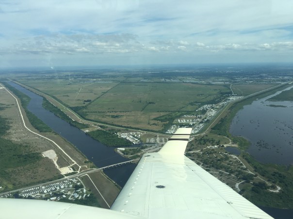
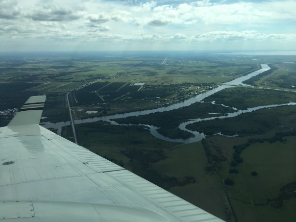
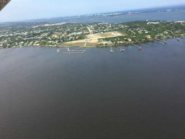
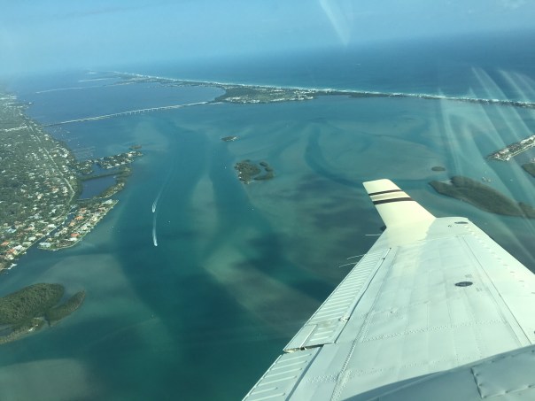
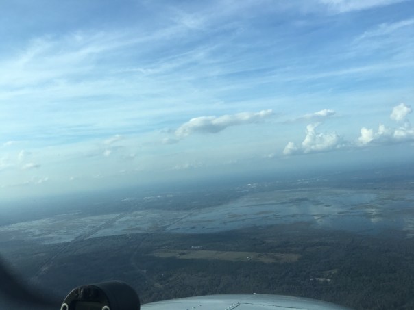
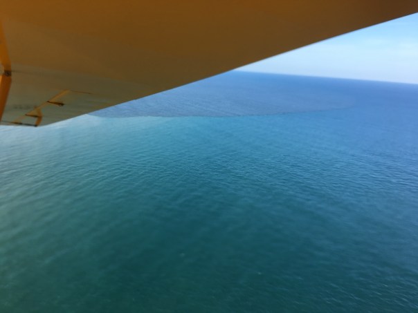
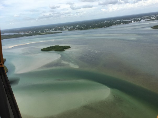
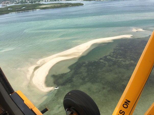
Yesterday, due to presidential Temporary Flight Restrictions, Ed and I decided to fly to the interior of the state and photograph the Kissimmee River. It was a beautiful day, but very bumpy up there.
Looking down at take off, the St Lucie River/Indian River Lagoon appeared dark-colored as the ACOE has been discharging to the river through C-44 from Lake Okeechobee since February 24, 2019 in an attempt to get the lake lower for hurricane season. It has also rained recently so there is canal (C-23; C-24 & C-25) and other runoff mixed in with the Lake O water. As we know, the “throat of our river was cut by these canals…” (https://www.saj.usace.army.mil/Media/News-Releases/Article/1791397/corps-adjusts-lake-o-releases-to-caloosahatchee-over-next-two-weeks/)
Within minutes, Ed and I had passed the Savannas, City of Port St Lucie, and were flying over sprawling agricultural lands, and then the northern diked region of Lake Okeechobee ~where the Kissimmee River meets the lake.
Today we will share photos of the approximate twenty-two miles of the Kissimmee River floodplain, once channelized, that is now being restored by the ACOE and SFWMD.
The map image below shows in detail the different parts of the floodplain-river, and its “de-construction.” For me, the Kissimmee is a the greatest example of Stuart News’ editor Ernie Lyons’ famous words: “What men do, they can undo,” as channelization in the late 1960s, was immediately recognized as an ecological disaster and people began lobbying Congress for change. Sometimes, I guess, we learn the hard way…but at least we learned. Thank you to all those who have been part of this restoration!
These five photos below show take-off from Witham Field in Stuart over Sewall’s Point, the St Lucie River and Indian River Lagoon. The last two photos are the North Fork of the SLR and Port St Lucie.
PART 2
The next six photos are the northern part of Lake Okeechobee. There is a lot of vegetation in this area that is sometimes submerged. These areas are important for bird life.
PART 3
Below we start at the still channelized mouth of the Kissimmee River entering Lake Okeechobee. As we approached the restored area, birds were flying down below, white against green, having returned to their historic nesting grounds: https://www.sfwmd.gov/news/nr_2018_0329_2017_sfwbr
~I created a self-made map to show where I took photos; (BETWEEN THE ARROWS). You will see pictures going form south to north.
1.Ed and the Super Cub 2019. Our “eye in the sky” since 2013.2.Tip of South Sewall’s Point looking north to Hell’s Gate. Witham Field, Stuart, west.
We continue to document the discharges…
Yesterday, 3-17-19, my husband, Ed, flew the Super-Cub over the St Lucie River/Indian River Lagoon ~ twenty-one days after the ACOE started discharging from Lake Okeechobee on February 24, 2019.
When Ed arrived home, I asked, “So how was it?”
“Brown,” he replied.
“Like dark coffee brown, or kind of like that weird mixed greenish-brown?”
He looked at me, and smiled. “Jacqui, it was brown.”
“OK, I said, I’ll take a look at your photos.”
So here are the photos from Ed’s flight from Witham Field in Stuart, over Sewall’s Point and Hutchinson Island, then out west to S-80 to see the “Seven Gates of Hell” where you can see the one gate discharging now at an average of 250 cubic feet per second, down from an average of 500 cubic feet per second. As you can see from the SFWMD chart below, there has been other runoff locations as well, but the majority is from Lake Okeechobee.
3. Approaching the SL Inlet, algae covered remaining seagrass beds4.Sandbar formation inside of SL Inlet5.Blurry but shows boats at the Sandbar and that weird green brown color6.Sailfish Point and SL Inlet algae covered remaining seagrass beds7. Ernie Lyons Bridge, IRL with SL inlet and Hutchinson Island in distance8. S-80 along C-44 Canal or the Seven Gate of Hell, boats going through locks, “250” cubic feet per second coming though
The following phots are of Caulkins Water Farm, a former orange grove that died due to citrus greening that now holds water from the C-44 Canal. This is a wonderful thing! As local ag-man Mr. Hadad, told me once, “Jacqui we spent 100 years taking the water off the land, and we’ll spend the next 100 years putting it back on.” The later photos are of S-80 again with view of C-44 canal leading west to Lake O.(https://www.facebook.com/CaulkinsWaterFarm/)
9.10.11.12.13.14.15.16.17.18.19.20.21.22.23.24.
The following photos are when Ed headed back to Witham Field going once again over the St Lucie Inlet over the Atlantic Ocean. You can see the water looks blue north of Sailfish Point north of the inlet with nearshore reefs visible. Plume is also visible south of St Lucie Inlet. Also in photos is the winding Jupiter Narrows and St Lucie River in the area of Stuart and Rio. You can see Langford Landing with scraped orange soil and docks built into river still under construction since 2015.
Temporary Flight Restrictions were in place this weekend as President Trump and the First Lady were visiting their home, Mar-a-Lago, in Palm Beach. The restrictions go right up to the edge of Stuart, thus it was not possible to fly into the Crossroads or St Lucie Inlet to continue documenting the discharges that began on February 23, 2019.
Instead, today, I am posting a link to an article by Tyler Treadway of TCPalm entitled:
If Army Corps stops Lake Okeechobee discharges soon, St. Lucie River Suffers Little Harm. It states:
“Two weeks of Lake Okeechobee discharges haven’t caused much damage to the St. Lucie River estuary, but an environmental expert says extending the releases much longer could be devastating.
The Army Corps of Engineers, which started discharging lake water to the river estuary Feb. 25 at an average daily rate of about 323 million gallons, plans for the releases to continue at least until March 16.
They’d better not last much longer, said Mark Perry, executive director of the Florida Oceanographic Society in Stuart.”
From what I understand the releases are scheduled for 21 days which would put them through around March 15, 2019.
Ed did fly to Zephyr Hills near Tampa, so I asked him to take photos of that trip. Below you can see Moore Haven, S-308 Port Mayaca, Lake Okeechobee, and other aerials of interest. Ed said he saw no cyanobacteria or blue-green algae in Lake Okeechobee.
S-308 at Port Mayaca, going to C-44 and SLR.Near Moore Haven where canal goes to Calooshatchee, near S-79.Somewhere on the way to Tampa region.Over Lake O.Looks like part or Restored Kissimmee River above Lake O, with canal.Flood plainLake O againC-44 canal, FPL pond, heading to Stuart. S-308 just being passed at Port Mayaca, Lake O.
Near Tampa, Zephyr Hills area – area one sees what looks like phosphate ponds, mines this is a big issue for water quality for rivers like the Peace and others in Central Florida.
Ed and I will try for an update of the discharges next week!
Some months ago, the original “River Warrior” Piper Cub was replaced with a Super Cub. Because the Super Cub is so much more powerful, more like a helicopter, it is much windier in the back of the plane, where I sit. I almost dropped my beloved iPhone, many times, before I gave up….
I have had to replace my lightweight and versatile iPhone with a “real” camera as the weight of the camera is stabilizing. Today, I share some of my other aerials of the St Lucie/IRL Region from 3-2-19, taken with this heavier camera. I thank my husband Ed for “giving me wings.” Over the coming months, as I adapt, we shall begin to document all of Florida’s east coast. First, here’s home!
Photo Ed Lippisch, Jacqui with new camera over barren seagrass beds, Sailfish Flats. Looking towards North Hutchinson Island, nearshore reefs, JTL Sailfish Point at St Lucie Inlet, JTL Atlantic Ocean looking east, JTL IRL and Jensen Beach Bridge, looking east, JTL Hutchinson Island, Sailfish Point, IRL, Sewall’s Point in distance. Sailfish Flats lie between. JTL Barren Sailfish Flats, JTL Indian River Plantation and Cove, Marriott, JTL IRL, St Lucie Power Plant in background. JTL IRL- Birds on a sandbar? No, a regatta! JTL The Savannas, near Jensen, behind Indian River Drive, JTL Savannah Road and US 1 leading to St Lucie River’s Roosevelt Bridge, Stuart, JTL Expanding Town of Ocean Breeze Park, IRL, JTL Rio/Jensen, Warner Creek, peninsula of Sewall’s Point, Stuart proper and airport, JTL Destructive C-23 canal separating Martin and St Lucie Counties across from North River Shores, SLR, JTL Dixie Highway and train track, JTL US 1 Roosevelt Bridge, discharges from LO coming through – see sediment…
Circling back over the IRL and US Sailing Center’s regatta, a beautiful sight!
The remaining photos are coming in for landing circling over the St Lucie at Roosevelt Bridge and developed lands…
Looking towards Palm City over SLR
Please note all comments become part of the Public Record.
Last week, on Friday, the ACOE announced in order to lower Lake O for wet season, it would begin discharging for the next 21 days from Lake Okeechobee into the St Lucie River/Indian River Lagoon with an average of 500 cubic feet per second through S-80 at St Lucie Locks and Dam.
My husband, Ed, and I took aerial photos at the beginning of these discharges on 2-24-19; we continue our documentation today, and in the future. The first set below was taken on Friday, March 1st around 3pm. The second on Saturday, March 2, around 12:30 pm. In both cases, it was an incoming tide ~with more sunshine on Saturday. Obviously, one can see negative changes in water-color and clarity after one week of discharges.
SFWMD basin map for SLR showing S-308 and S-80 along with other structures.
Set #1, 3-1-19, 3:10pm Ed Lippisch all photos
In this photo one can see the airstrip at Witham Field with flight going over Crossroads of St Lucie River and Indian River Lagoon as confluence meets at Sewall’s Point flowing out to St Lucie Inlet at Hutchison Island. The bare sand was formerly rich seagrass beds that have been devastated by the discharges. All photos are taken in this area of the St Lucie Inlet.
S-80 looking towards Lake Okeechobee one sees discharges coming through gates, photo Ed Lippisch 2-24-19
These aerial photos were taken yesterday, 2-24-19, by my husband, Ed Lippisch. The first two are of S-80, the structure at St Lucie Locks and Dam that drains water from the surrounding C-44 basin and also allows water to enter the St Lucie River/Indian River Lagoon from Lake Okeechobee.
On Friday, the ACOE announced it would be working up to 500 cubic feet per second to be discharged from Lake Okeechobee to the St Lucie River for possibly the next three weeks. These photos are meant as a starting point, and Ed and I will continue, weather allowing, to document the discharges. The discharge numbers can be viewed on the ACOE website but they are alway a day behind: http://w3.saj.usace.army.mil/h2o/reports.htm Website: https://www.saj.usace.army.mil
Structures and canals south of LO 2013 SFWMD map showing canals. The ACOE controls the structures discharging to the estuaries on east and west and the SFWMD controls those going south.
Ed and I plan on taking another flight next week to see how these discharges have visually affected the St Lucie and will do so until they are ended.
S-80 of the C-44 Canal is connected to the South Fork of the St Lucie River, here looking towards Stuart and Atlantic Ocean, note discharges coming through gates. Ed Lippisch 2-24-19Beaches south of St Lucie Inlet by Peck’s Lake, (being-renourished). This area is also known as the Jupiter Narrows. Photo Ed Lippisch 2-14-19.View of Sailfish Flats over Hutchinson Island, 2-24-19 Ed LippischSt Lucie Inlet where SLR and IRL meet at Atlantic Ocean, 2-24-19 Ed LippischSL Inlet showing Jupiter Island south and Hutchinson Island north, 2-14-19 Ed Lippisch
Pin is location east of EAA Reservoir area; Stuart is blue dot, and Chokoloskee is next to Everglades City on lower west coast.
The day began with smoke, smoke off the sugarcane fields.
Yesterday, Ed and I took a flight from Stuart to Everglades City, passing Chokoloskee and photographing the EAA Reservoir lands along the way. It is huge out there in the “Everglades,” seemingly endless. The easiest way to get one’s bearings is to look for the Miami and New River Canals that run south of Lake Okeechobee. Highway 27 parallels the New River Canal; where the red balloon is located above is the area east of where the EAA Reservoir will be constructed. For more specifics see link (https://jacquithurlowlippisch.com/tag/a-1-aerial/)
For Ed and I the flight, although hazy, was an opportunity to learn to recognize from the air Water Conservation Area 3, just south of the EAA Reservoir Area. The water conservation area lands are not located in Everglades National Park, but water quality is protected.
“To me these are the Everglades,” Ed said looking down.
“They are but they aren’t,” I replied. “They are part of the Central and South Florida Project, they are not natural; they are controlled. When they are too full from EAA water, the water from Lake O is not allowed to go south. If too full, from rain, or otherwise the animals can drown. Trapped on the tree islands raccoon, and deer, and panther together. Terrible.”
“Why can’t the water just flow south,” Ed asked.
“Lot of reasons, people like to say it’s because of an endangered bird, but its bigger than that, mostly because we have chosen to make it that way, and powerful entities keep our legislature from changing it in spite of what the voters say.” (SFWMD Constraints: https://apps.sfwmd.gov/SystemConstraintsDataApp/)
Ed did not reply.
We looked forward to what appeared to be little hills. The cypress domes of Big Cypress National Park reflected in the sunlight, and I could see “end of the earth” Chockoloskee right next to Everglades City in the distance. Pretty…
I can understand why people like to live down there so far away from everything. But they too can not escape our problems ~not with water.
Water Conservation AreasSmoke rises over sugarcane fields southwest of Martin County near the Palm Beach CanalSmoke, canals, sugarcane fields
Belle Glade, FL south of Lake OkeechobeeEd asked what this is. Not sure flooded fields, mining?Flowing Highway 27, the A1 on west side begins to show. Now a Flow Equalization Basin this land was once the Tailman Sugar Mill and is located on the east side of where the EAA reservoir is to be constructed.Looking west of A1 towards A2 where EAA Reservoir is to be builtA1 from another positionThe North New River Canal to Ft Lauderdale now follows Highway 27. It once was in isolation as people used the canal to get to and from Lake O from the mouth of the New RiverWater Conservation Area 3 (WCA3) lies under A1 and A2 area; although not part of Everglades National Park, it’s water quality is protected:
Even though the water in yesterday’s photo looked gorgeous, lest we forget, here are some images of the St Lucie River/Indian River Lagoon area during a rainy and cyanobacteria ridden 2018.
Ed and I didn’t start taking pictures until were motivated…
You’ll see that after the rain event, the St Lucie River/Indian River Lagoon looks terrible even with out Lake Okeechobee discharges. This is caused by directed water runoff from C-23, C-24, C-25, C-44 and “local” coastal runoff. Naturally, the river never took all this water. Humans made it this way, and we must fix it.
SFWMD canal and basin map.
Soon after the torrential rain, the Army Corp of Engineers made things even worse and started dumping from Lake Okeechobee through the C-44 Canal into the St Lucie River by opening up the gates at S-308 and S-80.
My husband, Ed, first flew over Lake O on June 1st, just by chance. At this time, he spotted algae on the lake and took a photo. Ironically, the next day, the Army Corp started dumping from Lake Okeechobee on June 2nd!
The algae or cyanobacteria (http://www.ucmp.berkeley.edu/bacteria/cyanointro.html)
that was festering in the Lake began to show up almost immediately thereafter in the St Lucie River that has also become a “nutrient porridge.”
After another long, hot summer, the Army Corp finally stopped discharging in the fall~October 5th… Take a look at the photos and remember to enjoy the blue water when it is here, but NEVER FORGET! Only though looking back, will we have the determination to change the future.
Major rain event in March 2018. Rain filled this vile up many times!SLR IRL following major rain event in March 2018. This is runoff from C-23, C-24, C-25, C-44, and “locally” from developed areas along the river and uplands made to drain into river. JTLFollowing rain event in March 2018. A brown Atlantic.Following rain event in March 2018, the SLR/IRL ~Scott KuhnsFollowing rain event in March 2018 Sailfish Flats between Sewall’s and Sailfish Points ~Scott KuhnsJune 5th. A very dark plume moves south along Jupiter Island, just days after ACOE begins dumping so this is a combination of all pollution/runoff waters…
LAKE OKEECHBEE DISCHARGES ADDED
Ed in the Cub after plume photoAlgae as photographed/spotted by Ed in Lake O on June 1st 2018.
City of Stuart, June 9 2018.
Rio near Central Marine, week of June 12, 2018
Photographing a manatee in the algae along seawall by Mary RadabaughMary Radabaugh manages Central Marine with her husband. JTL
Mary found a dead baby manatee floating in the putrid water shortly after LO discharges. MR
LAKE O: Week of June 16th, June 25th, and July 22nd. Cyanobacteria (blue green algae) blooms and then subsides. ~All the while, this water is dumped into the St Lucie River by the Federal Govt.; the water quality is terrible and this the responsibility not of the Feds but of the State of Florida.
Algae is now very visible in Lake O, June 16, 2018 JTLJune 25, 2018 Lake O, near S-308, Port Mayaca. JTLC-44 canal leading to SLR from Lake O.C-44 canal leading from LO to SLR.Satellite view LO bloom on June 24, 2018. ~At its height.By July 22, 2018 the bloom in the LO is lessening, JTLAugust 29, algae would come and go, throughout the SLR. Here near Overlook Drive JTLSeptember 4, algae still “coming and going” ~2018 Snug Harbor, Stuart. Photo by my uncle, Dale Hudson
October 5, the ACOE stops dumping from Lake O. The blooms stop almost right away but the damage remains….
December 8, 2018 the river looks “normal” again near Sewall’s Point but it is not. JTL
What should be normal, was a gift on Christmas Day, blue water in the St Lucie River/Indian River Lagoon. The peninsula of Sewall’s Point shone like the gem it is surrounded by aquamarine on both sides: the St Lucie River on its west, and the Indian River Lagoon on its east…
Feeling like the Bahamas, rather than the toxic-sludge we had to endure ~coming mostly from Lake Okeechobee this past summer, 2018, and yes, remember 2016, and 2013….the destruction must stop!
As 2019 edges into the picture, we will once again have to give everything we have to fight for clean water and encourage our state and federal government to support legislation “sending the water south.”
Seeing these beautiful blue waters once again is certainly encouraging. Now to keep the Army Corp and South Florida Water Management District at bay long enough, as projects proceed, and allow our precious seagrass beds to return so baby fish can once again hide, swim, and grow to maturity in these waters; once christened the “most bio-diverse in North America.”
Thank you to my dear husband, Ed, for these photos all taken 12-25-18. And from both of us, “Merry Christmas!”
Sewall’s Point lies between the St Lucie River and Indian River LagoonSailfish Flats between Sewall’s and Sailfish Point. Seagrass remains bleak after years of discharges from Lake O, and other area canalsSt Lucie Inlet opening to the Atlantic Ocean between Sailfish Point and the southern end of St Lucie Inlet State Park on Jupiter IslandAnother angle of St Lucie Inlet areaRemnants of once lush sea grass beds off Sewall’s PointAnother angle: Evan’s Crary and Ernest Lyons Bridges on far rightA great shot of the now pathetic seagrass beds. This area was once considered “the most bio-diverse in North America,” with approximately 700 acres of healthy seagrasses in this area between Sewall’s and Sailfish Points
Photo below as a comparison ___________________________________________________________________________
NEVER FORGET! Town of Sewall’s Point, Martin County Florida, 9-2013 surrounded by polluted waters released from Lake Okeechobee. Even the ocean brown! Similar years were 2016 and 2018 both with cyanobacteria blooms along shorelines. This awful sediment, and nutrient filled water is dumped on us by our federal and state government and is a health hazard.
The photograph above is one of those rare images that tells you everything even without a caption. This photo, shared by my mother, historian, Sandra Henderson Thurlow, (http://www.sandrathurlow.com) was given to her by Mrs. Elizabeth Early, a pioneer of Stuart, “Stuart on the St Lucie.” The photo is entitled “Mosquito Ditch Digging,” and the subjects are unidentified. My mother believes the photo was taken in our region around 1920.
Mosquito truck, Florida Memory.
Mosquitos…such an integral part of Florida ~as is our war against them. Some have even gone as far to call the mosquito our “state bird.” As a kid, growing up in Sewall’s Point, in the 1970s, I remember having to run in place at the bus stop so as not to be attacked. Forever it seemed, I had white scars covering my tan scrawny legs. Another classic mosquito tale is gleefully riding my bike, along with my friends, behind the fog of the mosquito trucks. When we heard the trucks coming we ran from our houses, meeting in the street, quickly negotiating who got to be first behind the blower.
In any case, the mosquito ditches, the mosquito control districts, and the small green and white metal markers along Indian River Drive reading “MC” for Mosquito Control are not something we think too much about anymore, but for the old timers, mosquitos, and our war against them, and thus against Nature, defines this place.
My mother’s photos from her “Mosquito Control” file tell part of our local Martin County tale below. The lands are almost unrecognizable. In 1948 when the “Bridges to the Sea” were constructed over the Indian River Lagoon onto Hutchinson Island’s beaches – everything changed. The wetlands, the scrublands, and the old bean farms from early pioneers were ditched and diked, laced through and through like a pearl necklace. The government and owners organized with the goal to control those pesky mosquitos so the land would be fit for fill and for sale.
Over time, the mosquitoes lessened, and more and more people came to replace them.
According to my mother, some of the very early mosquito control worked by allowing fish into ditches to eat the larva; this not-so-intense mode was later replaced by other more stringent methods, including chemical means using DDT. As so often is the case in Florida, we are “successful,” successful at the expense of the environment.
Today we drive over the the Indian River Lagoon and forget the wars we’ve waged to live here, and instead, we wage a war to put our environment back into place.
Like little pearls, dragline scoops of white sand are deposited along the sides of freshly dug mosquito ditches, the idea being for the fish to come in from the lagoon and eat the mosquito larva. In this photo the Stuart Causeway is being constructed form Sewall’s Point to Hutchinson Island. This area is where the Marriott’s Indian River Plantation and Marina are located today. (Thurlow collection, photo by Arthur Ruhnke, Ca 1948.)10-16-57 photo Aurthur Ruhnke, Thurlow Collection. Athough one cannot see the piles of sand as well, they are there. This broad aerial shows all what is today’s Marriott, Indian River PlantationMarriott along Ocean Boulevard, Stuart Beach, The Elliott Museum, Florida Oceanographic and Publix.Mosquito ditches Hutchinson Island, 1952, (Thurlow Collection, Aurthur Ruhnke) In the 1980s this area was developed by Mobile Corporation as Sailfish Point. Note natural ponds. After the mosquito ditches dug were, over the years, red mangroves already growing along the shoreline would move into the interior of the land via the dug canals. Note visible lush seagrass beds inside of Indian River Lagoon, this area was the epicenter of our SLR/IRL being the most diverse estuary in North America. This information is rooted in a conversation my mother had with, Grant Gilmore, an expert in area fisheries and in the IRL itself.Mangroves -1956, Hutchinson Island, Thurlow Collection, Aurthur Ruhnke. Note straight lined mosquito ditches. Today this area is in Jensen Beach just north of Jensen Beach Blvd., were a large swath of mangroves has died that inspired my mother to share these photos today.
St Lucie Lock & Dam, S-80 where water from sick Lake Okeechobee is sent into the St Lucie River
It really says something about the state of Florida waters, when our most renowned Nature photographers visit to photograph the decline of what was once most beautiful. They cannot lie. To only photograph what is beautiful, is not to tell the story of what is happening to Florida’s waters.
On August 19, my husband Ed and I had the pleasure of taking award-winning Florida conservation photographer, Mac Stone, https://www.macstonephoto.com for a flight over the St Lucie River, Lake Okeechobee, and afterwards, for a Sunday toxic drive.
Today, I share Mac’s photos, a testament to the terrible we must change…
To be around Mac himself was very uplifting. His message, I offer below. Please visit his Facebook page to view how Mac presented his St Lucie algae experience and to see his other work that is entirely inspirational.
Thank you Mac for sharing. Thank you Mac for caring! It meant so much to have you visit the dear St Lucie and your story reaches the world.
“Cities and estuaries, homeowners and businesses, beach goers and anglers, dems and repubs, people and wildlife, we are all affected by polluted water, no matter where you live. It’s heartbreaking to see my beloved coasts and wetlands like this and to hear the desperation in residents’ voices as algae-laden water courses through the arteries of their backyards. Let’s make sure this doesn’t happen again. Elections are coming up and no matter how you lean, please vote for water.” ~Mac Stone
#noworneverglades #florida #algae #everglades @ Martin County, Florida
Algae stream from Lake Okeechobee under the Veterans’ Bridge, Palm CityCyanobacteria, also known as blue-green algae takes shape in C-44A boat, no people, a dock, an eerie St Lucie RiverThe point is no longer the place to beCyanobacteria on the west side of Lake Okeechobee, littoral zone, and cloudsDriven by wind, what is toxic, proves beautiful in some odd wayWestern Lake Okeechobee with toxic algae blowing into shoreline marshA striking image, giant fingers of cyanobacteria and a small boat, Lake OkeechobeeEmpty Tiki Bar- Palm City is not, now so funPalm City, blue-green algae, properly called cyanobacteria- between red mangrovesLightning strikes, an ancient form in modern times -cyanobacteria along the St LucieGar fish, St Lucie Estuary, #toxic18An outdated water model. St Lucie Locks and Dam. Florida must change from water management to water enhancement
I’m the kind of person who gets attached. I’m loyal to people and things that are good to me. One of those is the Legend Cub, the little yellow airplane that started flying in Stuart in 2013.
As she began to fly over the St Lucie River/Indian River Lagoon helping spot destruction from Lake Okeechobee discharges, she came to be known by those who saw her from the ground as the “River Warrior.” Over time, she became known far and wide to pilots, guests, reporters, home-owners, boaters, beach-goers, and children. She flew over multiple river rallies tipping wings side-to-side “waving” inspiring thousands of people.
She inspired me too.
When I was too afraid to get up in the air with my husband, it was she who gave me wings. I trusted her to help me tell our River Story and she did. She discovered algae water pouring through S-80 and the gigantic algae blooms documented in Lake Okeechobee…
Looking back on the thousands of photos Ed and I took from her open cockpit, these photos starting with the Treasure Coast Council of Local Governments, were shared and published~during that changing “Lost Summer,” of 2013, and then 2016, and now, 2018.
The River Warrior’s distinctive yellow strutted aerials have been instrumental in gaining statewide and national attention of the government sponsored destruction of our St Lucie River. The little plane gave us our first look from above and she woke us to action, yes, she did.
~Never a stutter and always with a singing engine she flew…
Since 2013, there have been more “Lost Summers,” now complete with disappeared seagrasses, and toxic blue-green algae to boot. She has seen it all. And today, there are now a total of five Cubs in Martin and Lee Counties. Indeed, being so cute and reliable, she stared a trend.
Nonetheless, next week, she is being sold and replaced with a “better” model. For me, there is no better model. She has changed the game; she gave me confidence to fly when I had none; she shall be missed and remembered forever. So if you see her this final week please wave “goodbye” and wish her well.
Farewell and thank you River Warrior plane. May your next adventure be as touching to those around you, as you have been to me. You are, and alway will be, the soul and heart of our river movement legend.
My husband tells me I shouldn’t consider myself NOAA, but I am certain that since May 13th my rain gauge has documented over 34 inches of rain in south Sewall’s Point.
Crazy!
I have had cabin fever, trapped inside, but happy my roof is not leaking. And to think, hurricane season doesn’t officially start until Friday!
It has rained hard in Florida before; we just might not remember…
Crying Cow image along with report, sent to Washington to promote C&SFP.
The South Florida Water Management District describes the most memorable of rains like this:
“In 1947, after years of drought, the state is deluged by rainfall averaging 100 inches per year. This “Crying Cow” cover illustration from a 1947 flood drainage report becomes the symbol of the devastating effects of South Florida’s weather extremes. Floridians ask the federal government to step in with a flood protection plan.”
That flood protection plan was named the Central and South Florida Project, or C&SFP and it did indeed help tremendously with the flooding, but unfortunately came along with serious side effects that destroy our ecosystem, especially our waters. This is why there is CERP, “The Restudy,” or Comprehensive Everglades Restoration Plan, consisting of 68 major projects that the EAA Reservoir (https://www.sfwmd.gov/our-work/cerp-project-planning/eaa-reservoir)
is part. CERP’s goal is to try to undo, or ameliorate, some of what was done in 1948 and onward due to 1947’s rain.
When I was trapped inside during the deluge this past weekend, I started wondering what the land looked like back then, in the 40s, when the federal government made so many changes. I wasn’t born yet, but my father’s parents would come to Stuart in 1952, not too much later. Since then through agriculture and development most of these lands have changed. All those little ponds should have been a clue. You can drain them, but you can’t take them away.
View Florida’s early landscapes: UF Smather’s Library, Dept of Ag. Aerial Surveys: 1938 onward : http://ufdc.ufl.edu/aerials/all
UF Library 1940 aerials, Dept. of Agriculture. Border Palm Beach and Martin CountyClose-up Palm Beach/Martin border 1940. Note ponds/wetlands.
My husband, Ed, took these photos of the Indian River Lagoon at the St Lucie Inlet on 2-28-18, just a few days ago. They are certainly beautiful enough to sell real estate…The turquoise water is so pretty one could easily overlook the sand desert below the surface waters.
Enjoy the blue water, but know that especially since 2013, our seagrass beds have been decimated by black sediment filled waters and toxic discharges from Lake Okeechobee. Seagrasses are the nursery for all sea life, especially the baby fish. These beds need time to reestablish if they ever will.
True beauty has something to offer, not just “surface water.” Keep your eye on the lake and fight against any coming releases this summer so we can get life back in our dear dead river.
I remember my historian mother telling me that Paynes Prairie was once a giant lake and that in the mid-1800s, before a sinkhole drained the lake, famed pioneer and pineapple farmer, Capt. Thomas E. Richards sailed from the St Johns River, in Jacksonville, over the lake, only to wind up at the Indian River Lagoon in Eden, near today’s Jensen.
Well this past Friday, on my way to Gainesville for the “Future of Florida Summit” (http://www.futureoffloridasummit.com) Paynes Prairie looked like it had become a lake once again. Although it is not a truly a lake any longer, it must be flooded as the prairie’s water levels go up and down.
As my grandparents lived in Gainesville and I graduated from UF, I have driven across the prairie many times, but seeing it from the air “all wet looking” really took me aback. Like a miniature Tamiami Trail, one could see Highway 441 going right through this “lake!”
Apparently in 2000, eco-underpasses were installed as it has been widely documented that thousands of animals, mostly reptiles, have been killed on this road. And yet, many animals, reptiles and other, continue to be killed.
I know it would be expensive, but since transportation is perhaps one of the most highly funded of all state departments, in the billions and billions of dollars, and since Florida’s wildlife and natural lands rank as a portion of the state’s number one economic driver, tourism… could not, over time, Hwy. 441 become more like the Tamiami Trail is becoming, more bridged than flat…
It just doesn’t make sense to have a lake, or an Everglades, with a road through it.
Ed and I, a selfie on the way to GainesvilleA rainbow in the sky
Last night’s twilight flight was a first for me, but not for my husband Ed. Usually, we fly in daylight chasing algae blooms or black Lake Okeechobee water…
Last night was just for fun, but one still feels the pull to protect this sacred place.
The beauty of the lands lighting up beneath us was almost as inspiring as the sunset. Humanity, such promise.
We do live in a beautiful place. A place to protect and call home…
12-4-17, ca. 2:45 pm, photos: Ed Lippisch & Jacqui Thurlow-Lippisch
The Army Corp of Engineers has lessened but not stopped Lake O discharges that started September 20th, 2017 just prior to Hurricane Irma. Perhaps as the discharges have gone on at such a high rate for a comparatively long time, the plume has had a chance to extend its territory. In yesterday’s photos, the dark, filthy plume is reaching clearly south beyond the exclusive Town of Jupiter Island.
Yesterday was a beautiful day, but the river and ocean waters of our entire region were ugly, possibly contaminated. How are we to enjoy our property and lives here?
When viewing the aerials below, please note the blue, sapphire-colored water just on the edge of the discharge plume. Yes, of course all estuaries put forth darkened fresh water after a rain event, and Ed and I could see this occurring just south at Jupiter Inlet. Nonetheless, the black, gigantic plume that we repeatedly endure for the St Lucie River/Indian River Lagoon due to discharges from Lake Okeechobee is an aberration.
Please let’s all support Joe Negron and the public’s work to build the EAA Reservoir; clean & send the water south!
Lake O discharges: http://w3.saj.usace.army.mil/h2o/reports.htmLooking south along the southern most area of Jupiter Island.Looking north along Jupiter Island-dark ocean waters. Jupiter Narrows an extension of the IRL on left.Plume -looking north along Atlantic coastEdge of plume; note clean sapphire colored water juxtaposed to dark Lake O/canal plumeAnother angle, Jupiter Island, looking south-blur due to wind and camera movementBack at St Lucie InletIRL, note bare bottom. This area is known as the Sailfish Flats and once had hundreds of acres of seagrass beds.The Sandbar, a popular weekend recreational area for boaters, especially families, surrounded in dark Lake O discharge waters. This is a health issue.Barren Sailfish FlatsSand bottom with no seagrass between Sewall’s Point and Sailfish Point. An area once teaming with life.The Crossroads — no seagrass beds just sand bottomIRL looking northSt Lucie River near St Lucie Inlet dark as coffeeNorth of St Lucie Inlet the plume covers near shore protected reefs as it does south of the inlet.Blue!The plume as viewed from under the wing of the CubPlume edge: The tainted water we are given by our government; the blue –the water we should have by God & Nature.
Last Thursday on November 16, the ACOE reported they will reduce the amount of water they are releasing from Lake Okeechobee. The Corp had been releasing at a high rate, on and off, since September 20th. New targets are 2800 cfs east and 6500 cfs west.
Photos below were taken yesterday, 11-19-17 by my husband, Ed Lippisch. We will continue to document the discharges from Lake O, and area canals.
As Thanksgiving approaches, we are thankful the discharges are lessened and that the SFWMD and the public are working hard to plan the EAA Reservoir Senator Negron fought for… We the people of Martin County, will not be satisfied until these discharge stop. The river has its hands full with unfiltered discharges draining agriculture and developed lands from C-23, C-24, C-25 and C-44. All must be addressed.
“And where the river goes, every living creature that swarms will live, and there will be very many fish. For this water goes there that the waters of the sea may become fresh; so everything will live where the river goes…” Ezekiel
St Lucie Inlet, Sailfish Point R, Jupiter Island L, and Sewall’s Point and mainland Stuart in distance.Sewall’s PointManatee PocketHell’ s Gate Sewall’s Point to rightC-23 main SLRConfluence of SLR/IRL at Sewall’s Point’s southern tipSewall’s PointIRL looking towards Sewall’s Point and Stuart. Incoming tide pushes plume waters north into IRLsomewhere looking down…
SFWMD canal and basin map. C-44 canal is the canal most southerly in the image and was connected to Lake O in 1923. C-23, C-24 and C-25 were built later in the 50s as part of the Central and South Florida Project that over-drianed South Florida causing many of the water problems we live with today.Atlantic ocean off Jupiter Island, plume water moving south over nearshore reefsIRL near Sailfish Flats where seagrass forests used to flourish housing many fish…Hutchinson Island looking to IRLRoosevelt Bridge SLRC-23 SLR
A lone sailboat is a sea of blackness, confluence of the St Lucie River/Indian River Lagoon, once considered the most biodiverse estuary in North America and full of seagrasses, a nursery for the ocean..http://w3.saj.usace.army.mil/h2o/plots/s308h.pdfI am very fortunate to have a small army of people helping me document the Lake Okeechobee discharges this year. Presently, it is the tremendous rate of government sponsored discharge from Lake O that is destroying the regions’ economy and ecology, right before our eyes, ~once again.
Friends of my husband, pilots Dave Stone and Scott Kuhns, took these aerials yesterday, 11-8-17 around 5 pm. When I asked Scott about the plume, he relayed that it went 15 miles south almost all the way to Jupiter Inlet, and since there is also rain driven, fresh, dark- stained water flowing out of the Jupiter Inlet (not over-nutrified, black-sediment water from Lake O) there was no clear delineation of blackened plume to aqua ocean water, like usual–rather, the waters are all dark….
“How far did the plume go east from the St Lucie Inlet?” I asked. “From the coast, as far as the eye could see…”
End of plume, near Jupiter InletAnother angle end of plume near Jupiter InletUp close of a boat in the plume. Look at the sediment! Covering what once was seagrasses and killing our near shore “protected” reefs.Plume in black water. Brown on black. The ocean? You’d think it was an oil spill.Plume as seen at mouth of St Lucie Inlet near multi million dollar homes in Sailfish Point.Plume at mouth of St Lucie Inlet on south side as seen against Jupiter Island’s state park/Jupiter Narrows.A lone sailboat is a sea of blackness, St Lucie River/Indian River Lagoon, once considered the most biodiverse estuary in North America and full of seagrasses, a nursery for the ocean.Plume exiting St Lucie InletThe north Jetty at the St Lucie Inlet with plume waters going into the Atlantic Ocean. The plume goes east for many miles.
*The ACOE has been discharging from Lake O since Hurricane IRMA hit on Sept 2oth, 2017. The rate of discharge has gone up and down, however increasing over recent weeks. Word is the St Lucie could be dumped on for many more months, possibly through the end of the year. So don’t count on taking your visiting relatives out fishing this holiday season even though you moved here for the water. This ecological disaster is finally seeing light at the end of the tunnel as Senator Joe Negron, alongside the public, and “River Warrior” groups, particularly Bullsugar, has pushed so hard that the SFWMD and ACOE are finally working towards building an EAA Reservoir that will begin the long journey of changing water drainage culture in South Florida, and “sending the water south.” Please get involved and learn more by viewing this SFWMD EAA RESERVOIR website:https://www.sfwmd.gov/our-work/cerp-project-planning/eaa-reservoir
*Thank you to the people, and the children, groups such as the C4CW, Rivers Coalition, grandparents’ HOA email chains, leadership at Martin Health System, and to the those working for the agencies trying to help the St Lucie. As the River Kidz say:
These aerial photos over the St Lucie Inlet were taken by my husband, Ed Lippisch, Sunday, October 29, 2017, at 1:45pm.
The number one issue here is the polluted waters of Lake Okeechobee being forced into the SLR/IRL because they are blocked by the Everglades Agricultural Area from going south.
The ACOE has been discharging Lake O waters into the St Lucie since mid-September. These over-nutrified and sediment filled waters continue to destroy our economy and ecology on top of all the channelized agricultural and development waters of C-23, C-24 and C-25. Stormwater from our yards and streets also adds to this filthy cocktail.
Near shore reefs, sea grasses, oysters, fish? A human being? Better not have a cut on your hand…Not even a crab has an easy time living in this.
We move forward pushing the SFWMD and ACOE for the EAA Reservoir with these sad photos and the fact that our waters are putrid at the most beautiful time of year as motivation. We will prevail. One foot in front of the other.
Flight over SLR/IRL to view canal C-23, C-24, C-25 and especially present high releases from Lake Okeechobee through C-44 Canal. JTL/EL 10-14-17
Yesterday, I asked Ed to take me up in the plane, once again to document the discharges. In the wake of much rain and an active hurricane season, the St Lucie River/Indian River Lagoon continues to sacrifice its economy, health, and ecosystem for the EAA and South Florida drainage. A standard operating procedure that is outdated and dangerous.
The discharges from Lake O. have been on and off since Hurricane Irma hit on September 20th. Presently they are “on,” and it shows. Right now our river and ocean shores near the inlet should be at available to boaters, fisher-people, and youth, in”full-turquoise-glory.” Instead, the estuary, beaches, and near offshore is a ghost-town along a chocolate ocean and a black river. The edge of the plume can hardly be distinguished as all is dark, sediment filled waters. A disgrace.
ACOE 10-15-1710-15-17 Lake O is high. This is a threat to those who live south and around the lake.South Florida’s southern Everglades, 1850 & today. The water that used to flow south now is sent to the ocean and Gulf of Mexico through canals C-44 (SLR) and C-43.(Cal.) (Map courtesy of SFWMD.)Image showing drainage of S. Florida through St Lucie and Caloosahatchee rivers. These rivers, that God did not connect to Lake Okeechobee, have been channelized by humans to dump Lake O. This drainage system put in place in the 1920s does not serve Florida today. Not economically, health wise, or environmentally. We must continue to push to replumb the system the best we can. (Public image.)
I told Ed it’s best not to smile for this photo. We look forward to seeing the model and timeline from the SFWMD and ACOE for Senator Negron’s reservoir, and the beginning of turning this century old nightmare.
SFWMD basin map for SLR showing canal discharge structures.
“Right now billions of gallons of fertilizer, sewage, and legacy pollution from Lake Okeechobee are spewing into the St. Lucie River, carrying a new threat of toxic algae. Water managers may say Irma left them no choice, but of course that’s a half-truth…”
All photos/videos taken off St Luice Inlet September 30, 2017 JTL/EL
Documentation of primary and secondary plumes at St Lucie Inlet caused predominantly from human directed ACOE/SFWMD discharges post Irma and other from Lake Okeechobee & canals C-44, C-23, C-24, C-25. 10am, September 30, 2017. Primary plume out 3 miles; secondary 3 1/2 and not quite south to Peck’s Lake. We must continue to #ReplumbFlorida #forthefuture #forthewildlife #forthekidz #fortheeconomy for our #indianriverlagoon JTL/EL
Ed looks outside the plane: a “line” divides agricultural fields and the wetlands of J.W. Corbett Wildlife Area. 7-8-17. An overview…Sometimes it seems there is not a piece of land that doesn’t have the mark of modern-humans on it…but then, we have been leaving our mark for thousands, and thousands of years…
On a recent trip with renowned South Florida photographer Edward Carr, my husband Ed and I flew over the contiguous Dupuis and J.W. Corbett Wildlife Areas ~ “bordering” Martin and Palm Beach counties.
It was quite a view, and I felt embarrassed that I did not know more about these wonderful remaining lands located so close to home. So interesting to see them in a more natural state. The circles of trees, dome-like, standing in shallow water. Shades of green, brown, and blue changing and reflecting with every turn. An animal running into the bush. What was it?! A deer? A panther?
I have to admit, chasing toxic algae sometimes overtake me!.. I must remind myself “to stop and smell the pond apples!”
Pond apple blossom. Photo by Lisa Jefferson. There was a 32,000 acre pond apple forest on the Southern rim of Lake O prior to development.Mr Carr was photographing for a documentary on “Big Mound City” the most remarkable of places our human ancestors called home. These native people of Lake Okeechobee’s Belle Glade Culture, built mounds to get above the swamp rather than trying to drain it….as sea level rises, we many have to consider this once again just like the FEMA project in Sewall’s Point!
I find this entirely fascinating…history repeating itself…
I tried to get Ed later in that week to go with me into Corbett for a hike and to explore, but he said it’s too hot right now, he rather fly. It would be “torture in there.” Well, when the weather cools down, I am taking him. What a wonderful piece of natural history to have right in your own back yard.
Ed, my husband, and Todd my brother, algae hunters! The Cub.The Baron, Todd and Ed. All of Todd’s photos are linked at the bottom of this post.
On Saturday, my husband, Ed, took my brother, Todd, up in both the Cub and the Baron to look for a the large algae bloom Ed and I had seen last Wednesday in Lake Okeechobee. I went along for the Baron ride, but the Cub only holds two.
Maybe you, like me, after listening to the news the past few days, realized there were other blooms reported, even a “small one” in Pahokee on May 20th by famed biologist Barry Rosen, of USGA. I wondered if Todd and Ed would see more blooms, other blooms…
Saturday, July 22, 2017, was much more overcast than the previous Wednesday, so the lake photos Todd took are not as bright in color, but the “southwest of Port Mayaca” bloom is definitely still there. Todd did not report any others during the trip and the GPS track shows that he and Ed went quite far north and west. (Channel 12 reported on two blooms on Lake O’s western shore…)
Before the flight, Todd also shared the most recent Landsat 8 satellite image that shows where the large “southwest of Port Mayaca” bloom is located although here too, there are a lot of clouds blocking the image…
Approaching Lake O with widespread cloud cover.
After Wednesday’ s post, many were asking me if there were visible blooms in the St Lucie River or C-44 Canal.
The answer: “No.” From 1000 feet up, there are none visible. But there are the “bubble like nutrient swirls” that seem to proceed the blooms in some areas. (You’ll notice these in Todd’s photos and all 350+ photos are linked at end of post.)
I did notice that on Facebook a small bloom was reported at Rivers’ Landing in Palm City, and another one on rocks in the North Fork. The Caloosahatchee has indeed reported a pretty significant bloom…blooms are in the estuaries but the motherload is Lake O.
Have you seen any blooms? If so, here is the link to report algae blooms to the Department of Environmental Protection, “DEP.”
I happened to notice when I visited the DEP website that DEP states: “Blooms are naturally occurring.”
…Yes this is true; so is cancer.
However, nutrient pollution that feeds these algae blooms and is killing our estuaries, and possibly us, is entirely man-made. We know what causes it.
We must be more diligent and creative in stopping the nutrient run of from agriculture and development. “Taking measures”as noted in the DEP quote as the game plan just isn’t enough. After all, this is a war to save our Florida.
Florida’s five water managements districts map DEP.
“There are no short term solutions to rectifying the situation; this is a naturally occurring phenomenon that the State monitors closely. However, the state is taking measures that in the long-term will reduce nutrient loading and improve water quality.” DEP, 2017 website
GPS of trip. 1. Blue Cub. 2. Red Baron.South Fork that connects to C-44 and then Lake O at Port Mayaca, near Palm City; following photos just going west towards Lake Okeechobee. Notice the bubble trails.Rowers near Palm CityAmerican Yachts and 195 overpass is near where C-44 connects to South Fork of St Lucie RiverS-80 where area basin water is allowed into South Fork of St Lucie as well as water from Lake O if S-308 is open at Port MayacaPart of C-44 Reservoir project, the biggest in the state, to hold area basin water, clean and return to C-44.Water and sediment leaving ag canals entering C-44 canalIndiantown area and C-44.FPL cooling pond. This area was once a cypress tree forestPort Mayaca’s S-308 at Lake OkeechobeeC-44 is “running backwards” into Lake O right now, dark color is visibleAlgae is present south west of Port Mayaca but not as bright on this cloudy day…S-308Lake O southwest of Port MayacaS-308 looking east from LakeOthe northwestern shorelineS-308 with C-44 area basin waters going into lake. Usually these waters flow into C-44 and the SLRNorthwestern shorelineWater in northwest
Photo in 2nd plane, the Baron. I went along for this one as you can get a more overall view…Again algae present in Lake O southwest waters but not as intense as seen in blog photos I published four days prior as this day was cloudy and there was little sunlight.My brother noted the algae around the Okeechobee Waterway canal cut into the lake. Interesting!The water flowing backwards from C-44 area basin is certainly one of the things fouling Lake Okeechobee.2. This 1995-2005 map shows phosphorus loads to lake and SRL for that time. (SFWMD)
Poppleton Creek and St Lucie River, April 17, 1952, courtesy archives Sandra Henderson Thurlow.
This remarkable 1952 historic aerial photograph shows Poppleton Creek and what were once pioneer Hubert Bessey’s lands near Downtown Stuart. Within the bucolic photograph early stages of C-23’s white sands, as seen piled on the land in the upper right hand corner of the photograph, foreshadow the river’s future. This canal divides Martin and St Lucie County and is considered the “most polluting,” excluding C-44 when open for Lake Okeechobee.
Looking across the beautiful St Lucie River we see in the distance the virgin pinelands and wetlands of parts of today’s Palm City. Interestingly, if one continues west one will stumble upon the proposed lands to be developed by the Kiplinger Family, Pineland Prairie.
Go west young man, go west?
Time shall tell…
If we do, we may have more regard for the land than we did in 1952 and bring relief to the river that brought development and love of our area here in the first place.
You can use Poppleton Creek on the right as a reference point, Google Earth 2017Google Earth image 2017.
I am adding additional photos to this blog post for reference to questions posed. The Fairchild photos below are dated 1925 and in them you can see the white sands of the C-44 piled on the land connecting to the South Fork of the St Lucie River. The C-44 canal was built between 1915 and is documented to have opened in 1923. Dates vary by a few years depending on sources and it too was enlarged/deepened in the 40s and thereafter.
“What is that huge white stripe on the horizon??” I said. It’s looks like a giant 20-mile-long spaceship runway.
Well, it’s the spoil from the freshly-dug Okeechobee waterway. See it in the attached comparison from Google Earth.” Todd Thurlow
1925 Fairchild aerial, note white sands from C-44 canal in upper right area of photo. (Courtesy Thurlow Archives)Another perspective showing white sands more clearly of C-44 canal linking with South Fork of St Lucie River.My brother Todd’s Google Earth comparison showing C-44 and South Fork today. (Google/Todd Thurlow)
TCPalm’s Elliott Jones reported this morning that Stuart has received a whopping 11.30 inches of rain just so far this month! (The average being 7.14.)
Although due to the recent drought, the ACOE/SFWMD are not dumping Lake Okeechobee through Canal C-44, canals C-23, C-24, C-25, and areas along C-44, as well as our own basin, are draining right into the St Lucie River/Indian River Lagoon. Very little of this water is cleansed before it enters and thus is damaging to the eco system. Next time you see water draining through a grate in a parking lot, think about this. Remember too that before the major canals were constructed the 1900s, the river received less than half the water it gets every time it rains today.
SLR at “Hell’s Gate” looking at Sewall’s Point, Sailfish Point and the St Luice InletDrainage changes to the SLR. Green is the original watershed. Yellow and pink have been added since ca.1920. (St Lucie River Initiative’s Report to Congress 1994.)
The aerials below were taken 6-13-17 by my husband Ed Lippisch and pilot Dave Stone. It is important to monitor the river all of the time so we can view changes.
“Rain stained” we are; please remember not to fertilize during the rainy season. The birds on Bird Island will appreciate it! (http://befloridian.org)
TC Palm, Elliott Jones, 6-19-17Bird Island, IRL east of Sewall’s PointBird IslandIRL St Lucie Inlet and Sailfish PointSailfish Flats, IRLCrossroads, confluence SLR/IRL off Sewall’s PointSpoil Island off Sailfish, bird also roosting here!Sick looking seagrass beds in IRL looking south towards Jupiter Narrows““SL Inlet near Sailfish Point, no black plume but darker colored watersJupiter Island’s state park at St Lucie InletSailfish PointSt Lucie Inlet looking southinlet againClear ocean water at jetty, St Lucie InletLooking back to St Lucie Inlet mixed colored waters but not black as with Lake O water releasesSt Lucie Inlet between Jupiter Island’s state park and Sailfish Pointinlet againLooking north to SL InletJettyHutchinson Island and Sailfish Flats in IRL. Sewall’s Point in distance.Parts of the Savannas near Jensen , IRL and Hutchinson Island in distanceSavannas State Preserve Park
Canals draining water into SLR/IRL after rain events:
IRL in Jensen, ca. 1948 Seymour Gideon property, courtesy Sandra Henderson Thurlow Archives. (Note clear water and abundant seagrasses.)
This photo is on page 23 of my mother’s book Historic Jensen and Eden on Florida’s Indian River. The insert reads:
“This photograph of the Seymour Gideon property was made after 1948 when Arthur Ruhnke started taking photographs locally, and before the August 26th 1949 hurricane that destroyed the fish houses. A trail leads to the ridge called “Mt. Washington” (Killer Hill, Skyline Drive today) by the pioneers. The watery expanses of the Jensen Savannas are in the distance. Notice the clear water and the abundance of river grass.” (Thurlow/Ruhnke Collection)
It is a beautiful photograph….isn’t it? Certainly after the Hurricane of ’49 hit the seagrasses of Jensen in the Indian River Lagoon were impacted too!
~Wind gusts reached 160 mph (260 km/h) at Stuart.
~Stuart (Jensen) experienced the most severe damage from the storm in south Florida; hundreds of homes, apartment buildings, stores, and warehouse buildings lost roofs and windows. Interior furnishings were blown through broken glass into the streets.
When hurricanes Frances and Jeanne hit within three weeks apart in 2004, entering both times at my hometown of Sewall’s Point, there was reported loss not only of property, but also of seagrasses in the Indian River Lagoon. Seagrass is very slow to recover…
Photo by Lauren Hall, SJRWMD, showing healthy seagrasses in the IRL. (From Save the Manatee Website)
As some locations of the grasses were experiencing recovery, they died back again due to the extreme discharges and toxic algae blooms in 2013 and 2016 ~linked to Lake Okeechobee, and canals C-44, as well as C-23, C-24 and C-25.
Canal and basin map SLR/IRL. (Public)
The South Florida Water Management District reports periodically on not overall numbers but rather “patch dynamics” at certain locations of the lagoon. (For Martin County: Boy Scout Island and Willoughby Creek.) I feel this is limited. The best way to see seagrass bed coverage is from the air. I am hoping in the future there will be money in the budget or the District could coordinate with local pilot for aerial seagrass surveys. Another way to approach this is though Google Earth mapping/aerials, and my brother Todd Thurlow and Mark Perry of Florida Oceanographic are working on this now.
Hurricanes, discharges, fertilizer from our yards…Seagrasses are as important as property as they are the nurseries of the oceans and keep the lagoon “living.” Look at the aerials below to see the losses, so that we may be inspired to work for and better document a recovery.
Jacqui
Frances, September 4, and 5th 2004. NOAA image.Aerial of seagrasses in 1977 in and between Sailfish and Sewall’s Point, courtesy FOS, Chris Perry.Murky greenish water could be seen in the area of the Sandbar, between Sailfish and Sewall’s Point, and some remaining sickly looking seagrass beds were visible, 3-15. (Photo JTL.)5-25-16 remaining seagrasses with algae on top SLR/IRL between Sewall’s and Sailfish Point, JTL5-7-17 blue water but no visible seagrasses between Sailfish and Sewall’s Point, JTL SLR/IRL
Waters off of Sewall’s Point in August 2013 during high levels of discharges from Lake Okeechobee. Seagrass beds between Sewall’s and Sailfish Point used to be the lushest in the southern lagoon…(photo, JTL)
Ariel 1925, SLR/IRL courtesy Archives of Sandra Thurlow as shared by Higgins Engineering WPB.
I have shared this 1925 aerial previously, but it is worth sharing again. What a wonderful photograph of a healthy confluence of the St Lucie River/Indian River Lagoon!
Every time I see it, I see something new.
I see the white sands of the newly dug St Lucie Canal, today’s C-44 connected to Lake Okeechobee, in the far middle distance; I see dark, prevalent natural vegetation; I see an undeveloped Sailfish Point, Rocky Point, Manatee Pocket, Sewall’s Point, and Stuart; there are a few roads, but no airport; no spoil islands along Sewall’s Point; there are no “bridges to the sea; ” I see shoaling, as the St Lucie Inlet had been opened/widened not too long before ~located just around the left hand corner of the photograph; I see beaches at Hutchinson Island with beautiful coquina sands that had not been “re-nourished;” I see lush seagrass beds, the nurseries of life, cradled against the shoreline; I see Paradise…
What would we do as far as development in this paradise, if we had it to do all over again?Or would we do just the same?
How we develop lands, of course, affects the health of surrounding waters. Today, what can we do to reinvigorate our rivers, our paradise? How can we help bring back the seagrasses especially? Well, we can do a lot.
Think of all the lawns that would be in this photo today! All the development, and how when it rains everything on our streets, parking lots, and lawns runs into our drainage systems and into our river.
Yesterday was June 1st, the beginning of rainy season. The beginning of fertilizer restrictions that were especially inspired for the entire Indian River Lagoon by the work of Sewall’s Point, the first to have a strong fertilizer ordinance, in 2010. I am proud of this and thank my fellow commissioners of that era.
Do what you can by not fertilizing your yard this rainy season, and if you haven’t considered changing out your yard to a more natural, Florida Friendly landscape, perhaps begin the process.
Every little thing we do, counts. And the more we do, the pressure we can put on the “big polluters” to do the same.
Sandbar, St Lucie River/Indian River Lagoon, Memorial Day Weekend, 5-29-17, Todd Thurlow.
Today I am comparing and contrasting photos of the St Lucie River/Indian River Lagoon in May of 2016 to photos in 2017. A Lake O dump year to a non-Lake O dump year. “A picture speaks a thousand words”…maybe more.
Jacqui
________________________
Photos of the Sandbar at the confluence of the St Lucie River and Indian River Lagoon this Memorial Day weekend, 2017. Clear, clean water, although meadows of seagrass in Sailfish Flats has not yet returned.
Toxic algae blooms in St Lucie River/Indian River Lagoon in May and June of of 2016 due to dumping of Lake Okeechobee and area canals.
Sandbar area May/June 2016Sandbar 2016, JTLC-44 Lake Okeechobee dumping into St Lucie River May 28 2016. Photo JTLSt Lucie River May 2016, Shepherd’s Park. JTLSt Lucie River, May 2016. ,L.D.
4th Street/East Ocean Blvd 1957, Stuart, Florida, Arthur Ruhnke. Courtesy archives of historian, Sandra Henderson Thurlow.“See that white strip just below the wetland? That is the extension of Flamingo Drive that skirts the pond behind the old car wash. They just dug a retention pond and conducted the water to it. All of that pineland is covered with condominiums today.” (Cedar Point, Vista Pines, and Kingswood)~ Sandra H. Thurlow
Today we drive over the Indian River Lagoon and St Lucie River surrounded by “civilization,” and forget that once it was once a wetland and pine forest full of wildlife. In the course of a lifetime, these things are long forgotten.
The above 1957 photograph hangs in my brother’s law office. When I visit him, I find myself staring at it for long periods of time. It is one of those rare photos that really puts things into perspective. The road construction through the wetlands, (note it going through the pond, and pine forest) was all taking place around the same time that the “Bridges to the Sea,” from Stuart to Sewall’s Point, and Sewall’s Point to Hutchinson Island, were completed. It’s amazing to see what the landscape once looked like. The road in the photograph, Fourth Street, was renamed “East Ocean Boulevard” in 1960, and is a major thoroughfare to the beaches today.
Jenny, Todd and I 1973, alligator in background.I remember early East Ocean Blvd, although it was already quite changed by the time I was born in 1964. My family lived at 109 Edgewood Drive in Stuart, a short distance away from these wetland ponds under development. I recall Scrub Jays in our back yard and feeding them peanuts. By 1974 the family moved across the river to Sewall’s Point “growing and improving” with the changing landscape.
By 1979, when I was fifteen years old, riding my bike over the bridge to Stuart to work at the Pelican Car Wash, the beautiful wetland pond had been relegated to a retention pond for run off. Over the next two decades, you didn’t see wetlands and ponds anymore, or wildlife, just condominiums, office buildings, and shopping plazas. The state four-laned East Ocean Boulevard and built higher bridges to the ocean too.
Believe it or not, the pond in the aerial is still located behind a gas station that used to be the car wash. It is not even a shadow of its former self. Two days ago, I drove by and noticed that there was an extensive algae bloom in the pond backed up to the parking lot and gas pumps; the water reflecting a sickly shade of green.
I sat there thinking about the long forgotten pond in the middle of East Ocean Boulevard in the photo I love in my brother’s office, wishing the developers had figured out a way to go around the pond. As the shortest distance between two points, over time, is not always a straight line.
East Ocean Blvd 1957, courtesy historian, Sandra Henderson Thurlow
Flamingo and retention pond at Flamingo and East Ocean 2017, once a wetland.Google map of East Ocean Blvd. through what was once wetland and forest, 2017.1940s Dept of Agriculture photographs of Martin County showing wetlands. Courtney Todd Thurlow and UF archives.Overlay 1940 aerials over Google map today, Todd Thurlow.USDA History of Wetland Development in Florida: https://www.nrcs.usda.gov/wps/portal/nrcs/detailfull/fl/newsroom/features/?cid=stelprdb1252222
Award winning conservation, hunting and fishing journalist, Hal Herring over S-308, the connection from Lake Okeechobee to canal C-44 and the St Lucie River/IRL, JTL 5-13-17Award page Hal Herring, from his web site
At the recent Bullsugar “Fund the Fight” event, Captain Mike Connor introduced me to Montana based, award-winning fishing and hunting journalist, Hal Herring. I looked Hal straight in the eye, shook his strong hand and said, “It’s so nice to meet you Mr Herrington.” He smiled, eyes sparkling, and replied, “Herring mam. Like the fish.”
Fly Life Magazine writes: “Herring, one of the leading outdoor writers of our time, co-manages the Conservationist Blog for Field & Stream, is the author of several books and is a regular contributor to numerous other well-known outdoor news outlets including High Country News, Montana’s Bully Pulpit Blog and the Nature Conservancy magazine.”
To say the least, I felt honored to be chosen as a tour guide for Hal Herring as my husband and Mike Connor arranged an aerial journey for the visiting journalist. After researching Hal, checking out his website, and reading his article on the Clean Water Act, I knew I was dealing with a gifted journalist. What a great person to have learn about the problems of our St Lucie River!
Hal Herring and JTL, Baron’s back seatContemporary Florida canal map ACOE/SFWMD1839 military/Everglades mapDan, Ed, Hal and JTLCanals C-23, C-24, C-25 and most southerly C-44 connected to Lake Okeechobee.
We prepared the Baron for Saturday. My husband Ed invited friend and fellow fisherman Dr Dan Velinsky. The flight stared with a rough take off. I steadied myself. “Please don’t let me puke Lord…” As Ed gained altitude, things settled down and we were on our way…
After taking off from Witham Field in Stuart, we followed the dreadful C-44 canal west to Lake Okeechobee; diverting north at the C-44 Reservoir under construction in Indiantown; traveled over the FPL cooling pond and S-308, the opening to C-44 and the St Lucie River at Port Mayaca. Next we followed Lake Okeechobee’s east side south to Pahokee, and then Belle Glade in the Sugarland of the EAA; here we followed the North New River Canal and Highway 27 south to the lands spoken about so much lately, A-1 and A-2 and surrounding area of the Tailman property where Senate Presidient Joe Negron’s recently negociated deeper reservoir will be constructed if all goes well; then we flew over the Storm Water Treatment Areas, Water Conservation Areas, and headed home east over the houses of Broward County inside the Everglades. Last over West Palm Beach, Jupiter, north along the Indian River Lagoon and then back to the St Lucie Inlet. Everywhere the landscape was altered. No wonder the water is such a mess…
See red triangle left of right circle. This area of A-1 and A-2 and the reservoir is to be located on top of and closebyOld orange grove being made into the C-44 Reservoir/STA, IndiantownFPL cooling pond on edge of Lake O, IndiantownS-308 at Lake O, Port MayacaOver Lake OA-1 and A-2 area, southern EAA with WCA on leftEdge of Conservation areas next to A-1 and A-2 areasBroward County built into EvergladesAlong the SE coast looking south, FPL’s St Lucie Nuclear Power PlantMartin County, St Luice Inlet
I explained the history, Dan told fish stories, Ed ducked in and out of clouds. All the while, Hal Herring took notes on a yellow legal pad with calmness and confidence. Nothing surprised him; he was a quick study in spite of all the variables. He was so well read, not speaking often but when he did, like a prophet of sorts. He spoke about this strange time of history, the time we are living in, when humans have overrun the natural landscape. He spoke about mankind being obsessed with transcending the limits of the natural world…and the control of nature…but for Hal there was no anger or disbelief, just wisdom. In his biography, he says it best:
“My passions as a writer and storyteller lie where they always have – in exploring humankind’s evolving relationship to the natural world, and all the failures, successes and deep tensions inherent in that relationship…”
In the Everglades region, Hal may just have hit the jackpot!
5-7-17: Hutchinson Island along the Atlantic Ocean and confluence of the St Lucie River/Indian River Lagoon, blue waters, seagrass not yet revived from 2013 and 2016 Lake O discharges. Photo Ed LippischMy husband’s flight yesterday over the Atlantic Ocean, St Lucie Inlet, and St Lucie River/Indian River Lagoon is beautiful. But look carefully and you will see a light-colored brownish plume at the mouth of the St Luice Inlet entering the ocean. Finally after months of drought, it has begun raining. And when it rains… (mind you C-44 connecting the St Lucie River to Lake Okeechobee is closed now) the re-directed run-off of waters from canals C-23, and C-24 of course still flow into our St Luice River/Indian River Lagoon.
These canals organized and built during the 1950s and 60s are part of the Central and South Florida Flood Project that the Army Corp built following the hurricane and extensive south Florida flooding of 1949. The run-off waters from these canals and the local watershed are what you see in today’s video.
As damaging as C-23 and C-24 are (they too must be reworked and redirected) they are not the damaging discharges from Lake Okeechobee that throw the St Lucie over the brink as in 2013 and especially 2016 when toxic algae covered extensive portions of the entire St Lucie.
Rio, St Lucie River, Jeff Tucker, toxic algae
…
…
3
Shoreline of Sewall’s Point, Tracy Barnes 6-25-16
…
(Photo mosaic from 2016 shows various photos by Dr Scott Kuhns, Rebecca Fatzinger, (wildlife) JTL/Ed Lippisch, pilot Dave Stone and others.)
In spite of the light brown plume, the short video flight from Jensen to Peck’s Lake shows blue waters near the inlet and mouth of the estuary as it should be, not black water. If Governor Scott does not veto the budget, the reservoir in years to come will help offset the Lake Okeechobee destruction and open the way to truly “send the water south.” #ThankyouJoeNegron
This is very exciting, but believe me, this is no time to let down your guard, as the fight for control of Florida’s waters has really just begun.
Reef system off Sailfish point is covered in black water, sediment, and nutrient pollution when Lake O is discharging. Here after months of drought, and finally some rains we can see the reefs. 5-7-17, Photo Ed LippischMap SFWMD showing canals and basins. Note S-308 or structure s-308 at Lake O and S-80 down the C-44 canal AKA the St Lucie Canal. Both of these structures have to open to allow water to flow into the C-44 canal to the St Lucie River, Indian River Lagoon. All canals are destructive to the St Lucie/IRL yet it is C-44’s Lake O that puts the St Lucie system in complete and total overload.DEP C-23:http://www.dep.state.fl.us/southeast/ecosum/ecosums/c23.pdf
St Lucie River/Indian River Lagoon, Martin County, FL (JTL)Port of Miami, Biscayne Bay, Miami, FL (JTL)
Today my husband, Ed, is going to take you on a flight south along the Atlantic Coast from the St Lucie River/Indian River Lagoon in Martin County, to the Port of Miami. As we know, the coastline becomes more and more developed as one flies further south. Bright blue skylines of houses and condos morph into shadowy silver skyscrapers, and cargo ships. Expansive greenery slowly disappears…
I, probably like you, know people who grew up in Miami, Ft. Lauderdale, or Palm Beach County who have moved to Martin County to get away from the over-development and traffic nightmare of “down south.” Many tell stories about things changing “overnight,” and no longer recognizing the place they called home.
The “Martin County Difference,” its slow development, is not by accident. Many throughout the years have fought to keep our area less traversed than the rest of South Florida. One thing is for sure, if you want to keep it, you have to fight for it, or otherwise it will be going, going, GONE…
Ed’s tour-view, from the air, really makes the comparison hit home.
(Please see map of cities passed in flight, and 28 photos or slide show below.)
Ed your pilot and tour guideCoastal flight from Stuart/Palm City/Hobe Sound in Martin County to Miami and Key Biscayne.
This slideshow requires JavaScript.
I am having technical problems with this post; long up-loading and off links. I do apologize and will get worked out. Jacqui
Our Indian River Lagoon neighbor to the north, Ft Pierce, was recently voted as one of Florida’s “most affordable beach cities.” I have always loved Ft Pierce, and felt like it was underrated. Growing up in Martin County I was aware of its history and some shortfalls, but Martin County has its fair share too.
These aerial photos were taken recently by my husband Ed Lippisch and his friend Scott Kuhns. They show the beautiful turquoise water the area usually experiences. Yes, Taylor Creek is attached to the C-25 canal and at time spews dark, polluted water primarily from draining agricultural fields, but work is slowly being done to improve the situation. As we can see from some of the photos, seagrass has suffered in this area from repeated poor water quality too.
In the mid 1800s the area was called Edgartown, famous for an oyster cannery and fishing village. It was later named for a lieutenant colonel and fort of the Seminole Wars. Ft Pierce was incorporated 1901.
One thing the area can consistently brag about is its usually beautiful water. Certainly a better bet than the St Lucie River/Southern Indian River Lagoon in Martin County. As one the most affordable beach towns in Florida, maybe it’s time to take out our checkbooks…
Photos show Ft Pierce around the IRL, Taylor Marina, the Ft Pierce Inlet, and C-25.
SFWMD canal and basin map. C-25 canal is the northern most canal in the image.
“History, Encyclopedia Britanica: Fort Pierce, city, seat (1905) of St. Lucie county, east-central Florida, U.S. It is situated on the Indian River (a lagoon connected to the Atlantic Ocean by inlets), about 55 miles (90 km) north of West Palm Beach. The fort (1838–42), built during the Seminole Wars, was named for Lieutenant Colonel Benjamin K. Pierce (brother of President Franklin Pierce), who commanded a detachment. Permanent settlement began around the fort site in the 1860s, and the small fishing village of Edgartown and an oyster cannery were also established. In 1901 these entities were incorporated as the City of Fort Pierce. Pineapple growing was an early factor in the city’s economic growth that was later replaced by citrus farming.”
Today I am sharing photos taken yesterday, 2-8-17, by my husband, Ed, over Langford’s Landing, the controversial development along the once high bluff of the St Lucie River located on the northwest border of Sewall’s Point in Rio. Of course this property was the long time home of philanthropist, singer, and movie star, Frances Langford and years after her death, as she wished, those handling her estate put the monies from the sale of this land towards the trust in her name and legacy of giving. Whether the nature-loving long time Martin County resident would have approved of the conditions of the sale, we can only speculate…I know what I think.
Even though the naked property remains visible from the bridges it is nice to see it close up. Thank you Ed for the photos!
As we can see, since December of 2015, all trees have been wiped out, the marina appears completed, the roads are in, the once historic high bluff is now flat and even, and few blades of grass are now visible.
Last week, Ed and I toured guests in the Baron to see elements of the Everglades Agricultural Area. It was a beautiful day and clear as a bell. “Clear as a bell” until the smoke from the burning sugarcane fields built up actually causing turbulence on the way home.
Witnessing the burning from the sky is quite dramatic and few get to see, thus I am sharing today. I took these photos in the area north of the east/west running Bolles Canal; there is a map below, but you’ll have to search to find the Bolles. Look right under Lake Okeechobee. I am also including videos, and educational links for understanding.
Jacqui
*The video above was taken in the EAA during a tour in 2016. Some viewers must go to web site to view:https://jacquithurlowlippisch.com
SFWMD map showing STAs and WCAs. (Storm Water Treatment Areas clean the water of excess phosphorus and nitrogen from agriculture and developement via vegetation and then flow into the Water Conservation Areas, from here the water has been cleaned of phosphorus and nitrogen and hopefully meets standards that allow it to go into the Everglades.)Senator Negron’s proposed land purchase of EAA lands for Everglades Restoration’s EAA Reservoir, 2017–a familiar map right now shown for education and perspective.
Map giving an idea of location of A-1 and A-2A-1 with A-2 in distance
EAA=Everglades Agricultural Area
A-1 is a Flow Equalization Basin located above Strom Water Treatment Area 3/4 that today is part of a state program for EAA water quality improvement called “Restoration Strategies.” The A-1 was once was part of the Comprehensive Everglades Restoration Plan’s EAA Reservoir.
A-2 is to A-1’s west and is presently in agricultural use but scheduled to become another Flow Equalization Basin as part of the Central Everglades Planning Project coordinated by the South Florida Water Management District and the Army Corp of Engineers.
__________________________
Over the weekend, I asked my husband, Ed, to fly me over the A-1 and A-2. He rolled his eyes as he does when I use “acronyms speak,” saying: “Just tell me where you want to go….and get a map.”
I got my old Florida Atlas & Gazetteer that works just fine…
As Ed drank his coffee, I gave him the plan.
“Well we’re going to fly west over the C-44 Canal and then go south around Lake Okeechobee until we get to Belle Glade and there we are going to follow the North New River Canal south adjacent to Highway 27 until the bend, and the A-1 and A-2 should be just past there….”
Ed looked at me like I was crazy, smiling; I remind him that’s why he loves me and we were off!
Today I am sharing our photos of the area of the A-1.
“Once You have tasted flight you will walk the earth with your eyes turned skyward, for there you have been and there you will long to return.” Leonardo da Vinci (1452-1529)