“Right now billions of gallons of fertilizer, sewage, and legacy pollution from Lake Okeechobee are spewing into the St. Lucie River, carrying a new threat of toxic algae. Water managers may say Irma left them no choice, but of course that’s a half-truth…”
All photos/videos taken off St Luice Inlet September 30, 2017 JTL/EL
Documentation of primary and secondary plumes at St Lucie Inlet caused predominantly from human directed ACOE/SFWMD discharges post Irma and other from Lake Okeechobee & canals C-44, C-23, C-24, C-25. 10am, September 30, 2017. Primary plume out 3 miles; secondary 3 1/2 and not quite south to Peck’s Lake. We must continue to #ReplumbFlorida #forthefuture #forthewildlife #forthekidz #fortheeconomy for our #indianriverlagoon JTL/EL
My “Road Trip to the Glades” series is meant to be an experience of exploration. Exploration into a world many of us from the Coast have not seen. It is my hope that through learning about the Glades communities we can forge insights and hopefully friendships that assist us in our journey for a solution to Lake O’s discharges, Senate President Elect Joe Negron’s land purchase proposal for 2017, and a restored Everglades including a healthy St Lucie River/Indian River Lagoon.
At this point, as river advocates, we must make clear that we wish to attain these things, not at the expense of the communities of Lake Okeechobee. The best way to begin this conversation is to educate and visit there ourselves, because yes, #GladesLivesMatter.
We begin first our journey driving west from Stuart on Kanner Highway, named for Judge A.O. Kanner. “A.O.” had an accomplished legal and legislative career, and in 1925 was chosen to move to Martin County by longtime friend and colleague, Governor Martin, to get newly founded Martin County “off to a good start.” A note of interest is that “Abram” and his wife Mary were one of Martin County’s few Jewish families. At the time, Jews were not allowed to buy in certain subdivisions. But thankfully Kanner was embraced by the Martin County community, and became one of its most respected citizens. He lived in Stuart until his death in 1967. As a legislator, Kanner fought for roads. State Road 76, was the result of his effort to get good roads to the Glades. It is on his legacy that we will drive forward.
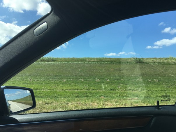
Driving west about twenty miles outside of Stuart, we pass Indiantown. We see train tracks, agricultural fields, and wonderful open natural lands such as DuPuis Wildlife Area. All the while the C-44 canal is to our right. An eagle flies overhead. The blue and white clouded sky seems bigger here.
Just a few miles before reaching the Lake we see the looming Port Mayaca Cemetery. In this cemetery are buried in a mass grave 1600 of the 3000 dead from the horrific 1928 Hurricane. A stark reminder of the past, the power of Mother Nature, and how we live dangerously so in a drained swamp. There are graves of others not associated with the hurricane too. Old families. People whose blood and sweat laid the ground for South Florida’s development. Many of the family plots go back to the 1800s.
Getting back into the car and back on Kanner Highway, we drive past sod farms and sugarcane fields. King Ranch has a sign with their brand atop. After about 10 minutes, slowly and with caution we approach Port Mayaca. It is impossible to see Lake Okeechobee herself as a gigantic berm and structure surround her. We do see the ACOE’s S-308, the structure that allows water to enter the C-44 from Lake Okeechobee that eventually flows and destroys the St Lucie River. Strangely, we notice an “advisory” blue-green algae sign prominently displayed while at least four people are fishing in the canal. Pulling onto the once famous toll road of Connors Highway and going south, we see the berm of Lake Okeechobee. We leave Martin and enter Palm Beach County. Large trucks fill the road. It is nerve-wracking but exciting. Some beautiful old homes stand amoungst thickets of royal palms and tropical vegetation. Roses and honey are for sale if one has the nerve to pull over.
After about twelve miles we reach Canal Point. Canal Point is not incorporated, but part of Palm Beach County. At this location is S-352 built in 1917, today’s SFWMD’s structure allowing water into the West Palm Beach Canal, Water Conservation Area 1, as well as being used for irrigation.
We take a sharp turn into the Canal Point Recreation Area praying not to get rear ended. Here we can drive on top of the dike and take a look at Lake Okeechobee and across the street. Fishermen fish near the structure. An alligator waits nearby. It’s nice to see some wildlife.
A beautiful Baptist church stands among tidy homes. A U.S.Department of Agriculture Research Service Sugarcane Station also sits along the Connor Highway that hugs the lake not too far from S-352.
Sugarcane fieldsConnors Hwy. allowed the Glades to develpHomes with dike in background
Canal Point has about 525 people and the town is very small located between Lake Okeechobee and sugarcane fields. From what we can see there is also a post office, one elementary school, and a store. Larger, Pahokee is just a few miles away.
This little town has a rich and important history. In the coming days we will learn about Canal Point’s mark on the Northern Everglades of which we are part.
In our continued documentation of the 2016 Lake Okeechobee event, my husband Ed and I flew over the St Lucie River/Indian River Lagoon around 5:00pm on Father’s Day, 6-19-16, at the very end of an outgoing tide. Being a stormy day, there was poor lighting, but it was easy to see the darkness that enveloped the river due to the discharges of surrounding agricultural canals, and tidal runoff, and especially the high and long-going releases from Lake Okeechobee. The dark plume hugged the coast and jutted far out into the Atlantic having no clear edge as it was churned up from high winds and waves. Nonetheless from above, it’s shadow was visible for miles all the way south to the Jupiter Inlet.
Over the weekend there were multiple reports of algae blooms throughout the river and canals. Below are photos from a family boat ride in the vicinity of the Harborage Dock in Downtown Stuart yesterday, showing foam and algae at the shoreline and tiny specks of algae dispersed throughout the entire river.
“One resident nearby of Stuart, Dr Vopal, texted: “The river is pea green! …It is time for the legislators to look at this river and consider the health of the people that live on it. ”
Over the weekend just to me and on Facebook there were reports of algae blooms not only in Stuart but along the C-44 canal, the condo/marinas along Palm City Road, the eastern area of Lake Okeechobee itself, the St Lucie Locks and Dam, the St Lucie River near Martin Memorial Hospital, Sandsprit Park, Phipps Park, and Poppleton Creek. Certainly there were many others.
As most of us know, the Army Corp of Engineers has been discharging into the St Lucie River since January 29th, 2016. The river is almost completely fresh thus these freshwater blooms— that are in the lake and upper agricultural canals prior to being released into our river (cyanobacteria is a freshwater bloom)—and then they spread throughout the river once it too is fresh from all of the discharges. Since the ACOE has been releasing since January and there has been so much rain conditions are really bad.
Ed and I will continue to document. Our region’s entire quality of life is at stake. Nothing affects our local economy more than our river. We all must continue pushing to send water south to be cleaned and conveyed to Everglades National Park as Nature intended. Call our elected officials at every level. And vote on Aug 30th in the primary.
Fondly,
Jacqui and Ed, #Skywarriors since 2013
Photos of SLR/IRL -Sewall’s Point, Sailfish Point, St Lucie Inlet, Sailfish Flat’s former seagrass beds, Jupiter Island, Atlantic Ocean’s “protected” nearshore reefs.
^-19-16 Ed Lippisch and Jacqui Thurlow-Lippisch view the confluence SLR/IRL over Sewall’s Point, Sailfish Point, Sailfish Flats, St Lucie Inlet, Jupiter Island, Atlantic Ocean.
Photos shared over weekend: Phipps Park, C-44 canal, St Lucie Locks and Dam, Sandspsprit Park also from family Father’s Day boat ride Harborage Marina, Downtown Stuart.
…
Foam and algae blooms in the area of Harborage Marina, Downtown Stuart, near the Roosevelt Bridge.
Harborage Marina near Roosevelt Bridge.
Lake O algae bloom shared by boater and posted by M. Connor just prior to weekend.
Pre weekend- Photos of an algae bloom in Lake Okeechobee on the east side of the lake. These photos were shared on Facebook by a river warrior and then by Michael Connor.
Sources of water ACOE/SFWMD june 2016SFWMD canal and basin map. According to Florida Oceanographic only 17% of water went into the SLR before the agriculture canals of C-23, C-24, and C-44 were dug in 1920s-1960s. Lake Okeechobee discharges on top of canal dumps are killing an already very stressed estuary. These waters must be redirected south and stored in other places that need the water. This overabundance of water is killing the St Lucie.River Kidz and Treasure Coast Rowing Club youth led a river clean up and planting of native vegetation to filter water during incoming and outgoing tides at Poppleton Creek. The creek was filled with an algae bloom. photo TC Palm
Blue line 2013 releases into SLR/IRL, red 2016. It is only February and we are 1/3 there. Discharge amounts are much higher this time. Slide, Todd Thurlow.Cumulative 2-18-16 Slide created by SFWMD data via Todd Thurlow. Click to enlarge.….
“—Here it is graphically vs 2013 – The year of ‘The Lost Summer.’ As you can see, as we approach 75 billion gallons we are already one-third of the way to the amount released in of all of 2013. It took us until July 30, 2013 to accumulate 75 billion gallons of discharges in that year.” —-Todd Thurlow(http://www.thurlowpa.com)
Today I am sharing numbers from my brother, and photos from my husband. Documenting the St Lucie River/Indian River Lagoon is a family effort. I am very fortunate to have such help.
The St Lucie River/Indian River Lagoon is not so fortunate. Right now as you can see from the two slides above, the cumulative discharges into the rivers are already one-third the total amount released by the ACOE/SFWMD into the estuary during 2013’s “Lost Summer.” We are experiencing another complete ecological disaster and rainy season doesn’t even begin until June 1st…
Sometimes I am speechless… Sometimes my eyes swell with tears thinking about all this and the sun hasn’t even risen….but I take a deep breath and know my duty.
We will not give up. We will shine a light on this issue for all the world to see; and for us to change. And we will.
….SLR approaching SL Inlet. (All photos, Ed Lippisch 2-17-16)…Sewall’s Point once surrounded by rich seagrass bed much fish and wildlife. Years of destruction from discharges especially has taken a great toll.….Sailfish Point…..Crossroads–seagrass beds covered in silt and viewed through blackwater.….Jupiter Island….….Plume leaving inlet. This year Ed says it is skinnier going further south than in 2013. It is reported about 2 miles out the inlet on outgoing tides.…..Jupiter Island….Jupiter Narrows, Jupiter Island…Jupiter Island….Jupiter Island beach


 Driving west about twenty miles outside of Stuart, we pass Indiantown. We see train tracks, agricultural fields, and wonderful open natural lands such as DuPuis Wildlife Area. All the while the C-44 canal is to our right. An eagle flies overhead. The blue and white clouded sky seems bigger here.


 Pulling onto the once famous toll road of Connors Highway and going south, we see the berm of Lake Okeechobee. We leave Martin and enter Palm Beach County. Large trucks fill the road. It is nerve-wracking but exciting. Some beautiful old homes stand amoungst thickets of royal palms and tropical vegetation. Roses and honey are for sale if one has the nerve to pull over.