“Right now billions of gallons of fertilizer, sewage, and legacy pollution from Lake Okeechobee are spewing into the St. Lucie River, carrying a new threat of toxic algae. Water managers may say Irma left them no choice, but of course that’s a half-truth…”
All photos/videos taken off St Luice Inlet September 30, 2017 JTL/EL
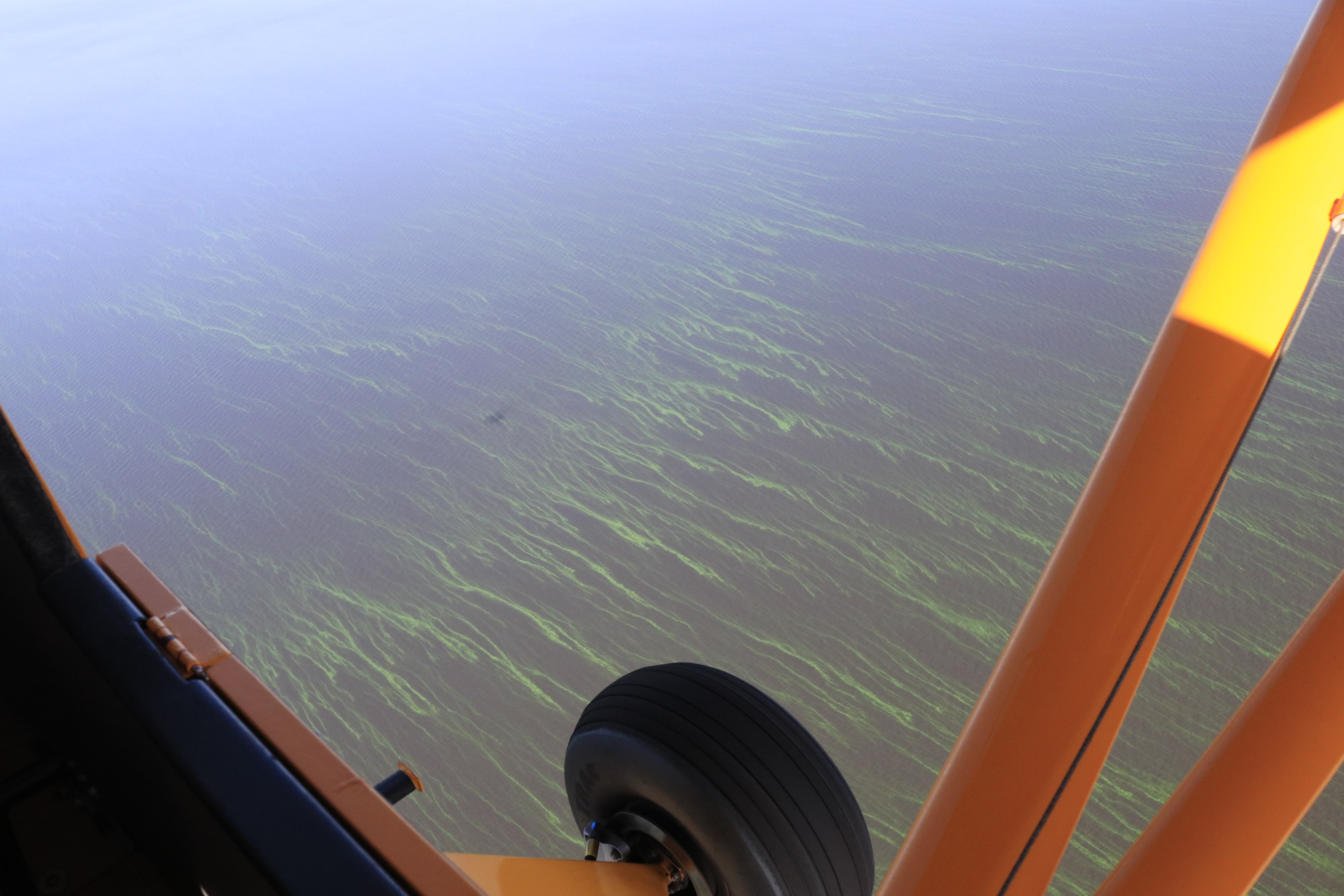
Documentation of primary and secondary plumes at St Lucie Inlet caused predominantly from human directed ACOE/SFWMD discharges post Irma and other from Lake Okeechobee & canals C-44, C-23, C-24, C-25. 10am, September 30, 2017. Primary plume out 3 miles; secondary 3 1/2 and not quite south to Peck’s Lake. We must continue to #ReplumbFlorida #forthefuture #forthewildlife #forthekidz #fortheeconomy for our #indianriverlagoon JTL/EL
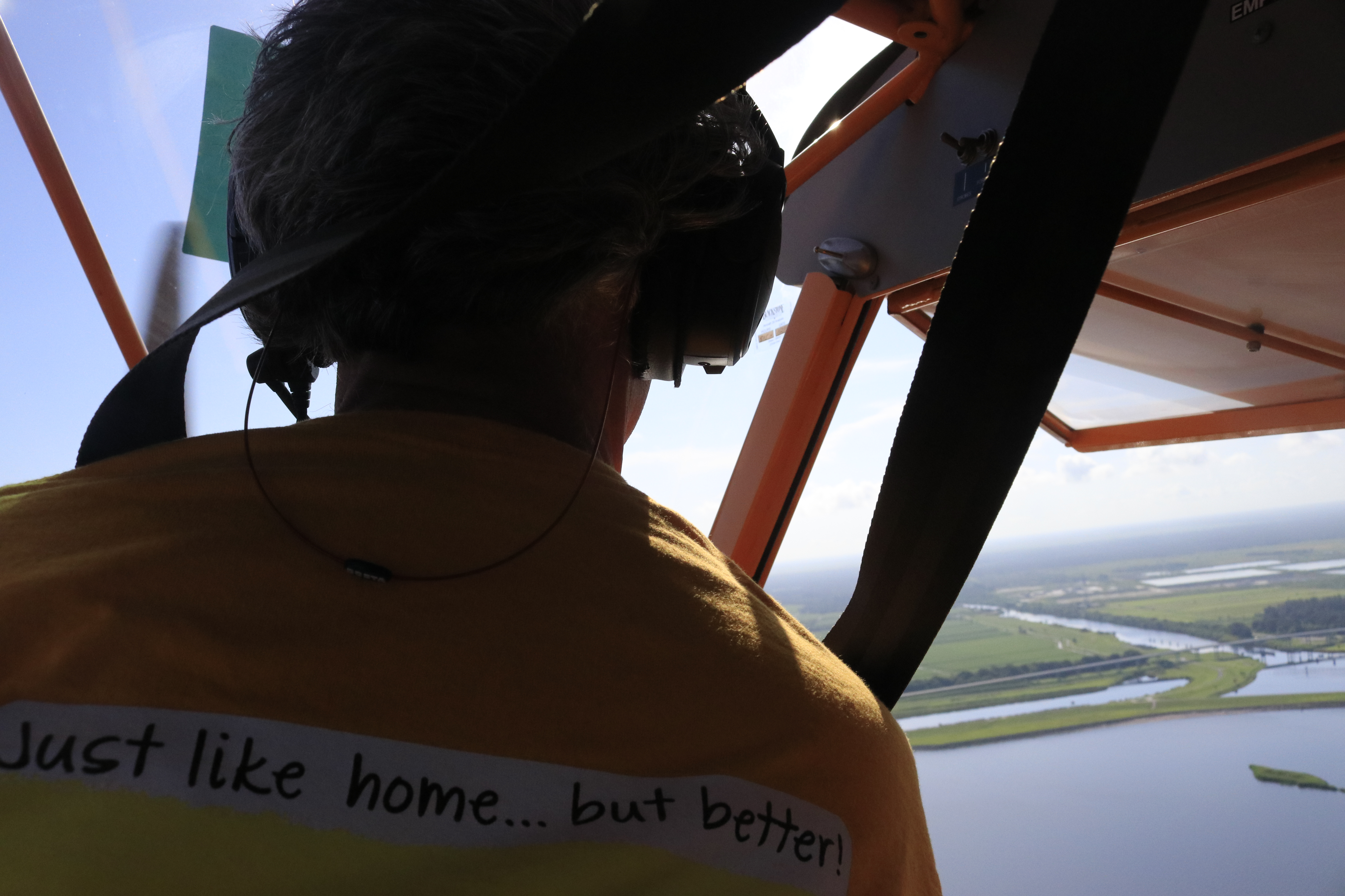
Ed, my husband, and Todd my brother, algae hunters! The Cub.The Baron, Todd and Ed. All of Todd’s photos are linked at the bottom of this post.
On Saturday, my husband, Ed, took my brother, Todd, up in both the Cub and the Baron to look for a the large algae bloom Ed and I had seen last Wednesday in Lake Okeechobee. I went along for the Baron ride, but the Cub only holds two.
Maybe you, like me, after listening to the news the past few days, realized there were other blooms reported, even a “small one” in Pahokee on May 20th by famed biologist Barry Rosen, of USGA. I wondered if Todd and Ed would see more blooms, other blooms…
Saturday, July 22, 2017, was much more overcast than the previous Wednesday, so the lake photos Todd took are not as bright in color, but the “southwest of Port Mayaca” bloom is definitely still there. Todd did not report any others during the trip and the GPS track shows that he and Ed went quite far north and west. (Channel 12 reported on two blooms on Lake O’s western shore…)
Before the flight, Todd also shared the most recent Landsat 8 satellite image that shows where the large “southwest of Port Mayaca” bloom is located although here too, there are a lot of clouds blocking the image…
Approaching Lake O with widespread cloud cover.
After Wednesday’ s post, many were asking me if there were visible blooms in the St Lucie River or C-44 Canal.
The answer: “No.” From 1000 feet up, there are none visible. But there are the “bubble like nutrient swirls” that seem to proceed the blooms in some areas. (You’ll notice these in Todd’s photos and all 350+ photos are linked at end of post.)
I did notice that on Facebook a small bloom was reported at Rivers’ Landing in Palm City, and another one on rocks in the North Fork. The Caloosahatchee has indeed reported a pretty significant bloom…blooms are in the estuaries but the motherload is Lake O.
Have you seen any blooms? If so, here is the link to report algae blooms to the Department of Environmental Protection, “DEP.”
I happened to notice when I visited the DEP website that DEP states: “Blooms are naturally occurring.”
…Yes this is true; so is cancer.
However, nutrient pollution that feeds these algae blooms and is killing our estuaries, and possibly us, is entirely man-made. We know what causes it.
We must be more diligent and creative in stopping the nutrient run of from agriculture and development. “Taking measures”as noted in the DEP quote as the game plan just isn’t enough. After all, this is a war to save our Florida.
Florida’s five water managements districts map DEP.
“There are no short term solutions to rectifying the situation; this is a naturally occurring phenomenon that the State monitors closely. However, the state is taking measures that in the long-term will reduce nutrient loading and improve water quality.” DEP, 2017 website
GPS of trip. 1. Blue Cub. 2. Red Baron.South Fork that connects to C-44 and then Lake O at Port Mayaca, near Palm City; following photos just going west towards Lake Okeechobee. Notice the bubble trails.Rowers near Palm CityAmerican Yachts and 195 overpass is near where C-44 connects to South Fork of St Lucie RiverS-80 where area basin water is allowed into South Fork of St Lucie as well as water from Lake O if S-308 is open at Port MayacaPart of C-44 Reservoir project, the biggest in the state, to hold area basin water, clean and return to C-44.Water and sediment leaving ag canals entering C-44 canalIndiantown area and C-44.FPL cooling pond. This area was once a cypress tree forestPort Mayaca’s S-308 at Lake OkeechobeeC-44 is “running backwards” into Lake O right now, dark color is visibleAlgae is present south west of Port Mayaca but not as bright on this cloudy day…S-308Lake O southwest of Port MayacaS-308 looking east from LakeOthe northwestern shorelineS-308 with C-44 area basin waters going into lake. Usually these waters flow into C-44 and the SLRNorthwestern shorelineWater in northwest
Photo in 2nd plane, the Baron. I went along for this one as you can get a more overall view…Again algae present in Lake O southwest waters but not as intense as seen in blog photos I published four days prior as this day was cloudy and there was little sunlight.My brother noted the algae around the Okeechobee Waterway canal cut into the lake. Interesting!The water flowing backwards from C-44 area basin is certainly one of the things fouling Lake Okeechobee.2. This 1995-2005 map shows phosphorus loads to lake and SRL for that time. (SFWMD)
My husband and I have decided we are algae hunters…
Hello Readers. Hope you are having a good summer!
Even though I am supposed to be on a “blogcation,” my husband, Ed, and I decided to fly over Lake Okeechobee this morning as yesterday Dr Susan Gray of the South Florida Water Management District reported on the Army Corp of Engineer Periodic Scientist Call that recent Landsat Satellite images had revealed significant algae in the middle of the lake- – – an area known as “LZ40.”
Sure enough, once Ed and I got up in the air, just a few miles west of Port Mayaca, the strings of bright green algae were visible from about 1000 feet —-looking down— up to as far as eye could see…
Very strange to be surrounded by water and bright-colored lines of algae; it resembled miles of suspended fluorescent paint. I have heard the scientists talking about how the algae comes up in the morning for sunlight and then goes back down into the water column later in the day. It is intelligent, like an animal, and knows how to hide. You have to track it….
The living bloom was quite extensive, going on for many miles. My photos do not do the color or amount justice, but do document. This is important.
Thank God the ACOE is not dumping into the St Lucie River/Indian River Lagoon this summer. Poor lake O, on the other hand, has been getting “backwards flowing” C-44 water and back-pumped water from the EAA, STAs, and WCAs. No wonder its a mess!
Thank you to the SFWMD for the heads up! We do appreciate your work. We have inherited and created “quite an animal.”
*Reader, Professor Geoff Norris recommends we ask NOAA to create a bulletin for Lake O like this one here for Lake Erie since basically we are “in the same boat:” I think this is a great idea. I will have to contact NOAA.
Tracking of journey upon return from Ed’s watch 7-19-17 around 9amCenter area of Lake O LZ40 is where SFWMD reported 7-18-17 that algae was showing on Landsat satellite images
Ed approaching Lake OkeechobeeFPL pond, Herbert Hoover Dike, and Lake OS-308 and dikeAlgae starts to appear just a few miles outAlgae get thicker and brighter as we continue flying west
Atlantic shoreline just south of St Lucie Inlet along Jupiter Island contrasting 6-20-15 clear waters to of 9-8-13’s dark waters. Dark waters reflect discharges from Lake Okeechobee and area canals C-23; C-24, and C-44. Blue waters reflect “no rain” and no dumping for one month from the ACOE and SFWMD. (Photos Jacqui Thurlow-Lippisch and Ed Lippisch)
Monday’s blog contrasting the beautiful, blue-waters of the St Lucie River/Indian River Lagoon this summer in 2015, to the silty, dark-brown waters of the “Lost Summer” of 2013 was well received, so today will post some more photos of this “contrast.”
My husband, Ed, encouraged me to do more framed contrast photos; however, time does not permit so there is just one “framed” photo above and the rest will be separate photos. I will try to do more framed ones in the future.
Also, although Ed and I have taken thousands of photographs, they do not always “match up” in location so the visual perspectives are not “exact.” My goal while in the plane is simply to hold on to the camera, hoping it does not fall into the river. It is always very windy in the open Cub. Getting a good photo is just secondary! I mostly just use my iPhone.
Well, a picture speaks a thousand words….” so I’m not going to “say” anything else…All photos are contrasting June 20th 2015 with either August 11th or September 8th of 2013.
Thank God we having a beautiful summer!
Bo and Baron, our dogs, sitting by the Cub Legend, the plane used for most of the photographs. (JTL) In 2013 it was christened the “River Warrior” plane. 🙂St Lucie Inlet looking west towards Stuart, Sailfish Point barely visible on far right of photo. Jupiter Narrows and “Hole in the Wall “on right. June 2015.St Lucie Inlet September 2013 looking north east towards Sailfish Point. Plume heading towards St Lucie Inlet.
Looking northerly towards Sailfish Point and St Lucie Inlet. Sailfish Flats between Sewall’s Point and Sailfish Point are visible here. Sewall’s Point is to the right or west of this photograph. (June 2015.)Looking north toward Sewall’s Point on east/left. The Sailfish Flats are to the right/east as is Sailfish Point. (September 2013.)
Shoreline of Jupiter Island June 2015.Jupiter Island ‘s Atlantic shoreline Sept 2013.
Sailfish Flats between Sailfish and Sewall’s Point 2015.Seagrasses remain decimated and covered in algae.They come back very slowly.Wideview of Sailfish Flats area between Sewall’s (L) and Sailfish (R). Points. (Aug 2013)
St Lucie River, west side of Sewall’s Point 2015. Point of Hell’s Gate visible on to east/right. June 2015.St Lucie River, west side of Sewall’s Point looking towards Evan’s Crary Bride. Hell’s Gate is on east/right but not visible in this photograph. August 2013.
The remainder below do not match at all, but provide contrast:
St Lucie Inlet June 2015.St Lucie Inlet June 2015.Hutchinson Island looking south to St Lucie Inlet, June 2015.Blurry but St Lucie Inlet in sight with near shore reefs south of of inlet very visible. (June 2015) These reefs have been terribly damaged by the years of releases from Lake O and the area canals (silt and poor water quality) even though they are “protected” by the State and Federal Government.
Crossroads SLR/IRL to St Lucie Inlet (R) with Sewall’s Point on left. Looking at flats area full of seagrass that bas been damaged again and again by releases. Once surely considered the most “bio diverse estuary” in the North America–1970s Grant Gilmore. Photo August 2013, it is surely not today.Same as above but closer to Sailfish Point nearer St Lucie Inlet Sept 2013.Crossroads Sept 2013.Looking toward Palm City Bridge 2013. St Lucie River.IRL side east of Sewall’s Point September 2013.Inlet area looking at Sailfish Point and St Lucie Inlet 2013.South Sewall’s Point’s waters at Crossroads of SLR/IRL near inlet, 2013.St Lucie Inlet 2013…..