Tag Archives: Everglades Restoration

EAA Reservoir/STA, Modern Progress and a Real Reason for Hope

-Looking towards a future where progress means water flowing south. EAA Reservoir /STA 2021. Photo credit, Libby Pigman, SFWMD. What do they say? “There is no stopping progress!” And the definition of progress changes throughout the ages…

Monday, February 15, 2021, was an Everglades “progress” inspiration for me. The last time I had visited this area was October of 2019. There were vast sugar fields as far as the eye could see. Today, the area is a field of dreams, a goal of collective effort, the lynchpin for sending more water south and significantly alleviating  a hundred years of destruction to the Northern Everglades: St Lucie, Caloosahtchee, and often Lake Worth Lagoon.

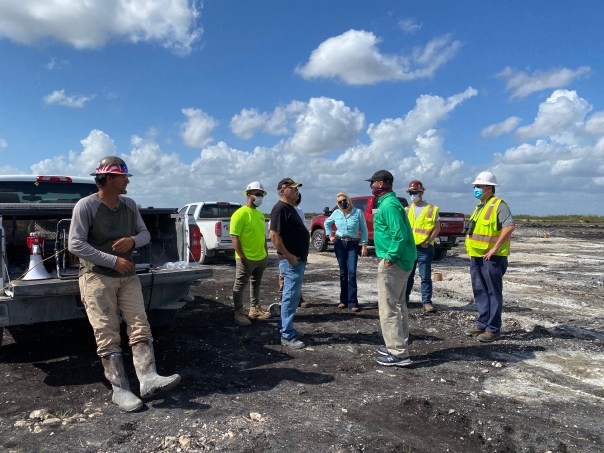
The trip to the Everglades Agricultural Area Reservoir/Stormwater Treatment Area is an experience in and of itself. The District is in charge of building the giant marsh or Stormwater Treatment Area (STA.) South Florida Water Management District  Communications Director, Sean Cooley and I met as the sun rose, and then drove west in a truck from South Florida Water Management District Headquarters through West Palm Beach and the Everglades Agricultural Area, to meet Regional Representative Libby Pigman and Hendry County Commissioner, Carson Turner – who chairs the powerful 16 County Coalition. I have known Commissioner Turner since 2008 and it was fantastic to see him. He is a wealth of knowledge and perspective that I very much appreciate. 

The highlight of the day? Because of my SFWMD Governing Board status, I was allowed to push the button to detonate the dynamite blast. Not really my cup of tea, but it was exciting! And oh my gosh, the shells! Boring 18 feet into the cap rock, thousands of years of ancient earth and shell come to surface.  

As we walked through the piles of rock and shell after the blast, I thought about how this area was once the flooded southern sawgrass plains leading to the Ridge and Slough and Shark River Slough, rising to replenish Florida Bay. I envisioned millions of beautiful wading birds and rookeries doting the spectacular and rare landscape. I thought of how in the name of “progress” humankind drained and destroyed the Everglades. I thought about how priorities change over time. I smiled thinking about how the EAA Reservoir and Storm Water Treatment Area is a real reason for hope, an attempt to return a connection to this sacred River of Grass. In the name of modern progress let’s keep going! For the birds, for the wildlife, for our children, indeed, for all of us. 

Enjoy the photos and blast videos! And thank you to SFWMD staff and RYAN for the tour. -Map of EAA Reservoir/STA. Our location A-2 STA, C-623

*Click here for February 2021 SFWMD EAA Reservoir/STA  construction details and update: Bill_20210216_0001

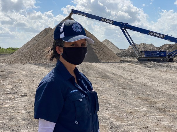
-A red-eared slider turtle greets us at the gate! “Hurry up…” he says!  -“We want the STA” cried  the wading birds! “We need an upgrade!” -We arrive at the EAA STA construction worksite. -David Anderson, RYAN inspector, reviews safely and the day.-Comr. Turner and I look at a map. Carson shares perspective. I learned a lot. -Amid EAA STA construction: David Anderson, RYAN Inspector; Libby Pigman, Regional Rep, SFWMD, Sean Cooley, Communications Dir. SFWMD, Carson Turner, Hendry County Comr. Dist. 5, JTL GB SFWMD.-Site of detonation that will be part of an intake canal system for the EAA STA (pink highlighter pen, upper left corner, on above map shows approximate location). -Muck, ancient deteriorated sawgrass, scraped from cap rock and piled up will be re-laid after construction in STA for plant growth that will filter the water before it goes to the reservoir.-Ancient shells. Florida is of course, an ancient sea…The Everglades is estimated to be “only” 6000 years old.-Dynamite container bored 18 feet into rock. -RYAN’S Mahmound Khalaifa saw I was looking for shells so he showed me what he had found! Ancient coral head and various bivalves. Beautiful! -More review on safety and blast from true professionals.-JTL prepares to hit the button! 

  1. CLICK HERE FOR AWESOME MOVIE #1 OF DYNAMITE BLAST CREATING THE INTAKE CANAL EAA STA 2021.
  2. CLICK HERE FOR MOVIE #2 EAA STA BLAST 2021  – JTL SCREAMING WITH DELIGHT!

POST BLAST

-Sean Cooley, Communications Director SFWMD and Comr. Turner walk carefully amid the mountainous post-blast site. -Carson Turner & JTL pose for the camera. Jacqui is finding fossils and cool rocks.-Carson found an ancient coral head and gifted it to me. Thank you Comr. Turner! -Driving a short distance from the blast site one sees the infamous “pyramids” against the horizon. This is rock that has been crushed and ground down. It will be used to create the canal edges and levees. Nothing on site is wasted. -Final explanations, questions, and wrap-up! A great day! Rock crusher in background.-The road home …-Treasures from the Earth… Thank you Everglades….-General location of EAA Reservoir STA on Google Maps. It lies between the Miami and New River Canals. The perfect place to reconnect! 

More photos of EAA Reservoir’s STA blast canal digging with explanations, January 2021, TCPalm, photographer, Leah Voss article Max Chesnes.


Slow is For Turtles, Not for Crises ~Lobbying for the EAA Reservoir, SLR/ILR

JTL not a happy camper ~at the zoo 1968

Fifty years have passed since my parents took this picture. The family was visiting the zoo and my mother told me to stand on the back of the giant tortoise for a photograph. I was four years old, and I refused. I “didn’t want to hurt the turtle” by standing on its back. My mother held the power in the negotiations. She won and I lost. I stood on the poor tortoise, but made sure my mother and father knew that I was mad about it. I gave it my best frown as there was no way I could hide my dismay ~as I wished to befriend and pet the turtle, not to stand on it.

The 1968 photo has become a family classic.

Over the years, I have learned that it is often the case, when dealing with the environment, that people with more power than I, tell me what to do. I often end up “standing on the turtle,” but today I smile. I have learned to conform, and I have definitely accepted that being mad, or mean, will get me few friends and even fewer successes.

This week, when I was in Washington DC with the Everglades Foundation, I was assigned to a great lobbying team. Our job, along with others, was to convince key congressional members of two things: 1. Authorization of the EAA Reservoir through the Water Resources Development Act as a portion of the CERP, (Comprehensive Everglades Restoration Plan), the master plan to restore the Everglades, that is cost-shared 50/50 between the State of Florida and the Federal Government. 2. Increase the Federal Funding for CERP as the federal contribution needs to increase to at least $200 million to begin to meet its cost-share commitment.

The feedback we got from the lobbied members of Congress was positive; however, sometimes I felt like that little girl standing on the tortoise when members in power told me that even with the approvals, if they were approved, Everglades restoration and improving the state of the Northern Estuaries and Florida Bay will take many, many years. “After all the Army Corp of  Engineers  has a very specific process…”

I smiled, but deep down inside I was frowning.

The environment, like the giant tortoise, should be treated more respectfully. Slow is for turtles, not for crises.

My lobbying team, SMILING, Everglades Foundation Summit 2018, #Nowor NeverGlades, John Adornato, National Park System; JTL, Tori Liner, “Path of the Panther;”Mark Perry, Florida Oceanographic Society (http://www.evergladessummit.org)

America’s Everglades Summit 2018: http://www.evergladessummit.org

WRDA, Water Resources Development Act: https://en.wikipedia.org/wiki/Water_Resources_Development_Act

EAA Reservoir: https://www.sfwmd.gov/our-work/cerp-project-planning/eaa-reservoir

Senate President Joe Negron/EAA Reservoir: http://sunshinestatenews.com/story/negron-concerned-about-initial-sfwmd-modeling-everglades-agricultural-area

CERP: http://141.232.10.32/pub/restudy_eis.aspx

Algae pouring in from Lake Okeechobee from Central Florida waters, 2016.

Algae bloom in Lake Okeechobee is estimated to be 263 square miles as shown in this NOAA satellite image on 7-2-16 shared by FOS on 7-6-16, Todd Thurlow.

Everglades Foundation handout 2018

Aerials of EAA’s A-1 & A-2, SLR/IRL

jxpf41485179455-2
Map giving an idea of location of A-1 and A-2

img_2790
A-1 with A-2 in distance

EAA=Everglades Agricultural Area

A-1 is a Flow Equalization Basin located above Strom Water Treatment Area 3/4 that today is part of a state program for EAA water quality improvement called “Restoration Strategies.”  The A-1 was once was part of the Comprehensive Everglades Restoration Plan’s EAA Reservoir.

A-2 is to A-1’s  west and is presently in agricultural use but scheduled to become another Flow Equalization Basin as part of the Central Everglades Planning Project coordinated by the South Florida Water Management District and the Army Corp of Engineers.

__________________________

Over the weekend, I asked my husband, Ed, to fly me over the A-1 and A-2. He rolled his eyes as he does when I use “acronyms speak,” saying: “Just tell me where you want to go….and get a map.”

I got my old Florida Atlas & Gazetteer that works just fine…

As Ed drank his coffee, I gave him the plan.

img_9622

“Well we’re going to fly west over the C-44 Canal and then go south around Lake Okeechobee until we get to Belle Glade and there we are going to follow the North New River Canal south adjacent to Highway 27 until the bend, and the A-1 and A-2 should be just past there….”

Ed looked at me like I was crazy, smiling; I remind him that’s why he loves me and we were off!

Today I am sharing our photos of the area of the A-1.

Sit back and enjoy the flight…

Jacqui

img_2819
A-1 with A-2 lands in distance

file-page1

CEPP:http://141.232.10.32/pm/projects/proj_51_cepp.aspx
Restoration Strategies:https://www.sfwmd.gov/our-work/restoration-strategies
EAA Reservoir what was completed before change to FEB:http://www.barnard-inc.com/projects/environmental/eaa-a-1-reservoir-environmental
Senate President Joe Negron’s Reservoir goal:http://www.sun-sentinel.com/local/palm-beach/fl-lake-okeechobee-reservoir-negron-20160809-story.html

Talking About It! Even If They Didn’t Let Us Talk! FL Senate Appropriations Subcommittee on the Environment and Natural Resources, SLR/IRL

FullSizeRender_5.jpg
Dr Wendy Graham, UF

IMG_9453.JPG

Committee Members: Senator Bradley, Chair; Senator Book, Vice Chair; Senators Braynon, Hukill, Hutson. Mayfield, and Stewart

Yesterday, January 11th, Florida’s Appropriations Subcommittee on the Environment and Natural Resources met in Tallahassee. The Legislative Session has not formally started, but as most things in life, the most important stuff happens ahead of time….”in committee.”

The topic was “Discussion and testimony relating to the options for reducing harmful Lake Okeechobee discharges and Everglades Restoration.”

This meeting is being held because of Senate President Joe Negrons’ proposal to buy 60,000 acres of land in the EAA south of Lake Okeechobee for a  Reservoir. file-page1.jpg

Yesterdays’ meeting was just informational, but first impressions are very important. And anything can be killed in committee.

I think the meeting went very well. “Everyone was represented:” East Coast; West Coast; Florida Bay; The Glades and agencies or organizations of those who presented. I thought it was great. Great to see people in power and those with knowledge talking about this important issue. Remember that just a few years ago, many in Tallahassee thought the Indian River Lagoon was a movie from the 50s.

Many people drove over 12 hours to speak but Chair Bradley did not allow public comment. Bullsugar, River Kidz, Glades Residents, Islamorada, Florida Bay, CaptainsForCleanWater, Stuart residents, Ft Meyers residents, Realtors, Hotel Owners, Business Owners and more…This is very disappointing, but certainly “The Powers That Be” knew everyone was there, and surely “They” are taking about it behind closed doors.  It makes an impression when the chamber is full because those politicians know that for every person there, there are hundreds, if not thousands behind him or her who did not come…The “Powers that Be” know this. And Senator Negron knows who came too. Surely he does. He appreciates this! He is motivated by this!

Having a full-house in a sub-committee room is not an everyday occurrence for these folks. Unlike our county government the State is not as practiced at this. They generally get to operate in a vacuum–Tallahassee being so far away! Not good!

Time was short and messages many, so Chair Bradley decided to cut the meeting presenters basically in half. Thus not all the presenters who came were allowed to speak either.

Those who presented were: Senate lawyer for the committee, Ashley Istler; UF’s Wendy Graham; ACOE’s Lt Col. Jennifer Reynolds; Independent, Dr Gary Goforth; and Exec. Dir of the SFWMD, Pete Antonacci .

Those moved to January 25th were: Dr Tom Van Lent, Everglades Foundation; Drew Bartlett, DEP; and Ernie Barnett, EAA Landowners.

Overall takeaway?

There was a common theme: “we need more water storage everywhere. North, South, East and West and concerns about where the reservoir should first be or if it should be….

This is clearly a very exasperating experience for many. But isn’t it great that we are actually talking and learning about it. Together.

FullSizeRender 3.jpg
Slide UF’s  Wendy Graham, needed water storage.

All presentations are linked here and are excellent resources:http://www.flsenate.gov/PublishedContent/Committees/2016-2018/AEN/MeetingRecords/MeetingPacket_3552.pdf

Committee meeting recorded by the Florida Channel Network:http://thefloridachannel.org/videos/11117-senate-appropriations-subcommittee-environment-natural-resources/

#SupportJoeNegron

Why #SupportJoeNegron ‘s EAA Reservoir? Because it Should Have Already Been Built! SLR/IR

Image 1-8-17 at 3.50 PM.jpg
CEPP, 2000.

img_9231-version-2
“A1” Reservoir was never built but rather the A1 Flow Equalization Basin instead

In my opinion, one should support Senator Negron’s controversial land purchase to build an EAA Reservoir, because the Reservoir should have already been built. It is a project that has been expected for almost two decades.

A summary–

Due to water quality lawsuits against sugarcane growers, during the 1980s and 90s, the State of Florida had to build six Storm Water Treatment Areas to clean runoff water using Everglades Agricultural Area land, taking valuable sugarcane out of production. (Orange shows STAs) Unfortunately, the industry brought this upon itself as for many years its water runoff had been polluting Everglades National Park and Tribal Lands.

.STA

The problem was so bad, that on top of the Stormwater Treatments Areas, Congress appropriated the beginnings of the Comprehensive Everglades Restoration Plan. Yes, “CERP” has a plan for  “EAA Storage.” A Reservoir, to be the heart of clean water flowing south. (See 4 down left of image below)  CERP (https://www.nps.gov/ever/learn/nature/cerp.htm)
image-1-8-17-at-3-50-pm

Ev. Restoration.gov:http://141.232.10.32/pm/projects/proj_08_eaa_phase_1.aspx

At the beginning of CERP it was determined that the Reservoir/s were to be built near Stormwater Treatment Areas between the Miami and New River Canals. Although they tried, the SFWMD and ACOE never got very far building the Reservoir/s and, you’ll notice “EAA Storage” is still listed on the ACOE calendar of projects, scheduled to begin in 2021. (http://evergladesrestoration.gov/content/cepp/meetings/012512/Recap_EAA_Reservoirs.pdf)

fullsizerender-2
This shows an area of the EAA Reservoir/s proposed between the Miami and New River Canals.

“Why?” You might ask, “didn’t the EAA Reservoir/s get built ?”

ACOE’s IDS or Schedule of Projects: http://www.saj.usace.army.mil/Missions/Environmental/Ecosystem-Restoration/Integrated-Delivery-Schedule/

IMG_3459
Close up of latest ACOE IDS schedule. EAA Storage in white.

The Reservoir/s did not get built because Gov. Charlie Crist’s proposed an idea of US Sugar’s to purchase all of United States Sugar Corporation’s land. This did not work out, induced a halt to the building of the Reservoir, and caused great discord with the Water Management Districts and the state Legislature.  The Great Recession also made the full purchase very difficult.(http://www.nytimes.com/2010/03/08/us/08everglades.html)(http://articles.sun-sentinel.com/2009-09-11/news/0909100559_1_everglades-restoration-reservoir-construction-reservoir-project)

Then on top of the US Sugar and the Recession situation, a Federal law suit that had been dragging on for years was settled and really changed things for the Reservoir/s. In 2010, Governor Rick Scott, “negotiated” a long-standing EPA law suit agreeing that the state of Florida would build more water quality projects to clean sugarcane runoff in the EAA that continued to destroy fauna and pollute Everglades National Park. This “fix” became known as “Restoration Strategies.”(https://www.sfwmd.gov/our-work/restoration-strategies)

Restoration Strategies supplanted CERP’s unfinished EAA Reservoir, building a Flow Equalization Basin instead. Mind you, a shallow treatment area is not a true Reservoir.(https://www.northstar.com/wp-content/uploads/2016/11/SFWMD-EAA-A-1-Flow-Equalization-Basin.pdf)

Now for one last thing…

Just recently, in December of 2016, Congress authorized CEPP. CEPP consist of  six components of CERP mentioned earlier. One of CEPP’s components is the “EAA Reservoir.” This sounds great, but….

CEPP, if appropriated, will not build a Reservoir but yet another Flow Equalization Basin to be located right next to Restoration Strategy’s “A1 Flow Equalization Basin.” This new Flow Equalization Basin will be called the “The A2.” (http://www.saj.usace.army.mil/Missions/Environmental/Ecosystem-Restoration/Central-Everglades-Planning-Project/)

So in conclusion, neither Restoration Strategies nor CEPP will provide the Reservoir that was underway before everything changed in 2008, nor will their water come close to adding up to “a Reservoir.”

Supporting Joe Negron’s land purchase of 60,000 acres is the ground work for building a Reservoir that should have already been built!

#SupportJoeNegron

Support the completion of the EAA Reservoir!

(http://www.miamiherald.com/news/local/environment/article94667592.html)

  • file-page1.jpgThe ACOE has EAA Storage on their construction schedule for 2021. By 2021 the estuaries will surly be dead.file-page1-2

Stofin Co. Inc, part of the Fanjul Empire, Mapping Out Florida’s Water Future, SLR/IRL

FloridasFanjuls_lg.jpg
The Fanjul Brothers, Plantation Services Land Report 2012

file-page1-2.jpg

“Who Owns the Land? Mapping Out Florida’s Water Future.”

Stofin Co. Inc. is #7 on the Treasure Coast Regional Planning Council’s (TCRPC) map of land ownership in the Everglades Agricultural Area, (EAA). These lands lie on the eastern side of the EAA and comprise 7,189 acres. Stofin Co. is affiliated with Fanjul Corporation more widely known to river activist as “Florida Crystals.” As we know, Fanjul Corporation is a large sugar and real estate conglomerate with interest in Florida, the Dominican Republic and soon to be in the brothers’ homeland, Cuba, once again. The family is very influential in all politics and donates extensively to both the Democratic and Republican parties.

We can see by doing just a bit of research that some of the same officers of Fanjul Corporation are also listed in Stofin Co. Inc. such as Erik J. Blomqvist and Luis J. Hernandez.

Fanjul Corp. Sunbiz (http://search.sunbiz.org/Inquiry/CorporationSearch/SearchResultDetail?inquirytype=EntityName&directionType=Initial&searchNameOrder=FANJUL%20M516461&aggregateId=domp-m51646-9316409f-936a-40c1-9bc9-3acc902edee5&searchTerm=fanjul%20corp&listNameOrder=FANJUL%20M516461)

IMG_6196.jpg
Fanjul Corp. Sunbiz 2016

Stofin Co. Inc., Sunbiz (http://search.sunbiz.org/Inquiry/CorporationSearch/SearchResultDetail?inquirytype=EntityName&directionType=Initial&searchNameOrder=STOFIN%201856420&aggregateId=domp-185642-9100e283-b064-4a5f-8083-da9865fd09e3&searchTerm=stofin%20co%20&listNameOrder=STOFIN%201856420)

IMG_6198.jpg
Stofin Co. 2016 (Note many of same officers) 

Looking at our TCRPC map I have colored #7 parcels in orange just as #2 Okeelanta Corp. and #3 New Hope Sugar Co. were. As we learned earlier those too are Fanjul Corp. lands. I have just added a purple dot to differentiate. So far all in ORANGE below is Fanjul holdings.

It is interesting to compare the TCRPC map with the historic maps also below and note the “shape” of the original “river of grass” before it was dammed and destroyed by agricultural development in the EAA. Note how the river veered off to the right, or in an eastly direction. Surveyor, Chappy Young’s map shows the westerly development over the years into the “Everglades’ agreeed boarder” from the east. We have swallowed her up in every direction. She needs to be restored. It only makes sense that some of the overflow water from Lake Okeechobee destroying the St Lucie River/Indian River Lagoon is allowed to go south again. Thank you for reading my blog and for caring about the health of the St Lucie River/Indian River Lagoon and the Florida Evergldes.

IMG_6202.jpg

Everglades Unknown early map from negative
Historic map from 1948 book “Lake Okeechobee” written in 1948 by Alfred Jackson and Kathryn Hanna as part of the Rivers of America Series.

war map
War map of the Everglades created during the Seminole Wars, 1856.

line for everglades
West of the red lines shows the edge of what was once the Everglades in South Florida. Development has crept and continues to creep over this edge. (Photo/map courtesy of Chappy Young,/GCY Surveyors, 2014.)

file-page1.jpg
Senator Joe Negron’s proposed aquisition map in the EAA, 2016.

Stofin Co. Inc. (http://www.companies-florida.com/stofin-co-inc-1fym6/)

Stofin donations to politicians: (http://archive.tcpalm.com/news/indian-river-lagoon/health/ken-pruitts-lobbying-firm-harvested-150000-from-florida-crystals-since-2012-investigation-finds-ep-3-332700741.html)

Stofin donations to political parties: (https://www.opensecrets.org/industries/indus.php?cycle=2016&ind=A1200)

King Ranch, King of the EAA, SLR/IRL

“Who Owns the Land in the EAA? Mapping Out Florida’s Water Future.”

FullSizeRender 3.jpg

Today we learn about King Ranch, #4 on the TCRPC map of land ownership in the Everglades Agricultural Area (EAA).

King Ranch is full of history and mystique and part of Texas’ long US history with Mexico. They are “Americana” even on the road. Perhaps you have gotten behind a truck with their brand symbol? Maybe you own one of those trucks? King Ranch is a huge company and  has many different interests.

One of King Ranch’s major interests in Florida is Consolidated Citrus and they have an office in Indiantown in Martin County.

Not everything has been a royal flush for King Ranch. Over the decades the company has had to change out their fields because of the loss of orange groves due to canker and citrus greening. In Martin County alone basically 98% of the groves are fallow. A terrible loss.  But to remain King, one must adapt, and they have according to Stuart Magazine “growing sod, corn and sugar, as well as testing out perennial peanuts and organic rice.”

So as the orange groves die, some are replaced with sugarcane.

You may recall articles about Rick Scott and the Florida Legislature a couple of years back going to visit King Ranch in Texas with the support of U.S. Sugar Corporation money?  Yes, “these guys are buds.” They do business together and they play chess together. There are kings, queens, knights, rooks, and pawns.

So according to the map, King Ranch owns 19,755 acres in the Everglades Agricultural Area.” I have colored this in dark blue. They may not be the largest land owner, but considering their influence they certainly are King.

FullSizeRender 2.jpg

file-page1.jpg
Negron’s proposed land map

file-page1-2.jpg
TCRPC map of land ownership in the EAA 2016

*Mr. Mitch Hutchcraft of King Ranch serves on the South Florida Water Management District. He was appointed by the Governor.

King Ranch web site: http://king-ranch.com

King Ranch: https://en.wikipedia.org/wiki/King_Ranch

Stuart Magazine article: https://www.stuartmagazine.com/features/farmers-martin-and-st-lucie-counties-work-grow-their-fair-share-despite-seasons

Citrus: http://king-ranch.com/operations/citrus/

Sugar: http://www.scgc.org

Consolidated Citrus: https://www.youtube.com/user/ConsolidatedCitrus

Texas Observer, King Ranch and Florida Politicians: https://www.texasobserver.org/king-ranch-heart-texas-sized-scandal/

New Hope Sugar Corporation; Can We Create More Than Hope? SLR/IRL

file-page1-2.jpg
TCRPC EAA map 2016

file-page1.jpg
Senator Negron’s possible land acquisition map 2016/17


map_of_pahokee_fl.jpg

“Who Owns the Land South of the Lake? Mapping Out Florida’s Water Future.”

Today we discuss #3, New Hope Sugar Corporation. It is difficult to find much information on the company, however, it is part of the Fanjul family’s holdings. It is also the same name, as we learned yesterday, as the Fanjul charity: New Hope Charities whose mission is to help families in the Glades.

Let’s look at the charity again…

Their website reads: “New Hope Charities was incorporated as a 501(3)(c) charity in 1988 offering support to remote, distressed and underserved segments of society. The first program implemented by New Hope distributed food to needy families living in the “Glades” area of western Palm Beach County. Currently, we operate a multi-service center in Pahokee, Florida, the second poorest city in the United States. The Family Center consists of a Day Care Center, a Youth Center, an Education Center, a Health Center, basketball courts, and an open field for soccer, baseball and football.”

Now back to the land…

I have colored in New Hope Sugar Corp. in the same orange highlighter as Okeelanta Corporation, but added a red dot to differentiate. New Hope Charities above mentions Pahokee as the nation’s second poorest town. Pahokee is south of the Martin County Line along the rim of Lake Okeechobee; it is not far away.  The point of my blog series is to show landholdings, but I think the “New Hope” theme lends itself to a discussion on something more.

FullSizeRender.jpg
New Hope Sugar Corp orange with red dot, #3. Fanjul holdings.

IMG_6003.JPG
Map south of Lake O, Pahokee is marked

I have been blogging for four years now,  it is becoming clear to us all that there is a bridge to be crossed, a hand to be held if we are going to go any further. Since the beginning of our river journey there have been cries from the interior of the state/south of the Lake. Cries of fear that we want to “send the water south” and destroy their cities and livelihoods…Even thought we know this isn’t so, this is understandable— and let there be no mistake about it: #GladesLivesMatter

I think it is time we talk about this openly. We must address the fears and the realities  and we must begin to help…because there is so much help we can do for these communities and for a better water future for our state.

What got me thinking on all this was researching New Hope Sugar Corporation, #3 on the TCRPC map. I realized I have never thought that much about these areas south the Lake, except maybe when my father told me some of the best football players come from Pahokee and Belle Glade. I have driven through before and I have flown over. But have I ever walked inside? No I have not. After I finish this “land south of the Lake series” I think it is time to go inside this world and see how we can help.

We have got start a conversation including the Glades communities, a plan to help the poverty in Pahokee and Belle Glade and other Glades communities. We have to talk about Everglades Restoration as a plan for everyone.  I am sure the Fanjul’s New Hope Charities with same name as their Sugar Corporation is doing great work, but why couldn’t Everglades restoration offer something more? Because in order to create more than hope, we must move beyond charity…


Links:

Glades Lives Matter: http://www.ussugar.com/news/icymi-glades-lives-matter/

New Hope Sugar Corp: Links: http://listings.findthecompany.com/l/29385192/New-Hope-Sugar-Company-in-West-Palm-Beach-FL

SunBiz: http://search.sunbiz.org/Inquiry/CorporationSearch/SearchResultDetail?inquirytype=EntityName&directionType=Initial&searchNameOrder=NEWHOPESUGAR%202486740&aggregateId=domp-248674-74190f46-1014-4027-89fb-78bffb22106a&searchTerm=new%20hope%20sugar%20corp&listNameOrder=NEWHOPESUGAR%202486740

Board of Dir. New Hope Charities: http://www.newhopecharities.com/about/our-board-of-directors/

Pahokee: http://www.cityofpahokee.com/Pages/index

Pahokee: https://en.wikipedia.org/wiki/Pahokee,_Florida

Pakokee: http://www.city-data.com/picfilesc/picc86312.php

Poorest Communities in Florida: http://www.onlyinyourstate.com/florida/poorest-cities-fl/

Excerpt NY Times Article, 2013… In the Glades, the “official” jobless rate has always been a joke because so few people are even on the books. Many of the agricultural jobs disappeared as vegetable production turned into sugar growing, now largely mechanized.

NY Times Article of Football Pahokee and Bell Glade and Hope of a Better Life: http://www.nytimes.com/2013/02/03/opinion/sunday/football-as-a-way-out-of-poverty.html?_r=0

New Hope Charities: http://www.newhopecharities.com

Pahokee IMG_4155 - Version 2.JPG
Pahokee from the air, 2014 JTL

IMG_4156.JPG
Black gold around Pahokee known as THE MUCK

Dr Van Lent–Why an EAA Reservoir Will Help to Save the St Lucie River/Indian River Lagoon

Slide 1. (Dr Thomas Van Lent, Everglades Foundation, 2015)
Slide 1. Everglades Foundation, 2015.)

Today, I am going to try to simplify and share the idea of an “EAA reservoir.” You probably have been hearing a lot about this, but you may not know how it fits into a an option lands purchase and the “sending more water south” concept that will help save the St Lucie River/Indian River Lagoon, and the Everglades.

This is not fully understood by me either, so I contacted Dr Thomas Van Lent of the Everglades Foundation; he sent me some information that today will share with you.

For me all of this is part of a “flow way concept,” though some may disagree.

Dr Tom Van Lent, Everglades Foundation. (Photo 2015.)
Dr Tom Van Lent, Everglades Foundation, (EF). (Photo 2015.)

(http://www.evergladesfoundation.org/about/staff/)

First things first.

LAND PURCHASE: In order to do anything that will actually take a significant amount of water off of Lake Okeechobee, so the ACOE doesn’t have to discharge to the SLR/IRL and Caloosahatchee, there needs to be land to “store, clean and convey that water south.”

Because over the past 95 years, the EAA took up all the southerly land to create their Everglades Agricultural Area, 700,000 acres of land south of Lake Okeechobee, we are “forced” to purchase lands in the EAA to move any water south. Thankfully, land is for sale; although US Sugar rather not sell it.  (Long drama….let’s just leave it at that–the land is for sale; I believe the state should buy it with Amendment 1 monies and /or “bond it.”) This Option 1, the brown lands below, runs out in October of 2015.

Option Lands Map SFWMD River of Grass, Option 1 is 46,800 acres and shown in brown. (SFWMD map, 2010)

So after getting the land purchase necessity out-of-the-way, let’s look at Dr Van Lent’s write-up and slides:

Jacqui, I’ve attached a graphic that I hope will help explain.

I think everyone can agree that the best solution to the estuaries’ problems is to send more water south. But the major limitation to doing that today is (1) the water is polluted and would irreparably damage the Everglades and (2) the dams in the Everglades prevent you from getting the water out, so adding more water would drown tree islands and other habitats. So, the bottleneck to flow is actually further south, in the Everglades, and not in the EAA.

The solution is to clean the water and then remove the dams. But if you just pull out the dams so water flows when it’s wet, then the Everglades will dry up and burn when it’s dry. So an essential step to pulling out the dams is to add water supply reservoir so that you can keep the Everglades wet during droughts.

The Central Everglades Plan started to open up the dams in the Everglades, but was limited because it did not build any storage. With storage, you can open up the Everglades even more, sending more water south.—–Dr Van Lent

—-I have to say I don’t know much about the dams in the Everglades, but that’s OK, let’s move on….


Slide 1. EF.
Slide 1. (EF, 2015.)

(Refer to above slide.) Discharges to the Everglades are limited because the STA’s (Storm Water Treatment Areas) (1.) are too small and cannot clean enough water. Also, dams in the Everglades (2) limit the flow through the Everglades. This leaves the St Lucie/S IRL and Caloosahatchee (3) as the primary outlets for Lake Okeechobee.

Slide 2. (EF, 2015)
Slide 2. (EF, 2015.)

(Refer to above slide.) The “*Restoration Strategies” expansions to STAs (1) and water quality features in *CEPP (2) expanded the ability to treat Lake water going to the Everglades. Moreover, CEPP and Tamiami Trail (3) bridging opened up the Everglades to take more flow, improving conditions in the national park and Florida Bay. The means that significantly less water could be discharged to the St Lucie and Caloosahatchee estuaries (4). The EAA Reservoir (5) supplies water during dry periods so the Everglades remains set seven when the dams are removed. That is why a reservoir is critical to sending water south; it allows the dams in the Everglades to be breached.

Thank you Dr Van Lent!

__________________________________________

In case you are wondering, I have added the following below, to explain Dr Van Lent’s slide explanation.

*Restoration Strategies is basically making the STAs larger due to a long going law suit of the federal government against Florida that was finalized in the past few years under Gov, Scott. The lawsuit occurred because of the dirty water from Lake O polluting the Everglades: This IS happening and the state has to pay for it, 880 million.(http://www.sfwmd.gov/portal/page/portal/xrepository/sfwmd_repository_pdf/rs_waterquality_plan_042712_final.pdf)

*CEPP the Central Everglades Planning Project of part of CERP (the Central Everglades Restoration Project.)(http://www.saj.usace.army.mil/Portals/44/docs/FactSheets/CEPP_FS_September2013_508.pdfThis is a project that was “fast tracked,” by the ACOE and SFWMD. Congressman Patrick Murphy helped a lot with this. It was not taken on as part of WRDA the Water Resources Development Act that funds projects so it is still on the burner really and will have to be approved the next time a WRDA bill is passed by the US Congress. So right now it is NOT happening but hopefully will in the future…

___________________________________________________

Whew!

In closing, I hope these slides, and the explanation from Dr Van Lent helped you in your journey of understand all this. I believe all these things are part of a greater whole. I am very appreciative to Dr Van Lent for sending the slides. What an honor to correspond with him.

When one looks at such, one certainly realizes we are planning for a far off future…and nothing is guaranteed. This can be discouraging, but don’t let it be!

It is our responsibility to the children of the future.

Please write a short email to the Florida Senate in support of purchasing Option Lands this 2015 Legislative Session: (http://www.flsenate.gov/media/topics/wlc) Thank you!

____________________________________________

Everglades Foundation: (http://www.evergladesfoundation.org)

SFWMD Recommends Against Approval of Sugar Hill, An Aerial Tour, St Lucie River/Indian River Lagoon

Water Structure
Flying west towards Clewiston and the proposed Sugar Hill development, along the southern rim of Lake Okeechobee, looking north, one sees wet lands inside of the lake, the rim canal, a water structure, a southerly canal, agriculture lands, and highways…(All photos, Jacqui Thurlow-Lippisch.)

Black Gold.
An open field exposes the land’s black gold. Pahokee area heading to Clewiston.

On Sunday, a beautiful day, Dr Shawn Engebretsen flew my husband and I, in his Piper Lance, to get a “higher view” of the  proposed Sugar Hill Sector Plan around the area of Clewiston in Hendry County and to get a shot of its heart, Airglades Airport.

I decided to continue this planned trip even though on Friday, October 3rd, the South Florida Water Management District (SFWMD) sent a letter to the state land planning agency “recommending against approving the proposed Sugar Hill Sector Plan, DEO #14-3SP, as it does not provide sufficient information to show that future Everglades restoration efforts will not be harmed…” The letter goes on to give additional comments on flood protection, pollutant loading , irrigation sources, and ecosystem restoration.

Kudos to the SFWMD!

Nonetheless, we must keep a close eye on this the project as it still has other state reviews and could resurrect itself at any time depending on timing, politics, and money.

So let’s go!

The most interesting way to fly to Clewiston from Witham Airfield in Stuart is to follow the C-44 canal from the St Lucie River to Lake Okeechobee and then fly to the southern edge of the lake. In doing so one sees the towns/cities of Canal Point, Pahokee, Bell Glade and South Bay on the easterly and southern side of the lake and Clewiston and Moore Haven further west.

It is a huge place out here and time and space somehow seem enlarged, like in the American West. The distances are vast and it takes a while to get one’s bearing.

After about thirty minutes, passing Pahokee and Bell Glade, hugging the southern edge of Lake Okeechobee and looking out toward the horizon one finally one sees, emerging out of the smoke of its processing plant, the historic city of Clewiston.

Lake Okeechobee.
Lake Okeechobee, cities and agricultural lands.

Circling over the city of Clewiston, the headquarters of US Sugar.

In the photo above one sees the sugar processing plant (smoke), the old Clewiston Airport which is no longer functioning, parts of the city and the agriculture lands south. The sector map below shows this same area but looking straight on. Clewiston is the gray square at the edge of the lake.

Sugar Hill Sector Plan map, Clewiston area. Courtesy of Miller, Legg.

Continuing, the next landmarks out in this open agricultural land, one sees the Airglades Airport and Highway 27 turning north. This area would be the “heart” of a Sugar Hill development. Right now there is just the air strip and miles and miles of agricultural lands. I believe many in this area are citrus.

Airglades Airpot
Airglades Airport and surrounding agricultural lands.

Looking south to Highway  27 turning north.
Looking south to Highway 27 turning north-miles of agricultural fields.

Map of Airglades Airport and surrounding proposed development. (Courtelsy of Miller /Legg.)
Map of Airglades Airport and surrounding proposed development. Note curve in highway 27 at top left side quickly turning north. Courtesy of Miller /Legg.

The third area on the far western edge of the proposed Sugar Hill development has Lake Hipochee as a landmark. Lake Hipochee was the headwaters of the Caloosahatchee River that Hamilton Disston put a canal through and dynamited its waterfall in order to lower Lake  Okeechobee in the late 1800s.  Although the lake appears as “a lake” on maps it has been destroyed by drainage and is now a sprawling wetland.

Lake Hipochee
Lake Hipochee with canal to Lake O.

Lake Hipochee with encroaching agriculture lands.
Lake Hipochee wetlands area with encroaching agriculture lands.

Lake Hipochee and agricultural lands south
“Lake Hipochee” and agricultural lands south into proposed SH sector lands.

So hopefully this little tour has helped you get your bearings and not totally confused you.

Why do we need to know about this?

Basically many of these option lands need to be purchases by the state by October, 2015 for Everglades restoration and or trading for other lands, to create a “flow way south.” Otherwise certainly, in time, there will be one more sprawling city in the area of the historic Everglades blocking it regaining a healthy future and water supply for south Florida. Personally I believe the way to build an economic future for the people south of the lake is through Everglades restoration not development.

But presently, the state does not want to buy these lands as they say there is not enough money to manage them and the purchase would impede on the continuation of projects already in progress.

I believe this to be true, but sometimes you’ve got to take advantage of an opportunity before its gone. Sometimes you just have to “do it,” or you never get another chance.

Entire map of proposed Sugar Hill area.
Entire map of proposed Sugar Hill area. Lake Hipochee is the blue dot in the very upper left corner that is cut off.

Key.
Key.


Trying to Understand US Sugar’s Option Lands Available for Purchase, Indian River Lagoon

Option lands 2008, US Sugar.
“River of Grass” US Sugar Land Acquisition map. US Sugar website 2014.

Do you remember the historic Everglades restoration plan entitled the “Reviving the River of Grass?” In all honesty, “I do, but I don’t,” as I was just jumping into the boiling pot of small town politics at this time having run for my Sewall’s Point commission seat in 2008.

From what I recall, this was an amazing time, in that it appeared possible for the state of Florida to purchase lands south and around Lake Okeechobee so that overflow waters  could flow south of the lake and thus not cause such incredible destruction to the St Lucie/Indian River Lagoon  and Caloosahatcee estuaries.

The short version of this deal and how it changed is as follows:

2008:  included 180,000 acres for 1.34 billion; 2009: included 73,000 acres for 536 million with option for remainder;  2010: 26,800 acres was bought for 194 million in cash, with option/s to purchase remaining 153,200 acres.

The clock is still ticking on these option lands and although it is not on the state’s agenda to buy these lands at this time, the recent sector lands’ land use change/s proposal has brought the US Sugar Lands Option and Everglades Restoration back into the limelight.

Even though our governor and state legislature would consider it a headache, now would be a good time for the people to push for the purchase of these lands.

Let’s learn about them and let’s begin by reviewing the history according to the deal’s biggest player, US Sugar Corporation:

According to their website , the US Sugar Corporation recalls 2008-2010 as follows: (http://www.ussugar.com/environment/env_restoration.html)

“2008 through 2010 was a bittersweet time for U.S. Sugar – a company that has been farming in the Lake Okeechobee region for more than four generations. It was during this time period when the Company agreed to sell a considerable amount of its sugar cane and citrus acreage to the South Florida Water Management District for the “River of Grass” restoration project. U.S. Sugar is firm in its belief that the sale was for a good cause and is proud to be part of this historic opportunity to make extraordinary progress in Everglades restoration and restore much of the natural footprint of South Florida.”

History of the Agreement

2008
In June of 2008, an announcement was made that the South Florida Water Management District would purchase 187,000 acres of U.S. Sugar’s land (292 square miles or three times the size of the city of Orlando) located in environmentally strategic areas that would help restoration efforts for Lake Okeechobee, the Caloosahatchee and St. Lucie estuaries and the Everglades. Under the terms of the original agreement, sufficient land would also be available for critical water storage and treatment as well as for allowing sustainable farming in the Everglades Agricultural Area and the Everglades to be sustainable.

Over the course of the next two years, modifications were made to the agreement. In May 2009, an amended agreement provided for the initial purchase of close to 73,000 acres for $536 million, with options to purchase the remaining 107,000 acres during the next ten years when economic and financial conditions improve.

2009
In 2009, a proposal for a scaled down acquisition was made due to the global economic crisis. Under the new contract, U.S. Sugar agreed to sell 72,500 acres of the Company’s land for approximately $530 million to the SFWMD. While the SFWMD finalized plans for the land, the Company would continue to farm the 72,500 acres through a 7-year lease that may be extended under certain circumstances. The agreement also provided the SFWMD with an option to acquire the Company’s remaining 107,500 acres for up to ten years.

2010
On August 12, 2010, a second amended agreement was reached for the South Florida Water Management District to buy 26,800 acres of land for $197 million along with the option to acquire 153,200 acres in the future.

In October 2010, the agreement for 26,800 acres was finalized and the following month the Florida Supreme Court struck down a challenge to the land acquisition stating that the purchase of U.S. Sugar lands fulfills a valid and extremely important public purpose in providing land for water storage and treatment to benefit the Everglades ecosystem and the coastal estuaries.

Option lands
Arrows point to lands with a 2 year non-exclusive option of purchase 46,000 acres by October 12, 2015.

The next part gets confusing, and I don’t think I understand it all, but I will try to share what I think I know. This is the part about the Sugar Hill Sector Plan controversy and how it relates to the US Sugar Option and Everglades restoration.

First: So in 2010 the state purchased two huge pieces of land. This purchase, totaling 26,000 acres, is shown  in black in the map above. I believe they are the piece in the upper right east corner and the piece below the lake all the way at the very bottom left.

Second: There was a 10 year option negotiated between US Sugar and the State of Florida to buy the remaining 153,000 acres. This is still out there.

Third: Another element  of this option mentioned above is a “2 year non-exclusive option” to buy 46,000 acres by October 12, 2015. This requires the purchase of 46,000 acres of land and it is shown in the map above; the four arrows point to these lands. One of these arrows is pointing to the lands that are the proposed Sugar Hill Sector Plan Lands in Hendry County; it  is the second arrow from the left.

Confused yet? Don’t feel bad, I always am!

Sector Plan lands, 44,000 acres.
Sector Plan lands, 44,000 acres, located in US Sugar option lands required to by bought by 2015 if purchased for Everglades restoration.

So it is these sector lands that the second arrow on the left side points to that are the proposed Sugar Hill development in Hendry County. These are the lands causing much controversy because they are located inside “option lands.”

Hendry County wants their land use changed for future economic development; for that I cannot blame them, this is the job of every commission. Nonetheless, the issue for the state and for those of us inundated with toxic waters from Lake Okeechobee every few years is that these lands were set aside for the “River of Grass Restoration Project.”

If the land use is changed from agricultural to residential/commercial its price will be much higher and realistically never purchased by the state of Florida for Everglades restoration.


Overlap lands
Overlap lands between option lands and Sugar Hill.

To keep going with this, the map above shows that the possible US Sugar land purchase option lands and the Sector Plan lands of Sugar Hill. You can see in the black lined areas that there is an overlap by approximately 13,250 acres. These are the acres that are requesting land use change that are located within the option lands. So if it is only part of the lands, why the problem?

According to Mr Mark Perry of Florida Oceanographic who provided the maps for this blog entry, ”

The issue here is that the subsequent 2-year, non-exclusive option —46,000 acres (by October 12, 2015)  must be bought in total and with changing “land use” on part of the lands, it may pose a problem for the State purchase.”

At this time many conservation groups led by the *Everglades Foundation have sent letters to Governor Scott stating stating:

“We are concerned the proposed land purchase can be jeopardized by a recent 43,000 development plan (The Sugar Hills Sector Plan…) We encourage your administration to revue the impact this Sector Plan may have on the ability of the state to move forward with the land purchase with special attention given to the fiscal impact a land use change could have on the market value of the option lands…”

Only time shall tell if development interests or Everglades restoration wins out. One way to help is to write Governor Scott at the website below. Thank you trying to learn all this and for continuing to fight for the St Lucie River/Indian River Lagoon.

Governor Scott’s email: (http://www.flgov.com/contact-gov-scott/email-the-governor/)

_________________________________________________

*It was pointed out to me that it was the Sierra Club, not the Everglades Foundation that sent a letter inclusive of many environmentalist groups. The Everglades Foundation did send a letter but just from their board. Thank you Chris Maroney.

SFWMD “Reviving the River of Grass:” (http://www.sfwmd.gov/portal/page/portal/pg_grp_sfwmd_koe/pg_sfwmd_koe_riverofgrass)

SFWMD Timeline, Land purchases for River of Grass, US Sugar Lands:
(http://www.sfwmd.gov/portal/page/portal/xrepository/sfwmd_repository_pdf/jtf_rog_acquisition_timeline_2008_2010.pdf)US Sugar, Map, Option Lands:

(http://www.ussugar.com/downloads/rog_land_acquisition_map.pdf

Jacqui Thurlow-Lippisch’s blog : SugarHill Sector Plan:(http://jacquithurlowlippisch.com/2014/09/08/sugar-hill-sector-planairglades-airports-location-and-how-it-affects-the-indian-river-lagoon/)

So Much Water, One Day, a Third Outlet South of the Lake, a “Flowway…”

Flow-way South

A flow-way south of one kind or another is the only way the St Lucie and Caloosahatchee estuaries will survive. Lake Okeechobee is 730 square miles and it is necessary to take the lake down by three to four feet during rain event. No reservoir will do enough…

JACQUI THURLOW-LIPPISCH

At Senator Joe Negron’s IRL Senate Hearing in August, I made a statement about eminent domain. If one listens carefully, I stated that there is an option to purchase the lands south of the lake, and if that is not enough to send water south, then “take” the rest.

This seems wise considering water is the “new oil” and many parts of our state do not have enough, and yet the ACOE is dumping 1.75 billions gallons of fresh water to tide a day, on average, through the the St Lucie and Caloosahatchee estuaries.

Any way one looks at it, the only long term solution for the St Lucie River and the Caloohasatchee, and for a thirsty and growing state, is a “flow way south.” And the only way to ever achieve this is through purchasing the sugar lands that are on the table today at an agreed price of $7400 per acre. Tomorrow will be too late.

The first rule of real estate is to “buy low and sell high.” Right now at $7400 an acre, the lands south of the lake could be purchased “low.” Just this year the land market is starting to go up. Time is of the essence. In the future, these lands will be too expensive to purchase.

It seems counter intuitive for the state to buy when it feels poor.  But if the price is right there is no other option to achieve one’s goal. This is how investors make money or government entities achieve big item tickets like under grounding power lines or buying lands. Smart governments, governments serving their voters responsibly, think ahead.

So, 48,600 acres would cost the state $359,640,000. 153,000 acres would cost $1,132,200,000. An enormous sum, yes, but within the state’s reach with land prices still suffering from the Great Recession.

It is also good to keep in mind, that once this purchase is made into a flow way it achieves more than saving the estuaries. It will recharge the aquifer for millions of  south Floridians; it will restore Everglades National Park; it will provide jobs to thousands of people; it will help create a future for tourism and for our children who are watching our every move.

Please tell the Governor that the  purchase of the sugar lands south of the lake is an investment, not a waste. Write to Governor Scott at 400 S Monroe Street, Tallahassee, Florida, 32399; emails at rick.scott@eog.myflorida.com and/or call him at 850-488-7146. The option to buy at $7400 expires on October 12th. Time is of the essence…