Tag Archives: Stuart

Tales of the Southern Loop, Cape Sable, Marco Island, Ft Meyers, Moore Haven, Clewiston, Stuart

Tales of the Southern Loop, Stuart to Boyton, Part 1

Tales of the Southern Loop, Boyton to Miami, Part 2

Tales of the Southern Loop, Miami to Tavernier, Part 3

Tales of the Southern Loop, Tavernier to Marathon, Part 4    

Tales of the Southern Loop, Marathon to Key West, Part 5

Tales of the Southern Loop, Key West to Cape Sable, Part 6

Tales of the Southern Loop, Cape Sable, Marco Island, Ft Meyers, Moore Haven, Clewiston, Stuart, Part 7

I’m a bit late in getting this final Southern Loop published. Between the presidential election, Tropical Storm Eta, seemingly endless overcast skies, ACOE discharges from Lake Okeechobee, and resurging Covid-19, I have had a hard time keeping myself on track!

This post is split into seven sections for dates 9-17-20 though 9-22-20. It shares highlights of the second half of the Southern Loop along the waters of Cape Sable, Marco Island, Ft Meyers, Moore Haven, Clewiston, and back to Stuart. A fantastic trip! 

I. MARCO ISLAND, GULF OF MEXICO 

 Having left Cape Sable, approaching from the Gulf of Mexico, Marco Island looked like a city rising from the water. It is actually the first and largest of a chain, that beyond it, comprises Ten Thousand Island National Wildlife Refuge and is adjacent to Everglades National Park.

Well before the era of high rise resort hotels, the island’s beach was surrounded by mangrove forests, and the Calusa Indians thrived here for possibly thousands years. Docking at Marco Island Marina was one of Ed and my most difficult experiences with the winds tearing along the seawalled canal as we struggled for direction. Once there, it was paradise. We wish to go back.

-Approaching Marco Island in the Gulf of Mexico-Marco Island is part of 10,000 Islands

II. FT MEYERS, CAPE CORAL, CALOOSAHATCHEE 

The following day, after running just offshore in the Gulf of Mexico, Adrift arrived at Tarpon Point Marina, and docked with out issue- a familiar spot as this is where Ed and I had taken trawler classes in 2018. We had reached the Caloosahatchee!

That afternoon, Ed and I arranged a visit with Cape Coral resident, friend, and long time River Warrior pilot, Dave Stone. Also joining us was advocate and west coast fishing expert, Captain Chris Wittman, Captains for Clean Water.

Dave and Chris reminisced their history together documenting the blue-green algae discharges from Lake Okeechobee that exacerbated the horrific red tide in the Gulf of Mexico in 2018. Dave and Chris’ Facebook Live  images helped turn the tide with the election of Governor Ron DeSantis and Executive Order 19-12.-

-Dave Stone and Chris Wittman visit Adrift In the following days, Ed and I made our way to Moore Haven. The channelized Caloosahatchee is 67 miles long with quiet, rural towns “Olga” and “Alva,” and two locks (Franklin and Ortona), along the way. During the course of this lasting and beautiful day, I actually heard Ed say: “I think I could retire here.” That was a first! 

Of course like everything else, although there remains great beauty, from an ecological view, the story of the Caloosahatchee is a bit depressing . In the late 1800s, it was the first water body altered as Hamilton Disston plowed through the oxbows to change its course and blew up the rapids to drive the river through the sawgrass marsh at Lake Hipochee and then on to Moore Haven. This unnaturally connected the Caloosahatchee to Lake Okeechobee. Like the St Lucie, the Caloosahatchee has been plumbed to drain diked, and polluted Lake Okeechobee. This drain the swamp “progress” of the time, affects Florida’s waters today at great cost.

-The Caloosahatchee connects the Gulf of Mexico to Lake Okeechobee-The Olga bascule bridge-A lovely home along the channelized Caloosahatchee River-Cows cooling off. Hey! What about Best Management Practices? 🙂-Ed talking to the ACOE at Franklin Locks  -Historic swing bridge at Fort Denaud, near La Belle; prior to dredging and drainage, just north of here were the rapids of the Caloosahatchee-Ed and I hold the ropes, Ortona Locks and Dam, near Ortona Prehistoric Village

III.MOORE HAVEN AT CALOOSAHATCHEE & LAKE OKEECHOBEE 

By the time we reached Moore Haven at the mouth of Lake Okeechobee, the sun was getting ready to set over the Moore Haven Bridge. Hospitality was in the air and Ed and I  were immediately assisted to dock by fellow travelers John and Susan Brady of Kemah, Texas,  who now live on their boat Sunset Drifter. We had a delightful visit and got great tips for “living aboard.”

As I looked out towards the lake, I was ecstatic to see the famous “Lone Cypress” tree was only a stone’s throw away. This tree has been a Lake Okeechobee landmark for hundreds of years. I found it rather ironic that it now has a sprinkler next to it! Considering it was living in a sawgrass marsh in more than a foot of water 140 years ago, this is the ultimate metaphor for Everglades’ change.

-Visiting with the Bradleys at the Public Docks of Moore Haven-Sunset over the Moore Haven Bridge, also known as, Highway 27-Me standing with the Lone Cypress today, 2020  -A sprinkler!? -Historic marker-Post card of the Lone Cypress at mouth of Lake Okeechobee ca. 1880, Florida Memory.

IV.MOORE HAVEN LOCK ENTERING LAKE O RIM CANAL 

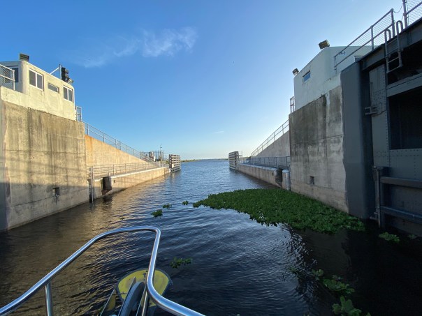
In the morning Ed and I waved goodby to the Lone Cypress and to the Bradleys. Then the craziest thing happened. We were going through the locks at Moore Haven and there was substantial floating vegetation. To my surprise, I saw many marsh rabbits floating on water hyacinth or actually in the water literally up to their ears. We have marsh rabbits at home along the Indian River Lagoon, but I have never seen them in deep water. My emotions got the best of me and I did the unthinkable. I abandoned my post.

“Where is the net?” I shouted as I climbed the stairs leaving the rope hanging against the lock’s tall cement wall. “Ed I’m going to save the drowning rabbits!

Ed was not pleased, yelling, “Jacqui, rule number one, never abandon your post!”

The trawler banged against the lock, the waters rushed in, and I could not reach the bobbing rabbits, so finally I gave up and re-grabbed the line. We passed through the lock into the rim canal of Lake Okeechobee. I silently watched as the rabbits floated by. Ed gave me that look that means he is “not happy.” 

-Marsh rabbit with only ears and face above water -Video of marsh rabbits trapped on floating vegetation below, hit arrow

-After the fiasco at the Moore Haven Locks, Ed and I continued towards Clewiston. We didn’t speak for hours. I actually sat on the bow and cried thinking about how much humankind has altered this planet. But I got ahold of myself. The wind was picking up and many birds were flying overhead -a sign of changes to come.

I checked to see if there was cell service. There was, so I looked up marsh rabbits and to my chagrin, I learned that they are “excellent swimmers.” I looked towards the helm. 

Hey Ed?”

“What?” 

Marsh rabbits can swim!” 

His laugh echoed over the water. “Good thing you didn’t pull them onto the boat!”

“I guess so. But nonetheless, that was NOT NORMAL! ” 

-The rim canal

V. CLEWISTON RIM CANAL/LAKE O 

When Ed and I arrived in Clewiston it was very stormy, we took refuge at Roland Martin Marina. Captain Sam, a war veteran with feathers in his cap, helped us dock. I knew with this weather we’d be here for a few days so I got out my phone and called Clewiston Mayor, Mali Gardner who I’ve known for many years. Over the coming days, she and her husband displayed the warmest hospitality taking Ed and I on a tour of the area. So nice! 

-After docking with the help of Captain Sam, Roland Martin’s Marina, Clewiston-Tour with Mayor of Clewiston, Mali Gardner. We sometimes have different interests, but we have great respect for one another. 

Welcome to Clewiston-Famous Clewiston Inn with wildlife mural-Mayor Gardner shows us the original shoreline of Lake Okeechobee where today many beautiful houses sit-Historic Clewiston homes and drainage system-Ed at the Clewiston Museum that houses the mind blowing fossil findings of Mark Renz from LaBelle-With Mary Anne Martin owner of Roland Martin Marina in Clewison. Ms Martin is a huge advocate for Lake Okeechobee. For years she has voiced against spraying of chemicals on floating vegetation, and works for the burning of lands when lake levels are low to regenerate Lake Okeechobee’s ecosystem. Lake Okeechobee is famous for its bass fishing. -Merchandise for sale and for display at Roland Martin Marina

VI. LAKE O 

-After three days the wind died down and the S-310 lock to Lake Okeechobee was opened. It had been closed for high water for the first time in years. Ed and I headed home to Stuart. Lake Okeechobee was wild and windy, like an ocean itself.  A flock of seagulls followed us 25 miles ! I threw bread from the upper helm and the talented birds, like acrobats, caught pieces in mid air. It was so much fun.

During the trip,  I looked for algae on the lake but saw none and pondered the changes that have altered this liquid heart of the Everglades… 

-S-310 to Lake O-Ed on open Lake O! -Flock of seagulls followed us all the way home across Lake Okeechobee!
This Google Earth image shows our path from Clewiston, across Lake O to the C-44 canal adjacent to Indiantown. The C-44 connects to the St Lucie River bringing us home to Stuart, Florida, in Martin County. 

VII. STUART, C-44 Canal, ST LUCIE RIVER 

S-308 Port Mayaca locks at Lake O to C-44 canal -Trees along the banks of the C-44 CanalS-80 St Lucie Locks and Dam, continuing C-44 to St Lucie River-C-44 is very impaired from Lake O, and basin agricultural and development runoff -After a long journey, a familiar sight, the Roosevelt Bridge opens to welcome us home to the Harborage Marina. Much of the C-44 Canal and upper St Lucie River were under water due to King Tides. This salt infusion is healthy for the St Lucie River as like the Caloosahatchee it is unnaturally connected to Lake Okeechobee.

-Roosevelt Bridges, Stuart, home sweet home back at the Harborage Marina After the almost three week trip, it was wonderful to be home. Ed and I had accomplished our goal and our promise to each other. Working together and experiencing our state’s waters first-hand was a life changing experience.

When we docked with out a hitch like pair of old pros, we  both became strangely quiet. Home is wonderful, but somehow, we knew from here on out, there was nothing that could compare to being Adrift. 


How Things Change ~1971 Aerial East Ocean Blvd.

Stuart, St Lucie River, Sewall’s Point, Indian River Lagoon, and Hutchinson Island, Atlantic Ocean, Martin County, Florida 1971

St Luice Blvd (L) East Ocean Blvd.(R)  1971, courtesy, archives historian Sandra Henderson Thurlow.

“I have enjoyed looking at this aerial taken in 1971. Too bad our little house on Edgewood is out of the photo. It shows the location of the future Monterey Road through the Krueger property. The Krueger building to house Merrill Lynch has not been built yet but you can see the little surgery center was already built. I think I can see Mimi and Grampy Tom’s house in Snug Harbor–at least the driveway. So many things yet to be built.” Mom

My mom, local historian, Sandra Thurlow, recently shared this aerial with my brother, sister and me as we grew up here in Martin County. It’s a really great photograph capturing a growing community. Look how Hutchinson Island, Sewall’s Point, and even parts of East Ocean were undeveloped. No Indian River Plantation, later renamed “Marriott Hutchinson Island.” No Cedar Point Plaza. No Benihana! White sands shine through the remaining forest denoting scrub habit, home to threatened and endangered scrub jays and gopher turtles. This sand pine scrub habitat that made up most of Florida’s east coast is now considered one of the most endangered habitats in the world. The East Ocean Mall on the right sits next to a flower farm. At this time flower farms were giving way to roads and development. Already, the freshwater ponds have been directed and drained, and obviously thousands of sand pines have been mowed down for condos, houses, farms, roads, and shopping centers. By 1971 this area was fully on its way to build-out as we see below in 2020.  Nonetheless, from air and ground this area of Martin County stands out as one of the most beautiful.

But it would be fun to bring back some of the scrub habitat ~easy to do by just altering our yards. How things could change…

Close-up Google Earth 2020
Google Earth 2020


Adrift’s Indian River Lagoon Water Report, June-July 2019

July 5, 2019

Hi. I hope everyone had a wonderful 4th of July! Wasn’t it exceptional? Exceptional because the St Lucie/IRL’s water wasn’t toxic like so many times in recent years. So nice to be able to enjoy our waterways. No dumping of Lake O. I am grateful!

Today I am a back with an Indian River Lagoon Report for the entire Indian River Lagoon.

During my husband, Ed, and my recent 156 miles trip up the IRL, aboard ADRIFT, I contacted Duane DeFreese Ph.D., Executive Director for the Indian River Lagoon National Estuary Program. I called Duane because I knew why the southern lagoon looked better but was impressed by how good the water in the central and northern lagoon looked as well. No brown tide. No superbloom.

Since am unfamiliar with the waters north of the Treasure Coast, except by books, I wanted a scientific update. Well, boy, did I get it! See Dr. Duane’s comments below. Also included is the invaluable, recent St John’s Water Management District’s “June 20th Indian River Lagoon Conditions Update.”

For visual input as well, I am inserting some of Ed and my photos, with comments, of our incredible journey along what is still considered to be one of the world’s most biodiverse estuaries. What a treasure! From north to south, we must do all we can to ensure a toxic-free future.

Keep up the fight!

Jacqui

IRL map: Researchgate

Ed and JTL start of the trip on “Adrift.”

Location: Jupiter Island near the Jupiter Inlet, as almost always the water here is like the Bahamas, looking great! Near the border of Martin and Palm Beach Counties.

Near Jupiter Inlet, border of Martin and Palm Beach Counties. Wow!

JTL:

Duane, hi. Hope you are having a great summer. At this time, are there algae blooms reported in the IRL near Melbourne, the N. IRL north of Titusville, or anywhere in the Mosquito Lagoon? Thank you for letting me know. Jacqui TL

Duane DeFreese, Ph.D. Exec. Dir National IRL Estuary Program, http://www.irlcouncil.com

Conditions being reported to me by the local guides are consistent with the report and my own observations. Overall water quality looks pretty good, but small, patchy areas of poor water quality continue. The fishing guides tell me one day it looks great and a day later the same area will have color and turbidity (probably patchy bloom conditions). My personal observation is that we have been lucky so far and the system is vulnerable. I would not be surprised to see blooms intensify as we move deeper into summer and the rainy season. Lagoon water temperatures are also really warm. the SJRWMD Report documents that we have had patchy blooms occurring of multiple species. Two confirmed species of concern are Pseudo-nitzschia, a marine diatom and Pyrodinium bahamensis, a dinoflagellate. The worst water conditions continue to be in Banana River and in Sykes Creek. There are boater reports of patchy poor water quality in some areas of the northern IRL. The third species of significant recent concern has been Brown tide (Aureoumbra lagunendis). It was in almost in continuous bloom for most of last year in the Banana River. Bloom conditions have subsided. Aureoumbra thrives in warm, high salinity environments. It is not known to be toxic. Blooms of pseudo nitzschia, a marine diatom, can produce a neurotoxin called domoic acid. Blooms of Pyrodinium can produce saxitoxin. I expect that we will see patchy and flashy bloom conditions of multiple species throughout the summer. If we get lucky, I hope none of these blooms get intense enough to elevate toxin levels, low DO levels and fish kills. I’m very concerned about the slow recovery of seagrasses, even in areas of good water quality. Feel free to call me anytime.  Have a great 4th July!

Indian River Lagoon Conditions Update June 20

JTL:

Dear Duane, thank you so very much for the super informative reply! I wrote because my husband and I are taking our maiden voyage in a trawler. We have gone from Stuart to Jupiter to Vero to Cocoa, north as far as possible in IRL, past Titusville, and today-through the Haul-over Canal into the Mosquito Lagoon. Not being familiar with these waters, all I have seen visually appears quite good compared to the St Lucie and even parts of the S. IRL. Some varying coloration is apparent, but overall seems good and in the north, many baitfish balls are shimmering under the surface and dolphin families are gorging themselves and teaching their young! We have seen many dolphins everywhere. Throughout Indin River County, Ospreys nesting in channel markers. One after the other!  In the Mosquito Lagoon there were many more wading birds than S IRL. Even saw a few roseate spoonbills. I was not expecting it to be so full of life up here… a nice surprise. Not off the chart healthy, but marine and bird life very visible! I really appreciate the info you sent. I plan to blog on trip once home, so I can quote your knowledge. Happy 4th of July to you as well and I hope to see you soon.


The confluence of the St Lucie River and Indian River Lagoon off S. Sewall’s Point, Bird Island. Near Stuart, Martin County.

Sewall’s Point and Stuart, Martin County.

Beautiful blue water near the Ft Pierce Inlet, St Lucie County. Ft Pierce rocks!

Waters of Vero Beach, Indian River County.

Old map showing the designated area of famous INDIAN RIVER LAGOON CITRUS. Citrus Museum, Vero Beach, FL

1920 Blue Heron Map shows clearly the area of the Everglades, Heritage Center and Citrus Museum, Vero.

Street sign in Vero Beach, as everywhere ALL canals lead to Lagoon! No trash, fertilizer, pesticides, etc!

Sebastian Inlet, Indian River County, brings blue waters to the area. So pretty!

Approaching Cocoa Village, north of Melbourne in Brevard County.

Waters nearing Cocoa Village in Brevard County

Ed and I visited the Kennedy Space Center along the Indian River Lagoon and Banana River. Surrounded by the Merritt Island National Wildlife Refuge. Space & Nature. https://www.fws.gov/refuge/Merritt_Island/visit/plan_your_visit.html Such an inspiration!

3-D movie at Kennedy Space Center really took us to the moon, Mars, and beyond!

The ominous Vehicle Assemble Building, NASA, so large it is visible no matter where one is are along the central and northern IRL. It’s like it is following you!

Eau Gallie, Melbourne. The Eau Gallie River, or Turkey Creek,  is a small version of the St Lucie and also impaired due to runoff from agriculture and development.

Like a sentinel, the Vehicle Assembly Building as seen over the Indian River Lagoon north of Titusville.

Baitfish!

Waters approaching Titusville, Brevard County.

Train track bridge north of Titusville, Brevard County.

Train track bridge north of Titusville, Brevard County. Shortly beyond channel turns right through the Haulover Canal and into the Mosquito Lagoon.

Ed navigates through the Haulover Canal, connecting the northern IRL with the Mosquito Lagoon.

Water in the Haulover Canal was greenish.

Entering the stunningly beautiful, peaceful, undeveloped Mosquito Lagoon. This area is flanked by the Scottsmoor Flatwoods Sanctuary and Canaveral National Seashore. Wildlife abounds.

360 of the unforgettable Mosquito Lagoon:

Flora and fauna along shoreline, Mosquito Lagoon

Anhinga twins, Mosquito Lagoon

Incredible footage of 4 dolphins in our wake near Ft Pierce welcoming us home!

ADRIFT is a 2007 Mainship 400 trawler, top speed about 8 knots 🙂

Looking Back, St Lucie River ~Rain and Algae 2018

Even though the water in yesterday’s photo looked gorgeous, lest we forget, here are some images of the St Lucie River/Indian River Lagoon area during a rainy and cyanobacteria ridden 2018.

Ed and I didn’t start taking pictures until were motivated…

In March 2018 there was a tremendous rain event. (https://www.sfwmd.gov/our-work/flood-control/managing-high-water)
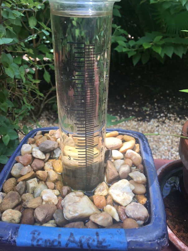
My homemade rain gauge showed over 27 inches in just a few days along the coast!

You’ll see that after the rain event, the St Lucie River/Indian River Lagoon looks terrible even with out Lake Okeechobee discharges. This is caused by directed water runoff from C-23, C-24, C-25, C-44 and “local” coastal runoff.  Naturally, the river never took all this water. Humans made it this way, and we must fix it.

SFWMD canal and basin map.

Soon after the torrential rain, the Army Corp of Engineers made things even worse and started dumping from Lake Okeechobee through the C-44 Canal into the St Lucie River by opening up the gates at S-308 and S-80.

My husband, Ed,  first flew over Lake O on June 1st,  just by chance. At this time, he spotted algae on the lake and took a photo.  Ironically, the next day, the Army Corp started dumping from Lake Okeechobee on June 2nd!

The algae or cyanobacteria (http://www.ucmp.berkeley.edu/bacteria/cyanointro.html)
that was festering in the Lake began to show up almost immediately thereafter in the St Lucie River that has also become  a “nutrient porridge.”

The rest unfortunately is history. 2018  was bad, but in my opinion not as awful as 2016 when the ocean was totally green: https://jacquithurlowlippisch.com/tag/bathtub-beach-algae/

After another long, hot summer, the Army Corp finally stopped discharging in the fall~October 5th… Take a look at the photos and remember to enjoy the blue water when it is here, but NEVER FORGET! Only though looking back, will we have the determination to change the future.

Major rain event in March 2018.  Rain filled this vile up many times!

SLR IRL following major rain event in March 2018. This is runoff from C-23, C-24, C-25, C-44,  and “locally” from developed areas along the river and uplands made to drain into river. JTL

Following rain event in March 2018. A brown Atlantic.

Following rain event in March 2018, the SLR/IRL ~Scott Kuhns

Following rain event in March 2018 Sailfish Flats between Sewall’s and Sailfish Points ~Scott Kuhns

June 5th. A very dark plume moves south along Jupiter Island, just days after ACOE begins dumping so this is a combination of all pollution/runoff  waters…

LAKE OKEECHBEE DISCHARGES ADDED

Ed in the Cub after plume photo

Algae as photographed/spotted by Ed in Lake O on June 1st 2018.

City of Stuart, June 9 2018.

Rio near Central Marine, week of June 12, 2018

Photographing a manatee in the algae along seawall by Mary Radabaugh

Mary Radabaugh manages Central Marine with her husband. JTL

Mary found a dead baby manatee floating in the putrid water shortly after LO discharges.  MR

LAKE O: Week of June 16th, June 25th, and July 22nd. Cyanobacteria (blue green algae) blooms and then subsides. ~All the while, this water is dumped into the St Lucie River by the Federal Govt.; the water quality is terrible and this the responsibility not of the Feds but of the State of Florida.

Algae is now very visible in Lake O, June 16, 2018 JTL

June 25, 2018 Lake O, near S-308, Port Mayaca.  JTL

C-44 canal leading to SLR from Lake O.

C-44 canal leading from LO to SLR.

Satellite view LO bloom on June 24, 2018. ~At its height.

By July 22, 2018 the bloom in the LO is lessening, JTL

August 29, algae would come and go, throughout the SLR. Here near Overlook Drive JTL

September 4, algae still “coming and going” ~2018 Snug Harbor, Stuart.  Photo by my uncle, Dale Hudson

October 5, the ACOE stops dumping from Lake O. The blooms stop almost right away but the damage remains….

December 8, 2018 the river looks “normal” again near Sewall’s Point but it is not. JTL

Stuart, Florida: From Izaak Walton to River Warriors, SLR/IRL

By Ernest Lyons, 1957 Stuart Chamber of Commerce Fishing Guide, courtesy of historian Sandra Henderson Thurlow

I continue to share now historic advertisements of Florida. Today’s is from my hometown of Stuart, Florida. My mother, historian Sandra Henderson Thurlow, has a trove of these things, and they are interesting to view ~thinking about how much our area has changed.

This 1957 Chamber of Commerce Fishing Guide advertisement, written by Ernest Lyons is entitled: “In the Tradition of Isaac Walton.” So let’s start there: Who was Isaak Walton? !

I had to refresh my memory as well, so don’t feel bad if you did not remember. He is famous for writing  the Complete Angler in 1653,  a book “celebrating the joys of fishing” that inspired thousands of sportsmen, and remains a classic for both men and women today.

Mr Lyons, who was the editor of the Stuart News and an award-winning environmentalist of his era, begins his composition:

“Stuart, Florida means sports fishing in the tradition of Izaak Walton,” and then proceeds to talk about good living, home building, and retirement in a community where the “best things in life are free.”

Fun for me to see, in the collage below, my Aunt Mary Thurlow Hudson is photographed far right playing tennis, and my father, her brother, Tom Thurlow Jr., #7, is shown making a basket for Stuart High School baseball team. Awesome! Those were the days!

My Aunt Mary Thurlow Hudson is photographed far right playing tennis and my father Tom Thurlow making a basket for Stuart High. “Those were the days!’

But we know that nothing is really for free. Stuart, and Florida at large have paid a price for moving so many people here since 1957, and trying to “feed the world” from our rich agriculture fields.

Sixty-one years have passed since 1957. I am now over three times the age of my father and my Aunt Mary pictured here…

Our youth can still golf, play tennis, ride a stallion at a rodeo, play baseball, and football, but water-skiing and fishing? Maybe not.

Before recreating, we must first ask :”Is there cyanobacteria in the water?”

Or God forbid, before going to the beach:  “Is there red-tide?”

The local Chambers of Commerce have not written a fishing guide for years. But if they did the topic sentence would not be, Stuart, Florida means sport fishing in the tradition of Izaak Walton, but rather:

“Stuart,  Florida means fighting for your waters in the tradition of a River Warrior…”

My do things change.

https://en.wikipedia.org/wiki/Izaak_Walton

https://www.audible.com/pd/The-Compleat-Angler-Audiobook/B0038CCZ2I?source_code=GO1GB907OSH060513&gclid=CjwKCAjw3qDeBRBkEiwAsqeO7iOWzzDQ17u9sRDjb0rNzBSnaeeNAjgIBDEZPHBwe95rMgpxxoivfBoCQE8QAvD_BwE&gclsrc=aw.ds

Martin County Chamber of Commerce 2018:https://www.stuartmartinchamber.org

John Moran’s “Florida’s Summer of Slime: Stuart and Lake Okeechobee”

It’s an honor to present:

“Florida’s Summer of Slime: Stuart and Lake Okeechobee,” photo essay by John Moran, August 2018

I reported last month on the plight of the Caloosahatchee River and its befouled waters flowing from Lake Okeechobee; delivering slime to waterfront neighborhoods in Fort Myers and Cape Coral along the way to the Gulf Islands of Southwest Florida.

Next up on our Summer of Slime photo tour is a visit to Stuart and Lake O…Stuart and environs is a glistening jewel born of water. It may well top the list of Florida cities in shoreline per capita. There’s simply water everywhere. Two forks of the St. Lucie River, the Indian River Lagoon, canals and peninsulas and islands, and the Atlantic Ocean beyond. Stuart is pictured above; below is neighboring Hutchinson Island.

But it wasn’t Stuart’s reputation for abundant clean water that drew me south from Gainesville with my cameras. In effect, I’ve become a traveling crime scene photographer—and slime is the crime. A devastating outbreak of toxic algae has once again hit the St. Lucie River and the Treasure Coast, fueled by the polluted waters of Lake Okeechobee and the Kissimmee River basin to the north. Damaging headlines trumpet the story to the nation and the world and Governor Scott has declared a state of emergency. It’s déjà vu all over again.

My hosts in Stuart were water blogger Jacqui Thurlow-Lippisch and her husband, Ed Lippisch.

Ed took me up for a photo flight in his Piper Cub so I could get the big picture.

Seen from a small plane at 500 feet, Florida is a beautiful place.

Here’s Lake Okeechobee and the western terminus of the St. Lucie C-44 Canal. Administered by the U.S. Army Corps of Engineers, the Port Mayaca Lock and Dam has the capacity to discharge 14,800 cubic feet of water per second downstream to Stuart and the St. Lucie River Estuary, 26 miles away.

Sugar industry representatives say the water coming out of Lake Okeechobee is not the problem and that the algae outbreak in Stuart is primarily caused by Stuart’s own septic tanks and urban stormwater. This claim is contradicted by the extensive algae mats seen along the C-44 Canal between the Port Mayaca and St. Lucie Locks, well upstream from Stuart.

Lake Okeechobee historically drained south to Florida Bay, not east and west to the Atlantic and Gulf. The C-44 canal was built in 1916 to divert floodwaters to the coast.

A view of the St. Lucie Lock and Dam, several miles southwest of Stuart. On the day of my photo flight in late July, the dam gates were closed, visibly holding back algae from flowing downstream. Look closely and you can see what some people call The Seven Gates of Hell.

The St. Lucie Lock and Dam are an integral part of South Florida’s complex web of water management structures, born of an age when the Everglades was reviled as a watery wasteland and America was driven to drain it.

Below the St. Lucie Lock and Dam, in Palm City and Stuart, you can still find waterfront homes untouched by the algae bloom. But that’s no consolation for the thousands of Martin County residents whose lives are in upheaval once again this summer. The familiar pattern of algae outbreaks is fueled by fertilizer, manure and urban sources of nutrient pollution, including septic tanks.

All of this is compounded by denial and neglect by elected officials and agencies to whom we entrust the important work of environmental protection and public health.

Jacqui Thurlow-Lippisch took me on a driving tour of the C-44 Canal from Stuart to enormous Lake O, which is more like a stormwater treatment pond than a biologically healthy lake. “There are toxic algae blooms across the globe, but only one place where the government dumps it on you: Florida,” she says.

It’s not just the algae from Lake Okeechobee causing headaches along Florida’s east coast; the sheer volume of freshwater discharges is an environmental pollutant that overwhelms the estuary.

The Lake O gunk visible in the satellite view, above, is shown in the detail photo below.

Fishermen are still drawn to Port Mayaca. On the day we visited, I counted nine.

Dinner in hand (speckled perch), Felix Gui, Jr. has been fishing Lake O for 30 years. “The algae doesn’t affect the fish,” he says. “They eat the same, algae or no algae, and I haven’t gotten sick.” Experts have warned against eating fish exposed to the algae.

A Martin County Health Department sign at Port Mayaca warns against contact with the water but I saw no messaging about whether fish caught in these waters is safe to eat.

Enroute home to Stuart, Jacqui and I stopped at deserted Timer Powers Park on the St. Lucie Canal in Indiantown.

At the St. Lucie Lock, a surreal scene of impaired water, above, and a vortex of slime, below, waiting to be flushed downstream.

A pair of jet-skiers signaled for the lock to be opened, and another pulse of algae-laden water is released towards Stuart and the coast.

Wouldn’t want to anyway, thanks.

Further downstream, the algae spreads…

Nearing the coast, Rio Nature Park and the neighboring Central Marine in Stuart are slimed again. This was the epicenter of the infamous Treasure Coast algae outbreak of 2016.

Reporter Tyler Treadway of TCPalm gathered a sample of the polluted water from a canal behind the offices of Florida Sportsman magazine in Stuart.

Staff complaints of headaches, nausea and dizziness prompted Florida Sportsman publisher Blair Wickstrom to temporarily close the office in late July. “It smells like death,” he said.

The Shepard Park boat ramp parking lot in Stuart was nearly empty on the day we visited.

A man on a mission, Mike Knepper, above and below, posts videos on his Youtube channel documenting the degradation of natural Florida.

“It’s totally unacceptable to me what we’re doing to this planet because we’re very rapidly destroying it,” Knepper says. “My children and grandchildren will be paying the price for all the bad decisions we’re making today. I want to be able to look them in the face and say, ‘I tried to make a difference.’”

Dead-end canals along the St. Lucie River with their limited water exchange have been hardest hit by the toxic blue-green algae, which scientists refer to as cyanobacteria.

A growing body of medical research links exposure to cyanobacteria with neurodegenerative diseases including Parkinson’s, ALS and Alzheimer’s. Google it.

Meanwhile, we’re getting conflicting messages from officialdom. Martin County has erected signs warning against contact with the water but the Florida Dept. of Health website, under the heading How to Keep Your Family Safe While Enjoying Florida’s Water Ways, has this to say: “Cyanobacteria/ blue-green algae…are naturally occurring in Florida’s environment and are also found all over the world. They are part of a healthy ecosystem and help support a wide variety of aquatic life.” (http://www.floridahealth.gov/environmental-health/aquatic-toxins/cyanobacteria.html) In other words, Lighten up, Florida. This is just nature being natural.

An open question remains: What will become of the value of the Florida brand when the world fully sees what we have done to our waters?

Even in disaster, strange beauty emerges.

Greg Fedele has lived in his water-front home since 1991. He grieves for his loss. “I have three kids who can’t enjoy the waterways of Martin County like I did growing up.”

The sign at Ocean Blue Yacht Sales in Stuart echoes a wide swath of community sentiment. Asked to describe in a word how the algae outbreak has impacted his business, president Bryan Boyd replied, “Horrible. The last three years, our bay boat sales have been a third of what they used to be.”

A roadside sign seen in Stuart in late July. If you’re wondering what you can do about the ongoing crisis of Florida waters, we are called to consider our own water footprint, learn about the issues and get involved. And never forget that elections have consequences. Vote for Clean Water. (https://www.bullsugar.org/#)

What we have here in Florida is not just a crisis of water, we have a crisis of democracy and civic engagement.

From the beleaguered springs of North Florida to the sickened rivers and coasts of South Florida, we must understand that no savior is waiting on the horizon who will fix this thing for us.

It took a group effort to create this mess and we need all hands on deck if are to reclaim our waters. Florida needs environmental patriots willing to face down politicians funded by wealthy interests who think nothing of sacrificing our public waters on the altar of their private profits.

We don’t have the luxury of time to get this right. We are losing our waters now. This is our moment. It’s time to set aside our differences and focus on what is at stake, for this is nothing less than a battle for the soul of Florida.

The pictures don’t lie. We the people of Florida bear witness today to nothing less than a crime against nature, and a crime against the children who shall inherit our natural legacy.

A long time ago, Florida political leaders—Republicans and Democrats in common cause—understood there can be no healthy economy without a healthy environment. They wisely enacted laws and regulatory safeguards accordingly.

But that was then and this is now. It’s time to end the popular fiction in Florida that we can plunder and pollute our way to prosperity.

Gov. Reubin Askew said it best when he declared in 1971, “Ecological destruction is nothing less than economic suicide.”

In this, our Summer of Slime, can I get an amen?

by John Moran
August 2018

web: http://johnmoranphoto.com
email: JohnMoranPhoto@gmail.com
cell: 352.514.7670

Feel free to forward or post this photo essay as you wish; attribution is appreciated. Please share this with elected officials and ask them: what’s their plan to clean up our waters?

Aerials of Our Rain Stained Lagoon, SLR/IRL

Recently, it seems to rain almost every day!

TCPalm’s Elliott Jones reported this morning that Stuart has received a whopping 11.30 inches of rain just so far this month! (The average being 7.14.)

Although due to the recent drought, the ACOE/SFWMD are not dumping Lake Okeechobee through Canal C-44, canals C-23, C-24, C-25, and areas along C-44, as well as our own basin, are draining right into the St Lucie River/Indian River Lagoon. Very little of this water is cleansed before it enters and thus is damaging to the eco system. Next time you see water draining through a grate in a parking lot, think about this. Remember too that before the major canals were constructed the 1900s, the river received less than half the water it gets every time it rains today.

IMG_5231.JPG
SLR at “Hell’s Gate” looking at Sewall’s Point, Sailfish Point and the St Luice Inlet

photo drainage basin
Drainage changes to the SLR. Green is the original watershed. Yellow and pink have been added since ca.1920. (St Lucie River Initiative’s Report to Congress 1994.)

The aerials below were taken 6-13-17 by my husband Ed Lippisch and pilot Dave Stone. It is important to monitor the river all of the time so we can view changes.

“Rain stained” we are; please remember not to fertilize during the rainy season. The birds on Bird Island will appreciate it! (http://befloridian.org)

Canals

TC Palm, Elliott Jones, 6-19-17

Bird Island, IRL east of Sewall’s Point

Bird Island

IRL St Lucie Inlet and Sailfish Point

Sailfish Flats, IRL

Crossroads, confluence SLR/IRL off Sewall’s Point

Spoil Island off Sailfish, bird also roosting here!

Sick looking seagrass beds in IRL looking south towards Jupiter Narrows

SL Inlet near Sailfish Point, no black plume but darker colored waters

Jupiter Island’s state park at St Lucie Inlet

Sailfish Point

St Lucie Inlet looking south

inlet again

Clear ocean water at jetty, St Lucie Inlet

Looking back to St Lucie Inlet mixed colored waters but not black as with Lake O water releases

St Lucie Inlet between Jupiter Island’s state park and Sailfish Point

inlet again

Looking north to SL Inlet

Jetty

Hutchinson Island and Sailfish Flats in IRL. Sewall’s Point in distance.

Parts of the Savannas near Jensen , IRL and Hutchinson Island in distance

Savannas State Preserve Park

Canals draining water into SLR/IRL after rain events:

C-23 http://www.dep.state.fl.us/southeast/ecosum/ecosums/c23.pdf

C-24 http://www.dep.state.fl.us/southeast/ecosum/ecosums/c24.pdf

C-25 http://www.dep.state.fl.us/southeast/ecosum/ecosums/c-25.pdf

C-44 http://www.dep.state.fl.us/southeast/ecosum/ecosums/C-44%20Canal%20.pdf

Award Winning “Field and Stream” Journalist, Hal Herring Tours the St Lucie River/Indian River Lagoon

Award winning conservation, hunting and fishing journalist, Hal Herring over S-308, the connection from Lake Okeechobee to canal C-44 and the St Lucie River/IRL, JTL 5-13-17

Award page Hal Herring, from his web site

At the recent Bullsugar “Fund the Fight” event, Captain Mike Connor introduced me to Montana based, award-winning fishing and hunting journalist, Hal Herring. I looked Hal straight in the eye, shook his strong hand and said, “It’s so nice to meet you Mr Herrington.” He smiled, eyes sparkling, and replied, “Herring mam. Like the fish.”

About Hal Herring: (https://www.halherring.com/about)

Hal Herring’s website: (https://www.halherring.com)

Fly Life Magazine writes: “Herring, one of the leading outdoor writers of our time, co-manages the Conservationist Blog for Field & Stream, is the author of several books and is a regular contributor to numerous other well-known outdoor news outlets including High Country News, Montana’s Bully Pulpit Blog and the Nature Conservancy magazine.”

To say the least, I felt honored to be chosen as a tour guide for Hal Herring as my husband and Mike Connor arranged an aerial journey for the visiting journalist. After researching Hal, checking out his website, and reading his article on the Clean Water Act, I knew I was dealing with a gifted journalist. What a great person to have learn about the problems of our St Lucie River!

IMG_3186.jpg
Hal Herring and JTL, Baron’s back seat

Contemporary Florida canal map ACOE/SFWMD

1839 military/Everglades map

Dan, Ed, Hal and JTL

Canals C-23, C-24, C-25 and most southerly C-44 connected to Lake Okeechobee.

We prepared the Baron for Saturday. My husband Ed invited friend and fellow fisherman Dr Dan Velinsky. The flight stared with a rough take off.  I steadied myself. “Please don’t let me puke Lord…” As Ed gained altitude, things settled down and we were on our way…

After taking off from Witham Field in Stuart, we followed the dreadful C-44 canal west to Lake Okeechobee; diverting north at the C-44 Reservoir under construction in Indiantown; traveled over the FPL cooling pond and S-308, the opening to C-44 and the St Lucie River at Port Mayaca. Next we followed Lake Okeechobee’s east side south to Pahokee, and then Belle Glade in the Sugarland of the EAA; here we followed the North New River Canal and Highway 27 south to the lands spoken about so much lately, A-1 and A-2 and surrounding area of the Tailman property where Senate Presidient Joe Negron’s recently negociated deeper reservoir will be constructed if all goes well; then we flew over the Storm Water Treatment Areas, Water Conservation Areas, and headed home east over the houses of Broward County inside the Everglades. Last over West Palm Beach, Jupiter, north along the Indian River Lagoon and then back to the St Lucie Inlet. Everywhere the landscape was altered. No wonder the water is such a mess…

See red triangle left of right circle. This area of A-1 and A-2 and the reservoir is to be located on top of and closeby

Old orange grove being made into the C-44 Reservoir/STA,  Indiantown

FPL cooling pond on edge of Lake O, Indiantown

S-308 at Lake O, Port Mayaca

Over Lake O

A-1 and A-2 area, southern EAA with WCA on left

Edge of Conservation areas next to A-1 and A-2 areas

Broward County built into Everglades

Along the SE coast looking south, FPL’s St Lucie Nuclear Power Plant

Martin County, St Luice Inlet

I explained the history, Dan told fish stories, Ed ducked in and out of clouds. All the while, Hal Herring took notes on a yellow legal pad with calmness and confidence. Nothing surprised him; he was a quick study in spite of all the variables. He was so well read, not speaking often but when he did, like a prophet of sorts. He spoke about this strange time of history, the time we are living in, when humans have overrun the natural landscape. He spoke about mankind being obsessed with transcending the limits of the natural world…and the control of nature…but for Hal there was no anger or disbelief, just wisdom. In his biography, he says it best:

“My passions as a writer and storyteller lie where they always have – in exploring humankind’s evolving relationship to the natural world, and all the failures, successes and deep tensions inherent in that relationship…”

In the Everglades region, Hal may just have hit the jackpot!

Hal Herring and JTL

Related Articles, Hal Herring

Filed and Stream: http://www.fieldandstream.com

http://flylifemagazine.com/profile-hal-herring-fights-environmental-indifference-word-by-word/

Fly Life: http://flylifemagazine.com

Field and Stream, Clean Water Act, Hal Herring: http://www.fieldandstream.com/imminent-death-waters-us-rule

Field and Stream, people: http://www.fieldandstream.com/people/hal-herring

Hal Herring’s website: https://www.halherring.com

About Hal Herring: https://www.halherring.com/about

He Shall Be King Again! The “Silver King” Tarpon of the St Luice River, Indian River Lagoon

Tarpon Fishing, Kent Hagerman 1893-1978. Courtesy, Sandra Henderson Thurlow.

Fishing map of McCoy Bros. SLR/IRL date unknown, notice the extensive tarpon fishing grounds,  Thurlow Archives.

IMG_8848.JPG
Tarpon on the line!  Dave Preston

If we look into the mirror of history, we begin to see…

We begin to see how we destroyed one of the most famous and beloved inland fishing waters in North America and how we learned to do better.  And if we are able, in time, not only to do better, but to return “health and glory” to the St Lucie River/Indian River Lagoon, it should be the tarpon, not the sailfish, that becomes our symbol, our king.

The first formal fishing club documented in Stuart was the 1916 St Lucie River Tarpon Club. The late 1800s and early 1900s were an era of great fame for the St Lucie River, build upon President Grover Cleveland and other presidents fishing trips to the area. Yes, the St Lucie was known as the “Fishing Grounds of Presidents.”

Ironically, at this same time, the Commercial Club, that evolved into today’s Chamber of Commerce, was promoting not just Stuart’s remarkable fishing, but also enthusiastically encouraging and awaiting the completion of the St Lucie Canal.

SFWMD canal and basin map. C-44 canal is the canal most southerly in the image.

“Once the muddy water flowed into the St Lucie River, they began to realize that the canal was not the blessing they envisioned,” writes Sandra Henderson Thurlow.  Historian Alice Luckhardt more directly notes, “at one time tarpon were often caught in the St. Lucie River, but “disappeared” from those waters soon after the opening of the canal system to Lake Okeechobee in 1923.”

Ingeniously, and with more insight,  in the years following the loss of tarpon and other river fish as seen in the McCoy map above, the ocean-going sailfish was marketed to replace the tarpon and become “the most prized fish of all…” as well as in time the symbol for both the city and county governments.

The magnificent Silver King? Just a dying memory, or no memory at all…

By the mid 1930s the Chamber of Commerce began publishing the “Stuart Fishing Guide.” In 1941 the largest sailfish run in Florida’s history occurred off the St Lucie Inlet. Remarkable! More than 5000 sailfish were caught in a 90 day period. “Thousands were slaughtered only to be dumped in the river, carted off by garbage collectors, and used for shark bait.” Stuart as the Sailfish Capital of the world was affirmed, but as my mother states, if “Stuart’s fame was to endure, so was the need for conservation of the species.”

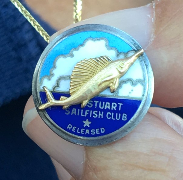
The idea for conservation/protecting the industry had been in the works, the Sailfish Club had been talking about it and a few sailfish were returned to the ocean….  But after the sailfish run of “41, the idea of an organized conservation effort was solidified, and Sailfish Club of ’31 updated their charter in “41 “to further and promote sports fishing and conservation in the waters of the City of Stuart and Martin County.” Visiting sportsmen were awarded and inspired to work for the most coveted bronze, silver, and gold lapel pins based on the size of the sail they caught and released, not killed.

This is a great story, but what of the tarpon?

I can see his giant, ancient, dorsal fin rising from the waters of a healthier St Lucie River/Indian River Lagoon. For me, no fish will ever compare. As we restore our rivers, it is he who shall be KING! 🙂

Close up of solidarity fish on Florida’s Capitol steps, Clean Water/Amd. 1 Rally 2-17-15.) (JTL)

FWC Tarpon: http://myfwc.com/research/saltwater/tarpon/information/facts/
Tarpon Trust: https://www.bonefishtarpontrust.org/tarpon-research

*Thank Thank you to my mother, historian Sandra Henderson Thurlow, whose work in Stuart on the St Lucie served as the basis of this blog post!

Link to 2016 unveiling of Silver King by sculptor Geoffrey Smith: (http://www.youtube.com/watch?v=bBwR1iHV3e8)

Vintage Catch and Release pin designed by the late Curt Whiticar.

Dave Preston of Bullsugar and Silver King, 2017.

Airspace, President Trump, and the Destiny of Our St Luice River/Indian River Lagoon, SLR/IRL

screenshot
Circles showing TFR, Temporary Flight Restrictions

Witham Air Field in Martin County is north, just outside of the circles….the circles that designate “No Fly Zones”during Presidient’s Trump’s return home today to Mar-a-Lago in Palm Beach. Many Palm Beachers will be flying into Witham who can’t get into Palm Beach due to the flight restrictions. Perhaps as they pass through they will be learning about the vociferous but sleepy little town of Stuart, to their north, with the toxic water problems stemming from discharges from Lake Okeechobee?

Martin and Palm Beach counties have a long history. In fact, Martin County was formed of north Palm Beach County in 1925. Our destiny is connected…

Looking at the circles on the “Temporary Fly Restriction” map above, sent to my husband, reminded me of some other circles that are also causing a stir. Senate President Joe Negron’s proposed circles for land purchase in the EAA. I know you are familiar with that map! I hope President Trump reads the local paper while he’s here. Or maybe he’ll even get a chance to meet with the President of the Florida Senate?

As we know, in today’s world, anything can happen…

img_9938

Palm Beach Post: http://www.palmbeachpost.com/news/state–regional-govt–politics/negron-defends-plan-buy-land-for-lake-okeechobee-cleanup/ad5uuAtxgWErmvCqGbhGmJ/

file-page1.jpg
Circles showing Senate President Joe Negron’s proposed land purchase in the EAA

Below is an explanation of the NO FLY as explained by Palm Beach Post reporter Eliot Kleinberg, January 24, 2017

Planned flight restrictions when President Trump is at Mar-a-Lago:

A “no fly” zone in a 1-mile radius. Commercial flights that normally would leave or arrive on a straight line from PBIA must instead angle north or south.

A ring of 10 nautical miles bars all private planes from landing at either PBIA or Lantana unless they came from a “gateway airport,” at which they’ve been screened by the Transportation Safety Administration. Any planes that land at Lantana can’t leave until Trump is gone.

A ring of 30 nautical miles allows only planes traveling to or from fields outside the 10 mile ring, all of those closely monitored by air traffic controllers.

Banned at Lantana during visits: all flight training, practice approaches, parachuting, and flights of aerobatic aircraft, gliders, seaplanes, ultralights, gliders and hang-gliders, balloons, and even crop-dusters. Also banned: banner-towing and sightseeing, maintenance test flights, model rockets and aircraft, utility and pipeline surveys and drones.

A ring of 10 nautical miles bars all private planes from landing at either PBIA or Lantana unless they came from a “gateway airport,” at which they’ve been screened by the Transportation Safety Administration. Any planes that land at Lantana can’t leave until Trump is gone.

And a ring of 30 nautical miles allows only planes traveling to or from fields outside the 10 mile ring, all of those closely monitored by air traffic controllers.

More ominously for Lantana: the restrictions ban from that airport, at leeast while Trump is in town, all flight training, practice approaches, parachuting, and flights of aerobatic aircraft, gliders, seaplanes, ultralights, gliders and hang-gliders, balloons, and even crop-dusters. Also banned: banner-towing and sightseeing, maintenance test flights, model rockets and aircraft, utility and pipeline surveys and drones.

_____________________________________________________

Below is the Report from https://www.aopa.org : Over Palm Beach, FL beginning Friday, February 3, 2017(((Change in times)))

30 NM RADIUS TFR

Location
On the PALM BEACH VORTAC (PBI) 094 degree radial at 1.6 nautical miles.
From the surface up to but not including 18,000 feet MSL.

2 NM EXCLUSION

Location
On the PALM BEACH VORTAC (PBI) 349 degree radial at 30.9 nautical miles.
From the surface up to but not including 18,000 feet MSL.
Location
On the FORT LAUDERDALE VOR/DME (FLL) 004 degree radial at 7.4 nautical miles.
From the surface up to but not including 18,000 feet MSL.

Times:
4:15 PM local Friday, February 3, 2017 until 11:30 AM Monday, February 6, 2017
10 NM RADIUS NO-FLY ZONE

Location
On the PALM BEACH VORTAC (PBI) 094 degree radial at 1.6 nautical miles.
From the surface up to but not including 18,000 feet MSL.

Times:
4:15 PM local Friday, February 3, 2017 until 11:30 AM Monday, February 6, 2017

Affected Public Use Airports

KPBI Palm Beach Intl
KLNA Palm Beach County Park
F45 North Palm Beach County General Aviation
KBCT Boca Raton

KPMP Pompano Beach Airpark
KFXE Fort Lauderdale Executive
X58 Indiantown
Additional Notes:

No pilots may operate an aircraft in the areas covered by this NOTAM (except as described).

Except as specified below and/or unless authorized by ATC in consultation with the air traffic security coordinator via the domestic events network (DEN):

A. All aircraft operations within the 10 NMR area(s) listed above, known as the inner core(s), are prohibited except for: Approved law enforcement, military aircraft directly supporting the United States Secret Service (USSS) and the office of the President of the United States, approved air ambulance flights, and regularly scheduled commercial passenger and all-cargo carriers operating under one of the following TSA-Approved Standard Security Programs/Procedures: Aircraft Operator Standard Security Program (AOSSP), Full All-Cargo Aircraft Operator Standard Security Program (FACAOSSP), Model Security Program (MSP), Twelve Five Standard Security Program (TFSSP) All Cargo, Or All-Cargo International Security Procedure (ACISP) and are arriving into and/or departing from 14 CFR part 139 airports. All emergency/life-saving flight (medical/law enforcement/firefighting) operations must coordinate with ATC prior to their departure at 561-684-9047 to avoid potential delays.

B. For operations within the airspace between the 10 NMR and 30 NMR area(s) listed above, known as the outer ring(s): All aircraft operating within the outer ring(s) listed above are limited to aircraft arriving or departing local airfields, and workload permitting, ATC may authorize transit operations. Aircraft may not loiter. All aircraft must be on an active IFR or VFR flight plan with a discrete code assigned by an air traffic control (ATC) facility. Aircraft must be squawking the discrete code prior to departure and at all times while in the TFR and must remain in two-way radio communications with ATC.

C. All flight operations not covered in paragraph A. within the 10 NMR area must be security screened by TSA at a gateway airport prior to arriving or departing Palm Beach International Airport (KPBI). Aircraft operators must register with the TSA for gateway screening no less than 24 hours prior to their scheduled departure time. Reservations for screening may begin on February 01, 2017 and last through the duration of the event by calling TSA at 561-616-9650.

D. Gateway airports have been created at Palm Beach International Airport (KPBI), Orlando International Airport (KMCO), Fort Lauderdale International Airport (KFLL), Dulles International Airport (KIAD), Teterboro Airport (KTEB), and Westchester Co. Airport (KHPN) by TSA to accommodate aircraft arriving or departing Palm Beach International Airport (KPBI).

E. TSA screening will not be available on Friday 2/3/2017. TSA screening will be available from 1702041300 UTC (0800 local 02/04/17) to 1702042200 UTC (1700 local 02/04/17), 1702051300 UTC (0800 local 02/05/17) to 1702052200 UTC (1700 local 02/05/17), and 1702061300 UTC (0800 local 02/06/17) to 1702061500 UTC (1000 local 02/06/17). Pilots, crew and passengers must provide valid government-issued photo identification to the TSA at the gateway airport. Gateway screening will include id verification and vetting of all pilots, crew and passengers, screening of persons and baggage, and inspection of the aircraft. No firearms on board aircraft will be authorized.

F. On departure from a gateway airport aircraft must maintain radio contact with ATC and continuously squawk an ATC-assigned discrete code. Intermediate stops while enroute are not authorized unless an emergency exists.

G. The following operations are not authorized within this TFR: flight training, practice instrument approaches, aerobatic flight, glider operations, seaplane operations, parachute operations, ultralight, hang gliding, balloon operations, agriculture/crop dusting, animal population control flight operations, banner towing operations, sightseeing operations, maintenance test flights, model aircraft operations, model rocketry, unmanned aircraft systems (UAS), and utility and pipeline survey operations.

H. FAA recommends that all aircraft operators check NOTAMs frequently for possible changes to this TFR prior to operations within this region.

TFR over Palm Beach, FL beginning Friday, February 3, 2017(((Change in times))): https://contentsharing.net/actions/email_web_version.cfm?recipient_id=2873089534&message_id=13922314&user_id=AOPA%5F4&group_id=4023858&jobid=36382299

“Airspace will change,” Palm Beach Post: http://postonpolitics.blog.palmbeachpost.com/2017/02/02/why-president-donald-trumps-palm-beach-arrival-could-affect-your-friday-commute/

Witham Air Field, Stuart, FL: https://www.aopa.org/airports/KSUA

“Too Unthinkable,” the Complete Destruction of the St Lucie River, SLR/IRL

"Too Unthinkable" sits in the algae waters of the St Lucie River. JTL
“Too Unthinkable” sits in the algae waters of the St Lucie River-with Evinrude motor. JTL 6-26-16

The blue-green algae, the cyanobacteria–sometimes toxic— that we first saw in aerial photos over Lake Okeechobee weeks ago, is not only here,  it is everywhere…our river has been made completely fresh by our government. Now the algae is blooming fluorescent green-blue, dying a putrid brown-green, flowing out of our inlet, and poisoning not only or rivers’ shores but our beaches.

On the widest level, this is a health hazard brought upon us by a “knowing government.” Our state, federal, and local governments  have seen this coming for years. The slow and steady destruction of the St Lucie River/Indian River Lagoon is well documented.

The St Lucie River was first declared “impaired” by the state of Florida in the year 2002. I have been blogging about this for four years.
(http://www.dep.state.fl.us/southeast/ecosum/ecosums/SLE_Impairment_Narrative_ver_3.7.pdf)

Now, in 2016, all of Martin County’s beaches and the southern most beach of St Lucie County are closed. Palm City; Stuart; Rio; Sewall’s Point, Jensen. All waters are off limits. “Don’t Touch the Water.” –A health, safety and welfare issue for the people, a nightmare for local government, and a complete environmental and economic disaster for us all.

Included for purposes of documentation– to be added to the thousands of other posts on social media this weekend— I share the following, some that were shared with me…Divided into 8 sections: 1. Algae in the waves at Bathtub Beach, by JTL; 2. algae aerials at C-44, S-80, and S-308,  by Dr Scott Kuhns; 3. Lake Okeechobee and St Lucie River’s extensive algae bloom, by jet pilot Dave Stone, and local pilot Ron Rowers; 4. Rio, a residential disaster, Jeff Tucker; 5. Sewall’s Point as seen from the Evan’s Cray Bridge with a river full of algae by walker Tracy Barnes; 6. Rebecca Fatzinger’s duck eating algae;  7. my Uncle Dale Hudson’s lead to Snug Harbor’s Marina “a multimillion dollar disaster,” and 8. Really blue-algae at Central Marina, Stuart/Rio.

The outpouring of the public is immense, and the powers that be, must look our way. Document, call, write, demand, and VOTE.

Jacqui