Today, May 12th, at 9:45 A.M. Governor Rick Scott is scheduled to sign Senate President Joe Negron’s “Senate Bill 10” in of all places Clewiston. Clewiston is “America’s Sweetest Town” and the headquarters of U.S. Sugar Corporation…
According to the article in the Glades County Democrat announcing the signing: “Earlier this week Senate Bill 10, a move to secure funding for a water storage reservoir south of Lake Okeechobee was approved. In its amended form, Senate Bill 10 became a measure that we in the Glades could stand behind. The bill no longer stated that additional farmlands be taken out of production but rather the state would utilize the property that it already owns to create a reservoir with a much smaller footprint.”
Although I am scratching my head, you know what? Sometimes you just have to be happy for what you get, no matter where you get it. I am tremendously thankful to Governor Scott for signing the bill ~ although I do wish he had decided to sign it in Martin County since we’ve worked so hard to get it.
When I read the announcement officially last night, it got me thinking about Clewiston before I went to sleep. It brought back memories of 2013 and famed paddle boarder Justin Riney’s idea to hold the Sugarland Rally in Clewiston on September 1st, 2013 to unite the movement. This was one of the early rallies for the river during the devastation of the “Lost Summer.”
Since Governor Scott is going to sign in Clewiston I think it’s a good time to walk down memory lane and be proud of how far we’ve come and to get ready for how far we have to go! The point of the location of the Sugarland Rally was to “meet halfway.” Hopefully Governor Scott is thinking the same, in that Joe Negron helped us meet half way and we are all thankful.
Now let’s remember the past, enjoy today, and then take it to the finish line!
“The Sugarland Rally will unite the east and west coasts of Florida in a peaceful, historic demonstration to speak out against the pollution of our estuaries from Lake Okeechobee discharges. We support both immediate and long-term solutions, but ecosystems and communities along the St. Lucie and Caloosahatchee Estuaries are in crisis. We cannot afford to wait for ecological and economic collapse. We urge all stakeholders–especially local, state and federal governments–to act immediately. We chose Clewiston as a central location to unify east and west at Lake Okeechobee, the source that is polluting our estuaries, and because we believe Florida’s sugar industry can be part of the solution. Please don’t misinterpret our intentions–we are NOT holding a rally at Clewiston to protest or point fingers at “Big Sugar.” It’s quite the opposite, actually. We invite Florida’s powerful sugar industry to join us in crafting an immediate solution to the ecological and economic crisis caused by discharges from Lake Okeechobee.” (Press release from Justin Riney, Aug. 2013)
SUGARLAND RALLY 2013
Maggy Hurchalla, Comm. Taylor, and Mayor RolandDon Voss!Nic Mader, Jenny Flaugh and the River KidzEve Samples of TC Palm and Don Voss with crowd
5-7-17: Hutchinson Island along the Atlantic Ocean and confluence of the St Lucie River/Indian River Lagoon, blue waters, seagrass not yet revived from 2013 and 2016 Lake O discharges. Photo Ed LippischMy husband’s flight yesterday over the Atlantic Ocean, St Lucie Inlet, and St Lucie River/Indian River Lagoon is beautiful. But look carefully and you will see a light-colored brownish plume at the mouth of the St Luice Inlet entering the ocean. Finally after months of drought, it has begun raining. And when it rains… (mind you C-44 connecting the St Lucie River to Lake Okeechobee is closed now) the re-directed run-off of waters from canals C-23, and C-24 of course still flow into our St Luice River/Indian River Lagoon.
These canals organized and built during the 1950s and 60s are part of the Central and South Florida Flood Project that the Army Corp built following the hurricane and extensive south Florida flooding of 1949. The run-off waters from these canals and the local watershed are what you see in today’s video.
As damaging as C-23 and C-24 are (they too must be reworked and redirected) they are not the damaging discharges from Lake Okeechobee that throw the St Lucie over the brink as in 2013 and especially 2016 when toxic algae covered extensive portions of the entire St Lucie.
Rio, St Lucie River, Jeff Tucker, toxic algae
…
…
3
Shoreline of Sewall’s Point, Tracy Barnes 6-25-16
…
(Photo mosaic from 2016 shows various photos by Dr Scott Kuhns, Rebecca Fatzinger, (wildlife) JTL/Ed Lippisch, pilot Dave Stone and others.)
In spite of the light brown plume, the short video flight from Jensen to Peck’s Lake shows blue waters near the inlet and mouth of the estuary as it should be, not black water. If Governor Scott does not veto the budget, the reservoir in years to come will help offset the Lake Okeechobee destruction and open the way to truly “send the water south.” #ThankyouJoeNegron
This is very exciting, but believe me, this is no time to let down your guard, as the fight for control of Florida’s waters has really just begun.
Reef system off Sailfish point is covered in black water, sediment, and nutrient pollution when Lake O is discharging. Here after months of drought, and finally some rains we can see the reefs. 5-7-17, Photo Ed LippischMap SFWMD showing canals and basins. Note S-308 or structure s-308 at Lake O and S-80 down the C-44 canal AKA the St Lucie Canal. Both of these structures have to open to allow water to flow into the C-44 canal to the St Lucie River, Indian River Lagoon. All canals are destructive to the St Lucie/IRL yet it is C-44’s Lake O that puts the St Lucie system in complete and total overload.DEP C-23:http://www.dep.state.fl.us/southeast/ecosum/ecosums/c23.pdf
We all know that young people are the largest key to a “better water future” for our great state of Florida. Recently I opened my mailbox to find the “Florida Coastal Law Review’s Special Symposium Issue: A look into the 2017 Florida Constitution Revision Commission/Fall Issue, Volume 18.” It is very excited to see what topics the students are covering. I read the whole thing! All of the articles are powerful expressions. My favorite? “Sugar, Politics, and the Destruction of Florida’s Natural Resources,” by Jaclyn Blair.
After such a difficult few weeks watching the state legislature pass the ball back and forth and finally catch SB10 and HB761, and then the false cry that Florida Forever could not be funded, the Law Review publication really lifted my spirits. I was so excited that I decided to call the law school, garnering more information and received permission to share.
The best way I know how, and with my limited time today, I am just going to photograph the article and post it. Even if you read the first few pages, you will be impressed. I have a better format, but cannot post PDF format on my blog. Email me if you’d like a PDF or call the law school at 904-680-7700. The Editor-in Chief, Dylan W. Retting, is a great help.
Close up toxic algae, SLR, 2016, JTLIn closing as I’m off to Panama City, more than anything…more than any bill or any politicking…. seeing young people pick up the torch for our waters and our environment is an inspiration. An inspiration for a true and longer-lasting, “better water future.”
Thank you to the students of Jacksonville’s Florida Coastal Law Review! I am impressed!
Senate Bill 10, the bill associated with Senate President Joe Negron and his goal to stop the damaging discharges of Lake Okeechobee to the St Lucie River and Caloosahatchee… my gosh, up and then down, and then up again…Why such a roller coaster ride?
The last time I went on a roller coaster ride was many years ago when I in my twenties and teaching German at Pensacola High School. I took my IB high school students and 14 visiting German exchange students to Six Flags. I got so sick on the ride that I had to sit on a bench the remainder of the day. The students? They loved it and went multiple times! Roller coasters are not fun for everyone. But one thing’s for sure, if you’re on the ride, and you feel sick, be assured that it will end, but when it hasn’t, hold on! This bill, this ride, won’t end for another month plus, as it has to be voted on by the full Senate and achieve a matching bill in the House….
Thus far, the bill has really gone “double-full-circle-upside down-roller-coaster” in that Stuart’s Dr Gary Goforth ( http://garygoforth.net) mentioned the many configurations available to achieve “the goal” during the January 11th 2017 meeting of the Senate Natural Resources Appropriations Committee. At this time he pointed out that some of those “loopy configurations” on his visual went back to CERP’s birth year of 2000 and the first goals the state and federal government had for an EAA reservoir!
You can watch Dr Goforth’s presentation and see his handout linked at the top of this post. Gosh, I kind of feel sick, yes, there have been so many changes and so many numbers… 60,000, 14,000, 360,000, 240,000, A-1, A-2, my head is spinning! There is so much back and forth! Yes there is, but goodness, you can’t say this isn’t exciting! The St Lucie River and Indian River Lagoon a roller coaster for the whole world to see! Personally, I am going to try NOT to sit out on the bench this time, how about you? 🙂
Here is a Senate staff summary of what part of the rollercoaster ride the bill is on today:
CS/SB 10:
Establishes options for providing additional water storage south of Lake Okeechobee, including the:
o Everglades Agricultural Area (EAA) reservoir project with the goal of providing a minimum of 240,000 acre-feet of water storage; and
o C-51 reservoir project with the goal of providing approximately 60,000 acre-feet of water storage.
Authorizes the Board of Trustees of the Internal Improvement Trust Fund (TIITF) and the South Florida Water Management District (SFWMD) to negotiate the amendment or termination of leases on lands within the EAA for exchange or use for the EAA reservoir project.
Requires lease agreements relating to land in the EAA leased to the Prison Rehabilitative Industries and Diversified Enterprises, Inc., (PRIDE Enterprises) for an agricultural work program to be terminated in accordance with the lease terms.
Requires the SFWMD, upon the effective date of the act, to identify the lessees of the approximately 3,200 acres of land owned by the state or the district west of the A-2 parcel and east of the Miami Canal and the private property owners of the approximately 500 acres of land surrounded by such lands;
Requires the SFWMD, by July 31, 2017, to contact the lessors and landowners of such lands to express the SFWMD’s interest in acquiring the land through the purchase or exchange of lands or by the amendment or termination of lease agreements.
Requires the SFWMD to jointly develop a post-authorization change report with the United States Army Corps of Engineers (USACE) for the Central Everglades Planning Project (CEPP) to revise the project component located on the A-2 parcel for implementation of the EAA reservoir project.
Requires that if, for any reason, the post-authorization change report does not receive Congressional approval by October 1, 2018, unless the district has been granted an extension by the Legislature, the SFWMD begin the planning study for the EAA reservoir project by October 31, 2018, and proceed with the A-2 parcel project component of CEPP in accordance with the project implementation report.
Requires the SFWMD to give preference to the hiring of former agricultural workers primarily employed during 36 of the past 60 months in the EAA, consistent with their qualifications and abilities, for the construction and operation of the EAA reservoir project.
Establishes the Everglades Restoration Agricultural Community Employment Training Program within the Department of Economic Opportunity to provide grants for employment programs that seek to match persons who complete such training programs to nonagricultural employment opportunities in areas of high agricultural employment, and to provide other training, educational, and information services necessary to stimulate the creation of jobs in the areas of agricultural unemployment. The program is required to include opportunities to obtain the qualifications and skills necessary for jobs related to federal and state restoration projects, the Airglades Airport in Hendry County, or an inland port in Palm Beach County.
Establishes a revolving loan fund to provide funding assistance to local governments and water supply entities for the development and construction of water storage facilities.
Revises the uses of the Water Protection and Sustainability Program Trust Fund to include the water storage facility revolving loan program.
Prohibits, beginning July 1, 2017, the use of inmates for correctional work programs in the agricultural industry in the EAA or in any area experiencing high unemployment rates in the agricultural sector.
Beginning in Fiscal Year 2018-2019, appropriates the sum of $100 million from the Land Acquisition Trust Fund (LATF) to the Everglades Trust Fund for the purpose of implementing the water storage reservoir projects, with the remainder of such funds in any fiscal year to be made available for Everglades projects.
The bill provides the following appropriations for the 2017-2018 fiscal year:
The sum of $30 million in nonrecurring funds from the LATF is appropriated to the Everglades Trust Fund for the purposes of acquiring land or negotiating leases pursuant to s. 373.4598(4), F.S., or for any cost related to the planning or construction of the EAA reservoir project.
The sum of $3 million in nonrecurring funds from the LATF to the Everglades Trust Fund for the purposes of developing the post-authorization change report pursuant to s. 373.4598, and the sum of $1 million in nonrecurring funds from the LATF to the Everglades Trust Fund for the purposes of negotiating Phase II of the C-51 reservoir project pursuant to s. 373.4598, F.S.
The sum of $30 million in nonrecurring funds from the LATF to the Water Resource Protection and Sustainability Program Trust Fund for the purposes of implementing Phase I of the C-51 reservoir project as a water storage facility in accordance with ss. 373.4598 and 373.475, F.S.
“Multiple combinations of location, configuration, land area and water depth can achieve the storage and flow objectives of the EAA Storage Reservoir.” Dr Gary Goforth
CEPP, 2000.“A1” Reservoir was never built but rather the A1 Flow Equalization Basin instead
In my opinion, one should support Senator Negron’s controversial land purchase to build an EAA Reservoir, because the Reservoir should have already been built. It is a project that has been expected for almost two decades.
A summary–
Due to water quality lawsuits against sugarcane growers, during the 1980s and 90s, the State of Florida had to build six Storm Water Treatment Areas to clean runoff water using Everglades Agricultural Area land, taking valuable sugarcane out of production. (Orange shows STAs) Unfortunately, the industry brought this upon itself as for many years its water runoff had been polluting Everglades National Park and Tribal Lands.
.
The problem was so bad, that on top of the Stormwater Treatments Areas, Congress appropriated the beginnings of the Comprehensive Everglades Restoration Plan. Yes, “CERP” has a plan for “EAA Storage.” A Reservoir, to be the heart of clean water flowing south. (See 4 down left of image below) CERP (https://www.nps.gov/ever/learn/nature/cerp.htm)
At the beginning of CERP it was determined that the Reservoir/s were to be built near Stormwater Treatment Areas between the Miami and New River Canals. Although they tried, the SFWMD and ACOE never got very far building the Reservoir/s and, you’ll notice “EAA Storage” is still listed on the ACOE calendar of projects, scheduled to begin in 2021. (http://evergladesrestoration.gov/content/cepp/meetings/012512/Recap_EAA_Reservoirs.pdf)
This shows an area of the EAA Reservoir/s proposed between the Miami and New River Canals.
“Why?” You might ask, “didn’t the EAA Reservoir/s get built ?”
Then on top of the US Sugar and the Recession situation, a Federal law suit that had been dragging on for years was settled and really changed things for the Reservoir/s. In 2010, Governor Rick Scott, “negotiated” a long-standing EPA law suit agreeing that the state of Florida would build more water quality projects to clean sugarcane runoff in the EAA that continued to destroy fauna and pollute Everglades National Park. This “fix” became known as “Restoration Strategies.”(https://www.sfwmd.gov/our-work/restoration-strategies)
Just recently, in December of 2016, Congress authorized CEPP. CEPP consist of six components of CERP mentioned earlier. One of CEPP’s components is the “EAA Reservoir.” This sounds great, but….
So in conclusion, neither Restoration Strategies nor CEPP will provide the Reservoir that was underway before everything changed in 2008, nor will their water come close to adding up to “a Reservoir.”
Supporting Joe Negron’s land purchase of 60,000 acres is the ground work for building a Reservoir that should have already been built!
Original locks at Canal Point WPB Canal, JTLWPB Canal built in 1917 at Canal Point, JTL
Survey marker on original lock at Canal Point, WPB Canal. JTLThe beautiful iron and wood work on the original lock at Canal Point’s WPB Canal.IronworkPictured here: The original lock at Canal Point. I think this should be restored as a historic landmark as it was built in 1917 as part of the WBP canal and basically set us on the path we are today and is also a symbol of where we can go. The man on this lock reminded me of the story of the shared swing-bridge at Torry Island that once was part of the Roosevelt Bridge in Stuart. This will be the subject of today’s post.
2016 has been an incredible year, and 2017 will be as well. In 2016, both Lake Okeechobee and the St Lucie River blew up with toxic algae, and #GladesLivesMatter was established as a voice for a way of life that could be lost…
As far as 2017, as I write this post, deals are being cut, and advocates on both sides are working to get legislative support for their positions. But during this season of light, may we also remember our interests, as they hold things we share in common rather than apart: a Healthy Lake Okeechobee and St Lucie River, as well as Local Economic Prosperity for All are certainly goals both the Glades and the Coast desires…right now, in most areas of our combined worlds, this does not exist…
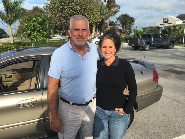
Yesterday, I toured the Glades once again with former Pahokee mayor, J.P. Sasser, someone I don’t always agree with, but definitely get along with. Someone who is teaching me a ton about the Glades, a history linked to my history, the St Lucie River/Indian River Lagoon….
Along the journey, a noteworthy thing happened right of the bat at Canal Point, our first stop. Here, I met an older gentleman fishing along the original locks of the historic West Palm Beach Canal. As I was taking photos, I thought I should introduce myself.
“Hello,” I said, extending my hand.
“Hello.”
“Catching much?” I asked.
“Not today, but usually, yes.”
“Do you live around here?” I inquired.
“No, Tequesta.”
“Wow Tequesta? That’s pretty far away…”
“Not really,” he said. “Maybe thirty minutes. I used to come here with my father in the 1950s.”
“That’s cool.”
“And where are You from?” He inquired.
“Stuart.”
The fishing line bobbed in the water. I saw noticed a dead gar fish float by. The water doesn’t look so good, I thought.
“Have things changed a lot?” I asked.
“Yes they have,” he said, “but not a lot out here at Canal Point. That’s why I come.”
An alligator silently swam the shoreline…
“You know your bridge is here.” the fisherman softly said,” pulling on the line.
“Wow, funny you should know that…my mom…she’s a historian. Torry Island right? They used part of the Roosevelt Bridge in Stuart to build out in here in Belle Glade in 1938. It’s still here today…a swing-bridge….right?”
He looked at me holding his gaze. “Right young lady, the bridge is here….”
J.P. called from the car. The fisherman and I locked eyes.
“The bridge is here.” I repeated.”The bridge is here.”
As we drove away, I wrote something on my notepad: “2017 #GladesCoastMatters … ”
_________________________________________
Torry Island Bridge is located in Belle Glade about a 15 minute drive around Lake O from Canal Point.
“The story of the bridge’s origins flow smoothly from Corbin… The 1928 hurricane that ravaged the Glades set in motion the chain of events that would bring the bridge to Belle Glade. The storm destroyed the original dike that surrounded the lake. To build the replacement dike, the federal government spooned out a canal, separating Torry Island from Belle Glade, and used the dirt for the dike. The new canal, called the Okeechobee Waterway, needed a bridge. In 1938, state contractors built the Point Chosen Bridge, replacing a pontoon bridge with a swing bridge that was built in 1916 and relocated from the St. Lucie River near Stuart. The bridge consisted of the movable portion and wooden trestles on each end.” Associated Press article, 2009.
Merry Christmas and Happy Holidays to all my readers! See you in 2017!
Jacqui
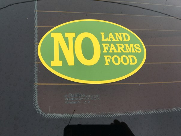
This is the swing bridge that used to be in Stuart on the Roosevelt Bridge but is now part of the Torry Island Bridge in the city limits of Belle Glade.Torry Island, Belle Glade.The swing-bridge looking across the rim canal around Torry Island.The Bridge Between Us…JP and JTL.J.P.’s bumper sticker
My bumper sticker/sHistoric map of the Glades showing cities. Canal Point upper left and Belle Glade further west and south. WPB canal is in Canal Point and the Torry Island Bridge is in Belle Glade.
My recent Glades tour with former Pahokee mayor, JP Sasser, lasted seven hours, and one of the most unexpected things I got to see was Storm Water Treatment Area 3-4. I have read about the STAs, flown over the STAs, and have had many discussions with engineer, Dr Gary Goforth, who is an “Architect of the STAs,” but nothing prepared me for what I felt when I unexpectedly saw an STA from the ground, or the other mystery I’d learn about that day.
So just about when my tour of the Glades was over, JP looked at me and ask: “Do you want to see the where the big reservoir was supposed to be?”
“Yes!” I exclaimed.” The reservoir? Hmmm. I’d heard stories of “the reservoir” but I really didn’t get it. Why didn’t it get finished? And what is it today? And then of course river advocates like me are supporting Senate President Joe Negron’s reservoir. What’s the deal with all these reservoirs? So confusing…
JP stopped the car, his blue eyes dancing: “We’ll have to drive south….”
“Please!” I begged, knowing I may never have this opportunity again.
So JP turned the steering wheel 180 degrees in the middle of all the sugar fields and headed south of Belle Glade on Highway #27– driving right along the historic North New River Canal that I did know something about.
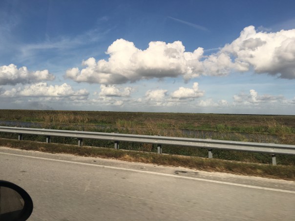
We drove, and we drove, and we drove…through sugar field after sugar field. And then, there it was, to my right, what appeared to be blowing reeds surrounded by shallow sparkling waters, silver and white, reflecting clouds in a blue sky. Birds flew by. It was beautiful. Miles long. My eyes welled up, and I thought about how amazing it was to see water in this place…”It’s like…..the Everglades….”
We drove until we got to the SFWMD’s STA 3-4 entrance gate and I asked JP to pull over so I could get a picture. I was unsure…So to JP, a Glades local, this area has to with “the reservoir,” but here we are at an STA? As I was pondering, we drove further into Broward County and JP pointed out many new-looking pump stations to send water south. I couldn’t stop wondering about “the reservoir.”
When I got home I did some research.
I believe, in short, this is the story. Please chime in if you know more.
After lawsuit/s due to long-standing polluted EAA water impacting southern lands, and after “acts of the Legislature,” in the 1990s a “Settlement Agreement,” was obtained. Thus the state of Florida had to construct 32,000 acres of storm water treatment areas (STAs) in the EAA (Everglades Agricultural Area) to clean water leaving the EAA and going into Water Conservation Areas and Everglades National Park.
By 2000 the first of six had been constructed, and by 2004 the first water ran through. Thus the building of the STAs is associated with the law suits. At the same time, Congress was working legislatively on CERP, the Comprehensive Everglades Restoration Plan. It was approved by Congress in 2000. But it was moving too slowly, so in 2006, Florida’s state legislature approved LOER (Lake Okeechobee and Estuary Recovery Plan) and under Jeb Bush chose 8 projects of CERP to “accelerate.”
One of the “Acceler 8” projects was the A-1 Reservoir. This reservoir was to be located basically right above STA 3-4 and it had three water components, one for agricultural use; one for the environment; and one for people.
Well time moves on and we are now post Jeb Bush, and into Charlie Crist’ governorship who in 2008 announced that the SFWMD would be negotiating with United States Sugar Corporation (USSC) to acquire as much as 187,000 acres of their land for Everglades Restoration! Lots of internal fighting. Environmentalist are excited about historic land acquisition, but many others are irritated that Everglades Restoration (CERP/Acceler 8) will be halted in order to purchase lands. Other sugar companies in the EAA are impacted as they share mills with USSC. US Sugar surprised everyone with this announcement. Not very nice! Some people in the ag industry are furious. Politics. Lawsuits. But such an opportunity!!! The Great Recession hits. The A-1 Reservoir and its 3 components are halted in order to possibly purchase the USSC lands.
Even more lawsuits ensue including one from the Miccosukkee who want the reservoir completed as their lands are being depleted. Time is of the Essence.
The recession gets worse…the USSC land deal falls apart. Fewer lands are purchased. In 2010 Tea Party and “Jobs” Governor Rick Scott comes to power and negotiates with the Federal Government over of a law suit that included creating Numeric Nutrient Criteria for Phosphorus coming out of the EAA. “10 parts per billion” becomes the number. Some feel he sold out, others think it’s good.
In any case….the SFWMD now implements what the District had been planning as things were falling apart and money got tight, not a 3 part deep reservoir but rather a shallow Flow Equalization Basin, or FEB, in the A-1 reservoir lands above STA 3-4.
Thus the “Restoration Strategies,” law suit brought to the table by Rick Scott and State Legislature funded the A-1 Reservoir FEB and has more to come. What is important to note is that the A-1 FEB and the STAs were created to clean EAA sugar/agricultural runoff, due to lawsuits, not to hold, clean, and convey overflow Lake Okeechobee water that is destroying the estuaries…This is different.
And that’s why we environmentalist are talking about “a reservoir” today…a reservoir that would help the estuaries…because we don’t have one.
On the way home, JP and I talked.
He is concerned that Negron’s 60,000 land purchase for a deep water reservoir could take so much land out of sugar production that one of the EAA’s four mills would not have enough cane to process, close, and put people out work. Pahokee cannot afford this…
“This stinks,” I thought to myself. “Do we have to choose?” Why can’t people in the Glades and the Environment flourish? Everything is so confusing around here. This too should not be a mystery…
I noticed after writing this post that I did not report uses of reservoirs correctly thus I am adding this slide on 12-16-16, one day later. This slide shows what the reservoir compartments were proposed for in this 2012 SFWMD presentation slide by Matt Morrison. I had included “people/water supply” and this was incorrect. The entire presentation is linked below title EAA Storage Reservoirs, 2012. JTL
I would like to thank former mayor of Pahokee, JP Sasser for on November 29th guiding me through a seven hour tour of the Glades! At first you may think JP and I are unlikely “friends.” Actually we have something very much in common in that we have both been mayors of small Florida cities.
Yes, there are also a few serious things we don’t have in common such as our opinion regarding land purchase in the Everglades Agricultural Area, (EAA), for a reservoir to alleviate the destruction of the St Lucie River. Also, Sasser has written extensively about concerns regarding the direction of the Rivers Coalition. I have been on the Rivers Coalition Defense Fund for six years. Mayor Sasser and I have not always been on the same page. For me this is O.K. JP and I having differences of opinion shouldn’t preclude working together. At this point in my river journey, I am going to do all I can to build relationships. To find common ground. “Common muck” should I say?
Anyway, enough politics. My tour was awesome! For this post, I will just concentrate on Pahokee.
JP and I met at Canal Point, at the USDA Sugarcane Field Station that dates back to 1920 about ten miles south of the Martin County/Palm Beach County line at the WPB Canal.
Pahokee has about 6000 residents. It has beautiful new schools. Many of the lands are owned by family farmers and the Fanjul family. The population is about 80% black and 20% white. Everyone I met was friendly and happy to see me.
Locals fishing at marina
JP asked me where I wanted to go. I asked him to take me to the Pahokee Marina and Tiki Bar that he so famously worked for during his mayorship. This marina is within view of Port Mayaca in Martin County. JP’s dream was that this marina would become the basis for economic development and diversity of Pahokee. The city desires economic development. (http://www.mypalmbeachpost.com/news/business/guy-harveys-resort-chain-eyes-site-in-okeechobee-c/nmwGw/)
I learned that Pahokee unlike much of the Glades is thirteen feet above the lake. It is high ground. The town is just a few miles long and 500 feet wide right along the dike. One sees dike, houses, road and then fields…Thus when the ACOE recently wanted to make improvements and “go out 500 feet out from the dike” they would have basically had to had to knock down the city.
I learned that much of the lands close to the Lake were covered with Apple Custard Trees that had been removed in the early 1900s and thus the lands have excellent deep muck soil that grows not only sugarcane, but sod, corn, vegetables, and supports tree farming. Pahokee is known as “Muck City.”
JP then took me off the beaten track to see his horses and donkeys. So here is something else we have in common. A love of animals!
We drove on…JP showed me the remains of the Pelican River which led to Pelican Bay that I had read about in my book. This was the area where the Palm Beach Times reported over 400 dead after the 1928 Hurricane. I tried not to imagine…
We then drove to Pahokee’s original graveyard that had to be moved along with its resting bodies to Port Mayaca in Martin County after the 1928 Hurricane. There was a plaque that listed those who had been buried there. A sad thought, but here is another way Martin County and the Glades are connected.
We visited the airport. Very nice. Right along the lake. In fact this area was once lake bottom. Bizarre. Hmmm…My husband Ed would like this airport I thought. More possibilities for economic development?
Again back to the dike. It always goes back to the dike…
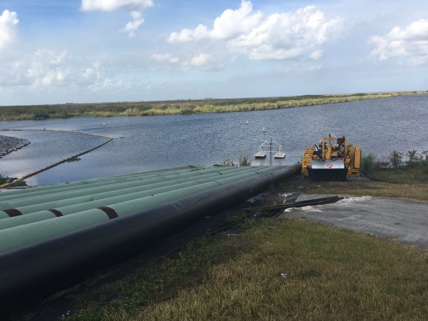
We checked up on ACOE repairs where they had draped the pipes carrying water to the fields over the dike like spaghetti and then JP took to me to lunch….
Part #2 will be entitled: “The Best Fried Chicken of My Life.” Please see photos below.
JP at Pahokee MarinaDriving on road atop the dike by marinaView from dike looking south. Homes stand right next to the dike.Old Pelican RiverTree Farm looking from dikeJP’s horese and donkeys
Original Pahokee graveyard at base of dike
Old GraveyardPahokee’s nice new roads with lovey houses on right and fields on other side of roadCanal and control structure to fieldsLocation of airport, once lake bottom
JPRepair of dike ACOE with water for irrigation from lake over dike so they can get to culverts
Canal Point, the lake town just south of today’s Martin County line, was once an epicenter of life changing activity, a road trip there is no turning back from…
As we learned previously, in 1917, the construction of the West Palm Beach Canal created Canal Point, the town of lumber-man and developer, Mr. Gilbert A Watkins. During this era, planting sugarcane in the rich muck soils surrounding Lake Okeechobee was becoming even more of a rage and the federal and state government helped it take shape.
In 1913, Florida’s Internal Improvement Fund appointed an engineering commission to study the feasibility of draining the Everglades. At this same time, roads were assessed. In 1919 those belonging to Southern Land and Timber Company, Hamilton Disston’s heirs’ lands around Lake Okeechobee–some that became Watkins’—were determined to be “inadequate.” The only east/west road was Jupiter -Indiantown, and that was not enough.
Nationally, it was all the rage to be part of South Florida’s new-found” investment. “Buffalo’s New Yorker, Fingy Connors, was perfect for the job. He’d lost his thumb when he was young, but this didn’t keep him from grasping or getting what he wanted. After a visit to the area celebrating the building of the West Palm Beach Canal, he bought lands in the area of Canal Point and built his road.
Connors’ Highway Toll-Road became an “engineering and development marvel” and all knew it was Fingy’s skill as a big time political boss that got it done. Like the video and biography in this post implies, some saw him as a villain, and others as a hero…
What is for sure, is that although a large section of the road was built from Canal Point north to Okeechobee, it later was extended under the lake and across the state becoming Highway-80, paving the way for the future of the sugar industry and what would evolve into the riches of the Everglades Agricultural Area.
William J. Conners, aka Fingy (1857-1929) was born in the slums of the Old First Ward. Fingy obtained his nick-name because he lost his thumb when he was young. When he was 19, his parents passed and he acquired a small saloon/rooming house on Louisiana St. He then bought a 2nd saloon on Ohio St. With Conners’s flashy, tough personality, he managed to form contracts to supply labor all across the Great Lakes utilizing 1,000s. His men would eat, sleep, drink, and spend their earnings at his saloons. He had sovereignty over the work force for over a decade. Next in life, he became a leading real-estate developer, operated his own paving company and brewing company, poultry farm, and started the early stages of the Courier Express. Conners definitely tested the waters by reducing wages of grain scoopers which caused a strike. This strike caught nation-wide attention, as 8,000,000 bushels of wheat were backed up. After dipping into politics, he came to control 85% of the packaged freight business on the Great Lakes (Great Lakes Transit Corporation). Conners donated a small fortune to Buffalo’s poor. Later in life, Fingy resided in Florida for half of the year. Floridians considered Fingy to be of hero stature.
HISTORIC PHOTOS CIA FLORIDA MEMORY, CONNORS’ HIGHWAY 1920s.
Connors’ Hwy. toll area with non-diked Lake Okeechobee in background ca. 1925. (Florida Memory Project)A car drives along Connors’ Hwy. with Everglades fauna to right. (FMP) Connors’ Hwy and Everglades fauna.
Cistern with Lake O in background.Connors’ Hwy along area of canal or rim canal-here I am uncertain but this photo too is included in the Florida Memory Projects documentation of the Connors’ Hwy.
HISTOROR MARKER TEXT AND PHOTO
*Thank you to my mother for the photos retrieved from Florida Memory and the write up of the historical marker and the video history.
The Fanjul Brothers, Plantation Services Land Report 2012
“Who Owns the Land? Mapping Out Florida’s Water Future.”
Stofin Co. Inc. is #7 on the Treasure Coast Regional Planning Council’s (TCRPC) map of land ownership in the Everglades Agricultural Area, (EAA). These lands lie on the eastern side of the EAA and comprise 7,189 acres. Stofin Co. is affiliated with Fanjul Corporation more widely known to river activist as “Florida Crystals.” As we know, Fanjul Corporation is a large sugar and real estate conglomerate with interest in Florida, the Dominican Republic and soon to be in the brothers’ homeland, Cuba, once again. The family is very influential in all politics and donates extensively to both the Democratic and Republican parties.
We can see by doing just a bit of research that some of the same officers of Fanjul Corporation are also listed in Stofin Co. Inc. such as Erik J. Blomqvist and Luis J. Hernandez.
Looking at our TCRPC map I have colored #7 parcels in orange just as #2 Okeelanta Corp. and #3 New Hope Sugar Co. were. As we learned earlier those too are Fanjul Corp. lands. I have just added a purple dot to differentiate. So far all in ORANGE below is Fanjul holdings.
It is interesting to compare the TCRPC map with the historic maps also below and note the “shape” of the original “river of grass” before it was dammed and destroyed by agricultural development in the EAA. Note how the river veered off to the right, or in an eastly direction. Surveyor, Chappy Young’s map shows the westerly development over the years into the “Everglades’ agreeed boarder” from the east. We have swallowed her up in every direction. She needs to be restored. It only makes sense that some of the overflow water from Lake Okeechobee destroying the St Lucie River/Indian River Lagoon is allowed to go south again. Thank you for reading my blog and for caring about the health of the St Lucie River/Indian River Lagoon and the Florida Evergldes.
Historic map from 1948 book “Lake Okeechobee” written in 1948 by Alfred Jackson and Kathryn Hanna as part of the Rivers of America Series.War map of the Everglades created during the Seminole Wars, 1856.West of the red lines shows the edge of what was once the Everglades in South Florida. Development has crept and continues to creep over this edge. (Photo/map courtesy of Chappy Young,/GCY Surveyors, 2014.)Senator Joe Negron’s proposed aquisition map in the EAA, 2016.
Today’s lesson in my series “Who Owns the Land? Mapping Out the Future of Water,” is #6, SBG Farms Incorporated. SBG Farms owns 8,569 acres of land in the EAA according to the TCRPC map.
I couldn’t figure out what SBG Farms stood for, but a couple of my favorite acronyms from acronym finder (http://www.acronymfinder.com/SBG.html) were: “Super Blue Green”and “Saved By Grace.”
Yes that makes sense…to not have Super Blue Green algae in the St Lucie River/Indian River Lagoon we all must be Saved By Grace….
So who is SBG Farms?
I believe SBG Farms is part of U.S. Sugar Corporation because according to Sunbiz, where once goes to look up registered corporations in the state of Florida, two of their officers are the same as for U.S. Sugar Corporation: president Robert H. Buker Jr. and vice president Malcolm S .Wade Jr. Also the registered address is in Clewiston, Florida, the same location as U.S. Sugar Corporation. As we learned with land owner #1, U.S. Sugar Corporation is the “Granddaddy” of the land owners. “They were in the EAA first.” We must respect and work with this… You can read the company’s history and their leadership from their website here: (http://www.ussugar.com/history/)
So above I have colored in the #6 parcels in the same purple crayon as #1 (USSC) and outlined in green marker so there is a visual difference.
Now for those of you who have been around fighting for the St Lucie River/Indian River Lagoon since 2013, don’t get worked up when you see “Bubba” Wade’s photo, remember in the end, we all can be “SBG.” All of us that is, and we need it! For a better Florida water future we must all be “Saved By Grace,” and maybe, just maybe, we already are…
Senate Presidient Joe Negron’s proposed land acquisition map for water storage –2016/2017 legislative session.
“Who Owns the Land in the EAA? Mapping Out Florida’s Water Future.”
Today we learn about King Ranch, #4 on the TCRPC map of land ownership in the Everglades Agricultural Area (EAA).
King Ranch is full of history and mystique and part of Texas’ long US history with Mexico. They are “Americana” even on the road. Perhaps you have gotten behind a truck with their brand symbol? Maybe you own one of those trucks? King Ranch is a huge company and has many different interests.
One of King Ranch’s major interests in Florida is Consolidated Citrus and they have an office in Indiantown in Martin County.
Not everything has been a royal flush for King Ranch. Over the decades the company has had to change out their fields because of the loss of orange groves due to canker and citrus greening. In Martin County alone basically 98% of the groves are fallow. A terrible loss. But to remain King, one must adapt, and they have according to Stuart Magazine “growing sod, corn and sugar, as well as testing out perennial peanuts and organic rice.”
So as the orange groves die, some are replaced with sugarcane.
You may recall articles about Rick Scott and the Florida Legislature a couple of years back going to visit King Ranch in Texas with the support of U.S. Sugar Corporation money? Yes, “these guys are buds.” They do business together and they play chess together. There are kings, queens, knights, rooks, and pawns.
So according to the map, King Ranch owns 19,755 acres in the Everglades Agricultural Area.” I have colored this in dark blue. They may not be the largest land owner, but considering their influence they certainly are King.
Negron’s proposed land mapTCRPC map of land ownership in the EAA 2016
*Mr. Mitch Hutchcraft of King Ranch serves on the South Florida Water Management District. He was appointed by the Governor.
TCRPC EAA map 2016Senator Negron’s possible land acquisition map 2016/17
“Who Owns the Land South of the Lake? Mapping Out Florida’s Water Future.”
Today we discuss #3, New Hope Sugar Corporation. It is difficult to find much information on the company, however, it is part of the Fanjul family’s holdings. It is also the same name, as we learned yesterday, as the Fanjul charity: New Hope Charities whose mission is to help families in the Glades.
Let’s look at the charity again…
Their website reads: “New Hope Charities was incorporated as a 501(3)(c) charity in 1988 offering support to remote, distressed and underserved segments of society. The first program implemented by New Hope distributed food to needy families living in the “Glades” area of western Palm Beach County. Currently, we operate a multi-service center in Pahokee, Florida, the second poorest city in the United States. The Family Center consists of a Day Care Center, a Youth Center, an Education Center, a Health Center, basketball courts, and an open field for soccer, baseball and football.”
Now back to the land…
I have colored in New Hope Sugar Corp. in the same orange highlighter as Okeelanta Corporation, but added a red dot to differentiate. New Hope Charities above mentions Pahokee as the nation’s second poorest town. Pahokee is south of the Martin County Line along the rim of Lake Okeechobee; it is not far away. The point of my blog series is to show landholdings, but I think the “New Hope” theme lends itself to a discussion on something more.
New Hope Sugar Corp orange with red dot, #3. Fanjul holdings.Map south of Lake O, Pahokee is marked
I have been blogging for four years now, it is becoming clear to us all that there is a bridge to be crossed, a hand to be held if we are going to go any further. Since the beginning of our river journey there have been cries from the interior of the state/south of the Lake. Cries of fear that we want to “send the water south” and destroy their cities and livelihoods…Even thought we know this isn’t so, this is understandable— and let there be no mistake about it: #GladesLivesMatter
I think it is time we talk about this openly. We must address the fears and the realities and we must begin to help…because there is so much help we can do for these communities and for a better water future for our state.
What got me thinking on all this was researching New Hope Sugar Corporation, #3 on the TCRPC map. I realized I have never thought that much about these areas south the Lake, except maybe when my father told me some of the best football players come from Pahokee and Belle Glade. I have driven through before and I have flown over. But have I ever walked inside? No I have not. After I finish this “land south of the Lake series” I think it is time to go inside this world and see how we can help.
We have got start a conversation including the Glades communities, a plan to help the poverty in Pahokee and Belle Glade and other Glades communities. We have to talk about Everglades Restoration as a plan for everyone. I am sure the Fanjul’s New Hope Charities with same name as their Sugar Corporation is doing great work, but why couldn’t Everglades restoration offer something more? Because in order to create more than hope, we must move beyond charity…
Excerpt NY Times Article, 2013… In the Glades, the “official” jobless rate has always been a joke because so few people are even on the books. Many of the agricultural jobs disappeared as vegetable production turned into sugar growing, now largely mechanized.
Today I will continue my series “Who Owns the Land South of Lake Okeechobee? Mapping out the Future of Water.” Hurricane Matthew caused a slight interruption, but now we shall continue. 🙂
Here we go!
Number two on the TCRPC map (above) is Okeelanta Corporation. “Okeelanta is a division of Florida Crystals, the word is a combination of two made into one. “Okee,” coming from “Okeechobee,” and “lanta,” coming from “Atlantic.” Cleverly named for a location between Lake Okeechobee and the Atlantic Ocean. Okeelanta was a historic town founded by writer and politician Laurence E. Will’s father. The town stood about one mile below South Bay. It was destroyed in the 1928 Hurricane: http://www.pbchistoryonline.org/page/okeelanta
I’m not sure if the company Okeelanta is named after the town, but I believe it was bought, and I know it is now owned by the Fanjul family of Cuba who owns Florida Crystals. As many of us know, the Fanjul family came to South Florida because of Fidel Castro’s 1959 Marxist Revolution. The family moved to Florida along with other wealthy, dispossessed families. Here with the support of the US Government the Fanjuls rebuilt their fortune as the US grew to be a leader in the world sugar trade, at the expense of the Florida Everglades.
In regards to the map, it must be noted that compared to US Sugar Corporation, the Fanjul family are relative”newcomers.” This is why their land holdings are further south of Lake Okeechobee. They acquired lands as the industry expanded after 1960.
Sometimes I say “until the Cuban Revolution there were only 100,000 acres of sugar cane in the EAA.” This is probably off, but you get the point. As Laurence E. Will in his historic book noted in a previous post: “After the Cuban Revolution, for a short time our government permitted the unrestricted panting of sugar cane…”
Again I stress that the expansion of these lands by the US Government is what allowed this area to be convered from Everglades to sugar fields, and it is only our state and national governments that can encourage and fairly compensate land owners for lands purchased in the EAA to allow water storage in an area that should never have been 100% developed in the first place. We have to encourage land owners to please be a part of the solution of allowing storage of excess water and helping more clean water move south…
According the TCRPC map Okeelanta owns 86,793 acres of land in the Everglades Agricultural Area, (EAA.) A lot!
I have colored in the #2s with orange highlighter so you can see these lands more clearly and how the intersect with Senator Joe Negron’s circles for possible proposed land acquisition. Remember that 9 days ago I colored in United States Sugar Corporation’s (USSC) lands in purple crayon. They are #1.
So now we can clearly “see” what lands are owned by USSC and by Okeelanta.
“Okeelanta Corporation, a sugarcane company, engages in farming, milling, packaging, and distributing sugar cane. It has a 67,000 acres facility that includes cane fields, a mill, refinery, packaging and distribution center and a power plant. The company was incorporated in 1984 and is based in West Palm Beach, Florida. Okeelanta Corporation operates as a subsidiary of Florida Crystals Corporation.”
As we shall see in future posts, the Fanjul holdings have various names, thus they own more land than noted in the map above. Like them or not, the family is clever just like the name “Okeelanta” and infamous for their political influence. The two most well known brothers are noted for ties to different political parties: Alfonso Fanjul, Democratic Party while Pepe, contributes to Republican Party. For the record the other brothers names are Alexander and Andres. And they have a sister. Her name is Lillian Banjul Azqueta and she is president and founder of New Hope Charities.
As controversial as the family is, they do a lot of good for the poor Glades communities and they own what we want. We must work together for a better water future for Florida that includes our St Lucie River/Indian River Lagoon.
Today we start learning about land owners inside the Everglades Agricultural Area (EAA) as listed on the above map; some will own land within Joe Negron’s proposed circles for land acquisition, and some will not. In any case, we should know them all.
#1 United States Sugar Corporation, “Old Granddaddy”
When talking about United States Sugar Corporation, (USSC), we must remember that we are talking about “Granddaddy,” the oldest of the sugar producers of the EAA. Granddaddy is listed on the Treasure Coast Regional Planning Council’s map as owning 140,451 acres of EAA land. I have colored the #1s in with a purple crayon to get a better idea of how these lands line up with Joe Negron’s circles. This non-tech approach I’m sure has my brother Todd cringing, but for me, a former 8th grade teacher, it works! Mind you it is just a “guestamation.” 🙂
Perusing the #1s I’ve colored in, we see vast land holdings. USSC has a long history in Florida, rising from the ashes of the failed Southern Sugar Company of Clewiston of the late 1920s to their Godlike political and production influence today. USSC owns some of the “muckiest of the muckland” closest to the lake, as they were there first. They own the most black gold….
General Collection Florida Memory, Clewiston ca.1929.
How did they rise to such power?
It was auto industry legend Charles Stewart Mott’s applied business principles and a twist of fate in the American political climate that lifted USSC to its tremendous status. Let’s review…
Mr Lawrence Will, well-known historian for people like my mother wrote in his 1968 book, “Swamp to Sugar Bowl:”
“…although Southern Sugar Company owned some 100,000 acres of the best land around the lake, under U.S. government regulations, the state of Florida was permitted to produce only nine tenth of the one percent of the nations needs. However, when Fidel Castro took over Cuba the Everglades reaped the benefit. For a short time our government permitted the unrestricted planting of sugar cane. Oh Brother, you should have seen how cow pastures and vegetable fields were plowed up and planted! Now we have 189,500 acres of sugar cane in the Glades.
By the 1980s USSC became a leading sugar producer in the United States as they are today. The key here is the effect on our waterways due to the politics of the Cuban Revolution.
Jumping ahead to 2007/8, an unprecedented opportunity was presented: Granddaddy offered a full buy out. USSC was on the table. Incredible! But not everyone liked then Governor Charlie Christ nor did the legislature appreciate him taking the situation into his “own” hands…nor did all trust US Sugar. The state had been implementing CERP since 2000. Now this giant opportunity was a gift but a wrench as well. Environmentalists were excited but wary. Politicians took sides. Other sugar companies fumed.Tempers flared. Blame. Intrigue. Posturing…Sound familiar?
Anyway, by the time the Great Recession bit down on the nation full force in 2010, a smaller land purchase had been negotiated by the SFWMD, and the drama of Florida politics and sugar was playing out. The land sale was but a shadow of its former self for Everglades Restoration and USSC left an option on the table through 2020 just in case there’s ever money in system again.
Exhausting.
After the SFWMD killed the EAA US Sugar Lands option, where do we go from here? (Map Everglades Foundation, River of Grass 2008.)
So …Granddaddy is still in control. But before we leave him, let’s remember this:
One of the unintended consequences of the proposed 2008 USSC “failure” we forget to talk about (sometimes in the excitement of hoping one day USSC will willing want to see their lands again,) was the halting of “more than a dozen projects already under way in 2008.
…among them (was) a massive reservoir in western Palm Beach County that was seen as a major step toward restoration of the Everglades.” (New York Times.) This reservoir would have alleviated discharges to the estuaries. This would have been a reservoir similar to the one we wish to create now.
Yes, the A-1 Reservoir, as it was known, was hit on two sides: halted for the USSC land purchase, and it also collided with yet another water issue, a law suit with the federal government over water quality standards, RESTORATION STRATEGIES. This one was guided to a close by then new Governor Rick Scott.
Thus the A-1 Reservoir became a shallow rather than a deep water reservoir. She never came into her full glory…
In in any case, the deep water reservoir needs to be back at the top of the list. Maybe if he’s in a good mood this year, Granddaddy can help her out. 🙂 Let’s be sweet and see what happens…becasue nothing will happen with out Granddaddy….
JTL vs the Political Machine, A Retrospective, Part #5
When I saw my mother yesterday, she said, “Jacqui, I think you need to stop writing about those PACs…I get it now…” One of my Grassroots Team members implied that I may ruin my reputation for running a clean campaign, and compromise my chances to run again, with all the harsh comments coming in on my recent posts….My husband looked at me wide-eyed over a glass of wine: “I thought you tried to keep your campaign out of the blog…?” Joe Catrambone, CEO of the Stuart Chamber, who I like very much, sent out a group email saying: “Jacqui isn’t accepting defeat very well! Speaks volumes doesn’t it!!!”
For those of you who are uncomfortable, or think I am a sore loser, please don’t fret. Today will be my final day investigating those who spent time and money to affect my loss for Martin County Commission District 1.
I do apologize to the Stuart Chamber as they really don’t belong in the category of reptiles as they chose not to send out a negative post card against me, just for Doug Smith; I was simply trying to make the point that the influence of Tallahassee affects home.
Early on, in my own head, I knew that whether I lost or won, I would be reporting on the outcome dynamics of the campaign in my blog. Writing on this issue is all part of my river journey. I know what I am doing, and it will be shared. These insights in time will help us get closer to saving our dying river…
Mom, “don’t worry,” I will stop taunting the alligators very soon! 🙂 But first we must try to see the truth behind the scenes.
Here we go:
#5
Our last PAC to add to the previous three days of postings: Write in Candidate Chase Lurgio; Martin County Firefighters Union’s “Citizens for Public Safety;” C-Pac; and “Committee to Elect Real Conservatives;” (all ridiculous names) and today’s”Committee to Protect Florida.”
So when we look at the third negative post card that came out against the JTL campaign, we see on the bottom it reads: “Paid electioneering Communication for by Committee to Protect Florida, PO Box 102005 Tallahassee, FL 32302.” It is yet another ad full of lies, but I do appreciate that they used two of my favorite pictures of myself, my younger looking real estate head shot from 2007 and the hysterical “piranha photo” Ed took of me in Peru along the Amazon River.
This PAC’s chairperson is Mr Roger “Rockie” Pennington. Mr Pennington is a very well-known in Tallahassee politics. I first heard about Mr Pennington, when I was told in the last campaign cycle that he ran Doug Smith’s campaigns. At the time I wondered why Doug would use someone from Tallahassee….
Rockie Pennington owns Southern Campaign Resources, and according to his website “has been a fixture in Republican politics for nearly four decades.” You can read more here: http://www.southerncampaigns.com
Let’s look up who contributed to his PAC: ironically the Florida Chamber of Commerce at over $100,000 dollars, Florida Jobs Pac, $50,000. These are the same PACs that gave money to C-PAC and Committee to Elect Real Conservatives from yesterday with sprinkles of the sugar industry.
But what is even weirder is when you look up “Nature Coast Conservatives” that gave the lion’s share of the donations, $100,000s of dollars. This PAC is run by Roger Pennington’s partner in Southern Campaign Resources, Mr Mark Zubaly who is listed along with Rocky Pennington on the bio page of Southern Campaign Resources.
As the bio states “(Mark) is a partner in two Tallahassee-based companies that count at least one-fourth of the Florida Legislature among their clients: Southern Campaign Resources, a political consulting and lobbying firm, and Summit Communications, a media production firm. He also serves as the campaign consultant to a number of Florida’s city, county and judicial elected officials.”
And yes…Mark Zubaly was also Rockie Pennington’s PACs treasurer…
Of course as you dig deeper the money keeps going and going and going….
So The Doug Smith Campaign had its own campaign manager with his own PAC with his own partner funding the PAC from his own PAC that uses many of the same questionable donors that were linked to, C-PAC, and the # 2 post card of Josh Cooper who ran opposition research for the Governor. On top of this there was the Firefighters Union PAC, Citizens for Public Safety, sending out positive post cards for Doug Smith, sending out negative post cards against JTL all the while building signs, placing signs, making negative phone calls against JTL, pulling up opposition JTL signs, and waving….
I’d say we did pretty well considering our opponents! What an alligator pit!
I feel like we’re in a Carl Hiaasen book! We don’t even need to go to Miami!
In conclusion, The Jacqui Thurlow-Lippisch Grassroots Campaign lost to this Political Machine by 2.9% or 677 votes…raised considerably more money and had considerably more diverse support. Supported a clean river and land purchase south of lake…in any case, did not support the status quo…
Wow! What a race!
It was exciting!
And now that we know who we’re in the pit with, maybe next time we’ll get them on their backs and Protect Florida For Real.
Now that the dust is settling, it is important to study and document the loss dynamics of “Jacqui Thurlow-Lippisch for Martin County Commission District 1.” In retrospect, it was a voice for the river grassroots campaign versus a sophisticated political machine. The narrow loss to 16 year incumbent Doug Smith, by only 677 votes or 2.9% makes the retrospective even more interesting!
As there is such a plethora of material, today we will research only parts #1 and #2: The Write in Candidate (WIC), and the Martin County Firefighters Union. In follow-up posts, we will breakdown the influence and monies of the political action committees and their cohorts better known as PACs.
#1 WRITE IN CANDIDATE (WIC)
One very effective way the political machine affects a race is by putting in a “write in candidate.” Because of a constitutional amendment brought forward by the voters in 1998, Florida is a “universal primary state,” meaning in a primary election that determines the General Election, voters of all parties are allowed to vote. But there is one “opinion” loophole that came later: “if a write in candidate (opposition) enters the race, the race becomes closed.”
Write in candidates could be real candidates who at the last minute decide to run, or they can be fake candidates who are put up by the “powers that be” to close the primary race to one party, or for the “benefit” a certain candidate.
This is what happened in the JTL District 1 race. Chase Lurgio, an 18 year old teenager at Jensen Beach High School, who is certainly a not in a position to be a county commissioner, was put up for the benefit of Mr Smith the last days of June. The race had been going on since September the year before.
Who put up this candidate and was he awarded for service? This we may never know, but as we study the players in the arena we begin to get an idea….
If you are interested, all of Chase Largo’s WIC information can be found on the Martin County Supervisor of Elections’ website; also, one can call and request his qualification papers. There is not much to learn as a write in candidate pays no fee, (“real” county commission candidates are required to pay almost 4,000$ or get 1100 petitions signed to quality); WIC do not have to fundraise, participate in forums, etc.., can be of the same party they close, (as is the case of Chase Lurgio who is a Republican himself like me and Doug Smith); they do not have to put forth a biography…nothing is really required to be a WIC, you just have to be willing to sign up.–they don’t even have to live in the county!
To repeat, the JTL Campaign, a loud independent voice for the health of the St Lucie River, a bipartisan issue with broad appeal to all parties was threatening to the political machine and to Doug Smith. So the race was closed by a WIC, disenfranchising over half the voting population of Martin County (Democrats and Independents.) Considering the will of the people 1998 constitutional amendment made Florida a universal primary state, this does not seem correct.
Numbers of Martin County Registered Voters: |Republican: 55,015 | Democrat: 27,501 | Other: 26,591 | Total: 109,107
People can change parties but this is a lot to ask, and only a very small population even figure out what is going on. Many voters are furious when they get to the polls and names they expected to vote for are not on the ballot.
Mind you, I have no problem with true write in candidates or closed primaries. However the tactics of Florida’s present system are fraudulent and encourage foul play. The only way to change this is to work against the corruption of WIC fraud and in time get the state constitution changed for either straight closed primaries or open primaries.
In conclusion, as time goes on more and more law suits have arisen regarding WIC and in fact there is a case in the Florida Supreme Court Case pending although one was just determined and the opinion on WICs was upheld. It is the people who must overturn this fraudulent part of our system.
SOE MCChase Largo’s Facebook picture has been widely distributed since he signed up to be a WIC
#2 THE MARTIN COUNTY FIREFIGHTERS UNION
Another factor affecting the JTL race was the Martin County Firefighters Union. The MC Firefighters Union has been at an impasse with the Martin County Commission for raises etc… To overcome this situation, they have regrouped and developed a ruthless union that has raised dues to back candidates that promote their interests.
It is kind of “You scratch my back, I’ll scratch your back” approach. As was quite obvious during the race, where I used my grassroots team, Doug Smith used the firefighters. They put his signs together in the union parking lot and waved signs along with their families on the side of the road in sweltering heat.
They also raised extra money with their union dues to send out a negative post card against me and later made direct phone calls to citizens in my hometown of Sewall’s Point stating untruths.
Their Political Action Committee, Citizens for Public Safety, (PAC) sent out the ad below and by clicking on the link one can see they raised over 100,000 dollars in their PAC to run negative ads against candidates. On average it cost about 15,000$ to send out one postcard.
If you go to the link from the Florida Department of State Division of Elections and enter their PAC “Citizens for Public Safety” into COMMITTEES you will see reporting.
The misleading ad they sent out against the JTL Campaign is below. Look closely and you will see “Paid electioneering communication paid for by Citizens for Public Safety”
As I said many times during the course of my campaign, I am forever grateful to the firefighters for saving my life when I broke my neck in 2001, but I find their campaigning for any candidate a total conflict of interest. It will be interesting to see if Mr. Smith supports their raises in the coming budget cycles. I am also surprised the “Republican” candidate would have such a close relationship with unions.
Hindsight is always 20/20. Hope you learned something today. I certainly have! See you for part 3, Stuart Chamber’s C-PAC in the coming days.
Jacqui
FL DOEPostcard sent out by Citizens for Public Safely-MC Firefighters Unionback of card
School bus reads HAVANA OR BUST! My father’s Stuart High senior trip for Stuart High, went to Cuba in 1954. (Photo Tom Thurlow)My father’s 1954 senior class, Stuart High School, Martin County, Florida. My father is in back row, far right second from end.(Photo Tom Thurlow)The book “Swamp to Sugar Bowl” was written in 1968 by Lawrence E. Will. (Borrowed from the library of Sandra Henderson Thurlow, historian.)
It is good to learn about the history and issues of the Everglades, South Florida, and our St Lucie River/Indian River Lagoon so that one day, in spite of the difficulties we face today, we will be able to fix our problem in the future…
Perhaps the greatest reason the our former Everglades are now overflowing with sugarcane fields is due to politics between Cuba and the United States. My father graduated from Stuart High School in 1954, and believe it or not, his senior trip was to Havana! Soon after, Castro’s revolutionaries took over Cuba in 1959. And as they say the “rest is history…” as the growing sugar fields blocked the flow of water south to the Everglades, the fate of our precious St Lucie River/Indian River Lagoon seemed forever doomed. But it is not, as nothing lasts forever.
This weekend my mother handed me a book entitled “Swamp to Sugar Bowl” by historian, author, businessman, and politician, Lawrence E. Will. I read the little book with great enjoyment. Although many things have changed since the book was written in 1968, it provides great insights.
This week I will be sharing some aspects of the books. Today I will quote a few excerpts from chapter 22, “Florida’s Sugar Bowl.”
“Brother if you’re addicted to using sugar you should come here to these Everglades. Sugar and molasses bring in 110 million to these glades each year, so let’s take a quick look at this sugar bowl. Back in 1922, at Moore Haven, the first feeble attempt was made at producing sugar, but the following year in Canal Point the first successful mill began to operate.
Map showing Canal Point. (Laurence E. Will)
This company was taken over by Southern Sugar Company, now the U.S. Sugar Corporation which ground its first cain in Clewiston in 1929. Although this company owned some 100,000 acres of the best land around the lake, under the US government’s regulation, the state of Florida was permitted to produce only nine-tenths of one percent of this nation’s needs.
However when Fidel Castro took over Cuba, the Everglades reaped the benefit. For a short time our government permitted the unrestricted planing of sugar cane. Oh brother, you should have seen how cow pastures and vegetable fields were plowed up and planted! Now we have 189,500 acres of sugar cane in the Glades.” –Lawrence E Will, 1968
US Sugar and Florida Crystals map ca. showing ownership of lands, and option to buy lands for state of Florida, 2008.Stats of Sugar average in Florida, 1991, Source Hazen and Sawyer, 1993)
I am not certain how much land U.S. Sugar Corporation owns today, but the Everglades option map from 2008 and IFAS statistics from 1993 show over 450,000 acres combining US Sugar and Florida Crystals.
Sugar has been grown in the glades since the 1920s but it exploded in the glades in the 1960s and became heavily supported by the US government due mostly to political reasons.
“Bridges to the Sea,” Stuart, to Sewall’s Point, to Hutchinson Island and the Atlantic Ocean, 1965. Rhunke Collection, Thurlow Archives.
Since the 1960s, I have seen many bridges destroyed and rebuilt, right here in Martin County. They are symbolic of our history, our accomplishments, and our struggles.
I may be making this up in my memory, but I think I recall my parents driving me over the Palm City bridge when I was a kid and it was made of wood. The clunk of slow-moving, heavy car, over the uneven planks was somehow comforting, like the rhythm of a familiar horse. But times change, and bigger and “better” bridges are built…
The “bridges to the sea,” from Stuart, to Sewall’s Point, to Hutchinson Island–over the St Lucie River and Indian River Lagoon were built in 1958. Sandra Henderson Thurlow, in her book, Sewall’s Point, The History of a Peninsular Community of Florida’s Treasure Coast, discusses how the relative isolation of Sewall’s Point ended in 1958 when, two “bridges to the sea opened.” For 10 cents, one could come to Sewall’s Point, and for 25 cents, one could go all the way to the ocean. The tolls were removed in 1961 and the bridges formally named in 1965: “Evans Crary Sr,” and “Ernst F. Lyons”– going west to east.
I am almost sure, I also remember, my mother, or some history person, telling me “they” did not name the bridges right away as it was a political “hot potato.” Perhaps in the beginning there had been controversy regarding building the bridges and certain people did not want their names associated with them until the political fumes dissipated and settled upon something else? Perhaps I am making this up? Like my fuzzy romanticized memory of wooden bridge in Palm City?
I don’t know. But what I do know, is that bridges allow us to cross over, to get to the other side.
I am trying to build bridges to send water south to the Everglades and save the St Lucie River/Indian River Lagoon. This means working with the sugar industry; the South Florida Water Management District; the Governor; the state and federal Legislature; the Army Corp of Engineers; the County; and most of all the people who live along the Treasure Coast.
I must admit, jokingly, sometimes I feel like “jumping off the bridge.” But I won’t. With your help, I will rebuild it; make it higher, more beautiful, and less damaging to the environment. And hopefully, in the end, we will all be inspired!


 The ACOE has EAA Storage on their construction schedule for 2021. By 2021 the estuaries will surly be dead.


 Today I will continue my series “Who Owns the Land South of Lake Okeechobee? Mapping out the Future of Water.” Hurricane Matthew caused a slight interruption, but now we shall continue. 🙂


 Today we start learning about land owners inside the Everglades Agricultural Area (EAA) as listed on the above map; some will own land within Joe Negron’s proposed circles for land acquisition, and some will not. In any case, we should know them all.


