Ed’s comment when he came home from flight yesterday was “not as bad as last time.”
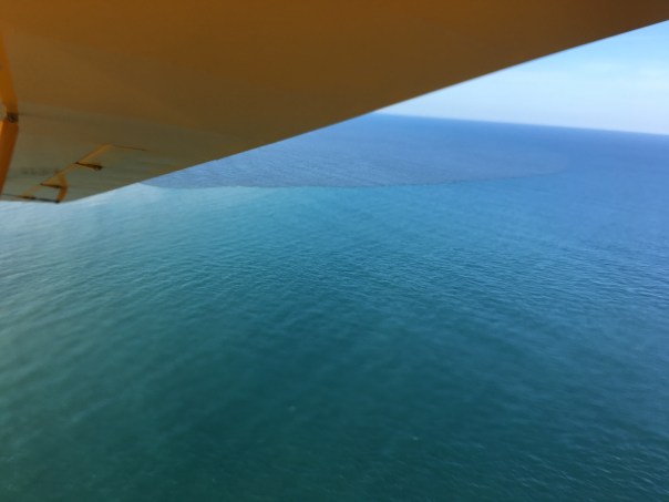
Today’s aerials were taken 8-6-23 around 1:30pm. One can see blue-green algae, along the eastern shoreline of Lake Okeechobee, but not as much in the C-44 canal.
The St. Lucie River looks a bluer near Sewall’s Point- perhaps thanks to recent full moon tides and less rain runoff. Seagrass meadows covered in increasing a cyanobacteria and macro algae are visible. The seagrass is returning, but not in as good a shape, after massive and longterm Lake O discharges in 2018, 2016, and 2013 and decades of destruction.
Sandbar near St. Lucie Inlet, 8-28-23, FB Mike Yustin
Ed and I continue to be your “eye in the sky” and Todd is helping all of us keep an eyeonlakeo now at 15.30 feet according to the SFWMD. Hurricane season should start ramping up. It is not a good situation. More water should be able to be sent south as God intended.
~Lake O, Rim Canal, and C-44 at Port Mayaca’s S-308
~St. Lucie River-Indian River Lagoon. Sewall’s Point divides these waters.
~Note seagrass beds in next two photos. Once 700 acres now much less and impaired. Good to see it in any case!
Thanks Ed!Canal system of CSFP SLR/IRL. credit SFWMD
You may have seen my most recent Lake Okeechobee post from July 25, 2020? After algae aerials since May 8th, my dear husband, Ed, said he saw no algae. Ed and I had a back and forth -me saying the algae “was hiding.” Hiding in the water column. Ed saying it was gone. Well, guess what? I was correct…
Today, July 29, only four days later, the cyanobacteria is back. There was one positive to it all. Ed added to his long list of esteemed flight guests, Ft Meyer’s Captains Chris Whitman and Daniel Andrews – the faces of Captains for Clean Water. The east and west coasts of Florida have been advocating together since the days of the Sugarland Rally in 2013. East and west, an important water alliance.
According to Ed, “the algae was bright and visible over the majority of the western, and southern-central portion of the lake, but became less dense as one approached Port Mayaca.”
“Were you surprised the cyanobacteria had returned?” I asked.
Ed had a very simple answer: “yes.”
Ed also said it was a great to hosts the Captains. What an honor.
Below are some of Ed and Captain Daniel’s photographs from Wednesday, July 29, 2020. You will see, with the sun shining, the lake is once again, visibly, full of algae. This is important documentation for the Army Corp of Engineers as we possibly face a very wet weekend.
Havens and Hoyer diagram from study of cyanophyte movements.Courtesy, Joe Gilio.Courtesy of Captain Daniel Andrews-off southwestern shore
Courtesy of pilot Ed Lippisch-southern to southwestern shore of L.O.
This morning, for purposes of documentation, I am posting the path my husband, Ed Lippisch, flew over Lake Okeechobee yesterday (6-10-20) and all aerials taken. Thank you to my brother Todd Thurlow, who shares technical information on his website, for re-creating Ed’s path via Flight Aware, and for also sharing the latest satellite high resolution images of Sentinel 2 retrieved 6-9-20. All of Ed’s phots displayed in gallery format below were taken from 2000 to 1500 feet on return flight along southern portion of Lake Okeechobee ending at Port Mayaca, east central, Martin County. His flight to the west coast was at 5000 feet and Ed said he saw no algae visible from that perspective.
All aerials, Ed Lippisch flight, 6-10-20, Moore Haven to Port Mayaca: if you are having trouble viewing this gallery please go to (https://wp.me/p3UayJ-b0a)
Moore Haven, Calooshahtchee canal C-43
Off southern rim. Cities of Moore Haven and Clewiston are in this area.
Turning over lake southern shore in distance
Now turned east, south eastern shoreline in view, getting close to Port Mayaca on east center in Martin County
Distinctive shape of S-308 at Port Mayaca in view
Algae bloom one mile or so off Port Mayaca, lighting makes difficult to see but it is clearly present
Ed said all algae was very bright, florescent, in color and his phone did not capture that aspect
Last night, 4-18-20, after a hiatus, Mother Nature decided to “let it rain” and this morning friends Dr Scott Kuhns and daughter-in-law, Dr Mary Kuhns went for a flight over the St Lucie River and Lake Okeechobee to check things out.Ed and I thank them for sharing their photographs!Update-No visible algae at S-308 or along the C-44 canal. The waters of the St Lucie River are grayish from rain water runoff. Things look good, considering. ~The rainfall numbers across the SFWMD can be viewed at the SFWMD’s 24 Hour Realtime Rain Gauge Site. S-308 at Port Mayaca, Lake OAlong C-44 canal, do you see algae?South Sewall’s Point, rain runoff visibleHole in the wall & St Lucie InletRain plume exciting St Lucie Inlet
Canals in Martin & St Lucie Co.that are connected to the St Luice River: C-23, C-24, C-25 built in the 50s and 60s. C-44 is also connected to Lake Okeechobee constructed in the 1920s. The natural basins of the SLR have been tremendously enlarged damaging the river.
excessive richness of nutrients in a lake or other body of water, frequently due to runoff from the land, which causes a dense growth of plant life and death of animal life from lack of oxygen.
6-16-18 Lake O cyanobacteria bloom, JTL
Although once known for her great life and beauty, modern-day Lake Okeechobee, has been dying for years…
Since the early 1970s, scientists were forecasting the imminent demise of the huge lake due to the tremendous influx of fertilizers and waste (oddly termed “nutrients”), especially from the Kissimmee River. The river had been channelized in the 60s, made straight, for flood control and the “benefit” of creating more agricultural lands. This was done by none other than the U.S. Army Corp of Engineers and, of course, supported by Florida politicians.
All of these problems were one of the reasons that Florida politicians reversed course and took action in the 1970s to do something for the environment. According to the book River of Interests “during the 1972 legislative session, the Florida Legislature passed several land and planning measures, including an authorization of a major study on eutrophicationof Lake Okeechobee.”
Although, I could not find any of the original reports of the Florida Department of Environmental Regulation, (the original name of the Florida Department of Environmental Protection – God forbid we say the word regulation!), I did come across the U.S. Environmental Protection Agency National Eutrophication Survey of 1977.
It is interesting to read, as if we are watching the soap opera General Hospital, where one can come back after many years and the same plot is playing out. In our soap opera episode today, most glaringly shown by non-point pollution still causing over 95% of the contamination. (https://www.epa.gov/nps/basic-information-about-nonpoint-source-nps-pollution)
Nonetheless, there have been positive changes in the characters!
A huge thing that has changed is that the Belle Glades sewage treatment plant, that once discharged into the Hillsborough Canal and was back pumped into Lake O, ~approximately 1/3 of the year, no longer does. This is no surprise. When I was a kid in Stuart in the 70s, there were still houses along the Indian River Lagoon that discharged sewage directly into the river! GROSS!
So I guess the plot has changed bit, but not enough yet to save Lake Okeechobee. We need to change the channel and do what we have known we need to do since I was ten years old…
Me, my sister Jenny, and me brother Todd in the 1970s…
You can read the full 1977 report at this long link below:
12-4-17, ca. 2:45 pm, photos: Ed Lippisch & Jacqui Thurlow-Lippisch
The Army Corp of Engineers has lessened but not stopped Lake O discharges that started September 20th, 2017 just prior to Hurricane Irma. Perhaps as the discharges have gone on at such a high rate for a comparatively long time, the plume has had a chance to extend its territory. In yesterday’s photos, the dark, filthy plume is reaching clearly south beyond the exclusive Town of Jupiter Island.
Yesterday was a beautiful day, but the river and ocean waters of our entire region were ugly, possibly contaminated. How are we to enjoy our property and lives here?
When viewing the aerials below, please note the blue, sapphire-colored water just on the edge of the discharge plume. Yes, of course all estuaries put forth darkened fresh water after a rain event, and Ed and I could see this occurring just south at Jupiter Inlet. Nonetheless, the black, gigantic plume that we repeatedly endure for the St Lucie River/Indian River Lagoon due to discharges from Lake Okeechobee is an aberration.
Please let’s all support Joe Negron and the public’s work to build the EAA Reservoir; clean & send the water south!
This first hand account of a man who is considered Stuart’s most important business leader, river captain, and pioneer, Stanley Kitching, gives rare insight into what it was like to take a drive to see the new St Lucie Canal, Lake Okeechobee, and the Everglades in 1918.
My mother sent her transcribed work first published in the Stuart Messenger, entitled “A Stuart Pioneer Away From Home,” stating: “Jacqui, You might find this interesting. It’s about the Custard Apples.” The custard apple forest was 32,000 acres along the southern rim of Lake Okeechobee that like a giant sieve strained the southern flowing waters of Lake Okeechobee before entering the sawgrass river of the Everglades. That forgotten forest was demolished to access the very richest of the Everglades Agricultural Area’s famous “black gold.” There are very few first hand accounts of this forest so this article is special. Many other parts of the story will captivate you as well.
Enjoy! And “thanks mom!”
~Jacqui
P.S. The digging of the St Lucie Canal, (C-44,) from Lake Okeechobee to the South Fork of the St Lucie River, was started in 1915, but not opened until 1923.
_____________________________________________
Stanley Kitching, photo Susan Barker Leek, Stuart on the St Lucie page 100, by Sandra Henderson Thurlow.
Stuart Messenger
July 25, 1918
Transcribed by Sandra Thurlow, Sept. 22, 2017
A STUART PIONEER AWAY FROM HOME
TAKES TWO WEEKS VACATION NEAR HIS OWN BACK DOOR
CAMP ON OKEECHOBBE-ST. LUCIE
Party Included Mr. and Mrs. Charles Christensen, Mrs. Smart, Mrs. Robinson and Stanley Kitching.
Like a great many Stuart people, we had heard stories about the wonderful Everglades, Lake Okeechobee, the rich soil, bumper crops, and the great Stuart-St. Lucie canal, so on July the Fourth our party consisting of Mr. and Mrs. Chas. Christensen, Mrs. Smart, Mrs. Robinson and myself started out to see the wonderful country lying to the west of Stuart.
We left Stuart at 9 a.m., with two cars, a Ford and a Dart, the Ford in the lead, of course. Each car was loaded to the limit. We estimated the weight in each car to be about 800 pounds. Consisting of tents, cots, cot pads, suit cases, fishing tackle, guns, axes, spade, rope, tent poles, nails, extra tires, gas, oil, spiers, mosquito bar, and enough groceries to last our party three weeks, also a lantern and flashlights and five heavy army blankets.
Just before starting we discovered a leak in the radiator of the Dart, but as we expected to find plenty of water along the road we didn’t let that bother us. We made our first stop twelve miles from town to fill the radiator as we were in cane slough and the sand on the fill was heavy and pulling hard, we put in water several times between there and the Platt place. After leaving the Platt place we left the main road and followed a cut off through the woods, passed a deserted Indian village and a mile further on came to another Indian village. We were now in the territory known as Indiantown. A squaw came out and told us we were on the right road. One mile on we passed another deserted Indian village. We found the wood’s road much easier to travel as the ground was harder. We arrived at the dam across the St. Lucie-Stuart canal at 12 noon, distance 30 miles. The dredging company were hauling a tug over the dam and we had to lay planks and board around the bow so we could pass. We got over the dam at 1 o’clock with the kindly assistance of some of the men from the big dredge.
Everglades, we ate lunch here, surrounded by a drove of genuine razor back hogs of all sizes. There is a sign on a pine tree at this point which reads 30 miles to Stuart.
Shortly after leaving the dam the road leaves the pine timber and climbs the fill made by the dredges. This fill is composed of rock, marle and shell, and we traveled it in high gear. Six miles from the dam the road enters the cypress timber, on the edge of the canal. It is very rough here for a short distance and everybody gets out of the cars but the drivers. This belt of timber extends nearly all around the shores of the lake, which looked like the Atlantic ocean on a calm day. It started to rain at this time. The road followed the lake shore, winding through the rag weeds which grow between the water’s edge and the timber line to a height of 8 feet. Five miles after leaving the canal the Dart sank in a mud hole and it took about one hour to get on the road again. We arrived at the home of Mr. and Mrs. Spiers, Cleve and Reginal Kitching wife and children, about four o’clock. This locality is known as Canal Point and is close to the Palm Beach canal. Our friends came out and greeted us and helped us put up the two tents. Then everybody got busy and we all had supper out in the open under the cypress trees just as the sun was setting in a golden glow on the west shore of Big Lake. After supper we all sat around the camp fire till bed time, which came early as we were tired with the day’s run.
Friday, (6th) morning everyone was up early and the day was spent fixing camp.
Saturday we put up a flag pole on the lake shore and hoisted the American, French and English flags. Rigged up a trot line to catch fish on, cleaned up the ground around the tents, cut wood, carried water from the lake, went in bathing, etc., and found that the time passed very quickly.
Sunday we laid around the camp.
Monday we went to the farm with the boys and helped dig potatoes.
Tuesday we looked over the farm lands, raw acres of fine corn, potatoes, onions, tomatoes and the land was richer than we ever dreamed of. The custard apple land next to the ridge is covered with a growth of custard apples, rubber and maple trees which are pulled up by the roots with tractors, Fords and other kinds. This land extends for about a mile in depth, then comes the saw grass lands. This extends as far as the eye can see and is cleared by burning off the saw grass, then pulverized with a tractor. It cost $100 per acre to clear the custard land and $5.00 per acre to clear saw grass. The tractors start work at daylight, and there is no sleep after they start as they run with the exhaust wide open and can be heard for miles.
Thursday and Wednesday we went fishing and caught some speckled cat fish which were fine eating. Most of the food we used was raised right on the spot, potatoes, onions, Indian pumpkins, butter beans, green corn, tomatoes, okra, rabbits and plenty of fresh milk from Reginald’s fine cow, which grazed along the lake shore and doesn’t cost a cent to keep. There was a pen for branded Berkshire hogs on the place and lots of chickens also a fine pond. Everything on the place was at our disposal and we certainly had a fine time during our stay at Canal Point.
We took down our tents Thursday morning and left at 11 o’clock. We reached the dam about 1:30 and spent about one hour working on the roads. After lunch we left the dam and canal and started south through the pine woods looking for a new place to pitch our tents. After going about four miles through and over palmetto scrub, etc. we stopped and dug for water, couldn’t find any, so went about a mile further dug again, same result. Went about another mile and were in what is called Hungry Land. We decided to camp near a cypress pond put up our tents, got wood and dug for water. Found a damp spot after digging five feet and in about two hours we got a pail full of muddy water. We had enough water to make tea for supper, that was all. About ? p.m. we got two pails of water and boiled it on the camp fire, thinking it would settle by morning but it wouldn’t settle , it was real thick so we decided the place had the right name. We were all hungry for a drink so we went to the dam five miles away and got a pail of water. This took three hours. After breakfast we folded up out tents and drove back to the canal. Met Guyler Baker and he said he had a good pump two miles down the canal at his camp and told us to go there and camp and use anything we found there. We drove down and camped on top the bank of the canal 300 feet from the pump and stayed there until Thursday the 18th. Caught both trout and catfish out of the canal and went in swimming in the clear water drove out to the woods, a distance of five miles and while sitting in the car saw a big deer walk past at a distance of 109 steps, saw wild turkey, quail, rabbits and wild hogs in abundance and I didn’t fire a shot during the whole trip. We saw a few snakes of the harmless kind and quite a number of Indian camps. One family had nine children.
The dredge boat people were very kind to us and furnished us with ice, and offered us anything they had in case we needed it.
The lands along the canal are rich and when it is finished the adjacent farms and all the territory on the eastern shore of the Big Lake will be a feeder to the town of Stuart. If you are doubtful, take a week off and go out into the big back country to the west of Stuart.
We broke up camp Thursday morning and started for home and arrived four hours later. Luck was with us all the way as we didn’t have any tire trouble. In closing will say get a Ford and a tent and go out and see the big wide world west of Stuart.
Stanley Kitching
This photo and those unmarked below are from the Florida Memory project, all photos are of Lake Okeechobee area and Conners Highway c.1920s
Courtney, Lawrence E Will, from his book Sawgrass to Sugarbowl showing a rare photo of the Custard Apple forest, 32,000 acres, cleared to access rich soils south and around L.O.
There is incredible footage of the 2016 toxic algae event caused primarily by forced discharges by the ACOE and SFWMD from Lake Okeechobee into the estuaries, St Lucie and Caloosahatchee. South Florida locals such as Mary Radabaugh, Dr Edie Widder, Dr Brian LaPointe, Mark Perry, Phil Norman, Dr Larry Brand, Dr Steve Davis, and Col. Jennifer Reynolds are prominently featured. Edie Widder’s political commentary at the end is priceless.
CHANGING SEAS Toxic Algae: Complex Sources and Solutions. Aired: 06/21/2017
Water releases from Lake Okeechobee periodically create putrid mats of blue-green algae. Scientists think water pollution is to blame, and if something isn’t done about it there could be irreparable damage to the environment, the local economy and people’s health.
You can Like Changing Seas on Facebook and attend their DIVE IN Summer series on this topic June 28th, 2017. See link:
Robert Lord is President and C.E.O. of Martin Health Systems, formally known as Martin Memorial Hospital. “MHS” as it is known for short, is the long time top-employer for Martin County, and a respected and expanding health system. It has been located in Martin County for 75 years. (https://www.martinhealth.org) The origianl institution sits along the shores of the St Lucie River, near downtown Stuart and has grown into both south Stuart and St Lucie County. It is a literal “lifeblood” of our communtiy.
I have known and admired the Lord family since my childhood. Bobby Lord, Robert Lord’s father was a local celebrity in Stuart’s early days as he is a County & Western legend. (https://en.wikipedia.org/wiki/Bobby_Lord )I attended both elementary and middle school, and graduated from Martin County High School in 1982 with Robert’s younger brother, Cabot.
I cannot express how much it meant to me last Thursday to see “Robby” Lord, accomplished attorney, now President and C.E.O. of Martin Health Systems, in his position of leadership and influence, speak in support for Senate President Joe Negron and Senate Bill 10. A bill intended to purchase land south of Lake Okeechobee for a reservoir to begin what must happen to save our river: “clean and send more water south.”
Having known the Lord family all these years, I have followed Rob’s career, especially as my sister, Jenny, is physician recruiter, and has served the hospital loyally for almost 20 years.
So, Bravo Rob Lord! You have created a “hometown game-change,” and as we all know, it is not easy to speak up. There are tremendous pressures to conform and accept things as they are. Over the past few years, outside powers have moved into our area influencing and blurring the lines.
I believe that Rob’s speaking out will clear the blurred lines and change the playing field forever. There is no mistaking it. Lake Okeechobee’s discharges are a health issue and must be stopped. Our state and federal government can ignore this no longer in spite of the influences of power.
2016, 239 sq. miles algae bloom in Lake O at S-308 entrance to C-44 and St Lucie River
St Lucie River 2016 toxic algae bloom brought on by Lake O discharges into SLR
Excerpt from speech:
“…Good morning, my name is Rob Lord. I am President and C.E.O of Martin Health System .. I care deeply about the impact of Lake Okeechobee discharges on the estuaries. I grew up on the Indian River Lagoon. My family moved here in 1969. I have fished these water with my father, my grandfather, and my brother and nephews and nieces. No one values this eco-system more than my family. We watched it change. As CEO of Martin Health System this has been a significant challenge for us. This past year blue-green algae came to our community. We needed to post this sign in our emergency room. We treated this very much like we needed to treat the Ebola situation….”
Dr. Steven Parr, Director of Emergency Medicine at Tradition Medical Center noted there are studies occurring now to determine whether the toxins trigger certain diseases such as Alzheimer’s, Parkinson’s, and ALS also known as Lou Gherig’s disease.
A-1 is a Flow Equalization Basin located above Strom Water Treatment Area 3/4 that today is part of a state program for EAA water quality improvement called “Restoration Strategies.” The A-1 was once was part of the Comprehensive Everglades Restoration Plan’s EAA Reservoir.
A-2 is to A-1’s west and is presently in agricultural use but scheduled to become another Flow Equalization Basin as part of the Central Everglades Planning Project coordinated by the South Florida Water Management District and the Army Corp of Engineers.
__________________________
Over the weekend, I asked my husband, Ed, to fly me over the A-1 and A-2. He rolled his eyes as he does when I use “acronyms speak,” saying: “Just tell me where you want to go….and get a map.”
I got my old Florida Atlas & Gazetteer that works just fine…
As Ed drank his coffee, I gave him the plan.
“Well we’re going to fly west over the C-44 Canal and then go south around Lake Okeechobee until we get to Belle Glade and there we are going to follow the North New River Canal south adjacent to Highway 27 until the bend, and the A-1 and A-2 should be just past there….”
Ed looked at me like I was crazy, smiling; I remind him that’s why he loves me and we were off!
Today I am sharing our photos of the area of the A-1.
I was on the Army Corp of Engineers Periodic Scientist Call this past Tuesday. These are excellent calls and one learns quickly the difficulties and the burdens of water management for our state and federal agencies in the state of Florida. I have participated in the calls as an elected official for the Town of Sewall’s Point since 2012.
This past Tuesday, something was said that struck me. Mark Perry, of Florida Oceanographic, reported something to the effect that over 600 acres of seagrasses inside the St Lucie Inlet are now “sand bottom.” Six hundred acres….
I went home and asked my husband that night at dinner…”Ed could it really be six-hundred acres? The seagrasses dead?”
“Easy.” He replied. “Just think of when I lived at the house at 22 South Sewall’s Point road when we first got married in 2005, and we’d walk out with the kayaks and there was lush seagrass all the way out ….well that’s gone–its gone all around the peninsula–you can see this from the air.”
Ed took some aerial photos the day after this conversation. Yesterday. I am including them today.
—-So it’s true, 600 acres of seagrasses are dead in one of the most bio-diverse estuaries in North America, the St Lucie River/Indian River Lagoon or southern IRL —for many years, as many of us know, confidently cited as not “one of,” but rather, “the most diverse…”
The Army Corp has been releasing from Lake Okeechobee this year since January 29th, 2016. We are only in June and there is more to come. Yes there is…there is “more to come” from us. There has to be. Because we are losing or have lost —everything.
Please compare the 1977 photo and then the 2012 map to photos taken yesterday. Please don’t give up the fight to bring back life to this estuary.
Aerial of seagrasses in 1977 in and around Sailfish and Sewall’s Point displaying rich seagrass beds. FOS
Seagrass map of seagrasses in area from SFWMD/MC ca. 2012. JTL
All aerial photos taken by Ed Lippisch, 5-25-16. St Lucie Inlet area, the Crossroads and Sailfish Flats between and around Sailfish Point and Sewall’s Point in the confluence of the St Lucie River and Indian River Lagoon near the St Lucie Inlet. This area has been inundated by release from Lake Okeechobee and area canals for many years most recently particularly Lake O during 2013 and 2016.
Black bobcat cubs following their mother in western Martin County on 4-11-16. Shared by Exec. Dir. David Hitzig, Busch Wildlife Sanctuary, Jupiter Florida.
mom bobcat…
two black bobcat juvenile cubs!
Martin County’s theme is “Our Good Nature.” We have kept some of it, unlike so many other counties in the state of Florida. I grew up appreciating this. My mother and father used to bring home injured animal for my sister, Jenny, my brother, Todd, and me to care for when we were growing up in Stuart in the 1960s, 70s, and 80s. I was taught never to be afraid of wild animals, but to respect them.
One of my favorite fascinations with local wildlife is the black, or “melanistic,” bobcats of western Martin County. I have written before about this local genetic phenomenon. In fact, it is one of my all time most popular posts. Indeed, there are more reports of black bobcats or “black panthers” occur right here, especially around Lake Okeechobee and the St Lucie Canal, than anywhere else in the state!
Yesterday, my friend and UF NRLI classmate, FWC biologist Angeline Scotten– who was in town to give a coyote presentation for Sewall’s Point and Martin County, took me to visit Busch Wildlife Sanctuary and to meet her mentor– of animal-fame– David Hitzig, Busch Wildlife’s long time executive director. I was totally impressed. What an amazing place. You must visit! http://www.buschwildlife.org
Early on in the conversation I told Mr Hitzig that for whatever reason, although an animal fan, I had never visited Busch Wildlife Sanctuary—but that I had written about a black bobcat that was documented to be at the sanctuary after being trapped near the St Lucie Canal in Western Martin County. This bobcat had been eating somebody’s chickens.
Excitedly, Mr Hitzig noted that yes, the melanistic bobcat had been at the center a few years ago, and was released. He also shared that just this month, April 2016, there had been reports of not one, but two, black bobcat cubs walking behind their mother; he later shared this rare and awesome photo.
What a sight! Two black bobcat cubs strolling happily along behind their mother in western Martin County. I love this place. Don’t you?
Black Bobcat cubs following mother in Western Martin County on 4-11-16. Shared by Busch Wildlife Center, Jupiter Florida.
_______________________________________
Correction to blog 🙂 Just after completing this post, I just received an email from David Hitzig of Busch Wildlife Sanctuary, and this black bobcat cub photo was taken in Okeechobee, a western neighbor to Martin County not Martin County itself as I thought when I wrote this! Certainly there are no boarders for the cats and Okeechobee and Martin are side by side “out west.” See map below. Wanted to note for the record. jacqui
“County lines are for people not cats….” nonetheless most black bobcats reports of the state have been in the area of western Martin County “whose “western edge boarders Okeechobee County.
__________________________________________
Thank you Mr David Hitzig for sharing this marvelous photo.
Thank you to FWC Angeline Scotten from UF NRLI Class XV for taking me to the Busch Wildllife Sanctuary and for her excellent coyote presentation for the Town of Sewall’s Point: http://nrli.ifas.ufl.edu
NASA aerial Lake Okeechobee, Florida, with text, JTL.
A tidal wave….always a scary thought, and usually associated with the ocean, however, tidal waves or “seiches,” can occur in enclosed bodies of water as well, such as a lake— like that of “big water,” or Lake Okeechobee.
As we have entered hurricane season and live in Florida, the most vulnerable state in the nation for strikes, it is important that all of us in the St Lucie River/Indian River Lagoon/Lake Okeechobee region know our evacuation plan should one be necessary….
A while back, I wrote about my frightening experience with a storm in the proximity of Lake Okeechobee and my friend, Dr Gary Goforth, wrote me back. Today I will share his thoughts on the subject of “tidal waves” in Lake Okeechobee.
Since “we” first walled the lake for agriculture in the 1920s, “white man” has changed the dynamics of both water and of storms….Recently, the ACOE has spent over 65 million dollars to repair the aging dike. As you know, nature evolved so Lake Okeechobee’s overflow waters would slowly flow south to the Everglades. This is no more, and her overflow waters are directed with great destruction through the Northern Estuaries…
So now about seiches…..or tidal waves…..
EAA A.K.A. Everglades Agricultural Area, below Lake Okeechobee, public image.
S-308 as, the structure that allows water from Lake Okeechobee to enter the C-44 canal, SLR/IRL.(JTL, 2015)
Lake Okeechobee is tremendous in size, 730 square miles. It was once closer to 1000 aware miles before it was diked for agriculture use around and south of the lake. When looking across, one cannot see across to the other side. (Photo Jacqui Thurlow-Lippisch, S. Engebretsen pilot, 2014.)
Your comments on the “tidal waves” within the Lake inspired me to chart the fluctuations in water levels in the Lake resulting from the 2004 hurricanes Frances and Jeanne…
The attached images below show two charts and a reference map.
The first chart shows the fluctuation in Lake stage as Hurricane Frances slowly moved through the area and the 2nd is a similar chart for Hurricane Jeanne. An interesting feature is that as the storm approached the Lake, strong north winds blew the water to the southern rim against the HHDike (as reflected by the rising red line: water level along the south shore) and simultaneously moved water away from the northern sections of the Dike (as reflected by the descending blue line: water level along the north shore). This phenomenon contributed to the catastrophic flooding south of the Lake in the 1926 and 1928 storms as the muck dike failed. For Hurricane Frances, the water level along the south shore rose by more than 5 ft as the eye approached!
As the eye of the storms passed over the Lake, the wind quickly changed direction and the water that was piled up along the south shore moved to the north rim of the Dike (rising blue line). For Hurricane Frances, the water level along the north shore rose by 10 ft or more when the winds shifted! For Hurricane Jeanne, which was moving faster than Frances, the water level on the north shore rose by more than 4 ft per hour – I suspect it looked like a slow-moving tidal wave coming towards the Dike!
For both storms, the water levels overtopped the stage gauges at both stations – so the fluctuations were actually greater than depicted in the charts!
For more information, you can read up on Lake seiches (http://en.wikipedia.org/wiki/Seiche) which are large waves sloshing back and forth in large bodies of water.
—Gary, Dr Goforth 4/15
Chart 1 Dr Gary Goforth, 2015.
Dr 2 Gary Goforth chart, 2015.
Dr Gary Goforth, 3. 2015.
Thank you Dr Goforth for an interesting lesson. Let’s all be safe and smart this hurricane season.
My niece, Evie, stands at the edge of the east side of Lake Okeechobee at Port Mayaca. (Photo Jacqui Thurlow-Lippisch 2013)
“Everglades Drainage District Map, 1947, by Alfred Jackson and Kathyrn Hannah’s book “Lake Okeechobee” from the “Rivers of America” series. Note Township 40 Range 39 is within the District. That was just a section away from the Gomez Grant where the Ashley Gang lived”—-Sandra Henderson Thurlow, historian.
“1920s map — Source: Leslie’s New World Atlas (New York, NY: Leslie-Judge Company, 1920) in Univ. of South Florida collection —- which shows that there was more swamp land than census notes…” Alice Luckhardt, historian.
Historic map, ca. late 1800s, unknown source. Courtesy of Sandra H. Thurlow, historian.
Today our St Lucie River/Indian River Lagoon Region is referred to as the “Northern Everglades,” back then, it was all the “Everglades”….
Today’s historic photos were shared because of my last two days of blogging featuring my brother Todd’s flying video showing where the dreaded C-44 canal entered the South Fork of the St Lucie River in 1923 connected from Lake Okeechobee.
Alice Luckhardt, friend and local historian, has been trying to figure out where the Everglades actually “started” in Martin County as she is writing a history of Martin County’s infamous Ashley Gang. (They used to hide out in the Everglades.) Alice’s Leslie’s New World Atlas 1920s map, the second from the top of this page, kind of makes Martin County “look” pretty dry….as do the other two maps shared by my mother…
Viewed closely, the old maps show different “Everglades” boarders as seen most clearly in the 1949 Everglades Drainage District map at the top of this page. This map comes from my mother’s files and she notes that it shows “Township 40, Range 39, in Martin “in” the Everglades….
So what determines “the Everglades?”
Of that I am not certain but in my mind it is a swamp. But swamps in Florida “come and go” with the rains. Also the Everglades has many different faces/landscapes that are part of a greater whole–different kinds of micro environments like pine forest, hardwood hammocks, mangroves forests, endless sawgrass prairies, tall ancient cypress forests, marshlands, wetlands, ponds, some higher ridges separating rivulets and standing water, little creeks that come and go, shallow clean fresh water flowing ever so slowly across white sugar sands…Aggg! Did I just say that! 🙂
So anyway, I then went to the US Government maps my brother showed me awhile back and here one can see the “little ponds “of the Everglades right there in Stuart, Jensen Beach, and of course in what is today’s Palm City. They were in today’s St Lucie County too. Wouldn’t this be the “everglades?”
In fact, when I was a kid, there was a large pond near our family home on East Ocean Boulevard across from today’s Fresh Market. Now it’s gone…and the road goes through…”They” moved it….
I think we have really moved just about “everything.” Nonetheless, that doesn’t mean we can’t put some of it back, or start draining and saving water in a new way. Studying old maps and aerials is a good place to start!
US Government 1940s aerials show little ponds all over Martin County. (UF)
*Thank you to historians Alice Luckhardt and Sandra Thurlow and Todd Thurlow for sharing their cool old maps!
Congressman Patrick Murphy, along with Ft Pierce mayor, Linda Hudson, greet President Barack Obama. The congressman gave the president a bottle of polluted St Lucie River water briefly explaining the plight of the SLR/IRL. (Photo, Congressman Patrick Murphy’s Facebook page 3-28-15)
Two years ago, in 2013, when the toxic waters of the St Lucie River/Southern Indian River Lagoon, stagnated under the baking sun of summer, and every man, woman, child, and dog was told by the Martin County Health Department, “not to touch the water,” there was a dream…
A dream that even the president of the United States of America would know that the polluted discharges by the ACOE and SFWMD from Lake Okeechobee “tip our rivers over the edge” turning them into a toxic soup, killing “protected” seagrasses, nearshore reefs, wildlife, property values, tourism, and every child’s summer. (A “lost summer” that may happen again with the government agencies discharging since January 16th, 2015.)
Toxic algae, photo by Mary Radabaugh of St Lucie Marina.)
Photo of Lake O plume and area canals having gone over estuary seagrasses and here near shore reefs–as seen in 2013, over Hutchinson Island/Jupiter Island. (Photo JTL)
In 2013, the situation was so dire, that multiple schools along the Treasure Coast organized writing letters, by the hundreds, to the president of the United States, Barack Obama, asking him to help to SAVE OUR RIVERS.
Ms D’Apolito’s class at the Montessori School was one of many schools that wrote the president for help to save the SLR/IRL in 2013. (Photos JTL from the book the class sent to the White House, 2013.)
1.
2.
Letter and photo sent back from White House staff, 2013.
Letter sent to students for their polluted river booklet, 2013.
Those letters and art work did get to the White House and were surely hedged-off by White House staff, who read the letters, but then neatly filed them away, sending a nice packet back to the students and teachers “thanking them for the drawings of their dying rivers.”
This is just reality and no fault of the president or staff—today we live in an evolved bureaucracy, a system that perpetuates itself, that holds one at bay, that protects power and influence, that stagnates—-just like the waters of Lake Okeechobee flowing into our St Lucie River/Indian River Lagoon….
But bureaucracies can be penetrated; walls can come down; dreams can come true..
For that to happen, you have to push very, very hard, and someone with some influence has to help you break through, someone has to cut you a break, someone has to stand up, someone has to stick their neck out….a champion….a champion, like Patrick Murphy.
Newly elected Patrick Murphy holds recycled River Kidz signs in 2012. The flag sign went to DC.
Kudos to Congressman Patrick Murphy, our Treasure Coast congressman soon to be running for US Senate, who must have had to make a decision “quickly and under pressure” as to what message he would bring President Barack Obama on the tarmac.
When the president arrived along the Treasure Coast for a weekend of golf at the famed “Floridian” this past Saturday, Congressman Murphy could have spoken about anything, but chose a message that had to do with everyone, a message that is neither “democrat” or “republican,” a message about the future….and today:
“the wish for clean water”….
Mayor Linda Hudson, Congressman Murphy and President Barack Obama, 2015.
In America, clean water is taken for granted–we no longer have it here…
Will President Obama go back to Washington and everything with our rivers will suddenly change?
Of course not.
But the president will know the name of the river he likes to play golf on, and he will know it has problems. He will talk to other people about his trip over a beer, and he will say:
“You know, that young Congressman, Murphy, he greeted me with a bottle of toxic water. Can you believe it? It surprised me. He spoke up for those people. I looked the St Lucie River up on the internet on the flight home…unbelievable…”
These words, and others spoken over time, will make great headway for our dreams of a better water future. History has been made.
(President Obama walks down the stairs of Air force One with no idea he will receive a bottle of polluted St Lucie River water…. (Photo from Congressman Murphy’s Facebook page.)
Cover of NOAA/DEP “Draft”Indian River Lagoon System Management Plan, 2014.
My husband came home from the airport yesterday, I was on the couch in the living room reading. “Have you had a good afternoon?” He asked.
“Awesome,” I replied. “I have been reading the most wonderful document that contains all of the important information about the entire Indian River Lagoon.” I energetically held up my gigantic copy of the Florida Department of Environmental Protection and NOAA- Indian River Lagoon, Draft Report for 2014. (http://www.dep.state.fl.us/coastal/sites/indianriver/plan.htm)
Ed smiled and looked at me like he usually looks at me in such instances. “That’s great,” he ironically replied, “government publications are my favorite too, how exciting…”
I am not always enamored with government publications, but I am with this one, especially as it is not finalized yet and the agencies are taking comment from the public.
What I like best about the document is that is deals with the entire lagoon, not just one section, including the lagoon’s four aquatic preserves: 1. Banana River; 2. Malabar to Vero Beach; 3. Vero Beach to Ft Pierce; and 4. Jensen Beach (really just south of the City of Ft Pierce) to Jupiter Inlet.
Locations of the IRL’s four aquatic preserves
According to the document, “each of the four aquatic preserves comprising the IRL System was classified by the state of Florida as OFWs or “Outstanding Florida Waters, “in 1979 (Rule 62-3-2.700 (9) F.A.C.
I was 15 years old at that time. I remember those waters and how they shaped and enriched my life growing up here in Stuart. To think that these “Outstanding Florida Waters,” are now “impaired” makes me sad and makes me angry.
It has been coming for years, but in 2011 through 2013 the lagoon system really “crashed” with the “super-bloom” and brown tides in the central and northern lagoon, killing more than 60% of the area’s seagrass and leading to two federally designated “Unusual Mortality Events” of the endangered manatee, and the protected bottle nosed dolphin.
And also in 2013 the months long toxic algae outbreak in the southern lagoon… This occurred due to blue-green “microcysis aeruginoas” algae water released by the ACOE from Lake Okeechobee, into the St Lucie River/IRL system. The SLR/IRL system was already over stressed from discharges coming from local canals C-44; C-23; C-24 and C-25…the lake Okeechobee water was the nail in the coffin so to speak.
I think there is a disconnect here. Aren’t these waters protected?
According to the publication, the mission statement of the Florida Coastal Office/Department of Environmental Protection is the following:
1. protect and enhance the ecological integrity of the aquatic preserves;
2. restore areas to the natural condition;
3. encourage sustainable use and foster active stewardship by engaging local communities in the protection of aquatic preserves; and
4. improve management effectiveness through a process based on sound science, consistent evaluation, and continual reassessment.
I will refrain from bashing of the Department of Environmental Protection as I do not think our fair state’s leadership over the past hundred and fifty plus years has helped them attain their mission. How do you “direct” an agency to protect something and then simultaneously promote over drainage of natural systems, channelizing, overdevelopment along the lands of these once “outstanding waters,” and allow water districts to over-grant permits for aquifer withdrawal for more agriculture and development?
Another irony I have to add here is that these once “outstanding waters” are what helped bring people to our locations and supported their high real estate values. That is changing as some people are now leaving. Last year, in the Town of Sewall’s Point, although the real estate market improved overall in the county, our property values only increased 0.13%. As a “desirable” water front community with some of the highest property values in the county, this came as a surprise and is certainly directly linked to the “lost summer” and toxic waters of 2013.
The state of Florida needs to “wake up.” The Town of Sewall’s Point is a microcosm for the rest of the state. So what can we do to help? Speak up!
Please if you have time and interest, check out Indian River Lagoon System Management Plan, Draft Report 2014 below. Even if you don’t read it all, which is almost impossible, keep it as an electronic resource, and MAKE A COMMENT to the DEP. Even if it is just one that you appreciate that they are reevaluating their management plan and how much the IRL means to you.
It is only through the continued pressure of a caring public that the Indian River Lagoon will be resurrected and its “living waters” will run through our cities again.
Florida League of Cities, 2014. (Photo FLC/Negron)
Senator Joe Negron, Senate Appropriations Chair, and leader of the “Senate Hearing on the Indian River Lagoon and Lake Okeechobee,” brought home more money for the IRL compared to any other water body in the state: $231,998,021. Our springs comrades who have been publicly fighting ten years longer than us, brought home 30 million. Tallahassee is wondering who this new kid on the block is, us….
Whether you are a fan or not, it must be noted that Senator Negron stuck his neck out, possibly compromising his senate presidency, to get our “name on the map” as far as Tallahassee goes. Prior to last year, most “good ‘ol boys in Tallahassee would have said, “Indian River Lagoon…Hmmmm? Creature of the Indian Lagoon, ain’t that a movie?”
Nonetheless, I do not pretend to think that these monies alone will cure the lagoon’s ills, as the gorilla in the room has not been addressed “head on and in its entirety:” the releases from Lake Okeechobee through S-308 and S-80. I believe this will come in time if we keep fighting.
In my opinion, the biggest part of change is the first step. With the outrage of the public over the “Lost Summer’s” toxic St Lucie River and Indian River Lagoon, and the support of Senator Negron, one of the few people in a the legislature with the seniority and status to act somewhat independently of demanding party pressures to conform, we have taken the first step forward to fixing the lagoon. Actually, a leap.
WE MUST CONTINUE, YES! But let’s be happy that we have made public progress on a state level more than ever before, and let’s look at what we received, as we should be aware of the gift of public monies from people all over our great state and be full of gratitude.
It’s a lot to go over, but it is important, so I will simply go down the list and summarize. Let’s look at the map as well. Please remember the SLR/IRL is part of the greater Everglades system, from the Kissimmee River area in Orlando, south to the Tamiami Trail in Dade, and beyond to Florida Bay. So anything done to help “the system,” helps us move water south, and with our health as well.
1. $32,000,000 for Water Quality storage in Storm Water Treatment Area 1 in Palm Beach County. Water storage is key to stop releasing so much into the estuaries.
2. $3,000,000 for Best Management Practices (BMPs) for farmers in the St Lucie, Lake O, and Caloosahatee watersheds. It is difficult to swallow more public money going to help farmers with pollution runoff, but there is no other way to do this. We must continue to help fund them, big or small. This is a historical issue as they have been here since the 1800s in many cases. I look at it like “grandfathering” with an extra requirement, as in real estate. The good news is that as time goes on, agriculture businesses will have higher standards to avoid pollution fertilizer, pesticides and fungicide runoff that is killing our waterbodies. Hopefully we can make changes before the rivers and springs die off completely.
3. $40,000,00 for the C-44 Storm Water Treatment Area/reservoir in Martin County. This will offset local drainage farm and urban runoff along the C-44 canal, not water from Lake Okeechobee. We must clean our local runoff as well as it is responsible for around 50% of the destruction to our estuary and on an everyday basis.
4. $2,000,000 CERP Picayune Strand east of Naples in Collier County. This area is important to the southern glades and needs monitoring and vegetative management for water flow and storage and improvement. Hopefully it will help some panthers too!
5. $5,000,000 C-111 South Dade. This is a crucial water delivery system to allow more water to “go south.” A must.
6. $5,000,000 Kissimmee River Restoration. The all time worst thing ever done in Florida other than dike Lake O and redirect the water to the estuaries, was to straighten the Kissimmee River. (Hold my tongue!) Restoration of the ox bows must continue. So far the ACOE has restored about 22 miles of the 56 miles of what was once 153 miles of gorgeous serpentine like, vegetative, wildlife filled, cleansing waters.
7. $18,000,000 C-43 STA along Caloosahatchee River. This is the equivalent of C-44 STA/reservoir for the Caloosahatchee. Only fair. C-43 is a must. They take up to three times the polluted runoff from Lake Okeechobee that we do!
8. $20,000,000 IRL muck removal in northern lagoon. The northern IRL has lost 60% of their seagrasses and has 2 Unexplained Mortality Events including manatee, dolphin, and pelican die offs. Give them what they need! Sediment/muck fills the lagoon over the years from canal runoff covering seagrasses; when stirred up, it releases legacy pollution. GET THE MUCK OUT!
9. $2,075,000 Lake Worth Lagoon. Lake Worth does not get the attention it needs being in development happy Palm Beach County. This area was once full of sea grass and life but not after years of receiving dump water from Lake O, like us, but through a different canal. Local advocate, Lee Shepard, is a great advocate for this part of the lagoon. Let’s help!
10. $4,000,000 Water Quality research for Harbor Branch and ORCA. Although it is hard to justify “more tests,” as we can all see the lagoon is dying, these new, scientific studies will help us find sources to our pollution issues that the legislature can’t ignore. Septic leakage, especially, is difficult to trace without such systems. LOBOS and Kilroys, please help us!
11. $1,000,000 Oyster recovery programs for St Lucie and Caloosahatchee Rivers. Millions of dollars worth of oysters, natural and deployed by government programs, died during the fresh water discharges of 2013 and years before. One oyster can filter 50 gallons of water a day. Government in action….
12. $90,000,000 NUMBER ONE NECESSITY is raising the Tamiami Trail in Dade County so water is not blocked off from going south. They should raise the whole road as the road built in the 1920s cuts off the flow of water south to the Everglades for the entire state. (Another environmental nightmare to fix.)
13, $2,7769,585 This money will be used for pump improvements etc to move more water south and cut away vegetation blocking water “going south,” or hold water in the C-43/44 reservoirs that would go into the estuaries.
14. $2,076,728 The Loxahatchee is one of two “Wild & Scenic Rivers” in the state of Florida and home to tremendous amounts of wildlife. Helping with storm water runoff and preservation is key for the health of this important part of the Everglades System.
15. $2,076,718 The St Lucie Rivers Issues Team has a long history of working with local governments for “close to home” projects along the SLR/IRL. Kathy LaMartina at its helm, South Florida Water Management District. Thank you!
Grand total= $231,998,021
I am grateful to the state legislature, especially Senator Negron, and I must note Governor Scott did not veto one line. But please know everyone, the “fight for right” along the Indian River Lagoon has just begun!