Tag Archives: TFR

Temporary Flight Restriction, no Documenting the Discharges this past weekend, SLR/IRL

*Please note comments become public record.

Temporary Flight Restrictions were in place this weekend as President Trump and the First Lady were visiting their home, Mar-a-Lago, in Palm Beach. The restrictions go right up to the edge of Stuart, thus it was not possible to fly into the Crossroads or St Lucie Inlet to continue documenting the discharges that began on February 23, 2019.

Instead, today, I am posting  a link to an article by Tyler Treadway of TCPalm entitled:

If Army Corps stops Lake Okeechobee discharges soon, St. Lucie River Suffers Little Harm. It states:

“Two weeks of Lake Okeechobee discharges haven’t caused much damage to the St. Lucie River estuary, but an environmental expert says extending the releases much longer could be devastating.

The Army Corps of Engineers, which started discharging lake water to the river estuary Feb. 25 at an average daily rate of about 323 million gallons, plans for the releases to continue at least until March 16.

They’d better not last much longer, said Mark Perry, executive director of the Florida Oceanographic Society in Stuart.”

Full article: https://www.tcpalm.com/story/news/local/indian-river-lagoon/health/2019/03/08/lake-okeechobee-discharges/3058538002/

From what I understand the releases are scheduled for 21 days which would put them through around March 15, 2019.

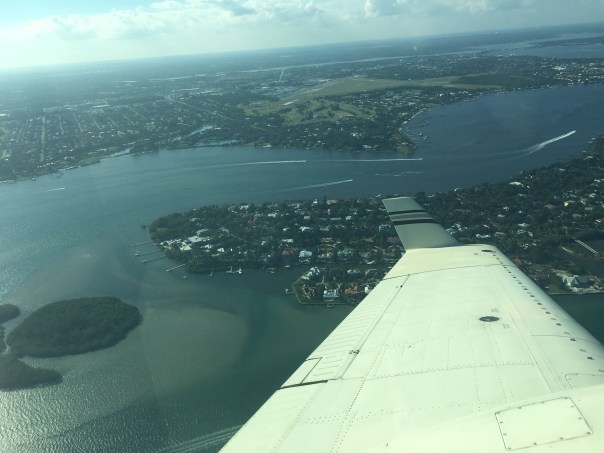
Ed did fly to Zephyr Hills near Tampa, so I asked him to take photos of that trip. Below you can see Moore Haven, S-308 Port Mayaca, Lake Okeechobee, and other aerials of interest. Ed said he saw no cyanobacteria or blue-green algae in Lake Okeechobee.


Link to TFR: https://contentsharing.net/actions/email_web_version.cfm?ep=vqM2fy2Ox3oo9a147CjVbkrn0IwxwCFcFsGjQGPffFSuxLqprS7UmNebRP1WKNSpmESJaQbSeNkWzNzkVbOhe990ltCQy62JQYPbMjyXjRjnBFTvJig3MX3kqpGJ25BT

S-308 at Port Mayaca, going to C-44 and SLR.
Near Moore Haven where canal goes to Calooshatchee, near S-79.
Somewhere on the way to Tampa region.
Over Lake O.
Looks like part or Restored Kissimmee River above Lake O, with canal.
Flood plain
Lake O again
C-44 canal, FPL pond, heading to Stuart. S-308 just being passed at Port Mayaca, Lake O.


Near Tampa, Zephyr Hills area – area one sees what looks like phosphate ponds, mines this is a big issue for water quality for rivers like the Peace and others in Central Florida.

Ed and I will try for an update of the discharges next week!

Documenting the Discharges 12-27-17

I guess one could say the St Lucie River is getting a new year’s present in that yesterday was the last scheduled release from Lake Okeechobee by the Army Corp of Engineers. The entire situation has a similar theme to an abusive relationship where the beaten thanks their oppressor for finally halting…

Therefore, I will not say “thank you.”

http://www.saj.usace.army.mil/Media/News-Releases/Article/1402349/corps-transitions-to-lower-flows-from-lake-okeechobee/

http://www.saj.usace.army.mil/Media/News-Releases/Article/1402349/corps-transitions-to-lower-flows-from-lake-okeechobee/

Due to Temporary Flight Restrictions (TFR) because of the President’s visit to Palm Beach, it was not possible to fly south along Jupiter Island from Witham Field in Stuart, however, when the wind and runway changed my husband, Ed, was able to get a few aerials at the Crossroads of the St Lucie River and Indian River Lagoon around Sewall’s Point. No seagrass, but the water already looks better.

After being decimated in 2013; part of 2015; toxic in 2016; and experiencing a no-holds-barred discharge rate since September 20, 2017, post Irma; we will continue to fight for the EAA Reservoir’s success and a better 2018 for our St Lucie River.

We shall never, never, never, give up!

Please see links to my brother Todd Thurlow’s website for St Lucie Canal Real Time Flows S-80 Cumulative 2017 and Latest Lake O Satellite Imagery

http://www.thurlowpa.com/LakeOLiveData/2017/

http://www.thurlowpa.com/LakeOImagery/LakeO3x7days.html

http://tfr.faa.gov/tfr_map_ims/html/index.html http://tfr.faa.gov/tfr_map_ims/html/ns/scale5/tile_14_15.html http://tfr.faa.gov/tfr_map_ims/html/ns/scale6/tile_28_29.html
All photos of SLR/IRL by Ed Lippisch 12-27-17

ACOE data is for previous weeks. Obviously the St Lucie gets enough redirected and area runoff without Lake O. ACOE 12-21-17