Category Archives: Trawler

In Search of the Calusa 3

About Randell Research Center, Pine Island, Lee County, FL -an extension of the University of Florida, both Ed and my alma-mater.

This post will be my final post in a series entitled “In search of the Calusa.” Today is number 3. You may have already read 1 & 2.

In Search of the Calusa 1

In Search of the Calusa 2

Pine Island’s Randell Reaserch Center was the perfect place to end Ed and my west coast Calusa journey in May of 2022. It made a huge impression. A big shout out to my Uncle Russell who brought the center to our attention.

The research center and heritage trail is located on the northwest side of Pine Island, an island that is seventeen miles long making it the largest on the Gulf Coast of Florida. Although Ed and I were traveling via our trawler, Adrift, we rented a car and drove about forty-nine miles from Captiva Island to the center.

The Randell Reasearch Center consists of fifty-three acres and is the heart of a huge shell mound of more than a hundred acres. At the center, one can interact with a volunteer expert, walk the Calusa Trail, and then look through artifacts and literature in the museum.

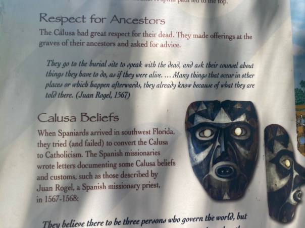
-Adrift docked in Sanibel/Captiva. Its draft precluded a boat outing to Pine Island.What made this experience different than Ft Meyers (1) or Marco Island (2) is that the Calusa village on Pine Island is basically intact. Thus it was here that Ed and I felt we finally met soul of the Calusa. The walking trail is about a mile long and a series of artistic and informational signs tell the story of the Calusa and the lands they inhabited. I have taken pictures of some of the signs. If you wish to read, click on the image and it will be enlarged.

The Calusa were a fascinating and impressive people. Standing tall, long-haired, painted  and beautiful, they skillfully constructed towns, built relationships with distant tribes, engineered extensive hand-dug canals, partook in canal-connected “aquaculture” holding-ponds to feed their people, experienced a deep spiritual life, and respectfully buried their dead. This society created complex and self-sufficient living with influence as far away as Cape Canaveral.

It was interesting to me to learn that the Pine Island site was originally named “Tampa.” Apparently, only Big Mound Key near Charlotte Harbor and Mound Key in Estero Bay are comparable in sophistication. All of these communities lived from the overflowing bounty of their estuaries and with shells, fish, and animal bones built what became multi-generational mounds rising from the landscape. These were the great cities of their time and perfectly located for life. The Spanish documented 60 smaller Calusa towns by 1612.

As one walks through the varied landscape, the tallest mound provides an observation platform. These sacred places are where for at least 1500 years these amazing people worshiped, loved, lived  and politicized, until unfortunately decimated by European Contact.

Ed and I were so honored to experience their home. Thank you to those who preserved rather than developed these lands. May the spirit of the Calusa Warrior be with us as we fight today to bring our estuaries back to full life.

-The Caloosahatchee River pours out into Pine Island Sound, beyond,  and into the Gulf of Mexico.-Ed with volunteer at welcome center and library.-A portion of the Calusa Trail.-Remains of a Calusa shell mound.-Another mound, the shape clear to see.-Walking on along the mile long trail, Ed spots an osprey chick!-Ed reads one of the many interpretive signs along the Calusa Trail.-The site is on the Nation Register of Historic Places. -A marsh rabbit says hello!-DAILY LIFE-BROWNS MOUND COMPLEX-Atop the highest mounds is a boardwalk.-It was hot! Bring your mosquito spray! -CALUSA SOCIETY-ON TOP OF THE WORLD -A nice place to sit and ponder the ways of the Calusa.THE PINELAND CANAL-Remnants of the two and a half mile, six foot deep canal, dug by hand using “buckets”! This canal cut ten miles off a journey to Matlacha Pass. The Calusa constructed many canals across the marshy landscape of South Florida and these canals were part of why they had such wide reaching influence. -Photos of the canal and bridge today… -A sign in three sections: EARLY & MIDDLE PINELAND -A view along the trail.-SPIRITUAL LIFE -PRESERVING THE PAST -SACRED PRECINCTS-PINELAND SINCE THE CALUSA -A walk through time…-Library information and artifacts -The Calusa made weights of shells for their fishing nets. -Quahog clams are often a part of the great mounds. You may see these clams around today.-An impressive people; we remember them with honor…

In Search of the Calusa, 1

-Museum exhibit, Mound House, photo Ed LippischOn May 2nd of 2022, Ed and I began one of my favorite adventures. We went in search of the Calusa, one of Florida’s most famous native tribes. It was in spirit that we found them and they, indeed, were everywhere…The trawler left Stuart going through Lake Okeechobee to Ft Meyers. Lightening and thunder exploded with great force over the Caloosahatchee as Adrift slowly approached Legacy Harbour Marina. As first mate, I refused to walk to the bow to dock the boat for fear I would be struck. “Don’t you realize Florida has more lightning strikes than any other state?” I called through the wind and rain. Ed gave me the evil-eye until I did my job, and the storm was lessening. I stepped out into the elements, crossed myself, pulled up the hood of my rain jacket, and grabbed the lines.

My prayers must have worked as almost immediately the sky began to clear.  After, cleaning up, Ed and I got off the boat, now in good spirits, and walked towards downtown where right away there were signs of former Calusa villages…The following day, my UF friend, Mindi Morrall, met us and we began the second part of the trip to the Mound House, this time by car, located about seven miles away on Ft Meyers Beach. We quickly realized that the Uber driver was from out of state and was not aware that any “Calusa Indians” had ever lived in Florida at all.

The Mound House is considered the “Crown Jewel” of Fort Myers Beach. In April of 2019, it was added to the National Register of Historic Places. It was selected for its historic and its archeological value. The Calusa built the shell mound underlying the mound house over many centuries. A timeline marks their presence in the region from 500 B.C. through the 1700s.

The Calusa lived from the riches of the estuary environment eating tremendous amounts of mollusk and fish, piling remains into very tall mounds -some taller than thirty feet- over centuries. In the 1500s the Calusa were the dominant people in what today we call “South Florida.” The word “Calusa” is thought to mean “fierce people.” They were not farmers, but fisher-hunter gatherers, and as their name states, fiercely independent. The Spanish explorer, Ponce de Leon, was attacked and fatally wounded by this tribe upon his return to La Florida, the conquistador’s first visit being in 1513.

I have always felt it is the spirit of the Calusa Warrior that helped bring a turning point to the estuaries of the St Lucie River and Caloosahatchee. Today, I will briefly share this experience as an introduction.

This image by the Florida Museum of Natural History shows the “radiation” of the Calusa.

Photos of our meeting the Calusa:

-Entrance to the Mound House, Lee County, FL-Mindi was taller than most Calusas and I was just about the height of the Spanish!-Road to the Mound House built in 1906 atop the thousand/s year old Calusa shell mound-Ed and Mindi wait for the tour to begin. Estero Bay in the distance. -Presentation by Mound House Preservation specialist. Welch & conch were used for many different tools and other utensils. The Calusa are famous for their masks and art.-Location of Mound House and other sites of the Caloosahatchee

-An Atala butterfly on a Strangler Fig tree, the sap of tree used by the Calusa to make paint. -Examples of Calusa replica artifacts -many are some of the most famous in the world. -Looking into floor of  the Mound House built in early 1900s. Shells! -Of great interest was where a display in the ground where a swimming pool had been excavated and shell layers of the mound beneath the house could be closely viewed “over time,” layer by layer.-Necklace of the four corners

Escalante Fontaneda’s Memoir 1575

The Mound House was a great introduction to the Calusa. But there is much, much more! Ed and I will take you there next: Marco Island & Pine Island…


Tales of the St Johns – Palatka to Sanford

East Palatka, St Johns River selfieHow does one tell the story of the St Johns River?  Believe it or not, the St Johns River starts close to home in the western marshes of Indian River and northern St Lucie counties. Drained and destroyed for agriculture and now in the process of being restored, the waters of these wetlands wind north, melding with springs, creeks, and rivers finally exiting into the Atlantic Ocean near Jacksonville. This is the mighty St Johns!

When Ed and I began our trawler excursion this year, I really didn’t know what to expect. I read as much as I could, asking my mother to share history, but even so I was really unprepared for the experience. The St Johns is so long (310 miles) and covers so much territory. It runs through twelve counties. I couldn’t even find it on one map. With the Mainship’s  four foot draft, only a portion of the river was navigable (Jacksonville to Sanford) but it is much longer than that. So again, how does one tell the story of the St Johns River? A part at a time.

  1. Stuart to Ortega
  2. Ortega to Palatka

Today’s part, 3, Palatka to Sanford, is longer than the previous two and will be the final tale of our journey. By the way, as 1st Mate, I didn’t miss a line! 🙂On September 11, 2021, Adrift departed the shores of East Palatka headed for Sanford. We were excited. There would be famous things to see along the way like, Rodam Reservoir, Lake George, Welaka State Forest, Astor, Hontoon Island, Blue Springs State Park, and Lake Monroe. We had overnighted at Corki Bells close to the 2,757 acre Horseshoe Point Conservation Area the night before. As with the entire St Johns, in some areas the water appeared impaired and in others not. By the conservation area the water looked healthy. The fish were jumping.  It was this morning that we saw the first eagle.

“Ed is that an osprey or an eagle? It has a white head. Oh my gosh! It’s an eagle!”

Over the course of the next two days, Ed and I saw a total of sixteen eagles, mostly in pairs.  They were staring down at us from tall cypress trees; they were sitting on channel markers eating fish; they were swirling overhead. It was incredible! None of my photographs are good enough to share, but I did take a photo of a mural at Corki Bells that gives the feel of these soaring majestic eagles, especially on Patriot Day. -Map showing St Johns River cut of Cross Florida Barge Canal to the Ocklawaha River

PALATKA

One cannot tell the story of the St Johns without telling the story of the Ocklawaha. Not too far south of Palatka’s conservation area lies a cut from the St Johns River into the Ocklawaha River -scared by the history of Rodman Pool and Kirkpatrick Dam. In the 1960s and 70s Marjorie Carr and Defenders of the Environment garnered public and political will to halt the ecological nightmare of the still infamous Florida Cross State Barge Canal. Today activists calls continue to free the damed Ocklawaha.

I had read so much about the 1800s Riverboat trips to Silver Springs and how they define the history of Florida itself -so much so that there is a giant painting by Christopher Still in the state Capitol entitled “Ocklawaha”and historic documents and photos of the river are housed in the archives of the University of Florida. She is a part of the St Johns we must never forget.

-Dredged cut  into St Johns River- the beginning of the Cross Florida Barge Canal-Historic postcardsRiverboat mural of the Ocklawaha, Florida State CaptiolUFLibrary Theodore Hahn’s Ocklawaha historic documents and photos

LAKE GEORGE

The winding waterway south of Palatka is treed with cypress, sable palms, and other trees I didn’t know with only a few small towns along the way. We saw turtles, alligators, wading birds and more eagles!  After about five hours we made it to Lake George the second largest lake in Florida and interesting enough, although the river is fresh at this point miles from the ocean, the lake is brackish -due to salt water springs- leftovers of an ancient Florida sea. The first clue we were in a different ecology was the abundance of hundreds of seabirds: seagulls, terns, and smaller birds I did not recognize. It was as if we were at the ocean! Shallow, eleven miles long, and six miles wide, Lake George is known for quickly- rising dramatic storms. Sure enough, when we entered the lake it was a beautiful day, by the time we were exiting, cumulonimbus had developed over the eastern edge forming thunder, lightening, wind, and white caps.

-Seabirds line the wooden guide to exit Lake George

ASTOR

Just south of Lake George lies Astor, a small hamlet that friend Captain Paul, who we’d met in Ortega, recommended. Ed and I stayed at Astor Bridge Marina. After a creative docking assignment, Ed and I exited Adrift stumbling upon the gigantic William Bartram Memorial Oak that had almost been obliterated by Highway 40 -basically cutting this little town in half.

As most of us were taught in school, in the mid 1700s William Bartram returned as he’d first come as a boy with his father to famously document the St Johns River Valley’s flora and fauna. The records remain a baseline today. For me it was serendipitous to find the  memorial tree and learn that Astor was a location that William Bartram had actually overnighted. Between all the eagle sightings and the memorial oak, I was feeling inspired to continue my own  journey for the St Lucie River. -William Bartram Memorial Oak, Astor, FL

AN ACCOUT BY WILLIAM BARTRAM

There was an exquisite sunset that evening. Sitting on the upper deck, as Ed sipped a vodka, and I drank white wine, I read Ed an excerpt from William Bartram. An account of a storm on Lake George as shared in Tales on the St Johns River, by Hallock.  Behold the little ocean of Lake George!” How absolutely full of wildlife the St Johns River Valley must have been when the Bartrams visited Florida in the 1700s! His accounts of birds, alligators, deer, bears, wolves, fish, the tannin-clear waters, and native people is especially amazing . I started to realize the St Johns Valley is equally important to the Everglades.

SANFORD

-Ed fixing the water pumpOn the morning of September 12, 2021, we departed for our final St Johns destination, Sanford on Lake Monroe. Docking was easy at Monroe Harbor Marina. Ed wanted to go get a pump as our water pump was failing, so I looked around  while he went to the office. Immediately I recognized  something because I’d been reading that William Bartram book. I saw hundreds, if not thousands, of dime sized banded mystery snail shells.

The grackles had eaten the mollusk and thrown the shells aside. I remembered Bartram’s account about the native people of Lake Monroe eating these by the millions to sustain themselves, creating middens, and that some of these middens remain today. What a name: Banded Mystery Snails…

-Lake Monroe approaching Sanford-Banded Mystery Snails from Lake Monroe, Sandford, FLWhere is Sanford anyway?To the east of Sanford lies Cape Canaveral and to the west Mount Dora. My maternal grandmother, Dorothy Dell Rawls Henderson, was born in Plymouth, Florida, not too far southwest of Sanford, close to Lake Apopka. The metropolis of Orlando lies south and Sanford International Airport, once a naval air station, now operates worldwide. Sanford has had its up and downs but now it is growing!

It was a fun change from being anchored out. There were good restaurants. There are great historic districts. Goldsboro was interesting. It was the second black incorporated township in the Inited States!  And the Sanford Museum?  It told the story of how the city grew up from agriculture south of Lake Monroe and Swedish immigrants role in its success. Once the citrus crop froze in the late 1800s, Sanford became the “Celery Capital of the World.” I never knew that!

-Sanford Museum with celery columns  -Sandford’s famous downtown clock -St Johns Riverboat tours  on Lake Monroe a big hit since 1850! -Downtown is historic and modern -The best pancake breakfast and coffee Ed and I ever had! Colonial Room Diner-Having fun! Many homes had natural yards for butterflies and birds in the historic district. -Veterans Memorial Park, Lake Monroe It’s hard to share everything so I have just noted highlights. What a great experience the 2021 St Johns trawler excursion had been!  It was sad to leave but it was time to get back to the St Lucie. Our farewell was a  beautiful and crystalline day and Ed and I shall cherish  it forever. “Goodbye St Johns! Thank you for sharing! Thank you for educating! Thank you for un-plugging us from social media! Now please safely take us home.”

So on September 15, now tried and true, Ed and I left Sanford to head back up the St Johns and then down the Indian River  towards “Stuart on the St Lucie.”

-Heading out of Lake Monroe-A mirror of beauty, the St Johns… -Returning home…

Watch a video of the beautiful St Johns River 

Tales of the St Johns-Ortega to Palatka

-Suspension bridge, Ravine Gardens State Park, Palatka.Today’s blog post continues the story of Ed my recent trawler excursion along the St Johns River. It was September 9 and we had been Adrift for eight days. Definitely starting to “mellow out,” the world as we knew it seemed a million miles away.

In order to reach Palatka, we’d departed Ortega at dawn. With the wind at our backs and overcast skies, Ed guided us past some of the most beautiful small towns and shorelines of the St Johns River: Mandarin, the home of Harriett Beecher Stowe; Hibernia, where Margaret Fleming taught her slaves to read; and Green Cove Springs, location of the famed “Fountain of Youth, and the “Mothball Fleet.”  So much history and Palatka would offer even more. St Mary’s Episcopal Church built in 1878, shoreline, Green Cove SpringsGetting from Ortega to Palatka took about five hours. As we nibbled on apples and peanut butter and jelly sandwiches, we looked down on a tannin colored, wide, curvy, and heavily treed St Johns. I had to wonder how much different it looked during the St Johns Riverboat era, long over a hundred years ago. The river’s path was taking a significant swing west. Dark clouds had formed and the ominous Seminole Power Generating Station gleamed like a dark sentinel as we slowly approached Palatka.“Is that Georgia-Pacific?” Ed pointed from the upper deck to what looked like billowing smokestacks.

“Yes, the area of the paper mill, and a coal-fired power station I think.” I yelled back from the bow.

“Isn’t Palatka the place you read there was once a giant lumber yard?

I shook my head up and down. “Wilson Cypress Company, established 1891-the second largest cypress mill in the world! I can’t imagine cutting down all those giant trees!”

-AdriftWith a few squalls but no major issues, we pulled into the Boathouse Marina, where Craig, the dock hand, greeted us with firm direction and a friendly demeanor.  As were tying up, I saw the remains of an old riverboat along the shoreline; a gator slipped into the water. “I’m gonna love this place.” I thought. And we did!

Before we went exploring, Ed wanted to take the dingy out and go across to East Palatka. It was windy and clouds were in the distance but I agreed. We made it across and explored but on the way home the engine sputtered and died.

“You have got to be kidding me.” Ed said.

I remained silent. Ed fooled with the battery. Watching the clouds rolling in from the west and checking my phone, I could see it read: “Lightening in Area.”

“There is lighting Ed. You better start rowing!” Ed looked sternly into my eyes. “That’s why I have the paddles!” he replied. I knew this was not the time for discussion. So like a modern Cleopatra I sat looking at my phone while Ed rowed across to Palatka proper. Luckily, Ed did a great job and we made it safely across. Ed immediately got a beer and went over to look at the old riverboat and see if I could find the alligator. Paltka is like a time-capsule of Florida history: railroads, riverboats, and wonderful historic homes. Our favorite excursion was Ravine Gardens State Park, one of nine 1930s New Deal state parks in Florida. The park is an ancient ecological wonderland with two ravines up to 120 feet deep featuring walking paths, gigantic trees, and wildlife. Its springs and waters trickle to the St Johns. It is part of the famed Bartram Trail of 1773-1777. It was a quite a hike and beautiful!  -Court of States, “Hi mom and dad!”I was born at Travis Air Force Base in Fairfield, California, 1964! -The Amphitheater  We also enjoyed the “The Hammock,” part of Palatka’s authentic Historic District. These homes were built during the city’s hay day of railroad crossings and Riverboats. Palatka is the City of Murals. All together there are twenty-three! On the way home from Ravine State Gardens we followed the on-line guide and visited almost all. A great way to share the past. Palatka has a great historic downtown right in the middle of the murals and the homes. They have not taken down their Confederate statues but the conversation is alive and well!Before I close on this chapter of Palatka, there is one more story I must tell. The public docks were within vision of the marina. For two days and nights Ed and I had seen crowds of locals throwing cast nets off the dock and this went on for hours. One night there was thunder and lightening and I awoke around midnight. I got up and looked outside. To my surprise the people were still throwing their cast nets! I woke up Ed.

What do you think they are catching?” I asked. “There must be something really incredible in those waters! What do you think? Catfish? Mullet? What could it be?” 

Ed kept snoring and when we awoke the next morning, the fisher people were still there. When we went to dinner that evening at a great Mexican restaurant, the fisher people were still there! On our walk home, I just couldn’t take it anymore.

“Let’s go visit the dock Ed!”We walked in the dim light onto the dock filled with people. Old folks, children, women, men. They were casting their nets into the water methodically, one throw at a time. Ed and I watched, walking along the far side of the dock, trying not to get in their way. We strained our eyes to see.

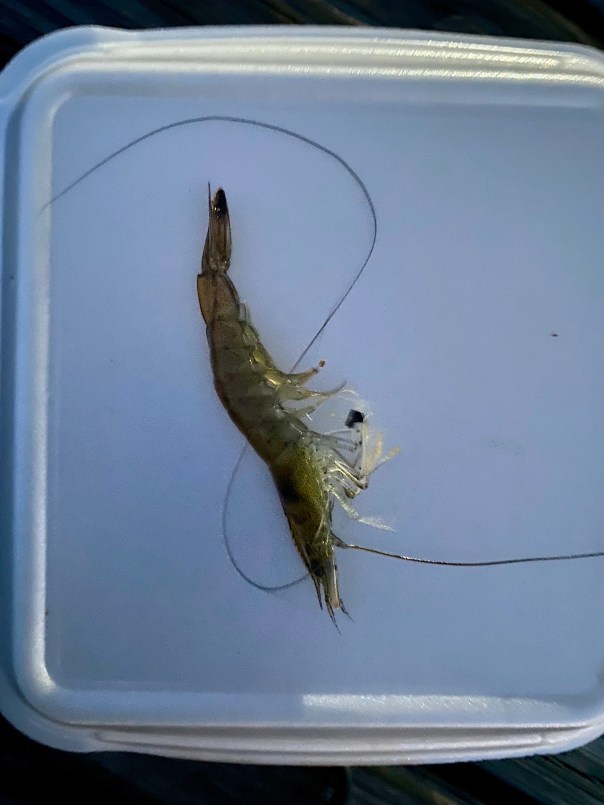
“Shrimp Ed! “They are catching shrimp!” They were not bring up many, maybe ten to twenty at a time. Each person had a five gallon bucket. Little kids would pick up the shrimp that got free and place them back into the bucket. I saw one they’d missed at the edge of the dock that certainly would have shriveled up.  I snuck it into my hand. I looked at the people working.

“May I take a picture?” I asked one of the sitting men.

“Sure,” he said. “Are the shrimp here all the time?” I inquired.

“No mam. They are here just once a year. This is the St Johns River shrimp run.” Ed and I smiled. We walked to the end of the pier. “I can’t believe it!” Ed said, “I never would have guessed!” I threw the shrimp that had been snapping in my hand as far off the dock as  possible. “Stay low.” I whispered, hearing the shrimp are caught as they ride a rising current.

“Incredible,” Ed said grabbing my hand.

So many things we didn’t yet know about the wonderful St Johns River. Next stop Astor.

Watch a video of the locals shrimping!

Shrimp Op-Ed 


Tales of the St Johns-Stuart to Ortega

So my blog has been quiet for a while. I have been away, but today I look forward to sharing with you Ed and my recent journey. On September 2, 2021, Ed and I began our trawler excursion number two.  Last year we christened “Adrift” by completing the Southern Loop. This year our goal was something a bit more unfamiliar, the St Johns River.

Always worried about leaving in the heart of hurricane season, we were pleased that the weather was nice leaving “Stuart on the St Lucie.” Inching around the southern tip of home, the peninsula of Sewall’s Point, we headed north on the Indian River Lagoon. Honing our skills, we anchored-out the first night in Wabasso, and again the second night in Titusville. The third night we docked at the Halifax Harbor Marina in Daytona; and the forth at St Augustine Municipal Marina.

St AugustineIt was St Augustine that awoke us from our South Florida slumber. Historic St Augustine lies at the intersection of what is named the Matanzas and Tolomoto Rivers and sits directly across from the St Augustine Inlet.

Docking at the marina went well, but our departure, not so much. In the pastel clouded morning, as wading birds and rock pigeons flew in every direction, Ed and I pulled away to continue on to Jacksonville. As we were slapping ourselves on the back for “an exit well done” the strong current pushed our craft aside sending us in the direction of two enormous yachts. We were headed for collision. Time froze, Ed and I could not believe our eyes. It happened so fast!

I followed orders grabbing a starboard line, but realized there was really nothing I could safely achieve. The force of the tide was overbearing. Ed’s instincts kicked in, he exercised full power, stern hitting a lone piling that swung wildly as we pulled away.

I heard a gentleman holding a cup of coffee yell to Ed: “Nice save!”

Ed and I looked at each other incredulously, both knowing it was more luck than skill that saved us. Miraculously, there was no damage other than our egos. From here on out, Ed and I paid great attention to the tides and currents of the region.We didn’t talk much that day, and the Tolomato River region revealed its most beautiful residents to sooth our spirts. At one point along the miles of bright green marshes, forty-two roseate spoonbills flew past! It was spectacular! Eventually we entered “the northern part of the ditch, better known as the Intracoastal Waterway and suddenly we we entering the mighty St Johns River.

Jacksonville

The Intracoastal and the St Johns intersect just west of the inlet at the Atlantic Ocean and Mayport, one of the largest naval stations in the United States and historic fishing village. As we veered west, Jacksonville came into view. It was impressive and intimidating. The river was wide and ships the length of skyscrapers filled the shorelines. I kept looking down, thinking I could “see” the tide. This river made the St Lucie look like a brook. In spite of the size of the river and the heavy industry, I kept noticing what appeared to be Monarch butterflies flying low across the water to the other side of the St Johns.“Unbelievable,” I thought. “How do they do that?”Everywhere I looked there were tugboats and container ships. A pod of dolphins joined our wake to say “hello.” Ed and I laughed and for a moment in time, nothing else existed. Just joy! “I can’t believe there are dolphins here!” Ed exclaimed.The dolphins finally pulled away and Ed shifted his eyes to the horizon. Our destination was an historic neighborhood, Ortega, about eight miles away located on the western bank of the St Johns River. Ed slowed down, called on the radio and little Ortega River Bridge slowly opened. The horn blew – a sound from a simpler past. “Thank you!” I waved from the bow and shortly thereafter we slid into a slip at the Ortega Marina.That evening we met Captain Paul, the Ortega Marina Dock Master, who became our guide, friend,  and confidant.  In the evenings he held court on his boat, “Passages,” telling stories of tides, time, and fishing tournaments.

The next morning Ed and I used the marina bicycles and rode throughout the historic district of Ortega. It was stunning! Oak trees and mansions the size of dinosaurs filled the landscape. Ortega got its start in 1769 so history includes many tales. I enjoyed seeing that Florida has many live oak trees that can compete with our northern neighbors. Breathtakingly beautiful trees, branches to the ground! Almost back at the marina, we visited nearby classic Chamblin Bookmine, Highway 17 – wonderful to browse for hours as most in Stuart are now long gone. After a final cool down and walk to Publix where we met displaced Canadian Geese searching for last year’s wetlands, Ed and I  visited again with Captian Paul. I informed him I had researched and found out the beautiful flowers growing in the Ortega Marina were swamp lilies;  we were already fast friends even though I was a “tree hugger.” Ed was looking to Paul as a mentor. Planning for tomorrow, we  talked tides and weather figuring out our departure.

Night fell. Ed and I slept like babies with the sound of the train echoing in the distance. I dreamt about Henry Flagler, riverboats, and Canadian Geese. I was excited about our next stop, September 8: Palatka.


Meeting up with Cinnamon Girl to Document the IRL

Friday night, August 6, 2021, Ed, Luna, Okee and I spent the night on Adrift, after meeting up with “Cinnamon Girl,” the craft of Dutch and Mary Radabaugh. Their name may ring a bell as Dutch and Mary were the face of Central Marine during the infamous toxic algae outbreaks of 2005, 2013, 2016 and 2018. Fortunately, there is no blue-green algae bloom  in the St Lucie/Indian River Lagoon today as they ACOE has not discharged from Lake Okeechobee since April 10, 2021 due to algae sitting at the gate of Port Mayaca.

As mentioned in my previous blog post, the rains have begun, rainy season is upon us, and although stormwater runoff and C-23/24 are tainting the river brown, it is remains beautiful and safe so Ed and I decided to take Mary and Dutch up on their offer to meet and anchor in the IRL near Boy Scout Island. We had done this two years ago. How time flies!

It turned out to be a wonderful weekend and we got to observe. The seagrasses were no where close to as thick as they were in 2019, but they were there, and and recovering.  Macroalgae coated everything. This is disappointing but is happening across the entire Indian River Lagoon due to nutrient conditions. Nonetheless, thankfully, at low tide the wading birds were abundant. We also saw manatees, sea turtles, stingrays, snook, hermit crabs, one large conch and hundreds of shiny minnows. I was impressed!  I think there is no more beautiful place that the Indian River Lagoon at sunrise or sunset. Glorious…

We must remain vigilant.

Lake Okeechobee reached 13.87 feet over the weekend, eyeonlakeo, thus the C-44 canal with its surrounding runoff will start flowing to the St Lucie once the lake achieves 14 feet. So is the operation of the Central and South Florida System. This will certainly affect the clarity of our waters. Thankfully there is still #NoLakeO.

I share these photographs to document and to celebrate a good year thus far in 2021. Let’s continue “Riverlution” to keep it that way!

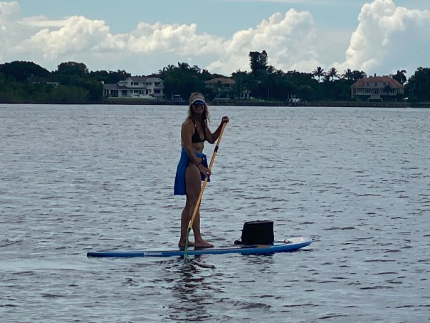
-St Lucie River -headed southeast into Indian River Lagoon Indian River Lagoon. There’s Cinnamon Girl! -Ed with Luna going to say “hi!”-Dutch with Holly-Okee stays inside Adrift. She likes sitting on maps.-IRL at sunset, silvery. -After a peaceful night’s sleep under the stars, Okee awakes to watch a golden sunrise -Sun’s up! Time to paddleboard and check out the conditions. JTL, Mary, Dutch and Ed. -Ed takes a break-Water brownish from rain and canals C-23/24. Greenish in bright light. -Mangrove island in the area known as the Sandbar. Many birds roosting! Mostly ibis. -Bare bottom with a some seagrasses surrounding mangrove island and sandbar area. Mary noted in 2007 this area had very lush seagrasses that have since been destroyed by Lake O discharges. Today there are sprigs. -Water looking greenish in bright light -Ed checking out the conditions and happy as a clam-Macroalgae (below) coats everything ground and seagrasses- not good. Many believe this system is replacing seagrasses through out the IRL. Water quality is key to keeping seagrasses! After our journey out we return to Cinnamon Girl. There are visitors!-Nic Mader and I relax. Nic is a dolphin specialist.  Bottlenose dolphins like all creatures of the IRL are intricately connected to the seagrass habitat and the life that grows there.-Getting some exercise-Rains are beautiful falling in giant sheets from the sky! -Nic paddles towards home while looking for dolphins. 

-Mary Radabaugh is a very good photographer always carrying her camera. She captured these images. The roseate spoonbills and American egret were on the sandbar along many other wading birds. Wonderful to see! Watch the link below (in red) to watch a manatee video Mary took as well.

What a place of beauty. The St Lucie River/Indian River Lagoon  was once considered “the most bio-diverse estuary in North America.” Let’s continue to fight to regain that status! We are on our way back. Such a stunning, special place! Thank you for getting us on the ground out to see.  We love you Cinnamon Girl!

MANATEE SWIMMING IRL  IMG_0638

-Saturday afternoon, on our way back to the Harborage Marina in Stuart. Another memorable sunset…

Tales of the Southern Loop, Cape Sable, Marco Island, Ft Meyers, Moore Haven, Clewiston, Stuart

Tales of the Southern Loop, Stuart to Boyton, Part 1

Tales of the Southern Loop, Boyton to Miami, Part 2

Tales of the Southern Loop, Miami to Tavernier, Part 3

Tales of the Southern Loop, Tavernier to Marathon, Part 4    

Tales of the Southern Loop, Marathon to Key West, Part 5

Tales of the Southern Loop, Key West to Cape Sable, Part 6

Tales of the Southern Loop, Cape Sable, Marco Island, Ft Meyers, Moore Haven, Clewiston, Stuart, Part 7

I’m a bit late in getting this final Southern Loop published. Between the presidential election, Tropical Storm Eta, seemingly endless overcast skies, ACOE discharges from Lake Okeechobee, and resurging Covid-19, I have had a hard time keeping myself on track!

This post is split into seven sections for dates 9-17-20 though 9-22-20. It shares highlights of the second half of the Southern Loop along the waters of Cape Sable, Marco Island, Ft Meyers, Moore Haven, Clewiston, and back to Stuart. A fantastic trip! 

I. MARCO ISLAND, GULF OF MEXICO 

 Having left Cape Sable, approaching from the Gulf of Mexico, Marco Island looked like a city rising from the water. It is actually the first and largest of a chain, that beyond it, comprises Ten Thousand Island National Wildlife Refuge and is adjacent to Everglades National Park.

Well before the era of high rise resort hotels, the island’s beach was surrounded by mangrove forests, and the Calusa Indians thrived here for possibly thousands years. Docking at Marco Island Marina was one of Ed and my most difficult experiences with the winds tearing along the seawalled canal as we struggled for direction. Once there, it was paradise. We wish to go back.

-Approaching Marco Island in the Gulf of Mexico-Marco Island is part of 10,000 Islands

II. FT MEYERS, CAPE CORAL, CALOOSAHATCHEE 

The following day, after running just offshore in the Gulf of Mexico, Adrift arrived at Tarpon Point Marina, and docked with out issue- a familiar spot as this is where Ed and I had taken trawler classes in 2018. We had reached the Caloosahatchee!

That afternoon, Ed and I arranged a visit with Cape Coral resident, friend, and long time River Warrior pilot, Dave Stone. Also joining us was advocate and west coast fishing expert, Captain Chris Wittman, Captains for Clean Water.

Dave and Chris reminisced their history together documenting the blue-green algae discharges from Lake Okeechobee that exacerbated the horrific red tide in the Gulf of Mexico in 2018. Dave and Chris’ Facebook Live  images helped turn the tide with the election of Governor Ron DeSantis and Executive Order 19-12.-

-Dave Stone and Chris Wittman visit Adrift In the following days, Ed and I made our way to Moore Haven. The channelized Caloosahatchee is 67 miles long with quiet, rural towns “Olga” and “Alva,” and two locks (Franklin and Ortona), along the way. During the course of this lasting and beautiful day, I actually heard Ed say: “I think I could retire here.” That was a first! 

Of course like everything else, although there remains great beauty, from an ecological view, the story of the Caloosahatchee is a bit depressing . In the late 1800s, it was the first water body altered as Hamilton Disston plowed through the oxbows to change its course and blew up the rapids to drive the river through the sawgrass marsh at Lake Hipochee and then on to Moore Haven. This unnaturally connected the Caloosahatchee to Lake Okeechobee. Like the St Lucie, the Caloosahatchee has been plumbed to drain diked, and polluted Lake Okeechobee. This drain the swamp “progress” of the time, affects Florida’s waters today at great cost.

-The Caloosahatchee connects the Gulf of Mexico to Lake Okeechobee-The Olga bascule bridge-A lovely home along the channelized Caloosahatchee River-Cows cooling off. Hey! What about Best Management Practices? 🙂-Ed talking to the ACOE at Franklin Locks  -Historic swing bridge at Fort Denaud, near La Belle; prior to dredging and drainage, just north of here were the rapids of the Caloosahatchee-Ed and I hold the ropes, Ortona Locks and Dam, near Ortona Prehistoric Village

III.MOORE HAVEN AT CALOOSAHATCHEE & LAKE OKEECHOBEE 

By the time we reached Moore Haven at the mouth of Lake Okeechobee, the sun was getting ready to set over the Moore Haven Bridge. Hospitality was in the air and Ed and I  were immediately assisted to dock by fellow travelers John and Susan Brady of Kemah, Texas,  who now live on their boat Sunset Drifter. We had a delightful visit and got great tips for “living aboard.”

As I looked out towards the lake, I was ecstatic to see the famous “Lone Cypress” tree was only a stone’s throw away. This tree has been a Lake Okeechobee landmark for hundreds of years. I found it rather ironic that it now has a sprinkler next to it! Considering it was living in a sawgrass marsh in more than a foot of water 140 years ago, this is the ultimate metaphor for Everglades’ change.

-Visiting with the Bradleys at the Public Docks of Moore Haven-Sunset over the Moore Haven Bridge, also known as, Highway 27-Me standing with the Lone Cypress today, 2020  -A sprinkler!? -Historic marker-Post card of the Lone Cypress at mouth of Lake Okeechobee ca. 1880, Florida Memory.

IV.MOORE HAVEN LOCK ENTERING LAKE O RIM CANAL 

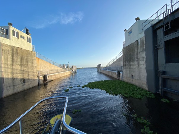
In the morning Ed and I waved goodby to the Lone Cypress and to the Bradleys. Then the craziest thing happened. We were going through the locks at Moore Haven and there was substantial floating vegetation. To my surprise, I saw many marsh rabbits floating on water hyacinth or actually in the water literally up to their ears. We have marsh rabbits at home along the Indian River Lagoon, but I have never seen them in deep water. My emotions got the best of me and I did the unthinkable. I abandoned my post.

“Where is the net?” I shouted as I climbed the stairs leaving the rope hanging against the lock’s tall cement wall. “Ed I’m going to save the drowning rabbits!

Ed was not pleased, yelling, “Jacqui, rule number one, never abandon your post!”

The trawler banged against the lock, the waters rushed in, and I could not reach the bobbing rabbits, so finally I gave up and re-grabbed the line. We passed through the lock into the rim canal of Lake Okeechobee. I silently watched as the rabbits floated by. Ed gave me that look that means he is “not happy.” 

-Marsh rabbit with only ears and face above water -Video of marsh rabbits trapped on floating vegetation below, hit arrow

-After the fiasco at the Moore Haven Locks, Ed and I continued towards Clewiston. We didn’t speak for hours. I actually sat on the bow and cried thinking about how much humankind has altered this planet. But I got ahold of myself. The wind was picking up and many birds were flying overhead -a sign of changes to come.

I checked to see if there was cell service. There was, so I looked up marsh rabbits and to my chagrin, I learned that they are “excellent swimmers.” I looked towards the helm. 

Hey Ed?”

“What?” 

Marsh rabbits can swim!” 

His laugh echoed over the water. “Good thing you didn’t pull them onto the boat!”

“I guess so. But nonetheless, that was NOT NORMAL! ” 

-The rim canal

V. CLEWISTON RIM CANAL/LAKE O 

When Ed and I arrived in Clewiston it was very stormy, we took refuge at Roland Martin Marina. Captain Sam, a war veteran with feathers in his cap, helped us dock. I knew with this weather we’d be here for a few days so I got out my phone and called Clewiston Mayor, Mali Gardner who I’ve known for many years. Over the coming days, she and her husband displayed the warmest hospitality taking Ed and I on a tour of the area. So nice! 

-After docking with the help of Captain Sam, Roland Martin’s Marina, Clewiston-Tour with Mayor of Clewiston, Mali Gardner. We sometimes have different interests, but we have great respect for one another. 

Welcome to Clewiston-Famous Clewiston Inn with wildlife mural-Mayor Gardner shows us the original shoreline of Lake Okeechobee where today many beautiful houses sit-Historic Clewiston homes and drainage system-Ed at the Clewiston Museum that houses the mind blowing fossil findings of Mark Renz from LaBelle-With Mary Anne Martin owner of Roland Martin Marina in Clewison. Ms Martin is a huge advocate for Lake Okeechobee. For years she has voiced against spraying of chemicals on floating vegetation, and works for the burning of lands when lake levels are low to regenerate Lake Okeechobee’s ecosystem. Lake Okeechobee is famous for its bass fishing. -Merchandise for sale and for display at Roland Martin Marina

VI. LAKE O 

-After three days the wind died down and the S-310 lock to Lake Okeechobee was opened. It had been closed for high water for the first time in years. Ed and I headed home to Stuart. Lake Okeechobee was wild and windy, like an ocean itself.  A flock of seagulls followed us 25 miles ! I threw bread from the upper helm and the talented birds, like acrobats, caught pieces in mid air. It was so much fun.

During the trip,  I looked for algae on the lake but saw none and pondered the changes that have altered this liquid heart of the Everglades… 

-S-310 to Lake O-Ed on open Lake O! -Flock of seagulls followed us all the way home across Lake Okeechobee!
This Google Earth image shows our path from Clewiston, across Lake O to the C-44 canal adjacent to Indiantown. The C-44 connects to the St Lucie River bringing us home to Stuart, Florida, in Martin County. 

VII. STUART, C-44 Canal, ST LUCIE RIVER 

S-308 Port Mayaca locks at Lake O to C-44 canal -Trees along the banks of the C-44 CanalS-80 St Lucie Locks and Dam, continuing C-44 to St Lucie River-C-44 is very impaired from Lake O, and basin agricultural and development runoff -After a long journey, a familiar sight, the Roosevelt Bridge opens to welcome us home to the Harborage Marina. Much of the C-44 Canal and upper St Lucie River were under water due to King Tides. This salt infusion is healthy for the St Lucie River as like the Caloosahatchee it is unnaturally connected to Lake Okeechobee.

-Roosevelt Bridges, Stuart, home sweet home back at the Harborage Marina After the almost three week trip, it was wonderful to be home. Ed and I had accomplished our goal and our promise to each other. Working together and experiencing our state’s waters first-hand was a life changing experience.

When we docked with out a hitch like pair of old pros, we  both became strangely quiet. Home is wonderful, but somehow, we knew from here on out, there was nothing that could compare to being Adrift. 


Tales of the Southern Loop, Key West to Cape Sable, Part 6

Tales of the Southern Loop, Stuart to Boyton, Part 1

Tales of the Southern Loop, Boyton to Miami, Part 2

Tales of the Southern Loop, Miami to Tavernier, Part 3

Tales of the Southern Loop, Tavernier to Marathon, Part 4    

Tales of the Southern Loop, Marathon to Key West, Part 5

Tales of the Southern Loop, Key West to Cape Sable, Part 6-Sunrise and setting moon, Key West

September 15, 2020

Before Ed and I left Key West, we were able to rid the trawler of the smell coming from the head’s sanitation system. It took three trips to West Marine, multiple pump-outs, flushing with extra water, enzyme cleaners, and most important, changing the vent filter. The whole situation made us much more careful and aware.

Excited to overcome yet another obstacle, Ed and I pulled away from a rooster crowing sunrise for what would be the most memorable leg of our trip, Key West to Cape Sable. This was unlike any other in that it was eight hours, alone, in wide Florida Bay for about 70 miles at 7 knots!

We saw pretty clouds, blue skies, turquoise-blue waters, bobbing seagulls, cormorants flying as fast as ducks, two pleasure crafts, one crab boat, and one shrimp trawler. But that was it, most of the time it was just Ed, me, and crab pots as far as the eye could see!

-Happy to be safe at seaAfter about an hour, the wind started picking up. I put on a life vest as the sea began to swell. I imagined that if I did fall in there would be no way to be rescued as I would quickly be carried off. My imagination started to roam. Staring out to the empty horizon, I started to think, about pirates…

-A shrimp boat in the Gulf of Mexico/Florida Bay off Key West“Ed what would happen if someone came up to the boat and asked us for all of our valuables.”

“It won’t happen.” Ed replied.

“How do you know?”I asked looking off into the wide distance.

“Because I’ve read.  Pirates don’t frequent these waters, and if they did, they wouldn’t be attracted to a boat like ours.”

“Why do you say that? We’d be perfect. We can’t speed away.”

“Don’t worry so much Jacqui.”

“Why shouldn’t I? 

“There’s nothing to worry about; plus I brought a gun.” Ed slowly replied. 

“A gun!” I exclaimed. “If we’re not going to get approached by pirates, why did you bring a gun?” 

“Just in case.”

“Holy —- Ed! That certainly doesn’t make me feel any better!”

I exhaled, trying to calm down. 

During the course of our conversation the swells got steadily larger, up to 5 feet coming from our stern, and off to the side, our beam. Adrift was dancing in the motion! 

“I didn’t know waves in Florida Bay could be so big. I exclaimed. “Why didn’t you tell me?” 

“Jacqui, come on,  it’s part of the Gulf of Mexico.” Ed peered through binoculars.“What are you looking for? Pirates?”

“No, just looking.” Ed replied. 

“Ed, I’m not feeling so good. These waves. This is crazy.”

“Do you want me to turn around?” He asked, getting irritated. 

“No.” I conceded. “Since we’ve been out here this long, we might as well go the whole way.” 

The trawler hit hard against the ocean, fear got the best of me and I wondered if the boat might eventually break into pieces. 

“Could this thing start coming apart?  I inquired, holding my hand over my mouth. Metal creaked and the hull hit relentlessly. With each strike I daydreamed of balancing on a piece of the crushed hull in my bright yellow life vest of course surrounded by sharks.

“I don’t think so,” replied Ed. 

“I’m going down; I think I’m going to be sick.”

“Holding on for dear life, I stumbled down the stairs from the upper helm to the stern. 

“Oh no,” I thought to myself, “I don’t feel good at all.” I walked into the cabin and then into the head, sat down on the toilet, and  suddenly projectile vomited. It was bright red as I had been drinking tropical punch Gatorade and raspberry yogurt. I stared in disbelief.  I felt terrible. The exaggerated wave motion was even more pronounced in the cabin. I held on for dear life.

 “This is unbelievable; this is no fun!” I got myself together, stumbled through the cabin hitting walls. With one arm always holding on to something,  I grabbed a hand towel, wiped my face, and struggled up the stairs to the upper upper helm.

And there I saw him. Ed was in his element! Loving it! Like a cowboy on a wild mustang. I sat myself down, holding on to a metal post that was creeping like a Halloween set. I looked up: “Ed, “I puked.”

“I figured as much. Feel better? “

“Oh no! It’s happening again!” Adrift sunk deep into a wave then popped back up. I leaned over, and let go. Ruminants of tropical punch Gatorade and yogurt splattered everywhere. This was not good. I was embarrassed. 

Ed softened. “Babe lay down; I’ll clean it up  later. It will be less bouncy up here.” Ed and I had been through such exercises many times as I had thrown up in the plane over the years when flying over Lake Okeechobee to take pictures of harmful algae blooms. 

I put my head down on the cushion but no matter how hard I tried, I could not rest. The seas tossed and slowed our progress. 

I raised my head. “How much longer?”

” A couple hours….” I lay down again praying for it to be over. 

As I lie in agony, I asked the same questing multiple times – about two hours apart: “How much longer?” Ed’s answer was always the same. “Two hours.” I eventually realized that if that were true, we would have already been there! This was the most extended motion sickness episode of the many I had had in my life. I couldn’t wait for it to be over. 

Eventually, the waters started to calm down and our destination, Cape Sable, came into to focus before us. As always, as soon as I was on stable ground, I felt better. My spirts rose, we easily dropped anchor, and planned an excursion. Looking towards the untouched shoreline was incredible! 

“This must be what Ponce de Leon felt like.” I said beaming.

-Map 1859

“Hey, isn’t this where that little tongue-twister of a bird is originally from?” Ed asked.

“Good job Ed! Yes!”  The endangered and controversial Cape Sable Seaside Sparrow! It was the changes and destruction brought to its habitat from the 1935 Labor Day Hurricane, and Hurricane Donna in 1960, that caused it to adapt further up the Florida peninsula-where the Central & South Florida Plan had drained the Everglades. Unfortunately the little bird chose to live just south of Tamiami Trail where we now want to move more water south.” 

“I wonder who will win that one?”  Ed joked. “The Endangered Species Act is sacred for you environmentalists.”  Like young kids, Ed and I explored a dying mangrove forest, endless shells, flora, and wildlife around Ingraham Lake. Just north-interior lie famous Whitewater Bay and Shark River Slough, all within dingy distance. A veritable eco-playground! 

I found the sands most beautiful, crushed shells from millions of years all mixed together. This makes sense as Cape Sable is the southernmost point in the United States, all left to flow, flows here. Thankfully it lies protected within Everglades National Park. And thought humankind and Climate Shifts are rapidly changing its nature, Cape Sable remains absolutely stunning  in its timeless and weathered beauty.

-Cape Sable, Everglades National Park-Taking the dingy to Cape Sable’s  shore. Ed wondered why the water was so murky. “It’s an estuary!”  Water coming from Shark River Slough into Florida Bay.-Adrift at her destination, Cape Sable-On the desolate beach, Cape Sable-Shells, and ancient Inidan midden remains -Dead and dying but strikingly beautiful mangroves like art from many hurricanes -Land snails -Many shells were pierced and attached to the weathered mangroves  -On the other side of this marsh lies Lake IngrahamThe whole experience was otherworldly- as if Ed and I were the only people in the world! As the sun set we made dinner and drank wine – watching the stars appear one by one until the entire Milky Way shone above us like a glistening blanket. Just incredible! We sat in the upper helm and discussed philosophy like we were students of Plato or Galileo. I had no memory of my motion sickness earlier in the day…

A gentle breeze blew, Ed held me under the stars…

“I love you.” I said softly into to his ear…

And then I continued…

“but I might as well tell you right now, you’ll be sleeping with the gun, by the door, in the cabin tonight, just in case the pirates do arrive.” 🙂“Sea you next time! Cape Sable to Marco Island!” 🙂


Tales of the Southern Loop, Marathon to Key West, Part 5

Tales of the Southern Loop, Stuart to Boyton, Part 1

Tales of the Southern Loop, Boyton to Miami, Part 2

Tales of the Southern Loop, Miami to Tavernier, Part 3

Tales of the Southern Loop, Tavernier to Marathon, Part 4    

Tales of the Southern Loop, Marathon to Key West, Part 5

The trip from Marathon to Key West was stunning. The sun was shining, it was the 11th of September, 2020, and the water was turquoise blue. Ed rounded Adrift under the Seven Mile Bridge, once the area of Henry Flagler’s famous Oversees Railroad. 

-Entering the Atlantic- going under the 7 Mile Bridge, Key WestAfter about an hour, I noticed something. I walked up the ladder to the upper helm.

“Babe when you come down can you tell me if it smells down here?” 

“What smells,” Ed asked.

“The cabin.”

“The salon? It smells? Did you flush properly?” he inquired. 

I rolled my eyes, “yes,” I replied, wondering if I did hold the foot pedal down long enough to draw water. 

We had another five hours before we reached Key West; I decided to put “the smell” out of my mind. As we looked out upon liquid glass water, I could see Ed smiling, stress free.

-Ed looks upon the blue Atlantic! The trip was absolutely beautiful. It was quiet and the water was almost like a blue mirror. I knew that the Keys, like all Florida, has water issues, but on a day like today you would never know. Ed and I enjoyed looking back and forth at each other so pleased that we had decided to actually take this trip. Taking three weeks off was something Ed had never done before; we both agreed  to do it NOW as “we’re not getting any younger.”

I climbed around the bow and again walked up the ladder. “On my deathbed I am going to be so glad we took this trip!” I shouted.

Ed smiled,“Always the optimist!” he replied.

I laughed and returned to the kitchen to make lunch.

“I think this is the prettiest kitchen anyone could have,” I said to myself. I looked for dolphins and sea turtles while I made peanut butter and jelly sandwiches. 

-Looking out the window-Approaching Key WestThe time flew by and as we reached Key West I worried about docking as it was getting windy. A&B Marina dockhands, Ty and Kyle, ran out to greet us and thus docking was a non-issue. We did notice right away that we were one of the smallest crafts in the marina; it was filled here mostly with super yachts and large sports fishing vessels.

“I think I’m beginning to suffer from an inferiority complex.” Ed noted looking around.

“I bet they’e not having as much fun as we are!” I quickly replied. 

Ed smiled. 

“Ty please bring us two bags of ice.” I was thinking of happy hour.

“Yes mam.” He said. 

-One of many yachts at A&B MarinaTrue happiness always seems to be short lived, doesn’t it? 

Ed rounded the corner. “What’s that smell?” He inquired.

“I told you, it’s coming out of the bathroom or bedroom. I can’t tell. This trawler should be able to hold more than a few days….” I complained.

“Well, we better pump out.”

“We just pumped out before we left.” I wined.

Ed retrieved a pair of gloves from under the sink and didn’t answer.

When Ty returned with the ice, we told him we wanted to pump out too. Living on the boat really mades one conscious of one’s footprint: water usage, food, plastic bottles, cans, waste, soap… It created an awareness I hoped to bring back to my household. 

Ed and Ty hooked up the giant vacuum. The large yellow tube looked like a fat winding snake. The apparatus slurped and groaned sucking all out of the holding bin. “Gross!” Hard to believe that it wasn’t until the Clean Water Act and the environmental movement of the 1970s that dumping human waste directly into the oceans began to change. Today we are still dealing with the residual problems that accompany our latest way to deal with sewage sludge, Biosolids.

-Ed pumping out sewage
After we pumped out, we decided to take a walk to allow Adrift to air out! Due to Covid-19, the cruise ships had not come into Key West so Ed and felt like we had this historic city all to ourselves. We took a few hours to enjoy the architecture, shared a couple of beers on Duval Street, visited the Ernest Hemingway estate, and laughed at the plethora of chickens, and roosters that greeted us at every corner who thankfully had escaped a tradition of cock-fighting.

-Photos from the Historic District of Key West  Thank God we had pumped out because by the next day, September 12, the storm that had been brewing behind us since Tavernier edged up to Key West. Hurricane Sally was forming just next to us!

“I’m really glad we left Tavernier when we did,” said Ed.

And you guessed it. What was the number one question while we were in lock-down inside the boat?

“What’s that smell?”

Obviously it was more than a pump out issue!

One thing that worried me more than smells, was hurricanes. I was very aware that our trip was taking place at the height of hurricane season, but it was the only time Ed could get away from the office. Thunder rattled the dishes and lightning lit up the sky. The trawler repetitively hit up against the dock. We held our noses finally falling asleep. By morning eleven inches of rain had fallen and much of Key West was flooded. But boy was it good to get out into the fresh air! 

Ed and I decided to not yet work on “the smell,” but we did immediately resume our roles as tourists! 

Hurricane Sally formed just northeast of Key West from a tropical storm, September 11th and 12.

Click her for video of Hurricane Sally forming!

-A very wet rooster the morning after tropical storm’s torrential rains-Ed at the laundry matt and enjoying ourselves as TOURISTS!The Key West Butterfly & Nature Conservancy  -Key West Trolly Tours – sight seeing! -A modern day conversation with Henry Flagler 🙂-View of the Key West Lighthouse from the Hemingway Home  & photos of 2 of 60 cats, most with 6 toes!-Mural on Duval Street-The classic Key West tourist photo: Southern Most Point USA -Resident iguana on ONE HUMAN FAMILY art After sightseeing, Ed and I went to West Marine and bought a filter to hopefully fix the toilet. But to take advantage of good weather, we first we took a spin in the dingy to check out the water. Amazingly enough, it looked terrific. There were queen conch hiding in lush seagrass beds, many water birds diving, and minnows and other fish jumping. The water appeared healthy in spite of the large mooring area, marinas, and heavy boat traffic.

I thought about the all of history I had learned in Key West. As with most places there was an earlier era where people thought there were no limitations of their natural resources, and Key West was one of those places! 

-The large sign below is erected in the heart of the city called the Historic Seaport of Key West. This area was once known as the Key West Bight where green sea turtles, pink shrimp, and sponges were harvested until exhaustion. Basically until no more were left…

This is not a part of Key West history we like to brag about, but perhaps it’s the most important story of all. The story of change, the story of recognizing poor practices and changing one’s ways. 

It might not be a perfect story but like the Atlantic’s blue glass water it reflects a beauty. Human beauty. The beauty to be able to do better,  to change. 

Ed looked at me, “Speaking of change, let’s go change that filter!”  🙂


FIU historic photos Key West, FL, ca. 1907


Key West Aquarium 2020, Educating People About & Protecting Sea Turtles

“See you next for part 6, Key West to Cape Sable” 


Tales of the Southern Loop, Tavernier to Marathon, Part 4

Tales of the Southern Loop, Stuart to Boyton, Part 1

Tales of the Southern Loop, Boyton to Miami, Part 2

Tales of the Southern Loop, Miami to Tavernier, Part 3

Tales of the Southern Loop, Tavernier to Marathon, Part 4

When Ed and I awoke, it was September 7, 2020. Even though rain and low visibility lie ahead, we decided to move towards Marathon. If we remained in Tavernier, the weather would only get worse.

Today, we would be passing some of the most famous areas of the Florida Keys such as Islamorada, where a memorial stands in remembrance those who perished in the all time historic Labor Day Hurricane of September 2, 1935. The tropics were buzzing this 2020 as well as Ed and I inched southwest through the drizzle. 

Within a few hours the weather was mostly behind and a family of dolphins welcomed us to their home of Florida Bay.  Florida Bay, a magnificent body of water that for centuries has cast its spell upon multitudes. A water body that now has its fair share of ecological issues due to Florida’s extensive agriculture and development that has basically stopped the flow of fresh water from the once Everglades, “River of Grass. “

-Historic Florida map, 1884. Interacting with the bottle nosed dolphins was a fun contrast to the stressful broken-generator-scenario that had consumed us in Tavernier and put me in a really good mood. 

  1. Dolphins jumping in our wake, Florida Bay with video! 

2. Before us was beautiful…3. Behind us looked ominous…It was a spectacular trip! Six hours later we arrived at Marlin Bay Marina in Marathon.  Everything was first class. Dockhands Gilde and Frances ran out to meet us so docking was a non-issue; Barbara checked us in with a friendliness not often anymore experienced. Nonetheless, a couple of  things were clear: not that many people were there, and in public places, even outside when in public, we would be wearing a mask. Covid-19 was taken very seriously here in Monroe County especially because Hurricane Irma had wiped out their hospital in 2017. Ed and I thanked Barbara and walked out carefully into the lightning and drizzle, a hint of things to come.4. Ed checking in and standing on wall at Marlin Bay MarinaEd and I were overnighting longer in Marathon because I had a week of meetings for the South Florida Water Management District. With the Zoom format trawler lifestyle was no big deal, but having reliable wi-fi was. Marlin Bay Marina turned out to be the perfect place for everything.  All technology worked and Ed went snorkeling while I zoomed. 

When time and weather allowed, Ed and I spun around in the dingy.  We saw iguanas, darting Northern Rough Winged swallows, minnows, nurse sharks, parrot fish, loads of penguin like cormorants, American egrets, white egrets, various herons, ospreys, magnificent frigate birds, pelicans, an island rookery, and visited a place achieving “ecological sainthood,” the world famous Marathon Sea Turtle Hospital. 

5. Sea Turtle Hospital display, Marathon Ed and I took long masked walks to the Fish Market on 35th Street and beyond, taking note of the thousands of crab and lobster traps lining the streets. Of course fishing and crabbing is a longstanding Keys’ industry. Thankfully, today there is more pressure for sustainable methods. In any case, its a way of life that will not be given up. 

6. Crab and lobster traps lined the streets/lots of Marathon  7. In spite of Covid, the Fish Market and other restaurants and shops at 35th Street were busy 8. Goofing around at the Fish Market

The water in Marathon looked as healthy as anywhere we’d seen with lush seagrass beds and substantial wildlife. The only thing we noticed was that there were not many pelicans flying in formation as we regularly see along the Treasure Coast. Here, if we saw a brown pelican, it was flying alone. 

10. Dingy adventure reveals seagrass beds, rookeries, and wildlife-Lush manatee grass-Magnificent frigate birds-An invasive but cool looking iguana -Minnows eating what looked to be periphyton 

Towards the end of our stay, Ed and I  walked at least a mile along US1 to Publix. We wore our masks the whole way;  it was so hot! I felt miserable. Cars zoomed by along a busy road that could have been anywhere. It was hard to believe all of this was all once mangroves and a native wildlife habitat. I really wanted to take off my mask. But I didn’t. Ed and I knew the importance of keeping them on, plus, in Monroe County the fine for not wearing a mask was $250.00.

11. Ed walking along US 1 in Marathon  As we neared home, we saw that the clouds we’d watched building over the past few days were lending themselves to the beginnings of a beautiful sunset.  Even though we were dripping sweat, we ran as fast as we could. When we got to the marina the sky was silver but ablaze. 

“Ed! Take off your mask!” I said to Ed. “Let’s take a selfie!”

We took off our masks, came together, and smiled. I thought about the smiles on the faces of the dolphins that had greeted us and I was eternally grateful for the beauty around Ed and me. Hurricanes, pandemics, changing landscapes, and impaired waters…the world remained a beautiful place!

Tales of the Southern Loop, Miami to Tavernier, Part 3

Tales of the Southern Loop, Stuart to Boyton, Part 1

Tales of the Southern Loop, Boyton to Miami, Part 2

Tales of the Southern Loop, Miami to Tavernier, Part 3A cloud covered sun and a silver moon coated Biscay Bay with a metallic morning light. Today was September 6th, and last night something had changed.

At 3am Ed had shot out of bed. “It’s too quiet in here.”

“It is. That’s why we’re sleeping.” I rolled over putting the pillow over my head.

Ed returned a few minutes later. “The generator stopped working.”

“Oh,”I mumbled and quickly went back to sleep. When I awoke, I found Ed inside the engine room. 

“Good morning,” I said. He looked up.  “So maybe it’s not such a good morning; the generator doesn’t work.” I tried to smile. “But let’s not let this ruin our trip.” 

“Jacqui the oven/stove wont work, the refrigerator and the air-conditioning won’t work, and forget easily charging the phone or computer. We wont be able to anchor out. I was really looking forward to more of that.”

“Yeah, it’s a bummer. But it will still be fun. So we’ll have to depend on marinas to plug in that shore power thing.”

Ed smirked. “I’m surprised you remember- shore power.- In any case, let’s get ADRIFT underway.” Ed closed up the engine room, headed to the helm, and hit the button to raise the anchor. The clickity-clack sound of metal hitting metal echoed throughout the bow and upper helm.

“At least the anchor still works!” I yelled to my Captain. 

ADRIFT crept south in the direction of Tavernier. Once again, it was turning out to be a beautiful day. -Leaving Miami, Biscayne Bay-Card Sound, Biscayne Bay, heading south to the Florida KeysBiscayne Bay was stunning and huge. As we exited the bridge at Card Sound, the waterway started to narrow. Some boats were going very fast. I decided to continue reading my new favorite book, Landscapes and Hydrology of the Predrainage Everglades,  rather than complain. I knew Ed was thinking about the generator…

“Hey Ed!” I yelled towards the upper helm. “Did you realize we have been passing the marl transverse glades?”

“Hadn’t really been thinking about them,”  he replied. 

I walked up the ladder and sat beside him. “I’m going to read to you, OK?”

“In contrast to the unobstructed, rimless, and continuously flowing Peat Transverse Glades, the Marl Transverse Glades were raised spillways, receiving water from the Everglades only during the wet season…The significance of of the Marl Transverse Glades for understanding predrainage Everglades hydrology lies not in their volumes of outflow but instead in their indication that Everglades waters from Rockland Marl Marsh typically rose high enough each year to flow out….” 

“Do you know what this means Ed?” 

“No idea…” 

“It means that when the Everglades were high, like now, during hurricane season, water oozed through to Biscayne Bay not just from areas around Ft Lauderdale, but also from south of Miami  to about Homestead. Today that stretch includes cities like Kendall, Palmetto Bay, Cutler Bay, Naranja, and Homestead Air Force Base.”

“That is pretty surprising.” Ed replied, seeming to be in better spirits. “So – another reason Biscayne Bay doesn’t get enough fresh water.”

“Look at you!” I lovingly mocked. “I’m surprised you remember!”

-Compare predrainage “marl transverse glades” (southern most arrows) pg. 48 & to post drainage developed areas today, pg. 49 -between Miami and Homestead. In predrainage times, this area McVoy calls the “marl transverse glades,” filled up/flowed over with high Lake O and rain waters oozing through to Biscayne Bay. Today due to development, pumps, and drainage this does not occur. Landscapes and Hydrology of the Predrainage Everglades, McVoy, 2011.I looked up from my book. We were in a narrow waterway of mangroves and approaching Key Largo. “Why are those boats going so fast?!” I complained. I couldn’t hold back anymore.

“Because they are allowed to.” Ed replied. “They are in the channel.” Wakes hit up hard against the shoreline.

“They shouldn’t be allowed to go so fast in here. I don’t see how a manatee could survive. And it’s dangerous.” I agonized. 

“Just smile Jacqui!” 

Ed remained silent looking straight ahead. ADRIFT plodded along in repetative wakes while swirling through boat traffic. And I decided – I better just smile…When we arrived in Tavernier, at Mangrove Marina, Ed was once again focusing on the broken generator. Docking was not so easy this time. The winds had kicked up and I was in charge of the lines. I wondered how I’d jump off to the dock if necessary. The engine ground as Ed moved forwards and backwards trying to back into the slip.  We almost smacked into the dock and I yelled loudly realizing the fender was caught on a neighboring house boat. Thankfully, at the last minute, two young dockhands saved us. We thanked them profusely and Ed handed them a tip. 

“Thank God they were here,” I grumbled.

“One day they wont be.” Ed replied. 

“How would I have jumped on that high dock?” 

Ed did not answer. 

“I’m going to open the lazarette to look at this generator again.” I knew Ed would be obsessed until this was resolved.

“OK. I’m going to take a walk,”  I said. I’ll see you in a little bit.”

It was good to get on land and good for Ed and I to take a break from each other. 

Walking the marina, the first thing I noticed, were these weird and beautiful sea anemone like things on the floor of the shallow docking areas. I got down on my stomach to look closer. -It looks like the DREAM OF THE SLEEPING JELLYFISH. Over the course of our stay, I became totally preoccupied with them, checking on them throughout the day and evening. My blog post is above.I continued my walk. Quaint houses lined the streets. “I love it here.” I thought. “There is absolutely nothing like the Florida Keys.” Once my stroll was over, I knew it was time to make it back to see Ed. He was not a happy camper.

“What’s wrong hunny?” I inquired. 

“I’m not sure I will be able to fix the generator, but the marina office gave me a number of a guy to call. It’s Labor Day weekend. I’m not going to bother him.”

“Come on babe, all the days blend together in a place like the Keys. Let’s call him.” Before we called, we decided to take the inflatable canoe out into a small cove. It was so beautiful! The seagrass was lush and Ed thought he saw an otter but it ended up being a mother manatee and and her young calf poking their noses out to breathe.  It was so joyous to just be there next to them as they came up for air. I though about the fast speed boats we’d seen by the mangroves and prayed the mother and calf would be safe. The sun set , we made dinner,  and retired early. I dreamt of sleeping jellyfish and baby manatees.

In the morning I convinced Ed to take a walk, meet my jellyfish, and see the adorable Keys houses. Lo and behold there was a sign! A sign on a red truck that just happened to be the number the marina had given Ed for someone to fix the generator. Ed left a message and Larry Heimer, Blue Earth Marine Services, returned the call! Soon after we met Larry and Wendy. Wonderful people! Ed learned a lot watching and asking questions. Thanks to Larry the generator got fixed!   Ed after the generator was fixed by Larry Heimer and Wendy 🙂Stormy weather forms… I was so happy! Ed was smiling again!

But there was another issue brewing…

We looked up. “Where is this weather coming from?”  

“There’s a system forming,” Larry replied. “You best leave tomorrow if you can.” 

Night fell; Ed and I listened to the band playing.

Lights reflected off the water and I thought about the jellyfish sleeping on their heads on the milky limestone bottom and the thousands of years of time, tide, and water that had formed this remarkable place.

Ed and I watched the heat lightning and toasted our good fortune to find Larry and  Wendy to fix the generator. 

We decided that unless it was really storming, we would head out first morning light….


Tales of the Southern Loop, Boyton to Miami, Part 2

Tales of the Southern Loop, Stuart to Boyton, Part 1

Tales of the Southern Loop, Boyton to Miami, Part 2

It was September 4th, early morning, we’d  had our first cup of coffee, the engine was yawning, and Ed was at the helm. Today was part two, Boyton to Miami…

“You know what to do right?” Ed jokingly mocked from the helm. He was way too chipper.

I rubbed my eyes. “Yes Captain.”

There wasn’t much wind or tide; I easily removed the spring, bow, and stern lines in that order.

ADRIFT inched off the dock.

“Good job mate.” Ed yelled.

“It’s easy on a day like today!” I replied, knowing the entire Southern Loop adventure would not be so easy.

It was an absolutely beautiful morning. Ed made the radio request on Channel 9 to open Boyton’s Ocean Bridge; we waited, and as the draw raised up the trawler slid into the long man-made cut of the Intercostal Waterway.

The scene was almost surreal, especially the reflections; the water itself did not look great -trapped inside seawalls, houses, and lawns gushing fertilizer.

Ed yelled,” Look at the man cutting the mangroves!”

I turned to see a worker balancing  atop rocks holding  a trimmer over his head.

“Unbelievable!” I sarcastically yelled back. “You’ve got to love South Florida!”

The sun shone hotter and hotter.  We passed Delray Beach, Highland Beach, Boca Raton, Deerfield Beach, Hillsboro Beach, and Lighthouse Point.

“Hey Ed,”Hillsboro Inlet and lighthouse is coming up. The pre-drainage Hillsboro River was about the north mark of the historic east coast seepage of the Everglades!”

I was referring to my new favorite book, Landscapes and Hydrology of the Predrainage Everglades.

As we slowly made our way, I saw finger canals everywhere…

Construction to channelize the Hillsboro River and the Miami River had first begun in 1910. The New River, in 1906. It wasn’t just the most southern coastline that was wet either, apparently the region from the Jupiter Inlet to the Hillsboro Inlet was once so marshy people canoed between the two- and out into the Everglades- regularly. That was until drainage lowered the water table six feet! Crazy isn’t it!

“Everglades eastern flow was directed towards numerous natural outlets piercing the Atlantic Coastal Ridge, specifically Cypress Creek, (region of Hillsboro River JTL) Middle River, New River, Snake River, Arch Creek, Little River, and the Miami River.” These flows eventually made it to the Atlantic Ocean and  Biscayne Bay.” Pg 262, Landscapes & Hydrology of the Predrainage Everglades, 2011. 

It is strange to think that there are no natural flows through these once cypress forests and rivers, but rather a channelized construction of canals, pumps, and structures kept in place by the South Florida Water Management District.

We forget that the Everglades’ waters, beginning in Lake Okeechobee, once seeped through, on and off, around today’s Pompano Beach; Ft Lauderdale to Miami; and even at South Miami to about Leisure City. Today ADRIFT would only make it to Miami.

  1. 1850s undeveloped South Florida: Cypress Strands, the Peat Transverse Glades; and the Marl Transverse Glades were once natural seepage areas from the Everglades. Landscapes and Hydrology of the Predrainage Everglades pgs. 49, 48, & 266. Notice how canals were constructed to these natural outlets. (3)

2. Modern satellite image of of S. Florida, note areas that once flowed through near Pompano (Cypress Strands); Ft Lauderdale area (Peat Transverse Glades); and further south of Miami (Marl Transverse Glades). Compare image 1 &2.

3.  Earliest canals New River to Ft Lauderdale 1906; Hillsboro & Miami 1910. (Boyton for reference.) These canals led to where the water was naturally exiting the east coast.

“Hey First Mate!”

“Captain!”

“Get your head our of that book and look around!”

“Holy cow!” I screamed. It looked like we were going to be swallowed up by the wake of a cargo ship!


4. Near Ft Lauderdale’s Port Everglades

5. Condos along the ICW near Ft Lauderdale

6. North area of Biscayne Bay, Broad Causeway Drawbridge at Bay Harbor

I was speechless. We had entered Ft Lauderdale. The modern Transverse Peat Glades! I watched in total amazement.

“Come up on to the helm,” Ed yelled. “We’re in Biscayne Bay almost to Miami.”

I put my book aside and crawled up the ladder. Even though I despise over development , it was very exciting. Huge ships went by and multi million dollar boats were docked everywhere.

“I think this is near the area of  the recent fish kill.” I said. I showed Ed my phone pointing to the area between Highway 934 and 1-95. “The bay has polluted stormwater runoff problems and also it doesn’t get all the fresh water it historically received because we have cut off its flow connection of the cypress, peat and marl transverse glades.”

Ed looked at me through his sunglasses. “You read too much. Just enjoy!”

7. Further south in Biscayne Bay

8. Port of Miami

9. Ed smiling

10. Miami shoreline near Miami River/Maimi Canal outlet

11. Some wildlife! Yeah! Cormorants!

“Wow. This is amazing I said. My book was put away under the cushions.

“Where are we going to park? Make sure we don’t damage any seagrass.”

Ed rolled his eyes. “Not “park,” “anchor!”

We made our way just southeast of the Magic City and Rickenbacker Causeway. Remarkably, we anchored without a blip on a sandy/muddy bottom.

ADRIFT relaxed and found her direction in the tropical breezes. The whole thing was rather otherworldly. “God I love South Florida,” I thought,” even with all its water and drainage issues, she’s beautiful!”

12. A homemade dinner on the ship!

13. The Magic City arises…as night falls.

Tales of the Southern Loop, Stuart to Boyton, Part 1

Tales of the Southern Loop, Stuart to Boyton, Part 1

It was 9:36 am, September 3, 2020, and we were preparing to leave the Harborage Marina in our hometown of Stuart. The sun blazed down upon me as I  stood on the bow of the Mainship 400 trawler we had christened ADRIFT. The day had arrived. Ed and I were off -for three weeks- to experience our first real boating adventure- the Southern Loop. 

Ed yelled down from the helm. “So you know what to do, right?”

“Of course Captain!” I reviewed: 1. Check wind and tide direction. 2. Release the stern spring line. 3. Release the the bow spring line. 4. Release the bow line. 5. Release the stern line. 6. Make sure boat is clearing the dock. 7. Relay message to Captain. 

“Aye, Aye, Captain!” I yelled back over the sound of the diesel engine. Then just to tease him, I asked: “Is it the front, or back spring line first?”

Ed did not smile…the motor growled, I moved starboard, quickly, carefully, and methodically removing some lines from their cleats and bringing others on board.

The trawler inched forward like a sputtering whale. 

“You’re clear!” I yelled, watching the transom just miss the dock piling.  

We slowly motored out against the tide, and our adventure had begun. I walked to the bow looking over the wide and beautiful St Lucie. The trip through the St Lucie, the Jupiter Narrows, the Loxahatchee, Lake Worth, and the canal-like portion of the Intercostal Waterway to Boyton would be familiar, but from there it was all new territory.

  1. St Lucie/Indian River Lagoon looking towards St Luice Inlet

2. Jupiter Narrows entering Loxahatchee and Jupiter Inlet area

3. Jupiter Lighthouse first lit in 1860, Loxahatchee River

4. Channelized ICW from Loxahatchee River in Jupiter south to Lake Worth

5. Lake Worth

6. Port of Palm Beach just west of Peanut Island and inlet

7. Lake Worth, the Alba Hotel, built in 1926, is today’s Biltmore Condominium 

Ed, and I planned for our Southern Loop adventure for over a year. We took hands-on classes. We altered our schedules. We read books. Most important, we promised not to kill each other. 

This blog series is meant to share our adventure and learn about our South Florida  waterways with the help of an incredible book I read along the way, Landscapes and Hydrology of the Predrainage Everglades, written by five South Florida Water Management District scientists, led by Christopher McCoy. 

By the time we arrived at Boyton Harbor Marina the sun was setting. It was time to have a cocktail at a classic establishment, the Banana Boat or TWO GEORGES, historically Lyman’s Commercial Fishing Dock, now part of the Community Redevelopment Area. 

A moist breeze filled the air. Ed inquired. “What’s our water lesson today?”

I took a deep swig of my daiquiri, “Well something new I learned is that there used to be a chain of ponds just west of here. Extensive. 20 miles of them! 2 miles wide…

Boyton sits not too far below Lake Worth in Palm Beach County. Chris McVoy’s book notes that in this area, not only was Lake Worth opened up to the ocean, and the gigantic arm of the Loxahatchee Slough -once connected with the Everglades- swallowed up by development, but  there was a  twenty mile chain of freshwater ponds – also described as a sawgrass marsh- just west of here, and now it’s the area of Congress Boulevard!”

“Really,” replied Ed. He took a swig of his beer. We drained the swamp right?”

My brain was frozen. “Sometimes I wish we didn’t. Not so much anyway…”

The two images above are from Landscapes and Hydrology of the Predrainage Everglades and compare the area from the Loxahatchee to the Freshwater Ponds east of the Northern Everglades from 1850 to present. The contrasting images reveal many aspects of the environment that we don’t think about today. Going clockwise from noon. The connection of the C-44 to the St Lucie River; the channelization for the ICW along Florida’s east coast; the cutting of pine and cypress forests; the “disappearance” of the Loxahatchee Slough’s giant red arm up from the Everglades and across Palm Beach County to the Loxahatchee River in Jupiter; the replacement of the sawgrass plains with the Everglades Agricultural Area; the man-made inlets and the opening to the ocean of Lake Worth; and last but not least, the very rarely talked about chain of freshwater ponds that that have been drained and are now the area of Congress Boulvard. All of the drainage allows us to live here and helped agriculture in the past; however we have impaired our waters. Images, pages 48 &49, Landscapes and Hydrology of the Predrainage Everglades, SFWMD, Christopher McVoy and others, 2011. 

Red lines equal pre-drainage boarder of the Everglades; yellow lines equal pre-drainage landscape boundaries: primarily sawgrass plains and Ridge and Slough with visible tree islands of which east coast development has heavily encroached. You can see the WCA (water conservation areas) along eastern Atlantic Ridge. You can recognize this because they are the only areas with ridge and slough water pattern remaining. These areas, although protected, are now water impoundments since the ACOE built the Central and South Florida Project after the 1947 flood. Tomorrow, we will learn how the Everglades’ waters once exited to the Atlantic Ocean right through parts of Florida’s east coast when we continue our trip from Boyton to Biscayne Bay/Miami! 


Adrift’s Indian River Lagoon Water Report, June-July 2019

July 5, 2019

Hi. I hope everyone had a wonderful 4th of July! Wasn’t it exceptional? Exceptional because the St Lucie/IRL’s water wasn’t toxic like so many times in recent years. So nice to be able to enjoy our waterways. No dumping of Lake O. I am grateful!

Today I am a back with an Indian River Lagoon Report for the entire Indian River Lagoon.

During my husband, Ed, and my recent 156 miles trip up the IRL, aboard ADRIFT, I contacted Duane DeFreese Ph.D., Executive Director for the Indian River Lagoon National Estuary Program. I called Duane because I knew why the southern lagoon looked better but was impressed by how good the water in the central and northern lagoon looked as well. No brown tide. No superbloom.

Since am unfamiliar with the waters north of the Treasure Coast, except by books, I wanted a scientific update. Well, boy, did I get it! See Dr. Duane’s comments below. Also included is the invaluable, recent St John’s Water Management District’s “June 20th Indian River Lagoon Conditions Update.”

For visual input as well, I am inserting some of Ed and my photos, with comments, of our incredible journey along what is still considered to be one of the world’s most biodiverse estuaries. What a treasure! From north to south, we must do all we can to ensure a toxic-free future.

Keep up the fight!

Jacqui

IRL map: Researchgate

Ed and JTL start of the trip on “Adrift.”

Location: Jupiter Island near the Jupiter Inlet, as almost always the water here is like the Bahamas, looking great! Near the border of Martin and Palm Beach Counties.

Near Jupiter Inlet, border of Martin and Palm Beach Counties. Wow!

JTL:

Duane, hi. Hope you are having a great summer. At this time, are there algae blooms reported in the IRL near Melbourne, the N. IRL north of Titusville, or anywhere in the Mosquito Lagoon? Thank you for letting me know. Jacqui TL

Duane DeFreese, Ph.D. Exec. Dir National IRL Estuary Program, http://www.irlcouncil.com

Conditions being reported to me by the local guides are consistent with the report and my own observations. Overall water quality looks pretty good, but small, patchy areas of poor water quality continue. The fishing guides tell me one day it looks great and a day later the same area will have color and turbidity (probably patchy bloom conditions). My personal observation is that we have been lucky so far and the system is vulnerable. I would not be surprised to see blooms intensify as we move deeper into summer and the rainy season. Lagoon water temperatures are also really warm. the SJRWMD Report documents that we have had patchy blooms occurring of multiple species. Two confirmed species of concern are Pseudo-nitzschia, a marine diatom and Pyrodinium bahamensis, a dinoflagellate. The worst water conditions continue to be in Banana River and in Sykes Creek. There are boater reports of patchy poor water quality in some areas of the northern IRL. The third species of significant recent concern has been Brown tide (Aureoumbra lagunendis). It was in almost in continuous bloom for most of last year in the Banana River. Bloom conditions have subsided. Aureoumbra thrives in warm, high salinity environments. It is not known to be toxic. Blooms of pseudo nitzschia, a marine diatom, can produce a neurotoxin called domoic acid. Blooms of Pyrodinium can produce saxitoxin. I expect that we will see patchy and flashy bloom conditions of multiple species throughout the summer. If we get lucky, I hope none of these blooms get intense enough to elevate toxin levels, low DO levels and fish kills. I’m very concerned about the slow recovery of seagrasses, even in areas of good water quality. Feel free to call me anytime.  Have a great 4th July!

Indian River Lagoon Conditions Update June 20

JTL:

Dear Duane, thank you so very much for the super informative reply! I wrote because my husband and I are taking our maiden voyage in a trawler. We have gone from Stuart to Jupiter to Vero to Cocoa, north as far as possible in IRL, past Titusville, and today-through the Haul-over Canal into the Mosquito Lagoon. Not being familiar with these waters, all I have seen visually appears quite good compared to the St Lucie and even parts of the S. IRL. Some varying coloration is apparent, but overall seems good and in the north, many baitfish balls are shimmering under the surface and dolphin families are gorging themselves and teaching their young! We have seen many dolphins everywhere. Throughout Indin River County, Ospreys nesting in channel markers. One after the other!  In the Mosquito Lagoon there were many more wading birds than S IRL. Even saw a few roseate spoonbills. I was not expecting it to be so full of life up here… a nice surprise. Not off the chart healthy, but marine and bird life very visible! I really appreciate the info you sent. I plan to blog on trip once home, so I can quote your knowledge. Happy 4th of July to you as well and I hope to see you soon.


The confluence of the St Lucie River and Indian River Lagoon off S. Sewall’s Point, Bird Island. Near Stuart, Martin County.

Sewall’s Point and Stuart, Martin County.

Beautiful blue water near the Ft Pierce Inlet, St Lucie County. Ft Pierce rocks!

Waters of Vero Beach, Indian River County.

Old map showing the designated area of famous INDIAN RIVER LAGOON CITRUS. Citrus Museum, Vero Beach, FL

1920 Blue Heron Map shows clearly the area of the Everglades, Heritage Center and Citrus Museum, Vero.

Street sign in Vero Beach, as everywhere ALL canals lead to Lagoon! No trash, fertilizer, pesticides, etc!

Sebastian Inlet, Indian River County, brings blue waters to the area. So pretty!

Approaching Cocoa Village, north of Melbourne in Brevard County.

Waters nearing Cocoa Village in Brevard County

Ed and I visited the Kennedy Space Center along the Indian River Lagoon and Banana River. Surrounded by the Merritt Island National Wildlife Refuge. Space & Nature. https://www.fws.gov/refuge/Merritt_Island/visit/plan_your_visit.html Such an inspiration!

3-D movie at Kennedy Space Center really took us to the moon, Mars, and beyond!

The ominous Vehicle Assemble Building, NASA, so large it is visible no matter where one is are along the central and northern IRL. It’s like it is following you!

Eau Gallie, Melbourne. The Eau Gallie River, or Turkey Creek,  is a small version of the St Lucie and also impaired due to runoff from agriculture and development.

Like a sentinel, the Vehicle Assembly Building as seen over the Indian River Lagoon north of Titusville.

Baitfish!

Waters approaching Titusville, Brevard County.

Train track bridge north of Titusville, Brevard County.

Train track bridge north of Titusville, Brevard County. Shortly beyond channel turns right through the Haulover Canal and into the Mosquito Lagoon.

Ed navigates through the Haulover Canal, connecting the northern IRL with the Mosquito Lagoon.

Water in the Haulover Canal was greenish.

Entering the stunningly beautiful, peaceful, undeveloped Mosquito Lagoon. This area is flanked by the Scottsmoor Flatwoods Sanctuary and Canaveral National Seashore. Wildlife abounds.

360 of the unforgettable Mosquito Lagoon:

Flora and fauna along shoreline, Mosquito Lagoon

Anhinga twins, Mosquito Lagoon

Incredible footage of 4 dolphins in our wake near Ft Pierce welcoming us home!

ADRIFT is a 2007 Mainship 400 trawler, top speed about 8 knots 🙂

~Cayo Costa in Photographs

I have had such a reaction to my blog post on Cayo Costa that I have decided to share more of my photos. Ed and my recent visit along this very special place will never be forgotten. A place I did not even know about, until I went;  I still am having trouble with its tongue- twister name! Thank you to those who helped protect this barrier island from development. It is a tremendous gift today, and for future generations. Enjoy.

https://www.floridastateparks.org/parks-and-trails/cayo-costa-state-park

Thankfully, it was not.


Screenshot of location iPhone

Links:

Audubon: https://www.audubon.org/important-bird-areas/cayo-costa-pine-island

Historic Cemetery: https://www.findagrave.com/cemetery/2277307/cayo-costa-pioneer-cemetery

General Info, Wiki: https://en.wikipedia.org/wiki/Cayo_Costa_State_Park

Useppa ~Very Different Waters Indeed

I was still stewing over thinking that Charlotte Harbor was the Gulf of Mexico when the trawler docked at Useppa.

The sunlight reflected off impressive white structures lining the island. An American flag flew prominently atop what Captain Glenn said was once a Calusa Indian midden ~the tribe whose arrow maimed, later killing, Ponce de Leon.

There was certainly an air about the place, that for eternity, it had been a center of power and influence.

As I walked with Captain Glen and Ed beyond the docks, the front office gave hints to the days of Baron Colliers’ famed Izaak Walton Club, clearing, dredging, filling and building, to make available Florida’s most famous of Tarpon filled waters.

ca. 1906 https://www.useppa.com/legacy/izaak-walton/, courtesy  web site, Useppa

Looking around, I saw messages and awards written on Tarpon scales, enshrined in glass casings of an era long gone by. It made my heart ache for a time of healthier Florida waters, times when nutrient pollution, toxic-algae, and over-drainage were not killing our state. I decided be thankful for this looking-glass of history and enjoy a walk.

The island remained absolutely beautiful…and such strange and wonderful treasures! As we walked up the mound, I gasped at the wonder all around me.

I saw night-blooming cactus vines like hundreds of green ropes covering the huge ancient oaks trees; Spanish-moss swaying in a light breeze: an empty beach catching the colors of coming sunset; orchids and bromeliads blooming everywhere high and low; a gigantic banyan tree, a gift from Thomas Edison, standing like an aging hurricane-weathered sentinel – old limbs broken and reformed, arching over houses and sidewalks alike!

There were animals too. We met a friendly, stowaway orange cat that had arrived on a supply vessel and now was the mayor of the town. And also an old gopher turtle happily clipping grass with an awesome multi-entrance and exit gopher tunnel.

At the end of the sidewalk tour, the famed Collier Inn stood atop the ancient Indian mound looking out over the waters. It was beautiful yes, but I knew, in spite of the awe around me, with no tarpon jumping, those were very different waters, indeed.


Links:

Useppa resident speaks up: https://www.news-press.com/story/news/2018/08/22/toxic-algae-florida-scientists-question-health-departments-stand/973593002/

Calusa Indians, Fl: http://www.pbchistoryonline.org/middle-school-lessons/001-Calusa/001-Calusa1.htm

Historic Society, Useppa: http://www.useppahs.org/pages/useppa_history.html

Izaak Walton Club, Collier: https://www.useppa.com/legacy/izaak-walton/

Note Useppa Award from Captains For Clean Waters: https://captainsforcleanwater.org

West Florida Sailing and Cruising School: http://www.flsailandcruiseschool.com

https://captainsforcleanwater.org

Getting to Know the Very Big Caloosahatchee and Beyond, SLR/IRL

Cape Coral along the Caloosahatchee River across river from Ft Meyers, Lee County, FL JTL

Recently, Ed and I took a trawler ride along the Caloosahatchee River and beyond with Captain Glenn. I learned so much, and got to see up close the condition of their waters.

The first thing that hit me was just the sheer size. The St Lucie River/Southern Indian River Lagoon, in comparison, seemed like the tip of a pen.

Flying in, one sees sprawling Cape Coral, once scrub and swamp, now carved with canals and spotted with endless houses. Like Port St Lucie on steroids. On the ground, four lane highways run through neighborhoods walled with strip malls. But old Florida houses are here and there, and one can tell this place was once a quaint hometown tropical paradise.

Remnants of Old Florida remain, a double-headed cabbage palm greeted us along Silver King Boulevard and the adventure began: P102, Inland Powerboat Cruising at the Florida Sailing and Cruising School.

As the old Grand Banks rounded the ben, the conversation went to Punta Rassa. It took me awhile to remember the areas historic importance in Florida and Cuban trade as the destination of the Florida cattle drive, as prominently featured in Patrick Smith’s famous novel,  A Land Remembered. 


Screenshot location from my phone


So a trawler goes slow, and the dolphins liked playing in the wake of our bow. I was happy to see them after reading about the many killed due to red-tide and blue-green algae outbreaks this past summer. There were dolphins everywhere! Calves and mothers too.

When we finally turned north into Pine Island Sound, again, the scale of the waterways and surrounding lands was amazing. I cannot imagine what a fishing haven this place was in its day! There could not be a more perfect combination of rivers, sounds, bays, and barrier islands.

Eventually, we made it north beyond Useppa, the once fishing camp of famed Florida developer Barron Collier, and up to Cayo Costa, a seven mile long state park. We anchored in Pelican Bay and then Ed and I made to the park’s dock. Looking down into shallow salty waters I saw what Captain Glenn said was turtle grass, along with drift algae. There were minnows and a few bigger fish. A good sign, but not particularly healthy looking.

Ironically, our pilot friend, Dave Stone, had sent us an aerial of Cayo Costa showing visible red-tide a couple of days before, so I was curious what Ed and I would see on the Gulf of Mexico side of the island. Thankfully, it was beautiful. I collected shells, admired the bird life, saw a manatee, and got lost in the simple beauty of the place praising those who must have worked miracles to keep it from turning into condominiums and green lawns belching nutrient pollution into the waters.

11-8-18 8000 feet off Captiva and Cayo Costa. Pilot Dave Stone.


As much fun as that day was, I was getting sick at the beginning of the trip and now I was coughing out of control. I went to bed early and when I awoke the boat was moving; the sound of the engines humming along.

I peaked my head out seeing a huge expanse of water thinking we were going through the pass between Cayo Costa and Boca Grande.

“Is that the Gulf of Mexico?” I yelled from the cabin excitedly.

“No, it’s Charlotte Harbor,” Ed yelled back. “We’re turning around to visit Useppa.”

The wind blew and the sun shone…

“God, I’m an idiot,” I thought to myself. I just thought Charlotte Harbor was the Gulf of Mexico.”

Things are bigger on the west coast and there’s a lot to learn around here!


Links:

Altering the Caloosahatchee: http://nsgl.gso.uri.edu/flsgp/flsgpm02003/flsgpm02003_part4.pdf

Lee County Watersheds: http://www.leegov.com/naturalresources/WaterQuality/watersheds/caloosahatchee