These aerials were taken by my husband, Ed Lippisch, between September 16 and September 23, 2022. I had asked him to get some photographs other than our normally featured Sailfish Flats area between Sewall’s Point and Hutchinson Island.
I chose a few of my favorites for a series entitled “A Different View.” This past weekend, I started closely reviewing all of Ed’s photos and decided to share more. Ed captured from Stuart, to Hobe Sound, to Palm City and Port St Lucie. I think what is most clear is how close we are to the river and thus how it is clearly our responsibility to protect her. Thank you Ed for being our eye in the sky and for giving us these different views.
-Roosevelt Bridge, FEC Railroad, and US1 crossing St Lucie River, Stuart. Palm City west. -Roosevelt Bridge, St Lucie River Stuart looking east over Witham Field and Sewall’s Point to Atlantic Ocean.-Shoreline of North River Shores, just north of Roosevelt Bridge, Stuart, FL.-Closeup Roosevelt Bridge, Florida East Coast Railway, and US1. St Lucie River, Stuart.-Indian River Lagoon and Savannas Preserve State Park, Jensen/Rio and north St Lucie Co. -North Fork of St Lucie River, Port St Lucie, looking east to Indian River Lagoon and Atlantic Ocean. -Savannas Preserve State Park looking west to Savannah Club Golf Course, St Lucie Co. (I think) -Savannas Preserve State Park looking south to St Lucie River, note Sewall’s Point & St Lucie Inlet. Very old- Indian River Drive and the Florida East Coast Railroad are clearly seen along the ridge of the Indian River Lagoon. -Nettles Island in the Indian River Lagoon, St Lucie County, Hutchinson Island. -Jensen Beach Bridge at Hutchison Island where large section of mangroves died due to drowning and poor planning. It appears some are coming back to life.-North Sewall’s Point looking from over the IRL to forks/and the St Lucie River. Line of C-23 can be seen in distance. -Evans Crary Sr. & Ernie Lyons bridges from Stuart to Sewall’s Point leading to Hutchinson Island, St Luice River/Indian River Lagoon. Rio/Jensen north, and City of Stuart sprawling north and south. -Bird Island, a Critical Wildlife Area, off South Sewall’s Point, note seagrass/macroalge beds.-Ernie Lyon’s Bridge ending at Hutchinson Island at Indian River Plantation, Marriott, right. Elliott Museum and Florida Oceanographic on left. Indian River Lagoon and Atlantic Ocean in view.-C-23 Canal, the county line between Martin and St Lucie counties. Note the difference in development patterns. “Newfield” will be constructed around Citrus Blvd. the wavy white line in the now green area of Martin County it’s pattern will not resemble PSL. -Next two photos: Another view of C-23 Canal and surrounding area near North Fork and former arm of the St Lucie River.-Next five photos: Winding North Fork of St Lucie River surrounded by development of Port St Lucie under puffy clouds. -Hobe Sound area near Bridge Road looking southwest. This is where the controversial development of Atlantic Fields was just approved by the Martin County Commission. The Polo Club where it will be built is located close to the oval shape (maybe a horse track) seen in the green field. Atlantic Ridge State Park and Loxa-Lucie are also in this region of Martin County. The Town of Jupiter Island is along the Indian River Lagoon and the Atlantic Ocean at the east end of Bridge Road. There are many other developers eyeing this area or Martin County. -Next three photos: Same area of Hobe Sound -note Indian River Lagoon and Atlantic Ocean east and right, and St Lucie River ahead. The South Fork of the St Lucie was once easy to see in this area. Since drainage of South Florida it is almost unrecognizable, but it is here. -Florida Turnpike and I95 near Bridge Road, Hobe Sound, FL. -Natural Lands near Atlantic Ridge State Park and Seabranch Preserve State Park looking east towards Jupiter Narrows, Indian River Lagoon, and Atlantic Ocean. Thank you to those who worked to save some of these lands around the St Lucie River/Indian River Lagoon. We must conserve even more!
-Ed in his favorite Bullsugar shirt and FOS Chair, Mr Bob Mathias smile for a selfie pre-flightWell the weather has been fabulous! Ed and I wish everyone a very Merry Christmas and Happy Holidays!
To document the end of the 2021, Ed and the Chair of Florida Oceanographic Society’s Board of Directors, Mr Bob Mathias, flew over the region on December 23 at 2:00 pm with Ed giving his best history lesson of the Central and South Florida Project that so negatively affects the health of our St Lucie River/Indian River Lagoon.
Most recently, since 2019, there have been some, but no major discharges from Lake Okeechobee as in 2013, 2016 and 2018. However, intermitent heavy rains have overwhelmed the estuary through C-23, C-24, C-44 and area stormwater runoff. We must remember that originally, prior to drainage the St Lucie received filtered water and less than half the amount being dumped into it today.
Above: drainage changes to the SLR. Green is the original watershed. Yellow and pink have been added since ca.1920. (St Lucie River Initiative’s Report to Congress 1994.)
As you know, because of recent record state and federal funding and Governor DeSantis, massive efforts are finally underway by the ACOE and SFMWD to improve the situation for the entire Everglades region, and the C-44 Reservoir came on-line in Martin County as the first major completed CERP Project this year. More good news is that the C-23, C-24 Reservoirs are in design by the ACOE, and the C-25 land purchase became complete by the South Florida Water Management District just two weeks ago!
With lots of work to do, we are heading in the right direction and must continue to do more, more, more to get water quality right and seagrass lushly growing again for Florida’s iconic manatees that are not having a happy holiday season.
Good new year’s resolutions we can achieve right in our own backyards to help are to give up fertilizer and plant native and Florida Friendly, and to keep pushing politicians on all levels to “work for water.”
The recent “Riverlution,” 2013, due to the LOST SUMMER, started right here in Matin County and it has spread to the entire state! WE MUST KEEP THE WAVE GOING!
~Merry Christmas and Happy Holidays as we all continue to work for clean waters!
~Jacqui & Ed
St Lucie Inlet: St Lucie Inlet State Park, Sailfish Point, Hutchinson Island, Sewall’s Point, Stuart, Rio, Jensen and Port St Lucie in the distance. This area is the St Lucie/Indian River Lagoon confluence. The inlet was dug by pioneers in 1892.
SFWMD basin map for SLR showing S-308 and S-80 along with other structures.
-Various views-Stuart and Rocky Point looking towards St Lucie Inlet and Atlantic Ocean -Looking up the Indian River Lagoon that is 156 miles long -the St Lucie is east of the peninsula of Sewall’s Point.
-Lake Okeechobee’s Port Mayaca S-308 and C-44 Canal
Stuart, St Lucie River, Sewall’s Point, Indian River Lagoon, and Hutchinson Island, Atlantic Ocean, Martin County, Florida 1971
St Luice Blvd (L) East Ocean Blvd.(R) 1971, courtesy, archives historian Sandra Henderson Thurlow.
“I have enjoyed looking at this aerial taken in 1971. Too bad our little house on Edgewood is out of the photo. It shows the location of the future Monterey Road through the Krueger property. The Krueger building to house Merrill Lynch has not been built yet but you can see the little surgery center was already built. I think I can see Mimi and Grampy Tom’s house in Snug Harbor–at least the driveway. So many things yet to be built.” Mom
My mom, local historian, Sandra Thurlow, recently shared this aerial with my brother, sister and me as we grew up here in Martin County. It’s a really great photograph capturing a growing community. Look how Hutchinson Island, Sewall’s Point, and even parts of East Ocean were undeveloped. No Indian River Plantation, later renamed “Marriott Hutchinson Island.” No Cedar Point Plaza. No Benihana! White sands shine through the remaining forest denoting scrub habit, home to threatened and endangered scrub jays and gopher turtles. This sand pine scrub habitat that made up most of Florida’s east coast is now considered one of the most endangered habitats in the world. The East Ocean Mall on the right sits next to a flower farm. At this time flower farms were giving way to roads and development. Already, the freshwater ponds have been directed and drained, and obviously thousands of sand pines have been mowed down for condos, houses, farms, roads, and shopping centers. By 1971 this area was fully on its way to build-out as we see below in 2020. Nonetheless, from air and ground this area of Martin County stands out as one of the most beautiful.
But it would be fun to bring back some of the scrub habitat ~easy to do by just altering our yards. How things could change…
Since I was a kid growing up in Martin County, I have been excited to hear stories about hail. Hail is really the closest thing to snow down in these parts. I remember once, in the 1970s, when our family lived at 109 Edgewood Drive, in Stuart, it hailed and we kids ran outside and collected it in our sweaty palms dumping it into Tupperware that ended up in the freezer. Those hail pieces sat in there for years, and every now and then we would climb on a squeaky high chair, when mom wasn’t looking, and take the cold frozen memory out, just to revel. Amazing! As a kid, I never knew what else to do with the hail, and in time, I’m sure my mother removed it to make room for ice cream.
Yes hail.
As I got older and my mother’s local history books were being published. I was struck by one photograph of the 1934 Roosevelt Bridge in Stuart overflowing with hail -looking like, yes,- like a snowstorm had come!
In this photo by Frances Carlberg King in “Stuart on the St. Lucie: A Pictorial History” by Sandra Henderson Thurlow, hail covers the old Roosevelt Bridge on Feb. 10, 1934. A hailstorm covered Stuart with ice, creating street scenes that some say looked like “someplace up North.”
Hail, though it can be destructive is a novelty, one to be appreciated, even celebrated.
Just last Sunday, April 19, 2020, month two coronavirus containment, it stormed wildly and hailed in south Sewall’s Point. The noise on our metal roof was deafening! Right after, I ran out and collected the hail pieces just like I had when I was a kid. The air was so chilly! My bare feet were cold against the deck and wet earth. Somehow, the whole thing was exhilarating!
When I brought my hail inside, I quickly put the bowl in the freezer and looked for my husband, Ed.
“Ed! Come look! I collected some hail!”
There was silence for a bit, and then I heard him slowly ask, “what are you going to do with it Jacqui ?” Ed grew up in Chicago so ice is not so unusual.
“I have a surprise!”
That evening after dinner, I said, “I recommend we do something special with this hail. I think we should make real cocktails with it, you know, like the kinds from the 1950s? And then, we are going to toast Mother Nature.”
Ed laughed and we did just that, “for the hail of it!”
Last night, 4-18-20, after a hiatus, Mother Nature decided to “let it rain” and this morning friends Dr Scott Kuhns and daughter-in-law, Dr Mary Kuhns went for a flight over the St Lucie River and Lake Okeechobee to check things out.Ed and I thank them for sharing their photographs!Update-No visible algae at S-308 or along the C-44 canal. The waters of the St Lucie River are grayish from rain water runoff. Things look good, considering. ~The rainfall numbers across the SFWMD can be viewed at the SFWMD’s 24 Hour Realtime Rain Gauge Site. S-308 at Port Mayaca, Lake OAlong C-44 canal, do you see algae?South Sewall’s Point, rain runoff visibleHole in the wall & St Lucie InletRain plume exciting St Lucie Inlet
Canals in Martin & St Lucie Co.that are connected to the St Luice River: C-23, C-24, C-25 built in the 50s and 60s. C-44 is also connected to Lake Okeechobee constructed in the 1920s. The natural basins of the SLR have been tremendously enlarged damaging the river.
Ed Lippisch -eye in the sky- St Luice River/Indian River Lagoon 2-26-20 3pmOfcouse, it’s important to document from the air during this great new era of no Lake Okeechobee discharges. In any case, the St Luice River is plagued by too many human made canals. The SFWMD basin map below reveals all.Ed’s photos are beautiful but the color of the water is not striking as area runoff from rain is visible in grayish tones. Still, a good time to go outside and enjoy! Thank you to my husband, Ed for flying over the St Lucie River/Indian River Lagoon as I can write all day long, but “a picture speaks a thousand words!” And we will continue to work a thousand times harder to save her.St Lucie InletSailfish Flats IRL east of Sewall’s PointApproaching St Lucie Inlet, Sailfish PointSailfish Flats over Hutchinson Isl.Atlantic & SL Inlet, Sailfish PointLooking south to Crossroads SLR/IRL
Hi. I hope everyone had a wonderful 4th of July! Wasn’t it exceptional? Exceptional because the St Lucie/IRL’s water wasn’t toxic like so many times in recent years. So nice to be able to enjoy our waterways. No dumping of Lake O. I am grateful!
Today I am a back with an Indian River Lagoon Report for the entire Indian River Lagoon.
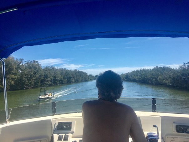
During my husband, Ed, and my recent 156 miles trip up the IRL, aboard ADRIFT, I contacted Duane DeFreese Ph.D., Executive Director for the Indian River Lagoon National Estuary Program. I called Duane because I knew why the southern lagoon looked better but was impressed by how good the water in the central and northern lagoon looked as well. No brown tide. No superbloom.
Since am unfamiliar with the waters north of the Treasure Coast, except by books, I wanted a scientific update. Well, boy, did I get it! See Dr. Duane’s comments below. Also included is the invaluable, recent St John’s Water Management District’s “June 20th Indian River Lagoon Conditions Update.”
For visual input as well, I am inserting some of Ed and my photos, with comments, of our incredible journey along what is still considered to be one of the world’s most biodiverse estuaries. What a treasure! From north to south, we must do all we can to ensure a toxic-free future.
Keep up the fight!
Jacqui
IRL map: Researchgate
Ed and JTL start of the trip on “Adrift.”
Location: Jupiter Island near the Jupiter Inlet, as almost always the water here is like the Bahamas, looking great! Near the border of Martin and Palm Beach Counties.
Near Jupiter Inlet, border of Martin and Palm Beach Counties. Wow!
JTL:
Duane, hi. Hope you are having a great summer. At this time, are there algae blooms reported in the IRL near Melbourne, the N. IRL north of Titusville, or anywhere in the Mosquito Lagoon? Thank you for letting me know. Jacqui TL
Conditions being reported to me by the local guides are consistent with the report and my own observations. Overall water quality looks pretty good, but small, patchy areas of poor water quality continue. The fishing guides tell me one day it looks great and a day later the same area will have color and turbidity (probably patchy bloom conditions). My personal observation is that we have been lucky so far and the system is vulnerable. I would not be surprised to see blooms intensify as we move deeper into summer and the rainy season. Lagoon water temperatures are also really warm. the SJRWMD Report documents that we have had patchy blooms occurring of multiple species. Two confirmed species of concern are Pseudo-nitzschia, a marine diatom and Pyrodinium bahamensis, a dinoflagellate. The worst water conditions continue to be in Banana River and in Sykes Creek. There are boater reports of patchy poor water quality in some areas of the northern IRL. The third species of significant recent concern has been Brown tide (Aureoumbra lagunendis). It was in almost in continuous bloom for most of last year in the Banana River. Bloom conditions have subsided. Aureoumbra thrives in warm, high salinity environments. It is not known to be toxic. Blooms of pseudo nitzschia, a marine diatom, can produce a neurotoxin called domoic acid. Blooms of Pyrodinium can produce saxitoxin. I expect that we will see patchy and flashy bloom conditions of multiple species throughout the summer. If we get lucky, I hope none of these blooms get intense enough to elevate toxin levels, low DO levels and fish kills. I’m very concerned about the slow recovery of seagrasses, even in areas of good water quality. Feel free to call me anytime. Have a great 4th July!
Dear Duane, thank you so very much for the super informative reply! I wrote because my husband and I are taking our maiden voyage in a trawler. We have gone from Stuart to Jupiter to Vero to Cocoa, north as far as possible in IRL, past Titusville, and today-through the Haul-over Canal into the Mosquito Lagoon. Not being familiar with these waters, all I have seen visually appears quite good compared to the St Lucie and even parts of the S. IRL. Some varying coloration is apparent, but overall seems good and in the north, many baitfish balls are shimmering under the surface and dolphin families are gorging themselves and teaching their young! We have seen many dolphins everywhere. Throughout Indin River County, Ospreys nesting in channel markers. One after the other! In the Mosquito Lagoon there were many more wading birds than S IRL. Even saw a few roseate spoonbills. I was not expecting it to be so full of life up here… a nice surprise. Not off the chart healthy, but marine and bird life very visible! I really appreciate the info you sent. I plan to blog on trip once home, so I can quote your knowledge. Happy 4th of July to you as well and I hope to see you soon.
The confluence of the St Lucie River and Indian River Lagoon off S. Sewall’s Point, Bird Island. Near Stuart, Martin County.
Sewall’s Point and Stuart, Martin County.
Beautiful blue water near the Ft Pierce Inlet, St Lucie County. Ft Pierce rocks!
Waters of Vero Beach, Indian River County.
Old map showing the designated area of famous INDIAN RIVER LAGOON CITRUS. Citrus Museum, Vero Beach, FL
1920 Blue Heron Map shows clearly the area of the Everglades, Heritage Center and Citrus Museum, Vero.
Street sign in Vero Beach, as everywhere ALL canals lead to Lagoon! No trash, fertilizer, pesticides, etc!
Sebastian Inlet, Indian River County, brings blue waters to the area. So pretty!
Approaching Cocoa Village, north of Melbourne in Brevard County.
3-D movie at Kennedy Space Center really took us to the moon, Mars, and beyond!
The ominous Vehicle Assemble Building, NASA, so large it is visible no matter where one is are along the central and northern IRL. It’s like it is following you!
Eau Gallie, Melbourne. The Eau Gallie River, or Turkey Creek, is a small version of the St Lucie and also impaired due to runoff from agriculture and development.
Like a sentinel, the Vehicle Assembly Building as seen over the Indian River Lagoon north of Titusville.
Baitfish!
Waters approaching Titusville, Brevard County.
Train track bridge north of Titusville, Brevard County.
Train track bridge north of Titusville, Brevard County. Shortly beyond channel turns right through the Haulover Canal and into the Mosquito Lagoon.
Ed navigates through the Haulover Canal, connecting the northern IRL with the Mosquito Lagoon.
Water in the Haulover Canal was greenish.
Entering the stunningly beautiful, peaceful, undeveloped Mosquito Lagoon. This area is flanked by the Scottsmoor Flatwoods Sanctuary and Canaveral National Seashore. Wildlife abounds.
360 of the unforgettable Mosquito Lagoon:
Flora and fauna along shoreline, Mosquito Lagoon
Anhinga twins, Mosquito Lagoon
Incredible footage of 4 dolphins in our wake near Ft Pierce welcoming us home!
ADRIFT is a 2007 Mainship 400 trawler, top speed about 8 knots 🙂
The creative seed for this blog post dates back to 2011. On November 1st in 2011, my mother forwarded Bill Lyons, son of famed Stuart News conservationist and newspaperman, Ernest Lyons, an email that had been sent to me by Mrs. Sheri Anker of the St Lucie County Conservation Alliance. Sheri had come up with an idea to erect a series of signs throughout the St Lucie River highlighting the favorite spots that “Ernie” so passionately and lovingly wrote about throughout his career.
The following essay is Ernie’s son Bill’s response to my mother’s inquiry for guidance on creating a historic Ernie Lyons’ St Lucie River tour, as Sheri envisioned: “Travels with Ernie on his Rio de Luz.”
Bill’s reply was insightful, poetic, and bittersweet. Bill updated the piece in 2014 -after reading about the St Lucie’s “Lost Summer” of 2013, the tipping point causing a tsunami river movement resurgence that even from the grave, through republished essays in the Stuart News, was inspired by the spirit of Ernie Lyons. Recently my mother rediscovered Bill’s essay in her files and now seems like a good time to rethink the sign idea.
It is my wish that after we read Bill’s tribute to his father, we follow through on Sheri’s idea for signage along the St Lucie River. Indeed, it is difficult to mark what is “favorite” when you love it all, but one thing is certain, we must ensure that our beloved river and the spirit of Mr. Ernest Lyons continues so that “progress” in the future won’t mean a bulldozer.
Favorite Places on the River, by Bill Lyons
Ernest Lyons, my father, first came to Stuart, Florida in 1913 and lived there for most of his life. He worked at the Stuart News for 40-some years, retiring as editor in 1975. Dad loved to fish and above all he loved the St. Lucie River, an affection evident in his writings. A few years ago an admirer of that writing suggested erecting signage at Dad’s favorite places on the River. This is my response.
Ernie Lyons as a boy
Dad’s favorite places changed with the moods of the River. For instance, I’m fairly sure North Fork Bay wasn’t his favorite place the day he couldn’t find shelter there from what he called a Blue Norther. He had gathered my mother, my sister and me in his boat and set off up the River to look at a piece of land. It rained and blew all the way up the River, abated for a while as he walked over the property, and then poured buckets all the way back to Stuart. Dad never owned a boat with a cabin or a cover, and I don’t recall that Mother ever got into one of his boats again.
Classic Ernie Lyons as a newspaperman, Stuart News
Dad really did love the North Fork, though. Willard Kiplinger commissioned Florida artist Beanie Backus to do a painting for Dad – “Just contact Beanie and tell him what you want” — so Dad requested a view from the shore where the narrow North Fork opens out into North Fork Bay. Beanie took a boat out there, sketched the scene, and the finished painting hangs in our home today. Many times in the nineteen forties and early fifties, Dad drove us to Burt Pruitt’s Fish Camp, rented a skiff, and motored down to where two branches of the North Fork converge. The River then was alive with fish and birds and alligators, but by the late fifties, it was gone. Drainage from the Rim Ditch Canal (C-24) did so much damage to that part of the River that it lost its sparkle. I don’t think Dad ever went back to the North Fork; after that, he just lived with the memories.
Bean Backus, “The narrow North Fork opening out into North Fork Bay.”
When Dad wrote about festoons of asters along the banks and sprays of orchids hanging from oaks over the River, he was thinking of the South Fork in summer. He took me there many times and we caught lots of fish, but the magical memories are of the flowers and of the tarpon and manatees that came rolling by while we sat quietly watching. During summer, sheet-flow from the Allapattah Flats converged in tiny rivulets into a deep pool with a sand bottom, the first of a series of pools connected by shallow streams of clear water that formed the headwaters of the South Fork. Dad loved that place, not just for its beauty but for its solitude. It could only be reached by Jeep during the wet season, so we hitched rides with the local game warden, who would drop us off and return for us later. Clyde Butcher’s photos of the upper Loxahatchee River are the nearest thing I’ve seen to what once was the upper South Fork. Then in the fifties, construction of the Florida Turnpike cut off the flow of freshwater to the River. Soon saltwater intrusion crept up the South Fork, impeding the spawning of its fish, and the River began to die. In 1962, a friend and I drove to the former site of the headwaters. The area had been bulldozed and the pool had become a cattle watering hole.
Fork of the St Lucie, Sandra Thurlow
Dad loved many places on the River. Some nights he would drive over to Lighthouse Point (the one with the restaurant on US 1, not the development). He took a lantern, a single-tined spear, and a croaker sack and went wading for flounders. He knew just where they would be, hanging at the edge of the bar waiting for unwary fish and shrimp to wash by. A few hours later he would come home, dump a bag of flounders into the kitchen sink, and start cleaning them. Then the mud from Lake Okeechobee washed down the River and the flounders went away.
Dad loved the widest part of the River, where vast schools of mullet gathered along the north shore. Tarpon and snook, seatrout and jack crevalle would attack the mullet and drive them grey-hounding in waves across the River, often all the way to the shores of Stuart. Interactions between Plains wolves and bison were no more dramatic. Much of the action happened at night as we lay in our beds, listening to the mullet thundering across the River. When hurricane season approached, immense schools of fingerling mullet moved down the River, sometimes taking several days to pass Stuart. They too ran the gauntlet of snook and jacks, and residents flocked to the shore to fish. Who then could not love the River, unless he were a mullet?
Burt Pruitt’s Fish Camp, North Fork. St Lucie River
In my early years, Dad loved the lower St. Lucie around Hell Gate, that part of the River that separates lower Sewall’s Point from Port Sewall. Again, it was the fishing that brought him there. When winter storms blew, he could find shelter in the lee of Sewall’s Point, and that’s where he would be, trolling for bluefish or bottom-fishing for weakfish. After the months-long runoff from the ’47 and ’49 hurricanes, though, the fish did not return.
Where the River rounds Sewall’s Point it meets the Indian River Lagoon and together their waters flow over large seagrass beds on their way to St. Lucie Inlet. Dad loved casting for large seatrout on the grass flats, and it was there that he and I were fishing in Dale Hipson’s iconic photo that graces one of Dad’s books.
And of course he loved the inlet, where the River meets the sea. Dad was enchanted by the place he called the Sun Parlor, the channel that hooked north around Sailfish Point and spread out to feed the adjacent grass-beds. Ancient black and red mangroves hung in the water along the channel, and sheepshead and snappers could be seen swimming among the snags in the gin-clear waters on flood tides. Sharks were not uncommon in the channel, and queen conchs and large horse conchs lived in the grass-beds. If you wanted to see a roseate spoonbill in Martin County in the fifties, that’s where it would be. Dad spent countless hours in the Sun Parlor. Then the developers came in the late fifties, and it was lost.
“Ernie with son Bill and Pudge pop-corking at the Crossroads off Sewall’s Point, 1950s” Photo courtesy of Dr. Dale Hipson. Cover of The Last Cracker Barrel by Ernest Lyons
Dad loved Bessey Creek, a tributary of the lower North Fork, and once in the early fifties he accompanied me and two other boys on a camping trip to the upper reaches of the creek. Around the campfire at night, Dad told us of a remote pond connected to the main creek by a hidden stream that he found in his youth. We boys searched until we found it, and we took Dad back there to fish. Judging from the abundance of hungry bass in that pond, I don’t think anyone had been there for decades. There were no houses on Bessey Creek then, and we could spend days without seeing another human being. But around 1960 the county built a new road to extend Murphy Road across C-23 Canal. The road cut across upper Bessey Creek virtually on top of our old campsite and passed within 100 yards of the hidden pond. When I returned from the Army in 1962, I walked across a sand lot from the road to the bank of the pond and gazed at the empty bait cups and beer cans on its shore. Humpty Dumpty was off the wall.
Aerial maps suggest that Mile Lake and a few adjacent lakes in southern St. Lucie County may be ox-bows, formed as part of the North Fork but pinched off as the River meandered away. In his boyhood Dad camped and fished around Mile Lake, and he took me there many times. I don’t know if Dad knew Mile Lake had once been part of the River, but it may explain his affection for the place. He loved the River in all of its many parts, but I don’t know how he’d have felt about Mile Lake surrounded by homes and golf courses as it is now.
Ernie Lyons with Bass, possibly Mile Lake
Dad had a love/hate relationship with the St. Lucie Canal. Its discharges damaged the River downstream, and he campaigned tirelessly but futilely for the Army Corps of Engineers to manage it responsibly. Still, when many of his favorite places were gone, fishing remained good in the canal, and Dad could drive out and fish along its banks. Then, testing found some of the nation’s highest readings for pesticides and heavy metals in fish from the canal. That’s when Dad gave up fishing.
If anyone were to put up signage at Dad’s favorite places on the River, they would need lots of signs. And the signs should say “This was one of Ernest Lyons’ favorite places, a place of magic, until progress did it in. Sit quietly, look closely and try to imagine the sparkle that once was here.” If you can’t see the sparkle, it just looks like water. Or, more recently, like guacamole.
~Bill Lyons, son of Ernest Lyons
A mullet jumps at sunset, St Lucie River off of North River Shores, photo Todd Thurlow.
Biography of Bill’s father, Ernest Lyons
Florida Newspaper Hall of Fame, Ernest Lyons, 1994
Lyons began working as a reporter for The Stuart News in 1931. He also worked as an advertising salesman, printing salesman, then as advertising director for the paper. He became editor in 1945, serving until his retirement on March 1, 1975. He died April 6, 1990, at age 85.
Under Lyons the paper grew from a tiny independent weekly to a lively Scripps Howard daily. As editor, Lyons practiced community journalism at its best. He had a keen sense of what local people wanted to read and a zeal to guard their interests. Fearing that rapid population growth and urbanization might ruin coastal Florida, Lyons fought for protection of endangered water resources and wildlife habitats.
In 1965, his newspaper columns won the nationwide Edward J. Meeman Award for conservation writing. His writings, some composed 30 or more years ago, still are quoted by conservationists because they ring with enduring concepts and timeless values.
Last night’s twilight flight was a first for me, but not for my husband Ed. Usually, we fly in daylight chasing algae blooms or black Lake Okeechobee water…
Last night was just for fun, but one still feels the pull to protect this sacred place.
The beauty of the lands lighting up beneath us was almost as inspiring as the sunset. Humanity, such promise.
We do live in a beautiful place. A place to protect and call home…
Photo, Robert M. Pitchford, as seen on page 45 of “Stuart on the St Lucie” by Sandra Henderson Thurlow.
(Bonnie Gross)
Today I share an incredible historic piece about commercial fishing, written by a leading citizen of Stuart’s earliest days, Mr Curt Schroeder. My mother, historian, Sandra Henderson Thurlow, transcribed his writings. They are typed from a handwritten, unpublished, manuscript. The first time she shared the piece with me I was spellbound and even speechless during parts.
As an animal lover, the story of capturing the manatee, eating loggerhead turtles, or having to tie a line around a cabbage palm tree to hold off a net full of thousands of pounds of fighting mullet was unsettling to me. Nevertheless, those were the times, people were struggling to make ends meet, and the river fed them. They were trying to get everything they could get! In time, it was realized that they were “killing the goose that laid the golden egg…”
Mr Schroeder’s excerpt about the effects of the St Lucie Canal’s (C-44) connection to the river and the destruction that followed, only reinforces my present opinion. He writes: “all self-respecting fish left the river, the silt covered the large feeding places, and the continued fresh water killed the mussels, clams and oysters, and changed the depth of our river….”
It’s all quite a story!🐟
Thank you to my mother for her work and for sharing. As it’s a long narrative, I have highlighted some of the most astounding parts for easy reading. Hope you enjoy!
Jacqui
Curt Schroeder emigrated from Germany in 1893 joining his brothers Otto, Ernest, and Albert on the St Lucie River. (SHT)
COMMERCIAL FISHING IN AND AROUND THE ST. LUCIE RIVER
THE MEMORIES, THEORIES AND OPINIONS OF STUART PIONEER CURT SCHROEDER
A manuscript, handwritten by Crut Schroedure during the 1940s, was among the papers of his granddaughter Emily Beach. I have tried to type it as it was written with minimal editing and have not changed the spelling he used for local fishes. Though many of Curt Schroeder’s articles have been published in the Stuart News, I do not believe this piece has ever appeared in print. Sandra Thurlow, July 24, 1994
The crews, two gill net and one seine stayed till mid March, at Palm City, our fish camp. At the beginning of March millions of crabs came into the river and damaged our gill nets, chewing long holes along the lead-line, no sale for crab meat then. One bright moonlit night in February, Capt. John Blakeslee, father of C. D., woke the writer and asked him to get his shotgun and load it with buckshot as there was a black bear across from us, near Noah Parks’ palmetto shack. Slipping into my pants and loading the shotgun with buckshot took a moment. Coming out of our door, I could see across the way near the seine crew shack, something that looked like a bear standing motionless watching. No movement could be detected. From the rear came the encouragement, “Shoot, damn you, shoot!”
Near the line of fire were Noah’s and Sam Young’s bunks. Knowing buckshot to scatter, the watching for movement continued. Finally convinced that there was no animal across from us, we advanced and found Capt. MacCloud’s winter overcoat thrown over a small bush. Part of the overcoat was adorned with black sheepskin. It looked like a bear all right, and if this apparition had been clear of the other shack the writer would have turned loose both barrels.
Speaking of shotguns, my partner that year was a Norwegian, Anderson Stolzwig, who had built our skip jack the “Pompano.” Well Andy owned a single barrel shotgun (maybe some old-timers remember the “Zulu Guns” with the 3 inch firing pins.) This was a 12 gauge. Well in his travel overland and sea, (He had walked from Tampa to Malabar) he had lost the firing pin and used a 20-penny spike in its place. Shooting ducks from the boat, he used to warn anyone with him to stand to the left near him, as the recoil of the shot would throw the 20-penny spike back. Of course, he could not aim this gun as the firing pin would have hit him so he simply pointed the gun. He became a good shot and killed many a duck. But he had no takers when he offered his Zulu to others for a trial shot. Of course the had to carry a pound of 20-penny spikes on his hunting trips, as he never found any of the used ones after firing.
We had lots of visitors at Palm City. Our palmetto shacks stood in a fine palmetto and oak hammock. One evening Noah’s father, Uncle Ben Parks, came to see us about dusk. Standing near the writer, he asked ,”Did you hear him?.”
Of course a head shake was the answer. “Well,” he said, “a big gobbler flew up to roost within 300 yards of us.” He went off located his gobbler and next morning at daybreak, armed with his 10 gauge double-barreled shotgun, he went to the roost and killed the big gobbler.
The first seine fished in our section was manned by Brice Loveless and Noah Parks. In those days, seines ordered were hung at the factory in New York. As the crew lived at Waveland, most fishing was done in the Indian River.
In September 1895, R. D. Hoke, Harry Schultz and George Keller entered into a partnership ordered one 800-yard seine, wings of 9-thread near mid 12-thread and ________15 thread net. A very heavy seine. Their end cables were 3/4 inch rope The steamboat “Lillian” furnished the power to lay out the net, and with trip lines and pulleys hauled it ashore.
Keller was an experienced fisherman and also owned the seine boat. Their first remarkable haul was on Rocky Point in early November, they caught over 50 tons of fish, 20 tons salable, balance foul.
In this haul they had over 10,000 pounds of stingrays some weighing up to 200 pounds. As stated earlier one of the crews fishing out of Palm City was a seine crew, Noah Parks, Captain Sam Young, A. C. MacCloud and Sam Martin the crew. Noah had an accident and hurt his knees badly so to fill his crew he asked the writer to take over and captain his rig. Going towards the inlet after clearing Rocky Point, a large school of mullet was spotted, preparations made for the half circle to enclose the school of fish. Two men were set overboard in knee-deep water, at that time our shorelines were about 50 yards, as soon as the crail or end staff dropped off the boat, these men began to pull for shore. Seining the school of mullet near the shore, the writer used only 2/3 of the net, which was a 500 yard seine and got criticized for not using all the net. Seining the thick school of mullet only a crazy man would have tried to use the entire net, when our boat came near shore we pulled net off to reach shore and tied it securely to a tree. As a strong flood was running, we hauled the end first put over, to keep the net in shape, then next to the end put over last, got same in shape, returned to the first put over end, by this time there were about 250 yards of net out, after pulling a few feet, the school of fish decided it was time for their turn, the fish massed, hit the net and pulled us four men into the river, seeing this, the writer went back and tied the cork line around a cabbage palm standing on the river bank, for a few minutes the crew gained, as this was a slack, a new onset by the mullet, we dug in our heels and it seemed were holding our own, then everyone sat down or fell on the other one behind, the terrific strain was over, we hauled the net in fast, formed about 20 feet of number-9-thread webbing gone between cork and let-line. Picking up we had a 40 dollar haul, but lost about 100.000 pounds of mullet. It was the same day the “Lillian” made her big haul.
When the St Lucie Inlet was permanently opened in 1892 saltwater fish could more easily enter the SLR/IRL and commercial fishing became a local industry. Photo by Robert M. Pitchford, courtesy of Sandra Henderson Thurlow.
About February 1897 Noah and his crew caught a bull sea cow, manatee that weighed a ton. There was demand for sea cow in our northern zoos. The boys put an inch cable around the narrow part in front of the broad tail and fastened the other end of the cable to a cabbage palm. Delivering their catch of fish they went to Juno, the county seat, for permission to sell the manatee, same was granted. Noah came to the writer and asked him if he could load this big bulk. Having studied this beforehand, he was assured, “yes.” As the sale was confirmed on a Sunday, Noah with the crew and the writer, with two large boats went to the scene of capture. The water at the end of the cable, where the manatee rested, was 4 1/2 feet. We sank the large bateaux which could carry 3000 pounds, slipped it under the sea cow, till same rested in the center and bailed the boat dry. For some reason the old bull did not like the planking under him, he rolled over to the side and upset the boat, anticipating some trouble the manatee had not been untied. Well, the same procedure had to be gone through again. The writer dispatched one of the crew to the camp to bring an additional boat. When this boat arrived a boat was lashed to each side holding the middle one with the bull safe. The buyer had a tank built at West Palm Beach, loaded on a flatcar and brought to north Stuart where the manatee was loaded over a ramp with help of block and tackle. About two weeks later one of the New York Sunday papers told how the brave buyer had captured the monster of the deep at peril of his life. Of course our manatees are very timid, the only danger lies in coming too close to the broad tail. In deep water, a blow with that tail will knock a man senseless.
In summer 1894, Cousin Henry Stypmann and the writer had rowed down to Sewall’s Point, while there about one hundred yards off shore, the rear of the row boat went up about 2 feet above water, throwing the writer, who handled the oars, backward, all his hair standing on end. Well Henry set in the back seat laughing, asking for an explanation, he told me that the s—— of the rowboat had hit a sleeping sea cow. I had the same pleasure in the summer of 1918, sailing up river in a light skiff the center board hit a sleeping sea cow knocking the boat about a foot out of the water. The old sea cow got scared and made for the deep. Manatee Creek and Manatee Pocket also called Scobee’s Pocket, seemed to be the favored spots for sea cows to come ashore on high tides and take their sun baths. As many as 7 have been seen there at one time, sunbathing.
During the summer they came up the river and were often seen in the North and South Forks. In the early days when game was plentiful, no one though of eating manatee, but around 1916 young manatees were butchered, pickled and smoked, the meat tasting like pork. In April 1897, C. D. Blakeslee and self decided to take up seining. Charles had ordered a 350 yard specified cotton net. When this net arrived, we went up to his homestead to tar and hang this net. Having given lots of thought to this new undertaking — this was the first seine hung in South Florida. — We hung our cork-line reasonably tight, the lead-line was pulled tight by two men and securely tied, making same 20 feet shorter than the cork line. In hanging the net, each cork and lead were tied separately. Captain John kept our hanging needles filed and Robert, better known as “Pete,” by his friends was the chef, conscientiously cooking three pots of Lima beans each day, the fourth day Pete struck as cook. Our first one-man strike in upper Dade. Pete by inclination and training was a horse trainer, also a good man with cattle. Pete trained trotting horses, owned a rig of his own and won many a race in Yankee land. From 1912 till 1918 he was a teamster and always had fine horses. He passed away in 1926, while this writer was North.
Coming to the fish house with our small seine, Uncle Ernest Stypmann, then part owner of the fish house said, “Once already that seine will never glut our marked.” The 350 yards of light twine 4-inch mesh on wings. Three and one half-inch bunt–looked a very small pile. We ran 100 yard end lines which gave us a 550 yard half-circle. After handling it a few days making paying catches, the two of us made 8 hauls a day. Three weeks after our first landing at the fish house we came in with 1200 pounds of large pompano and about 400 pounds of bottom fish. Well, Uncle Ernest scratched his beard. Ogletree said he’d take 600 pounds of pompano at 6 cents and ship 600 pounds or three barrels on commission, bottom fish 1 cent per pound. It seemed the little seine had glutted the market. Each barrel and packing the fish was $2.00. The commission 10 percent. About six days after our catch, Ogletree made the proposition to give us 6 cents per pound for the fish sent out on commission. Our attitude was that we take what the commission sale would bring, win or loose. These pompano had been sent to Washington D. C. and returned eighty bucks for the 3 barrels, $8.00 for commission and $6.00 for the 3 barrels ice and packing, left $64.00 for the fish. About 10 1/2 cents per pound. No wonder Ogletree wanted to take them at 6 cents. The pompano market became glutted that late spring. To keep on making grits we caught 500 pounds of pompano for M. R. Johns, who paid us $10.00 as we caught the fish in two hauls in less than 3 hours, we were making many.
By 1901 seining was in full swing. There were 3 fish house on the river. In February 1901, a big run of sheepshead had come up the river, the writer was fishing gill nets, Gus Griffin, was our helper, that night the gill nets picked up 50,000 pounds of sheepshead, our boat had 5000 pounds. Charles Blakeslee and hid dad caught 48,000 in their seine haul at Rocky Point. Russian Ed got over 90,000 pounds at Sewall’s Point. The sheepshead were so thick and massed, that a man could have walked on them for a long distance. The sheepsheads will fight a net for a short while, but not as savage and massed as mullet. Two days after these catches the market broke. You could not sell sheepshead for anything.
In 1904 we had three fish houses on the River, and 15 seines running, fishing North and South Fork our main bay, Hogg’s Cove, the sandsprit and the Indian River at Bessey’s Cove. Fishing was good. In February, March and April, big schools of blues came up river to spawn and feed. The seines made big catches of blues. Our first Palmer-powered launches turned out for trawling caught big catches with two lines running. One hundred pound per hour trolling catch was common that spring per boat with one man.
Fall 1902 instead of fishing, a garden was started. Beans, tomatoes, squash were planted on about three acres, located from the east side of the Stuart Department Store to the east end of the Pressel Building, including Osceola Avenue, to near the Post Office, also Seminole Street. As the strong northers were hurting the growth of plants we had to put up a 10 foot high wind brake, getting edgings for same from the Dupont and Middleton Sawmill on the north side of the River, location was South of the Wiley Garage, this mill cut 25,000 square feet each day. The first vegetables planting paid expenses and some profit. Our pineapples were making money and carpenter work during winter months helped out. Prospects were grand. Everyone here was making money. One met none but smiling faces. Our banner crop of 1908 promised great returns, till the F. E. C. turned loose their Cuban Fruit Express. The operation of same has been explained in a former article. Christmas Eve 1909 brought a slight freeze and February 1910 brought a white frost. The writer with John Michelis as a partner and Jack Spiers had farmed at Cane Slough fall 1909 till mid June 1910. The Christmas cold killed our beans, four acres between the three February white frosts killed another four acres. In March, Johns and self had 1 1/4 acre of fine Irish potatoes ready to dry when a heavy rainfall flooded same, loss about $500.00. The three of us had 5, more acres of potatoes on the west side of Big Cane Slough, but same so planted later were badly damaged by the flood and brought only a few bushel large enough to sell locally. That season’s farming will never be forgotten. The writer had never handled teams or plows. Jack and John did our plowing, the three of us had bought a good big horse, “Jim.” as they did the plowing. Well they wished a bull and three oxen on me to do the disking. Oh boy, what a life! The two yokes pulling the disks moved about 1 1/2 miles per hour. As a short handled 10-foot whip went along, it took a very short time to learn how to flick a small piece of hide from the oxen. The bull when whipped, would stop, and the three oxen had to haul the disk and the bull. No more whipping the bull, but speed went down to about 1 mile per hour. On a Saturday night coming to town, saw my friend Pete Blakeslee and asked his advise about the bull — how to accelerate his movements. Well Pete laughed, said believe it or not, but try it, takes a small piece of board put it under the bulls tail take a piece of wood about 2 inches wide 4 to 6 inches long, use the edge of same and scrape the bull’s tail, but be sure you are free of whatever the bull is hitched too. Will next Monday while disking with the ox and bull team, when the bull — he belonged to Hans Olsen –got lazy, the board and scraper was tried. I am glad that Pete had advised to stand clear, as after about four scrapes, the bull tried to run away with the disk and oxen. Only one more scrape treatment was given after that, banging the two pieces of wood was enough to convince the bull it was time to work. Well, the best this ox and bull team would do was one-half acre in 10 hours. Rental for the ox and bull team was 40 quarts of sweet feed per day, also the rounding up of same every morning as these cattle were turned loose to graze. Well on the 8th day the writer went on a strike. No more oxen or bulls– too pay for work returned. We hired Byron Ball’s “Nellie,” a large black mare and with our “Jim” had a fine span of houses, turned out 1 1/2 acres and better per day of well disked land. Growing that year was jinxed: freeze out, frost out, drown out — after the water had run off, John agreed to go in with two acres of tomatoes. Picking out a piece of good prairie land, the writer did his first plowing and turned up two acres in two days. Luckily, Will Crews, had a very large seed bed of tomatoes, ready to plant. Well, we planted our tomatoes in the damp soil and with plenty of fertilizer they grew rapidly and in early May plenty of fruit had set. There was hope that we might retrieve some of our losses. Well you know, “Hope is eternal,” as May sped into June, hope was lost, as we did not have a drop of rain till near the end of June. Our tomatoes were looking fine and had plenty of fruit, but on account of the drought were too small to ship. We sold plenty of tomatoes locally at 10 cents per basket, shipped about 10 crates North.
Our pineapple crop that year was very small, no prospects of any work. Well, when we went out to Cane Slough in early November 1909, we had no debts, some cash money. Coming back we owed the Trueman Fertilizer Company 457 bucks. The feed fill at Parks’ $100.00, our grocery bill nearly $200.00 and we had done seven months of hard work, hours from daylight to dark. As we sold our team, the feed bill was paid, the pineapple crop helped to pay for some of the groceries. Well, things did not look rosy. Talking things over with the boys here, seine fishing was thought of the sinecure.
Well in 1910 it was against the law to seine as matters were grave, the writer went to West Palm Beach, to ask for help from the County Commissioners while in session. The help asked was to allow seining. As the County Commissioners had not made the law, they could not set same aside. Well, Capt. Baker, our first sheriff of Palm Beach County, was tackled, he was told that matters were really desperate. It was a matter of robbing a bank or breaking the law seining. Old Capt. shook his head, “Curt, if you rob a bank, I will put you in the pen, if you seine, well if I don’t see you, I can’t catch you.” Well this oracle was good enough.
With the exception of about 10 elderly men every male went a-seining. John Michaelis and self got an 800 yard used seine weak in spots, a round bottom seine boat with a 5 horse power Palmer and a large bateaux. Seining method had advanced, using 200 yards of 3/8 end-lines on each end of the net, the net was hauled ashore by one man windlass power and about 200 yards of each side of the half circle was hauled in by windlass, balance of 400 yards was hauled in by hand. Six months of fishing paid up the farming debt my share about $600. In the summer of 1910, the river was full of pompano, one thousand pound per single haul occurred often. One day in August, while laying out, our seine got around a school of pompano over on the sandsprit in front of Rio, as we reeled the net to shore the cork line in about the center broke in two and the web tore half way down. We tied the net back together — when the haul was finished we had 853 pounds of pompano. How many got away? Who knows? In September John and self ordered a new net and new lines, our lead lines now were double lines, to avoid the rolling of the seine when hauled in. We tarred one net and hung it. As part of the net was hauled by hand the lead line in an eight hundred yard seine was at least 60 feet shorter than the cork-line, object to form a slack in the web to kind of pocket the fish when pulled ashore — later regular pockets were knit into the bunt. About October John decided to go to West Palm Beach leaving me to look for a new partner. Well, my good friend Bill Baker wanted to try, we fished for two weeks, made about $15.00 between us in that time, one day in the second week we caught an eight pound loggerhead turtle, Bill said, “There is some fine meat. Let’s kill it, when we get home.” Well we got home, sometime, in 1909, while horse trading, the legislature enacted a law, declaring it illegal to kill loggerheads, or have their meat in possession. Knowing the law and also knowing that Bill Baker was our Justice of Peace, Bill was told if his kids needed meat, he was elected to decapitate said Loggerhead. The writer was willing to do the butchering. Well, we ate turtle meat for supper. Bill quit on Saturday night. Pete Blakeslee who had just returned from the nutmeg state was elected to jump in. In our first haul next Monday night we caught about 3000 pounds of mutton fish, snooks and some pompano at total of $35.00. We had made the bill haul, and after making same steady each day took out over $1000.00 in 6 weeks time. Who was jinxed in Bill’s time?
Through the years all obstructions: logs, brush, tree trunks had been hauled ashore. The river bed was cleared, there were a few places up the North Fork and in Hogg’s Cove where the bottom was muck which would foul the lead-line and pull the seine under. These spots were avoided.
When we started seining in July 1910 we started fishing at night, on account of the “no seine law” which Capt. Baker’s dictum had eased considerably. One night, going up the South Fork to make a haul, we came close to the shore near the junction of the North and Sough Forks, someone was hauling a seine there. The Next day we learned that Capt. Hansen with Jack Spiers and Cleve had been nearly caught fishing, when they saw our boat they had taken to the Palmettos believing the law had come for them. Talk about poetic justice, about three weeks later, the same thing happened, only this time John and the writer who melted soundlessly into the saw palmettos, and Jack, Cleve and Hansen had the laugh. After an hour of hiding we came out finished our haul, most the fish got away, we sold about $3.00 worth that night. The opening of the St. Lucie Canal brought great changes. The roiled water ran out all self respecting fish, the silt covered the large feeding places, and the continued fresh water killed the mussels, clams and oysters. During the years it changed the depth of our river. The North and South had an average depth of about 14 feet, our main bay 16 feet and better — figures set up by the 1895 Geodetic Survey of our Government. All these bodies have shallowed more than 4 feet. Most of the clear sand bottom is gone, now filled over with silt and muck. Fishing methods changed in former years it took two boats, power and bateaux, two good men could make two hauls a day an eight hundred yard seine using elbow grease and hand windlass. Now a different style of net is used, hung in reverse to the old customs, the lead line being about 100 foot longer than the cork line. Each crew has two heaving engines, hauling shorelines and net in by power, a seine crew now used 4 boats. The silt bottom changed the method of hauling. In former years the lead line at all times was ahead of the cork line. Now the lead line, weighted down with about 4 times the amount of lead used in former years, drags many feet behind the cork line. This kind of fishing today seems to be all fun and no work.
Seining laws have been enacted several time in the past 40 years. Many theories have been advanced pro and con. The earliest theory advanced was that seining would catch up all the fish and there would be none left to catch. I twice overheard conversations, when a big seine catch was brought in, a gill-net crew said, “It was no use to set the net that night as the damn seiner had caught all the fish in the river.” Another a few days later where a tourist made nearly the same remark. What a nonsense, what folly!
If our river was a closed body of water without ingress or egress to sea, these remarks would have been well founded, but with an inlet at the mouth of our river and more inlets within 20 miles each way, such remarks are more than foolish. Most of our fish varieties are migrating. Our pompano during a part of the year go as far as Africa, coming in from the sea in small schools on the November quarter moon, followed in December and January. When coming in from the sea, they are lean and silver white in color, within four weeks their bellies show a slight golden hue and in three months the fat set only the rich river-fed pompano shows golden color in two-thirds of their body. Pompano feed on small white-shelled clams. Far back in their mouth they have a “kind of nutcracker” with which they crack the clam shell. By the beginning of June the Pompano show roe. By August they have finished spawning. Blues, mackerel, trout and sheephead go north. Mutton fish and snooks, just as the mullets, go and come, many of them stay the year around. The Jew fish–large kind of bass– seems native, same as flounders. Sailor’s choice used to come in large schools and were regular on the first North Easters in September each year. The Gaff-top sail cat migrates and comes back in January and February. Tarpon come up in June to spawn. The young tarpon stay up river and can be found there in considerable schools. All kinds of fish return from October till March to spawn in our shallows. Seining is bringing in considerable amounts of “new” money from out of State. Seines seem to deplete, but at the same time destroys, thousand of game fish that would have devoured near the amounts caught in years to come.
Before the war, fish was a staple food for the poor. Now it seems only rich people can eat fish. Two years ago a three pound flounder was brought home cost, cleaned and dressed, ninety-five cents. Well, well, we used to get three cents for a three pound flounder. Have not had anymore flounders at my house since.
Seining keeps the river bottom clean and free of snags and stranded trees. It helps to mix the spawn dropped by the different varieties of fish. You may know that when fish spawn they go into shallow waters drop their spawn and roil the sand and water, that the commotion will mix the white milky spawn with the yellow roe–fish eggs. The seines hauling over the spawning grounds again stir water and sand and help to fruition much of the spawn that laid there sterile. Of course the haul has to be made within a few hours after the spawning. Mullet and Jack fish could be heard for miles over the river in calm nights while spawning.
Our first outrage against seining was the custom of the seine crew to ‘bail” the foul fish ashore, in the very early days there were few homes on the river but with the influx of people, more and more homes were built along our shores. Well you have heard of tourists. Have you heard of tourist buzzards? I mean the bird. Well, from 1901, for years, there were thousands of buzzards on our and the Indian River. They came in November and left in April. Tons of foul fish were dumped ashore daily. After the seine law in 1909, the buzzards stopped coming. It was common sight to see 100 to 200 buzzards run along the shore in one flock. In September 1917, Russian Ed caught a school of sailor’s choice on the Indian River, sold 50,000 pounds and let more than 100,000 pounds rot there, creating a stench that stayed there for many weeks.
Some of our masons belonging to the Chapter and Commadery at Fort Pierce, used to make weekly runs via Dixie to For Pierce and were near choked traversing that stench zone on the Indian River. We voted seining out that year. The fault that seining has been voted out time and again lies with the fisherman. In the years long ago, it was the dumping of foul fish that raised opposition, later there was “greediness.” by using smaller and smaller mesh in their bunts and pockets.
When we started seining, we used four-inch mesh on wings and three and one-half inch mesh in center. Two pound blues, trout and large mullet would gill, or rather “jam” and were caught. One and a half-pound fish would easily go through the mesh, occasionally we had a one and one-half pound trout or blue, bundled up with other fish but these were exceptions. Today with the small mesh, trout, blues mackerel, mullet and other fish are caught that weigh less than one pound. A two pound fish spawns and reproduces, a one pound fish is not developed for spawning and when caught cannot reproduce. Continued practice of this will help to lower reproduction. A sensible seine law should be passed allowing 800 yard seines, prescribing four-inch mesh wings and the bunt of 150 yards to be three and one-half inch mesh. The web hung four inches and three and one-half inches to each two meshes. This would give half grown fish a chance to find its way through the mesh. Any net with smaller mesh should be confiscated for good, burned or destroyed by rock line, so later legal tricks could not restore such net to some mysterious owner.
Laws of protection for spawning fish should be set out for each species. Fish are spawning the year around when one species finished another starts, etc. These laws would protect the fishermen and assure him and posterity of plenty of fish. Catching pompano of under one pound (in bygone years they brought one cent per pound) a wise fisherman should return these small pompano to the river as the hauling ashore does little harm to them.
But with the seine law, restrictions should be more stringent about gill nets in the forbidden zone of the inlet. Up to 1901 there were no restrictions about fishing in the or near the Inlet. John Michaelis and self fished partner boats with Captain John Houston and his brother, making our circles just outside the mouth of the inlet. Later when the Houstons returned to Eau Galie we fished with Phil O’Brien, and old Bank fisherman from Glouchester, Massachusetts. We saw after 1901 many a net drift end ways out of the Inlets, forbidden waters, then as today. In the old time we used two sets of ten-foot oars. Now power boats capable of making 20 m. p. h. fish these waters, use their bright spotlights to dazzle the fish and catch them easier than the old-timer ever dreamed of. It is not a common practice to fish the forbidden zone, but believe it is fished. This new power method turns many a fish back into sea, that would have come into the river.
Many of the fish here have different methods to evade capture, mullet and pompano will jump the cork line. A trout, watching the encroachment of the net, will back off, get his underfins busy, fan a hole into the sand, stick his snout into the hole and let the lead-line slip over his head and body. We never made big trout catches in the old days. The good old snook will stick his snout into a mesh open his jaws, get his two razor blades, located in front of the gills, busy and cut himself out. A mullet will jump to a light. In the old days it was easy to catch a mess of mullet at night. A lantern sat on the thwart would do the trick, but you sure had to douse the light quickly, as there were more than enough mullet around to sink the boat.
Neither seine nor gill nets have diminished our food-fish supply. The disregard, legal or illegal, of catching fish during spawning periods will make our returning schools of fish ever smaller.
As stated, the different times, each species of food fish should be protected by stringent Federal laws. We had a state mullet law, trying to protect that fine food fish for about 15 days each year. (Who laughed?) Well, our fine Indian River mullet are few and far between, in the 1890s they came in schools of millions.
Seine and gill net fishermen and their dealers should ask for decent laws, including closed seasons of at least 4 weeks for all salt-water food-fish, to protect this great industry that has brought many millions to our state. Get together, there is no use of the pot calling the kettle black.
IRL in Jensen, ca. 1948 Seymour Gideon property, courtesy Sandra Henderson Thurlow Archives. (Note clear water and abundant seagrasses.)
This photo is on page 23 of my mother’s book Historic Jensen and Eden on Florida’s Indian River. The insert reads:
“This photograph of the Seymour Gideon property was made after 1948 when Arthur Ruhnke started taking photographs locally, and before the August 26th 1949 hurricane that destroyed the fish houses. A trail leads to the ridge called “Mt. Washington” (Killer Hill, Skyline Drive today) by the pioneers. The watery expanses of the Jensen Savannas are in the distance. Notice the clear water and the abundance of river grass.” (Thurlow/Ruhnke Collection)
It is a beautiful photograph….isn’t it? Certainly after the Hurricane of ’49 hit the seagrasses of Jensen in the Indian River Lagoon were impacted too!
~Wind gusts reached 160 mph (260 km/h) at Stuart.
~Stuart (Jensen) experienced the most severe damage from the storm in south Florida; hundreds of homes, apartment buildings, stores, and warehouse buildings lost roofs and windows. Interior furnishings were blown through broken glass into the streets.
When hurricanes Frances and Jeanne hit within three weeks apart in 2004, entering both times at my hometown of Sewall’s Point, there was reported loss not only of property, but also of seagrasses in the Indian River Lagoon. Seagrass is very slow to recover…
Photo by Lauren Hall, SJRWMD, showing healthy seagrasses in the IRL. (From Save the Manatee Website)
As some locations of the grasses were experiencing recovery, they died back again due to the extreme discharges and toxic algae blooms in 2013 and 2016 ~linked to Lake Okeechobee, and canals C-44, as well as C-23, C-24 and C-25.
Canal and basin map SLR/IRL. (Public)
The South Florida Water Management District reports periodically on not overall numbers but rather “patch dynamics” at certain locations of the lagoon. (For Martin County: Boy Scout Island and Willoughby Creek.) I feel this is limited. The best way to see seagrass bed coverage is from the air. I am hoping in the future there will be money in the budget or the District could coordinate with local pilot for aerial seagrass surveys. Another way to approach this is though Google Earth mapping/aerials, and my brother Todd Thurlow and Mark Perry of Florida Oceanographic are working on this now.
Hurricanes, discharges, fertilizer from our yards…Seagrasses are as important as property as they are the nurseries of the oceans and keep the lagoon “living.” Look at the aerials below to see the losses, so that we may be inspired to work for and better document a recovery.
Jacqui
Frances, September 4, and 5th 2004. NOAA image.
Aerial of seagrasses in 1977 in and between Sailfish and Sewall’s Point, courtesy FOS, Chris Perry.
Murky greenish water could be seen in the area of the Sandbar, between Sailfish and Sewall’s Point, and some remaining sickly looking seagrass beds were visible, 3-15. (Photo JTL.)
5-25-16 remaining seagrasses with algae on top SLR/IRL between Sewall’s and Sailfish Point, JTL
5-7-17 blue water but no visible seagrasses between Sailfish and Sewall’s Point, JTL SLR/IRL
Waters off of Sewall’s Point in August 2013 during high levels of discharges from Lake Okeechobee. Seagrass beds between Sewall’s and Sailfish Point used to be the lushest in the southern lagoon…(photo, JTL)
Ariel 1925, SLR/IRL courtesy Archives of Sandra Thurlow as shared by Higgins Engineering WPB.
I have shared this 1925 aerial previously, but it is worth sharing again. What a wonderful photograph of a healthy confluence of the St Lucie River/Indian River Lagoon!
Every time I see it, I see something new.
I see the white sands of the newly dug St Lucie Canal, today’s C-44 connected to Lake Okeechobee, in the far middle distance; I see dark, prevalent natural vegetation; I see an undeveloped Sailfish Point, Rocky Point, Manatee Pocket, Sewall’s Point, and Stuart; there are a few roads, but no airport; no spoil islands along Sewall’s Point; there are no “bridges to the sea; ” I see shoaling, as the St Lucie Inlet had been opened/widened not too long before ~located just around the left hand corner of the photograph; I see beaches at Hutchinson Island with beautiful coquina sands that had not been “re-nourished;” I see lush seagrass beds, the nurseries of life, cradled against the shoreline; I see Paradise…
What would we do as far as development in this paradise, if we had it to do all over again?Or would we do just the same?
How we develop lands, of course, affects the health of surrounding waters. Today, what can we do to reinvigorate our rivers, our paradise? How can we help bring back the seagrasses especially? Well, we can do a lot.
Think of all the lawns that would be in this photo today! All the development, and how when it rains everything on our streets, parking lots, and lawns runs into our drainage systems and into our river.
Yesterday was June 1st, the beginning of rainy season. The beginning of fertilizer restrictions that were especially inspired for the entire Indian River Lagoon by the work of Sewall’s Point, the first to have a strong fertilizer ordinance, in 2010. I am proud of this and thank my fellow commissioners of that era.
Do what you can by not fertilizing your yard this rainy season, and if you haven’t considered changing out your yard to a more natural, Florida Friendly landscape, perhaps begin the process.
Every little thing we do, counts. And the more we do, the pressure we can put on the “big polluters” to do the same.
Public image, human waste to biosolids-fertilizer, 2017
Today is June 1st, the beginning of the fertilizer ban in Martin County, especially Sewall’s Point that goes through November.
It was Mr Gary Roderick who worked for Martin County that first taught me about Biosolids, or “fertilizer” made from all of our human waste. It was Gary who taught me about the business of spreading this on the lands, the state basically paying farmers to do so, and how no matter how hard we all worked, no matter a reservoir and water sent south or not, the truth of the matter is that we just keep over-nutrifying and polluting the land and thus our waters just as fast as we can try to fix them.
On Sunday , May 27th, 2017 TCPalm ran an article by Lucas Daprile, part of an outstanding series they are doing on this issues. The article begins: “The state plans to allow a massive farm (Sunbreak Farms) on the St Lucie/Indian River County line to annually fertilize its cornfields with 80,000 tons of compost comprised of one-fourth treated human waste.”
Chances are the Department of Environmental Protection will approve this because “it’s safe”…as they have for decades.
This waste-made-fertilizer should be shipped and sold to areas outside of the state that do not have the nutrient issues we do in here Florida –not spread in watersheds that drain into Lake Okeechobee and the Indian River Lagoon.
Drowning in our human excrement? You’ve got to be kidding me.
_____________________________________________
St Lucie County Commission Meeting on this issue “Sunbreak Farm’s Permit”
6pm, June 6th, 2017, 23000 Virginia Ave, 3rd Floor, Ft Pierce, Florida
Useful links/and some articles where Gary Roderick is quoted:
“Wastewater treatment plants (WWTPs) in the United States generate approximately
7 million dry tons of biosolids each year. Since biosolids are rich in plant nutrients, farmers, landscapers, and homeowners use about 50 percent of the annual production of biosolids as fertilizer for plants. Biosolids must meet standards for nutrient, metal, and pathogen content before it can be used to fertilize plants and to improve the quality of soil. Because a variety of pharmaceuticals and other household chemicals have been found in the wastewater discharged from WWTPs, questions have been raised about the presence of these chemicals in biosolids. To help answer the questions the scientists purchased or obtained nine different commercially or publicly available biosolids and analyzed them for 87 organic chemicals found in cleaners, personal care products, pharmaceuticals, and other products.” USGS
Toxic Algae bloom washes up along the shoreline, St Lucie River, Riverside Drive, Stuart, Florida. (Photo Jenny Flaugh, 7-13)
“Once You have tasted flight you will walk the earth with your eyes turned skyward, for there you have been and there you will long to return.” Leonardo da Vinci (1452-1529)
“Too Unthinkable” sits in the algae waters of the St Lucie River-with Evinrude motor. JTL 6-26-16
The blue-green algae, the cyanobacteria–sometimes toxic— that we first saw in aerial photos over Lake Okeechobee weeks ago, is not only here, it is everywhere…our river has been made completely fresh by our government. Now the algae is blooming fluorescent green-blue, dying a putrid brown-green, flowing out of our inlet, and poisoning not only or rivers’ shores but our beaches.
On the widest level, this is a health hazard brought upon us by a “knowing government.” Our state, federal, and local governments have seen this coming for years. The slow and steady destruction of the St Lucie River/Indian River Lagoon is well documented.
Now, in 2016, all of Martin County’s beaches and the southern most beach of St Lucie County are closed. Palm City; Stuart; Rio; Sewall’s Point, Jensen. All waters are off limits. “Don’t Touch the Water.” –A health, safety and welfare issue for the people, a nightmare for local government, and a complete environmental and economic disaster for us all.
Included for purposes of documentation– to be added to the thousands of other posts on social media this weekend— I share the following, some that were shared with me…Divided into 8 sections: 1. Algae in the waves at Bathtub Beach, by JTL; 2. algae aerials at C-44, S-80, and S-308, by Dr Scott Kuhns; 3. Lake Okeechobee and St Lucie River’s extensive algae bloom, by jet pilot Dave Stone, and local pilot Ron Rowers; 4. Rio, a residential disaster, Jeff Tucker; 5. Sewall’s Point as seen from the Evan’s Cray Bridge with a river full of algae by walker Tracy Barnes; 6. Rebecca Fatzinger’s duck eating algae; 7. my Uncle Dale Hudson’s lead to Snug Harbor’s Marina “a multimillion dollar disaster,” and 8. Really blue-algae at Central Marina, Stuart/Rio.
The outpouring of the public is immense, and the powers that be, must look our way. Document, call, write, demand, and VOTE.
Jacqui
I. Bathtub Beach, JTL
Algae rolling in the tide at Bathtub Beach on Hutchison Island, 6-26-16, JTL
II. Photos by Dr Scott Kuhns Lake Okeechobee, Port Mayaca (S-308), St Lucie Locks and Dam (S-80) and C-44 canal. All aerial photos taken 6-25-16.
St Lucie Locks and Dam 6-25-16 Dr Scott Kuhns
East side of Lake O north of Port Mayaca 6-25-16
S-308 structure at Port Mayaca, heavy glare on Lke Okeechobee–bloom visible on bottom left area of photograph.
C-44 Canal connecting to St Lucie River
C-44 canal
C-44 canal
Near Fuge Street in Martin County approaching Palm City from C-44 as it connects to the South Fork of the St Lucie River where original curves still can be seen.
III. Professional jet pilot Dave Stone coming from Lee County to Martin County 6-26-16.
Aerial Video St Lucie River approaching North River Shores at 700 feet.
Duck in St Lucie River’s bloom, Rebecca Fatzinger 6-24-16.
VII. Dale Hudson, alerted Ed and I to Snug Harbor Marina where we took these photos yesterday.
Snug Harbor Marina, JTL Ed looks on.
blue on wall
dead oysters
VIII. *Central Marina, Rio/Stuart blue algae
Central Marina blue green algae
….
Green algae turning blue at Central Marina 6-27-16.
….
“Too Unthinkable”
“Too Unthinkable” sits in the algae waters of the St Lucie River, 6-26-16. JTL
SFWMD canal and basin map. C-44 canal is the canal most southerly in the image, Lake O is released into the SLR through the C-44 canal. All canals and the lake destroy our estuary. The water must be redirected south and stored north and south. Fill the canals in; they have killed this area. JTL
In our continued documentation of the 2016 Lake Okeechobee event, my husband Ed and I flew over the St Lucie River/Indian River Lagoon around 5:00pm on Father’s Day, 6-19-16, at the very end of an outgoing tide. Being a stormy day, there was poor lighting, but it was easy to see the darkness that enveloped the river due to the discharges of surrounding agricultural canals, and tidal runoff, and especially the high and long-going releases from Lake Okeechobee. The dark plume hugged the coast and jutted far out into the Atlantic having no clear edge as it was churned up from high winds and waves. Nonetheless from above, it’s shadow was visible for miles all the way south to the Jupiter Inlet.
Over the weekend there were multiple reports of algae blooms throughout the river and canals. Below are photos from a family boat ride in the vicinity of the Harborage Dock in Downtown Stuart yesterday, showing foam and algae at the shoreline and tiny specks of algae dispersed throughout the entire river.
“One resident nearby of Stuart, Dr Vopal, texted: “The river is pea green! …It is time for the legislators to look at this river and consider the health of the people that live on it. ”
Over the weekend just to me and on Facebook there were reports of algae blooms not only in Stuart but along the C-44 canal, the condo/marinas along Palm City Road, the eastern area of Lake Okeechobee itself, the St Lucie Locks and Dam, the St Lucie River near Martin Memorial Hospital, Sandsprit Park, Phipps Park, and Poppleton Creek. Certainly there were many others.
As most of us know, the Army Corp of Engineers has been discharging into the St Lucie River since January 29th, 2016. The river is almost completely fresh thus these freshwater blooms— that are in the lake and upper agricultural canals prior to being released into our river (cyanobacteria is a freshwater bloom)—and then they spread throughout the river once it too is fresh from all of the discharges. Since the ACOE has been releasing since January and there has been so much rain conditions are really bad.
Ed and I will continue to document. Our region’s entire quality of life is at stake. Nothing affects our local economy more than our river. We all must continue pushing to send water south to be cleaned and conveyed to Everglades National Park as Nature intended. Call our elected officials at every level. And vote on Aug 30th in the primary.
Fondly,
Jacqui and Ed, #Skywarriors since 2013
Photos of SLR/IRL -Sewall’s Point, Sailfish Point, St Lucie Inlet, Sailfish Flat’s former seagrass beds, Jupiter Island, Atlantic Ocean’s “protected” nearshore reefs.
^-19-16 Ed Lippisch and Jacqui Thurlow-Lippisch view the confluence SLR/IRL over Sewall’s Point, Sailfish Point, Sailfish Flats, St Lucie Inlet, Jupiter Island, Atlantic Ocean.
Photos shared over weekend: Phipps Park, C-44 canal, St Lucie Locks and Dam, Sandspsprit Park also from family Father’s Day boat ride Harborage Marina, Downtown Stuart.
…
Foam and algae blooms in the area of Harborage Marina, Downtown Stuart, near the Roosevelt Bridge.
Harborage Marina near Roosevelt Bridge.
Lake O algae bloom shared by boater and posted by M. Connor just prior to weekend.
Pre weekend- Photos of an algae bloom in Lake Okeechobee on the east side of the lake. These photos were shared on Facebook by a river warrior and then by Michael Connor.
Sources of water ACOE/SFWMD june 2016
SFWMD canal and basin map. According to Florida Oceanographic only 17% of water went into the SLR before the agriculture canals of C-23, C-24, and C-44 were dug in 1920s-1960s. Lake Okeechobee discharges on top of canal dumps are killing an already very stressed estuary. These waters must be redirected south and stored in other places that need the water. This overabundance of water is killing the St Lucie.
River Kidz and Treasure Coast Rowing Club youth led a river clean up and planting of native vegetation to filter water during incoming and outgoing tides at Poppleton Creek. The creek was filled with an algae bloom. photo TC Palm
As many of us have read in Ed Killer’ excellent TCPalm article, the discharges from Lake Okeechobee have surpassed the level of 2013, the “Lost Summer.” As my husband Ed and I go up fairly regularly in the Cub, I will attempt to share shorter more frequent posts with more aerial photos of the St Lucie River/Indian River Lagoon in order to document this year’s continued destruction.
This destruction is not expected to stop anytime soon as Lake Okeechobee yesterday was reported at 14.77–very high for hurricane season. Last year, on 6-10-15, the lake stood at a “comfortable” 12.58. As we know, the entire reason we are being dumped on is because the water cannot go south as Mother Nature intended.
The photos below were taken 6-15-16. The ACOE has been releasing since January 29th, 2016. Today is June 17th, 2016. All charts below showing basin water inputs of area agricultural canals and tidal runoff are courtesy of the South Florida Water Management District and Army Corp of Engineers’ Periodic Scientists Call.
Aerial photos taken by Ed Lippisch at the confluence of the St Lucie River and Indian River Lagoon around Sewall’s Point, Sailfish Point, Manatee Pocket and St Lucie Inlet 6-15-16, formerly the richest seagrass beds in the county as well as North America.
All aerials in the area of Sewall’s Point and Sailfish Point by Ed Lippisch, 6-15-16.
“1933 photograph shows Hugh Willoughby flying over Sewall’s Point and Willoughby Point in Port Sewall. The insignia of the New York Yacht Club is on th side of the biplane.” (Photo, Dale M. Hudson from Sandra H. Thurlow’s book “Sewall’s Point, A History of a Peninsular Community of Florida’s Treasure Coast”.)
One of my favorite aerial photographs from my mother’s history books on Martin County is of the infamous Hugh Willoughby flying over the St Lucie River at Sewall’s Point and Willoughby Point. In more familiar terms for boaters, this location is known as “Hell’s Gate” due to the bottle-necking of the rushing tide.
Mr Hugh de Laussat Willoughby, one of the “early birds” of aviation, and a resident of Sewall’s Point, (http://earlyaviators.com/ewilloug.htm) had the idea of locating the New York Yacht Club at the southern tip of the peninsula as envisioned in the map below. It is difficult to see in the aerial, but the insignia of the New York Yacht Club is on the side of the biplane.
The yacht club never materialized as the market crash of the late 1920s and following depression of the 1930s dashed that dream. Today many local pilots fly over the St Lucie River at this same location to photograph a different dream. –By showing the devistation, inspiring a dream for our state and federal agencies, of clean water…
Would Mr Willoughby ever have imagined his paradise would be one of controversial pollution? Never in a thousand years….
This year, the ACOE has been discharging from Lake Okeechobee since January 29th 2016; in 2013 they released May through October, and in 2014 nothing…
May the photographs or today’s ailing river inspire change, and may the spirit of Mr Willoughby keep adventure and love alive in our hearts—and the wind— ever at our backs.
New York Yacht Club Station courtesy of Sandra H. Thurlow.
Cub taking photo of a cub, pilot Ron Rowers. (Photo Scott Kuhns, 2014, St Lucie River, Stuart.)
St Lucie River at Sewall’s Point and Willoughby Point 2016 with dark waters from Lake O releases and area run off. (Ed Lippisch)
….further away–Hell’s Gate.
Sewall’s Point and Willoughby Point, 2016
Sewall’s Point and Willoughby Point 2014.JTL
East side of Sewall’s Point and confluence SLR/IRL Lost Summer–(JTL)
Aerial of S-80 at St Lucie Locks and Dam. Visible cyanobacteria bloom flowing through S-80 from western area of C-44 towards the St Lucie River. These blooms were documented in Lake Okeechobee and around S-308 weeks ago and are now being released into our now fresh river. Photo Ed Lippisch.
I have been questioning the sick irony of the government sanctioned “toxic algae” releases into the St Lucie River since 2014. This was questionable, until now…
Let’s back up a bit…
My blog post on July 8th, 2014 was entitled: “Do the ACOE and SFWMD Release Lake Okeechobee Into to SLR When There is Toxic Algae?”
At that time there was a question for me; now there is not.
The 2014 post told the story of seeing cyanobacteria’s fluorescent blooms in the lake when my husband Ed and traveled through the St Lucie River to Lake Okeechobee by boat passing the St Lucie Locks and Dam (S-80) and Port Mayaca, (S-308) in 2009. This was just when I was beginning to focus my interests on the health of the St Lucie River/Indian River Lagoon as I had been elected to office in the Town of Sewall’s Point in 2008. During this trip it hit me that the algae started in the lake. Ed and I had traveled throughout the St Lucie River and C-44 canal, and when we got to Port Mayaca, at the lake, there it was….the fluorescent green algae.
Not being a scientist or biologist –it finally hit me “this is a fresh water bloom.” It blooms in the lake….not in the river that is more saline. But once the river is fresh from releases from the lake and canals, it can spread there too.
Hmmm?
The story of the blog continues into 2013, when I saw the SFWMD testing the water at S-80, St Lucie Locks and Dam, and to my surprise I could see the unmistakable flourescent green cyanobacteria that often becomes “toxic”going right though the gates! I found this unsettling. Obviously the SFWMD, the ACOE, DEP, the Florida Health Dept and other official entities were in full knowledge that these dangerous blooms were being sent down the river to the residents of Stuart, Florida. Here I was an elected official representing a peninsular community and I had no clue. I had never even heard of this. Something is weird here, I thought. There is no warning to local governments. There is no press for the public. This is just everyday business….the everyday business of quietly poisoning Martin County’s citizens.
How could this be? I wondered…Maybe I am missing something? Maybe I am exaggerating?
Over time, I wrote other posts about this too.
I decided that this concept could be widely shared and understood, but we needed a good visual.
Well the ultimate visual is here…
Thank you to my husband, Dr Ed Lippisch for these photos and two short videos taken on Memorial Day, May 30, 2016 of tremendous blooms knowingly being sent through the open gates at S-80 towards the St Lucie River. We don’t have to wonder anymore.
In broad daylight, for all to see. State and Federal agencies….you’re busted.
*Thank you to the Stuart News, the River Warriors, Bullsugar.org and other river advocates for all of their work identifying and reporting the blooms especially in the lake and around Lake O this 2016.
Toxic Algae blooms (Microcystis/Cyanobacteria) :https://en.wikipedia.org/wiki/Microcystis_aeruginosa
Historic aerial of Port Sewall’s Golden Gate area in 1954, US1 and Dixie in foreground. (Photo courtesy of historian, Sandra Henderson Thurlow)
If you ever drive the easterly location of Indian Street in Martin County, you are in the historic subdivision for the proposed Town of Port Sewall. According to the “History of Martin County,” in 1910, Hugh Willoughby and Captain Henry Sewall established the Sewall’s Point Land Company which developed Port Sewall–of which Golden Gate is part.
I was taken by these old aerials from 1954 showing the straight roads of the Golden Gate section of the development with Sewall’s Point and St Lucie Inlet in the distance; I wanted to compare the photo to a cool old plat map and a Google map of today.
I love this old area of Martin County. So much history. It is fun to drive along Old St Lucie Boulevard and through Golden Gate. There are still remnants of the past. To visit the old Golden Gate building on Dixie Highway now getting a new life as the office of House of Hope—that was once a real estate office…..an awesome old Whiticar Boatworks from a bit later…
One of the long forgotten thing about this area is that Sewall and Willoughby’s vision for this development was a deepwater port off of Sewall’s Point. According to historian Sandra Thurlow, “The port was to be established at the junction of the waterways known today as the Crossroads. It would be called “Port Santa Lucia” and would handle the vast amounts of produce that would be shipped out of the interior of Florida via the cross state canal.”
The cross-state canal in this reference? Yes, the cross state canal of the 1920s was the dreaded St Lucie Canal or more lovingly know today as C-44…the canal that connects Lake Okeechobee to the St Lucie River/Indian River Lagoon.
Willoughby and Sewall’s development and the Port of Santa Lucia never succeeded as the Great Depression of the 1920s killed that dream. But unfortunately part of the dream of that era lived on. Today the cross state canal or since named “Okeechobee Waterway” (C-44 in Martin County) does not transport vast amounts of fresh produce, but rather is used to “manage” the waters of Lake Okeechobee and to send sediment and nutrient filled Agricultural run off to feed algae blooms and destroy the property values of Sewall’s Point, Port Sewall, Golden Gate, and the rest of Martin County.
Golden Gate 1954
Historic Port Sewall plat map 1913 – Version 2 (rotated for comparison.)
Google maps of Port Sewall area today, 2016.
SFWMD canal and basin map. C-44 canal is the canal most southerly in the image. The canal goes from Lake Okeechobee to the St Lucie River exiting at the ocean near Sewall’s Point and Hutchinson Island.
Waters off of Sewall’s Point where the Port was to be located in August 2013 during high levels of discharges from Lake Okeechobee. (JTL)
Releases from Lake O at tip of Sewall’s Point at the Crossroads, 2016. Photo Ed Lippisch.
Today I wanted to get caught up on Langford Landing, the 53 acre property along the St Lucie River that I have written about before. This property used to belong to the late, great Frances Langford.
As time goes on, from the air, we can see that development seems to be “coming along…”
Months ago, when I first called and asked about the property, I was told that the high bluff along the river would not be flattened as rumored by some residents of Sewall’s Point–that “the elevation was why the property was so valuable.”
I guess I did not ask the right questions, because although it was not flattened, it certainly has been altered.
Ancient lore states that in the early days of the Spanish’s exploration, Don Pedro, the famed “black-beard” pirate, sat drinking wine along this bluff to watch for approaching ships. Now it is fitted and flattened for houses of a subdivision.
I think I rather it be fit for a pirate. How about you?
Blue line 2013 releases into SLR/IRL, red 2016. It is only February and we are 1/3 there. Discharge amounts are much higher this time. Slide, Todd Thurlow.
Cumulative 2-18-16 Slide created by SFWMD data via Todd Thurlow. Click to enlarge.
….
“—Here it is graphically vs 2013 – The year of ‘The Lost Summer.’ As you can see, as we approach 75 billion gallons we are already one-third of the way to the amount released in of all of 2013. It took us until July 30, 2013 to accumulate 75 billion gallons of discharges in that year.” —-Todd Thurlow(http://www.thurlowpa.com)
Today I am sharing numbers from my brother, and photos from my husband. Documenting the St Lucie River/Indian River Lagoon is a family effort. I am very fortunate to have such help.
The St Lucie River/Indian River Lagoon is not so fortunate. Right now as you can see from the two slides above, the cumulative discharges into the rivers are already one-third the total amount released by the ACOE/SFWMD into the estuary during 2013’s “Lost Summer.” We are experiencing another complete ecological disaster and rainy season doesn’t even begin until June 1st…
Sometimes I am speechless… Sometimes my eyes swell with tears thinking about all this and the sun hasn’t even risen….but I take a deep breath and know my duty.
We will not give up. We will shine a light on this issue for all the world to see; and for us to change. And we will.
….SLR approaching SL Inlet. (All photos, Ed Lippisch 2-17-16)
…Sewall’s Point once surrounded by rich seagrass bed much fish and wildlife. Years of destruction from discharges especially has taken a great toll.
….Sailfish Point
…..Crossroads–seagrass beds covered in silt and viewed through blackwater.
….Jupiter Island
….
….Plume leaving inlet. This year Ed says it is skinnier going further south than in 2013. It is reported about 2 miles out the inlet on outgoing tides.
Former Langford Estate, 1-20-16 Photo by Ed Lippisch.
Today I continue documentation of the former Frances Langford Estate, the 53 acres bordering Mount Pisgah and the Town of Sewall’s Point. Mount Pisgah, at 57 feet, is the highest point in the region along the St Lucie River and Indian River Lagoon.
I have written on this topic extensively already. Perhaps, too much. So I’ll keep it short and just say, once again…”There has to be a better way to develop property with such historical significance, and once, such tremendous natural beauty.”
Yes—- this type of development is within the law, but is it within our conscience? What was Martin County and the Commission thinking when they approved this transfer? How can we stop this from happening again? Can we?
Anyway—I did recently visit the site and the “Engineer of Record” assured me the high bluff will not be leveled to allow for more homes as is rumored.
“It is the lot’s majestic view of the water that we want…” he said. Six will face the river. You can see that lots are small compared to Sewall’s Point.
Personally, I think it would have looked even more majestic if some of Mrs Langford’s world-famous tropical vegetation and pond had been left and the lots were not so crammed in.
In conclusion, here are some photos for “the record.”
Thank you to my husband, Ed Lippisch for taking the aerials. All were taken yesterday, January 20th, 2016.
Oh, by the way, when I was leaving I noticed the documents stated that the cleared land had to be “seeded” within 30 days. We’re getting close. The lot was cleared at Christmas. I bet they put in sod. From tropical paradise to sodded conformity. What a loss.
Front of Langford Landing today 1-19-16. (Photo JTL)
Langford home stands on barren hill 1-19-16. (Photo JTL)
The subdivision Langford Landing. 6 houses will be located on bluff overlooking the St Lucie River. (Documents on site)
A 60 boat marina will be put in. The submerged lands went with the property.
Today’s blog is a full expansion of the 1925 aerial photo I wrote about last Friday.
My brother Todd took this photo creating a time line flight of 1925 and 1940 views of the Sailfish Flats, the Indian and St. Lucie Rivers, and the St. Lucie Canal (C-44).
Todd’s video is a history lesson in “dredge and fill” which was very common throughout all south Florida and the United States until national laws in the 1970s required more scrutiny and often no longer allow such due to heavy impacts and damages on waterways and the natural environment.
Our Martin and St Lucie County canals dug by the ACOE and water management entities C-44, C-23, C-24, C-25 are dredge and fill. Sailfish Point, Sewall’s Point, and Indian River Plantation, just to name a few, have large portions that are dredge and fill. The dike around Lake Okeechobee and the work abound the FPL plant in Indiantown by Barley Barber Swamp are dredge and fill. At the time, it was “how it was done.” People did not foresee the ramifications to the environment or to people living in these areas in the future.
The land was our Play Doh…
1925 aerial by Bob Higgins shared by Sandra H. Thurlow. SLR/IRL
I know you will learn a lot and enjoy watching Todd’s video. The link is above.
—My questions to Todd after I saw the video included:
Jacqui: “So Todd, what are the white lines on the edge of Stuart, Rocky Point etc…more piled white sand? Looks like Jupiter Island was smaller at one point…across from Sailfish…
So how in the world did they dig out the Sailfish Point Marina and what about the straight marina of Sailfish Point that was already there from the days of Mr Rand? Also what about the FPL Pond in Indiantown? Where do you think they put that fill? Holy cow! That’s a lot of fill!
(I have adapted Todd’s words after checking concepts with him so I could present info in a simple manner.)
Todd: “The lines on the edge of Rocky Point were probably a beachy shoreline. With it being more open water at the time and more exposed to the inlet; I’m sure there was more of a beach there. That shoreline matches perfectly the shoreline shown on the early NOAA maps – even before the inlet was there.
With respect to Jupiter Island, you are probably referring to all the spoil that was piled up at the entrance to the Great Pocket – some of that was put there when I was in middle school. The main part of Jupiter Island is more to the east and is now gone – and earlier connected to Hutchinson Island. The old Gilbert’s Bar Inlet was south of that point.
The marina on Sailfish Point was dredge fill. We have some aerials of it in the making. As was the case in areas of Sewall’s Point, the sand dug to build small marinas or subdivisions was piled on the land (Archipelago, Isle Addition) to make the land higher or to create completely new lands.
As far as the giant FPL pond, they probably just dug with a dragline and used the fill to make the dike around the outside of the pond and also to build up the land around FPL.”
Hmmm?
So we live in an environment altered by our forefathers, and now we are experiencing unintended consequences to the health of our St Lucie River/Indian River Lagoon. We must assist the next generation in understanding the past so that we and they can create a better water future. And that we can!
Sewall’s Point Post Office ca. 1890s. Photo courtesy of Historic Society of Martin County and Sandra Henderson Thurlow.
Certain photographs become imprinted in our minds, affecting us on an emotional level–conjuring up images and memories again and again….
One such photo for me is this late 1800s image of Captain Henry Sewall’s Post Office and home. The picture graces the cover of my mother’s book “Sewall’s Point, A History of a Peninsular Community on Florida’s Treasure Coast.” This photograph was often laid out on our family dining room table and we kids listened to mom tell stories of the house and the people from that era of history.
The first time I ever saw the photo it was like I was walking along the long, crooked dock myself to say “hello” or go pick up the mail. I could imagine a gentle breeze blowing, the sun shining, the birds flying over, the fish jumping, and yes, maybe a mosquito or two….
In my imagination, I also thought about how happy I would be to say “hi” to the Sewalls and to maybe get some mail…My mother in her years of writing the books repeatedly pointed out how “lonely” it was for the pioneers, and that the post office played a social role in the community as well as one of function.
With no roads, the St Lucie River/Indian River Lagoon—were the roads—the only means of transportation to greet a neighbor, get supplies, or pick up the mail. The river brought people tougher, just like it does today.
Yesterday, when I drove to today’s Stuart Post Office from Sewall’s Point to drop off Ed and my Christmas cards, I thought about how much things have changed.
But I have to say, that even though I did not recognize anyone at the post office, the holiday mood and bustle of mail led to many smiles just as it must have in the days of Captain Henry Sewall. The post office, even with all of the world’s changes, still holds the heart of “greetings and hellos,” especially during the holidays.
SEWALL POST OFFICE/HOUSE TIMELINE
1889: Capt. Henry Sewall builds a house on Sewall’s Point
1891: Sewall’s Point post office established in the house
1913: The house is moved by barge to Port Sewall
2006: The house is moved by barge to Indian RiverSide Park with unanimous support from the Martin County Commission and advocacy of historian Sandra Thurlow, Stuart Heritage, the Historical Society of Martin County and others. A large donation is made to support the move by Mr. Fred Ayers.
2012: Restoration of the house is completed/the house is listed as one of 11 properties on the Martin County Local Historic Register of Historic Places.
Merry Christmas and Happy Holidays!
Jacqui
Jacqui Thurlow-Lippisch
Sewall House and Post Office tip of South Sewall’s Point, ca 1890s. HSMC
All of Sandra Thurlow’s books can be purchased at the Stuart Heritage Museum (http://www.stuartheritagemuseum.com) on Flagler Avenue, the Elliott Museum, or ordered on Amazon.
Wild turkey sitting under American Flag in Sewall’s Point, 2008. JTL.
Dear Readers:
I wish all of you a very “Happy Thanksgiving!”
There is so much to be thankful for in spite of the difficulties we face with the health of our river, as well as our nation and the world. This week, I will be taking a blog break in order to “take time to be grateful.” Tomorrow is my husband’s birthday and of course Thursday is Thanksgiving, a time to spend with family and friends. Before I break, I thought you might enjoy this photo of a wild turkey that flew over the St Lucie River to rest in Sewall’s Point. She appears to be feeling rather grateful to be taking such a nice rest right under the American flag…See you next week.
Fondly,
Jacqui
Close up of wild turkey under American flag, Sewall’s Point, 2008.
Like it or not, “Coyote” is here, and coyote is not going away. He is clever; he is ancient; and he is a master at adapting to his environment, as are we—humans. We have met our match.
Of course because both are “canines,” coyotes can mate with our friends, domesticated dogs. This is documented out west; they are known as “coydogs.” Hmmmmm?
Warner Bros. “Looney Tunes,” “Coyote and Road Runner” was a cartoon my generation grew up with. Unlike in real life, “Coyote” was not always so smart!
Don’t get me wrong… the first time I read that coyotes were “here,” in Marin County…the first time I saw Bud Adams’ picture on the back page of “Indian River Magazine,” the hair went up on the back of my neck. Old wives tales and ancient fears gripping me….
Since that time, I have read a lot and learned more. I am cautious but not afraid. In fact my roommate at this month’s University of Florida Natural Resources Leadership Institute class was a coyote expert for the Florida Wildlife Commission. We stayed up late into the night; she showed me photos of all the things coyotes eat and told me first hand stories of how places like Hernando County, Florida, are dealing with the issue.
I sat in silent awe….
One of the most interesting things she shared was that the population of coyotes goes up the more populated an area is–you would think the opposite. “Coyotes have moved in and adapted so well we sometimes wonder who the suburbs were actually built for, us or them.” Her excellent article is at the end of this post.
Last night at a Sewall’s Point Commission meeting, a resident came forward during public comment to report about the coyotes in her subdivision. Passions flared! The discussion included guns, protected wildlife, unprotected wildlife, trapping, not leaving out cat food, not leaving out cats, as well as not leaving your small dogs or small children outside unattended. In the end, it was decided comprehensive town education was the best approach.
Coyote, public image.
I find my self struggling with the image of coyote. Last night after the meeting, I took a walk and kept waiting for one’s red eyes to shine in the reflection of my iPhone. At every corner I was sure one was standing….They do intimidate me, but I am intrigued with their success. I respect them.
This animal is deeply associated with Native Americans who of course “we” eradicated. Remember the Seminole Wars? The US relocation plans? Not that long ago really. Perhaps this is our karma?
For many Native American tribes the coyote, known as a trickster for his ability to “be everywhere at once,” was the most powerful of creatures. In fact, it was believed that tribal members of tremendous power could “shift” shape into a coyote achieving amazing things….Why the coyote? The reasons are many, but one is because “Coyote,” just as in the Greek story of Prometheus, —-(also a clever trickster)—-brought fire from Heaven to the Earth, betraying the Gods, to help us survive.
Perhaps there is a greater message here? I don’t know…but it has me thinking…One thing is for sure: smart, master-adapter, coyote is here in Sewall’s Point, and throughout Martin County. And he is so smart and adaptable that “he is not going away.”
__________________________________
—Coyotes are now reported in all 67 counties of the state of Florida. They also live throughout much of the nation.
–Due to agriculture/rancher and landowner complaints, California spent 20 million dollars to eradicate coyotes with no success and now ironically the population is perhaps higher than ever.
—Coyotes are omnivorous, like people, eating everything especially insects, pet food, vegetation, road-kill, rodents, and “trash.” Thus they adapt easily.
—-Coyotes have flourished and spread since the human eradication of the larger canine family wolf —in Florida and through out the U.S. When top predators are removed others expand.
—Coyotes hunt in family groups not “packs, or alone; ” They mate for life and their social nature is part of their success.
—Read article below for tips on how to live and/or deal with coyotes.
From bottom to top: Atlantic Ocean, Hutchinson Island, Indian River Lagoon, Sewall’s Point, St Lucie River, Stuart…1947. One notes here Hutchinson Island– so thin… (Fairchild aerial survey ca. 1940s-photo courtesy of Sandra H. Thurlow)
Look closely–My mother’s business card shows an historic map of the mid 1800s with an Inlet across from Sewall’s Point at today’s A1A and SP Road. This area is not an inlet today as it was in the 1800s. (Sandra H. Thurlow)
Inlets, the shifting sands of time on our barrier islands. Fascinating, and a reminder of the power of Nature and the limited control of human endeavors….
Recently I looked closely at my mother’s business card and asked “Why is the St Lucie Inlet so far north?” Looking closely one can see it once was located midway across from South Sewall’s Point. “It looks like it was there, because at that time, it was,” she replied.
Such is the matter-a-factness of coastal change…
Today, I am going to feature one of my brother Todd’s amazing flight videos incorporating historic maps and today’s Google images to show the changing sands of time, our barrier islands, in a way you may never have seen before. Todd has a talent for this rare communication format and he will be teaching us more before the end of the year!
This is his write up”
This video is a time capsule review of the inlet of Hutchinson island that appeared on maps between 1515 and 1900. It is a rough draft of a larger project that I wasn’t going to post yet. I planned to drop the music and break it down into 5 shorter videos which were kind of the chapters of the long one: 1. 1515 to 1871 Freducci, Jeffreys and Romans 2. St. Lucie Sound 1763 to 1834 – 5 maps 3. Gilbert’s Bar 1850 to 1861 – 4 survey maps 4. Hurricanes and The Gap 1871 to 1882 – hurricane tracks and 2 maps 5. Digging the St. Lucie Inlet 1887 to 1900 – 2 maps I believe there was an inlet, referred to on the old maps as “The Gap”, that reappeared in the mid 1800s. It was in the general area of today’s Florida Oceanographic Society and probably opened and closed many times like the other inlets. Coincidentally the area was struck by back-to-back Cat 2 and Cat 3 hurricanes around that time (sound familiar?). “The Gap” will be the topic of another project the I would like to post some day on Jonathan Dickinson because I believe that it could be described in his journal. I will update this summary later… Todd Thurlow
Official seals are as ancient as Mesopotamia. Whether ancient or modern, seals symbolize what is important to us and how we see ourselves. Throughout history, seals are often recreated to represent new perceptions and values. All seals, of every era, hold great historic importance. Let’s take a look at the seals of Martin County, Florida, and its surrounding municipalities.
Recently my mother, historian Sandra Henderson Thurlow, gave a presentation at Indian River State College. I was intrigued by the early seal of Stuart and its changes throughout the years.
I was also struck that the St Lucie River, the original reason people moved to our area, was removed in favor of the sailfish and ocean sometime in the 1970s or 80s. I was also struck that the Railroad was so prominent, and today we are fighting it. —-Today the prominent symbol is a sailfish. A sailfish is certainly a wonderful and attractive symbol, however, it seems repetitive in that both Martin County and the City of Stuart use the sailfish. View both seals below.
Martin County sailfish.
City of Stuart sailfish.
Let’ s reflect. Stuart became the sailfish capital of the world in the 1930s and 40s, very cool, but Stuart was originally named “Stuart on the St Lucie ” for the river….Stuart became a city if 1914; Martin became a county in 1925.
In any case, how much do we promote sports fishing since it is the symbol of both the city and the county? The sports fishing industry a huge money-maker and is directly related to the health of the St Lucie River/Indian River Lagoon. If the river is sick, and the polluted canal plume waters from C-23, C-24, C-25, C-44 and Lake Okeechobee are belching off our inlet, it is more difficult for the sailfish to have a successful spawning season.
Why isn’t the river at all represented anymore?
It’s all tied together— the river and the inlet ocean area…partially due to the degradation of our waterways we are really no longer truly the “Sailfish Capital of the World.” How can we become the sailfish capital of the world again?
How can we honor our sailfish history and have an eye for a better water future? Is it time for updated seals? Should Stuart and Marin County both be sailfish? What do you think? I suppose the most important questions are: “What is most important to us today, and what do we really stand for?”
Stuart City seal 1914 with East Coast Railroad Bridge over the St Lucie River and docks. No auto bridge. Image shared by Sandra Henderson Thurlow.
City of Stuart seal showed the railroad and an auto bridge over the St Lucie River in 1978. Seal taken from city stationary. Courtesy of Sandra Henderson Thurlow.
City of Stuart seal changed to sailfish sometime after 1978. (Sandra Henderson Thurlow)
Here are some other seals of Martin County’s incorporated cities and towns:
Town of Jupiter Island, palm tree and wavy waters, 2015.
Town of Sewall’s Point seal brown pelican and satin leaf plant unique to its hammock, 2015.
The Town of Ocean Breeze does not appear to have an official seal that I could find, but this image is displayed often, 2015.
Stuart’s City Seal The original seal of Stuart was designed by a committee of three, A. T. Hogarth, J. A. Hancock and Curt Schroeder. It showed the confluence of the north and south forks of the St. Lucie River and the Florida East Coast railroad bridge. The original seal, adopted when Stuart was incorporated on May 7, 1914, served through the 1970s. (Sandra Henderson Thurlow, Stuart on the St Lucie)
The ironies of life in Stuart and Martin County are grand.
Here are a few:
Business tycoon, Henry Flagler, is said to have first planned to run his railway through and develop Sewall’s Point and then across the St Lucie River to Rocky Point rather than developing Palm Beach. Title problems with the Hanson Grant, of which Sewall’s Point encompassed, led Henry to change the path of his railroad, instead taking it through Potsdam, later named Stuart.
Stuart’s orignal seal, adopted in 1914, shows only the railroad going through Stuart as there was no “auto bridge” at that time. The docks sticking out into the St Lucie River can be seen on the seal due to their importance to property and commerce at that time in history. —The St Lucie River was important to “commerce” like the train at that time.
Stuart was first on the north side of the railroad over the St Lucie River. When leaders wanted to change the name to “Port St Lucie” the railroad company “denied” this as there was already a town by the same name north. So the clever leaders of the town just moved the train station over the river to Potsdam and changed the name to Stuart. When things don’t work, smart business men take another path…
All Aboard Florida and East Coast Railroad, Henry Flagler’s company, is now owned by Fortress; their plan to expand Mr Flagler’s business is likely to fail.
City of Stuart seal showed the railroad and an auto bridge in 1978. Seal taken from city stationary. Courtesy of Sandra Henderson Thurlow.
Today proposed All Aboard Florida is not following Henry Flagler’s one famous quote: “To help others is to help yourself,” in the age of paternalism such was the justification of the railroad….not today… Fortress Corporation is doing nothing to help others, like putting a stop at every pineapple plantation, but rather figuring how much money they can make for themselves barreling right through and then failing for bigger and better things…like Panama Canal freight. Luckily their plan is falling apart.
The following information was simplified and explained by Mr Len Sucsy, of CARE, Citizens Against Railroad Expansion. He is a business expert. He gives us the inside scoop in layman terms we can understand.
You probably know about the Martin County and Indian River County lawsuits that are pending, but the specifics of All Aboard Florida’s failing business deal makes its vulnerability easier to understand:
“All Aboard Florida is having difficulty selling their $1.7 billion tax exempt, junk bond issue. Municipal bond investors are being quoted in Bloomberg, the Chicago Tribune, and other media sources as being “uncomfortable” with the business model not only because no passenger train in the history of the country has been profitable but also the real estate above and around some train stations is speculative and yet to be built. Other freight rail cash-flowing services are also future events and speculative. The high leverage of the deal is also been noted…. a problem. A well known muni manger of a $36 billion fund passed on the deal for “credit risk” reasons.
Fortress, Inc., parent company of All Aboard Florida and Florida East Coast Railway, is closing its flagship macro hedge fund. At its peak, it managed $1.6 billion which now stands at $400 million due to investor flight. Last year the fund lost .6% and this year is down 17.5%. Managing partner and billionaire co-founder of Fortress, Michael Novogratz will leave the firm. The company share price (FIG, NASDQ) has dropped 32% this year…”
AAF CAN’T SELL ITS BONDS. THEY ARE A BAD DEAL. SPREAD THE WORD. WRITE IT ON FACEBOOK. CALL YOUR FRIENDS UP NORTH. PUT UP A SIGN.
Maybe our sign should read: “HENRY FLAGLER WOULDN’T HAVE BOUGHT AAF BONDS.”
A train on the original wooden bridge that spanned the St Lucie River 1894. Historical Society of Martin County via Sandra H. Thurlow’s book St on the St Lucie.
Flooding on South Sewall’s Point and Riverview Rd. where I live. On 7-17-15 after a major storm event, super moon and high tides the water was very high. This water has never completely receded. Over the past years the high waters and high tides seem to be occurring more frequently. Not just every 50 or 100 year flood. (Photo JTL)
South Sewall’s Point JTL 2014.
Aerial public image.
River water from the IRL and groundwater coming up through the grates…
The “tides of change” are coming to Martin County. In some places they are already here. As a member of the Florida League of Cites, over the past years I have met officials from counties south of ours in Palm Beach, Broward, Miami-Dade and Monroe who have formal and open departments within their governments to plan for and deal with sea level rise or “nuisance flooding.” It doesn’t matter what you call it, or what caused it, when it’s happening in your city. You just want it gone…
We in Martin County, we talk about rising tides, but not really. It is something for those people “down there….”
I think we need to bring the conversation up here.
I live in Sewall’s Point, a peninsula in Martin County, surrounded by the St Lucie River/Indian River Lagoon. I have lived here since 1974. After graduating from college I left but did return years later to the beautiful peninsula to marry and buy a house with my husband in 2005. Ed, my husband, lived on South Sewall’s Point Road prior to our marriage, my parents still live here, as does my sister, so I have witnessed and heard about many water/weather events over the years in our fair town.
….
….
…
I have noticed that since Superstorm Sandy in 2012, even though she did not hit here, the waters in my area of Sewall’s Point seem to be consistently higher. Yes super moons, full moons, high tides, rains certainly have a lot to do with these events, but do they have everything to do with it? Certain hurricanes are documented to cause changes to flooding etc indefinitely—as out in the ocean things have shifted. We may not see the shift, but things have changed and it affects us on land…(http://www.livescience.com/24380-hurricane-sandy-status-data.html)
I don’t know, I am just speculating as I see a changes. It’s hard not to wonder when you see see water on the street almost every day…For the past four years our street has flooded consistently for long periods of time. Even with an outfall fixed there are issues. This time our road has been under various levels of water on and off for a couple of months, before the rain event as well. I have been documenting this in photos and emails for our town and for my neighbors.
The first photo in this blog is flood water from a rain event. The rest is river water. Yes river water that has come up through the grates and up through the ground into our neighborhood.
At first I was driving through the water when it was low…then my husband made me hose off the bottom of my car. Not fun. Since then I have gone one block over to Pineapple….So every day I drive one block over to exit my street.
The past couple of days it seems the water is receding, but if you look closely, you can still see it “high” right under the grate. Vegetation in the area will be and is already dying from the salt water. What will happen to the road?
Yes we that live here know where the flood zones are and cannot feign ignorance, nonetheless, this cannot be ignored..My advice? We must start a conversation with the Department of Environmental Protection and all local governments. We must face reality because she is knocking, right at our front door!
This is an excellent article from the Florida Keys shared with me on the subject:
Flooding advice: Learn to cope
BY Charlotte Twine Free Press Staff
KEY LARGO — Residents of Twin Lakes, withstanding 14 days of floods as of press time, have a nickname for their bayside neighborhood, according to Narelle Prew, who has lived on Adams Drive for 20 years.
“We call it Little Venice. On the street, it becomes a canal,” she said.
Twin Lakes isn’t the only Key Largo neighborhood that is currently flooded during the recent spate of higher-than-normal tides.
Emilie Stewart lives on North Blackwell Lane in Stillwright Point. “The water came 7 feet into my driveway. And Sexton Way and Stillwright Way are both totally under, and Center Lane,” she said.
On the 13th day of flooding, Emilie Stewart posted on Facebook a photo of her street completely underwater with the words, “The flood waters are rising!!!! Cannot believe this!”
Some residents are making their frustration public. Frank Garces, who lives in the Twin Lakes neighborhood and bought his house in May, has created a Facebook page called Key Largo Community Swamp.
In the “About” section, it says, “This page is to promote awareness about the long-time, ongoing flooding problem on Shaw Drive, Crane St. and Adams Drive.” Garces has posted many photos showing the conditions he and his neighbors have been living in.
“At the worst, it was over 15 inches,” Garces told the Free Press. “The water is finally starting to recede. I still have to drive through 5 inches of water. It floods when it rains, but that doesn’t concern me — it goes away in two days. This saltwater issue is more of a problem. It turns our street into a canal.”
In Twin Lakes and Stillwright Point, garbage and mail service has been continuous. But residents worry particularly about the damage that the saltwater is doing to their cars.
“People in my neighborhood are driving through the water, and I’m saying, ‘Oh my God,’” Stewart said. “I’m choosing to keep my cars parked. I walk to Winn-Dixie with a backpack for necessities.”
But for people who have to drive to work, the matter is more complicated than simply footing it to the local store. Garces and his wife, Stephanie Russo, have no choice but to drive through the saltwater in front of their home.
“I’ve got a big Ram diesel truck that can do it,” Garces said. “My wife has a two-door coupe that can’t do it. We rented her a truck from Enterprise to use to drive through the water.”
But driving your car through saltwater, which makes most mechanics cringe at the thought, isn’t the only problem from the flooding.
“The mosquitoes are out of control,” said Garces. “The wake from UPS trucks knocks over garbage cans, and garbage floats down the street. I don’t pay taxes to drive my car through canals and put up with stink and mosquitoes and garbage. That’s not right.”
Prew agrees.
“Our whole neighborhood is actually sinking, we were built on a marsh,” she said. “It shouldn’t have been allowed to be built the way it was. The county approved the neighborhood to be built, and the county should maintain it.”
The Free Press asked Monroe County Commissioner Sylvia Murphy to respond to Prew’s comments.
“This is true, it’s an old neighborhood. Yes, we did,” said Murphy, referring to the fact that the county approved the neighborhood. “At least one of the roads in there is a private road, the rest are county.”
Murphy, however, said solutions to the problem are limited.
“We’re surrounded by saltwater. Saltwater is what’s coming up in the street. There is nowhere for the saltwater to go, which is why it’s on the streets,” she said. “The county is not going to pump out the saltwater because there is nowhere to pump it to.”
Taking the high road
But residents question whether the county could raise the roads to prevent the flooding.
“The concern here is that the roads are low,” Garces said.
“Raising the roads would costs millions and millions of dollars,” Murphy said. “And to raise the road blocks water. Where would the water go? The water has to go somewhere, and that’s for the engineers to figure out. Just because you block it doesn’t mean it’s going to sit in the bay. It’s going to come on the land somewhere. And then those people are jeopardized.”
Judith Clarke, engineering director for Monroe County, said permitting and environmental changes present challenges.
“Unfortunately, potential physical modifications that may be made are not simple,” she told the Free Press. “Street grates allow water to drain by gravity, but with sea level rise, the water elevation is above the road and water comes up through some structures rather than draining into them.
“Construction on roads that are directly adjacent to the open water is subject to permitting through South Florida Water Management District and, depending on the proposed course of action, potentially the U.S. Army Corps of Engineers.”
For now, the county appears to be in studying mode.
“The county has embarked on the climate change adaptation study to develop a strategy to address climate change impacts in the county, a part of which is developing a strategy and criteria to adapt county roadways,” Clarke said.
Not a simple process
Rhonda Haag, sustainability director for Monroe County, said the county has been conducting modeling of several areas of the county for the past 18 months to determine what can be expected for saltwater inundation into neighborhoods, to identify potential road segments at risk of sea level rise, and to review the various infrastructure of the county and utilities. This effort is wrapping up in the next two months.
“It does not address how to address the flooding issues, only what are the flooding issues,” she said. “When this information is presented to our commissioners, there will be recommendations for how to proceed for the next steps. It is not a simple process.”
So why is the water lingering so long in these neighborhoods — 14 days as of press time?
“This was an event where the moon, autumnal equinox and weather all converged at one time to create an extremely high tide,” Haag said. “It’s not often the autumnal equinox falls at the same time as a full moon, but this year it did. The moon was also at its perigee, or the closest point to the Earth for the year. Experts were anticipating a somewhat higher tide due to these conditions. However, the storms and hurricane last week also contributed to the issue by driving strong westerly winds into Key Largo, thereby stacking up the water. Instead of the tidal waters receding with the tide, the westerly winds kept pushing the water in. Therefore, when the next high tide arrived, it stacked on the existing water that hadn’t fully receded.”
But some residents of the impacted neighborhoods say flooding there has been getting worse, rare confluence of circumstances or not.
“This time is probably the worst we’ve ever seen it. I don’t recall having this problem 20 years ago. I notice it more now. The last 10 years have been bad,” Prew said.
Haag didn’t dispute that perception.
“The general level of the sea is rising, so this will contribute to more tidal flooding, called ‘nuisance flooding,’ in the future,” said Haag, who added that Key Largo residents have been calling her to complain about flooding.
Clarke said county staff has received calls about flooding from residents in all parts of the county.
On the radar
Island of Key Largo Federation of Homeowners Association President Dottie Moses, who lives in the bayside Sunset Waterways neighborhood, said the concerns about flooding are on her group’s radar. She said the federation is also in a fact-finding phase.
“In the county there is an effort to raise the 35-foot height limit of homes in order to raise the base flood elevation of homes. We are still exploring the situation,” she said. “Traditionally, the federation is against raising the height limit. With the sea level rise, it has become a bigger discussion.
“I haven’t had the chance to ask homeowners how things are going since this incident. I know how things are going on Facebook and in my immediate neighborhood. We’ll be having a general membership meeting [Wednesday, Oct. 14], and I’ll ask how things are going.”
Garces just wants a solution.
“In no way, shape or form, I’m not slamming anyone in particular,” he said. “Rhonda met with us — she drove her car through saltwater to meet with my wife at our house. Judith called my wife. I just want them to come up with a solution for us.”
And, as he noted on day 14, “Water is getting deeper again today.”
For now, Haag recommended that residents help the county’s research.
“Please take photos of the high tidal waters, and email them to me, identifying the date taken and street,” she said. Her email is Haag-Rhonda@MonroeCounty-FL.Gov<mailto:Haag-Rhonda@MonroeCounty-FL.Gov>. “The county is assembling a database of photos of tidal flooding areas that will help us to identify problem areas and therefore plan for the future on how to respond to these areas.”
And as for what flood-area residents should do with their cars, Haag said, “This would be up to each resident.”
Meanwhile, if Murphy were one of those residents, she said, “What I would do is I would park my car on high ground, I would put on a pair of boat shoes, and I would walk home through the water. I sure would not drive my car through the saltwater. I would take off my high heel shoes, put on my boat shoes and get down to it.
Riverview and South Sewall’s Point Road flooded in the Town of Sewall’s Point 9-16-15 (JTL)
When I was a kid growing up in Indialucie, named so as it is located between the Indian River Lagoon and the St Lucie River….it flooded a lot. We kids loved it. We would play and play! Just like kids did in the Town of Sewall’s Point when it rained so hard the past couple of days. I was told yesterday by Pam Hopkins, water quality specialist, at Florida Oceanographic that their gauge showed 8.5 inches!
Kids play in the retention pond in Sewall’s Point, 9-16-15. (Photo courtesy of Simone McPhee)
Rain is not the problem. It’s the drainage…
Florida was drained so agriculture and development could flourish. But we have literally outgrown the plumbing system of the 1920, 30s, 40, 50, 60, and 70s….we must begin to think anew.
Rain events like the past couple of days allow us to clearly see the problem and to be creative in thinking about solutions. —-One thing is clear, when Lake Okeechobee’s water is added on top of such events, “not only are we flooded, but we are drowning.”
Whether it is the overflow waters of Lake Okeechobee, runoff from area canals, or “local flood waters,” such experiences highlight the need for storage, as fresh water is a resource and should not be wasted.
I have used the basin/canal map a lot recently as it applies to just about everything. Here you can see the drainage system draining the lands into the SRL/IRL; of course there is other local infrastructure drainage such as street “gutters,” drains, and underground piping that do not show up on this map. In any case, the goal is to “get the water off the land as soon as possible” and drain it to the lowest point, the river……
Well that has got to change.
SFWMD canal and basin map. C-44 canal is the canal most southerly in the image.
South Sewall’s Point Road 9-16-15….(JTL)
…….
……
……
…….
BELOW, HUTCHINSON ISLAND, FLORIDA OCEANOGRAPHIC AREA/PUBLIX
A flooded Publix parking lot on Hutchinson Island….
Oil atop the water from parking lot and street. This all drains into the river.
To get the current conditions of drainage from canals around Lake O excluding C-23, C-24, and C-25 see this ACOE link; also the drainage from around the coastal area like Stuart, Sewall’s Point etc…is not shown here but estimated in other models.
Current Conditions report ACOE drainage: (http://w3.saj.usace.army.mil/h2o/reports/StatusDaily_files/slide0178.htm)
What is Pecha Kucha? JTL’s attempt, “Love the Everglades, 2015,” the Rights of Water, Miccosukki Tribe. (Still from Kenny Hinkle’s video with word overlay..)
________________________________________________________________
When Miccosukee Tribe member, Houston Cypress, recently informed me that I needed to prepare a “Pecha Kucha” for the “Rights of Water” symposium at Love the Everglades August 22, 2015, I was amiss.
“What’s Pecha Kucha? Or was that Pechu Kuchu? Pecha, what? ” I inquired, thinking it must be a Native American term.
Houston calmly replied:
“It is Japanese for “chit-chat,” Jacqui. It consist of 20 slides in power point format that run only 20 seconds each” It keeps presentations interesting and succinct. Pecha Kuchas are now a popular format all over the world.”
“Wow, that’s cool,” I replied.” Thinking to myself, “The Miccosukee—near Miami–ahead of the game—I live in Stuart, 30 years behind the curve….Hmmm? I’ll act like I get it….”
“This should be easy.” ….I said to Houston. “20 seconds, 20 slides? Sure! Count me in!”
The weeks went by and I realized, well, I was wrong! The fast-moving slides force a familiarly and adaptability that I had never before adjusted to while speaking. Practice took on a new meaning because you really couldn’t. You just had to know your subject. “Live” became the theme.
I was terrified and realized I could not look at notes or do what I usually do when I speak, especially in an unfamiliar place. My husband, Ed watched me sweat and stumble trying to prepare. Scratching my plan altogether at least twice. He smiled just telling me to “look it over….”My slides that is…
“PechaKucha Night,” now in over 800 cities, according to their web site, was devised in Tokyo in February 2003 as an event for young designers to meet, network, and show their work in public.
Today I will share my attempt of a Pecha Kucha for the St Lucie River/Indian River Lagoon at the Miccosukee’s “Love the Everglades Conference “and the RIGHTS OF WATER 2015. Thank you to Ed for helping me prepare; thank you to videographer, activist, and friend, Kenny Hinkle, for his finesse in taping this experience. Also thank you to those whose photographs and maps I used in my presentation and help me all the time: Joh Whiticar, Dr Gary Goforth, Ed Lippisch, Sandra Thurlow, Nic Mader and the River Kidz, Julia Kelly, Sevin Bullwinkle, Val Martin, and Greg Braun. The slides are below.
Last, thank you most of all to Houston Cypress and the Miccosukee Tribe of South Florida for the opportunity to grow and to share, because from what I am learning, getting out of one’s comfort zone is where it all begins as we continue “our war” of which we too, “will never surrender” —St Lucie River/Indian River Lagoon.
Pecha Kucha slides: 20×20
1. John Whiticar SLR/IRL
2. John Whiticar SLR/IRL
3. Ais, from Theodore Morris book of painting of “Florida'”native tribes, via Sandra Thurlow.
4. 1856 US Seminole war map. via Val Martin, Florida Classics Library.
5. Gary Gorforth’s shared map of J.O. Wright 1909.
6. Canals showing St Lucie (public)
7.1920s C-44 St Lucie Connection, Ruhnke Collection/via Sandra Thurlow collection.
8. Harry Hill/Florida Photographic Concern photo, White City, fishing along the SLR via Sandra Thurlow.
Little boy and giant grouper Jenen Beach ca. 40 or 50s. Ruhnke Collection via Sandra Thurlow.
10. C-24 canal JTL/EL.
11. SFWMD basin map for SLR.
12. LO and other canals’ plume Jupiter Island 2013 (JTL/EL)
13. Plume over nearshore reefs. (Martin County files)
14. River Kidz member, Veronica Dalton, speaks, protest for SLR/IRL, St Lucie Locks, and Dam, 2013. At this event she spoke before more than 5000 people. (Photo Sevin Bullwinkle)
15. Marty the Manatee, River Kidz work book 2015. (Julia Kelly.)
16. RK oyster deployment with FOS, 2014. Nic Mader.
17. Dolphin calf with mother 2014, SLR/IRL. Nic Mader.
18. White Ibis, Bird Island, Greg Braun.
19. Dirty Water Kills. River Kidz recycled FDOT sign, Rachel Goldman. 2013.
20. Last slide: A Miccosukki word for the Everglades….left on screen.
Aerial of SLR/IRL. Confluence of St Lucie River/Indian River Lagoon near St Lucie Inlet with low tide exposed sea grasses looking bleak. (Photo Ed Lippisch; plane piloted by Scott Kuhns 8-20-15.)
Most recent chart showing discharges into the SLR from area canals C-23, C-24, C-44 Ten Mile Creek, and “Tidal Basin” –from rainfall. No Lake O. (From ACOE Periodic Scientist Call 8-18-15. Image courtesy of the SFWMD.)
Basin chart, SFWMD.
As we all know, until last week, it has been raining a lot! Almost daily it seems the grey clouds gather and beat their chests threateningly; most often making good on their promise. This past week was the first time in a long time, my husband, Ed, could get up in the Cub and photograph the river. I will share these photos today.
Following are two sets of photos; the first Ed took on Thursday, August 20, 2015, and the second set were taken by Ed and friend Scott Kuhns, Sunday, August 23, 2015.
The point of the blog is to share the photos, and celebrate our 2015 “clearer waters” near the Indian River Lagoon’s southern inlets, but also to feature the weaker-looking “rain-event, fresh-water plumes.” You may recall the wretched, horrific looking plumes of the Lost Summer of 2013 during the discharges from Lake Okeechobee and area canals? Here is a photo to remind you taken in September 2013:
St Lucie Inlet September 2013 looking towards Sailfish Point.(JTL)
2015’s summer rain induced plumes do not include Lake Okeechobee releases, or the other conditions of 2013; this summer’s plumes are not as severe looking as 2013’s as you will see. Thus we have “clear water,” even when there is a lot of rain.
Last, I ask you to note the photos of the seagrasses around the Sailfish Flats area between Sewall’s Point and Sailfish Point. I am no scientist, but I think they look awful. Recently, I was told having some algae on the seagrasses is good in that when they are exposed during low tide they are protected from the burning sun. That is nice to know. Nevertheless, they look weird. Like there is too much algae; they do not look healthy. They appear grey and sickly. It is obvious they are not recovered yet from 2013 and before.
Seagrass beds of the St Lucie River/Indian River Lagoon near St Lucie Inlet 8-20-15.
I do not have a “before aerial.” but this photo from the St Johns River Water Management District show up close what healthy seagrasses look like and I do not think ours look anything like this right now.
Photo by Lauren Hall, SJRWMD, “up close” showing what healthy seagrasses should look like in the IRL. (From Save the Manatee Website)
So here are the photos, enjoy the clearer water thus far this summer, and please stay on the Water Districts and politicians noting that clear water doesn’t mean healthy seagrasses. We have a long way to go!
Sailfish Flats outskirts off Sewall’s Point near St Lucie Inlet. Beautiful blue waters but odd-looking sea grass beds. 8-20-15. (Ed Lippisch)
St Lucie Inlet with weak plume exiting northerly through jetty with most going south. 8-20-15. (Ed Lippisch)
Sewall’s Point, 8-23-15. (Ed Lippisch)
Sailfish Flat between Sailfish Point and Sewall’s Point. Here aside Hutchison Island looking southwest. 8-23-15. (Ed Lippisch)
St Lucie Inlet 8-20-15. (Ed Lippisch)
Weak rain plume exiting SL Inlet with near shore reefs in clear view through clear ocean water. 8-24-15. (Ed Lippisch)
View of rain plume hugging shoreline as it leaves St Lucie Inlet along Jupiter Island. 8-24-15. (Ed Lippisch)
THESE LAST PHOTOS ARE OF FT PIERCE INLET. FT PIERCE INLET GETS WATER FROM C-25 WHICH DOES NOT DISCHARGE INTO THE ST LUCIE BUT DIRECTLY INTO THE IRL JUST OUTSIDE OF THE FT PIERCE INLET AT TAYLOR CREEK. C-25 IS NOT SHOWN ON THE CHART AT THE BEGINNING OF THIS POST FOR THE ST LUCIE RIVER. C-25 CAN ALSO RELEASE WATER FROM THE C-23 AND C-24 CANALS IF THE SFWMD DIRECTS SUCH. SEE CANAL MAP BELOW.
Canal and basin map SLR/IRL. (SFWMD)
Ft Pierce Inlet takes water from C-25. This water exits directly into the IRL at Taylor Creek and Marina. 8-23-15. (Ed Lippisch)
Ft Pierce Inlet 8-23-15. (EL)
Ft Pierce Inlet. 8-23-15. (EL)
Thank you to my husband Ed Lippisch, friend Scott Kuhns for these photos. Also thank you the ACOE and SFWMD for sharing their chart information.
A Lagoon on the Mt Pisgah Property, ca. 1950. (Photo Aurthur Ruhnke via Sandra Henderson Thurlow.)
When I was a young person growing up in Sewall’s Point, things were unlike today. Very few people lived here and some of the old estates sat empty for us kids to explore with out the Sewall’s Point cops arresting us for trespassing.
In the late 1970s and early 80s, I often rode my bike to what I called “Paradise Found,” or the “Secret Lagoon” which I later learned was part of the north Sewall’s Point Mt. Pisgah estate, last owned at that time, by Mr Louis Dommerich and his wife Margaret. This large parcel was later developed as “Plantation.” It is the northern most subdivision in Sewall’s Point. It is a lush amazing piece with all sorts of palms planted by the Dommerichs and many lagoons attached to the rising and falling tides of the St Lucie River.
After school, I would ride my bike up the long, winding driveway as fast as I could so my skinny 10-speed Schwinn wheels would not sink in the shell-like sand. Upon getting to the top of the hill, lay a veritable jungle, as beautiful a thing as one has ever seen. There were egrets and herons and jumping fish. I could think here; I could wander in the most gorgeous nature ever seen; I could be away from my “nagging” parents whom I now know were just trying to raise a disciplined and productive child.
An empty house sat like a lone sentinel amongst the vines and sweeping palm trees. I never approached the house as it seemed to hold too many memories, but I made the lagoons my second home.
Margaret and Louis Dommerich’s Sewall’s Point home. (Aurthur Ruhnke via Sandra Henderson Thurlow.)
Shore birds–Florida Audubon photo.
In my mind of memories, this area is a sacred place and I feel so lucky that I was able to wander its magical shores. I somehow feel the spirit of the place helped form the person I am today.
A lot has changed since those day, but I still recall it all with great fondness…
Very recently my mother contacted me saying she had a hunch, and had it for quite some time. Her hunch was that the Dommerichs of Sewall’s Point may be related to Louis F. Dommerich and Clara J. Dommerich who founded Florida Audubon.
Wow that would be cool! Why wouldn’t we know this?!
It is well-known and written about recently in “Conservation in Florida, A History of Heroes,” by Gary L. White, that the Dommerichs of the United States became wealthy socialites, and used it for “good cause.”
“On March 1, 1900, in their Maitland, Florida home, near Orlando, they organized with friends the first Florida Audubon meeting. In time, Florida Audubon changed the world, and the fate of shore birds in Florida. Until the Florida Audubon campaign these birds were being recklessly slaughtered in late 1800s for their beautiful feathers. Their chirping, starving, chicks were left to rot in the sun. Thousands, and thousands, and thousands of birds were shot—entire rookeries decimated—all to adorn ladies hats….
Within a decade, through advocacy and education, Florida Audubon had turned this slaughter around. Today we protect birds, and ten percent of what once graced the skies is remaining…
What a legacy….saved by a shoe-string.
So back to our detective work. The couple that owned the Mt Pisgah property were Margaret and Louis Dommerich, Louis died in 1982. The older Louis F. must have died in the early 1900s. Could Louis be related to Louis?
I knew just who to contact to find out, my mom’s friend historian Alice Luckhardt who specializes in genealogy. I wrote her and she wrote back in one day. Mom’s hunch was right!
From: “Alice L. Luckhardt”
Subject: Dommerich Family
Date: August 1, 2015 at 4:31:49 PM EDT
To: Jacqui Thurlow-Lippisch <jthurlowlippisch@comcast.net>
Hi Jacqui –
As you and your Mom know finding information on families is my special area of research.
I have attached a MS Word document I did up of what I found and attached a photo of Louis Ferdinand Dommerich (1841-1912) – the one with his second wife, Clara who started the Florida Audubon Society – bring together many of the local branches across the state. In the Blake Library on microfilm are the obits (Stuart news issue dates) for Louis and his wife Margaret, who lived in Sewall’s Point, who both died in 1982.
Alice
Louis Ferdinand Dommerich (1841-1912) photo provided by historian Alice Luckhardt.
DOMMERICH, LOUIS F. November 14, 1982 Pg A8 OB DOMMERICH, LOUIS FERDINAND November 15, 1982 Pg A5 DA DOMMERICH, MARGARET WHITEHEAD October 29, 1982 Pg A8 OB
Louis Ferdinand Dommerich born Feb. 2, 1841 in Germany, died July 22, 1912 in NYC
Louis F. Dommerich was born on February 2, 1841 in Cassel Germany. His father was a college professor. In 1858-1859, Dommerich came over to the United States where he worked for as an apprentice in a German factory, Noell & Oelbermann, which served as a direct agent for a foreign manufacturing. He was employed there for ten years before becoming a partner in the renamed E. Oelbermann & Co. In 1889 the company was renamed once again to Oelbermann, Dommerich and Co. His company specialized in dry goods exchange and bank dealing in textile commerce, and became so successful that it had manufacturing companies all across the United States and Europe.
In 1885 Dommerich visited Florida for the first time, and two years later he visited Winter Park and stayed in the Seminole Hotel. In 1891 Dommerich bought 400 Acres of land in Maitland, Orange Co., Florida. His holdings included the orange groves on Lake Minnehaha. It was there that he built his first home in Maitland and called it “Hiawatha Grove” to serve as his winter residence. He kept also a home in NYC. The house constructed was a 30 room-mansion surrounded by 130 acres of landscaped grounds and 72 acres of citrus trees. The mansion was an impressive three-story frame house containing multiple turrets and gables. His wife, Clara J. Dommerich (his second wife, married in Oct. 1884) established the Maitland Public Library in 1896 — started with 360 books and Louis Dommerich was its major contributor. In 1907 he donated $3,000 in memory of his late wife, who died in 1900. From 1897 to 1904, Dommerich served on the Rollins College Board of Trustees. He and his wife founded the Florida Audubon Society in mid-1900 in the their home because of the all the bird feathers being used in fashion hats and served as president from 1901 to 1911. Supporters of the Florida Audubon Society in 1900 were President Theodore Roosevelt, railroad baron Henry M. Flagler, Gov. William Jennings, the presidents of Rollins and Stetson colleges and the editors of leading newspapers in the state. In 1903 Dommerich donated $5,000 towards Rollins College’s first endowment. In 1907 Dommerich donated $500 to help secure Carnegie Library and in 1910 he donated $1,000 to help secure a science building. Back on the Board in 1909, he remained a trustee until his death in 1912.
Louis Ferdinand Dommerich died at the age of 72 on July 22, 1912. His son Alexander Louis Dommerich served on the Board of Trustees as his other son Otto Louis Dommerich helped Hamilton Holt finance the College in 1927. By the time Louis Ferdinand Dommerich died, his company had become one of the most prominent commercial banking houses in the world. Hiawatha Grove stood until 1954, when the property was sold for $420,000, the house was torn down to make way for homes in the area.
Louis Ferdinard Dommerich and first wife Julie Louise Dommerich (1843-1882) – one of their sons was Otto Louis Dommerich (1871-1938). A son of Otto was Louis Ferdinard Dommerich, born May 4,1906 in NYC, married to Margaret, their had a home first in NYC and later in Deer Park Meadow in Conn. and on Sewall’s Point.
Louis F. Dommerich, born 1906 died in Martin County on Nov. 11, 1982. His wife Margaret died in 1982. This Louis was the grandson of Louis F. Dommerich who with his second wife, Clara started the Florida Audubon Society.
Their son was Louis Alexander Dommerich, born 1929 and died 2004.
Well thank you Alice and thank you mom! And thank you that I was born in a time when I got to experience “Paradise Found”, because so much of paradise has been lost.
The Google Map photo shows the lagoons today just along the curve of North Sewall’s Point. If you look closely, you will see them.
Photo of Mt Pisgah area in 1957 featuring the Langford Estate. the Dommerich’s property can be seen in the upper right corner where the vegetation has not been cleared for orange groves. (Photo from “Sewall’s Point a History of a Peninsular Community of Florida’s Treasure Coast” written by Sandra Henderson Thurlow.)
Geodetic marker at Mt Pisgah. This ancient sandbar rises 57 feet above today’s sea level. IT is the highest point in Sewall’s Point. (Photo Sandra H. Thurlow.)
Today the lagoon and palm still remain. A 7 acres estate is now owned by friends Jack and Ceejay Heckenberg. Their home and surrounding acreage is perhaps the most beautiful in the Town of Sewall’s Point.
Thank you my mother’s (Sandra H. Thurlow) chapter on Mt Pisgah in her book Sewall’s Point, a History of a Peninsular Community on Florida’s Treasure Coast,” form which content and photos come.
Storm forming over the Indian River Lagoon around sunset, North Sewall’s Point. (Photo JTL 8-11-15.)
Low clouds of storm approaching over the IRL. (JTL)
Late yesterday afternoon, I walked the Ernest Lyons Bridge between Sewall’s Point and Hutchinson Island. There was a storm in the west–way off in the distance over Palm City perhaps. In what seemed like minutes the storm had flattened and stretched out over the St Lucie River and Indian River Lagoon. It was upon me.
For a moment I was scared. There was lightning in the near distance. Cold rain pelted down. The winds generated tremendous power and the birds flying back to Bird Island were caught in place suspended like mobiles.
I started running, not something I do ever anymore….
After stopping and starting, and taking photos….. 🙂 I got safely to the other side.
I had ‘made it.” I felt invigorated. It’s good to be aware of your smallness against nature every once in a while….
Today I will share “Reflections on Reflections on a Jungle River” written by famed environmentalist and “Stuart News” editor Ernest Lyons. The work is transcribed by my mother, historian Sandra Henderson Thurlow. I think Ernie’s essay “captures the storm better than I ever could…although he is writing about the St Lucie or Loxahatchee, the sister Indian River seems just the same…
Looking overhead –storm forming in iridescent blue and white. (JTL)
Drifting on the surface of a Florida jungle river, like the South Fork of the St. Lucie or the Northwest Branch of the Loxahatchee, I experience the feeling that nothing is ordinary, nothing is commonplace.
The onyx surface of the water reflects in perfect color the images of the bushy headed cabbage palms, the moss draped live-oaks and cypresses along the banks.
Cascading clumps of wild asters and a fragile white spider-lily are mirrored on the smooth blank film. I drift in my rowboat on top of an image of scenery. There is probably, a natural law which some logically minded egghead can recite to explain how a color image can be reflected on the face of a river, but please don’t quote it. I would rather marvel.
What has happened to awe? Where has wonder gone? I suspect that too much has been “explained” by the ignorant to the stupid. Modern man’s greatest loss of spirit may be that he has ceased to be amazed at the wonders all around him.
Looking up from the tunnel of trees one sees more intimately the blue sky and white clouds. Why blue? Why white? Why are the palm fronds that glittering green? Why is that crimson color on the air plant’s flowering spikes? I glance at the molten sun above the palm trees. Just a glance. What frailty is in us that we can not ever look the sun in the eye? I remember a snatch of Alfred Noyes’ poem to the sun: “My light upon the far, faint planets that attend me…whose flowers watch me with adoring eyes…”
A flower can do what a man cannot; it can look the sun in the eye. Mighty Ra to whom the ancient Egyptians built temples on the banks of the Nile. The Sun God who controlled the seasons, the droughts and the floods. We smile at the fantasies of the Pharaohs and have replaced them with plain, old ordinary sun among millions like it sending out radiation as it burns nuclear fuel. But it still does what Ra did — and sunlight remains as great a mystery now as then.
The river on which I drift begins in that distant flaming sphere pouring our rays of light that suck mists from the sea to make clouds in the sky.
So simple a process. There’s really nothing to it. Just done with light. All of the rivers and all of the clouds all over the world are children of a star. The sun is their father, the sea is their mother and they are born and reborn again so long as the light shines on the waters. We yawn at continuing creation. It is all explainable, if you just have a logical mind. I’m glad I don’t.
Storm in distance over Sewall’s Point. (JTL)
Storm rapidly approaching, IRL. (JTL)
I would make a good Druid. I believe in magic and in miracles, in mysteries and wonders, and that trees, mountains, rivers, even clouds and certain secret places have personalities. I like storms. I enjoy watching the maneuvering of giant thunderheads, edging around each other, moving in closer, muttering and grumbling and threatening, coming together and destroying each other with furies of wind, crashes of lighting and deluges of rain.
They remind me of the ponderous movements of great governments coming in on each other toward a war which everyone wants to avoid —until caught in the thick of it, when all must make the best of it. One is a storm of mist, the other a storm of belief —and the second is the least tangible and the most destructive. The sun makes one from water; we from the other from thoughts and beliefs. As we believe, they are shaped. What a power for good or evil is the human mind, making its own storms, malignant and benign.
Storms up the river remind me of creatures that sneak up and pounce. You hear them muttering, you see them coming, you figure they are going to miss you—and there is a time when you could do something about avoiding them. Then there is a point of no return. You are definitely caught, can do nothing to escape. There is no place to go.
You look at the bright side. You are glad you are not in a small boat at sea. You are going to get wet, but you are not going to be drowned. You are, after all, a land creature, and having shielding trees and firm land close by is relatively comforting. How human it is that, our first thought about the threat of nuclear storms is that perhaps—just perhaps, but hopefully—we may burrow into the earth and escape.
Hauled under a leaning palm, I endure the storm, but it finds me out and soaks me to the skin. And it is gone. Nothing is so completely gone as a storm that has passed or Druids or Pharaohs or empires in which people have stopped believing.
There are trickles and rivulets and creeklets coming into the river, making it whole again, flowing to the sea to be warmed once more by the sun and made into clouds to fill the river again.
What is light? I glance at incandescent Ra, but dare not look him in the eye. “You wet me good,” I say, “Now warm me up.”
River Kidz founders Evie Flaugh and Naia Mader, 2011.
River Kidz 2015.(Photo Nic Mader.)
“Time flies”… “Time waits for no one”… “Time is of the essence”….
There are hundreds of sayings about time, and none of them can truly encompass its passage and what it feels like to know it is slipping away….
Having no children of my own, I am dependent on the children of others to really see time “fly.” As time seems to fly fastest when it comes to children turning into adults–right before our eyes, while we of course feel “exactly the same…”
I deeply believe that all kids are River Kidz!
The two closest to me are my niece Evie Flaugh, and Naia Mader, two Town of Sewall’s Point girls that founded River Kidz in 2011 when I was mayor. Sometimes they come and visit me. These are some of my favorite days. When they visit, I am struck by how they are changing. They are growing up. They are becoming women.
“10ish” years old when their endeavor started, I think they are now both “15.” Three months apart. Evie is a bit older but they are in different grades. I can’t keep up actually. But I do know they were both once well below my shoulder and they now stand almost a full foot taller than me. I noticed recently, when I sat on the bench with them for a picture, that my feet hardly reached the ground. Their knees were bent…
I look at them in awe.
“Was I that young once?
I was, and boy did want to be older…. This I remember.
Things are going to start changing even more quickly.
They will be driving soon….Gulp….
And where have “we” all driven the river since 2011? The St Lucie River/Indian River Lagoon is in really in the about same predicament it was in 2011. In some areas worse. A lot has happened, and good has been achieved, however, the biggest killer, discharges from canals C-23, C-24, C-25, C-44 and Lake Okeechobee will continue to slowly kill the river with no end in sight, because our state in is denial of the depth and timing of our pollution and water crisis. They think we have 30 years…Oh let’s make that 50 years….no 100….
However awareness is high. As Amendment 1 and our local River Movement has shown, the public is pushing for change; and not giving up. WE ARE MAKING PROGRESS even though it seems sometimes it may take forever, or that we will return to our maker not having achieved the goal.
I am certain that one day there will be substantive positive change for the Indian River and all of Florida’s precious waters. There must be in order for the state to survive. To feed this change and the human will for survival which requires clean water, we must continue to put “gas in the car,” or better yet, use solar energy—- we have to keep making “River Kidz out of kids.” We have to keep driving.
One day soon, these kids will take the wheel of life. I am confident they will drive with more care than previous generations did; they will do all they can to navigate the crash we will be leaving them.
The River Kidz, Naia and Evie, they inspire me. But my heart aches for them. For them we must work harder to change the tide of legislative and agency complacency. We must make more people realize that we do not have 30 years. We have now.
A baby rabbit in my mother’s hands, Sewall’s Point, 1974. (Thurlow Family Album)
I grew up in both Stuart and Sewall’s Point, not on, but close to the St Lucie River/Indian River Lagoon. My mother named our second home, “Shady Refuge,” because of the tremendous oak trees arching over the property. Many animals visited, and we welcomed them. Some even lived with our family for short periods of time. Early on, there was no Treasure Coast Wildlife Center like today, so we took animals that needed care to the vet or tried to help them ourselves. My mother was an expert at this. We were taught not to fear animals, even poisonous ones, but to respect them, and to learn from them. It was a great childhood; a great lesson for life.
The photos I am sharing today were taken at my parent’s home in Indialucie over many years.
I still live in Sewall’s Point today, 30 years later. Of course with continued development of the Treasure Coast, population growth, and continued degradation of our waterways, wildlife is not as plentiful. But it is still here! When I see an any animal, it is one of my greatest joys. Right now, a hawk is living in my and Ed’s yard. I always feel that having one of God’s wild creatures visiting me is a gift.
Thank you mom and dad for keeping this family wildlife album and know that siblings, Jenny, Todd, and I, are “passing it on….”
Raccoon family in our driveway.
Sister, Jenny, with baby squirrel.
Mom with Bandit, who lived with us for a long time until released back into the wild.
A blue heron we took to the vet due to hook in its leg. It was returned to the wild.
A mole. Such soft fur! Returned to dirt.
Me holding large native Lubber grasshopper who lived in our yard.
Me holding rat snake that was returned to the bushes.
Foxes and raccoons that came to food put out and we took pictures. In the 70s we did not know how “bad” this is to do as the animals become dependent on human food, and may learn not to fear humans as they should. This practice was stopped but we enjoyed while it lasted!
The Three Stooges…. 🙂
Ping and Pong, who we raised after they fell out of a nest.
Screech owl in our yard.
A bobcat, just walking by…
A lizard shedding its skin.
A Zebra butterfly and a butterfly plant planted to attract them.
A box turtle in the bird bath.
“Secret Garden Tour” write-up by my mother, Sandra Thurlow, 2005.
Historic map with beginnings of Google overlay showing pronged area of South Fork, St Lucie River, C-44 canal’s connection, and the many ponds that once spotted the landscape that are now filled with agriculture and development. (1940 US Government aerials shared by Todd Thurlow.)
C-44 canal 1940 map with beginnings of Google overlay emerging. (Todd Thurlow)
0:34 – Roosevelt Bridge 0:39 – Note the Old 1934 two-lane drawbridge in use. The current drawbridge was built in 1964 1:05 – Palm City Bridge 1:22 – Indian Street Bridge 1:27 – Note the increase in width of the river — in some places from approx 225 feet to 460+ feet. 3:24 – Halpatiokee Park 3:24 – Note the old Gaines Highway “Humpback” Bridge (SR-76) in use in 1940. 3:42 – Okeechobee Waterway (C-44) 4:00 – St. Lucie Lock and Dam (—timetable from Todd Thurlow)
I continue to take great pleasure in featuring the “time-capsule flight” historic map and Google Earth work of my brother, Todd Thurlow.(http://thurlowpa.com)
Today’s short video focuses on our beloved South Fork area of the St Lucie River. This video visually juxtaposes 1940s U.S. Government maps to Google Earth images of today. The video begins over an undeveloped Horseshoe Point, Sewall’s Point, and St Lucie River proper and then travels in a southern direction to the wide fork of the St Lucie River and deep along its wild, winding, and African-looking curves. One sees the old Palm City and new Veteran’s Memorial bridges come and go, and notices the build up over time of sand in the fork (maybe some from dredging and some from sediment build-up from Lake Okeechobee releases.) This serpentine and beautiful section of the South Fork is southerly of Highway 76 that runs out to Lake Okeechobee alone the C-44 canal. Today’s I-95 exchange is also visible.
Broad overlay of maps South Fork. (Todd Thurlow)
And the little ponds! My favorite! Just everywhere!This is most incredible to me as today they are “gone.” These hundreds, if not thousands of little ponds, once slowly increased and decreased in depth and size based on rainfall, overflowing at times, into the winding South Fork. One can still see the lush vegetation surrounding some of these areas. Can you imaging the wildlife that used to be in our area? I so would have loved to have seen it but this trip is better than nothing!
As the flight continues, “today’s” development is neatly stacked right up to the winding edge of the fork on the south side in particular…makes me think of septic tanks???
I have to say it nice that there is some land around the areas of the fork and I am sure local environmentalist have fought to keep this over the years. Nonetheless, if we had it to do over again, I think we would decide to leave a much wider birth around these important watersheds.
In the final minutes of the video we travel over the dreaded C-44 canal built in the 1920s, known in its early years as the “St Lucie Canal.” This canal of course, connects Lake Okeechobee to a section of a second prong (fork) in the winding South Fork. The canal itself is wider and apparently the “connection is just “above” today’s Four Rivers which lies beyond the I-95 bridge and exchange and All American Marina.
Zooming in and out in time and place, one can see the cleared lands around St Lucie Locks and Dam and white sand piled high from dredging on the north side of the canal….The picture fades in and out as we view the old locks structure compared to its “new and improved” version today….
I just love this stuff. It makes it all so easy to “see.”
The environmental destruction that is…I guess for others it is the sight of money and making a swamp “useful.” How ever you view it, the journey is an education.
Thank you to Todd for opening my eyes and for allowing me to travel in time and “place.”
C-44 canal Google Earth with St Lucie Locks and Dam. (Todd Thurlow Google Earth)
1940 US Gov’t map showing C-44 canal cut from Todd Thurlow’s video. Notice agriculture fields on top of what was a stream.
_______________________________
To see more of Todd’s work on my blog, search his name on my blog’s front page, go to my blog’s “About Jacqui Thurlow-Lippisch” page or just google Todd Thurlow bluewatertt3 on You Tube.
The most rewarding part of my St Lucie River/Indian River Lagoon journey is working with young people. Today I share a video created by Geoffrey Smith Jr., a graduating senior at the Pine School in Hobe Sound.
Many of you may have viewed this video on Facebook as it has been a big hit and already has over 500 views, but in case you are not the “Facebook type, “today, I am sharing it through my blog. The video production is part of Geoffrey’s Capstone Project for graduation.
I commend Geoffrey for his interest on the topic of water and pollution issues in Florida. His video required many hours and includes interviews those below. I especially was impressed that Geoffrey interviewed Mr. Sonny Stein, president of Stein Sugar Farms, and multi-generational farmer in the Everglades Agricultural Area. Both sides must always be represented at the table of judgment…
As you will see, Geoffrey also had a chance to interview Michael Grunwald, author of “The Swamp.”
I know my part chosen for the video is very hard on the agriculture industry…as you’ll hear later, I am doing my best to clean up my own yard…
How does the saying go?
“Shine the light, and the people will find their way….
“Thank you Geoffrey for shining the light, may we all find our way, good luck with graduation this week, and we all look forward to seeing more of your work in the future!
Nathaniel Osborn author of “Oranges and Inlets, An Environmental History of the Indian River Lagoon”
Mark Perry, Executive Director of Florida Oceanographic
Sonny Stein, long time sugar family farmer
Jacqui Thurlow-Lippisch, commissioner, Town of Sewall’s Point, Martin County
Marty Baum, Indian Riverkeeper
Nic Mader, Dolphin Ecology Project
Michael Grunwald, author of “The Swamp”
Geoffrey Smith and I at Town Hall during interview. Geoffrey is a senior at the Pine School.
Roseate Spoonbill…according to Florida Audubon, since the early 1900s, the bird population of Florida’s Everglades is down 95% due to the over-drainage of South Florida and the agriculture and development of the state.
 -Roosevelt Bridge, St Lucie River Stuart looking east over Witham Field and Sewall’s Point to Atlantic Ocean.
 -Shoreline of North River Shores, just north of Roosevelt Bridge, Stuart, FL.
 -Closeup Roosevelt Bridge, Florida East Coast Railway, and US1. St Lucie River, Stuart.
 -Indian River Lagoon and Savannas Preserve State Park, Jensen/Rio and north St Lucie Co.
  -North Fork of St Lucie River, Port St Lucie, looking east to Indian River Lagoon and Atlantic Ocean.
  -Savannas Preserve State Park looking west to Savannah Club Golf Course, St Lucie Co. (I think)
  -Savannas Preserve State Park looking south to St Lucie River, note Sewall’s Point & St Lucie Inlet. Very old- Indian River Drive and the Florida East Coast Railroad are clearly seen along the ridge of the Indian River Lagoon.
  -Nettles Island in the Indian River Lagoon, St Lucie County, Hutchinson Island.
  -Jensen Beach Bridge at Hutchison Island where large section of mangroves died due to drowning and poor planning. It appears some are coming back to life.
 -North Sewall’s Point looking from over the IRL to forks/and the St Lucie River. Line of C-23 can be seen in distance.
  -Evans Crary Sr. & Ernie Lyons bridges from Stuart to Sewall’s Point leading to Hutchinson Island, St Luice River/Indian River Lagoon. Rio/Jensen north, and City of Stuart sprawling north and south.
  -Bird Island, a Critical Wildlife Area, off South Sewall’s Point, note seagrass/macroalge beds.
 -Ernie Lyon’s Bridge ending at Hutchinson Island at Indian River Plantation, Marriott, right. Elliott Museum and Florida Oceanographic on left. Indian River Lagoon and Atlantic Ocean in view.
 -C-23 Canal, the county line between Martin and St Lucie counties. Note the difference in development patterns. “Newfield” will be constructed around Citrus Blvd. the wavy white line in the now green area of Martin County it’s pattern will not resemble PSL.
  -Next two photos: Another view of C-23 Canal and surrounding area near North Fork and former arm of the St Lucie River.
 -Next five photos: Winding North Fork of St Lucie River surrounded by development of Port St Lucie under puffy clouds.


 -Hobe Sound area near Bridge Road looking southwest. This is where the controversial development of Atlantic Fields was just approved by the Martin County Commission. The Polo Club where it will be built is located close to the oval shape (maybe a horse track) seen in the green field. Atlantic Ridge State Park and Loxa-Lucie are also in this region of Martin County. The Town of Jupiter Island is along the Indian River Lagoon and the Atlantic Ocean at the east end of Bridge Road. There are many other developers eyeing this area or Martin County.
  -Next three photos: Same area of Hobe Sound -note Indian River Lagoon and Atlantic Ocean east and right, and St Lucie River ahead. The South Fork of the St Lucie was once easy to see in this area. Since drainage of South Florida it is almost unrecognizable, but it is here.
 -Florida Turnpike and I95 near Bridge Road, Hobe Sound, FL.
 -Natural Lands near Atlantic Ridge State Park and Seabranch Preserve State Park looking east towards Jupiter Narrows, Indian River Lagoon, and Atlantic Ocean. Thank you to those who worked to save some of these lands around the St Lucie River/Indian River Lagoon. We must conserve even more!