Tag Archives: inspiration

A Captains’ Introduction to the Shark River!

-Captain Chris Wittman & Captain Daniel Andrews of Captains for Clean Water w/JTL & Ed. Shark River to Shark River Slough transition zone adventure, 3-24-21. Photo Noah Miller.I have had this fascination with finding the Shark River. Maybe it’s the visual; maybe it’s the promise of more water flowing south; maybe it’s because I keep having a hard time finding it…

Twice I had tried. Once, on a boat trip from Flamingo and another flying over with my husband. In both cases, really, the river eluded me. “How can something so big, be so hard to find?” I thought to myself. Well, some of that may be related to the complex changes humankind has made to the Everglades system. It took a day led by Chris Whitman and Daniel Andrews of Captains for Clean Water to meet this elusive river “face to face,” and even begin to understand it.

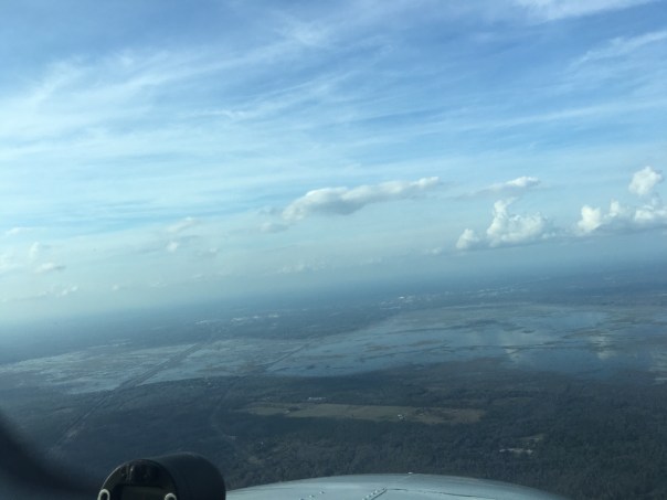
Before I share the story, I am taking my favorite book off the shelf: Landscapes and Hydrology of the Predrainage Everglades. These images, on pages 46 and 47, compare the hydrology of the Everglades south of Lake Okeechobee from 1850 to today. Even without clicking to study the image, one can see the changes. The Shark River, near the bottom of the system, receives considerably less water today than in its past. The River of Grass south of Lake Okeechobee, which includes Shark River Slough, has been blocked by roads, cut by canals, amputated in the north by the Everglades Agricultural Area, and pushed west from encroaching eastern development.  A modern picture from the National Park System reveals what remains today inside of Everglades National Park and shows the connection of the Shark River to Shark River Slough. My goal was to meet this river and to do so my husband, Ed, and I met the Captains in Flamingo at Flamingo Marina. We were to cross through Whitewater Bay, then enter the “Little Shark River” and next, come face to face with the Shark River itself!

Ed and my morning began at 3:00am. I don’t believe I have ever gotten up this early. The alarm rang and Ed excitedly said: “Time to get up! ” 

“Already?” I replied, stuffing my head under the pillow.

After getting ready, we jumped in the car driving south from Stuart in total darkness to Homestead and entered Everglades National Park. We were to meet the Captains at 8:00am. We were on time, but Ed likes being early.

Slow down Ed! You might hit a panther! I exclaimed.

“I’m following the speed limit Jacqui.” Ed replied. “Go back to sleep.”

The sun was coming up and a menagerie of wading birds gracefully glided overhead. The sun shone through their feathers in hues of oranges and pinks. “This is beautiful.” I said, starting to wake up.

“You should try getting up early more often-we could go fishing together.”  Ed joked.

I rolled my eyes, “I would only get up this early to meet the Shark River, not to catch fishes!”  We laughed.

We saw the sign for Flamingo. We had arrived.

The Captains were waiting; boat already in the water. After quick “hellos,” we waved goodbye to a sleeping crocodile and headed up the Buttonwood Canal to Whitewater Bay. It was so exciting! Finally, I thought, I will indeed meet the Shark River!

It was chilly but no wind. The water was like glass. There was no one else.

-Captain Daniel Andrews and Noah Miller in the Buttonwood Canal leading into Coot Bay.-JTL and Captain Chris Wittman.-What a cool decking! “Send the water south!”-Ed smiles for the camera.Suddenly we stopped.

“Is this Whitewater Bay?” I asked.

Chris nodded his head up and down and climbed above the engine. I noticed he was wearing no shoes, just socks.

“What’s he doing?” I whispered to Ed.

“He’s sighting tarpon. Shhh.”Suddenly I saw a tremendous splash in the distance! A rolling silver monster of a fish. It was spectacular! Never in my lifetime had I seen a jumping “silver king.”

I watched. I listened. It was magical. And like the Shark River, the tarpon stayed just out of reach, remaining a mystery….

We continued on..

We traveled quite a long way, many miles, first hitting the Little Shark River and then the Shark River itself. Some maps like the one below show it all as the Shark River.

“Chris looked at me through reflective glasses. He smiled. “Here you go Jacqui, this is it. The Shark River.”

“Oh my Gosh finally! I exclaimed standing up.“Hello Shark River! I dragged my fingers in the clear, brownish water smiling from ear to ear.

It felt like we were in Africa or some far away land. The Captains were taking us deep into the northern reaches of Otter Creek and  Rookery Branch  as displayed on page 109 of The Everglades Handbook, another excellent publication. Chris said, “Not only are you going to meet the Shark River, we are going to take you to were its connection meets Shark River Slough.” When we arrived at the end of the branch, the waterway got thinner and thinner, the plants began to change. We stopped when we could go no further. Captain Daniel explained that we were in the “transition zone.” Shark River Slough was just north of us, on the other side, where the vegetation would become more marshy. Fresh water flowed through here. I could see coco-plum, like in my yard,  growing right next to mangroves. The vegetation was mixed and different. Daniel discussed the history and how the mangroves have grown much further north since around 1920 because of the lack of fresh water. I looked down. It was very shallow. I could see limestone, marl or some type of rock. What looked like peat and leaves lie on top. The water was clear. Fishes were darting about. I could see the water slowly flowing…

We were at the interface, the meeting place of river and slough. We talked about Everglades restoration for a long time noting that the water now wasted to tide and destroying the Northern Estuaries from Lake Okeechobee once flowed massively south through this area into Florida Bay. We talked about the hyper-salinity and seagrass die-offs in Florida Bay due to the lack of fresh water. Yes, recently, and in 2015, starting in the 1980s. What a conundrum. We must continue to work to send more water south!

-Captain Chris teaches us about the transition zone.-Transition zone between river forks and Shark River Slough. Blue dot is location of the boat. Line above is Tamiami Trail east of Miami. Before heading home, the Captains took us in the opposite direction to see Ponce de Leon Bay, where the Shark River and other rivers carry the water of Shark River Slough into Florida Bay and the Gulf of Mexico.

Along the way, we passed a mangrove forest that contained giant remnant black mangroves the size of oak trees! I even saw a tree snail. I had never seen such a big tree snail either!

All the way home, I felt renewed.

I will never forget this special day. The day Ed and I had a Captains’ introduction to the Shark River -and so much more!  Ed and I are forever grateful.

With every experience like this I can see, really see, what needs to be done to send more water south, to save the estuaries, and to replenish Florida Bay. Having met the Shark River, may just have been the ultimate inspiration.

-Ponce de Leon Bay mangrove forest. -Hugging an enormous ancient black mangrove.-An Everglades tree snail!-Captain Chris overlooks Ponce de Leon Bay. -Heading home! -
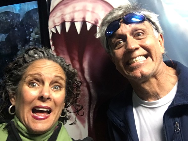
Back on land at Flamingo Marina. A final farewell selfie. -Crocodile loves the comfy boat ramp.-Ospreys feed their rapidly growing young. All animals of the Everglades need flowing fresh water from Lake Okeechobee to Florida Bay. We must continue to send more water south!

Videos: 1 & 2  on the way to the transition zone of the upper forks towards Shark River Slough.

1.

2.


3.  Approaching Ponce de Leon Bay that opens into Florida Bay and Gulf of Mexico.


Walking for Panthers

~Above photo: FWC public records. FWC officer documents young male Florida Panther hit on Hwy. 710, November 2, 2019. 

I waited a long time to share this photograph. It’s almost too much to take.

This panther was hit and killed November 2, 2019, on Highway 710, less than a mile south of Indiantown in Martin County, Florida. Today I share this photo because of an article I read in TCPalm by environmental reporter, Max Chesnes. The title of the article is Man Walking From Vero Beach to Key West to Tallahassee for Panther Donations.

It is a story of loss and inspiration.

Mr Chesnes explains that when tragedy struck, Mr Steve Fugate “hit the road.” Fugate had lost his son to suicide and his daughter to accidental drug overdose To cope, the 74 year old Vero Beach native, began walking, finding solace and inspiration in Nature along the way…

There are panthers in Martin County.

In 2016, I wrote about one sighted in Allapattah Flats – ten miles west of Palm City, where in fact, SFWDM just held a Ribbon-Cutting. But because Panthers are few and far between compared to the south west coast of Florida, in my opinion, they do not get the government press or the protection via fencing and wildlife underpasses they should here. There is no urgency anyway.

“It was just one hit in twenty years.” I’ve heard. “Most are on the west coast…”

I think there should be signs, underpasses, fencing, and press on the east coast as well. For Mr Fugate and others, every life counts. Thank you to reporter, Max Chesnes and thank you to Mr Fugate, I am inspired!  I will be making a donation on the panther’s behalf! 

TCpalm: In an effort to raise awareness, and funding for the critically endangered Florida Panther, Vero Beach native, Steve Fugate has partnered with the Fish & Wildlife Foundation of Florida and started on a nearly three-week, 1,600mile walk around Florida. Photo PATRICK DOVE/TCPALM. Click here for full article. 

Chesnes writes:

“Now, Fugate hopes to give back to the natural world and its inhabitants that embraced him throughout the years. His latest walk, which started Saturday, will take him from Vero Beach — through St. Lucie, Martin and Palm Beach counties — to Key West, then up Florida’s west coast from Naples to Tallahassee.

The nearly three-week, 1,600-mile journey is meant to raise awareness and funding for the critically endangered Florida panther, he said. 

“They’re just gorgeous animals,” Fugate said of the species, named in 1982 as Florida’s official state animal. There are only an estimated 120 to 230 wild panthers left, according to data from the Florida Fish and Wildlife Conservation Commission.

More:FLorida panther deaths map and details”

~Florida Panther, Florida public photo


The Dream of the Sleeping Jellyfish

When I saw them I was immediately struck by their shapes. They looked like hundreds of snowflakes lying at the bottom of the mudflats in the Florida Keys’ Tavernier mangrove swamp.

I became preoccupied with them, checking them during different times of day.

“I’ll be there in a few minutes, I’m going to visit those underwater snowflakes.” I told my husband, Ed.

“Are they sea anemones?” I wondered. “Are they some kind of tropical underwater flower?”

I lay prone on the dock, staring. And there I saw it. I saw upside down jellyfish- yes standing on their heads as if they were sleeping. I realized the beautiful geometric shapes, the snowflakes, were their out folded branching tentacles.

How bizarre!

Some of the jellyfish were “breathing,” their heads expanding and contracting, pushing water, while others seemed completely comatose, not moving at all.

A few smaller ones were actually swimming heads-up the way I would expect a jellyfish to!

I took lots of photos while hoping no boat would disturb their slumber.

I read, laughing, when I learned that they are indeed known as Cassiopea, the “upside down jellyfish,” ironically, all part of a symbiotic relationship with algae. (https://en.m.wikipedia.org/wiki/Cassiopea)

I really fell in love with this snowflake jelly forest. Now, before I go to bed, I often wonder what they are dreaming about.

Perhaps clean water and a healthy sea…

https://jacquithurlowlippisch.com/wp-content/uploads/2020/09/img_1105-1.mov

For the Hail of It!

Since I was a kid growing up in Martin County, I have been excited to hear stories about  hail. Hail is really the closest thing to snow down in these parts. I remember once, in the 1970s, when our family lived at 109 Edgewood Drive, in Stuart, it hailed and we kids ran outside and collected it in our sweaty palms dumping it into Tupperware that ended up in the freezer. Those hail pieces sat in there for years, and every now and then we would climb on a squeaky high chair, when mom wasn’t looking, and take the cold frozen memory out,  just to revel. Amazing! As a kid, I never knew what else to do with the hail, and in time, I’m sure my mother removed it to make room for ice cream.  

Yes hail.

As I got older and my mother’s local history books were being published. I was struck by one photograph of the 1934 Roosevelt Bridge in Stuart overflowing with hail -looking like, yes,- like a snowstorm had come!

In this photo by Frances Carlberg King in “Stuart on the St. Lucie: A Pictorial History” by Sandra Henderson Thurlow, hail covers the old Roosevelt Bridge on Feb. 10, 1934. A hailstorm covered Stuart with ice, creating street scenes that some say looked like “someplace up North.”

Hail, though it can be destructive is a novelty, one to be appreciated, even celebrated. 

Just last Sunday, April 19, 2020, month two coronavirus containment, it stormed wildly and hailed in south Sewall’s Point. The noise on our metal roof was deafening! Right after,  I ran out and collected the hail pieces just like I had when I was a kid. The air was so chilly! My bare feet were cold against the deck and wet earth. Somehow, the whole thing was exhilarating! 

When I brought my hail inside, I quickly put the bowl in the freezer and looked for my husband, Ed.

“Ed! Come look! I collected some hail!”

There was silence for a bit, and then I heard him slowly ask, “what are you going to do with it Jacqui ?” Ed grew up in Chicago so ice is not so unusual. 

“I have a surprise!”

That evening after dinner, I said, “I recommend we do something special with this hail. I think we should  make real cocktails with it, you know, like the kinds from the 1950s? And  then, we are going to toast Mother Nature.”  

Ed laughed and we did just that, “for the hail of it!”

Beauty After the Storm

If you live in Martin County, you may have experienced a short lived violent storm this past Sunday, April 26th, 2020. In south Sewall’s Point, early afternoon, the winds exploded in a crash of falling branches, rain, thunder, and hail! Under the deafening sound of our metal roof, Ed and I stood on the porch in amazement, looked at each other and said, “well at least it’s raining,” as presently drought conditions cover much of the state. 

The following day, Ed took wing taking these aerial photographs. They are a good example of “local runoff.” No Lake Okeechobee thankfully! Lake O too though looked beautiful after the storm as displayed at the end of this aerial series. Somehow, it always seems most beautiful after the storm…

L-R: ST LUCIE RIVER, SEWALL’S POINT, INDIAN RIVER LAGOON, HUTCHINSON ISLAND, ATLANTIC OCEAN, by Ed Lippisch 4-27-20

INDIAN RIVER LAGOON, ST LUCIE COUNTY, HUTCHINSON ISLAND ~NOTE ST LUCIE POWER PLANT AND SAVANNAHS ON MAINLAND TO WEST

A SHINING LAKE OKEECHOBEE at S-308 PORT MAYACA

From Girl Scout to Activist, Rediscovering the Seeds of Jonathan Dickinson State Park

In the 1970s, my girl scout troop often spent the night in Jonathan Dickinson State Park. At the time, almost all of Martin County was undeveloped so it really didn’t hit me – the value in this very special place.

We girls collected dried flowers, seeds, and grasses to be bound with ribbons and given to our mothers; we lay our packs on bunk beds in musty cabins; we hiked through the pines; we sat around the campfire telling ghosts stories and speaking of bears until too scared to  sleep; we sat in a rare silence, together, staring at the bright stars while eating marshmallows…

Last weekend, I went back to Jonathan Dickinson ~45 years later, this time with my husband Ed, and our dog, Luna.

Although I have aged, the place was even more beautiful!  Almost immediately, I  knew that even though I hadn’t walked it’s piney paths in such a long, long time, it had been an inspiration all my life. A seed growing within me. 

Ed and I chose to walk the trail of Kitching Creek. My attention was captured  by the beauty of the small flowers and I took as many pictures as I could. Slash pine trees abounded, like sentinels, second generation, the magnificent virgin forest cleared in the the 1920s.  Woodpeckers flew from tree to tree looking for insects or maybe a place to set up house. Ed walked far ahead with Luna, stopping every time he came upon a number; I would catch up and read aloud from a pamphlet available at the trail head. 

On our walk, I recognized some of the same grasses I used for my bouquet in 1974. But I knew this time I would not pluck them from the Earth, but take them to heart as inspiration in our fight for clean water, -the St Luice and Loxahatchee-, and the future of Florida.

~I then I realized that long ago, I already had. 

Before drainage there were times the surrounding wetlands, the St Luice, and the Loxahatchee Rivers were wet enough that people could  paddle between them. Today the Loxahatchee suffers from too little water and the St Lucie too much. 

Ron DeSantis: Protecting Florida’s Environment on Day 1

Yesterday, I called in for the final conference call of Governor-elect Ron DeSantis’ Transition Advisory Committee on the Environment,  chaired by our own, Congressman Brian Mast. It was very, very interesting. Highlights of the call were recorded by TC Palm’s Ali Schmitz:

https://www.tcpalm.com/story/news/local/indian-river-lagoon/politics/2018/12/28/desantis-transition-work-agriculture-limit-pollution/2424629002/

https://desantistransition.com/governor-elect-ron-desantis-announces-transition-advisory-committee-on-the-environment-natural-resources-agriculture/

As a member of the public, I was able to listen-in on the call ~this one focusing on Agriculture, and make my recommendation.

Having served on the Constitution Revision Commission in 2018, I am especially drawn to the importance of government structure. DeSantis’ originally posted environmental policy statement listed Accountability for Water Quality. Right now, many Floridians wonder “who is charge,” who answers for our present lack of water quality? Some even think, understandably so, that it is the Army Corp of Engineers. It is not. Under the law, the state of Florida is responsible for water quality, but with “three cooks in the kitchen,” (DEP, Water Management Districts, and Dept of Agriculture) this is difficult. So with my time on the call, I asked for centralization of enforcement of water quality standards and a strong Lead Agency:

CENTRALIZE THE ENFORCEMENT OF WATER QUALITY STANDARDS. A Majority of water quality regulation is currently housed at the Florida Department of Environmental Protection (DEP). However, certain water quality standards and monitoring reside within the Florida Department of Agriculture and Consumer Services (DACS) which is overseen by the Commission of Agriculture. DeSantis will work with the Florida legislature to move all components of water quality regulation within the Executive Branch to DEP. This will increase uniformity and ensure that the Secretary of DEP, who is accountable to the Governor, has the tools necessary to meet the water quality standards that Floridians deserve. ~DeSantis for Governor website Sept. 2018.

As we all know, the inauguration is January 8th, 2019. Very exciting! Congratulations Governor DeSantis! And awesome that Congressman Mast is by your side!!

Before we get too excited, let’s not forget…

Today, I will post the website of Governor-Elect Ron DeSantis on the environment so we can remember what was promised and hold the governor and all members of the Transition Advisory Committee on the Environment accountable for next four years. Looking forward to a governor who will protect the environment on day one!

Website links:

GOVERNOR-ELECT RON DESANTIS

https://rondesantis.com/issues/

https://rondesantis.com/environment/

Looking Back, St Lucie River ~Rain and Algae 2018

Even though the water in yesterday’s photo looked gorgeous, lest we forget, here are some images of the St Lucie River/Indian River Lagoon area during a rainy and cyanobacteria ridden 2018.

Ed and I didn’t start taking pictures until were motivated…

In March 2018 there was a tremendous rain event. (https://www.sfwmd.gov/our-work/flood-control/managing-high-water)
My homemade rain gauge showed over 27 inches in just a few days along the coast!

You’ll see that after the rain event, the St Lucie River/Indian River Lagoon looks terrible even with out Lake Okeechobee discharges. This is caused by directed water runoff from C-23, C-24, C-25, C-44 and “local” coastal runoff.  Naturally, the river never took all this water. Humans made it this way, and we must fix it.

SFWMD canal and basin map.

Soon after the torrential rain, the Army Corp of Engineers made things even worse and started dumping from Lake Okeechobee through the C-44 Canal into the St Lucie River by opening up the gates at S-308 and S-80.

My husband, Ed,  first flew over Lake O on June 1st,  just by chance. At this time, he spotted algae on the lake and took a photo.  Ironically, the next day, the Army Corp started dumping from Lake Okeechobee on June 2nd!

The algae or cyanobacteria (http://www.ucmp.berkeley.edu/bacteria/cyanointro.html)
that was festering in the Lake began to show up almost immediately thereafter in the St Lucie River that has also become  a “nutrient porridge.”

The rest unfortunately is history. 2018  was bad, but in my opinion not as awful as 2016 when the ocean was totally green: https://jacquithurlowlippisch.com/tag/bathtub-beach-algae/

After another long, hot summer, the Army Corp finally stopped discharging in the fall~October 5th… Take a look at the photos and remember to enjoy the blue water when it is here, but NEVER FORGET! Only though looking back, will we have the determination to change the future.

Major rain event in March 2018.  Rain filled this vile up many times!

SLR IRL following major rain event in March 2018. This is runoff from C-23, C-24, C-25, C-44,  and “locally” from developed areas along the river and uplands made to drain into river. JTL

Following rain event in March 2018. A brown Atlantic.

Following rain event in March 2018, the SLR/IRL ~Scott Kuhns

Following rain event in March 2018 Sailfish Flats between Sewall’s and Sailfish Points ~Scott Kuhns

June 5th. A very dark plume moves south along Jupiter Island, just days after ACOE begins dumping so this is a combination of all pollution/runoff  waters…

LAKE OKEECHBEE DISCHARGES ADDED

Ed in the Cub after plume photo

Algae as photographed/spotted by Ed in Lake O on June 1st 2018.

City of Stuart, June 9 2018.

Rio near Central Marine, week of June 12, 2018

Photographing a manatee in the algae along seawall by Mary Radabaugh

Mary Radabaugh manages Central Marine with her husband. JTL

Mary found a dead baby manatee floating in the putrid water shortly after LO discharges.  MR

LAKE O: Week of June 16th, June 25th, and July 22nd. Cyanobacteria (blue green algae) blooms and then subsides. ~All the while, this water is dumped into the St Lucie River by the Federal Govt.; the water quality is terrible and this the responsibility not of the Feds but of the State of Florida.

Algae is now very visible in Lake O, June 16, 2018 JTL

June 25, 2018 Lake O, near S-308, Port Mayaca.  JTL

C-44 canal leading to SLR from Lake O.

C-44 canal leading from LO to SLR.

Satellite view LO bloom on June 24, 2018. ~At its height.

By July 22, 2018 the bloom in the LO is lessening, JTL

August 29, algae would come and go, throughout the SLR. Here near Overlook Drive JTL

September 4, algae still “coming and going” ~2018 Snug Harbor, Stuart.  Photo by my uncle, Dale Hudson

October 5, the ACOE stops dumping from Lake O. The blooms stop almost right away but the damage remains….

December 8, 2018 the river looks “normal” again near Sewall’s Point but it is not. JTL

Leadership, Florida House of Representatives, Water in Mind 2019

Recently, the Florida House of Representatives announced its committee appointments made by new House Speaker Jose Oliva. Today, I will note those appointed to environmental committees which, of course, function in the dark ages, bound together with agriculture. Advocates should know these key players and build relationships now, and during the committee process that beings January 8, 2019 ~not once Legislative Session begins in March. Too late!

So here we go…

The really all-powerful Speaker of the House is Jose Oliva who will reign from the end of 2018 to 2020. He is from Miami Lakes and is C.E.O. of Oliva Cigar Co. Read about him below and the committees and representatives over which he has great influence. Congratulations to him on attaining this leadership role that very few achieve.

Speaker 2018-2020, Jose R. Oliva: https://www.myfloridahouse.gov/Sections/Representatives/details.aspx?MemberId=4534

Committees of the HOR: https://www.myfloridahouse.gov/Sections/Committees/committees.aspx

Speaker Oliva’s environmental appointments are below with an article or two giving background on each appointee. Agriculture and Natural Resources Appropriations Subcommittee Chair, Rep. Holly Raschein is from Key Largo and a Health Care Special Projects Manager. Vice-chair, Rep. Rick Roth is from West Palm Beach and his heritage is linked to a multi-generational family-farm in the Everglades Agricultural Area. Holly has a track record supporting environmental issues such as the EAA Reservoir and Rick works for the environment within the goals of the EAA Environmental Protection District and the 1994 Everglades Forever Act.  Read below about both representatives and what they have to say.

Agriculture and Natural Resources Appropriations Subcommittee: https://www.myfloridahouse.gov/Sections/Committees/committeesdetail.aspx?CommitteeId=3003

Rep. Holly Raschein: https://www.myfloridahouse.gov/Sections/Representatives/details.aspx?MemberId=4562

Holly Raschein :https://www.miamiherald.com/news/local/community/florida-keys/article213189389.html

Rep. Rick Roth:https://www.myfloridahouse.gov/Sections/Representatives/details.aspx?MemberId=4648

Roth Farms: https://www.rothfarms.com/roth-farms-history/

Rick Roth:https://www.farmprogress.com/vegetables/heritage-success-rick-roths-roots-go-lot-deeper-muck-soils

Interestingly, Holly Raschein also serves on the Subcommittee for Agriculture as  and  Natural Resources as vice-chair to, chair, Chuck Wesley, a College  Administrator from Newberry (near Gainesville). Rep Wesley notes that “sustainable agriculture and the environment are some of his top goals.” You can read what he wrote in an op-ed for below. All this sounds good. But what does that really mean? Our job is to hold all of these politicians accountable. 

Agriculture and Natural Resources Subcommittee: https://www.myfloridahouse.gov/Sections/Committees/committeesdetail.aspx?CommitteeId=3024

Rep. : https://www.myfloridahouse.gov/Sections/Representatives/details.aspx?MemberId=4655

Chuck Clemons: https://www.gainesville.com/opinion/20181001/chuck-clemons-my-record-shows-support-for-agriculture-environment

Yes, it is important we know and communicate with who is in charge. I hope you will reach out to all of them through letter best, but email, or phone call helps too.  I wish all my readers a Merry Christmas and Happy Holidays! Thank you for reading my blog in 2019. I’m looking forward to seeing what 2019 will bring…

For more information on Florida House of Representatives go here https://www.myfloridahouse.gov. Look at their calendar, see when committees meet, follow what they are reviewing and call, write their office to let them know how much you love Florida and that water is key!

Florida Water, A Thing of the Past? SLR/IRL

My mother gave me a late birthday present: antique post cards and a bottle once filled with “Florida Water,” a popular tonic sold for health and beauty around the world. Believe it or not, “Florida Water” is still selling across the globe, and has been since 1808 ~for 210 years!

It was poignant to receive such a rare and special gift from my mother because if Murray & Landman began marketing Florida water today, the product would not be so romantic; in fact, the branding  would more look like war.

“Florida Water,” a thing of the past?

Not if we fight to win.

TCPalm reporter Tyler Treadway holds a container of Florida Water in July 2018, Photo by John Moran

Posted on #toxic18, Florida’s new image

LINKS:

Florida Water Cures: http://www.nydailynews.com/making-splash-old-fashioned-florida-water-cures-ails-ya-smells-good-article-1.828293

Florida Water, History WIKI: https://en.wikipedia.org/wiki/Florida_Water

Florida is Losing it’s Brand:

Graham Brink, Business Columnist: Toxic algae blooms from Lake Okeechobee are a stain on Florida, Tampa Bay Times: https://www.tampabay.com/news/business/tourism/Brink-Toxic-algae-blooms-from-Lake-Okeechobee-are-a-stain-on-Florida-_169667590

Julie Dermansky, Fueled by Pollution and Unsound Policies, Toxic Algae Overtakes Florida Beaches and Waterways,https://www.desmogblog.com/2018/08/02/pollution-policies-toxic-algae-red-tide-cyanobacteria-florida-lake-okeechobee

Breaking Through Water and Sky, Believe

If you feel anything like me, you’re not just tired, but sick of heart from looking at dead animals. The atrocities of our estuaries this year, especially for the Caloosahatchee, are Armageddon like in nature.

It is natural to be saddened, but we must stay strong and find inspiration. When we look around, even on the bloody environmental battlefield, it is there.

Today, I share the beautiful photos of local St Lucie River photographer Stephen Duffy, his Anhinga series shows this symbolic bird in all its glory. These special, yet common birds have no oil on their feathers, so they can both swim underwater and fly above the Earth. Thus the Native People held them sacred.  ~The bird that can fly and swim. The bird that can do “anything.” The bird that breaks the wall of water and sky.

When you see the anhinga remember: fly, swim, break through walls, and most important, believe.

Links:

https://www.nps.gov/ever/learn/nature/anhinga.htm

https://childrenofthesunnativeculture.com/cosnc/?q=node/187

In the Garden of Impatience, SLR/IRL

“Patience is a virtue…” 

Yesterday, I went to my garden. A garden for butterflies that I planted in 2011 during my mayorship for the Town of Sewall’s Point.

It was at this time, that I realized I needed a place to go, close to home, to get away, when I was grinding my teeth so hard at night that I would awake with headaches. This garden has calmed many nerves, and brought both beauty and delight to Ed and my home.

I learn a lot of lessons from my garden. But I still have a lot to learn…

…Upon getting the newspaper from the driveway, I noticed a monarch butterfly that had just emerged from its chrysalis drying its wings on the shrimp plant by my front door. The orange, black, and white pattern against green and red was quite striking. I decided to do something I have never done, watch the butterfly dry its wings, and to wait to watch it fly off.

Every few minutes its stain-glassed wings would open to the sun and wind, and then it would sit motionless. When its wings opened again, I could see its body tighten and contort, pumping liquid deep into its wings. It looked uncomfortable this miraculous metamorphosis. Finally, it seemed erect and proud; I kept waiting for it to fly off, but it didn’t.

I counted the white spots on its wings and body to pass time. I studied its bizarre mouth and antennae. I laid on the ground. I took pictures. I tried to be patient. I thought about all I needed to do. I thought about how I would be breaking a deal with myself ~to see a newborn butterfly fly away, if I walked off.

“Come on butterfly!” I said. “You can do it!” But it did not fly off. It just sat there.

I thought about how in the garden there is no rush, as in my own life, to finish the “task.”  Things take the time needed to take, and that is all…

I waited. I wondered. I wished.

I started to get impatient.

“I can’t believe I am losing my patience with a butterfly,” I thought. “This is not good; my plan is backfiring.”

I took some breaths, calmed myself down, and tried to be like nature. Ever-present. Ever-enduring, patient in my Garden of Impatience…

It did not work. I noticed I was grinding my teeth. ” I’ve got so much to do!” I walked two steps towards the rose-bush, just to regroup, taking my eyes off the butterfly for the very first time… It could not have been more than a second.

When I turned around, the butterfly was gone!

I smiled, in disbelief, thinking for a moment “I can’t believe I wasted all this time,” looking into the sky for fluttering wings, but there were none. There was just the sound of the wind and the warmth of the sun — the eternal.

There is no time wasted in the lessons of nature, I suppose…

I walked back into the house “to get things done.”  🙂

Monarch Butterflies, Florida,IFAS, UF:http://edis.ifas.ufl.edu/uw311

The Eagle of the 16th Hole, Sailfish Point, SLR/IRL

Eagle, Sailfish Point, 3-18, by Susan Kane

Last evening, at a gathering of friends of my mothers, I met Mrs Susan Kane. The conversation started as usual with someone I do not know, but quickly, somehow, the our words turned to eagles living along the St Lucie River, Indian River Lagoon.

I told Susan, I had never seen one here flying, ever, but I knew they were here as Greg Braun, formerly of Audubon, took photos of one sitting on a rock at Bird Island…. I  had also heard that there was a pair that hunted from a tall, dead, Australian Pine tree by the Marriott’s Indian River Plantation Marina. But again, although I walk the bridge between Sewall’s Point and Hutchinson Island quite often, I had never seen them…Once, while driving on Highway 76  in Indiantown, I did see an eagle, and was so excited that I parked my car on the side of the road and with trucks zooming by I watched it soar. I was smiling from ear to ear.

Susan listened politely, and then replied, “Well recently, Jacqui,  I took a photograph of an eagle on the 16th hole of the Sailfish Point golf course.”

“You’re kidding?” I inquired.

“Yes, the eagle captured a fish right there in the pond at the 16th hole of the golf course.”

“That’s incredible.” I replied, taking a large sip of my cocktail, to hide my bird envy.

Over the course of dinner, Susan pulled out her photos and shared. They are wonderful! And today I am sharing her photos with you.

Look at this eagle. Its expression!

What a sight I hope I get to see! 🙂

Eagle of Sailfish Point, by Susan Kane

Photo by Susan Kane

Photo by Susan Kane

Sailfish Point: http://www.sailfishpoint.com

Former post on eagles of the IRL:

I’d Rather be an Eagle Than a Turkey, St Luice River/Indian River Lagoon

Thank you Susan for sharing your photos of the eagle of Sailfish Point along the Indian River Lagoon!!!

The Crashing Ocean, and the Unfazed House Upon the Rock, SLR/IRL

John Whitcar, of the famed local Whiticar Boat Works family,  has been a longtime family friend, and I have featured his incredible photography before. Today’s shared photos were taken on March 5th.

He describes today’s photos below:

House of Refuge Huge Waves
Monday, March 5, 2018 / Stuart Florida, USA
11 ft. waves coming in from North Easter off of New England.
Very little wind / High Tide / ~11:00 am

The story of the House of Refuge is an amazing one, being the last of its kind, Old-Florida pine construction, having endured multiple hurricanes and other forces of time and nature, and still standing since 1876.

“US government houses of refuge were constructed to assist shipwreck survivors and were unique to the east coast of Florida. Ten were constructed between 1876 and 1886, but only but Martin County’s Gilbert’s Bar House of Refuge survives.” ~Historian Sandra Thurlow

The moral of the story?

Build your house upon a rock. ~Including the Anastasia Formation, preferably.

(https://en.wikipedia.org/wiki/Anastasia_Formation)

Thank you John for sharing your wonderful photos of Gilbert’s Bar House of Refuge including its mascots the Blue Angels of Nature, our brown pelicans!

*House of Refuge web site: (http://houseofrefugefl.org/house-of-refuge-museum-at-gilberts-bar/)

Pensacola Dreamin’, P91 No Oil or Gas Drilling in Florida’s Territorial Seas, CRC

Landing in Pensacola For years, I have had a reoccurring dream.

I am looking up at an absolutely blue and cloudless sky; white, sparkling sands are hot beneath my feet; and crashing waves of emerald green, mesmerize…

Blue. White. Green. This is all there is. This is the vision, the dream. And it is real. These are my memories of living at Pensacola Beach.

Pensacola Beach

More than twenty years later, I am not dreaming. I am back, and I am fighting for CRC proposal 91, “no oil or gas drilling in Florida’s territorial seas,” our state waters.

Full text, etc. P91 CRC website: (http://flcrc.gov/Proposals/Commissioner/2017?billNumber=91&searchOnlyCurrentVersion=True&isIncludeAmendments=False&pageNumber=0)

2-26-18, Pensacola News Journal, Kevin Robinson, “Public Support Could End Drilling:” https://www.google.com/amp/s/amp.pnj.com/amp/367909002

In the early 1990s, I came to Pensacola from UF in Gainesville, to teach German and English at Pensacola High School in both the traditional and International Baccalaureate Program.

I learned perhaps as much as my students. It was hard and rewarding work. I matured here one could say.

My mom, me and Dash mid 1990s

Maturing didn’t just involve the discipline of being a teacher, but also the responsibility of my first dog. “Dash,” as he was named for his ability to sprint. Dash was a stray I found in Downtown’s Seville Square. He was as beautiful and white as Pensacola Beach with black spots over his eyes. Even my parents visited to meet him!

Every evening he sat by my side for hours as I graded papers long into night. I would leave at 6 am for the first bell at 7:01. When I got home from a day of teaching, Dash and I would swim at Pensacola Beach or take long walks to Fort Pickens and then of course, grade papers,

These were wonderful times! The powerful simplicity of the blue sky, the green waves,  the white sands, and my white and black best friend, forever left an impression on me.

Though I have been back home in Stuart, and Sewall’s Point, in Martin County for over twenty years, my life has changed, and Dash has passed away–Pensacola still holds my heart. Nothing compares to its white sandy beaches and how could I forget? Its longest of Florida histories! http://news.wfsu.org/post/pensacola-discovery-complicates-title-oldest-city; https://www.visitpensacola.com/things-to-do/history-heritage/

Hopefully we will continue to make history in Pensacola today.

Pensacola will be the linchpin in convincing the CRC to support P91 to go on the 2018 ballot: “No Oil and Gas Drilling in Florida’s Territorial Seas:” please attend today’s public hearing at UWF from 1-7 pm to speak. Read here for details. 😎 http://www.northescambia.com/2018/02/constitution-revision-commission-to-hold-pensacola-public-hearing-tuesday 🇺🇸🐬

Jacqui Thurlow-Lippisch is a commissioner for the 2018 CRC, the former mayor of Sewall’s Point, and an environmental activist

http://flcrc.gov/Commissioners/Thurlow-Lippisch

Marjory Stoneman Douglas, SLR/IRL

Just last weekend, I presented at the “Future of Florida Summit” at the University of Florida’s Graham Center. Eric Eikenberg, CEO of the Everglades Foundation, gave a passionate speech to hundreds of young people during the lunchtime session. My husband, Ed, usually quiet, turned to me saying: ” He is a really good speaker.”

The crowd listened…

Mr Eikenberg noted that he was a graduate of Marjory Stoneman Douglas High School in Parkland, Broward County, Florida and that even though the school was literally built in what was once the Everglades, there had not been studies on that subject while he attended the school. He talked about the importance of our state waters and the need to involve youth in the education of our natural world, especially here in South Florida.

Ironically, four days later, the horrific shooting at Mr Eikenberg’s alma mater, has called attention, once again, to the shortcomings, and cultural sickness in our society.

In 1991, the “Marjory Stoneman Douglas Everglades Protection Act” was enacted by the Florida Legislature becoming the precursor to the Comprehensive Everglades Restoration Plan (CERP). Douglas ended up asking for her name to be removed from the legislation. At the time, she was 103 years old. After fighting for the Everglades for a lifetime, she said she felt the legislation was too favorable to the Sugar Farmers. “Growers should clean up the water on their own land…” meaning the state and federal government shouldn’t be building Storm Water Treatment Areas with taxpayer dollars to do it for them….

In time, Ms Douglas’ name was removed.

I wonder if she were alive today, if she would want her name removed from the school? I doubt it. She may have been tough on those destroying the Everglades, but she had a soft heart for youth. Lore states that when she was starting her famed organization Friends for the Everglades she refused to have the membership fee too high for students to be able to join, as she knew they were the most internal of keys.

My greatest sorrow and prayers for the families of the dead.

May the blood of the slain remind us to stop looking at our phones, and to turn to nature and Nature’s God for insight and inspiration in this crazy and destructive human-made world.

St Lucie River sunset, Todd Thurlow

______________________________________________________________

Links:

Palm Beach Post, Who was MSD: http://www.mypalmbeachpost.com/news/broward-school-shooting-who-was-marjory-stoneman-douglas/OOPs63TWxpyyxDOjW9SM6J/

CNN Who was MSD: https://www.cnn.com/2018/02/15/us/marjory-stoneman-douglas-who-was-trnd/index.html

Tampa Bay Times year she died: http://www.tampabay.com/news/nation/Who-was-Marjory-Stoneman-Douglas-_165518820

Washington Post MSD obituary: https://www.washingtonpost.com/archive/local/1998/05/15/environmentalist-marjory-stoneman-douglas-dies-at-108/99d2a81d-2141-4dd1-b8fc-69d4cb0da27b/

Everglades Protection Act, Sun Sentinel, MSD, http://articles.sun-sentinel.com/1991-04-26/news/9101210185_1_joe-podgor-everglades-marshes

Everglades Protection Act, Sun Sentinel 2, MSD removing her name: http://articles.sun-sentinel.com/1991-05-08/news/9102250472_1_everglades-pollution-lawsuit-pollution-filtering-marshes-joe-podgor

Timeline of Everglades Restoration: http://evergladeslaw.org/everglades-timeline/

Everglades Protection Act, originally, the MSD EPA:http://evergladeslaw.org/timeline/florida-legislature-passes-everglades-protection-act/

National Park Service, MSD Bio: https://www.nps.gov/ever/learn/historyculture/msdouglas.htm

Alligators and Litigators: https://www.floridabar.org/news/tfb-journal/?durl=/DIVCOM%2FJN%2FJNJournal01%2Ensf%2FAuthor%2FD0FE7CE69AFA102885256ADB005D635E

SFWMD history including 1991 EPA: https://www.sfwmd.gov/sites/default/files/documents/bmp_nonpoint_source.pdf

Everglades Foundation:https://www.evergladesfoundation.org

Paynes Prairie ~A Lake With a Road Through It…

I remember my historian mother telling me that Paynes Prairie was once a giant lake and that in the mid-1800s, before a sinkhole drained the lake, famed pioneer and pineapple farmer, Capt. Thomas E. Richards sailed from the St Johns River, in Jacksonville, over the lake, only to wind up at the Indian River Lagoon in Eden, near today’s Jensen.

Well this past Friday, on my way to Gainesville for the “Future of Florida Summit” (http://www.futureoffloridasummit.com) Paynes Prairie looked like it had become a lake once again. Although it is not a truly a lake any longer, it must be flooded as the prairie’s water levels go up and down.

As my grandparents lived in Gainesville and I graduated from UF, I have driven across the prairie many times, but seeing it from the air “all wet looking” really took me aback.  Like a miniature Tamiami Trail, one could see Highway 441 going right through this “lake!”

Apparently in 2000, eco-underpasses were installed as it has been widely documented that thousands of animals, mostly reptiles, have been killed on this road. And yet, many animals, reptiles and other, continue to be killed.

I know it would be expensive, but since transportation is perhaps one of the most highly funded of all state departments, in the billions and billions of dollars, and since Florida’s wildlife and natural lands rank as a portion of the state’s number one economic driver, tourism… could not, over time, Hwy. 441 become more like the Tamiami Trail is becoming, more bridged than flat…

It just doesn’t make sense to have a lake, or an Everglades, with a road through it.

Ed and I, a selfie on the way to Gainesville

A rainbow in the sky

Links:

Paynes Prairie website: web site: https://www.floridastateparks.org/park/Paynes-Prairie

Good historical article on Paynes Prairie: Chicago Tribune1991:http://articles.chicagotribune.com/1991-12-29/travel/9104260758_1_wild-horses-bison-spanish-florida

FDOT http://www.fdot.gov

2017-18, Funding for FDOT, state of Florida: https://www.bizjournals.com/jacksonville/news/2017/02/01/see-which-local-highway-port-programs-just-got.html

Abstract, animal mortality along 441 in Paynes Prairie and eco-underpass: http://www.jstor.org/stable/24321153

Twilight Flight Over the St Lucie River, SLR/IRL

Last night’s twilight flight was a first for me, but not for my husband Ed. Usually, we fly in daylight chasing algae blooms or black Lake Okeechobee water…

Last night was just for fun, but one still feels the pull to protect this sacred place.

The beauty of the lands lighting up beneath us was almost as inspiring as the sunset. Humanity, such promise.

We do live in a beautiful place. A place to protect and call home…

Toxic Beauty, SLR/IRL

Growing up in Stuart in the 1970s, my mother and father gave me full reign to explore the undeveloped lands in the area of St Lucie Estates. I remember endless summers, wandering around in “the woods” and of course my eyes were drawn to the vine of the widely dispersed, perfectly shaped, red and black seeds known as rosary peas.

I would collect them tightly in my little, sweaty hands, pushing them far down into my pockets. I recall the first time I brought them home, my mother said, “Yes, they are very pretty, but don’t eat them, they are poisonous.”

“Hmmm,”I thought. “How can something beautiful be poisonous?”

I continued to collect the seeds, and over the years filled up many clear glass bottles that sat in my window sill; the sun never fading their brilliant color.

Later in life, I learned that bright color patterns, especially red, black, and yellow, as with some caterpillars, or the famous, shy, and deadly coral snake, are “warnings” in nature and actually provide the animal with protection from being eaten.

As I walk through Hawk’s Bluff today, I am thankful to my parents who allowed me to explore the natural world and grow confident, unafraid, even with all of its toxic beauty.

Hawks Bluff Trail

Rosary pea, known many other names: https://plants.ifas.ufl.edu/plant-directory/abrus-precatorius/

Colors in Nature: http://flnps.org/color-nature

Back Up, After a Triple Knockout, CRC January 11-12, 2018

Face down on the dike at Lake Okeechobee, photo Ed Lippisch 1-15-18

On Monday, I had Ed drive me to the lake. I needed to see it face-to-face, and be reminded of why I am driven to protect Florida’s environment.

It was a beautiful, chilly, day and as I lay on the warm earth, soaking it all in, Ed snapped a photo. I laughed when I saw it, thinking it summarized my experience at the Constitution Revision Commission last week in Tallahassee.

A triple knock out.

But I am back up, and today will fill you in on last week, and note what remains possible for the future.On Thursday, January 11th, I presented two proposals to the Executive Committee; a committee upon which I serve. Both proposals were voted down.

They were: P 24, “Creating a Commissioner of Environmental Protection,” and P48, “FWC/Wildlife Corridors.”

I presented right after highly respected, former Senate President, Don Gaetz, who spoke in favor of a making the Secretary of State, once again, a cabinet position.

We were both voted down. The committee had no tolerance for expanding the executive branch in any form.

Exec. Committee Florida Channel: https://thefloridachannel.org/videos/1-11-18-constitution-revision-commission-executive-committee/

On Friday, I awoke to torrential rains and cold temperatures, rushing to make it in the darkness by 8:00 am to stand before the Judicial Committee, finally, for a vote on controversial, Gunster-attorney-fought, and widely reported P23, “A Right to A Clean and Healthful Environment.” It was voted down by every member of the committee as it would have created  a new “cause of action,” and given citizens standing, regarding environmental claims, in a court of law. In the committee’s opinion, P23 would have caused a Florida litigation nightmare.

For me, the lack of prioritization for the environment, the over-protection of permit holders, and the “buddy-agency-system,” holding it all in place, is already causing a “nightmare;” thus, I was all for a change and in favor of this student-inspired proposal that spoke for what the CRC is supposed to be speaking for—-its citizens.

In any case, it was quite a lesson for me, bleeding my heart out, and getting denied. I was not embarrassed, just kind of numb. I must say, it was very kind, and I appreciated that many of my comrades complimented my efforts and encouraged me to continue my fight, right before the knock-out punch. 🙂

Judicial Committee meeting, Florida Channel: https://thefloridachannel.org/videos/1-12-18-constitution-revision-commission-judicial-committee/

Thank you to reporter Jim Turner, from the News Service of Florida, who stood with me afterwards as I mumbled trying to find words to instill inspiration in my defeat. His article is a good summary:

Jim Turner, New Service of Florida: http://sunshinestatenews.com/story/controversial-crc-environmental-proposal-dead

So, I have two of my five proposals still alive.

P48, “Clarifying Language Amd. 1, 2014, Land Acquisition Trust Fund” and

P91,  “No Oil and Gas Drilling in Florida’s Territorial Waters”

No dates have been set to hear these proposals, but in the meanwhile, I am back up on my feet and getting ready for the next round. I know it will come. I have been studying one of my favorite boxers, Sugar Ray Leonard, who was a favorite of my students in Pensacola, for some moves. I’m going to be ready!

Thanks for you support and for your love of Florida’s environment.

Jacqui

JTL is a member of the Constitution Revision Commission 1018.  See Jacqui’s sponsored proposals and CRC webpage here: https://www.flcrc.gov/Commissioners/Thurlow-Lippisch

Ed on the dike with Bo and Luna, Lake Okeechobee 1-15-18

I’m standing….

S-308 at Port Mayaca, the awful ACOE structure that allows water in from Lake Okeechobee that destroys the St Lucie River/Indian River Lagoon; note color of water even in winter, video below.

Jacqui Thurlow-Lippisch is a member of the 2018 Constitution Revision Commission; she was appointed by Senate President Joe Negron: https://www.flcrc.gov/Commissioners/Thurlow-Lippisch

What’s Up With Me and the CRC? January 2018

Image via WTSP: http://www.wtsp.com/news/politics/florida/whos-behind-fls-constitution-revision-commission/477559159

2018 has arrived.

I was appointed to the Constitution Revision Commission, that meets only once every 20 years, last February, by Senate President Joe Negron (https://www.flcrc.gov). After a dizzying time, I’d say, I feel like I am finally catching my stride. The entire experience has been a lot like when I moved to Berlin, Germany in 1989. It was cold and I did not speak the language, but after many months of study and applying myself, it started to feel natural.

I have learned the CRC history; mastered the insane elevator system at the Capitol; gotten insight into the complexities of power and politics; met people from all over the state with their own serious issues; recognized the incredible importance of staff and of journalists;  have learned how to run an effective legislative-style meeting; and how to stand my ground on a vote.

I have tried to apply the “5-Cs” that an army general taught me years ago…. Communication, Collaboration, Compromise,  Cooperation, and Consensus…

As you may know, I sponsored 5 CRC environmental proposals. These came from the public’s submittals on-line, or from a public hearing earlier last year. One was a former citizen’s initiative. Today I will review where I am and where I think things are going.

The proposal that has gotten the most attention as well as the most push back–with 4 AIF hired Gunster lawyers, one a former Supreme Court Justice, fighting tooth and nail—has been P23, “A Right to Clean and Healthful Environment.” It was workshopped and heard by the Judicial Committee and I expect it to be voted on Friday, January 12, 2018. Due to the controversy, the  prognosis does not look good,  but it has raised environmental awareness for all of the proposals, and in my opinion made the business and government community look desperate to hold on to Florida’s “standard environmental operating procedure” that puts corporations and development before people. This power will not last forever, and we are all dependent on Florida’s good nature for our “riches.” —A search will pull up a multitude of editorials, news articles, and opinions, on this subject.

Two others will also be heard this coming week. P24 “Commissioner Environmental Protection”and P48 “FWC/Wildlife Corridors.” Both of these will be discussed and voted on  by the Executive Committee of which I happen to sit on. P48 would allow FWC to protect habitat not just species. This seems a no brainer as how can you have species without protecting their habitat; but private property and development rights play into the equation so it will be a fight. I look forward to the discussion and for all of us to realize that one way or another, the only way to approach Florida’s growth filled future is with the pragmatic goal of statewide living wildlife corridors, connected and protected lands.

P24 would establish a Commissioner of Environmental Protection. A  cabinet position. Just like Agriculture. Since the environment is linked to our number one state income generator–tourism  it seems the time has come….challenging power structures is always a wrestling match, but this is one we can win.

The following week, on January 18, I expect to go before the Legislative Committee for P46, “Clarifying Language in Amendment 1 2014, or Land Acquisition Trust Fund.” It was heard once already but “temporarily postponed” to requests by committee and myself to work on the language. Sue Mullins and Clay Henderson are backbone of this proposal, know the background, etc., and I am fortunate to have their expertise.

And finally…

I expect on January 19 to go before the Declaration of Rights Committee for P91,”No gas and oil drilling in Florida’s territorial waters.”

P91 is the  only one of the five proposals to have “passed committee” in December. What is so amazing to me about this proposal is its timeliness. When I took it on, I actually first thought to myself, “You know, isn’t this kind of pase’? The River Kidz were protesting oil drilling with Surfrider Foundation in 2012. This won’t happen here…” But because it was past citizens’ initiative, and the language had already been reviewed, and because Manley Fuller who is a legend in the environmental community and the president of the Florida Wildlife Federation brought it to my attention, recommending I support it, I submitted the proposal three minutes before the deadline.

Now many months have passed and things have quickly changed. As headlines explode with oil drilling and federal opening of submerged lands including Floirda’s…it seems serendipitous that this proposal is lined up for the CRC, every Florida politician — regardless of party affiliation, and the diverse citizens of the state of Florida to support.

Some people would call it a “God-wink;” I like to think so. I will fight for every proposal, but it sure is nice to feel the wind at my back.

Rainbow over the Atlantic Ocean. (Jensen Beach, 2-8-15, Jacqui Thurlow-Lippisch)

See CRC Calendars here: https://www.flcrc.gov/Meetings/Calendars/2017

To write committees mentioned above in support or with concerns see Committee Tab here and then link to committee: https://www.flcrc.gov/Committees

Jacqui Thurlow-Lippisch is Chair of General Provisions, her proposals can be viewed here, and she can be emailed from this link: https://www.flcrc.gov/Commissioners/Thurlow-Lippisch

Coastal Connections, SLR/IRL

Child’s drawing of tailless Winter and new friend baby Hope. Both of these dolphins were rescued from the IRL and now reside at CMA, in Clearwater, Fl.

The first thing I noticed flying in to St Petersburg was that they had a lot  of seagrass beds…

“How in can a place with so many people have so much more seagrass than Stuart?” I thought to myself. “Well, number one, they don’t have releases from Lake Okeechobee destroying their estuary every few years, and they are known for the state’s most successful estuary restoration program–of Tampa Bay (http://www.tbep.org) something we are trying to emulate for the Indian River Lagoon (http://www.irlcouncil.com).

It was the new year’s weekend and Ed and I had decided to “get away.”

What I had forgotten is that Clearwater, our destination, is home to Winter and Hope, Indian River east coast dolphins who were rescued by Harbor Branch (http://www.fau.edu/hboi/marine_mammals/) based in St Lucie County who were then rehabilitated at Clearwater Marine Aquarium on the west coast.  These dolphins could not be released. Winter, an amputee due to a crab trap cutting off her tail, and Hope, an orphan who was suckling on her dead mother when found never learned life skills…

Today these dolphins are alive, friends, inspiring thousands of people including a multitude of veteran and children amputees, have starred in two feature films, and have made Clearwater a favorite nationwide family destination: (https://www.seewinter.com)

The experience of visiting the aquarium, made me think about how connected we all really are. How much we can do together. If Harbor Branch had not saved these IRL dolphins, Winter and Hope would not be the worldwide ambassadors for their species that they are today.

Yes, we are all connected across our great state! Happy 2018 Florida!


Seagrass beds as we approach St Petersburg

At the CWA having fun

Clearwater Causway

Ed in his Bullsugar shirt along the causeway

“Adequate Provision” is not enough, Strengthening Florida’s Constitution, SLR/IRL

St Lucie River/Indian River Lagoon, (Photo Jenny Thurlow Flaugh)

Florida’s constitution is important, not only because it is the ultimate law of the state, but because it sets the people’s values before the legislative, executive, and judicial branches. These words are a reference in times of question and must be clearly written on the side of the citizen.

Right now, in Article II, Section 7, (a) “Natural resources and scenic beauty,” the Florida constitution reads: 

(a) It shall be the policy of the state to conserve and protect its natural resources and scenic beauty. Adequate provision shall be made by law for the abatement of air and water pollution and of excessive and unnecessary noise and for the conservation and protection of natural resources.
Because this language is vague, ( what is adequate provision? ), and case law is sparse, these words become “overruled” by Florida Statute that clearly gives “permit holders” standing over citizens, and of course the environment making the present environmental protections in the state constitution “inadequate.”

Florida Statues, Chapter 403. 412. e.) reads:
https://www.flsenate.gov/Laws/Statutes/2013/403.412

No action pursuant to this section may be maintained if the person (natural or corporate) or governmental agency or authority charged with pollution, impairment, or destruction of the air, water, or other natural resources of the state is acting or conducting operations pursuant to currently valid permit or certificate covering such operations, issued by the appropriate governmental authorities or agencies, and is complying with the requirements of said permits or certificates.”

So a citizen is not at liberty to sue if a polluting entity is causing environmental destruction that is acting or conducting operations pursuant to a currently valid permit protected by a state agency. And if someone attempts to sue anyway, they have no real standing in a Florida court of law.

Hmmm?

~But, what if a sinkhole spanning 45 feet opened at a Mosaic phosphate fertilizer facility leaking 215 million gallons of “slightly radioactive water,” but this news did not get to the people who have wells in the area for weeks?

~What if the Army Corp of Engineers, and the South Florida Water Management District knew they were discharging billions of gallons of toxic algae from Lake Okeechobee into a community’s river making some citizens sick, yet there was no discussion, warning, or health notices posted until the entire ocean ran green?

~What if an entity could withdraw so much water from a spring or aquifer that….

What if, is now reality.

Yes, permit holders should be “protected,” nonetheless, having a valid permit should not be a right to infringe on the health, safety, and welfare of Florida citizens. Florida citizens and their environment co-exist. When necessary, citizens should have the right to fight for a clean and healthy environment.

We all know that many of Florida’s waters are “growing greener,  and more toxic.” This was recently reported by TCPalm’s Jim Turner:

“The 2016 report from the Florida Department of Environmental Protection shows a mixed bag for the state’s waters, with many trending toward more-frequent toxic algae blooms, fueled by rising nitrates from farm and residential fertilizers, sewage, pet waste and other human-related sources.”

Florida’s “impaired” waters are growing, not decreasing. More springs, rivers and lakes are in horrible condition. We see it. Like it or not, the only way to ensure an “adequate” future for Florida’s citizen’s and her waters is to find a way to create acceptable language giving people a constitutional right to a clean and healthful environment.

CRC - 2017P 23By Commissioner Thurlow-Lippisch
       
       thurlowlj-00038-17                                      201723__
    1                         A proposal to amend                       
    2         Section 7 of Article II of the State Constitution to
    3         establish that every person has a right to a clean and
    4         healthful environment.
    5          
    6  Be It Proposed by the Constitution Revision Commission of
    7  Florida:
    8  
    9         Section 7 of Article II of the State Constitution is
   10  amended to read:
   11                             ARTICLE II                            
   12                         GENERAL PROVISIONS                        
   13         SECTION 7. Natural resources and scenic beauty.--
   14         (a) It shall be the policy of the state to conserve and
   15  protect its natural resources and scenic beauty. Adequate
   16  provision shall be made by law for the abatement of air and
   17  water pollution and of excessive and unnecessary noise and for
   18  the conservation and protection of natural resources.
   19         (b) Those in the Everglades Agricultural Area who cause
   20  water pollution within the Everglades Protection Area or the
   21  Everglades Agricultural Area shall be primarily responsible for
   22  paying the costs of the abatement of that pollution. For the
   23  purposes of this subsection, the terms "Everglades Protection
   24  Area" and "Everglades Agricultural Area" shall have the meanings
   25  as defined in statutes in effect on January 1, 1996.
   26         (c) The natural resources of the state are the legacy of
   27  present and future generations. Every person has a right to a
   28  clean and healthful environment, including clean air and water;
   29  control of pollution; and the conservation and restoration of
   30  the natural, scenic, historic, and aesthetic values of the
   31  environment as provided by law. Any person may enforce this
   32  right against any party, public or private, subject to
   33  reasonable limitations, as provided by law.
Proposal #23 was a public proposal. It was created by Traci Deen and her students at Barry University. I sponsored their publicly submitted proposal #700450. There were other proposals also on the “rights of environment/nature” topic including 7000672 by Richard Silvestri; 7000216 by Trevor Tezel; 700739 by Richard Grosso; —submitted to Article 1, Declaration of Rights, 700558 a Florida Environmental Bill of Rights by Paul Laura;  and the Rights of Nature submitted independently by Mr. David Hargrove. Thank you to all and the many others!
If you have any ideas or would like to comment, please write me directly at jacqui.lippisch@flcrc.gov or at this blog post.

Jacqui Thurlow-Lippisch is a member of the Constitution Revision Commission 2017/18
http://flcrc.gov/Commissioners/Thurlow-Lippisch

*This proposal will go before the Judicial Committee on November 28 and if it makes through that committee it will go through the General Provisions committee. You can write committees here to support or express concerns:
http://flcrc.gov/Committees

11-8-17

Documenting the Discharges, 10-29-17, SLR/IRL

These aerial photos over the St Lucie Inlet were taken by my husband, Ed Lippisch, Sunday, October 29, 2017, at 1:45pm. 

The number one issue here is the polluted waters of Lake Okeechobee being forced into the SLR/IRL because they are blocked by the Everglades Agricultural Area from going south. 

The ACOE has been discharging Lake O waters into the St Lucie since mid-September. These over-nutrified and sediment filled waters continue to destroy our economy and ecology on top of all the channelized agricultural and development waters of C-23, C-24 and C-25. Stormwater from our yards and streets also adds to this filthy cocktail. 

Near shore reefs, sea grasses, oysters, fish? A human being? Better not have a cut on your hand…Not even a crab has an easy time living in this.

We move forward pushing the SFWMD and ACOE for the EAA Reservoir with these sad photos and the fact that our waters are putrid at the most beautiful time of year as motivation. We will prevail. One foot in front of the other. 

Save the St Lucie! Save the Indian River Lagoon!

Links to ACOE website: See S-80 & S-308, others intesting too. Northern waters should also be cleaned! http://w3.saj.usace.army.mil/h2o/reports.htm

Most Recent Disturbing Photos of Discharges from Lake Okeechobee and Area Canal, SLR/IRL

Today is October 7th, 2017 and I am sharing photos taken October 6th, 2017 in the area of the St Lucie Inlet displaying the recent discharges from Lake Okeechobee and area canals. The plume was measured four miles out, this is very far, and can be seen both north and south of the inlet. The edges are churned up and  blurred, and there are many layers fanning out.

I share to document. I share in hope of eventual change, and I share to inspire the so many people who are causing change, change,  that one day we will see in a better water future.

Thank you to my husband Ed for piloting, and to passenger, and photographer, Matt Coppeletta.

Sincerely,

Jacqui

All photos taken of the St Lucie Inlet area on 10-6-17 by Ed Lippisch and Matt Coppeletta. Discoloration of water is caused primarily by discharges from Lake Okeechobee but also from canals C-23, C-24, C-25 and area runoff.


ACOE, Lake O: http://w3.saj.usace.army.mil/h2o/currentLL.shtml

S-308 and S-80 connected to both LO and C-44: http://w3.saj.usace.army.mil/h2o/reports.htm

C-23,(S97) C-24,(S49) C-25 (S99): http://my.sfwmd.gov/portal/pls/portal/realtime.pkg_rr.proc_rr?p_op=FORT_PIERCE


St Luice River canal and basin map, with structures. SFWMD.

Florida’s Flood System Built on 1947 Hurricane Season, Now Irma, SLR/IRL

Florida hurricane of 1947 https://www.youtube.com/watch?v=PgAHv_Z5wqE

As the possibility of a direct hit from Hurricane Irma approaches, I can’t help but reflect.

Looking back, we see that it was the severe flooding and the hurricane season of 1947 that led Florida and the U.S. Government down the track to where we are today through the creation of the Florida Central and South Florida Flood Project, (CSFP).

In 1947, during the United States’ post World War II boom, Florida had a very active and destructive hurricane season. This slightly edited excerpt from the  ACOE’s book  River of Interest does a good job giving a short overview of that year:

 “…Rain began falling on the Everglades in large amounts. On 1 March, a storm dropped six inches of rain, while April and May also saw above average totals. The situation became severe in the summer…

As September approached and the rains continued, the ground in the Everglades became waterlogged and lake levels reached dangerous heights. Then, on 17 September, a hurricane hit Florida on the southwest coast, passing Lake Okeechobee on the west and dumping large amounts of rain on the upper Everglades, flooding most of the agricultural land south of Lake Okeechobee.

George Wedgworth, who would later become president of the Sugar Cane Growers Cooperative of Florida and whose parents were vegetable growers in the Everglades, related that his mother called him during the storm and told him, “ this is the last call I’ll make from this telephone because I’m leaving. . . . “We’ve got an inch or two of water over our oak floors and they’re taking me out on a row boat.”

Such conditions were prevalent throughout the region. Before the area had a chance to recover from the devastation, another hurricane developed, moving into South Florida and the Atlantic Ocean by way of Fort Lauderdale. Coastal cities received rain in large quantities, including six inches in two hours at Hialeah and nearly 15 inches at Fort Lauderdale in less than 24 hours.

The Everglades Drainage District kept its drainage canals open to discharge to the ocean as much of the floodwater in the agricultural area as it could, exacerbating coastal flooding. East coast residents charged the District with endangering their lives in order to please ag- ricultural interests, but this was vehemently denied…

Whoever was to blame, the hurricanes had devastating effects. Although the levee around Lake Okeechobee held, preventing the large numbers of deaths that occurred in 1926 and 1928, over 2,000 square miles of land south of the lake was covered by, in the words of U.S. Senator Spessard Holland, “an endless sheet of water anywhere from 6 to 7 feet deep down to a lesser depth.” The Corps estimated that the storms caused $59 million in property damage throughout southern Florida, but Holland believed that the agency had “under- stated the actual figures.” The destruction shocked citizens of South Florida, both in the upper Everglades and in the coastal cities, and they demanded that something be done.”

Cover of the “Weeping Cow” book. (South Florida Water Management District)

Well, what was done was the Central and South Florida Flood Project.

Key Florida politicians, and the public demanded the Federal Government assist, and as both the resources and will were present, the project was authorized in 1948 with massive additional components making way not only for flood protection, but for even more agriculture and development. In Martin County and St Lucie County this happened by the controversial building of canals C-23, C-24, C-25 and “improving” the infamous C-44 canal that connects to Lake Okeechobee. This construction was basically the nail in the coffin for the St Lucie River and Southern Indian River Lagoon.

Map showing the Jacksonville District’s initial comprehensive proposal, 1947. (Claude Pepper Collection, Claude Pepper Library, Florida State University, Tallahassee, Florida)

But before the death of the environment was clear, the Corps developed a plan that would include 1,000 miles of levees, 720 miles of canals, and almost 200 water control structures. Flooding in coastal cities and in the agricultural lands south of Lake Okeechobee would be minimized and more controllable.

Yes, a goal of the program was to provide conservation areas for water storage, protecting fish and wildlife habitat. Although water conservation areas were constructed, conservation of wildlife did not work out so well, and has caused extreme habitat degradation of the Everglades system, Lake Okeechobee, the southern and northern estuaries, the Kissimmee chain of lakes, and Florida Bay.  Nonetheless, this project made possible for over five million people to now live and work in the 18,000 square mile area that extends from south of Orlando to Florida Bay “protected from flooding” but in 2017 living with serious water quality issues.

With problems apparent, in 1992 the Central and South Florida Project was “re-studied” and we continue to work on that today both for people and for wildlife…

Irma many be the system’s greatest test yet…

Yesterday’s Army Corp of Engineer Periodic Scientist Call was focused on saving people’s lives and safety. After the built-system was discussed, Mr Tyler Beck of the Florida Wildlife Commission, and Mr Steve Schubert of the U.S. Fish and Wildlife Service reported on the endangered Everglades Snail Kites and their nests at Lake Okeechobee. Like most birds, pairs mate for life. There are presently fifty-five active nests, thirty-three in incubation, and twenty-three with baby chicks…

In the coming days, as the waters rise on Lake Okeechobee, and the winds scream through an empty void that was once a cathedral of colossal cypress trees, Mother Nature will again change the lives of Florida’s wildlife and its people, just as she did in 1947. Perhaps this time, she will give us vision for a future where nature and humankind can live in greater harmony…

Hurricane Irma as a category 5, 2017

Everglades Snail Kite, Florida Audubon

SFWMD basin map for SLR showing S-308 and S-80 along with other structures.

South Florida today…

Florida map 1500s

Links:

1947 Hurricane: https://en.wikipedia.org/wiki/1947_Cape_Sable_hurricane

1947 Hurricane, 2: https://en.wikipedia.org/wiki/1947_Fort_Lauderdale_hurricane

Central and South Florida Flood Project full text: https://archive.org/stream/centralsouthernf00unse/centralsouthernf00unse_djvu.txt

Restudy of CSFFP: http://141.232.10.32/about/restudy_csf_devel.aspx

Central and South Florida Flood Project Restudy, 1948Sofia: https://sofia.usgs.gov/sfrsf/entdisplays/restudy/

River of Interest, ACOE, Chapter 2: http://141.232.10.32/docs/river_interest/031512_river_interests_2012_chap_02.pdf

US Fish and Wildlife: The endangered and beautiful Everglades Snail Kite:https://www.nps.gov/ever/learn/nature/snailkite.htm

Environmental Provisions in Florida’s State Constitution/Getting Your Issues in Front of the CRC, SLR/IRL

Indian River Lagoon, John Whiticar

Part #4 in a series about the Constitution Revision Commission, (CRC) and how to get involved, by Jacqui Thurlow-Lippisch

Environmental Provisions in Florida’s State Constitution/Getting Your Issues in Front of the CRC (https://www.flcrc.gov)
The Florida constitution….(http://www.leg.state.fl.us/statutes/index.cfm?submenu=3)

It is amazing to realize how much of the Florida Constitution ensures protections of the environment, and yet we see the continued degradation of the natural resources of our state. It’s time we learn our constitution by heart, make sure it’s followed, and take action to see if something need be added.

Today, I am going to list the areas of the constitution that have to do with the environment for easy reference. You can click the links below to see the full amendments.

In 1968, “ardent environmentalist” and respected state representative, John Robert Middlemas, of Panama City, insisted that words of support for environmental policy were placed in the historic constitutional revision that same year.

In his honor, I ask that all fellow environmentalists review below, and ask oneself how to make these words take on a new sense of urgency as our springs, rivers, and natural lands need our voice. At the end of this article, and after reviewing our state constitution, if so inspired, please feel free to enter your own constitutional proposal or improve one that’s simply being ignored.

The CRC is considering September 22nd as the deadline for public proposals so please submit soon!

As an aside, it is my honor to serve as the Chair of the CRC’s General Provisions Committee, which is charged with examining Article II of the Florida Constitution. If you have comments or thoughts regarding Article II (or other provisions relating to the environment), please email me at Jacqui.Lippisch@flcrc.gov.

Here is the list of current environmental provisions in the Florida Constitution:


  • General Provisions (Article II): Section 7, Natural Resources & Scenic Beauty/Everglades Agricultural Area
  • Executive (Article IV): Section 4 (f), cabinet/Internal Improvement Fund/Land Acquisition Trust Fund; Section 9, Fish & Wildlife Conservation Commission
  • Finance and Taxation (Article VII): Section 3 (f), conservation easements/ taxes -exemptions; Section 4 (b) taxation-assessments ; Section 9 (a), special districts/water management; Section 11 (e) state/revenue bonds; Section (14) bonds-pollution control
  • Miscellaneous (Article X): Section 11, sovereignty lands; Section 16, limiting marine net fishing; Section 17, Everglades Trust Fund; Section 18, disposition of conservation lands; Section 28, Land Acquisition Trust Fund, (Florida Water and Land Conservation Initiative, 2014.)

  To enter your own proposal or idea regarding the environment:


Adams Ranch, Bud Adams/Photographer

  • Go to gov/Proposals/Submit to create a free account and submit your proposed change to the Florida constitution. The online tool allows you to create your proposal using legal language by redacting or adding language. Remember to keep it simple and clear.


  • Using the same program, submit your proposal to the Constitution Revision Commission and sign up for the alert emails. Commissioners will review proposals and determine which proposals should be placed on Florida’s 2018 General Election ballot.


*Proposals can also be emailed to the commission at admin@flcrc.gov, or sent in the mail to: Constitution Revision Commission, The Capitol, 400 S. Monroe St., Tallahassee, FL 32399. Thank you so much for conserving and protecting the great state of Florida!

Manatee, Paul Nicklen, King’s Bay, FL

Mangroves, John Whiticar

Kids swimming/Florida springs, John Moran

Blue Springs, Madison, FL Sandra Henderson Thurlow

We especially must conserve and protect our environment for the future! (My niece, Evie, co-founder of River Kidz http://riverscoalition.org/riverkidz/ photo, Jenny Flaugh)


The Amazing Dupuis Alligator March; Too Many to Count Indeed! SLR/IRL

https://clydebutcher.com

I love alligators. Their population comeback is one of the great success stories of Florida conservation. They are an ancient and modern-day inspiration. https://www.fws.gov/endangered/esa-library/pdf/alligator.pdf

The video I am sharing today was filmed by the late Dr. Dale Hipson. Born and raised in Stuart, Dr Hipson was an avid wildlife lover, and very involved at the Stuart Heritage Museum. http://www.stuartheritagemuseum.com

Through the help of my mother, Dale’s family, and the community, I share one of Dr Hipson’s most famous videos from 2006 filming what seems to be hundreds of alligators marching across Powerline Road in the Dupuis Wildlife Area. I recall asking Dr Hipson why they were all crossing the road. “They are seeking more water,” he said,  “levels change abruptly all the time.”

In the video, Dr Hipson and Shirley Corley’s “amazements” can be heard in the background. The video is quite delightful, even funny at times,  and deserves to be reintroduced to the public. I know you will enjoy it.

Go Gators!

(video:https://www.youtube.com/watch?v=PRbOjKbbfk0)

Dupuis, FWC: http://www.myfwc.com/viewing/recreation/wmas/cooperative/dupuis

*Thank you to Treasure Coast Multi-Media for transferring the original VHS to digital formant!http://tcmultimedia.net

The Line Between Past and Present: Corbett Wildlife Area, SLR/IRL

Ed looks outside the plane: a  “line” divides agricultural fields and the wetlands of J.W. Corbett Wildlife Area. 7-8-17.

An overview…
Sometimes it seems there is not a piece of land that doesn’t have the mark of modern-humans on it…but then, we have been leaving our mark for thousands, and thousands of years…

On a recent trip with renowned South Florida photographer Edward Carr, my husband Ed and I flew over the contiguous Dupuis and J.W. Corbett Wildlife Areas ~ “bordering” Martin and Palm Beach counties.

It was quite a view, and I felt embarrassed that I did not know more about these wonderful remaining lands located so close to home. So interesting to see them in a more natural state. The circles of trees, dome-like, standing in shallow water. Shades of green, brown, and blue changing and reflecting with every turn. An animal running into the bush. What was it?! A deer? A panther?

I have to admit, chasing toxic algae sometimes overtake me!.. I must remind myself  “to stop and smell the pond apples!”

Pond apple blossom. Photo by Lisa Jefferson. There was a 32,000 acre pond apple forest on the Southern rim of Lake O prior to development.
Mr Carr was photographing for a documentary on “Big Mound City” the most remarkable of places our human ancestors called home. These native people of Lake Okeechobee’s Belle Glade Culture, built mounds to get above the swamp rather than trying to drain it….as sea level rises, we many have to consider this once again just like the FEMA project in Sewall’s Point!

I find this entirely fascinating…history repeating itself…

I tried to get Ed later in that week to go with me into Corbett for a hike and to explore, but he said it’s too hot right now, he rather fly. It would be “torture in there.” Well, when the weather cools down, I am taking him. What a wonderful piece of natural history to have right in your own back yard.

LINKS:

FWC JW CORBETT: http://myfwc.com/viewing/recreation/wmas/lead/jw-corbett

BIG MOUND CITY: http://myfwc.com/viewing/recreation/wmas/lead/jw-corbett/history/

DUPUIS, SFWMD: https://www.sfwmd.gov/recreation-site/dupuis-management-area

The L-8 Canal runs through Corbett: http://www.dep.state.fl.us/southeast/ecosum/ecosums/l-8.pdf

L-8 & C-51 Reservoir etc: http://my.sfwmd.gov/webapps/publicMeetings/viewFile/8656

Interestingly, Sirkorsky is located in J.W. Corbett: http://lockheedmartin.com/us/what-we-do/aerospace-defense/sikorsky.html

Flight path

Google Earth Dupuis and JW Corbett just east of Lake O and south of FPL reservoir

A view from above

Agriculture fields meet JW Corbett

Edward Carr

The Everglades’ Boundary of 1910, and Today’s Toxic Lake Okeechobee, SLR/IRL

Historic map, Palm Beach Farms Company Lands ca. 1910 showing “edge of Everglades.”  Archives, Lawrence E. Will Museum of the Glades, Belle Glade, Fl.

Looking back gives us perspective when looking forward.

This old map showing the Palm Beach Farms Company Lands is interesting as is shows where people saw the “edge of the Everglades” when they were first developing around 1910.

Today it is hard to judge where we are and what “was” the Everglades…Some of us are literally “in it.”

Looking back, it is easy to see how  after over 100 years the waters of Lake Okeechobee are becoming more and more “toxic.” Kind of like a fish tank that can never be cleaned out….

One has wonder if the developers of the Everglades ever considered what would happen to the lake by building and developing farm lands right in the way of the natural flow, and then really blocking it by eventually putting a dike around the lake? In this map, the push was to develop lands further west beyond the eastern ridge…Think all all the development today out west beyond the ridge and into the historic Everglades!

Perhaps in their wildest dreams the early developers  would have never envisioned how many people live in south Florida today. Maybe they didn’t care. In any case, today we all here in South Florida are connected somehow to Lake Okeechobee, Florida’s  “liquid heart,” for drinking water, recharge, recreation, property values, and our health.

Over our history the human spirit has overcome greater threats than toxic algae; I am confident we will once again.

SFWMD satellite map South Florida. Red lines denote historic Everglades.

SFWMD

Lake O eastern shoreline, Port Mayaca, 7-21-17, JTL

Lake O, 7-21-17


LINKS:

Lawrence E Will Museum of the Glades: https://www.museumoftheglades.org

https://www.facebook.com/lawrenceewillmuseum/

Lake O acres today?/451,000: http://www.lakelubbers.com/lake-okeechobee-107/

Township and Range? the squares: http://www.jsu.edu/dept/geography/mhill/phygeogone/trprac.html

Palm Beach Farms Company Lands-History (-bottom of blog by Ginger Peterson, Boyton Historical Society: http://www.jsu.edu/dept/geography/mhill/phygeogone/trprac.html

Deadlines for EAA Reservoir and SB10, SLR/IRL

Aerials of A-1/A-2 region of the EAA, JTL/EL 2017

The following is a handout Mark Perry of Florida Oceanographic passed out yesterday at the Rivers Coalition meeting. It is created by John Ullman of the Florida Sierra Club and gives clear presentation on what is necessary for the EAA Reservoir and SB10’s success. I am reprinting here as a resource and reference. Getting the legislation passed for Senate Bil 10 was just the beginning. As we know, for the reservoir to come to fruition we must be diligent over the coming years.
Notice the July 1st, 2017 deadline for the SFWMD to”request that the US Army Corps jointly develop a post-authorization change report for the Central Everglades Planning Project to revise the A-2 parcel element of the project.”
Relationships with the District continue to be strained; a nice phone call or email to Executive Director Peter Antonacci or board member would prove helpful. We must rebuild relationships for future success. We all do have a common goal, clean water for Florida.

http://my.sfwmd.gov/portal/page/portal/xweb%20about%20us/executive%20management

SIERRA CLUB, FLORIDA’S SB10 Blog-by John Ullman
SB10, Important Deadlines:

By July 1, 2017 SFWMD must request that the US Army Corps jointly develop a post-authorization change report for the Central Everglades Planning Project to revise the A-2 parcel element of the project.

By July 31, 2017, SFWMD must contact the lessors and landowners of 3,200 acres of state-owned land and 500 acres of privately-owned land just west of the A-2 parcel. SFWMD must express interest in acquiring this land through purchase, exchange, or terminating leases.

If the US Army Corps agrees to begin developing the post-authorization report, work on the report must begin by August 1, 2017.

SFWMD must report the status of the post-authorization change report to Fla Legislature by January 9, 2018.

SFWMD and Corps must submit the post-authorization change report to Congress by October 1, 2018.*

The House passed the measure with a 99-19 vote; the Senate passed it 33-0.

The Governor signed SB 10 into law on May 9, 2017

Details of SB 10:

• Accelerates the state’s 20-year goal of storing water south of Lake Okeechobee.

• Requires SFWMD to develop a project plan for an Everglades Agricultural Area (EAA) Reservoir that provides at least 240,000 acre-feet (about 78 billion gallons) of water storage by utilizing the A-2 parcel (14,000 acres of state-owned land), land swaps, early termination of leases, and land acquisition.

• Provides for at least two-thirds of the water storage capacity of the Comprehensive Everglades Restoration Plan (CERP) Component G.

• Allows the A-1 parcel to remain a Flow Equalization Basin (FEB) as provided for in the Central Everglades Planning Project (CEPP), or to be utilized for the EAA Reservoir if SFWMD can provide for at least 360,000 acre-feet of water storage.

• Requires SFWMD to include increased canal conveyance improvements, if needed, and features to meet water quality standards in the EAA Reservoir project.

• Provides deadlines for submitting the plan to Congress as a post-authorization change report, which will seek approval of the use of the A-2 parcel in a different manner than was authorized in CEPP.

• If the Corps has not approved the post-authorization change report and submitted it to Congress by October 1, 2018 or the post-authorization change report is not approved by Congress by December 31, 2019, SFWMD must request the Corps to develop a project implementation report for the EAA Reservoir Project located somewhere else.

• Prohibits the use of eminent domain to obtain privately held land.

• Provides for termination of the U.S. Sugar option agreement prior to the October 2020 expiration date if the post-authorization change report receives congressional approval or SFWMD certifies to the Board of Trustees of the Internal Improvement Trust Fund, the President of the Senate, and the Speaker of the House that acquisition of the land necessary for the EAA reservoir project has been completed.

• Authorizes the use of Florida Forever bonds in an amount of up to $800 million for the costs of land acquisition, planning and construction of the EAA reservoir project.

• Appropriates $30 million from the Land Acquisition Trust Fund (LATF) to the Everglades Trust Fund, in the 2017-18 fiscal year, for the purposes of acquiring land or negotiating leases to implement or for planning or construction of the Everglades Agricultural Area reservoir project.

• Appropriates $3 million from the LATF to the Everglades Trust Fund in the 2017-18 fiscal year for the development of the CEPP post-authorization change report.

• Amends the LATF distribution to include $64 million of additional funding for the EAA reservoir project.

• Appropriates $30 million from the General Revenue Trust Fund to the Water Protection and Sustainability Program Trust Fund to provide a loan for implementation of Phase I of the C-51 reservoir project.

• Appropriates $1 million from the LATF to the Everglades Trust Fund in the 2017-18 fiscal year for the purpose of negotiating Phase II of the C-51 reservoir and provides the LATF as a potential funding source for the implementation of Phase II of the C-51 reservoir.

• Creates the water storage facility revolving loan fund and requires the Department of Environmental Protection (DEP) to adopt rules for its implementation.

• Creates the Everglades Restoration Agricultural Community Employment Training Program within the Department of Economic Opportunity (DEO) to provide grants to stimulate and support training and employment programs that seek to re-train and employ displaced agricultural workers.

• Requires SFWMD to give preferential hiring treatment to displaced agricultural workers, consistent with their qualifications and abilities, for construction and operation of the EAA reservoir project.

• Terminates the inmate labor work program on state-owned lands in the EAA.

The post-authorization change report must be approved by Congress by December 1, 2019.*

*If these two deadlines are not met (and no extension is granted), then the SFWMD must request that the Corps initiate the planning for the EAA Reservoir project that will result in a new Project Implementation Report (PIR) and may continue to build CEPP components as planned in the 2014 PIR.

Posted by Jon Ullman, May 2017, Sierra Club blog
Sierra Club Florida website:http://www.sierraclub.org/florida

JTL 6-23-17

WPTV’s “Changing Seas” Features St Lucie River’s Toxic Algae Saga, SLR/IRL

The day before yesterday, I received an email from my mother. It read:

“I was watching TV and it looked like “our” toxic algae is going to be in the Changing Seas program tomorrow night on PBS at 9.”

She was right! So glad she let me know as I may have missed it. If you did, you can view on link below.

CHANGING SEAS
Toxic Algae: Complex Sources and Solutions:

http://video.wpbt2.org/video/3002101897/

There is incredible footage of the 2016 toxic algae event caused primarily by forced discharges by the ACOE and SFWMD from Lake Okeechobee into the estuaries, St Lucie and Caloosahatchee. South Florida locals such as Mary Radabaugh, Dr Edie Widder, Dr Brian LaPointe, Mark Perry, Phil Norman, Dr Larry Brand, Dr Steve Davis, and Col. Jennifer Reynolds are prominently featured. Edie Widder’s political commentary at the end is priceless.

CHANGING SEAS
Toxic Algae: Complex Sources and Solutions.
Aired: 06/21/2017

Water releases from Lake Okeechobee periodically create putrid mats of blue-green algae. Scientists think water pollution is to blame, and if something isn’t done about it there could be irreparable damage to the environment, the local economy and people’s health.

You can Like Changing Seas on Facebook and attend their DIVE IN Summer series on this topic June 28th, 2017. See link:

https://www.facebook.com/changingseas/?hc_ref=PAGES_TIMELINE


Please use link, not arrow to access video again: http://video.wpbt2.org/video/3002101897/

Thank you Changing Seas for covering this important topic!

6-22-17

JTL

Aerials of Our Rain Stained Lagoon, SLR/IRL

Recently, it seems to rain almost every day!

TCPalm’s Elliott Jones reported this morning that Stuart has received a whopping 11.30 inches of rain just so far this month! (The average being 7.14.)

Although due to the recent drought, the ACOE/SFWMD are not dumping Lake Okeechobee through Canal C-44, canals C-23, C-24, C-25, and areas along C-44, as well as our own basin, are draining right into the St Lucie River/Indian River Lagoon. Very little of this water is cleansed before it enters and thus is damaging to the eco system. Next time you see water draining through a grate in a parking lot, think about this. Remember too that before the major canals were constructed the 1900s, the river received less than half the water it gets every time it rains today.

IMG_5231.JPG
SLR at “Hell’s Gate” looking at Sewall’s Point, Sailfish Point and the St Luice Inlet

photo drainage basin
Drainage changes to the SLR. Green is the original watershed. Yellow and pink have been added since ca.1920. (St Lucie River Initiative’s Report to Congress 1994.)

The aerials below were taken 6-13-17 by my husband Ed Lippisch and pilot Dave Stone. It is important to monitor the river all of the time so we can view changes.

“Rain stained” we are; please remember not to fertilize during the rainy season. The birds on Bird Island will appreciate it! (http://befloridian.org)

Canals

TC Palm, Elliott Jones, 6-19-17

Bird Island, IRL east of Sewall’s Point

Bird Island

IRL St Lucie Inlet and Sailfish Point

Sailfish Flats, IRL

Crossroads, confluence SLR/IRL off Sewall’s Point

Spoil Island off Sailfish, bird also roosting here!

Sick looking seagrass beds in IRL looking south towards Jupiter Narrows

SL Inlet near Sailfish Point, no black plume but darker colored waters

Jupiter Island’s state park at St Lucie Inlet

Sailfish Point

St Lucie Inlet looking south

inlet again

Clear ocean water at jetty, St Lucie Inlet

Looking back to St Lucie Inlet mixed colored waters but not black as with Lake O water releases

St Lucie Inlet between Jupiter Island’s state park and Sailfish Point

inlet again

Looking north to SL Inlet

Jetty

Hutchinson Island and Sailfish Flats in IRL. Sewall’s Point in distance.

Parts of the Savannas near Jensen , IRL and Hutchinson Island in distance

Savannas State Preserve Park

Canals draining water into SLR/IRL after rain events:

C-23 http://www.dep.state.fl.us/southeast/ecosum/ecosums/c23.pdf

C-24 http://www.dep.state.fl.us/southeast/ecosum/ecosums/c24.pdf

C-25 http://www.dep.state.fl.us/southeast/ecosum/ecosums/c-25.pdf

C-44 http://www.dep.state.fl.us/southeast/ecosum/ecosums/C-44%20Canal%20.pdf

Constitution Revision Commission, JTL Talk #1, NAACP, SLR/IRL

Tonight I am speaking for the first time in public  as a commissioner of the 2017/18 Florida Constitution Revision Commission. I have been invited to present to the Martin County NAACP. Everyone is invited. I am very excited about this, and am sharing my notes so others who may not be able to attend can also be part.

History NAACP: http://americanhistory.si.edu/brown/history/3-organized/naacp.html

As this entire process is “historic,” I have decided to include this experiences on my blog. Please note this post is “in the Sunshine,” will be archived in my CRC email, and open to the public. All comments made will be public record.

CRC 2018
NOTES FOR NAACP/CRC TALK 6-15-17

I am proud to present to the Martin County National Association for the Advancement of Colored People. Getting involved in Florida’s 2017/2018 Constitution Revision Commission process will be rewarding!

My name is Jacqui Thurlow-Lippisch. My family has been in Stuart since 1952, and I was part of the first desegregated class to attend Stuart’s Parker Annex, known today as J.D. Parker Elementary. I have many friends in Stuart’s black community; I graduated from both Stuart Middle School and Martin County High School.  After graduating from the University of Florida and University West Florida,  I worked as a public school teacher and as a real estate agent.

In 2008, I ran for public office, and after a decade of pubic service as mayor/commissioner of Sewall’s Point, (as well narrowly losing a race for Martin County Commissioner in 2016) I was chosen by Senate President Joe Negron to serve on the 2018 Constitution Revision Commission, or “CRC” for short. Quite an honor! I am very thankful to Senate President Joe Negron for giving me this opportunity to serve the people of Florida and expand my experience.

Today my goal for you is to briefly cover the CRC’s history; discuss the CRC “today;” and review how to submit a proposal to the CRC for consideration to go before the voters as a constitutional amendment, on the ballot, in November 2018.

The handouts cover much more material than I will be able to cover in the next thirty minutes and are excellent resources.

BRIEF HISTORY

The history of the Florida constitution is the history of Florida itself.

I recommend two books: Making Modern Florida, by Mary E. Adkins, and The Florida State Constitution, 2nd Edition, by Talbot “Sandy” D’Alemberte. Both are great resources on this subject.

The books discuss:

Florida as a territory and entering the union as a slave state in 1845; succession from the Union in 1861, military occupation following the Civil War; the finally “recognized” constitution of 1885 (and its many others!); overcoming the power of the “Pork Chop Gang”;  Reapportionment; and the landmark case of 1962, Baker v. Carr enabling U.S.Federal Courts to intervene in the voting boundaries of the states…

This did happened in 1966,  leading to upheaval and redistricting, creating “modern Florida” and its 1968 constitution that is the basis of Florida today.

So what is the CRC and why does it exist? Why does it happen only every 20 years?

Professor D’Alemberte notes with all the political and social instability of the 1960s, it was born…

in 1965 every effort was made to revise Florida’s constitution when the legislature enacted a statutory CRC, and in 1968 the new constitution had substantial changes relating to the amendatory process. In addition to the two traditional methods of constitutional change: constitutional convention and legislative proposals, the 1968 document added the process of the independent Constitution Revision Commission.

Chair off the 1968 commission, Chesterfield Smith, stated:

“It is my own personal judgement that above all other matters, the new provisions in the 1968 Constitution authorizing means for further constitutional law changes are the most important things in the new constitution.”

The state never wanted to be in a position again like it was in the 1960s having the federal government tell it what to do…

So since 1968, every twenty years, there is the possibility and encouragement, if needed, for constitutional change through the CRC process, so that the voices of the people will be heard and recorded.

(Yes there are other ways too, but this is the most direct, in that amendments go directly on the ballot.)

TODAY’S CRC

CRC Commissioner: http://flcrc.gov/Commissioners; CRC full website: http://flcrc.gov

The CRC is made up of 37 people. 15 are chosen by the Governor; 9 by the President of the Senate, 9 by the Speaker of the House; and 3 by the Chief of the Florida Supreme Court; the Attorney General is automatically a member. The chair, one of the governors’ 15,  is Mr Carlos Beruff.

Let’s look at the diversity of the members:

I think it is a good representation for Florida, however, it must be noted that the commission like Tallahassee right now, is predominantly republican.

We can see there are 22 men; 15 women; 14 minorities.  Other notes include 14 attorneys; 5 legislators; 3 former senators, 1 former house representative; 5 other elected officials such as sheriff, clerk, county commissioner, school board member and attorney general; at least 10 educators; including business owners and 3 developers.

Over the past few months, the commission has held numerous public hearings entitled “listening tours” across the state and during this time the public has proposed over 400 unique proposals and 900 all together!

CRC 2018
I will read some of the topics that have come up and the order they were presented during one of the listening tours. Please note I am not going to say if I am for or against. This is just to share so you have an idea of what’s coming up. You can watch all of the hearings on the Florida Channel: http://thefloridachannel.org
Ready?

~Voting rights for ex. felons; Amd. 1 Art. 23, privacy and abortion; Legislature’s failure to implement the 2014 citizen’s initiative, Land and Water Legacy; open primaries; issues with write in candidates; insuring veteran’s health; clean water and air as a right; more solar energy; gun rights; gun control; transparency in government; equal rights amendment; right to assisted suicide; right to life; bear hunting; fair districts; non discrimination; independent redistricting; universal background checks/guns; home rule and local government; school choice; support of public schools; term limits for judges; no term limits for judges; cruelty to greyhound dogs/no racing…there are many more!

SUBMITTING A PROPOSAL


In closing, I will share with you how you can submit a proposal and am happy to answer any questions.

An excellent and easy way to submit a proposal is on-line: (above)

(Link for on-line CRC proposals: http://flcrc.gov/Proposals/Submit)

Just fill out the requited fields and walk through the prompts; you can practice before you publish.

Obviously you must be familiar with state constitution and the area of the constitution that refers to your topic/proposal, or would if it were there. The Constitution can be read by Article on the site or here: http://www.leg.state.fl.us/statutes/index.cfm?submenu=3

Second, ask yourself what would this change look like in the constitution itself? The wording? After finding the Article and Section, you will  insert, and or redact language for your final product.

Look here to see examples of proposals submitted to the CRC : http://flcrc.gov/Proposals/Public

So proposals can be submitted on-line, emailed; US mailed, or turned  in by hand at a public meeting.

Once committees are in place, all proposals will be referred to the correct committee and here it will be  determined if the proposal will go before the entire commission for a vote.

So far there are more proposals than 1978 or 1998 and we are far from the finish line!

To give you an idea of past approval numbers: 1998 CRC, nine constitutional amendments went on the ballot and eight were voted and approved by the public to go into the Florida Constitution. 1978 CRC, not one put on the ballot made it. Back then the threshold was 50%; today it is 60%. The Constitution should not be changed easily!

You, the voters, will decide!

So thank you again, get involved and know I am here to help you with the process of  making sure your voice is heard and Florida’s constitution is relevant, living and real.

Sincerely,

Commissioner, Jacqui Thurlow-Lippisch, jacqui.lippisch@flcrc.gov

West of Eden, SLR/IRL

“Eden,” the name says it all. Wouldn’t it be cool to say you lived in Eden?

Today there is a historic sign, but there is no longer a town. In 1879 “Eden” was named by Captain Thomas E. Richards who decided this spot along the high ridge of the Indian River would be a good place to grow pineapples.  According to historian, Sandra Henderson Thurlow,  “Richards felt he had arrived in a tropical paradise, and named his new home Eden.”

In Sandra’s book, “Historic Jensen and Eden on Florida’s Indian River,” she talks about how today’s Jensen Beach evolved from both the historic communities of Eden and Jensen, but over time, while Jensen had room to grow, Eden faded, as it was hemmed in by the wet, fragile ecosystem of the savannas. This marshy savannas system once stretched along the lagoon for over a hundred miles, but today, the only remnant lies right behind the lost town of Eden, and to the north and south of close-by extending lands.

This very special photo was given to my mother, historical Sandra Henderson Thurlow, by Capt. Thomas Richards’s great-granddaughter, Mary Simon.

The town of Eden was located between the IRL and the wet savannas, Ruhnke/Thurlow Collection. “Historic Eden and Jensen on Florida’s Indian River,” by Sandra Henderson Thurlow.

These rare lands known today as Savannas Preserve State Park, “encompass more than 5,400 acres and stretch more the ten miles from Jensen Beach to Ft Pierce containing  the largest, most ecologically intact stretch of freshwater marsh in southeast Florida.” Remarkable!

If you haven’t ever seen it, I can promise, “Eden awaits you…”

This past weekend, my husband Ed and I put on our wet weather gear, and walked from Jensen Beach Blvd to “west of Eden. ” It is amazing to have this treasure right in our own backyards, a study in plant and animal life that “used to be.” ~A study in what we can bring back, if we want to…

Website, Savannas Preserve State Park: https://www.floridastateparks.org/park/Savannas

Where Jacqui and Ed walked, “west of Eden,” Google maps

Savannas Preserve State Park, photos 6-10-17, JTL.

Savannas from the air in 2013, JTL 

Eden, St Lucie Co.: https://sites.google.com/a/flgenweb.net/stlucie/history/old-communities/e

Eden Ghost Town: http://www.ghosttowns.com/states/fl/eden.html

Jensen WIKI: https://en.wikipedia.org/wiki/Jensen_Beach,_Florida
Jensen Chamber of Commerce: http://www.jensenbeachflorida.info

Glimpse From the St Lucie, and its Lost Pine Forests of Yesteryear, SLR/IRL

Historic postcard, St Lucie River looking from “Dudley’s,” today’s Palm City, near Sandhill Cove, across the river to Stuart, undated. Courtesy, Sandra Henderson Thurlow.

In this historic postcard we see many things that today we often do not see: a well dressed man in a hat; women also with lavish hats and donning long dresses; tall grasses along the shoreline; and an extensive pine forest across the St Lucie River…

Martin County, like most of Florida was once a giant forest. Logging companies harvested much of the area starting in the mid 1800s. We can only really guess what it looked like, and only imagine what the world was like for the animals and native peoples that lived under its cover.

Harshberger vegetation map 1913.

The famous Harshberger vegetation map of 1913 gives us an idea of what Martin County would have looked like, noting mostly pine forests of Caribbean and Sand Pine, but other plant communities near the St Lucie River would have included: beach; strand; tropical hammock; mangroves; low hammock; scrub; dry prairie; wet prairie; pine flat woods; swamp and marsh. The United States woodland density map of 1873 shows Florida to be one of the greenest areas of the continent having had the most trees. Wouldn’t that have been something to see!

Woodland density map 1873, William H. Brewer.

We cannot return the forests, but we can choose what plants and trees to put in our yards. The business of landscaping has us in a cycle of turf, fertilizing, pesticides, and often bushes and trees that don’t really “go” here.

One way to help the St Lucie River is to take into our own hands what we plant in our yards. This can take time and that’s part of the fun of it. Creating a Florida Friendly yard using a mixture of native and Florida tolerant plants, less turf, requiring  fewer chemicals and maintenance really does help. What if everyone did it?

When you drive across the bridge, or look across the river, or look at your yard, just for fun, ask yourself: “What would have been here, what would have been naturally beautiful, what would have attracted wildlife one hundred years ago?”….and then if you feel like it–recreate!

A photo from DEP showing a yard along the North Fork of the SLR. In instances like this it is easy to see the negative effects of fertilizer runoff in river from a yard that is mostly turf grass. A better choice would be like the image below. 

John Whiticar SLR/IRL

Florida Native Plant Society: http://www.fnps.org/natives/native-plant-communities

Florida Friendly Yards and Native Plants: http://floridayards.org/fyplants/

Original plant communities of Broward Co, (very similar to Martin Co. St Lucie mentioned):
http://journals.fcla.edu/browardlegacy/article/viewFile/77908/75344

US old forests: https://www.nrs.fs.fed.us/pubs/rmap/rmap_nrs4.pdf

John Harshberger:http://people.wku.edu/charles.smith/chronob/HARS1869.htm

6-9-17 JTL

“Tainted Waters, Threats to Public Health, and the People’s Right to Know,” SLR/IRL

Cover to ACLU report, “Tainted Waters,” by John Lantigua, released  6-7-17.

Civil Lib·er·ty/(definition)
noun
“the state of being subject only to laws established for the good of the community, especially with regard to freedom of action and speech.
individual rights protected by law from unjust governmental or other interference.”

Today I am sharing a report that came out only yesterday and is spreading through social media and news channels like ~ toxic algae…

“Tainted Waters, Threats to Public Health, and People’s Right to Know” is written by award-winning journalist and ACLU investigative reporter, John Lantigua.

After being contacted, Mr Lantigua approached me and many others months ago, traveling and interviewing numerous stakeholders from various  backgrounds.  He was a consummate professional with an air that only an experienced, savvy, and  hard-hitting journalist can attain. I will never forget being interviewed by him at a diner in Belle Glade and saying to myself:  “Holy cow, this is the real deal…”

In today’s TCPalm article by Tyler Treadway, Mr Lantigua states: “We don’t typically focus on environmental concerns but getting timely and trustworthy information about a public health issue is a civil right…”

Thank you Mr Lantigua for recognizing the “lack of urgency and transparency” on the part of the state of Florida in reporting information about the 2016 Toxic Algae Crisis caused by the Army Corp of Engineers and South Florida Water Management Districts’ releases of tainted waters from Lake Okeechobee into our St Lucie River/Indian River Lagoon.


Reporter, John Lantigua, 2017.


ACCESS REPORT “Tainted Waters, Threats to Public Health, and the People’s Right to Know,”HERE:

https://aclufl.org/report-tainted-waters-threats-to-public-health-and-the-peoples-right-to-know/


Lake O 239 square mile algae bloom, NASA satellite image, July 2, 2016.

Toxic St Lucie River June 2016, photo pilot Dave Stone.

Toxic algae flowing through locks from Lake O into SLR May 2016. Photo Ed and Jacqui Thurlow-Lippisch.

TCPalm, Tyler Treadway:http://www.tcpalm.com/story/news/local/indian-river-lagoon/health/2017/06/07/aclu-state-failed-public-reporting-dangers-2016-algae-bloom-st-lucie-river/377720001/

Hurricanes, Discharges, and Monitoring Seagrass Loss in the Indian River Lagoon, SLR/IRL

IRL in Jensen, ca. 1948 Seymour Gideon property, courtesy Sandra Henderson Thurlow Archives. (Note clear water and abundant seagrasses.)

This photo is on page 23 of my mother’s book Historic Jensen and Eden on Florida’s Indian River. The insert reads:

“This photograph of the Seymour Gideon property was made after 1948 when Arthur Ruhnke started taking photographs locally, and before the August 26th 1949 hurricane that destroyed the fish houses. A trail leads to the ridge called “Mt. Washington” (Killer Hill, Skyline Drive today) by the pioneers. The watery expanses of the Jensen Savannas are in the distance. Notice the clear water and the abundance of river grass.” (Thurlow/Ruhnke Collection)

It is a beautiful photograph….isn’t it? Certainly after the Hurricane of ’49 hit the seagrasses of Jensen in the Indian River Lagoon were impacted too!

~Wind gusts reached 160 mph (260 km/h) at Stuart. 

~Stuart (Jensen)  experienced the most severe damage from the storm in south Florida; hundreds of homes, apartment buildings, stores, and warehouse buildings lost roofs and windows. Interior furnishings were blown through broken glass into the streets. 

WIKI 1949 Hurricane: https://en.wikipedia.org/wiki/1949_Florida_hurricane

Jeanne, September 25, 26, 2004. NOAA image.

When hurricanes Frances and Jeanne hit within three weeks apart in 2004, entering both times at my hometown of Sewall’s Point, there was reported loss not only of property, but also of seagrasses in the Indian River Lagoon. Seagrass is very slow to recover…

Photo by Lauren Hall, SJRWMD, showing healthy seagrasses in the IRL. (From Save the Manatee Website)

As some locations of the grasses were experiencing recovery, they died back again due to the extreme discharges and toxic algae blooms in 2013 and 2016 ~linked to Lake Okeechobee, and canals C-44, as well as C-23, C-24 and C-25.

canals
Canal and basin map SLR/IRL. (Public)

The South Florida Water Management District reports periodically on not overall numbers but rather “patch dynamics” at certain locations of the lagoon. (For Martin County: Boy Scout Island and Willoughby Creek.) I feel this is limited. The best way to see seagrass bed coverage is from the air. I am hoping in the future there will be money in the budget or the District could coordinate with local pilot for aerial seagrass surveys. Another way to approach this is though Google Earth mapping/aerials, and my brother Todd Thurlow and Mark Perry of Florida Oceanographic are working on this now.

Hurricanes, discharges, fertilizer from our yards…Seagrasses are as important as property as they are the nurseries of the oceans and keep the lagoon “living.” Look at the aerials below to see the losses, so that we may be inspired to work for and better document a recovery.

Jacqui


Frances, September 4, and 5th 2004. NOAA image.

Aerial of seagrasses in 1977 in and between Sailfish and Sewall’s Point, courtesy FOS, Chris Perry.

Murky greenish water could be seen in the area of the Sandbar, between Sailfish and Sewall’s Point,  and some remaining sickly looking seagrass beds were visible, 3-15.  (Photo JTL.)

5-25-16 remaining seagrasses with algae on top SLR/IRL between Sewall’s and Sailfish Point, JTL

5-7-17 blue water but no visible seagrasses between Sailfish and Sewall’s Point,  JTL SLR/IRL

See page 14 of Water Resources Advisory Commission, (WRAC) for seagrass report in SLR/IRL, presentation by Dr Susan Gray, 5-31-17: https://apps.sfwmd.gov/webapps/publicMeetings/viewFile/10633

List of all Hurricanes of US, including 1949: http://www.aoml.noaa.gov/hrd/hurdat/All_U.S._Hurricanes.html

Waters off of Sewall’s Point in August 2013 during high levels of discharges from Lake Okeechobee. Seagrass beds between Sewall’s and Sailfish Point used to be the lushest in the southern lagoon…(photo, JTL)

River Comparison 2016/ 2017, SLR/IRL

Sandbar, St Lucie River/Indian River Lagoon, Memorial Day Weekend,  5-29-17, Todd Thurlow.

Today I am comparing and contrasting photos of the St Lucie River/Indian River Lagoon in May of  2016 to photos in 2017. A Lake O dump year to a non-Lake O dump year. “A picture speaks a thousand words”…maybe more.

Jacqui

________________________

Photos of the Sandbar at the confluence of the St Lucie River and Indian River Lagoon this Memorial Day weekend, 2017.  Clear, clean water, although meadows of seagrass in Sailfish Flats has not yet returned.

Link to video:(https://www.youtube.com/watch?v=IHaDQFZhnr0)
Sandbar movie by my niece Julia Thurlow.

Compare to:

Toxic algae blooms in St Lucie River/Indian River Lagoon in May and June of of 2016 due to dumping of Lake Okeechobee and area canals.

Sandbar area May/June 2016

Sandbar 2016, JTL

C-44 Lake Okeechobee dumping into St Lucie River May 28 2016. Photo JTL

St Lucie River May 2016, Shepherd’s Park. JTL

St Lucie River, May 2016. ,L.D.

Chasing Tarpon! SLR/IRL

Chase with a tarpon he recently caught and released, St Lucie River/Indian River Lagoon region. Photos courtesy of  Chase’s iPhone, 5-24-17.

Happy 17th Birthday to Chase! If you don’t already know him, Chase is one of Stuart’s leading sports fishermen, in any age category. This photo is of a recent catch of my favorite fish, the beautiful and unforgettable, “Silver King Tarpon.”

Since Chase was thirteen years old, when we ran into each other, he would share photos of his fishing expeditions. I always stood there, mouth wide open…”Are you kidding me?” I would ask. He would just smile with his wide, blue eyes saying it all:” THIS IS NO FISH STORY…

In 2015, Chase and I,  together with many others tried to save a pigmy whale that had beached at Stuart. Chase loves the outdoors and has respect for all of the water’s creatures.

Yesterday,  in Jensen, I ran into Chase celebrating his 17th birthday with family and friends.

Perhaps it is his mother’s wonderful name, “Cobia,”  that inspires her son! 🙂

If you are a reader of my blog you know, the ancient, acrobatic, and historic tarpon is my favorite fish as it was the original sports fish of the St Lucie River/Indian River Lagoon, until its numbers were destroyed by canals, C-44, C-23, C-25 and C-25. Had these canals not been allowed to decimate our river, Tarpon would still be King, not the famous off-shore Sailfish….

Thank you Chase for sharing and inspiring us all! We know you have a great future ahead of you!!!! I can’t wait ’til you have your own show!!!!!!

Chase w/Tarpon . What a beautiful fish!

Chase w/Tarpon!

Tarpon Fishing in the St Lucie River/S. Indian River Lagoon ~ by famed artist or the time, Kent Hagerman, 1893-1978. Image courtesy, Sandra Henderson Thurlow archives.

Former Blog post explaining the story of  Stuart’s focus from “Tarpon to Sailfish: “He Shall Be King Again! The Silver King of the St Lucie River/Indian River Lagoon, by Jacqui Thurlow-Lippisch: https://jacquithurlowlippisch.com/tag/st-lucie-river-tarpon-club/

Tarpon Links:

Fishing Stuart,Tarpon: http://www.fishingstuart.com/floridafish/tarpon.php

FWC, Tarpon:http://myfwc.com/research/saltwater/tarpon/information/facts/

Tarpon Facts:Tarpon:https://www.tarponfish.com/tarpon-facts/

Florida Museum, Tarpon: https://www.floridamuseum.ufl.edu/fish/discover/species-profiles/megalops-atlanticus/

Bonefish/Tarpon Trust: https://www.bonefishtarpontrust.org

CANALS:

Canals in Martin and St Lucie Co.: C-23, C-24, C-25 constructed in the 50s and 60s. C-44 connected to Lake Okeechobee, the worst,  constructed in the 1920s. These canals, assisting agriculture and development, destroyed the “fishing grounds of presidents” from the early 1900s, the famed St Lucie River. In the 30s and 40s the offshore Sailfish was marketed and Stuart became known as the “Sailfish Capital of the World” as so many of the tarpon and other fish of the river had declined. The tarpon was forgotten as the original main game fish of the St Lucie River. May he rise again! JTL