Today’s blog post is about western Martin County Florida’s Palm City. This post includes my mother’s inspiration, my brother Todd’s time capsule flight video, and my writing.
Palm City was once narrow strips of pine flatlands interspersed with hammocks, ponds, wide prairies, sloughs, sawgrass and cypress trees. Today it is a bustling part of Martin County due to the drainage of the C-23 canal on the north, and the C-44 canal on the south. When one attempts to unravel the long history of drainage of Palm City, it is helpful to think in three connected but separate levels: local, state, and federal.
In 1919 the Palm City Drainage District was created. It was established for a local level as a special drainage district by the Florida Legislature with a lifetime of fifty years. It was primarily created to drain newly established Palm City Farms. Miles of canals and ditches were dug to drain into Bessey Creek, Dansforth Creek, and the South Fork of the St Lucie River. Some of these canals and ditches still exist today or have been incorporated into larger canals.
Digging of the St Lucie Canal in the south began around 1915 lasting into 1926. It was dug by the Everglades Drainage District, State of Florida, from the South Fork of the St Lucie River to Lake Okeechobee. After the deathly hurricane of 1928, the federal government authorized widening and deepening the St Lucie Canal to create the Okeechobee Waterway also known as the Cross State Canal from Stuart, across Lake Okeechobee, to Ft Meyers. Doing so allowed the St Lucie Canal to conveniently function as the main outlet for Lake Okeechobee’s flood waters. Later, after the great flood of 1947, the canal became part of the Central and Southern Florida Plan and renamed C-44 becoming part of the giant Central and Southern Florida Flood Control System of the Army Corp of Engineers.
The great flood of 1947 called not just for the widening and depending of the St Lucie Canal and enlargement of its structures, but the federal Flood Control Act of 1948 authorized more canals, levees, and structures to be built by the Army Corps of Engineers throughout southern and central Florida. Among the new canals were the C-23, the C-24 and C-25 canals of Martin and St Lucie counties -all discharging into the North Fork of the St Lucie River. The state asked for and supported this. The C-23 is the border between Martin and St Lucie Counties. Of course there were major unintended consequences that added to the discharges of the St Lucie Canal and the original Palm City Drainage District. This plethora of fresh, dirty water has all but killed the St Lucie River. Improving the health of the St Lucie is the goal of local, state, and federal restoration efforts today.
-Below: the federal government’s (ACOE) Central and Southern Florida Flood Control Project authorized by Congress in 1948 included C-23 on the border of Martin and St Lucie Counties, C-24, and C-25,- and enlarging the flood control structure along the St Lucie Canal. Once this system was built out it was turned over the state of Florida’s Central and Southern Flood Control District; however, the ACOE kept the St Lucie Canal now named C-44, for federal flood control. The Central and Southern Flood Control District, a Florida state agency that followed the Everglades Drainage District in 1949, became the South Florida Water Management District in 1977. -Below: A 1973 C&SFP update map, Army Corp of Engineers. Green never built thank God!
Thank you to Rotarians Mr Larry Lavargna and Ms Elmira Gainey for co-chairing Stuart-Sunrise Rotary’s 2nd Annual Water Forum, Public Health as it Relates to the St Lucie River. There are few instances where so many influential water voices come together to speak on the river as it relates to public health and for a question/answer period after each to boot. A excellent public forum!
I noticed that of all the speakers, Dr Gary Goforth had written out his talk, thus in case you were unable to attend, I asked if he would share. His words are included below. You can also find many of the presentations recorded and posted at Treasure Coast on Facebook.
The most powerful things happen when we all get involved and include others! Thank you Sunshine-Rotary!
We are so blessed to live in Paradise! Like you I love this river, its estuary, its mangroves, its beaches, its near-shore reefs. But as many of you know, it is a Paradise with a tragic problem. Below the surface of this serene river lies poison.
Ms. Sandra Thurlow recently provided the following treasure: In 1885, Homer Hine Stuart, Jr. for whom Stuart is named carried around a small woodcutting representing the confluence of the North Fork and South Fork of the St Lucie Rivers. This carving showed the river as 20 feet deep at the location of the future Roosevelt Bridge. Imagine that!
Thirty years later Ernie Lyons described looking down into the River 15-20 ft through clear tea-colored water to a sandy bottom below.
The area behind us was known worldwide as “Giant Tarpon Kingdom” with regular catches of silver kings above 175 pounds. The world record was reported as 220 pounds, caught just up river.
In 1913, the State of Florida decided to construct a canal connecting Lake Okeechobee with the Atlantic Ocean. The primary intent was to divert the overflow of Lake Okeechobee away from its natural course south through the Everglades, thereby allowing the sawgrass plains south of the lake to be developed for agriculture. A secondary benefit was to provide cross-Florida transportation of produce and other commerce.
On June 15, 1923, the first recorded discharges from Lake Okeechobee passed through the newly constructed St. Lucie Canal, which connected the St. Lucie Estuary to the Lake. But an unintended consequence was the discharge of countless tons of muck and dirty freshwater from the Lake that forever changed the landscape of the St Lucie River and Estuary.
Within 10 years the Martin County Commissioners had asked the State to stop the discharges “for the reason that the continued discharge of a large volume of dirty freshwater has killed all the shell fish, driven all salt water fish from the river, filled the river with hyacinths and so polluted the St Lucie River as to completely take away the attractive features and ruin its commercial value to the community.” (December 15, 1930 MCBCC)
The lake discharges drove out the king tarpons – the 150-200 pounders – and the small city of Stuart recast itself as the “Sailfish Capital of the World.”
Ernie Lyons described the damage in this way:
“We turned our good, sweet water into a cup of poison and changed a laughing little river into a reeking abomination – in the latter part of an ordinary lifetime. Clean rivers are not “forever and forever” like the sunrise.” (from The Last Cracker Barrel (1976) p 62)
As a professional engineer I’ve had the honor of working to protect the environment of south Florida for more than three decades – in the Everglades, in Lake Okeechobee, along the Kissimmee River and its headwaters, and in the magnificent estuaries –the St Lucie and Caloosahatchee. My wife and I raised three kids here along the St Lucie River and I’ve taught my two grandsons to fish and appreciate the incredible biological diversity throughout the river and estuary and near shore reefs. But unfortunately, we don’t eat the fish we catch in the River because of the public health risk.
I recently had the misfortune of being in the emergency room of our local hospital. One of the very first questions I was asked was if I had had any recent contact with the St Lucie River.
During the 2016 discharges I walked along Stuart Beach with Jacqui Thurlow-Lippisch and we collected the names and stories of over 100 people who had gotten sick after coming in contact with the water.
A beautiful dog, Finn, died that summer after morning frolic in the water. Several other dogs suffered acute liver failure, and suffer to this day.
2016 was a watershed year in understanding the relationship between the discharge of polluted water from the Lake and public health. The media began to focus on toxic blue green algae – particularly the microcystis form. While parts of our beloved estuary were covered in foul smelling neon green guacamole, the media began reporting on the effects of microcystis and human health. An Ohio State University study reported that those of us in Martin and St Lucie County have twice the national average rate of death for non-alcoholic liver disease. They correlated this high rate with one thing – discharge of polluted water carrying blue green algae from Lake Okeechobee. This particular form of blue-green algae – microcystis – carries a dangerous toxin that can cause serious liver disease which can lead to death. Additional human health risks have also been identified – Parkinson’s, Alzheimer’s and Lou Gehrig’s disease.
In the last year – thanks to the efforts of Congressman Brian Mast – the Corps of Engineers acknowledged for the first time that Lake discharges to the estuaries carrying microcystis are toxic to humans, and the US Government makes these discharges knowingly and with the understanding that they are poisoning us – the public that they serve.
Numerous public health advisories have been issued in our region in association with lake discharges – warnings to the public to avoid contact with the water. But none have ever been issued when Lake water is sent south – the environmental conditions south of the lake are not advantageous for sustaining toxic blooms. So the alternative to knowingly poisoning the public are clear – send the water south.
Col. Kelly is now in charge, and we are truly grateful for his leadership. As the Corps revises its operation schedule of the Lake, I am sure that Col. Kelly will ensure that the public health, economies and environment of our region are given equal weight as the public health, economies and environment of the area south of the Lake. Hundreds of millions of dollars in economic loss are felt by the regions around the estuaries during years of heavy lake discharges. Public health is adversely affected. There is no acceptable level of lake discharges. There is no level of Lake releases to the St Lucie Estuary that is beneficial.
Lake discharges contain pollutants include toxic blue green algae, sediment (muck), low salinity water, and nutrients. However, even if all the Lake water was sent south, our beloved St Lucie would still be in trouble. Our local watershed has its challenges – particularly high levels of nitrogen and phosphorus in agricultural runoff. Our watershed suffers from the same lack of pollution regulation as the Lake Okeechobee watershed: landowners are not held accountable for pollution from their property.
But the problem is not just ag runoff – WE ALL ARE RESPONSIBLE. For the St Lucie Estuary, approximately 5-10% of the total nitrogen loading is from our septic tanks. If you have a tank – have it inspected and maintained. Water quality data show an improvement in nitrogen levels due to positive actions taken by the City of Stuart, Martin County, Port St. Lucie and homeowners – conversion of more than 8,000 septic tanks to centralized sewer. The City of Stuart has one of the best programs for converting septic tanks to sewers: a voluntary system that allows homeowners the option of waiting until their tanks or drainfields need replacing before hooking up. But converting septic to sewer doesn’t solve the problem of nutrient overload – it just moves the problem to other areas. The majority of the residuals from wastewater treatment plants are returned to our watersheds as “biosolids” that contain high concentrations of phosphorus and nitrogen. An article in this morning’s Stuart News documented the presence of antibiotic-resistant bacteria in dolphins, and the researchers attribute much of the problem to pharmaceuticals that pass generally untreated through centralized sewers and are returned to the watershed through biosolids. We still need a better strategy for managing biosolids. Sen. Harrell – we look to you for leadership in the Legislature to require additional oversight and regulation of the application of all biosolids in our watershed.
The Florida Legislature is the single most influential group that can positively affect the public health in the state of Florida. The Legislature has an obligation to understand that allowing continued pollution of Lake Okeechobee and the estuaries will directly and adversely impact the health of the public you represent. Unless the State begins holding landowners accountable for the pollution they generate, there is absolutely no reason to believe that our water quality will improve and as a result, our public health will continue to decline. No matter if the Corps and SFWMD implement all the projects on the books – there will still be Lake discharges of toxic water to our estuaries – and unless the Legislature reverses its direction, the water quality and public health problems will persist.
I ask Sen. Harrell to work with the Legislature to hold the state’s Dept. of Environmental Protection (DEP) accountable for protecting our environment. Their current program for improving water quality going into the Lake is terribly broken. Pollution loading to the lake reached an all-time high in 2017. And compounding this problem is that annual DEP reports to the Governor and legislature and public are misleading – as they allege that pollution loads are decreasing – when the reality – as documented by the SFWMD – is that average pollution loads are higher than the Starting Period. For 2017 the measured phosphorus loads to the Lake were 60% greater than they reported in their annual report. For 2018, the measured loads were 40% greater than they reported. Who holds the DEP accountable for transparency and accuracy in reporting to the Governor, the Legislature and the public? Sen. Harrell – please demand accountability on the part of DEP.
USEPA recently established draft guidelines for microcystin in water. We urge the legislature to direct DEP to expeditiously embrace and adopt those guidelines to protect human health. We support Col. Kelly’s efforts to prevent Lake discharges to our estuary that contain blue green algae, and urge him to adopt the microcystin guideline into the new version of the Lake operating manual.
I want to thank Ms. Thurlow-Lippisch on behalf of the SFWMD – for exploring more ways to sending Lake water south through the STAs, into the Everglades and on to Florida Bay. The SFWMD is also the agency responsible for collecting water quality data documenting the state of the water. Thanks to the leadership of Ms. Thurlow-Lippisch, they are initiating steps to establish a regulatory program that if done properly will hold landowners accountable for reducing nutrient pollution. The SFWMD will need our support as they develop an effective program – and we the public need to turn out and support them in their efforts.
We’ve heard Col. Kelly and others describe projects to be completed in the next 2-3 years. Wouldn’t it be wonderful to celebrate the 100th anniversary of the first discharges from the Lake with a promise to stop the toxic discharges?!
I’d like to end with a challenge for all of us from an idol of mine – Timer Powers – Timer was a former Martin County commissioner and water management board member and Executive Director:
“The greatest challenge in front of us is to take the steps that are necessary to assure that our younger generation has the rivers, the creeks and the critters that are at the heart of our whole society. There’s not many people representing the critters, and if we fail to represent those who can’t represent themselves, either nature or people, then we have failed.”
So to my fellow clean water advocates – let’s rise up to meet this challenge! We can do this people!
Thank you all, and to the Rotary for bringing us all together on this beautiful day along side this beautiful estuary!
Background: Time Capsule Flight: Jupiter to Lake Worth Haulover Canal, by Todd Thurlow
Recently, my husband Ed and I guided Adrift south from Stuart to the Lake Worth Lagoon. For us, the boat ride was delightful! Jupiter is by far one of the Intracoastal’s most beautiful of places with its blue water and iconic Jupiter Lighthouse. Today the canal linking it to Lake Worth Lagoon is easy to navigate. What we must remember, as the video above shows, it wasn’t always this way…
Today I share Ed and my 2019 modern Intracoastal Waterway photos contrasted to an 1884 account by Champlin H. Spencer, an experienced seaman, who took the same route in 1884 before the area was developed. In his account, he describes this journey as “the most arduous of any yet experienced.” In the early days, this area between Jupiter and Lake Worth was a marsh, creek and in high waters, a sawgrass highway. It must have been spectacular in natural beauty, but not so easy to navigate!
Thank you to my mother, historian Sandra Henderson Thurlow for sharing this rare piece she researched from the National Archives while writing her book US Life-Saving Service: Florida’s East Coast.
The Jupiter Lighthouse, 1860, Jupiter Florida, 2019 photo JTL.
~From the library of historian Sandra Henderson Thurlow, a historic account: Jupiter to Lake Worth, 1884.
A letter in the national archives written to Captain James H. Merryman, Inspector of Life-Saving Station by Champlin H. Spencer. Spencer became the superintendent of District Seven after William Hunt died in 1882. The narrative illustrates the hardships encountered by early District Superintendents.
Nov. 6th, 1884
Port Orange,
Sir,
In connection with my last trip, I may say, it was the most arduous of any yet experienced. Knowing the October trip to be the worst of the year, I had provided the government sharpie with new sails at my own expense… the only practicable means of locomotion for the Superintendent to get over the 7th District. On arriving at Jupiter, a gale was blowing, a hurricane expected and no reasonable prospect for weeks for crossing the various bars on my route.I therefore borrowed a boat from the assistant light-house keeper Carlisle, pushed in company with my boat-hand through the everglades to haul-over near Lake Worth with the little dinkey in tow which with my boat-hand’s help, it being a desolate point, I tugged over to Lake Worth. The experience of making miles a few inches at a push with pole adhering in the mud & all locomotion confined to literal pushing through lily-pads & rushes cradled in amphibious land is unique while on this occasion camping in an open boat in a torrent of rain amid such surroundings gave a higher spice to its uniqueness. My regular boat-hand returned to Jupiter to take care of (?) while in the cockle shell of a dinkey, proceeded to the settlement, procured a sailboat, hoisted the peak as reef, sailed down the lake & hence footed it down the beach. Mr. Quimby … more from innate gallantry & personal liking than for pay, accompanied me and at the Hillsborough swam the gauntlet of alligators and shark to the other side, bring from the opposite side the boat left there by the Coast-Survey although in so doing he came nigh being swept out to sea. The water was very high, the walking, at all times execrable, was the worst I have ever known it along the coast so that on arriving at Lauderdale station, it being impossible at the time to push through the everglades in a boat to Miami the gale still blowing, I dispatched Keeper Peacock for Keeper Pierce who met me a Lauderdale and there signed the pay-roll. It is my settled purpose not to shirk any portion of the route, but footsore, exhausted and down with a chill & the back track before me, the volunteered readiness of Keepers Peacock & Pierce to meeting me at Lauderdale was truly acceptable & I trust inspection in the premises will not meet with severe censure.*Photocopy of official letter obtained from Ranger Sandra Hines, Canaveral National Seashore.
Old Dixie Highway and rail road bridge, Loxahatchee River, Jupiter, FL.Loxahatchee River headed towards the canal that takes one to Lake Worth Lagoon, formerly Lake Worth.Donald Ross Bridge, Intracoastal.
Google Earth map shows modern Jupiter Inlet, Loxahatchee River and canal known as the Intracoastal Waterway that makes navigation to Lake Worth easy. This stretch was formerly sawgrass, a marsh and creek. (Lake Worth Creek)
Parker Bridge, US1, Intracoastal. This is the last bridge before entering north Lake Worth Lagoon and may have been close to the original “Haulover.”Intracoastal opening into northern Lake Worth LagoonNow entering the mouth of northern Lake Worth (Lagoon. The Haulover canal was right in this area.Northern Lake Worth LagoonLake Worth Lagoon now a mixtue of salt and fresh water, was formerly fresh.
excessive richness of nutrients in a lake or other body of water, frequently due to runoff from the land, which causes a dense growth of plant life and death of animal life from lack of oxygen.
6-16-18 Lake O cyanobacteria bloom, JTL
Although once known for her great life and beauty, modern-day Lake Okeechobee, has been dying for years…
Since the early 1970s, scientists were forecasting the imminent demise of the huge lake due to the tremendous influx of fertilizers and waste (oddly termed “nutrients”), especially from the Kissimmee River. The river had been channelized in the 60s, made straight, for flood control and the “benefit” of creating more agricultural lands. This was done by none other than the U.S. Army Corp of Engineers and, of course, supported by Florida politicians.
All of these problems were one of the reasons that Florida politicians reversed course and took action in the 1970s to do something for the environment. According to the book River of Interests “during the 1972 legislative session, the Florida Legislature passed several land and planning measures, including an authorization of a major study on eutrophicationof Lake Okeechobee.”
Although, I could not find any of the original reports of the Florida Department of Environmental Regulation, (the original name of the Florida Department of Environmental Protection – God forbid we say the word regulation!), I did come across the U.S. Environmental Protection Agency National Eutrophication Survey of 1977.
It is interesting to read, as if we are watching the soap opera General Hospital, where one can come back after many years and the same plot is playing out. In our soap opera episode today, most glaringly shown by non-point pollution still causing over 95% of the contamination. (https://www.epa.gov/nps/basic-information-about-nonpoint-source-nps-pollution)
Nonetheless, there have been positive changes in the characters!
A huge thing that has changed is that the Belle Glades sewage treatment plant, that once discharged into the Hillsborough Canal and was back pumped into Lake O, ~approximately 1/3 of the year, no longer does. This is no surprise. When I was a kid in Stuart in the 70s, there were still houses along the Indian River Lagoon that discharged sewage directly into the river! GROSS!
So I guess the plot has changed bit, but not enough yet to save Lake Okeechobee. We need to change the channel and do what we have known we need to do since I was ten years old…
Me, my sister Jenny, and me brother Todd in the 1970s…
You can read the full 1977 report at this long link below:
Sometimes the history of the Everglades is really confusing. Why, with all of the environmental advocacy, since the 1970s, does the health of our environment remain crippled? One way to simplify it is to think in terms of before and after the 1947 U.S. Central and South Florida Plan. Of course there is extensive history before 1947, but it was after 1947 that things in South Florida’s water world became culturalized, compartmentalized, and legally defined. Before we talk about this 1947 Central and South Florida Plan, let’s review some important highlights pre-1947.
1. Hamilton Disston begins the drainage of Lake Okeechobee (1881)
2. Governor Napoleon Broward hires U.S.D.A. scientist James Wright who determines that “eight canals would indeed drain 1,850,000 acres of swampland” (1904)
3. The U.S. Congress’ Rivers and Harbors Act includes significant funds to deepen the manmade Hamilton Disston connection of the Calooshahatchee River to Lake Okeechobee (ca.1910)
4. The scandal of James Wright (from #2 above) who was deemed “a fraud” for the failure of the land to drain as expected ~causing the slump in swampy real estate sales (1914)
5. The resurgence of confidence in sales and a 1920s real estate boom fueled by advances in soil science, and the success of agricultural start-ups located in Moore Haven, Belle Glade, and Clewiston south of Lake Okeechobee
6. Land in a defined “Everglades Drainage District” more fully being systematically cut into sections for development with canals draining agricultural fertilizers and other chemicals into the waters of the state (1924)
6. Two very powerful hurricanes causing thousands of deaths and the destruction of property, and thus the state’s “call for a higher dike” (1926 and 1928)
7. The state’s reaction to the hurricanes, the 1929 establishment of the “Okeechobee Flood Control District” for the “Everglades Drainage District” as well as the Federal Government’s Army Corp of Engineers taking over “field operations”around Lake Okeechobee ~including the building of a thirty-five foot earthen dike and ingeniously using navigation funding to build the cross-state-canal, connecting the Caloosahatchee and the St Lucie Estuaries to Lake Okeechobee ~conveniently working as discharge-escapes through those estuaries when “necessary”
So, as we can see, a lot happened pre-1947, but it was what happened after, were things really changed…
In 1947 it rained and rained, and there were two hurricanes. From Orlando to Florida Bay the agricultural and developed lands, that had been built in drained, once marshy, swampy areas, really flooded, and in some places a foot of water sat for months. There was great economic loss.
The crying cow booklet, above, was sent to every member of the U.S. Congress.
The country as a whole was empowered with its post World War II success and prosperity, and with that same determination, the U.S. Congress came to Florida’s rescue…
To fight Florida’s destructive “flood waters” the 1948 U.S. Congress adopted legislation for the CENTRAL AND SOUTH FLORIDA PROJECT, a twenty year flood plan from Orlando to Florida Bay that included the formal creation and protection of the Everglades Agricultural Area south of Lake O, the Water Conservation Areas, intertwined with thousands of miles of canals and structures to control the once headwaters and River of Grass. HOUSE DOCUMENT 643 – 80TH CONGRESS (00570762xBA9D6)
Next, mirroring the same terminology the United States Government had used (the Central and South Florid Project) the state of Florida created the “Central and South Florida Flood Control District” to manage that CENTRAL and SOUTH FLORIDA PROJECT. A bit confusing huh? A tongue twister. And in a way one could say, at that time, the Central and South Florida Project and the Central and South Florida Flood Control District “became one.” The overall goal above all other things was flood control. And this marriage of the Central and South Florida Project and the Central and South Florida Flood Control District was successful at controlling the waters, but it also killed the natural environment, thus Florida herself.
This embedded cultural philosophy of “flood control only” was challenged in 1972 with the birth of the national environmental movement, and a consciousness that the natural system that supported Florida’s tourism, quality of life, agriculture, not to mention valuable wildlife, was in tremendous decline.
As Florida matured came Governor Claude Kirk, a republican, in 1968, who was advised by environmentalist Nathaniel Reed. Then came Governor Reubin Askew, a democrat. The Florida Legislature, seeing the destruction of the state’s natural resources, passed a very important piece of legislation, the “Florida Water Resources Act,” today’s Chapter 373 in Florida Statures. (http://www.leg.state.fl.us/statutes/index.cfm?App_mode=Display_Statute&URL=0300-0399/0373/0373ContentsIndex.html)
This law created five Florida water management districts with expanded responsibilities for regional water resources management includingenvironmental protection not just flood control.
Accordingly, the Central and South Florida Flood Control District changed its name, but not its heart, becoming the South Florida Water Management District, we know today…(https://www.sfwmd.gov)
I continue to share my mother’s historic documents for those who love and appreciate history. Today’s original 1934 Stuart Daily News publication is very impressive, oversized, with aerial photographs and pride-filled words lauding the City of Stuart, and her Roosevelt Bridge as part of the new “Gateway to the Gulf of Mexico.”
This gateway, of course, was the Cross State Canal that was federally funded through “navigation” with the dual use to discharge Lake Okeechobee water, that Nature would have flowed south to Florida Bay, into the northern estuaries enhancing “Fishing, Hunting, and Sports on the Beautiful St Lucie….Lake Okeechobee, and Caloosahtchee River….”
In 1934, an era of Man Over Nature, both men and women did not know their determination to control the environment and its waters would, eventually, kill almost everything they loved.
And here we are today…
But as my hero Ernie Lyons, editor environmentalist of a later newspaper, the Stuart News said: “What men do they can undo.”
I believe this.
New bridges must be built. Not just of concrete but of the heart.
Bridges between people and politics. Bridges between corporations and children. Bridges between agriculture giants and fish. Bridges between developers and a new way to live. Why? Because like it or not, we are a Florida Water Family. All connected. All bridged together by depending on this place.
#FLWaterFamily
I will end with words from my mother, historian, Sandra Henderson Thurlow:
“Jacqui, This is a very large book that was published to celebrate the dedication of the original Roosevelt Bridge on January 8, 1934. The pages are supposed to face each other so “Stuart–‘Atlantic Gateway to the Gulf of Mexico'” run together. The sentence at the bottom should be “The City of Stuart Invites You to Winter on the Beautiful St. Lucie River.” A gentleman who lives in Rio, Richard Lewis Miller, shared the original in honor of his father, Alvin Richard Miller 1906-1976.” Mom (http://www.sandrathurlow.com)
1953 Stuart Fishing Guide, courtesy of Sandra Henderson Thurlow, Thurlow Archives.
I think for this Friday’s blog post, I will keep it short as the words of the late Ernest Lyons resonate for themselves, especially for those of us who knew our waters in better days. This poetic piece fills one with inspiration to see healthy waters once again, but reminds us, that in spite of all our troubles, the force of beauty remains.
In her email to me ~sharing this piece, my mother simply wrote:
“This was in a 1953 Fishing Guide. The man in the photo is Capt. Francis A. Adams. Ernie surely could write. He never went to church but….” Mom
Enjoy.
The Fisherman, by Ernest Lyons
His is a measure of the peace that comes to the man of wide waters and in quiet places. Clouds, sea, and rain, the wind and sun accept him into their company.
He sees the creatures that the Lord hath wrought in the deeps…the sawfish with its armored flail, the remora with sucking cups atop its head to fasten onto shark or ray, the mullet always fleeing. He feels the presence of creation’s magic close at hand.
He knows the beauty of the morning and bright fullness of the day upon the sea and rivers. He sees the swift and dreadful, the timid, and the fierce. And within him there is wonder that such miracles should be.
My mother gave me a late birthday present: antique post cards and a bottle once filled with “Florida Water,” a popular tonic sold for health and beauty around the world. Believe it or not, “Florida Water” is still selling across the globe, and has been since 1808 ~for 210 years!
It was poignant to receive such a rare and special gift from my mother because if Murray & Landman began marketing Florida water today, the product would not be so romantic; in fact, the branding would more look like war.
“Florida Water,” a thing of the past?
Not if we fight to win.
TCPalm reporter Tyler Treadway holds a container of Florida Water in July 2018, Photo by John MoranPosted on #toxic18, Florida’s new image
I’m the kind of person who gets attached. I’m loyal to people and things that are good to me. One of those is the Legend Cub, the little yellow airplane that started flying in Stuart in 2013.
As she began to fly over the St Lucie River/Indian River Lagoon helping spot destruction from Lake Okeechobee discharges, she came to be known by those who saw her from the ground as the “River Warrior.” Over time, she became known far and wide to pilots, guests, reporters, home-owners, boaters, beach-goers, and children. She flew over multiple river rallies tipping wings side-to-side “waving” inspiring thousands of people.
She inspired me too.
When I was too afraid to get up in the air with my husband, it was she who gave me wings. I trusted her to help me tell our River Story and she did. She discovered algae water pouring through S-80 and the gigantic algae blooms documented in Lake Okeechobee…
Looking back on the thousands of photos Ed and I took from her open cockpit, these photos starting with the Treasure Coast Council of Local Governments, were shared and published~during that changing “Lost Summer,” of 2013, and then 2016, and now, 2018.
The River Warrior’s distinctive yellow strutted aerials have been instrumental in gaining statewide and national attention of the government sponsored destruction of our St Lucie River. The little plane gave us our first look from above and she woke us to action, yes, she did.
~Never a stutter and always with a singing engine she flew…
Since 2013, there have been more “Lost Summers,” now complete with disappeared seagrasses, and toxic blue-green algae to boot. She has seen it all. And today, there are now a total of five Cubs in Martin and Lee Counties. Indeed, being so cute and reliable, she stared a trend.
Nonetheless, next week, she is being sold and replaced with a “better” model. For me, there is no better model. She has changed the game; she gave me confidence to fly when I had none; she shall be missed and remembered forever. So if you see her this final week please wave “goodbye” and wish her well.
Farewell and thank you River Warrior plane. May your next adventure be as touching to those around you, as you have been to me. You are, and alway will be, the soul and heart of our river movement legend.
In my last post, I shared my brother Todd Thurlow’s “Lake Okeechobee Satellite Images 1972-2013.” Today, I am sharing his Lake Okeechobee Satellite Images 1982-2018.
Hmmm?
In 1972, I was 8 years old…
In 1982, I was 18 years old…
A lot changes in ten years, and an extra-lot changes in the 100 years we have not taken good care of our state’s largest lake; this is now affecting millions of people and the remaining wildlife we have left.
Todd told me he did not “create by hand,” as I alluded to in my last post, but rather he used a USGS website tool to do it, and then converted, and loaded to YouTube, embed, etc.
In the last video the emphasis was on an a visible algae bloom in 1979, in this “video” the dates of algae blooms are not marked, but you can see clearly blooms towards the end as we reach 2018.
Unless something drastic occurs structurally, socially, and politically, I am sorry to say that we are doomed to have more and more algae blooms in the future.
~“The consequences of ignoring ecological planning and environmental protection could be economically devastating in a way not commonly foreseen.” Environments of South Florida Present and Past, by Patrick J. Gleason 1974.
I woke up to seeing sunshine through the window. I looked at my phone. My brother’s text read: “S-308 just jumped to 1484 cfs and its climbing.”
(Go to St Lucie River for reports: http://www.thurlowpa.com/news.htm)
In Sewall’s Point, today is the first morning in three weeks that it hasn’t been raining, or just about to. My porches have been slick with moisture and leaves. The frogs in my pond are so loud at night I have to put in ear-plugs. My husband and I laugh saying you can count sheep, but there is no sleep!
In spite of all of this and the fact that the ACOE has been discharging from C-44 canal basin since around May 16, and the St Lucie River already looks like hell, it is still disappointing and heart-wrenching when they formally “open the gates.” ~To Lake Okeechobee that is…
In spite of the history, or knowing why they do it, it just seems so wrong that little St Lucie has to take basically one-third of the crap water for the state. Sorry and I know my mother will not like that word, but its the truth. Thank God for Joe Negron and his work last year as President of the Florida Senate and resurrecting the EAA Reservoir. And curse to any new Governor who does not help it be fulfilled.
The natural drainage basin of the St Lucie River shown in GREEN below was much smaller than it is today. The introduction of four man-made drainage canals dramatically altered its size and the drainage patterns. This primarily being C-44, the canal connected to Lake Okeechobee (bottom). One can see from the map image that C-44 Basin and of course Lake O’s water, the most effective assassins, were never part of the St Lucie Basin as were not Port St Lucie’s C-23, C-24, and C-25 system. These canals have killed our river!
The EAA Reservoir must be built, and in time, more water must move south to Florida Bay. We shall be fixed or compensated or a combination of both for our now noxious-reality. We will not accept this fate. Who knows what this summer shall bring. But one thing is for sure, this life along the St Lucie, is now toxic.
Drainage changes to the SLR. Green is the original watershed. Yellow and pink have been added since ca.1920. (St Lucie River Initiative’s Report to Congress 1994.)
A lone Great Egret looks for fish along a putrid looking, foam filled river. All images taken yesterday, 5-31-18 at Ernest Lyons Bridge. JTL
Thank you to ACOE for the following information and press conference yesterday.
Lake O water management slide_20180531: this slide shows lake levels comparatively. The lake is now high going into hurricane season, starting June 1st, ironically today. The lake is managed as a reservoir for agriculture.
Email 5-31-18
All,
The U.S. Army Corps of Engineers (USACE) Jacksonville District will start releasing water from Lake Okeechobee this weekend as part of its effort to manage rising water levels.
The discharges are scheduled to begin Friday (June 1). The target flow for the Caloosahatchee Estuary is 4,000 cubic feet per second (cfs) as measured at Moore Haven Lock (S-77) located in the southwest part of the lake. The target flow for the St. Lucie Estuary is 1,800 cfs as measured at St. Lucie Lock (S-80) near Stuart. Additional runoff from rain in the St. Lucie basins could occasionally result in flows that exceeds the target.
“Historic rain across the region since the middle of May has caused the lake to rise more than a foot,” said Col. Jason Kirk, Jacksonville District commander. “We have to be prepared for additional water that could result from a tropical system. The lake today is above the stage when Irma struck in September, which eventually caused the water level to exceed 17 feet. A similar storm could take the lake to higher levels.”
Today, the lake stage is 14.08 feet, up 1.25 feet from its 2018 low which occurred May 13. The lake is currently in the Operational Low Sub-Band as defined by the 2008 Lake Okeechobee Regulation Schedule (LORS), but within one foot of the Intermediate Sub-Band. Under current conditions, LORS authorizes USACE to discharge up to 4,000 cfs to the Caloosahatchee (measured at S-77) and up to 1,800 cfs to the St. Lucie (measured at S-80).
“Forecasts indicate more rain is on the way in the coming week,” said Kirk. “Additionally, long-range predictions indicate increasing probabilities of above-average precipitation for the rest of the wet season. We must start aggressively managing the water level to create storage for additional rain in the coming wet season.”
Page 10, historic Stuart Daily News, Special Edition 1937, in celebration of the Stuart to Ft Meyers Cross State Canal courtesy Knight A. Kiplinger
We are up to page 10 in our history lesson and today’s photos are some of my favorite. The first is an aerial of the St Lucie Inlet entitled “Stuart on the St Lucie River.” Since its earliest day’s, Stuart has always been defined by its proximity to the river. Below the aerial it boast: “World Famous For its Fishing, Provides an Ocean Entrance for Small Craft.” And by today’s standards, a rather comical or un-comical plug can’t be missed: “Where the Waters of Lake Okeechobee Meet the Atlantic.”
It is also fascinating to note the shape of the south side of the St Lucie Inlet as today it has shifted and filled in. I am sharing my brother’s Time Capsule Flight used in former posts as it is so interesting and shows the various inlets of this area and land shapes as documented on various historical maps. Although today, we try to make barrier islands, beaches, and inlets permanent, by watching my brother’s video the message is clear: “the only constant is change.”
“The St Lucie River Estuary Leading to Stuart, Six Miles upriver. Here, at Sewall’s Point in the Foreground, Is the Junction of the Intracoastal Waterway and the St Lucie. Stuart Bridge in Background.”
Today, we will open this exceptional document and see what’s inside, on page two…
There are five ads on the page. Each one is a peek into history, and for me the final ad from the commercial fishing industry is the most interesting! But first, let’s look at the left hand top of the page.
There is an ad for The English Tavern, south of the Roosevelt Bridge, that welcomes the yachtsman; with ample parking space. This sounds like fun! Why wouldn’t there be ample parking in 1937. 🙂
To the right of that is an Enjoy Sailfishing in the Gulf Stream ad. It ask you to write, wire, or Phone 47-J for reservations. (Note today we have a three-figure area-code and six numbers!) The ad notes: Marine Ways Storage; Marine Supplies Repairs; and Boat Building at Toley’s Boat Yard, Salerno. (Ironically the grandson of Toley, Shawn T. Engebretsen, is my husband’s oral surgery business partner!)
The next ad, on bottom right, is from Stuart Metal Works where one can investigate the opportunities for building in the beautiful St Lucie River Region, Phil Pence, Proprietor. “Plan to make your home in the yachting wonderland!”
And the last of the foursome, in bottom right, is an ad by the Fort Pierce Financing and Construction Co., 208 Orange Avenue, Fort Pierce, stating that “Completion of the Cross-State Waterway is a mark of progress for South Florida.” (People of that era loved this word “progress,” and my mother still uses it!)
~Like when I was a kid, I would see a mowed down forested area made for a parking lot and she would say: “It’s progress honey!”
And last, but not least this insightful ad from the Commercial Fishermen’s Industry of Martin County that reads below a gigantic every-day catch of that era, a gargantuan pile of speckled sea-trout:
“The Commercial Fishing Industry of Martin County, Producing an Annual Revenue of More Than $1,00,000, Requests The Cooperation Of Officials On Charge Of The Lake Okeechobee Project To Maintain Discharge Of Fresh Waters From St. Lucie Canal At A Minimum During The Fishing Season From November To March.”
If you had the time to read yesterday’s blog, Edwin Menninger’s article stated that “Construction of the St Lucie Canal began in 1921 when the fact dawned on the Everglades pioneers that canals through muck lands were useless – they refused to carry water out of the lake. Four of them had been dug, and were utterly worthless. The St Lucie was completed in 1924 and for 13 years has been the ONLY functioning outlet from Lake Okeechobee to the sea.”
Attached is a 1909 map of South Florida from the 1909 State of Florida report “Report on the Drainage of the Everglades of Florida, By J. O. Wright, Supervising Drainage Engineer”. (Not in article but for reference)
The concerns of Stuart’s nationally recognized and often President-visited waters are well documented in my mother Sandra Henderson Thurlow’s book Stuart on the St Lucie. Nonetheless, I never knew that from approximately 1924 to 1937 the St Lucie canal, today’s C-44, was the only outlet for Lake O. Yikes!
The wonderful thing about history is that there is always something to learn!
Frances Langford Estate in Rio/Jensen Beach Florida ca. 1960s. Courtesy of Sandra Henderson Thurlow, Thurlow Collection.
You know, I hate to be a broken record from the past, and I know the rules. Fights should lie dormant after they are fought, and won, or lost….
But I just can’t help myself…
Recently my husband Ed and I received a postcard in the mail advertising Langford Landings’ Grand Opening on March 10th, 2018.
It made me so sad to see this card. It looked like an ad from Rooms to Go.
I just don’t see how we as a county allowed such a tropical, historical piece of property to go to the “cookie cutter mill.”
Albeit the homes are expensive, pretty, and modern, they have no character of the original famed, Frances Langford Estate. None. Scraping all the trees off the land was the greatest sin, as these modern homes could look more tropical, more Frances Langfordish, if they had left some of the stately trees that she planted.
Yes, the developer “did not break any rules,” but we did, the Martin County Commission did. The rule broken? To show respect and honor to those who have walked before us. Especially, Mrs Langford.
Photos speak a thousand words.
Below are many from my mother, historian Sandra Thurlow, and Facebook friends, Bobbie Blodgett, and Rebecca Fatzinger. Local, Pop Delancy and others. People who shared with me as the property was be cleared and dismantled beginning in 2015…
2015 Clearing as seen from Palmer Road and Present 2018 Post Card Sent Out Recently For Grand Opening of “Langford Landing,” the former Frances Langford Estate
Frances Langford in her later years stands before photos decorating the Francis Langford Outrigger Resort. Her home was across the street on 53 acres she turned into a tropical paradise. (Public photo)
John Whitcar, of the famed local Whiticar Boat Works family, has been a longtime family friend, and I have featured his incredible photography before. Today’s shared photos were taken on March 5th.
He describes today’s photos below:
House of Refuge Huge Waves Monday, March 5, 2018 / Stuart Florida, USA 11 ft. waves coming in from North Easter off of New England. Very little wind / High Tide / ~11:00 am
The story of the House of Refuge is an amazing one, being the last of its kind, Old-Florida pine construction, having endured multiple hurricanes and other forces of time and nature, and still standing since 1876.
“US government houses of refuge were constructed to assist shipwreck survivors and were unique to the east coast of Florida. Ten were constructed between 1876 and 1886, but only but Martin County’s Gilbert’s Bar House of Refuge survives.” ~Historian Sandra Thurlow
The moral of the story?
Build your house upon a rock. ~Including the Anastasia Formation, preferably.
I remember my historian mother telling me that Paynes Prairie was once a giant lake and that in the mid-1800s, before a sinkhole drained the lake, famed pioneer and pineapple farmer, Capt. Thomas E. Richards sailed from the St Johns River, in Jacksonville, over the lake, only to wind up at the Indian River Lagoon in Eden, near today’s Jensen.
Well this past Friday, on my way to Gainesville for the “Future of Florida Summit” (http://www.futureoffloridasummit.com) Paynes Prairie looked like it had become a lake once again. Although it is not a truly a lake any longer, it must be flooded as the prairie’s water levels go up and down.
As my grandparents lived in Gainesville and I graduated from UF, I have driven across the prairie many times, but seeing it from the air “all wet looking” really took me aback. Like a miniature Tamiami Trail, one could see Highway 441 going right through this “lake!”
Apparently in 2000, eco-underpasses were installed as it has been widely documented that thousands of animals, mostly reptiles, have been killed on this road. And yet, many animals, reptiles and other, continue to be killed.
I know it would be expensive, but since transportation is perhaps one of the most highly funded of all state departments, in the billions and billions of dollars, and since Florida’s wildlife and natural lands rank as a portion of the state’s number one economic driver, tourism… could not, over time, Hwy. 441 become more like the Tamiami Trail is becoming, more bridged than flat…
It just doesn’t make sense to have a lake, or an Everglades, with a road through it.
Ed and I, a selfie on the way to GainesvilleA rainbow in the sky
This past Wednesday, I presented, P91 or “No Oil and Gas Drilling in Florida’s Territorial Seas” to the Declaration of Rights Committee of the Constitution Revision Commission. This was the second and final committee hearing and it passed! My other four environmental proposals were “killed”…
To be clear, as it is confusing, there are coastal territorial seas and there are offshore federal waters. This proposal would protect our territorial seas, our state waters, the waters under our jurisdiction. These waters have been drilled before and, hands down, if the oil and gas industry can, they will influence our state legislature so that they can drill our coastal waters again. There is no doubt about it. Just study history!
We all know, drilling so close to shore, as is done in other coastal southern states, would be visually, environmentally, and economically destructive to Florida’s unique/peninsular marine, real estate, and tourism resouces.
It is written in Article II of our state constitutional that “we shall protect our natural resources and scenic beauty.” P91 belongs in Florida’s Constitution. It would be an enormous statement on behalf of the people of Florida and would have major policy implications on many levels helping to keep all oil drilling away from our state today and in the future.
P91 is now one of 37 proposals of 103 that made it through the CRC committee process.
Today I am publishing the notes from my presentation that should be interesting and informative to readers.
Thank you for following the CRC process and I will keep you appraised of P91 as the CRC process continues and we move towards what gets on the ballot for 2018.
In the end, we must do something for our environment!
Fondly,
Jacqui
P91, presentation Declaration of Rights 1-31-18
Greetings Chair Carlton and Honorable Commissioners; I am Jacqui Thurlow-Lippisch from the Town of Sewall’s Point in Martin County.
This morning, I am pleased to be presenting P91, also known as, “no oil and gas drilling in Florida’s territorial seas.”
~So you may ask,“ what are Florida’s territorial seas?”
The boundaries of Florida’s territorial seas are based on the foresight of our forefathers who expanded the boundaries of Florida, accepted into Florida’s Constitution in 1868 during the era we rejoined the Union. These boundaries are defined as: three marine leagues, or approximately 9 miles, on to the west coast, in the Gulf of Mexico, and extending as far as the shifting Gulf Stream, or three miles east, which ever is further, into the Atlantic Ocean off Florida’s east coast.
The US Code defines Florida’s territorial seas as three marine leagues on the west cost, and three miles out on the east coast.
Most of us have forgotten our history, but in 1944 Florida sold “everything hugging the shore out to 10.36 miles, from Apalachicola to Naples,” on the Gulf Coast to Arnold Oil Company. These lands consisted of of 3.6 million acres.
After decades of embittered fighting, unsuccessful exploration, and a movement to end the leases, in 1989 the Florida legislature banned oil and gas drilling in Florida’s territorial waters and stopped collecting lease money from the oil company that had the rights to these leases lands.
The battle ensued over time and party lines, but in 2002 Governor Jeb Busch with the help of his brother, the president of the United States, arranged for the oil company to accept 12.5 million state dollars to “abandon all further claims.” This transaction was finalized by 2005 with great fanfare of the public that was ecstatic to have Florida’s beautiful beaches and important natural resources “off the table.”
And yet by 2006 there were rumblings and by 2009, there was even serious talk of a bill on the floor of the Florida Legislature allowing for drilling within five miles of Florida’s west coast. Once again, tremendous pressure to reopen Florida’s territorial seas!
In 2010 the nightmare of the BP Deepwater Horizon really took this possibility off the table for discussion, but we must not be naive, especially in the current climate, this threat to our shores is still there!
Today, you as Commissions of the Constitution Revision Commission have a chance to make history by voting “yes” on P91 “no oil and gas drilling in Florida’s territorial seas,” giving the possibility for Floridians to put language into our state constitution in 2018 that would protect Florida.
The next phase of the CRC is public hearings; there is a hearing in Ft Lauderdale tomorrow. After the public hearings the final proposals will be chosen to go on the 2018 ballot. http://flcrc.gov/Media/PressReleases/Show/1071
Jacqui Thurlow-Lippisch is a member of the 2018 CRC, all comments are public record: http://flcrc.gov/Commissioners/Thurlow-Lippisch
Article 11 Sec. 1 of our constitution defines Florida’s boundaries. Our forefathers had foresight in doing this. Our boundaries are much more extensive than other coastal sates. May we have the same foresight in expanding the boundaries to protect or territorial seas.
The Florida Capitol is a walk through our state’s history. It’s really worth a visit just to look around. Over most of the walls, hang portraits and pictures that tell the story of our state.
Today, I thought I would feature what I call the “Hall of Governors” that one passes on the way to the Constitution Revisions Commission’s (CRC) headquarters. My photos are taken right to left as I exited the CRC, adjacent to the Governor’s office.
From what I understand, each governor has input into the mood and composition of his, (as there are yet no “her”), portrait. I find this very interesting. Look closely and see what this reveals.
And what shall be our future?
Le Roy Collins 1955-1961Charlie Crist 2007-2011Claude Kirk 1967-1971Jeb Bush 1999-2007Ruben Askew 1971-1979Buddy MaKay 1998-1999Bob Graham 1979-1987Lawton Chiles 1991-1998Wayne Mixon January 3, 1987-January 6, 1987Bob Martinez 1987-1991
Recently, I convinced my husband, Ed, to come up to Tallahassee with me for the “State of the State” reception at the Governor’s mansion.
It was very exciting; however, we had waited in line for almost an hour, to shake hands with the Governor and First Lady, when a secret service man told me we weren’t going to make the cut. The line was cut off one person in front of me!
“You’re kidding? That’s a bummer.” I thought. “Maybe they’ve had enough of my controversial Constitution Revision Commission environmental proposals? Perhaps I’ve been put on the Affiliated Industries of Florida’s blacklist? Just chance? Hmmm. I can handle it, but poor Ed!”
I tried to negotiate with the secret service man. He was not budging.
While I moped, Ed seemed unaffected, rolled his eyes, smiled, and headed for the bar.
I, on the other hand, could not let go. I was determined to have the Governor see me, or for me to see the Governor, so I moved as far to the front of the room as I could.
When I was right up with the crowd surrounding the Governor, I saw an empty chair. I didn’t see any secret service men staring at me, so I sat in the chair. I could see everything!
But, right at that moment the Governor, First Lady, and crew made a quick exit, and I was sitting there in my black dress, and fake fur, trying to look cool, gazing purposely at a book on the side table.
It was beautiful, very old, and entitled,”Florida Land of Enchantment.” Old-fashioned keys covered the historic book’s fading green face. I stared at it thinking about how the mystique of Florida is “what built Florida.” And how that historic mystique was, and remains, built on the enchantment of Florida’s lands.
Well, Ed and I didn’t get to shake hands with the Governor or First Lady, but I got to see this magnificent book and I’ll never forget it.
This Friday, at 11:00 am, my fourth CRC proposal, P46, or Land Acquisition Trust Fund, goes before the CRC Legislative Committee. The goal of P46 is to have a very needed conversation and to clarify language in Article X, Section 28 of Florida’s Constitution (Amendment 1, 2014) and direct the state legislature to deposit no less that one third of the revenue, not to exceed 300 million annually, into the Florida Forever Trust Fund. This money would go specifically to conservation land purchase as prioritized by the long standing and once “always funded” Florida Forever program.
I already know, there are many reasons, and many conspiracy theories, about why the state legislature has stopped funding Florida Forever. And no matter what occurs at the CRC meeting, the proposal will not be self-executing. We cannot force the legislature to spend money a certain way. That is their prerogative, a power that is derived for them alone from the state constitution.
But a strong message can be sent. A directive can be given. And shouldn’t they listen? They should.
How many years has that book been sitting by the table? Governors and legislatures will come and go, but if “Florida, the land of enchantment,” is to remain, we must continue to invest in Florida Forever.
As I prepare myself for the continuation and 2018 closure of the Constitution Revision Commission, I am reviewing my history. Thanks to my parent’s historic Florida book collection, I did not have to go any further than their living room bookshelves…
The 1968 Constitution is credited with “making modern Florida,” as written about by Mary E. Atkins. It was the 1885 constitution that was “remade.”
According to historical records, (https://en.wikipedia.org/wiki/Florida_Constitution_of_1885 ) the 1885 constitution ratified at the convention passed with a vote of 31,804 to 21,243. It was “the model” of Florida’s government until 1968 and “represented the regression to racial discrimination which was occurring throughout the South in the post-Reconstruction period.”
The Constitution was weighted in favor of counties. Each new county was entitled to one to three representatives according to population…This overrepresentation of rural areas led to increasing tension in twentieth-century Florida politics, as central and then south Florida grew. It was a major factor leading to the current Constitution of 1968, which changed apportionment.”
It remains interesting to note the eloquence and tone of the times…
There is always something “good” and something “bad” to learn from history. It will be most interesting to see the history the 2018 Constitution Revision Commission leaves behind (https://www.flcrc.gov).
Temporary Chairman, Judge A.E. Maxwell, of Escambia, First Day, Tuesday, June 9, 1885:
...”The unusual and exceeding importance of the work before us can be estimated by the fact that we are the delegates of the people, acting in their sovereign capacity, emphatically delegates, but empowered to construct for them a system of State Government —a Constitution–that fundamental frame work which defines rights of persons and property and at the same time provides an organization by which their rights are to be secured, protected and defended. I trust we are all fully impressed with the heavy responsibilities of such a position, and that we will not permit ourselves to be led away from the discharge of its duties by any petty personal ambition or by any selfish schemes. The people who have put their trust in us feel that they have a guarantee of our good faith in their behalf and our devotion to their interest, in the fellowship which ties us to them as being ourselves a part of the people; and therefore, entirely identified with them in the desire and purpose to establish such government as will relive them from the evils of the present system, and ensure to them and their prosperity the blessings of civil and religious liberty.”
Martin County High School under construction. The school replaced Stuart High School and opened MCHS doors in 1964. (Ruhnke, Thurlow Collection)
Recently, I attended the ribbon-cutting for Martin County High School’s Administration and Classroom Building. They even opened a time capsule from the school’s origins in 1964. I hardly recognized the place…having graduated in 1982. It was so much bigger and better than when I attended. The place has come a long way from being what was literally once the county dump.
When I got home my mother had sent me a historic photograph via email (above.) I looked at it wondering what it was. I wrote back: “Where is that? Somewhere near Frances Langfords? IRL?”
I couldn’t believe it when she replied that it was an aerial of Martin County High School in 1964. I didn’t even recognize it! All these years, and I have never really realized the school lies so close to the St Lucie River. In fact, it lies not too far from where the South Fork of the St Lucie River was connected to the St Lucie Canal, today known as C-44. The link that allows polluted water in from Lake Okeechobee. A link that should be closed…
This Google map shows location with the purple pin.Another map from Mr Young identifying location.
In her Vignettes, local historian Alice Luckhardt writes about the first school in Stuart. ~Stuart became the county seat of Martin County in 1914:
“Stuart’s first school was a one room building, about 12 x 16 feet, built in 1891 on the banks of the St. Lucie River, to accommodate the community’s children; the first teacher was Kate Hamilton whose salary was about $30 a month, but at that time there were not 12 grade levels and very few students.”
Imagine being taught, along the shores of a clean, beautiful, fish filled, St Lucie River….what a day, what an education, that must have been….
Aerial of Martin County High School, Kanner Highway Stuart, on line -MCHS E. Hassert, TCPalm 2015Martin County, FlSFWMD canal and basin map. C-44 canal is the canal most southerly in the image.
This first hand account of a man who is considered Stuart’s most important business leader, river captain, and pioneer, Stanley Kitching, gives rare insight into what it was like to take a drive to see the new St Lucie Canal, Lake Okeechobee, and the Everglades in 1918.
My mother sent her transcribed work first published in the Stuart Messenger, entitled “A Stuart Pioneer Away From Home,” stating: “Jacqui, You might find this interesting. It’s about the Custard Apples.” The custard apple forest was 32,000 acres along the southern rim of Lake Okeechobee that like a giant sieve strained the southern flowing waters of Lake Okeechobee before entering the sawgrass river of the Everglades. That forgotten forest was demolished to access the very richest of the Everglades Agricultural Area’s famous “black gold.” There are very few first hand accounts of this forest so this article is special. Many other parts of the story will captivate you as well.
Enjoy! And “thanks mom!”
~Jacqui
P.S. The digging of the St Lucie Canal, (C-44,) from Lake Okeechobee to the South Fork of the St Lucie River, was started in 1915, but not opened until 1923.
_____________________________________________
Stanley Kitching, photo Susan Barker Leek, Stuart on the St Lucie page 100, by Sandra Henderson Thurlow.
Stuart Messenger
July 25, 1918
Transcribed by Sandra Thurlow, Sept. 22, 2017
A STUART PIONEER AWAY FROM HOME
TAKES TWO WEEKS VACATION NEAR HIS OWN BACK DOOR
CAMP ON OKEECHOBBE-ST. LUCIE
Party Included Mr. and Mrs. Charles Christensen, Mrs. Smart, Mrs. Robinson and Stanley Kitching.
Like a great many Stuart people, we had heard stories about the wonderful Everglades, Lake Okeechobee, the rich soil, bumper crops, and the great Stuart-St. Lucie canal, so on July the Fourth our party consisting of Mr. and Mrs. Chas. Christensen, Mrs. Smart, Mrs. Robinson and myself started out to see the wonderful country lying to the west of Stuart.
We left Stuart at 9 a.m., with two cars, a Ford and a Dart, the Ford in the lead, of course. Each car was loaded to the limit. We estimated the weight in each car to be about 800 pounds. Consisting of tents, cots, cot pads, suit cases, fishing tackle, guns, axes, spade, rope, tent poles, nails, extra tires, gas, oil, spiers, mosquito bar, and enough groceries to last our party three weeks, also a lantern and flashlights and five heavy army blankets.
Just before starting we discovered a leak in the radiator of the Dart, but as we expected to find plenty of water along the road we didn’t let that bother us. We made our first stop twelve miles from town to fill the radiator as we were in cane slough and the sand on the fill was heavy and pulling hard, we put in water several times between there and the Platt place. After leaving the Platt place we left the main road and followed a cut off through the woods, passed a deserted Indian village and a mile further on came to another Indian village. We were now in the territory known as Indiantown. A squaw came out and told us we were on the right road. One mile on we passed another deserted Indian village. We found the wood’s road much easier to travel as the ground was harder. We arrived at the dam across the St. Lucie-Stuart canal at 12 noon, distance 30 miles. The dredging company were hauling a tug over the dam and we had to lay planks and board around the bow so we could pass. We got over the dam at 1 o’clock with the kindly assistance of some of the men from the big dredge.
Everglades, we ate lunch here, surrounded by a drove of genuine razor back hogs of all sizes. There is a sign on a pine tree at this point which reads 30 miles to Stuart.
Shortly after leaving the dam the road leaves the pine timber and climbs the fill made by the dredges. This fill is composed of rock, marle and shell, and we traveled it in high gear. Six miles from the dam the road enters the cypress timber, on the edge of the canal. It is very rough here for a short distance and everybody gets out of the cars but the drivers. This belt of timber extends nearly all around the shores of the lake, which looked like the Atlantic ocean on a calm day. It started to rain at this time. The road followed the lake shore, winding through the rag weeds which grow between the water’s edge and the timber line to a height of 8 feet. Five miles after leaving the canal the Dart sank in a mud hole and it took about one hour to get on the road again. We arrived at the home of Mr. and Mrs. Spiers, Cleve and Reginal Kitching wife and children, about four o’clock. This locality is known as Canal Point and is close to the Palm Beach canal. Our friends came out and greeted us and helped us put up the two tents. Then everybody got busy and we all had supper out in the open under the cypress trees just as the sun was setting in a golden glow on the west shore of Big Lake. After supper we all sat around the camp fire till bed time, which came early as we were tired with the day’s run.
Friday, (6th) morning everyone was up early and the day was spent fixing camp.
Saturday we put up a flag pole on the lake shore and hoisted the American, French and English flags. Rigged up a trot line to catch fish on, cleaned up the ground around the tents, cut wood, carried water from the lake, went in bathing, etc., and found that the time passed very quickly.
Sunday we laid around the camp.
Monday we went to the farm with the boys and helped dig potatoes.
Tuesday we looked over the farm lands, raw acres of fine corn, potatoes, onions, tomatoes and the land was richer than we ever dreamed of. The custard apple land next to the ridge is covered with a growth of custard apples, rubber and maple trees which are pulled up by the roots with tractors, Fords and other kinds. This land extends for about a mile in depth, then comes the saw grass lands. This extends as far as the eye can see and is cleared by burning off the saw grass, then pulverized with a tractor. It cost $100 per acre to clear the custard land and $5.00 per acre to clear saw grass. The tractors start work at daylight, and there is no sleep after they start as they run with the exhaust wide open and can be heard for miles.
Thursday and Wednesday we went fishing and caught some speckled cat fish which were fine eating. Most of the food we used was raised right on the spot, potatoes, onions, Indian pumpkins, butter beans, green corn, tomatoes, okra, rabbits and plenty of fresh milk from Reginald’s fine cow, which grazed along the lake shore and doesn’t cost a cent to keep. There was a pen for branded Berkshire hogs on the place and lots of chickens also a fine pond. Everything on the place was at our disposal and we certainly had a fine time during our stay at Canal Point.
We took down our tents Thursday morning and left at 11 o’clock. We reached the dam about 1:30 and spent about one hour working on the roads. After lunch we left the dam and canal and started south through the pine woods looking for a new place to pitch our tents. After going about four miles through and over palmetto scrub, etc. we stopped and dug for water, couldn’t find any, so went about a mile further dug again, same result. Went about another mile and were in what is called Hungry Land. We decided to camp near a cypress pond put up our tents, got wood and dug for water. Found a damp spot after digging five feet and in about two hours we got a pail full of muddy water. We had enough water to make tea for supper, that was all. About ? p.m. we got two pails of water and boiled it on the camp fire, thinking it would settle by morning but it wouldn’t settle , it was real thick so we decided the place had the right name. We were all hungry for a drink so we went to the dam five miles away and got a pail of water. This took three hours. After breakfast we folded up out tents and drove back to the canal. Met Guyler Baker and he said he had a good pump two miles down the canal at his camp and told us to go there and camp and use anything we found there. We drove down and camped on top the bank of the canal 300 feet from the pump and stayed there until Thursday the 18th. Caught both trout and catfish out of the canal and went in swimming in the clear water drove out to the woods, a distance of five miles and while sitting in the car saw a big deer walk past at a distance of 109 steps, saw wild turkey, quail, rabbits and wild hogs in abundance and I didn’t fire a shot during the whole trip. We saw a few snakes of the harmless kind and quite a number of Indian camps. One family had nine children.
The dredge boat people were very kind to us and furnished us with ice, and offered us anything they had in case we needed it.
The lands along the canal are rich and when it is finished the adjacent farms and all the territory on the eastern shore of the Big Lake will be a feeder to the town of Stuart. If you are doubtful, take a week off and go out into the big back country to the west of Stuart.
We broke up camp Thursday morning and started for home and arrived four hours later. Luck was with us all the way as we didn’t have any tire trouble. In closing will say get a Ford and a tent and go out and see the big wide world west of Stuart.
Stanley Kitching
This photo and those unmarked below are from the Florida Memory project, all photos are of Lake Okeechobee area and Conners Highway c.1920sCourtney, Lawrence E Will, from his book Sawgrass to Sugarbowl showing a rare photo of the Custard Apple forest, 32,000 acres, cleared to access rich soils south and around L.O.
Stuart Messenger 1918, #1#2#3Stuart Messenger cont. 1918. #4#5#6
The population increase of the Goliath Grouper is one of those rare “feel-good” conservation success stories. With the help of a 1990 law of protection, the species has come back from being historically over-hunted.
I was recently contacted by advocate goliath grouper protectionist, Ms. Katie Carlsson, who spurned my interest in the debate to “reopen hunting on the species.” I also knew I could share my mother’s plethora of historic St Lucie River “Jew Fish” photos labeled such during the non-politically correct era that was part of my childhood and before. In today’s blog post the original terminology is used in the photographs as documented.
Now for today’s “Goliath Grouper!”
I wanted to speak up for Katie’s cause, questioning the reopening of the hunt. She has forward much information on FWC meeting dates, etc. Thank you Katie.
Before presenting you with many links to explore and opinions to read, I will say, that according to the Snook Foundation, “vast technological improvements in spear guns and diving equipment in the 1960s and 1970s made no wreck, cave or hole safe for Goliath grouper to hide. They have few natural predators and little fear of divers.They are easy prey.”
Of course anglers have the right to argue that the grouper in some areas, like South Florida, have been perhaps “too successful” and believe hunting should be reopened.
My question is if the giant fish will basically look you in the eye and let you kill it, or if there is a question as to the efficacy of the conservation program, why do it? There are so many other fish in the sea.
These are the locations and dates for future hearings:
Oct. 9: Jacksonville, Pablo Creek Regional Library, 13295 Beach Blvd.
Oct. 10: Titusville, American Police Hall of Fame & Museum, 6350 Horizon Drive.
Oct. 11: Stuart, Flagler Place, 201 SW Flagler Ave.
Oct. 12: Davie, Old Davie School Historical Museum, 6650 Griffin Road.
Oct. 16: Pinellas Park, Bill Jackson’s Shop for Adventure, 9501 U.S. Highway 19 N.
Oct. 17: Port Charlotte, The Cultural Center of Charlotte County, 2280 Aaron St.
Oct. 18: Naples, Collier County Public Library – South Regional, 8065 Lely Cultural Parkway
Oct. 25: Tallahassee, FWC Bryant Building, Room 272, 600 S. Meridian St. (6-9 p.m. ET)
Man with Goliath Grouper, photo of Harold R. Johns family, c. 1925, St Lucie River, from the archives of Sandra Henderson Thurlow.Fishermen with Goliath Grouper, Stuart, Florida photo of Harold R. Johns family, c.1925, St Lucie River, from the archives of Sandra Henderson Thurlow.Goliath Grouper caught near today’s Roosevelt Bridge in downtown Stuart c. 1920. Photo of Homer Hines Stuart Jr. from the archives of Sandra Henderson Thurlow. (This photo is similar to the one below.)“This photograph of jewfish suspended from a pole resting on a Florida East Coast Railway car was taken in what was called the hole, a rail spur that went down to the St Lucie River near the Stuart freight depot. (Homer Hines Stuart Jr.)From page 50 of “Stuart on the St Lucie” by Sandra Henderson Thurlow.“This postcard illustrates the use of President Grover Clevland’s name to promote Stuart. Joseph Jefferson, a famous actor of the day, also fished in the St Lucie River region” in the early late 1800s. Cleveland was president 1885-89 and again in 1893-97. (Photo courtesy of page 51 of “Stuart on the St Lucie” by Sandra Henderson Thurlow.)Photo by Earl Dyer Ricou, Stuart, Fl, c. 1950. (Archives of Sandra Henderson Thurlow.)A dead Goliath Grouper that washed ashore near Bathtub Beach in Martin County, 2011. Goliath Grouper do not spaun until approximately six years of age and are believed to be able to live from 50 to even 100 years of age. They can weigh over 800 pounds. JTLMy corgi, Baron, gives perspective to the size of a Goliath Grouper. 2011, JTLCourtney of “Fishens Magazine.” Photo taken prior to restrictions put in place in the 1990s. History shows, unfortunately, it is the nature of people to take more than they need.
This is a link to the hearing in Key Largo. If anyone goes to hearings this can prepare them for what to expect and the information that FFWC is sharing.
In the earlier part of the last century, Atlantic goliath groupers were abundant from Florida to Brazil and throughout the Gulf of Mexico and Caribbean Sea. If you have been lucky enough to be in the water with these creatures, then you appreciate their unflappable personality and awe-inspiring size, which reaches up to 8 feet and 1,000 pounds. The goliath grouper has no natural predators besides large sharks and humans. We are writing with regards to the latter.
Goliath groupers reached commercial extinction in the late 1980s. For this reason, in 1990 a federal and state ban on killing them was implemented for U.S. federal waters and state waters of Florida, Alabama, Mississippi, Louisiana and Texas, followed by a 1993 ban in the U.S. Caribbean. Twenty-seven years of protection have led to a population increase, although not a recovery to pre-exploitation levels, in the state of Florida alone. Spawning aggregations are forming again off the east coast of Florida. It’s the only place in the world where goliath groupers are now reliably found in significant numbers, as juveniles in mangroves, and as adults in reefs, solitary or forming spawning aggregations. People come from all over the nation and the world to see the goliath grouper spawning aggregations in the late summer, bringing big dollars that boost local economies.
“Diving in the Palm Beaches back in the late 1980s, to see a goliath grouper was the holy grail. Many of us dove year after year, and saw perhaps one, maybe none,” said Deb Castellana of Mission Blue. “To witness the resurgence of the species since protections were enacted has been heartening, a real story of hope.”
Yet, the Florida Fish and Wildlife Conservation Commission (FWC) is currently considering allowing the limited take of goliath groupers in state waters. The proposal would allow the killing of 100 goliath groupers per year for 4 years, for a total of 400 goliath groupers. The sizes targeted are breeding individuals. If implemented, the kill will exterminate most of Florida’s breeding population of goliath groupers, destroying 27 years of conservation management effort. This “limited take” is not supported by scientific evidence. Critics of the goliath grouper say the species is overeating and responsible for declining fish and lobster stocks. Yet, actual scientific data from researchers like Sarah Frias-Torres, Ph.D. show that overfishing, not the goliath groupers, is the reason for declining fish and lobster stocks.
Some say that a “sustainable” take of goliath groupers is possible, but many scientists agree that the current population would not last more than one, or perhaps two years after opening the fishery. And groupers have no nutritional value for humans since they contain levels of mercury that are unsafe for human consumption according to the U.S. Food and Drug Administration (FDA) and the U.S. Department of Health.
“I repeatedly asked what scientific evidence the FWC has to support killing the goliath groupers, because all scientific research published to date does not support a fishery for this species and shows the species is highly conservation dependent and highly vulnerable to overfishing,” said Dr. Frias-Torres. “Many don’t realize that goliath groupers actually eat predators of juvenile lobsters, allowing more lobsters to grow to legal size and making more lobsters available to fishers.”
Don DeMaria, a local professional diver, adds, “the annual goliath grouper spawning aggregations that occur off the coast of South Florida are spectacular natural events on a world scale. Efforts by the FWC, and others, to reopen a take of this fish are sure to disrupt, and eventually eliminate this natural wonder.”
If a hunting season is opened on the goliath grouper, the FWC has floated the idea of charging $300 per fish killed. Yet, recreational divers pay around $100 for one goliath grouper sighting. Think of that: a single goliath grouper in the water is supporting local business to the tune of $36,500 per year or more than a million dollars over its lifetime. But one spawning aggregation alone, made by several goliath groupers, generates about half a million dollars a year for one dive business. Financially speaking, that’s a much better investment than collecting a one-time payment of $300 per dead fish.
“Killing goliath groupers will also kill growing economic benefits derived from divers who revel in the opportunity to be in the presence of these iconic animals who are often as curious about us.” – Dr. Sylvia Earle
A Final Message from Katie:
We are aware that the FWC is gathering public input on the possibility of a goliath grouper killing season in Florida. As such, we have called for our supporters to attend one of the many workshops held in the state in August and October, as well as to submit a public comment on FWC’s website. We will also gathering signatures to a petition, which will be delivered to the FWC in anticipation of the goliath grouper decision coming down later this year.
“Although the species has not recovered to pre-exploitation levels, enough goliath groupers are showing up at a few spawning aggregation sites that their presence, and the SCUBA divers that come to visit them, bring a much-needed lifesaver to small businesses in Florida, between late August and early October, just when transition between the summer and winter seasons will leave these businesses in the doldrums,” said Dr. Frias-Torres. “A live goliath grouper is more valuable than a dead one. And living goliaths will keep forming spawning aggregations and contributing to the Florida economy for as long as they live.”
We strongly urge the Commissioners of FWC to maintain protections for goliath groupers in Florida and to deny any requests for opening the fishery. A policy such as this would represent the best interests of the wildlife and humans in Florida, as well as rest on conclusions drawn from the best available science.
HELP US: Ask the FWC to maintain protections for goliath groupers!
You don’t have to live in Florida to help. Please take a moment to tell the FWC to continue protections for the goliaths at this link. Feel free to use the language below as your comment.
“I am disappointed to learn the FWC is considering allowing the taking of goliath groupers. Many countries look up to the United States as a leader in so many fields, including conservation, and here we are about to permit fishermen to take goliaths—a species depleted throughout its range, except Florida—and nursed back to healthy numbers over the course of 27 years of Federal and state protection. We strongly urge you to maintain protections for goliath groupers in Florida and to deny any requests for opening the fishery. A policy such as this would represent the best interests of the wildlife and humans in Florida, as well as rest on conclusions drawn from the best available science.”
I know this is a lot. This is a pretty interesting problem from science, conservation, and politics. The voting in the hearings is by clicker and is shown on the screen so have everyone who goes take a picture and post it. People that are under eighteen can attend and vote. They can also comment online at the FFW link.
Aurthur Ruhnke, post hurricane 1949. Archives of Sandra Thurlow.
The following is a follow-up to my recent post “Our Most Powerful Hurricane,” about the Hurricane of 1949 that devastated Stuart, Florida. It proved to be very popular and my brother Todd relayed more notes that I would like to include. The original post can be found at the bottom of the page.
Hurricane season runs from June 1st through November 30th.
Paths of hurricanes 28, 33, and 49, shared by Todd Thurlow.
Notes:
Jacqui,
Attached is the National Weather Bureau 1949 year-end summary of the hurricane season. It is very interesting to read.
MONTHLY WEATHER REVIEW 339 NORTH ATLANTIC HURRICANES AND TROPICAL DISTURBANCES OF 1949, Richmond T. Zoch
It’s hard to believe that the official reports still reflect a Cat 4 storm at 135mph for the “49 storm with the higher wind speeds being reported. That storm sounds more like a Cat5. The ’28, ’33 and ’49 storms took almost identical paths. See http://bit.ly/2fy4hww
Quotes from the attached report: “The strongest wind occurred, as usual, some distance to the right of the center in the vicinity of Jupiter and Stuart, Florida. The anemometer failed at Jupiter Lighthouse after reaching a velocity of 153 m.p.h. The observer reported that winds were somewhat stronger thereafter, but he felt unable to make a reliable estimate of the peak strength.”
“The water of the lake rose 12 feet or more at places on the southeast and east side of the lake, but the levees held and there was no flooding from the lake.”
As the possibility of a direct hit from Hurricane Irma approaches, I can’t help but reflect.
Looking back, we see that it was the severe flooding and the hurricane season of 1947 that led Florida and the U.S. Government down the track to where we are today through the creation of the Florida Central and South Florida Flood Project, (CSFP).
In 1947, during the United States’ post World War II boom, Florida had a very active and destructive hurricane season. This slightly edited excerpt from the ACOE’s book River of Interest does a good job giving a short overview of that year:
“…Rain began falling on the Everglades in large amounts. On 1 March, a storm dropped six inches of rain, while April and May also saw above average totals. The situation became severe in the summer…
As September approached and the rains continued, the ground in the Everglades became waterlogged and lake levels reached dangerous heights. Then, on 17 September, a hurricane hit Florida on the southwest coast, passing Lake Okeechobee on the west and dumping large amounts of rain on the upper Everglades, flooding most of the agricultural land south of Lake Okeechobee.
George Wedgworth, who would later become president of the Sugar Cane Growers Cooperative of Florida and whose parents were vegetable growers in the Everglades, related that his mother called him during the storm and told him, “ this is the last call I’ll make from this telephone because I’m leaving. . . . “We’ve got an inch or two of water over our oak floors and they’re taking me out on a row boat.”
Such conditions were prevalent throughout the region. Before the area had a chance to recover from the devastation, another hurricane developed, moving into South Florida and the Atlantic Ocean by way of Fort Lauderdale. Coastal cities received rain in large quantities, including six inches in two hours at Hialeah and nearly 15 inches at Fort Lauderdale in less than 24 hours.
The Everglades Drainage District kept its drainage canals open to discharge to the ocean as much of the floodwater in the agricultural area as it could, exacerbating coastal flooding. East coast residents charged the District with endangering their lives in order to please ag- ricultural interests, but this was vehemently denied…
Whoever was to blame, the hurricanes had devastating effects. Although the levee around Lake Okeechobee held, preventing the large numbers of deaths that occurred in 1926 and 1928, over 2,000 square miles of land south of the lake was covered by, in the words of U.S. Senator Spessard Holland, “an endless sheet of water anywhere from 6 to 7 feet deep down to a lesser depth.” The Corps estimated that the storms caused $59 million in property damage throughout southern Florida, but Holland believed that the agency had “under- stated the actual figures.” The destruction shocked citizens of South Florida, both in the upper Everglades and in the coastal cities, and they demanded that something be done.”
Cover of the “Weeping Cow” book. (South Florida Water Management District)
Well, what was done was the Central and South Florida Flood Project.
Key Florida politicians, and the public demanded the Federal Government assist, and as both the resources and will were present, the project was authorized in 1948 with massive additional components making way not only for flood protection, but for even more agriculture and development. In Martin County and St Lucie County this happened by the controversial building of canals C-23, C-24, C-25 and “improving” the infamous C-44 canal that connects to Lake Okeechobee. This construction was basically the nail in the coffin for the St Lucie River and Southern Indian River Lagoon.
Map showing the Jacksonville District’s initial comprehensive proposal, 1947. (Claude Pepper Collection, Claude Pepper Library, Florida State University, Tallahassee, Florida)
But before the death of the environment was clear, the Corps developed a plan that would include 1,000 miles of levees, 720 miles of canals, and almost 200 water control structures. Flooding in coastal cities and in the agricultural lands south of Lake Okeechobee would be minimized and more controllable.
Yes, a goal of the program was to provide conservation areas for water storage, protecting fish and wildlife habitat. Although water conservation areas were constructed, conservation of wildlife did not work out so well, and has caused extreme habitat degradation of the Everglades system, Lake Okeechobee, the southern and northern estuaries, the Kissimmee chain of lakes, and Florida Bay. Nonetheless, this project made possible for over five million people to now live and work in the 18,000 square mile area that extends from south of Orlando to Florida Bay “protected from flooding” but in 2017 living with serious water quality issues.
With problems apparent, in 1992 the Central and South Florida Project was “re-studied” and we continue to work on that today both for people and for wildlife…
Irma many be the system’s greatest test yet…
Yesterday’s Army Corp of Engineer Periodic Scientist Call was focused on saving people’s lives and safety. After the built-system was discussed, Mr Tyler Beck of the Florida Wildlife Commission, and Mr Steve Schubert of the U.S. Fish and Wildlife Service reported on the endangered Everglades Snail Kites and their nests at Lake Okeechobee. Like most birds, pairs mate for life. There are presently fifty-five active nests, thirty-three in incubation, and twenty-three with baby chicks…
In the coming days, as the waters rise on Lake Okeechobee, and the winds scream through an empty void that was once a cathedral of colossal cypress trees, Mother Nature will again change the lives of Florida’s wildlife and its people, just as she did in 1947. Perhaps this time, she will give us vision for a future where nature and humankind can live in greater harmony…
Hurricane Irma as a category 5, 2017Everglades Snail Kite, Florida AudubonSFWMD basin map for SLR showing S-308 and S-80 along with other structures.South Florida today…Florida map 1500s
On Halloween eve, October 30th 1979, the southwest side of the dike embankment at Florida Power & Light Company’s Martin Plant suddenly, and without warning failed catastrophically.
It was the dead of night and certainly the creatures of the nearby Barley Barber Swamp sensed more than their human masters. No person saw the incident. There were no cameras, no guards, no witnesses. It was the 1970s.
We can imagine, though, even though the final report said “not,” that for months sands had been slipping, eroding underground, perhaps led by connection to the old borrow pits dug for the railroad that came through in the 1920s.
My brother Todd’s latest spectacular time capsule flight takes us through this fateful night that by the time Halloween arrived, derailed a southbound train. The conductor reported the incident to his superiors as a “flash flood.” It was eventually realized that this flash flood was part of something much larger in scope!
Even if you know the story, the numbers are staggering…
As Todd notes, when the dike let loose, 100,000 cfs of water (cubic feet per second) blew into L-65, the canal on the edge of the FPL reservoir, and into the C-44 canal connected to the reservoir at S-53. The biggest numbers we hear these days in cfs is about 5000.
Facing west, a wave surged over the sugarcane fields and overtop US 441, traveling north seven miles in the rim canal. S-308 at Port Mayaca flowed backwards, and 4000 cfs entered Lake Okeechobee.
The finally alerted ACOE maxed S-80 at St Lucie Locks and Dam at 15,800 cfs, (over twice the highest amount of the Lost Summer of 2013 at 5700+/-). Crazy! Todd says the max for S-80 into the St Lucie River is 16,900 cfs. Not too far off were they.
Of course, these peaks would have only been for a few hours, but nonetheless, as is often the case, these kind of numbers mean “instant death for the St Lucie.”
This FPL event traveled much further north than the C-44 canal though; the last paragraph of the SFWMD 1980 report’s “failure section” notes:
“The Rim Canal reached a peak the next day (November 1) at the north end of the basin, 17 miles from the St. Lucie Canal. The flood was contained at this northerly point by the Nubbin Slough Tieback Levee along Canal 59. The maximum area flooded, was about 14,100 acres.”
What a story!
Well, it’s only history, right? But then history has a strange way of repeating itself in one form or another doesn’t it?
Photo, Robert M. Pitchford, as seen on page 45 of “Stuart on the St Lucie” by Sandra Henderson Thurlow.(Bonnie Gross)
Today I share an incredible historic piece about commercial fishing, written by a leading citizen of Stuart’s earliest days, Mr Curt Schroeder. My mother, historian, Sandra Henderson Thurlow, transcribed his writings. They are typed from a handwritten, unpublished, manuscript. The first time she shared the piece with me I was spellbound and even speechless during parts.
As an animal lover, the story of capturing the manatee, eating loggerhead turtles, or having to tie a line around a cabbage palm tree to hold off a net full of thousands of pounds of fighting mullet was unsettling to me. Nevertheless, those were the times, people were struggling to make ends meet, and the river fed them. They were trying to get everything they could get! In time, it was realized that they were “killing the goose that laid the golden egg…”
Mr Schroeder’s excerpt about the effects of the St Lucie Canal’s (C-44) connection to the river and the destruction that followed, only reinforces my present opinion. He writes: “all self-respecting fish left the river, the silt covered the large feeding places, and the continued fresh water killed the mussels, clams and oysters, and changed the depth of our river….”
It’s all quite a story!🐟
Thank you to my mother for her work and for sharing. As it’s a long narrative, I have highlighted some of the most astounding parts for easy reading. Hope you enjoy!
Jacqui
Curt Schroeder emigrated from Germany in 1893 joining his brothers Otto, Ernest, and Albert on the St Lucie River. (SHT)
COMMERCIAL FISHING IN AND AROUND THE ST. LUCIE RIVER
THE MEMORIES, THEORIES AND OPINIONS OF STUART PIONEER CURT SCHROEDER
A manuscript, handwritten by Crut Schroedure during the 1940s, was among the papers of his granddaughter Emily Beach. I have tried to type it as it was written with minimal editing and have not changed the spelling he used for local fishes. Though many of Curt Schroeder’s articles have been published in the Stuart News, I do not believe this piece has ever appeared in print. Sandra Thurlow, July 24, 1994
The crews, two gill net and one seine stayed till mid March, at Palm City, our fish camp. At the beginning of March millions of crabs came into the river and damaged our gill nets, chewing long holes along the lead-line, no sale for crab meat then. One bright moonlit night in February, Capt. John Blakeslee, father of C. D., woke the writer and asked him to get his shotgun and load it with buckshot as there was a black bear across from us, near Noah Parks’ palmetto shack. Slipping into my pants and loading the shotgun with buckshot took a moment. Coming out of our door, I could see across the way near the seine crew shack, something that looked like a bear standing motionless watching. No movement could be detected. From the rear came the encouragement, “Shoot, damn you, shoot!”
Near the line of fire were Noah’s and Sam Young’s bunks. Knowing buckshot to scatter, the watching for movement continued. Finally convinced that there was no animal across from us, we advanced and found Capt. MacCloud’s winter overcoat thrown over a small bush. Part of the overcoat was adorned with black sheepskin. It looked like a bear all right, and if this apparition had been clear of the other shack the writer would have turned loose both barrels.
Speaking of shotguns, my partner that year was a Norwegian, Anderson Stolzwig, who had built our skip jack the “Pompano.” Well Andy owned a single barrel shotgun (maybe some old-timers remember the “Zulu Guns” with the 3 inch firing pins.) This was a 12 gauge. Well in his travel overland and sea, (He had walked from Tampa to Malabar) he had lost the firing pin and used a 20-penny spike in its place. Shooting ducks from the boat, he used to warn anyone with him to stand to the left near him, as the recoil of the shot would throw the 20-penny spike back. Of course, he could not aim this gun as the firing pin would have hit him so he simply pointed the gun. He became a good shot and killed many a duck. But he had no takers when he offered his Zulu to others for a trial shot. Of course the had to carry a pound of 20-penny spikes on his hunting trips, as he never found any of the used ones after firing.
We had lots of visitors at Palm City. Our palmetto shacks stood in a fine palmetto and oak hammock. One evening Noah’s father, Uncle Ben Parks, came to see us about dusk. Standing near the writer, he asked ,”Did you hear him?.”
Of course a head shake was the answer. “Well,” he said, “a big gobbler flew up to roost within 300 yards of us.” He went off located his gobbler and next morning at daybreak, armed with his 10 gauge double-barreled shotgun, he went to the roost and killed the big gobbler.
The first seine fished in our section was manned by Brice Loveless and Noah Parks. In those days, seines ordered were hung at the factory in New York. As the crew lived at Waveland, most fishing was done in the Indian River.
In September 1895, R. D. Hoke, Harry Schultz and George Keller entered into a partnership ordered one 800-yard seine, wings of 9-thread near mid 12-thread and ________15 thread net. A very heavy seine. Their end cables were 3/4 inch rope The steamboat “Lillian” furnished the power to lay out the net, and with trip lines and pulleys hauled it ashore.
Keller was an experienced fisherman and also owned the seine boat. Their first remarkable haul was on Rocky Point in early November, they caught over 50 tons of fish, 20 tons salable, balance foul.
In this haul they had over 10,000 pounds of stingrays some weighing up to 200 pounds. As stated earlier one of the crews fishing out of Palm City was a seine crew, Noah Parks, Captain Sam Young, A. C. MacCloud and Sam Martin the crew. Noah had an accident and hurt his knees badly so to fill his crew he asked the writer to take over and captain his rig. Going towards the inlet after clearing Rocky Point, a large school of mullet was spotted, preparations made for the half circle to enclose the school of fish. Two men were set overboard in knee-deep water, at that time our shorelines were about 50 yards, as soon as the crail or end staff dropped off the boat, these men began to pull for shore. Seining the school of mullet near the shore, the writer used only 2/3 of the net, which was a 500 yard seine and got criticized for not using all the net. Seining the thick school of mullet only a crazy man would have tried to use the entire net, when our boat came near shore we pulled net off to reach shore and tied it securely to a tree. As a strong flood was running, we hauled the end first put over, to keep the net in shape, then next to the end put over last, got same in shape, returned to the first put over end, by this time there were about 250 yards of net out, after pulling a few feet, the school of fish decided it was time for their turn, the fish massed, hit the net and pulled us four men into the river, seeing this, the writer went back and tied the cork line around a cabbage palm standing on the river bank, for a few minutes the crew gained, as this was a slack, a new onset by the mullet, we dug in our heels and it seemed were holding our own, then everyone sat down or fell on the other one behind, the terrific strain was over, we hauled the net in fast, formed about 20 feet of number-9-thread webbing gone between cork and let-line. Picking up we had a 40 dollar haul, but lost about 100.000 pounds of mullet. It was the same day the “Lillian” made her big haul.
When the St Lucie Inlet was permanently opened in 1892 saltwater fish could more easily enter the SLR/IRL and commercial fishing became a local industry. Photo by Robert M. Pitchford, courtesy of Sandra Henderson Thurlow.
About February 1897 Noah and his crew caught a bull sea cow, manatee that weighed a ton. There was demand for sea cow in our northern zoos. The boys put an inch cable around the narrow part in front of the broad tail and fastened the other end of the cable to a cabbage palm. Delivering their catch of fish they went to Juno, the county seat, for permission to sell the manatee, same was granted. Noah came to the writer and asked him if he could load this big bulk. Having studied this beforehand, he was assured, “yes.” As the sale was confirmed on a Sunday, Noah with the crew and the writer, with two large boats went to the scene of capture. The water at the end of the cable, where the manatee rested, was 4 1/2 feet. We sank the large bateaux which could carry 3000 pounds, slipped it under the sea cow, till same rested in the center and bailed the boat dry. For some reason the old bull did not like the planking under him, he rolled over to the side and upset the boat, anticipating some trouble the manatee had not been untied. Well, the same procedure had to be gone through again. The writer dispatched one of the crew to the camp to bring an additional boat. When this boat arrived a boat was lashed to each side holding the middle one with the bull safe. The buyer had a tank built at West Palm Beach, loaded on a flatcar and brought to north Stuart where the manatee was loaded over a ramp with help of block and tackle. About two weeks later one of the New York Sunday papers told how the brave buyer had captured the monster of the deep at peril of his life. Of course our manatees are very timid, the only danger lies in coming too close to the broad tail. In deep water, a blow with that tail will knock a man senseless.
In summer 1894, Cousin Henry Stypmann and the writer had rowed down to Sewall’s Point, while there about one hundred yards off shore, the rear of the row boat went up about 2 feet above water, throwing the writer, who handled the oars, backward, all his hair standing on end. Well Henry set in the back seat laughing, asking for an explanation, he told me that the s—— of the rowboat had hit a sleeping sea cow. I had the same pleasure in the summer of 1918, sailing up river in a light skiff the center board hit a sleeping sea cow knocking the boat about a foot out of the water. The old sea cow got scared and made for the deep. Manatee Creek and Manatee Pocket also called Scobee’s Pocket, seemed to be the favored spots for sea cows to come ashore on high tides and take their sun baths. As many as 7 have been seen there at one time, sunbathing.
During the summer they came up the river and were often seen in the North and South Forks. In the early days when game was plentiful, no one though of eating manatee, but around 1916 young manatees were butchered, pickled and smoked, the meat tasting like pork. In April 1897, C. D. Blakeslee and self decided to take up seining. Charles had ordered a 350 yard specified cotton net. When this net arrived, we went up to his homestead to tar and hang this net. Having given lots of thought to this new undertaking — this was the first seine hung in South Florida. — We hung our cork-line reasonably tight, the lead-line was pulled tight by two men and securely tied, making same 20 feet shorter than the cork line. In hanging the net, each cork and lead were tied separately. Captain John kept our hanging needles filed and Robert, better known as “Pete,” by his friends was the chef, conscientiously cooking three pots of Lima beans each day, the fourth day Pete struck as cook. Our first one-man strike in upper Dade. Pete by inclination and training was a horse trainer, also a good man with cattle. Pete trained trotting horses, owned a rig of his own and won many a race in Yankee land. From 1912 till 1918 he was a teamster and always had fine horses. He passed away in 1926, while this writer was North.
Coming to the fish house with our small seine, Uncle Ernest Stypmann, then part owner of the fish house said, “Once already that seine will never glut our marked.” The 350 yards of light twine 4-inch mesh on wings. Three and one half-inch bunt–looked a very small pile. We ran 100 yard end lines which gave us a 550 yard half-circle. After handling it a few days making paying catches, the two of us made 8 hauls a day. Three weeks after our first landing at the fish house we came in with 1200 pounds of large pompano and about 400 pounds of bottom fish. Well, Uncle Ernest scratched his beard. Ogletree said he’d take 600 pounds of pompano at 6 cents and ship 600 pounds or three barrels on commission, bottom fish 1 cent per pound. It seemed the little seine had glutted the market. Each barrel and packing the fish was $2.00. The commission 10 percent. About six days after our catch, Ogletree made the proposition to give us 6 cents per pound for the fish sent out on commission. Our attitude was that we take what the commission sale would bring, win or loose. These pompano had been sent to Washington D. C. and returned eighty bucks for the 3 barrels, $8.00 for commission and $6.00 for the 3 barrels ice and packing, left $64.00 for the fish. About 10 1/2 cents per pound. No wonder Ogletree wanted to take them at 6 cents. The pompano market became glutted that late spring. To keep on making grits we caught 500 pounds of pompano for M. R. Johns, who paid us $10.00 as we caught the fish in two hauls in less than 3 hours, we were making many.
By 1901 seining was in full swing. There were 3 fish house on the river. In February 1901, a big run of sheepshead had come up the river, the writer was fishing gill nets, Gus Griffin, was our helper, that night the gill nets picked up 50,000 pounds of sheepshead, our boat had 5000 pounds. Charles Blakeslee and hid dad caught 48,000 in their seine haul at Rocky Point. Russian Ed got over 90,000 pounds at Sewall’s Point. The sheepshead were so thick and massed, that a man could have walked on them for a long distance. The sheepsheads will fight a net for a short while, but not as savage and massed as mullet. Two days after these catches the market broke. You could not sell sheepshead for anything.
In 1904 we had three fish houses on the River, and 15 seines running, fishing North and South Fork our main bay, Hogg’s Cove, the sandsprit and the Indian River at Bessey’s Cove. Fishing was good. In February, March and April, big schools of blues came up river to spawn and feed. The seines made big catches of blues. Our first Palmer-powered launches turned out for trawling caught big catches with two lines running. One hundred pound per hour trolling catch was common that spring per boat with one man.
Fall 1902 instead of fishing, a garden was started. Beans, tomatoes, squash were planted on about three acres, located from the east side of the Stuart Department Store to the east end of the Pressel Building, including Osceola Avenue, to near the Post Office, also Seminole Street. As the strong northers were hurting the growth of plants we had to put up a 10 foot high wind brake, getting edgings for same from the Dupont and Middleton Sawmill on the north side of the River, location was South of the Wiley Garage, this mill cut 25,000 square feet each day. The first vegetables planting paid expenses and some profit. Our pineapples were making money and carpenter work during winter months helped out. Prospects were grand. Everyone here was making money. One met none but smiling faces. Our banner crop of 1908 promised great returns, till the F. E. C. turned loose their Cuban Fruit Express. The operation of same has been explained in a former article. Christmas Eve 1909 brought a slight freeze and February 1910 brought a white frost. The writer with John Michelis as a partner and Jack Spiers had farmed at Cane Slough fall 1909 till mid June 1910. The Christmas cold killed our beans, four acres between the three February white frosts killed another four acres. In March, Johns and self had 1 1/4 acre of fine Irish potatoes ready to dry when a heavy rainfall flooded same, loss about $500.00. The three of us had 5, more acres of potatoes on the west side of Big Cane Slough, but same so planted later were badly damaged by the flood and brought only a few bushel large enough to sell locally. That season’s farming will never be forgotten. The writer had never handled teams or plows. Jack and John did our plowing, the three of us had bought a good big horse, “Jim.” as they did the plowing. Well they wished a bull and three oxen on me to do the disking. Oh boy, what a life! The two yokes pulling the disks moved about 1 1/2 miles per hour. As a short handled 10-foot whip went along, it took a very short time to learn how to flick a small piece of hide from the oxen. The bull when whipped, would stop, and the three oxen had to haul the disk and the bull. No more whipping the bull, but speed went down to about 1 mile per hour. On a Saturday night coming to town, saw my friend Pete Blakeslee and asked his advise about the bull — how to accelerate his movements. Well Pete laughed, said believe it or not, but try it, takes a small piece of board put it under the bulls tail take a piece of wood about 2 inches wide 4 to 6 inches long, use the edge of same and scrape the bull’s tail, but be sure you are free of whatever the bull is hitched too. Will next Monday while disking with the ox and bull team, when the bull — he belonged to Hans Olsen –got lazy, the board and scraper was tried. I am glad that Pete had advised to stand clear, as after about four scrapes, the bull tried to run away with the disk and oxen. Only one more scrape treatment was given after that, banging the two pieces of wood was enough to convince the bull it was time to work. Well, the best this ox and bull team would do was one-half acre in 10 hours. Rental for the ox and bull team was 40 quarts of sweet feed per day, also the rounding up of same every morning as these cattle were turned loose to graze. Well on the 8th day the writer went on a strike. No more oxen or bulls– too pay for work returned. We hired Byron Ball’s “Nellie,” a large black mare and with our “Jim” had a fine span of houses, turned out 1 1/2 acres and better per day of well disked land. Growing that year was jinxed: freeze out, frost out, drown out — after the water had run off, John agreed to go in with two acres of tomatoes. Picking out a piece of good prairie land, the writer did his first plowing and turned up two acres in two days. Luckily, Will Crews, had a very large seed bed of tomatoes, ready to plant. Well, we planted our tomatoes in the damp soil and with plenty of fertilizer they grew rapidly and in early May plenty of fruit had set. There was hope that we might retrieve some of our losses. Well you know, “Hope is eternal,” as May sped into June, hope was lost, as we did not have a drop of rain till near the end of June. Our tomatoes were looking fine and had plenty of fruit, but on account of the drought were too small to ship. We sold plenty of tomatoes locally at 10 cents per basket, shipped about 10 crates North.
Our pineapple crop that year was very small, no prospects of any work. Well, when we went out to Cane Slough in early November 1909, we had no debts, some cash money. Coming back we owed the Trueman Fertilizer Company 457 bucks. The feed fill at Parks’ $100.00, our grocery bill nearly $200.00 and we had done seven months of hard work, hours from daylight to dark. As we sold our team, the feed bill was paid, the pineapple crop helped to pay for some of the groceries. Well, things did not look rosy. Talking things over with the boys here, seine fishing was thought of the sinecure.
Well in 1910 it was against the law to seine as matters were grave, the writer went to West Palm Beach, to ask for help from the County Commissioners while in session. The help asked was to allow seining. As the County Commissioners had not made the law, they could not set same aside. Well, Capt. Baker, our first sheriff of Palm Beach County, was tackled, he was told that matters were really desperate. It was a matter of robbing a bank or breaking the law seining. Old Capt. shook his head, “Curt, if you rob a bank, I will put you in the pen, if you seine, well if I don’t see you, I can’t catch you.” Well this oracle was good enough.
With the exception of about 10 elderly men every male went a-seining. John Michaelis and self got an 800 yard used seine weak in spots, a round bottom seine boat with a 5 horse power Palmer and a large bateaux. Seining method had advanced, using 200 yards of 3/8 end-lines on each end of the net, the net was hauled ashore by one man windlass power and about 200 yards of each side of the half circle was hauled in by windlass, balance of 400 yards was hauled in by hand. Six months of fishing paid up the farming debt my share about $600. In the summer of 1910, the river was full of pompano, one thousand pound per single haul occurred often. One day in August, while laying out, our seine got around a school of pompano over on the sandsprit in front of Rio, as we reeled the net to shore the cork line in about the center broke in two and the web tore half way down. We tied the net back together — when the haul was finished we had 853 pounds of pompano. How many got away? Who knows? In September John and self ordered a new net and new lines, our lead lines now were double lines, to avoid the rolling of the seine when hauled in. We tarred one net and hung it. As part of the net was hauled by hand the lead line in an eight hundred yard seine was at least 60 feet shorter than the cork-line, object to form a slack in the web to kind of pocket the fish when pulled ashore — later regular pockets were knit into the bunt. About October John decided to go to West Palm Beach leaving me to look for a new partner. Well, my good friend Bill Baker wanted to try, we fished for two weeks, made about $15.00 between us in that time, one day in the second week we caught an eight pound loggerhead turtle, Bill said, “There is some fine meat. Let’s kill it, when we get home.” Well we got home, sometime, in 1909, while horse trading, the legislature enacted a law, declaring it illegal to kill loggerheads, or have their meat in possession. Knowing the law and also knowing that Bill Baker was our Justice of Peace, Bill was told if his kids needed meat, he was elected to decapitate said Loggerhead. The writer was willing to do the butchering. Well, we ate turtle meat for supper. Bill quit on Saturday night. Pete Blakeslee who had just returned from the nutmeg state was elected to jump in. In our first haul next Monday night we caught about 3000 pounds of mutton fish, snooks and some pompano at total of $35.00. We had made the bill haul, and after making same steady each day took out over $1000.00 in 6 weeks time. Who was jinxed in Bill’s time?
Through the years all obstructions: logs, brush, tree trunks had been hauled ashore. The river bed was cleared, there were a few places up the North Fork and in Hogg’s Cove where the bottom was muck which would foul the lead-line and pull the seine under. These spots were avoided.
When we started seining in July 1910 we started fishing at night, on account of the “no seine law” which Capt. Baker’s dictum had eased considerably. One night, going up the South Fork to make a haul, we came close to the shore near the junction of the North and Sough Forks, someone was hauling a seine there. The Next day we learned that Capt. Hansen with Jack Spiers and Cleve had been nearly caught fishing, when they saw our boat they had taken to the Palmettos believing the law had come for them. Talk about poetic justice, about three weeks later, the same thing happened, only this time John and the writer who melted soundlessly into the saw palmettos, and Jack, Cleve and Hansen had the laugh. After an hour of hiding we came out finished our haul, most the fish got away, we sold about $3.00 worth that night. The opening of the St. Lucie Canal brought great changes. The roiled water ran out all self respecting fish, the silt covered the large feeding places, and the continued fresh water killed the mussels, clams and oysters. During the years it changed the depth of our river. The North and South had an average depth of about 14 feet, our main bay 16 feet and better — figures set up by the 1895 Geodetic Survey of our Government. All these bodies have shallowed more than 4 feet. Most of the clear sand bottom is gone, now filled over with silt and muck. Fishing methods changed in former years it took two boats, power and bateaux, two good men could make two hauls a day an eight hundred yard seine using elbow grease and hand windlass. Now a different style of net is used, hung in reverse to the old customs, the lead line being about 100 foot longer than the cork line. Each crew has two heaving engines, hauling shorelines and net in by power, a seine crew now used 4 boats. The silt bottom changed the method of hauling. In former years the lead line at all times was ahead of the cork line. Now the lead line, weighted down with about 4 times the amount of lead used in former years, drags many feet behind the cork line. This kind of fishing today seems to be all fun and no work.
Seining laws have been enacted several time in the past 40 years. Many theories have been advanced pro and con. The earliest theory advanced was that seining would catch up all the fish and there would be none left to catch. I twice overheard conversations, when a big seine catch was brought in, a gill-net crew said, “It was no use to set the net that night as the damn seiner had caught all the fish in the river.” Another a few days later where a tourist made nearly the same remark. What a nonsense, what folly!
If our river was a closed body of water without ingress or egress to sea, these remarks would have been well founded, but with an inlet at the mouth of our river and more inlets within 20 miles each way, such remarks are more than foolish. Most of our fish varieties are migrating. Our pompano during a part of the year go as far as Africa, coming in from the sea in small schools on the November quarter moon, followed in December and January. When coming in from the sea, they are lean and silver white in color, within four weeks their bellies show a slight golden hue and in three months the fat set only the rich river-fed pompano shows golden color in two-thirds of their body. Pompano feed on small white-shelled clams. Far back in their mouth they have a “kind of nutcracker” with which they crack the clam shell. By the beginning of June the Pompano show roe. By August they have finished spawning. Blues, mackerel, trout and sheephead go north. Mutton fish and snooks, just as the mullets, go and come, many of them stay the year around. The Jew fish–large kind of bass– seems native, same as flounders. Sailor’s choice used to come in large schools and were regular on the first North Easters in September each year. The Gaff-top sail cat migrates and comes back in January and February. Tarpon come up in June to spawn. The young tarpon stay up river and can be found there in considerable schools. All kinds of fish return from October till March to spawn in our shallows. Seining is bringing in considerable amounts of “new” money from out of State. Seines seem to deplete, but at the same time destroys, thousand of game fish that would have devoured near the amounts caught in years to come.
Before the war, fish was a staple food for the poor. Now it seems only rich people can eat fish. Two years ago a three pound flounder was brought home cost, cleaned and dressed, ninety-five cents. Well, well, we used to get three cents for a three pound flounder. Have not had anymore flounders at my house since.
Seining keeps the river bottom clean and free of snags and stranded trees. It helps to mix the spawn dropped by the different varieties of fish. You may know that when fish spawn they go into shallow waters drop their spawn and roil the sand and water, that the commotion will mix the white milky spawn with the yellow roe–fish eggs. The seines hauling over the spawning grounds again stir water and sand and help to fruition much of the spawn that laid there sterile. Of course the haul has to be made within a few hours after the spawning. Mullet and Jack fish could be heard for miles over the river in calm nights while spawning.
Our first outrage against seining was the custom of the seine crew to ‘bail” the foul fish ashore, in the very early days there were few homes on the river but with the influx of people, more and more homes were built along our shores. Well you have heard of tourists. Have you heard of tourist buzzards? I mean the bird. Well, from 1901, for years, there were thousands of buzzards on our and the Indian River. They came in November and left in April. Tons of foul fish were dumped ashore daily. After the seine law in 1909, the buzzards stopped coming. It was common sight to see 100 to 200 buzzards run along the shore in one flock. In September 1917, Russian Ed caught a school of sailor’s choice on the Indian River, sold 50,000 pounds and let more than 100,000 pounds rot there, creating a stench that stayed there for many weeks.
Some of our masons belonging to the Chapter and Commadery at Fort Pierce, used to make weekly runs via Dixie to For Pierce and were near choked traversing that stench zone on the Indian River. We voted seining out that year. The fault that seining has been voted out time and again lies with the fisherman. In the years long ago, it was the dumping of foul fish that raised opposition, later there was “greediness.” by using smaller and smaller mesh in their bunts and pockets.
When we started seining, we used four-inch mesh on wings and three and one-half inch mesh in center. Two pound blues, trout and large mullet would gill, or rather “jam” and were caught. One and a half-pound fish would easily go through the mesh, occasionally we had a one and one-half pound trout or blue, bundled up with other fish but these were exceptions. Today with the small mesh, trout, blues mackerel, mullet and other fish are caught that weigh less than one pound. A two pound fish spawns and reproduces, a one pound fish is not developed for spawning and when caught cannot reproduce. Continued practice of this will help to lower reproduction. A sensible seine law should be passed allowing 800 yard seines, prescribing four-inch mesh wings and the bunt of 150 yards to be three and one-half inch mesh. The web hung four inches and three and one-half inches to each two meshes. This would give half grown fish a chance to find its way through the mesh. Any net with smaller mesh should be confiscated for good, burned or destroyed by rock line, so later legal tricks could not restore such net to some mysterious owner.
Laws of protection for spawning fish should be set out for each species. Fish are spawning the year around when one species finished another starts, etc. These laws would protect the fishermen and assure him and posterity of plenty of fish. Catching pompano of under one pound (in bygone years they brought one cent per pound) a wise fisherman should return these small pompano to the river as the hauling ashore does little harm to them.
But with the seine law, restrictions should be more stringent about gill nets in the forbidden zone of the inlet. Up to 1901 there were no restrictions about fishing in the or near the Inlet. John Michaelis and self fished partner boats with Captain John Houston and his brother, making our circles just outside the mouth of the inlet. Later when the Houstons returned to Eau Galie we fished with Phil O’Brien, and old Bank fisherman from Glouchester, Massachusetts. We saw after 1901 many a net drift end ways out of the Inlets, forbidden waters, then as today. In the old time we used two sets of ten-foot oars. Now power boats capable of making 20 m. p. h. fish these waters, use their bright spotlights to dazzle the fish and catch them easier than the old-timer ever dreamed of. It is not a common practice to fish the forbidden zone, but believe it is fished. This new power method turns many a fish back into sea, that would have come into the river.
Many of the fish here have different methods to evade capture, mullet and pompano will jump the cork line. A trout, watching the encroachment of the net, will back off, get his underfins busy, fan a hole into the sand, stick his snout into the hole and let the lead-line slip over his head and body. We never made big trout catches in the old days. The good old snook will stick his snout into a mesh open his jaws, get his two razor blades, located in front of the gills, busy and cut himself out. A mullet will jump to a light. In the old days it was easy to catch a mess of mullet at night. A lantern sat on the thwart would do the trick, but you sure had to douse the light quickly, as there were more than enough mullet around to sink the boat.
Neither seine nor gill nets have diminished our food-fish supply. The disregard, legal or illegal, of catching fish during spawning periods will make our returning schools of fish ever smaller.
As stated, the different times, each species of food fish should be protected by stringent Federal laws. We had a state mullet law, trying to protect that fine food fish for about 15 days each year. (Who laughed?) Well, our fine Indian River mullet are few and far between, in the 1890s they came in schools of millions.
Seine and gill net fishermen and their dealers should ask for decent laws, including closed seasons of at least 4 weeks for all salt-water food-fish, to protect this great industry that has brought many millions to our state. Get together, there is no use of the pot calling the kettle black.
When I was a kid, I often walked to the Indian River Lagoon and just stood there in amazement watching the hundreds, if not thousands, of baby horseshoe crabs winding their way through the sands. They left circular trails, crossing over and over again…
Where were they going? What were they doing? Why were there so many?
Photo by Anthony J. Martin
Every once in a while, I would pick one up and place it carefully in the palm of my hand. Its sharp tail and prickly feet pushed against me. I watched in wonder at its strength as it bent in half. Once returned to the sand, the little crab went back to work immediately as if nothing had happened at all.
My mother had told me the horseshoe crabs were more ancient than the dinosaurs and had been here “forever.” “They are living fossils” she would say. “And they can live over 20 years and take 10 years just to mature.”
Although I picked them up with such care, today, forty years later, when I try to find them, they’re gone.
What happened to the horseshoe crabs of the Indian River Lagoon? How did a creature so ancient, resilient, and prevalent almost “disappear?”
Although there is quite a bit of literature on the Central Indian River Lagoon, I could not find much on the Southern Lagoon. Some of the best documentation came from Gretchen S. Ehlinger and Richard A. Tankersley. On line, they are cited multiple times for their paper “Reproductive Ecology of the American Horseshoe Crab, Limulus Polyphemus, in the Indian River Lagoon: An Overview.” I was also able to read “Evaluation of the Horseshoe Crab Fishery in the Indian River Lagoon Using Catch Data From Two Power Plants,” and a September 2014 “FPL Cape Canaveral Energy Center Horseshoe Crab Deterrent Fence Specifications” publication.
All of these lead to the following observations: decline of the species has been noted for around three decades. There have been UME’s or “Unexplained Mortality Events” where up to a 100,000 have died in the same area around the same time.
Factors that are related to their overall decline in the lagoon include intense coastal development, shoreline breeding grounds destruction, and unbridled human population growth; expansion of agriculture drainage watersheds into the IRL; deteriorating water quality; power plants sucking up as many as 100,000 a year into their intake canals; and over-fishing. The crabs are used as bait, collected for marine purposes, and more recently captured live and bled for their “blue-blood”that is invaluable to human health.
Unfortunately, for many years, the value and importance of the horseshoe crab was not recognized. For instance, Ehlinger and Tankersley note a one year study in the early 2000s at two Indian River Lagoon power plants that recorded a total of 39,097 crabs trapped on the intake screens at Cape Canaveral, and 53,121 at the Orland Utilities Plant. The scientists also mention a previous study from 1975 that estimated 69,662 at the Canaveral Plant, and 104,000 trapped annually at the Orlando Utilitility’s Indian River plant. “This alone could easily account for a decline in the Indian River population.” (Ehlinger and Tankersley 2007)
The St Lucie Power Plant located here in the southern lagoon did not agree to be part of the study and there is very little research one can now find on the subject.
In any case, the good news is that just recently the Cape Canaveral plant has installed a wall to protect the horseshoe crabs and science’s recognition of the species has people wanting them to come back.
The Florida Wildlife Commission notes:
“Horseshoe crabs are extremely important to the biomedical industry because their unique, copper-based blue blood contains a substance called “Limulus Amebocyte Lysate”, or “LAL”.This compound coagulates in the presence of small amounts of bacterial toxins and is used to test for sterility of medical equipment and virtually all injectable drugs. Anyone who has had an injection, vaccination, or surgery has benefitted from horseshoe crabs!”
…”in March 2000, a series of management measures for horseshoe crabs went into effect in Florida. The regulations required a license to harvest and set a limit on the number of animals each licensee could harvest per day (25 to 100 animals allowed per day per person depending on the permit). In 2002, a biomedical permitting rule created a mechanism to allow for biomedical collection.”
Yikes!
Horseshoe crabs being bled. Image as shared by FWC in 2017, first published in Popular Science.
Personally, looking at these photos of the horseshoe crabs being bled is like a science fiction movie to me. Never as a kid would I have imagined my little friends with needles in their heads being milked for their blood.
….But if this is what is going to save them… I must say, if they could talk, I bet now is the strangest part of their 450 million year journey. In my mind, they will always be free and drawing circles in the sand.
A piece of long-leaf virgin pine from the windowsill of my Grandfather Henderson’s house in Gainesville, FLHistoric post card(s), long-leaf pine logging, courtesy Sandra Henderson Thurlow.
Grandaddy Russell Henderson as a young man, late 1920s Madison, FL. Family archives.
Like hard resin, stories of long-leaf pine and towering Florida forests are in me. Since my earliest days, I remember visiting my mother’s family and hearing tales around the dinner table:
“In the 1930s your Granddady and Uncle Gordy dove down to the bottom of the Withlacoochee River, chained those sunken water-logged giant trees, pulled them out with mules, put them on a train to Gainesville, milled them, and built this house by hand. Virgin long-leaf pine that had been on the bottom of that river for 90 years became our home. This house is history.”
At the time, the stories were just part of a lifestyle I did not lead living “down” in Stuart, Florida with the Yankees. In Gainesville we ate boiled peanuts, okra, gigantic breakfasts of bacon, eggs, toast, and homemade jelly. In Stuart, I ate Lucky Charms.
Now that I am becoming an old-pine myself, the story of the long-lost, long-leaf pine is more interesting to me. And “lo and behold,” although public records show the famous long-leaf forest stopping just north of Lake Okeechobee, recently my mother and I learned that they were, indeed, further south, right here in what today is Martin County!
This observation is based on a 1st hand account of 1910 by J.H. Vaughn in an Abstract of Title for Indiantown, Florida, No. 12386.
Florida State Geological Survey 1927 belonging to my grandfather who worked for IFAS and UF in soil science.This public photo off the internet gives scope of the size of the long-leaf pines.
In the early days of our country, long-leaf pine forests covered approximately 90 million acres and stretched across the entire southeastern United States. These trees are documented to have stood from 80 to 175 feet tall and many were up to 400 years in age. Of course multiple animals were dependent on the forest for shelter and food and there were massive benefits to the watersheds. The cleanest waters in the world run off of forests. These amazing trees evolved to completely withstand forest fires, actually thriving in such conditions. Imagine if you would these remarkable trees of our Creator, cut to the ground with the same state of mind as today when mowing one’s lawn….By the 1920s only 3% of the forests remained.
Digital Forest documentation of forest loss in the U.S.
So where were these trees in Martin County? Where do we fit into the incredible history of these magnificent conifers? J. H. Vaughn, a lumber man of the 1800s, negotiating a sale states in the abstract of title below:
“…there is an average of 2000 feet of Long Leaf Yellow Virgin pine per acre.. being on the eastern side of Lake Okeechobee…”.
(The Townships and Ranges listed are today’s Indiantown.)
I think it is incredible that we are part of the long-leaf pine odyssey. As today, the Nature Conservancy and people like M.C. Davies have dedicated their fortunes and lives to bringing back this magnificent species and the animal life that comes along with it. The situation is a lot like St Lucie River and Lake Okeechobee restoration. It’s a generational goal done so that our stories and our lives are remembered, and not “long-lost.”
No 12386
Page 5, original land survey 1855
Today’s map, as printed on-line August 2, 2017.Newspaper article in about cutting of trees and lumber in Indiantown area, 1927. (Thurlow Archives)
My mother looking through a book on trees of Florida. 7/17 JTLKelly Morris, 2017
“Here is the basin right now. It may not be the blue-green algae but I am willing to bet it has some of the same properties that created the algae bloom.” —Mary Radabaugh, Central Marine
Central Marine…the epicenter for the St Lucie River’s “Algae Crisis of 2016.” More photographed than a movie star, the marina became home-base for reporters, politicians, as well as state and federal agencies. All witnessed something beyond human imagination. It is something we will never forget…
Mary and Dutch Radabaugh, who manage Central Marine, bravely and eloquently handled the situation, and kept working….
Mary became the spokesperson for Martin County on local, state, national, and international media. Her confident and calm southern manner gave stability when it was difficult to breathe.
Mary Radabaugh
This year, in 2017, Mary has remained low-key. Although the ACOE is not discharging Lake Okeechobee waters in to the St Lucie River, the marina definitely has been showing signs of a possible coming bloom…
The “circus” too fresh in Mary’s memory, she has not spoken, until now.
The photos below are Mary’s; they are dated. As one can see, although there is no blue-green algae visible, there are the signs. The signs we learned to recognize in 2016. The bubbles, the foam, the nutrient swirls of seeming organization…
So, with no dumping where are the nutrient bubbles coming from? These nutrients (phosphorus and nitrogen) are known side effects from years of careless agriculture and development—- that feed the “algae…”
Is it there from last year, or before? Is is rising from the putrid muck of the river where the blooms sunk and died only to rise again?
Most important. Is it now endemic to the system? Will it affect our health?
~Just to look and see if we could follow the bubble/foam for Mary, Ed and I flew on Sunday, July 30th, from the St Lucie Locks to the St Lucie Inlet. It was early morning, and the light was not great, but one could see the intermittent bubble swirls like a gigantic serpent to the Inlet. In the video they are most visible rounding the peninsula of Sewall’s Point.
Sewall’s Point is the peninsula and Sailfish Point is the ball like formation at the south end of Hutchinson Island (R) Atlantic on far R. (Google Maps 2013, another Lake O discharge year…)
Mary just happened to be at the Sandbar and St Lucie Inlet on Sunday, just off Sewall’s Point. She texted a photo and wrote:
“I really have a hard time watching people swim in the water when it is that gross brown color. I truly believe if they were dumping the lake right now we would be way worse than last year. This that we are seeing I believe is remnants of algae settled in our river bottom being churned up in combination with natural runoffs. Keep up the documentation so when they do decide they need to open them we can show it will be a catastrophe to human health.”
Mary’s photos of dark river water flowing out towards the St Lucie Inlet, July 30th, 2017:
June 19, Central Marine, Mary Radabaugh–list signs of water changesCentral Marine, June 19, 2017, Mary RadabaughCentral Marine, June 29, 2017, Mary RadabaughCentral Marine, June 30, 2017, Mary RadabaughCentral Marine, June 30, 2017, Mary RadabaughCentral Marine, July 10, 2017, Mary RadabaughCentral Marine, July 10, 2017, Mary RadabaughCentral Marine, July 10, 2017, Mary RadabaughCentral Marine, July 17, 2017, Mary RadabaughCentral Marine, July 17, 2017, Mary RadabaughCentral Marine, July 17, 2017, Mary RadabaughCentral Marine, July 25, 2017, Mary RadabaughCentral Marine, July 27, 2017, Mary RadabaughCentral Marine, July 10, 2017, Mary RadabaughCentral Marine, July 10, 2017, Mary RadabaughCentral Marine, July 28, 2017, Mary RadabaughCentral Marine, July 28, 2017, Mary RadabaughCentral Marine, July 28, 2017, Mary RadabaughCentral Marine, July 28, 2017, Mary RadabaughCentral Marine, July 28, 2017, Mary RadabaughCentral Marine, July 28, 2017, Mary Radabaugh
Central Marine, JTL
Ed & Jacqui’s Flight from the St Lucie Locks and Dam to the St Lucie Inlet, July 30, 2017. “Chasing nutrient bubble/foam swirls….precursors to blooms?”
Ed looks outside the plane: a “line” divides agricultural fields and the wetlands of J.W. Corbett Wildlife Area. 7-8-17. An overview…Sometimes it seems there is not a piece of land that doesn’t have the mark of modern-humans on it…but then, we have been leaving our mark for thousands, and thousands of years…
On a recent trip with renowned South Florida photographer Edward Carr, my husband Ed and I flew over the contiguous Dupuis and J.W. Corbett Wildlife Areas ~ “bordering” Martin and Palm Beach counties.
It was quite a view, and I felt embarrassed that I did not know more about these wonderful remaining lands located so close to home. So interesting to see them in a more natural state. The circles of trees, dome-like, standing in shallow water. Shades of green, brown, and blue changing and reflecting with every turn. An animal running into the bush. What was it?! A deer? A panther?
I have to admit, chasing toxic algae sometimes overtake me!.. I must remind myself “to stop and smell the pond apples!”
Pond apple blossom. Photo by Lisa Jefferson. There was a 32,000 acre pond apple forest on the Southern rim of Lake O prior to development.Mr Carr was photographing for a documentary on “Big Mound City” the most remarkable of places our human ancestors called home. These native people of Lake Okeechobee’s Belle Glade Culture, built mounds to get above the swamp rather than trying to drain it….as sea level rises, we many have to consider this once again just like the FEMA project in Sewall’s Point!
I find this entirely fascinating…history repeating itself…
I tried to get Ed later in that week to go with me into Corbett for a hike and to explore, but he said it’s too hot right now, he rather fly. It would be “torture in there.” Well, when the weather cools down, I am taking him. What a wonderful piece of natural history to have right in your own back yard.
The fact that Lake Okeechobee, the St Lucie River, and other water bodies of our state are in such poor condition puts the state of Florida “between a rock and a hard place.” After all, for centuries just saying the word “Florida” conjured up visions paradise…
Early rendition of the Everglades area including the rivers of the SLR/IRL. (Thurlow Collection.)Cyanobacteria, that often becomes “toxic algae,” is bad for business. In fact, perhaps nothing is worse for business. It is also bad for people’s health. Hmm? How does the state report toxic algae and fulfill their responsibility for safety without scaring people away? And without hurting business?
The answer is of course that “you really can’t…” But you can be honest and take leadership. You can turn a bad situation into a good one, because after all, a very powerful force of human nature is a common enemy.
Cyanobacteria, toxic algae, is our common enemy. For ALL of us.
The state has known that Lake Okeechobee has been eutrophic (prone to algae blooms) since at least the 1960s–the time of my birth. Early documentation from the state Geological Societies and Water Management Districts clearly documented the over nutrification of the lake, due to agriculture and development’s run-off exacerbated by channelization of rivers, lakes, the draining of lands, later the spreading of bio-solids (treated human waste) on fields, and a population explosion.
It is time to start diligently approaching the reporting of algae blooms and tracking their sources. There is a lot of area to cover; we can’t just test from the side of the road. Algae is living and changing and morphing every second. It is worth the investment to monitor it for what it is, an enemy. 24 hours a day…
Historic map, Palm Beach Farms Company Lands ca. 1910 showing “edge of Everglades.” Archives, Lawrence E. Will Museum of the Glades, Belle Glade, Fl.
Looking back gives us perspective when looking forward.
This old map showing the Palm Beach Farms Company Lands is interesting as is shows where people saw the “edge of the Everglades” when they were first developing around 1910.
Today it is hard to judge where we are and what “was” the Everglades…Some of us are literally “in it.”
Looking back, it is easy to see how after over 100 years the waters of Lake Okeechobee are becoming more and more “toxic.” Kind of like a fish tank that can never be cleaned out….
One has wonder if the developers of the Everglades ever considered what would happen to the lake by building and developing farm lands right in the way of the natural flow, and then really blocking it by eventually putting a dike around the lake? In this map, the push was to develop lands further west beyond the eastern ridge…Think all all the development today out west beyond the ridge and into the historic Everglades!
Perhaps in their wildest dreams the early developers would have never envisioned how many people live in south Florida today. Maybe they didn’t care. In any case, today we all here in South Florida are connected somehow to Lake Okeechobee, Florida’s “liquid heart,” for drinking water, recharge, recreation, property values, and our health.
Over our history the human spirit has overcome greater threats than toxic algae; I am confident we will once again.
SFWMD satellite map South Florida. Red lines denote historic Everglades.SFWMDLake O eastern shoreline, Port Mayaca, 7-21-17, JTLLake O, 7-21-17
In recent years we along the St Lucie River/Indian River Lagoon have been screaming because the ACOE and SFWMD have been discharging water from Lake Okeechobee and the C-44 basin into our waterways causing destructive toxic algae blooms and other issues to our area …
This year some are screaming because C-44 basin runoff water in southern Martin County is being pumped back into Lake Okeechobee. Yes, C-44 is “running backwards.” It’s a crazy world here in South Florida even through the water managers are working hard at “getting the water right…”
So two odd things are going on right now. First, water is being sent into Lake O from the C-44 canal as we were in a long-time drought, and also, now, water is being back-pumped into the lake from the south to help alleviate flooding in the Water Conservation Areas— as it has rained so much recently “down there.” This whole situation is exacerbated because the EAA, in the middle, “is kept dry to protect the property of the agricultural industry and safety of communities south of the dike.”
SLR basins. C-44 and surrounding man-made basin is in pink. This is the area that is being back pumped into Lake O as the lake has been low due to drought. But area rains in southern Water Conservation Areas are so full water “cannot be sent south…” South Florida Conundrum…SFMWD, 2017.The graph and short write-up below are from friend and engineer Dr Gary Goforth. The graph “shows” the C-44 basin runoff (see image above) being sent to Lake Okeechobee in 2017 compared to other years since 1980 (other than ’81) “is at 100%.”
I have also included some articles and images on the other “back into Lake O” subject. Back-pumping was made illegal in the 1990s, but is allowed under certain circumstances such as endangering communities and agriculture in the EAA, and danger to wildlife in the conservation areas due to flooding…All of this is “back-pumping” not good for the health of the lake. In all cases, it is helping one thing while hurting another…
One day we will have to truly get the water right. Images below may help explain things.
ISSUE OF BACK-PUMPING:
This satellite photo shows water on lands in 2005. One can see the lands in the EAA are devoid of water. This water has been pumped off the lands into the Water Conservation Areas, sometimes back pumped into the lake, and also stored in other canals. *This slide is similar to what is going on today in June of 2017. Wildlife is drowning in the Water Conservation Areas (south of EAA) while the Everglades Agricultural Area is pumped dry to protect agriculture. (just south Lake O) Crazy. (Captiva Conservation 2005.)ISSUE OF C-44 CANAL BASIN WATER BEING SENT INTO LAKE O RAHTER THAN TO SLR:
” For the period 1980-2016, about 32% of the C-44 Basin runoff was sent to the Lake, while 68% was sent to the St. Lucie River and Estuary. Historically (i.e., before 1923) virtually none of the C-44 Basin runoff went to the St. Lucie River and Estuary: some went to the Lake, some went to the Loxahatchee River and some went north to the St. John’s River. So far in 2017, virtually all of the basin runoff has been sent to the Lake.”
The following is a handout Mark Perry of Florida Oceanographic passed out yesterday at the Rivers Coalition meeting. It is created by John Ullman of the Florida Sierra Club and gives clear presentation on what is necessary for the EAA Reservoir and SB10’s success. I am reprinting here as a resource and reference. Getting the legislation passed for Senate Bil 10 was just the beginning. As we know, for the reservoir to come to fruition we must be diligent over the coming years.
Notice the July 1st, 2017 deadline for the SFWMD to”request that the US Army Corps jointly develop a post-authorization change report for the Central Everglades Planning Project to revise the A-2 parcel element of the project.”
Relationships with the District continue to be strained; a nice phone call or email to Executive Director Peter Antonacci or board member would prove helpful. We must rebuild relationships for future success. We all do have a common goal, clean water for Florida.
SIERRA CLUB, FLORIDA’S SB10 Blog-by John Ullman
SB10, Important Deadlines:
By July 1, 2017 SFWMD must request that the US Army Corps jointly develop a post-authorization change report for the Central Everglades Planning Project to revise the A-2 parcel element of the project.
By July 31, 2017, SFWMD must contact the lessors and landowners of 3,200 acres of state-owned land and 500 acres of privately-owned land just west of the A-2 parcel. SFWMD must express interest in acquiring this land through purchase, exchange, or terminating leases.
If the US Army Corps agrees to begin developing the post-authorization report, work on the report must begin by August 1, 2017.
SFWMD must report the status of the post-authorization change report to Fla Legislature by January 9, 2018.
SFWMD and Corps must submit the post-authorization change report to Congress by October 1, 2018.*
The House passed the measure with a 99-19 vote; the Senate passed it 33-0.
The Governor signed SB 10 into law on May 9, 2017
Details of SB 10:
• Accelerates the state’s 20-year goal of storing water south of Lake Okeechobee.
• Requires SFWMD to develop a project plan for an Everglades Agricultural Area (EAA) Reservoir that provides at least 240,000 acre-feet (about 78 billion gallons) of water storage by utilizing the A-2 parcel (14,000 acres of state-owned land), land swaps, early termination of leases, and land acquisition.
• Provides for at least two-thirds of the water storage capacity of the Comprehensive Everglades Restoration Plan (CERP) Component G.
• Allows the A-1 parcel to remain a Flow Equalization Basin (FEB) as provided for in the Central Everglades Planning Project (CEPP), or to be utilized for the EAA Reservoir if SFWMD can provide for at least 360,000 acre-feet of water storage.
• Requires SFWMD to include increased canal conveyance improvements, if needed, and features to meet water quality standards in the EAA Reservoir project.
• Provides deadlines for submitting the plan to Congress as a post-authorization change report, which will seek approval of the use of the A-2 parcel in a different manner than was authorized in CEPP.
• If the Corps has not approved the post-authorization change report and submitted it to Congress by October 1, 2018 or the post-authorization change report is not approved by Congress by December 31, 2019, SFWMD must request the Corps to develop a project implementation report for the EAA Reservoir Project located somewhere else.
• Prohibits the use of eminent domain to obtain privately held land.
• Provides for termination of the U.S. Sugar option agreement prior to the October 2020 expiration date if the post-authorization change report receives congressional approval or SFWMD certifies to the Board of Trustees of the Internal Improvement Trust Fund, the President of the Senate, and the Speaker of the House that acquisition of the land necessary for the EAA reservoir project has been completed.
• Authorizes the use of Florida Forever bonds in an amount of up to $800 million for the costs of land acquisition, planning and construction of the EAA reservoir project.
• Appropriates $30 million from the Land Acquisition Trust Fund (LATF) to the Everglades Trust Fund, in the 2017-18 fiscal year, for the purposes of acquiring land or negotiating leases to implement or for planning or construction of the Everglades Agricultural Area reservoir project.
• Appropriates $3 million from the LATF to the Everglades Trust Fund in the 2017-18 fiscal year for the development of the CEPP post-authorization change report.
• Amends the LATF distribution to include $64 million of additional funding for the EAA reservoir project.
• Appropriates $30 million from the General Revenue Trust Fund to the Water Protection and Sustainability Program Trust Fund to provide a loan for implementation of Phase I of the C-51 reservoir project.
• Appropriates $1 million from the LATF to the Everglades Trust Fund in the 2017-18 fiscal year for the purpose of negotiating Phase II of the C-51 reservoir and provides the LATF as a potential funding source for the implementation of Phase II of the C-51 reservoir.
• Creates the water storage facility revolving loan fund and requires the Department of Environmental Protection (DEP) to adopt rules for its implementation.
• Creates the Everglades Restoration Agricultural Community Employment Training Program within the Department of Economic Opportunity (DEO) to provide grants to stimulate and support training and employment programs that seek to re-train and employ displaced agricultural workers.
• Requires SFWMD to give preferential hiring treatment to displaced agricultural workers, consistent with their qualifications and abilities, for construction and operation of the EAA reservoir project.
• Terminates the inmate labor work program on state-owned lands in the EAA.
The post-authorization change report must be approved by Congress by December 1, 2019.*
*If these two deadlines are not met (and no extension is granted), then the SFWMD must request that the Corps initiate the planning for the EAA Reservoir project that will result in a new Project Implementation Report (PIR) and may continue to build CEPP components as planned in the 2014 PIR.
There is incredible footage of the 2016 toxic algae event caused primarily by forced discharges by the ACOE and SFWMD from Lake Okeechobee into the estuaries, St Lucie and Caloosahatchee. South Florida locals such as Mary Radabaugh, Dr Edie Widder, Dr Brian LaPointe, Mark Perry, Phil Norman, Dr Larry Brand, Dr Steve Davis, and Col. Jennifer Reynolds are prominently featured. Edie Widder’s political commentary at the end is priceless.
CHANGING SEAS Toxic Algae: Complex Sources and Solutions. Aired: 06/21/2017
Water releases from Lake Okeechobee periodically create putrid mats of blue-green algae. Scientists think water pollution is to blame, and if something isn’t done about it there could be irreparable damage to the environment, the local economy and people’s health.
You can Like Changing Seas on Facebook and attend their DIVE IN Summer series on this topic June 28th, 2017. See link:
Poppleton Creek and St Lucie River, April 17, 1952, courtesy archives Sandra Henderson Thurlow.
This remarkable 1952 historic aerial photograph shows Poppleton Creek and what were once pioneer Hubert Bessey’s lands near Downtown Stuart. Within the bucolic photograph early stages of C-23’s white sands, as seen piled on the land in the upper right hand corner of the photograph, foreshadow the river’s future. This canal divides Martin and St Lucie County and is considered the “most polluting,” excluding C-44 when open for Lake Okeechobee.
Looking across the beautiful St Lucie River we see in the distance the virgin pinelands and wetlands of parts of today’s Palm City. Interestingly, if one continues west one will stumble upon the proposed lands to be developed by the Kiplinger Family, Pineland Prairie.
Go west young man, go west?
Time shall tell…
If we do, we may have more regard for the land than we did in 1952 and bring relief to the river that brought development and love of our area here in the first place.
You can use Poppleton Creek on the right as a reference point, Google Earth 2017Google Earth image 2017.
I am adding additional photos to this blog post for reference to questions posed. The Fairchild photos below are dated 1925 and in them you can see the white sands of the C-44 piled on the land connecting to the South Fork of the St Lucie River. The C-44 canal was built between 1915 and is documented to have opened in 1923. Dates vary by a few years depending on sources and it too was enlarged/deepened in the 40s and thereafter.
“What is that huge white stripe on the horizon??” I said. It’s looks like a giant 20-mile-long spaceship runway.
Well, it’s the spoil from the freshly-dug Okeechobee waterway. See it in the attached comparison from Google Earth.” Todd Thurlow
1925 Fairchild aerial, note white sands from C-44 canal in upper right area of photo. (Courtesy Thurlow Archives)Another perspective showing white sands more clearly of C-44 canal linking with South Fork of St Lucie River.My brother Todd’s Google Earth comparison showing C-44 and South Fork today. (Google/Todd Thurlow)
TCPalm’s Elliott Jones reported this morning that Stuart has received a whopping 11.30 inches of rain just so far this month! (The average being 7.14.)
Although due to the recent drought, the ACOE/SFWMD are not dumping Lake Okeechobee through Canal C-44, canals C-23, C-24, C-25, and areas along C-44, as well as our own basin, are draining right into the St Lucie River/Indian River Lagoon. Very little of this water is cleansed before it enters and thus is damaging to the eco system. Next time you see water draining through a grate in a parking lot, think about this. Remember too that before the major canals were constructed the 1900s, the river received less than half the water it gets every time it rains today.
SLR at “Hell’s Gate” looking at Sewall’s Point, Sailfish Point and the St Luice InletDrainage changes to the SLR. Green is the original watershed. Yellow and pink have been added since ca.1920. (St Lucie River Initiative’s Report to Congress 1994.)
The aerials below were taken 6-13-17 by my husband Ed Lippisch and pilot Dave Stone. It is important to monitor the river all of the time so we can view changes.
“Rain stained” we are; please remember not to fertilize during the rainy season. The birds on Bird Island will appreciate it! (http://befloridian.org)
TC Palm, Elliott Jones, 6-19-17Bird Island, IRL east of Sewall’s PointBird IslandIRL St Lucie Inlet and Sailfish PointSailfish Flats, IRLCrossroads, confluence SLR/IRL off Sewall’s PointSpoil Island off Sailfish, bird also roosting here!Sick looking seagrass beds in IRL looking south towards Jupiter Narrows““SL Inlet near Sailfish Point, no black plume but darker colored watersJupiter Island’s state park at St Lucie InletSailfish PointSt Lucie Inlet looking southinlet againClear ocean water at jetty, St Lucie InletLooking back to St Lucie Inlet mixed colored waters but not black as with Lake O water releasesSt Lucie Inlet between Jupiter Island’s state park and Sailfish Pointinlet againLooking north to SL InletJettyHutchinson Island and Sailfish Flats in IRL. Sewall’s Point in distance.Parts of the Savannas near Jensen , IRL and Hutchinson Island in distanceSavannas State Preserve Park
Canals draining water into SLR/IRL after rain events:
Tonight I am speaking for the first time in public as a commissioner of the 2017/18 Florida Constitution Revision Commission. I have been invited to present to the Martin County NAACP. Everyone is invited. I am very excited about this, and am sharing my notes so others who may not be able to attend can also be part.
As this entire process is “historic,” I have decided to include this experiences on my blog. Please note this post is “in the Sunshine,” will be archived in my CRC email, and open to the public. All comments made will be public record.
CRC 2018NOTES FOR NAACP/CRC TALK 6-15-17
I am proud to present to the Martin County National Association for the Advancement of Colored People. Getting involved in Florida’s 2017/2018 Constitution Revision Commission process will be rewarding!
My name is Jacqui Thurlow-Lippisch. My family has been in Stuart since 1952, and I was part of the first desegregated class to attend Stuart’s Parker Annex, known today as J.D. Parker Elementary. I have many friends in Stuart’s black community; I graduated from both Stuart Middle School and Martin County High School. After graduating from the University of Florida and University West Florida, I worked as a public school teacher and as a real estate agent.
In 2008, I ran for public office, and after a decade of pubic service as mayor/commissioner of Sewall’s Point, (as well narrowly losing a race for Martin County Commissioner in 2016) I was chosen by Senate President Joe Negron to serve on the 2018 Constitution Revision Commission, or “CRC” for short. Quite an honor! I am very thankful to Senate President Joe Negron for giving me this opportunity to serve the people of Florida and expand my experience.
Today my goal for you is to briefly cover the CRC’s history; discuss the CRC “today;” and review how to submit a proposal to the CRC for consideration to go before the voters as a constitutional amendment, on the ballot, in November 2018.
The handouts cover much more material than I will be able to cover in the next thirty minutes and are excellent resources.
BRIEF HISTORY
The history of the Florida constitution is the history of Florida itself.
I recommend two books: Making Modern Florida, by Mary E. Adkins, and The Florida State Constitution, 2nd Edition, by Talbot “Sandy” D’Alemberte. Both are great resources on this subject.
The books discuss:
Florida as a territory and entering the union as a slave state in 1845; succession from the Union in 1861, military occupation following the Civil War; the finally “recognized” constitution of 1885 (and its many others!); overcoming the power of the “Pork Chop Gang”; Reapportionment; and the landmark case of 1962, Baker v. Carr enabling U.S.Federal Courts to intervene in the voting boundaries of the states…
This did happened in 1966, leading to upheaval and redistricting, creating “modern Florida” and its 1968 constitution that is the basis of Florida today.
So what is the CRC and why does it exist? Why does it happen only every 20 years?
Professor D’Alemberte notes with all the political and social instability of the 1960s, it was born…
“in 1965 every effort was made to revise Florida’s constitution when the legislature enacted a statutory CRC, and in 1968 the new constitution had substantial changes relating to the amendatory process. In addition to the two traditional methods of constitutional change: constitutional convention and legislative proposals, the 1968 document added the process of the independent Constitution Revision Commission.“
Chair off the 1968 commission, Chesterfield Smith, stated:
“It is my own personal judgement that above all other matters, the new provisions in the 1968 Constitution authorizing means for further constitutional law changes are the most important things in the new constitution.”
The state never wanted to be in a position again like it was in the 1960s having the federal government tell it what to do…
So since 1968, every twenty years, there is the possibility and encouragement, if needed, for constitutional change through the CRC process, so that the voices of the people will be heard and recorded.
(Yes there are other ways too, but this is the most direct, in that amendments go directly on the ballot.)
The CRC is made up of 37 people. 15 are chosen by the Governor; 9 by the President of the Senate, 9 by the Speaker of the House; and 3 by the Chief of the Florida Supreme Court; the Attorney General is automatically a member. The chair, one of the governors’ 15, is Mr Carlos Beruff.
Let’s look at the diversity of the members:
I think it is a good representation for Florida, however, it must be noted that the commission like Tallahassee right now, is predominantly republican.
We can see there are 22 men; 15 women; 14 minorities. Other notes include 14 attorneys; 5 legislators; 3 former senators, 1 former house representative; 5 other elected officials such as sheriff, clerk, county commissioner, school board member and attorney general; at least 10 educators; including business owners and 3 developers.
Over the past few months, the commission has held numerous public hearings entitled “listening tours” across the state and during this time the public has proposed over 400 unique proposals and 900 all together!
CRC 2018I will read some of the topics that have come up and the order they were presented during one of the listening tours. Please note I am not going to say if I am for or against. This is just to share so you have an idea of what’s coming up. You can watch all of the hearings on the Florida Channel: http://thefloridachannel.org
Ready?
~Voting rights for ex. felons; Amd. 1 Art. 23, privacy and abortion; Legislature’s failure to implement the 2014 citizen’s initiative, Land and Water Legacy; open primaries; issues with write in candidates; insuring veteran’s health; clean water and air as a right; more solar energy; gun rights; gun control; transparency in government; equal rights amendment; right to assisted suicide; right to life; bear hunting; fair districts; non discrimination; independent redistricting; universal background checks/guns; home rule and local government; school choice; support of public schools; term limits for judges; no term limits for judges; cruelty to greyhound dogs/no racing…there are many more!
SUBMITTING A PROPOSAL
In closing, I will share with you how you can submit a proposal and am happy to answer any questions.
An excellent and easy way to submit a proposal is on-line: (above)
Just fill out the requited fields and walk through the prompts; you can practice before you publish.
Obviously you must be familiar with state constitution and the area of the constitution that refers to your topic/proposal, or would if it were there. The Constitution can be read by Article on the site or here: http://www.leg.state.fl.us/statutes/index.cfm?submenu=3
Second, ask yourself what would this change look like in the constitution itself? The wording? After finding the Article and Section, you will insert, and or redact language for your final product.
So proposals can be submitted on-line, emailed; US mailed, or turned in by hand at a public meeting.
Once committees are in place, all proposals will be referred to the correct committee and here it will be determined if the proposal will go before the entire commission for a vote.
So far there are more proposals than 1978 or 1998 and we are far from the finish line!
To give you an idea of past approval numbers: 1998 CRC, nine constitutional amendments went on the ballot and eight were voted and approved by the public to go into the Florida Constitution. 1978 CRC, not one put on the ballot made it. Back then the threshold was 50%; today it is 60%. The Constitution should not be changed easily!
You, the voters, will decide!
So thank you again, get involved and know I am here to help you with the process of making sure your voice is heard and Florida’s constitution is relevant, living and real.
 Today’s blog post is about western Martin County Florida’s Palm City. This post includes my mother’s inspiration, my brother Todd’s time capsule flight video, and my writing.
 -Below: A 1973 C&SFP update map, Army Corp of Engineers. Green never built thank God!


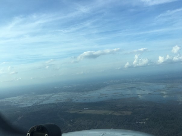


