It may seem like a small thing, but it’s actually a big thing. How does the South Florida Water Management District (SFWMD) manage mowing responsibilities for the Central and South Florida Project?
The Central and South Florida (C&SF) Project, first authorized by Congress in 1948, is a multi-purpose project that provides flood control, water supply for municipal, industrial, and agricultural uses, prevention of saltwater intrusion, water supply for Everglades National Park, and protection of fish and wildlife resources. The primary system includes more than 1,000 miles each of levees and canals, 150 water control structures, and 16 major pump stations.
~The ACOE built this system and the SFWMD was created to manage it.
-S-308, C-44, & S-153 in Martin County are part of the vast Central and South Florida Project In December 2020, item 19 of the SFWMD Consent Agenda read:
“Maintenance of District Lands is required to ensure that vegetation is controlled at the appropriate height to provide for optimal performance and operational efficiency of the District’s flood control system.”
I had inquired. I had questioned…
I had visions of the District mowing down every blade of grass. I asked what was done for the ecology? “Does the District leave any flowering weeds for bees or butterflies?” “Does the the District think about vegetation for the wildlife or do we just mow it all down in the name of flood control?”
I figured it would be the later…I was wrong.
On January 28, 2021, I got the tour of a lifetime and learned that there was more to it than mowing. A lot more. I met the heads of departments at DuPuis Wildlife Management Area near Indiantown in Martin County. The goal of my tour was to visit levees and canals and learn about SFWMD mowing practices.
  Photo: South Florida Florida Management Leadership, L-R back to front: Francois Laroche, Vegetation Mgt. Section Administrator; Rich Virgil, Field Ops. Division Director; Rory Feeney, Land Resources Bureau Chief; Chris Edelstein, Field Ops. Bureau Chief; LeRoy Rodger, Invasive Species Unit Lead; and me, JTL, SFWMD Governing Board.
I.
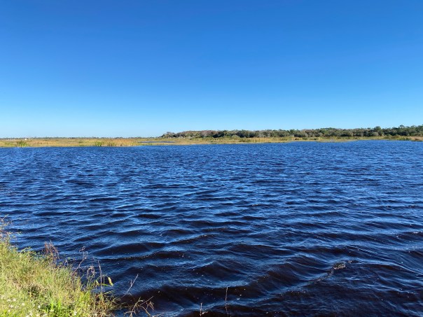
First we drove to the C-44 canal near S-308, an area I know well. The S-308 structure allows the Army Corp of Engineers to discharge water from Lake Okeechobee into the St Lucie River. The C-44 was first constructed from ca. 1913 to 1923 and over the years widened and “improved.” This repetitive disruption of the soil allows invasive plants to move in each time.
I did not realize the extent until SFWMD’s LeRoy Rodgers, Invasive Species Unit Lead, and Francois Laroche, Vegetation Management Specialist, told me the story and showed me the back side of the C-44 canal near S-308.
NAPIER GRASS: Introduced as a forage grass for cattle in the early 1900s; this African grass is extremely invasive. It grows best along disturbed canal edges eventually hindering flood control by blocking access to canals and impeding water flow. It has been here for decades.Over the years, C-44 levees near S-308 have become covered with Napier Grass also known as “Elephant Grass.”
-Canal C-44 at S-308 coved in Napier Grass  -Rory Feeney, Land Resources Bureau Chief, tugs on a Napier plant. ~The Rhizome structure makes the grass very difficult to “just pull out.”
 The tall grass is mowed intermittently on a schedule. The roots go wide and deep into the ground making it impossible to pull out without compromising the integrity of the Central and South Florida Project at C-44. All that can be done is to manage this explosion of grass.
I looked around. The tall Napier Grass reached as far as my eye could see. I thought about history. I though about time. I thought about responsibility. I asked if there were any benefits for wildlife.
LeRoyRodgers, Invasive Species Unit Lead answered. He said certainly, animals could hide there, but it was not a preferred habitat except for one, another invasive, the Burmese Python. He noted that when the SFWMD mowing crews started finding chopped-up python down in Homestead, a few years ago, that was when the District became aware of the python population issue down there.
Not a good visual…
The men compared areas showing me how the grass does respond to more frequent mowing. They explained how when it is mowed, some is cut short, some is left long and some is cut more often than other.
Closest to the road, where it can be mowed more frequently, I could see other plants and weeds not just Nadier Grasses coming in. Weed-like flowers bloomed here and there. Francois Laroche, Vegetation Management Specialist explained the ways of nature. With the more frequent mowing, other plants could “compete.”
I started to get the picture…
-LeRory Rodgers, Invasive Species Unit Lead, points to other plants coming in when Napier Grass is more frequently mowed along flat areas.
II.
Next, we drove just a bit further to the intersection of the C-44 and the S-153 Structure. This structure controls the water inside a canal parallel to Highway 98 and the FPL cooling pond. It was explained to me that this levee is a second line of defense should the waters of Lake Okeechobee pour over. A levee holds water back and a canal moves water. We were here to look at the levee. However, keep in mind, there is a “canal” where dirt is dug to build a levee… -S-153 intersects with C-44 canal; it is an area full of wildlife and displays both native and non-native plants along the canal used to build the levee.
-LeRoy Rodgers & Rich Vigil observe a fern; this one is not native, used in landscaping yards.  -S-153 at C-44 canal
  Looking around I was happy to see more flowering weeds and plants, and less invasive Napier Grass. This wasn’t the “flowering prairie” I had hoped for, but after my lesson on invasives, I was a bit more open minded. As I looked around, small birds darted away, quickly taking cover. A fish jumped close to a mass of dollar weeds that were wedged up against a floating rope. Some wildlife lives here!
I was starting to consider the balance. Where there was mowing, there were more flowering weeds and other plants. As Francois had said, mowing allowed competition.
To answer my question about plants for pollinators, we found numerous native Spanish Needles. These native blooms are highly visited by a range of pollinators and butterflies. There were others I did not recognize flowering as well. I saw a yellow butterfly, maybe a sulphur. Dragonflies were everywhere. I could hear insects chirping.
Mr LeRoy and the others picked flowers saying the names in Latin. We discussed the various vegetation, some native, some not, along the levee. It was a mix. 


We kept walking.
“O.K. there’s ding,” said Chris Edelstein, Field Ops Bureau Cheif.
“What’s a ding?” I inquired.
“Something the Army Corp would mark against us. See the dug out areas? That’s from wild hogs foraging for roots and worms.” LeRoy said the name of the long roots left behind in Latin. “This agressive digging is problematic to the integrity of the levee.”
“A ding!” I replied, noting the District’s legal obligation to the Army Corp. of Engineers.
“At least there’s life here,” I repeated. “And I do adore those little piglets!”
We continued looking at plants and weeds.  “Oh and here is another ding,” said Chris.
I looked up seeing nothing more than a pile of sand.
Rich Virgil, Field Ops Division Director explained: “That’s a gopher tortoise burrow…their burrows can be over 15 feet long and 6 feet deep. This can definitely be an issue for the integrity of the levee.”
I thought about the possibility of a hurricane and Lake Okeechobee overtaking its dike, the waters pouring east towards the levee. As the men had explained, this levee would be a line of defense.
I got down on the ground, and took a picture. The men talked. It sounded that a threatened gopher tortoise was not as easy to remove as the wild hogs.
The area was very interesting and definitely more wildlife friendly than our first stop. The mowing pattern again showed some vegetation left alone, some mowed shorter, and wild plants growing along the edge of the canal. The edge of the canal is mowed most infrequently by a special contractor when the plants get “too woody.” Otherwise it is left to grow….
I was somewhat impressed.
-Gopher Tortoise burrow in the levee  -Edge of canal connected to S-153 displays ferns and other plants, many flowering. I did see a few clumps of the invasive Nadier Grass, but not much.
III.
Last but not least, we drove to Lakeside Ranch, a Storm Water Treatment Area (STA) for nutrient reduction near Taylor Creek, northeast of Lake Okeechobee. In this area the levees of the STA were only a couple of years old; flowering weeds and “good” plants totally outnumbered the small clumps of Nadier Grass. The men talked about the importance of staying on top of the mowing so the Nadeir Grass and other invasive plants wouldn’t take over this area that is now habitat to an extensive number of birds and other wildlife.
“You have to stay on top of it.” Rich said looking from horizon to horizon.

 The place was beautiful. As we continued down the path, I laughed out loud at seeing a pile of apple snails, the trash midden of Snail Kites. Rory Feeney, Land Resources Bureau Chief, explained: “You can tell by the shape that these snails are not native, some can become invasive, but for the endangered snail kite, it’s been a life saver. The native Florida apple snail lives in a very limited habitat, whereas the invasive species tolerate more diverse conditions, including human-made impoundments.”
Wow. An invasive apple snail as a life-saver? The metaphor hit me hard. Non-native species are not always a bad thing, I guess.
And mowing?
I’m not as judgmental as I was before the field trip. There’s a lot more to it than just mowing!
-Staring down at piles of invasive apple snail shells left by endangered Snail Kites
 -I hold an empty, non-native, invasive apple snail shell, the snails that helps the Snail Kite survive in a changing Everglades environment. If only the invasive Nadier Grass could do so much good!
*Thank you to staff!


 –
–


