

In the 1960s, I grew up in St Lucie Estates, Stuart, Florida, the neighborhood just north and south of Kreugar Creek close to the St Lucie River, not too far from Downtown Stuart. Until I was ten, we lived at 109 Edgewood Drive. I loved that little brick house. I had full reign over the neighboring empty lots and could ride my bike on the “black road,” to get to a park, along the river, next to the Granfield’s house. The kids of the neighborhood often met there, and we pretended the gigantic, falling Australian Pine was a ship and we made it into our fort. We traveled across oceans. We fought pirates. It was a wonderful childhood.
As a kid, I had no idea of the long running issues with the St Lucie River/Indian River Lagoon, the canals, and Lake Okeechobee. I just knew I loved the river. I loved that I could escape there. Even when I was in high school, living in Sewall’s Point, I’d steal away and sit under the bridges and “think” in the privacy of the river’s ancient calm.
Today, at half a century, I am still in love with the river, but I view it in a different light. A light of history and destruction. My heart aches because I really don’t know if it can make it against the odds. Now that I am older, I know its complete destruction has been coming for a long time, kind of like a cancer. I am miffed that since 1923, when the ACOE first connected the C-44 to the South Fork of the St Luice, that locals were not able to stop the “drainage machine,” as Ernie Lyons, previous editor of the Stuart News, called it. I am miffed also that the state and federal agencies would so blatantly kill an ecosystem.
When I look through my mother’s historical data and read the ads for selling land in Stuart in the early 1900s, it is ironic that they all incorporate the St Lucie River into their sell while they were killing her.
“Stuart on the St Lucie, 1907;” “St Luice Estates, On the Beautiful St Lucie River, 1926;” “Stuart, Atlantic Gateway to the Gulf of Mexico, ca. 1926.”
The are all bragging about draining the Everglades; they are bragging about the digging of the Okeechobee Waterway from Stuart to Ft Meyers thorough Lake Okeechobee; they are basing the draw of the Stuart area on its location/proximity to the St Lucie River/Indian River Lagoon, and yet they seem to have no clue that by supporting the over draining and over dredging of everything, they have created the rivers’ own destruction!


 ;
;

This is an excerpt from the St Lucie Estates sales booklet:
” St Lucie Estates is situated in one of the most gorgeous spots in Florida—the beautiful St Lucie River County…The St Lucie and the Indian River meet here to form one of the most wonderful bodies of water in the world—one hundred miles of navigable waterway, edged with luxurious tropical foliage able white sandy beaches…”
“In the introduction to my mother’s book, Stuart on the St Lucie, she writes” Pioneer businessmen of Stuart…realized the St Lucie River was the town’s greatest asset. To foster awareness they of the town’s superior location, they used “Stuart on the St Lucie” in promotional literature, on signs and as newspaper headings. Time has not changed the fact that the St Lucie River is the best thing about Stuart.”

The St Lucie is still the best thing about Stuart, and now we know better. The drainage of lands surrounding the St Lucie/IRL was too extensive. In order to make way for agriculture and real estate development. The St Lucie River and Indian River Lagoon now take on more than twice what was originally drained into them.
The excess fresh water and pollutants have all but killed the St Lucie River/Indian River Lagoon. This chart shows the original drainage in green and today’s drainage which has been added to the green area in yellow. Lake Okeechobee’s discharges, in pink, are often on top of this. It is too much.
The old adage says “history repeats itself.” Well, here in “Stuart on the St Lucie,” history cannot repeat itself anymore. We must create a new future.


The concept that fresh water is a “pollutant” is sometimes confusing as we typically associate pollution with heavy metals, nutrients like phosphorus and nitrogen from fertilizer, and muck accumulation, on the bottom of the river, from sediments running off of lands, through canals. Believe it or not, too much fresh water is just as polluting and has dire consequences for the St Lucie River/Indian River Lagoon.
This is historically ironic as well, as when the Ais Indians lived in this area, the St Lucie River was a large fresh water “stream.” Throughout history, most of the time, the “St Lucie,” was not connected to the ocean. The natural inlet at what was later called “Gilbert’s Bar” by the Spanish was sometimes open, sometimes not, but never for too long, and the inlet opening was much smaller and shallower than today’s St Lucie Inlet.
Yes, we are going back, before we go forward, but history is important to know!
The “St Lucie Inlet” was permanently opened by hand using shovels, in 1892, by local pioneers who wanted access to the ocean for trade and communication. They had no idea that by doing this they would create “the most bio-diverse estuary in North America.”
As the salt water came in and mixed with the fresh water of the St Lucie and the “fresher than today’s water” of the Indian River Lagoon, one ecosystem, a freshwater ecosystem was destroyed by the salt, and another was born.
Over time, more fish and critters entered the St Lucie/ Southern Indian River Lagoon than at any other time in known history. The forks of the St Lucie, north and especially north, remained more “fresh” as the salt water usually did not go up that high into those areas. Perfect! Salt and fresh water fishing! It was a unique situation and as mentioned in the day before yesterday’s blog, presidents and other famous people swarmed to the St Lucie for its amazing fishing during this era, and all enjoyed.
Then things changed. In the late 1920s and early 30s, due to flooding of agricultural lands and bad hurricanes killing people living and working in the southern area surrounding the lake, the Army Corp built the C-44 canal from Lake Okeechobee to the south fork of the St Lucie River. Then in the 50s and 60s they built canals C-23 and C-24 as part of the Central and South Florida Flood System, another “flood protection project.” Although all of these drainage programs helped agriculture, especially the sugar industry south of the lake, and citrus, in mostly St Lucie and parts of Okeechobee counties, as well as greedy developers, it did not help the St Lucie River. In fact, these drainage canals have been slowly killing the St Lucie and Indian River Lagoon ever since.
How?
Through many things, but believe it or not, mostly through fresh water.
Once the estuary (St Lucie/IRL) became brackish, a mixture of fresh and salt water, this delicate balance was important to the fish, mammals and others critters that made the river/lagoon their home in this new found paradise.
Briefly, I will summarize some of the killer effects of fresh water on its residents:
1. Fish: When there is too much fresh water the fish get lesions. This is from a fungus that only can live and operate in a fresh environment. The name of the fungus is Aphanomyces invadans and its spores get into fish skin when temperatures are low and water is fresh causing horrible lesions. More lesions have been reported over time in the St Lucie River that any other site in Florida according to the FDEP report at the end of this blog. The worst outbreak was in 1998 after the ACOE had been releasing fresh water from Lake Okeechobee in the winter months due to heavy rains. Thousands of fisherman were reporting fish with lesions; it is well accepted in the literature of our state agencies that this outbreak was connected to the gigantic releases of fresh water from Lake O.

2. Bottle nosed dolphins: Dr Gregory Bossert formerly, of Harbor Branch, has done extensive research into lobo-mycosis, an awful skin disease, in dolphins of the SLR/IRL. The highest number of dolphins with lobo in the entire 156 mile Indian River Lagoon system from Jupiter to New Smyrna Beach, are in the Stuart to Sebastian area. Dr Bossert’s 2009-20014 “Application for a Scientific Research Permit” to NOAA states on page 59:
“Water quality in the central and southern segments of the lagoon, is influenced by infusion of water from flood control drainage canals, e.g., in particular, run-off form agricultural watersheds and fresh water releases from Lake Okeechobee. (Sime, 2005.) Discharges from these sources introduce higher amounts of nutrients, metals, pesticides and suspended solids into the system (Woodward-Clyde, 1994). Analysis of spatial distribution of presumptive cases showed that the highs rates occurred in the IRL segments 3 and 4 confirming our earlier observations.” (Mazzoil, 2003/Rief, 2006).”
(Sections 3 and 4 are the “south central” and “south” IRL/SLR-from-south of Sebastian Inlet, to Stuart’s St Lucie Inlet. IRL dolphins are “site specific” staying usually in a 30 mile range. The St Lucie River is considered part of the southern IRL.)

3. Seagrasses: Seagrasses are the basis of health for the entire SRL/IRL. Seagrasses that live in an “estuary” need sunlight and brackish (part salt/part fresh) water to survive. among other problems, the fresh water releases cause turbidity in the water so the grasses can’t get light and they die. Mark Perry of Florida Oceanographic states that during the Lake Okeechobee and canal releases from 2013, that lasted five months, up to 85 percent of the seagrasses died around the St Lucie Inlet. All nursery fishes are affected by this and of course it goes right up the food chain. Manatees, an endangered species, that live exclusively off of seagrasses, are very affected and reduced to eating drift algae that in some cases kills them. Dolphins are swimming around saying: “Where are the fish?!”

4. Near shore reefs: The reef system in our area is the northern most of a tropical reef system that goes all the way south to the Keys. It cannot survive with fresh water dumping sediment on its delicate system and altering the salinity of the St Lucie Inlet. Insaine. These reefs are supposedly “protected.”

I could go on and on, but I will stop here. I’m sure you get the point. Salinity is a delicate and important part of a healthy estuary. Generally short lived fresh water releases during heavy rains by our local canals are bad enough, but long term dumping of Lake Okeechobee releases on top of that, is certain death. It must stop. Send the water south.
_______________________________________________
(NOTE: The links below were removed by the Florida Department of Environmental Protection in 2016. When I called and asked why, I was told they were archiving…JTL)
FDEP, SLR Impairment/fish lesions: (http://www.dep.state.fl.us/southeast/ecosum/ecosums/SLE_Impairment_Narrative_ver_3.7.pdf )
WETLANDS Volume 25, SFWMD, Estuary in Distress: (SRL/IRL:http://www.evergladesplan.org/pm/recover/recover_docs/cems/cem_st_lucie_irl.pdf)

Thousands of years ago, humankind found a way to avoid the constant nomadic life of following big game, becoming more self sufficient, learning the art of agriculture. Nothing has made our lives better. Unfortunately, after thousands of years of its evolution, nothing has made our lives worse.
Don’t get me wrong, I realize that agriculture an important industry, the second largest after tourism, in the state of Florida. Still, we must look at its issues and try to make things better.
Agriculture is a high intensity land use, using large amounts of pesticides, fertilizers, and fungicides that over time accumulate in the water and the environment. The May 2014 issue of National Geographic states that “farming is the largest endeavor on earth using just under 40 percent of the earth’s surface causing the second largest impact to the earth, erosion.”
Much of the land in our area is devoted to agriculture as well, particularly citrus.
The Indian River Lagoon region is famous for its delicious citrus and although the industry is in decline due to canker, it has had huge impacts on the IRL area due to the canal system built to drain the land and water the crops. The muck that has entered the lagoon since the early 1900s is mostly from erosion of canals, due to the runoff from agriculture as they drain their lands that were once swamp or wetlands.

The USDA documented 89,367 acres of citrus in the Indian River Lagoon region in 2009, declining to 81,673 in 2010. There is a lot of land devoted to citrus, land that has been radically altered from its original state and affects the Indian River Lagoon as there are literally thousands of miles of canals attached and interwoven along these groves. All eventually dump to the river or other water body.
In 1994 the Florida Department of Environmental Protection (FDEP) determined that the north fork of the St Lucie River/Indian River Lagoon, a registered state “Aquatic Preserve,” was contaminated by pesticides that came from the citrus groves in the area of the St Lucie’s headwaters, Ten Mile Creek. (http://www.dep.state.fl.us/southeast/ecosum/ecosums/tenmile_creek.pdf)
In 2002, the Florida Department of Environmental Protection labeled the St Lucie River as “impaired.” Reading through the document there is clear determination of agricultures’ role in this process, especially with sediment run off, pesticides and heavy metals that have accumulated in the environment. (http://www.dep.state.fl.us/southeast/ecosum/ecosums/SLE_Impairment_Narrative_ver_3.7.pdf)


Reading through the documents it is noted that many of the agricultural areas are quite old, as the post cards I am sharing today from my mother’s collection are from 1912 and 1914. According to the FDEP, many of the areas around Ten Mile Creek did not have BMPs, or best management practices in place, as they were there before such rules were voluntarily implemented in the 1980s and 90s.
I don’t get it. Our environmental agencies have seen the writing on the wall for decades and even with the modern implementations of BMPs, (http://solutionsforyourlife.ufl.edu/hot_topics/agriculture/bmps.html) where farmers try to minimize their impacts on our waterbodies, the rivers, estuaries, and lakes are filling up with excess nitrogen and phosphorus from fertilizer and other pollutants at an alarming rate.
Yes, the FDEP is implementing TMDLs or total maximum daily loads through the BMAP, or basin management action plan, where municipalities and counties are required to lower their nutrient levels in waterbodies, but these are 15 and 30 year goals, that most certainly will take longer to truly implement. Also agriculture is exempt under the law and Right to Farm Act. They, as mentioned, implement BMPs but it may take fifty or more years to get all farms up to speed, if ever. Do we have that much time?
In the meanwhile, we watch or rivers dying from local runoff from C-23, C-23, and C-44 supporting the citrus and agriculture industries in Martin and St Lucie Counties. On top of this, during major rain events, Lake Okeechobee, also full of agriculture runoff and high nutrients suspended in muck, from the sometimes back pumping sugar industry south of the lake, pours into the St Lucie River as well, wreaking any work we have done locally to meet local TMDLs.
Would I rather see the citrus lands developed for houses?
No. I rather fix the problems we have. And even though its called “corporate welfare,” I think state, federal, and local governments must help agriculture operate in a way that is not killing the environment. Some of the funds from the state this year that came out of the Senate Hearing on the IRL are doing this and the state really has been helping “forever,” but quietly, under the radar.
It is time to come full out to the public and explain the situation: we must feed ourselves and support our historic industry, but agriculture/citrus is killing our waterways.
In conclusion, of course the industry should make every effort itself to improve the situation, and some are more than others. In any case, we cannot just point fingers at them, we must help them. Perhaps we should bond together and put into law even better, stricter management practices, that will give the children of our state a future, not just eating, but also fishing, swimming and boating in a clean river.
___________________________________________________
IFAS, Update on Best Management Practices, 2014: (http://www.crec.ifas.ufl.edu/extension/trade_journals/2014/2014_January_best_mgt.pd)
USDA and State of Florida Citrus Report 2009: (http://www.nass.usda.gov/Statistics_by_State/Florida/Publications/Citrus/fcs/2009-10/fcs0910.pdf)

When the pioneers permanently opened the St Lucie Inlet in 1892, it killed the freshwater grasses that filled the waterways creating a brackish estuary that due to the convergence of tropical and temperate zones, and the nearby warmth of the Gulf Stream, became “the most diverse estuary in North America.” (Gilmore)
After a short period of time, sportfishing thrived in the area, and fishing guides called Stuart the “fishing grounds of presidents” as US president, Grover Cleveland, vacationed and fished the area in 1900 and years after.
In spite of long standing issues with the health of the estuary, as late as the 1970/80s Dr Grant Gilmore of Harbor Branch documented over 800 species of fish living and breeding in the then healthy seagrasses around Sailfish and Sewall’s Point at the convergence of the St Lucie River and Indian River Lagoon. This was a larger variety of species in one place than any other area in United States. (Gilmore)

“Goliath Grouper” called “Jew Fish” at the time, Stuart. ca. 1920s. (Thurlow Collection)
Going back to the the 1930s, the 1938 Blue Book, a popular annual fishing publication of the time, lauds fishing throughout the entire Stuart area:
“The City of Stuart located approximately 20 miles south of Fort Pierce is world renowned for its fishing. Located as it is…it offers a variety of fishing similar to Fort Pierce but somewhat more pronounced, particularly with regards to the tarpon, sea trout, snook, channel bass, bluefish, crevasse jack, pompano and ladyfish. It’s fresh water fishing is particularly good far into the back county among the Sloughs with their tributary and drainage canals to Lake Okeechobee and the many drainage canals through this territory. These Sloughs and Canals offer splendid fishing for black bass, as well as for the larger game fish from the salt water, such as th snook and tarpon, that make their way into Stuart Harbor and on up into the both and south branches of the St Lucie River. –Particularly good fishing for these species can be had at the St Lucie Locks about 12 miles inland south of Stuart…”


It is interesting to note that although the Blue Book piece, written in 1938, celebrates Stuart’s fishing, one can find evidence of tension regarding the releases from Lake Okeechobee in the literature of the day as early as 1925.
Fearing the onslaught of development in the booming twenties and the changes brought on by the connection and building of the C-44 canal from Lake Okeechobee to the South Fork of the St Lucie River, beginning in 1923, the South Florida Developer’s, November 10th, 1925 headline reads:

“Fish Will Leave the River As City Grows, Fisherman Assert, Sewage and Oil Sure Death to a Favored Sport is Verdict.”
The article quotes commercial fishermen who know that the over abundance of fresh water from Lake Okeechobee will chase away the salt water fish and that the oil on the water from development, perhaps from cars and road runoff, if excessive, won’t allow the fish to sufficiently breathe.
Fishing guide Phil O’Brian is quoted as saying: “I know the ways of the sea fish. They can’t stand fresh water; and they won’t stand sewer water. We have the fresh water now mixin’ in from Lake Okeechobee and we’ll soon have the sewer water.”
These pioneers are probably rolling over in their graves should they have learned about the story of the St Lucie/Indian River Lagoon most recently.
The St Lucie River was labeled “impaired” by the Florida Department of Environmental Protection in 2002 mostly due to pesticides and heavy metals from agriculture and urban pollution runoff accumulating in the sediment from all area canals, especially C-44 and Lake Okeechobee. In a way, just like the 1920s fisherman foresaw…
The fight against the area canals and Lake Okeechobee continues today, and if by the grace of God we can undo some of the hands of history, the St Lucie and Indian River Lagoon will surely heal herself and we once again could be the ” Fishing Grounds of Presidents…”
…but then we might have to get rid of that green and sprawling golf course at the Floridian.
______________________________________________________
FDEP Impairment St Lucie River: (http://www.dep.state.fl.us/southeast/ecosum/ecosums/SLE_Impairment_Narrative_ver_3.7.pdf)

If you have ever visited a marine park in the United States, chances are you have seen a dolphin, or its offspring perform, that once lived in the Indian River Lagoon. A total of 68 dolphins were captured and permanently removed from the lagoon between 1973 and 1988 for captive display at mostly US marine parks.
I myself went to Discovery Cove in 2008 with my husband Ed, and witnessed a freak accident when Natasha, “our” assigned dolphin, was killed during a stunt when she slammed into another dolphin while preforming back flips in the confined area. What was to be a wonderful day, turned into a disturbing experience and it caused me to reevaluate and think more deeply about capturing and holding bottle-nosed dolphins and other marine mammals in captivity. In 2008, I had just become a commissioner for the Town of Sewall’s Point and started my journey, some may call it, my obsession, with the health of the Indian River Lagoon. This horrible experience at Discovery Cove has fed my obsession.
In 2010-11, I served as mayor of Sewall’s Point, and at this time, through my interactions with the Treasure Coast Council of Local Governments, I became a volunteer in the Marine Mammal Department for FAU’s Harbor Branch Oceanographic Institute in Ft Pierce, through the help of Steven McCulloch. I learned a lot during this time, and Steven taught me about the history of dolphins in the IRL because he had lived it.
He explained to me that things started to look better for dolphins in the late 1980s as prior to this time they were being captured for marine parks.
The Marine Mammal Protection Act of 1972 was the beginning of change and awareness for dolphins.
The Marine Mammal Protection Act of 1972 (MMPA) was the first act of the United States Congress to call specifically for an ecosystem approach to natural resource management and conservation. MMPA prohibits the taking of marine mammals, and enacts a moratorium on the import, export, and sale of any marine mammal, along with any marine mammal part or product within the United States. The Act defines “take” as “the act of hunting, killing, capture, and/or harassment of any marine mammal; or, the attempt at such.”
In November 1989, a temporary ban on the practice of removing dolphins by permit from the IRL and other Florida waters was passed federally. The last dolphin to be captured and removed from the Indian River Lagoon was in 1988.
Dolphins of course are mammals and they like humans, have very strong social ties. They live in pods, or groups and display site fidelity. Dolphin calves are raised by a group of females and will stay with the mother and nurse for up to four years. Generally, only males leave the original group and even so these dolphins have lifelong family relationships. These bonds are fierce and serve the animals in their survival.
Steve MuCulloch started and oversaw the Marine Mammal Department at Harbor Branch and is the most incredible person I know in this arena. No longer with the institute he helped build, he was responsible for overseeing the health assessments (HERA) that occurred in the IRL and has provided tremendous scientific information with the help and permitting of NOAA and Dr Gregory Bossert. Steve always showed a passion and attachment to the animals that defied the norm. I was fascinated and ask him to tell me his story.

Eventually, he told me of his history with the dolphins of the IRL and explained that in the early days, he had helped with their capture for marine parks. He told a heart wrenching story of how this changed for him when once on a mission, the take included a calf and the mother swam frantically along side the boat jumping and whistling/speaking with her calf. The calf struggled and clicked and whistled back.

Steve said a powerful feeling overcame him and he knew this was the last dolphin he would ever help remove from the lagoon; he would now make it his life to keep them safe and the families together. He yelled out: “The calf is not going to make it! Release!” This was policy if it appeared a dolphin was over stressing, as they are known to die in stressful situations with humans. The others on the boat stood speechless as McCulloch released the fretting, but not “over stressing,” calf back into the water with its mother. McCulloch said the mother happily reunited with her calf and then lifted her head out of the water looking straight at him as if to say “thank you!” Over time, Steve McCulloch became the charismatic local leader in marine mammal studies, research, fund raising and rehabilitation.
Things do change. Hearts change. Laws are passed for the good of the environment. Perceptions of yesteryear become archaic reminders of how far we as humans have come as a species.
Today, there are new threats due to poor water quality, excessive agricultural and urban runoff, emerging diseases, algae blooms, and an increasing number of boat hits, but at least the dolphins are free.
Life changing, good things have happened for the lagoon in the past and will be happening again. Please remember this and be inspired next time you see our protected friends, the beautiful Indian River Lagoon bottle nosed dolphins.
______________________________________________________
Bottlenosed Dolphin (Tursiops truncates) IRL Estuarine System Stock, December 2009, pg. 467 documents # of dolphins documented by the state of Florida removed from the lagoon for marine parks: (http://www.nefsc.noaa.gov/publications/tm/tm219/462_BODO_IRLES.pdf)
FAU/HBOI Marine Mammal Department: (http://www.fau.edu/hboi/marine_mammals/)
NOAA Marine Mammal Act 1972: (http://www.nmfs.noaa.gov/pr/laws/mmpa/)
Orlando Sentinel Article, 1992 IRL Dolphin Alliance: (http://articles.orlandosentinel.com/1992-10-26/news/9210260130_1_dolphins-indian-river-marine-fisheries)

A wolf of the Indian River Lagoon? You’re kidding?
Not too long ago, before 1908, a black wolf known as the “Florida black wolf” was part of the ecosystem of the St Lucie River/Indian River Lagoon. One of the best local accounts of this black wolf, can still be found in an historical document written by a member of the Seminole War party, of Col. Benjamin Pierce, for whom Ft Pierce is named.
Col. Pierce was fighting the Indians in the 1837 Seminole War. According to the Sebastian River Area Historical Society, Col. Pierce and his troops sailed down the Indian River Lagoon on December 31st “in boats filled with baggage, men, and provisions.” Surgeon Mott, of his party, wrote of the journey:
“Nothing occurred to disturb the quiet of the night, except the wolves in the neighboring forest responding with howls as they threatened one another…” (Source, Tales of Sebastian, 1990 compiled by the Sebastian Historical Society.)

This “black wolf subspecies” became extinct in 1908, mostly due to hunting as homesteaders pushed the wolf out of its habitat. John James Audubon’s drawing is about all we have left. It is documented that there was also a more reddish colored “red wolf” that coexisted with the black wolf simultaneously and it went extinct a bit later, in 1921.
These black wolves and red wolves were a related subspecies of the more well known American grey wolf (Canis lupus) and related to today’s Gregory’s Wolf or Red Wolf that has been recently been reintroduced in North Carolina.

For many years, there were intellectual arguments in the scientific community about whether the the black and red Florida wolves were true “wolves” or more closely genetically related to the coyote. Although after years of heated discussion, it was first determined that the black and red wolves were a type of coyote, this was contested and overturned by the International Commission on Zoological Nomenclature in 1957.
Yes, although they had adapted and taken on a smaller frame than their grey wolf relatives, Florida’s black and red canines were “wolves.”

Hmmm?
The state of Florida still has bears and panthers. Wouldn’t it be amazing if we still had wolves!
There may always be that element of fear with wolves but there must also be respect, as the wolf is second only to humans in adapting to a changing planet, and of course the extinct black wolf, and the modern grey wolf, are closely related to our very best friends, domesticated dogs.
Just incredible! The once wild and beautiful creatures of the Indian River Lagoon…..
_______________________________________________________
Florida Black Wolf: (http://en.wikipedia.org/wiki/Florida_Black_Wolf)
US Fish and Wildlife Commission/Grey Wolf: (http://www.fws.gov/midwest/wolf/aboutwolves/biologue.htm)
Wolf facts: (http://www.defenders.org/gray-wolf/basic-facts)

For many years, I was searching for old photos and maps showing what the river looked like before it was intersected by the C-44 canal, at the south fork of the St Lucie River, in Martin County around 1923. The canal was widened and deepened many times thereafter, but according to documents, the construction began around that time.
I felt like a sign should be erected noting the spot were we changed the St Lucie River/Indian River Lagoon forever….I still have not done this, even after the spot was discovered.
Time went on, and one day my mother, historian, Sandy Thurlow, looking through her old aerial photos said, “Jacqui, I think I found it! That spot you are looking for.”

These are the aerial photos she sent me. I wanted to share. I will not write much today, as a picture speaks a thousand words….
_______________________________________________________
FDEP/History C-44 Canal: (http://www.dep.state.fl.us/southeast/ecosum/ecosums/C-44%20Canal%20.pdf)
FDEP-Evidence of Impairment, C-44 Canal: (http://www.dep.state.fl.us/southeast/ecosum/ecosums/C-44_Impairment.pdf)


The locks are back in the news again. WPTV, “hard working for the river reporter,” Jana Eschbach, broke the story yesterday, that the Army Corp of Engineers did not alert the public that they would be releasing polluted canal, C-44 basin water through the S-80 structure into the St Lucie River. Jana, like most people, feels that the public should be alerted when polluted water will be coming into the estuary in that we swim and fish. She is also concerned the water in the area of Palm City and the Roosevelt Bridge, which has been reported to have high levels of bacteria, will be pushed to the popular Sandbar area.
This can be confusing. Don’t we just care about lake water? Also, if the locks are open, doesn’t that mean the ACOE is releasing Lake Okeechobee water? Not necessarily, and the basin water can be just as damaging to the estuary and the public. So how does releasing basin or lake water work?
There are two structures along the C-44 canal which runs along the side of Highway 76 from the South Fork of the St Lucie River, to Lake Okeechobee: S-308 at the edge of Lake Okeechobee, and S-80, 20 miles or so, east, at the St Lucie Locks and Dam.

S-80 serves duel purposes. First to release water through Lake Okeechobee, but only if S-308, at the lake, is open first, allowing water into the C-44 canal. Then S-80 lets the water pour into the St Lucie River.
Second, S-80 can be opened just to allow water from the C-44 to flow into the St Lucie River, as the C-44 canal is surrounded by a 185 square mile basin, mostly agriculture, that has been directed to flow into the canal when it rains. Agriculture also uses this water in the C-44 canal to water their crops. To make things more confusing, C-44 can “deliver” local basin runoff in both directions: to Lake Okeechobee and to the St Lucie Estuary. The ACOE decides where the water “needs” to go by opening and closing the structures of S-308 and S-80.
It must be noted that the water from the C-44 basin is polluted, as is the water from Lake Okeechobee. The Florida Department of Environmental Protection writes: “…the construction of the C-44 canal has had the greatest impact of the St Lucie Estuary–and nearly all of that impact has been bad, FDEP 2001.) The charts below show how much nitrogen and phosphorus come into the river from the C-44 and other basins. C-44 is the highest. Phosphorus and nitrogen mostly from fertilizer, feed toxic algae blooms in the hot summer months.


Fortunately, there is good news due to the help of our local, state and federal governments. The almost 3 billion dollar “C-44 Storm Water Treatment Area/Reservoir” has received first stage fundings and is under construction in Indiantown. It has been since 2011. This reservoir will hold the release water from the C-44 basin and clean it before it is returned to the St Lucie River. This is a huge positive, although it will not stop the releases from Lake Okeechobee.
An educated public is the best defense against the continued destruction of the St Lucie River/Indian River Lagoon. Thank you for being part of the solution and hopefully, next time, the ACOE opens any structure for any reason, they will alert the public, because here in Martin and St Lucie counties, we want to know!
________________________________________________
Cool video SFWMD C-44 STA/R. (https://www.youtube.com/watch?v=4BsC0BoIPJ4)SFWMD (http://www.hdrinc.com/portfolio/c-44-reservoir-stormwater-treatment-area-project)
FDEP C-44 Canal: (http://www.dep.state.fl.us/southeast/ecosum/ecosums/C-44%20Canal%20.pdf)
For thousands of years, before the intervention of modern man, the Ais Indians walked the banks of a large fresh water “stream,” that flowed to the Indian River Lagoon. When the Seminoles came years later, they called it Halipatiokee, Alligator Water, as it was fresh and full of gators. The Spaniards came in the 1500s, on and off for centuries. They first called the river, Rio de Santa Cruz, river of the Holy Cross, as the river is cross-like. Later, they re-christened the river Rio De Luz , river of light, for the lighting on the water is heavenly. Eventually, the Spanish called the river, Santa Lucea. The English then taking over, “anglicized” the name Santa Lucea, to what we know today, as “St Lucie,” the church’s saint of the blind, and of “vision.”

Unfortunately, there was not much long-term vision when the watersheds around the St Lucie were altered by modern man. In 1892 area pioneers cut a permanent inlet from the St Lucie River/Indian River Lagoon to the Atlantic Ocean, killing the native fresh water grasses that supported an entire ecosystem. Nonetheless, they created something wonderful, the brackish estuary we all know today. This area, over the years, before its recent destruction, became one of the most bio diverse estuaries in North America.
That wasn’t enough, the local people and the state, with the help of the federal government’s Army Corp of Engineers, decided they wanted a connection to Lake Okeechobee for trade, travel, agriculture and the convenience of keeping the big lake of Okeechobee, “low.” So they built the C-44 canal connecting Lake Okeechobee to to the St Lucie “River.” In high water times, the overflow from the lake was directed into the St Lucie River as it is today. Later, around the late 1950s the people decided they wanted more drained land for orange groves and development in the north, and less flooding, so they got the state and federal government to build the C-23, C-24 canals in Martin and St Lucie counties, draining some areas that had never flown south before. These canals even drained lands out west, in what is now Okeechobee County, and in the north, known today as the City of Port St Lucie.
Did the people building these canals ever think about the effects on the Saint Lucie River? This seems doubtful. And so today, we have a river system that takes on much more water than it was ever meant to receive.
As Ernie Lyons, the former great environmentalist and editor of the Stuart News wrote in the 1960s about the loss of the headwaters of the South Fork of the St Lucie River during his lifetime:
“…The drainers got to work on the marshes. The cypress bordered ponds became white sand in the dry times. A ditch through them gushed silted floods during the heavy rains. The little stream was ruined. It turned from paradise to paradise lost…”
Not until really the 1970s did humankind start to reflect and realize that we literally were killling paradise, and we have been trying to revive the spirit of the St Lucie River/Indian River Lagoon ever since.
With out a doubt, the spirit of the saint still lives in the St Lucie River; her ancient story is that she lost her eyes to give the people their own “to see .” When you drive over the bridge and look at her, the beautiful St Lucie, open your eyes and ask her to give us all, “better vision.”
____________________________________________________________
St Lucie River SFWMD: (https://my.sfwmd.gov/portal/page/portal/common/pdf/stlucie.pdf)
Watershed maps/FDEP: (http://www.protectingourwater.org/watersheds/map/)
Story of St Lucy/Lucie: (http://en.wikipedia.org/wiki/Saint_Lucy)

Senator Joe Negron, Senate Appropriations Chair, and leader of the “Senate Hearing on the Indian River Lagoon and Lake Okeechobee,” brought home more money for the IRL compared to any other water body in the state: $231,998,021. Our springs comrades who have been publicly fighting ten years longer than us, brought home 30 million. Tallahassee is wondering who this new kid on the block is, us….

Whether you are a fan or not, it must be noted that Senator Negron stuck his neck out, possibly compromising his senate presidency, to get our “name on the map” as far as Tallahassee goes. Prior to last year, most “good ‘ol boys in Tallahassee would have said, “Indian River Lagoon…Hmmmm? Creature of the Indian Lagoon, ain’t that a movie?”
Nonetheless, I do not pretend to think that these monies alone will cure the lagoon’s ills, as the gorilla in the room has not been addressed “head on and in its entirety:” the releases from Lake Okeechobee through S-308 and S-80. I believe this will come in time if we keep fighting.
In my opinion, the biggest part of change is the first step. With the outrage of the public over the “Lost Summer’s” toxic St Lucie River and Indian River Lagoon, and the support of Senator Negron, one of the few people in a the legislature with the seniority and status to act somewhat independently of demanding party pressures to conform, we have taken the first step forward to fixing the lagoon. Actually, a leap.
WE MUST CONTINUE, YES! But let’s be happy that we have made public progress on a state level more than ever before, and let’s look at what we received, as we should be aware of the gift of public monies from people all over our great state and be full of gratitude.
It’s a lot to go over, but it is important, so I will simply go down the list and summarize. Let’s look at the map as well. Please remember the SLR/IRL is part of the greater Everglades system, from the Kissimmee River area in Orlando, south to the Tamiami Trail in Dade, and beyond to Florida Bay. So anything done to help “the system,” helps us move water south, and with our health as well.


Here we go!
1. $32,000,000 for Water Quality storage in Storm Water Treatment Area 1 in Palm Beach County. Water storage is key to stop releasing so much into the estuaries.
2. $3,000,000 for Best Management Practices (BMPs) for farmers in the St Lucie, Lake O, and Caloosahatee watersheds. It is difficult to swallow more public money going to help farmers with pollution runoff, but there is no other way to do this. We must continue to help fund them, big or small. This is a historical issue as they have been here since the 1800s in many cases. I look at it like “grandfathering” with an extra requirement, as in real estate. The good news is that as time goes on, agriculture businesses will have higher standards to avoid pollution fertilizer, pesticides and fungicide runoff that is killing our waterbodies. Hopefully we can make changes before the rivers and springs die off completely.
3. $40,000,00 for the C-44 Storm Water Treatment Area/reservoir in Martin County. This will offset local drainage farm and urban runoff along the C-44 canal, not water from Lake Okeechobee. We must clean our local runoff as well as it is responsible for around 50% of the destruction to our estuary and on an everyday basis.
4. $2,000,000 CERP Picayune Strand east of Naples in Collier County. This area is important to the southern glades and needs monitoring and vegetative management for water flow and storage and improvement. Hopefully it will help some panthers too!
5. $5,000,000 C-111 South Dade. This is a crucial water delivery system to allow more water to “go south.” A must.
6. $5,000,000 Kissimmee River Restoration. The all time worst thing ever done in Florida other than dike Lake O and redirect the water to the estuaries, was to straighten the Kissimmee River. (Hold my tongue!) Restoration of the ox bows must continue. So far the ACOE has restored about 22 miles of the 56 miles of what was once 153 miles of gorgeous serpentine like, vegetative, wildlife filled, cleansing waters.
7. $18,000,000 C-43 STA along Caloosahatchee River. This is the equivalent of C-44 STA/reservoir for the Caloosahatchee. Only fair. C-43 is a must. They take up to three times the polluted runoff from Lake Okeechobee that we do!
8. $20,000,000 IRL muck removal in northern lagoon. The northern IRL has lost 60% of their seagrasses and has 2 Unexplained Mortality Events including manatee, dolphin, and pelican die offs. Give them what they need! Sediment/muck fills the lagoon over the years from canal runoff covering seagrasses; when stirred up, it releases legacy pollution. GET THE MUCK OUT!
9. $2,075,000 Lake Worth Lagoon. Lake Worth does not get the attention it needs being in development happy Palm Beach County. This area was once full of sea grass and life but not after years of receiving dump water from Lake O, like us, but through a different canal. Local advocate, Lee Shepard, is a great advocate for this part of the lagoon. Let’s help!
10. $4,000,000 Water Quality research for Harbor Branch and ORCA. Although it is hard to justify “more tests,” as we can all see the lagoon is dying, these new, scientific studies will help us find sources to our pollution issues that the legislature can’t ignore. Septic leakage, especially, is difficult to trace without such systems. LOBOS and Kilroys, please help us!
11. $1,000,000 Oyster recovery programs for St Lucie and Caloosahatchee Rivers. Millions of dollars worth of oysters, natural and deployed by government programs, died during the fresh water discharges of 2013 and years before. One oyster can filter 50 gallons of water a day. Government in action….
12. $90,000,000 NUMBER ONE NECESSITY is raising the Tamiami Trail in Dade County so water is not blocked off from going south. They should raise the whole road as the road built in the 1920s cuts off the flow of water south to the Everglades for the entire state. (Another environmental nightmare to fix.)
13, $2,7769,585 This money will be used for pump improvements etc to move more water south and cut away vegetation blocking water “going south,” or hold water in the C-43/44 reservoirs that would go into the estuaries.
14. $2,076,728 The Loxahatchee is one of two “Wild & Scenic Rivers” in the state of Florida and home to tremendous amounts of wildlife. Helping with storm water runoff and preservation is key for the health of this important part of the Everglades System.
15. $2,076,718 The St Lucie Rivers Issues Team has a long history of working with local governments for “close to home” projects along the SLR/IRL. Kathy LaMartina at its helm, South Florida Water Management District. Thank you!
Grand total= $231,998,021
I am grateful to the state legislature, especially Senator Negron, and I must note Governor Scott did not veto one line. But please know everyone, the “fight for right” along the Indian River Lagoon has just begun!


Nic Mader has one of the coolest jobs in the world, and one of great importance to our St Lucie River/Indian River Lagoon. She volunteers for the Dolphin Ecology Project in conjunction with Harbor Branch’s photo ID program. She photographs the dorsal fins of all dolphins in our area. When one looks closely, each dorsal fin is unique.

Generally speaking, the IRL bottle-nosed dolphins are “site specific,” they have a “territory.” Even during crisis, like heavy rains causing polluted discharges and toxic algae blooms in our river from our local canals and Lake Okeechobee, the dolphins remain in our area within a range of about thirty miles. Nic photographs these dolphins and knows them by name. Her newest dolphin is a baby named “Clover.” The mother’s name is Shamrock. Baby Clover will stay aside Shamrock and accompanying group females for up to three years.
Clover is the newest documented member of the group/family of dolphins that live in the “southern lagoon,”which includes the southern IRL and St Lucie River. There are are other groups in the central and northern lagoon as well, all the way up to Volusia County. Sometimes these different groups interact but not too often.
Also, very rarely would one go into the Atlantic ocean through an inlet or a larger oceanic dolphin come inside. The dolphins of the SLR/IRL feel protected here. The entire 156 mile lagoon has about 800-1000 dolphins. Just over a hundred live in the southern area full time.
Even though the lagoon provides protection, there are numerous threats to Clover and her friends and family.
1. Boat hits: More dolphins are struck by boat hits in the southern IRL than any other part of the lagoon and unfortunately Clover’s mother Shamrock is raising the calf in the Crossroads area, the busiest boat traffic area in Martin County. Fishing is good in this area so Clover is being taught to fish, like her pod, in these dangerous waters. (FAU/Harbor Branch Dolphin Health and Boat Hits: (http://www.fau.edu/hboi/marine_mammals/pbbe_lab.php)

2. Toxicity: Harbor Branch has documented that IRL dolphin have the highest levels of mercury in the southeastern US. As much as 14 times higher than “acceptable” by FDEP. In fact, it is well accepted that the first baby dolphin a mother has often dies as mothers offload acquired toxins into the first baby that are stored in the mother’s fat. Just horrific. (Dolphin and Human Mercury IRL, Schafer, HBOI, (http://www.cehaweb.com/documents/2_000.pdf)
3. Fishing line and hooks: Unfortunatley dolphins are so smart it often gets them in trouble like when they try to steal fish off a fisherman’s hook or curiously tamper with crab traps getting the band stuck over their head and neck.
4. Feeding by humans: One of the worst things that can happen to wild dolphins is for people to feed them, as this behavior teaches them not to feed themselves. (PSA,Don’t Feed Wild Dolphins: (https://www.youtube.com/watch?v=EjHNXbviACk)
5. Lobomycosis: Lobomycosis is a terrible skin disease only know to affect humans and bottle nosed dolphins. Harbor Branch has documented more lobomycosis in the southern IRL (17%) than anywhere in the entire IRL, west Florida, and SE US. This is linked to polluted fresh water releases. (Abstract “Lobomycosis,” Dr Bossert, Harbor Branch: (http://link.springer.com/article/10.1007%2Fs10393-008-0187-8)

6. Chemicals: Unfortunately, septic tanks do not filter drugs that we all take and these drugs, antibiotics, even caffeine, find their way into our rivers accumulating in dolphins. Many are immune to antibiotics in the IRL. (Abstract, Anti-biotics IRL Dolphins, Dr Bossert, Harbor Branch: (http://www.ncbi.nlm.nih.gov/pubmed/19415386)
7. Morbillavirus: Morbillavirus is like dolphin measles. Presently there is an UME or “unusual mortality event” along the east coast of the US and thousands of dolphins have died. If there were contact between a sick oceanic dolphin and our IRL dolphins, our IRL dolphins could contract the deadly disease. (Abstract, Morbilliavirus IRL dolphins, Dr. Bossert, Harbor Branch: (http://www.sciencedirect.com/science/article/pii/S0378113509005732)
8. Tumors/Papillomaviruses: About 33% of IRL dolphins have been documented to have tumors linked to papillomaviruses. (Abstract, Papillomaviruses IRL Dolphins, Dr Bossert, Harbor Branch: (http://www.sciencedirect.com/science/article/pii/S0378113512003574)
Most IRL dolphins have an average life span of 25 years – and a maximum life span of about 50 years. Dolphins living in the ocean have a longer average life span by about 15 years. Seems it would be the opposite as the lagoon is a “safe haven.” (Sea World, (http://www.animalsnetwork.org/wild-world/zoo-research/indian-river-project/dolphin-56.htm)
Clover, like all new life, has a mountain of obstacles to overcome, but making that even more difficult is that, in today’s world, especially in the St Lucie River/indian River Lagoon, bottle-nosed dolphins’ immune systems are compromised due to poor water quality.
Let’s do what we can to help out. Please slow down if you are in the Crossroads, take the time to look around and see if you can find Clover playing in the waves or learning to hunt. And most important, let’s not accept the above list of 1-8 as “status quo;” let’s fight to give Clover a chance for a long and beautiful life along the Indian River Lagoon.
________________________________________________
Dolphin Ecology Project: (http://www.dolphinecology.org/FindOut/index.html)
FAU/Harbor Branch and “Save Wild Dolphin” license plates: (http://www.fau.edu/hboi/)

The front page of today’s Stuart News, reads: “40 Acres Burn in the Savannas.” The wind shifted causing a prescribed burn to jump control lines. Unfortunate. There have been other fires in the history of our area too, like the great fire of Jensen in 1908.

Here is an anonymous account of the 1908 fire in my mother’s book. The account was published in the Jensen Beach Mirror in 1962.
“The town of Jensen is burning down this morning. The fire rages up and down Commercial Street, from the river to the railroad tracks and beyond. It seems certain that each of the seventeen stores…will be consumed. Jensen has no fire department. Men are trying to stem the holocaust with buckets of water and what little power can be built with hand pumps and windmills…”
The fire’s location at C.H. Munch & Co. was determined but the reason for the fire never was… Jensen business was slow to rebuild after the 1908 fire and two years later another fire brought down the iconic Al Fresco Hotel that was located closer to the river just off of Main Street.

Historic post card of the Al Fresco Hotel, Jensen, late 1800s. (Courtesy of Sandra H. Thurlow.)
Many fires in Florida and in Martin/StLucie Counties are made by Mother Nature and not humankind. Fire is actually a heathy and needed part of our area’s pine, scrub, hammock, and swamp system. Fire naturally rejuvenates the land and habitat of the native animals and birds. Many native trees and animals have evolved over thousands of years to live in harmony with this fire system. Gopher turtle holes can be very long and deep, providing protection during fires to many species. Palmettos, sabal palms, and pines trees are “fire resistant.” Fire is nature’s way to bring nutrients (fertilizer) to the plants in a way that does not hurt the river as ash holds in the soil, and shortly after fires, a very obvious “rebirth” occurs.
This Florida Forest Service chart shows how frequently fires would occur if mankind was not suppressing them.

Chart by Forest Service showing frequency of wildfire in Florida if there were no human intervention.
Prescribed burns are an attempt to help nature, not hurt it. Unfortunately, when playing with fire, things can get out of control quickly. At least we did not have a fire like the Great Jensen Fire of 1908. ___________________________________________________________________
University of Florida/Florida Wildfires/Forest Service: (http://www.srs.fs.usda.gov/factsheet/pdf/fire-considering.pdf)
Alice and Greg Luckhardt’s historical vignette of the Jensen Fire: Google “Jensen Fire Luckhardt” for a great story I cannot get to link to this page.

The Intracoastal and Okeechobee Waterways are important navigation channels and part of our country’s heritage.

The history of navigation in the United States is a long one that is difficult to put into perspective within the context of today’s modern world. Military, commercial and communication centers were imperative goals to the newly established United States and remain so today, but these things are now taken for granted and have also inadvertently caused massive environmental destruction.
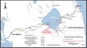
The Atlantic Intracoastal Waterway is a 3000 mile inland waterway along the east coast of the US from Maine to Florida. The Okeechobee Waterway is a few hundred miles across the state, from Stuart to Ft Meyers, linking the Atlantic to the Gulf of Mexico through canals and Lake Okeechobee.
These canals are directly supported by the public though a tax. If you look at your tax bill you will notice you are charged a .3045 mill to maintain the Florida Atlantic and Okeechobee Intracoastal Waterways. After a long evolution, today, the state’s Florida Inland Navigational District or FIND is the entity that acts in cooperation with the US Government, Army Corp of Engineers, to oversee these tax funds in order to maintain these important canals that serve many purposes. Some we don’t like…
One of the purposes of the Okeechobee Canal, built in the late 1920s and “improved” many times since, by being deepened and widened, is to release water from Lake Okeechobee into the St Lucie River/Indian River Lagoon when Lake Okeechobee gets too full, as the lake has been diked for the safety of agricultural lands and urban communities living around and south of the lake.
The mission of FIND is very broad actually; if we look at the mission statement of FIND it reads:
“The Florida Inland Navigation District has two primary missions: (1) to perform the functions of the “local sponsor” of the Atlantic Intracoastal Waterway project and a portion of the Okeechobee Waterway project in Florida, both of which are State/Federal navigation projects, and (2) provide assistance to other governments to develop waterway access and improvement projects. As the local sponsor of the Waterway, the District provides all lands required for the navigation project including rights of way and lands for the management of dredged materials removed from the waterway channel during dredging activities.”(http://aicw.org/index.jsp)
FIND is overseen by commissioners from the twelve counties along Florida’s east coast. Commissioners are appointed by the Governor and approved by the Senate. Our local commissioner is friendly and well known, Mr Don Cuozzo.

FIND also serves other purposes very close to the people and local communities that I do care about, such as providing grant funding for local waterways improvements, and maintaining the important manatee signage and protection zones. We all know this iconic and endanger species, a gentle, distant relative of the elephant, is often stuck by speeding boaters.

Thank you to FIND, but it sure would be nice if we could FIND another way to for the lake’s water to go than through the St Lucie/Indian River Lagoon.
For 2013, Ed and I paid $13.31 to FIND. Although I would prefer not to support the Okeechobee Waterway atrocity, I do like manatees, boating, and the Town of Sewall’s Point has benefited from FIND grant programs as well. So, I guess, for now, Ed and I will pay the tax; but one day, I have the feeling, I might just rebel!
_______________________________________________________
Atlantic Intercoastal Waterway (http://en.wikipedia.org/wiki/Atlantic_Intracoastal_Waterway)
Okeechobee Waterway, ACOE: (http://www.saj.usace.army.mil/Missions/CivilWorks/LakeOkeechobee/OkeechobeeWaterway(OWW).aspx )


For six years I have driven north to Ft Pierce from the Town of Sewall’s Point, along Indian River Drive, to attend my meeting as a representative for the Treasure Coast Council of Local Governments.
I love this time. I love this road. It is a meditation, a prayer for me.
I know lots of stories that I heard throughout my childhood and they all seem to come alive as I drive through the cathedral of sabal palms, old plantations, and ancient live oaks; my car creeps up the rising ridge rolling at the 25 mile an hour speed limit; I gaze over the lagoon itself, sometimes quiet, sometimes moody, but always beautiful. Ospreys keep their high perch or fly in circles over my head, egrets and herons stand along the shallow shoreline; I pass ancient Indian mounds, and when I wave, the the warriors hold up their right arms in strength and friendship; I see old pioneers like Captain Richards, and Bahamian workers sweating buckets, as they labor to grow pineapples in the heat of the 1800s; I see their graveyards …Every once in a while, I have to stop day dreaming and let a family of sandhill cranes cross the road. Sometimes I think I see a pirate out of the corner of my eye…
The road is an old one, first an Indian trail on the pushed up Atlantic Ridge along the west side of the lagoon; later to become a river road for Florida’s early pioneers as they traveled along its “river highway,” trading supplies and establishing post offices. After being a military/wagon trail it evolved with the modernization of the post World War II era, and the event of the automobile, into a “modern drive,” and its large parcels were sold off and eventually the “Indian River Freeholder Association” formed in St Lucie County, for its protection and order. (http://rickinbham.tripod.com/TownOfSIRD/SIRD_History_2.html)
Indian River Drive covers more than our shores going more or less the entire 156 mile length of the Indian River Lagoon from Stuart to St Augustine covering five counties; thankfully it has been designated as a “Scenic Highway” in many areas. (http://www.floridascenichighways.com/indian-river-lagoon-national-scenic-byway/)
It is my favorite drive along our Treasure Coast.
If you have not driven it lately, on a beautiful morning please take a ride, and if your imagination gets the best of you, don’t be afraid to wave!

___________________________________________
Visit Florida: “Treasure Coast Scenic Highway” Indian River Drive (http://www.visitflorida.com/en-us/listings/002/a0t40000007qu8nAAA.html)

The first time I saw Gary Goforth speak (http://garygoforth.net/services.htm) at Senator Joe Negron’s Senate Hearing on the Indian River Lagoon and Lake Okeechobee in 2013, I was very impressed. He was sitting next to Karl Wickstrom, the founder of Florida Sportsman Magazine, who I sit with on the Rivers Coalition Defense Fund. I knew if Dr Goforth had Karl’s “blessing” he belonged to an elite group of people in the River Movement, as Karl, who I love, is understandably critical of everyone.
I came to learn that this accomplished and well spoken man, had worked at the South Florida Water Management District (SFWMD) as a Ph.D. engineer, most of his esteemed career and in fact “built” the Storm Water Treatment Areas (STA) in the Everglades Agriculture Area (EAA) as head engineer for the district’s projects in 2004 on onward. Today he runs his own engineering company here in Martin County independent of the district. (See link above.)

An STA is an area that filters water through vegetation taking up nutrients like phosphorus and nitrogen and even pollution before it goes into a water conservation area and then to the Everglades. It is an area engineered to do what Mother Nature did before we transformed her into farmlands and urban landscapes.

When the Everglades Forever Act was passed by the Florida legislature in 1994, and after Governor Chiles “laid down his sword,” the SFWMD was required to build more STAs to filter the polluted water running into the Miccosukee lands and Everglades further south. The Miccosukee had sued the US government and the SFWMD, (a long, famous lawsuit starting in 1988), as specifically the high phosphorus from fertilizers and pollution from the EAA’s sugar farms was destroying their reservation’s waters and fauna and therefore all that lived there. The law suit accomplished two major things. It called for 10 parts per billion phosphorus rather than 200 plus so the STAs were built and it called for a certain amount of water to go south to sustain the life of the Everglades.
So in comes the law regarding amounts: In chapter 3773.4592, Florida Statues, “1994 Everglades Forever Act” the SFWMD was directed to send an additional 28 % water to the Everglades, including 250,000 acre feet of Lake Okeechobee water based on base flow statistics from 1979-1988. The Everglades needs water to live.
It is confusing, but although the STAs can send both EAA water and lake water south to the Everglades, the SFWMD gives the EAA water (from the lake, used to water their crops), priority in moving south. Lake water goes south only if the STAs have room….
OK. Here is the kicker.
Although in the recent past, the EAA spent tons of money removing toxic chemicals from the lands they had to give up for STAs and although the tax payers spent billions of dollars building the STAs on those lands for cleaning EAA water and Lake Okeechobee water, Gary Goforth’s charts and engineering show that since 2004, actually less lake water is going south to the Everglades. And most of the water going south is EAA water, very little Lake water comparatively ….Why?
Well, from what I think I understand, even though all this money has been spent in the EAA and tax payers building the STAs, the EAA and SFWMD who work together, are “scared” to send too much water south because if they go over the 10 parts per billion phosphorus limit (an annual limit) they could be sued again. Thus they hold the EAA water in the STAs letting it dribble out and therefore there is no room for Lake O’s water most of the time.
Hmmm?
As Dr Goforth points out, it is the St Lucie River and Caloosahatchee that do not get what was legislated for them: a minimum of 250,000 acre feet of lake water sent south a year.
As stated in an email to me:
“The 1994 Everglades Forever Act (Florida legislation Ch. 373.4592, F.S.) directed the South Florida Water Management District to send an additional 28 percent water to the Everglades, including 250,000 acre feet of Lake water. The 1979-1988 base period flows to the Everglades included an average of 100,931 acre feet from Lake Okeechobee – resulting in a targeted increase of Lake water to the Everglades of 148 percent.
For the most recent 10-year period (May 2005-April 2014) an average of 71,353 acre feet of Lake water was sent to the Everglades – or an average decrease of 29 percent from the 1979-1988 base period.
So – the target was a 148 percent increase – and the reality was a 29 percent decrease. This was in exchange for a billion dollars of public funding for the STAs. Who holds the State accountable?” Gary Goforth

If you are like me, this all may remain confusing, but I think the point is made… I hope so anyway.
“Legally, not enough Lake O water is going south.”
This is a serious situation. Really, only the people can hold the state accountable, but do we really want to sue again? Can this be resolved?
Many say it is impossible to send the water south at 10 ppb. This may be the case. Nonetheless, I say the Miccosukee Indians finally won something after generations of sadness to their people, after being forced to live on a postage stamp, so as “tough as it sounds,” I believe the EAA, the SFWMD, and the state of Florida have some more work to do.
_________________________________________________________________
Florida Statutes, Everglades Forever Act, (Ch. 373.4592)(http://archive.flsenate.gov/statutes/index.cfm?App_mode=Display_Statute&URL=0300-0399/0373/Sections/0373.4592.html)
FDEP, Everglades Forever Act: (http://www.floridadep.org/everglades/efa.htm)
(Everglades Restoration:(http://en.wikipedia.org/wiki/Everglades_Forever_Act#Everglades_Forever_Act)

Wow, look at this! A 1957 aerial photograph of the beautiful North Fork of the St Lucie River and its surrounding virgin lands that would incorporate as the City of Port St Lucie in 1961.
This Aia Indian and Seminole wilderness became spotted with many ranch lands but there was foresight for “protections” for some areas as it was beloved by hunters and fisherman and “just people” that wanted to protect its resources. It was full of wildlife on land and in its waters, which had been considered the best mostly “fresh water” fishing in the area for decades.

In 1972 local, federal and state agencies led by the Florida Department of Natural Resources cooperated to declare the North Fork of the St Lucie River an “Aquatic Preserve.” And in 1984 the Department of Natural Resource, which merged into today’s Department of Environmental Protection, created a management plan for the area. The plan states:
“The preserve is one of the last remaining freshwater/estuarine wilderness areas in this region of Florida. The major objectives of the aquatic preserve management program are to manage the preserve to ensure maintenance of essentially natural conditions, and to restore and enhance those conditions which are not in a natural condition. Management will also be directed to ensure public recreational opportunities while assuring the continued propagation of fish and wildlife.” (
http://www.gpo.gov/fdsys/pkg/CZIC-qh90-75-f6-g57-1984/html/CZIC-qh90-75-f6-g57-1984.htm
)
(NOTE: The Florida Department of Environmental Protection removed these links from public view in 2016. When I called they said the links were being archived. JTL)
I don’t know why really, but this plan was not implemented and unfortunately the area of the North Fork’s headwater’s at Five and Ten Mile Creek were contaminated by agricultural pesticides in 1995 in a formal document by the Florida Department of Environmental Protection. (
Click to access tenmile_creek.pdf
) In 2002 the St Lucie River including parts and beyond the “aquatic preserve” was designated an “impaired water body” by the same agency in 2002. (
Click to access SLE_Impairment_Narrative_ver_3.7.pdf
)
All the while the city of Port St Lucie grew and grew…


According to the US census there were 330 residents in 1970 and 88,769 in 2000. In 2012 there were over 250,000 residents.
Over the years, the city and agencies did not pay attention to how developers and people developed their homes along the river, and many were developed go right up the the shoreline of the Aquatic Preserve as this photo by the FDEP shows. This is how fertilizers and pesticieds run right into the water. Not smart. (
http://www.dep.state.fl.us/coastal/sites/northfork/description/surroundings.htm
)

The State of Florida projects that the City of Port St Lucie is to have have 400,000 residents by 2025. Presently with over 250,000 residents, they are the state of Florida’s ninth largest city.
As odd as it sounds, this population may be a key to turning things around for the St Lucie River/Indian River Lagoon. Our Treasure Coast area never had enough votes to get much attention until recently and some of the St Lucie city and county commissioners are some of the most vocal in the the Save the Indian River Lagoon movement.
Why the state and federal and local agencies allowed the degradation of lands they spent an enormous amount of time protecting is pathetic. As usual there is only one hope for change, the people pushing government to save what’s left and find ways to let the estuary recover, may be the only answer to saving the St Lucie River/Indian River Lagoon.

Coyotes are here along the St Lucie River/Indian River Lagoon.
Coyotes were historically associated with the American West, but now they are now in most states and have been reported in 66 of 67 Florida counties, other than Monroe. There is no one to thank for this but humans. With the near eradication of the the American wolf and family of big cats related to the mountain lion since the 1800s, coyotes have no natural predators, other than man, and thus the coyote has flourished.
Most recently, along the Treasure Coast you many have read about Indian River County using cameras to see if coyotes are raiding sea turtle nests, or the controversial trapping and killing of the coyotes at Witham Field in Stuart interfering with plane landings, or the many residents in Palm City or western St Lucie County, who say they hear coyotes howling at night. Coyotes have also, within the past six months, been reported in the Town of Sewall’s Point, in the vicinity of South River Road on the south end, and Castle Hill in the north.

As a long time resident of Sewall’s Point, I love the wildlife and encourage all to live in harmony with these animals. They are God’s creatures and they keep the rat population down! I have seen both grey and red foxes, as well as many bobcats. I have friends who swear in Sewall’s Point’s earlier days, they witnessed panthers.
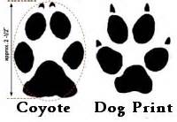
But I have yet to see a coyote. Unlike native bobcats who are solitary animals, unless mating or raising young, coyotes usually hunt in pairs and belong to a pack of about six members.
Coyotes are in the dog family and are related to wolves, foxes and domestic dogs. Coyotes and dogs can mate although this is unusual as coyotes have specific social ties and mate only once a year. When dogs and coyotes do mate, the hybrid offspring is called a “coydog.” Coydogs are well documented out west and are said to make poor pets, as more often than not, they are very high strung.
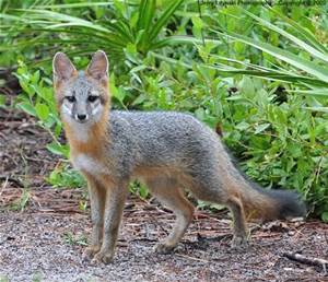
The photo below is a grey fox for comparison. Coyotes are taller and weigh more than foxes; in our area sometimes weighing up to 30 pounds, whereas a fox may be closer to 12.
Should we be scared? I don’t think so. We just need to be smart, coy and cautious, like the coyote.
Many Native American myths laud the craftiness of “coyote” and often in Native American mythology, he is so respected, he is portrayed as the “Creator.” He is respected for being “ubiquitous,” as he is so successful, “he appears to be everywhere at once,” or “seems to appear everywhere at the same time.” He is not to be outsmarted.
One thing for certain, now that coyote is here, chances are, he will not go away. We must learn to live with him by keeping our distance, not leaving pets out for long periods unattended, in the evening or early mornings, and by not feeding him. He is smart enough to feed himself.
It is said we all have a bit of fear in our inner most nature, as the collective memory recalls the earlier times of fires and wolves, but then humankind tamed the wolf and hence today, we have “man best friend,” our dogs.
Remember that the coyote is related to dogs if you see him, and if you look him in the eye ask for a sliver of his adaptability and success surviving on an ever changing planet and an ever changing Indian River Lagoon.
__________________________________________
Florida Coyotes: (http://www.floridiannature.com/Coyote.htm)
Florid Wildlife Commission:(http://myfwc.com/wildlifehabitats/profiles/mammals/land/coyote/)
History, Eradication of Wolves/Rise in Coyote Population:(http://www.wolfweb.com/history2.html)
Coyote/Native American Mythology:(http://www.pantheon.org/articles/c/coyote.html)
______________________________________
I added this photo from Dr Gary Goforth 8-13-15 that was taken this February in Foxwood off 96 A in Martin County.


_______________________________
I added this link on 8-13-15 written by my classmate Angeline Scotten whom I met last week at the UF Natural Resouces Leadership Institute. She is an expert on the subject of coyotes for the Florida Fish and Wildlife Commission. This article was written for Hernando County but certainly applies to us as well. I found it very informative. (http://hernandosun.com/coyotes_in_hernando)

If Hugh Willoughby had not been searching for a southern location for the prestigious New York Yacht Club in 1906, we would not have the remarkable hand drawn map above. The New York Yacht Club’s southern headquarters was never established at the southern tip of Sewall’s Point, but we can see the water depths in the area were substantial, at 20 feet, around the tip of the protected west side of today’s High Point subdivision.
I stumbled upon the information about the New York Yacht Club again, because of trying to track water depths in the St Lucie River/Indian River Lagoon over the past century in my mother’s book, The History of Sewall’s Point.
From my parent’s old timer friends, over the years, I have heard stories about the the water depth and clarity being extensive in many areas of the St Lucie River, from Palm City to Stuart to Sewall’s Point, and how over time the sediment, due to canal run off from C-23, C-24 and C-44, has “filled the bottom of the river” in many areas, even forming “islands” north of the Palm City Bridge. C-44, connected to Lake Okeechobee, was first connected in 1923, and then deepened and widened again in the 1930s, and 50s and “improved since.” C-23 and C-24 were built in the 50s and 60s. Tremendous amounts of sediment and pollution has filled the river over time from these once thought “harmless” canals.
Today this sediment fill is often referred to as “muck.”
Anyway, for a baseline comparison of water depths, I started looking thorough my historian mother’s maps and asking questions to my attorney brother, who is a wiz at any type of map old or new, and although I did not get mapping for all of the the St Lucie River/Indian River Lagoon, I did for my own beloved Sewall’s Point. I imagine it is a microcosm of the rest.
Let’s take a closer look:

(http://www.charts.noaa.gov/OnLineViewer/11428cgd.shtml)

NOAA, 2014 electronic water depth map juxtaposed to hand drawn map of Sewall’s Point ca. 1906.
Comparing the two maps, one can see that the southern tip of Sewall’s Point in the NOAA map is not documented, I imagine because it is too far away from the Okeechobee Waterway. Disappointing. Nonetheless, if one looks at Sewall’s Point’s mid area, across and north of Hell’s Gate (the narrow part of the river) one can see water depth numbers like 19; 15; and 14 feet. Today those numbers on the NOAA chart read 4; 8; and 7.
Looking on the Stuart side, north of Hell’s Gate, the 1906 map reads 10; 8 and 12 feet. The 2014 NOAA map reads 2; 3; and 4 feet. Mind you, the channel has been dredged many times by the Army Corp, and Florida Inland Navigation District since 1906 and this certainly affects depths overall in the river as well. Nonetheless, for me, it is interesting to compare as even the channel depths in this area are no deeper than 11 feet and often more like 8 or 6 feet.
The famous mid 1900s environmentalist editor of the Stuart News, Mr Ernie Lyons, once said “Life too, is a changing river.” I wonder if he knew how much we were going to fill it in…
___________________________________________________
After I wrote this blog , friend, Kevin Stinnette, sent me the insert for south Sewall’s Point as he has experience as an avid sailer. I am adding for interest although I will not adjust my blog. The same principles hold true. 🙂 Thank you Kevin!

I taught middle and high school for many years, and I still have numerous friends in the profession. Last week, I received a phone call from teacher, Maureen Breslauer, whose son now attends Bessey Creek Elementary School in Palm City. She asked if I’d like to be filmed by the school’s media specialist, Kelly Middleton, creating a River Kidz public service announcement, as the school, headed by outstanding, Principal Defenthaler, has been learning about river issues and were having a T-shirt day. I was grateful to Maureen for the opportunity to share the concept of “River Kidz” through the morning news. The product reminded me of who I am “most,” at heart, a teacher, and very funny in that in “a moment,” I became the “River Lady.” We did it in one take! For any you who watched Mr Roger’s Neighborhood growing up, I think you’ll get a kick out of the video.
*River Kidz, a division of the Rivers Coalition: (
) See River Kidz tab.

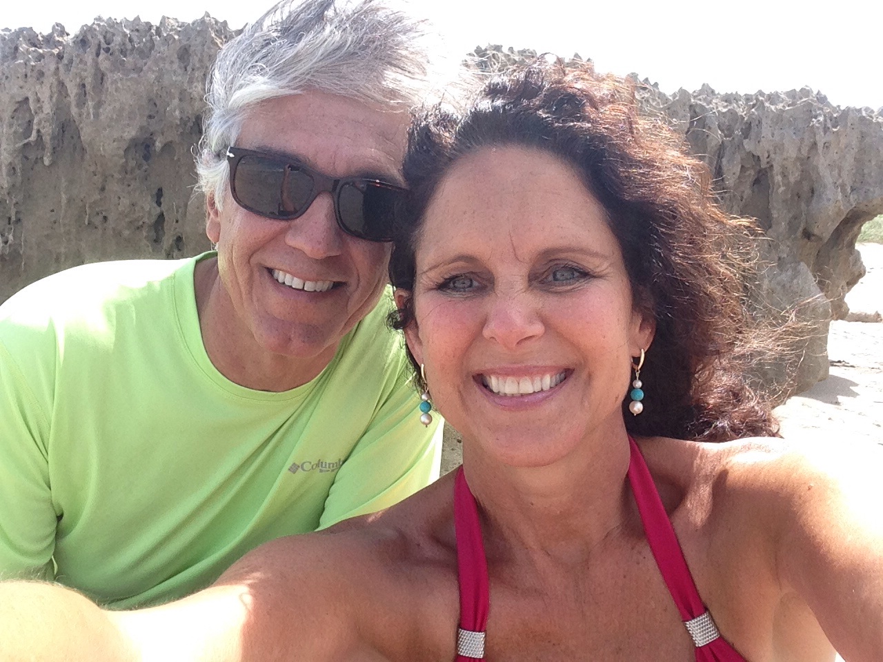
This past weekend, my girlfriends from high school decided to travel across the state to celebrate our 50th birthdays!

It was a great time. We stayed in the area of the Caloosahatchee River which is the sister river the the St Lucie River. Both rivers have been plumbed to take overflow waters from Lake Okeechobee that Nature meant to flow south to the Everglades. The Caloosahatchee, in fact, is the “bigger sister,” in that when the rains come, she takes three to four times as much polluted, fresh water as we do—she is longer and larger than ourself. Ironically now, year long, the river needs constant small releases of fresh water from the lake as she becomes too saline. The system is suffering as is the St Lucie.

“Caloosahtchee” means “river of the Calusa,” after the native peoples who lived and thrived there thousands of years ago.
So how does the Calooshatchee compare to the St Lucie? Well, according to the Caloosahatchee River Citizens Association, (CRCA), as sea levels receded after the last ice age, a series of lakes connected by wet prairies fed a tiny lake in the center of a valley feeding a “tortuously” long, crooked river that flowed slowly west to the Gulf of Mexico. So the Calooshatchee like the St Lucie drained to the sea but was never “connected” to Lake Okechobee.
But then entered “modern man.”
In 1881, investor and business man, Hamilton Disston, bought four million acres of Florida lands for development and agriculture getting the state out of debt. His first project was to drain the land around lake Okeechobee.
He dynamited the water fall between Lake Flirt and the Caloosahatchee and connected an old Indian passage from the Caloosahtchee to the lake. With that and the dredging and channeling of the mouth of the Kissimmee, the lake dropped tremendously, and although Disston committed suicide in a bathtub after the Panic of 1893, he inspired those following him to continue the drainage machine that has formed the Florida we know today.
After the floods and hurricanes of 1926 and 1928 the Caloosahatchee was straightened, deepened, and widened, draining surrounding agricultural lands and controlling flood waters. The “improvements” continued again in the the 1950s as more people moved into the area.
The story of the Calooshatchee is very similar to the St Lucie.
On another note, one of the most interesting parts of getting to the Caloosahatchee with my friends was driving “under” Lake Okeechobee taking Highways 441, to 80, to 27 and passing through the sugar towns of Belle Glade, South Bay, Clewiston and La Belle. It was a three and a half hour drive from Stuart to Captiva and most of the drive was through the Everglades Agricultural Area.

As we were driving through we were amazed to think that historically the waters of Lake Okeechobee went south, as today, south of the lake, it is sugar fields for as far as the eye can see! And for many, many miles you are driving right next to the dike.
“This is kind of weird…”


I reminded my friends of the hurricane of 1928 and the thousands of migrant workers that were killed with no alert of the coming doom. The small dike around the southern lake certainly did not look like it would hold if another monster storm came. We talked about how clueless we were as kids to the environmental effects of agriculture on our St Lucie River/Indian River Lagoon compared to what the children are learning today.
Of course we need agriculture but to have 700,000 acres completely cut off water flow south of the lake is an accident waiting to happen and a death sentence for our St Lucie Indian River Lagoon and for the Caloosahatchee.
As I talked about a possible third outlet to the lake, I told my friend Jill not to speed because if we were stopped, and I was in the car, we would all certainly go to jail!They laughed knowing I am an advocate for the St Lucie/Indian River Lagoon an often contentious issue when it comes to sugar farming.
Once in Captiva, we had a great time, paddle boarding, riding bicycles, swimming, and going out in Sanibel/Captiva Island.
Such a wonderful time would not have been possible had the Army Corp and South Florida Water Management District been releasing masses of polluted, fresh water from Lake Okeechobee. United we are on both sides of the state, that there has to be another option for Lake Okeechobee’s water coming through our estuaries–we are sisters!
