Today is October 7th, 2017 and I am sharing photos taken October 6th, 2017 in the area of the St Lucie Inlet displaying the recent discharges from Lake Okeechobee and area canals. The plume was measured four miles out, this is very far, and can be seen both north and south of the inlet. The edges are churned up and blurred, and there are many layers fanning out.
I share to document. I share in hope of eventual change, and I share to inspire the so many people who are causing change, change, that one day we will see in a better water future.
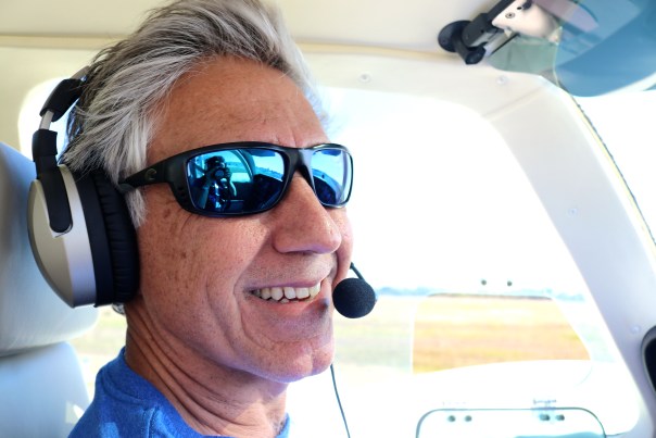
Thank you to my husband Ed for piloting, and to passenger, and photographer, Matt Coppeletta.
Sincerely,
Jacqui
All photos taken of the St Lucie Inlet area on 10-6-17 by Ed Lippisch and Matt Coppeletta. Discoloration of water is caused primarily by discharges from Lake Okeechobee but also from canals C-23, C-24, C-25 and area runoff.
“Right now billions of gallons of fertilizer, sewage, and legacy pollution from Lake Okeechobee are spewing into the St. Lucie River, carrying a new threat of toxic algae. Water managers may say Irma left them no choice, but of course that’s a half-truth…”
All photos/videos taken off St Luice Inlet September 30, 2017 JTL/EL
Documentation of primary and secondary plumes at St Lucie Inlet caused predominantly from human directed ACOE/SFWMD discharges post Irma and other from Lake Okeechobee & canals C-44, C-23, C-24, C-25. 10am, September 30, 2017. Primary plume out 3 miles; secondary 3 1/2 and not quite south to Peck’s Lake. We must continue to #ReplumbFlorida #forthefuture #forthewildlife #forthekidz #fortheeconomy for our #indianriverlagoon JTL/EL
Ed looks outside the plane: a “line” divides agricultural fields and the wetlands of J.W. Corbett Wildlife Area. 7-8-17. An overview…Sometimes it seems there is not a piece of land that doesn’t have the mark of modern-humans on it…but then, we have been leaving our mark for thousands, and thousands of years…
On a recent trip with renowned South Florida photographer Edward Carr, my husband Ed and I flew over the contiguous Dupuis and J.W. Corbett Wildlife Areas ~ “bordering” Martin and Palm Beach counties.
It was quite a view, and I felt embarrassed that I did not know more about these wonderful remaining lands located so close to home. So interesting to see them in a more natural state. The circles of trees, dome-like, standing in shallow water. Shades of green, brown, and blue changing and reflecting with every turn. An animal running into the bush. What was it?! A deer? A panther?
I have to admit, chasing toxic algae sometimes overtake me!.. I must remind myself “to stop and smell the pond apples!”
Pond apple blossom. Photo by Lisa Jefferson. There was a 32,000 acre pond apple forest on the Southern rim of Lake O prior to development.Mr Carr was photographing for a documentary on “Big Mound City” the most remarkable of places our human ancestors called home. These native people of Lake Okeechobee’s Belle Glade Culture, built mounds to get above the swamp rather than trying to drain it….as sea level rises, we many have to consider this once again just like the FEMA project in Sewall’s Point!
I find this entirely fascinating…history repeating itself…
I tried to get Ed later in that week to go with me into Corbett for a hike and to explore, but he said it’s too hot right now, he rather fly. It would be “torture in there.” Well, when the weather cools down, I am taking him. What a wonderful piece of natural history to have right in your own back yard.
Ed, my husband, and Todd my brother, algae hunters! The Cub.The Baron, Todd and Ed. All of Todd’s photos are linked at the bottom of this post.
On Saturday, my husband, Ed, took my brother, Todd, up in both the Cub and the Baron to look for a the large algae bloom Ed and I had seen last Wednesday in Lake Okeechobee. I went along for the Baron ride, but the Cub only holds two.
Maybe you, like me, after listening to the news the past few days, realized there were other blooms reported, even a “small one” in Pahokee on May 20th by famed biologist Barry Rosen, of USGA. I wondered if Todd and Ed would see more blooms, other blooms…
Saturday, July 22, 2017, was much more overcast than the previous Wednesday, so the lake photos Todd took are not as bright in color, but the “southwest of Port Mayaca” bloom is definitely still there. Todd did not report any others during the trip and the GPS track shows that he and Ed went quite far north and west. (Channel 12 reported on two blooms on Lake O’s western shore…)
Before the flight, Todd also shared the most recent Landsat 8 satellite image that shows where the large “southwest of Port Mayaca” bloom is located although here too, there are a lot of clouds blocking the image…
Approaching Lake O with widespread cloud cover.
After Wednesday’ s post, many were asking me if there were visible blooms in the St Lucie River or C-44 Canal.
The answer: “No.” From 1000 feet up, there are none visible. But there are the “bubble like nutrient swirls” that seem to proceed the blooms in some areas. (You’ll notice these in Todd’s photos and all 350+ photos are linked at end of post.)
I did notice that on Facebook a small bloom was reported at Rivers’ Landing in Palm City, and another one on rocks in the North Fork. The Caloosahatchee has indeed reported a pretty significant bloom…blooms are in the estuaries but the motherload is Lake O.
Have you seen any blooms? If so, here is the link to report algae blooms to the Department of Environmental Protection, “DEP.”
I happened to notice when I visited the DEP website that DEP states: “Blooms are naturally occurring.”
…Yes this is true; so is cancer.
However, nutrient pollution that feeds these algae blooms and is killing our estuaries, and possibly us, is entirely man-made. We know what causes it.
We must be more diligent and creative in stopping the nutrient run of from agriculture and development. “Taking measures”as noted in the DEP quote as the game plan just isn’t enough. After all, this is a war to save our Florida.
Florida’s five water managements districts map DEP.
“There are no short term solutions to rectifying the situation; this is a naturally occurring phenomenon that the State monitors closely. However, the state is taking measures that in the long-term will reduce nutrient loading and improve water quality.” DEP, 2017 website
GPS of trip. 1. Blue Cub. 2. Red Baron.South Fork that connects to C-44 and then Lake O at Port Mayaca, near Palm City; following photos just going west towards Lake Okeechobee. Notice the bubble trails.Rowers near Palm CityAmerican Yachts and 195 overpass is near where C-44 connects to South Fork of St Lucie RiverS-80 where area basin water is allowed into South Fork of St Lucie as well as water from Lake O if S-308 is open at Port MayacaPart of C-44 Reservoir project, the biggest in the state, to hold area basin water, clean and return to C-44.Water and sediment leaving ag canals entering C-44 canalIndiantown area and C-44.FPL cooling pond. This area was once a cypress tree forestPort Mayaca’s S-308 at Lake OkeechobeeC-44 is “running backwards” into Lake O right now, dark color is visibleAlgae is present south west of Port Mayaca but not as bright on this cloudy day…S-308Lake O southwest of Port MayacaS-308 looking east from LakeOthe northwestern shorelineS-308 with C-44 area basin waters going into lake. Usually these waters flow into C-44 and the SLRNorthwestern shorelineWater in northwest
Photo in 2nd plane, the Baron. I went along for this one as you can get a more overall view…Again algae present in Lake O southwest waters but not as intense as seen in blog photos I published four days prior as this day was cloudy and there was little sunlight.My brother noted the algae around the Okeechobee Waterway canal cut into the lake. Interesting!The water flowing backwards from C-44 area basin is certainly one of the things fouling Lake Okeechobee.2. This 1995-2005 map shows phosphorus loads to lake and SRL for that time. (SFWMD)
TCPalm’s Elliott Jones reported this morning that Stuart has received a whopping 11.30 inches of rain just so far this month! (The average being 7.14.)
Although due to the recent drought, the ACOE/SFWMD are not dumping Lake Okeechobee through Canal C-44, canals C-23, C-24, C-25, and areas along C-44, as well as our own basin, are draining right into the St Lucie River/Indian River Lagoon. Very little of this water is cleansed before it enters and thus is damaging to the eco system. Next time you see water draining through a grate in a parking lot, think about this. Remember too that before the major canals were constructed the 1900s, the river received less than half the water it gets every time it rains today.
SLR at “Hell’s Gate” looking at Sewall’s Point, Sailfish Point and the St Luice InletDrainage changes to the SLR. Green is the original watershed. Yellow and pink have been added since ca.1920. (St Lucie River Initiative’s Report to Congress 1994.)
The aerials below were taken 6-13-17 by my husband Ed Lippisch and pilot Dave Stone. It is important to monitor the river all of the time so we can view changes.
“Rain stained” we are; please remember not to fertilize during the rainy season. The birds on Bird Island will appreciate it! (http://befloridian.org)
TC Palm, Elliott Jones, 6-19-17Bird Island, IRL east of Sewall’s PointBird IslandIRL St Lucie Inlet and Sailfish PointSailfish Flats, IRLCrossroads, confluence SLR/IRL off Sewall’s PointSpoil Island off Sailfish, bird also roosting here!Sick looking seagrass beds in IRL looking south towards Jupiter Narrows““SL Inlet near Sailfish Point, no black plume but darker colored watersJupiter Island’s state park at St Lucie InletSailfish PointSt Lucie Inlet looking southinlet againClear ocean water at jetty, St Lucie InletLooking back to St Lucie Inlet mixed colored waters but not black as with Lake O water releasesSt Lucie Inlet between Jupiter Island’s state park and Sailfish Pointinlet againLooking north to SL InletJettyHutchinson Island and Sailfish Flats in IRL. Sewall’s Point in distance.Parts of the Savannas near Jensen , IRL and Hutchinson Island in distanceSavannas State Preserve Park
Canals draining water into SLR/IRL after rain events:
“Eden,” the name says it all. Wouldn’t it be cool to say you lived in Eden?
Today there is a historic sign, but there is no longer a town. In 1879 “Eden” was named by Captain Thomas E. Richards who decided this spot along the high ridge of the Indian River would be a good place to grow pineapples. According to historian, Sandra Henderson Thurlow, “Richards felt he had arrived in a tropical paradise, and named his new home Eden.”
In Sandra’s book, “Historic Jensen and Eden on Florida’s Indian River,” she talks about how today’s Jensen Beach evolved from both the historic communities of Eden and Jensen, but over time, while Jensen had room to grow, Eden faded, as it was hemmed in by the wet, fragile ecosystem of the savannas. This marshy savannas system once stretched along the lagoon for over a hundred miles, but today, the only remnant lies right behind the lost town of Eden, and to the north and south of close-by extending lands.
This very special photo was given to my mother, historical Sandra Henderson Thurlow, by Capt. Thomas Richards’s great-granddaughter, Mary Simon.The town of Eden was located between the IRL and the wet savannas, Ruhnke/Thurlow Collection. “Historic Eden and Jensen on Florida’s Indian River,” by Sandra Henderson Thurlow.
These rare lands known today as Savannas Preserve State Park, “encompass more than 5,400 acres and stretch more the ten miles from Jensen Beach to Ft Pierce containing the largest, most ecologically intact stretch of freshwater marsh in southeast Florida.” Remarkable!
If you haven’t ever seen it, I can promise, “Eden awaits you…”
This past weekend, my husband Ed and I put on our wet weather gear, and walked from Jensen Beach Blvd to “west of Eden. ” It is amazing to have this treasure right in our own backyards, a study in plant and animal life that “used to be.” ~A study in what we can bring back, if we want to…
Cover to ACLU report, “Tainted Waters,” by John Lantigua, released 6-7-17.
Civil Lib·er·ty/(definition) noun “the state of being subject only to laws established for the good of the community, especially with regard to freedom of action and speech. individual rights protected by law from unjust governmental or other interference.”
Today I am sharing a report that came out only yesterday and is spreading through social media and news channels like ~ toxic algae…
“Tainted Waters, Threats to Public Health, and People’s Right to Know” is written by award-winning journalist and ACLU investigative reporter, John Lantigua.
After being contacted, Mr Lantigua approached me and many others months ago, traveling and interviewing numerous stakeholders from various backgrounds. He was a consummate professional with an air that only an experienced, savvy, and hard-hitting journalist can attain. I will never forget being interviewed by him at a diner in Belle Glade and saying to myself: “Holy cow, this is the real deal…”
In today’s TCPalm article by Tyler Treadway, Mr Lantigua states: “We don’t typically focus on environmental concerns but getting timely and trustworthy information about a public health issue is a civil right…”
Thank you Mr Lantigua for recognizing the “lack of urgency and transparency” on the part of the state of Florida in reporting information about the 2016 Toxic Algae Crisis caused by the Army Corp of Engineers and South Florida Water Management Districts’ releases of tainted waters from Lake Okeechobee into our St Lucie River/Indian River Lagoon.
Reporter, John Lantigua, 2017.
ACCESS REPORT “Tainted Waters, Threats to Public Health, and the People’s Right to Know,”HERE:
Lake O 239 square mile algae bloom, NASA satellite image, July 2, 2016.Toxic St Lucie River June 2016, photo pilot Dave Stone.Toxic algae flowing through locks from Lake O into SLR May 2016. Photo Ed and Jacqui Thurlow-Lippisch.
Sandbar, St Lucie River/Indian River Lagoon, Memorial Day Weekend, 5-29-17, Todd Thurlow.
Today I am comparing and contrasting photos of the St Lucie River/Indian River Lagoon in May of 2016 to photos in 2017. A Lake O dump year to a non-Lake O dump year. “A picture speaks a thousand words”…maybe more.
Jacqui
________________________
Photos of the Sandbar at the confluence of the St Lucie River and Indian River Lagoon this Memorial Day weekend, 2017. Clear, clean water, although meadows of seagrass in Sailfish Flats has not yet returned.
Toxic algae blooms in St Lucie River/Indian River Lagoon in May and June of of 2016 due to dumping of Lake Okeechobee and area canals.
Sandbar area May/June 2016Sandbar 2016, JTLC-44 Lake Okeechobee dumping into St Lucie River May 28 2016. Photo JTLSt Lucie River May 2016, Shepherd’s Park. JTLSt Lucie River, May 2016. ,L.D.
Today, May 12th, at 9:45 A.M. Governor Rick Scott is scheduled to sign Senate President Joe Negron’s “Senate Bill 10” in of all places Clewiston. Clewiston is “America’s Sweetest Town” and the headquarters of U.S. Sugar Corporation…
According to the article in the Glades County Democrat announcing the signing: “Earlier this week Senate Bill 10, a move to secure funding for a water storage reservoir south of Lake Okeechobee was approved. In its amended form, Senate Bill 10 became a measure that we in the Glades could stand behind. The bill no longer stated that additional farmlands be taken out of production but rather the state would utilize the property that it already owns to create a reservoir with a much smaller footprint.”
Although I am scratching my head, you know what? Sometimes you just have to be happy for what you get, no matter where you get it. I am tremendously thankful to Governor Scott for signing the bill ~ although I do wish he had decided to sign it in Martin County since we’ve worked so hard to get it.
When I read the announcement officially last night, it got me thinking about Clewiston before I went to sleep. It brought back memories of 2013 and famed paddle boarder Justin Riney’s idea to hold the Sugarland Rally in Clewiston on September 1st, 2013 to unite the movement. This was one of the early rallies for the river during the devastation of the “Lost Summer.”
Since Governor Scott is going to sign in Clewiston I think it’s a good time to walk down memory lane and be proud of how far we’ve come and to get ready for how far we have to go! The point of the location of the Sugarland Rally was to “meet halfway.” Hopefully Governor Scott is thinking the same, in that Joe Negron helped us meet half way and we are all thankful.
Now let’s remember the past, enjoy today, and then take it to the finish line!
“The Sugarland Rally will unite the east and west coasts of Florida in a peaceful, historic demonstration to speak out against the pollution of our estuaries from Lake Okeechobee discharges. We support both immediate and long-term solutions, but ecosystems and communities along the St. Lucie and Caloosahatchee Estuaries are in crisis. We cannot afford to wait for ecological and economic collapse. We urge all stakeholders–especially local, state and federal governments–to act immediately. We chose Clewiston as a central location to unify east and west at Lake Okeechobee, the source that is polluting our estuaries, and because we believe Florida’s sugar industry can be part of the solution. Please don’t misinterpret our intentions–we are NOT holding a rally at Clewiston to protest or point fingers at “Big Sugar.” It’s quite the opposite, actually. We invite Florida’s powerful sugar industry to join us in crafting an immediate solution to the ecological and economic crisis caused by discharges from Lake Okeechobee.” (Press release from Justin Riney, Aug. 2013)
SUGARLAND RALLY 2013
Maggy Hurchalla, Comm. Taylor, and Mayor RolandDon Voss!Nic Mader, Jenny Flaugh and the River KidzEve Samples of TC Palm and Don Voss with crowd
5-7-17: Hutchinson Island along the Atlantic Ocean and confluence of the St Lucie River/Indian River Lagoon, blue waters, seagrass not yet revived from 2013 and 2016 Lake O discharges. Photo Ed LippischMy husband’s flight yesterday over the Atlantic Ocean, St Lucie Inlet, and St Lucie River/Indian River Lagoon is beautiful. But look carefully and you will see a light-colored brownish plume at the mouth of the St Luice Inlet entering the ocean. Finally after months of drought, it has begun raining. And when it rains… (mind you C-44 connecting the St Lucie River to Lake Okeechobee is closed now) the re-directed run-off of waters from canals C-23, and C-24 of course still flow into our St Luice River/Indian River Lagoon.
These canals organized and built during the 1950s and 60s are part of the Central and South Florida Flood Project that the Army Corp built following the hurricane and extensive south Florida flooding of 1949. The run-off waters from these canals and the local watershed are what you see in today’s video.
As damaging as C-23 and C-24 are (they too must be reworked and redirected) they are not the damaging discharges from Lake Okeechobee that throw the St Lucie over the brink as in 2013 and especially 2016 when toxic algae covered extensive portions of the entire St Lucie.
Rio, St Lucie River, Jeff Tucker, toxic algae
…
…
3
Shoreline of Sewall’s Point, Tracy Barnes 6-25-16
…
(Photo mosaic from 2016 shows various photos by Dr Scott Kuhns, Rebecca Fatzinger, (wildlife) JTL/Ed Lippisch, pilot Dave Stone and others.)
In spite of the light brown plume, the short video flight from Jensen to Peck’s Lake shows blue waters near the inlet and mouth of the estuary as it should be, not black water. If Governor Scott does not veto the budget, the reservoir in years to come will help offset the Lake Okeechobee destruction and open the way to truly “send the water south.” #ThankyouJoeNegron
This is very exciting, but believe me, this is no time to let down your guard, as the fight for control of Florida’s waters has really just begun.
Reef system off Sailfish point is covered in black water, sediment, and nutrient pollution when Lake O is discharging. Here after months of drought, and finally some rains we can see the reefs. 5-7-17, Photo Ed LippischMap SFWMD showing canals and basins. Note S-308 or structure s-308 at Lake O and S-80 down the C-44 canal AKA the St Lucie Canal. Both of these structures have to open to allow water to flow into the C-44 canal to the St Lucie River, Indian River Lagoon. All canals are destructive to the St Lucie/IRL yet it is C-44’s Lake O that puts the St Lucie system in complete and total overload.DEP C-23:http://www.dep.state.fl.us/southeast/ecosum/ecosums/c23.pdf
St Lucie River/Indian River Lagoon, Martin County, FL (JTL)Port of Miami, Biscayne Bay, Miami, FL (JTL)
Today my husband, Ed, is going to take you on a flight south along the Atlantic Coast from the St Lucie River/Indian River Lagoon in Martin County, to the Port of Miami. As we know, the coastline becomes more and more developed as one flies further south. Bright blue skylines of houses and condos morph into shadowy silver skyscrapers, and cargo ships. Expansive greenery slowly disappears…
I, probably like you, know people who grew up in Miami, Ft. Lauderdale, or Palm Beach County who have moved to Martin County to get away from the over-development and traffic nightmare of “down south.” Many tell stories about things changing “overnight,” and no longer recognizing the place they called home.
The “Martin County Difference,” its slow development, is not by accident. Many throughout the years have fought to keep our area less traversed than the rest of South Florida. One thing is for sure, if you want to keep it, you have to fight for it, or otherwise it will be going, going, GONE…
Ed’s tour-view, from the air, really makes the comparison hit home.
(Please see map of cities passed in flight, and 28 photos or slide show below.)
Ed your pilot and tour guideCoastal flight from Stuart/Palm City/Hobe Sound in Martin County to Miami and Key Biscayne.
This slideshow requires JavaScript.
I am having technical problems with this post; long up-loading and off links. I do apologize and will get worked out. Jacqui
Today I am sharing photos taken yesterday, 2-8-17, by my husband, Ed, over Langford’s Landing, the controversial development along the once high bluff of the St Lucie River located on the northwest border of Sewall’s Point in Rio. Of course this property was the long time home of philanthropist, singer, and movie star, Frances Langford and years after her death, as she wished, those handling her estate put the monies from the sale of this land towards the trust in her name and legacy of giving. Whether the nature-loving long time Martin County resident would have approved of the conditions of the sale, we can only speculate…I know what I think.
Even though the naked property remains visible from the bridges it is nice to see it close up. Thank you Ed for the photos!
As we can see, since December of 2015, all trees have been wiped out, the marina appears completed, the roads are in, the once historic high bluff is now flat and even, and few blades of grass are now visible.
Map giving an idea of location of A-1 and A-2A-1 with A-2 in distance
EAA=Everglades Agricultural Area
A-1 is a Flow Equalization Basin located above Strom Water Treatment Area 3/4 that today is part of a state program for EAA water quality improvement called “Restoration Strategies.” The A-1 was once was part of the Comprehensive Everglades Restoration Plan’s EAA Reservoir.
A-2 is to A-1’s west and is presently in agricultural use but scheduled to become another Flow Equalization Basin as part of the Central Everglades Planning Project coordinated by the South Florida Water Management District and the Army Corp of Engineers.
__________________________
Over the weekend, I asked my husband, Ed, to fly me over the A-1 and A-2. He rolled his eyes as he does when I use “acronyms speak,” saying: “Just tell me where you want to go….and get a map.”
I got my old Florida Atlas & Gazetteer that works just fine…
As Ed drank his coffee, I gave him the plan.
“Well we’re going to fly west over the C-44 Canal and then go south around Lake Okeechobee until we get to Belle Glade and there we are going to follow the North New River Canal south adjacent to Highway 27 until the bend, and the A-1 and A-2 should be just past there….”
Ed looked at me like I was crazy, smiling; I remind him that’s why he loves me and we were off!
Today I am sharing our photos of the area of the A-1.
“Once You have tasted flight you will walk the earth with your eyes turned skyward, for there you have been and there you will long to return.” Leonardo da Vinci (1452-1529)
Road Trip Series, St Lucie River/Indian River Lagoon-Taylor Slough
Happy New Year to all of my readers!
We begin 2017 at the southern most part of our state, the Florida Everglades. Over the holidays my husband, Ed, and I continued the Road Trip Series further south to gather insights, one that I will share with you today: the great water disconnect of Taylor Slough. We have too much water and it doesn’t have enough. Could we help?
Before we begin, what is a “slough?” What a strange word!
For years I drove along a road in Port St Lucie, north of Stuart, named “Cane Slough.” I wondered to myself what that meant considering the area was paved over. When my mother told me Cane Slough was once a marshy shallow river, I thought how odd that was considering there was not trace of it today. The same thing, but on a much larger scale, has happened in the Florida Everglades and in both instances it is a great loss.
“Slough,” pronounced “slew,” is not just a river, but a river that is made for Florida’s dry and rainy seasons. It is a slow-moving river whose grassy shores expand and contract. During the dry season when rains are scarce, the remaining water in the deepest part of these depressions is where plants and animals hold on to life-giving water until the rains begin anew…
Before South Florida was developed there were two main sloughs running through the Everglades to Florida Bay. Named, the Shark River, the largest, and Taylor Slew, smaller and further to the east. We must note that Florida Bay the past years has suffered from algae blooms and seagrass die off due to high salinity because Taylor Slew cannot flow southeast. This lack of water affects both land and marine communities.
It is easy to see the great “disconnect” for Taylor Slough on this National Park map. A park ranger informed me that “all water” received into Taylor Slew now comes via canal structures controlled by the South Florida Water Management District.
Yes, some great things finally are happening such as the recent construction of elevated bridges along Tamiami Trail designed to deliver more sheet flow into the park and a future where the “Chekika” public access area off 997 could be closed year-round so water could be flowing south. Others too I’ve no room to mention…
One can visually note that restoring this flow is tricky as Homestead’s agricultural and rural development zones abut the old water shed and Broward County north of this area has communities literally in the Everglades (C-11 Basin) that were once part of Taylor Slough as well. Crazy!
But, if we sent men to the moon 50 years ago, shouldn’t we be able to accomplish reconnecting the flow of water “today?” Now, when the Everglades and Florida Bay need it?
How can we along the St Lucie River help speed things up?
…Learn about Senator Negron’s proposal for 60,000 acres of storage, cleaning and conveyance in 2017. Learn about pressuring our government to “face the facts.”
…One thing is certain, we can’t allow the Everglades to die on our watch, and we have exactly what she needs…
On May 10th, 2016 there was a knock on my front door. I was expecting somebody. Kait Parker and her team from the Weather Channel had arrived via New York to do a story on the St Lucie River/Indian River Lagoon.
The group was upbeat and friendly. They interviewed Ed and me in our kitchen, and later we took them up in both the Cub and the Baron to shoot footage and to get “the view.” –The aerial view of the discharges from Lake Okeechobee that had started this year on January 29th.
What really struck me about Kait was that although this Texas girl’s beauty, talent, and ambition had moved her beyond the Treasure Coast to Atlanta’s Weather Channel, (Kait had been a well-known and loved meteorologist for three years at WPTV, the West Palm Beach/Treasure Coast NBC affiliate), she had come “home” to see what the heck was going on. She, as so many others, had heard the horrible stories of destruction facing the St Lucie River/Indian River Lagoon.
I commend Kait for coming back to see for herself and for using her fame to share our story with others. This gesture will not be forgotten and “Toxic Lake” is already making waves! Waves of change.
Thank you Kait.
With Kait ParkerGetting camera and barf bag ready just in caseEd explaining something.Smile
Discharges from Lake O through the St Lucie Inlet 5-10-16Plume rounding Jupiter Island through St Lucie Inlet 5-10-16St Luice Inlet 5-10-16Crossroads and SL Inlet 5-10-16
*Thank you Kait Parker,Spenser Wilking,and Andy Bowley.
St Lucie Inlet, Ed Lippisch photos 10-9-16Hurricane Matthew a CAT 4 was 42.8 miles from shore, Google Image via Todd ThurlowHurricane Matthew over Florida, Terra MODIS via Todd Thurlow
Martin County was fortunate to “dodge the bullet” of category 4 Hurricane Matthew, but as long as the St Lucie Indian/River Lagoon is attached to Lake Okeechobee via the C-44 canal, the river cannot. She is shot in the chest each time.
These photos taken yesterday morning by my husband, Ed, show the discharges, like blood, gushing out of the St Lucie Inlet. Melodramatic personification? Perhaps, but true.
A press release by the Army Corp of Engineers on October 7th stated:
“Lake Okeechobee continues to rise; today’s stage is 15.93 feet…
The Corps has resumed discharges from Lake Okeechobee after suspending them during the storm. Water managers have removed target flows and will release as much water as practical through Moore Haven Lock (S-77) located on the west side of the lake, and the Port Mayaca Lock (S-308) located on the east side of the lake…
‘We anticipate inflows to the lake will increase as a result of Hurricane Matthew,’ said Col. Kirk. ‘Therefore, we must maximize outflows in order to slow the rise in the lake and be as prepared as possible for additional hurricane season uncertainty…”
“Additional uncertainty?” Not for the river.
As the Corp has been discharging from the lake since January 29th, 2016 and now the gates are wide open to save life and property south of the lake, the St Lucie did not really dodge a bullet at all. She is hemorrhaging once again.
Until Lake Okeechobee is redirected south as God designed, “dodging a bullet” in Martin County remains an illusion.
Evan Miller grew up in Stuart, Florida, not far from the St Lucie Locks and Dam. He attended Crystal Lakes Elementary School, Hidden Oaks Middle School, South Fork and Martin County High Schools, graduating in 2002.
As a kid, Evan would ride his bike down to the St Lucie Locks and Dam with his friends. He knew the sad story of the lake and St Lucie River. He knew about the long history and steady destruction of the waterways he loved that one day would come to a head. But little did he know, that it would happen in his lifetime, and he would lead the message.
The story is this—
After graduating, Evan was sponsored as a professional surfer and lived in Costa Rica, and came home in 2012. Upon his return, he saw the river’s decline and innocently put a message on his Facebook page during the “Lost Summer os 2013,” when the river was posted by the Health Department as “off-limits.” Evan’s message read: “Who wants to meet me at the locks?”
Believe it or not, this request turned into a rally of over 5000 people!
Two weeks later, Evan organized a beach rally, putting down stakes and having a surveyor friend help him create the letters–over 2000 people came and spelled out in the sand SAVE OUR RIVER.
Destiny had found its man…
Now in 2016, under even worse conditions, after the St Lucie River and area beaches turned into a toxic-soup from an onslaught of releases from Lake Okeechobee since January—- that in time were dumping toxic algae from the lake into the river—- Evan has used his Facebook talents again.
This past Saturday, on July 3rd, the Martin County Sheriff’s Department reported that over 3500 people, from every walk of life, came out to spell in the sand the message of the masses to fix the lake and river debacle: BUY THE LAND.
This event played out over the 4th of July weekend on national media outlets. People in Martin County were getting phone calls from people in other states they had not spoken to in years. My father got a call from a man in his wedding from 1962 who lives in California. They had not spoken in years…
“What’s going on down there?”
Yes, the world has “seen” the peoples’ message thanks to Evan.
SAVE OUR RIVER/BUY THE LAND!
Sometimes it’s just destiny…
2013/2016 Evan Miller
From the Cub Ed Lippisch and Scott Kuhns2016 The crowd. Rebecca Fatzinger2016, The crowd. Rebecca Fatzingerwith daughter SummerOcean of algae July 2016 (Evan Miller)Evan Miller at the bullhorn. Kenny Hinkle looks on. (Facebook)
In our continued documentation of the 2016 Lake Okeechobee event, my husband Ed and I flew over the St Lucie River/Indian River Lagoon around 5:00pm on Father’s Day, 6-19-16, at the very end of an outgoing tide. Being a stormy day, there was poor lighting, but it was easy to see the darkness that enveloped the river due to the discharges of surrounding agricultural canals, and tidal runoff, and especially the high and long-going releases from Lake Okeechobee. The dark plume hugged the coast and jutted far out into the Atlantic having no clear edge as it was churned up from high winds and waves. Nonetheless from above, it’s shadow was visible for miles all the way south to the Jupiter Inlet.
Over the weekend there were multiple reports of algae blooms throughout the river and canals. Below are photos from a family boat ride in the vicinity of the Harborage Dock in Downtown Stuart yesterday, showing foam and algae at the shoreline and tiny specks of algae dispersed throughout the entire river.
“One resident nearby of Stuart, Dr Vopal, texted: “The river is pea green! …It is time for the legislators to look at this river and consider the health of the people that live on it. ”
Over the weekend just to me and on Facebook there were reports of algae blooms not only in Stuart but along the C-44 canal, the condo/marinas along Palm City Road, the eastern area of Lake Okeechobee itself, the St Lucie Locks and Dam, the St Lucie River near Martin Memorial Hospital, Sandsprit Park, Phipps Park, and Poppleton Creek. Certainly there were many others.
As most of us know, the Army Corp of Engineers has been discharging into the St Lucie River since January 29th, 2016. The river is almost completely fresh thus these freshwater blooms— that are in the lake and upper agricultural canals prior to being released into our river (cyanobacteria is a freshwater bloom)—and then they spread throughout the river once it too is fresh from all of the discharges. Since the ACOE has been releasing since January and there has been so much rain conditions are really bad.
Ed and I will continue to document. Our region’s entire quality of life is at stake. Nothing affects our local economy more than our river. We all must continue pushing to send water south to be cleaned and conveyed to Everglades National Park as Nature intended. Call our elected officials at every level. And vote on Aug 30th in the primary.
Fondly,
Jacqui and Ed, #Skywarriors since 2013
Photos of SLR/IRL -Sewall’s Point, Sailfish Point, St Lucie Inlet, Sailfish Flat’s former seagrass beds, Jupiter Island, Atlantic Ocean’s “protected” nearshore reefs.
^-19-16 Ed Lippisch and Jacqui Thurlow-Lippisch view the confluence SLR/IRL over Sewall’s Point, Sailfish Point, Sailfish Flats, St Lucie Inlet, Jupiter Island, Atlantic Ocean.
Photos shared over weekend: Phipps Park, C-44 canal, St Lucie Locks and Dam, Sandspsprit Park also from family Father’s Day boat ride Harborage Marina, Downtown Stuart.
…
Foam and algae blooms in the area of Harborage Marina, Downtown Stuart, near the Roosevelt Bridge.
Harborage Marina near Roosevelt Bridge.
Lake O algae bloom shared by boater and posted by M. Connor just prior to weekend.
Pre weekend- Photos of an algae bloom in Lake Okeechobee on the east side of the lake. These photos were shared on Facebook by a river warrior and then by Michael Connor.
Sources of water ACOE/SFWMD june 2016SFWMD canal and basin map. According to Florida Oceanographic only 17% of water went into the SLR before the agriculture canals of C-23, C-24, and C-44 were dug in 1920s-1960s. Lake Okeechobee discharges on top of canal dumps are killing an already very stressed estuary. These waters must be redirected south and stored in other places that need the water. This overabundance of water is killing the St Lucie.River Kidz and Treasure Coast Rowing Club youth led a river clean up and planting of native vegetation to filter water during incoming and outgoing tides at Poppleton Creek. The creek was filled with an algae bloom. photo TC Palm
Today I will share aerial photos of the Manatee Pocket area around Sandsprit Park taken yesterday by my husband, Ed Lippisch, and a short written update by Dr Gary Goforth dated 6-12-16.
Manatee Pocket lies close to the St Lucie Inlet just across from Sewall’s Point. It once was the mecca for the St Lucie River/Indian River Lagoon commercial fishing business. The Lake Okeechobee discharges continue having started by the Army Corp of Engineers January 29th of this year and are approaching the level for all of 2013. Lake Okeechobee yesterday was reported to stand at a very high for this time of year 14.77 feet—-There is no end to discharges in sight for the St Lucie River. Conditions are very bad and the state and federal government are stuck in a pattern that is killing our quality of life and economy.
There must be a better way…
For the St. Lucie, the 2016 Lake discharges: – exceeded 133 billion gallons (compared with 136 billion gallons for 2013) – dumped more nitrogen, phosphorus and sediment than the “Lost Summer” of 2013 – dirtier than 2013 (higher concentrations of nitrogen, phosphorus and suspended sediment) – have exceeded the nitrogen and phosphorus TMDLs for the C-44 Canal by 600% For the Caloosahatchee, the 2016 Lake discharges: – have exceeded 302 billion gallons (compared with 456 billion gallons for 2013) – are dirtier than they were in 2013 for nitrogen and phosphorus
Gary Goforth, (garygoforth.net), 6-12-16
Photos of SLR at Manatee Pocket, Ed Lippisch, 6-15-16.
“1933 photograph shows Hugh Willoughby flying over Sewall’s Point and Willoughby Point in Port Sewall. The insignia of the New York Yacht Club is on th side of the biplane.” (Photo, Dale M. Hudson from Sandra H. Thurlow’s book “Sewall’s Point, A History of a Peninsular Community of Florida’s Treasure Coast”.)
One of my favorite aerial photographs from my mother’s history books on Martin County is of the infamous Hugh Willoughby flying over the St Lucie River at Sewall’s Point and Willoughby Point. In more familiar terms for boaters, this location is known as “Hell’s Gate” due to the bottle-necking of the rushing tide.
Mr Hugh de Laussat Willoughby, one of the “early birds” of aviation, and a resident of Sewall’s Point, (http://earlyaviators.com/ewilloug.htm) had the idea of locating the New York Yacht Club at the southern tip of the peninsula as envisioned in the map below. It is difficult to see in the aerial, but the insignia of the New York Yacht Club is on the side of the biplane.
The yacht club never materialized as the market crash of the late 1920s and following depression of the 1930s dashed that dream. Today many local pilots fly over the St Lucie River at this same location to photograph a different dream. –By showing the devistation, inspiring a dream for our state and federal agencies, of clean water…
Would Mr Willoughby ever have imagined his paradise would be one of controversial pollution? Never in a thousand years….
This year, the ACOE has been discharging from Lake Okeechobee since January 29th 2016; in 2013 they released May through October, and in 2014 nothing…
May the photographs or today’s ailing river inspire change, and may the spirit of Mr Willoughby keep adventure and love alive in our hearts—and the wind— ever at our backs.
New York Yacht Club Station courtesy of Sandra H. Thurlow.Cub taking photo of a cub, pilot Ron Rowers. (Photo Scott Kuhns, 2014, St Lucie River, Stuart.)St Lucie River at Sewall’s Point and Willoughby Point 2016 with dark waters from Lake O releases and area run off. (Ed Lippisch)….further away–Hell’s Gate.Sewall’s Point and Willoughby Point, 2016Sewall’s Point and Willoughby Point 2014.JTLEast side of Sewall’s Point and confluence SLR/IRL Lost Summer–(JTL)2013 SLR JTL
Aerial of S-80 at St Lucie Locks and Dam. Visible cyanobacteria bloom flowing through S-80 from western area of C-44 towards the St Lucie River. These blooms were documented in Lake Okeechobee and around S-308 weeks ago and are now being released into our now fresh river. Photo Ed Lippisch.
I have been questioning the sick irony of the government sanctioned “toxic algae” releases into the St Lucie River since 2014. This was questionable, until now…
Let’s back up a bit…
My blog post on July 8th, 2014 was entitled: “Do the ACOE and SFWMD Release Lake Okeechobee Into to SLR When There is Toxic Algae?”
At that time there was a question for me; now there is not.
The 2014 post told the story of seeing cyanobacteria’s fluorescent blooms in the lake when my husband Ed and traveled through the St Lucie River to Lake Okeechobee by boat passing the St Lucie Locks and Dam (S-80) and Port Mayaca, (S-308) in 2009. This was just when I was beginning to focus my interests on the health of the St Lucie River/Indian River Lagoon as I had been elected to office in the Town of Sewall’s Point in 2008. During this trip it hit me that the algae started in the lake. Ed and I had traveled throughout the St Lucie River and C-44 canal, and when we got to Port Mayaca, at the lake, there it was….the fluorescent green algae.
Not being a scientist or biologist –it finally hit me “this is a fresh water bloom.” It blooms in the lake….not in the river that is more saline. But once the river is fresh from releases from the lake and canals, it can spread there too.
Hmmm?
The story of the blog continues into 2013, when I saw the SFWMD testing the water at S-80, St Lucie Locks and Dam, and to my surprise I could see the unmistakable flourescent green cyanobacteria that often becomes “toxic”going right though the gates! I found this unsettling. Obviously the SFWMD, the ACOE, DEP, the Florida Health Dept and other official entities were in full knowledge that these dangerous blooms were being sent down the river to the residents of Stuart, Florida. Here I was an elected official representing a peninsular community and I had no clue. I had never even heard of this. Something is weird here, I thought. There is no warning to local governments. There is no press for the public. This is just everyday business….the everyday business of quietly poisoning Martin County’s citizens.
How could this be? I wondered…Maybe I am missing something? Maybe I am exaggerating?
Over time, I wrote other posts about this too.
I decided that this concept could be widely shared and understood, but we needed a good visual.
Well the ultimate visual is here…
Thank you to my husband, Dr Ed Lippisch for these photos and two short videos taken on Memorial Day, May 30, 2016 of tremendous blooms knowingly being sent through the open gates at S-80 towards the St Lucie River. We don’t have to wonder anymore.
In broad daylight, for all to see. State and Federal agencies….you’re busted.
*Thank you to the Stuart News, the River Warriors, Bullsugar.org and other river advocates for all of their work identifying and reporting the blooms especially in the lake and around Lake O this 2016.
Toxic Algae blooms (Microcystis/Cyanobacteria) :https://en.wikipedia.org/wiki/Microcystis_aeruginosa
I was on the Army Corp of Engineers Periodic Scientist Call this past Tuesday. These are excellent calls and one learns quickly the difficulties and the burdens of water management for our state and federal agencies in the state of Florida. I have participated in the calls as an elected official for the Town of Sewall’s Point since 2012.
This past Tuesday, something was said that struck me. Mark Perry, of Florida Oceanographic, reported something to the effect that over 600 acres of seagrasses inside the St Lucie Inlet are now “sand bottom.” Six hundred acres….
I went home and asked my husband that night at dinner…”Ed could it really be six-hundred acres? The seagrasses dead?”
“Easy.” He replied. “Just think of when I lived at the house at 22 South Sewall’s Point road when we first got married in 2005, and we’d walk out with the kayaks and there was lush seagrass all the way out ….well that’s gone–its gone all around the peninsula–you can see this from the air.”
Ed took some aerial photos the day after this conversation. Yesterday. I am including them today.
—-So it’s true, 600 acres of seagrasses are dead in one of the most bio-diverse estuaries in North America, the St Lucie River/Indian River Lagoon or southern IRL —for many years, as many of us know, confidently cited as not “one of,” but rather, “the most diverse…”
The Army Corp has been releasing from Lake Okeechobee this year since January 29th, 2016. We are only in June and there is more to come. Yes there is…there is “more to come” from us. There has to be. Because we are losing or have lost —everything.
Please compare the 1977 photo and then the 2012 map to photos taken yesterday. Please don’t give up the fight to bring back life to this estuary.
Aerial of seagrasses in 1977 in and around Sailfish and Sewall’s Point displaying rich seagrass beds. FOSSeagrass map of seagrasses in area from SFWMD/MC ca. 2012. JTL
All aerial photos taken by Ed Lippisch, 5-25-16. St Lucie Inlet area, the Crossroads and Sailfish Flats between and around Sailfish Point and Sewall’s Point in the confluence of the St Lucie River and Indian River Lagoon near the St Lucie Inlet. This area has been inundated by release from Lake Okeechobee and area canals for many years most recently particularly Lake O during 2013 and 2016.
Lake Okeechobee’s S-308 at Port Mayaca, Ed Lippisch, May 13, 2016.
The first time I ever laid eyes on Lake Okeechobee, I was eleven years old. I remember thinking that I must be looking at the ocean because I could not see across to the other side. Just enormous!
In spite of its magnificent size, over the past century, Lake Okeechobee has been made smaller–around thirty percent smaller– as its shallow waters have been modified for human use–pushed back, tilled, planted, diked, and controlled. Today, it is managed by the South Florida Water Management District and the Army Corp of Engineers. Sprawling sugar fields, the Everglades Agricultural Area, (EAA), canals, highways, telephone poles, train tracks, processing facilities, a FPL power plant, and small cites surround it.
S-308, (the “S” standing for “structure), opens easterly into the St Lucie Canal, also known as C-44, (Canal 44). About twenty miles east is another structure, S-80, at the St Lucie Locks and Dam. It is S-80 that is usually photographed with its “seven gates of hell,” the waters roaring towards the St Lucie River/Indian River Lagoon, and the City of Stuart, but it is actually S-308 that allows the waters of Lake Okeechobee “in” from the lake in the first place.
Such a fragile looking structure to be the welcome matt of so much destruction…a sliver unto an ocean. So strange…
Today I will share some aerial photos that my husband took on Friday, May 13th, 2016 at about 700 feet above the lake. I asked Ed if from that height he could see the algae bloom so much in the news last week even though over time blooms migrate, “bloom” and then sink into the water column, becoming less visible but still lurking.
“Yes.” He replied.
” It’s harder to see from that altitude, and it depends on the light, but it’s still visible. It’s green in the brown water. The lighting shows were it is. You can see a difference in texture about 100 yards west of S-308. It is not right up against the structure, but further out. Boats are driving through it leaving a trail. It’s appears that is slowly being sucked in to the opening of the S-308 structure , like when you pull the drain out of the sink….”
S-308 at Port Mayaca, Indiantown, Martin County. Ed Lippisch, 5-13-16Dike and rim canal around Lake Okeechobee near S-308. Ed Lippisch, 5-13-16…ELopening S-308 EL…Looking towards S-308 from Lake O, boat going through bloom. Ed Lippisch, 5-13-15Remnants of bloom seen bunched in waves. Ed Lippisch 5-13-16.…EL…EL……ELC-44 or St Lucie Canal that is connected by S-308 to Lake Okeechobee.ELCloser view of algae bloom in C-44 near Indiantown “downstream” of Port Maraca and S-308 headed to Stuart. (JTL 5-10-16)SFWMD SLR basin and canal map showing S-308 and S-80 along with other structures.Algae Bloom in Lake Okeechobee: This aerial was taken last week by Will Glover as he was flying over Lake Okeechobee in a commercial airplane. It was shared on Facebook.
TC Palm’s Tyler Treadway reported on 5-13-16: “The lake bloom was spread over 33 square miles near Pahokee, the South Florida Water Management District said Thursday. The Florida Department of Health reported Friday the bloom contains the toxin microcystin, but at a level less than half what the World Health Organization says can cause “adverse health impacts” from recreational exposure.”
Pahokee is south and west of Port Maraca and S-308. (Florida Trails)
Today, I was looking though my family library of photos and saw one from 2005, the year Ed and I got married.
“Boy we looked young,” I thought…”We have really changed…”
Then I noticed these SFWMD nutrient loading maps in the same file, as they were “published” in 2005 as well. These awesome maps were shared by SFWMD’s Boyd Gunsalus, such a helpful and smart person when it comes to water.
These SFWMD maps were very helpful to me when I was first learning about phosphorous and nitrogen loading by basins and Lake Okeechobee. The lake’s cumulative pollution is even higher than the different canals/basins. I would bet these numbers have not changed much. The state’s approach with BMAPS and TMDL’s is to be appreciated but just too slow.
Well, Ed and I have clearly aged and changed… but the maps–I bet if they made new ones for 2005-2016, the numbers would look about the same. I can’t say I’m envious. We are meant to change. To get better.
___________________________________________
Maybe a scientist will chime in and let me know???
Seagrass….it has had a rough few years in the Indian River Lagoon-south,central, and north. Seagrass is a flowering plant, and just like plants that grow on land, it “comes and grows” with the seasons. We are just going now into spring…maybe it hasn’t flowered yet? Maybe it really grows in summer? Anyway…
My husband, Ed, brought home these photos yesterday of the area between Sewall’s Point and Sailfish Point. The area looks pretty naked to me. Ed will fly over again and we will watch whether the seagrass comes back or not. At least these are good baseline photos for 2016.
We all know the seagrasses have been terribly compromised throughout the years of due to agriculture and developments’ rampage in Florida, and Mother Nature’s too. For instance, 2004 and 2005’s hurricanes, 1998 and this year’s El Nino…Tough times were especially visible in 2013 with the toxic Lake O “Lost Summer,” and again this year in 2016—-with the constant releases from Lake Okeechobee since January. But even with these tough conditions the seagrass usually comes back, although weaker than before.
At the end of the blog I linked a post from August 2015, where you can see the seagrasses here in 2015 that looked dark and full of algae but were visible.
Just in case you don’t know, the location between Sewall’s Point and Sailfish Point is considered the cradle of the St Lucie River/Indian River Lagoon. For years it has been labeled the “heart of the most biodiverse estuary in North America,” with more fish species that any other, over 800 (Grant Gilmore, formerly of Harbor Branch).
What a crime to allow this fishery to go into to such demise. A nursery that affects all of Florida’s east coast. An engine for our economy and quality of life for all species.
To conclude, the photos Ed took below are in two groups: taking off from Witham Airport in Stuart (1-11) and then from Jupiter Island over the waters of Sewall’s and Sailfish Point (12-26). Parts of these waters are known as the Sailfish Flats. You will notice the waters of Lake O slowly exiting the St Lucie Inlet.
Sewall’s Point is the peninsula between the SLR/IRL and Sailfish Point is the ball like formation at the south end of Hutchinson Island (R) Atlantic on far R. Stuart is far left with Witham Field clearly in center. (Google Maps 2013) This is the southern IRL.
Thank you to my husband Ed for taking these photos once again of our east coast Indian River Lagoon inlets: Sebastian, Ft Pierce, and St Lucie– in this order. He took them Saturday, 3-12-16, around 4pm.
How to recognize a photo up close if you are not sure? Sebastian is recognized by its bridge over the inlet, Ft Pierce by the discharges exiting C-25 into the IRL at Taylor Creek near the marina, and Stuart’s St Lucie by “ball-like” Sailfish Point and undeveloped Jupiter Island south across the inlet.
Each inlet is unique, but all share that destructive channelized discharge waters running through them to the Atlantic Ocean—carrying sediment covering seagrasses, oysters, and reefs—too much freshwater for healthy fisheries and wildlife….and over nutrification—–
The rare, old-fashioned, 1987 “IRL Joint Reconnaissance Report “map below shows the Indian River Lagoon basin as a whole all the way from Ponce de Leon, in Volusia County to Jupiter Inlet, in Palm Bach County. The image shows the various freshwater discharge points into the Indian River Lagoon “basin.”
Yes, the Florida we know was “built on drainage” of the lands, but if the Florida of tomorrow is going to thrive, this system must be re-plumed/reorganized.
As we are aware, and have been aware, we are slowing killing our treasured ecosystem with these discharge outlets. It is time to rethink the drainage equation. Hopefully, in the future, “the canal map” will not look like this, nor will the aerials. To view series of aerials below, please click image and then direct with arrows.
Source: Indian River Lagoon Joint Reconnaissance Report 1987 as shared by Gary Roderick.
Aerials of Sebastian, Ft Pierce and Stuart’s St Lucie Inlet 3-12-16 Ed Lippisch.
Today I am sharing a “gallery” of discharge photographs from my husband Ed’s flight over Ft Pierce, Sebastian, and Stuart’s St Lucie Inlets. The photos were taken yesterday, March 6th, 2016, around 2pm.
A picture speaks a thousands words…(In this case through about 106 frames.) Yesterday was an absolutely beautiful day, yet area waters estuarine and ocean were not necessarily so. —-Certainly not those surrounding the St Lucie River/Indian River Lagoon near the St Lucie Inlet.
The discharge levels and reports for Lake Okeechobee can be reviewed at the Army Corp of Engineer’s Jacksonville website here: http://w3.saj.usace.army.mil/h2o/reports.htm. Lake Okeechobee is reported at 15.68.
The ACOE will be releasing less according to a recent press release.
Ft Pierce, Sebastian, and Stuart’s St Lucie Inlet, 3-6-16, Ed Lippisch
…..Dead pelican floating in discharge water, recent photo from Jupiter Island’s, photo credit: The Guardians.
These aerial photos were taken around 4PM by my husband, Ed Lippisch, this past Sunday, 2-21-16. They show the Lake Okeechobee/area canals’ plume moving south along Jupiter Island over nearshore reefs. There are photos of the exclusive neighborhood, Sailfish Point, at the mouth of the St Lucie Inlet as well.
High levels of Lake Okeechobee and canal discharge water (7000 cfs +/- at S-80) continue to decimate the seagrasses, oysters, fish, and bird life of the St Lucie River/Indian River Lagoon. Our reef communities and property values are also affected.
Unfortunately, even with unprecedented state and federal actions of the South Florida Water Management District and the Army Corp of Engineers to “move water south” from the Water Conservation Areas to Everglades National Park, there is presently no end in sight for the northern estuaries.
There has to be a better way. “Finishing the projects” is not enough….
Over the weekend at my niece Julia’s lacrosse game I ran into a former fellow commissioner, and long time Martin County resident, Dr Paul Schoppe.
“Hey Jacqui,” he said. “I was just thinking about you…”
“Oh really, ” I replied.
“Yes. I was thinking about you when I went down to my dock and saw a dead Snook floating in the foamy dark water….. What are we doing about this river…..?”
Yesterday, I received a call from a Sewall’s Point resident informing me of a phone call he got from a friend in real estate. The friend was photographing the water at his listing on the St Lucie River and forwarding the photos saying: “I hope the buyers don’t cancel when they see the water. They are doing their walk through today.”
At Publix, that evening, I ran into an old-timer of Stuart. He said to me: “Jacqui of course there have been releases from the lake for years…the difference now is that the water is so polluted….”
Blue line 2013 releases into SLR/IRL, red 2016. It is only February and we are 1/3 there. Discharge amounts are much higher this time. Slide, Todd Thurlow.Cumulative 2-18-16 Slide created by SFWMD data via Todd Thurlow. Click to enlarge.….
“—Here it is graphically vs 2013 – The year of ‘The Lost Summer.’ As you can see, as we approach 75 billion gallons we are already one-third of the way to the amount released in of all of 2013. It took us until July 30, 2013 to accumulate 75 billion gallons of discharges in that year.” —-Todd Thurlow(http://www.thurlowpa.com)
Today I am sharing numbers from my brother, and photos from my husband. Documenting the St Lucie River/Indian River Lagoon is a family effort. I am very fortunate to have such help.
The St Lucie River/Indian River Lagoon is not so fortunate. Right now as you can see from the two slides above, the cumulative discharges into the rivers are already one-third the total amount released by the ACOE/SFWMD into the estuary during 2013’s “Lost Summer.” We are experiencing another complete ecological disaster and rainy season doesn’t even begin until June 1st…
Sometimes I am speechless… Sometimes my eyes swell with tears thinking about all this and the sun hasn’t even risen….but I take a deep breath and know my duty.
We will not give up. We will shine a light on this issue for all the world to see; and for us to change. And we will.
….SLR approaching SL Inlet. (All photos, Ed Lippisch 2-17-16)…Sewall’s Point once surrounded by rich seagrass bed much fish and wildlife. Years of destruction from discharges especially has taken a great toll.….Sailfish Point…..Crossroads–seagrass beds covered in silt and viewed through blackwater.….Jupiter Island….….Plume leaving inlet. This year Ed says it is skinnier going further south than in 2013. It is reported about 2 miles out the inlet on outgoing tides.…..Jupiter Island….Jupiter Narrows, Jupiter Island…Jupiter Island….Jupiter Island beach
2-10-16, 9AM Looking at peninsula of Sewall’s Point, SLR/IRL. Photo by Dave Stone and Ed Lippisch. Incoming tide pushes plume back into IRL and SLR. Witham Airport seen beyond in Stuart/Martin County.
Today’s first photo was taken by Dave Stone a good friend of my husband and a professional pilot. Taken with an iPhone it shows and incoming tide yesterday, 2-10-16, over the once seagrass rich Sailfish Flats.
The video below the photo shows yesterday’s Lake O/canals/run-off plume having traveled out the St Lucie Inlet moving along Jupiter Island south of Bridge Road far past Peck’s Lake. The video is taken using a Go-Pro by Ed Lippisch.
These videos and photographs are helpful tools of understanding and documentation. Recent others are included below.
Thank you to my husband and the pilots of Witham Aero Club.
2-7-16 Ed Lippisch view of SL Inlet Hutchinson and Jupiter Island from ocean.2-7-16 Ed Lippisch SL Inlet and Sailfish Flats.SL Inlet looking north from Jupiter Island, Ed Lippisch.
SLR/IRL St Lucie Inlet 2-7-16 by Ed Lippisch.SFWMD canal and basin map. C-44’s S-80 is the canal most southerly in the image.SFWMD 1955-2015 history of discharges at S-80.
The idiomatic expression “death by a thousand cuts” has been used by many people in many situations…but the St Lucie River/Indian River Lagoon is the expression’s poster child…
Idiom: Death of a thousand cuts Idiom Definitions for ‘Death of a thousand cuts’
“If something is suffering the death of a thousand cuts, or death by a thousand cuts, lots of bad things are happening, none of which are fatal in themselves, but which add up to a slow and painful demise.”
The St Lucie River/Indian River Lagoon has been dying, has been “being killed” by our local, state, and federal governments since before I was born. Since the 1940s when the 1915 “slice” between Lake Okeechobee and the South Fork of the St Lucie River was deepened, widened and made permanent by the ACOE as requested by a state protecting agriculture and development interests.
Does this make it “right?” —That it has been happening for so long? Does this mean we should have nothing to say about the present very high level discharges killing our estuary? Absolutely not.
As in most instances righting cultural wrongs takes time. It takes many years of pain and realization. And then it takes people rising up for change.—- It takes bravery, determination, and exposure.
For instance, it wasn’t until the first TV stations in the 1960s showed black Americans displaying non-violence in the face of attack dogs and beatings; it wasn’t until a few brave women spoke out publicly and were arrested as displayed in the first newspapers of the day that these hundred year old issues began to change.
…….……
For Florida, we are that new issue. Our river is that “new issue.” Without the advent of social media and Go Pros allowing a pilot, like my husband Ed, to attach a camera to his plane and share formerly unseen images with the world, the cuts of Lake Okeechobee and area canal discharges at S-80 would happen again and again and again. But since 2013 images have been shared, social media has ripped through the hearts of people who want something different. Not just here but on the west coast and all across our state. The River Warriors, the Rivers Coalition and thousands of others have stood up. We are primed to do this again but even more effectively. Film it. Share it. Expose it.
The SFWMD chart below, found by my brother Todd, shows the Lake Okeechobee and C-44 area canal releases from Structure-80 displayed from 1955-2015. Dr Gary Goforth has shown us in a blog I wrote in 2013 that in the 1920s the release levels were even higher. We can see the destructive releases have happened many times at horrific levels. They are going down. Now they must stop.
These red lines are the historic destruction that is driving our actions today. Each line a new cut causing a weaker estuary. ——-We are the chosen generation to change this. We are the chosen generation to save the St Lucie River/Indian River Lagoon.
Yesterday, after the vocal encouragement of the River Warriors and others our Martin County Commission unanimously voted to send a resolution to Governor Scott asking for a “State of Emergency.”
In my opinion, this means that not some, but every commissioner must support the purchase of land south of Lake Okeechobee. Because the propaganda of “finishing the projects” as the answer— just isn’t going to cut it.
River Warriors protesting before the MCBOCC 7-9-16. Photo JTL.SFWMD 1955-2015 discharges at S-80.With SFWMD info on bottom of slide.Plume, Ed Lippisch 2-7-16.SL Inlet, 2-7-16, Ed Lippisch.Plume, Sailfish Flats discharges, photo 2-7-16 Ed Lippisch 2016.
View of convergence of SLR/IRL between Sailfish Point and Jupiter Island. Plume from Lake O discharges flowing out into ocean. Photo 2-7-16, Ed LippischCanals in Stuart, C-23, C-24, C-25 built in the 50s and 60s. C-44 connected to Lake Okeechobee constructed in the 1920/expanded in 1940s. The natural basins of the SLR have been tremendously enlarged plus Lake O water. This is killing the SLR/IRL. More water must go south.
It is important to know how to “speak the language” of the ACOE and SFWMD.
The St Lucie River/Indian River Lagoon is once again under siege. The Army Corp of Engineers and the South Florida Water Management District are doing the will of the reigning powers and discharging tremendous amounts of water and pollutants from Lake Okeechobee and altered surrounding lands (basins) into the St Lucie River/Indian River Lagoon.
We must learn how to interpret this destruction and how to use their language of “cubic feet per second,” (cfs), when talking about discharge amounts from Lake Okeechobee and area canals into the SLR/IRL.
I am not good at this interpretation, but someone I know is….
As in most families, each chid in my family was born with different talents. My brother, Todd Thurlow, got all the number and sharp analytical skills that I did not. I am very thankful to him for helping with my St Lucie/Indian River Lagoon educational efforts.
Todd has created a VERY EASY way to convert cubic feet per second (the language of the ACOE/SFWMD discharges) into gallons. All you have to do is click on this link below and put in the numbers. Seriously.
For instance if you click on the link today, it will show that S-80 is last reported to be releasing approximately 6800 (cfs) cubic per second, down from just under 7600. Just enter 6800 in the top box and it will be converted to 1. gallons per second; 2. gallons per day; and 3. “olympic size swimming pools” (in honor of Stuart News reporter Tyler Treadway’s common example for communicating with the public.)
Go to this link now, and try it! You will be amazed at how east this is. To win this war, we must be able to speak “their” language and to understand.
Click on chart below to get started. Save the link to have it handy for this year. It is going to be a difficult one and we are going to need to know what we are talking about in order to negotiate and to communicate.
Former Langford Estate, 1-20-16 Photo by Ed Lippisch.
Today I continue documentation of the former Frances Langford Estate, the 53 acres bordering Mount Pisgah and the Town of Sewall’s Point. Mount Pisgah, at 57 feet, is the highest point in the region along the St Lucie River and Indian River Lagoon.
I have written on this topic extensively already. Perhaps, too much. So I’ll keep it short and just say, once again…”There has to be a better way to develop property with such historical significance, and once, such tremendous natural beauty.”
Yes—- this type of development is within the law, but is it within our conscience? What was Martin County and the Commission thinking when they approved this transfer? How can we stop this from happening again? Can we?
Anyway—I did recently visit the site and the “Engineer of Record” assured me the high bluff will not be leveled to allow for more homes as is rumored.
“It is the lot’s majestic view of the water that we want…” he said. Six will face the river. You can see that lots are small compared to Sewall’s Point.
Personally, I think it would have looked even more majestic if some of Mrs Langford’s world-famous tropical vegetation and pond had been left and the lots were not so crammed in.
In conclusion, here are some photos for “the record.”
Thank you to my husband, Ed Lippisch for taking the aerials. All were taken yesterday, January 20th, 2016.
Oh, by the way, when I was leaving I noticed the documents stated that the cleared land had to be “seeded” within 30 days. We’re getting close. The lot was cleared at Christmas. I bet they put in sod. From tropical paradise to sodded conformity. What a loss.
Front of Langford Landing today 1-19-16. (Photo JTL)Langford home stands on barren hill 1-19-16. (Photo JTL)The subdivision Langford Landing. 6 houses will be located on bluff overlooking the St Lucie River. (Documents on site)A 60 boat marina will be put in. The submerged lands went with the property.…..…….….
Aerial photo of plume from C-44; C-23, C-24, Tidal Basin, and 10 Mile Creek, along Jupiter Island south of St Lucie Inlet. Photo taken at 1000-1500 feet on 10-10-15 through a green glass canopy. Jupiter Narrows, part of the Indian River Lagoon, is visible west of Atlantic Ocean. Photo Cam Collins/Pilot Ed Lippisch.
Today I will be sharing aerial photos of the recent plume along Jupiter Island south of the St Lucie Inlet, taken this past Saturday, October 10th at 9:34 am. These photos are courtesy of friend Mr. Cam Collins. My husband, Ed, took Cam up in an acrobatic plane, the Extra 300, a plane I have not flown in yet. Doing “Half-Cubans” and “Loops” over the Atlantic Ocean is not my favorite way to see the St Lucie River/Indian River Lagoon….
Typically I am sharing photographs taken in the Legend Cub, an open aircraft; most photos are taken at around 500 feet. Cam’s photos are taken at about 1000-1500 feet, thus there is a much broader perspective. The effect is powerful.
I was surprised to see the giant plume considering the major rain event from tropical activity occurred on September 17th, 2015, over three weeks ago. Out of curiosity, I went back and looked at the ACOE Periodic Scientists Call information to review what the release numbers from C-44, C-23, C-24, the Tidal Basin, and Ten Mile Creek have been. No Lake Okeechobee so far. This is what I found:
8-25-15/8-31-15 was reported at 1985 cfs (cubic feet per second)
9-8-15/ to 9-14-15 was reported at 2108 cfs
9-15-15/9-21-15 was reported at 5877 cfs (rain event)
9-22-15/9-28-15 was reported at 2311 cfs
9-29-15/10-5-15 was reported at 1418 cfs.
Cubic feet per second is very hard to understand. For reference, I can share that at the height of releases from Lake O during 2013, the cfs were between 5000 and 7000 cfs at S-80. (http://www.midtel.net/~dccinc/sample_graph.html)
SFWMD discharge chart via ACOE 10-6-15.
So I wonder how long it takes the discharge water to travel through the St Lucie River/Southern Indian River Lagoon and out of the St Lucie Inlet? September 17th’s rain event was three weeks ago? It seems that water would have passed through by now…..what water is the water in Cam’s photographs? Is October’s plume September’s water? If you have an idea, please write in.
——In any case, thank you Cam and thank you Ed. We will continue to document the discharges, Lake O or otherwise, that are killing our St Lucie River and Indian River Lagoon.
SFWMD canal and basin map. These canals have expanded the basin of the SLR/IRL 5 times or more its natural water flow. (Florida Oceanographic Society)Cam Collins, 10-10-15.2.3.4.5.6.
To get involved, advocate, and learn about St Lucie River/Indian River Lagoon issues please attend a Rivers Coalition meeting: (http://riverscoalition.org)
Fresh water plume flowing past Sailfish Point at St Lucie Inlet 9-3-15. (Ed Lippisch)
Fresh water plumes flowing out of estuaries into the ocean are, of course, noted all over the world. There are even accounts from early Florida pioneers in the 1800s documenting such phenomenon. The difference with the “freshwater plumes” in our area of the St Lucie River/Indian River Lagoon, is that the watershed has been radically altered over time to take on more than its fair share of water and the plumes are not just sediment and organic material but often toxic.
As we are aware, canals C-44, C-23, C-24, and C-25 expanded the watershed of the SLR/IRL by more than five times its God-given capacity, plus in the case of C-44 the overflow waters of Lake Okeechobee. Yes we live in a “swamp.” But our South Florida swamp has been over-drained.
Drainage changes to the SLR. Green is the original watershed. Yellow and pink have been added since ca.1920. (St Lucie River Initiative’s Report to Congress 1994.)
Today I will share photos my husband Ed Lippisch took on September 3rd, and September 7th, 2015, and then contrast then with a few taken in September of 2013 during the “Lost Summer.” My point being, even our rain plumes, like “now,” are not natural to our watershed as the watershed has been expanded so much. Add Lake Okeechobee to it, and a really bad summer like 2013, and the plumes are visibly “different.”
Of course lighting and timing have a lot to do with a photograph.
A photograph is an image in time; it is not necessary “scientific,” but no one can say, a picture doesn’t “speak a thousand words.”
9-3-15 SL Inlet.9-3-15. SL Inlet.9-3-15 Close up freshwater plume exiting SL Inlet.
_______________________________________________
9-7-15 By Over Stuart Harbor looking north towards the North Fork. Plume seeming to be coming from South Fork, C-44. (bottom brown) (Ed Lippisch)Over Rocky Point looking to Sewall’s Point, 9-7-15.SL Inlet near Jupiter Narrow’s opening 9-7-15.Sailfish Flats between Sewall’s Point and Sailfish Point 9-7-15.Sailfish Flats…9-7-15.Sewall’s Point storm approaching, 9-17-15.SLR near Willoughby Creek a polluting outfall into river, water from Airport and surrounding area….This is just on the west side of South Sewall’s Point, 9-7-15.
_______________________________________
Map. Sewall’s Point is the peninsula. Inlet is to east. (Google maps) 2013.Plume in 2013, during the LOST SUMMER along Jupiter Island coming form SLI.C-23, C-24 , C-44 and mostly Lake O.9-13 St Lucie Inlet with plume exiting…JTL C-23, C-23, C-244 and mostly Lake O.Plume in 9-13 coming form C-23, C-24, C-44 and mostly Lake O. (JTL)
C-25 at Taylor Creek, exits into the IRL near Ft Pierce Inlet. (Photo Ed Lippisch 9-2-15)
On Wednesday, my husband Ed and I sat down for dinner. “Did you see my photos of the river? He asked.
“No, I’m sorry, I haven’t looked at them yet…”
“They are pretty dramatic,” he replied, taking a swig of his Lagunitas.
I didn’t think much more about it, but later that evening, when I reviewed his shots, I understood.
Today I will share Ed’s recent photos of the Indian River Lagoon and St Lucie River that he took on Wednesday, September 2nd between 11:30AM-1PM. The first set of photos are from the Ft Pierce area around Taylor Creek where canal C-25 dumps into the IRL near Ft Pierce Inlet. C-25’s discharge can also be from C-24 or C-23 as they are all connected and can be manipulated to flow in different ways by the South Florida Water Management District. C-25, C-24 and C-23 ARE NOT connected to Lake Okeechobee. These photos are just showing rain runoff and all that is carried along with it and brought in by rising ground waters.
Canal and basin map SLR/IRL. (Public, SFWMD)Drainage changes to the SLR. Green is the original watershed. Yellow and pink have been added since ca.1920. The watershed has been unnaturlaly expanded to include up to 5 times the amount of water in the natural watershed.LO is the final blow when it comes. (St Lucie River Initiative’s Report to Congress 1994.)SFWMD chart showing flow into C-25 over past days.
I believe there have been recent improvements made at Taylor Creek (C-25), but perhaps there should be more as the outflow still looks like an oil spill. A cocktail of agriculture, development, residential, and road runoff….a “river of death…”
Once a reader wrote me saying,” Jacqui I like your blog but when it rains anywhere in the world there are these freshwater plumes….you are being misleading….”
I nicely replied. “I agree there are freshwater plumes all over the world, but I have to say, ours in the SLR/IRL region are beyond freshwater-soil plumes…they are deadly, full of heavy pollution. You can read it on agency web sites if you look hard enough…It is unnatural…and it is killing the St Lucie River/Indian River Lagoon.”
C-25 Canal in Ft Pierce. 9-2-15. (EL)C-25 discharging into Taylor Creek and the Marina, IRL Ft Pierce. 9-2-15. (EL)9-2-15 EL9-2-15 EL9-2-15. EL
_____________________________________
This second set of photos is from the same day, but further south along the Indian River Lagoon where it meets the St Lucie River at Sewall’s Point. Here you will see a plume at Hell’s Gate, not so dramatic as the C-25 plume, but a definite plume nonetheless.
The ACOE did recently dump BASIN runoff from around the C-44 canal (see map above) in preparation for ERIKA, but they DID NOT dump from Lake Okeechobee. In fact the canal is higher than the lake. I think this blog makes clear we have enough problems even with out releases from Lake Okeechobee.
Well, hope you learned something. Have a good Labor Day weekend as we honor the American Labor Movement and the contributions laborers have made to the strength, prosperity, and well-being of our country. —Sounds like just who we need to rework our canals….
ACOE/SFWMD slide showing breakdown of runoff into SLR. (9-1-15)ACOE website shows no releases from S-308 or Lake O.
ACOE website does show releases from S-80. In this case this is from the C-44 basin only. The basin is huge and mostly agricultural. See above chart.Plume at Hell’s Gate St Lucie River, west side of Sewall’s Point. This water is from rain runoff probably from C-44, C-24, and C-23 unless the SFWMD is dumping C-23 and C-24 through C-25 in Ft Pierce. (Photo EL 9-2-15)9-2-15 EL Another angle of Hell’s Gate and SP, SLR9-12-15 ELIncoming tide still clear around southern tip of Sewall’s Point. 9-2-15 EL –Hell’s Gate jutting forward far left.Confluence of SLR/IRL between Sailfish Point and Sewall’s Point. St Lucie Inlet in full view. (Photo EL 9-12-15)EL 9-2-15. Another view. Sailfish Point, SLR/IRL This areas seagrasses have still not recovered from 2013 even though water is blue in this photo.Sailfish Flats in distance SLR/IRL EL 9-2-15.
Aerial of SLR/IRL. Confluence of St Lucie River/Indian River Lagoon near St Lucie Inlet with low tide exposed sea grasses looking bleak. (Photo Ed Lippisch; plane piloted by Scott Kuhns 8-20-15.)Most recent chart showing discharges into the SLR from area canals C-23, C-24, C-44 Ten Mile Creek, and “Tidal Basin” –from rainfall. No Lake O. (From ACOE Periodic Scientist Call 8-18-15. Image courtesy of the SFWMD.)Basin chart, SFWMD.
As we all know, until last week, it has been raining a lot! Almost daily it seems the grey clouds gather and beat their chests threateningly; most often making good on their promise. This past week was the first time in a long time, my husband, Ed, could get up in the Cub and photograph the river. I will share these photos today.
Following are two sets of photos; the first Ed took on Thursday, August 20, 2015, and the second set were taken by Ed and friend Scott Kuhns, Sunday, August 23, 2015.
The point of the blog is to share the photos, and celebrate our 2015 “clearer waters” near the Indian River Lagoon’s southern inlets, but also to feature the weaker-looking “rain-event, fresh-water plumes.” You may recall the wretched, horrific looking plumes of the Lost Summer of 2013 during the discharges from Lake Okeechobee and area canals? Here is a photo to remind you taken in September 2013:
St Lucie Inlet September 2013 looking towards Sailfish Point.(JTL)
2015’s summer rain induced plumes do not include Lake Okeechobee releases, or the other conditions of 2013; this summer’s plumes are not as severe looking as 2013’s as you will see. Thus we have “clear water,” even when there is a lot of rain.
Last, I ask you to note the photos of the seagrasses around the Sailfish Flats area between Sewall’s Point and Sailfish Point. I am no scientist, but I think they look awful. Recently, I was told having some algae on the seagrasses is good in that when they are exposed during low tide they are protected from the burning sun. That is nice to know. Nevertheless, they look weird. Like there is too much algae; they do not look healthy. They appear grey and sickly. It is obvious they are not recovered yet from 2013 and before.
Seagrass beds of the St Lucie River/Indian River Lagoon near St Lucie Inlet 8-20-15.
I do not have a “before aerial.” but this photo from the St Johns River Water Management District show up close what healthy seagrasses look like and I do not think ours look anything like this right now.
Photo by Lauren Hall, SJRWMD, “up close” showing what healthy seagrasses should look like in the IRL. (From Save the Manatee Website)
So here are the photos, enjoy the clearer water thus far this summer, and please stay on the Water Districts and politicians noting that clear water doesn’t mean healthy seagrasses. We have a long way to go!
Sailfish Flats outskirts off Sewall’s Point near St Lucie Inlet. Beautiful blue waters but odd-looking sea grass beds. 8-20-15. (Ed Lippisch)St Lucie Inlet with weak plume exiting northerly through jetty with most going south. 8-20-15. (Ed Lippisch)Sewall’s Point, 8-23-15. (Ed Lippisch)Sailfish Flat between Sailfish Point and Sewall’s Point. Here aside Hutchison Island looking southwest. 8-23-15. (Ed Lippisch)St Lucie Inlet 8-20-15. (Ed Lippisch)Weak rain plume exiting SL Inlet with near shore reefs in clear view through clear ocean water. 8-24-15. (Ed Lippisch)View of rain plume hugging shoreline as it leaves St Lucie Inlet along Jupiter Island. 8-24-15. (Ed Lippisch)
THESE LAST PHOTOS ARE OF FT PIERCE INLET. FT PIERCE INLET GETS WATER FROM C-25 WHICH DOES NOT DISCHARGE INTO THE ST LUCIE BUT DIRECTLY INTO THE IRL JUST OUTSIDE OF THE FT PIERCE INLET AT TAYLOR CREEK. C-25 IS NOT SHOWN ON THE CHART AT THE BEGINNING OF THIS POST FOR THE ST LUCIE RIVER. C-25 CAN ALSO RELEASE WATER FROM THE C-23 AND C-24 CANALS IF THE SFWMD DIRECTS SUCH. SEE CANAL MAP BELOW.
Canal and basin map SLR/IRL. (SFWMD)Ft Pierce Inlet takes water from C-25. This water exits directly into the IRL at Taylor Creek and Marina. 8-23-15. (Ed Lippisch)Ft Pierce Inlet 8-23-15. (EL)Ft Pierce Inlet. 8-23-15. (EL)
Thank you to my husband Ed Lippisch, friend Scott Kuhns for these photos. Also thank you the ACOE and SFWMD for sharing their chart information.
The seawall at Sailfish Point’s Dunes Condominium is right next to the ocean. St Lucie Inlet lies beyond this point by about a quarter-mile. 7-26-15. (Photo Ed Lippisch)
Yesterday afternoon, Ed and I had hoped to walk our dogs, Bo and Baron, to the St Lucie Inlet, but were cut off by an incoming tide and a Sailfish Point’s seawall. Having grown up in Martin County, it is amazing to see such changes “right before my 50-year-old eyes…”
Of course when I was a kid there was no Sailfish Point development, no seawall, no apparent sea level rise, just the beach sun-flowered sand dunes and Bathtub Beach changing daily to the winds of time with the remnants of James Rand’s “Seminole Shores” development crumbling…
Today Sailfish Point is here. Its 625 homes are some of the most exclusive in the county. Built in the 1980’s it was developed by Mobile Oil Corporation. The area brings tremendous tax revenue to everyone and to every school in Martin County…if it washed into the sea there would be issues for all.
Sailfish Point: (http://www.sailfishpoint.com/martin-county/)
It must be noted that the St Lucie Inlet itself is responsible for some of this erosion…the inlet was opened permanently in 1892 by pioneers led by Captain Henry Sewall of Sewall’s Point. Naturally the inlet would open and close with tides and time. Opening the inlet permanently now defines our county, and we would not give it up; but as all things in life: there are both positives and negatives to every action.
Today the waters of the ocean are encroaching….and time seems to be speeding up.
Building on barrier islands is not particularly long-term in that barrier islands are meant by nature to turn over on themselves like a conveyor belt. On the other hand, I have been to the Breakers Hotel in Palm Beach and their seawall is right up to the historic hotel and has been for years….We stave off the ocean as long as we can. Much of Florida east coast is built on barrier islands…
What does the Bible say? “The wise man built his house upon a rock…”
Anyway….today I wanted to share Ed and my walk as it is symbolic of our times.
Google map showing Hutchinson Island showing St Lucie Inlet. Sailfish Point immediately north of inlet. East is Atlantic Ocean and west is the Indian River Lagoon and Sewall’s Point and St Lucie River.
Other than the surreal seawall and encroaching sea….there were many sea turtle nests, marked by the Fish and Wildlife Commission. Many turtles had laid their eggs right up against the seawall! Many of them! I counted at least 50 just in our short walk. Good for the turtles but it seems many nest are doomed to wash away… For thousands of years these turtles have returned to the beaches of their birth to lay eggs. Now many of them literally come up “against a wall.”
Turtle nest right up the seawall at Sailfish Point. 7-26-15.(Photo JTL)Turtle nest close to SP’s seawall. (JTL)Sea turtle nest. (JTL)
I must mention that the people of Sailfish Point are also “up against a wall,” as they have to worry about their homes falling into the sea….Here one sees a sea wall repair taking place. I don’t think the sea wall is that old in the first place.
Home at Sailfish Point undergoing seawall repair. 7-26-15. (Photo JTL)Ed looks inside sea wall being repaired. (Photo JTL)
The most intense erosion seems to be the north area of Sailfish Point, closest to Bathtub Beach….and it is summer. This should be the time the ocean, sands and tides are most forgiving. Winter waves are much more brutal, unless there is a hurricane of course….
The other interesting anomaly Ed, Bo, and Baron and I experienced was the hundreds of sea hare mollusks that had washed up on shore. Ed Killer of TC Palm just wrote a great piece on these interesting, harmless creatures that scientists believe are washing ashore due to cold water upswells and algae shifts in the ocean–their swimming affected, they slow down and are carried to shore by the waves fated to dry out in the sun.
As Ed and I walked back I picked up as many as I could and threw them back into the ocean knowing that really I was only “buying them some time.” Chances are they will wash right back up on the shore. In the end, nature always wins. In time, we like the sea hares, will find this out , but until then it’s a great walk on the beach, isn’t it?
One of hundreds of sea hare mollusks that had washed ashore near Sailfish Point 7-26-15. (Photo Ed Lippisch)
Ed stands with Bo and Baron in front of the seawall at Sailfish Point looking towards the sea….(Photo JTL)
Playing fetch with Bo and Baron, (Photo JTL)Jacqui and Ed, near Bathtub Beach, Stuart, Florida. 2015. We had fun even though the beach is not what it used to be….
THIS ADDITION CAME IN FROM MY BROTHER TODD: AMAZING!
Jacqui–
Interesting blog post!
In the meantime I thought I would respond to your post with a rough video of Sailfish Point while eating my lunch…..
(https://youtu.be/TW8URTQG2o0)
It is a movie of the following:
1. 1935 NOAA Chart – note the jetty already in place
2. 1940 Aerial
3. 1952 Aerial
4. 1968 Aerial – quick. I should have skipped it.
5. 1970 Aerial – note the old “Empire of the Ants” pier and the strange water slick to the south.
6. 1981 Aerial – showing the construction of Sailfish Point.
Look at these two screenshots of the beach just a few months apart late last year—-Todd Thurlow
Google image seawall is covered 8-12-14.Google image seawall is uncovered 12-2-14.
Confluence of SLR/IRL at Sewall’s Point. “The Crossroads.” 7-22-15. (Photo Ed Lippisch)
Of course when it rains the waters of the St Lucie River/Southern Indian River Lagoon get darker due to runoff into the river. But unless it keeps raining, the water will clear up. The government likes to call this water “storm water.” This is all of the water that flows into the river from people’s yards, roads, agriculture fields, etc….
Lately it seems to me, our recent storms, like yesterday, and a few days before have concentrated right along our coast. I am not certain, but I looked on the South Florida Water Management District’s website and it did not appear that C-23, C-24 and C-25 were open or if they were it was not a lot. To check C-44 you have to go to the ACOE website; it is definitely not open. So I think most of what we are seeing right now in our river is runoff from the lands closest to the coast not necessary connected to canals. You can see a basin map below.
Canals in Stuart, C-23, C-24, C-25 built in the 50s and 60s. C-44 connected to Lake Okeechobee constructed in the 1920s.
So anyway, the photo above with the murky-grey colored water was taken yesterday 7-22-15; it was an outgoing tide; and it was around 11AM. Thank you Ed!
Today, I will share some of Ed’s photos and then compare others from when there was some rain, and the ACOE was dumping into our river JUST FROM LAKE O, and others from very rainy times when dumping from Lake O and the area canals of C-23, C-24, C-25 and C-44 by ACOE/and SFWMD was “constant.”
THESE PHOTOS IMMEDIATELY BELOW FROM yesterday 7-22-15 in the area of Sewall’s Point. They show grayish-murky waters from storm water coastal runoff but green-blue shines through…
Confluence of SLR/IRL at Sewall’s Point. “The Crossroads.” 7-22-15. (Photo Ed Lippisch)Sailfish Flats looking towards Sewall’s Point. Hutchinson Island in foreground. 7-22-15. Photo Ed Lippisch.Runoff plume as seen over St Lucie Inlet 7-22-15. Jupiter Narrows on left and S. Hutchinson Island. (Photo Ed Lippisch)Reefs off Hutchinson Island. north of SL Inlet 7-22-15 St Lucie Inlet so appear clear. (Photo Ed Lippisch)
THIS PHOTO BELOW IS FROM July 14th, 2015, a week ago. It had not recently rained and my yard was bone dry. It was an incoming tide. Sewall’s Point and confluence of SLR/IRL appears very “blue.” It is beautiful although seagrasses and the benthic community are still “recovering.” Blue does not mean the river is “healthy,” but BLUE IS GOOD.
Sewall’s Point looking north SLR/IRL from the air 7-14-15. (Photo Ed Lippisch)
THIS PHOTO BELOW IS DATED May 18th 2015. This is the tip of South Sewall’s Point looking towards the St Lucie Inlet and Jupiter Narrows. Sailfish Point is under the wing. It was not raining much at this time in March of 2015, but the ACOE/SFWMD was dumping from Lake Okeechobee because the lake was “too high.” The river looked brown and gross.
Flying north at convergence of SLR/IRL at St Lucie Inlet. (Photo Jacqui Thurlow-Lippisch, 3-18-15.)
Ironically, now we appear to be on the verge of a serious “water shortage”….too bad there isn’t a place to store this water somewhere north and/or south of Lake O….that the ACOE and AFWMD dump during the dry season trying to get the lake down in case there is a hurricane….The agriculture community could use that water now as could the Everglades, Miami/Dade, wildlife etc…..the C-44 STA/Reservoir is wonderful and we are thankful but it is only for C-44 BASIN RUNOFF not Lake O.
THIS PHOTO BELOW IS SEWALL’S POINT’s west side, IRL, looking north with the confluence of the SLR/IRL in foreground. This was September of 2013 during some of the highest releases from Lake O and C-23, C-24, C-25 and C-44. This is when the river was toxic and there were signs not to touch the water. It is very dark brown. Too dark.
Looking north toward Sewall’s Point on east/left. The Sailfish Flats are to the right/east as is Sailfish Point. (September 2013.)
THIS DISGUSTING SHOT BELOW is of the St Lucie Inlet with Sailfish Point foreground. This photo was also taken in September 2013 during very high discharges from Lake O especially and the C-23, C-24, C-25 and C-44. Yes. It was raining! And certainly coastal storm-water runoff not going into canals as seen in the photo at the beginning of this blog was also included. It was all horrible, but the biggest single overdose during this time was from Lake O.
September 2013, St Lucie Inlet JTL.
At this time our river was almost black in color and had a strange consistency due to all of the sediment and pollution in the water. During this year of 2013 our river lost about 85 percent of its seagrasses and ALL of its oysters. The releases lasted from May through October. Salinity was way down and 0 in some places. Algae blooms, toxic in nature, were documented from Palm City to Stuart to Sewall’s Point. The Sandbar at the mouth of the inlet was posted as a health hazard area by Martin County. Real estate sales were lost and animals were absent; it was a true state of emergency as filed with the state by many local governments.
We live in a state of unbalance.
South Florida is a swinging pendulum of too much water and not enough water. It makes no sense. We waste water, yet we encourage more people to come to South Florida when do often don’t have enough as it is because we are dumping it all…
We want things to be like they were in 1970 and 80….
We want to be the sugar and vegetable basket for the world, and have everyone move here… Well no matter how much sugar we produce, or how many houses we build, “we can’t have our cake and eat it too.”
We need more storage south and north of Lake Okeechobee. If we can engineer to send a camera to photograph Pluto 2.7 billion miles away, can’t we fix things here at home?
Well, unless we can figure out how to live on Pluto, we are going to have to—
Pluto 2015 as photographed by NEW HORIZONS spacecraft.