Road Trip Series, St Lucie River/Indian River Lagoon-Taylor Slough
Happy New Year to all of my readers!
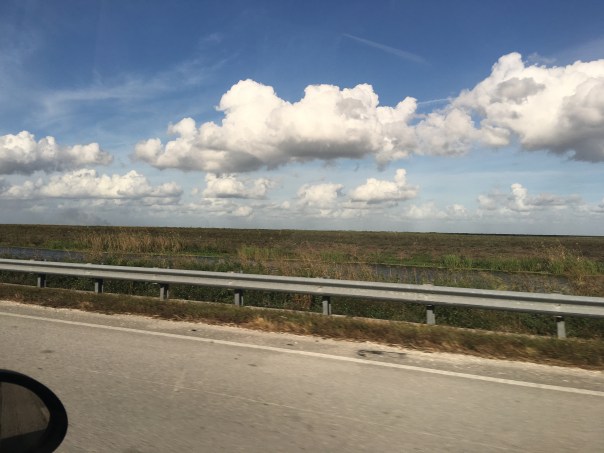
We begin 2017 at the southern most part of our state, the Florida Everglades. Over the holidays my husband, Ed, and I continued the Road Trip Series further south to gather insights, one that I will share with you today: the great water disconnect of Taylor Slough. We have too much water and it doesn’t have enough. Could we help?
Before we begin, what is a “slough?” What a strange word!
For years I drove along a road in Port St Lucie, north of Stuart, named “Cane Slough.” I wondered to myself what that meant considering the area was paved over. When my mother told me Cane Slough was once a marshy shallow river, I thought how odd that was considering there was not trace of it today. The same thing, but on a much larger scale, has happened in the Florida Everglades and in both instances it is a great loss.
“Slough,” pronounced “slew,” is not just a river, but a river that is made for Florida’s dry and rainy seasons. It is a slow-moving river whose grassy shores expand and contract. During the dry season when rains are scarce, the remaining water in the deepest part of these depressions is where plants and animals hold on to life-giving water until the rains begin anew…
Before South Florida was developed there were two main sloughs running through the Everglades to Florida Bay. Named, the Shark River, the largest, and Taylor Slew, smaller and further to the east. We must note that Florida Bay the past years has suffered from algae blooms and seagrass die off due to high salinity because Taylor Slew cannot flow southeast. This lack of water affects both land and marine communities.
It is easy to see the great “disconnect” for Taylor Slough on this National Park map. A park ranger informed me that “all water” received into Taylor Slew now comes via canal structures controlled by the South Florida Water Management District.
Yes, some great things finally are happening such as the recent construction of elevated bridges along Tamiami Trail designed to deliver more sheet flow into the park and a future where the “Chekika” public access area off 997 could be closed year-round so water could be flowing south. Others too I’ve no room to mention…
One can visually note that restoring this flow is tricky as Homestead’s agricultural and rural development zones abut the old water shed and Broward County north of this area has communities literally in the Everglades (C-11 Basin) that were once part of Taylor Slough as well. Crazy!
But, if we sent men to the moon 50 years ago, shouldn’t we be able to accomplish reconnecting the flow of water “today?” Now, when the Everglades and Florida Bay need it?
How can we along the St Lucie River help speed things up?
…Learn about Senator Negron’s proposal for 60,000 acres of storage, cleaning and conveyance in 2017. Learn about pressuring our government to “face the facts.”
…One thing is certain, we can’t allow the Everglades to die on our watch, and we have exactly what she needs…
My recent Glades tour with former Pahokee mayor, JP Sasser, lasted seven hours, and one of the most unexpected things I got to see was Storm Water Treatment Area 3-4. I have read about the STAs, flown over the STAs, and have had many discussions with engineer, Dr Gary Goforth, who is an “Architect of the STAs,” but nothing prepared me for what I felt when I unexpectedly saw an STA from the ground, or the other mystery I’d learn about that day.
So just about when my tour of the Glades was over, JP looked at me and ask: “Do you want to see the where the big reservoir was supposed to be?”
“Yes!” I exclaimed.” The reservoir? Hmmm. I’d heard stories of “the reservoir” but I really didn’t get it. Why didn’t it get finished? And what is it today? And then of course river advocates like me are supporting Senate President Joe Negron’s reservoir. What’s the deal with all these reservoirs? So confusing…
JP stopped the car, his blue eyes dancing: “We’ll have to drive south….”
“Please!” I begged, knowing I may never have this opportunity again.
So JP turned the steering wheel 180 degrees in the middle of all the sugar fields and headed south of Belle Glade on Highway #27– driving right along the historic North New River Canal that I did know something about.
We drove, and we drove, and we drove…through sugar field after sugar field. And then, there it was, to my right, what appeared to be blowing reeds surrounded by shallow sparkling waters, silver and white, reflecting clouds in a blue sky. Birds flew by. It was beautiful. Miles long. My eyes welled up, and I thought about how amazing it was to see water in this place…”It’s like…..the Everglades….”
We drove until we got to the SFWMD’s STA 3-4 entrance gate and I asked JP to pull over so I could get a picture. I was unsure…So to JP, a Glades local, this area has to with “the reservoir,” but here we are at an STA? As I was pondering, we drove further into Broward County and JP pointed out many new-looking pump stations to send water south. I couldn’t stop wondering about “the reservoir.”
When I got home I did some research.
I believe, in short, this is the story. Please chime in if you know more.
After lawsuit/s due to long-standing polluted EAA water impacting southern lands, and after “acts of the Legislature,” in the 1990s a “Settlement Agreement,” was obtained. Thus the state of Florida had to construct 32,000 acres of storm water treatment areas (STAs) in the EAA (Everglades Agricultural Area) to clean water leaving the EAA and going into Water Conservation Areas and Everglades National Park.
By 2000 the first of six had been constructed, and by 2004 the first water ran through. Thus the building of the STAs is associated with the law suits. At the same time, Congress was working legislatively on CERP, the Comprehensive Everglades Restoration Plan. It was approved by Congress in 2000. But it was moving too slowly, so in 2006, Florida’s state legislature approved LOER (Lake Okeechobee and Estuary Recovery Plan) and under Jeb Bush chose 8 projects of CERP to “accelerate.”
One of the “Acceler 8” projects was the A-1 Reservoir. This reservoir was to be located basically right above STA 3-4 and it had three water components, one for agricultural use; one for the environment; and one for people.
Well time moves on and we are now post Jeb Bush, and into Charlie Crist’ governorship who in 2008 announced that the SFWMD would be negotiating with United States Sugar Corporation (USSC) to acquire as much as 187,000 acres of their land for Everglades Restoration! Lots of internal fighting. Environmentalist are excited about historic land acquisition, but many others are irritated that Everglades Restoration (CERP/Acceler 8) will be halted in order to purchase lands. Other sugar companies in the EAA are impacted as they share mills with USSC. US Sugar surprised everyone with this announcement. Not very nice! Some people in the ag industry are furious. Politics. Lawsuits. But such an opportunity!!! The Great Recession hits. The A-1 Reservoir and its 3 components are halted in order to possibly purchase the USSC lands.
Even more lawsuits ensue including one from the Miccosukkee who want the reservoir completed as their lands are being depleted. Time is of the Essence.
The recession gets worse…the USSC land deal falls apart. Fewer lands are purchased. In 2010 Tea Party and “Jobs” Governor Rick Scott comes to power and negotiates with the Federal Government over of a law suit that included creating Numeric Nutrient Criteria for Phosphorus coming out of the EAA. “10 parts per billion” becomes the number. Some feel he sold out, others think it’s good.
In any case….the SFWMD now implements what the District had been planning as things were falling apart and money got tight, not a 3 part deep reservoir but rather a shallow Flow Equalization Basin, or FEB, in the A-1 reservoir lands above STA 3-4.
Thus the “Restoration Strategies,” law suit brought to the table by Rick Scott and State Legislature funded the A-1 Reservoir FEB and has more to come. What is important to note is that the A-1 FEB and the STAs were created to clean EAA sugar/agricultural runoff, due to lawsuits, not to hold, clean, and convey overflow Lake Okeechobee water that is destroying the estuaries…This is different.
And that’s why we environmentalist are talking about “a reservoir” today…a reservoir that would help the estuaries…because we don’t have one.
On the way home, JP and I talked.
He is concerned that Negron’s 60,000 land purchase for a deep water reservoir could take so much land out of sugar production that one of the EAA’s four mills would not have enough cane to process, close, and put people out work. Pahokee cannot afford this…
“This stinks,” I thought to myself. “Do we have to choose?” Why can’t people in the Glades and the Environment flourish? Everything is so confusing around here. This too should not be a mystery…
I noticed after writing this post that I did not report uses of reservoirs correctly thus I am adding this slide on 12-16-16, one day later. This slide shows what the reservoir compartments were proposed for in this 2012 SFWMD presentation slide by Matt Morrison. I had included “people/water supply” and this was incorrect. The entire presentation is linked below title EAA Storage Reservoirs, 2012. JTL
When looking through old ones you can find clues to Martin County’s historical ties with The Glades. Finding things in common is important as we work to improve relations, communications, and our waters.
My mother, historian, Sandra Henderson Thurlow, came across this ad, when looking in a 1921 Stuart City Directory. She writes: “The McCoy Brothers became rum-runners and owned what is now Sailfish Point. What is interesting to me is that in the 1920s, they were taking passengers and freight across the state through Lake Okeechobee via the West Palm Beach Canal.”
As we are learning from our Road Trip series, the West Palm Beach Canal was built in 1917 and intersects with Lake Okeechobee at Canal Point. What we might not know is that the McCoy’s Hutchinson Island land then known as “Coral Strand” became today’s Sailfish Point.
The brothers knew and loved the St Lucie Inlet area well enough to buy this land and establish their business there. The “Everglades Line” was probably one of many. Perhaps the brothers drank ice tea on their way from Sailfish Point down the Indian River Lagoon to Lake Worth’s entrance to the West Palm Beach Canal and through Lake Okeechobee? Although they were famous rum-runners, the most well-known brother, Bill, did not drink!
His obituary notes:
William Frederick McCoy (1877 – December 30, 1948): Bill McCoy was an American sea-captain and rum runner smuggler during the Prohibition in the United States. In running alcohol from the Bahamas to the Eastern Seaboard, he became world-famous as his merchandise was uncut and clean. Thus the saying the “Real McCoy.” McCoy himself never touched liquor and was considered an “honest law-breaker.” He also took pride in the fact that he never paid organized crime, politicians, or law enforcement for protection.
I think we can consider Bill McCoy a Glades/Martin County honest law-breaker common ancestor. “The Real McCoy” a symbol and foundation for building better relations from the Coast to the Glades?
I don’t know about you, but I can’t think of a better place to start. 🙂
Map of Canals 1924 Florida Archives.1950 map by Ben McCoy of the “Coral Strand” and its riches, today known as Sailfish Point.South Hutchinson Island aerial showing mosquito ditches through mangroves and other vegetation. 1952 courtesy of Thurlow Archives.Google map showing Hutchinson Island with Sailfish Point south next to St Lucie Inlet. East is Atlantic Ocean and west is the Indian River Lagoon and Sewall’s Point.Lake Okeechobee.
Recently, in response to Senate President Joe Negron’s proposal to purchase 60,000 acres of land south of Lake Okeechobee, a movement began called #GladesLivesMatter. This group is concerned for the future of their communities due to the intensifying coastal cry: “Send the water south!”
Tension or misunderstanding between the Glades and the Coastal Communities is not a new theme. As we’ll learn, with creativity and determination it has been overcome before. Maybe we can learn something from the past and try to achieve this too?
In 1917, the year the West Palm Beach Canal was constructed and roads were first available from the coast to the Glades, Palm Beach County Chamber of Commerce president, T.J. Campbell wrote a Post article urging his readers to “take a growing interest in the people who live in rural communities, and make their living from the products of the soil.”
According to Palm Beach County historian James D. Snyder, Campbell’s article was unintentionally patronizing in that, “it chastised the urbanite for too often viewing the ruralists with feelings not unmixed with contempt or at least a certain pride of superiority.”
Sound familiar?
After some ruffled feathers, deliberation, and discussion it was decided that Campbell was making a point and that both sides needed each other, and both sides misunderstood the other.
So with the new transportation routes a motorcade (road trip) was organized to Belle Glade. It was a success and the coastal residents were amazed. To show good will, in the months following, the American Legion of the Glades traveled to the coast and marched in the 1921 Palm Beach County parade. They performed a song-poem as the “Muck Rats” and were the hit of the parade!
I’m from old Lake Okeechobee,
Where they raise gators,
Beans and pertaters,
Catfish and termites and Prohibition haters,
Custard apple, moon vine,
Catfish and moonshine,
All the time!
Even if the main thing in common was that many of the Coastal and Glades residents were “Prohibition haters,” of which we’ll learn about tomorrow, this effort of goodwill bettered relationships. And in the end, both sides made the effort. Why not take a drive? A road trip? You just might be amazed… 🙂
Before we begin today’s lesson, two major changes must be recognized. First after almost a year, the ACOE halted the destructive Lake Okeechobee discharges to the St Lucie River. These releases began January 29th, and lasted through November 4th, 2016.
And on Tuesday, November 8th, Donald Trump won the 2016 presidential election over Hillary Clinton, an election considered the most remarkable and unpredictable in over 100 years…
Now back to our Road Trip series:
Most recently we have traveled to Canal Point, the first town south of the Martin County line on the east side of Lake Okeechobee. This almost forgotten little town has an amazing history, and holds the seeds of today’s expansive Everglades Agriculture Area and of United States Sugar Corporation itself.
The easiest way to take this drive through history is a timeline. So let’s crank up the car and begin!
Connors’ Hwy 1920s Florida Memory
1914-1918 – World War 1. Sugar rationing across the nation.
1917- The West Palm Beach Canal is constructed, intersecting at Canal Point, allowing transportation of goods and internal land development around Lake Okeechobee
1918-After the war, Congress holds hearings about concerns that the county should “never again” get into a position where domestic sugar production is just 1.7 billion. The United States Department of Agriculture opens a sugarcane research central at Canal Point that still operates today-a hundred years later.
Original USDA lab/office, Canal Point (Wiki)2016
1920- The American Legion and Federation of Women’s Clubs mount a national lobbying campaign against the high price of sugar. West Palm Beach chapters lead in support of the effort.
1920- Englishman, F.E. Bryant, already a successful farming business man in Lake Worth, forms the Florida Sugar and Food Products Company working with G.T. Anderson at Canal Point. They buy land and build the first sugar mill by 1921 and encourage expanded sugar farming.
1922-Flooding of some cane fields…they plod on…
1923- 900 acres of sugarcane in Palm Beach County, 800 of it in Canal Point. This is a real success.
1924- Connors’ Highway constructed allowing access in and south of Lake Okeechobee for more sugar farming and development
1924- More flooding of cane fields– a major set back so Bryant merges his faltering company into a “better capitalized” company in Clewiston. The name of this company is Southern Sugar Company.
1926- Hurricane
1926 Florida land booms slows, beginnings of the Great Depression for Florida
1928 Hurricane- an historic Category 4/5 hits Lake O area coming through West Plam Beach. Up to 3000 people die. Many are never found.
Coffins at Canal Point, Florida Memory
1931 Businessman and General Motors executive, Charles Stewart Mott purchases Bryant’s failing Southern Sugar Company renaming it United States Sugar Corporation. This is the hugley successful and profitiable Clewiston “US Sugar Corporation” that we know today. http://www.ussugar.com
When I drove through Canal Point a couple of weeks ago, I had no idea that this little town held so much history. A history that eventually and unintentionally led to the diking of Lake Okeechobee and the destruction of the St Lucie River/Indian River Lagoon.
S-352 at Canal Point/WPB Canal
*Thank you to the book Black Gold and Silver Sands, by James D Synder, and the Palm Beach Historical Society as sources.