Tag Archives: 2016

The Swing-Bridge Between Us,#GladesCoastMatters, SLR/IRL

IMG_8127 - Version 2.JPG
Original locks at Canal Point WPB Canal, JTL
IMG_8131.jpg
WPB Canal built in 1917 at Canal Point, JTL

IMG_8133.JPG

IMG_8140.jpg
Survey marker on original lock at Canal Point, WPB Canal. JTL
IMG_8134.jpg
The beautiful iron and wood work on the original lock at Canal Point’s WPB Canal.
IMG_8141.jpg
Ironwork
IMG_8127.JPG
Pictured here: The original lock at Canal Point. I think this should be restored as a historic landmark as it was built in 1917 as part of the WBP canal and basically set us on the path we are today and is also a symbol of where we can go. The man on this lock reminded me of the story of the shared swing-bridge at Torry Island that once was part of the Roosevelt Bridge in Stuart. This will be the subject of today’s post.

2016 has been an incredible year, and 2017 will be as well. In 2016, both Lake Okeechobee and the St Lucie River blew up with toxic algae, and #GladesLivesMatter was established as a voice for a way of life that could be lost…

As far as 2017, as I write this post, deals are being cut, and advocates on both sides are working to get legislative support for their positions. But during this season of light, may we also remember our interests, as they hold things we share in common rather than apart: a Healthy Lake Okeechobee and St Lucie River, as well as Local Economic Prosperity for All  are certainly goals both the Glades and the Coast desires…right now, in most areas of our combined worlds, this does not exist…

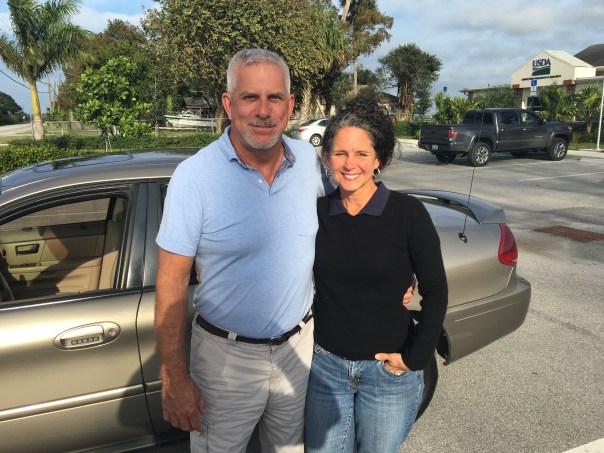
Yesterday, I toured the Glades once again with former Pahokee mayor, J.P. Sasser, someone I don’t always agree with, but definitely get along with. Someone who is teaching me a ton about the Glades, a history linked to my history, the St Lucie River/Indian River Lagoon….

Along the journey, a noteworthy thing happened right of the bat at Canal Point, our first stop. Here, I met an older gentleman fishing along the original locks of the historic West Palm Beach Canal. As I was taking photos, I thought I should introduce myself.

“Hello,” I said, extending my hand.

“Hello.”

“Catching much?” I asked.

“Not today, but usually, yes.”

“Do you live around here?” I inquired.

“No, Tequesta.”

“Wow Tequesta? That’s pretty far away…”

“Not really,” he said. “Maybe thirty minutes. I used to come here with my father in the 1950s.”

“That’s cool.”

“And where are You from?” He inquired.

“Stuart.”

The fishing line bobbed in the water. I saw noticed a dead gar fish float by. The water doesn’t look so good, I thought.

“Have things changed a lot?” I asked.

“Yes they have,” he said, “but not a lot out here at Canal Point. That’s why I come.”

An alligator silently swam the shoreline…

“You know  your bridge is here.” the fisherman softly said,” pulling on the line.

“Wow, funny you should know that…my mom…she’s a historian. Torry Island right? They used part of the Roosevelt Bridge in Stuart to build out in here in Belle Glade in 1938. It’s still here today…a swing-bridge….right?”

He looked at me holding his gaze. “Right young lady, the bridge is here….”

J.P. called from the car. The fisherman and I locked eyes.

“The bridge is here.” I repeated.”The bridge is here.”

As we drove away, I wrote something on my notepad: “2017 #GladesCoastMatters … ”

_________________________________________

Torry Island Bridge is located in Belle Glade about a 15 minute drive around Lake O from Canal Point.

“The story of the bridge’s origins flow smoothly from Corbin… The 1928 hurricane that ravaged the Glades set in motion the chain of events that would bring the bridge to Belle Glade. The storm destroyed the original dike that surrounded the lake. To build the replacement dike, the federal government spooned out a canal, separating Torry Island from Belle Glade, and used the dirt for the dike. The new canal, called the Okeechobee Waterway, needed a bridge. In 1938, state contractors built the Point Chosen Bridge, replacing a pontoon bridge with a swing bridge that was built in 1916 and relocated from the St. Lucie River near Stuart. The bridge consisted of the movable portion and wooden trestles on each end.” Associated Press article, 2009.

Link to story: https://jacquithurlowlippisch.com/tag/torry-island/

Merry Christmas and Happy Holidays to all my readers! See you in 2017!

Jacqui

IMG_7539.JPG
This is the swing bridge that used to be in Stuart on the Roosevelt Bridge but is now part of the Torry Island Bridge in the city limits of Belle Glade.
IMG_7538.jpg
Torry Island, Belle Glade.
IMG_7532.JPG
The swing-bridge looking across the rim canal around Torry Island.
IMG_7531.JPG
The Bridge Between Us…
IMG_8266.JPG
JP and JTL.
IMG_8212.JPG
J.P.’s bumper sticker

IMG_8274.jpg


IMG_8271.jpg
My bumper sticker/s
img_7427-2
Historic map of the Glades showing cities. Canal Point upper left and Belle Glade further west and south. WPB canal is in Canal Point and the Torry Island Bridge is in Belle Glade.

file-page1

New Hope Sugar Corporation; Can We Create More Than Hope? SLR/IRL

file-page1-2.jpg
TCRPC EAA map 2016
file-page1.jpg
Senator Negron’s possible land acquisition map 2016/17


map_of_pahokee_fl.jpg

“Who Owns the Land South of the Lake? Mapping Out Florida’s Water Future.”

Today we discuss #3, New Hope Sugar Corporation. It is difficult to find much information on the company, however, it is part of the Fanjul family’s holdings. It is also the same name, as we learned yesterday, as the Fanjul charity: New Hope Charities whose mission is to help families in the Glades.

Let’s look at the charity again…

Their website reads: “New Hope Charities was incorporated as a 501(3)(c) charity in 1988 offering support to remote, distressed and underserved segments of society. The first program implemented by New Hope distributed food to needy families living in the “Glades” area of western Palm Beach County. Currently, we operate a multi-service center in Pahokee, Florida, the second poorest city in the United States. The Family Center consists of a Day Care Center, a Youth Center, an Education Center, a Health Center, basketball courts, and an open field for soccer, baseball and football.”

Now back to the land…

I have colored in New Hope Sugar Corp. in the same orange highlighter as Okeelanta Corporation, but added a red dot to differentiate. New Hope Charities above mentions Pahokee as the nation’s second poorest town. Pahokee is south of the Martin County Line along the rim of Lake Okeechobee; it is not far away.  The point of my blog series is to show landholdings, but I think the “New Hope” theme lends itself to a discussion on something more.

FullSizeRender.jpg
New Hope Sugar Corp orange with red dot, #3. Fanjul holdings.
IMG_6003.JPG
Map south of Lake O, Pahokee is marked

I have been blogging for four years now,  it is becoming clear to us all that there is a bridge to be crossed, a hand to be held if we are going to go any further. Since the beginning of our river journey there have been cries from the interior of the state/south of the Lake. Cries of fear that we want to “send the water south” and destroy their cities and livelihoods…Even thought we know this isn’t so, this is understandable— and let there be no mistake about it: #GladesLivesMatter

I think it is time we talk about this openly. We must address the fears and the realities  and we must begin to help…because there is so much help we can do for these communities and for a better water future for our state.

What got me thinking on all this was researching New Hope Sugar Corporation, #3 on the TCRPC map. I realized I have never thought that much about these areas south the Lake, except maybe when my father told me some of the best football players come from Pahokee and Belle Glade. I have driven through before and I have flown over. But have I ever walked inside? No I have not. After I finish this “land south of the Lake series” I think it is time to go inside this world and see how we can help.

We have got start a conversation including the Glades communities, a plan to help the poverty in Pahokee and Belle Glade and other Glades communities. We have to talk about Everglades Restoration as a plan for everyone.  I am sure the Fanjul’s New Hope Charities with same name as their Sugar Corporation is doing great work, but why couldn’t Everglades restoration offer something more? Because in order to create more than hope, we must move beyond charity…


Links:

Glades Lives Matter: http://www.ussugar.com/news/icymi-glades-lives-matter/

New Hope Sugar Corp: Links: http://listings.findthecompany.com/l/29385192/New-Hope-Sugar-Company-in-West-Palm-Beach-FL

SunBiz: http://search.sunbiz.org/Inquiry/CorporationSearch/SearchResultDetail?inquirytype=EntityName&directionType=Initial&searchNameOrder=NEWHOPESUGAR%202486740&aggregateId=domp-248674-74190f46-1014-4027-89fb-78bffb22106a&searchTerm=new%20hope%20sugar%20corp&listNameOrder=NEWHOPESUGAR%202486740

Board of Dir. New Hope Charities: http://www.newhopecharities.com/about/our-board-of-directors/

Pahokee: http://www.cityofpahokee.com/Pages/index

Pahokee: https://en.wikipedia.org/wiki/Pahokee,_Florida

Pakokee: http://www.city-data.com/picfilesc/picc86312.php

Poorest Communities in Florida: http://www.onlyinyourstate.com/florida/poorest-cities-fl/

Excerpt NY Times Article, 2013… In the Glades, the “official” jobless rate has always been a joke because so few people are even on the books. Many of the agricultural jobs disappeared as vegetable production turned into sugar growing, now largely mechanized.

NY Times Article of Football Pahokee and Bell Glade and Hope of a Better Life: http://www.nytimes.com/2013/02/03/opinion/sunday/football-as-a-way-out-of-poverty.html?_r=0

New Hope Charities: http://www.newhopecharities.com

Pahokee IMG_4155 - Version 2.JPG
Pahokee from the air, 2014 JTL
IMG_4156.JPG
Black gold around Pahokee known as THE MUCK

Dodging the Bullet, St Lucie River Shot In The Chest, SLR/IRL

IMG_3841.JPG
St Lucie Inlet, Ed Lippisch photos 10-9-16
MatthewDistancefromSLI.jpg
Hurricane Matthew a CAT 4 was 42.8 miles from shore, Google Image via Todd Thurlow
Matthew10072016TerraMODIS.jpg
Hurricane  Matthew over Florida, Terra MODIS via Todd Thurlow

IMG_5966.jpg

Martin County was fortunate to “dodge the bullet” of category 4 Hurricane Matthew, but as long as the St Lucie Indian/River Lagoon is attached to Lake Okeechobee via the C-44 canal, the river cannot. She is shot in the chest each time.

These photos taken yesterday morning by my husband, Ed, show the discharges, like blood, gushing out of the St Lucie Inlet. Melodramatic personification? Perhaps, but true.

A press release by the Army Corp of Engineers on October 7th stated:

“Lake Okeechobee continues to rise; today’s stage is 15.93 feet… 

The Corps has resumed discharges from Lake Okeechobee after suspending them during the storm. Water managers have removed target flows and will release as much water as practical through Moore Haven Lock (S-77) located on the west side of the lake, and the Port Mayaca Lock (S-308) located on the east side of the lake…

‘We anticipate inflows to the lake will increase as a result of Hurricane Matthew,’ said Col. Kirk. ‘Therefore, we must maximize outflows in order to slow the rise in the lake and be as prepared as possible for additional hurricane season uncertainty…”

“Additional uncertainty?” Not for the river.

As the Corp has been discharging from the lake since January 29th, 2016 and now the gates are wide open to save life and property south of the lake, the St Lucie did not really dodge a bullet at all. She is hemorrhaging once again.

Until Lake Okeechobee is redirected south as God designed, “dodging a bullet” in Martin County remains an illusion.

IMG_3845.JPGIMG_3848.JPGIMG_3865.JPGIMG_3872.JPGIMG_3877.JPG

Hurricane Matthew: https://en.wikipedia.org/wiki/Hurricane_Matthew

ACOE Jacksonville: Today LO is at 16.04 feet: http://w3.saj.usace.army.mil/h2o/reports.htm

*Thank you to my husband, Ed Lippisch and his Extra 300, and my brother, Todd Thurlow’s computer skills –whose images made this blog post possible.

Just in case anyone is having deja vu to 1979, SLR/IRL

This email came in via my brother Todd this morning, amazing how similar the paths of the two hurricanes are. I thought I’d share. In any case, to all “be safe.” Jacqui

“Attached is the 1979 Hurricane David Track vs. the Hurricane Matthew track and forecast track.

Best regards,

Todd
http://www.thurlowpa.com
Thomas H. Thurlow III”

PATH OF HURRICANE DAVID, 1979 (https://en.wikipedia.org/wiki/Hurricane_David)

HurricanesDavidvsMatthew100416ToddThurlowClose.jpg

PREDICTED PATH OF HURRICANE MATTHEW, 2016. AM 10-4-16. Latest  NOAA: (http://www.nhc.noaa.gov/#MATTHEW)
HurricanesDavidvsMatthew100416ToddThurlow.jpg

JTL vs The Political Machine, A Retrospective. Parts 1&2 Write in Candidate & Firefighters Union, SLR/IRL


bcixy1474297494.jpg

Now that the dust is settling, it is important to study and document the loss dynamics of “Jacqui Thurlow-Lippisch for Martin County Commission District 1.” In retrospect, it was a voice for the river grassroots campaign versus a sophisticated political machine. The narrow loss to 16 year incumbent Doug Smith, by only 677 votes or 2.9% makes the retrospective even more interesting!

As there is such a plethora of material, today we will research only parts #1 and #2: The Write in Candidate (WIC), and the Martin County Firefighters Union. In follow-up posts, we will breakdown the influence and monies of the political action committees and their cohorts better known as PACs.

#1 WRITE IN CANDIDATE (WIC)

One very effective way the political machine affects a race is by putting in a “write in candidate.” Because of a constitutional amendment brought forward by the voters in 1998, Florida is a “universal primary state,” meaning in a primary election that determines the General Election,  voters of all parties are allowed to vote. But there is one “opinion” loophole that came later: “if a write in candidate (opposition) enters the race, the race becomes closed.”

Write in candidates could be real candidates who at the last minute decide to run, or they can be fake candidates who are put up by the “powers that be” to close the primary race to one party, or for the “benefit” a certain candidate.

This is what happened in the JTL District 1 race. Chase Lurgio, an 18 year old teenager at Jensen Beach High School, who is certainly a not in a position to be a county commissioner, was put up for the benefit of Mr Smith the last days of June. The race had been going on since September the year before.

Who put up this candidate and was he awarded for service? This we may never know, but as we study the players in the arena we begin to get an idea….

If you are interested, all of Chase Largo’s WIC information can be found on the Martin County Supervisor of Elections’ website; also, one can call and request his qualification papers. There is not much to learn as a  write in candidate pays no fee, (“real” county commission candidates are required to pay almost 4,000$ or get 1100 petitions signed to quality); WIC do not have to fundraise, participate in forums, etc.., can be of the same party they close, (as is the case of Chase Lurgio who is a Republican himself like me and Doug Smith); they do not have to put forth a biography…nothing is really required to be a WIC, you just have to be willing to sign up.–they don’t even have to live in the county!

2016 Candidates by name: http://www.martinvotes.com/content.aspx?id=474

To repeat, the JTL Campaign, a loud independent voice for the health of the St Lucie River, a bipartisan issue with broad appeal to all parties was threatening to the political machine and to Doug Smith. So the race was closed by a WIC, disenfranchising  over half the voting population of Martin County (Democrats and Independents.)  Considering the will of the people 1998 constitutional amendment made Florida a universal primary state, this does not seem correct.

Numbers of Martin County Registered Voters: |Republican: 55,015 | Democrat: 27,501 | Other: 26,591 | Total: 109,107

People can change parties but this is a lot to ask, and only a very small population even figure out what is going on. Many voters are furious when they get to the polls and names they expected to vote for are not on the ballot.

Mind you, I have no problem with true write in candidates or closed primaries. However the tactics of Florida’s present system are fraudulent and encourage foul play. The only way to change this is to work against the corruption of WIC fraud and in time get the state constitution changed for either straight closed primaries or open primaries.

In conclusion, as time goes on more and more law suits have arisen regarding WIC and in fact there is a case in the Florida Supreme Court Case pending although one was just determined and the opinion on WICs was upheld. It is the people who must overturn this fraudulent part of our system.

Orlando Sentinel article on WIC: http://www.orlandosentinel.com/news/politics/os-write-in-candidate-lawsuit-20160805-story.html

IMG_5288.jpg
SOE MC
chaselurgio55569952667_7102540263022042389_n.jpg
Chase Largo’s Facebook picture has been widely distributed since he signed up to be a WIC


#2 THE MARTIN COUNTY FIREFIGHTERS UNION

Another factor affecting the JTL race was the Martin County Firefighters Union. The MC Firefighters Union has been at an impasse with the Martin County Commission for raises etc… To overcome this situation, they have regrouped and developed a ruthless union that has raised dues to back candidates that promote their interests.

It is kind of “You scratch my back, I’ll scratch your back” approach. As was quite obvious during the race, where I used my grassroots team, Doug Smith used the firefighters. They put his signs together in the union parking lot and waved signs along with their families on the side of the road in sweltering heat.

They also raised extra money with their union dues to send out a negative post card against me and later made direct phone calls to citizens in my hometown of Sewall’s Point stating untruths.

Their Political Action Committee, Citizens for Public Safety, (PAC) sent out the ad below and by clicking on the link one can see they raised over 100,000 dollars in their PAC to run negative ads against candidates. On average it cost about 15,000$ to send out one postcard.

If you go to the link from the Florida Department of State Division of Elections and enter their PAC “Citizens for Public Safety” into COMMITTEES you will see reporting.

GO HERE TO LOOK UP MC Firefighters’ Citizens for Public Safety or any PAC: http://dos.elections.myflorida.com/campaign-finance/contributions/

The misleading ad they sent out against the JTL Campaign is below. Look closely and you will see “Paid electioneering communication paid for by Citizens for Public Safety”

As I said many times during the course of my campaign, I am forever grateful to the firefighters for saving my life when I broke my neck in 2001, but I find their campaigning for any candidate a total conflict of interest. It will be interesting to see if  Mr. Smith supports their raises in the coming budget cycles. I am also surprised the “Republican” candidate would have such a close relationship with unions.

Hindsight is always 20/20. Hope you learned something today. I certainly have! See you for part 3, Stuart Chamber’s C-PAC in the coming days.

Jacqui

IMG_5289 2.jpg
FL DOE
IMG_5276.jpg
Postcard sent out by Citizens for Public Safely-MC Firefighters Union
IMG_5277.jpg
back of card

History’s Stairway-From the “Greatest Fishing Waters in America” to the Home of Toxic Algae 2016, SLR/IRL

Stairs leading to the former home of Hubert W. Bessey, the Perkins family and later William H. and Lucy Anne Shepard ca. 1890-1947 via historian Sandra Henderson Thurlow.
Stairs leading to the former home of Hubert W. Bessey, the Perkins family, and later William H. and Lucy Anne Shepherd ca. 1890-1947- via historian Sandra Henderson Thurlow.
Courtesy of "Stuart on the St Lucie," by Sandra Henderson Thurlow.
Courtesy of “Stuart on the St Lucie,” by Sandra Henderson Thurlow.
Shepherd's Park, Stuart 5-30-16. JTL
Shepherd’s Park shoreline, St Lucie River, Stuart 5-30-16. The ACOE in collaboration with the SFWMD and other state agencies has been discharging waters that cannot go south to the Everglades from Lake Okeechobee as they are blocked by the EAA. The ACOE has been releasing this year since January 29, 2016. The estuary is now fresh and breeding the algae blooms of Lake Okeechobee. JTL

My earliest memories of Stuart include stairs…stairs leading to the river…

Walking in Shepherd’s Park as a child, I would ask, “Where did those stairs go Mom?” Her answer may have gone something like this…

“Jacqui, those stairs led to a great house, one of Stuart’s first, built by pioneer, Hubert Bessey. It later became the residence of William and Lucy Ann Shepherd who first came to Stuart in the early 1900s. They came, like so many did at that time, for the fishing. Stuart, you know, was “the fishing grounds of presidents” and known as “the greatest waters in America” for this sport. Mr Shepherd was president and owner of T.H. Brooks and Company, a steel corporation in Cleveland. He and his wife were generous citizens of our community.  In 1947 the house was almost demolished by a hurricane, but repaired. Then in 1949, disaster struck. Right in the middle of the winter season, the house mysteriously burned to the ground, but the stairs still stand today…” (Adapted from “History of Martin County”)

Yesterday, with these 50-year-old lessons ringing in my ears, I approached the remains of the old Shepherd residence that became today’s Shepherd’s Park. I was here on Memorial Day to meet reporter Jana Eschbach, from CBS affiliate Channel 12 News in West Palm Beach. It was Jana who had alerted me to a large fluorescent green algae bloom-more than likely toxic.

I arrived early and walked around. Lots of memories. Seeing the old stairs, I thought about how they used to lead to “the fishing grounds of presidents and the greatest fishing grounds in America.” And today, less than 100 years later, they are leading to toxic algae blooms. Never in my wildest dreams would I have foreseen this as a child.

Walking around the breakwater, I thought to myself:

“I will not give up on this place–this former paradise. It could recover if given the chance. History can repeat itself in some form here for the positive.  Yes, and I will remember the words of Ernest Lyons who my mother taught me about too—the writer and editor of Stuart’s early paper–a leader and inspiration in fighting against the digging of the excessive agricultural canals that have destroyed our St Lucie River.

I mused for a second and remembered his inspirational quote:

“What men do, they can undo. And the hope for our river is in the hundreds of men and women in our communities who are resolved to save the St Lucie.” 

Yes.

The recovery of this river is in the people, for no government can exist in today’s age knowingly bringing this upon its people…It continues to be our time to change history.

.
.
...
...
...
..
..
...

CBS 12 report: http://cbs12.com/news/local/toxic-green-slime-invades-waterways-for-miles-in-martin-county#

http://cbs12.com/news/local/toxic-green-slime-invades-waterways-for-miles-in-martin-county#
_______________________________________________

OTHER PHOTOS FROM STUART, 5-30-16, Dusty Pearsall.

....
….
....
….
....
….
....
….


Comparison Update of Lake O Discharge Events, 1998, 2013, and 2016, SLR/IRL


Summary of Lake Okeechobee 2016. Dr Gary Goforth.
Comparison of Lake Okeechobee releases to the St Lucie River & Estuary 2016, Dr Gary Goforth.

This year, the Army Corp of Engineers– with input from the South Florida Water Management District, and other stakeholders— has been discharging from Lake Okeechobee into the St Lucie River and southern Indian River Lagoon since January 29th, 2016. Today will review an April update.

We as citizens must pay attention and know what is happening to the river so that we can intelligently fight for its future.

Dr Goforth’s chart above gives a good visual comparison of 2016’s discharges, thus far, compared to those of 1997/98, another El Nino year with fish lesions, fish kills, and toxic algae reports. This chart  also compares 2013, our recent “Lost Summer,” when toxic algae blooms filled the river, on and off, for about three out of five dumping months. (–Running May through October, 2013.)

One can see, that Lake Okeechobee’s 2016 discharge amounts are quickly approaching the total numbers released in 2013— although well below those of 1997/98.

Although discharges have been lessened lately, with the Army Corp of Engineers reporting a possible La Nina indications for the 2016 Hurricane season, (4-26-16 ACOE Periodic Scientist Call) considerably more rain could be on the way.

NOAA: https://www.climate.gov/enso

With the lake sitting at 14.29 today,  —a high level going into “wet season,” starting June 1st—we should all be watching the situation very closely. Hopefully 2016’s total Lake O release numbers will be nowhere close to 1997/98.

We must continue to advocate hard for a third outlet, and land purchase south of the Lake Okeechobee, as this is the only way to spare our rivers’ repeated total destruction.

Thank you to Dr Goforth for his contribution today.

ACOE Lake O: http://w3.saj.usace.army.mil/h2o/currentLL.shtml
_______________________________________________

The following is from an email dated from Dr Gary Goforth on April 26, 2016 including the slide used for today’s blog and others of interest. Click on image to enlarge.

Hi all,

Attached are

1. Summary of the 2016 Lake discharge event to the St. Lucie River and Estuary.

2. Preliminary Water Year 2016 (May 1, 2015 to March 31, 2016 – missing April 2016) summary, including
a. Inflows to Lake Okeechobee by basin, with comparison to last year
b. Outflows from Lake Okeechobee by region, with comparison to last year
c. Flow diagram for Lake releases, with comparison to last year
d. Lake releases to STAs, with comparison to last year
e. Nutrient and TSS load from Lake discharges to the St Lucie and Caloosahatchee Estuary
f. The graphs are shown for both acre feet and billion gallons

Dr Gary Goforth http://garygoforth.net


Previous blog on 1998:https://jacquithurlowlippisch.com/2015/12/16/remembering-and-comparing-the-199798-el-nino-to-todays-slrirl/

“Death in Every Direction,” The State of Florida’s Waters…SLR/IRL

Photo 3-20-16 Facebook SWFL Clean Water Movement- Sarah Joleen / Cocoa Bch
Photo 3-20-16 Facebook, SWFL Clean Water Movement- Sarah Joleen / Cocoa Bch.

North, South, East, West….

You know I have really just about had it. I know you have too.

I am so tired of posting and writing about the sad state of affairs of our state waters. Every direction one turns!

This weekend many photos showed up on Facebook reporting an enormous fish kill in the Central Indian River Lagoon near Melbourne and Cocoa Beach. These photos of hovering and floating fish are very disturbing.

What is even more upsetting is when one considers the state of just about all of Florida’s waters. Is this the same state I grew up in as a child. Really?

To summarize  a few recent, ongoing situations:

CENTRAL INDIAN RIVER LAGOON-experiencing  “brown tide” and fish die off…

NORTHERN LAGOON: 2011-2013 Super Bloom, morality events (both north and central), 60% seagrass die off…

Florida Today: http://www.floridatoday.com/story/news/local/2016/03/18/report-fish-kill-brevard-county/81992006/ or http://www.orlandosentinel.com/news/environment/os-florida-water-catastrophe-statewide-20160304-story.html

–ST LUCIE RIVER/S. INDIAN RIVER LAGOON: repeated discharges from Lake Okeechobee and area canals have destroyed the heath of the river. It was declared “impaired by the state in 2002. State of Emergency due to Lake O called in Feb. 2016).

(Article: TC Palm: http://www.tcpalm.com/news/indian-river-lagoon/health/lake-okeechobee-discharges-to-st-lucie-river-begin-2a945729-88d4-59b9-e053-0100007fc4eb-367103911.html)

—-CALOOSAHATCHEE RIVER  (The western outlet for lake Okeechobee discharges, the river has been straightened, and connected to Lake O. Sometimes suffers from too little fresh water/high salinity. State of Emergency due to Lake O called in Feb. 2016)

Caloosahatchee area photo John Moran 2016.
Caloosahatchee River area, photo John Moran 2016.

(Article: Tampa Bay Times http://www.tampabay.com/news/environment/water/lake-okeechobee-flood-control-creates-environmental-disaster/2270032)

—FLORIDA BAY: over the past few years has lost massive amounts of sea-grasses due to high salinity. When I was just there with my UF NRLI class this year, the bay looked murky. This bay historically received the fresh waters from Lake O.

(Article: Miami Herald http://www.miamiherald.com/news/local/environment/article37583577.html)

—FLORIDA SPRINGS– Some have gone dry and others are lacking sufficient flow due to aquifer withdrawal. Many have experienced algae blooms. Photographer John Moran has documented their decline.

(Site: http://springsforever.org) or (http://springseternalproject.org)

–LAKE OKEECHOBEE–deluged with water from the mostly straightened Kissimmee River and others. It has been dammed and directed to the northern estuaries.

(State BMAP plan to improve: http://www.dep.state.fl.us/water/watersheds/docs/bmap/LakeOkeechobeeBMAP.pdf)

–BISCAYNE BAY has also had seagrass die off and water quality issues/high human impact)

(Article: http://www.sun-sentinel.com/local/broward/fl-noaa-biscayne-bay-20150118-story.html)

Keep documenting. Keep posting. Keep reading. Keep learning…Keep writing your elected officials…

Keep pushing for a better state. A better state of Florida’s waters.

2016 St Lucie River /IRL
2016 St Lucie River/IRL EL/JTL

(Thank you to Ms Bobbi Blodgett for getting me the details on the fish kill photograph.)

Photo 3-20-16 C.IRL fish kill Coco Bch.
Photo 3-20-16 C.IRL fish kill by Saha Joleen, Cocoa Bch.


_________________________________________
3-25-16: I am adding this follow up article on the fish kill by Florida Today. The blog was written on 3-21-16. http://www.floridatoday.com/story/news/local/environment/2016/03/23/what-we-know—-and-dont-know—-fish-kill/82163574/

Summary of Dry Season Flows – Nov. 1, 2015 – February 29, 2016, Goforth, SLR/IRL

Florida is like Africa. We have a wet season and a dry season. This dry season has been very wet!

In today’s blog, I will share the most recent update by Dr Gary Goforth sent to Martin County on 3-13-15 entitled: “Summary of Dry Season Flows, November 1,  2015 – February 29, 2016.” Dr Goforth gives a summary and provides wonderful visuals. The “pages” he mentions in his summary for this post have been converted to slides. (Please view slides from left to right.)

Thank you Dr Goforth. (http://garygoforth.net)
Are are an integral part in helping us understand why we must sent the water south…

Engineer, Dr Gary Goforth led the SFWMD Storm Water Treatment Area design for over a decade.
Engineer, Dr Gary Goforth.
The red line shows the designated "Everglades." As we can see humankind has filled a lot of it in. (SFWMD map, 2012.)
SFWMD satellite map, S.Fl. Water Conservation Areas (WCAs) are below the Everglades Ag. Area (EAA) which is just under Lake O.

” All,

Thought you might be interested in this comparison of dry season inflows to, and discharges from, Lake Okeechobee. Inflows to the Lake were 79% higher this dry season (Nov. 1 2015 – February 29, 2016) compared to a year ago, but Lake discharges have only been 1% higher due to the inability to send water south. Hence Lake stages have increased more than a foot above the level it was at this time last year.

The basins with the biggest increases in Lake inflows are those along the north and northwest shores of the Lake – but not the Upper Kissimmee, which exhibited a 50% reduction in flows to the Lake compared to last year.

As we’ve seen, because of the heavy rains south of the Lake and the agencies delay in moving water out of the Water Conservation Areas, WCAs, the estuaries have taken the brunt of Lake releases this year.

The flow estimates on the first 5 pages are in acre feet and in billion gallons on the second 5 pages.

Gary Goforth