Tag Archives: Caloosahatchee River

The Heart of the 1947 Central and South Florida Project, the SFWMD

Everglades National Park, JTL

Sometimes the history of the Everglades is really confusing.  Why, with all of the environmental advocacy, since the 1970s, does the health of our environment remain crippled?  One way to simplify it is to think in terms of before and after the 1947 U.S. Central and South Florida Plan. Of course there is extensive history before 1947, but it was after 1947 that things in South Florida’s water world became culturalized, compartmentalized, and legally defined. Before we talk about this 1947 Central and South Florida Plan, let’s review some important highlights pre-1947.

1. Hamilton Disston begins the drainage of Lake Okeechobee (1881)

2. Governor Napoleon Broward hires U.S.D.A. scientist James Wright who determines that “eight canals would indeed drain 1,850,000 acres of swampland” (1904)

3. The U.S. Congress’ Rivers and Harbors Act  includes significant funds to deepen  the manmade Hamilton Disston connection of the Calooshahatchee River to Lake Okeechobee (ca.1910)

4. The scandal of James Wright (from #2 above) who was deemed “a fraud” for the failure of the land to drain as expected ~causing the slump in swampy real estate sales (1914)

5. The resurgence of confidence in sales and a 1920s real estate boom fueled by advances in soil science, and the success of agricultural start-ups located in Moore Haven, Belle Glade, and Clewiston south of Lake Okeechobee

6.  Land in a defined “Everglades Drainage District” more fully being systematically cut into sections for development with canals draining agricultural fertilizers and other chemicals into the waters of the state (1924)

6. Two very powerful hurricanes causing thousands of deaths and the destruction of property, and thus the state’s “call for a higher dike” (1926 and 1928)

7. The state’s reaction to the hurricanes, the 1929 establishment of the “Okeechobee Flood Control District” for the “Everglades Drainage District” as well as the Federal Government’s Army Corp of Engineers taking over “field operations”around Lake Okeechobee ~including the building of a thirty-five foot earthen dike and ingeniously using navigation funding to build the cross-state-canal, connecting the Caloosahatchee and the St Lucie Estuaries to Lake Okeechobee ~conveniently working as discharge-escapes through those estuaries when “necessary”

So, as we can see, a lot happened pre-1947, but it was what happened after, were things really changed…

In 1947 it rained and rained, and there were two hurricanes. From Orlando to Florida Bay the agricultural and developed lands, that had been built in drained, once marshy, swampy areas, really flooded, and in some places a foot of water sat for months. There was great economic loss.

The crying cow booklet, above, was sent to every member of the U.S. Congress.

The country as a whole was empowered with its post World War II success and prosperity, and with that same determination, the U.S. Congress came to Florida’s rescue…

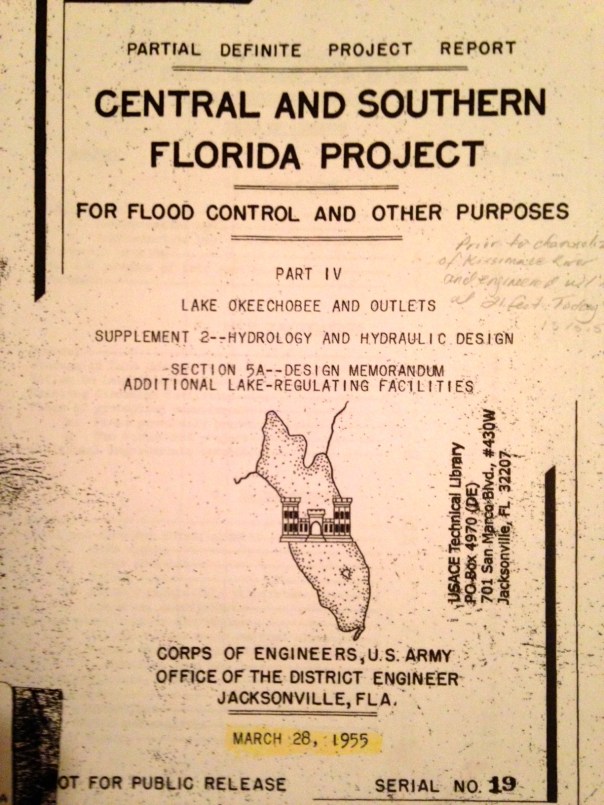
To fight Florida’s destructive “flood waters” the 1948 U.S. Congress adopted legislation for the CENTRAL AND SOUTH FLORIDA PROJECT, a twenty year flood plan from Orlando to Florida Bay that included the formal creation and protection of the Everglades Agricultural Area south of Lake O, the Water Conservation Areas, intertwined with thousands of miles of canals and structures to control the once headwaters and River of Grass. HOUSE DOCUMENT 643 – 80TH CONGRESS (00570762xBA9D6)

Next, mirroring the same terminology the United States Government had used (the Central and South Florid Project) the state of Florida created the “Central and South Florida Flood Control District” to manage that CENTRAL and SOUTH FLORIDA PROJECT. A bit confusing huh? A tongue twister. And in a way one could say, at that time, the Central and South Florida Project and the  Central and South Florida Flood Control District “became one.” The overall goal above all other things was flood control. And this marriage of the Central and South Florida Project and the Central and South Florida Flood Control District was successful at controlling the waters, but it also killed the natural environment, thus Florida herself.

This embedded cultural philosophy of “flood control only” was challenged in 1972 with the birth of the national environmental movement, and a consciousness that the natural system that supported Florida’s tourism, quality of life, agriculture, not to mention valuable wildlife,  was in tremendous decline.

As Florida matured came Governor Claude Kirk, a republican,  in 1968, who was advised by environmentalist Nathaniel Reed. Then came Governor Reubin Askew, a democrat. The Florida Legislature, seeing the destruction of the state’s natural resources, passed a very important piece of legislation, the “Florida Water Resources Act,” today’s Chapter 373 in Florida Statures. (http://www.leg.state.fl.us/statutes/index.cfm?App_mode=Display_Statute&URL=0300-0399/0373/0373ContentsIndex.html)

This law created five Florida water management districts with expanded responsibilities for regional water resources management including environmental protection not just flood control.

Accordingly, the Central and South Florida Flood Control District changed its name, but not its heart, becoming the South Florida Water Management District, we know today…(https://www.sfwmd.gov)

Everglades National Park, JTL

Why are C-44 and S-2 flowing backwards into Lake Okeechobee? 

My brother, Todd,  wrote to me on June 8th noting that the C-44 canal was flowing westwards into Lake Okeechobee rather than dumping eastwards into the St Lucie as is standard operating procedure after a big rain…

Yes this canal, as most of the others, can “flow” in either direction, seemly “backwards.”

So how can this happen? This backwards flow?

Dr Gary Goforth says the following:

“Yes this is normal operations; generally when the Lake level is below 14 ft the Corps leaves the locks at S-308 wide open which allows any local runoff to flow into the lake.”

Another way Lake Okeechobee can receive water in an unusual way is if the water is pumped into it–back pumped. This has recently been done from the EAA. Back pumping into Lake O has been outlawed, but it is allowed if communities or farmland would flood.

According to an exchange yesterday on Facebook, with  Audubon’s Dr Paul Grey:

“St Lucie (C-44) backflows are just one of many southern inflows now, S-2 is backpumping, three other southern outlets are flowing backward into the low lake (L-8, S354, S-352) the Caloosahatchee was backflowing but appears equalized today. More water is flowing into the lake from downstream areas than upstream right now. Not the end of the world but not desirable either, it is very polluted water. http://w3.saj.usace.army.mil/h2o/reports/r-oke.html  “

When I asked Dr Grey if this was being done to gather water in the lake as we’ve recently been in a drought, or to keep the farmlands in the  EAA and surrounding areas dry, this was his response:

“Both, they want to fill the lake this summer, and so do I, in concept, but much of this backpumping and flowing is because the farmers have been pumping water so rapdily off their own lands they have made the canals too deep, and risk fooding the communities. And rather than tell the farmers the canal its too deep and they have to modererate their pumping, the SFWMD backpumps/flow it to the lake.”

In any case, when I visited yesterday during my trip to Belle Glade, S-308 was closed at Port Mayaca and no more water was entering Lake O from C-44. I’m not sure about S-2.

The water looks dark and full of sediment. The once beautiful beach is full of gritty rocks. Maybe the lake is healthy in the shallows south, near the islands, but by Port Mayaca it looks terrible. Algae has been reported by S-308 a few weeks ago according to a report from Martin County at the River’s Coalition meeting. But thankfully there is not algae reported in C-44 right now.

We have really made a mess of it. For our rivers and for Lake Okeechobee, the reservoir must be built and we must continue to advocate for sending cleaned water south and re -plumb this outdated system. Forward flow or backwards flow, just say NO.

6-13-17 JTL

____________________________________

Todd Thurlow notes 6-8-17

Jacqui,

Interesting note: if this data is correct, C-44 has poured 10.7 billion gallons (aka 13.82 Stuart Feet) of water into Lake Okeechobee in the last three days. With all the recent “local” runoff into the canal, they have opened S-308, sending the water west to the Lake to help get the low lake level up.

48.5 million gallons passed through S-80 to the St. Lucie on June 5th…

-Todd

C-44 back flow to Lake O, ACOE

Article in Okeechobee News by Katrina Elsken “St Lucie Water Flowing Into the Big O” http://okeechobeenews.net/lake-okeechobee/st-lucie-water-flowing-big-o/

SFWMD: https://www.sfwmd.gov

ACOE Lake O: http://www.saj.usace.army.mil/Missions/Civil-Works/Lake-Okeechobee/

Structures and canals south of LO
Canal and basin map, Martin and St Lucie Co,SLR/IRL. SFWMD
C-44 canal from Stuart to Lake O.
S-308 at Lake O and C-44 canal Port Mayaca

Numerous wood storks and great egrets eating fish in the polluted side canals of C-44:

Video:(http://www.youtube.com/watch?v=Z-7IwzHGZIM)

Stay on the Ride! The Many Roller Coaster Configurations of Senate Bill 10, SLR/IRL

Rollercoaster.jpg

Senate January 11 2016 – Goforth (PDF of Dr Gary Goforth’s presentation to the Senate NRAC)

screenshot
Gary Goforth, PhD

Florida Channel 1-11-17 video (go to time 1:08-1:32 to see Dr Goforth’s presentation) (http://thefloridachannel.org/videos/11117-senate-appropriations-subcommittee-environment-natural-resources/)

___________________________________________________________________________

Senate Bill 10, the bill associated with Senate President Joe Negron and his goal to stop the damaging discharges of Lake Okeechobee to the St Lucie River and Caloosahatchee… my gosh, up and then down, and then up again…Why such a roller coaster ride?

The last time I went on a roller coaster ride was many years ago when I in my twenties and teaching German at Pensacola High School. I took my IB high school students and 14 visiting German exchange students to Six Flags. I got so sick on the ride that I had to sit on a bench the remainder of the day. The students? They loved it and went multiple times! Roller coasters are not fun for everyone. But one thing’s for sure, if you’re on the ride, and you feel sick, be assured that it will end, but when it hasn’t, hold on! This bill, this ride, won’t end for another month plus, as it has to be voted on by the full Senate and achieve a matching bill in the House….

Thus far, the bill has really gone “double-full-circle-upside down-roller-coaster” in that Stuart’s Dr Gary Goforth ( http://garygoforth.net) mentioned the many configurations available to achieve “the goal” during the January 11th 2017 meeting of the Senate Natural Resources Appropriations Committee. At this time he pointed out that some of those “loopy configurations” on his visual went back to CERP’s birth year of 2000 and the first goals the state and federal government had for an EAA reservoir!

You can watch Dr Goforth’s presentation and see his handout linked at the top of this post. Gosh, I kind of feel sick, yes, there have been so many changes and so many numbers… 60,000, 14,000, 360,000, 240,000, A-1, A-2, my head is spinning! There is so much back and forth! Yes there is, but goodness, you can’t say this isn’t exciting! The St Lucie River and Indian River Lagoon a roller coaster for the whole world to see! Personally, I am going to try NOT to sit out on the bench this time, how about you?  🙂

maverick-roller-coaster-cedar-point-ohio.jpg.rend.tccom.1280.960 2.jpeg

Here is a Senate staff summary of what part of the rollercoaster ride the bill is on today:

CS/SB 10:
 Establishes options for providing additional water storage south of Lake Okeechobee, including the:
o Everglades Agricultural Area (EAA) reservoir project with the goal of providing a minimum of 240,000 acre-feet of water storage; and
o C-51 reservoir project with the goal of providing approximately 60,000 acre-feet of water storage.
 Authorizes the Board of Trustees of the Internal Improvement Trust Fund (TIITF) and the South Florida Water Management District (SFWMD) to negotiate the amendment or termination of leases on lands within the EAA for exchange or use for the EAA reservoir project.
 Requires lease agreements relating to land in the EAA leased to the Prison Rehabilitative Industries and Diversified Enterprises, Inc., (PRIDE Enterprises) for an agricultural work program to be terminated in accordance with the lease terms.
 Requires the SFWMD, upon the effective date of the act, to identify the lessees of the approximately 3,200 acres of land owned by the state or the district west of the A-2 parcel and east of the Miami Canal and the private property owners of the approximately 500 acres of land surrounded by such lands;
 Requires the SFWMD, by July 31, 2017, to contact the lessors and landowners of such lands to express the SFWMD’s interest in acquiring the land through the purchase or exchange of lands or by the amendment or termination of lease agreements.
 Requires the SFWMD to jointly develop a post-authorization change report with the United States Army Corps of Engineers (USACE) for the Central Everglades Planning Project (CEPP) to revise the project component located on the A-2 parcel for implementation of the EAA reservoir project.
 Requires that if, for any reason, the post-authorization change report does not receive Congressional approval by October 1, 2018, unless the district has been granted an extension by the Legislature, the SFWMD begin the planning study for the EAA reservoir project by October 31, 2018, and proceed with the A-2 parcel project component of CEPP in accordance with the project implementation report.
 Requires the SFWMD to give preference to the hiring of former agricultural workers primarily employed during 36 of the past 60 months in the EAA, consistent with their qualifications and abilities, for the construction and operation of the EAA reservoir project.
 Establishes the Everglades Restoration Agricultural Community Employment Training Program within the Department of Economic Opportunity to provide grants for employment programs that seek to match persons who complete such training programs to nonagricultural employment opportunities in areas of high agricultural employment, and to provide other training, educational, and information services necessary to stimulate the creation of jobs in the areas of agricultural unemployment. The program is required to include opportunities to obtain the qualifications and skills necessary for jobs related to federal and state restoration projects, the Airglades Airport in Hendry County, or an inland port in Palm Beach County.
 Establishes a revolving loan fund to provide funding assistance to local governments and water supply entities for the development and construction of water storage facilities.
 Revises the uses of the Water Protection and Sustainability Program Trust Fund to include the water storage facility revolving loan program.
 Prohibits, beginning July 1, 2017, the use of inmates for correctional work programs in the agricultural industry in the EAA or in any area experiencing high unemployment rates in the agricultural sector.
 Beginning in Fiscal Year 2018-2019, appropriates the sum of $100 million from the Land Acquisition Trust Fund (LATF) to the Everglades Trust Fund for the purpose of implementing the water storage reservoir projects, with the remainder of such funds in any fiscal year to be made available for Everglades projects.
The bill provides the following appropriations for the 2017-2018 fiscal year:
 The sum of $30 million in nonrecurring funds from the LATF is appropriated to the Everglades Trust Fund for the purposes of acquiring land or negotiating leases pursuant to s. 373.4598(4), F.S., or for any cost related to the planning or construction of the EAA reservoir project.
 The sum of $3 million in nonrecurring funds from the LATF to the Everglades Trust Fund for the purposes of developing the post-authorization change report pursuant to s. 373.4598, and the sum of $1 million in nonrecurring funds from the LATF to the Everglades Trust Fund for the purposes of negotiating Phase II of the C-51 reservoir project pursuant to s. 373.4598, F.S.
 The sum of $30 million in nonrecurring funds from the LATF to the Water Resource Protection and Sustainability Program Trust Fund for the purposes of implementing Phase I of the C-51 reservoir project as a water storage facility in accordance with ss. 373.4598 and 373.475, F.S.

Image 4-9-17 at 11.29 AM

Full bill with changes, Senate Bill 10 version #3, 4-6-17 https://www.flsenate.gov/Session/Bill/2017/10/Amendment/920390/HTML

History of bill in Senate: https://www.flsenate.gov/Session/Bill/2017/00010

“Multiple combinations of location, configuration, land area and water depth can achieve the storage and flow objectives of the EAA Storage Reservoir.” Dr Gary Goforth

screenshot

Image 4-9-17 at 11.34 AM
Stay on the ride!

River Kidz Expands to All South Florida, SLR/IRL

river-kidz-cover-color
New cover for 3rd Edition River Kidz workbook that will be released this Spring, by Julia Kelly.

New artwork by Julia Kelly: http://juliakellyart.com

River Kidz, an organization created in 2011 in the Town of Sewall’s Point “by kids for kids,” whose mission is “to speak out, get involved, and raise awareness, because we believe kids should have a voice in the future of our rivers,” is expanding its range.

The group’s message will now encompass not only the St Lucie River/Indian River Lagoon, but also the Caloosahatchee and Florida Bay. These three south Florida estuaries all suffer due to longstanding mis-management practices of Lake Okeechobee by the Army Corp of Engineers and the South Florida Water Management District. You may have most recently heard about these three estuaries together as Senate President Joe Negron has proposed a land purchase in the Everglades Agricultural Area and a deep reservoir to improve the situation.

So what’s the problem?

Ft Meyer’s Calooshahatchee River on the west coast gets too much, or too little water, “depending.” And Florida Bay, especially in regards to Taylor Slough near Homestead, hardly gets any water at all. In fact the waterbody is reported to have lost up to 50,000 acres of seagrass due to high salinity. No way! And here at home, as we know first hand, during wet years the St Lucie/Indian River Lagoon is pummeled with Lake O water causing toxic algae blooms beyond comprehension as experienced in 2016.

In all cases, whether it is too much, or too little water, algae blooms, destruction of water quality, and demise of valuable wildlife habitat ensues. Kids know about this because the most recent generation has lived this first hand. -A kid growing up, not being able to go in the water or fish or swim? No way!!!!

We can see from the satellite photo below how odd the situation is with the EAA lands just south of Lake Okeechobee engineered to be devoid of water so the EAA plants “don’t get their feet wet” while the rest of the southern state suffers. Yes, even a four-year old kid can see this!  🙂

EAA drainage 2005
This satellite photo shows water on lands in 2005. One can see the lands in the EAA are devoid of water. This water has been pumped off the lands into the Water Conservation Areas, sometimes back pumped into the lake if flooding, and also stored in other canals. (Captiva Conservation 2005.)

To tell this story, in Kidz fashion, new characters have been created. Familiar, Marty the Manatee of the St Lucie River/Southern Indian River Lagoon, has been joined by two new friends: Milly the Manatee from the Caloosahatchee, and Manny the Manatee from Florida Bay. Quite the trio! river-kidz-cover-color

Also joining the motley crew is a white pelican, sometimes visitor to Lake Okeechobee, Florida Bay, and the Central IRL; also a stunning orange footed Everglades Snail Kite complete with Apple Snail; and last but not least, the poor “blamed for mankind’s woes of not being able to send water south,” the Cape Sable Seaside Sparrow. Finally, she will have a chance to share her story. Endangered species, weather, and the water-cycle will be added to the curriculum.

Workbooks will be available free of charge thanks to donations from The Knoph Family Foundation, and Ms. Michelle Weiler.

River Kidz is a division of the Rivers Coalition: http://riverscoalition.org/riverkidz/

group-shot
Cover of 2nd Edition River Kidz Workbook, with Marty the Manatee and friends of the St Lucie River and Southern Indian River Lagoon. For the 3rd Edition, new characters have been added.

Workbook Brainstormers: River Kidz co- founders Evie Flaugh and Naia Mader; the River Kidz, (especially River Kidz member #1, Jack Benton); Julia Kelly, artist; Valerie Gaynor, Martin County School System; Nic Mader, Dolphin Ecology Project; Crystal Lucas, Marine Biology teacher and her daughter Hannah; and Jacqui Thurlow-Lippisch, former mayor and commissioner of the Town of Sewall’s Point. Workbooks will meet Florida Standards and be approved by the Martin County School System thanks to Superintendent, Laurie Gaylord.

“Coming to a River Near You!”

President Negron’s Memorandum to the Florida Senate, Senate Bill 10,”Protecting Coastal Counties from Polluted Discharges” SLR/IRL

For me this memorandum, perhaps more than other work published, helps the everyday person understand Senate Bill 10. Thus I share today. Thank you Senate President Joe Negron, “Champion of champions,” for the St Lucie River/Indian River Lagoon!

636153421042051226-joe-negron

THE FLORIDA SENATE

SENATOR JOE NEGRON President

MEMORANDUM

SUITE 409, THE CAPITOL, 404 SOUTH MONROE STREET ▪ TALLAHASSEE, FLORIDA 32399-1100 ▪ TELEPHONE (850) 487-5229 Senate’s Website: http://www.flsenate.gov

TO: All Senators

FROM: Joe Negron, President

SUBJECT: Protecting Coastal Counties from Polluted Discharges DATE: January 26, 2017

I greatly appreciate the support many of you have provided over the last several years as my home community and others across our state have been flooded with billions of gallons of polluted water that destroys our estuaries and harms our local economies. Today Senator Bradley filed Senate Bill 10, an act relating to water resources, to begin the formal process of purchasing land to increase water storage south of Lake Okeechobee. This legislation provides a clear plan to address this plague on our communities in a manner that respects the interests of the agricultural community and private land owners. While I have had the opportunity to discuss this critical issue with each of you, I wanted to provide a brief summary of how we arrived at this solution as well as a summary of Senator Bradley’s legislation.

Background: Record rainfall this past year resulted in unseasonably high water levels in Lake Okeechobee, which threatened the integrity of the Herbert Hoover Dike. To maintain safe water levels, the Army Corps of Engineers authorized the release of billions of gallons of water from the Lake to the St. Lucie and Caloosahatchee Rivers. Such freshwater discharges cause significant environmental damage by lowering the salinity levels of the estuaries and introducing pollutants into coastal waters. Due to the discharges this summer, massive amounts of toxic algae that originated in Lake Okeechobee were sent to the estuaries and coastal waterways.

The extent and severity of the blooms resulted in Governor Scott declaring a state of emergency in four Florida counties.

These algal blooms have occurred before and will occur again unless high volume discharges from Lake Okeechobee are stopped and pollution in the Lake Okeechobee basin is abated. Algal blooms are not simply an unsightly nuisance for residents and tourists. They bring real health risks to humans and wildlife and result in severe economic damage to local businesses.

January 26, 2017 Page 2

As a result of the high volume discharges, coastal communities experienced enormous harmful algal blooms with devastating impacts not only to the ecology of local waterways, but also to residents, fishermen, and local businesses.

Despite the sincere efforts of our state and federal government to plan and fund long-term solutions to address rising water levels and pollution in Lake Okeechobee, year after year as the Lake levels rise, the solution is to flood my community and many others across our state with billions of gallons of polluted water.

From Governor Jeb Bush’s historic support of the bipartisan Comprehensive Everglades Restoration Plan (CERP) in 2000 to the recent University of Florida Water Institute study commissioned by the Senate and completed in 2015, for nearly two decades, there has been scientific consensus and recognition by state leaders that additional water storage south of Lake Okeechobee is necessary to stop this ongoing problem. This sentiment was reiterated as speaker after speaker addressed our Appropriations Subcommittee on the Environment and Natural Resources calling for increased storage south of the Lake.

Senate Bill 10 authorizes bonding a portion of proceeds from the Land Acquisition Trust Fund, set aside by the voter-approved Water and Land Conservation Amendment (Amendment 1, 2014), to purchase land and construct a reservoir south of Lake Okeechobee to reduce harmful discharges to the St. Lucie and Caloosahatchee estuaries.

Senate Bill 10 Summary: Senate Bill 10 authorizes the issuance of bonds to raise over a billion dollars to acquire 60,000 acres of land and build a reservoir south of Lake Okeechobee to reduce harmful discharges to the St. Lucie and Caloosahatchee estuaries.The reservoir is expected to hold 120 billion gallons of water, approximately as much water as was discharged from Lake Okeechobee into the St. Lucie Estuary between January and May of 2016. The creation of significant storage capacity south of the Lake will help manage Lake levels in anticipation of periods of high rainfall like this year’s predicted El Nino weather pattern. Storing water during the wet season provides the additional benefit of allowing water to be sent south to hydrate the Everglades and Florida Bay, or for agricultural use, during the dry season.

The estimated cost of a reservoir on 60,000 acres of land providing 120 billion gallons of storage in the area south of Lake Okeechobee is roughly $2.4 billion. With the federal government paying at least half of the cost of such a reservoir, the state’s commitment would be $1.2 billion. The bill authorizes the use of approximately $100 million of documentary stamp tax revenue set aside by the Water and Land Conservation  Amendment (Amendment 1, 2014) annually over the next 20 years to finance land acquisition and construction of the reservoir.

January 26, 2017 Page 3

The bill directs the South Florida Water Management District (SFWMD) to begin the formal process of purchasing land from willing sellers. The project is subject to Congressional approval to secure the 50/50 cost sharing agreement authorized for other CERP projects.

If the SFWMD is unable to identify sellers of land appropriate for a reservoir through an open solicitation by the end of 2017, the legislation authorizes the Board of Trustees to exercise the option with U.S. Sugar entered into in 2010 to buy 153,000 acres of land in the Everglades Agricultural Area, for the purpose of securing the 60,000 acres necessary for the reservoir and to begin planning the construction of the reservoir.

If the state is ultimately unable to purchase land for the reservoir by November 30, 2018, the legislation increases the ongoing Legacy Florida appropriation by an additional $50 million for the CERP, which includes a reservoir in the Everglades Agricultural Area as a key component. This is in addition to Legacy Florida’s existing commitment of $200 million. Legacy Florida also requires preference among these projects to be given to projects that reduce the harmful discharges from Lake Okeechobee to the St. Lucie or Caloosahatchee Estuaries.

As we move forward, I have a personal mission to work with the agricultural community, to work with Florida’s best scientists, and to work with every member of the Legislature, to protect our estuaries, to protect our lagoons, and to put the harmful discharges from Lake Okeechobee that destroy our environment and harm our economy into the past pages of history instead of the daily front pages of newspapers. I appreciate your consideration of this proposal and look forward to discussing it further in the days and weeks ahead.

florida_senate_seal

(For a full copy of Senate Bill 10, go to http://www.flsenate.gov/ and put 10 into “Bill” section at top of page.)
file-page1

“Don’t Expect Protection,” Toxic Algae Blooms 2016, SLR/IRL–Caloosahatchee

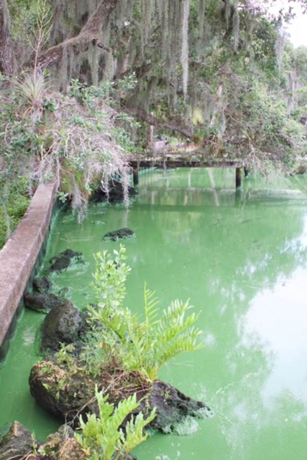
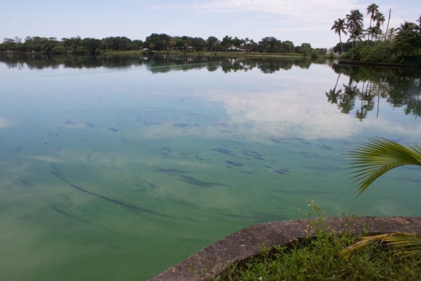
The photos below of a severe algae bloom were shared yesterday by Rick Solvenson and Brenda Brooks who live on the Caloosahatchee River near Olga. This is on the south side of Caloosahatchee River near Fort Myers’ shores, just downstream of the Franklin lock. There is a second set of photos taken last Sunday and yesterday by Michael and Michelle Connor of Martin County along the side of Lake Okeechobee and at Port Mayaca.

So far in 2016, algae blooms have been reported in Lake Okeechobee, the St Lucie Canal,  Palm City, (C-44) and the Caloosahatchee (C-43). The ACOE continues to discharge these algae filled waters from the lake into the estuaries St Lucie and Caloosahatchee with the support of the South Florida Water Management  District, the Department of Environmental Protection, the Florida Department of Health, and the knowledge of the Governor and Florida State Legislature.

From what I have read to date, the cyanobacteria toxic algae blooms reported thus far have not yet tested “high enough” to warrant concerns at the level of the World Health Organization…not yet, but if they do, —-expect some information, but don’t expect protection. Florida is not providing such these days, not to us anyway.

This is absolutely unacceptable.

DEP:http://www.dep.state.fl.us/Labs/biology/hab/index.htm

FDH: http://www.floridahealth.gov/ENVIRONMENTAL-HEALTH/aquatic-toxins/index.html

WHO: http://www.who.int/water_sanitation_health/bathing/srwe1execsum/en/index6.html

TC PALM: http://www.tcpalm.com/news/indian-river-lagoon/health/low-levels-of-toxin-found-in-lake-okeechobee-algae-bloom-32ba0e44-cd9f-1a9a-e053-0100007fd083-379388811.html

Google maps
Google maps
map
map
Photos by Rick Solvenson, Caloosahatchee River 5-23-16.
2
2
3
3
4
4
5
5
6
6
7
7
8
8
9
9
10
10
11
11
12
12

_____________________________

Map Port Maraca and south side of Lake O in MC
Map of Port Maraca and south side of Lake O in MC.
Port Mayaca 5-23-16
Port Mayaca 5-23-16 (Mike Connor)
Lake O
Lake O
Lake O's south side in Martin Coutny
Lake O’s south side in Martin County
Close up
Close up
Redirection of water to the estuaries. Late 1800 and early 1900s.(Map Everglades Foundation.)
Redirection of water to the estuaries supports and protects the EAA south of the lake. (Map Everglades Foundation.)


The Straight Roads of Golden Gate and Port Santa Lucia’s Demise, SLR/IRL


Golden Gate 1954 US1 and Dixie (Photo courtesy of Sandra Henderson Thurlow)
Historic aerial of Port Sewall’s Golden Gate area in 1954, US1 and Dixie in foreground. (Photo courtesy of historian, Sandra Henderson Thurlow)

If you ever drive the easterly location of Indian Street in Martin County, you are in the historic subdivision for the proposed Town of Port Sewall. According to the “History of Martin County,” in 1910, Hugh Willoughby and Captain Henry Sewall established the Sewall’s Point Land Company which developed Port Sewall–of which Golden Gate is part.

I  was taken by these old aerials from 1954 showing the straight roads of the Golden Gate section of the development with Sewall’s Point and St Lucie Inlet in the distance; I wanted to compare the photo to a cool old plat map and a Google map of today.

I love this old area of Martin County. So much history. It is fun to drive along Old St Lucie Boulevard and through Golden Gate. There are still remnants of the past. To visit the old Golden Gate building on Dixie Highway now getting a new life as the office of House of Hope—that was once a real estate office…..an awesome old Whiticar Boatworks from a bit later…

One of the long forgotten thing about this area is that Sewall and Willoughby’s vision for this development  was a deepwater port off of Sewall’s Point. According to historian Sandra Thurlow, “The port was to be established at the junction of the waterways known today as the Crossroads. It would be called “Port Santa Lucia” and would handle the vast amounts of produce that would be shipped out of the interior of Florida via the cross state canal.”

The cross-state canal in this reference? Yes, the cross state canal of the 1920s was the dreaded St Lucie Canal or more lovingly know today as C-44…the canal that connects Lake Okeechobee to the St Lucie River/Indian River Lagoon.

Willoughby and Sewall’s development and the Port of Santa Lucia never succeeded as the Great Depression of the 1920s killed that dream. But unfortunately part of the dream of that era lived on. Today the cross state canal or since named “Okeechobee Waterway” (C-44 in Martin County) does not transport vast amounts of fresh produce, but rather is used to “manage” the waters of Lake Okeechobee and to send sediment and nutrient filled Agricultural run off to feed algae blooms and destroy the property values of Sewall’s Point, Port Sewall, Golden Gate, and the rest of Martin County.

Golden Gate 1954
Golden Gate 1954
Historic Port Sewall plat map 1913 - Version 2
Historic Port Sewall plat map 1913 – Version 2 (rotated for comparison.)
Google maps of area today, 2016.
Google maps of Port Sewall area today, 2016.
SFWMD canal and basin map. C-44 canal is the canal most southerly in the image.
SFWMD canal and basin map. C-44 canal is the canal most southerly in the image. The canal goes from Lake Okeechobee to the St Lucie River exiting at the ocean near Sewall’s Point and Hutchinson Island.
Waters off of Sewall's Point where the Port was to be located in August 2013 during high levels of discharges from Lake Okeechobee. (JTL)
Waters off of Sewall’s Point where the Port was to be located in August 2013 during high levels of discharges from Lake Okeechobee. (JTL)
Releases from Lake O at tip of Sewall's Point, 2016. Photo Ed Lippisch.
Releases from Lake O at tip of Sewall’s Point at the Crossroads, 2016. Photo Ed Lippisch.

ACOE Okeechobee Waterway partially the C-44 canal:http://www.saj.usace.army.mil/Missions/CivilWorks/LakeOkeechobee/OkeechobeeWaterway(OWW).aspx

“Sacrificed for the Protection of U.S. Sugar and Agricultural Lands…” Dr Goforth Refutes US Sugar Ads, SLR/IRL


Engineer, Dr Gary Goforth led the SFWMD Storm Water Treatment Dr. Gary Goforth has more than 30 years of experience in water resources engineering, encompassing strategic planning, design, permitting, construction, operation and program management. design for over a decade.
Dr. Gary Goforth has more than 30 years of experience in water resources engineering, encompassing strategic planning, design, permitting, construction, operation and program management. (Photo JTL, 2015)
...


The following was written by Dr Gary Goforth as a response to U.S. Sugar Corporation’s months long ad campaign in the Stuart News.
http://garygoforth.net

· The health and economies of the St. Lucie River and Estuary, the Caloosahatchee Estuary, and Florida Bay have been sacrificed for decades by the management of Lake Okeechobee for the protection of US Sugar and other agricultural lands south of the Lake.

The recent ad blitz by US Sugar appears to be an attempt to divert the public’s attention away from this preferential treatment and from an egregious betrayal of south Florida taxpayers perpetrated by US Sugar, the Florida legislature and the Governor’s administration – the failure to exercise the willing seller contract to purchase US Sugar land south of the lake. Failure to secure needed land south of the Lake is the single biggest obstacle to long-term protection of the St. Lucie and Caloosahatchee estuaries from destructive Lake discharges, and providing Florida Bay and lower east coast wellfields with needed water.

· Water storage necessary to reduce high flows to the estuaries by about 90% will require about 10% of the land in the EAA – not complete elimination of farming in the area. The recent UF Water Institute study reconfirmed what scientists have been saying for decades – additional storage and treatment beyond what is currently planned in CERP and CEPP is needed south of the Lake: “If this required storage were to be provided strictly though deep 12-ft reservoirs, new land area between approximately 11,000 and 43,000 acres would be required south of Lake Okeechobee.” The upper limit – 43,000 acres – is less than ¼ of the amount of land US Sugar was willing to sell to the state (187,000 acres).

· Regarding the numbers in the ads – some are accurate, some are completely fictitious (e.g., the distribution of water from Lake Okeechobee), and many critical numbers are missing, e.g.,

-millions of pounds of nitrogen and phosphorus from lake Okeechobee that  feed algal blooms and wreak havoc on the ecology of the river, estuary, lagoon and near-shore reefs. (million off pounds of nutrients that the State of Florida ignores in their BMAP progress reports for the St Lucie River.)
– the hundreds of millions of pounds of Lake Okeechobee sediment that turned a once sand-bottom clear water estuary into a muck-filled lagoon that belches blackwater every time it rains.
– the hundreds of millions of dollars of economic impact to local businesses, tourism and real estate values attributable to poor water quality
If you’re interested go to the SFWMD’s (or my) website.

· Most of the area that the ads calls “local waterways” did not flow into the St. Lucie River (SLR) until after the major agricultural drainage canals (C-23, C-24, C-25 and C-44) were dug, connecting more than 250,000 acres to the SLR. Historically these areas flowed north into the St. Johns River watershed, south into the Loxahatchee and Everglades watersheds, evaporated or recharged the groundwater.

· The ads ignore the fact that more than half of the “local watershed” is agriculture, and that more than half of the flows and nutrient loads to the St. Lucie River and Estuary come from agricultural land use.

· Nutrient loads from septic tanks along the Indian River Lagoon need to be addressed in cost-effective ways based on good science. Nevertheless, nutrient loading and sediment from Lake Okeechobee and agricultural runoff constitute a far greater threat to the health of the St. Lucie Estuary than does loading from Martin County septic tanks. The loading from septic tanks in Martin County have been overstated by upwards of 200-300%.

· The 2016 Florida Legislature was an unmitigated disaster for the environment of Florida, with misappropriations of Amendment 1 funds for the second year in a row and the passage of a water bill that rolled back environmental protection for the benefit of agricultural interests. What role did lobbyists for US Sugar and other agricultural interests play in this debacle? —–Dr. Gary Goforth

*Dr. Goforth has more than 30 years of experience in water resources engineering encompassing strategic planning, design, permitting, construction, operation and program management. For the last 25 years, his focus has been on large-scale environmental restoration programs in the Kissimmee-Okeechobee-Everglades ecosystem. He was the Chief Consulting Engineer during the design, construction and operation of the $700 million Everglades Construction Project, containing over 41,000 acres of constructed wetlands.  He is experienced in public education, water quality treatment design and evaluation, engineering design and peer review, systems ecology, statistical hydrology, hydrologic modeling, hydrodynamic modeling, water quality modeling, environmental permit acquisition and administration, hydrologic and water quality performance analyses. (Website: http://garygoforth.net)


Ad 6-10-15 Stuart News.

Speaking Their Language, ACOE/SFWMD: Converting “Cubic Feet per Second” (cfs) to Gallons, Discharges SLR/IRL

View of convergence of SLR/IRL between Sailfish Point and Jupiter Island. Plume from Lake O discharges flowing out into ocean. Photo 2-7-16, Ed Lippisch
Canals in Stuart, C-23, C-24, C-25 built in the 50s and 60s. C-44 connected to Lake Okeechobee constructed in the 1920s. The natural basins of the SLR have been tremendously enlarged.
Canals in Stuart, C-23, C-24, C-25 built in the 50s and 60s. C-44 connected to Lake Okeechobee constructed in the 1920/expanded in 1940s. The natural basins of the SLR have been tremendously enlarged plus Lake O water. This is killing the SLR/IRL. More water must go south.

It is important to know how to “speak the language” of the ACOE and SFWMD.

The St Lucie River/Indian River Lagoon is once again under siege. The Army Corp of Engineers and the South Florida Water Management District are doing the will of the reigning powers and discharging tremendous amounts of water and pollutants from Lake Okeechobee and altered surrounding lands (basins) into the St Lucie River/Indian River Lagoon.

We must learn how to interpret this destruction and how to use their language of “cubic feet per second,” (cfs), when talking about discharge amounts from Lake Okeechobee and area canals into the SLR/IRL.

I am not good at this interpretation, but someone I know is….

As in most families, each chid in my family was born with different talents. My brother, Todd Thurlow, got all the number and sharp analytical skills that I did not. I am very thankful to him for helping with my St Lucie/Indian River Lagoon educational efforts.

Todd has created a VERY EASY way to convert cubic feet per second (the language of the ACOE/SFWMD discharges) into gallons. All you have to do is click on this link below and put in the numbers. Seriously.

For instance if you click on the link today, it will show that S-80 is last reported to be releasing approximately 6800 (cfs) cubic per second, down from just under 7600. Just enter 6800  in the top box and it will be converted to 1. gallons per second; 2. gallons per day; and 3. “olympic size swimming pools” (in honor of Stuart News reporter Tyler Treadway’s common example for communicating with the public.)

Go to this link now, and try it! You will be amazed at how east this is. To win this war, we must be able to speak “their” language and to understand.

Click on chart below to get started. Save the link to have it handy for this year. It is going to be a difficult one and we are going to need to know what we are talking about in order to negotiate and to communicate.

Conversation chart “cfs to Gallons:” http://www.thurlowpa.com/C44RealTimeData.htm

Examples: (but go to live link above.)

blank conversion chart
Blank conversion chart
Conversion chart with 7500 cfs
Conversion chart with 5600 cfs
Conversion chart with 6800 cfs

*Conversation Chart “cfs to Gallons:” http://www.thurlowpa.com/C44RealTimeData.htm

ACOE live pictures: http://w3.saj.usace.army.mil/h2o/cam/s80.htm

SFWMD/ACOE visual report: http://w3.saj.usace.army.mil/h2o/reports/StatusDaily_files/slide0178.htm

Todd’s firm page with all information:http://www.thurlowpa.com/news.htm

______________________________________

Videos by Ed Lippisch of discharges 2-6/2-7 2016.

2-6-16 3PM:Video of discharges: St Lucie Inlet area: http://www.youtube.com/watch?v=aoO0dj6f_zs
2-7-16 11AM: Video of discharges St Lucie Inlet area: http://www.youtube.com/watch?v=44NeEeFnkoQ


The History of the “EAA” Along the St Lucie River/Indian River Lagoon, St Lucie Gardens

This image shows St Lucie Farms separated from the entire land purchase of reed from Disston. (overlay created by Todd Thurlow)
This image shows St Lucie Farms separated from the entire land purchase of Disston to Reed. IRL east and PSL west.(Overlay created by Todd Thurlow)


St Lucie Gardens...overlay by Todd Thurlow.
Lands purchased by Sir Edward J. Reed from Hamilton Disston, as platted in the late 1880s/early 1900s. This land includes areas of Martin and St Lucie Counties…overlay on Google map by Todd Thurlow.

It all started with a recent comment by Bob Ulevich, at a Treasure Coast Regional Planning Council meeting.  In the course of his presentation and questioning on the history of the water management districts, Bob noted that the EAA, the Everglades Agricultural Area, was not historically “just located” where it is today, south of Lake Okeechobee, but basically included all of Disston’s lands. Are you kidding me? “Gulp”….

TCRPC meeting excerpt, no video, just sound: (http://youtu.be/acP_ri2vElc)
Mr Ulevich’s powerpoint: (http://www.tcrpc.org/council_meetings/2015/SEPT15/Final_Reports/Water_Presentation.pdf)
 

The red colored blocks south of Lake O. are the EAA-700,000 acres of sugar lands and vegetables. South of the EAA are the STAs and water conservation areas .(SFWMD map, 2012.)

Hamilton Disston. Remember him?  The “savior,” “the drainer” of our state—-who basically bought the entire state from a bankrupt entity, the Internal Improvement Fund? (https://en.wikipedia.org/wiki/Hamilton_Disston)
The more I read and think about it, I think what Bob meant was that almost of all the swamp lands sold to Disston and then others were marketed for people to purchase and farm….basically creating a giant Everglades agricultural area…but it wasn’t always so easy….

Orginal everglades document of the state of Florida. (TT)
Orginal Everglades document of the state of Florida. (Downloaded by TT)
TT
Ddisston’s AGCCOL Co. (TT)

When I was trying to figure all this out, I went back to a map I had seen before, reread a chapter in my mother’s Jensen and Eden book, and contacted my brother, Todd,  to help me answer a question.

Map
Map of Disston’s lands.

“Todd, why isn’t St Lucie Gardens in pink on the Disston map? …And wasn’t this area supposed to be farmland?”

St Lucie Gardens was a huge subdivision in the region of the St Lucie River/Indian River Lagoon including the savannas filed in 1911 by the Franklin Land Company of Jacksonville. According to my mother’s book, “the land was advertised as far away a Kansas and a few families bought land and tried to make a living farming. However land that had been pine flat woods continued to have cycles of flooding a drought and was impossible to farm profitably. The families that came to farm in St Lucie Gardens either gave up or turned to other ways to make a living.”

St Lucie Gardens...overlay by Todd Thurlow.
St Lucie Gardens…overlay by Todd Thurlow.
St Lucie Gardens plat map 1881. MC Property appraiser, via Todd Thurlow.
St Lucie Gardens plat map 1910. MC Property appraiser, via Todd Thurlow.
The Waters family promoting St Lucie Gardens 1910. (Photo Reginald Waters Rice) from Jensen and Eden by Sandra Henderson Thurlow.
Draining the savannas around St Lucie Gardens, 1911. Franklin Land Co. (Reginald Waters Rice) Jensen and Eden, Sandra Henderson Thurlow.
Page listing lands of Disston, mind you county boarders were different at this time. Matin was Brevard.
Page listing lands of Disston, mind you county boarders were different at this time. Martin was Brevard. (TT)

Todd and I never found our why those lands of the St Lucie River/Indian River Lagoon were not included on the 1881 Disston lands map, and the people who created it are not around to ask, but Todd did create the awesome visuals at the beginning of this post and he did find the deed of the purchase of the lands in our region. To have this document is an incredible part of our history.

Deed of Disston lands sold to Reed, 1881. (TT)
Deed of Disston lands sold to Reed, 1881, page 1. (TT)
Page 2. (TT)
Page 2. (TT)
Disston 4,000,000 acres from the state of Florida in 1881, which included much of the land within the savannas. ( Public map, 1881.)
Disston bought 4,000,000 acres from the state of Florida then sold half to Reed. Some of those lands included land in the SLR/IRL region. These lands are not shown on this map. ( Public map, 1881.)

And the EAA? With all the water problems we have today, I am glad it does not include everything in pink and green on the map and that something remains of our Savannas along the Indian River Lagoon.

____________________________________

An interesting email from Todd; Thank you Todd for all the research!

Jacqui,

It was fun to go through some of the stuff on my computer tonight. I just downloaded this publication “Disston Lands of Florida”, published 1885. I attached the intro page.

Disston had the pick of ALL the public lands owned by the state. It took three years to make the selection. Perhaps the pink area had been picked as of the date of the map and St. Lucie Gardens had not yet been picked?

Or maybe the St. Lucie Gardens land is not shown in pink on the map because Disston directed that the St. Lucie Gardens property be deeded directly from TIIF to Sir Edward James Reed. The Florida Land and Improvement Company never took title.

The TIIF deed that we pulled up for Sir Edward James Reed (attached) is dated 6/1/1881. In includes a little more land (21,577 Acres) than ended up in St. Lucie Gardens (e.g. Section 1, of T36S R40E is not part of St. Lucie Gardens but is included in the deed.)

Disston Lands of Florida: https://archive.org/details/disstonlandsoffl00flor
St. Lucie Gardens Plat: http://plat.martinclerk.com/St%20Lucie%20County%20Plat%20Books/BK%2001%20PG%20035-001.tif

Todd Thurlow (http://www.thurlowpa.com)

Rain, Flooding, Drainage/Building a Better Future for the St Lucie River/Indian River Lagoon


Riverview and South Sewall's Point Road flooded in the Town of Sewall's Point 9-17-15 (JTL)
Riverview and South Sewall’s Point Road flooded in the Town of Sewall’s Point 9-16-15 (JTL)

When I was a kid growing up in Indialucie, named so as it is located between the Indian River Lagoon and the St Lucie River….it flooded a lot. We kids loved it. We would  play and play! Just like kids did in the Town of Sewall’s Point when it rained so hard the past couple of days. I was told yesterday by Pam Hopkins, water quality specialist, at Florida Oceanographic that their gauge showed 8.5 inches!

Kids play in the retention pond in Sewall's Point. (Photo Simone McPhee)
Kids play in the retention pond in Sewall’s Point, 9-16-15. (Photo courtesy of Simone McPhee)

Rain is not the problem. It’s the drainage…

Florida was drained so agriculture and development could flourish. But we have literally outgrown the plumbing system of the 1920, 30s, 40, 50, 60, and 70s….we must begin to  think anew.

Rain events like the past couple of days allow us to clearly see the problem and to be creative in thinking about solutions. —-One thing is clear, when Lake Okeechobee’s water is added on top of such events, “not only are we flooded, but we are drowning.”

Whether it is the overflow waters of Lake Okeechobee, runoff from area canals, or “local flood waters,” such experiences highlight the need for storage, as fresh water is a resource and should not be wasted.

I have used the basin/canal map a lot recently as it applies to just about everything.  Here you can see the drainage system draining the lands into the SRL/IRL; of course there is other local infrastructure drainage such as street “gutters,” drains, and underground piping that do not show up on this map. In any case,  the goal is to “get the water off the land as soon as possible” and drain it to the lowest point, the river……

Well that has got to change.

SFWMD canal and basin map. C-44 canal is the canal most southerly in the image.
South Sewall's Point Road 9-16-15....(JTL)
South Sewall’s Point Road 9-16-15….(JTL)
.......
…….
......
……
......
……
.......
…….

BELOW, HUTCHINSON ISLAND, FLORIDA OCEANOGRAPHIC AREA/PUBLIX

Video of storm water going into local drainage system:(http://www.youtube.com/watch?v=aTN51n6ICMI)


........
……..
........
……..
A flooded Publix parking lot on Hutchinson Island....
A flooded Publix parking lot on Hutchinson Island….
Oil atop the water from parking lot and street. This all drains into the river.

To get the current conditions of drainage from canals around Lake O excluding C-23, C-24, and C-25 see this ACOE link; also the drainage from around the coastal area like Stuart, Sewall’s Point etc…is not shown here but estimated in other models.
Current Conditions report ACOE drainage: (http://w3.saj.usace.army.mil/h2o/reports/StatusDaily_files/slide0178.htm)

ACOE J-ville, C-44 (http://w3.saj.usace.army.mil/h2o/reports.htm)

SFWMD shows canals C-23, C-24 and C-25 but it is deeply imbedded and hard to find: (http://www.sfwmd.gov/portal/page/portal/sfwmdmain/home%20page)

Reaching the Finish Line, C-44 Storm Water Treatment Area/Reservoir, SLR/IRL

View of new intake canal and lands to be used for C-44 STA/Reservoir. C-44 canal in foreground. (Photo 2014, JTL)
View of new intake canal far right and lands to be used for C-44 STA/Reservoir. C-44 canal in foreground. Near Indiantown.(Photo 2014, JTL)
Intake canal for C-44 STR/R.(JTL)
Intake canal for C-44 STA/R.(JTL)

Today’s blog is a review of something we have been talking about for a long time now. Something that is in the news once again. The C-44 Storm Water Treatment Area and Reservoir, a component of the Indian River Lagoon South, CERP project.

Today we will break down this project into chucks so we can understand what is happening, and what has already happened, and clarify some terminology.

The term “C-44” can be confusing as C-44 is a canal but is applied to others things and used as a “nickname” for an entire, multi-layered project.  First, the C-44 is a canal that was built from 1915 to 1923 by the flood control district of the era and later by the Army Corp of Engineers. This canal has dual purposes. It allows water from the C-44 basin to run into and be released into the North Fork of the St Lucie River, and it allows overflow water from Lake Okeechobee to be released into the North Fork of the St Lucie River. “All this water” plasters the bottom of the estuary with silt and pollution from surrounding lands, in this case mostly from agricultural runoff.

There are two structures along the C-44 canal that release the water: structure 308 (S-308) at Lake Okeechobee, “Port Mayaca,” and S-80 at St Lucie Locks and Dam in Tropical Farms.

Believe it or not, the canal can “run in both directions, dumping water to the lake or to the St Lucie. The ACOE is in charge and works together with the South Florida Water Management District to manage this canal that is part of Florida’s history for “water supply” of agriculture and “flood control” for agricultural lands that later became populated by people other than just farmers…..

SFWMD canal and basin map. C-44 canal is the canal most southerly in the image.

So the “C-44 STA/R.,” as I will call it, has been in the works conceptually since the Comprehensive  Everglades Restoration Plan or CERP that was agreed on by stakeholders in 2000. There are/were 68 project components of CERP, none are 100% complete. C-44 STA/R is part of  “Indian River Lagoon South” a part of CERP that got a jump-start in 2007 and moved up on the list of 68.

Why haven’t all these projects been approved and funded? In the insane and fickle world of federal and state politics there is never a guarantee. So the ACOE and SFWMD live in a state of flux as do we, the public. This is why we must fight so hard, elect the right legislators, and “never give up.”

An overview of C-44 STA/R can be read about here:(http://www.martin.fl.us/web_docs/eng/web/EcoSystem_Restoration_and_Management/Water_Quality/Indian_River_Lagoon_South_Fact_Sheet.pdf)
Martin County and the public have done a great job supporting the SFWMD and advocating for the C-44 STA/R. As reporter, Tyler Treadway, stated in his recent Stuart News, article: “The C-44 project began in 2007 when the South Florida Water Management District spent $173 million and Martin County kicked in $27 million through a special 1-cent sales tax to buy and clear 12,000 acres for the facility.”

In 2011, after a couple of false starts the ACOE held a groundbreaking for the C-44 STA/R project. This was a happy day. I was mayor of the Town of Sewall’s Point at the time and participated in the groundbreaking event. This was Contract 1 and there are many components to this contract, but the most visible one is the building of the INTAKE CANAL from C-44 canal into the interior of the lands where the STA and Reservoir are to be built.

You can read about this here: (http://www.army.mil/article/61750/Corps_Awards_Contract_for_Construction_of_C_44_Reservoir_and_Stormwater_Treatment_Area/)
(https://www.pandj.com/project/c44-reservoirsta-project-contract-1-intake-canalproject-acess-road-canals/)

As you can see from this breakdown the project below, C-44 STA/R has multiple “contracts.” This is why we keep hearing about it “again and again.”  The chart below is very helpful in understanding a timeline of the contracts. Each is funded separately. For fun, I have also included some pictures of the 2011 groundbreaking event. You can see how many people involved are not “here” anymore….

Breakdown of Contracts, C-44 STA/R.
Sign for groundbreaking, 2011.
Conceptual rendering 2011 event.
ACOE Col. Pantero and Lt Col. Kinade, 2011. (Photo JTL)
Unidentified gentleman, Lt Col. Kinard, and Col Pantano. 2011. (Photo JTL)
Agency leadership, groundbreaking 2011.
Martin County Commissioners, 2011.
Local and regional leadership, 2011.
Agency, regional leadership, and local leadership pose for the camera, groundbreaking, 2011.

OK so now fast forward to 2013. A year that rings like torture for those of us who lived here in Martin and St Lucie Counties during that time. It was the “Lost Summer” when the waters of Lake Okeechobee and C-44, C-23, C-24, and C-25 just about killed us and did kill our economy and the St Lucie River Southern Indian River Lagoon. It was during this time that Governor Rick Scott and the state legislature put 40 million towards “the C-44” to speed up construction of the STAs. This was wonderful cooperation between state and federal agencies. Entities that sometimes are at odds. This cooperation shined light on the agreed importance of improving water quality in the St Lucie River/Indian River Lagoon system, a yes…it WAS an election year! 🙂

You can read about Gov. Scott here: (http://www.flgov.com/gov-scott-announces-40-million-commitment-to-speed-up-critical-water-treatment-project-2/)

Sewall's Point confluence of SLR/IRL 2013. (JTL)
Sewall’s Point confluence of SLR/IRL 2013. (JTL)
Toxic alge SLR, photo Mary Ratabaugh 2013.
Toxic algae SLR, photo Mary Ratabaugh 2013.
Plume along Jupiter Island, Lost Summer 2013. (JTL)
The people rally for the river! (Stuart Beach) 2000 people docuemtned. (Sevin Bullwinkle)
The people rally for the river, Stuart Beach. Over 2000 people docuemtned. (Sevin Bullwinkle, 2013.)

There were also other local politicians that were very vocal and helpful during this 2013 time. Florida Senator Joe Negron; Congressional Representative Patrick Murphy, there were others too like Senator Bill Nelson; Senator Marco Rubio even visited- and others….the public though was what really shined as they rallied and advocated on behalf of the river.

Now we are hearing about C-44 STA/R in the news AGAIN. So what are they talking about now? They are talking about the next part of the “contract sequence,” or phase…this time to build the reservoir as seen in light blue below. This is where the water will  be held before going to he STA to be cleaned before again being released into the canal and then the river….

STA is in light blue on left.
The reservoir is in light blue on left. The canal and storm water treatment area is in blue. The water is pulled out of the C-44 canal as seen in bottom of image.(ACOE)
C-44
Palmar on far bottom right is part of the water quality component of the C-44 STA/R as seen on north side of C-44 canal.(ACOE)
....
….

Read about this next contract sequence that just came out in the news here: (http://www.saj.usace.army.mil/Media/NewsReleases/tabid/6071/Article/616981/corps-awards-indian-river-lagoon-south-construction-contract.aspx)

So what is all of this going to look like when it is done, and when might it be done? This chart shows the end date as 2020.

YouTube TMBA video/artist’s and engineering’s interpretation of final product:

Link: (https://www.youtube.com/watch?v=4BsC0BoIPJ4)

Breakdown of Contracts, C-44 STA/R.
End date 2020…(ACOE)

So as you can see, the building and funding of the C-44 STA/Reservoir is not an event but rather a story. “Reaching the finish line” includes many chapters….Considering so many other Everglades Restoration projects are not even close to getting this kind of attention and funding is something we must appreciate and be proud and thankful for.

What we must also understand is this is just the beginning and will not alone fix our water problems. In a bad year maybe 1.5 to 2 million acre feet— (one foot of water on one acre of land) ——-of water goes into Lake Okeechobee from the Kissimmee River alone. This amount of water is basically unfathomable. Picture all the water that used to be on the lands of central Florida each wet season before we drained them and straightened the Kissimmee River….not to mention “Disney”….

And since the Everglades Agricultural Area (EAA) south of Lake Okeechobee blocks the flow of water south to the Everglades this water is redirected to the St Lucie River/IRL and to the Calooshahatchee. The C-44 STA/R is meant to clean water from the C-44 basin alone. A reservoir of 50,600 acre feet will help the C-44 basin problems but not the releases from Lake Okeechobee. Only an outlet south of the lake, and a tremendous amount of storage can do that. —-So in essence, our race has just begun…

This satellite photo shows water on lands in 2005. One can see the lands in the EAA are devoid of water. This water has been pumped off the lands into the Water Conservation Areas, sometimes back pumped into the lake, and also stored in other canals. (Captiva Conservation 2005.)

__________________________________________________________________

CERP and Everglades Restoration:(http://141.232.10.32/pm/projects/project_list.aspx) (http://www.evergladesrestoration.gov)

ACOE 2014 Completed Work Review: (http://www.saj.usace.army.mil/Media/NewsReleases/tabid/6071/Article/486920/corps-completes-first-construction-contract-for-indian-river-lagoon-south-proje.aspx)

DEP C-44 Canal: (http://www.dep.state.fl.us/southeast/ecosum/ecosums/C-44%20Canal%20.pdf)

“No-ing” Your Canals, South Florida, St Lucie River/Indian River Lagoon

1909 map of South Florida from the 1909 State of Florida report “Report on the Drainage of the Everglades of Florida, By J. O. Wright, Supervising Drainage Engineer." (Courtesy of Dr Gary Goforth.)
1909 map of South Florida from the State of Florida report: “Report on the Drainage of the Everglades of Florida, By J. O. Wright, Supervising Drainage Engineer.” (Courtesy of Dr Gary Goforth.)

Just say “No!” To wasteful canals that is….

There are over 2000 miles of canals draining precious fresh water off South Florida; it’s a good idea to know the main ones. I started thinking about this after going through some old files and finding this awesome 1909 Map Dr Gary Goforth shared with me showing a plan in 1909 to drain the Everglades and Lake Okeechobee WITHOUT killing the St Lucie River/Indian River Lagoon.

1909 map of South Florida from the 1909 State of Florida report “Report on the Drainage of the Everglades of Florida, By J. O. Wright, Supervising Drainage Engineer." (Courtesy of Dr Gary Goforth.)
1909 map of South Florida from the 1909 State of Florida report on the Drainage of the Everglades of Florida, By J. O. Wright. (Goforth)

Well as they say: “The rest is history….”  As we know, the C-44, or St Lucie Canal, was later built.

So when I was looking on-line for a good map to show the canals of South Florida today to compare to Gary’s canal map of 1909, believe it or not, I could not find one! One that was well labeled anyway. So I made my own.

It’s pretty “home-school” but its readable. From left to right, below, you will see canals Caloosahatchee, (C-43); Miami, (L-23); New River, (L-18); Hillsboro, (L-15); West Palm Beach, (L-12); L-8 that never got a name as far as I am aware; and St Lucie, (C-44.) I do not know why some are labeled “C” and others are “L,” but you can follow them to see where they dump.

I believe the first two built were the Miami and the New River— by 1911, as I often see those two on historic maps prior to 1920. Today our state canal plumbing system is outdated and wasteful sending on average over 1.7 billion gallons of fresh water to tide (to the ocean) every day. (Mark Perry, Florida Oceanographic.)

Even though I grew up in Stuart, I was never really taught about the canals. As a young adult and even older, I drove around for years not knowing about these canals and others like C-23, C-24, and C-25. If I “saw” them, I did not “recognize” them. I knew the land had been “drained” but really had no conception of what that meant or the extent thereof…

I remember my mom used to say if we were driving around in Ft Pierce in the 80s, “And to think there used to be inches of water covering all this land at certain times of the year….” I just stared at her but didn’t really “get it.” The pine trees flashed by and it seemed “impossible” what she was saying…

In any case, the young people today should be learning in detail about these canals so they can be “updated,” “refreshed,” “reworked,” and “replugged.” Say “no” to old-fashioned canals, and “hello” to a new and better South Florida!

South Florida major canals: L to R. Calloosahatchee, Miami, New River, Hillsboro, West Palm Beach, L-8 and St Lucie. (SFWMD canal map 2013)
South Florida major canals: L to R. Caloosahatchee, Miami, New River, Hillsboro, West Palm Beach, L-8, and St Lucie. (SFWMD canal map 2013)

Below is a history of the South Florida canals as written in an email to me by Dr Gary Goforth. It is very enlightening. Thanks Gary!

Hi Jacqui

As you know, plans to manage the level of Lake Okeechobee (by discharging to tide) in order to develop and protect the agricultural lands south of the lake were developed before 1850 and evolved through the mid-1950s.

1. Buckingham Smith, Esq. in 1848 proposed connecting the Lake with the Loxahatchee River and/or the San Lucia (report to the Sec. of the US Treasury; copy available).

2. In 1905, Gov. Broward rejected a proposal to lower the Lake with a new canal connecting to the St. Lucie River.

3. Attached is a 1909 map of South Florida from the 1909 State of Florida report “Report on the Drainage of the Everglades of Florida, By J. O. Wright, Supervising Drainage Engineer”. The importance of this map and report is the recommendation to manage the water level in Lake Okeechobee via drainage into multiple canals from the Lake to the Atlantic Ocean – but NOT the St. Lucie Canal. The primary canal for moving Lake water to the Atlantic was to be the Hillsboro Canal which would connect the Lake to the Hillsboro River in present day Deerfield Beach / Boca Raton. Note the recommendation is to construct what is now called the “West Palm Beach Canal” and route Lake water into the Loxahatchee River and then out to the ocean via the Jupiter Inlet – this is actually being accomplished as part of CERP and the Loxahatchee River restoration program.

4. In 1913, the State accepted the recommendation of an NY engineer (Isham Randolph) to construct a canal connecting the Lake to the St. Lucie River (report available). The Everglades Drainage District was formed the same year, and was responsible for the construction of the canal and associated locks/water control gates. (historical construction photos available). Construction lasted from May 1915 through 1924, and the first Lake discharges to the St. Lucie occurred June 15, 1923 (ref: Nat Osborn Master’s thesis 2012, copy available)

5. After the 1928 hurricane, the State asked for and received federal assistance. The canal was enlarged by 1938; new St. Lucie Locks was rebuilt in 1941; the new spillway was constructed in 1944. —Dr Gary Goforth (http://garygoforth.net)

_____________________________________________________

The canal systems of South Florida are managed by the SFWMD:(http://www.sfwmd.gov/portal/page/portal/sfwmdmain/home%20page) and the ACOE: (http://w3.saj.usace.army.mil/h2o/reports.htm) Their future will be determined by the people and the Florida Legislature.

The Striking Endangered Everglades Snail Kite, and the Fight for Water. St Lucie River/Indian River Lagoon

Everglades Snail Kite, Audubon web site. Photo
Everglades Snail Kite, Audubon web site. Photo by R. J. Wiley.

To me there are few birds as striking as the Everglades snail kite, especially the hooked-beaked, wicked-talloned, dark/red-orange colored male. They are raptors in the family of eagles, hawks and vultures. Skilled beyond belief they have specialized their hunting ritual to include one thing, the apple snail. They fly with what is described as the slow, head-down, gargoyle-like flight of a blue heron, but eyes lowered with radar vision positioned to see and seize their tiny prey. Beautiful, remarkable, a machine of God’s creation and nature’s adaptation. An inspiration to all.

Video: Photographer Mac Stone: (http://youtu.be/ZrVFZFa_W2Q)
Well almost all….

You may have heard that recently at the South Florida Water Management District the Snail Kite  was discussed in light of pumping water from Lake Okeechobee. I do not know all the details of the meeting, but I would imagine it had something to do with the Endangered Species Act, the birds are endangered, and that the snail kite’s habitat. Their habit is around Lake Okeechobee, so if too much water were pumped out of the lake, more than likely their habitat and health would be affected. They are protected by federal law.

Another species also affected by the level of Lake Okeechobee is humans. We are not endangered. Homo Sapiens flourish in Florida. Especially those who are farming south of the Lake in the Everglades Agricultural Area, (EAA), 700,000 acres of sugar cane, vegetables, and citrus that is also reliant on the waters of the lake (to water their crops free of charge….) This area totally blocks the once free-flowing waters of Lake Okeechobee. Those waters were diverted to the estuaries such as the St Lucie River/Indian River Lagoon and Caloosahatchee.

Do I sound like I have a chip on my shoulder? I do.

Also— I believe the aquifers under and surrounding the Water Conservation Areas south/outside of the EAA are connected to the people of Miami-Dade and their water supply.

This is huge….

Presently it is not raining that much and the lake is close to being near “water shortage,” for the Homo Sapiens as defined by the SFWMD.

I feel for everyone “hemmed in by this situation,” I really do  but I also feel for the birds, for the lake, and for all of us who endure the wrath of a system that is totally altered and totally out of balance. A system we have created and can work harder to improve.

Perhaps situations like these will push us to develop more water storage south, north, and around the lake? To buy more land? To support Amendment  1? To exercise the option…or something like it?

Because we all know, with out the needed water levels, we too, like the snail kite are “dead.”

_____________________________________

Endangered Species Act 1973:(https://en.wikipedia.org/wiki/Endangered_Species_Act)

Audubon Snail Kites:(http://fl.audubon.org/sites/default/files/documents/audubon_evergladesnailkite_jan2013.pdf)

Water Shortage SFWMD:(http://mytest.sfwmd.gov/portal/page/portal/xweb%20-%20release%203%20water%20conservation/water%20restrictions)

Sediment Loads Into the St Lucie River-2015, Dr Gary Goforth, SLR/IRL

St Lucie River substrate map, DEP, Chris Perry. (http://www.dep.state.fl.us/coastal/sites/northfork/resources/physical.htm)

Perhaps the greatest tragedy that is constantly playing out in our declining St Lucie River/Indian River Lagoon is the tremendous sediment infill covering its once white sands, seagrasses, and benthic communities.  This began heavily in the 1920s with the connection of the St Lucie Canal (C-44) connecting Lake Okeechobee to the South Fork of the St Lucie River, and then increased in the 1950s and beyond with the construction of canals C-23, C-24 and C-25.

It must also be noted that the St Lucie River/SIRL underwent great changes when the St Lucie Inlet was opened permanently by local pioneers at the encouragement of Capt Henry Sewall in 1892. (Historian, Sandra Henderson Thurlow) Prior to that time, the Southern Indian River Lagoon and St Lucie River had been “fresh” —-fresh and brackish waters and their communities of plants and animals “came and went” with nature’s opening and closing of the “Gilbert’s Bar Inlet” over thousands of years….

Since 1892 the St Lucie River has been a permanent brackish water “estuary…” and until the opening of the St Lucie Canal was teeming with fish and wildlife and considered the “most bio-diverse estuary in North America.” (Gilmore 1974)

Anyway, today we have a very special guest, and one of my favorite people in the world, Dr Gary Goforth, to share with us information on 2015 sediment statistics entering the St Lucie River from C-44, our most damaging canal. (DEP 2001:(http://www.dep.state.fl.us/southeast/ecosum/ecosums/C-44%20Canal%20.pdf)

Dr Goforth recently sent out an email,  and I ask him if I could share the information; he agreed. He states:

“The pollutant that has been consistently left out of discussions is the sediment load to the estuaries from Lake Okeechobee – over 2 million pounds to the St. Lucie River and Estuary in 2015 alone; almost 4 million pounds to the Caloosahatchee Estuary.” (Dr Gary Goforth)

Isn’t that awful? “We” are filling the river in….smothering it.

The slides Dr Goforth included are the following:

Flows and loads for the period January 1, 2015-May 31, 2015. (Dr Gary Goforth 2015)

Please click on image above to read the numbers. Mind boggling!

This second and complicated image below shows “flows” into the estuaries from Lake O into the St Lucie, Caloosahatchee, and to the Everglades Agricultural Area. Generally speaking, the Army Corp of Engineers in discussions with the South Florida Water Management District,  began releasing into the St Lucie River January 16, 2015 until late May/early June. About 3 weeks ago.

Flows between January 1 and May 31, 2015. All flows in acre feet and subject to revision. (Dr Gary Goforth,, 2015)

Recently our river waters have looked very beautiful and blue near Sewall’s Point and the Southern Indian River Lagoon and water quality reports have been more favorable.  Nonetheless the river, especially in the South Fork and wide St Lucie River, is absolutely impaired as there is not much flushing of these areas and the sediment infill is tremendous. The seagrasses around Sewall’s Point and Sailfish remain sparse and algae covered when viewed by airplane. Blue waters does not mean the estuary is not suffering!

Months ago I wrote a blog, that is linked below, focusing on south Sewall’s Point’s river bottom infill history,  and depths that  have gone from 19, 15, and 14 feet in 1906, to 4, 8, and 7 in 2014—and looking on the Stuart side, north of Hell’s Gate, the 1906 map shows 10, 8 and 12 feet and a 2014 NOAA map reads 2; 3; and 4 feet!

Insane….so many changes!

Our government has filled and dredged our precious river…elements of this inputting sediment become MUCK…..

I’ll end with this:

The River Kidz say it best, although my mother didn’t approve of the tone: 🙂

River Kidz "Get the Muck Out" campaign, 2014.
River Kidz “Get the Muck Out” campaign, 2014.

__________________________________________

For interest, I am going to include two more images Dr Goforth included in his email on sediment loading; please click on image to see details.

Thank you Dr Gary Goforth for sharing you expertise on the science of the St Lucie River/Indian River Lagoon, Lake Okeechobee and Everglades. Please check out Dr Goforth’s website here:((http://garygoforth.net))

Lake Releases to the South. (Dr Gary Goforth, 2015)
Lake Releases to STAs (Storm Water Treatment Areas) (Dr Gary Goforth, 2015)

___________________________________

FDEP North Fork Aquatic Preserve: (http://www.dep.state.fl.us/coastal/sites/northfork/resources/physical.htm)

Former Blog post about depths of St Lucie River, JTL: (http://jacquithurlowlippisch.com/2014/06/04/1906-2014-water-depth-changes-in-the-st-lucie-riverindian-river-lagoon/)

Trying to Understand the Structure of the SFWMD within Government, St Lucie River/Indian River Lagoon

Florida Statutes books on shelf. Public photo.

If there is one thing I have learned in my seven-year stint in local government, it is that for the public, the structure of government and how it works is unclear. In my opinion, this happens due to many reasons, but first and foremost is because government as a whole is terrible at being open and explaining itself, perhaps preferring to function behind a shroud of confusion. Also, governments’ sense of responsibility to communicate with the public is often nonexistent or skewed at best… plus communicating is expensive…This situation is compounded by the fact that every year there are new laws, and every few years new elected officials coming in….so the public is constantly having to “catch up.”

To make a point, let me give a simple example from the Town of Sewall’s Point, where I live and am a town commissioner. Prior to 2006 the town did not have a full-time town manager. In 2006 the town charter was amended by the commission creating a manager/commission form of government as opposed to commissioners being in charge of different departments. I was elected in 2008. For years, many citizens did not know this change had occurred, and their expectations were functioning off the old system and their expectations were not met. They came into the commission meetings very upset. The town did not “advertise” the charter changes. I was too new to really understand what was going on….it took me a year or so to figure it out, and the public—

People are too busy trying to live their lives, raise their children, and “put bread on the table,” to follow every move of government be it local, state or federal. Add to this that government itself is a terrible communicator, and what happens? The mechanisms are not in place for government to work….This is how I see it anyway. The answer? Better communication and learning to understand how things work.

A few months ago when the South Florida Water Management District was ignoring a desperate and pleading public that had come before them begging for the purchase of the US Sugar Option Lands through Amendment 1 monies, to help save the St Lucie River/Indian River Lagoon and Calooshatchee, I drove to West Palm Beach and met with high level officials. They were very nice but it was a frustrating meeting. Basically I asked them, “What are you doing?” “Why are you acting like this?”

The answer?

“Commissioner, you know the power isn’t in our hands anymore anyway…”
“What do you mean?” I inquired.

A conversation around the table ensured:

SFWMD: “Well after the debacle that occurred 2008-2010 with then Governor Charlie Christ, the recession, and the attempted buyout of all of US Sugar’s lands, basically a water district was trying to purchase a corporation…..the Florida Legislature got fed up.  So later,  in section 373.556 of Florida Statutes, the Florida Legislature made sure the District would never be in a position to do that again….Significant legislative changes have occurred related to water management budgeting with substantial ramification for Water Management District land transactions. In 2013, Senate Bill 1986 provided that certain District land transaction should be subject to the scrutiny of the Legislative Budget Commission. As this bill renewed the authority of the Governor to approve or disapprove the SFWMD budget, as with all water management budgets of the state, we can no longer do things we have done in the past like oversee giant land purchases using the monies from our ad-valorem taxes…There is a lot more to it but that’s the main difference now. You are talking to the wrong people….”

I stood there just staring…..”I didn’t know this gentlemen, so how do you expect the public to know this ? Are you telling me, the SFWMD has no power to purchase those Sugar Lands?”

“I am telling you the legislature is in charge of the budget and we don’t have enough money to buy the lands, and couldn’t without their approval….”

“So why don’t you explain that to the public?” I asked.

Stares….

Long awkward silence….

The reply was more or less: “It’s best not to get involved in such a discussion…..”

I lectured them on the importance of communication and education and said they certainly still have influence even if they say they “do not” …..but this did go over particularly well… the meeting ended. I shook their hands. I felt like an idiot. I drove home.

Since that time I have been trying to learn more…..So I read about the history of the Water Management Districts in Florida.

Florida's five water managements districts map DEP.
Florida’s five water managements districts map DEP.

To me it seems that originally when the water management districts were created in the 1970s they were allowed to levy taxes from the public in order to be an independent entity of water knowledgeable citizens  advising the governor as to how best manage water resources.  Also, the Dept of Environmental Protection was just evolving at this time so when the water districts were formed they did not work “under” or “beside” the DEP like today.

Over time, the laws have changed and our water management districts  have become an arm of the governor and his or her people in the state legislature. The SFWMD is and has been losing its power. Especially since 2013. This  loss of influence has politicized the structure of Florida’s water management districts to a level that “the people” no longer have a voice locally with their districts, and they don’t know they are now expected to go to their state legislature;  and even if they did, their local delegation is one in hundreds in that structure  that would need to be convinced to change water policy (for land purchase south of Lake Okeechobee for the health of the estuaries, for instance.)

I have learned too through this journey that really today about ten people run our state: Right now it is our governor, Rick Scott: cabinet members, Adam Putnam, Dept of Agriculture; Pam Bondi, Attorney General; Jeff Atwater, Chief Financial Officer; “leadership,” Speaker of the House: Steve Crisafulli; President of the Senate, Andy Gardiner; and the committee heads of the senate and the house which are only a few “tapped” people. (People who have agreed to conform or are smart enough to walk the razors’ edge.)”Leadership” keeps all elected officials  in line by allowing them, or not allowing them, to be on, or to chair, certain committees, or by allowing, or not allowing their bills “to be heard”… also by discouraging new candidates from running for office if this is against “leaderships’ master-plan.” This behavior is worse in the republican party than the democratic party, but they are all encouraging conformity rather than leadership.

So how can we best communicate with our government?

Hmmmm?

Let’s keep educating ourselves,  and can anyone say “revolution?”

Seal of Florida
Seal of Florida


2013 DEP letter explaining changes to SFWMD structure: (http://www.dep.state.fl.us/secretary/watman/files/017_Land_Acquisition_Revised_Guidance_032713.pdf)

2011 DEP letter leading up to changes in 2013 letter above:(http://www.dep.state.fl.us/secretary/watman/files/004_land_acquistion_042511.pdf)

DEP Florida’s Water Management Districts:(http://www.dep.state.fl.us/secretary/watman/)

SFWMD, Florida’s oldest water management district: (http://en.wikipedia.org/wiki/South_Florida_Water_Management_District)

Florida Statures Section 373 (http://www.leg.state.fl.us/STATUTES/index.cfm?App_mode=Display_Statute&URL=0300-0399/0373/0373ContentsIndex.html&StatuteYear=2014&Title=%2D%3E2014%2D%3EChapter%20373)

The Mechanization of the Sugar Industry as a Metaphor for Change, St Lucie River/Indian River Lagoon

Historic postcard, ca.1900 sugarcane in Florida, from the Thurlow Collection.
Historic postcard, ca.1900 “Cutting Sugarcane in Florida,” from the Thurlow Collection.

This week, due to the inspiration of small book my mother handed me, I have been exploring the history, and political change encompassing the sugar industry. Monday, I wrote about Cuba; Tuesday, I wrote about the Calusa Indians, pioneers, and workers; and yesterday, I wrote about  the pond apple forest that used to border the southern rim of Lake Okeechobee.

Today, based on chapter 29 of Lawrence E. Will’s 1968 book, “Swamp to Sugar Bowl, Pioneer Days in Belle Glade,” I will briefly write about the evolution of labor practices in Florida’s sugar industry and how public pressure led to the mechanization of the industry. For me, the mechanization of the sugar Industry is a metaphor for change for our St Lucie River/Indian River Lagoon.

The point of this journey is to learn our history and to remind ourselves that even the “worst of circumstances” can be improved. I believe, that one day, we too, will see improvement of the government sponsored destruction of the St Lucie River/Indian River Lagoon from Lake Okeechobee. Our relation to the sugar industry? For those who may not know.. .Their location blocks the flow of Lake Okeechobee’s waters flowing south to the Everglades. 

The delay of CEPP, the Central Everglades Planning Project may end up symbolically being the beginning of Florida's  4th Seminole War.
The Everglades Agricultural Area is just south of Lake Okeechobee, it is composed mostly sugar farming and block the flow of waters flowing south from Lake O so they are directed to the northern estuaries. (EF)

Before I start, I must say that “everyone has a history,” and the history of the world is mostly “not a pretty one.” This goes for me as well. Parts of my family have been here before the American Revolution, and a few of  my ancestors owned slaves. I have read the wills these relatives handing down their slaves from one generation to the next like these souls were pieces of furniture. It is retched. It is uncomfortable. It is immoral. But to forget, is not the answer. It is important to know our own history and the history of businesses in our state no matter how difficult. As is said, we must “Never Forget…” Slavery and the extermination of Florida’s native peoples “is the ground we sit on,” and our job today is to continue to make this world, and our living waters a “better place.”

Back of postcard.
Back of postcard.

So, let’s begin.

The history of sugarcane has “roots” all over the world, but in our area it is connected to the Caribbean. I recommend a book entitled: “History of the Caribbean,” by Frank Moya Pons.

The basis of this book is the extermination of the Arawak Indians due to colonization and the bloody wars on both sides of the Atlantic over control of the region’s lucrative sugar market . The Arawaks were native to the Caribbean. When they were unwilling slaves for the Europeans, and died as a race due to european-brought diseases, African slaves were brought in to replace them.

After centuries involving  world political struggles for “sugar dominance,” and with the rise of the United States and the horrible world wars, sugar came to be seen as “national security issue,” not just a food source as it can be used for the making of explosives/weapons.  As we know, over the centuries, through political strategy, the United States rose as a power in sugar production, as Cuban dominance declined.

The apex of this shift in our area was around 1960. For reference, my husband, Ed, came to this county when he was four, with his family from Argentina, in 1960, the Perons had been in power; and I was born in California, at Travis Air Force Base in 1964. It was the Vietnam Era.

The Everglades Agricultural Area south of Lake Okeechobee where the sugar industry resides expanded the most it ever has around this time. To quote Mr Lawrence E. Wills:

“when Fidel Castro took over Cuba, (1958) the Everglades reaped the benefit. For a short time our government permitted the unrestricted planting of sugar cane …and before that time, under the U.S government’s regulations, the state of Florida was permitted to produce only nine-tenths of one percent of the nation’s needs.”

The US government helped the sugar industry grow and for “a reason:” Power. Influence. National Security. Food Source. Weapons. This is heavy currency in world politics and it is achieved at any expense….here in south Florida, it was achieved at the expense of the uneducated and poor worker.

Chapter 29 of Mr Will’s book is entitled, “Harvest of Shame.”

(http://www.bing.com/videos/search?q=Documentary+Harvest+of+Shame&FORM=RESTAB#view=detail&mid=D9218CAC685FC8880984D9218CAC685FC8880984)

Mr Wills writes about a television documentary that was released on Thanksgiving Day in 1960. Mr Wills says the piece is “sensationalized.” It was produced  by the Columbia Broadcasting System, presented by Edgar R. Murrow and sponsored by Philip Morris Cigarette Company. Certainly the piece was “sensationalized,” but undoubtedly there was also truth regarding the difficult conditions for migrant workers.

What is important here, is that the explosive public reaction to the documentary pressured the sugar industry to move towards mechanization, which they achieved just over thirty years later around 1992.

As the industry moved towards this goal, other problems ensued, such as H-2 program changes.  With claims that the local labor force “could not,” or “would not” do the back-breaking work of cutting the sugar cane with machete, the H-2 program allowed the sugar industry to hire foreign workers, mostly from the Caribbean, especially Jamaica, who as we already know had a history with this difficult work.

The rub for labor activists was that these workers could be deported if they did not “produce.” They could be shipped out and replaced. Some called this a form of modern slavery. An award-winning documentary, on this subject, H-2 Worker, was produced by Stephanie Black in 1990. She points out that although the sugar industry had basically achieved mechanization by this time, others had not. (http://www.docurama.com/docurama/h-2-worker/)

The sugar industry moved to mechanization because of public outcry. Of course it is more complicated than that and is driven by economics, nonetheless, it was a huge factor. With more outcry regarding our St Lucie River/Indian River Lagoon, the same thing could happen. Change. More water flowing south. A flow way. A reservoir. Lands to clean, store and convey water south….fewer, or no more polluted/toxic releases into the St Lucie River/IRL…

To deviate just a bit before I close, we may ask ourselves, how could this happen? Slavery? Mistreatment of workers? Destruction of the environment?

Well, the answer is the same today as it was in 1500; it happens because government allows, supports, and encourages it. The U.S. Department of Labor, the United States Department of Agriculture and others. Some right under our nose.

USDA: (http://naldc.nal.usda.gov/download/20644/PDF)

Remember, today’s state and federal agencies are made up of people; people are hired by government entities;  government entities are directed by politicians, and politicians are voted for by the people. It all starts with us.

Make sure your voice is heard, and vote accordingly.

History is in the making, and somewhere out there, there  is a better water future for the St Lucie River/Indian River Lagoon!

Inside page of Stuart News, US President Obama meets with Raul Castro, Fidel Castro's brother, 4/2015.)
Inside page of Stuart News, US President Obama meets with Raul Castro, Fidel Castro’s brother, 4/2015.)

_______________________________________________________________

Another source for this post and excellent reading is “Raising Cane in the ‘Glades, The Global Sugar Trade and the Transformation of Florida,” by Gail M. Hollander. (http://www.press.uchicago.edu/ucp/books/book/chicago/R/bo5704198.html)

Public Information on H-2 Lawsuit: (http://www.leagle.com/decision/19951403660So2d743_11274.xml/OKEELANTA%20CORP.%20v.%20BYGRAVE)

Agriculture’s Eradication of the Mythical Pond Apple Forest, Lake Okeechobee, SLR/IRL

Photo of pond apples in Big Cypress, a shared flicker photo by Mac
Photo of pond apples in Big Cypress, a shared Flicker photo by Mac Stone, 2014.
Pond apple also known as custard apple--this is the custard apple forest as depicted by artist Julia Kelly in the River Kidz second edition workbook, 2015.
Pond apple is also known as custard apple–this is the custard apple forest as depicted by artist Julia Kelly in the River Kidz second edition workbook, 2015.

In Florida, the pond apple is also known by many locals as the “custard apple,”(http://www.regionalconservation.org/beta/nfyn/plantdetail.asp?tx=Annoglab)

The mythical pond apple forest….Imagine, for a mile or two back from the water’s edge the trees grew, and like God’s magic sieve, their colossal roots strained the water of Lake Okeechobee before it inched its way south through the river of grass to the Everglades. Over thousands of years, the lake’s muck built up inside, around, and under, their gigantic roots, a forest grew, until one day the farmer came, the engineer came, the “white man” came, and took it all.

“We are chosen!” they said. “We are chosen to have dominion over the earth! Strip it! Cut it! Burn it! Tear it out! Expose the muck, the precious muck, and let us build an empire. Let us lift ourselves from poverty, feed ourselves, and become rich!”

Pond apple
Pond apple public photo.
Pond apple blossom. Photo by Lisa Jefferson, 2015.
Pond apple blossom. Photo by Lisa Jefferson, Stuart, Florida, 2015.
Pond apple blossom opening, photo Chuck McCartney.

And many of today’s generations have become rich from this soil.

The story of the explosion of agriculture, and the sugar industry below the great lake known as “big waters,” or “Okeechobee,” as the Seminole people called it, is a not a tale for the weak. It is the story of the nature of man, and his destruction of the environment of which he is part. It is the story of “success,” and the difficult  journey of a culture to define what “success” really means.

Lawrence E.  Will, in his book, “Swamp to Sugar Bowl,” writes in his cracker style in 1968:

“That part of the woods along the south shore and half way up the eastern side, was a dense forest of tropical custard apple trees. For a mile to two miles back from the water’s edge they grew, and on all the islands as well. About 33,000 acres of solid custard apple tress there were, and that’s a heap of woods.”

33,000 acres of custard apple trees destroyed. Gone. Forever.

Today, the Everglades Agricultural Area is 700,000 square miles south of the lake. It produces sugar and vegetables.  The growth of the area is the reason why the overflow waters of Lake Okeechobee are directed thorough the northern estuaries killing local economies, rivers, and wildlife. Thus the story of the St Lucie River/Indian River Lagoon.

Once during a conversation with Mr Tom MacVicar, a respected engineer who works with the agricultural and sugar industry, I was told that Lake Okeechobee used to be about “30% bigger.” At the time, I wondered what he was talking about, but over the years through reading and study I have come to understand.

Let me explain. In the late 1800s when the early farmers planted their crops they would do so in winter when Lake Okeechobee’s waters had “receded back” as it was the “dry season.”  This would be after the back-breaking work in some areas of tearing out the pond apple trees in order to get to the rich muck, “black gold,” that lies underneath. Over the years the edge of the southern shore of the lake was pushed back and then the “smaller” lake was entirely diked. This is one reason why the lake can’t hold its historical water level. Through Florida and Congress, the history of the South Florida Water Management District and the Army Corp of Engineers is linked to this history of pushing back the lake and building the agricultural empire, although now their mission includes environmental restoration.

Hmmm?

I think it would be fitting to replant some pond apple trees each year until one day, perhaps, we can regain part of the soul of that lake that was ripped out at the roots.

Old military map from 1846 shows how the fingers of water south of Lake Okeechobee that are no longer there today as the lake is diked.
Old military map from 1846 shows the fingers of water south of Lake Okeechobee that are no longer there today as the lake is diked. This would have been one area where the pond apple grew.


EAA below Lake Okeechobee. (Public map.)
Today's black gold south of Lake Okeechobee. (Photo JTL, 2014)
Today’s black gold south of Lake Okeechobee. (Photo JTL, 2014)
Photo from Swamp to Suagrland, showing pond apple with moon vines around Lake O. (Lawrence E Will)
Photo from Swamp to Sugarland, showing pond apple with moon vines around Lake O. Lawrence E Will, 1968.
Close up of small pond apple on Torry Island, by Lawrence E Will.
Close up of small pond apple on Torry Island, by Belle Glade , by Lawrence E Will, 1968.
Florida Memory Project, photo by John Kunkel Small 1869-1938.
Florida Memory Project, pond apples in a creek of the  Lake Okeechobee area photo by John Kunkel Small 1869-1938.


History of EAA: (http://en.wikipedia.org/wiki/Everglades#Everglades_Agricultural_Area)

Nature for Your Neighborhood, A Program of the Institute for Regional Conservation: (http://www.regionalconservation.org/beta/nfyn/plantdetail.asp?tx=Annoglab)

Mr Tom MacVicar: (http://www.macvicarconsulting.com)

ACOE Herbert Hoover Dike around Lake Okeechobee: http://www.saj.usace.army.mil/Missions/CivilWorks/LakeOkeechobee/HerbertHooverDike.aspx

Writing History-Changing History: “Resolving System Constraints: An Action Plan,” by Dr Gary Goforth, SL/IRL

Dr Gary Goforth speaking before the SFWMD Governing Board, 3-12-15. (Photo Jacqui Thurlow-Lippisch.)
Dr Gary Goforth speaks before the SFWMD Governing Board 3-12-15. (Photo Jacqui Thurlow-Lippisch.)


Words and images are powerful tools in our quest to save the St Lucie River/Indian River Lagoon. It is critical that we are part of “writing history,” and not “allowing it to be written for us.”

Even though things get discouraging sometimes and we may feel like we are “getting nowhere,” believe me, in time, we will see that our work has not been in vain. A better river history is being made right now. You are part of that history.

Today I will share the document of Dr Gary Goforth, (http://garygoforth.netResolving System Constraints: An Action Plan,” that is really “making history.”

It was passed out March 12, 2015 at the South Florida Water Management District’s (SFWMD) Governing Board Meeting where eighty members of the public signed up to speak on behalf of supporting the purchase of US Sugar option lands in the Everglades Agricultural Area (EAA) in order to create a reservoir to store, clean and convey significant amounts of water south to the Everglades, thus sparing the estuaries from the redirected waters of Lake Okeechobee that are killing our rivers on top of the already destructive discharges from area canals. 

This document will be an important part of that day’s “official record”…

Please read and store this document in your reference folder. You can click on the images to enlarge them.

Thank you Dr Goforth, River Warriors, Mark Perry, Maggy Hurchalla, Indian Riverkeeper, Marty Baum, Martin County’s Deborah Drum, Commissioner Ed Fielding, Ray Judah, Rae Anne Wetzel, the Sierra Club, the Everglades Coalition, The Stuart News, the state press, and all others, especially the “varied general public”—who continually speak in support of  the St Lucie, Indian, and Caloosahatchee rivers. Thank you to those who everyday are part of this ongoing cause. 

Thank you to the SFWMD for hearing our voices and reading our words, even when you are silent….

Thank you to Dr Goforth for writing our goals down scientifically for the District to read, reference, and remember, as all of us build a new history we know is coming…

Page 1.
Page 1.(SFWMD, 2012 option lands and EAA map adapted by Dr Goforth, 2015.)
2.
2. (Image, cover of constraints document prepared by Jeff Kivitt, SFWMD, 2015.)
3.
3.
4.
4.
5.
5.
6.
6.
7.
7.
8.
8.
Dr Gary Goforth speaking before the SFWMD Governing Board, 3-12-15. (Photo Jacqui Thurlow-Lippisch.)

Dr Goforth’s work can be referenced below:  (http://garygoforth.net/Other%20projects.htm) (http://garygoforth.net)

Jeff Kivett, SFWMD, Division Director, Operations, Engineering, and Construction Division, “Types of Constraints Present in the Existing System, including those that may affect operation of the Central and Southern Flood Control Project:”  (http://www.sfwmd.gov/portal/page/portal/xrepository/sfwmd_repository_pdf/gb_pres_system_constraints_2015_0312.pdf)

Documenting the Destructive Discharges, SLR/IRL 3-15-15

Flight over Crossroads at confluence of St Lucie River/Indian River Lagoon with St Lucie Inlet in distance to the right of Sailfish Point. This area has been documented as the central point of the highest fish bio-diversity in North America by Dr Grant Gilmore. (Photo Ed Lippisch and Jacqui Thurlow-Lippisch 3-15-15.)
Flight over the “Crossroads” at confluence of St Lucie River/Indian River Lagoon south and east of Sewall’s Point. 700 acres of seagrass between Sewall’s Point and Sailfish Point has been documented as containing the highest fish bio-diversity in North America by Dr Grant Gilmore. The releases destroy this biodiversity and kill seagrasses.  (Photo Ed Lippisch and Jacqui Thurlow-Lippisch 3-15-15.)
Very Southern Tip of Sewall's Point 3-15-15. (Photo JTL)
A dark southern tip of Sewall’s Point looking towards St Lucie Inlet, 3-15-15. (Photo JTL)


Flying over South Sewall's Point the discharges are seen in their full entirety. Water usually bluish in color is dark brown. (3-15-15)
Flying over south Sewall’s Point, SLR west, IRL east, —looking north the discharges are seen in their full entirety. Water usually bluish in color is dark brown. (3-15-15)


Ed  in front of me.
Ed in front of me in Cub with Hutchinson Island in foreground. “Thank you Ed, for helping document the discharges.”

Yesterday, around noon, hours into an outgoing tide, once again, my husband Ed and I flew over the rivers to document the polluted discharges from Lake Okeechobee and the area canals pouring into the St Lucie River/Indian River Lagoon.

Today I am going to incorporate the “latest” information I have received:

1. The photos from 3-15-15 throughout this blog.

2. The ACOE press release is from 3-12-15:

ACOE Press Release,  3-12-15.
Classification: UNCLASSIFIED
Caveats: NONE
All,
Corps has decided next pulse release will be the same as last week–2,500
cfs west and 950 cfs east averaged over seven days. More information is
attached.
Please contact me if you have questions. Thanks for your help.
JHC
John H Campbell
Public Affairs Specialist
Jacksonville District, US Army Corps of Engineers
Jacksonville, FL
Office: 904-232-1004
Mobile: 904-614-9134
Join our online communities: http://about.me/usacejax/
Classification: UNCLASSIFIED
Caveats: NONE

3. Florida Oceanographic’s  water quality chart, 3-12-15.

Water Quality chart 3-12-15. (Florida Oceanographic)
Water Quality chart 3-12-15. (Florida Oceanographic )

4. The SFWMD’s “water input” chart, 3-3/3-9-15.)

3-3-15 through 3-9-15.

As you can see above, last week with Lake Okeechobee around 14.7 feet, the Army Crop of Engineers, (ACOE) with the input of the South Florida Water Management District (SFWMD) and stakeholder from 16 counties: “decided next pulse release will be the same as last week–2,500 cfs west to the Calooshatchee and 950 cfs east to the St Lucie/SIRL averaged over seven days…(If this is confusing, a useful way to convert is to know that every 1,000 cfs is equivalent to 650 million gallons per day!)

Lake O level ACOE: (http://w3.saj.usace.army.mil/h2o/currentLL.shtml)

Today the Lake Okeechobee  is reading 14.56 feet. It is going down thankfully and the goal would be 13 feet if the ACOE and SFWMD were allowed to say it…. 

These releases could not come at a worse time, as we are already inundated by area canals and it is the beginning of spawning season, oyster spating season, and the warm weather drawing the public to area waters, like the Sandbar in the photos below.  This year, the ACOE has been dumping since January 16th, very early in the year,  foreshadowing another  possible toxic summer.

In response to these releases, last Thursday, many  of the “River Movement” including the River Warriors, continued their fight for clean water at the SFWMD as hundreds pleaded for US Sugar option lands to be purchase south of Lake Okeechobee in order to, over time, create a reservoir to store, clean and convey water “south” to the water starved Everglades.

The people realize the amounts of water coming into Lake Okeechobee from the Kissimmee River are so tremendous there is no other way to offset the destruction of the estuaries except with a third outlet south of the lake. Activists have been pushing for the this for decades but since the toxic summer of 2013, known as the “Lost Summer” a tipping point has been reached.

The goal is to save the St Lucie/S. Indian River Lagoon, the Caloosahatchee, and the Florida Everglades! Call to action video here: (https://vimeo.com/119495955)

The Crossroads off of Sewall's Point. (Photo 3-15-15, JTL)
The Crossroads off of Sewall’s Point looking towards the Jupiter Narrows and the SL Inlet. (Photo 3-15-15, JTL)
Murky greenish water could be seen in the area of the Sandbar and some remaining sickly looking seagrass beds were visible. (Photo JTL.)
Looking towards Stuart and S. Sewall’s Point, murky greenish water could be seen in the area of the Sandbar and some remaining sickly looking seagrass beds were visible. (Photo JTL.)
Off Sewall's Point.
IRL and SLR waters between S. Sewall’s Point, Sailfish Point looking at the “Sandbar.” (Photo 3-15-15, JTL.)
St Lucie Inlet, 3-15-15. (Photo JTL)
St Lucie Inlet. Plume going over “protected” near shore reefs.” 3-15-15. (Photo JTL)
Plume exiting St Lucie Inlet over near shore reefs just over a mile offshore. (Photo 3-15-15,  JTL)
Plume exiting St Lucie Inlet over near shore reefs just over a mile offshore. (Photo 3-15-15, JTL)
Plume dispersing in ocean. (3-15-15, photo JTL)
St Lucie Inlet near Sailfish Point 3-15-15. (Photo JTL)
Plume at St Lucie Inlet near Sailfish Point (foreground) and Jupiter Island in distance,  3-15-15. (Photo JTL)


The River Kidz’ Second Edition Workbooks are Here, Our Mission’s Quite Clear! SLR/IRL

River Kidz' Second Edition Workbook, presented by Marty the Manatee is here!
1.River Kidz’ Second Edition Workbook, 2015, presented by Marty the Manatee, is here!

River Kidz is a division of the Rivers Coalition: (http://riverscoalition.org)

2-2-15: ELECTRONIC COPY via TC Palm: http://shar.es/1oqnzM

_______________________________________

The first verse of the River Kidz’ Song, written by River Mom, Nicole Mader, and the River Kidz goes:

“The River Kidz are here; Our mission’s quite clear; We love our river and ALL its critters; Let’s hold it all dear…”

The rest of this wonderful song can be found on page 36 of the new workbook below.

After over a year of creative preparation, and community collaboration, the River Kidz’ 2nd Edition Workbook is here!

After long contemplation this morning, I decided to share the entire booklet in my blog; but as WordPress, does not accept PDF files, I have photographed the entire 39 pages! So, not all pages are perfectly readable, but you can get the idea.

The really cool thing about this workbook is that it was written “by kids for kids,” (Jensen Beach High School students for elementary students). The high school students named the main character of the book after Marty Baum, our Indian Riverkeeper.  The students had met Mr Baum in their classroom (of Mrs Crystal Lucas) along with other presenters and field trip guides like the Army Corp of Engineers, South Florida Water Management District, and politicians speaking on the subject…

The books will be going into all second grade public school classrooms and many private school classrooms beginning in February of 2015. Teacher training  will be underway this February at the Environmental Studies Center in Jensen: (https://www.facebook.com/escmc?rf=132947903444315)

River Kidz will make the booklet available to everyone. Some will be given away, and some will be used to raise money at five dollars a booklet. To purchase the booklets, please contact Olivia Sala, administrative assistant for the Rivers Coalition at olivia@riverscoalition.org —-Numbers are limited.

In closing, enjoy the workbook and thank you to Martin County, Superintendent, Laurie J. Gaylord for encouraging the workbook and for her  beautiful  letter in the front of the booklet. Thank you to Martin County School Science Leader, Valerie Gaylord; teacher, Mrs Crystal Lucas; Mom, Mrs Nicole Mader; Sewall’s Point artist, Ms Julia Kelly; Southeastern Printing’s Bluewater Editions’ manager and River Dad, Jason Leonard; to River Kidz founders Evie Flaugh and Naia Mader, now 14/13; years old–they were 10 and 9 when this started,—- to the Knoph Foundation, and the Garden Club of Stuart, and to the hundreds of kids, parents, students, businesses, politicians, state and federal agencies, and especially to Southeastern Printing and the Mader Family who made this concept a reality through education, participation. (Please see page 34 below.)

Thank you to all those who donated money for the workbook campaign and to River Kidz over the years, and to the Stuart News, for Eve Samples’ column, and reporter, Tyler Treadway, for including the River Kidz in their “12 Days of Christmas” for two years in a row.  River Kidz is grateful to everyone has helped…this is a community effort!

River Kidz is now in St Lucie County and across the coast in Lee County….

Remember, all kids are “River Kidz,” even you!

—-The workbook is in loving memory of JBHS student, Kyle Conrad.


2.
2.
3.
3.
4.
4.
5.
5.
6.
6.
7.
7.
8.
8.
9.
9.
10.
10.
11.
11.
12.
12.
13.
13.
14.
14.
15.
15.
16.
16.
16.
17.
18.
18.
19.
19.
20.
20.
21.
21.
21.
22.
23.
23.
24.
24.
25.
25.
26.
26.
27.
27.
29.
28.
29.
29.
30
30.
31.
31.
32.
32.
33.
33.
34.
34.
35.
35.
36.
36.
37.
37.
38.
38.
39.
39.

Understanding the Water Conservation Areas, St Lucie River/Indian River Lagoon

This image shows the Everglades' three water conservation areas (WCAs) just under the storm water treatment areas (STAs) south of the EAA. (Image courtesy of (http://sofia.usgs.gov/virtual_tour/controlling/wca.html
In red, this image shows the Everglades’ three water conservation areas (WCAs) just south of the Everglades Agricultural Area (EAA.) (Image courtesy of (http://sofia.usgs.gov/virtual_tour/controlling/wca.html)

Yesterday, reviewing Everglades/IRL history, we learned about Storm Water Treatment Areas (STAs) that clean Lake Okeechobee water going to the Everglades; today we will take a look at their “older brother and sisters” the Water Conservation Areas ( WCAs),changed but remaining parts of the Everglades, that deliver water to Everglades National Park, and are protected as part of the Everglades themselves…

The Water Conservation Areas, the three large red images in the photo at the beginning of this blog post, comprise 900,000 acres. For reference, the Everglades Agricultural Area (EAA) is 700,000 acres. As we learned yesterday, the STAs were built in 1994; the WCAs are were  developed/created in 1948.

According to United States Geological Survey, (USGA,) the WCAs were developed as part of the (1948) Central and Southern Florida (C&SF) Project.

To me, this is ironic, as I consider the C&SF the nail in the coffin for Central and South Florida. (http://www.evergladesplan.org/about/restudy_csf_devel.aspx)

It followed tremendous flooding  in 1947, and inspired the widening and deepening of the C-44, (St Lucie) C-43, (Caloosahatchee) canals, the building of C-23, C-24, C-25 in Martin and St Lucie Counties, as well as many, many, other projects around and south of Lake Okeechobee. The Army Corp of Engineers did what they were charged to by the state and the US Congress, and as usual they did it “too well,” over draining the state with the continued destruction of the northern estuaries.  On top of that, today we waste on average 1.7 billion gallons of valuable water to tide every day. (Florida Oceanographic Society, Mark Perry.)

So anyway, the WCAs were also “created”during this time; they on the other hand are a good thing…

According to the USGA web site:

They were designed for use as storage to prevent flooding, to irrigate agriculture and recharge well fields and as input for agricultural and urban runoff. 

They are also recharged by rain, but leeves were built around the WCAs so water flows into them and then slowly streams into Everglades National Park by the hand of man, not Nature…

The USGA also states that:

Historic flow of water and the quality of water through the WCAs have been greatly reduced. These conditions have resulted in decreased wading bird populations due to shortened hydroperiods, invasion of the native environments by exotic plants and fish, and conversions of sawgrass communities to cattail/sawgrass mixes.

Recently, Martin County’s Dr Gary Goforth (http://garygoforth.net), formerly of the SFWMD, and one of the primary creators of the STAs, has been revealing publicly at River Coalition meetings and SFWMD meetings  that although more STAs have been built since 1994 to bring and clean water into the WCA/Everglades, less water is actually getting there!

2014 was the first year in ten years that a substantial amount of water (over 250,000 Acre Feet) was sent south. (See chart below.) This is odd isn’t it? And until last year, most of that water was EAA water used to water their crops, not “overflow” Lake Okeechobee water.

Dr Goforth's chart showing amount of Lake O. water sent south to the STAs from 1995-2014.
Dr Goforth’s chart showing amount of Lake O. water sent south to the STAs from 1995-2014.

I believe it was the public outcry that inspired the ACOE and SFWMD to send more water south last year through the STAs and WCAs.. .The problem lies with the SFWMD and ACOE mostly because in 1994, by law, phosphorus was limited into Everglades National Park. This is understandable, but adds to our St Lucie/Indian River Lagoon continued destruction.

Even with all of the STAs and the WCAs nature cannot take up all of the man-made phosphorus and nitrogen from farming and development. So what can we do?

We must return more of the EAA land to nature or at least “man-made” nature…we must purchase the option lands….

Option Lands Map SFWMD River of Grass, Option 1 is 46,800 acres and shown in brown. (SFWMD map, 2010)

_________________________________________________

USGA: (http://sofia.usgs.gov/virtual_tour/controlling/wca.html)

STAs: (http://jacquithurlowlippisch.com/2015/01/20/learning-about-storm-water-treatment-areas-st-lucie-riverindian-river-lagoon/)

Purchasing option lands:

(http://jacquithurlowlippisch.com/2015/01/12/what-are-our-options-for-sending-it-south-st-lucie-riverindian-river-lagoon/)

(http://jacquithurlowlippisch.com/2015/01/15/water-water-everywhere-st-lucie-riverindian-river-lagoon/)

(www.jacquithurlowlippisch.com)

Trying to Understand US Sugar’s Option Lands Available for Purchase, Indian River Lagoon

Option lands 2008, US Sugar.
“River of Grass” US Sugar Land Acquisition map. US Sugar website 2014.

Do you remember the historic Everglades restoration plan entitled the “Reviving the River of Grass?” In all honesty, “I do, but I don’t,” as I was just jumping into the boiling pot of small town politics at this time having run for my Sewall’s Point commission seat in 2008.

From what I recall, this was an amazing time, in that it appeared possible for the state of Florida to purchase lands south and around Lake Okeechobee so that overflow waters  could flow south of the lake and thus not cause such incredible destruction to the St Lucie/Indian River Lagoon  and Caloosahatcee estuaries.

The short version of this deal and how it changed is as follows:

2008:  included 180,000 acres for 1.34 billion; 2009: included 73,000 acres for 536 million with option for remainder;  2010: 26,800 acres was bought for 194 million in cash, with option/s to purchase remaining 153,200 acres.

The clock is still ticking on these option lands and although it is not on the state’s agenda to buy these lands at this time, the recent sector lands’ land use change/s proposal has brought the US Sugar Lands Option and Everglades Restoration back into the limelight.

Even though our governor and state legislature would consider it a headache, now would be a good time for the people to push for the purchase of these lands.

Let’s learn about them and let’s begin by reviewing the history according to the deal’s biggest player, US Sugar Corporation:

According to their website , the US Sugar Corporation recalls 2008-2010 as follows: (http://www.ussugar.com/environment/env_restoration.html)

“2008 through 2010 was a bittersweet time for U.S. Sugar – a company that has been farming in the Lake Okeechobee region for more than four generations. It was during this time period when the Company agreed to sell a considerable amount of its sugar cane and citrus acreage to the South Florida Water Management District for the “River of Grass” restoration project. U.S. Sugar is firm in its belief that the sale was for a good cause and is proud to be part of this historic opportunity to make extraordinary progress in Everglades restoration and restore much of the natural footprint of South Florida.”

History of the Agreement

2008
In June of 2008, an announcement was made that the South Florida Water Management District would purchase 187,000 acres of U.S. Sugar’s land (292 square miles or three times the size of the city of Orlando) located in environmentally strategic areas that would help restoration efforts for Lake Okeechobee, the Caloosahatchee and St. Lucie estuaries and the Everglades. Under the terms of the original agreement, sufficient land would also be available for critical water storage and treatment as well as for allowing sustainable farming in the Everglades Agricultural Area and the Everglades to be sustainable.

Over the course of the next two years, modifications were made to the agreement. In May 2009, an amended agreement provided for the initial purchase of close to 73,000 acres for $536 million, with options to purchase the remaining 107,000 acres during the next ten years when economic and financial conditions improve.

2009
In 2009, a proposal for a scaled down acquisition was made due to the global economic crisis. Under the new contract, U.S. Sugar agreed to sell 72,500 acres of the Company’s land for approximately $530 million to the SFWMD. While the SFWMD finalized plans for the land, the Company would continue to farm the 72,500 acres through a 7-year lease that may be extended under certain circumstances. The agreement also provided the SFWMD with an option to acquire the Company’s remaining 107,500 acres for up to ten years.

2010
On August 12, 2010, a second amended agreement was reached for the South Florida Water Management District to buy 26,800 acres of land for $197 million along with the option to acquire 153,200 acres in the future.

In October 2010, the agreement for 26,800 acres was finalized and the following month the Florida Supreme Court struck down a challenge to the land acquisition stating that the purchase of U.S. Sugar lands fulfills a valid and extremely important public purpose in providing land for water storage and treatment to benefit the Everglades ecosystem and the coastal estuaries.

Option lands
Arrows point to lands with a 2 year non-exclusive option of purchase 46,000 acres by October 12, 2015.

The next part gets confusing, and I don’t think I understand it all, but I will try to share what I think I know. This is the part about the Sugar Hill Sector Plan controversy and how it relates to the US Sugar Option and Everglades restoration.

First: So in 2010 the state purchased two huge pieces of land. This purchase, totaling 26,000 acres, is shown  in black in the map above. I believe they are the piece in the upper right east corner and the piece below the lake all the way at the very bottom left.

Second: There was a 10 year option negotiated between US Sugar and the State of Florida to buy the remaining 153,000 acres. This is still out there.

Third: Another element  of this option mentioned above is a “2 year non-exclusive option” to buy 46,000 acres by October 12, 2015. This requires the purchase of 46,000 acres of land and it is shown in the map above; the four arrows point to these lands. One of these arrows is pointing to the lands that are the proposed Sugar Hill Sector Plan Lands in Hendry County; it  is the second arrow from the left.

Confused yet? Don’t feel bad, I always am!

Sector Plan lands, 44,000 acres.
Sector Plan lands, 44,000 acres, located in US Sugar option lands required to by bought by 2015 if purchased for Everglades restoration.

So it is these sector lands that the second arrow on the left side points to that are the proposed Sugar Hill development in Hendry County. These are the lands causing much controversy because they are located inside “option lands.”

Hendry County wants their land use changed for future economic development; for that I cannot blame them, this is the job of every commission. Nonetheless, the issue for the state and for those of us inundated with toxic waters from Lake Okeechobee every few years is that these lands were set aside for the “River of Grass Restoration Project.”

If the land use is changed from agricultural to residential/commercial its price will be much higher and realistically never purchased by the state of Florida for Everglades restoration.


Overlap lands
Overlap lands between option lands and Sugar Hill.

To keep going with this, the map above shows that the possible US Sugar land purchase option lands and the Sector Plan lands of Sugar Hill. You can see in the black lined areas that there is an overlap by approximately 13,250 acres. These are the acres that are requesting land use change that are located within the option lands. So if it is only part of the lands, why the problem?

According to Mr Mark Perry of Florida Oceanographic who provided the maps for this blog entry, ”

The issue here is that the subsequent 2-year, non-exclusive option —46,000 acres (by October 12, 2015)  must be bought in total and with changing “land use” on part of the lands, it may pose a problem for the State purchase.”

At this time many conservation groups led by the *Everglades Foundation have sent letters to Governor Scott stating stating:

“We are concerned the proposed land purchase can be jeopardized by a recent 43,000 development plan (The Sugar Hills Sector Plan…) We encourage your administration to revue the impact this Sector Plan may have on the ability of the state to move forward with the land purchase with special attention given to the fiscal impact a land use change could have on the market value of the option lands…”

Only time shall tell if development interests or Everglades restoration wins out. One way to help is to write Governor Scott at the website below. Thank you trying to learn all this and for continuing to fight for the St Lucie River/Indian River Lagoon.

Governor Scott’s email: (http://www.flgov.com/contact-gov-scott/email-the-governor/)

_________________________________________________

*It was pointed out to me that it was the Sierra Club, not the Everglades Foundation that sent a letter inclusive of many environmentalist groups. The Everglades Foundation did send a letter but just from their board. Thank you Chris Maroney.

SFWMD “Reviving the River of Grass:” (http://www.sfwmd.gov/portal/page/portal/pg_grp_sfwmd_koe/pg_sfwmd_koe_riverofgrass)

SFWMD Timeline, Land purchases for River of Grass, US Sugar Lands:
(http://www.sfwmd.gov/portal/page/portal/xrepository/sfwmd_repository_pdf/jtf_rog_acquisition_timeline_2008_2010.pdf)US Sugar, Map, Option Lands:

(http://www.ussugar.com/downloads/rog_land_acquisition_map.pdf

Jacqui Thurlow-Lippisch’s blog : SugarHill Sector Plan:(http://jacquithurlowlippisch.com/2014/09/08/sugar-hill-sector-planairglades-airports-location-and-how-it-affects-the-indian-river-lagoon/)

“Mueva el agua al sur!” South Florida’s Impacts and Needs, St Lucie River/Indian River Lagoon

Color graph showing land use and development possible through drainage and redirection of natural water flow in South Florida by 1953. (SOFIA, Robert Renken team 2000.)
Color graph showing land use and development in South Florida by 1972 made possible by drainage and re-plumbing of Lake Okeechobee waters to the northern estuaries. (SOFIA, Robert Renken team 2000.)

To understand the impacts on the St Lucie River/Indian River Lagoon, it is necessary to look in beyond our boarders.  One of the most telling documents helping to explain why the St Lucie River/Indian River Lagoon is forced to take the over flow water of Lake Okeechobee (which in some years, since 1923, has been above 2,000,000 acre feet) is a document entitled “Synthesis of the Impacts of 20th Century Water Management Land Use  Practices on Coastal Hydrology of South East Florida,” by Robert Renken and other scientists  for the 2000 Greater Everglades Ecosystem Restoration Conference.

The full document is here: (http://sofia.usgs.gov/geer/2000/posters/use_impact/index.html)

Today I will show parts of this document as “food for thought.”

Chart 1, 1900
Chart 1, 1900.

As one can see above, in 1900, Lake Okeechobee overflowed naturally to the Everglades  to Florida Bay. The green on the eastern coast was a Florida forest.

Chart 2, 1952
Chart 2, 1953.

By 1953, the year after my Thurlow grandparents came to Stuart from Syracuse, New York, the Everglades Agricultural Area, (EAA), just south of the lake had caused the destructive redirection of Lake Okeechobee waters; this water was directed to the northern estuaries, the St Lucie River/Indian River Lagoon on the east, and to the Calooshatchee on the west.  More agriculture can be seen in dark brown along the eastern coast and south to Homestead. Forests in some areas remain (green). The yellow is urban development. There is some urban development but it is not extensive.

By 1972 when I was 8 years old growing up in Stuart, the EAA had morphed to gigantic proportions and coastal development had moved into the eastern Everglades.
Chart 3, 1972.

By 1972, when I was 8 years old growing up in Stuart, the Everglades Agricultural Area (EAA) now mostly sugarcane, south of Lake Okeechobee, had morphed to gigantic proportions (dark brown), agriculture had also expanded along the eastern coast, and coastal development (yellow) had grown and moved into the eastern Everglades.  

Chart 4, 1995.
Chart 4, 1995.

By 1995, when I was 31 years old, and teaching English and German at Pensacola High School, the EAA had achieved its 700,000 acreage south of the lake, and although there remained extensive agriculture (dark brown) along the east coast, excessive urban development had taken over many of these lands (yellow.)

Today, there is nothing but more rapid population growth projected for this area. There were 5,564,635 inhabitants of the Miami-Dade metropolitan area as of the 2010 Census; it is the most populous in Florida, and southeastern United States. It is the eighth-most populous area in the entire United States. (http://en.wikipedia.org/wiki/Miami_metropolitan_area)

For me, this rapid population and agriculture growth is rather depressing, but I will say Ed and I had a great Cuban meal in West Miami at Islas Canarias Restaurant over the  Labor Day weekend…

At the end of the day, this area is going to need more water. With a growing population, documented salt water intrusion, and sinking aquifer level this part of the county will not stand the test of time unless it has more fresh water.  Perhaps they would reconsider re-plumbing the canals making releases to the estuaries?

“Move the Water South” may just start being chanted from Miami…

I hear it now, don’t you?

“Mueva el agua al sur!”

Sea Level Rise and the Indian River Lagoon

Artist depiction of a Florida in the future. Sea level rise, public photos.

I have read and listened to people speak about sea level rise before, but for some reason, this time it was different…

Last week, in Hollywood, Florida, at the sparkling ocean side resort, the Westin Diplomat, I listened to Dr Harold Wanless, Chairman of the Department of Geological Sciences, University of Miami. I experienced half denial and half fascination as he gave his unemotional, scientific presentation at the Florida League of Cities Annual Conference. The first sentence he said was “Sometime in the next 30 years, people in South Florida with 30 year mortgages will not be able to sell their homes.”

He cited Miami as the ninth most vulnerable city in the world to sea level rise and number one in exposed assets. He noted the warming and expansion of the world oceans, and the melting of Greenland and the polar glaciers. He said the oceans will rise 2-5 feet by the end of the century. Miami International Airport will be a marsh. He calmly projected that there will be forced evacuation of most barrier islands.

“Guess what?” he said. “The ocean has arrived.”

“The ocean city, Sewall’s Point. The island city that is…”I fantasized.

Dr Wanless like a mannequin continued.

The porous sand of Florida will not allow what Holland and New Orleans have done. South Florida will be under water and if not underwater the water will be so close underground that it will make maintaining roads and infrastructure almost impossible for cities…

At two feet increase, 72% of Miami’s land mass will remain above water. At six feet, 44%.

At this point I started doing the math. In years that is. I wrote down my age, 50, and all the ages of my family. In 34 years, with his prediction for two feet, I would be 84. Ed my husband, 92. My parents in heaven. My sister 81; my brother 78; my nieces 44; 46; 47 and 47. “I guess Ed and I can’t leave the house to the “kids…” I thought.

The whole time I was watching my real estate values go down, I was wondering about my beloved Indian River Lagoon. Can we still save her? Will the ocean reclaim her? Will she still be an estuary?  Is all our work in vain?

There were two more speakers after Dr Wanless. Attorney Thomas Ruppert and Assistant Public Works Director of the City of Ft Lauderdale, Nancy Gassman. Basically Ruppert said you can’t win and Gassman said not to panic. Cites have gone through changes before…we must believe in humankind. We will keep building; we will adapt and survive.

As someone who has given my life to the preservation of the St Lucie River/Indian River Lagoon, I felt like “preserve” was suddenly a word that was outdated.

I starred thinking…worrying…’

“I must rather help the lagoon “adapt” to changes the best I can. If this to be, which I do not know, but probably is… I cannot preserve her, in fact I never could, she has always been changing. Wow, this is uncomfortable. It’s like my world is upside down. How can I plan if this is to be the future? …I must stay the course; I will not abandon ship. I will keep my values…

I think I’ll go to my room and look out the window, at the ocean…when is happy hour?

I think I will begin to prepare for the storm ahead…”

–thank you to Mayor, Cindy Lerner, Village of Pinecrest and Ryan Matthews, FLC for organizing this presentation.

FLC links:
Sea Level Rise and the Impacts of Climate Change

8-15-14SeaLevelRise-Gassman (http://flcmobile.com/wp-content/uploads/2014/08/8-15-14SeaLevelRise-Gassman.pdf)
8-15-14SeaLevelRise-Ruppert (http://flcmobile.com/wp-content/uploads/2014/08/8-15-14SeaLevelRise-Ruppert.pdf)
8-15-14-SeaLevelRise-Wanless http://flcmobile.com/wp-content/uploads/2014/08/8-15-14-SeaLevelRise-Wanless.pdf)

How Can We Know How Much Water the ACOE/SFWMD are Sending South or to the St Lucie River/Indian River Lagoon?

System Status Update is a presentation slide from the ACOE periodic scientist calls. It shows how much water is going east/west and south to the Everglades.
System Status Update is a presentation slide from the ACOE periodic scientist calls. It shows how much water is going east/west and south, in this slide, from the Everglades Agricultural Area (EAA) to the Everglades.

Today I am going to share an entire 25 piece slide presentation from the Army Corp of Engineers’ Periodic Scientists Call, 7-25-14. It’s a lot of slides, but I think you’ll enjoy trying to interpret them, and I’ll help the best I can. These presentations include a lot of information and show how the ACOE decides how much Lake Okeechobee water is going to go the estuaries, south, to the Everglades, and held, or released, to other places.  This information is UNCLASSIFIED so I can share it.

I first was invited to sit in on these calls in 2012, as I was former mayor and continued commissioner, as today, for the Town of Sewall’s Point. I have talked about this before in my blog but I will restate. I felt like a complete idiot for the first  six months as the ACOE kind of speaks in their own language. A military language.

Eventually, I started to catch on, and even gained the confidence to comment. Although not a scientist, as an elected official I am allowed to give succinct perspective.

These calls take place approximately every two weeks depending on the circumstances. During the terrible 2013 releases from Lake Okeechobee into the St Lucie River/Indian River Lagoon and the Caloosahatchee, calls took place every week.  “Stakeholders” from the lakes south of Orlando to the  Everglades participate in these calls. Representatives from agriculture, the state agencies, counties and others are present.

Here is the entire presentation from the last call on July 25, 2014.

7-25-14 Periodic Scientists Call, ACOE. UNCLASSIFIED.

In the slides one sees weather outlooks; inflows/outflows (west, east, south) from Lake Okeechobee and/or the southern flow of water from the EAA or Storm Water Treatment Areas into the Water Conservation Areas and Everglades;  position/historical analysis of water levels in the lake; Lake Okeechobee Regulation Schedule (LORS) guidance for releases; estuary salinities; basin and lake runoff/releases into the estuaries; ongoing emergency storage of water…

In all honesty, it’s a lot for me. I mostly pay attention to the level of Lake Okeechobee and how much they may or may not decide to release into the St Lucie River/IRL. Here the LORS guidance said they could release 1170 cfs cubic feet per second into the SLR/IRL but the ACOE chose not to. Yes, many times the ACOE actually cuts us a break. But when the lake is really high, over 15 feet or so,  there is no break.

I also pay more attention to how much water is going south, as this would help alleviate our situation. It appears to me that usually the water “going south” is from the Everglades Agricultural Area (EAA), not from the lake, as in this presentation, the canals just south of the lake are not noted or say “0.” Understandably, the agriculture people like to hold the water in the lake, in case a drought comes, as they need water for their crops.

I will never interpret these calls like a scientist and some the scientist may cringe when I make my non-scientific statements. But that’s OK. I am “trying.”

I think the ACOE and shared South Florida Water Management District (SFWMD) slides have gotten better and show more information than when I first started attending. I think they know the people and some politicians of Martin and St Lucie Counties, really all over the state now,  are watching like hawks and demanding more disclosure and transparency in how the ACOE and SFWMD decide to manage Lake Okeechobee and surrounding areas.

I do hope you find this information interesting and not overwhelming. You can find some of it on the ACOE Facebook page (Jacksonville District, U.S. Army Corps of Engineers) or on their website (http://www.saj.usace.army.mil).

(http://w3.saj.usace.army.mil/h2o/reports.htm) is also a great website but very technical.

Personally, I still find the info for the SLR/IRL hard to find. I wish the ACOE  would devote a special area on their website to us like the SRWMD has because the more we as citizens can easily learn and pay attention, the better chance we have, one day, for a healthier St Lucie River Indian River Lagoon for our children.  

IMG_6991 IMG_6992 IMG_6993 IMG_6994 IMG_6995 IMG_6996 IMG_6997 IMG_6998 IMG_6999 IMG_7001 IMG_7002 IMG_7003 IMG_7004 IMG_7005 IMG_7006 IMG_7007 IMG_7008 IMG_7009 IMG_7010 IMG_7011 IMG_7012 IMG_7013 IMG_7014 IMG_7015 

The History, the Future, of Plan 6 and “Sending Water South,” St Lucie River/Indian River Lagoon


plan 6 prototype
Map for the “Performance Configuration” co-authored in 2009, incorporating Plan 6 ideas for sending more water south.

First thank you to Dr Gary Goforth for providing much of this historical data.(http://garygoforth.net)

There is a lot of controversy surrounding the idea of “sending water south,” mostly because in order to do so privately owned lands would be taken out of sugar productivity. This post is meant to share some of the history of ideas over the years to do so, not debate it.

As we all know, before the lands south of Lake Okeechobee were drained for the budding agriculture industry in the late 1800s onward, when Lake Okeechobee overflowed, ever so gently its waters ran over the southern lip of the lake through a pond apple forest, creating a “river of grass” that became the Everglades.

In the 1920s at the direction of Congress and the State of Florida the Army Corp of Engineers (ACOE) redirected these overflow waters that had functioned as such for thousands of years through canals C-44 to the St Lucie River and C-43 to the Caloosahatchee.

This achieved better flood control for agriculture and development but has caused an environmental disaster for the northern estuaries and for the Everglades.

The environmental destruction and safety issues of the Herbert Hoover Dike were noted early on.  As far as the destruction of a local industry, the fishing industry in the St Lucie River was the poster child.  This and many other reasons caused many people over the years to seeks “improvements,” to the  overall ecological system.

One of the first was the 1955 ACOE Central and Southern Florida Project Part IV. It was a proposal evaluating different options (plans) for “increasing lake outlet capacity.  One component was “Plan 6,” a one mile wide floodway extending from the Herbert Hoover Dike to one mile into Water Conservation Area 3. For this report, Plan 6  was  the recommended improvement.  Dr Gary Goforth notes discharges to the St Lucie would have been lessened about by half,  but “not eliminate lake discharges to the St Lucie River.” In the end, the entire plan was not acted upon as many tax payer paid plans are not…but Plan 6 was not forgotten…

photo 1
Photos taken of 1955 ACOE CSFP Report courtesy of Dr Gary Goforth.
photo 5
Floodway 1955

photo 3 photo 2

Various references to Plan 6 and a floodway.

Dr Goforth also notes a “more robust plan,”a plan co-authored in 2009 by Karl Wickstrum, Paul Gray, Maggy Hurchalla, Tom Van Lent, Mark Oncavgne, Cynthia Interlandi, and Jennifer Nelson. (See first photo in this blog.) This plan is referenced by Mark Perry in his well known “River of Grass” presentation.

Plan 6
Mark Perry’s drawing in his presentation for “River of Grass,”used today, 2014.

photo 1

The Art Marshal Foundation (Art was one of the great conservationist of the early 1960/70s environmental movement and has a wildlife preserve named after him) also notes in their literature that Plan 6 is traceable to the Marshall Plan-1981.

marshall
“Marshall Plan 1981 to Repair the Everglades, Why Plan 6 Will Work.” Marshall Foundation publication 2013, Version 2.2.

Most recently in 2013, the Rivers Coalition published on its website “Plan 6 Flowway, River of Grass, Missing Link.”

photo 2

Rivers Coalition Plan 6, the Missing Link, River of Grass, 2013.
Rivers Coalition Plan 6, the Missing Link, River of Grass, 2013 (http://riverscoalition.org/the-solution/)

You can learn more about this version of the plan by clicking on the above link.

All of these plans, I believe, are one way or another based upon the 1955 ACOE Report. it may not have come to fruition but it certainly provided a lot of inspiration!

Also last year, Senator Joe Negron was able to secure $250,000 for a University of Florida study that should occur in 2014 for “Sending more water south.” Wonder what their plan will recommend?

If history repeats itself, even more Plan 6 versions will be created. In any case, let’s keep pushing for change to save the estuaries and find some way to move more water south. And thank you Army Corp of Engineers for the inspiration…


Understanding Appropriations for the IRL & Okeechobee Basin, Fiscal Year 2014-2015

Florida League of Cities, 2014. (Photo FLC/Negron)

Senator Joe Negron, Senate Appropriations Chair, and leader of the “Senate Hearing on the Indian River Lagoon and Lake Okeechobee,” brought home more money for the IRL compared to any other water body in the state: $231,998,021. Our springs comrades  who have been publicly fighting ten years longer than us, brought home 30 million. Tallahassee is wondering who this new kid on the block is, us….

Appropriations chart IRL/L.O. Basin 2014/15. (Senator Negron's  Office)
Appropriations chart IRL/L.O. Basin 2014/15. (Senator Negron’s Office)

Whether you are a fan or not, it must be noted that Senator Negron stuck his neck out, possibly compromising his senate presidency, to get our “name on the map” as far as Tallahassee  goes. Prior to last year, most “good ‘ol boys in Tallahassee would have said, “Indian River Lagoon…Hmmmm? Creature of the Indian Lagoon, ain’t that a movie?”

Nonetheless, I do not pretend to think that these monies alone will cure the lagoon’s ills, as the gorilla in the room has not been addressed “head on and in its entirety:” the releases from Lake Okeechobee through S-308 and S-80. I believe this will come in time if we keep fighting.

In my opinion, the biggest part of change is the first step. With the outrage of the public over the “Lost Summer’s” toxic St Lucie River and Indian River Lagoon, and the support of Senator Negron, one of the few  people in a the legislature with the seniority and status to act somewhat independently of demanding party pressures to conform, we have taken the first step forward to fixing the lagoon. Actually, a leap.

WE MUST CONTINUE, YES! But let’s be happy that we have made public progress on a state level more than ever before, and let’s look at what we received, as we should be aware of the gift of public monies from people all over our great state and be full of gratitude. 

It’s a lot to go over, but it is important, so I will simply go down the list and summarize. Let’s look at the map as well. Please remember the SLR/IRL is part of the greater Everglades system, from the Kissimmee River area in Orlando, south to the Tamiami Trail in Dade, and beyond to Florida Bay.  So anything done to help “the system,” helps us move water south, and with our health as well.

Fascility and Infrastructure Location Map Index, 2014. (Senator Negron's Office)
IRL/L.O. Fascility and Infrastructure Location Map Index, 2014. (Senator Negron’s Office)
Key to star/locations on map.
Key to stars/locations on map.

Here we go!

1. $32,000,000 for Water Quality storage in Storm Water Treatment Area 1 in Palm Beach County. Water storage is key to stop releasing so much into the estuaries.

2. $3,000,000 for Best Management Practices (BMPs) for farmers in the St Lucie, Lake O, and Caloosahatee watersheds. It is difficult to swallow more public money going to help farmers with pollution runoff, but there is no other way to do this. We must continue to help fund them, big or small. This is a historical issue as they have been here since the 1800s in many cases. I look at it like “grandfathering” with an extra requirement, as in real estate. The good news is that as time goes on, agriculture businesses will have higher standards to avoid pollution fertilizer, pesticides and fungicide runoff that is killing our waterbodies. Hopefully we can make changes before the rivers and springs die off completely.

3. $40,000,00  for the C-44 Storm Water Treatment Area/reservoir in Martin County. This will offset local drainage farm and urban runoff along the C-44 canal, not water from Lake Okeechobee. We must clean our local runoff as well as it is responsible for around 50% of the destruction to our estuary and on an everyday basis.

4. $2,000,000 CERP Picayune Strand east of Naples in Collier County. This area is important to the southern glades and needs monitoring and vegetative management for water flow and storage and improvement. Hopefully it will help some panthers too!

5. $5,000,000 C-111 South Dade. This is a crucial water delivery system to allow more water to “go south.” A  must.

6. $5,000,000 Kissimmee River Restoration. The all time worst thing ever done in Florida other than dike Lake O and redirect the water to the estuaries, was to straighten the Kissimmee River. (Hold my tongue!) Restoration of the ox bows must continue. So far the ACOE has restored about 22 miles of the 56 miles of what was once 153 miles of gorgeous serpentine like, vegetative, wildlife filled, cleansing waters.

7. $18,000,000 C-43 STA along Caloosahatchee River. This is the equivalent of C-44 STA/reservoir for the Caloosahatchee.  Only fair. C-43 is a must. They take up to three times the polluted runoff from Lake Okeechobee that we do!

8. $20,000,000 IRL muck removal in northern lagoon. The northern IRL has lost 60% of their seagrasses and has 2 Unexplained Mortality Events including manatee, dolphin, and pelican die offs. Give them what they need! Sediment/muck fills the lagoon over the years from canal runoff covering seagrasses; when stirred up, it releases legacy pollution. GET THE MUCK OUT!

9. $2,075,000 Lake Worth Lagoon. Lake Worth does not get the attention it needs being in development happy Palm Beach County. This area was once full of sea grass and life but not after years of receiving dump water from Lake O, like us, but through a different canal. Local advocate, Lee  Shepard, is a great advocate for this part of the lagoon. Let’s help!

10. $4,000,000 Water Quality research for  Harbor Branch and ORCA. Although it is hard to justify “more tests,” as we can all see the lagoon is dying, these new, scientific studies will help us find sources to our pollution issues that the legislature can’t ignore.  Septic leakage,  especially, is difficult to trace without such systems. LOBOS and Kilroys, please help us!

11. $1,000,000 Oyster recovery programs for St Lucie and Caloosahatchee Rivers. Millions of dollars worth of  oysters, natural and deployed by government programs, died during the fresh water discharges of 2013 and years before. One oyster can filter 50 gallons of water a day. Government in action….

12. $90,000,000 NUMBER ONE NECESSITY  is raising the Tamiami Trail in Dade County so water is not blocked off from going south. They should raise the whole  road as the road built in the 1920s cuts off the flow of water south to the Everglades  for the entire state. (Another environmental nightmare to fix.)

13, $2,7769,585 This money will be used for pump improvements etc to move more water south and cut away vegetation blocking water “going south,” or hold water in the C-43/44 reservoirs that would go into the estuaries.

14. $2,076,728 The Loxahatchee is one of two “Wild & Scenic Rivers” in the state of Florida and home to tremendous amounts of wildlife. Helping with storm water runoff and preservation is key for the health of this important part of the Everglades System.

15. $2,076,718 The St Lucie Rivers Issues Team has a long history of working with local governments for “close to home” projects along the SLR/IRL. Kathy LaMartina at its helm, South Florida Water Management District. Thank you!

Grand total= $231,998,021

I am  grateful to the state legislature, especially Senator Negron, and I must note Governor Scott did not veto one line. But please know everyone, the “fight for right” along the Indian River Lagoon has just begun!


EAA/SFWMD, why isn’t more water going south, instead of into the SLR/IRL?

This chart shows how even though more Storm Water Treatment Areas came on line in 2004 and after, actually less water from Lake Okeechobee is "going south." Why? (Chart by engineer Gary Gorforth, formerly of the SFWMD.)
This chart shows that even though more Storm Water Treatment Areas (STAs) came on line (red) in 2004, actually less water is “going south,” (blue). Why? (Chart by engineer, Dr. Gary Gorforth, formerly of the SFWMD, 2014.)

The first time I saw Gary Goforth speak (http://garygoforth.net/services.htm) at Senator Joe Negron’s Senate Hearing on the Indian River Lagoon and Lake Okeechobee in 2013, I was very impressed. He was sitting next to Karl Wickstrom, the founder of Florida Sportsman Magazine, who I sit with on the Rivers Coalition Defense Fund. I knew if Dr Goforth had Karl’s “blessing” he belonged to an elite group of people in the River Movement, as Karl, who I love,  is understandably critical of everyone.

I came to learn that this accomplished and well spoken man, had worked at the South Florida Water Management District (SFWMD) as a Ph.D. engineer, most of his esteemed career and in fact “built” the Storm Water Treatment Areas (STA) in the Everglades Agriculture Area (EAA) as head engineer for the district’s projects in 2004 on onward. Today he runs his own engineering company here in Martin County independent of the district. (See link above.)

Map south of Lake O. showing EAA, STAs, and WCAs. (Map Everglades Foundation, public)
Map south of Lake O. showing EAA, canals, STAs, and Water Conservation Areas, (WCAs.) (Map SFWMD, public.)

An STA is an area that filters water through vegetation taking up nutrients like phosphorus and nitrogen and even pollution before it goes into a water conservation area and then to the Everglades.  It is an area engineered to do what Mother Nature did before we transformed her into farmlands and urban landscapes.

Aerial os STA in EAA surrounded by sugar fields. (Public photo.)
Aerial of STA in EAA surrounded by sugar fields, northern area. (Public photo.)

When the Everglades Forever Act was passed by the Florida legislature in 1994, and after Governor Chiles “laid down his sword,” the SFWMD was required to build more STAs to filter the polluted water running  into the Miccosukee lands and Everglades further south. The Miccosukee had sued the US government and the SFWMD, (a long, famous lawsuit starting in 1988), as specifically the high phosphorus from  fertilizers and pollution from  the EAA’s sugar farms was destroying their reservation’s waters and fauna and therefore all that lived there. The law suit accomplished two major things. It called for 10 parts per billion phosphorus rather than 200 plus so the STAs were built and it called for a certain amount of water to go south to sustain the life of the Everglades.

So in comes the law regarding amounts: In chapter 3773.4592, Florida Statues, “1994 Everglades Forever Act” the SFWMD was directed to send an additional 28 % water to the Everglades, including 250,000 acre feet of Lake Okeechobee water based on base flow statistics from 1979-1988. The Everglades needs water to live.

It is confusing, but although the STAs can send both EAA water and lake water south to the Everglades, the SFWMD gives the EAA water (from the lake, used to water their crops), priority in moving south. Lake water goes south only if the STAs have room….

OK. Here is the kicker.

Although in the recent past, the EAA spent tons of money removing toxic chemicals from the lands they had to give up for STAs and although the tax payers spent billions of dollars building the STAs on those lands for cleaning EAA water and Lake Okeechobee water, Gary Goforth’s charts and engineering show that since 2004, actually less lake water is going south to the Everglades. And most of the water going south is EAA water, very little Lake water comparatively ….Why?

Well, from what I think I understand, even though all this money has been spent in the EAA and tax payers building the STAs, the EAA and SFWMD who work together,  are “scared” to send too much water south  because if they go over the 10 parts per billion phosphorus limit (an annual limit) they could be sued again. Thus they hold the EAA water in the STAs letting it dribble out and therefore there is no room for Lake O’s water most of the time.

Hmmm?

As Dr Goforth points out,  it is the St Lucie River and Caloosahatchee that do not get what was legislated for them: a minimum of 250,000 acre feet of lake water sent south a year.

As  stated in an email to me:

“The 1994 Everglades Forever Act (Florida legislation Ch. 373.4592, F.S.) directed the South Florida Water Management District to send an additional 28 percent water to the Everglades, including 250,000 acre feet of Lake water. The 1979-1988 base period flows to the Everglades included an average of 100,931 acre feet from Lake Okeechobee – resulting in a targeted increase of Lake water to the Everglades of 148 percent.
For the most recent 10-year period (May 2005-April 2014) an average of 71,353 acre feet of Lake water was sent to the Everglades – or an average decrease of 29 percent from the 1979-1988 base period.

So – the target was a 148 percent increase – and the reality was a 29 percent decrease. This was in exchange for a billion dollars of public funding for the STAs. Who holds the State accountable?” Gary Goforth

Another chart showing the same ideas. )Gary Goforth 2014.)
Another chart showing the same ideas.) (Gary Goforth 2014.)

If you are like me, this all may remain confusing, but I think the point is made… I hope so anyway.

“Legally, not enough Lake O water is going south.”

This is a serious situation. Really, only the people can hold the state accountable, but do we really want to sue again? Can this be resolved?

Many say it is impossible to send the water south at 10 ppb. This may be the case. Nonetheless, I say the Miccosukee  Indians finally won something after generations of sadness to their people, after being forced to live on a postage stamp, so as “tough as it sounds,” I believe the EAA, the SFWMD,  and the state of Florida have some more work to do.

_________________________________________________________________

Florida Statutes, Everglades Forever Act, (Ch. 373.4592)(http://archive.flsenate.gov/statutes/index.cfm?App_mode=Display_Statute&URL=0300-0399/0373/Sections/0373.4592.html)

FDEP, Everglades Forever Act: (http://www.floridadep.org/everglades/efa.htm)

(Everglades Restoration:(http://en.wikipedia.org/wiki/Everglades_Forever_Act#Everglades_Forever_Act)

Aerial Tour of the Kissimmee River/Inspiration for the Indian River Lagoon

Aerial photo of positron of restored Kissimmee River. Note discolored filled in C-38 canal juxtaposed to winding restored oxbows. (Photo Jacqui Thurlow-Lippisch, 2014).
A portion of the restored Kissimmee River. Note discolored and filled C-38 canal juxtaposed to winding restored, greener oxbows. (Photo Jacqui Thurlow-Lippisch, 2014).

Last week, on a hazy smoked filled afternoon, Ed and I flew over Lake Okeechobee and the once mighty Kissimmee River. There was the normal stress involved with me giving Ed directions and the fun of an adventure. It went something like this:

“Oh there it is, the Kissimmee’s opening to the lake, over there!”

I can’t fly north of “over there,” it’s off limits; it’s a near a bombing range or air force base…” says Ed, shooting me a serious glance.

“What a bombing range-air force base? You’re kidding, close to of some of the state’s richest wildlife habitat? How symbolic…”

Ed rolls his eyes, I can feel it. But he tries harder…

Somehow, Ed talks to Miami Air Traffic Conrol and we get lucky.  It is  a Sunday and we are allowed to fly over at least part of the area I wish to see.

On the way, we fly over the southwest area of the lake’s agricultural lands. The hand of humankind is reflected in organized, perfect sized boxes of agriculture and straight canals.

SW Lake O. Ag

We veer off to the northwestern area of the Lake Okeechobee where earth and water meet; on this side of the lake the hand of the Creator still evident. Little specks of light blend together in a blinding symphony of light.

Fish-eating Creek

We near the area in Okeechobee County where the mouth of the once great Kissimmee meets Lake Okeechobee. The straightened canal looks out of place among the lush greenery and  a small town is evident. There are people here. Flooding is an issue.

mouth

It is great seeing “it all” from above as I have never really been able to figure out on a map where the Kissimmee River restoration is happening. It starts about 20 miles north of the lake.

The Kissimmee river was once 103 miles of wildlife/fish filled meandering oxbows, but it was canalized to a depth of 30 feet as C-38 from 1962-71. This was  part of the Army Corp of Engineers and the Central and South Florida “Flood Control Project” of 1954. The state had asked for help after two back to back hurricanes and wide spread flooding and destruction  in 1945. The state got help but with untended consequences…

The Kissimmee River that once meandered south to Lake Okeechobee as part of a two mile wide flood plane now shot down to the lake with grave environmental effects that included the destruction of the estuaries, St Lucie/Indian River Lagoon and Caloosahatechee.

Since 1994, around 23 miles of the now 56 mile long  canal, C-38,  from Lake Kissimmee to Lake Okeechobee has been/is being backfilled and considered part of “the” most ambitious environmental restoration project in the world.

IMG_3558

Recently, the ACOE and SFWMD  have been in a dispute over the completion of the restoration project.  The project is tremendously expensive requiring federal and state funding which has not come easy since 2008. The two agencies “cost share” in its completion. Word is they are “working things out…”

The long term goal is to continue the restoration of at least 20 miles more of the 56 miles of the canal.

In light of the dying Indian River Lagoon, it is important to see that restoration can be accomplished. Mother Nature is quick to rebound once given the chance.

The Kissimmee’s restoration is critical, as the polluted waters coming from Orlando south carry sediment, and urban and agricultural runoff  into the lake. As we know, when the lake gets too full the water is diverted to the estuaries because the water is not presently allowed to flow south, as the EAA (Everglades Agricultural Area) is located there along with cities of people.

So we here along the St Lucie Indian River Lagoon, are fighting a two front war. One north and the other south of the lake.  We are winning in the north because the ACOE and SFWMD recognized their/our mistakes, and have been working since 1994.  We are also getting closer in the to finding a safe way to “move the water south…” CEPP (Central Everglades Planning Project) is not looking good right now,  but the pressure is on, and even Tallahassee  is saying “move the water south!”

We must have inspiration or we will never complete our goal of saving the estuaries. The  Kissimmee River is a place to look and find hope.

15b869bc8b67d1256346bae6b672f40f

2014 Google Earth map of restored area of Kissimmee River.

___________________________________

LINKS:

SFWMD (http://www.sfwmd.gov/portal/page/portal/xweb%20protecting%20and%20restoring/kissimmee%20river)

Great write up on Kissimmee from  2006 SFWMD: (http://www.sfwmd.gov/portal/page/portal/xrepository/sfwmd_repository_pdf/krr_exec_summary.pdf)

Sun Sentinel photos: (http://www.orlandosentinel.com/news/local/orl-kissimmee-river-photos,0,460375.photogallery?index=orl-kissimmee-river-rend20100103202823)DEP ( http://www.protectingourwater.org/watersheds/map/kissimmee_river/)

Cinnamon Toast and the Indian River Lagoon

The Ship and the Oak Tree
The Ship and the Oak Tree (Photo JTL)

In the late 1960s, one of the best things about Christmas, was that old Christmas trees reinforced our fort under the old oak tree, we pretended was a ship, along the St Lucie River.  I remember going to my neighbors, the Schramm’s house, with all their brothers and sisters, to have cinnamon sugar toast for breakfast around this time of year.

Mrs Schramm’s cinnamon toast was like nothing I had ever had: butter, sugar and cinnamon on Wonder Bread toast. Delicious! Little did I know, that one day I would be criticizing  the sugar industry for not doing enough to help us save the Indian River Lagoon.

Recently, I have been reading the book, Raising Cane in the Glades,  The Global Sugar Trade and the Transformation of Florida, by Florida International University professor, Gail M. Hollander. http://www.press.uchicago.edu/ucp/books/book/chicago/R/bo5704198.html

The book is credited as the first “to study the environmental transformation of the Everglades within the economic and historical geography of global sugar production and trade.” It is an “environmental history,” a discipline that is becoming more studied and written about: how we as humans effect change in our environment.

The book’s history is amazing and so far the story that has hit me the most is one about Mr Bohr Dahlberg who in the late 1920s owned Southern Sugar Company  before it went into “receivership” and was purchased by Stewart Mott who created the United States Sugar Corporation. http://www.ussugar.com/downloads/ussc-history.pdf

Although Mr Dahlberg’s  company went broke by 1928, the year of the great hurricane, he managed to break the Democratic hold on the “South” and form relationships with Republicans across the country for the benefit of the sugar industry in South Florida by supporting the successful presidential campaign of Herbert Hoover. Mr Hoover was a man who came to the support of those who had supported him, and it is he who authorized the building of the Herbert Hoover Dike around Lake Okeechobee, to protect the sugar industry’s lands and the labor. The dike was completed in 1933 and changed forever the fate of the Everglades, the St Lucie River, and the Caloosahatchee River.

The politics of this book will make your jaw drop. Expressions such as: structure of the world system, national and global importance for presidents, national interest and world unrest, supposed and real issues of national security, using drainage and navigation to nationally fund the Okeechobee Flood District, the Army Corp of Engineers, the  Cross State Canal that opened up the major draining of Lake Okeechobee into the St Lucie River/Indian River Lagoon.

All of this happened thirty years before I ate that cinnamon toast at the Schramms; there are fifty more years of politics that have come into play since then!  The whole thing is rather daunting, but whether a kid, or a 50 year old today, I think the Sugar Industry owes the St Lucie River/Indian River Lagoon something, after all we take their drainage and I ate all that toast as a kid.

EAA Fills Up STAs so the Water Can’t Flow South

2005 Satellite Map showing Water Location. Notice EAA South of Lake is Dry.

This 2005 map from the water districts shows where the water is located. Although it is now 2014, a map of today would show a similar situation, a feat of American engineering that unfortunately is to the detriment of the St Lucie and Caloosahatchee Estuaries.

The Everglades Agricultural Area south of Lake Okeechobee is allowed  by law to  pump the water off their lands into the STAs (Storm Water Treatment Areas) south of the lake.  They do this  so as not to flood their crops. Once these STAs are full, there is no way to send the overflow water  in Lake Okeechobee through the STAs to be cleaned before it goes to the Everglades.

The real pinch here is that mostly public tax dollars and yes, some monies from the EAA paid for the STAs. So why do “they” get 100% of the storage in rainy times and why do we get  100% of the discharges reeking havoc on our economy and our bio-divese/dying treasure, the St Lucie River /Indian River Lagoon?

The government, the ACOE  and the SFWMD and even local entities don’t often point this out; they simply say “there is no place for the water to go but through the estuaries.”

This model may have worked in the 1960s but it is not working today.  Especially since much of the EAA is subsidized through our Federal Government. “Feed the world” or not, this is government sponsored ecological destruction in an era where we need to  rethink the model not embrace it.

The ACOE may need to start dumping 1170 cubic feet per second into the St Lucie River/Indian River Lagoon starting tomorrow as “there is no where for the water to go but through the estuaries….”

It’s a “Riverlution,” St Lucie River/Indian River Lagoon in 2013

1850s map of Florida

OVERVIEW: The water system for South Florida starts in the chain of lakes, just south of Orlando.  This water runs south, along the canalized  Kissimmee River, making it to Lake Okeechobee in just a few days, a trip that took months before the snake like river was turned into a canal by the Army Corp and the State of Florida in the 1960s. The now unfiltered water is full of pollutants, nitrogen and phosphorus  it picks up along the way.

The giant lake, once open to the south to nourish the Everglades, has been closed off by a dike since the late 1920s. Thus when the lake water rises too high for the  “safety” of agriculture, mostly sugar,  south of lake, the water is diverted east and west through the estuaries: the Caloosahatchee and the St Lucie.

From this diverted water, billions of gallons goes to tide through the Gulf of Mexico on the west, and the Atlantic Ocean on the east. Along the way, the estuaries are destroyed of all life and the economies of the surrounding cites are decimated.

At South Florida Water Management meetings, stakeholders fight over water rights…

For the St Lucie, dumping billions of gallons to tide, there are toxic algae warnings from the health department and state; salinity is  so low oysters and seagrasses have died off by 99%;  wildlife suffers and dies;  business and recreation are at a standstill; children go  back to school speaking of the “lost summer…”

Yes, the estuaries have been the dumping ground for Lake Okeechobee since the 1920’s when the estuaries were canalized by the State of Florida and the Army Corp of Engineers…

And yes, Martin County residents have fought against this destruction before, but this time it is different…

This summer a  “Riverlution” began….

Right now, this “Riverlution” is building and organizing….

This new blog is dedicated to the “Riverlution” of  Martin County, Florida, 2013.  May it educate and inspire you….as you inspire me!

For the Estuaries,

Jacqui Thurlow-Lippisch, Commissioner, Town of Sewall’s Point