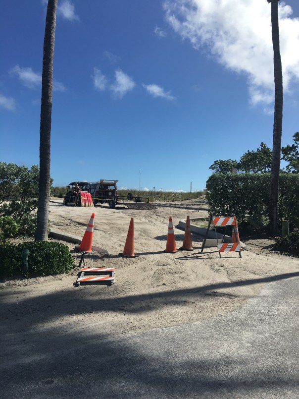
Martin County is furiously fighting erosion at Bathtub Beach. Friend, Amy Galante, sent me a web-cam photo today revealing that ocean water appears to have earlier *breached the remaining man-made dune. When I stopped the by the beach, about an hour ago, at lunchtime, workers assured me no water had entered the parking lot and insisted the area was closed and that I needed to leave immediately. When I got out of my car on the side of the road, it certainly looked as though Mother Nature had left her footprint, but what do I know, I’ve only been visiting Bathtub Beach since I was an infant…
11-15-17: *The County has contacted me asked if I am going to “correct” my post. “The breach you are referring to may be the hole cut in the dune to give equipment access to the beach.” —-I do apologize if my word choice was incorrect. I continue to feel this area of Martin County is one of concern.
Chart 2004-2014. Much re -nourishment has been done since this time. Source: Martin County Government.
The seawall at Sailfish Point’s Dunes Condominium is right next to the ocean. St Lucie Inlet lies beyond this point by about a quarter-mile. 7-26-15. (Photo Ed Lippisch)
Yesterday afternoon, Ed and I had hoped to walk our dogs, Bo and Baron, to the St Lucie Inlet, but were cut off by an incoming tide and a Sailfish Point’s seawall. Having grown up in Martin County, it is amazing to see such changes “right before my 50-year-old eyes…”
Of course when I was a kid there was no Sailfish Point development, no seawall, no apparent sea level rise, just the beach sun-flowered sand dunes and Bathtub Beach changing daily to the winds of time with the remnants of James Rand’s “Seminole Shores” development crumbling…
Today Sailfish Point is here. Its 625 homes are some of the most exclusive in the county. Built in the 1980’s it was developed by Mobile Oil Corporation. The area brings tremendous tax revenue to everyone and to every school in Martin County…if it washed into the sea there would be issues for all.
Sailfish Point: (http://www.sailfishpoint.com/martin-county/)
It must be noted that the St Lucie Inlet itself is responsible for some of this erosion…the inlet was opened permanently in 1892 by pioneers led by Captain Henry Sewall of Sewall’s Point. Naturally the inlet would open and close with tides and time. Opening the inlet permanently now defines our county, and we would not give it up; but as all things in life: there are both positives and negatives to every action.
Today the waters of the ocean are encroaching….and time seems to be speeding up.
Building on barrier islands is not particularly long-term in that barrier islands are meant by nature to turn over on themselves like a conveyor belt. On the other hand, I have been to the Breakers Hotel in Palm Beach and their seawall is right up to the historic hotel and has been for years….We stave off the ocean as long as we can. Much of Florida east coast is built on barrier islands…
What does the Bible say? “The wise man built his house upon a rock…”
Anyway….today I wanted to share Ed and my walk as it is symbolic of our times.
Google map showing Hutchinson Island showing St Lucie Inlet. Sailfish Point immediately north of inlet. East is Atlantic Ocean and west is the Indian River Lagoon and Sewall’s Point and St Lucie River.
Other than the surreal seawall and encroaching sea….there were many sea turtle nests, marked by the Fish and Wildlife Commission. Many turtles had laid their eggs right up against the seawall! Many of them! I counted at least 50 just in our short walk. Good for the turtles but it seems many nest are doomed to wash away… For thousands of years these turtles have returned to the beaches of their birth to lay eggs. Now many of them literally come up “against a wall.”
Turtle nest right up the seawall at Sailfish Point. 7-26-15.(Photo JTL)Turtle nest close to SP’s seawall. (JTL)Sea turtle nest. (JTL)
I must mention that the people of Sailfish Point are also “up against a wall,” as they have to worry about their homes falling into the sea….Here one sees a sea wall repair taking place. I don’t think the sea wall is that old in the first place.
Home at Sailfish Point undergoing seawall repair. 7-26-15. (Photo JTL)Ed looks inside sea wall being repaired. (Photo JTL)
The most intense erosion seems to be the north area of Sailfish Point, closest to Bathtub Beach….and it is summer. This should be the time the ocean, sands and tides are most forgiving. Winter waves are much more brutal, unless there is a hurricane of course….
The other interesting anomaly Ed, Bo, and Baron and I experienced was the hundreds of sea hare mollusks that had washed up on shore. Ed Killer of TC Palm just wrote a great piece on these interesting, harmless creatures that scientists believe are washing ashore due to cold water upswells and algae shifts in the ocean–their swimming affected, they slow down and are carried to shore by the waves fated to dry out in the sun.
As Ed and I walked back I picked up as many as I could and threw them back into the ocean knowing that really I was only “buying them some time.” Chances are they will wash right back up on the shore. In the end, nature always wins. In time, we like the sea hares, will find this out , but until then it’s a great walk on the beach, isn’t it?
One of hundreds of sea hare mollusks that had washed ashore near Sailfish Point 7-26-15. (Photo Ed Lippisch)
Ed stands with Bo and Baron in front of the seawall at Sailfish Point looking towards the sea….(Photo JTL)
Playing fetch with Bo and Baron, (Photo JTL)Jacqui and Ed, near Bathtub Beach, Stuart, Florida. 2015. We had fun even though the beach is not what it used to be….
THIS ADDITION CAME IN FROM MY BROTHER TODD: AMAZING!
Jacqui–
Interesting blog post!
In the meantime I thought I would respond to your post with a rough video of Sailfish Point while eating my lunch…..
(https://youtu.be/TW8URTQG2o0)
It is a movie of the following:
1. 1935 NOAA Chart – note the jetty already in place
2. 1940 Aerial
3. 1952 Aerial
4. 1968 Aerial – quick. I should have skipped it.
5. 1970 Aerial – note the old “Empire of the Ants” pier and the strange water slick to the south.
6. 1981 Aerial – showing the construction of Sailfish Point.
Look at these two screenshots of the beach just a few months apart late last year—-Todd Thurlow
Google image seawall is covered 8-12-14.Google image seawall is uncovered 12-2-14.
(ca.1971) Local Stuart kids swimming on Jupiter Island beaches, near Peck’s Lake. Pictured: (Jenny Thurlow, Mark Postsdam, Lynda Nelson, Jacqui Thurlow, Eric Potsdam, and Chris Williams. (Thurlow Family album)
My post yesterday about erosion at Bathtub Beach brought a lot of discussion and questions about when the inlet at Peck’s Lake broke through to the Indian River Lagoon as well as beach erosion in general.
Later in the day, my mother sent me some old Whiticar family photos of the Aurthur Ruhnke family. Her friend, John Whiticar, had shared these photos awhile back. I had seen them before as well, and in light of the erosion situation, I thought I would share them today. I often share the gorgeous IRL photography of Mr John Whiticar of the famous Whiticar Boatworks family (http://whiticar.com). John’s photos of the Ruhnke family’s photographs are outstanding and quite beautiful, especially in the black and white of the 1960s.
So whether looking at my own family photo on the beach in 1971 above, or the Whiticar/Ruhnke photos of the same era, one thing is for sure: the shorelines and tree lines may change, and the shifting tides of time may change as well; but one thing is constant: people, especially kids, love the beaches and shorelines of our Atlantic Ocean and St Lucie River/Indian River Lagoon area….Enjoy!
Peck’s Lake breakthrough inlet at Jupiter Island, early 1960s. (Photo Whiticar/Ruhnke.)Wash through, Peck’s Lake, Jupiter Island, ca. early 1960s. (Whiticar/Ruhnke)Another angle of Peck’s Lake inlet at Jupiter Island, ca. early 1960s. (Whiticar/Ruhnke.)News clip regarding Peck’s Lake Inlet contract date to be closed, “June 6th,” with no year. (Whiticar, ca. early 1960s)Aerial of Peck’s Lake area with new inlet. (Whiticar/Ruhnke, ca. 1960s)Driftwood, old trees, and “forest” of perhaps Australian Pines/erosion in the area of Peck’s Lake’s beaches, Jupiter Island. (Whiticar/Ruhnke, ca 1960s)Boaters, Peck’s Lake area…. (Whiticar/Ruhnke ca. 1960s)Huge old tree..perhaps a black mangrove/erosion. (Whiticar/Ruhnke ca. 1960s)Ancient looking tree and beautiful lady… (Whiticar/Ruhnke ca. 1960s)Shoreline…(Whiticar/Ruhnke ca. 1960s)Old trees…(Whiticar/Ruhnke ca. 1960)Old tree….(Whiticar/Ruhnke ca. 1960s)Thank you to John Whiticar for allowing me to use his family’s Art . Ruhnke photos. The Ruhnke’s had a photo shop in Stuart’s early days.
Looking out to the Atlantic Ocean through and ancient black mangrove that was exposed by erosion off of Bathtub Beach.. (Photo 2009, JTL)
There have been many times over thousands of years that the ocean has broken through Hutchinson Island and flowed into the Indian River Lagoon off of Sewall’s Point. Most recently, in 2004, after hurricanes Jeanne and Francis. Also in the early 1960s, at Peck’s Lake*, on Jupiter Island. But of course we “repair” the areas and “put them back”…for a little while anyway….
Peck’s Lake breakthrough ca. 1960, Jupiter Island. (Ruhnke Collection, Thurlow Archives, from the book “Sewall’s Point,” by Sandra Henderson Thurlow.)
I have been fortunate the past few years in my river photography to see the island by air in my husband’s airplane; it never ceases to amaze me that Hutchinson Island, as all barrier islands, is really just a ribbon of sand….
So, of course Mother Nature comes through….
Sand piled hight at Bathtub Beach. (Photo 12-10-14, JTL)
Bathtub Beach is an area that Nature seems determined to reclaim soon. Yesterday, as many, I drove to see the “State of Emergency” claimed by Martin County at Bathtub Beach.
Looking to the ocean….(Photo 12-10-14, JTL)
There was a young couple that had scaled the piled protective sand and I struck up a conversation with them.
“Hi, I’m Jacqui. This is amazing isn’t it?”
The young man replied: “Yeah we came yesterday, and the waves were 10 to 12 feet!” The water was all the way up to this fake dune. Look, you can see the sand is still wet.”
Former Wentworth house, Bathtub Beach. (Photo 12-10-14, JTL)
“Wow,” I exclaimed. “Yes, I have seen this before. It’s incredible. You just have to wonder if one day the ocean will come through so hard she takes it all. This would be terrible for the people who live here…”
The response from the young man?
“Well, at least the river will be cleaner….”
I was amazed to see how far the river culture has expanded, and perhaps the values of a younger generation…
Rather than get into a political conversation with a nice young couple just here to explore, I said how nice it was to meet them, and ran down the sand pile in my high heels to get to my car before I got a ticket.
Wormrock at Bathtub Beach (Photo 2009, JTL)
At 50 years now, I have known our beaches since I was a kid walking around on the worm reef catching fish with a homemade net, before we knew that was “bad” for it. During my youth, the older generation began to really build on Hutchinson Island, which was not such a good idea either….The same goes for the low areas of the Town of Sewall’s Point, across the Indian River, where I live and sit on the town commission. These areas are very vulnerable. It’s a problem.
So how do we deal with this “realization,” that we have built on Mother Natures’ front line? Do we retreat, as in war, knowing we will never win, or do we harden our areas reinforcing the shoreline and our homes as long as we can? Do we spend millions of dollars putting concrete seawalls and dredged sand on our shorelines that will surely eventually wash away and each time, not to mention it covers and destroys our “protected” off shore reefs and sea grasses?
These are the difficult questions, and if we follow the model of South Florida that has been dealing with these issues of sea level rise, and just the “normality” of living on a shifting sandbar that God wants to roll over on itself like a conveyor belt, every few hundred to a thousand years, we have some big problems ahead of us. We can reinforce our shorelines and raise our houses, but in the end, Nature will win. In our short lifetimes, we may not see the “grand change,” but our children and grandchildren will.
For instance, the photo at the beginning of this blog is an ancient black mangrove with a hole in it looking towards the ocean. These mangroves are exposed during high erosion because Hutchinson Island is rolling over on itself. This is called “transgression.”
To repeat, much of the construction on barrier islands happened before people fully understood that these places are particularly volatile.  The clues have been accumulating for decades: beachfronts are thinning, storms regularly swallow dunes and send sand flowing to the far side of the island… Slowly, geologists and government entities have realized that the very nature of barrier islands truly is to “roll over,” typically toward the mainland, as waves and weather erode one side and build up the other. Barrier island ecology is not fully understood; there are many theories. It is complex, but some things we understand now…
Thus when the erosion is greatest, the remnants of an ancient mangrove swamp on the ocean side of the island can be seen….Kind of bizarre isn’t it?
What do they say? “The only constant is change.”
Yes, times are changing, the climate and the oceans are warming; no matter the reason, this has happened before. Our job, as it always has been, is to adapt. But in the world of money, real estate, and ad-valorum tax values to governments—along the Indian River Lagoon, this may never occur, until the ocean is truly upon us…
Ancient swamp on ocean side…..(Photo 2009, JTL)Northerly view of Bathtub Beach and exposed ancient mangrove swamp….(Photo 2009, JTL)Today even with high erosion the ancient mangrove swamp is under the sand. You can see one sticking up…(Photo 12-10-14, JTL)This photo that I found on water/river activist Nyla Pipes’ Facebook page. The view of ocean action along the Atlantic Coast is very telling….
*Originally, I wrote” 1948: as well as “1960” in this blog post as the years that Peck’s Lake opened. Due to communication with my mother, historian, Sandra H. Thurlow, I have changed my blog to say only “1960s.” She believes there was an error in a photograph used in her book, “Sewall’s Point,” in that the photo she used in her book said 1948 but she now, after seeing old shared photos from John Whiticar, thinks this date is incorrect. Please read below:
Peck’s Lake Inlet
The photograph of a wash over at Peck’s Lake in Sewall Point on page 19 is identified as “1948” because it an 8 x 10 print in the Ruhnke/Conant Collection we purchase had that date written on the back.
Year later I began to suspect this was in error.
The clincher was a group of photos that John Whiticar came across that were obviously from Ruhnke which included the washout I had labeled 1948 with others that were obviously from the 1960s because of a flower farm in the background. There were also photos of the drowned trees and Ruhnke family photos of a visit to Peck’s Lake.
A Nov. 11. 1963 article in the Stuart News about Inlet worked said, “Also in April of this year the Martin County Commission passed a resolution asking the Corps of Engineers to take action to insure the boating public would always have as safe an inlet from the ocean as was available at that time through the storm-opened Peck’s Lake Inlet, closed by the Corps this past summer.
12-30-14 I received the numbers on costs from Martin County for beach re-nourishment over the years; I am adding the list here as a photo so I can share it with comments on this blog:
Beach Renourishment Numbers from Martin County 2014.
Homes and Condos at Sailfish Point compromised by beach erosion-with newly constructed seawall and birm, 2-22-14. (Photo JTL)
The trucks come in about once a year and dump millions of dollars worth of tax payer sand on Martin County beaches and other’s throughout our state. Then winter’s storms arrive and wash it back into the ocean, covering and damaging our nearshore reefs. But at least the turtles have a place to lay their eggs…?
Erosion is a natural part of all coastal barrier islands, in fact, time lapse photography would show these islands moving, like giant sea slugs, changing shape, due to erosion and accretion, over time.
Before modern man settled this area, inlets along the Indian River Lagoon came and went with the whims of Mother Nature. Looking at old maps, one sees documentation of changing natural inlets over time. Jupiter and Indian River Inlet north of Ft Pierce were the only long standing opening to the sea in our area most recently. Over thousands of years, others came and went, all along the lagoon. Peck’s Lake in Martin County broke through as recently as 1960 and was quickly “closed…”
In 1892 in today’s Martin County, then Dade, Captain Henry Sewall’s inspired local men to dig a permanent inlet, by hand. My historian mother has told me stories of other inlet attempts as well. According to her, one time, the men fell asleep after the exhausting dig, only to awake and find the tide coming in, filling in their work! One local’s pet raccoon was tied to a tree and taken away by the strong waters. Even today, Mother Nature want’s to fill back in the St Lucie Inlet, but we continue to resist her.
Very interesting is that “old maps” also show Jupiter Island on equal “terms” with Sailfish Point. But today Jupiter Island is much “further back” as she has eroded over time and been slowly swept into the sea. This remains an problem of enormous proportions today that is on the verge of law suit. Last year, the Army Corp of Engineers informed Martin County they wish to take the lovely textured, offshore sands of Stuart, to re-nourish, Dade and Broward Counties beaches. Unbelievable…
The inlets give us access to the ocean, they raise the value of our property, they were and could be again national defense. Most timely for today, in the case of the St Lucie Inlet, it allows the putrid waters slugging forth during rainy season from C-23; C-24 ; C-44; and worst of all from Lake Okeechobee, to go to sea.
There are those who believe we should let the inlet close up; and there are many who believe we should fill in the canals; there are those who believe the inlet is what defines Martin County and we should do everything to keep her open. Hmm…
One thing for sure, fighting Mother Nature is a full time job.