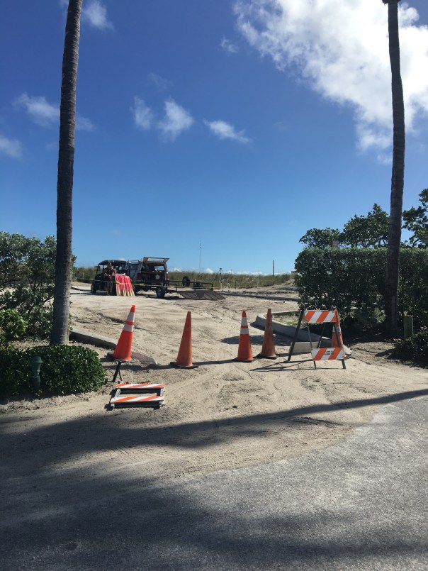
Martin County is furiously fighting erosion at Bathtub Beach. Friend, Amy Galante, sent me a web-cam photo today revealing that ocean water appears to have earlier *breached the remaining man-made dune. When I stopped the by the beach, about an hour ago, at lunchtime, workers assured me no water had entered the parking lot and insisted the area was closed and that I needed to leave immediately. When I got out of my car on the side of the road, it certainly looked as though Mother Nature had left her footprint, but what do I know, I’ve only been visiting Bathtub Beach since I was an infant…
11-15-17: *The County has contacted me asked if I am going to “correct” my post. “The breach you are referring to may be the hole cut in the dune to give equipment access to the beach.” —-I do apologize if my word choice was incorrect. I continue to feel this area of Martin County is one of concern.
Chart 2004-2014. Much re -nourishment has been done since this time. Source: Martin County Government.
The seawall at Sailfish Point’s Dunes Condominium is right next to the ocean. St Lucie Inlet lies beyond this point by about a quarter-mile. 7-26-15. (Photo Ed Lippisch)
Yesterday afternoon, Ed and I had hoped to walk our dogs, Bo and Baron, to the St Lucie Inlet, but were cut off by an incoming tide and a Sailfish Point’s seawall. Having grown up in Martin County, it is amazing to see such changes “right before my 50-year-old eyes…”
Of course when I was a kid there was no Sailfish Point development, no seawall, no apparent sea level rise, just the beach sun-flowered sand dunes and Bathtub Beach changing daily to the winds of time with the remnants of James Rand’s “Seminole Shores” development crumbling…
Today Sailfish Point is here. Its 625 homes are some of the most exclusive in the county. Built in the 1980’s it was developed by Mobile Oil Corporation. The area brings tremendous tax revenue to everyone and to every school in Martin County…if it washed into the sea there would be issues for all.
Sailfish Point: (http://www.sailfishpoint.com/martin-county/)
It must be noted that the St Lucie Inlet itself is responsible for some of this erosion…the inlet was opened permanently in 1892 by pioneers led by Captain Henry Sewall of Sewall’s Point. Naturally the inlet would open and close with tides and time. Opening the inlet permanently now defines our county, and we would not give it up; but as all things in life: there are both positives and negatives to every action.
Today the waters of the ocean are encroaching….and time seems to be speeding up.
Building on barrier islands is not particularly long-term in that barrier islands are meant by nature to turn over on themselves like a conveyor belt. On the other hand, I have been to the Breakers Hotel in Palm Beach and their seawall is right up to the historic hotel and has been for years….We stave off the ocean as long as we can. Much of Florida east coast is built on barrier islands…
What does the Bible say? “The wise man built his house upon a rock…”
Anyway….today I wanted to share Ed and my walk as it is symbolic of our times.
Google map showing Hutchinson Island showing St Lucie Inlet. Sailfish Point immediately north of inlet. East is Atlantic Ocean and west is the Indian River Lagoon and Sewall’s Point and St Lucie River.
Other than the surreal seawall and encroaching sea….there were many sea turtle nests, marked by the Fish and Wildlife Commission. Many turtles had laid their eggs right up against the seawall! Many of them! I counted at least 50 just in our short walk. Good for the turtles but it seems many nest are doomed to wash away… For thousands of years these turtles have returned to the beaches of their birth to lay eggs. Now many of them literally come up “against a wall.”
Turtle nest right up the seawall at Sailfish Point. 7-26-15.(Photo JTL)Turtle nest close to SP’s seawall. (JTL)Sea turtle nest. (JTL)
I must mention that the people of Sailfish Point are also “up against a wall,” as they have to worry about their homes falling into the sea….Here one sees a sea wall repair taking place. I don’t think the sea wall is that old in the first place.
Home at Sailfish Point undergoing seawall repair. 7-26-15. (Photo JTL)Ed looks inside sea wall being repaired. (Photo JTL)
The most intense erosion seems to be the north area of Sailfish Point, closest to Bathtub Beach….and it is summer. This should be the time the ocean, sands and tides are most forgiving. Winter waves are much more brutal, unless there is a hurricane of course….
The other interesting anomaly Ed, Bo, and Baron and I experienced was the hundreds of sea hare mollusks that had washed up on shore. Ed Killer of TC Palm just wrote a great piece on these interesting, harmless creatures that scientists believe are washing ashore due to cold water upswells and algae shifts in the ocean–their swimming affected, they slow down and are carried to shore by the waves fated to dry out in the sun.
As Ed and I walked back I picked up as many as I could and threw them back into the ocean knowing that really I was only “buying them some time.” Chances are they will wash right back up on the shore. In the end, nature always wins. In time, we like the sea hares, will find this out , but until then it’s a great walk on the beach, isn’t it?
One of hundreds of sea hare mollusks that had washed ashore near Sailfish Point 7-26-15. (Photo Ed Lippisch)
Ed stands with Bo and Baron in front of the seawall at Sailfish Point looking towards the sea….(Photo JTL)
Playing fetch with Bo and Baron, (Photo JTL)Jacqui and Ed, near Bathtub Beach, Stuart, Florida. 2015. We had fun even though the beach is not what it used to be….
THIS ADDITION CAME IN FROM MY BROTHER TODD: AMAZING!
Jacqui–
Interesting blog post!
In the meantime I thought I would respond to your post with a rough video of Sailfish Point while eating my lunch…..
(https://youtu.be/TW8URTQG2o0)
It is a movie of the following:
1. 1935 NOAA Chart – note the jetty already in place
2. 1940 Aerial
3. 1952 Aerial
4. 1968 Aerial – quick. I should have skipped it.
5. 1970 Aerial – note the old “Empire of the Ants” pier and the strange water slick to the south.
6. 1981 Aerial – showing the construction of Sailfish Point.
Look at these two screenshots of the beach just a few months apart late last year—-Todd Thurlow
Google image seawall is covered 8-12-14.Google image seawall is uncovered 12-2-14.
(ca.1971) Local Stuart kids swimming on Jupiter Island beaches, near Peck’s Lake. Pictured: (Jenny Thurlow, Mark Postsdam, Lynda Nelson, Jacqui Thurlow, Eric Potsdam, and Chris Williams. (Thurlow Family album)
My post yesterday about erosion at Bathtub Beach brought a lot of discussion and questions about when the inlet at Peck’s Lake broke through to the Indian River Lagoon as well as beach erosion in general.
Later in the day, my mother sent me some old Whiticar family photos of the Aurthur Ruhnke family. Her friend, John Whiticar, had shared these photos awhile back. I had seen them before as well, and in light of the erosion situation, I thought I would share them today. I often share the gorgeous IRL photography of Mr John Whiticar of the famous Whiticar Boatworks family (http://whiticar.com). John’s photos of the Ruhnke family’s photographs are outstanding and quite beautiful, especially in the black and white of the 1960s.
So whether looking at my own family photo on the beach in 1971 above, or the Whiticar/Ruhnke photos of the same era, one thing is for sure: the shorelines and tree lines may change, and the shifting tides of time may change as well; but one thing is constant: people, especially kids, love the beaches and shorelines of our Atlantic Ocean and St Lucie River/Indian River Lagoon area….Enjoy!
Peck’s Lake breakthrough inlet at Jupiter Island, early 1960s. (Photo Whiticar/Ruhnke.)Wash through, Peck’s Lake, Jupiter Island, ca. early 1960s. (Whiticar/Ruhnke)Another angle of Peck’s Lake inlet at Jupiter Island, ca. early 1960s. (Whiticar/Ruhnke.)News clip regarding Peck’s Lake Inlet contract date to be closed, “June 6th,” with no year. (Whiticar, ca. early 1960s)Aerial of Peck’s Lake area with new inlet. (Whiticar/Ruhnke, ca. 1960s)Driftwood, old trees, and “forest” of perhaps Australian Pines/erosion in the area of Peck’s Lake’s beaches, Jupiter Island. (Whiticar/Ruhnke, ca 1960s)Boaters, Peck’s Lake area…. (Whiticar/Ruhnke ca. 1960s)Huge old tree..perhaps a black mangrove/erosion. (Whiticar/Ruhnke ca. 1960s)Ancient looking tree and beautiful lady… (Whiticar/Ruhnke ca. 1960s)Shoreline…(Whiticar/Ruhnke ca. 1960s)Old trees…(Whiticar/Ruhnke ca. 1960)Old tree….(Whiticar/Ruhnke ca. 1960s)Thank you to John Whiticar for allowing me to use his family’s Art . Ruhnke photos. The Ruhnke’s had a photo shop in Stuart’s early days.
Just recently, my husband Ed and I had the hardwood floors of our 1977 home redone. During this time, we literally “moved out” into one room of the house for almost four weeks. As much as this turned my world upside-down, it forced me to go through all of the “stuff” I have acquired over the past ten years in my St Lucie River/Indian River Lagoon files. I found some cool things I had forgotten about.
The folder I am sharing today is entitled OLD INLET PHOTOS. It includes aerial photos of the Jupiter, Stuart (St Lucie), Ft Pierce, and Sebastian inlets. I borrowed the photos from my mother, historian Sandra Henderson Thurlow, years ago. My photos are copies of the originals. I believe she and my father acquired the photos through Aurthur Ruhnke’s Photography Shop that once was located in Downtown, Stuart.
Written on the back of all photos except the Sebastian Inlet, was the year “1936.” The photographer was R.B. Holt. The Sebastian Inlet however, has “1962” written on the back of the photo along with “Sterling Hawk’s name,” a different photographer.
I love old stuff like this; I hope you do too.
Enjoy and dream of a time long ago…the fishing must have been great, and look how undeveloped the surrounding lands were! The inlets helped promote the development of the Treasure Coast Region.
Of course before man created the inlets permanently along the Indian River Lagoon, Mother Nature’s winds and tides would decide if an inlet was open or closed to the sea. Over thousands of years, inlets opened and closed all along the Indian River Lagoon making the naturally fresh waters brackish for a time and allowing wildlife to flourish in these areas.
Man was attracted to these natural inlets as well. I was just reading last night about how the inlet at Jupiter closed in the 1860s when the US government was building the Jupiter Lighthouse. Nature’s closing of the inlet was a “great inconvenience.” Today we would also consider it a great inconvenience to have any of our inlets closed.
The problem is that they are not meant to be permanently open and erosion problems occur over time. As most things in life, there is a positive and a negative; the tricky part is figuring our just where to draw the line in the sand…
Jupiter Inlet, 1936. (All aerials from the Rhunke Collection, R.B. Holt is believed to be the photographer for all but Sebastian Inlet photo, Thurlow archives.)Jupiter Inlet, March 18, 1936.Stuart (St Lucie) Inlet, 1936.Ft Pierce Inlet, 1936.Ft Pierce Inlet, 1936.Ft Pierce Inlet, 1936.Sebastian Inlet, 1962. Photo by Sterling Hawk.
_____________________________________________
All photos courtesy of Sandra Henderson Thurlow, historian. Her books on Sewall’ Point, Stuart, Jensen and the House of Refuge can be purchased at both the Stuart Heritage Museum, (http://www.stuartheritagemuseum.com) and at the Elliott Museum, (http://www.elliottmuseumfl.org).
Historic postcard, Indian River Citris. (Collection of Sandra Henderson Thurlow.)
Thousands of years ago, humankind found a way to avoid the constant nomadic life of following big game, becoming more self sufficient, learning the art of agriculture. Nothing has made our lives better. Unfortunately, after thousands of years of its evolution, nothing has made our lives worse.
Don’t get me wrong, I realize that agriculture an important industry, the second largest after tourism, in the state of Florida. Still, we must look at its issues and try to make things better.
Agriculture is a high intensity land use, using large amounts of pesticides, fertilizers, and fungicides that over time accumulate in the water and the environment. The May 2014 issue of National Geographic states that “farming is the largest endeavor on earth using just under 40 percent of the earth’s surface causing the second largest impact to the earth, erosion.”
Much of the land in our area is devoted to agriculture as well, particularly citrus.
The Indian River Lagoon region is famous for its delicious citrus and although the industry is in decline due to canker, it has had huge impacts on the IRL area due to the canal system built to drain the land and water the crops. The muck that has entered the lagoon since the early 1900s is mostly from erosion of canals, due to the runoff from agriculture as they drain their lands that were once swamp or wetlands.
The Indian River Lagoon Region runs from Palm Beach to Volusia Counties, along the 156 miles of the lagoon. (USDA map 2011.)
The USDA documented 89,367 acres of citrus in the Indian River Lagoon region in 2009, declining to 81,673 in 2010. There is a lot of land devoted to citrus, land that has been radically altered from its original state and affects the Indian River Lagoon as there are literally thousands of miles of canals attached and interwoven along these groves. All eventually dump to the river or other water body.
In 1994 the Florida Department of Environmental Protection (FDEP) determined that the north fork of the St Lucie River/Indian River Lagoon, a registered state “Aquatic Preserve,” was contaminated by pesticides that came from the citrus groves in the area of the St Lucie’s headwaters, Ten Mile Creek. (http://www.dep.state.fl.us/southeast/ecosum/ecosums/tenmile_creek.pdf)
In 2002, the Florida Department of Environmental Protection labeled the St Lucie River as “impaired.” Reading through the document there is clear determination of agricultures’ role in this process, especially with sediment run off, pesticides and heavy metals that have accumulated in the environment. (http://www.dep.state.fl.us/southeast/ecosum/ecosums/SLE_Impairment_Narrative_ver_3.7.pdf)
All postcards of citrus industry in Florida, ca. 1912. (Collection of Sandra Henderson Thurlow.)
Reading through the documents it is noted that many of the agricultural areas are quite old, as the post cards I am sharing today from my mother’s collection are from 1912 and 1914. According to the FDEP, many of the areas around Ten Mile Creek did not have BMPs, or best management practices in place, as they were there before such rules were voluntarily implemented in the 1980s and 90s.
I don’t get it. Our environmental agencies have seen the writing on the wall for decades and even with the modern implementations of BMPs, (http://solutionsforyourlife.ufl.edu/hot_topics/agriculture/bmps.html) where farmers try to minimize their impacts on our waterbodies, the rivers, estuaries, and lakes are filling up with excess nitrogen and phosphorus from fertilizer and other pollutants at an alarming rate.
Yes, the FDEP is implementing TMDLs or total maximum daily loads through the BMAP, or basin management action plan, where municipalities and counties are required to lower their nutrient levels in waterbodies, but these are 15 and 30 year goals, that most certainly will take longer to truly implement. Also agriculture is exempt under the law and Right to Farm Act. They, as mentioned, implement BMPs but it may take fifty or more years to get all farms up to speed, if ever. Do we have that much time?
In the meanwhile, we watch or rivers dying from local runoff from C-23, C-23, and C-44 supporting the citrus and agriculture industries in Martin and St Lucie Counties. On top of this, during major rain events, Lake Okeechobee, also full of agriculture runoff and high nutrients suspended in muck, from the sometimes back pumping sugar industry south of the lake, pours into the St Lucie River as well, wreaking any work we have done locally to meet local TMDLs.
Would I rather see the citrus lands developed for houses?
No. I rather fix the problems we have. And even though its called “corporate welfare,” I think state, federal, and local governments must help agriculture operate in a way that is not killing the environment. Some of the funds from the state this year that came out of the Senate Hearing on the IRL are doing this and the state really has been helping “forever,” but quietly, under the radar.
It is time to come full out to the public and explain the situation: we must feed ourselves and support our historic industry, but agriculture/citrus is killing our waterways.
In conclusion, of course the industry should make every effort itself to improve the situation, and some are more than others. In any case, we cannot just point fingers at them, we must help them. Perhaps we should bond together and put into law even better, stricter management practices, that will give the children of our state a future, not just eating, but also fishing, swimming and boating in a clean river.