Guest blog an photos by Geoff Norris, Indian River Plantation POA Group:
Guest blog an photos by Geoff Norris, Indian River Plantation POA Group:
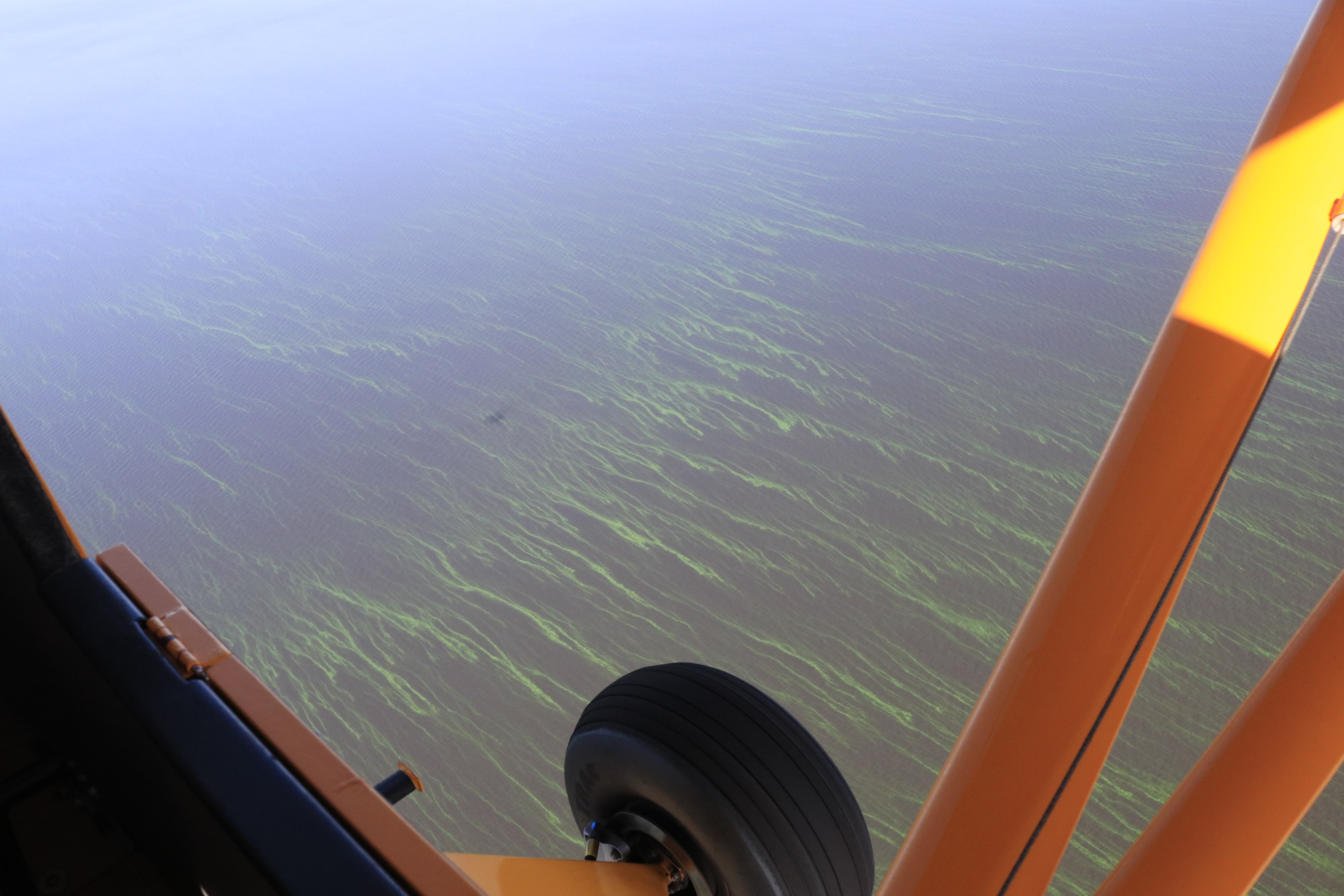
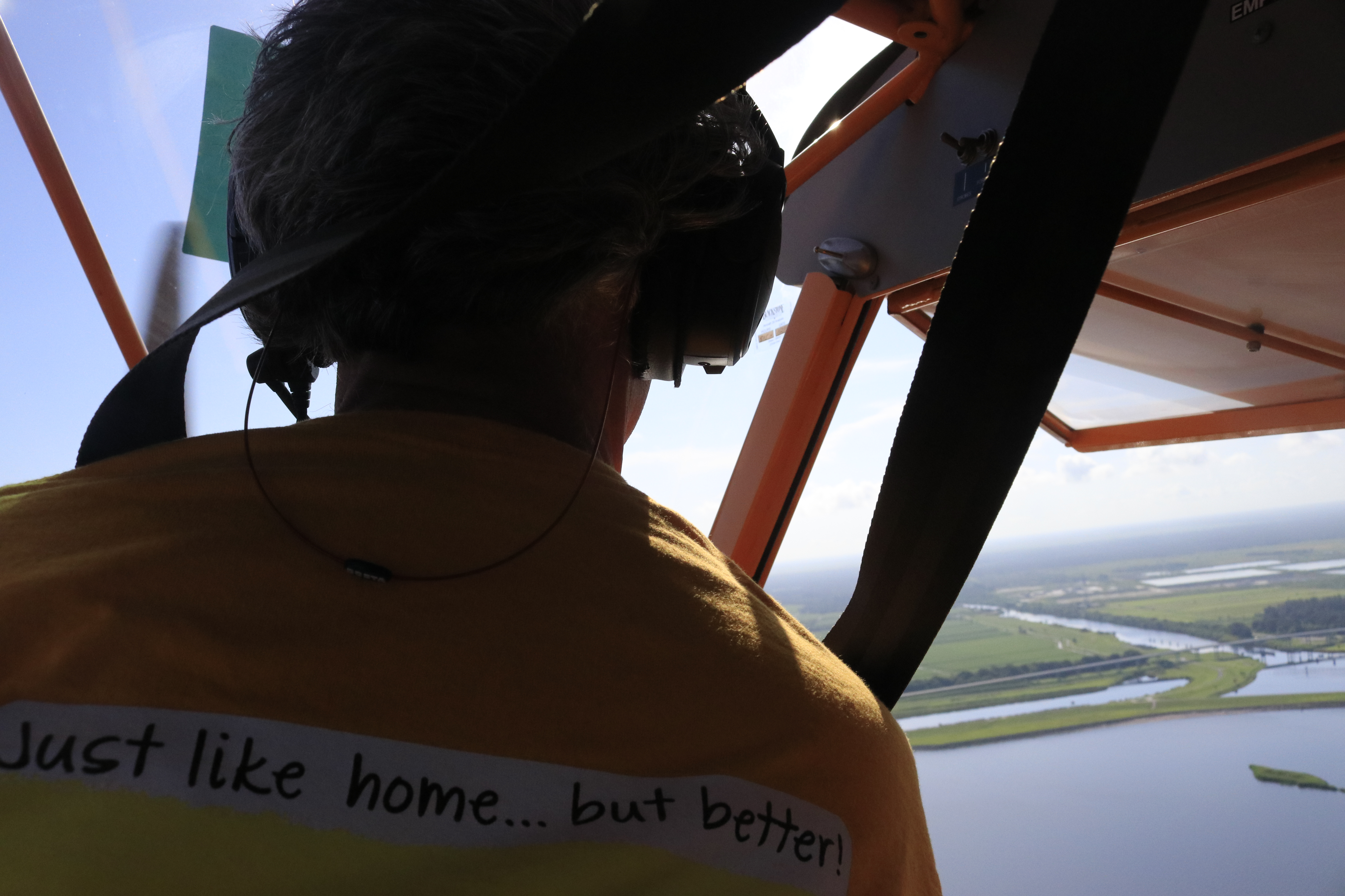
These photographs of the Indian River Lagoon were taken on 11 October 2017, between the bridge at East Ocean Blvd, Stuart and north to Indian Riverside Park and Jensen Beach, Florida. The lagoon waters have been polluted for several days with run-off from Lake Okeechobee making the lagoon various shades of brown, orange, red and grey, with dirty scummy foam a feature at the shorelines and also as foamy windrows and wave crests in open water. The St Lucie River is in much the same state.
During this time the Army Corps of Engineers has been opening the locks at Port Mayaca to discharge water from Lake Okeechobee down the St Lucie Canal to the St Lucie River/Indian River Lagoon estuarine system. Rates vary from 4500 to 5500 cubic feet per second, equivalent to 2.9 to 3.5 billion gallons per day. It has been calculated that this amount of discharge would cover the Stuart peninsula north of Monterey Road with four feet or more of water in one day.
The Florida Oceanographic Society reports for 10 October 2017 that salinities in the Lagoon have been drastically reduced by this lake discharge to between 1 and 3 parts per thousand sufficient to kill many estuarine fish and other plants and animals (normally the salinity would be between about 20 and 25 parts per thousand in this section of the lagoon). The Society has graded the overall health of the Lagoon on either side of the East Ocean Bridge as “Poor to Destructive”. See this link:
The Army Corps of Engineers is aware that they are killing the St Lucie/Indian River Lagoon estuarine system by their actions, but consider it more important to lower the Lake Okeechobee level from the current level of 17.2 (feet above mean sea level) to a desired level of between 12 ft and 15 ft.
These are the facts. It is also a fact that politicians have not managed to stop this destruction.
Flight over SLR/IRL to view canal C-23, C-24, C-25 and especially present high releases from Lake Okeechobee through C-44 Canal. JTL/EL 10-14-17
Yesterday, I asked Ed to take me up in the plane, once again to document the discharges. In the wake of much rain and an active hurricane season, the St Lucie River/Indian River Lagoon continues to sacrifice its economy, health, and ecosystem for the EAA and South Florida drainage. A standard operating procedure that is outdated and dangerous.
The discharges from Lake O. have been on and off since Hurricane Irma hit on September 20th. Presently they are “on,” and it shows. Right now our river and ocean shores near the inlet should be at available to boaters, fisher-people, and youth, in”full-turquoise-glory.” Instead, the estuary, beaches, and near offshore is a ghost-town along a chocolate ocean and a black river. The edge of the plume can hardly be distinguished as all is dark, sediment filled waters. A disgrace.
ACOE 10-15-1710-15-17 Lake O is high. This is a threat to those who live south and around the lake.South Florida’s southern Everglades, 1850 & today. The water that used to flow south now is sent to the ocean and Gulf of Mexico through canals C-44 (SLR) and C-43.(Cal.) (Map courtesy of SFWMD.)Image showing drainage of S. Florida through St Lucie and Caloosahatchee rivers. These rivers, that God did not connect to Lake Okeechobee, have been channelized by humans to dump Lake O. This drainage system put in place in the 1920s does not serve Florida today. Not economically, health wise, or environmentally. We must continue to push to replumb the system the best we can. (Public image.)
I told Ed it’s best not to smile for this photo. We look forward to seeing the model and timeline from the SFWMD and ACOE for Senator Negron’s reservoir, and the beginning of turning this century old nightmare.
SFWMD basin map for SLR showing canal discharge structures.
This first hand account of a man who is considered Stuart’s most important business leader, river captain, and pioneer, Stanley Kitching, gives rare insight into what it was like to take a drive to see the new St Lucie Canal, Lake Okeechobee, and the Everglades in 1918.
My mother sent her transcribed work first published in the Stuart Messenger, entitled “A Stuart Pioneer Away From Home,” stating: “Jacqui, You might find this interesting. It’s about the Custard Apples.” The custard apple forest was 32,000 acres along the southern rim of Lake Okeechobee that like a giant sieve strained the southern flowing waters of Lake Okeechobee before entering the sawgrass river of the Everglades. That forgotten forest was demolished to access the very richest of the Everglades Agricultural Area’s famous “black gold.” There are very few first hand accounts of this forest so this article is special. Many other parts of the story will captivate you as well.
Enjoy! And “thanks mom!”
~Jacqui
P.S. The digging of the St Lucie Canal, (C-44,) from Lake Okeechobee to the South Fork of the St Lucie River, was started in 1915, but not opened until 1923.
_____________________________________________
Stanley Kitching, photo Susan Barker Leek, Stuart on the St Lucie page 100, by Sandra Henderson Thurlow.
Stuart Messenger
July 25, 1918
Transcribed by Sandra Thurlow, Sept. 22, 2017
A STUART PIONEER AWAY FROM HOME
TAKES TWO WEEKS VACATION NEAR HIS OWN BACK DOOR
CAMP ON OKEECHOBBE-ST. LUCIE
Party Included Mr. and Mrs. Charles Christensen, Mrs. Smart, Mrs. Robinson and Stanley Kitching.
Like a great many Stuart people, we had heard stories about the wonderful Everglades, Lake Okeechobee, the rich soil, bumper crops, and the great Stuart-St. Lucie canal, so on July the Fourth our party consisting of Mr. and Mrs. Chas. Christensen, Mrs. Smart, Mrs. Robinson and myself started out to see the wonderful country lying to the west of Stuart.
We left Stuart at 9 a.m., with two cars, a Ford and a Dart, the Ford in the lead, of course. Each car was loaded to the limit. We estimated the weight in each car to be about 800 pounds. Consisting of tents, cots, cot pads, suit cases, fishing tackle, guns, axes, spade, rope, tent poles, nails, extra tires, gas, oil, spiers, mosquito bar, and enough groceries to last our party three weeks, also a lantern and flashlights and five heavy army blankets.
Just before starting we discovered a leak in the radiator of the Dart, but as we expected to find plenty of water along the road we didn’t let that bother us. We made our first stop twelve miles from town to fill the radiator as we were in cane slough and the sand on the fill was heavy and pulling hard, we put in water several times between there and the Platt place. After leaving the Platt place we left the main road and followed a cut off through the woods, passed a deserted Indian village and a mile further on came to another Indian village. We were now in the territory known as Indiantown. A squaw came out and told us we were on the right road. One mile on we passed another deserted Indian village. We found the wood’s road much easier to travel as the ground was harder. We arrived at the dam across the St. Lucie-Stuart canal at 12 noon, distance 30 miles. The dredging company were hauling a tug over the dam and we had to lay planks and board around the bow so we could pass. We got over the dam at 1 o’clock with the kindly assistance of some of the men from the big dredge.
Everglades, we ate lunch here, surrounded by a drove of genuine razor back hogs of all sizes. There is a sign on a pine tree at this point which reads 30 miles to Stuart.
Shortly after leaving the dam the road leaves the pine timber and climbs the fill made by the dredges. This fill is composed of rock, marle and shell, and we traveled it in high gear. Six miles from the dam the road enters the cypress timber, on the edge of the canal. It is very rough here for a short distance and everybody gets out of the cars but the drivers. This belt of timber extends nearly all around the shores of the lake, which looked like the Atlantic ocean on a calm day. It started to rain at this time. The road followed the lake shore, winding through the rag weeds which grow between the water’s edge and the timber line to a height of 8 feet. Five miles after leaving the canal the Dart sank in a mud hole and it took about one hour to get on the road again. We arrived at the home of Mr. and Mrs. Spiers, Cleve and Reginal Kitching wife and children, about four o’clock. This locality is known as Canal Point and is close to the Palm Beach canal. Our friends came out and greeted us and helped us put up the two tents. Then everybody got busy and we all had supper out in the open under the cypress trees just as the sun was setting in a golden glow on the west shore of Big Lake. After supper we all sat around the camp fire till bed time, which came early as we were tired with the day’s run.
Friday, (6th) morning everyone was up early and the day was spent fixing camp.
Saturday we put up a flag pole on the lake shore and hoisted the American, French and English flags. Rigged up a trot line to catch fish on, cleaned up the ground around the tents, cut wood, carried water from the lake, went in bathing, etc., and found that the time passed very quickly.
Sunday we laid around the camp.
Monday we went to the farm with the boys and helped dig potatoes.
Tuesday we looked over the farm lands, raw acres of fine corn, potatoes, onions, tomatoes and the land was richer than we ever dreamed of. The custard apple land next to the ridge is covered with a growth of custard apples, rubber and maple trees which are pulled up by the roots with tractors, Fords and other kinds. This land extends for about a mile in depth, then comes the saw grass lands. This extends as far as the eye can see and is cleared by burning off the saw grass, then pulverized with a tractor. It cost $100 per acre to clear the custard land and $5.00 per acre to clear saw grass. The tractors start work at daylight, and there is no sleep after they start as they run with the exhaust wide open and can be heard for miles.
Thursday and Wednesday we went fishing and caught some speckled cat fish which were fine eating. Most of the food we used was raised right on the spot, potatoes, onions, Indian pumpkins, butter beans, green corn, tomatoes, okra, rabbits and plenty of fresh milk from Reginald’s fine cow, which grazed along the lake shore and doesn’t cost a cent to keep. There was a pen for branded Berkshire hogs on the place and lots of chickens also a fine pond. Everything on the place was at our disposal and we certainly had a fine time during our stay at Canal Point.
We took down our tents Thursday morning and left at 11 o’clock. We reached the dam about 1:30 and spent about one hour working on the roads. After lunch we left the dam and canal and started south through the pine woods looking for a new place to pitch our tents. After going about four miles through and over palmetto scrub, etc. we stopped and dug for water, couldn’t find any, so went about a mile further dug again, same result. Went about another mile and were in what is called Hungry Land. We decided to camp near a cypress pond put up our tents, got wood and dug for water. Found a damp spot after digging five feet and in about two hours we got a pail full of muddy water. We had enough water to make tea for supper, that was all. About ? p.m. we got two pails of water and boiled it on the camp fire, thinking it would settle by morning but it wouldn’t settle , it was real thick so we decided the place had the right name. We were all hungry for a drink so we went to the dam five miles away and got a pail of water. This took three hours. After breakfast we folded up out tents and drove back to the canal. Met Guyler Baker and he said he had a good pump two miles down the canal at his camp and told us to go there and camp and use anything we found there. We drove down and camped on top the bank of the canal 300 feet from the pump and stayed there until Thursday the 18th. Caught both trout and catfish out of the canal and went in swimming in the clear water drove out to the woods, a distance of five miles and while sitting in the car saw a big deer walk past at a distance of 109 steps, saw wild turkey, quail, rabbits and wild hogs in abundance and I didn’t fire a shot during the whole trip. We saw a few snakes of the harmless kind and quite a number of Indian camps. One family had nine children.
The dredge boat people were very kind to us and furnished us with ice, and offered us anything they had in case we needed it.
The lands along the canal are rich and when it is finished the adjacent farms and all the territory on the eastern shore of the Big Lake will be a feeder to the town of Stuart. If you are doubtful, take a week off and go out into the big back country to the west of Stuart.
We broke up camp Thursday morning and started for home and arrived four hours later. Luck was with us all the way as we didn’t have any tire trouble. In closing will say get a Ford and a tent and go out and see the big wide world west of Stuart.
Stanley Kitching
This photo and those unmarked below are from the Florida Memory project, all photos are of Lake Okeechobee area and Conners Highway c.1920sCourtney, Lawrence E Will, from his book Sawgrass to Sugarbowl showing a rare photo of the Custard Apple forest, 32,000 acres, cleared to access rich soils south and around L.O.
Stuart Messenger 1918, #1#2#3Stuart Messenger cont. 1918. #4#5#6
Today is October 7th, 2017 and I am sharing photos taken October 6th, 2017 in the area of the St Lucie Inlet displaying the recent discharges from Lake Okeechobee and area canals. The plume was measured four miles out, this is very far, and can be seen both north and south of the inlet. The edges are churned up and blurred, and there are many layers fanning out.
I share to document. I share in hope of eventual change, and I share to inspire the so many people who are causing change, change, that one day we will see in a better water future.
Thank you to my husband Ed for piloting, and to passenger, and photographer, Matt Coppeletta.
Sincerely,
Jacqui
All photos taken of the St Lucie Inlet area on 10-6-17 by Ed Lippisch and Matt Coppeletta. Discoloration of water is caused primarily by discharges from Lake Okeechobee but also from canals C-23, C-24, C-25 and area runoff.
Aurthur Ruhnke, post hurricane 1949. Archives of Sandra Thurlow.
The following is a follow-up to my recent post “Our Most Powerful Hurricane,” about the Hurricane of 1949 that devastated Stuart, Florida. It proved to be very popular and my brother Todd relayed more notes that I would like to include. The original post can be found at the bottom of the page.
Hurricane season runs from June 1st through November 30th.
Paths of hurricanes 28, 33, and 49, shared by Todd Thurlow.
Notes:
Jacqui,
Attached is the National Weather Bureau 1949 year-end summary of the hurricane season. It is very interesting to read.
MONTHLY WEATHER REVIEW 339 NORTH ATLANTIC HURRICANES AND TROPICAL DISTURBANCES OF 1949, Richmond T. Zoch
It’s hard to believe that the official reports still reflect a Cat 4 storm at 135mph for the “49 storm with the higher wind speeds being reported. That storm sounds more like a Cat5. The ’28, ’33 and ’49 storms took almost identical paths. See http://bit.ly/2fy4hww
Quotes from the attached report: “The strongest wind occurred, as usual, some distance to the right of the center in the vicinity of Jupiter and Stuart, Florida. The anemometer failed at Jupiter Lighthouse after reaching a velocity of 153 m.p.h. The observer reported that winds were somewhat stronger thereafter, but he felt unable to make a reliable estimate of the peak strength.”
“The water of the lake rose 12 feet or more at places on the southeast and east side of the lake, but the levees held and there was no flooding from the lake.”
“Right now billions of gallons of fertilizer, sewage, and legacy pollution from Lake Okeechobee are spewing into the St. Lucie River, carrying a new threat of toxic algae. Water managers may say Irma left them no choice, but of course that’s a half-truth…”
All photos/videos taken off St Luice Inlet September 30, 2017 JTL/EL
Documentation of primary and secondary plumes at St Lucie Inlet caused predominantly from human directed ACOE/SFWMD discharges post Irma and other from Lake Okeechobee & canals C-44, C-23, C-24, C-25. 10am, September 30, 2017. Primary plume out 3 miles; secondary 3 1/2 and not quite south to Peck’s Lake. We must continue to #ReplumbFlorida #forthefuture #forthewildlife #forthekidz #fortheeconomy for our #indianriverlagoon JTL/EL
Hurricane Irma may be gone, but her waters are not. Our now black river and the giant plume off the St Lucie Inlet attest to this. Clean rain that fell in our region during the hurricane is now filthy “stormwater” discharging, unfiltered, through manmade canals C-23, C-24, C-25, and C-44. Nature did not design the river to directly take this much water; this much water kills.
Every plume looks different, and this one is multilayered with no clear border. Sediment soup, black-brown in color, yesterday it extended out about 2/3 of a mile into a stirred up Atlantic and flowed south, in the rough waves not quite having made it to Peck’s Lake.
Since Hurricane Irma’s rains, area canals dug with no environmental foresight in the 1920s and 50s for flood control, and to facilitate agriculture and development, have been flowing straight into the river. On top of this, in anticipation of the hurricane, three days prior to IRMA the Army Corp of Engineers began discharging from Lake Okeechobee. During the hurricane they halted, and then started up again at high discharge levels reaching over (4000 cfs +/-) this past Friday, September 15th. As Lake Okeechobee rises and inflow water pours in from the north, and is blocked by the Everglades Agricultural Area in the south, we can expect more Lake O discharge on top of the canal releases themselves.
As advocates for the St Lucie River we continue the fight to expedite the building of the EAA reservoir and to create a culture to “send more water south.” In the meantime, we, and the fish and wildlife, and the once “most bio diverse estuary in North America,” suffer…
My brother Todd, has complied many other links on his website’s favorites under St Lucie River and ACOE/SFWMD: http://www.thurlowpa.com/news.htm
Post Irma flight over St Lucie River/IRL 9-17-17
SFWMD canal and basin map. C-44 canal is the canal most southerly in the image. All canals shown here discharge into the SLR/IRL.The confluence of the St Lucie River and Indian River Lagoon at Sewall’s Point, an area once full of seagrasses and fisheries and formerly considered the heart of “the most bio diverse estuary in North America.”Waves in plume breaking over offshore reefs; looking north to Hurchinson Island.Southern edge of plume along Jupiter Island and Jupiter Narrows south of St Lucie Inlet.
Looking south off St Lucie Inlet.South edge of plume looking south towards Jupiter Island.
As the possibility of a direct hit from Hurricane Irma approaches, I can’t help but reflect.
Looking back, we see that it was the severe flooding and the hurricane season of 1947 that led Florida and the U.S. Government down the track to where we are today through the creation of the Florida Central and South Florida Flood Project, (CSFP).
In 1947, during the United States’ post World War II boom, Florida had a very active and destructive hurricane season. This slightly edited excerpt from the ACOE’s book River of Interest does a good job giving a short overview of that year:
“…Rain began falling on the Everglades in large amounts. On 1 March, a storm dropped six inches of rain, while April and May also saw above average totals. The situation became severe in the summer…
As September approached and the rains continued, the ground in the Everglades became waterlogged and lake levels reached dangerous heights. Then, on 17 September, a hurricane hit Florida on the southwest coast, passing Lake Okeechobee on the west and dumping large amounts of rain on the upper Everglades, flooding most of the agricultural land south of Lake Okeechobee.
George Wedgworth, who would later become president of the Sugar Cane Growers Cooperative of Florida and whose parents were vegetable growers in the Everglades, related that his mother called him during the storm and told him, “ this is the last call I’ll make from this telephone because I’m leaving. . . . “We’ve got an inch or two of water over our oak floors and they’re taking me out on a row boat.”
Such conditions were prevalent throughout the region. Before the area had a chance to recover from the devastation, another hurricane developed, moving into South Florida and the Atlantic Ocean by way of Fort Lauderdale. Coastal cities received rain in large quantities, including six inches in two hours at Hialeah and nearly 15 inches at Fort Lauderdale in less than 24 hours.
The Everglades Drainage District kept its drainage canals open to discharge to the ocean as much of the floodwater in the agricultural area as it could, exacerbating coastal flooding. East coast residents charged the District with endangering their lives in order to please ag- ricultural interests, but this was vehemently denied…
Whoever was to blame, the hurricanes had devastating effects. Although the levee around Lake Okeechobee held, preventing the large numbers of deaths that occurred in 1926 and 1928, over 2,000 square miles of land south of the lake was covered by, in the words of U.S. Senator Spessard Holland, “an endless sheet of water anywhere from 6 to 7 feet deep down to a lesser depth.” The Corps estimated that the storms caused $59 million in property damage throughout southern Florida, but Holland believed that the agency had “under- stated the actual figures.” The destruction shocked citizens of South Florida, both in the upper Everglades and in the coastal cities, and they demanded that something be done.”
Cover of the “Weeping Cow” book. (South Florida Water Management District)
Well, what was done was the Central and South Florida Flood Project.
Key Florida politicians, and the public demanded the Federal Government assist, and as both the resources and will were present, the project was authorized in 1948 with massive additional components making way not only for flood protection, but for even more agriculture and development. In Martin County and St Lucie County this happened by the controversial building of canals C-23, C-24, C-25 and “improving” the infamous C-44 canal that connects to Lake Okeechobee. This construction was basically the nail in the coffin for the St Lucie River and Southern Indian River Lagoon.
Map showing the Jacksonville District’s initial comprehensive proposal, 1947. (Claude Pepper Collection, Claude Pepper Library, Florida State University, Tallahassee, Florida)
But before the death of the environment was clear, the Corps developed a plan that would include 1,000 miles of levees, 720 miles of canals, and almost 200 water control structures. Flooding in coastal cities and in the agricultural lands south of Lake Okeechobee would be minimized and more controllable.
Yes, a goal of the program was to provide conservation areas for water storage, protecting fish and wildlife habitat. Although water conservation areas were constructed, conservation of wildlife did not work out so well, and has caused extreme habitat degradation of the Everglades system, Lake Okeechobee, the southern and northern estuaries, the Kissimmee chain of lakes, and Florida Bay. Nonetheless, this project made possible for over five million people to now live and work in the 18,000 square mile area that extends from south of Orlando to Florida Bay “protected from flooding” but in 2017 living with serious water quality issues.
With problems apparent, in 1992 the Central and South Florida Project was “re-studied” and we continue to work on that today both for people and for wildlife…
Irma many be the system’s greatest test yet…
Yesterday’s Army Corp of Engineer Periodic Scientist Call was focused on saving people’s lives and safety. After the built-system was discussed, Mr Tyler Beck of the Florida Wildlife Commission, and Mr Steve Schubert of the U.S. Fish and Wildlife Service reported on the endangered Everglades Snail Kites and their nests at Lake Okeechobee. Like most birds, pairs mate for life. There are presently fifty-five active nests, thirty-three in incubation, and twenty-three with baby chicks…
In the coming days, as the waters rise on Lake Okeechobee, and the winds scream through an empty void that was once a cathedral of colossal cypress trees, Mother Nature will again change the lives of Florida’s wildlife and its people, just as she did in 1947. Perhaps this time, she will give us vision for a future where nature and humankind can live in greater harmony…
Hurricane Irma as a category 5, 2017Everglades Snail Kite, Florida AudubonSFWMD basin map for SLR showing S-308 and S-80 along with other structures.South Florida today…Florida map 1500s
On Halloween eve, October 30th 1979, the southwest side of the dike embankment at Florida Power & Light Company’s Martin Plant suddenly, and without warning failed catastrophically.
It was the dead of night and certainly the creatures of the nearby Barley Barber Swamp sensed more than their human masters. No person saw the incident. There were no cameras, no guards, no witnesses. It was the 1970s.
We can imagine, though, even though the final report said “not,” that for months sands had been slipping, eroding underground, perhaps led by connection to the old borrow pits dug for the railroad that came through in the 1920s.
My brother Todd’s latest spectacular time capsule flight takes us through this fateful night that by the time Halloween arrived, derailed a southbound train. The conductor reported the incident to his superiors as a “flash flood.” It was eventually realized that this flash flood was part of something much larger in scope!
Even if you know the story, the numbers are staggering…
As Todd notes, when the dike let loose, 100,000 cfs of water (cubic feet per second) blew into L-65, the canal on the edge of the FPL reservoir, and into the C-44 canal connected to the reservoir at S-53. The biggest numbers we hear these days in cfs is about 5000.
Facing west, a wave surged over the sugarcane fields and overtop US 441, traveling north seven miles in the rim canal. S-308 at Port Mayaca flowed backwards, and 4000 cfs entered Lake Okeechobee.
The finally alerted ACOE maxed S-80 at St Lucie Locks and Dam at 15,800 cfs, (over twice the highest amount of the Lost Summer of 2013 at 5700+/-). Crazy! Todd says the max for S-80 into the St Lucie River is 16,900 cfs. Not too far off were they.
Of course, these peaks would have only been for a few hours, but nonetheless, as is often the case, these kind of numbers mean “instant death for the St Lucie.”
This FPL event traveled much further north than the C-44 canal though; the last paragraph of the SFWMD 1980 report’s “failure section” notes:
“The Rim Canal reached a peak the next day (November 1) at the north end of the basin, 17 miles from the St. Lucie Canal. The flood was contained at this northerly point by the Nubbin Slough Tieback Levee along Canal 59. The maximum area flooded, was about 14,100 acres.”
What a story!
Well, it’s only history, right? But then history has a strange way of repeating itself in one form or another doesn’t it?
It is a journey the state, federal, and local agencies don’t always wish to take–a journey to face the numbers of our watershed…
Today, Dr Gary Goforth (http://garygoforth.net) shares his most recent report, “Water Quality Assessment of the St Lucie River Watershed, For Water Year 2017, DRAFT.”
Mind you, for non-scientist people like myself, a “water year” is reported from May of one year, through April the next year, as opposed to a calendar year.
The full report is linked at the bottom of the post and contains numerous helpful charts. I have just included the key findings below.
Dr Goforth wanted to get the draft assessment out before the Florida Department of Environmental Protection’s Basin Management Action Plan workshop scheduled for this Friday Aug. 25th at 10:00 am at Martin County Building Permits Office, 900 Southeast Ruhnke Street, Stuart, FL 34994, Conference Rooms A & B because this is where the rubber hits the road! FDEP: (http://www.dep.state.fl.us/central/Home/Watershed/BMAP.htm)
Reflections in the St Lucie River, JTL
Water Quality Assessment of the St. Lucie River Watershed –Water Year 2017 – DRAFT Gary Goforth, P.E., Ph.D.
Quis custodiet ipsos custodes? (Who watches the Watchers?)
Key Findings:
1. Over the last water year (May 2016 – April 2017), the surface water entering the St. Lucie River and Estuary (SLRE) in general was of poor water quality. The best water quality entering the SLRE was from the highly urbanized Tidal Basins. The largest source of phosphorus, nitrogen and sediment pollution to the SLRE was Lake Okeechobee discharges. The C-44 Canal Basin contributed poor water quality, and was the only basin demonstrating a worsening in water quality over the last ten years.
2. It was estimated that stormwater runoff from agricultural land use contributed more flow and nutrient pollution than any other land use, even contributing more flow than Lake Okeechobee discharges.
3. The annual Basin Management Action Plan (BMAP) progress reports produced by the Florida Department of Environmental Protection continue to indicate water quality conditions in the tributaries of the SLRE are better than they actually are. Examples of flaws in the BMAP assessment process include the omission of Lake Okeechobee pollution loads, the use of simulated data instead of observed data, the inability to account for hydrologic variability, and the inability to assess individually each of the major basins contributing to the SLRE.
4. An alternative to the assessment approach presented in the BMAP progress reports was developed and used to evaluate water quality conditions of major inflows to the SLRE and to assess progress towards achieving the Total Maximum Daily Load (TMDL) load reduction goals. This alternative approach uses observed data, includes Lake discharges, accounts for hydrologic variability, and is applied to each of the major basins contributing pollution loads to the SLRE. For WY2017, observed nitrogen loads to the SLRE exceeded the Phase 1 BMAP target loads (adjusted for hydrologic variability) by 77 percent. Observed phosphorus loads exceeded the Phase 1 BMAP target loads (adjusted for hydrologic variability) by 53 percent.
5. The largest single source of total nitrogen, total phosphorus and sediment load to the SLRE was Lake Okeechobee discharges. In addition, total phosphorus concentrations in Lake Okeechobee discharges to the SLRE remained almost four times the lake’s TMDL in-lake target concentration of 40 parts per billion (ppb). In 2017, the South Florida Water Management District (SFWMD) reported that phosphorus loading to the lake from surrounding watersheds was almost 5 times the Lake’s TMDL of 105 metric tons, yet staff acknowledged the agency does not enforce permits that set numeric limits on phosphorus discharges to the lake[1] (SFWMD 2016, SFWMD 2017). Unfortunately, despite the continued and well-publicized pollution of the lake, the Florida legislature in 2016 enacted a water bill that pushed back deadlines for achieving the lake’s TMDL by decades (Ch. 2016-1).
6. The best water quality entering the SLRE during WY2017 was observed in the highly urbanized Tidal Basins, with concentrations of 97 ppb and 819 ppb for TP and TN, respectively. Each of the remaining source basins, except the C-44 Canal Basin[2], exhibited a slight improvement in nutrient levels compared to their base periods, however, collectively these WY2017 loads did not achieve the alternative BMAP Phase 1 load target (Figures ES-1 and ES-2). The C-23 and Tidal Basins met the alternative BMAP Phase 1 target for TP, while the C-23, C-24 and Tidal Basins met the alternative BMAP Phase 1 target for TN. The predominantly agricultural C-44 Canal Basin exhibited poor nutrient conditions, and in fact, continued a trend of deteriorating nutrient conditions compared to its 1996-2005 base period. As a whole, the water quality entering the SLRE remains poor, although a slight improvement over the 1996-2005 period was observed.
Army Corp of Engineer Structure S-80 releases water from Lake Okeechobee in the the C-44 Canal that leads to the St Lucie River. JTLLake Okeechobee.basins of SLR/IRL SFWMD
A piece of long-leaf virgin pine from the windowsill of my Grandfather Henderson’s house in Gainesville, FLHistoric post card(s), long-leaf pine logging, courtesy Sandra Henderson Thurlow.
Grandaddy Russell Henderson as a young man, late 1920s Madison, FL. Family archives.
Like hard resin, stories of long-leaf pine and towering Florida forests are in me. Since my earliest days, I remember visiting my mother’s family and hearing tales around the dinner table:
“In the 1930s your Granddady and Uncle Gordy dove down to the bottom of the Withlacoochee River, chained those sunken water-logged giant trees, pulled them out with mules, put them on a train to Gainesville, milled them, and built this house by hand. Virgin long-leaf pine that had been on the bottom of that river for 90 years became our home. This house is history.”
At the time, the stories were just part of a lifestyle I did not lead living “down” in Stuart, Florida with the Yankees. In Gainesville we ate boiled peanuts, okra, gigantic breakfasts of bacon, eggs, toast, and homemade jelly. In Stuart, I ate Lucky Charms.
Now that I am becoming an old-pine myself, the story of the long-lost, long-leaf pine is more interesting to me. And “lo and behold,” although public records show the famous long-leaf forest stopping just north of Lake Okeechobee, recently my mother and I learned that they were, indeed, further south, right here in what today is Martin County!
This observation is based on a 1st hand account of 1910 by J.H. Vaughn in an Abstract of Title for Indiantown, Florida, No. 12386.
Florida State Geological Survey 1927 belonging to my grandfather who worked for IFAS and UF in soil science.This public photo off the internet gives scope of the size of the long-leaf pines.
In the early days of our country, long-leaf pine forests covered approximately 90 million acres and stretched across the entire southeastern United States. These trees are documented to have stood from 80 to 175 feet tall and many were up to 400 years in age. Of course multiple animals were dependent on the forest for shelter and food and there were massive benefits to the watersheds. The cleanest waters in the world run off of forests. These amazing trees evolved to completely withstand forest fires, actually thriving in such conditions. Imagine if you would these remarkable trees of our Creator, cut to the ground with the same state of mind as today when mowing one’s lawn….By the 1920s only 3% of the forests remained.
Digital Forest documentation of forest loss in the U.S.
So where were these trees in Martin County? Where do we fit into the incredible history of these magnificent conifers? J. H. Vaughn, a lumber man of the 1800s, negotiating a sale states in the abstract of title below:
“…there is an average of 2000 feet of Long Leaf Yellow Virgin pine per acre.. being on the eastern side of Lake Okeechobee…”.
(The Townships and Ranges listed are today’s Indiantown.)
I think it is incredible that we are part of the long-leaf pine odyssey. As today, the Nature Conservancy and people like M.C. Davies have dedicated their fortunes and lives to bringing back this magnificent species and the animal life that comes along with it. The situation is a lot like St Lucie River and Lake Okeechobee restoration. It’s a generational goal done so that our stories and our lives are remembered, and not “long-lost.”
No 12386
Page 5, original land survey 1855
Today’s map, as printed on-line August 2, 2017.Newspaper article in about cutting of trees and lumber in Indiantown area, 1927. (Thurlow Archives)
My mother looking through a book on trees of Florida. 7/17 JTLKelly Morris, 2017
“Here is the basin right now. It may not be the blue-green algae but I am willing to bet it has some of the same properties that created the algae bloom.” —Mary Radabaugh, Central Marine
Central Marine…the epicenter for the St Lucie River’s “Algae Crisis of 2016.” More photographed than a movie star, the marina became home-base for reporters, politicians, as well as state and federal agencies. All witnessed something beyond human imagination. It is something we will never forget…
Mary and Dutch Radabaugh, who manage Central Marine, bravely and eloquently handled the situation, and kept working….
Mary became the spokesperson for Martin County on local, state, national, and international media. Her confident and calm southern manner gave stability when it was difficult to breathe.
Mary Radabaugh
This year, in 2017, Mary has remained low-key. Although the ACOE is not discharging Lake Okeechobee waters in to the St Lucie River, the marina definitely has been showing signs of a possible coming bloom…
The “circus” too fresh in Mary’s memory, she has not spoken, until now.
The photos below are Mary’s; they are dated. As one can see, although there is no blue-green algae visible, there are the signs. The signs we learned to recognize in 2016. The bubbles, the foam, the nutrient swirls of seeming organization…
So, with no dumping where are the nutrient bubbles coming from? These nutrients (phosphorus and nitrogen) are known side effects from years of careless agriculture and development—- that feed the “algae…”
Is it there from last year, or before? Is is rising from the putrid muck of the river where the blooms sunk and died only to rise again?
Most important. Is it now endemic to the system? Will it affect our health?
~Just to look and see if we could follow the bubble/foam for Mary, Ed and I flew on Sunday, July 30th, from the St Lucie Locks to the St Lucie Inlet. It was early morning, and the light was not great, but one could see the intermittent bubble swirls like a gigantic serpent to the Inlet. In the video they are most visible rounding the peninsula of Sewall’s Point.
Sewall’s Point is the peninsula and Sailfish Point is the ball like formation at the south end of Hutchinson Island (R) Atlantic on far R. (Google Maps 2013, another Lake O discharge year…)
Mary just happened to be at the Sandbar and St Lucie Inlet on Sunday, just off Sewall’s Point. She texted a photo and wrote:
“I really have a hard time watching people swim in the water when it is that gross brown color. I truly believe if they were dumping the lake right now we would be way worse than last year. This that we are seeing I believe is remnants of algae settled in our river bottom being churned up in combination with natural runoffs. Keep up the documentation so when they do decide they need to open them we can show it will be a catastrophe to human health.”
Mary’s photos of dark river water flowing out towards the St Lucie Inlet, July 30th, 2017:
June 19, Central Marine, Mary Radabaugh–list signs of water changesCentral Marine, June 19, 2017, Mary RadabaughCentral Marine, June 29, 2017, Mary RadabaughCentral Marine, June 30, 2017, Mary RadabaughCentral Marine, June 30, 2017, Mary RadabaughCentral Marine, July 10, 2017, Mary RadabaughCentral Marine, July 10, 2017, Mary RadabaughCentral Marine, July 10, 2017, Mary RadabaughCentral Marine, July 17, 2017, Mary RadabaughCentral Marine, July 17, 2017, Mary RadabaughCentral Marine, July 17, 2017, Mary RadabaughCentral Marine, July 25, 2017, Mary RadabaughCentral Marine, July 27, 2017, Mary RadabaughCentral Marine, July 10, 2017, Mary RadabaughCentral Marine, July 10, 2017, Mary RadabaughCentral Marine, July 28, 2017, Mary RadabaughCentral Marine, July 28, 2017, Mary RadabaughCentral Marine, July 28, 2017, Mary RadabaughCentral Marine, July 28, 2017, Mary RadabaughCentral Marine, July 28, 2017, Mary RadabaughCentral Marine, July 28, 2017, Mary Radabaugh
Central Marine, JTL
Ed & Jacqui’s Flight from the St Lucie Locks and Dam to the St Lucie Inlet, July 30, 2017. “Chasing nutrient bubble/foam swirls….precursors to blooms?”
Ed looks outside the plane: a “line” divides agricultural fields and the wetlands of J.W. Corbett Wildlife Area. 7-8-17. An overview…Sometimes it seems there is not a piece of land that doesn’t have the mark of modern-humans on it…but then, we have been leaving our mark for thousands, and thousands of years…
On a recent trip with renowned South Florida photographer Edward Carr, my husband Ed and I flew over the contiguous Dupuis and J.W. Corbett Wildlife Areas ~ “bordering” Martin and Palm Beach counties.
It was quite a view, and I felt embarrassed that I did not know more about these wonderful remaining lands located so close to home. So interesting to see them in a more natural state. The circles of trees, dome-like, standing in shallow water. Shades of green, brown, and blue changing and reflecting with every turn. An animal running into the bush. What was it?! A deer? A panther?
I have to admit, chasing toxic algae sometimes overtake me!.. I must remind myself “to stop and smell the pond apples!”
Pond apple blossom. Photo by Lisa Jefferson. There was a 32,000 acre pond apple forest on the Southern rim of Lake O prior to development.Mr Carr was photographing for a documentary on “Big Mound City” the most remarkable of places our human ancestors called home. These native people of Lake Okeechobee’s Belle Glade Culture, built mounds to get above the swamp rather than trying to drain it….as sea level rises, we many have to consider this once again just like the FEMA project in Sewall’s Point!
I find this entirely fascinating…history repeating itself…
I tried to get Ed later in that week to go with me into Corbett for a hike and to explore, but he said it’s too hot right now, he rather fly. It would be “torture in there.” Well, when the weather cools down, I am taking him. What a wonderful piece of natural history to have right in your own back yard.
The fact that Lake Okeechobee, the St Lucie River, and other water bodies of our state are in such poor condition puts the state of Florida “between a rock and a hard place.” After all, for centuries just saying the word “Florida” conjured up visions paradise…
Early rendition of the Everglades area including the rivers of the SLR/IRL. (Thurlow Collection.)Cyanobacteria, that often becomes “toxic algae,” is bad for business. In fact, perhaps nothing is worse for business. It is also bad for people’s health. Hmm? How does the state report toxic algae and fulfill their responsibility for safety without scaring people away? And without hurting business?
The answer is of course that “you really can’t…” But you can be honest and take leadership. You can turn a bad situation into a good one, because after all, a very powerful force of human nature is a common enemy.
Cyanobacteria, toxic algae, is our common enemy. For ALL of us.
The state has known that Lake Okeechobee has been eutrophic (prone to algae blooms) since at least the 1960s–the time of my birth. Early documentation from the state Geological Societies and Water Management Districts clearly documented the over nutrification of the lake, due to agriculture and development’s run-off exacerbated by channelization of rivers, lakes, the draining of lands, later the spreading of bio-solids (treated human waste) on fields, and a population explosion.
It is time to start diligently approaching the reporting of algae blooms and tracking their sources. There is a lot of area to cover; we can’t just test from the side of the road. Algae is living and changing and morphing every second. It is worth the investment to monitor it for what it is, an enemy. 24 hours a day…
Historic map, Palm Beach Farms Company Lands ca. 1910 showing “edge of Everglades.” Archives, Lawrence E. Will Museum of the Glades, Belle Glade, Fl.
Looking back gives us perspective when looking forward.
This old map showing the Palm Beach Farms Company Lands is interesting as is shows where people saw the “edge of the Everglades” when they were first developing around 1910.
Today it is hard to judge where we are and what “was” the Everglades…Some of us are literally “in it.”
Looking back, it is easy to see how after over 100 years the waters of Lake Okeechobee are becoming more and more “toxic.” Kind of like a fish tank that can never be cleaned out….
One has wonder if the developers of the Everglades ever considered what would happen to the lake by building and developing farm lands right in the way of the natural flow, and then really blocking it by eventually putting a dike around the lake? In this map, the push was to develop lands further west beyond the eastern ridge…Think all all the development today out west beyond the ridge and into the historic Everglades!
Perhaps in their wildest dreams the early developers would have never envisioned how many people live in south Florida today. Maybe they didn’t care. In any case, today we all here in South Florida are connected somehow to Lake Okeechobee, Florida’s “liquid heart,” for drinking water, recharge, recreation, property values, and our health.
Over our history the human spirit has overcome greater threats than toxic algae; I am confident we will once again.
SFWMD satellite map South Florida. Red lines denote historic Everglades.SFWMDLake O eastern shoreline, Port Mayaca, 7-21-17, JTLLake O, 7-21-17
Ed, my husband, and Todd my brother, algae hunters! The Cub.The Baron, Todd and Ed. All of Todd’s photos are linked at the bottom of this post.
On Saturday, my husband, Ed, took my brother, Todd, up in both the Cub and the Baron to look for a the large algae bloom Ed and I had seen last Wednesday in Lake Okeechobee. I went along for the Baron ride, but the Cub only holds two.
Maybe you, like me, after listening to the news the past few days, realized there were other blooms reported, even a “small one” in Pahokee on May 20th by famed biologist Barry Rosen, of USGA. I wondered if Todd and Ed would see more blooms, other blooms…
Saturday, July 22, 2017, was much more overcast than the previous Wednesday, so the lake photos Todd took are not as bright in color, but the “southwest of Port Mayaca” bloom is definitely still there. Todd did not report any others during the trip and the GPS track shows that he and Ed went quite far north and west. (Channel 12 reported on two blooms on Lake O’s western shore…)
Before the flight, Todd also shared the most recent Landsat 8 satellite image that shows where the large “southwest of Port Mayaca” bloom is located although here too, there are a lot of clouds blocking the image…
Approaching Lake O with widespread cloud cover.
After Wednesday’ s post, many were asking me if there were visible blooms in the St Lucie River or C-44 Canal.
The answer: “No.” From 1000 feet up, there are none visible. But there are the “bubble like nutrient swirls” that seem to proceed the blooms in some areas. (You’ll notice these in Todd’s photos and all 350+ photos are linked at end of post.)
I did notice that on Facebook a small bloom was reported at Rivers’ Landing in Palm City, and another one on rocks in the North Fork. The Caloosahatchee has indeed reported a pretty significant bloom…blooms are in the estuaries but the motherload is Lake O.
Have you seen any blooms? If so, here is the link to report algae blooms to the Department of Environmental Protection, “DEP.”
I happened to notice when I visited the DEP website that DEP states: “Blooms are naturally occurring.”
…Yes this is true; so is cancer.
However, nutrient pollution that feeds these algae blooms and is killing our estuaries, and possibly us, is entirely man-made. We know what causes it.
We must be more diligent and creative in stopping the nutrient run of from agriculture and development. “Taking measures”as noted in the DEP quote as the game plan just isn’t enough. After all, this is a war to save our Florida.
Florida’s five water managements districts map DEP.
“There are no short term solutions to rectifying the situation; this is a naturally occurring phenomenon that the State monitors closely. However, the state is taking measures that in the long-term will reduce nutrient loading and improve water quality.” DEP, 2017 website
GPS of trip. 1. Blue Cub. 2. Red Baron.South Fork that connects to C-44 and then Lake O at Port Mayaca, near Palm City; following photos just going west towards Lake Okeechobee. Notice the bubble trails.Rowers near Palm CityAmerican Yachts and 195 overpass is near where C-44 connects to South Fork of St Lucie RiverS-80 where area basin water is allowed into South Fork of St Lucie as well as water from Lake O if S-308 is open at Port MayacaPart of C-44 Reservoir project, the biggest in the state, to hold area basin water, clean and return to C-44.Water and sediment leaving ag canals entering C-44 canalIndiantown area and C-44.FPL cooling pond. This area was once a cypress tree forestPort Mayaca’s S-308 at Lake OkeechobeeC-44 is “running backwards” into Lake O right now, dark color is visibleAlgae is present south west of Port Mayaca but not as bright on this cloudy day…S-308Lake O southwest of Port MayacaS-308 looking east from LakeOthe northwestern shorelineS-308 with C-44 area basin waters going into lake. Usually these waters flow into C-44 and the SLRNorthwestern shorelineWater in northwest
Photo in 2nd plane, the Baron. I went along for this one as you can get a more overall view…Again algae present in Lake O southwest waters but not as intense as seen in blog photos I published four days prior as this day was cloudy and there was little sunlight.My brother noted the algae around the Okeechobee Waterway canal cut into the lake. Interesting!The water flowing backwards from C-44 area basin is certainly one of the things fouling Lake Okeechobee.2. This 1995-2005 map shows phosphorus loads to lake and SRL for that time. (SFWMD)
My husband and I have decided we are algae hunters…
Hello Readers. Hope you are having a good summer!
Even though I am supposed to be on a “blogcation,” my husband, Ed, and I decided to fly over Lake Okeechobee this morning as yesterday Dr Susan Gray of the South Florida Water Management District reported on the Army Corp of Engineer Periodic Scientist Call that recent Landsat Satellite images had revealed significant algae in the middle of the lake- – – an area known as “LZ40.”
Sure enough, once Ed and I got up in the air, just a few miles west of Port Mayaca, the strings of bright green algae were visible from about 1000 feet —-looking down— up to as far as eye could see…
Very strange to be surrounded by water and bright-colored lines of algae; it resembled miles of suspended fluorescent paint. I have heard the scientists talking about how the algae comes up in the morning for sunlight and then goes back down into the water column later in the day. It is intelligent, like an animal, and knows how to hide. You have to track it….
The living bloom was quite extensive, going on for many miles. My photos do not do the color or amount justice, but do document. This is important.
Thank God the ACOE is not dumping into the St Lucie River/Indian River Lagoon this summer. Poor lake O, on the other hand, has been getting “backwards flowing” C-44 water and back-pumped water from the EAA, STAs, and WCAs. No wonder its a mess!
Thank you to the SFWMD for the heads up! We do appreciate your work. We have inherited and created “quite an animal.”
*Reader, Professor Geoff Norris recommends we ask NOAA to create a bulletin for Lake O like this one here for Lake Erie since basically we are “in the same boat:” I think this is a great idea. I will have to contact NOAA.
Tracking of journey upon return from Ed’s watch 7-19-17 around 9amCenter area of Lake O LZ40 is where SFWMD reported 7-18-17 that algae was showing on Landsat satellite images
Ed approaching Lake OkeechobeeFPL pond, Herbert Hoover Dike, and Lake OS-308 and dikeAlgae starts to appear just a few miles outAlgae get thicker and brighter as we continue flying west
I wanted to personally thank the South Florida Water Management District for their awesome new website “Everglades Agricultural Area Reservoir Project, A Timeline Toward More Water Storage South of Lake Okeechobee” that tracks Senate Bill 10 and the EAA Reservoir’s progress. I saw many people Tweet and post on this wonderful new tool, and wanted to share also and say THANK YOU!
6-28-17 JTL
_____________________________________
Note below from District, what a nice gesture!
Jacqui:
Hello, I’m not sure we have ever been formally introduced. My name is Jerry Eisenband and I’m the Comms Director at the SFWMD.
I was on your website the other day and saw this posting about SFWMD deadlines in relation to the EAA Reservoir.
I wanted to reach out and make sure you saw our latest and greatest webpage dedicated to this exact topic. Our goal is to keep the public informed.
I hope you like this website and encourage your followers to utilize it. If you can give us any help to promote it, we would be extremely grateful.
West Palm Beach, FL – The South Florida Water Management District (SFWMD) today launched a new webpage, featuring an interactive map and milestone tracker to allow the public to follow the progress of the Everglades Agricultural Area Reservoir south of Lake Okeechobee.
“This project was approved by the Florida Legislature and signed into law by Gov. Rick Scott, as part of an effort to reduce harmful Lake Okeechobee discharges to the Caloosahatchee and St. Lucie estuaries,” said SFWMD Governing Board Chairman Dan O’Keefe. “This new web page allows citizens to see how their tax dollars are being spent on this project, as well as track the progress of this reservoir.”
The Water Resources Law of 2017 — Senate Bill 10 — calls for SFWMD to construct a reservoir that can hold 240,000 acre-feet of water on about 18,000 acres of state-owned land in the Everglades Agricultural Area (EAA) south of the lake. This property was originally purchased with the intention of building a shallow Flow Equalization Basin (FEB), which would have been known as the A-2 FEB.
The project was included in the Comprehensive Everglades Restoration Plan, as well as Central Everglades Planning Project to improve the conveyance of water south from the lake to Everglades National Park. Instead, the land will now be used to build the much deeper 240,000-acre foot reservoir. The EAA Reservoir is intended to help reduce damaging estuary discharges from the lake.
The web page displays to the public where the reservoir will be located, what steps required by the Legislature have already been completed and what key points remain. To date, SFWMD has identified the approximately 3,200 acres of land it owns (currently leasing to private entities) that would be used for the project and about 500 acres of privately owned land that would need to be acquired. SFWMD has already contacted the private landowners to express interest in acquiring their property.
By July 1, SFWMD will take the next step by sending a letter to the U.S. Army Corps of Engineers requesting that the Corps develop with SFWMD a “Post Authorization Change Report” to the project for approval by the U.S. Congress. This is necessary since the land was originally slated to be used as part of the Congressionally-approved Central Everglades Planning Project.
In recent years we along the St Lucie River/Indian River Lagoon have been screaming because the ACOE and SFWMD have been discharging water from Lake Okeechobee and the C-44 basin into our waterways causing destructive toxic algae blooms and other issues to our area …
This year some are screaming because C-44 basin runoff water in southern Martin County is being pumped back into Lake Okeechobee. Yes, C-44 is “running backwards.” It’s a crazy world here in South Florida even through the water managers are working hard at “getting the water right…”
So two odd things are going on right now. First, water is being sent into Lake O from the C-44 canal as we were in a long-time drought, and also, now, water is being back-pumped into the lake from the south to help alleviate flooding in the Water Conservation Areas— as it has rained so much recently “down there.” This whole situation is exacerbated because the EAA, in the middle, “is kept dry to protect the property of the agricultural industry and safety of communities south of the dike.”
SLR basins. C-44 and surrounding man-made basin is in pink. This is the area that is being back pumped into Lake O as the lake has been low due to drought. But area rains in southern Water Conservation Areas are so full water “cannot be sent south…” South Florida Conundrum…SFMWD, 2017.The graph and short write-up below are from friend and engineer Dr Gary Goforth. The graph “shows” the C-44 basin runoff (see image above) being sent to Lake Okeechobee in 2017 compared to other years since 1980 (other than ’81) “is at 100%.”
I have also included some articles and images on the other “back into Lake O” subject. Back-pumping was made illegal in the 1990s, but is allowed under certain circumstances such as endangering communities and agriculture in the EAA, and danger to wildlife in the conservation areas due to flooding…All of this is “back-pumping” not good for the health of the lake. In all cases, it is helping one thing while hurting another…
One day we will have to truly get the water right. Images below may help explain things.
ISSUE OF BACK-PUMPING:
This satellite photo shows water on lands in 2005. One can see the lands in the EAA are devoid of water. This water has been pumped off the lands into the Water Conservation Areas, sometimes back pumped into the lake, and also stored in other canals. *This slide is similar to what is going on today in June of 2017. Wildlife is drowning in the Water Conservation Areas (south of EAA) while the Everglades Agricultural Area is pumped dry to protect agriculture. (just south Lake O) Crazy. (Captiva Conservation 2005.)ISSUE OF C-44 CANAL BASIN WATER BEING SENT INTO LAKE O RAHTER THAN TO SLR:
” For the period 1980-2016, about 32% of the C-44 Basin runoff was sent to the Lake, while 68% was sent to the St. Lucie River and Estuary. Historically (i.e., before 1923) virtually none of the C-44 Basin runoff went to the St. Lucie River and Estuary: some went to the Lake, some went to the Loxahatchee River and some went north to the St. John’s River. So far in 2017, virtually all of the basin runoff has been sent to the Lake.”
The following is a handout Mark Perry of Florida Oceanographic passed out yesterday at the Rivers Coalition meeting. It is created by John Ullman of the Florida Sierra Club and gives clear presentation on what is necessary for the EAA Reservoir and SB10’s success. I am reprinting here as a resource and reference. Getting the legislation passed for Senate Bil 10 was just the beginning. As we know, for the reservoir to come to fruition we must be diligent over the coming years.
Notice the July 1st, 2017 deadline for the SFWMD to”request that the US Army Corps jointly develop a post-authorization change report for the Central Everglades Planning Project to revise the A-2 parcel element of the project.”
Relationships with the District continue to be strained; a nice phone call or email to Executive Director Peter Antonacci or board member would prove helpful. We must rebuild relationships for future success. We all do have a common goal, clean water for Florida.
SIERRA CLUB, FLORIDA’S SB10 Blog-by John Ullman
SB10, Important Deadlines:
By July 1, 2017 SFWMD must request that the US Army Corps jointly develop a post-authorization change report for the Central Everglades Planning Project to revise the A-2 parcel element of the project.
By July 31, 2017, SFWMD must contact the lessors and landowners of 3,200 acres of state-owned land and 500 acres of privately-owned land just west of the A-2 parcel. SFWMD must express interest in acquiring this land through purchase, exchange, or terminating leases.
If the US Army Corps agrees to begin developing the post-authorization report, work on the report must begin by August 1, 2017.
SFWMD must report the status of the post-authorization change report to Fla Legislature by January 9, 2018.
SFWMD and Corps must submit the post-authorization change report to Congress by October 1, 2018.*
The House passed the measure with a 99-19 vote; the Senate passed it 33-0.
The Governor signed SB 10 into law on May 9, 2017
Details of SB 10:
• Accelerates the state’s 20-year goal of storing water south of Lake Okeechobee.
• Requires SFWMD to develop a project plan for an Everglades Agricultural Area (EAA) Reservoir that provides at least 240,000 acre-feet (about 78 billion gallons) of water storage by utilizing the A-2 parcel (14,000 acres of state-owned land), land swaps, early termination of leases, and land acquisition.
• Provides for at least two-thirds of the water storage capacity of the Comprehensive Everglades Restoration Plan (CERP) Component G.
• Allows the A-1 parcel to remain a Flow Equalization Basin (FEB) as provided for in the Central Everglades Planning Project (CEPP), or to be utilized for the EAA Reservoir if SFWMD can provide for at least 360,000 acre-feet of water storage.
• Requires SFWMD to include increased canal conveyance improvements, if needed, and features to meet water quality standards in the EAA Reservoir project.
• Provides deadlines for submitting the plan to Congress as a post-authorization change report, which will seek approval of the use of the A-2 parcel in a different manner than was authorized in CEPP.
• If the Corps has not approved the post-authorization change report and submitted it to Congress by October 1, 2018 or the post-authorization change report is not approved by Congress by December 31, 2019, SFWMD must request the Corps to develop a project implementation report for the EAA Reservoir Project located somewhere else.
• Prohibits the use of eminent domain to obtain privately held land.
• Provides for termination of the U.S. Sugar option agreement prior to the October 2020 expiration date if the post-authorization change report receives congressional approval or SFWMD certifies to the Board of Trustees of the Internal Improvement Trust Fund, the President of the Senate, and the Speaker of the House that acquisition of the land necessary for the EAA reservoir project has been completed.
• Authorizes the use of Florida Forever bonds in an amount of up to $800 million for the costs of land acquisition, planning and construction of the EAA reservoir project.
• Appropriates $30 million from the Land Acquisition Trust Fund (LATF) to the Everglades Trust Fund, in the 2017-18 fiscal year, for the purposes of acquiring land or negotiating leases to implement or for planning or construction of the Everglades Agricultural Area reservoir project.
• Appropriates $3 million from the LATF to the Everglades Trust Fund in the 2017-18 fiscal year for the development of the CEPP post-authorization change report.
• Amends the LATF distribution to include $64 million of additional funding for the EAA reservoir project.
• Appropriates $30 million from the General Revenue Trust Fund to the Water Protection and Sustainability Program Trust Fund to provide a loan for implementation of Phase I of the C-51 reservoir project.
• Appropriates $1 million from the LATF to the Everglades Trust Fund in the 2017-18 fiscal year for the purpose of negotiating Phase II of the C-51 reservoir and provides the LATF as a potential funding source for the implementation of Phase II of the C-51 reservoir.
• Creates the water storage facility revolving loan fund and requires the Department of Environmental Protection (DEP) to adopt rules for its implementation.
• Creates the Everglades Restoration Agricultural Community Employment Training Program within the Department of Economic Opportunity (DEO) to provide grants to stimulate and support training and employment programs that seek to re-train and employ displaced agricultural workers.
• Requires SFWMD to give preferential hiring treatment to displaced agricultural workers, consistent with their qualifications and abilities, for construction and operation of the EAA reservoir project.
• Terminates the inmate labor work program on state-owned lands in the EAA.
The post-authorization change report must be approved by Congress by December 1, 2019.*
*If these two deadlines are not met (and no extension is granted), then the SFWMD must request that the Corps initiate the planning for the EAA Reservoir project that will result in a new Project Implementation Report (PIR) and may continue to build CEPP components as planned in the 2014 PIR.
There is incredible footage of the 2016 toxic algae event caused primarily by forced discharges by the ACOE and SFWMD from Lake Okeechobee into the estuaries, St Lucie and Caloosahatchee. South Florida locals such as Mary Radabaugh, Dr Edie Widder, Dr Brian LaPointe, Mark Perry, Phil Norman, Dr Larry Brand, Dr Steve Davis, and Col. Jennifer Reynolds are prominently featured. Edie Widder’s political commentary at the end is priceless.
CHANGING SEAS Toxic Algae: Complex Sources and Solutions. Aired: 06/21/2017
Water releases from Lake Okeechobee periodically create putrid mats of blue-green algae. Scientists think water pollution is to blame, and if something isn’t done about it there could be irreparable damage to the environment, the local economy and people’s health.
You can Like Changing Seas on Facebook and attend their DIVE IN Summer series on this topic June 28th, 2017. See link:
My brother, Todd, wrote to me on June 8th noting that the C-44 canal was flowing westwards into Lake Okeechobee rather than dumping eastwards into the St Lucie as is standard operating procedure after a big rain…
Yes this canal, as most of the others, can “flow” in either direction, seemly “backwards.”
So how can this happen? This backwards flow?
Dr Gary Goforth says the following:
“Yes this is normal operations; generally when the Lake level is below 14 ft the Corps leaves the locks at S-308 wide open which allows any local runoff to flow into the lake.”
Another way Lake Okeechobee can receive water in an unusual way is if the water is pumped into it–back pumped. This has recently been done from the EAA. Back pumping into Lake O has been outlawed, but it is allowed if communities or farmland would flood.
According to an exchange yesterday on Facebook, with Audubon’s Dr Paul Grey:
“St Lucie (C-44) backflows are just one of many southern inflows now, S-2 is backpumping, three other southern outlets are flowing backward into the low lake (L-8, S354, S-352) the Caloosahatchee was backflowing but appears equalized today. More water is flowing into the lake from downstream areas than upstream right now. Not the end of the world but not desirable either, it is very polluted water. http://w3.saj.usace.army.mil/h2o/reports/r-oke.html “
When I asked Dr Grey if this was being done to gather water in the lake as we’ve recently been in a drought, or to keep the farmlands in the EAA and surrounding areas dry, this was his response:
“Both, they want to fill the lake this summer, and so do I, in concept, but much of this backpumping and flowing is because the farmers have been pumping water so rapdily off their own lands they have made the canals too deep, and risk fooding the communities. And rather than tell the farmers the canal its too deep and they have to modererate their pumping, the SFWMD backpumps/flow it to the lake.”
In any case, when I visited yesterday during my trip to Belle Glade, S-308 was closed at Port Mayaca and no more water was entering Lake O from C-44. I’m not sure about S-2.
The water looks dark and full of sediment. The once beautiful beach is full of gritty rocks. Maybe the lake is healthy in the shallows south, near the islands, but by Port Mayaca it looks terrible. Algae has been reported by S-308 a few weeks ago according to a report from Martin County at the River’s Coalition meeting. But thankfully there is not algae reported in C-44 right now.
We have really made a mess of it. For our rivers and for Lake Okeechobee, the reservoir must be built and we must continue to advocate for sending cleaned water south and re -plumb this outdated system. Forward flow or backwards flow, just say NO.
6-13-17 JTL
____________________________________
Todd Thurlow notes 6-8-17
Jacqui,
Interesting note: if this data is correct, C-44 has poured 10.7 billion gallons (aka 13.82 Stuart Feet) of water into Lake Okeechobee in the last three days. With all the recent “local” runoff into the canal, they have opened S-308, sending the water west to the Lake to help get the low lake level up.
48.5 million gallons passed through S-80 to the St. Lucie on June 5th…
Structures and canals south of LOCanal and basin map, Martin and St Lucie Co,SLR/IRL. SFWMDC-44 canal from Stuart to Lake O.S-308 at Lake O and C-44 canal Port Mayaca
Numerous wood storks and great egrets eating fish in the polluted side canals of C-44:
Historic postcard, St Lucie River looking from “Dudley’s,” today’s Palm City, near Sandhill Cove, across the river to Stuart, undated. Courtesy, Sandra Henderson Thurlow.
In this historic postcard we see many things that today we often do not see: a well dressed man in a hat; women also with lavish hats and donning long dresses; tall grasses along the shoreline; and an extensive pine forest across the St Lucie River…
Martin County, like most of Florida was once a giant forest. Logging companies harvested much of the area starting in the mid 1800s. We can only really guess what it looked like, and only imagine what the world was like for the animals and native peoples that lived under its cover.
Harshberger vegetation map 1913.
The famous Harshberger vegetation map of 1913 gives us an idea of what Martin County would have looked like, noting mostly pine forests of Caribbean and Sand Pine, but other plant communities near the St Lucie River would have included: beach; strand; tropical hammock; mangroves; low hammock; scrub; dry prairie; wet prairie; pine flat woods; swamp and marsh. The United States woodland density map of 1873 shows Florida to be one of the greenest areas of the continent having had the most trees. Wouldn’t that have been something to see!
Woodland density map 1873, William H. Brewer.
We cannot return the forests, but we can choose what plants and trees to put in our yards. The business of landscaping has us in a cycle of turf, fertilizing, pesticides, and often bushes and trees that don’t really “go” here.
One way to help the St Lucie River is to take into our own hands what we plant in our yards. This can take time and that’s part of the fun of it. Creating a Florida Friendly yard using a mixture of native and Florida tolerant plants, less turf, requiring fewer chemicals and maintenance really does help. What if everyone did it?
When you drive across the bridge, or look across the river, or look at your yard, just for fun, ask yourself: “What would have been here, what would have been naturally beautiful, what would have attracted wildlife one hundred years ago?”….and then if you feel like it–recreate!
A photo from DEP showing a yard along the North Fork of the SLR. In instances like this it is easy to see the negative effects of fertilizer runoff in river from a yard that is mostly turf grass. A better choice would be like the image below.
Cover to ACLU report, “Tainted Waters,” by John Lantigua, released 6-7-17.
Civil Lib·er·ty/(definition) noun “the state of being subject only to laws established for the good of the community, especially with regard to freedom of action and speech. individual rights protected by law from unjust governmental or other interference.”
Today I am sharing a report that came out only yesterday and is spreading through social media and news channels like ~ toxic algae…
“Tainted Waters, Threats to Public Health, and People’s Right to Know” is written by award-winning journalist and ACLU investigative reporter, John Lantigua.
After being contacted, Mr Lantigua approached me and many others months ago, traveling and interviewing numerous stakeholders from various backgrounds. He was a consummate professional with an air that only an experienced, savvy, and hard-hitting journalist can attain. I will never forget being interviewed by him at a diner in Belle Glade and saying to myself: “Holy cow, this is the real deal…”
In today’s TCPalm article by Tyler Treadway, Mr Lantigua states: “We don’t typically focus on environmental concerns but getting timely and trustworthy information about a public health issue is a civil right…”
Thank you Mr Lantigua for recognizing the “lack of urgency and transparency” on the part of the state of Florida in reporting information about the 2016 Toxic Algae Crisis caused by the Army Corp of Engineers and South Florida Water Management Districts’ releases of tainted waters from Lake Okeechobee into our St Lucie River/Indian River Lagoon.
Reporter, John Lantigua, 2017.
ACCESS REPORT “Tainted Waters, Threats to Public Health, and the People’s Right to Know,”HERE:
Lake O 239 square mile algae bloom, NASA satellite image, July 2, 2016.Toxic St Lucie River June 2016, photo pilot Dave Stone.Toxic algae flowing through locks from Lake O into SLR May 2016. Photo Ed and Jacqui Thurlow-Lippisch.
IRL in Jensen, ca. 1948 Seymour Gideon property, courtesy Sandra Henderson Thurlow Archives. (Note clear water and abundant seagrasses.)
This photo is on page 23 of my mother’s book Historic Jensen and Eden on Florida’s Indian River. The insert reads:
“This photograph of the Seymour Gideon property was made after 1948 when Arthur Ruhnke started taking photographs locally, and before the August 26th 1949 hurricane that destroyed the fish houses. A trail leads to the ridge called “Mt. Washington” (Killer Hill, Skyline Drive today) by the pioneers. The watery expanses of the Jensen Savannas are in the distance. Notice the clear water and the abundance of river grass.” (Thurlow/Ruhnke Collection)
It is a beautiful photograph….isn’t it? Certainly after the Hurricane of ’49 hit the seagrasses of Jensen in the Indian River Lagoon were impacted too!
~Wind gusts reached 160 mph (260 km/h) at Stuart.
~Stuart (Jensen) experienced the most severe damage from the storm in south Florida; hundreds of homes, apartment buildings, stores, and warehouse buildings lost roofs and windows. Interior furnishings were blown through broken glass into the streets.
When hurricanes Frances and Jeanne hit within three weeks apart in 2004, entering both times at my hometown of Sewall’s Point, there was reported loss not only of property, but also of seagrasses in the Indian River Lagoon. Seagrass is very slow to recover…
Photo by Lauren Hall, SJRWMD, showing healthy seagrasses in the IRL. (From Save the Manatee Website)
As some locations of the grasses were experiencing recovery, they died back again due to the extreme discharges and toxic algae blooms in 2013 and 2016 ~linked to Lake Okeechobee, and canals C-44, as well as C-23, C-24 and C-25.
Canal and basin map SLR/IRL. (Public)
The South Florida Water Management District reports periodically on not overall numbers but rather “patch dynamics” at certain locations of the lagoon. (For Martin County: Boy Scout Island and Willoughby Creek.) I feel this is limited. The best way to see seagrass bed coverage is from the air. I am hoping in the future there will be money in the budget or the District could coordinate with local pilot for aerial seagrass surveys. Another way to approach this is though Google Earth mapping/aerials, and my brother Todd Thurlow and Mark Perry of Florida Oceanographic are working on this now.
Hurricanes, discharges, fertilizer from our yards…Seagrasses are as important as property as they are the nurseries of the oceans and keep the lagoon “living.” Look at the aerials below to see the losses, so that we may be inspired to work for and better document a recovery.
Jacqui
Frances, September 4, and 5th 2004. NOAA image.Aerial of seagrasses in 1977 in and between Sailfish and Sewall’s Point, courtesy FOS, Chris Perry.Murky greenish water could be seen in the area of the Sandbar, between Sailfish and Sewall’s Point, and some remaining sickly looking seagrass beds were visible, 3-15. (Photo JTL.)5-25-16 remaining seagrasses with algae on top SLR/IRL between Sewall’s and Sailfish Point, JTL5-7-17 blue water but no visible seagrasses between Sailfish and Sewall’s Point, JTL SLR/IRL
Waters off of Sewall’s Point in August 2013 during high levels of discharges from Lake Okeechobee. Seagrass beds between Sewall’s and Sailfish Point used to be the lushest in the southern lagoon…(photo, JTL)
Public image, human waste to biosolids-fertilizer, 2017
Today is June 1st, the beginning of the fertilizer ban in Martin County, especially Sewall’s Point that goes through November.
It was Mr Gary Roderick who worked for Martin County that first taught me about Biosolids, or “fertilizer” made from all of our human waste. It was Gary who taught me about the business of spreading this on the lands, the state basically paying farmers to do so, and how no matter how hard we all worked, no matter a reservoir and water sent south or not, the truth of the matter is that we just keep over-nutrifying and polluting the land and thus our waters just as fast as we can try to fix them.
On Sunday , May 27th, 2017 TCPalm ran an article by Lucas Daprile, part of an outstanding series they are doing on this issues. The article begins: “The state plans to allow a massive farm (Sunbreak Farms) on the St Lucie/Indian River County line to annually fertilize its cornfields with 80,000 tons of compost comprised of one-fourth treated human waste.”
Chances are the Department of Environmental Protection will approve this because “it’s safe”…as they have for decades.
This waste-made-fertilizer should be shipped and sold to areas outside of the state that do not have the nutrient issues we do in here Florida –not spread in watersheds that drain into Lake Okeechobee and the Indian River Lagoon.
Drowning in our human excrement? You’ve got to be kidding me.
_____________________________________________
St Lucie County Commission Meeting on this issue “Sunbreak Farm’s Permit”
6pm, June 6th, 2017, 23000 Virginia Ave, 3rd Floor, Ft Pierce, Florida
Useful links/and some articles where Gary Roderick is quoted:
“Wastewater treatment plants (WWTPs) in the United States generate approximately
7 million dry tons of biosolids each year. Since biosolids are rich in plant nutrients, farmers, landscapers, and homeowners use about 50 percent of the annual production of biosolids as fertilizer for plants. Biosolids must meet standards for nutrient, metal, and pathogen content before it can be used to fertilize plants and to improve the quality of soil. Because a variety of pharmaceuticals and other household chemicals have been found in the wastewater discharged from WWTPs, questions have been raised about the presence of these chemicals in biosolids. To help answer the questions the scientists purchased or obtained nine different commercially or publicly available biosolids and analyzed them for 87 organic chemicals found in cleaners, personal care products, pharmaceuticals, and other products.” USGS
Toxic Algae bloom washes up along the shoreline, St Lucie River, Riverside Drive, Stuart, Florida. (Photo Jenny Flaugh, 7-13)
Sandbar, St Lucie River/Indian River Lagoon, Memorial Day Weekend, 5-29-17, Todd Thurlow.
Today I am comparing and contrasting photos of the St Lucie River/Indian River Lagoon in May of 2016 to photos in 2017. A Lake O dump year to a non-Lake O dump year. “A picture speaks a thousand words”…maybe more.
Jacqui
________________________
Photos of the Sandbar at the confluence of the St Lucie River and Indian River Lagoon this Memorial Day weekend, 2017. Clear, clean water, although meadows of seagrass in Sailfish Flats has not yet returned.
Toxic algae blooms in St Lucie River/Indian River Lagoon in May and June of of 2016 due to dumping of Lake Okeechobee and area canals.
Sandbar area May/June 2016Sandbar 2016, JTLC-44 Lake Okeechobee dumping into St Lucie River May 28 2016. Photo JTLSt Lucie River May 2016, Shepherd’s Park. JTLSt Lucie River, May 2016. ,L.D.
Chase with a tarpon he recently caught and released, St Lucie River/Indian River Lagoon region. Photos courtesy of Chase’s iPhone, 5-24-17.
Happy 17th Birthday to Chase! If you don’t already know him, Chase is one of Stuart’s leading sports fishermen, in any age category. This photo is of a recent catch of my favorite fish, the beautiful and unforgettable, “Silver King Tarpon.”
Since Chase was thirteen years old, when we ran into each other, he would share photos of his fishing expeditions. I always stood there, mouth wide open…”Are you kidding me?” I would ask. He would just smile with his wide, blue eyes saying it all:” THIS IS NO FISH STORY…
In 2015, Chase and I, together with many others tried to save a pigmy whale that had beached at Stuart. Chase loves the outdoors and has respect for all of the water’s creatures.
Yesterday, in Jensen, I ran into Chase celebrating his 17th birthday with family and friends.
Perhaps it is his mother’s wonderful name, “Cobia,” that inspires her son! 🙂
If you are a reader of my blog you know, the ancient, acrobatic, and historic tarpon is my favorite fish as it was the original sports fish of the St Lucie River/Indian River Lagoon, until its numbers were destroyed by canals, C-44, C-23, C-25 and C-25. Had these canals not been allowed to decimate our river, Tarpon would still be King, not the famous off-shore Sailfish….
Thank you Chase for sharing and inspiring us all! We know you have a great future ahead of you!!!! I can’t wait ’til you have your own show!!!!!!
Chase w/Tarpon . What a beautiful fish!Chase w/Tarpon!Tarpon Fishing in the St Lucie River/S. Indian River Lagoon ~ by famed artist or the time, Kent Hagerman, 1893-1978. Image courtesy, Sandra Henderson Thurlow archives.
Canals in Martin and St Lucie Co.: C-23, C-24, C-25 constructed in the 50s and 60s. C-44 connected to Lake Okeechobee, the worst, constructed in the 1920s. These canals, assisting agriculture and development, destroyed the “fishing grounds of presidents” from the early 1900s, the famed St Lucie River. In the 30s and 40s the offshore Sailfish was marketed and Stuart became known as the “Sailfish Capital of the World” as so many of the tarpon and other fish of the river had declined. The tarpon was forgotten as the original main game fish of the St Lucie River. May he rise again! JTL
1st Methodist Church, Belle Glade, post 1928 Hurricane, courtesy Lawrence E. Will Museum of the Glades, 2017.
Today I am sharing a very moving and disturbing historic letter written in the days following the hurricane that killed thousands of migrant workers and pioneer farmers south of Lake Okeechobee on September 16th, 1928. It is not an easy letter to read; please be warned. I do not believe it has ever been shared publicly before…
So how did I come upon this remarkable letter?
In January of 2017 I made it my goal to learn more about the communities south and around Lake Okeechobee. At this time, after a discussion with my historian mother, I offered my services as a volunteer at the Laurence E. Will Museum of the Glades in Belle Glade. This made sense as my mother’s friend, and Stuart local, Linda Geary, had opened the museum. Thankfully, present Museum Director Dorothy Block accepted my offer.
For weeks I went through old files and later, myself and a young Pahokee student from Palm Beach Community College scanned hundreds of photographs of the 1928 Hurricane for archival purposes. This was quite the education.
After one of my “museum days,” while having dinner at my parents, my mother, noting my interests in the 1928 Hurricane subject gets up from the table saying: “I do think I have a letter written after the 1928 Hurricane. It was given to me by Iris Wall.” (Some of you know, Iris Wall is a legend of Indiantown and the state of Florida.)
When my mother brought the hand written letter down, I read it out loud at the table, struggling with some of the cursive handwriting of the era. In spite of not getting every word, at one point tears streamed down my face. To think of what Floridians lived through, and reading it first hand almost a century later really puts things in perspective. I have read and listened to many first hand accounts of the storm, but this may top them all…
Letter About the Aftermath of the 1928 Hurricane, transcribed by historian Sandra Henderson Thurlow. Letter was given to Sandra by Mrs Iris Wall of Indiantown in 2003.
Tuesday Nite
Dear Papa:
We arrived here at four A.M. this morning and tried to sleep for an hour and a half then started to work. This is undoubtedly as bad a mess as I ever care to see. They are bringing in dead people all the time and they are swollen up about as big as cows and stink something awful. The old Dog Fennels are where they are lodged up. The water is about three feet over the farms and deeper in other places. The town is about two feet deep all over. Everything is ruined. Houses look like trash heaps—lot of them are scattered for a mile, just a piece here and there. Dead cows and hogs everywhere. The place smells like a corpse. It is awful but I am about used to smelling it now. Don’t know what I will do when I smell fresh air again. The water in the lake is awful on account of the dead things in it. They will not allow us to even bathe as all the water we get comes in on boats and is used to drink and cook with. We cannot even shave on account of the danger of cutting ourselves and getting it infected and we have to [be] looked over ever so often and any scratch doctored.
Awful does not describe it at all. I saw one man identify his father, mother, and brother and wife in a batch of bodies brought in. Now that was a pitiful sight. He had not closed his eyes since Friday looking and waiting for them and then to find them all downed and they were in awful shape. Hardly any clothes left on them, just rags. One man identified his fifth child this afternoon and his wife is still missing. One old man about eighty identified his wife this morning when they brought her in with hardly a rag on her, that was awful to see the old fellow. Some bodies come in with all the skin and hair gone and their eyes swollen until they have busted and their tongues sticking out and swollen larger than your hand and their faces all out of shape. One man brought in here looked as tho he would weigh about 250 pounds they said only weighed about 110.
They do not embalm them any more, just put them in a box and haul them to Cities Center and bury them. Two trucks have been busy now two days hauling bodies out to the solid ground and two hauling in coffins. I guess they built about 20 coffins out of rough lumber today and they have to wait for boxes –some bodies have to lay on the ground for several hours before they have any thing to put them in.
The State is sending in a bunch of antitoxin to inoculate us with tomorrow to prevent us from getting sick. I saw a paper today but they don’t describe it near as bad as it is.
The town is under Martial Law and they are sending people out of here as fast as they can get a means of getting them out. They have to get them out because there is no place for them to sleep and nothing for them to eat.
I took a second lieutenant in tow this afternoon. He was drunk and just raising sand and Chesterfield told him to quiet down and he was in for getting his gun and he was standing right in front of me. I grabbed his arm and got a “Hammer Lock” on him and believe me he hit the ground like a sack of sand and…I held my holt until a deputy took him over. That is the only fun I have had since I left Arcadia.
I am on guard duty now and have been on for eight straight hours. Got up at 5:30 and it is nearly two A. M. now. How is that for a day. All I have to do is sit here and see that there is no stealing. My orders are to stop them and if they did not stop use my own judgement. Things are pretty quiet so don’t guess I will have any trouble. Most of the people are gone and no one is allowed in here.
There are houses or rather what is left of them, with lily pads on top of them the water was so high. The people say that when the dykes broke the water came in a wall and a lot of people were drowned before they could get out of it. Cars are left in the road right where the water caught them. There is a steel coal care one mile from the track and two big Gul Ref. Co tanks about four miles from town where they were washed. The water just picked up about a mile of the railroad track and just turned it bottom upwards. Now that was some force. The embankment was not washed away either.
Well, Papa, it is time for my relief so will close and try to mail this tomorrow.
Love to you all
Dick
No need to write as no mail comes in and I will have to meet a train or find someone who will to mail this as the train does not come closer that 12 miles. DBJ
Award winning conservation, hunting and fishing journalist, Hal Herring over S-308, the connection from Lake Okeechobee to canal C-44 and the St Lucie River/IRL, JTL 5-13-17Award page Hal Herring, from his web site
At the recent Bullsugar “Fund the Fight” event, Captain Mike Connor introduced me to Montana based, award-winning fishing and hunting journalist, Hal Herring. I looked Hal straight in the eye, shook his strong hand and said, “It’s so nice to meet you Mr Herrington.” He smiled, eyes sparkling, and replied, “Herring mam. Like the fish.”
Fly Life Magazine writes: “Herring, one of the leading outdoor writers of our time, co-manages the Conservationist Blog for Field & Stream, is the author of several books and is a regular contributor to numerous other well-known outdoor news outlets including High Country News, Montana’s Bully Pulpit Blog and the Nature Conservancy magazine.”
To say the least, I felt honored to be chosen as a tour guide for Hal Herring as my husband and Mike Connor arranged an aerial journey for the visiting journalist. After researching Hal, checking out his website, and reading his article on the Clean Water Act, I knew I was dealing with a gifted journalist. What a great person to have learn about the problems of our St Lucie River!
Hal Herring and JTL, Baron’s back seatContemporary Florida canal map ACOE/SFWMD1839 military/Everglades mapDan, Ed, Hal and JTLCanals C-23, C-24, C-25 and most southerly C-44 connected to Lake Okeechobee.
We prepared the Baron for Saturday. My husband Ed invited friend and fellow fisherman Dr Dan Velinsky. The flight stared with a rough take off. I steadied myself. “Please don’t let me puke Lord…” As Ed gained altitude, things settled down and we were on our way…
After taking off from Witham Field in Stuart, we followed the dreadful C-44 canal west to Lake Okeechobee; diverting north at the C-44 Reservoir under construction in Indiantown; traveled over the FPL cooling pond and S-308, the opening to C-44 and the St Lucie River at Port Mayaca. Next we followed Lake Okeechobee’s east side south to Pahokee, and then Belle Glade in the Sugarland of the EAA; here we followed the North New River Canal and Highway 27 south to the lands spoken about so much lately, A-1 and A-2 and surrounding area of the Tailman property where Senate Presidient Joe Negron’s recently negociated deeper reservoir will be constructed if all goes well; then we flew over the Storm Water Treatment Areas, Water Conservation Areas, and headed home east over the houses of Broward County inside the Everglades. Last over West Palm Beach, Jupiter, north along the Indian River Lagoon and then back to the St Lucie Inlet. Everywhere the landscape was altered. No wonder the water is such a mess…
See red triangle left of right circle. This area of A-1 and A-2 and the reservoir is to be located on top of and closebyOld orange grove being made into the C-44 Reservoir/STA, IndiantownFPL cooling pond on edge of Lake O, IndiantownS-308 at Lake O, Port MayacaOver Lake OA-1 and A-2 area, southern EAA with WCA on leftEdge of Conservation areas next to A-1 and A-2 areasBroward County built into EvergladesAlong the SE coast looking south, FPL’s St Lucie Nuclear Power PlantMartin County, St Luice Inlet
I explained the history, Dan told fish stories, Ed ducked in and out of clouds. All the while, Hal Herring took notes on a yellow legal pad with calmness and confidence. Nothing surprised him; he was a quick study in spite of all the variables. He was so well read, not speaking often but when he did, like a prophet of sorts. He spoke about this strange time of history, the time we are living in, when humans have overrun the natural landscape. He spoke about mankind being obsessed with transcending the limits of the natural world…and the control of nature…but for Hal there was no anger or disbelief, just wisdom. In his biography, he says it best:
“My passions as a writer and storyteller lie where they always have – in exploring humankind’s evolving relationship to the natural world, and all the failures, successes and deep tensions inherent in that relationship…”
In the Everglades region, Hal may just have hit the jackpot!
Today I am again honored to feature the writing of Professor Geoff Norris. This most recent work is a tremendous achievement of time, research, and puzzle piecing. Professor Norris’ past shared articles “Blue Green Algal Blooms in the Lakes, Rivers, and Marine Waters of South Florida Surrounding Lake Okeechobee,” and “Sugarcane and Indians” were extremely popular with many of my readers. Professor Norris has a way of communicating complex topics in an easy and interesting way so that everyone can understand and make the connections. In the 1960s Professor Norris lived and worked as a petroleum exploration geologist in Tulsa, Oklahoma. Subsequently, he spent 40 years at the University of Toronto teaching and performing research in geology. A geologist by training, Professor Norris has a specialized knowledge of fossil algae, their ecology, morphology, and distribution. He has published hundreds of scientific papers on fossil algae and related topics…I encourage you to contact him by email with any questions at rosalex@interlog.com
Thank you Professor Norris. “Together we will create a “better water future!”
Jacqui
Lake Okeechobee blue-green bacterial blooms in Florida: lessons from Lake Erie
In the following article, I have attempted to summarize some of the voluminous literature on Lake Erie and its problem blue-green blooms, and how this might help to understand similar events in Lake Okeechobee. I have included URL web addresses for some of the topics, which can be used to access further information.
Although the blooms are often referred to as blue-green algae, this is quite inaccurate and I can see no further point in perpetuating this misnomer. The blooms are largely or entirely composed of Cyanobacteria, or blue-green bacteria as I have chosen to call them for this article. This is not just for precision and to point up their lack of a nucleus and other organelles in each cell, but serves to underline how these organisms earn a living and perpetuate themselves that is quite different compared to nucleated organisms, the latter including algae, fungi, all green plants, and all animals. This difference is really important.
The topic is vast and my review barely scratches the surface – it’s not meant to, because I am not an expert and am still trying to understand the vast complexity of blue-green bacterial bloom formation. I have tried to unravel and clarify some of the science and scientific investigations that have been important for me, and have used these as examples of the work that is going on or has led to current advances. For every paper I have cited, however, there could be tens or hundreds more that haven’t been consulted or mentioned. I apologize in advance to those many talented scientists that I haven’t mentioned or that I am simply unaware of.
Steel Town
I used to live in Hamilton, Ontario, a prosperous city with thriving iron and steel mills, other manufacturing industries, an excellent university and a great football team, a sort of Pittsburg of the North. It sits on the shores of Lake Ontario on a sliver of land – the Niagara Peninsula – that separates Lake Erie from Lake Ontario. In the early summer after the ice had melted, many of the locals in the mid-1900s would take advantage of the beaches along Lake Ontario to sun themselves and wait until the water was warm enough to swim in. However, you could get a head start on summer by taking a short drive south (less than an hour) to the beaches along Lake Erie where the water was warmer earlier in the summer, and resorts and tourism thrived. Fish were abundant and the lake was very productive for commercial fishing and equally attractive for sport fishing. The beaches were superb for tourism and sun lovers. Lake Erie is large but shallow (average depth about 60ft) and so a baby on a Great Lakes scale from a volumetric point of view (most of the Great Lakes are hundreds of feet deep, the deepest being Superior at more than 1300 ft maximum depth). However, Lake Erie’s smaller volume and shallow waters helped it to warm up quickly in the spring and summer.
The Dead Sea of North America
Then something happened to Lake Erie, starting in the 1960s. The water of Lake Erie became murky and discolored, mass fish kills led to piles of rotting marine life polluting the beaches, the tourists and anglers and sun worshippers stayed away in droves, the resorts closed down, the commercial fisheries were badly hit, and the economy suffered enormously. Algae were blamed but no one was quite sure why they had become so abundant – “eutrophication” was the buzzword of the time. Lake Erie was declared “dead”, which was quite inaccurate since it was swarming with life, but the wrong sort of life. The culprits polluting the environment were a mixture of true green algae (such as Cladophora) and so-called “blue green algae” (such as Microcystis and Aphanizomenon), which in truth are types of bacteria using chlorophyll and other pigments that allow them to live in sunlight (their technical name is Cyanobacteria –called blue-green bacteria in this article), and this is discussed in more detail in my previous blog: https://jacquithurlowlippisch.com/tag/dr-geoffrey-norris/). The plight of the Dead Sea of North America (as Lake Erie became known) was so notorious that one of Dr Seuss’s books for children – The Lorax (1971) – made reference to it in his famous style of doggerel:
You’re glumping the pond where the Humming-Fish hummed!
No more can they hum, for their gills are gummed.
So I’m sending them off. Oh, their future is dreary.
They’ll walk on their fins and get woefully weary
In search of some water that isn’t so smeary.
I hear things are just as bad up in Lake Erie.
The Fix
Very fortunately the mystery of Lake Erie’s “death” was soon solved, thanks to a treaty between the U.S. and Canada dating back to the early 1900s that acknowledged the need to maintain water quality in the Great Lakes’ waters bordering the two countries.
By the middle of the 20th century this had morphed into the International Joint Commission for the Great Lakes. These international efforts were underpinned by government and university-based research in both the U.S. and Canada, which identified phosphorus entering the waters as a major contributor, particularly from agricultural fertilizers on the one hand and from domestic laundry detergents on the other. In 1972 the Great Lakes Water Quality Agreement (GLQWA) was signed between the United States and Canada, by Prime Minister Pierre Trudeau for Canada and President Richard Nixon for the United States. They loathed one another personally, but they knew what was the right thing to do for their countries.
Prime Minister Pierre Elliott Trudeau and President Richard Nixon signing the Agreement.
The Agreement emphasized the reduction of phosphorous entering lakes Erie and Ontario, and, in 1977, maximum levels for phosphorous were added to the Agreement. Also, phosphorus in laundry detergents was finally drastically reduced or banned. Coupled with the U.S. and Canadian Clean Water acts, the International Joint Commission did much to reduce the phosphorus levels in Lake Erie.
International Joint Commission (IJC): “More than a century of cooperation protecting shared waters. Canada and the United States each appoint three of the six IJC Commissioners, including one chair from each country. The two chairs serve concurrently.The Commissioners are appointed by the highest level of government in each country, but once appointed they do not represent the national governments; they operate at arm’s length.The Commissioners traditionally work by consensus to find solutions that are in the best interest of both countries. The Commissioners are supported by U.S. and Canadian Section offices in Washington, D.C. and Ottawa, Ontario.”
So everyone breathed a sigh of relief, phosphorus levels went down, farmers applied fertilizers to their fields differently, consumers chose phosphorus-free detergents, municipalities improved their storm water and sewage treatment facilities, the fish and other wildlife came back to Lake Erie, and Dr Seuss was persuaded to remove the last line in his poem. Further details can be found in a report by the National Wildlife Federation:
For almost 20 years, Lake Erie was not plagued by the blue-green bacteria problem, but other problems did emerge such as exotic zebra mussels that interfered with the distribution of elements important in nutrition, but they seemed at the time to be unrelated to bacterial infestations. Then starting in the mid-1990s, the blue-greens reappeared and became progressively worse leading to super-gigantic blooms that choked the western end of Lake Erie with green muck inches thick and hundred of square miles in extent. Dead zones – biological black holes – reappeared in the Lake as the rotting organic matter sucked the oxygen out of the water, promising certain death to animals that ventured in.
In the summer of 2011 the mother of all blue-green bacterial blooms exploded in Lake Erie, the bloom at its peak being more than 1900 square miles in extent. That is more than 50% greater than the entire state of Rhode Island, or 35% larger than Long Island, or more than six times larger than all of New York City’s five boroughs. This super-giant bloom had an estimated weight of 40,000 metric tons dry weight. The wet weights of algae and blue-green bacteria are generally at least 10 times the dry weight. So, this supergiant bloom had at least half a billion tons of blue-green bacteria living within it – a true monster.
MODIS (Moderate Resolution Imaging Spectroradiometer) satellite Image of Lake Erie on September 3, 2011, overlaid over map of Lake Erie tributaries. This image shows the bloom (in green) about 6 weeks after its initiation in the western basin. From Michalak et al, 2013.
These blooms had a devastating effect on the areas flanking the western end of Lake Erie – Ohio, Michigan, and Ontario – with large agricultural areas and several major cities and industrial towns. Toxins from the blue-green bacteria polluted the drinking water supplies of large cities, and potable water had to be trucked in for the residents.
The “greening” of Lake Erie has been documented by Prof. Tom Bridgeman of the University of Toledo in a presentation:
In his presentation Prof. Bridgman showed how increasing phosphorus in the lake water favored the blue-green bacteria and shut out the normal tiny floating plants (true algae), a situation that had culminated in the American Dead Sea catastrophe of the 1960s. The international agreement on phosphorus reduction in the Great Lakes was a huge success story for Lake Erie, but by the mid 1990s algal biomass was beginning to increase again (eutrophication was returning), and by the early 2000s blue green bacteria such as Microcystis were increasing ten-fold, as the reactive phosphorus in the lake waters increased beyond levels recorded in the 1970s.
What the heck was going on here? Everyone had played their part in reducing phosphorus run-off from agricultural lands, and the municipalities and citizens had cleaned up their act. So where was the phosphorus coming from? Well now the plot thickens.
Farming and Phosphorus
This time, the main problems are thought to be ones that governments have much less direct control over, according to a file posted by Emily Chung of the Canadian Broadcasting Corporation News (2014).
To some extent, they include the application of fertilizers to lawns and golf courses, growing expanses of pavement in urban areas that cause water to drain more quickly into waterways without being filtered by vegetation, and invasive zebra mussels that release extra nutrients into the water as they feed. But those aren’t thought to be the biggest cause.
“We think farming is the major culprit behind the current levels of phosphorus that’s in runoff and the phosphorus loads that are getting dumped into the western basin of Lake Erie,” said Dr. Glenn Benoy (senior water quality specialist and science adviser with the International Joint Commission in Ottawa).
Dr Glenn Benoy
So why is this? Well, there are several things going on. Firstly, corn production is at an all time high because of the push to increase alcohol biofuel production, and soybeans are being produced in gigantic quantities for use as animal feed, oil and protein for human consumption, plastics and biodiesel. Secondly, the introduction of no-till farming practice in the U.S. has led to increased run-off of fertilizer. Thirdly, there’s just not enough infrastructure to deliver in the spring the huge amounts of fertilizer that are required by the corn farmers. Prof. Ivan O’Halloran of Guelph University, Ontario and a specialist in soil fertility and nutrient use commented that the demand by corn farmers is such that there are simply not enough rail cars to satisfy the need. So companies offer discounts to farmers who are willing to apply fertilizer in the fall, which in turn leads to enhanced run-off of phosphorus during the winter storms.
Prof. Ivan O’Halloran
No-till Farming and Glyphosate
And then there is the matter of no-till farming. No-till farming (also called zero tillage or direct drilling) is a way of growing crops or pasture from year to year without disturbing the soil through tillage, and in current practice depends on the use of powerful herbicides such as glyphosate (Monsanto’s Roundup brand being the most popular formulation). Application of glyphosate kills weeds and other vegetation in preparation of the seedbed. Later in the year, another application of the herbicide is used to reduce weeds that might be harming the crop. However, this is only possible if the farmers use genetically modified seeds that are resistant to glyphosate – often referred to as Roundup Ready seeds. In 2014 in the U.S. 98% of soybeans and more than half of corn was Roundup Ready. Advocates of Roundup point out that glyphosate is a compound derived from phosphonic acid in which the phosphorus is strongly bonded to carbon and therefore is not available to plants, unlike fertilizer which contains phosphates (not phosphonates) which has phosphorus bonded less strongly to oxygen, and is therefore more readily available for uptake by plants (often referred to by the acronym DRP – dissolved reactive phosphorus).
Prof. Chris Spiese is a chemist at Ohio Northern University and he decided to test the contribution that glyphosate might make to the amount of dissolved reactive phosphorus running off of cultivated fields. He found that glyphosate acts on the soil to allow the phosphorus bonded to the soil (either being naturally present or due to fertilizer use) to be released by the chemical process known as desorption. He also found that soils richer in both iron oxides and iron hydroxides tend to release by desorption more phosphorus, as do soils that are more acidic. Overall, he calculated that glyphosate is responsible for releasing 20-25% of the dissolved reactive phosphorus in the Maumee watershed, a river discharging into the western end of Lake Erie. Prof. Spiese calculated that for every acre of Roundup Ready soybeans, one-third of a pound of phosphorus comes down the Maumee River. In 2010, according to the Ohio Soybean Council, 4.6 million acres were planted in soybeans, of which about 2 million acres of soybean fields drain into Lake Erie.
If Prof. Spiese’s calculation for the Maumee watershed hold true for all the soybean acreage in Ohio draining into Lake Erie, this would suggest that each year hundreds of tons of dissolved reactive phosphorus are entering the Lake from this source alone. And then there are the other states and provinces bordering Lake Erie that are also involved in soybean production: Ontario 2 million acres; Michigan 1.5 million acres; NW New York, 1/3 million acres; Pennsylvania 1/2 million acres. Of course, not all these agricultural lands drain into Lake Erie but these numbers give some idea of potential dissolved reactive phosphorus input related to soybean production alone.
The Monster Revisited
The super-giant blue-green bacterial bloom of 2011 in Lake Erie required a concerted response from the scientific community to understand just why this had happened. There was no doubt in scientists’ minds that dissolved reactive phosphorus as run-off from agricultural land was a major factor. But why should a super-giant bloom happen in 2011 and not in 2012 when the same agricultural land and its phosphorus run-off were still flanking the Lake and continued to be a constant factor? Something else was involved. So an elite team of scientists from universities, government laboratories, and industrial laboratories got together to investigate, headed up by Prof. Anna Michalak of Stanford University.
Prof. Anna Michalak
In 2013 this team of 29 scientists came up with their report, which was published in the prestigious Proceedings of the National Academy of Sciences.
The team concluded that long-term trends in agricultural practices (e.g. no-till farming) plus increased acreage under intense cultivation (notably soybeans and corn) led to a major pulse of phosphorus into Lake Erie during some unusually intense spring rainstorms in 2011. Then in the late spring and summer unusually quiet but warm weather conditions provided just the right conditions to seed, incubate and grow the bloom in the waters of Lake Erie. The team stated “If a scientifically guided management plan to mitigate these impacts is not implemented, we can therefore expect this [super-giant blue-green bacterial] bloom to be a harbinger of future blooms in Lake Erie.” – because unusual weather events, lower wind speeds, warmer waters, and higher rainfalls are becoming more common and can be expected in the future.
Glyphosate and Blue Green Bacteria
Recent work by scientists at Bowling Green State University has reported the presence of glyphosate in Lake Erie. It is evidently washing out of the no-till crop fields, and reaches a maximum in the summer months. Also it has been found in water treatment plants, peaking in the summer months. Prof. McKay and his colleagues raised the possibility in 2010 that the presence of glyphosate in Lake Erie together with phosphates from fertilizers tend to stimulate the growth of blue-green bacteria, whereas phosphates alone do not do this but favor diatoms, a normal algal component of Lake Erie. It seems that blue-green bacteria can utilize the phosphorus in the glyphosate, which was believed to be otherwise not normally bio-available. Many questions remain to be answered but the intense use of glyphosate in the area around Lake Erie demands rapid action in the very near future to establish just how much glyphosate is involved in blue-green bacterial blooms.
An even more disturbing piece of microbiological and genetic research was done by Prof. Victoria López-Rodas in Madrid together with other Spanish colleagues in 2007. They studied Microcystis, one of the bad boys of the blue-green bacteria family. They found that rare mutations during growth and division of cells could clone a glyphosate-resistant strain that could survive in glyphosate polluted waters. In other words, Microcystis has the potential to develop into a “superbug” unaffected by glyphosate. The odds of a mutation like this occurring were calculated to be a few times in 10 million by Prof. Lopez-Rodas’ team. That’s better than the odds for winning the Jackpot in the Florida Power Ball Lottery (1 in 292 million), but still not great. If you bought hundreds of millions of ticket in the lottery, you would have a good chance of winning at least once, perhaps several times (but at $2 a ticket you financial advisor might have some things to say to you about your investment strategy). However, given a little phosphorus and nitrogen, Microcystis can keep on dividing trillions and trillions of time to form blooms in warm water. With such astronomical numbers, a rare mutation becomes a virtual certainty at some point during cloning, and in the presence of an antibiotic such as glyphosate, a superbug is born.
So far the emphasis has been on phosphorus and how it is important in blue-green bacterial bloom formation. But nitrogen is also very important as a nutritional component for blue-greens and indeed for all life. Green plants need nitrogen to synthesize proteins and other important components in their cells. Although nitrogen is abundant in the atmosphere, it is an inert gas and simply unavailable as a nutrient for many green plants. It needs to be combined with hydrogen (as an ammonia compound) or with oxygen (as a nitrate compound) to be absorbed by the plant. These nitrogen compounds may be naturally occurring in soil, but in agricultural land they need to be added frequently as fertilizer for crops to thrive.
Blue-green bacteria have an advantage over green algae and other green plants because some blue-greens have the ability to synthesize nitrogen compounds directly from gaseous nitrogen – they are said to be able to “fix” the nitrogen. But some other blue-green bacteria are unable to fix the nitrogen and have to depend on another source. Microcystis is a case in point (the blue-green bacteria that are often dominant in the giant blooms in Lake Erie and Lake Okeechobee). Microcystis is highly dependant on a source of nitrogen to thrive. This can of course be provided by run-off from crop fertilizer, but it does not always explain the fluctuations of this and other blue-green bacteria that have or do not have nitrogen fixation ability in Lake Erie, in spite of the fact that the experts all agree that phosphorus – not nitrogen – is the principal limiting factor.
Lucas Beversdorf and colleagues at the University of Wisconsin decided in 2010 to try and solve the problem and improve predictability of toxic blue-green episodes in a beautifully designed and detailed study of Lake Mendota, Wisconsin a much smaller lake (15 square miles) than Lake Erie but about the same depth and with similar temperate seasonal weather patterns.
They found that Microcystis (blue-green non-nitrogen fixer) rode on the back of Aphanizomenon (blue-green nitrogen fixer) in a nutritional sense. Without the nitrogen fixer doing its work first in the spring, Microcystis as a non-nitrogen fixer could not attain dominance and pollute the water with toxic microcystin in the summer. This could be relevant to understanding how the blooms that occurred in the mid-20th century in Lake Erie came about, both Microcystis and Aphanizomenon being important contributors to large blue-green blooms at that time. It could also be important in predicting when blooms can be expected.
Prof. Karl Havens, a biologist at the University of Florida (and formerly of the South Florida Water Management District) has discussed the implications of nitrogen and phosphorus as nutrients for blue-green bacteria in Lake Okeechobee, and the need to reduce both given the physical and biological complexities in a shallow lake.
It has been known for some time that non-nitrogen fixing bacteria are highly competitive when it comes to ammonium compounds in freshwater lakes, possibly explaining why Microcystis and similar blue-green bacteria do achieve dominance in the blue-green blooms when in proximity to agricultural run-off.
Researchers are looking for ways to monitor assess and predict algal blooms of all types. This can be done by sampling the lake waters and analyzing them for various organisms and chemical compounds, such as Dr Beversdorf did for his detailed study of Lake Mendota. However, in very large lakes such as Lake Erie the shear size of the lake makes rapid response to a growing giant algal bloom impossible.
Prof. Joseph Ortiz of Kent State University, Ohio has been actively involved in developing new ways to gather information on giant blue-green bacterial blooms using an instrument on board the International Space Station. From space it can image all of Lake Erie in two days – remember Lake Erie is about 9,900 square miles (241 miles long, 57 miles wide). He uses a technique called hyperspectral visible derivative spectroscopy, quite a mouthful but very important. The hyperspectral imager works in orbit about 220 miles above the Earth’s surface and transmit the results to Dr Ortiz who uses sophisticated analytical methods to identify various types of algae and bacteria in the lake water.
This and related techniques are now being used to forecast blue-green bacterial blooms, in cooperative ventures between NASA and NOAA (National Oceanographic and Atmospheric Administration). For example this was their forecast summary for 2014:
“This year’s forecast is for a western basin Lake Erie cyanobacteria bloom of 22,000 metric tons dry weight (MT), with a 95% predictive interval of 11,000 to 33,000 MT. The bloom size over the last decade (2004-2013) has averaged 14,000 MT, such that this year’s bloom will likely be above average. However, the 2014 bloom is expected to be less than the record bloom of 40,000 MT, which occurred in 2011.”
In August of 2014 the City of Toledo shut down its water supply because of contamination by blue-green bacterial toxins (microcystin), which made it undrinkable for 400,000 residents, confirming the astonishing power of this predictive method.
A Florida Mismanagement Plan for Niagara Falls
Just imagine if the same planning “logic” had been applied to Lake Erie as has happened with Lake Okeechobee. In the case of Lake Okeechobee, agricultural interests took over an Everglades river and associated sawgrass wetlands to drain them for use as sugar plantations. To do this the ancient course of an Everglades river was disrupted by damming its 25-mile wide outflow from Lake Okeechobee, upstream from the Everglades Agricultural Area. In so doing the lake level rose because it had no other natural outlet. Therefore higher shoreline dike construction was needed (the Herbert Hoover Dike) to impound the water to prevent flooding of the adjacent land. All this destroyed a large part of the Everglades, a natural wonder of the world designated an International Biosphere Reserve and a World Heritage Site by UNESCO and a Wetland of International Importance. The “river of grass” in the Everglades became starved for water.
Everglades River of Grass
Meanwhile, the Kissimmee River feeding into Lake Okeechobee and draining another agricultural area was straightened and canalized to remove those annoying meanders that characterize river systems as they approach local base level (the lowest point to which a river can flow). The straightened channels thus allowed rapid fertilizer run-off from the fields, preventing filtering and bio-cleansing in the natural wetland vegetation of the flood plain meanders that would otherwise exist, further contributing to heavy phosphorus loading in Lake Okeechobee and the consequent blue-green bacterial blooms. The straightened channels also contributed voluminous extra water that the lake could not handle. Therefore, the lake managers and flood controllers (the Army Corps of Engineers) directed the overflow waters down a number of canals with outlets to the highly populated Atlantic and Gulf coastlines and the sea, the overflow water being heavily polluted with blue-green bacteria from the giant blooms that grew in the lake.
So let’s work this through for our imaginary Niagara Gorge Agricultural Area, a 7-mile stretch that would be ideal land for growing grapes and other fruits in a valley just below Niagara Falls. Once drained, the imaginary agricultural area would eventually develop lime-rich soils, which would be perfect for high quality wine grapes, and would be similar to the soils in the adjacent Niagara Wine Country. The fruit would be sheltered from the worst of the Canadian winter that might otherwise be unfavorable for growing and ripening the grapes. There would be one big problem: there is too much water in the Niagara Gorge, which transports the Great Lakes waters through the Niagara River into Lake Ontario.
So, the imaginary managers deemed that a dam would be necessary across the Niagara River upstream from Niagara Falls to divert the water elsewhere, and help to drain the Gorge. They knew this would be entirely possible because the Army Corps of Engineers had dammed the Niagara River once before to make repairs to the Falls, back in 1969. Of course, the magnificent Niagara Falls, a real wonder of the world, would cease to exist. Meanwhile, the Lake Erie water level would start to rise and bigger and better dikes would be needed, particularly around population centers such as Buffalo, Cleveland, Toledo, and Detroit, to prevent flooding. This in turn would raise the base level of the inflowing rivers and they would back up and tend to flood more frequently. The imaginary managers decided to straighten the meander channels of the rivers to allow quicker drainage, but this in turn sent a high discharge of agricultural phosphorus run-off into the Lake. The higher loading of phosphorus triggered gigantic blue-green bacterial blooms.
Clearly an outlet would be needed for the imaginary re-engineered Lake Erie high-level water, so the imaginary lake managers decided to discharge the lake water somewhere else. Very fortunately, an older structure – the Erie Canal – still existed and would be ideally suited for modification to act as a spillway or overflow channel. The Erie Canal in turn would channel the water from Niagara into the Hudson River and out into the Atlantic Ocean near New York City. Unfortunately the voluminous discharge of polluted freshwater from the Lake would do two things. First, the blue green bacteria would thrive as the discharge water slowed and became semi-stagnant in the estuaries and coastal regions around Manhattan during the summer. Secondly, the marine wildlife would be severely impacted due to the drastic reduction in salinities by mixing with freshwater. This would lead to the mass death of marine life, together with animals and plants that thrive in marginal marine and brackish environments such as oysters and clams. Millions of New Yorkers and those in adjacent areas would become enraged because the grape and fruit growers in the Niagara Gorge Agricultural Area have caused all this in the first place, due to their insistence on the change of land usage. Meanwhile, the farmers in the newly established Niagara Gorge Agricultural Area are thriving and unaffected by these changes, and blame the towns and cities for inadequate sewage treatment and leaky septic tanks.
Of course, all this is nonsense and absurd – a figment of my imagination. It wouldn’t happen in real life, would it? No one could be that inept or uncaring – or could they?
The chances of such a catastrophe happening in real life are very slim in the Niagara region. Any move by a special interest group planning to monopolize a Great Lakes’ resource would come under the immediate scrutiny the International Joint Commission. In all likelihood they would jump on such a rapacious scheme like a ton of bricks and it would never see the light of day.
It’s a great pity that the people of Florida don’t have an equivalent body with overarching responsibility for maintaining the quality of Florida waters for all Floridians. Unfortunately, sensible planning initiatives over the decades have been circumvented, and most state politicians have been incapable or reluctant to fund policies directed towards protecting Florida’s water resources. It is a dismal story of failure to protect Florida’s natural resources, and continues to be fueled by campaign contributions from Big Sugar to Tallahassee. The more-than-century-long story has been insightfully summarized recently by Jaclyn Blair, a law student at Florida Coastal Law School, Jacksonville, graduating this year (2017) as Juris Doctor. It is recommended reading for anyone wanting to understand the various parts played by corporate interests, citizens concerns, politicians, policies, legalities, and constitutional amendments regarding the destruction of Florida’s natural resources.
I didn’t think up this sub-header, but thanks to PBS for producing a video of that name. In 2007 PBS published this synopsis of their program:
“During the past 125 years, a series of well-intentioned decisions, actions and policies have turned what should have been one of Florida’s greatest natural treasures into an environmental villain. Six thousand years later after if was formed, residents and agencies across the state are now raising the questions: Is it too late for Lake O?”
In 2017 the question is still valid.
Let’s start with the Manager of Lake Okeechobee, the South Florida Water Management District (SFWMD), which describes itself as follows in its mission statement:
“OUR MISSION: To manage and protect water resources of the region by balancing and improving flood control, water supply, water quality and natural systems.
The South Florida Water Management District is a regional governmental agency that manages the water resources in the southern half of the state, covering 16 counties from Orlando to the Florida Keys and serving a population of 8.1 million residents. It is the oldest and largest of the state’s five water management districts. Created in 1949, the agency is responsible for managing and protecting water resources of South Florida by balancing and improving flood control, water supply, water quality and natural systems.
A key initiative is restoration of the Everglades – the largest environmental restoration project in the nation’s history. The District is also working to improve the Kissimmee River and its floodplain, Lake Okeechobee and South Florida’s coastal estuaries.”
Now, let’s take a look at Lake Okeechobee’s basic statistics. It is 730 square miles in area (about 36×29 miles in longest dimensions), very shallow with an average depth of about 9 feet, varies from about 12 ft to 18 ft above sea level, and has a total volume of water of about 1 cubic mile (for comparison, Lake Erie is more than 100 times greater in volume but only about 13 times larger in water surface area). Lake Okeechobee is the largest lake in the contiguous United States, outside the Great Lakes.
Until about 1930, the lake had a natural outflow about 25 miles wide on its south side allowing water to enter the Everglades system. From about 1930 to 1960 a dirt dam was progressively built, 143 miles in length, and extended all around the Lake as the Herbert Hoover Dike. This converted Lake Okeechobee from a dynamic system of seasonal inflow and outflow into a semi-stagnant reservoir, with emergency releases of overflow water into canals discharging east and west into the Atlantic Ocean or the Gulf of Mexico, along heavily populated coastal areas.
Muddy Waters
SFWMD has scientists and engineers working on various aspects of water quality in south Florida, including Lake Okeechobee. For more than half a century, the Lake Managers have been collecting information on water quality such as water chemistry, amounts of phosphorus and nitrogen, temperature, turbidity, and so on. That, of course, is their job as a management agency, and each year they and their contractors collect more than a quarter million samples for analysis, many from Lake Okeechobee. In addition, NOAA has a weather station on the southern rim of the lake and these meteorological data can be integrated with the Managers’ observations on lake water. This is really important information. However, their attention to details of biological data seems to be less precise. Their definitions of bloom formation is based, generally, on the amount of a particular type of chlorophyll extracted from water samples, rather than information on the number and concentration of particular types of bacteria or algae. Nevertheless their information is important, and the Lake Manager’s scientific staff have produced many significant reports analyzing these data to try to explain why bacterial blooms form in the waters of Lake Okeechobee.
Of first rank importance was the assessment by the Lake Manager’s scientists that Lake Okeechobee was eutrophicating, that is becoming enriched in dissolved nutrients (such as phosphates) that stimulate the growth of aquatic plant life usually resulting in the depletion of dissolved oxygen.
Another report by the Lake Manager’s scientists documented the continuing increase and doubling of total phosphorus in the Lake between 1973 and 1984. Fluctuating lake levels and/or resuspension of soft bottom muds my have been involved in the increase. However other studies drew attention to the burgeoning intensive dairy and beef cattle industries to the north, starting in the 1950s, providing nutrients from agricultural run-off flowing down the Kissimmee River into Lake Okeechobee, together with nutrients entering the Lake system from the sugar cane industry to the south of the Lake, often by back-pumping.
Other scientists employed by the Lake Manager attempted calculations to balance the amount of phosphorus flowing from the Kissimmee River into the Lake from the cattle farms to the north, compared with the amount being discharged principally through the St Lucie and Caloosahatchee Canals to the east and west. Their numbers suggested that between 1973 and 2002, each year on average almost 300 tons of phosphorus ended up sinking to the bottom of the Lake. In the early 2000s the situation had reached crisis proportions because the bottom sediments in the Lake had become thoroughly saturated with phosphorus. Any further phosphorus would not have bonded firmly to the bottom sediments but would be available in the lake water for biological activity. In other words, eutrophication was predicted to become much worse, which meant more organisms growing in the lake waters.
Other studies by the Lake Manager’s scientists looked at meteorological information from NOAA and discerned a complex inter-relationship between wind speed, rainfall, inflow from the Kissimmee River, and lake levels, apparently related to “algal” (i.e. bacterial) bloom formation (that is as judged by the amount of chlorophyll extracted from water samples). They also noted a steady increase in lake levels between 1972 and 1978. The maximum amount of algal/bacterial material occurred between May and September in calm summer months when the water temperature typically reaches into the mid-80s.
So the Lake Manager’s scientists had come up with some interesting possibilities as to what conditions promote blue-green bacterial bloom formation, but not everything matched and not everyone agreed. This was a real tough nut to crack. Something seemed to be missing in the puzzle. But some scientists were concerned enough to state in 2009 “that the [Lake Okeechobee] ecosystem is at risk for continued and perhaps worsened eutrophication symptoms under current P [phosphorus] loading conditions.”
Descending the Murky Depths
In 1994 Dr. P. Moore, a soil science researcher attached to the University of Arkansas and Prof. K.R. Reddy of the University of Florida came up with a new idea. It might not be just the lake water that was involved in bloom formation, but the sediments on the bottom of the lake might be implicated in promoting higher phosphorus levels, and particularly the extent of acidity and oxidation or reduction near the sediment-water interface. They arranged for scuba divers to swim down to the lake bottom with special plastic tubes to be pushed into the mud. The divers brought back several cores of the mud for analysis in the laboratory. What they found was that phosphorus can be released from the lake muds when the water mixing with the mud is reducing (i.e. little or no oxygen) and/or acidic, and particularly if iron oxides and iron hydroxides are also present. This is important in a shallow lake where wind can cause the water column to be mixed, bringing oxygen down to greater depths, which assists in retaining phosphorus in sediments. However, in the case of Lake Okeechobee, winds in the calm summer months tend to be minimal, and oxygen concentrations diminish at the lake bottom. Therefore, the reducing conditions help to release phosphorus in the water, just as the water temperatures increase optimally to 75-80 degrees F favoring the growth of bacteria.
Prof. Ramesh Reddy
Glyphosate in Lake Okeechobee
It’s interesting that Dr. Moore’s and Prof. Reddy’s observations about phosphorus release being favored by acid conditions and iron oxides/hydroxides parallels Prof. Spiese’s work on glyphosate in Ohio, which also implicates acidity and iron oxides and hydroxides in the release of phosphorus from cultivated fields and the growth of blue-green bacterial blooms in lakes. Maybe something similar is happening in Lake Okeechobee and surrounding cultivated land.
Well, is glyphosate really present in Lake Okeechobee? I searched the Lake Manager’s website and noted that as early as 2000 glyphosate was being used to exterminate several thousand acres of cattails in and around the lake by aerial spraying.
In addition, the agricultural areas around Lake Okeechobee and in the Kissimmee River watershed are awash with glyphosate, and the farmers appear to have been enthusiastic users since the early 1990s according to the U.S. Geological Survey, whose maps are reproduced below (one for 1992 and another for 2014, but there are others for the in between years).
But the strongest evidence of all for recent years comes from the website of the US Army Corps of Engineers. They head up the Lake Okeechobee Aquatic Plant Management Interagency Task Force, which has this mission statement:
The Corps of Engineers shall chair, and actively solicit participation in the Lake Okeechobee Aquatic Plant Management Interagency Task Force. The Task Force members will represent State of Florida agencies (including the Florida Fish and Wildlife Conservation Commission and the South Florida Water Management District), state Universities, the Corps of Engineers, and other Federal agencies. The Task Force will serve in an advisory capacity, providing multi-disciplinary technical and scientific data from which the Corps’ aquatic plant management strategy, methodology, and research planning and operational efforts will evolve. The focus of the aquatic plant effort will be to benefit the overall ecological health of Lake Okeechobee.
So now it seems that there are two lake managers: The US army Corps of Engineers on the one hand, and the South Florida Water Management District on the other. The Army Corps of Engineers, as well as having absolute authority to open the floodgates for Lake Okeechobee whenever it deems this necessary, has also now got control of the program to exterminate various aquatic plant species by use of powerful herbicides. Is this a matter of too many chiefs and not enough Indians? The Mission of the Army Corps of Engineers is clear: The U.S. Army Corps of Engineer’s mission is to provide vital public engineering services in peace and war to strengthen our Nation’s security, energize the economy, and reduce risks from disasters. Their Vision is equally clear “Engineering solutions for our Nation’s toughest challenges.” Their Motto is clear “Building Strong”. The potential conflict between the two Managers (ACE on the one hand, SFWMD on the other) needs to be rationalized and sorted out to achieve sensible results.
So what can ACE tell us about glyphosate? From time to time the Army Corps of Engineers posts their schedule for spraying programs to control aquatic plants in Lake Okeechobee. For example, they used glyphosate in July 2016 for extermination of cattails in Lake Okeechobee and again in March 2017. So glyphosate is present in Lake Okeechobee, definitely from Army Corps of Engineers’ activities and the SFWMD, starting as early as 1988:
The presence of glyphosate is highly probable from farming activities around and upstream from Lake Okeechobee. It has already been noted that glyphosate may stimulate blue-green bacterial growth, and that the cloning by natural selection of glyphosate-resistant strains is also possible. The Lake Managers have yet to come up with an up-to-date, complete analysis of Lake Okeechobee waters, showing how much herbicide is present – at least I have not been able to find it on their websites or other relevant publications – and how many toxins such as microcystin have been detected on a routine basis. Surely the public has a right to know this vital information.
Where has all the Water Gone?
Well the problem is that the water in Lake Okeechobee generally does not go anywhere, or not where it is meant to be, that is into the southern Everglades. The various planning decisions and missteps over the years have converted Lake Okeechobee into a vast semi-static reservoir. From time to time it gets overfull, even with an enlarged dike, and great volumes of water have to be released by the Army Corps of Engineers to the St Lucie River and the Caloosahatchee Rivers with dire results.
An impressive report appeared in 2015 by a team of experts headed up Prof. Wendy Graham of the Water Institute of the University of Florida. The title of the report says it all: “Options to Reduce High Volume Freshwater Flows to the St. Lucie and Caloosahatchee Estuaries and Move More Water from Lake Okeechobee to the Southern Everglades. An Independent Technical Review by the University of Florida Water Institute”.
It is a very detailed and comprehensive report and well worth reading because it was produced independently at arm’s length from the politicians, and it is for the most part written in plain and comprehensible language. It discusses many options to solve the problem and to start getting the lake water back down to the southern Everglades.
To my mind, the key thing is to include bio-cleaning and remediation of the lake water before it passes south too far down the Everglades system. Constructed wetlands for water treatment have been in use since the mid-1950s, including several system using cattails, reeds, and other aquatic plants to remove such things as nitrogen, phosphorus, and other pollutants from waste water. Such systems could be utilized to good effect in the reservoirs anticipated in areas south of Lake Okeechobee, in effect being “reconstructed wetlands” in place of the former sawgrass plains.
To its credit, the South Florida Water Management District has constructed several large wetlands called Stormwater Treatment Areas, which are designed to remove excess phosphorus and other nutrients from waters immediately north of the Everglades Protection Area. One of them in western Palm Beach County STA-3/4) is the largest constructed wetland in the world.
If the overflow water from Lake Okeechobee is not cleaned to rigorous standards, it will fail to reach the high standards of purity required by federal regulators of the Miccosukee Indian tribal lands in the Everglades south of Alligator Alley (see my blog “Sugar and Indians”):
Well, all the above makes for pretty dismal reading for the most part. But there are several rays of sunshine cutting through the mess that has been created to suggest that all is not lost. Up in Lake Erie there’s a lot of activity on both sides of the border in reconstructing wetlands to replace those lost to drainage and infill schemes over the last century. New treatments are being invented to remove phosphorus and other pollutants from the run-off water before it hits the lake. Some of the links below will lead you to more details.
Down in Lake Okeechobee, the South Florida Water Management District is showing the world how to build gigantic constructed wetlands as a start to cleaning up the Okeechobee water ultimately destined for the southern Everglades. And Florida’s politicians are now making major inroads into passing legislation to fund these schemes, such as Senator Joe Negron’s continuing efforts to get the state House and Senate to agree.
5-7-17: Hutchinson Island along the Atlantic Ocean and confluence of the St Lucie River/Indian River Lagoon, blue waters, seagrass not yet revived from 2013 and 2016 Lake O discharges. Photo Ed LippischMy husband’s flight yesterday over the Atlantic Ocean, St Lucie Inlet, and St Lucie River/Indian River Lagoon is beautiful. But look carefully and you will see a light-colored brownish plume at the mouth of the St Luice Inlet entering the ocean. Finally after months of drought, it has begun raining. And when it rains… (mind you C-44 connecting the St Lucie River to Lake Okeechobee is closed now) the re-directed run-off of waters from canals C-23, and C-24 of course still flow into our St Luice River/Indian River Lagoon.
These canals organized and built during the 1950s and 60s are part of the Central and South Florida Flood Project that the Army Corp built following the hurricane and extensive south Florida flooding of 1949. The run-off waters from these canals and the local watershed are what you see in today’s video.
As damaging as C-23 and C-24 are (they too must be reworked and redirected) they are not the damaging discharges from Lake Okeechobee that throw the St Lucie over the brink as in 2013 and especially 2016 when toxic algae covered extensive portions of the entire St Lucie.
Rio, St Lucie River, Jeff Tucker, toxic algae
…
…
3
Shoreline of Sewall’s Point, Tracy Barnes 6-25-16
…
(Photo mosaic from 2016 shows various photos by Dr Scott Kuhns, Rebecca Fatzinger, (wildlife) JTL/Ed Lippisch, pilot Dave Stone and others.)
In spite of the light brown plume, the short video flight from Jensen to Peck’s Lake shows blue waters near the inlet and mouth of the estuary as it should be, not black water. If Governor Scott does not veto the budget, the reservoir in years to come will help offset the Lake Okeechobee destruction and open the way to truly “send the water south.” #ThankyouJoeNegron
This is very exciting, but believe me, this is no time to let down your guard, as the fight for control of Florida’s waters has really just begun.
Reef system off Sailfish point is covered in black water, sediment, and nutrient pollution when Lake O is discharging. Here after months of drought, and finally some rains we can see the reefs. 5-7-17, Photo Ed LippischMap SFWMD showing canals and basins. Note S-308 or structure s-308 at Lake O and S-80 down the C-44 canal AKA the St Lucie Canal. Both of these structures have to open to allow water to flow into the C-44 canal to the St Lucie River, Indian River Lagoon. All canals are destructive to the St Lucie/IRL yet it is C-44’s Lake O that puts the St Lucie system in complete and total overload.DEP C-23:http://www.dep.state.fl.us/southeast/ecosum/ecosums/c23.pdf
Peacock sitting atop wall, Orange Avenue, Ft Pierce, Florida. 5-8-17, JTLCrain Building Orange Ave, Ft Pierce, home of the peacocksOrange Avenue, Ft Pierce
I love Ft Pierce. Every time I’m there I feel like I see a good friend I haven’t seen in awhile: “Old Florida.”
Not only does Ft Pierce have a rich history, a great revived downtown, sit along the beautiful Indian River Lagoon, offer a river and sparkling beaches not contaminated by Lake Okeechobee discharges, the city just has so much CHARACTER.
Yesterday was an absolutely gorgeous day and as I drove past the iconic Crain house on Orange Avenue, decorated with special tiles and styles, my eyes locked with a peacock. I was captivated and pulled over my car to take a look around. Numerous birds crossed the busy street, jumped in the large oak trees, loudly calling to their mates. The busy cars darted around corners, merging off US1, and then stopped politely and patiently as the peahens, especially, decided if they really wanted to cross the road.
It was quite a sight.
I winced a couple of times thinking this was the end for one or more of the birds, but somehow there was a consciousness, an awareness, and the dance between the cars and the peafowl appeared almost scripted, as if a greater power were watching, maybe even intervening…..
“This is awesome,” I thought. Just how did this come to be, I wondered. I saw CRAIN on the eccentric, large building where the peacocks were gathering. I knew of the gentleman because I had actually called once years ago to inquire about the birds….But who was he really? When I got home and researched, this is what I learned:
Jack Crain’s obituary photo, St Lucie County.
Jackson Crain, Obituary, Legacy.com
Fort Pierce, FL
Jackson Crain, age 90, of Fort Pierce, Florida, passed away at his home on October 17, 2016.
Jack was born in East St. Louis, Illinois, and has been a longtime resident of Fort Pierce. Jack attended school in St. Louis before serving in the United States Army for a brief period of time. After being discharged he went to work for the railroad in Missouri. While in Missouri, Jack met Mary Lee Steinhoff, whom lived next door to his aunt. He married her February 9. 1952. After moving to Orange Avenue in Fort Pierce, Florida, Jack opened Buccaneer Building and Tile Company, and American Travel Agency, which he opened and operated along with his wife Mary Lee for 29 years. Jack also served as a Scout Master for the Boy Scouts of America.
Jack was a member of St. Anastasia Catholic Church, and had an affinity for peacocks and peahens, which he raised at his home on Orange Avenue. He also enjoyed coin collecting, traveling, and collecting knives, swords, fine art and paintings from around the world. Jack and Mary Lee traveled around the world nine times.
Jack was the devoted and loving husband of Mary Lee Crain for the past 64 years; beloved brother of Margaret Ray of Enterprise, AL, Dorothy Cardinale of St. Charles, MO, Hazel Dalton of St. Louis, MO, and Richard Berthold Crain of Orlando, FL; and many nieces and nephews.
Thank you to Mr Crain for watching over your legacy of beauty that makes Ft Pierce an even a cooler place. I promise to be careful when I see one of your birds crossing the road!
We all know that young people are the largest key to a “better water future” for our great state of Florida. Recently I opened my mailbox to find the “Florida Coastal Law Review’s Special Symposium Issue: A look into the 2017 Florida Constitution Revision Commission/Fall Issue, Volume 18.” It is very excited to see what topics the students are covering. I read the whole thing! All of the articles are powerful expressions. My favorite? “Sugar, Politics, and the Destruction of Florida’s Natural Resources,” by Jaclyn Blair.
After such a difficult few weeks watching the state legislature pass the ball back and forth and finally catch SB10 and HB761, and then the false cry that Florida Forever could not be funded, the Law Review publication really lifted my spirits. I was so excited that I decided to call the law school, garnering more information and received permission to share.
The best way I know how, and with my limited time today, I am just going to photograph the article and post it. Even if you read the first few pages, you will be impressed. I have a better format, but cannot post PDF format on my blog. Email me if you’d like a PDF or call the law school at 904-680-7700. The Editor-in Chief, Dylan W. Retting, is a great help.
Close up toxic algae, SLR, 2016, JTLIn closing as I’m off to Panama City, more than anything…more than any bill or any politicking…. seeing young people pick up the torch for our waters and our environment is an inspiration. An inspiration for a true and longer-lasting, “better water future.”
Thank you to the students of Jacksonville’s Florida Coastal Law Review! I am impressed!
Tarpon Fishing, Kent Hagerman 1893-1978. Courtesy, Sandra Henderson Thurlow.Fishing map of McCoy Bros. SLR/IRL date unknown, notice the extensive tarpon fishing grounds, Thurlow Archives.Tarpon on the line! Dave Preston
If we look into the mirror of history, we begin to see…
We begin to see how we destroyed one of the most famous and beloved inland fishing waters in North America and how we learned to do better. And if we are able, in time, not only to do better, but to return “health and glory” to the St Lucie River/Indian River Lagoon, it should be the tarpon, not the sailfish, that becomes our symbol, our king.
The first formal fishing club documented in Stuart was the 1916 St Lucie River Tarpon Club. The late 1800s and early 1900s were an era of great fame for the St Lucie River, build upon President Grover Cleveland and other presidents fishing trips to the area. Yes, the St Lucie was known as the “Fishing Grounds of Presidents.”
Ironically, at this same time, the Commercial Club, that evolved into today’s Chamber of Commerce, was promoting not just Stuart’s remarkable fishing, but also enthusiastically encouraging and awaiting the completion of the St Lucie Canal.
SFWMD canal and basin map. C-44 canal is the canal most southerly in the image.
“Once the muddy water flowed into the St Lucie River, they began to realize that the canal was not the blessing they envisioned,” writes Sandra Henderson Thurlow. Historian Alice Luckhardt more directly notes, “at one time tarpon were often caught in the St. Lucie River, but “disappeared” from those waters soon after the opening of the canal system to Lake Okeechobee in 1923.”
Ingeniously, and with more insight, in the years following the loss of tarpon and other river fish as seen in the McCoy map above, the ocean-going sailfish was marketed to replace the tarpon and become “the most prized fish of all…” as well as in time the symbol for both the city and county governments.
The magnificent Silver King? Just a dying memory, or no memory at all…
By the mid 1930s the Chamber of Commerce began publishing the “Stuart Fishing Guide.” In 1941 the largest sailfish run in Florida’s history occurred off the St Lucie Inlet. Remarkable! More than 5000 sailfish were caught in a 90 day period. “Thousands were slaughtered only to be dumped in the river, carted off by garbage collectors, and used for shark bait.” Stuart as the Sailfish Capital of the world was affirmed, but as my mother states, if “Stuart’s fame was to endure, so was the need for conservation of the species.”
The idea for conservation/protecting the industry had been in the works, the Sailfish Club had been talking about it and a few sailfish were returned to the ocean…. But after the sailfish run of “41, the idea of an organized conservation effort was solidified, and Sailfish Club of ’31 updated their charter in “41 “to further and promote sports fishing and conservation in the waters of the City of Stuart and Martin County.” Visiting sportsmen were awarded and inspired to work for the most coveted bronze, silver, and gold lapel pins based on the size of the sail they caught and released, not killed.
This is a great story, but what of the tarpon?
I can see his giant, ancient, dorsal fin rising from the waters of a healthier St Lucie River/Indian River Lagoon. For me, no fish will ever compare. As we restore our rivers, it is he who shall be KING! 🙂
Close up of solidarity fish on Florida’s Capitol steps, Clean Water/Amd. 1 Rally 2-17-15.) (JTL)
“It is not the critic who counts; not the man who points out how the strong man stumbles, or where the doer of deeds could have done them better. The credit belongs to the man who is actually in the arena, whose face is marred by dust and sweat and blood; who strives valiantly; who errs, who comes short again and again, because there is no effort without error and shortcoming; but who does actually strive to do the deeds; who knows great enthusiasms, the great devotions; who spends himself in a worthy cause; who at the best knows in the end the triumph of high achievement, and who at the worst, if he fails, at least fails while daring greatly, so that his place shall never be with those cold and timid souls who neither know victory nor defeat.”
Theodore Roosevelt, from “Citizenship in a Republic,” Paris, 1910
Joe Negron at River Kidz protests at St Lucie Locks and Dam because of Lake O releases in 2102.River Kidz walk with Senator Joe Negron, Stuart 4th of July Parade 2013
Thank you for keeping your word to the Kidz, and fighting your heart out for Florida’s water future. As you, we will “Never, Never, Never Give Up!”
House Speaker Richard Corcoran, public Twitter photo“Corcoran is a fearless political marksman who uses laws, rules, tweets, videos, lawsuits and sheer nerve to lay waste to what he calls “a culture of corruption” in Tallahassee.” –Tampa Bay Times
Due to passionate public input and the remarkable political will of Senate President Joe Negron, last Wednesday, SB10, passed its first goal, the Florida Senate. Today, TC Palm’s headline reads: “Gov. Rick Scott Supports South Reservoir to Curb Lake Okeechobee Discharges.” Amazing. Now, just the House of Representatives remains. And at the Florida House’s helm, is a very interesting man, Speaker Richard Corcoran.
In the news we have read about warring between the House Speaker and the Governor….Negron with his Harvard training stays above the fray, but of course is affected.
Today we are going to put aside the fighting and look deeper. And in doing so we just might find that Richard Corcoran is the “perfect match” to help the problems plaguing the St Lucie River/Indian River Lagoon- because he helped write “Blueprint Florida,” in 2010, the blueprint to overcome corruption and special interest in Tallahassee.
Hmmm? Corruption? Special Interests? Need I name names? 🙂
Some have said this is hypocritical as Corcoran himself is a product of Tallahassee culture, but I say he is for real. It’s kind of like family… like it or not you are part of it, but in very serious ways as you grow up you don’t agree with parts of it. You want better, you want change, especially for your kids.
Let’s check the Blueprint out:
Here are some excerpts and the entire document is linked below. It reads like a manifesto for change. The goal is to leave a legacy by fighting special interests.
Blueprint Florida
“Thomas Jefferson said, “One man with courage is a majority.”
“Our legacy may be forged in fires of resistance to new culture to which we have committed. There many be times where we hear the call to retreat to safety of self-preservation, the shelter of self-promotion, or the promises of security and ease made by the special interests. When those times come, we must remember our pledge to leave a legacy….”
“We desire a future generation to mark our service as a turning point in Florida’s history. The time when we turned toward independence and made our government truly accountable to the people who matter most, Florida’s citizens.”
“Our legacy can only be a gift for future generations if we choose today to put Floridians first no matter what he cost to our own political career. Working together we can crate an effective Blueprint for Florida.”
“We will all leave a legacy. Some will leave legacies that are truly gifts to future generations while others make choices that result in a legacy of burden. This should cause us to pause and consider why we’re doing what we’re doing. What we value the most will determine what kind of legacy we leave.”
The wildflower I would like to remember in “all its glory” this Easter is the moonflower whose sweet fragrance used to fill Lake Okeechobee’s shores.
David Troxtell of the Marie Selby Botanical Garden in Sarasota writes:
“Not too long ago, Florida’s giant Lake Okeechobee would fill with rainwater and flood its southern banks every year during the wet season. The water’s slow journey through the Everglades’ 100-mile long “river of grass” and out to Florida Bay and the Gulf of Mexico would take months.
At the very beginning of this journey would have been a floodplain covered in a massive pond apple forest, completely blanketed in moonvine. Pond apple is a native tree which grows in regularly flooded areas, and is a preferred host for the moonvine. It has also become a rare sight in the state outside of the Everglades due to development, mostly agriculture.
The massive forest of moonvine and pond apples covering 32,000 acres along the southern edge of Lake Okeechobee was destroyed in less than a decade…” (http://selby.org/moonvine-morning-glory-family/)
What is exciting is that there is a resurgence of interest in reestablishing the pond apple also known as the custard apple which would inadvertently include the moonflower. The Art Marshall Foundation worked on such, but many were destroyed in the hurricanes of 2004 and 2005. Sarah Brown, a local South Florida photographer, has a show presently at the Lawrence E. Will Museum of the Glades. Many of her photographs feature the few remaining custard apple trees and moonvines. Zachariah Cosner, a student at University of Miami, is writing a book on the subject and I will be featuring his work more in the coming months.
So on this sacred Easter, remember, there is hope of recovering some of Florida’s wildflowers for which we are named. May we once again be Florida, “land of flowers.”
Senate Bill 10, the bill associated with Senate President Joe Negron and his goal to stop the damaging discharges of Lake Okeechobee to the St Lucie River and Caloosahatchee… my gosh, up and then down, and then up again…Why such a roller coaster ride?
The last time I went on a roller coaster ride was many years ago when I in my twenties and teaching German at Pensacola High School. I took my IB high school students and 14 visiting German exchange students to Six Flags. I got so sick on the ride that I had to sit on a bench the remainder of the day. The students? They loved it and went multiple times! Roller coasters are not fun for everyone. But one thing’s for sure, if you’re on the ride, and you feel sick, be assured that it will end, but when it hasn’t, hold on! This bill, this ride, won’t end for another month plus, as it has to be voted on by the full Senate and achieve a matching bill in the House….
Thus far, the bill has really gone “double-full-circle-upside down-roller-coaster” in that Stuart’s Dr Gary Goforth ( http://garygoforth.net) mentioned the many configurations available to achieve “the goal” during the January 11th 2017 meeting of the Senate Natural Resources Appropriations Committee. At this time he pointed out that some of those “loopy configurations” on his visual went back to CERP’s birth year of 2000 and the first goals the state and federal government had for an EAA reservoir!
You can watch Dr Goforth’s presentation and see his handout linked at the top of this post. Gosh, I kind of feel sick, yes, there have been so many changes and so many numbers… 60,000, 14,000, 360,000, 240,000, A-1, A-2, my head is spinning! There is so much back and forth! Yes there is, but goodness, you can’t say this isn’t exciting! The St Lucie River and Indian River Lagoon a roller coaster for the whole world to see! Personally, I am going to try NOT to sit out on the bench this time, how about you? 🙂
Here is a Senate staff summary of what part of the rollercoaster ride the bill is on today:
CS/SB 10:
Establishes options for providing additional water storage south of Lake Okeechobee, including the:
o Everglades Agricultural Area (EAA) reservoir project with the goal of providing a minimum of 240,000 acre-feet of water storage; and
o C-51 reservoir project with the goal of providing approximately 60,000 acre-feet of water storage.
Authorizes the Board of Trustees of the Internal Improvement Trust Fund (TIITF) and the South Florida Water Management District (SFWMD) to negotiate the amendment or termination of leases on lands within the EAA for exchange or use for the EAA reservoir project.
Requires lease agreements relating to land in the EAA leased to the Prison Rehabilitative Industries and Diversified Enterprises, Inc., (PRIDE Enterprises) for an agricultural work program to be terminated in accordance with the lease terms.
Requires the SFWMD, upon the effective date of the act, to identify the lessees of the approximately 3,200 acres of land owned by the state or the district west of the A-2 parcel and east of the Miami Canal and the private property owners of the approximately 500 acres of land surrounded by such lands;
Requires the SFWMD, by July 31, 2017, to contact the lessors and landowners of such lands to express the SFWMD’s interest in acquiring the land through the purchase or exchange of lands or by the amendment or termination of lease agreements.
Requires the SFWMD to jointly develop a post-authorization change report with the United States Army Corps of Engineers (USACE) for the Central Everglades Planning Project (CEPP) to revise the project component located on the A-2 parcel for implementation of the EAA reservoir project.
Requires that if, for any reason, the post-authorization change report does not receive Congressional approval by October 1, 2018, unless the district has been granted an extension by the Legislature, the SFWMD begin the planning study for the EAA reservoir project by October 31, 2018, and proceed with the A-2 parcel project component of CEPP in accordance with the project implementation report.
Requires the SFWMD to give preference to the hiring of former agricultural workers primarily employed during 36 of the past 60 months in the EAA, consistent with their qualifications and abilities, for the construction and operation of the EAA reservoir project.
Establishes the Everglades Restoration Agricultural Community Employment Training Program within the Department of Economic Opportunity to provide grants for employment programs that seek to match persons who complete such training programs to nonagricultural employment opportunities in areas of high agricultural employment, and to provide other training, educational, and information services necessary to stimulate the creation of jobs in the areas of agricultural unemployment. The program is required to include opportunities to obtain the qualifications and skills necessary for jobs related to federal and state restoration projects, the Airglades Airport in Hendry County, or an inland port in Palm Beach County.
Establishes a revolving loan fund to provide funding assistance to local governments and water supply entities for the development and construction of water storage facilities.
Revises the uses of the Water Protection and Sustainability Program Trust Fund to include the water storage facility revolving loan program.
Prohibits, beginning July 1, 2017, the use of inmates for correctional work programs in the agricultural industry in the EAA or in any area experiencing high unemployment rates in the agricultural sector.
Beginning in Fiscal Year 2018-2019, appropriates the sum of $100 million from the Land Acquisition Trust Fund (LATF) to the Everglades Trust Fund for the purpose of implementing the water storage reservoir projects, with the remainder of such funds in any fiscal year to be made available for Everglades projects.
The bill provides the following appropriations for the 2017-2018 fiscal year:
The sum of $30 million in nonrecurring funds from the LATF is appropriated to the Everglades Trust Fund for the purposes of acquiring land or negotiating leases pursuant to s. 373.4598(4), F.S., or for any cost related to the planning or construction of the EAA reservoir project.
The sum of $3 million in nonrecurring funds from the LATF to the Everglades Trust Fund for the purposes of developing the post-authorization change report pursuant to s. 373.4598, and the sum of $1 million in nonrecurring funds from the LATF to the Everglades Trust Fund for the purposes of negotiating Phase II of the C-51 reservoir project pursuant to s. 373.4598, F.S.
The sum of $30 million in nonrecurring funds from the LATF to the Water Resource Protection and Sustainability Program Trust Fund for the purposes of implementing Phase I of the C-51 reservoir project as a water storage facility in accordance with ss. 373.4598 and 373.475, F.S.
“Multiple combinations of location, configuration, land area and water depth can achieve the storage and flow objectives of the EAA Storage Reservoir.” Dr Gary Goforth
 Guest blog an photos by Geoff Norris, Indian River Plantation POA Group: