Tag Archives: algae in lake okeechobee

No Visible Algae in Lake O? Really Hunny?

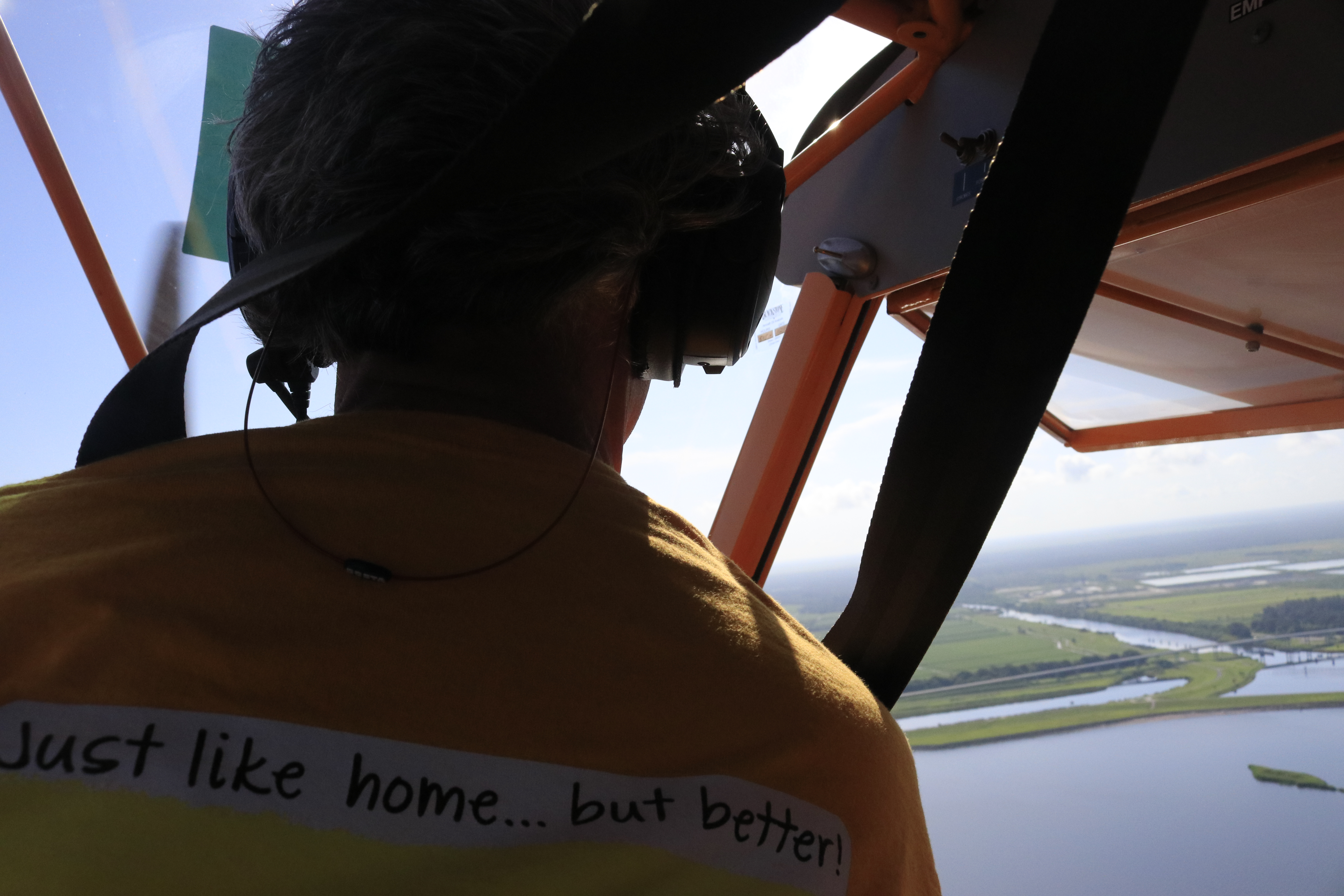
This past Saturday, July 25, 2020, my husband, Ed, flew across the state to Ft Meyers  to visit pilot and fellow River Warrior, Dave Stone. Along for the ride were two other friends, Scott Kuhns and Don Page. 

Before the men flew off, I asked the question, like a tape-recorded message: “Could you please take some photos of the algae in Lake Okeechobee?”

Sure,” Ed replied. “But we’re just going straight across.”

The afternoon went by, and when Ed returned home, my first question was, “Did you see any algae?”

“No,” he answered. “Didn’t you look at the photos I shared?”

I looked at my phone and clicked on the 52 photos. “No visible algae in Lake Okeechobee? Really hunny?

…Where did you guys fly?”

Ed took a long breath. “I told you Jacqui- straight across.”  

“What was your altitude?” I shot out. 

“About 2000 feet; why are you asking?” Ed looked at me with wide eyes.  

“Were you talking to Scott and Don so much that you didn’t really look?” I inquired. 

Ed looked me straight in the eye: “Jacqui, we were ALL looking. I told you, there was none, zero, nada.”

“Hmm.” I mused. “Why then aren’t there any photos of the central or west side of the lake?” 

“Because there wasn’t any algae!” His final reply.  

So today, I share Ed’s photos.

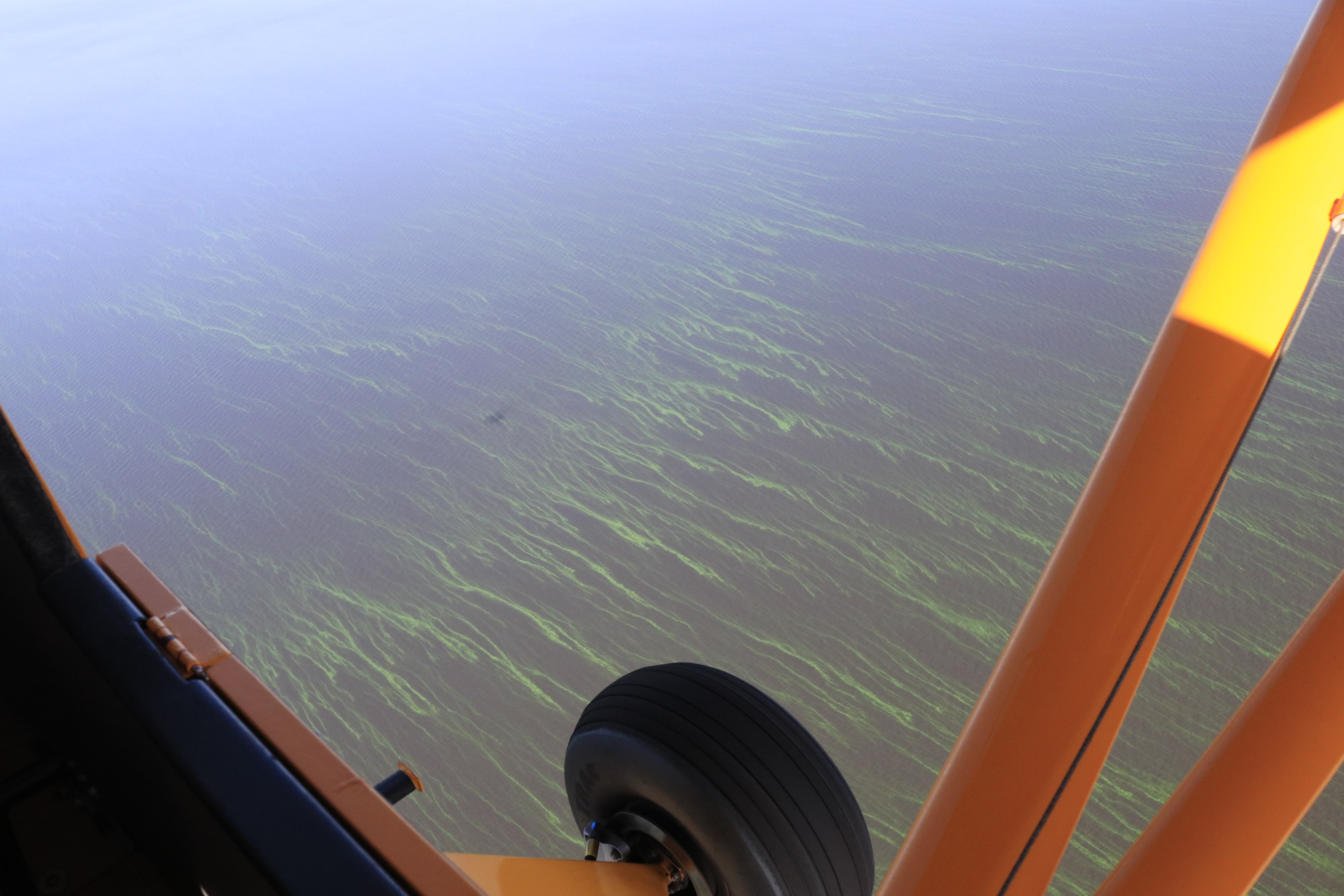
They highlight Port Mayaca at Lake Okeechobee, C-44 Canal, St Lucie Inlet, Hutchinson Island (with a lot of seaweed), Sailfish Flats (seagrass kind of coming back), and Sewall’s Point (with very little seagrass around Bird Island.) Nonetheless, you’ll see that the water itself looks better all around.

And the algae?

It is wonderful that Ed and his friends saw no visible algae.” Really great.

“Visible” though is the key word here. Cyanobacteria is known for its ability to move up and down in the water column. Sunlight is key. My brother Todd’s website eyeonlakeo reveals daily pass satellites Terra, Aqua -there was heavy cloud cover over Lake Okeechobee parts of Thursday, Friday and Saturday. 

In 2016, the year the lake was 90% covered in algae, Dr Edward Philips of the University of Florida Dept. of Fisheries and Aquatic Science was quoted in an Okeechobee publication. I thought it explained all so well, I wrote it down: 

“Cyanobacteria have gas vesicles which act as buoyancy control devices. The vesicles can be expanded and filled with gas, causing the cyanobacteria to float on the surface, or deflated, which causes the cyanobacteria to descend into the water column. Just because you don’t see it, doesn’t mean there’s nothing going on.”

No Visible Algae in LakeO? Really Hunny? 

Ed and I will back up in the air again soon! 🙂

~Your Eye in the Sky,

Jacqui and Ed 

Port Mayaca at Lake Okeechobee

C-44 Canal and S-80. Now closed. 

St Luice Inlet and Hutchinson Island 

Sailfish Flats between Hutchison Island and Sewall’s Point.

Satellite View, All Aerials, 2020 Algae Bloom Lake Okeechobee

Regarding: yesterday’s post, Eutrophic Lake Okeechobee

This morning, for purposes of documentation, I am posting the path my husband, Ed Lippisch, flew over Lake Okeechobee yesterday (6-10-20) and all aerials taken. Thank you to my brother Todd Thurlow, who shares technical information on his website, for re-creating Ed’s path via Flight Aware, and for also sharing the latest satellite high resolution images of Sentinel 2 retrieved 6-9-20. All of Ed’s phots displayed in gallery format below were taken from 2000 to 1500 feet on return flight along southern portion of Lake Okeechobee ending at Port Mayaca, east central, Martin County. His flight to the west coast was at 5000 feet and Ed said he saw no algae visible from that perspective.

High Res links to 6-9-20 Sentinel 2 imagery


(http://eyeonlakeo.com/NCCOS%20HAB%20Images/sentinel-3b.2020161.0609.1532C.L3.SF3.v950V20193_1_2.CIcyano-Crop%2BTruecolor.tif)

EyeonLakeO website, TT

All aerials, Ed Lippisch flight, 6-10-20, Moore Haven to Port Mayaca: if you are having trouble viewing this gallery please go to (https://wp.me/p3UayJ-b0a)


The Politics of Algae, “God Save the Queen,” SLR/IRL

Present Lake O algae bloom, as first publicly reported June 2nd, has grown to approximately 253 square miles. Although larger, this bloom appears less dense from space than either the June 24th or July 2nd 2016 images –  that measured approximately 239 square miles. Image courtesy of Todd Thurlow, 6-20-18. See other satellite images here: http://www.thurlowpa.com/LakeOImagery/

The algae in Lake Okeechobee is Mother Nature’s political checkmate, the time in chess in which the King cannot escape…

Thank you to Department of Environmental Protection Secretary, Noah Valenstein, whose Emergency Order directed by Governor Rick Scott, announced yesterday,  will implement an array of new actions to move more clean water south into the conservation areas and away from the estuaries.

f=”https://jacquithurlowlippisch.com/wp-content/uploads/2015/01/photo7.jpg”> SFWMD’s Home Page for Sending Water South. (http://sfwmd.maps.arcgis.com/apps/MapTour/index.html?appid=a9072c94b5c144d8a8af14996ce23bca&webmap=d8e767997b0d494494243ffbc7f6f861)[/capt
Make no mistake about it, this order happened due to Mother Nature’s “check.” The algae in Lake Okeechobee is exploding at record speed – see above image from yesterday, 6-20-18.

Sending algae that is potentially toxic to the communities of the St Lucie River and the Caloosahatchee is political suicide even for the Army Corp, an entity that is basically untouchable, like a King.

But since the state is legally in charge of water quality, not the Corp, the order comes from Florida’s Executive Branch as they, became aware of the seriousness of the problem. The Corp has reported they were lessening discharge amount anyway, however, they did not recognize the health threat of the algae…

Nobody wants to purposefully poison the estuaries, but the Federal Government and the State of Florida does when algae, potentially toxic, is sent through gates connected to Lake Okeechobee. We are all in a difficult situation, a chess game whose rules are outdated and were created years ago…

And even if there is “limited capacity” to move water south, it can be done. “Something” is “everything” in this water game of chess. We must take what we can get, check the King, and then go back for more – the goal to close the gates forever. “Checkmate.”

In my opinion, this emergency order is a real move that will send more water south and help reinforce a “send water south,” political culture that all Florida must embrace!

God Save the Queen, our one and only, “Mother-Nature.”

(I have updated this post due to spelling errors, etc.. 6-24-18. Sorry. I, like everyone, am exhausted. JTL)

LINKS: 

[/caption]June 21, 2018 PRESS RELEASE SFWMD

SFWMD Takes Additional Action to Send Water South Under Direction of Gov. Rick Scott; Issuance of Emergency Order
~District measures underway to help lower water levels, reduce need for Lake Okeechobee releases to northern estuaries: http://campaign.r20.constantcontact.com/render?m=1117910826311&ca=88c832d4-c24e-4928-ae9d-96e80ad4ee21

6-20-18, Politico, reporter Bruce Ritchie, Lake O Discharges Raise Ire From DC to Tallahassee: https://www.politico.com/states/florida/story/2018/06/20/lake-okeechobee-discharges-raises-ire-from-dc-to-tallahassee-480899
Checkmate:https://en.wikipedia.org/wiki/Checkmate

6-20-10 Palm Beach Post Associated Press: https://www.palmbeachpost.com/news/local/florida-gov-rick-scott-urges-lake-discharges-sent-south/EWNzmsDxs2oBjnuwAqnRKM/

6-20-18: Press Release Office of Governor Rick Scott.: https://www.flgov.com/2018/06/20/gov-scott-directs-dep-to-take-steps-to-curb-potential-algae-blooms/

6-21-18 Col Jason Kirk, Viewpoint Lake Okeechobee,Editorial, Sun Sentinel, http://www.sun-sentinel.com/opinion/commentary/fl-op-viewpoint-lake-okeechobee-army-corps-20180620-story.html

6-23-18 Ed Killer, Did Rick Scott Save Summer? TCPALM: https://www.tcpalm.com/story/sports/2018/06/23/campaign-strategy-doing-right-thing-you-judge/727278002/

“Algae Hunters” Track Significant Bloom Living in the Middle of Lake Okeechobee, SLR/IRL

My husband and I have decided we are algae hunters…

Hello Readers. Hope you are having a good summer!

Even though I am supposed to be on a “blogcation,” my husband, Ed, and I decided to fly over Lake Okeechobee this morning as yesterday Dr Susan Gray of the South Florida Water Management District reported on the Army Corp of Engineer Periodic Scientist Call that recent Landsat Satellite images had revealed significant algae in the middle of the lake- – – an area known as “LZ40.”

Sure enough, once Ed  and I got up in the air, just a few miles west of Port Mayaca, the strings of bright green algae were visible from about 1000 feet —-looking down— up to as far as eye could see…

Very strange to be surrounded by water and bright-colored lines of algae; it resembled  miles of suspended fluorescent paint. I have heard the scientists talking about how the algae comes up in the morning for sunlight and then goes back down into the water column later in the day. It is  intelligent, like an animal, and knows how to hide. You have to track it….

The living bloom was quite extensive, going on for many miles. My photos do not do the color or amount justice, but do document. This is important.

Thank God the ACOE is not dumping into the St Lucie River/Indian River Lagoon this summer. Poor lake O, on the other hand, has been getting “backwards flowing” C-44 water and back-pumped water from the EAA, STAs, and WCAs. No wonder its a mess!

Thank you to the SFWMD for the heads up! We do appreciate your work. We have inherited and created “quite an animal.”

See everyone soon.

Jacqui

*STA is storm water treatment areas

* WCA is water conservation areas

South Florida

SFWMD website:  (https://www.sfwmd.gov)

NOTE OF INTEREST:

*Reader, Professor Geoff Norris recommends we ask NOAA to create a bulletin for Lake O like this one here for Lake Erie since basically we are “in the same boat:” I think this is a great idea. I will have to contact NOAA.

(https://nccospublicstor.blob.core.windows.net/hab-data/bulletins/lake-erie/2017/projection_2017-05.pdf?utm_medium=email&utm_source=GovDelivery)

Tracking of journey upon return from Ed’s watch 7-19-17 around 9am

Center area of Lake O LZ40 is where SFWMD reported 7-18-17 that algae was showing on Landsat satellite images


Ed approaching Lake Okeechobee

FPL pond, Herbert Hoover Dike, and Lake O

S-308 and dike

Algae starts to appear just a few miles out

Algae get thicker and brighter as we continue flying west

_____________________________________________________________________________

​​

Lake Okeechobee Algae Bloom Satellite Imagery May- July 2016, SLR/IRL


....
….

Today I share an amazing link to a website of Lake Okeechobee satellite imagery from May-June 2016 as created by my brother,  Todd Thurlow. These images reflect the huge algae bloom in the lake that on July 2nd was estimated to be over 200 square miles. The algae has been discharged into the St Lucie River causing the present State of Emergency.

After going through thousands of images, Todd picked and cropped the best “bands” for each satellite. Each of the two Landsat satellites only pass every 16 days. So there are gaps. Plus, he skipped other days because of clouds. The other satellites pass daily but you will see gaps for cloudy and hazy days.

Each folder is arranged in reverse chronological order – most recent image first. The algae seemed to be worst around June 24. The current images from the low-res satellites are fairly clear. It will be interesting to see the next Landsat 8 pass on July 18.

Thank you Todd!

LINK: http://www.thurlowpa.com/LakeOImagery/

LINK: http://www.thurlowpa.com/LakeOImagery/

LE70150412016176EDC02 - crop
LE70150412016176EDC02 – crop

http://www.thurlowpa.com