Florida Memory, early Everglades drawing, Anonymous.
We have really killed them. A Google Search will bring up practically nothing, although they were probably the most interesting Everglades’ feature of all. Lake Okeechobee’s “Dead Rivers,” entitled as such as they were “perceived not to go anywhere…” but they did…they flowed out of Lake Okeechobee, running through the custard apple forest, and then disappeared into the sawgrass river of grass, today known as the Everglades.
The engineer of Hamilton Disston stated that there were 17 rivers leading out of Lake Okeechobee. Some of the larger ones were named the Dead, Democrat, Dowell, Forked, Hidden, Copper, Hutchinson, Leatherman, Menge, Pelican, and Ritta. Some were miles long, over 100 feet wide, and many feet deep. These rivers flowed curvaceously through the custard apple/pond apple swamp that extended from the lake’s rim as far as four miles south. Today these locations encompass the cities south of the lake especially Pahokee, Belle Glade, South Bay, and Clewiston.
Presently, the south and eastern shores of Lake Okeechobee are devoid of these once very rich-with-life rivers as they have been cut-off, redirected into canals, filled in, or diked. Apparently it was documented that the “dead” rivers could flow north or south depending on rainfall. We found it more efficient to drain the Lake and to eventually erect a dike destroying all of the wildlife highways.
The Boyer Survey: An Archaeological Investigation of Lake Okeechobee, 2011, by Christopher Davenport and others–from which these images and much of the information in this post comes from, show where some of these ancient and now “dead” rivers flowed. One thing is for sure, they were never really dead, until we killed them. I think it is important to, at least for our memories, bring them back to life; we will learn more about them.
IFAS: http://conference.ifas.ufl.edu/geer2008/Presentation_PDFs/Thursday/Royal%20Palm%20VIII/1040%20C%20McVoy.pdf SFWMD notes dead rivers “as a mile or less.”The Boyer Survey: An Archaeological Investigation of Lake Okeechobee, 2011The Boyer Survey: An Archaeological Investigation of Lake Okeechobee, 2011The Boyer Survey: An Archaeological Investigation of Lake Okeechobee, 2011The Boyer Survey: An Archaeological Investigation of Lake Okeechobee, 2011The Boyer Survey: An Archaeological Investigation of Lake Okeechobee, 2011Google Earth 2018.
One of the most rewarding parts of my advocacy is the people I meet, especially the “young people.” As a former teacher, and having no children myself, I feel a special connection. If they ask for advice, I encourage them in every way possible to relay their story and their concerns, uncensored. “Speak out! Speak out for the environment!”
A few months ago, a young lady by the name of Mariya Feldman contacted me. She had been working as a teacher in Pahokee, Florida, and was concerned about the poor air quality caused by the burning of nearby sugar fields and the effects it had on her students’ health.
I have experienced this burning from both the air, and the ground; I was interested in her story.
Burning sugarcane fields in the EAA. (Photo Ed Lippisch and Jacqui Thurlow-Lippisch, 2012.)Well, months later, Mariya contacted me again, this time she had completed her video production. She intermixed her topic of interest, poor air-quality and human health, with the health issues regarding the 2016 toxic algae outbreak in the St Lucie River caused by discharges from Lake Okeechobee. In the months previous, I had spoken openly to her and allowed her to record my interview and use it in her video. My interview, interwoven with others is included. Mariya has collaborated well to get her point across. She is a modern day student investigative reporter. I am excited to see where her talents, technological abilities, and passions will take her in the future.
I feature her work today in a You Tube Video below. Please watch it. It will make you think!
I thank Mariya and all the young people working for a clean and healthful environment for the next generation. Never give up. Never stop speaking up! It is up to us for sure.
1st Methodist Church, Belle Glade, post 1928 Hurricane, courtesy Lawrence E. Will Museum of the Glades, 2017.
Today I am sharing a very moving and disturbing historic letter written in the days following the hurricane that killed thousands of migrant workers and pioneer farmers south of Lake Okeechobee on September 16th, 1928. It is not an easy letter to read; please be warned. I do not believe it has ever been shared publicly before…
So how did I come upon this remarkable letter?
In January of 2017 I made it my goal to learn more about the communities south and around Lake Okeechobee. At this time, after a discussion with my historian mother, I offered my services as a volunteer at the Laurence E. Will Museum of the Glades in Belle Glade. This made sense as my mother’s friend, and Stuart local, Linda Geary, had opened the museum. Thankfully, present Museum Director Dorothy Block accepted my offer.
For weeks I went through old files and later, myself and a young Pahokee student from Palm Beach Community College scanned hundreds of photographs of the 1928 Hurricane for archival purposes. This was quite the education.
After one of my “museum days,” while having dinner at my parents, my mother, noting my interests in the 1928 Hurricane subject gets up from the table saying: “I do think I have a letter written after the 1928 Hurricane. It was given to me by Iris Wall.” (Some of you know, Iris Wall is a legend of Indiantown and the state of Florida.)
When my mother brought the hand written letter down, I read it out loud at the table, struggling with some of the cursive handwriting of the era. In spite of not getting every word, at one point tears streamed down my face. To think of what Floridians lived through, and reading it first hand almost a century later really puts things in perspective. I have read and listened to many first hand accounts of the storm, but this may top them all…
Letter About the Aftermath of the 1928 Hurricane, transcribed by historian Sandra Henderson Thurlow. Letter was given to Sandra by Mrs Iris Wall of Indiantown in 2003.
Tuesday Nite
Dear Papa:
We arrived here at four A.M. this morning and tried to sleep for an hour and a half then started to work. This is undoubtedly as bad a mess as I ever care to see. They are bringing in dead people all the time and they are swollen up about as big as cows and stink something awful. The old Dog Fennels are where they are lodged up. The water is about three feet over the farms and deeper in other places. The town is about two feet deep all over. Everything is ruined. Houses look like trash heaps—lot of them are scattered for a mile, just a piece here and there. Dead cows and hogs everywhere. The place smells like a corpse. It is awful but I am about used to smelling it now. Don’t know what I will do when I smell fresh air again. The water in the lake is awful on account of the dead things in it. They will not allow us to even bathe as all the water we get comes in on boats and is used to drink and cook with. We cannot even shave on account of the danger of cutting ourselves and getting it infected and we have to [be] looked over ever so often and any scratch doctored.
Awful does not describe it at all. I saw one man identify his father, mother, and brother and wife in a batch of bodies brought in. Now that was a pitiful sight. He had not closed his eyes since Friday looking and waiting for them and then to find them all downed and they were in awful shape. Hardly any clothes left on them, just rags. One man identified his fifth child this afternoon and his wife is still missing. One old man about eighty identified his wife this morning when they brought her in with hardly a rag on her, that was awful to see the old fellow. Some bodies come in with all the skin and hair gone and their eyes swollen until they have busted and their tongues sticking out and swollen larger than your hand and their faces all out of shape. One man brought in here looked as tho he would weigh about 250 pounds they said only weighed about 110.
They do not embalm them any more, just put them in a box and haul them to Cities Center and bury them. Two trucks have been busy now two days hauling bodies out to the solid ground and two hauling in coffins. I guess they built about 20 coffins out of rough lumber today and they have to wait for boxes –some bodies have to lay on the ground for several hours before they have any thing to put them in.
The State is sending in a bunch of antitoxin to inoculate us with tomorrow to prevent us from getting sick. I saw a paper today but they don’t describe it near as bad as it is.
The town is under Martial Law and they are sending people out of here as fast as they can get a means of getting them out. They have to get them out because there is no place for them to sleep and nothing for them to eat.
I took a second lieutenant in tow this afternoon. He was drunk and just raising sand and Chesterfield told him to quiet down and he was in for getting his gun and he was standing right in front of me. I grabbed his arm and got a “Hammer Lock” on him and believe me he hit the ground like a sack of sand and…I held my holt until a deputy took him over. That is the only fun I have had since I left Arcadia.
I am on guard duty now and have been on for eight straight hours. Got up at 5:30 and it is nearly two A. M. now. How is that for a day. All I have to do is sit here and see that there is no stealing. My orders are to stop them and if they did not stop use my own judgement. Things are pretty quiet so don’t guess I will have any trouble. Most of the people are gone and no one is allowed in here.
There are houses or rather what is left of them, with lily pads on top of them the water was so high. The people say that when the dykes broke the water came in a wall and a lot of people were drowned before they could get out of it. Cars are left in the road right where the water caught them. There is a steel coal care one mile from the track and two big Gul Ref. Co tanks about four miles from town where they were washed. The water just picked up about a mile of the railroad track and just turned it bottom upwards. Now that was some force. The embankment was not washed away either.
Well, Papa, it is time for my relief so will close and try to mail this tomorrow.
Love to you all
Dick
No need to write as no mail comes in and I will have to meet a train or find someone who will to mail this as the train does not come closer that 12 miles. DBJ
A quaint church before the water tower, Pahokee, “Welcome Home,” JTLNegronBraynon
Senate President Joe Negron’s District 25 includes the Treasure Coast south to Palm Beach County, and inland to the City of Pahokee in the Glades. Pahokee will be hosting President Negron and Senate Democratic leader Oscar Braynon tomorrow, March 17th at 5p.m. to talk about Senate Bill 10, and the future of the area.
This is a good opportunity to meet our neighbors and learn what they, the people, have to say about Senate Bill 10, and what they want for the future of their historic community. I encourage coastal residents to attend.
The people we support; the environmental destruction of our St Lucie River/Indian River Lagoon, we cannot. The waters of the great Lake Okeechobee flowed south for thousands of years before the rich soils it created were discovered, and our environment was put at risk.
Isn’t there a way more water can flow south as God and Nature intended while enhancing the economics and life style for the people of this area? Can’t we let the people speak for themselves?
Let us try.
Thank you.
Jacqui
_____________________________________
Press Release: Glades County Democrat Newspaper
Area residents invited to hear Senator Joe Negron Mar 15th, 2017 · by Special to the Glades County Democrat PAHOKEE — Florida Senate President Senator Joe Negron and Florida Senate Democratic Leader Senator Oscar Braynon will be at the Glades Community Discussion on Friday, March 17, at 5 p.m. to discuss the future of our historic communities.
This discussion is open to all communities of Pahokee, Belle Glade, Clewiston, South Bay, Canal Point, LaBelle, Okeechobee and Moore Haven.
The Glades Community Discussion will take place at the Pahokee High School located at 900 Larrimore Road.
Free locally grown food for Glades residents will be served. There will be chicken dinners, corn boil and corn giveaway for Glades families.
Photos of beautiful, historic, Pahokee
Hanging in the Presidient Negron’s office if this historic photo from Pahokee of the corn harvest.Pahokee is famous for its streets lined with stately royal palms. JTL…Pahokee’s rich muck soils yield tremendous produce.Black gold up closeA home in Pahokee.Homes in the Glades are built on multiple stilts in the mucky soils. Soil subsidence is an issue.The sugar mill nearby-there are concerns about job loss if land in the EAA is purchased for a reservoir. The area already has a high unemployment rate. The question is, is the present situation the situation Glades residents want for their future?Number sticker on a car in the GladesSenate Districts Florida
Sunset over Lake Okeechobee at Canal Point, neighbor to Pahokee, by Todd Thurlow
Flying over the black gold of the EAA. JTLFields in Pahokee, JTL
Road Trip Series.
Since I began my Glades “Road Trip” Series, I have read three books by Lake Okeechobee historian, Laurence E. Will: Okeechobee Hurricane, Swamp to Sugar Bowl, and A Cracker History of Okeechobee.
These books hold amazing stories of the Glades; if Mr. Will hadn’t written, there would be very few first-hand accounts of farming that became a Florida mega-industry just over the first half century of the 1900s. Today, I will transcribe some of his most interesting descriptions of Lake Okeechobee, the magical landscape that was transformed into today’s contoversial Everglades Agricultural Area, for none other than its MUCK.
EAA below Lake Okeechobee. (Public map SFWMD)Photo of pond apples also know to locals as custard apples in Big Cypress- shared on Flicker by photographer Mac Stone, allow us to envision what this incredible forest looked like. 32,000 acres rimming the southern and eastern shore of Lake Okeechobee. The best muck built up over thousands of years under these roots that worked like a seine as the lake overflowed its edge then running south through the sawgrass. The Everglades….
Florida Memory Project, photo by John Kunkel Small 1869-1938.
Close up of small pond apple on Torry Island, by Lawrence E Will.
Photo from Swamp to Suagrland, showing pond apple with moon vines around Lake O. (Lawrence E Will)
pond apples
When I was on my recent tour with former mayor of Pahokee, J.P. Sasser, I learned the nick-name for Pahokee is “The Muck,” named so for the “black gold” soil that accumulated over thousands of years under the roots of a custard apple forest that rimmed the lake. (Kind of like fresh water mangroves today in the Indian River Lagoon.)
When one drives deeper into the Glades, one finds similar nick-names or “muck mottos,” that have to do with the muck. For instance, Belle Glade’s motto is “Her Soil is Her Fortune;” Clewiston’s is “America’s Sweetest Town,” and South Bay’s refers to its highways, “Crossroads of South Florida,” named so for its intersection of two major roads, East-West State Road 80, and North-South, U.S. Highway 27, roads that get one into the muck, or out of it….
Will first experienced the Lake in the early 1900s as a boy when his father was developing Okeelanta, located about four miles below today’s South Bay. Okeelanta, today a mill location for the Fanjul holdings, was located not in an apple custard forest, but rather in the miles of sawgrass lying south. Although the soil here is excellent, it is different, more peaty and not as “mucky.” Thus the most productive lands lie closer to the lake, deep in the MUCK.
Here is a moving account by Will about the land of muck in “Cracker History of Lake Okeechobee:
“Before the dredges crashed through the custard apple woods to start the first canals, the lake most always stayed high and clear, unbroken except for those islands Kreamer, Torry, and Observation. When I first saw the lake it was still wild. Excusing the trifling settlements at Utopia, Ritta, and Tantie, a score of fishing camps, and the openings to four unfinished canals, it’s swampy shores hadn’t changed since Zachary Taylor found the redskins or probably not since DeSoto anchored in Tampa Bay. It sill was just as the good Lord had fashioned it. The lake was lonely Mack, silent and mysterious as well. But I tell you boy, it was beautiful, and sort of inspiring too.”
Will was absolutely pro development, pro farming/agriculture, but he, like most of the old timers, recognized the tremendous awe-inspiring beauty of the place.
Most all the natural beauty the lakeside shoreline in Martin County, where the FPL Power Plant is today, and north to the town of Okeechobee has also been radically altered as well.
FPL solar plant and “cooling pond” in Martin County looking west towards “Barley Barber Swamp.” This area was once a forest of mostly giant cypress trees and others. JTL
Excerpts by Lawrence E. Will:
“Dense forest ringed the lake around. Along its northern half water oak, maple, cypress, potash, rubber and palmetto trees crowded each other on the lakeshore ridge…the south shore and half way up the eastern side was something else… Here were custard apples, a solid belt of tropical trees, blanketed with a moonvine cover, which stood, two miles or more in width, without break or opening, from near Clewiston’s Sand Point, slap around to Port Mayaca. 32,000 acres of custard apple woods there were, the most of these trees, I wouldn’t doubt, on the whole blamed continent of America.”
“…Although the shores were for the most part black muck, low and flat, there were some fine sandy beaches too. Along the east side for eighteen miles lay beautiful East Beach…”
“Now if Zachary Taylor or Hamilton Disston could return to Okeechobee they would find that farmers have exterminated the custard apple woods. Highways, service stations, super markets and housing projects have replaced the cypress, rubber and maple trees along the ridge. A levee occupies the onetime shore and drainage has lowered by half a dozen feet the water’s elevation. Tractors cultivate the former seining grounds, and unless you as old–and no amount, as some of us, your never heard of town of Tantie, Utopia or Ritta. Civilization has re-made the lake and I’d be the last to say it isn’t better so, but the lakeshore’s one time natural beauty is long gone, and man, wasn’t that old lake a fascinating place.”
Well, to the land of Lake Okeechobee! For all she was, and for all she is. It’s enough to make one exclaim:”What The Muck?!!!”
Today we continue our road trip in the Glades atop the Herbert Hoover Dike.
In the short video below you can see my Glades tour-guide, former mayor JP Sasser, driving, –in his hometown of which he knows so much about–Pahokee. On the right lies the city, and on the left is Lake Okeechobee. A precarious position indeed!
Pahokee is actually unusual in that this little town is “high-ground.” According to JP, about 13 feet above ground. This is not the case for most of the Glades.
Interestingly, in the video, JP discusses how the Army Corp recently decided where to strengthen the dike in Pahokee, because if they had extended it out 500 feet as was done along the rest of the eastern shore, the town of Pahokee would have been covered up as it is located right beside the dike.
Lake Okeechobee’s dike and its history are fascinating just as is all our area of the Northern Everglades including the St Lucie River/Indian River Lagoon that in 1923 became the primary exit point for waters that could no longer flow south after the Herbert Hoover Dike was built.
According to historian and Gladesman Lawrence E. Will:
“…following the floods of 1923 and 1924 water stood over farm lands nearly the entire winter. To protect the farms, the state of Florida had then constructed an earthen dike along the whole south shore. It was some five to eight feet above ground level but this dike was never intended to withstand a hurricane.”
Regarding the expansion of the dike, as the “Herbert Hoover,”after the horrific hurricanes of 1926, ’28 and again in again in ’49, Mr. Nathaniel Reed notes in his writing “Lake Okeechobee and the Everglades: “The Corps of Engineers studied the average size of Lake Okeechobee and designed a dike around it…”
Now this is where things get very interesting.
“The average size of the lake….” what’s that?
Now if we look at this slide taken from a 2016, presented by Jeff Sumner, who was at the time Office Chief State and Agricultural Policy, SFWMD, it shows the size of the lake pre-development. One can see it was about once about 1000 square miles in size and today it is 750.
The False Edge of Lake Okeechobee, SFWMDThe checkered fields were once lake bottom. L. E. Will, “Okeechobee Hurricane”L.E. Will Swamp to Sugar Bowl. The Glades area, today’s Everglades Agricultural Area has become one of the most productive agricultural areas in the world…
Of course the size expanded and contracted based on rainfall, but one still gets the point…this lower area was nature’s shoreline, a boggy marsh with rivers leading into a sawgrass “river of grass” bordered by a forest of over 30,000 acres of Custard Apple trees that functioned like mangroves extending up to five miles or more south into what is today’s Belle Glade. As Mr Lawrence Will would have said: “Who wudda thought!” (http://museumoftheglades.org)
Pahokee is in upper right. Map Laurence E WillThe lake once went further south here and there following the rivers to Hwy. 80Land ownership todaySen. Joe Negron’s map for land purchase
I would like to thank former mayor of Pahokee, JP Sasser for on November 29th guiding me through a seven hour tour of the Glades! At first you may think JP and I are unlikely “friends.” Actually we have something very much in common in that we have both been mayors of small Florida cities.
Yes, there are also a few serious things we don’t have in common such as our opinion regarding land purchase in the Everglades Agricultural Area, (EAA), for a reservoir to alleviate the destruction of the St Lucie River. Also, Sasser has written extensively about concerns regarding the direction of the Rivers Coalition. I have been on the Rivers Coalition Defense Fund for six years. Mayor Sasser and I have not always been on the same page. For me this is O.K. JP and I having differences of opinion shouldn’t preclude working together. At this point in my river journey, I am going to do all I can to build relationships. To find common ground. “Common muck” should I say?
Anyway, enough politics. My tour was awesome! For this post, I will just concentrate on Pahokee.
JP and I met at Canal Point, at the USDA Sugarcane Field Station that dates back to 1920 about ten miles south of the Martin County/Palm Beach County line at the WPB Canal.
Pahokee has about 6000 residents. It has beautiful new schools. Many of the lands are owned by family farmers and the Fanjul family. The population is about 80% black and 20% white. Everyone I met was friendly and happy to see me.
Locals fishing at marina
JP asked me where I wanted to go. I asked him to take me to the Pahokee Marina and Tiki Bar that he so famously worked for during his mayorship. This marina is within view of Port Mayaca in Martin County. JP’s dream was that this marina would become the basis for economic development and diversity of Pahokee. The city desires economic development. (http://www.mypalmbeachpost.com/news/business/guy-harveys-resort-chain-eyes-site-in-okeechobee-c/nmwGw/)
I learned that Pahokee unlike much of the Glades is thirteen feet above the lake. It is high ground. The town is just a few miles long and 500 feet wide right along the dike. One sees dike, houses, road and then fields…Thus when the ACOE recently wanted to make improvements and “go out 500 feet out from the dike” they would have basically had to had to knock down the city.
I learned that much of the lands close to the Lake were covered with Apple Custard Trees that had been removed in the early 1900s and thus the lands have excellent deep muck soil that grows not only sugarcane, but sod, corn, vegetables, and supports tree farming. Pahokee is known as “Muck City.”
JP then took me off the beaten track to see his horses and donkeys. So here is something else we have in common. A love of animals!
We drove on…JP showed me the remains of the Pelican River which led to Pelican Bay that I had read about in my book. This was the area where the Palm Beach Times reported over 400 dead after the 1928 Hurricane. I tried not to imagine…
We then drove to Pahokee’s original graveyard that had to be moved along with its resting bodies to Port Mayaca in Martin County after the 1928 Hurricane. There was a plaque that listed those who had been buried there. A sad thought, but here is another way Martin County and the Glades are connected.
We visited the airport. Very nice. Right along the lake. In fact this area was once lake bottom. Bizarre. Hmmm…My husband Ed would like this airport I thought. More possibilities for economic development?
Again back to the dike. It always goes back to the dike…
We checked up on ACOE repairs where they had draped the pipes carrying water to the fields over the dike like spaghetti and then JP took to me to lunch….
Part #2 will be entitled: “The Best Fried Chicken of My Life.” Please see photos below.
JP at Pahokee MarinaDriving on road atop the dike by marinaView from dike looking south. Homes stand right next to the dike.Old Pelican RiverTree Farm looking from dikeJP’s horese and donkeys
Original Pahokee graveyard at base of dike
Old GraveyardPahokee’s nice new roads with lovey houses on right and fields on other side of roadCanal and control structure to fieldsLocation of airport, once lake bottom
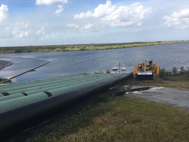
JPRepair of dike ACOE with water for irrigation from lake over dike so they can get to culverts
As you know, we are on a Road Trip. We are driving through not only to learn about the Glades, but also to learn about ourselves. Whether we realize it or not, we are all connected. We are related by history, by the drainage of the Everglades, and by a “better water future” we have no choice but to build together.
This map of the Glades is from the Florida Memory Project. It maps flood damage from two great hurricanes. Notice that the 1926 Hurricane damaged mostly the western part of the lake near Moore Haven, where as the 1928 Hurricane most intensely hit the eastern communities around Belle Glade. The towns/areas of Canal Point, Pahokee, Bacom Point, Belle Glade, South Bay, Lake Harbor, Bare Beach, Clewiston, Moore Haven and Newell all had to rebuild. “Chosen” near Belle Glade was chosen to be lost…
These past hurricanes define the history and the nature of some of the people of the Glades. The ones who “made-it” are survivors beyond anything we can possibly envision.
As Mr Lawrence E. Will an old family, a politician, and a prolific writer from the area wrote in HURRICANE:
“One word describes it. It was Hell. A raging inferno of rolling, swirling waters, of shrieking, demoniac winds, of lashing rain and of darkness, black and absolute. There were no atheists that night on the shores of Okeechobee! Then for the those still living came the second phase of hell; the phase of desolation and despair; of searching in the flooded woods and marshes, in elder clumps and sawgrass for the horrible remains of family and friends and neighbors; of loading them into trucks by unending scores; and finally of burning them in help of dozens when they could no longer be transported. It is hard to know which hell was worse…”
As we know in the 1930s the Herbert Hoover Dike was built to avoid such a disaster from happening again…but there is always the question of whether it will or not. It is dangerous to live on the low side of a dike.
As advocates of the St Luice River/Indian River Lagoon, we must be sensitive when discussing Senate President Joe Negron’s proposal for 60,000 acres to be purchased south of the lake to store, convey and move water south to the Everlgades. One can see how shouts of “Send the Water South” may send some people living south of the lake “over the edge…”
We must always make clear that when discussing Everglades resoration and improved health of the St Lucie River/Indin River Lagoon, safety, and economic prosperty for the Glades communties comes first. We know and respect their past…
TCRPC EAA map 2016Senator Negron’s possible land acquisition map 2016/17
“Who Owns the Land South of the Lake? Mapping Out Florida’s Water Future.”
Today we discuss #3, New Hope Sugar Corporation. It is difficult to find much information on the company, however, it is part of the Fanjul family’s holdings. It is also the same name, as we learned yesterday, as the Fanjul charity: New Hope Charities whose mission is to help families in the Glades.
Let’s look at the charity again…
Their website reads: “New Hope Charities was incorporated as a 501(3)(c) charity in 1988 offering support to remote, distressed and underserved segments of society. The first program implemented by New Hope distributed food to needy families living in the “Glades” area of western Palm Beach County. Currently, we operate a multi-service center in Pahokee, Florida, the second poorest city in the United States. The Family Center consists of a Day Care Center, a Youth Center, an Education Center, a Health Center, basketball courts, and an open field for soccer, baseball and football.”
Now back to the land…
I have colored in New Hope Sugar Corp. in the same orange highlighter as Okeelanta Corporation, but added a red dot to differentiate. New Hope Charities above mentions Pahokee as the nation’s second poorest town. Pahokee is south of the Martin County Line along the rim of Lake Okeechobee; it is not far away. The point of my blog series is to show landholdings, but I think the “New Hope” theme lends itself to a discussion on something more.
New Hope Sugar Corp orange with red dot, #3. Fanjul holdings.Map south of Lake O, Pahokee is marked
I have been blogging for four years now, it is becoming clear to us all that there is a bridge to be crossed, a hand to be held if we are going to go any further. Since the beginning of our river journey there have been cries from the interior of the state/south of the Lake. Cries of fear that we want to “send the water south” and destroy their cities and livelihoods…Even thought we know this isn’t so, this is understandable— and let there be no mistake about it: #GladesLivesMatter
I think it is time we talk about this openly. We must address the fears and the realities and we must begin to help…because there is so much help we can do for these communities and for a better water future for our state.
What got me thinking on all this was researching New Hope Sugar Corporation, #3 on the TCRPC map. I realized I have never thought that much about these areas south the Lake, except maybe when my father told me some of the best football players come from Pahokee and Belle Glade. I have driven through before and I have flown over. But have I ever walked inside? No I have not. After I finish this “land south of the Lake series” I think it is time to go inside this world and see how we can help.
We have got start a conversation including the Glades communities, a plan to help the poverty in Pahokee and Belle Glade and other Glades communities. We have to talk about Everglades Restoration as a plan for everyone. I am sure the Fanjul’s New Hope Charities with same name as their Sugar Corporation is doing great work, but why couldn’t Everglades restoration offer something more? Because in order to create more than hope, we must move beyond charity…
Excerpt NY Times Article, 2013… In the Glades, the “official” jobless rate has always been a joke because so few people are even on the books. Many of the agricultural jobs disappeared as vegetable production turned into sugar growing, now largely mechanized.
Looking at Lake Okeechobee from Port Mayaca in Martin County-sky and lake are one. (Gary Goforth)
Today I am going to share an adventure of engineer and St Lucie River/Indian River Lagoon advocate Dr Gary Goforth. I will tie in his Lake Okeechobee experience with a few wonderful historic postcards from my mother, historian Sandra Henderson Thurlow. Although you couldn’t get my mother on a motorcycle if you paid her, there is a common thread. The lone cypress…
“The Lone Cypress…” You may have heard of it? As we know, cypress trees live for thousands of years. There were large forest of these magnificent trees prior to their being cut down around the turn of the last century. But a few still stand. Like this one in Moore Haven.
Dr Goforth’s account of his ride around the lake is inspirational. I have done it a couple of times by car, most recently during the final session of my UF Natural Resources Leadership Institute in Clewiston. During Dr Goforth’s ride, he visits the ancient cypress tree–the one in my mom’s historic post cards. I find this really cool. I hope you do too!
Historic map from 1948 book “Lake Okeechobee” written in 1948 by Alfred Jackson and Kathryn Hanna as part of the Rivers of America Series gives some idea of where the many cypress tree forests and others natural systems were once located.
“Hi Jacqui – I know you’re very busy as always – in fact more so these days I imagine. I got around to reading a recent blog of yours entitled “Taking the Emotion out of “Clewiston”-UF’s Natural Resources Leadership Institute, SLR/IRL.” I enjoyed it so much I thought I would share a trip I took on Sunday afternoon – a motorcycle ride around Lake Okeechobee.
It started out as a leisurely Sunday afternoon ride around the Martin County countryside. When I got to Port Mayaca I decided to head south for a couple of mile to the trailhead of the Lake to Ocean Trail – a 55-mile hike I’ll get around to tackling during cooler weather. When I got to the trailhead, I said what the heck – might as well circle the Lake. I’ve done the route before, and love to roll through the small towns that we are linked to primarily because of the Lake releases. Probably my favorite stretch is along the eastern shore of the Lake where the old-growth linear forests still remain – the magnificent cypress, bay, and others. My companion for the entire way around the Lake was the Herbert Hoover dike – almost always in sight off to my right along the small roads I took. Before I knew it I was passing through Sand Cut and Pahokee on my way to Belle Glade with their motto “Our Soil is our Fortune.” I thought of my Dad’s cousin Jack Fullenweider who was a general manager of the old Talisman sugar mill (bought by the State prior to construction of STA-3/4), and whose son, Jack, Jr. was a sheriff’s deputy in Belle Glade. I thought of Fritz Stein – a former District Board member from Belle Glade and all around good guy.
The traffic was light and the weather was beautiful. Before long I was riding along US 27/SR 80 with the big dike/dam to my right. The site of the 1928 breach and untold deaths. Along this stretch the ground level is the lowest of the entire lake’s perimeter; the Lake’s water level that day was a foot or two above ground level, which has subsided more than 6 feet since records began decades ago due to the drainage canals and ag practices. Around the rest of the Lake, the actual lake level is below the surrounding ground level.
Soon I was in Clewiston where the banners were hung announcing the upcoming Sugar Festival (today through Sunday). I thought of the many good folks who worry about the State purchasing US Sugar lands with the purported 12,000 people who would be out of a job – the folks that get angry at the estuary folks – and wonder who they turned their anger toward when US Sugar announced they had struck a voluntary deal to sell the land to Gov. Crist. What a missed opportunity, and to think the Legislature and Gov. didn’t go through with the deal – likely out of spite towards Gov. Crist – they didn’t want anything to do with extending his legacy. Deplorable. I put that out of my mind as I rode through Clewiston – a lovely little town.
Lone Cypress as it appears today.Picture taken in 1917 showing Lone Cypress tree as it appeared during the construction of Lock No. 1 in Moore Haven. (via Gary Goforth)
Before long I was in Moore Haven and thought about the big history of that small town – the early Indian canal excavations, the early dredging/draining activity of Hamilton Disston connecting the big lake to the Caloosahatchee, the farming community, the devastating hurricanes and the Lone Cypress Tree which has stood as a sentinel along the Caloosahatchee Canal since the days of Disston. The Lone Cypress Tree! I have always wanted to find that tree! So I rode around till I found it along the banks of the river/canal. It was beginning to send out the bright green needles and was remarkable in its majesty!
A few more miles on US 27 and I turned north onto SR 78 – a pleasant ride along the west side of the Lake. Pretty soon the road drops onto the floodplain of Fisheating Creek – the only unregulated tributary feeding Lake Okeechobee. I was reminded how the flows into the Lake from Fisheating Creek increased 6-fold this dry season compared to last year. All along the west side of the Lake are small mobile home and RV communities enjoying the good life!
Before long I crossed the Kissimmee River and was into the south side of Okeechobee. White pelicans ushered me along the road lined with hotels filled with seasonal fishermen and women. On around the lake and passing J&R Fish camp – busy with Sunday afternoon bikers. Many days I’ve enjoyed the free hot dogs and music. Before long I passed alongside of the FP&L cooling reservoir – site of the levee failure that occurred just before midnight in October 30, 1979.
Then I crested the bridge over the C-44 Canal with Port Mayaca off to the right. The calm water belied the massive and destructive discharges that were occurring, sending tons of sediment, algae and nutrients on their way to the troubled St. Lucie River and Estuary.
A quick turn back to the east onto SR 76, past DuPuis (my favorite public land to hike), past the sod and cane fields where once there was citrus and before long I parked the bike in the garage – it was a good ride.
Enjoy!
Gary
The attached photo of me on the motorcycle was taken on a post card perfect day in 2009 at Port Mayaca – the wind was calm, the Lake was still and the air was so clear you could see all the way across to Moore Have, some 30 miles to the southwest! I love how the water and sky blend together on the horizon.
…..Dr. Gary Goforth ready to tour Lake Okeechobee.
_______________________
After reading Gary’s account I kept thinking about that lone cypress standing like a sentinel as all has changed around it… I wrote my mother to see what she had in her history files. She sent the following four postcards from her historic collection:
We should all go ride and see it and make post cards or Facebook posts of our own!
1. Postcards courtesy of historian Sandra Henderson Thurlow.2.3.4.