This slide was to sent to me from Jeff Kivett of the SFWMD. It shows Regional Flows “south,” for Water Year 2014-2015 or May 2014 thorough April 2015.Map south of Lake O. showing EAA, STAs, and WCAs. Everglades is south as is Florida Bay. (Map public.)
I was a teacher for many years. I taught 8th, 9th, and 11th grade English and German. Throughout my career, whether the students were 13 or 17 years old, there was nothing better for them than “getting an A.”
I don’t think in my ten-year career, I ever gave an A plus.
Until now that is…. 🙂
The South Florida Water Management District deserves an A plus for their creative, determined, and difficult work “sending water south” in a politically explosive environment. —-Probably the worst mine fields in the state…
For “WATER YEAR REGIONAL FLOWS May 2014, through April 2015” at least 585,000 acre feet of water was sent south to the Storm Water treatment Areas and into the Water Conservation Areas. This translated into 565,000 acre feet of water to starved Everglades National Park.
To appreciate this achievement one must compare:
This chart from Dr Gary Goforth shows water flow comparisons for water years 1995-2015. (Courtesy Dr Gary Goforth who worked for the SFWMD and was key in designing the STAs. 7-22-15.)
The chart above, courtesy of Dr Gary Goforth, shows acre feet of water going to STAs from 1995-2015. The highest number ever. The colors show the different STAs the water went through.
Sometimes when studying “sending water south” it gets VERY confusing as more water was sent south in 1995, but this water was sent when there were very few STAs and so Florida Bay got pounded with nitrogen and phosphorus laden Lake Okeechobee, and I would think some water from the Everglades Agricultural Area….
The Storm Water Treatment Areas clean the water…
It must be noted that some grading the system may think differently as South Florida certian water users and agriculture have been afraid we were, or are almost going into a drought or that the STA were overused. Some may say the ACOE and SFWMD district “should not have sent so much water south, but rather stored it in the lake…” Maybe they are right. Today I will not judge, but reward.
So anyway, “to repeat myself IRL students,” 🙂 THIS YEAR THE SOUTH FLORIDA WATER MANAGEMENT DISTRICT HAS SENT MORE WATER SOUTH TO THE STAs THAN EVER BEFORE.
You may recall that the Army Corp of Engineers opened the gates to the St Lucie River on January 16th 2015 and this did not stop until late May. This water charted going south this year helped alleviate our destruction. It could have been worse… If they weren’t sending it south, it may have gone to “us.”
My hope is that water management becomes the top-cool thing to do for future generations, and that many River Kidz and even more young people from all over the world and our nation, come to our state to work, learn and study water management. It is a politically explosive and difficult work environment, but nothing is more important for the people and the for wildlife of our state.
I admit that I am part of that politically explosive environment..but my heart really is with the living creatures of the Earth and its waters. May we overcome our genetically wired warlike behavior, send the water south, and save the St Lucie River/Indian River Lagoon….
Thank you South Florida Water Management District for your outstanding work! Yes there are great difficulties, but for a better water future, we are counting on you!
The next generation! (Public photo of a shore bird baby in the Everglades.)
A pipe into the Indian River Lagoon from a cottage along the Indian River Drive goes directly into the river disposing of sewage. In our Treasure Coast’s regions’ early days there were no laws prohibiting this. Photo archives of historian Sandra Thurlow. ca late 1950/60s.
It’s been a tough week for river lovers.
It was reported by the Stuart News and others that a gentleman died suddenly after being “stuck by a fish.” He had put in his line in the Indian River Lagoon, near Harbor Branch, in St Lucie County. Just a few days later, the headlines noted the experience of Mr Bruce Osborn whose “knee and leg turned black, swelled up, and became hot to the touch after he dove into the confluence of the St Lucie River/Indian River Lagoon. Mr Osborn was boating near the Sandbar which is located within sight of the St Lucie Inlet…
Mr Osborn had an open sore….he recovered with prompt, emergency-room, antibiotic-treatment and a good wife.
Today in Stuart New’s “Letters to the Editor” a retired New York sheriff is of the opinion that the news of the fisherman had been “sensationalized” noting that “no autopsy had been performed on the man– who died…..”
Who is right? Who is wrong? Or does “truth” lie somewhere in between?
Who knows…But it is all certainly worth thinking about.
Interestingly enough, in this river or near-ocean story, the culprit would not be a shark or anything scary like that, but rather a microscopic bacteria or virus that cannot even be seen….
Bacteria is everywhere. In soil and in water. On our skin and in our bodies. For humans there is “good” and “bad” bacteria.
How do we know where there “bad” bacteria is in the river?
Canal and basin map SLR/IRL. (Public) The basin has been expanded at least 5x its natural size since 1920.
I don’t know, but I do know numbers of bacteria everywhere in water communities are highest in the sediment. Sediment is the sand, clay and other soil types that build up on the bottom of the river in the St Lucie River/Indian River Lagoon and all estuaries of the world.
Muck from the bottom of the Indian River Lagoon. (Public photo)
In our area, the most recent hundred years of sediment, this “muck,” has been heavily affected by human alteration of the environment, especially by drainage canals, like C-44, the drainage of Lake Okeechobee, C-23, C-24, and C-25, as well as shoreline development’s tear down of native vegetation along the shoreline. (That can no longer filter runoff.)
Giant, mile-long canals drain mostly agricultural lands from out west. Many if not most of these lands never even drained into the St Lucie River/Indian River Lagoon in the first place. Not by God. Not by Nature. Just by “us” since around 1920.
So now literally thousands of pounds of fertilizers, pesticides, herbicides, metals, oils from cars and roads, septic effluent…..the list goes on and on….so these pollutants run into our waterways building up in the sediments of the river, —-to be re-suspended with every storm, with every boat that races by……as the sediment builds and flocculates, bacteria grows–especially if it is warm..many fish live on the bottom of the river….
Estuary depiction public photo.
On the positive side, as far as water, many things have changed for the better since my childhood.
During my lifetime, in the early 60s, sewage was directly dumped into the St Lucie River/Indian River Lagoon from homes and boats….I swam and skied in this water every weekend….Not many people lived here. As kids, we did not know or notice although we used to make jokes about “logs passing by…”
🙂
And yes, since the 1960s and 70s tremendous improvements in sewage treatment plants, packaging plants, septic systems, “Best Management Practices” for Agriculture to lower runoff, etc…have been made. This is fantastic.
Ag runoff DEP photo.
But we can never catch up….We are always chasing our tail….Because we keep putting more pollution into the system than we can clean up. Like putting too many fish in a fish tank, and not cleaning your gravel often enough…our relatively closed lagoon system has met its limit…
The chart below just goes to the year 2000. Florida is now the third most populated state in the nation with over 19 million people. 19 million people’s’ waste….19 million people’s yards, and not just small time farmers anymore, but agribusiness– hundred of thousands of acres of fields and chemicals….a huge portion seeping into our water. Best Management Practices. That’s just not enough…Oh. Let’s not forget what runs down from Orlando….
What’s the truth? The truth is there are too many fish in our fish tank. And we whether we know the cause or not, until we stop draining so much of our personal and agricultural waste into our waterways, we will continue to “drown in our own filth.”
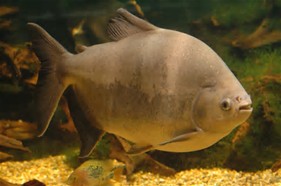
Mouth of a pacu fish with very human like teeth. Yikes! 🙂 These fish are reported to be in Lake O. Public photo.
Just the other day, one of my readers sent me a funny but educational video on Lake Okeechobee and the continued sightings of Pacu fish. Pacu Fish are related to Piranhas and both fish live in the Amazon River of South America. Both have TEETH.
Since my husband pulls out wisdom teeth and replaces teeth with implants, teeth are often a topic of discussion for us, even at the dinner table….when we first met, he told me my teeth were great, except my “lateral incisors were too prominent…..:) —-the vampire teeth! 🙂 I was not happy…:)
Me holding up a fried piranha Ed and I caught recently on a trip to Peru. (Photo Ed Lippisch 2015.)
Anyway. Today’s blog post is meant to be fun but serious.
Invasive species are forever changing South Florida. Between pythons in the Everglades, Lion Fish in the St Lucie River/Indian River Lagoon, Cuban Tree Frogs as well as Bufo Frogs in Sewall’s Point, and Pacu Fish with their “human like teeth” in the Lake Okeechobee—that of course is periodically dumped into our rivers—our world is changing. Native species are being replaced and overwhelmed.
In their 5th Biennial Review of Progress in the Everglades or lack thereof, the National Reasearch Council noted Invasive Species as a top concern for Everglades Restoration.
I read about all this and get upset at the invasive species problem…then it dawns on me that some may say “we, modern man, in South Florida, are an invasive species too.”
Food for thought anyway….
Thank you to Ricardo Zambrano and Kelly Gestring of the Florida Wildlife Commission for replying to my question about PACU and Lake Okeechobee as seen below:
Pacu fish in an aquarium. Related to a piranha that looks somewhat similar but has sharp teeth. People have released them into Lake O. Public photo.
Dear Commissioner Thurlow-Lippish,
To the best of my knowledge, this report of a singleton pacu being caught by a commercial fisherman in Lake Okeechobee is true. The reporter contacted several FWC people and I was asked to confirm the identity of the fish.
We receive numerous reports every year of singleton pacu being caught (primarily in HOA ponds) every year from locations around the state. However, there is no indication that pacu are reproducing in any of our waterbodies. This strongly suggests that the illegal releases of pacu are by owners who no longer want their pet.
Pacu are primarily herbivores and pose little threat to native species. Anglers should be careful removing the hook as pacu’s have very strong jaws and their molar-shaped teeth could inflict a lot of damage to a finger.
We encourage anglers that catch a pacu to remove them to reduce any potential impacts they may have on the environment.
Thank you for your concern and if you have additional questions, don’t hesitate to contact me.
Kelly Gestring
Non-Native Fish and Wildlife Program Florida Fish and Wildlife Conservation Commission 10216 Lee Road Boynton Beach, FL 33473 (561) 292-6007 office (561) 234-9925 cell kelly.gestring@myfwc.com
The Hobe Sound Depot with engine ca. early part of 1900s, photo courtesy of Stuart Heritage.
I was recently reminded of train depots while reading a front page “Stuart News” article showing an artist painting a mural of the old Hobe Sound Train Depot….All Aboard Florida being rammed down our throats has the Treasure Coast very unhappy about “trains…” yet our area has a history of trains that we may know a bit better if the rail service and the government hadn’t demolished most of the depots that once peppered the Indian River Lagoon Region from Volusia to Palm Beach counties.
As the daughter of a historian, I was fortunate to hear many stories during my youth that if nothing else “made me think.” One of these stories was about how lonely it was to be pioneer here in Stuart’s early days. My mother would say….
Stuart Train Depot, photo courtesy of Historical Society of Martin County, Elliott Museum via archives of Sandra Thurlow.
“Jacqui, for the people, for the women especially, this was a very lonely place.”
The daily train used to alleviate that loneliness and give the people a place to meet, gossip, and share. Kind of like today’s Facebook. As my mother Sandra Thurlow notes in her book, “Stuart on the St Lucie,” “Town life centered around the arrivals and departures of passenger trains that also brought the mail.”
Sound familiar? “YOU’VE GOT MAIL!”
Jensen Depot. Photo courtesy of Seth Bramson via Sandra Thurlow.Train depot in Hobe Sound, courtesy of Seth Bramson via archives of Sandra Thurlow.
From my reading it sounds as if most of the construction and the use of depots and lesser “flag stops,” (a flag was raised if they needed the conductor to stop?)….was between 1894 and 1935. The Hurricanes of 1926 and 1928 coupled with the real estate crash of 1926 was a big part of the railroads’ demise as was the fact that wholesale fishing industries waned from unwise over-fishing, and pineapples had to start competing with Cuba. So basically, in about one generation, the railroads depots and the railroad of Henry Flagler along the Lagoon had seen their “best days.”
In the 1960s and before, the aging, remaining, cute-little, aging stations were demolished by order of F.E.C. Railway officials. As my mother writes about the Stuart Depot: “The depot that was once the center of the community’s activities was demolished without fanfare during the 1960s.”
And so “it goes,” and “so it went”….. THERE GOES THE TRAIN!
The passenger train is gone, along with the depots….today we have too much car traffic, roads are everywhere, All Abroad Florida threats purport a bleak future, Florida’s population is expanding, Panama Canal freight is coming…
Well, at least we have Facebook or we can stay home and text…..
Hmmmmm?
What will the future bring? 🙂
Walton Flag Stop, with people happy to see each other and get the mail. Photo. Photo courtesy of Reginald Waters Rice and Sandra Thurlow’s book “Historic Jensen and Eden on Florida’s Indian River.”
Great link shared by Rick Langdon of Walton Flag Stop and what wonderful things came of it: (http://rickinbham.tripod.com/TownOfSIRD/SIRD_Homes_11090RidgeAve.html)
(In Martin and southern St Lucie counties, there were stations in Jensen, Stuart, Salerno, Hobe Sound, and “Flag Stops” in Walton, Eden.)
Salerno Depot, courtesy of Seth Bramson via Sandra Henderson Thurlow.Train route along Indian River/St Lucie. Map Sandra Thurlow’s book “Jensen and Eden…”Eden’s Flag Stop. (SHT)Inside cover of “Stuart on the St Lucie,” Sandra Henderson Thurlow. Photo shows train depot in downtown, Stuart.
Thank you to my mother, Sandra Henderson Thurlow, for sharing all the photos for this blog post.
The seawall at Sailfish Point’s Dunes Condominium is right next to the ocean. St Lucie Inlet lies beyond this point by about a quarter-mile. 7-26-15. (Photo Ed Lippisch)
Yesterday afternoon, Ed and I had hoped to walk our dogs, Bo and Baron, to the St Lucie Inlet, but were cut off by an incoming tide and a Sailfish Point’s seawall. Having grown up in Martin County, it is amazing to see such changes “right before my 50-year-old eyes…”
Of course when I was a kid there was no Sailfish Point development, no seawall, no apparent sea level rise, just the beach sun-flowered sand dunes and Bathtub Beach changing daily to the winds of time with the remnants of James Rand’s “Seminole Shores” development crumbling…
Today Sailfish Point is here. Its 625 homes are some of the most exclusive in the county. Built in the 1980’s it was developed by Mobile Oil Corporation. The area brings tremendous tax revenue to everyone and to every school in Martin County…if it washed into the sea there would be issues for all.
Sailfish Point: (http://www.sailfishpoint.com/martin-county/)
It must be noted that the St Lucie Inlet itself is responsible for some of this erosion…the inlet was opened permanently in 1892 by pioneers led by Captain Henry Sewall of Sewall’s Point. Naturally the inlet would open and close with tides and time. Opening the inlet permanently now defines our county, and we would not give it up; but as all things in life: there are both positives and negatives to every action.
Today the waters of the ocean are encroaching….and time seems to be speeding up.
Building on barrier islands is not particularly long-term in that barrier islands are meant by nature to turn over on themselves like a conveyor belt. On the other hand, I have been to the Breakers Hotel in Palm Beach and their seawall is right up to the historic hotel and has been for years….We stave off the ocean as long as we can. Much of Florida east coast is built on barrier islands…
What does the Bible say? “The wise man built his house upon a rock…”
Anyway….today I wanted to share Ed and my walk as it is symbolic of our times.
Google map showing Hutchinson Island showing St Lucie Inlet. Sailfish Point immediately north of inlet. East is Atlantic Ocean and west is the Indian River Lagoon and Sewall’s Point and St Lucie River.
Other than the surreal seawall and encroaching sea….there were many sea turtle nests, marked by the Fish and Wildlife Commission. Many turtles had laid their eggs right up against the seawall! Many of them! I counted at least 50 just in our short walk. Good for the turtles but it seems many nest are doomed to wash away… For thousands of years these turtles have returned to the beaches of their birth to lay eggs. Now many of them literally come up “against a wall.”
Turtle nest right up the seawall at Sailfish Point. 7-26-15.(Photo JTL)Turtle nest close to SP’s seawall. (JTL)Sea turtle nest. (JTL)
I must mention that the people of Sailfish Point are also “up against a wall,” as they have to worry about their homes falling into the sea….Here one sees a sea wall repair taking place. I don’t think the sea wall is that old in the first place.
Home at Sailfish Point undergoing seawall repair. 7-26-15. (Photo JTL)Ed looks inside sea wall being repaired. (Photo JTL)
The most intense erosion seems to be the north area of Sailfish Point, closest to Bathtub Beach….and it is summer. This should be the time the ocean, sands and tides are most forgiving. Winter waves are much more brutal, unless there is a hurricane of course….
The other interesting anomaly Ed, Bo, and Baron and I experienced was the hundreds of sea hare mollusks that had washed up on shore. Ed Killer of TC Palm just wrote a great piece on these interesting, harmless creatures that scientists believe are washing ashore due to cold water upswells and algae shifts in the ocean–their swimming affected, they slow down and are carried to shore by the waves fated to dry out in the sun.
As Ed and I walked back I picked up as many as I could and threw them back into the ocean knowing that really I was only “buying them some time.” Chances are they will wash right back up on the shore. In the end, nature always wins. In time, we like the sea hares, will find this out , but until then it’s a great walk on the beach, isn’t it?
One of hundreds of sea hare mollusks that had washed ashore near Sailfish Point 7-26-15. (Photo Ed Lippisch)
Ed stands with Bo and Baron in front of the seawall at Sailfish Point looking towards the sea….(Photo JTL)
Playing fetch with Bo and Baron, (Photo JTL)Jacqui and Ed, near Bathtub Beach, Stuart, Florida. 2015. We had fun even though the beach is not what it used to be….
THIS ADDITION CAME IN FROM MY BROTHER TODD: AMAZING!
Jacqui–
Interesting blog post!
In the meantime I thought I would respond to your post with a rough video of Sailfish Point while eating my lunch…..
(https://youtu.be/TW8URTQG2o0)
It is a movie of the following:
1. 1935 NOAA Chart – note the jetty already in place
2. 1940 Aerial
3. 1952 Aerial
4. 1968 Aerial – quick. I should have skipped it.
5. 1970 Aerial – note the old “Empire of the Ants” pier and the strange water slick to the south.
6. 1981 Aerial – showing the construction of Sailfish Point.
Look at these two screenshots of the beach just a few months apart late last year—-Todd Thurlow
Google image seawall is covered 8-12-14.Google image seawall is uncovered 12-2-14.
Stuart, Florida youths pose with a 14-foot sawfish hoisted on a dock around 1916. (Photo Jack E. McDonald courtesy Sandra Henderson Thurlow’s book “Stuart on the St Lucie.”)
I recently heard a great story from Doug Bournique who is executive vice-president of the Indian River Citrus League (http://ircitrus.wpengine.com). He told me he accidentally stepped on a sawfish! Doug is very vocal about “leaving a legacy” for the Indian River Lagoon. He advocates at government meetings for the reconnection of the waters of the North Fork of the St Lucie River and the St Johns River, as well as “water farming.” He grew up along our Treasure Coast and loves fishing, especially in the area of Sewall’s Point.
Doug was excited to see a sawfish and I was excited to hear about it. Seeing an endangered sawfish is a “good sign” for the river.
…..
I have written about sawfish before, and recently I came across the photo at the top of this post in my mother’s book “Stuart on the St Lucie.” This time, with Doug’s story in mind, I looked at the photo a little differently.
It is a curious photo, isn’t it?
The “boys” all dressed up in coats and ties, the younger one on the far right, hand on hip, gazing to the horizon like a Norman Rockwell painting….The gigantic, contoured, muscular, sawfish hanging from a hook like a piece of meat in a butcher shop….in 1916 a common nuisance perhaps. Today an endangered species…
The photo says a lot about people, about Florida’s history, about humankind, about culture, about sportsmanship, and also about how times and perceptions change…
All sawfishes are now critically endangered. Scientists say they don’t reach sexual maturity until maybe 12 or 14 years old. Their reproduction number increase is very slow like many sharks to which they are related. The are nocturnal. They are remarkable and ancient. They are awesome. They have been overfished.
What if we could find a way to use the sawfish to protect the Indian River Lagoon? What if we could use it as an “endangered species”? This may be difficult as they adapt and can live in both salty and fresh water…
“Single species management” is taking a beating lately as we know. The Cape Sea Side Sparrow, the Everglades Snail Kite, the Florida Panther….Many say when you manage an ecosystem, especially water, for a single species, it is at the expense of all the other animals in the eco-system. Of course the animal we are always most concerned about is really ourselves. It’s hard to give anything up when you at the top of the food chain….
But that is why being human is so different from being a dinosaur. We can think. We can reason. We can dream. If we want to, we can save the sawfish and the St Lucie River/Indian River Lagoon..let’s pick up our sword and win!
Confluence of SLR/IRL at Sewall’s Point. “The Crossroads.” 7-22-15. (Photo Ed Lippisch)
Of course when it rains the waters of the St Lucie River/Southern Indian River Lagoon get darker due to runoff into the river. But unless it keeps raining, the water will clear up. The government likes to call this water “storm water.” This is all of the water that flows into the river from people’s yards, roads, agriculture fields, etc….
Lately it seems to me, our recent storms, like yesterday, and a few days before have concentrated right along our coast. I am not certain, but I looked on the South Florida Water Management District’s website and it did not appear that C-23, C-24 and C-25 were open or if they were it was not a lot. To check C-44 you have to go to the ACOE website; it is definitely not open. So I think most of what we are seeing right now in our river is runoff from the lands closest to the coast not necessary connected to canals. You can see a basin map below.
Canals in Stuart, C-23, C-24, C-25 built in the 50s and 60s. C-44 connected to Lake Okeechobee constructed in the 1920s.
So anyway, the photo above with the murky-grey colored water was taken yesterday 7-22-15; it was an outgoing tide; and it was around 11AM. Thank you Ed!
Today, I will share some of Ed’s photos and then compare others from when there was some rain, and the ACOE was dumping into our river JUST FROM LAKE O, and others from very rainy times when dumping from Lake O and the area canals of C-23, C-24, C-25 and C-44 by ACOE/and SFWMD was “constant.”
THESE PHOTOS IMMEDIATELY BELOW FROM yesterday 7-22-15 in the area of Sewall’s Point. They show grayish-murky waters from storm water coastal runoff but green-blue shines through…
Confluence of SLR/IRL at Sewall’s Point. “The Crossroads.” 7-22-15. (Photo Ed Lippisch)Sailfish Flats looking towards Sewall’s Point. Hutchinson Island in foreground. 7-22-15. Photo Ed Lippisch.Runoff plume as seen over St Lucie Inlet 7-22-15. Jupiter Narrows on left and S. Hutchinson Island. (Photo Ed Lippisch)Reefs off Hutchinson Island. north of SL Inlet 7-22-15 St Lucie Inlet so appear clear. (Photo Ed Lippisch)
THIS PHOTO BELOW IS FROM July 14th, 2015, a week ago. It had not recently rained and my yard was bone dry. It was an incoming tide. Sewall’s Point and confluence of SLR/IRL appears very “blue.” It is beautiful although seagrasses and the benthic community are still “recovering.” Blue does not mean the river is “healthy,” but BLUE IS GOOD.
Sewall’s Point looking north SLR/IRL from the air 7-14-15. (Photo Ed Lippisch)
THIS PHOTO BELOW IS DATED May 18th 2015. This is the tip of South Sewall’s Point looking towards the St Lucie Inlet and Jupiter Narrows. Sailfish Point is under the wing. It was not raining much at this time in March of 2015, but the ACOE/SFWMD was dumping from Lake Okeechobee because the lake was “too high.” The river looked brown and gross.
Flying north at convergence of SLR/IRL at St Lucie Inlet. (Photo Jacqui Thurlow-Lippisch, 3-18-15.)
Ironically, now we appear to be on the verge of a serious “water shortage”….too bad there isn’t a place to store this water somewhere north and/or south of Lake O….that the ACOE and AFWMD dump during the dry season trying to get the lake down in case there is a hurricane….The agriculture community could use that water now as could the Everglades, Miami/Dade, wildlife etc…..the C-44 STA/Reservoir is wonderful and we are thankful but it is only for C-44 BASIN RUNOFF not Lake O.
THIS PHOTO BELOW IS SEWALL’S POINT’s west side, IRL, looking north with the confluence of the SLR/IRL in foreground. This was September of 2013 during some of the highest releases from Lake O and C-23, C-24, C-25 and C-44. This is when the river was toxic and there were signs not to touch the water. It is very dark brown. Too dark.
Looking north toward Sewall’s Point on east/left. The Sailfish Flats are to the right/east as is Sailfish Point. (September 2013.)
THIS DISGUSTING SHOT BELOW is of the St Lucie Inlet with Sailfish Point foreground. This photo was also taken in September 2013 during very high discharges from Lake O especially and the C-23, C-24, C-25 and C-44. Yes. It was raining! And certainly coastal storm-water runoff not going into canals as seen in the photo at the beginning of this blog was also included. It was all horrible, but the biggest single overdose during this time was from Lake O.
September 2013, St Lucie Inlet JTL.
At this time our river was almost black in color and had a strange consistency due to all of the sediment and pollution in the water. During this year of 2013 our river lost about 85 percent of its seagrasses and ALL of its oysters. The releases lasted from May through October. Salinity was way down and 0 in some places. Algae blooms, toxic in nature, were documented from Palm City to Stuart to Sewall’s Point. The Sandbar at the mouth of the inlet was posted as a health hazard area by Martin County. Real estate sales were lost and animals were absent; it was a true state of emergency as filed with the state by many local governments.
We live in a state of unbalance.
South Florida is a swinging pendulum of too much water and not enough water. It makes no sense. We waste water, yet we encourage more people to come to South Florida when do often don’t have enough as it is because we are dumping it all…
We want things to be like they were in 1970 and 80….
We want to be the sugar and vegetable basket for the world, and have everyone move here… Well no matter how much sugar we produce, or how many houses we build, “we can’t have our cake and eat it too.”
We need more storage south and north of Lake Okeechobee. If we can engineer to send a camera to photograph Pluto 2.7 billion miles away, can’t we fix things here at home?
Well, unless we can figure out how to live on Pluto, we are going to have to—
Pluto 2015 as photographed by NEW HORIZONS spacecraft.
Everglades Snail Kite, Audubon web site. Photo by R. J. Wiley.
To me there are few birds as striking as the Everglades snail kite, especially the hooked-beaked, wicked-talloned, dark/red-orange colored male. They are raptors in the family of eagles, hawks and vultures. Skilled beyond belief they have specialized their hunting ritual to include one thing, the apple snail. They fly with what is described as the slow, head-down, gargoyle-like flight of a blue heron, but eyes lowered with radar vision positioned to see and seize their tiny prey. Beautiful, remarkable, a machine of God’s creation and nature’s adaptation. An inspiration to all.
You may have heard that recently at the South Florida Water Management District the Snail Kite was discussed in light of pumping water from Lake Okeechobee. I do not know all the details of the meeting, but I would imagine it had something to do with the Endangered Species Act, the birds are endangered, and that the snail kite’s habitat. Their habit is around Lake Okeechobee, so if too much water were pumped out of the lake, more than likely their habitat and health would be affected. They are protected by federal law.
Another species also affected by the level of Lake Okeechobee is humans. We are not endangered. Homo Sapiens flourish in Florida. Especially those who are farming south of the Lake in the Everglades Agricultural Area, (EAA), 700,000 acres of sugar cane, vegetables, and citrus that is also reliant on the waters of the lake (to water their crops free of charge….) This area totally blocks the once free-flowing waters of Lake Okeechobee. Those waters were diverted to the estuaries such as the St Lucie River/Indian River Lagoon and Caloosahatchee.
Do I sound like I have a chip on my shoulder? I do.
Also— I believe the aquifers under and surrounding the Water Conservation Areas south/outside of the EAA are connected to the people of Miami-Dade and their water supply.
This is huge….
Presently it is not raining that much and the lake is close to being near “water shortage,” for the Homo Sapiens as defined by the SFWMD.
I feel for everyone “hemmed in by this situation,” I really do but I also feel for the birds, for the lake, and for all of us who endure the wrath of a system that is totally altered and totally out of balance. A system we have created and can work harder to improve.
Perhaps situations like these will push us to develop more water storage south, north, and around the lake? To buy more land? To support Amendment 1? To exercise the option…or something like it?
Because we all know, with out the needed water levels, we too, like the snail kite are “dead.”
As all fertilizer companies, Scotts has traditionally developed many products heavy in phosphorus and nitrogen, they are now producing products with no nitrogen and phosphorus. Amazing. (Public photo)
It is a good thing when one sees the market adapting to an educated public rather than fighting it. For me, this is especially rewarding when it comes to adapting to a public educated on fertilizer use, and how it negatively affects the health of our St Lucie River/Indian River Lagoon.
In 2010 the Town of Sewall’s Point passed the first “strong fertilizer ordinance” with a black out period on Florida’s east coast. A blackout period is a period when no fertilizer using phosphorus or nitrogen is allowed during a designated time frame that corresponds with South Florida’s rainy season. Due to fertilizers role in the destruction of waterways and increased harmful algae blooms, this idea first took shape on Florida’s west coast in 2007.
Although local governments can affect residential fertilizer, farmers are dealt with separately through the Dept. of Agriculture. So anyway—–
After Sewall’s Point, Martin County a much bigger player, soon followed with a black out period and the domino effect ensued. River advocates worked tirelessly, and within about one year St Lucie, Indian River, parts of Brevard and Volusia counties, also along the lagoon, had jumped on board. The public showed they were willing to put “skin in the game” to achieve clean water. Many are rethinking “green lawns” in general…and becoming ever MORE EDUCATED.
Recently, Dianne Hughes, who works for Martin County, sent out an email announcing that Scotts Fertilizer would be launching a new “Florida-Friendly Lawn Supplement in Key Test Markets.” I would image this will include “us.” Dianne has worked very hard on promoting the BE FLORIDAN, a program thats model includes fertilizer education and a summer black out period. (http://befloridian.org)
A photo from DEP showing a yard along the North Fork of the SLR. In instances like this it is easy to see the negative effects of fertilizers on area waterways.
Dianne’s email read:
Scotts® Launches New Florida-Friendly Lawn Supplement in Key Test Markets
Scotts® Smarter Solutions for Cleaner Waterways Initiative Brings New Lawn Response™ Nitrogen and Phosphorus Free Product to Florida
West Palm Beach, FL (July 15, 2015) – As part of it’s Smarter Solutions for Cleaner Waterways initiative, ScottsMiracle-Gro, announced the launch of Scotts ®Lawn Response™, a nitrogen and phosphorus free lawn nutrient supplement that will help residents in communities with local fertilizer restrictions support the health of their landscapes. This new product is the latest addition to the Scotts® portfolio in Florida and is a lawn nutrient supplement that replenishes essential micro-nutrients for improved plant health. Produced in Florida and specifically for Florida lawns and gardens, Lawn Response™ is currently available in select areas of the state.
Designed to use on any grass type, outdoor plants and trees, Lawn Response™ is nitrogen and phosphorus free and is compliant for use throughout the year, even during the summer for communities that have localized fertilizer restrictions in place.
Kudos to Scotts for these changes. Kudos to Scotts for listening and adapting to the public. Kudos to Scotts for realizing you can still find a market and make money and protect the environment. I won’t tell them though that I have not put any fertilizer on my almost grassless yard for over six years and it’s still green. 🙂
FULL PRESS RELEASE:
For Immediate Release
Contact: Molly Jennings; (561) 681-7683
molly.jennings@scotts.com
Scotts® Launches New Florida-Friendly Lawn Supplement in Key Test Markets
Scotts® Smarter Solutions for Cleaner Waterways Initiative Brings New Lawn Response™ Nitrogen and Phosphorus Free Product to Florida
West Palm Beach, FL (July 15, 2015) – As part of it’s Smarter Solutions for Cleaner Waterways initiative, ScottsMiracle-Gro, announced the launch of Scotts ®Lawn Response™, a nitrogen and phosphorus free lawn nutrient supplement that will help residents in communities with local fertilizer restrictions support the health of their landscapes. This new product is the latest addition to the Scotts® portfolio in Florida and is a lawn nutrient supplement that replenishes essential micro-nutrients for improved plant health. Produced in Florida and specifically for Florida lawns and gardens, Lawn Response™ is currently available in select areas of the state.
Designed to use on any grass type, outdoor plants and trees, Lawn Response™ is nitrogen and phosphorus free and is compliant for use throughout the year, even during the summer for communities that have localized fertilizer restrictions in place.
“Last year we publicly committed to help create solutions for Florida’s one-of- a kind environment and the launch of Lawn Response ™ is part of that commitment. Several Florida communities concerned with excess nitrogen and phosphorus in local waterways have restricted the use of lawn fertilizers during the summer season. We recognize that nitrogen is an essential building block for all plant life and while there is no substitute, Lawn Response ™ gives residents a new lawn care option that will help to keep plants healthy, hearty and drought resistant“,” said Mark Slavens, ScottsMiracle-Gro Vice President of Environmental Affairs.
ScottsMiracle-Gro along with leading academic institutions have long agreed that by naturally filtering and storing water before it reaches stormwater treatment centers and local waterbodies, a healthy lawn promotes cleaner waterways. Lawn Response™ features a micro-nutrient packet that includes Iron, Potassium, Magnesium and Calcium, which can enhance greening and increases water efficiency.
Last year, ScottsMiracle-Gro’s “Smarter Solutions for Cleaner Waterways” initiative included a three-year, $5 million commitment to in-state water quality research, habitat restoration, consumer education and green infrastructure improvements. The company is supporting local independent research to determine the sources of pollution in the Indian River Lagoon; results from which will help create solutions to improve the lagoon’s water and wildlife, and create a model that can be replicated for other sensitive waterways. Through its partnerships with additional local partners, Scotts is helping to restore more than 20 acres of salt marsh plants will be restored in Tampa Bay, and supporting research on the Bay’s long-term environmental resiliency. Grants to community gardens, farms and greenspaces throughout Florida have protected more than 47,600 square feet of land. The addition of Lawn Response™ nutrient supplement is an extension of that initiative and demonstrates ScottMiracle-Gro’s continued commitment to Florida’s waterways.
The development of Scotts® Lawn Response™ is consistent with the company’s long history of innovation. Over the past several years, ScottsMiracle-Gro has developed products designed to preserve and protect the local water bodies by removing phosphorus from their Turf Builder® lawn maintenance products, and reducing the amount of total nitrogen while also increasing the amount of slow-release nitrogen in fertilizers. Additionally, the company has developed a SNAP® lawn care system that eliminates product pouring and possible spills and continues to make advances in product applicators, like EdgeGuard®, that help consumers apply the product correctly and on-target.
For more on the product launch and additional information on the Florida Smarter Solutions for Cleaner Waterways initiative, visit http://www.scotts.com/Florida.
About ScottsMiracle-Gro
With more than $2.8 billion in worldwide sales, The Scotts Miracle-Gro Company is the world’s largest marketer of branded consumer products for lawn and garden care. The Company’s brands are the most recognized in the industry. In the U.S., the Company’s Scotts®, Miracle-Gro® and Ortho® brands are market-leading in their categories, as is the consumer Roundup® brand, which is marketed in North America and most of Europe exclusively by Scotts and owned by Monsanto. In the U.S., we operate Scotts LawnService®, the second largest residential lawn care service business. In Europe, the Company’s brands include Weedol®, Pathclear®, Evergreen®, Levington®, Miracle-Gro®, KB®, Fertiligène® and Substral®. In 2015, the Company ranked in Forbes 100 Most Reputable Companies in America. For additional information, visit us at http://www.scottsmiraclegro.com.
###
Molly Jennings ·
This email was sent to DHughes@martin.fl.us.
River Kidz founders Evie Flaugh and Naia Mader, 2011.River Kidz 2015.(Photo Nic Mader.)
“Time flies”… “Time waits for no one”… “Time is of the essence”….
There are hundreds of sayings about time, and none of them can truly encompass its passage and what it feels like to know it is slipping away….
Having no children of my own, I am dependent on the children of others to really see time “fly.” As time seems to fly fastest when it comes to children turning into adults–right before our eyes, while we of course feel “exactly the same…”
I deeply believe that all kids are River Kidz!
The two closest to me are my niece Evie Flaugh, and Naia Mader, two Town of Sewall’s Point girls that founded River Kidz in 2011 when I was mayor. Sometimes they come and visit me. These are some of my favorite days. When they visit, I am struck by how they are changing. They are growing up. They are becoming women.
“10ish” years old when their endeavor started, I think they are now both “15.” Three months apart. Evie is a bit older but they are in different grades. I can’t keep up actually. But I do know they were both once well below my shoulder and they now stand almost a full foot taller than me. I noticed recently, when I sat on the bench with them for a picture, that my feet hardly reached the ground. Their knees were bent…
I look at them in awe.
“Was I that young once?
I was, and boy did want to be older…. This I remember.
Things are going to start changing even more quickly.
They will be driving soon….Gulp….
And where have “we” all driven the river since 2011? The St Lucie River/Indian River Lagoon is in really in the about same predicament it was in 2011. In some areas worse. A lot has happened, and good has been achieved, however, the biggest killer, discharges from canals C-23, C-24, C-25, C-44 and Lake Okeechobee will continue to slowly kill the river with no end in sight, because our state in is denial of the depth and timing of our pollution and water crisis. They think we have 30 years…Oh let’s make that 50 years….no 100….
However awareness is high. As Amendment 1 and our local River Movement has shown, the public is pushing for change; and not giving up. WE ARE MAKING PROGRESS even though it seems sometimes it may take forever, or that we will return to our maker not having achieved the goal.
I am certain that one day there will be substantive positive change for the Indian River and all of Florida’s precious waters. There must be in order for the state to survive. To feed this change and the human will for survival which requires clean water, we must continue to put “gas in the car,” or better yet, use solar energy—- we have to keep making “River Kidz out of kids.” We have to keep driving.
One day soon, these kids will take the wheel of life. I am confident they will drive with more care than previous generations did; they will do all they can to navigate the crash we will be leaving them.
The River Kidz, Naia and Evie, they inspire me. But my heart aches for them. For them we must work harder to change the tide of legislative and agency complacency. We must make more people realize that we do not have 30 years. We have now.
Pink River Dolphin, Amazon River of South America. They can be large, up to 8 feet. Shared Pinterest photo, Nic Bou 2013.
Today I feature an incredible and mystical creature that I just recently saw, the Pink River Dolphin of the Amazon River. This mammal does not live in our rivers, but their relations, our resident Indian River Lagoon bottle-nosed dolphins do. I think the story of the pink river dolphins is a good one to share and may make us look at our IRL bottle-nosed dolphins a bit differently.
Except for a few people, here in the U.S., we “all love dolphins.” The TV show “Flipper” indoctrinated many of us. In fact until the late 1980s we liked dolphins so much we were still capturing them from the wild to put into theme parks…. thankfully, this practice was finally stopped after the implementation of the Marine Mammal Protection Act. Here dolphins are “protected.”
I have alway loved dolphins, but over recent years people like Nic Mader of Dolphin Ecology Project, and Nancy Beaver of Sunshine Wildlife Tours, have helped me to appreciate these very smart and adaptable mammals even more. Many scientists believe they are as intelligent or more intelligent than humans. They live in extended families and are territorial like people.
So when I was in South America just recently with my husband Ed, who was born in Argentina, I was stuck by the story of the Pink River Dolphin of Peru and wanted to share it with you today.
Here we go….
The life of the people in the Amazon River Basin is one that I would say none of us can comprehend as these people living along the river are totally self-sustainable. Their value is judged not by how much they “have” in material wealth, but in their ability to provide for their very close-knit families, and their ability TO ADAPT. The powerful and plentiful Amazon River can vary in water level by up to 45 feet! This means that when the river decides to change course, it can quickly erode away chunks of land and forest that are the entire size of the Town of Sewall’s Point. Gone….History….See ya!
–Giant Kapok trees and towering palms that stood only yesterday are suddenly floating down the river with your village or your lone school-house. Such is life and so it has been for thousands of years.
When this happens the people just “move back” into the jungle and adapt. They see it coming. Incredible. The river keeps you alive and it can kill you. The river gives; the river takes away.
From what I heard about 95 percent of the people’s diets, in the area we visited, are fish. They are a fishing society. But they do eat “bushmeat” from the jungle, and other things like birds, caiman, manatee, and monkeys. “Easy to judge,” and at first it was hard for me as an animal lover to “accept this,” but then—-I get my food from Publix.
Ed and I decided we would be dead in two weeks if we had to try to live off the land like these villagers. There is no way. We are not trained to do it. We are soft.
So the people eat what they need to survive but mostly fish.
Nonetheless, according to what Ed and I were told by the locals, there is one animal they do not eat. The Pink River Dolphin.
As a local tour guide explained: “Why don’t the people eat them? They don’t eat them because superstition is stronger than the law.”
According to what we were told, the people of the Amazon River in this area of Peru believe that the Pink River Dolphin is part human, or was so years ago ….they believe or have grown up hearing stories that there are cities under the muddy waters of the river that have developed from a people who once lived along the shoreline, like them, but who decided to move into the water….they also believe if you kill a pink river dolphin you will have very bad luck, and you will not be able to find the fish that sustain your family….the dolphin which are swimming around just about everywhere, show you where the fish are. They help you.
There was one legend, in fact, where a fisherman harpooned a pink river dolphin because it got caught in his net or “stole” one of his fish. When the fisherman was magically transported to a judgement hall under the water and he saw that the dolphin he had stabbed was actually human! He was mortified. The dolphin tribunal told the fisherman he could redeem himself if he returned to the surface and told all villagers the story of the underwater dolphin city and taught the people NOT to hurt the dolphins, but to honor them.
Stories such as these told through generations have protected this species.
The guide asked me if I thought the story could be true? First I laughed, and then after a while I started to wonder. This magical species who is related to our Indian River Lagoon bottle-nosed dolphins certainly is very special. They do seem kind of human-like….
Hmmmm?
Lima is Peru’s capitol city. In Lima’s airport, there is a giant mural on the wall. I was taken by the images and thought about the story of the pink river dolphin as I got ready to fly back home. Ed was yelling at me not to be late as I snapped away thinking about this incredible story of the pink river dolphin.
I have included some of the photos below.
—-Myths….stories….how we see the world….
Even though the human-dolphin story is “just a story” from the Amazon, I don’t think I will ever look at our bottle-nosed dolphins quite the same. 🙂
Mural Lima airport, 2015.The dolphin people.Mural Lima airport, 2015. a mermaid or a dolphin girl?Half dolphin half boy. Mural Lima 2015.Half baby half dolphin. Mural Lima, 2015.Mural Lima airport, 2015.Purple looking pink river dolphin, up close. Mural Lima, Peru, 2015.
Is the SFWMD losing power if every year it feels it must levy less money to make Tallahassee happy, not to mention the District’s ability to determine how to use that money?..And doesn’t this mean that on a local level we are losing power too? (Picfont image, 2015)A beautiful Sewall’s Point SLR/IRL from the air 7-14-15. No dumping from Lake O or area canals show what the area is meant to be. Under the water much recovery is still needed. (Photo Ed Lippisch)
Well it’s great to be home! When it is beautiful here along the St Lucie River/Indian River Lagoon there truly is “no place like home.” It’s hard to put a price tag on this…
How much are beautiful water, high property values, a healthy environment, recreational opportunities, and a plethora of fish and wildlife worth anyway? For me, it is “priceless,” and therefore it is worth spending money on.
Today in the “Stuart News,” Tyler Treadway wrote an article entitled “Water District Lowers Tax.” Lowering taxes always sound good but as with everything in life, “there is a price.”
According to the South Florida Water Managements District’s ( SFWMD) website: “The annual budget funds the agency’s core flood control and water supply missions as well as its continued progress to restore and protect the South Florida ecosystem.”
Just out of curiosity I did some research. Of course millage rates and property values determine taxable value, and years must be compared “in context”–but nevertheless it is interesting to compare and contemplate:
Here are the budget number from the SFWMD since 2007:
2007: 1.439 billion
2008: 1.283 billion
2009-2010: (did not find separately) 1.5 billion
2011: 1.07 billion
2012: 576.1 million
2013: 567.3 million
2014: 622 million
2015: 720 million
2016: 719,300 million (This number is based on Mr Treadway saying the value, if approved, would be 700,000 less than the previous year-so this is just a very soft estimate.)
Yes, building up to 2007 we were in a “bubble.” We can see that after the Financial Crisis (2008) and Gov. Scott coming to power shortly thereafter, the budget numbers drop drastically around 2012.
We can also see that the numbers have gone up the last couple of years but this is because thankfully our property values have increased. In fact as Tyler Treadway notes the millage rate has gone down over the past four years. This means final budget number is “less that it could be if the millage rate were left the same instead of going to its “roll-back rate.” A rate that allows a taxing agency to generate the same amount it did the previous year. Confusing. Basically the budget number could be higher if they just leave the millage number the same.
Governor Scott has certainly kept his word about cutting taxes. This is impressive. But have the Governor and the Legislature gone too far? I think so.
Why?
The first reason is because I believe a lot of “this change” was based on an emotional reaction…
Basically, the 2008 Governor Charlie Christ plan to buy out US Sugar’s land “pissed” a lot of people in Tallahassee off. Excuse my language, but it did. Because it was such a tremendous land purchase and was out of the hands of the legislature— because the governor at the time was kind of on a “white horse” and up for election to the US Senate some people got really mad….For me if it had happened it would have been a dream come true, for others “it did not happen” and it was a nightmare. An emotional reaction on both accounts to what was really a historical anomaly. Understandably so, the 2008 Financial Crisis was also part of this emotional quagmire…
So after Gov. Scott got into office, he and others felt strongly about insuring this kind of land-buy would “never happen again….” So they revamped things in Tallahassee, cut the budgets of the water management districts to the bone, and folded it law into law that the water districts had to have their budgets approved by the legislature. This really changed things for the district and for the governing board members too….Now they have to be more submissive to Tallahassee. Yuk.
Some would say answering to the legislature is very good. Being careful with money is always “good,” and I agree, but to hang water districts on the pendulum of politics is an ineffective model for success.
Let’s look at history.
–On March 9, 1976 a voter-approved, Florida constitutional amendment authorized water management districts to levy ad valorem taxes up to 1 mill. Today we don’t even blink an eye at this. Years ago it was a feat of Florida history in favor of the environment and water planning.
Think about it.
If you have the power to levy your own millage as a special assessment district, kind of like a city, shouldn’t you be given the authority to determine how to manage and what to do with that money? What if the Town of Sewall’s Point had to run its budget by the state legislature? That would be fun. “Please! Please! Let us have that street light!”
I know I am going far out there, but still.
Why allow the water districts to levy their own millage rates if they are simply an arm of Tallahassee? Every district has its own local problems and this is why there are five separate water districts….perhaps the next “secret” step is to formally put the water districts all under one hat? Like the Department of Environmental Protection also known as “Don’t Expect Protection….”
Looking at our state’s history and the intensions of those who have gone before us, the water districts were meant to “change our world”. To save Florida. Thank you to all those working for the District and may the future give you the freedom to create your own destiny-our destiny. Shouldn’t you represent us and not Tallahassee anyway? Isn’t it our taxes that are being levied? Shouldn’t we have a loud voice? Shouldn’t you not be afraid to listen?
I think so.
These wonderful timelines of history are wonderful perspectives on how far we have come and why we should keep going!
Sometimes you just need to take a break! I will be “blog-breaking” to spend time with my husband; I will return 7-15-15.
In review, before I stop blogging, thus far 2015 has not been a particularly rewarding year for river advocates— mostly because of the state legislature’s tumultuous session, their interpretation of Amendment 1, and their refusal to consider the purchase of the US Sugar’s option lands in the Everglades Agricultural Area.
To top it off, the ACOE began releasing from Lake Okeechobee into the St Lucie River very early this year, starting January 16th and continuing until just recently–the end of May. There may be more coming this rainy season….
The ACOE and the SFWMD decided to “dump” because the lake was “too high” to be safe for the Herbert Hoover’s Dike and its surrounding farms and communities. This is “understandable,” but at great expense to our SLR/IRL economy and ecosystem.
Ironically, ample water supply is now a concern for “users,” such as agriculture, with Lake Okeechobee down to 12.20 feet and rapidly evaporating….((http://w3.saj.usace.army.mil/h2o/currentLL.shtml))You may have heard that Miami is already in a drought…on top of this, the Caloosahatchee needs some lake water right now to keep its salinities from going too high but they are not getting it…
It always seems more likely that South Florida will have a hurricane, and that Lake O could fill up quickly with 3-4 feet in one week, too much to dump fast, so the agencies prefer the lake lower during summer’s rainy season… There is that chance though—that it won’t rain, and dry conditions will parch our state as occurred in 2006/2007.
Wouldn’t that be something? After all that water being released? South Florida going into a drought? The farm fields dying? The ecosystem and its animals in danger? And people not having enough water?
It may seem an odd thought, but it is one that is not the “stuff of science fiction”— that one day, in the future, after an extended drought or a climatic shift, people could be fighting over the billions of gallons of fresh water that is wasted to the Atlantic Ocean through the C-44 basin, the St Lucie River, and Caloosahatchee during storm events…
We need to prepare for this. We must not give up our advocacy. We must keep more of this precious water on the land and going south for the Everglades.
On a positive-personal note regarding the year thus far….
You may have noticed—-
I am enjoying collaborating with my family. To have my mother’s history and most recently my brother’s “flying time capsule maps” to share is very rewarding. I have linked some of Todd time capsule flights below. They have been very popular!
My brother Todd and I on Ronnie Nelson’s dock, Martin County, FL, IRL, ca 1974. (Thurlow Family Album)
Todd is six years younger than me as you can see from the photo above. My sister, Jenny, is four years younger. Growing up, Todd and Jenny were more together, and I was kind of “old.” I was out of Martin County High School where as they attended during the same time. Now, the years seems fewer in between…. 🙂
In closing, thank you very much for reading my blog; I wish you a good couple of weeks enjoying the Indian River Region, and I’ll see you soon!
Above: Google Earth/Historic Maps Overlay Flights shared on my blog, created by my brother Todd Thurlow, (http://thurlowpa.com) These flights using Topo and other historic maps combined with today’s Google Earth images flashing between “yesterday and today” give tremendous insight into the water and land changes due to drainage for agriculture and development that have occurred in our region. JTL
In the opening chapter of Nathaniel Osborn’s soon to be published thesis, “Oranges and Inlets: An Environmental History of Florida’s Indian River Lagoon,” he quotes Herman Herold in 1884: “It is a wonderful river…immensely deep and very fine sweet water; the beauties of nature are here very manifest , in fact it is a wonderland…”
Eighth birthday party at Sandsprit Park, with L to R Brenda Bobinski, Amy Harmon, Barbie Bobinski, Linda Nelson and Dale “Chip” Hudson. (Photo Sandra Thurlow 1972)
In 1964, Stuart News editor, and iconic award-winning environmentalist, Ernest Lyons, wrote something similar, in his piece “Life is a Changing River.”
“And what a marvelous river it was, with the pelicans diving into the mullet schools, bald eagles screaming as they robbed ospreys of their prey, a river teeming with interesting things to see and do, and such good things to eat…Pompano jumped into the boats. Tasty oysters were abundant–‘squirt clams put hair on your chest.’ How sad it is to see it change. But life, too, is a changing river. I suppose the river today is just as wonderful to those who are as young as I was in 1914.”
Lyons was born in 1905.
I was born in 1964.
The river, as life, is always changing and even though we are fighting for the river’s life and it is not well, it still provides wonder to all.
After graduating from University of Florida in 1986, I wanted to get as far away from “boring” Stuart as I could so I lived and worked in California, Germany, and Pensacola. Nonetheless, I always considered the Indian River Lagoon Region “home,” and after growing-up and realizing Stuart was actually paradise, it was “to its shores” in 1997 that I returned. But it was not the same. Stuart had grown up too. Things change.
Today is my birthday. I am fifty-one!
It is interesting to be 51, only because when I was a kid, I thought someone who was 50 was “really old…” I had no idea that although “weathered,” and “dried-out, “by the storms and rainbows of life, being old is really quite fun and can actually be an advantage.
First of all, no one is telling you what to do, as much as when you were a kid; and second of all, for me anyway, there is a much deeper appreciation of this life. This gift. This wonderland…
First Fish, a blowfish, Jacqui, IRL. (Photo Sandra Thurlow, ca .1968)
A quick run though of my early memories of the St Lucie River/Indian River Lagoon and why its memories are powerful for me, would include:
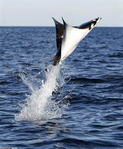
….every day at sunset, climbing the gigantic tree in my parent’s yard so I could see the river and the ocean and the sky; sneaking on my bike to the “black-road, “Riverside Drive,” in Stuart, so we kids could play in a fallen Australian Pine, pretending it was a ship and we were pirates; fishing under the bridges and then later making a pact with God that I would never do so again after the blow fish grunted so much I thought it was talking; after school, visiting the shoreline of the river, never thinking of who owned the property because it was all wild, to find hermit crabs and horseshoe crabs and any number of small and amazing creatures; seining with my classmates at the Environmental Studies Center; long summer days with my best friends in high school, learning to slalom; spending the night on the spoil islands and talking until sunrise under a gigantic shining moon; traveling from the river through the inlet into the dark blue ocean while accompanying my father fishing for sailfish, straddling front bars of the boat, to see an enormous manta-ray jump so close that I could see its eye….
Jumping manta ray public photo
Today my Indian River Lagoon adventures are less so, but still remain wondrous. This past weekend Ed and I went out in the boat at sunset with my brothers’ family and my nieces. We took silhouette photos against the sky…One day my nieces will be old too.
For the young, for the old, for the future…
“What a marvelous river it is…..”
Sunset photo over the St Lucie River 6-27-15. (Photo Ed Lippisch)
In case you are interested to view, I realized my previous post sent out small versions of the 1885 wood cut map of the St Lucie River. These images below are larger if you wish to click to view. Have a good weekend.—Jacqui
Rare wood cut map of St Lucie River, ca. 1885, by Homer Hine Stuart. Image shows water depth in heart of St Lucie River near today’s Roosevelt Bridge at 20 feet. (Courtesy of historian, Sandra Henderson Thurlow)Homer Hine Stuart Jr., for whom Stuart, Florida is named. (Portrait courtesy of historian, Sandra Henderson Thurlow.)
Homer Hine Stuart, Jr. for whom Stuart is named, had a little wood cut map that was about 4 by 2 1/2 inches and looked like one of those address stamps we use today made. Maps made from the wood cut were used to show his the location of his property and his bungalow “Gator’s Nest” to his family in New York and Michigan. This image was made from a photograph of the wood cut. It is printed is reverse so the writing, etc., isn’t backward. You can see that there was 20 feet of water depth between the peninsulas that would later be connected by bridges. The date of the map would be around 1885.” –Sandra Henderson Thurlow
Rare wood cut map of St Lucie River, ca. 1885, by Homer Hine Stuart. Image shows water depth in heart of St Lucie River near today’s Roosevelt Bridge at 20 feet. (Courtesy of historian, Sandra Henderson Thurlow)Homer Hine Stuart Jr., for whom Stuart, Florida is named. (Portrait courtesy of historian, Sandra Henderson Thurlow.)
Some days I get really lucky because people send me cool stuff based on what I wrote the previous day in my blog. Yesterday this happened with both my mother, Sandra Thurlow, Dr Gary Gorfoth and a slew of other comments . I will be sharing some of my mother and Dr Goforth’s insights today.
After reading my post on sediment loads in the St Lucie River/Indian River Lagoon and how they have lessened the natural depths of the river/s, my historian mother, sent me the awesome image of a historic wood cut at the top of this post created around 1885 by Homer Hine Stuart Jr., for whom Stuart, Florida is named.
This historic wood cut shows the depth of the St Lucie River at 20 feet in the area of what would become the span for the Roosevelt Bridge. A contemporary navigation chart below, shows the depth of the water in this area at 11 feet. At least 9 feet of sediment and or —MUCK!
Contemporary St John’s waterway navigation map, public files, shows the depth of the St Lucie River at the Roosevelt Bridge at 11 feet.
“Jacqui, Your post about sediments made me think of this little map. Homer Hine Stuart, Jr. for whom Stuart is named, had a little wood cut map that was about 4 by 2 1/2 inches and looked like one of those address stamps we use today made. Maps made from the wood cut were used to show his the location of his property and his bungalow “Gator’s Nest” to his family in New York and Michigan. This image was made from a photograph of the wood cut. It is printed is reverse so the writing, etc., isn’t backward. You can see that there was 20 feet of water depth between the peninsulas that would later be connected by bridges. The date of the map would be around 1885.” –Mom
Dr Goforth also wrote. He tells a sad story mentioning that Stuart News editor and famed environmentalist Ernie Lyons wrote prolifically about the great fishing in the St Lucie prior to the construction of the St Lucie Canal (C-44) in 1923.
“… the St. Lucie River and Estuary was known as the “Giant Tarpon Kingdom” before the Lake Okeechobee discharges began in 1923; after the Lake Okeechobee discharges began the muck from the Lake despoiled the clear waters and drove the tarpon offshore, and the area was recast as the “Sailfish Capital of the World” (Lyons 1975: The Last Cracker Barrel).
Thankfully, Dr Goforth gives an idea to fix and or improve the accumulation of muck sediments into the St Lucie River:
One effective means of reducing the sediment/much discharges from the Lake would be the construction of a sediment trap just upstream of the St. Lucie Locks and Spillway. This simple approach has worked well in other areas, most recently in West Palm Beach on the C-51 Canal just upstream of the Lake Worth Lagoon (see attached fact sheet). By deepening and widening the C-44 canal just upstream of the locks/spillway, a large portion of the sediment would settle out of the water in a relatively contained area before entering the River; with routine dredging, the material can be removed and spread over adjacent lands… —(perhaps using lands along the canal purchased by Martin County and SFWMD?). —-Dr Gary Goforth
Muck Removal using sediment trap, Lake Worth Lagoon, C-51, shared by Dr Gary Goforth.
Kudos to Dr Goforth’s ideas. Kudos to my mother’s history! Let’s get Governor Rick Scott towork and get to work ourselves too! We can do it. Together, we can do anything. 🙂
___________________________
MUCK THEMED PHOTOS:
Muck coats the bottom of our beautiful river but determination coats our hearts. We and future generations will continue to fight to save our St Lucie River/Indian River Lagoon!
Muck from St Lucie River, covering oysters, 2014.Jim Moir teaches Hannah Lucas about muck at the River Kidz GET THE MUCK OUT event, March 2014.Muck Buster, River Kidz 2014.My close up photo of front page Stuart News article where Kevin Powers of the SFWMD shows Gov. Rick Scott a shovel full of muck from around Power’s dock in Stuart. 2014. (Photo Stuart News)Mark Perry and I display our “muckstaches” for Florida Oceanographics fundraiser/awareness raiser, 2015.River Kidz GET THE MUCK OUT campaign and bumper sticker, 2014.
Perhaps the greatest tragedy that is constantly playing out in our declining St Lucie River/Indian River Lagoon is the tremendous sediment infill covering its once white sands, seagrasses, and benthic communities. This began heavily in the 1920s with the connection of the St Lucie Canal (C-44) connecting Lake Okeechobee to the South Fork of the St Lucie River, and then increased in the 1950s and beyond with the construction of canals C-23, C-24 and C-25.
It must also be noted that the St Lucie River/SIRL underwent great changes when the St Lucie Inlet was opened permanently by local pioneers at the encouragement of Capt Henry Sewall in 1892. (Historian, Sandra Henderson Thurlow) Prior to that time, the Southern Indian River Lagoon and St Lucie River had been “fresh” —-fresh and brackish waters and their communities of plants and animals “came and went” with nature’s opening and closing of the “Gilbert’s Bar Inlet” over thousands of years….
Since 1892 the St Lucie River has been a permanent brackish water “estuary…” and until the opening of the St Lucie Canal was teeming with fish and wildlife and considered the “most bio-diverse estuary in North America.” (Gilmore 1974)
Anyway, today we have a very special guest, and one of my favorite people in the world, Dr Gary Goforth, to share with us information on 2015 sediment statistics entering the St Lucie River from C-44, our most damaging canal. (DEP 2001:(http://www.dep.state.fl.us/southeast/ecosum/ecosums/C-44%20Canal%20.pdf)
Dr Goforth recently sent out an email, and I ask him if I could share the information; he agreed. He states:
“The pollutant that has been consistently left out of discussions is the sediment load to the estuaries from Lake Okeechobee – over 2 million pounds to the St. Lucie River and Estuary in 2015 alone; almost 4 million pounds to the Caloosahatchee Estuary.” (Dr Gary Goforth)
Isn’t that awful? “We” are filling the river in….smothering it.
The slides Dr Goforth included are the following:
Flows and loads for the period January 1, 2015-May 31, 2015. (Dr Gary Goforth 2015)
Please click on image above to read the numbers. Mind boggling!
This second and complicated image below shows “flows” into the estuaries from Lake O into the St Lucie, Caloosahatchee, and to the Everglades Agricultural Area. Generally speaking, the Army Corp of Engineers in discussions with the South Florida Water Management District, began releasing into the St Lucie River January 16, 2015 until late May/early June. About 3 weeks ago.
Flows between January 1 and May 31, 2015. All flows in acre feet and subject to revision. (Dr Gary Goforth,, 2015)
Recently our river waters have looked very beautiful and blue near Sewall’s Point and the Southern Indian River Lagoon and water quality reports have been more favorable. Nonetheless the river, especially in the South Fork and wide St Lucie River, is absolutely impaired as there is not much flushing of these areas and the sediment infill is tremendous. The seagrasses around Sewall’s Point and Sailfish remain sparse and algae covered when viewed by airplane. Blue waters does not mean the estuary is not suffering!
Months ago I wrote a blog, that is linked below, focusing on south Sewall’s Point’s river bottom infill history, and depths that have gone from 19, 15, and 14 feet in 1906, to 4, 8, and 7 in 2014—and looking on the Stuart side, north of Hell’s Gate, the 1906 map shows 10, 8 and 12 feet and a 2014 NOAA map reads 2; 3; and 4 feet!
Insane….so many changes!
Our government has filled and dredged our precious river…elements of this inputting sediment become MUCK…..
I’ll end with this:
The River Kidz say it best, although my mother didn’t approve of the tone: 🙂
River Kidz “Get the Muck Out” campaign, 2014.
__________________________________________
For interest, I am going to include two more images Dr Goforth included in his email on sediment loading; please click on image to see details.
Thank you Dr Gary Goforth for sharing you expertise on the science of the St Lucie River/Indian River Lagoon, Lake Okeechobee and Everglades. Please check out Dr Goforth’s website here:((http://garygoforth.net))
Lake Releases to the South. (Dr Gary Goforth, 2015)Lake Releases to STAs (Storm Water Treatment Areas) (Dr Gary Goforth, 2015)
Atlantic shoreline just south of St Lucie Inlet along Jupiter Island contrasting 6-20-15 clear waters to of 9-8-13’s dark waters. Dark waters reflect discharges from Lake Okeechobee and area canals C-23; C-24, and C-44. Blue waters reflect “no rain” and no dumping for one month from the ACOE and SFWMD. (Photos Jacqui Thurlow-Lippisch and Ed Lippisch)
Monday’s blog contrasting the beautiful, blue-waters of the St Lucie River/Indian River Lagoon this summer in 2015, to the silty, dark-brown waters of the “Lost Summer” of 2013 was well received, so today will post some more photos of this “contrast.”
My husband, Ed, encouraged me to do more framed contrast photos; however, time does not permit so there is just one “framed” photo above and the rest will be separate photos. I will try to do more framed ones in the future.
Also, although Ed and I have taken thousands of photographs, they do not always “match up” in location so the visual perspectives are not “exact.” My goal while in the plane is simply to hold on to the camera, hoping it does not fall into the river. It is always very windy in the open Cub. Getting a good photo is just secondary! I mostly just use my iPhone.
Well, a picture speaks a thousand words….” so I’m not going to “say” anything else…All photos are contrasting June 20th 2015 with either August 11th or September 8th of 2013.
Thank God we having a beautiful summer!
Bo and Baron, our dogs, sitting by the Cub Legend, the plane used for most of the photographs. (JTL) In 2013 it was christened the “River Warrior” plane. 🙂St Lucie Inlet looking west towards Stuart, Sailfish Point barely visible on far right of photo. Jupiter Narrows and “Hole in the Wall “on right. June 2015.St Lucie Inlet September 2013 looking north east towards Sailfish Point. Plume heading towards St Lucie Inlet.
Looking northerly towards Sailfish Point and St Lucie Inlet. Sailfish Flats between Sewall’s Point and Sailfish Point are visible here. Sewall’s Point is to the right or west of this photograph. (June 2015.)Looking north toward Sewall’s Point on east/left. The Sailfish Flats are to the right/east as is Sailfish Point. (September 2013.)
Shoreline of Jupiter Island June 2015.Jupiter Island ‘s Atlantic shoreline Sept 2013.
Sailfish Flats between Sailfish and Sewall’s Point 2015.Seagrasses remain decimated and covered in algae.They come back very slowly.Wideview of Sailfish Flats area between Sewall’s (L) and Sailfish (R). Points. (Aug 2013)
St Lucie River, west side of Sewall’s Point 2015. Point of Hell’s Gate visible on to east/right. June 2015.St Lucie River, west side of Sewall’s Point looking towards Evan’s Crary Bride. Hell’s Gate is on east/right but not visible in this photograph. August 2013.
The remainder below do not match at all, but provide contrast:
St Lucie Inlet June 2015.St Lucie Inlet June 2015.Hutchinson Island looking south to St Lucie Inlet, June 2015.Blurry but St Lucie Inlet in sight with near shore reefs south of of inlet very visible. (June 2015) These reefs have been terribly damaged by the years of releases from Lake O and the area canals (silt and poor water quality) even though they are “protected” by the State and Federal Government.
Crossroads SLR/IRL to St Lucie Inlet (R) with Sewall’s Point on left. Looking at flats area full of seagrass that bas been damaged again and again by releases. Once surely considered the most “bio diverse estuary” in the North America–1970s Grant Gilmore. Photo August 2013, it is surely not today.Same as above but closer to Sailfish Point nearer St Lucie Inlet Sept 2013.Crossroads Sept 2013.Looking toward Palm City Bridge 2013. St Lucie River.IRL side east of Sewall’s Point September 2013.Inlet area looking at Sailfish Point and St Lucie Inlet 2013.South Sewall’s Point’s waters at Crossroads of SLR/IRL near inlet, 2013.St Lucie Inlet 2013…..
Mosquito County was formed from St Johns County in 1824; this was the era of the Indian Wars. Florida became a state in 1845. (Florida Works Progress Administration, courtesy of historian, Sandra Henderson Thurlow)Mosquito County ca. 1827. All maps here and below are from University of South Florida’s map website.Mosquito County early map. USF.Mosquito County early map. USF.
Since the Lost Summer of 2013 and the super bloom of 2011-2013, the counties from the south and to the north along the Indian River Lagoon have been “coming together.” The more unified we are, the better we can protect, improve, and negotiate with our legislature for our waters. The revamped National Estuary Program of the Indian River Lagoon, under the leadership of Martin County Commissioner Ed Fielding, is proof of this and a great hope for a better future. (http://itsyourlagoon.com)
Of course the irony of it all is that the counties along the Indian River were once “one,” under the flag of “Mosquito County…”
–Mosquito—Musquito—-
Such a fitting name….Too bad they exterminated the name for tourism. I like it.
I remember mosquitoes well. As I have written about before, one of our great joys as kids growing up in Stuart in the 1960s and 70s was riding our bikes behind the mosquito spray truck as it drove by just about every evening…. 🙂
Mosquito truck Hillsborough County archives.
Mosquito County was formed in 1824 and compromised most of east Florida including Volusia, Brevard, Indian River, St Lucie, Martin, Seminole, Osceola, Orange, Lake, and Polk counties.
Apparently from 1500 until 1844 the east coast of Florida was known as “Los Musquitos…”
I think it is important to remember we all have been connected for a long, long, time and that we are still connected today through our waterways, the St Lucie, the Indian River Lagoon, and really also the St Johns– if its headwaters had not been directed south through C-25…We must also recall that although during rainy times the native peoples and pioneers documented traveling through the St Johns into the Indian River —our waterways were never naturally connected to Lake Okeechobee…
Full counties evolution map, florida Works Progress Administration, courtesy Sandra Henderson Thurlow.
Canal C-25 at the top of this image is where the headwaters of the St John’s River– originally west of Vero and Sebastian– were redirected to go south through C-25 into the IRL and connecting canals that exit into the North Fork of the St Lucie River.
Contrast June 21, 2015 and June 28, 2013. St Lucie Inlet, Martin County, Fl. (Photos JTL and EL)
I hope you and your family had a happy Father’s Day. The water was beautiful this weekend, so I thought today I would compare some aerial photos my husband Ed and I took this weekend to some we took in June of 2013 during the “Lost Summer.” No wonder we all fight for clean water and fewer discharges from Lake Okeechobee and area canals. What a difference!
Of course other than “history,” rain has a lot to do with discharges into the St Lucie River/Indian River Lagoon, and it has not been raining too much lately— thus the blue waters rather than the ugly dark brown plumes. It is important for all of us to understand why our paradise sometimes turns into a disgusting toxic mess so we can keep working for policy to change this problem.
The first and worst part of the problem lies in southern Martin County—the C-44 canal built by the Flood Control District of the era and later the Army Corp of Engineers to connect Lake Okeechobee to the South Fork of the St Lucie River. This canal was connected in 1923 for agriculture and transportation. So now, not only is there the agricultural lands’ runoff from the C-44 basin that pours into the river, but also the periodic often huge releases from Lake Okeechobee. In spite of claims that this lake water is “only 30%” of total discharge water coming into the estuary, when it comes it is tremendous, filthy, and always a killer.
I think a decent metaphor would be that one could drink alcohol all time (from the C-23, C-24, C-25) and have problems like an alcoholic but function, however, if one downed two bottles of gin in a short period of time, one would kill oneself. Lake Okeechobee and its periodic huge slugs are death each time for our St Lucie River/Indian River Lagoon.
Canals in Stuart, C-23, C-24, C-25 built in the 40s, 50s and 60s. C-44 connected to Lake Okeechobee constructed in the 1920s.
Next we must recognize the other problem-part of our canal system in the northern region…
After a tremendous hurricane/storm and flooding (because we are a swamp….) in 1947 the state of Florida and the federal government worked to appropriate monies for the Central and South Florida Flood Project which created the plumbing system we know today for all South Florida.
The part “we got” was the building of canals C-25, C-24 and C-23. The state and federal government acted like this was “just for flooding” but it wasn’t. It was also to allow for more agriculture and development in the region by draining the lands. (Mostly citrus and development of Port St Lucie). These canals were built and “improved” throughout the 50s and 60s and expanded the water being drained into the St Lucie River by about five times!
So now water from Okeechobee and St Lucie counties, and even water that had been flowing north into the St Johns River, through Indian River County and beyond— drains into the St Lucie River! (The headwaters of the St Johns River started flowing north in the marshes west of Sebastian and Vero—they have been directed to the SLR…)
Crazy isn’t it?
You know these “guys” —these politicians and business people, knew they were killing the river. They were just so driven by the pay-off of citrus/agriculture and cheap lands to sell….that they didn’t care…The river dies slowly so many of them did not see the “close to total death” —what we see today…but they knew what they were doing.
There were those who objected trying to protect the river’s fishing industry and wildlife….But their voices were not enough to stop the train….sound familiar?
Drainage changes to the SLR. Green is the original, natural, watershed,. Yellow and pink show the expanded drainage to the SLR/IRL. St Lucie River Initiative, Letter to Congress 1994.
The map above shows the “expanded watershed” in yellow and pink going into the St Lucie River. This is why I very much object also when I hear “how 70-80%” of the water polluting the St Lucie “is from our local watershed.”
Like we are supposed to feel responsible? Most of it’s not local!!!!! Plus it is the SFWMD’s job to oversee these canals. FIX THEM!
The moral of the story though is that the “local watershed” does not exist anymore….
“Wealth (agriculture and development) at the expense of the environment….” The story of our state.
Of course the grand irony is that we all came here for the “environment” ….the water, the fishing, the wildlife, the beauty…..
So here we are in Martin County living in a world where the pendulum swings between “paradise and hell.”
Paradise is not what it used to be, but it is still here. We saw some of it this past weekend…And we could bring back more if we really tried….If we want it, our job is to get more of the water coming into the St Lucie River/IRL back onto the land, going south, and returned or held north, and not draining or being released into our watershed.
Sounds reasonable doesn’t it? Well, the problem is we don’t have 30 years….or 50 years….like “the plan” (CERP) calls for now….(http://www.evergladesrestoration.gov)
There is alway hope we could do it faster. We must make hope a reality….all of us.
As newspaper man and famed environmentalist Ernie Lyons said: “What men do, they can undo…..and the hope for our river is in the hundreds of men and women in our communities who are resolved to save the St Lucie…” (Ernest Lyons, Editor and reporter, Stuart News)
This weekend I think we were all inspired! 🙂
Comparison 2015 and 2013 Atlantic shoreline with nearshore reefs, Jupiter Island south of St Lucie Inlet. (JTL)
_____________________________
September 2013–plume as it exits St Lucie Inlet.Another aerial from September 2013- plume along Jupiter Island that had exited the St Lucie Inlet.
King Arthur is historically noted for creating the concept of a “round table.”
Yesterday, at the Wolf Technology Center, on the campus of Indian River State College, Todd Reid, the Deputy Chief of Staff and State Director for the Office of Marco Rubio oversaw a “Lake Okeechobee Roundtable.” New US Army Corp of Engineers Lt Col. Jennifer Reynolds broke the ice with her introduction, noting she was curious as to whether there would truly be a “roundtable…” She smiled saying she was happy to see the “rectangle-roundtable…” Her comments were funny and refreshing. The point was everyone was sitting around the table—“together,” like in King Arthur’s days….
Agenda, L.O. Roundtable, Office Senator Marco Rubio, 2015Agenda.
I want to thank Senator Rubio’s office and Senator Rubio himself for the meeting. Could the meeting have been politically motivated? I hope so! Political motivation in any form is the gas that drives the bus. I’ll take it and I’ll hitch a ride….
The meeting was a rare opportunity to sit face to face in a non-charged environment and to listen, to ask questions, to learn, and to get to know each other.
Other than the many Army Corp, South Florida Water Management, and Rubio official leaders that sat at the table, some regional names you might recognize who also were there are: Comr. Ed Fielding, Kate Parmalee and Don Donaldson, Martin County; Richard Gilmore, Mayor, Sebastian; Dr Jacoby, St John’s River Water Management District; Nyla Pipes; Meagan Davis, HBOI; Mark Perry; Rae Ann Wessel, Caloosahatchee; Jason Bessey, SLC and myself. Sorry if I missed anyone. There were a few some empty chairs with name tags prepared for people who did not make it. Their loss. Of course Gayle Ryan of the River Warriors was in the audience as were others! 🙂 Thank you PUBLIC!
I have written many times, that “building relationships” is what is going to get us beyond the St Lucie/Indian River Lagoon nightmare we live in today. I appreciate the opportunity to build those relationships.
I did learn a lot.
The “Roundtable…” Photo Jax ACOE Twitter 6-18-15.
One thing I learned again is that the ACOE and SFWMD don’t know how to promote the good things they do. Perhaps this is because they are “government.”
For instance Jim Jeffords, Chief of the ACOE Operations Division noted very quietly that the ACOE under the LORS (Lake Okeechobee Regulation Schedule) this water year had only released 40% of the Lake O water that COULD HAVE gone to the Caloosahatchee River; and only 24% on the water that COULD HAVE gone to the St Lucie. Holy Cow? Are you kidding me?
I don’t really get the complexities of the entire system, but basically LORS has huge ranges and it gives the ACOE flexibility so they use discretion in determining how much water is actually released rather than just opening the gates to match the number on the chart. So even though they released from Lake O into our SLR since January 16 until a few weeks ago–apparently it could have been worse. —Kind of like when you got into trouble in my day as a kid and got sent to the office and the principal only spanks you three times when he or she could have spanked you fifteen times. You still walk away crying and humiliated, but it could have been worse….We never thank the ACOE for “not releasing even more,” a lot more, because basically we don’t know that they could….they don’t tell us..they don’t brag. I do; I guess that’s why I’m a “civilian….”
LORS schedule releases SLR 2014 and some of 2015.(Photo ACOE Twitter)
And then Jeff Kivett, Divisions Director Operations, Engineering and Construction SFWMD, gave a really nice and erudite presentation with an awesome color copy packet and he just kind of goes right through what for me, if I were him, would have been the most important part: “the SFWMD has sent more than 500,000 acre feet of water south this dry season.” I get this all mixed up like “water year,” “annual year,” dry season, from Lake O, or from the sugar farmer in the EAA, —-in any case for me what’s important is they sent so much water south!
Dr Gary Goforth has written about this and if I remember correctly the most ever sent was in 1995 (like a million acre feet and it killed Biscayne Bay’s reefs) but after 2002 it really slowed to almost “nothing” due to the consent decree’s law suit on phosphorus numbers —but then after 2013’s toxic estuary disaster the SRWMD started sending more water south again. Because now that water is CLEAN due to STAs. (Storm Water Treatment Areas–they are still nervous to send “too much with too much phosphorus…”)
I know I am rambling, but two years ago I remember being happy water sent was over 250,000 acre feet and now the District has sent more than 500,000 acre feet almost two years in a row… This is awesome and to be commended. If I worked at the SFWMD I would be jumping up and down screaming from the rooftops, but government people just kind of “mention it…..”
Anyway–Good job guys and gals. Good job!
Also, there was also a presentation on the slow but steady-going, expensive repair of the Herbert Hoover Dike by Ingrid Bon, and an update by Howard Gonzales on ecosystem restoration projects. Yes the ones whose names we know by heart that have been taking eight billion years to complete but are actually getting closer! There were also hopeful updates on CEPP (Central Everglades Planning Project) and Ten Mile Creek’s recovery…again very slow-moving like molasses, but moving…maybe….yes….no maybe….YES! How old am I now? Will the projects be done before I am dead? Not funny, but sometime you wonder.
In the end, it was a great meeting and I appreciate that I was allowed to sit “at the roundtable.” It was so good to see Greg Langowski who I have known through Rubio’s office since my early days in the Treasure Coast Council of Local Governments, as well as my dear friend mayor, Richard Gilmore of Sebastian! We are all getting older, but wiser too, and if we stick together, we just might make a difference for the St Lucie River/Indian River Lagoon, and for the kids of the future that just want to fish, swim and boat in the river and just be a “kid.”
Thank you for the Roundtable Senator Rubio. I hope there will be more…
Great visual from Jeff Kivett’s presentation on changes to the Everglades system.
Anyway, today I will once again to try to boil-down some fancy government terms to help you understand what our state is doing to try to fix the “impaired waters of the state…” such as our St Lucie River and Indian River Lagoon. I will focus on a report about “what is impeding its progress.” This report will be discussed at the Treasure Coast Regional Planning Council on 6-19-15.
“Impediments to Implementation of the Indian River Lagoon Basin Management Action Plans” by the East Central Florida Regional Planning Council and the Treasure Coast Regional Planning Council was prepared with technical assistance from the Florida Department of Economic Opportunity, 5-27-15.
For a full copy of this report please contact Mr Michael Busha at mbusha@tcrpc.org
Here we go:
The Background section of the report notes:” …In the past century the IRL has been affected by many activities including the creation of inlets, dredging of navigational channels, impoundment of mangroves for mosquito control, shoreline development, and alteration of the watershed basins draining into the lagoon. Today water quality the single most important issue impacting the lagoon. The decline in water quality is attributed to an increase in nutrient input, sedimentation, turbidity, atmospheric deposition, nutrient releases from legacy muck deposits, and changes in salinity due to freshwater discharges. The issue is complex because the impact comes from a variety of sources, including non point sources of stromwater entering the lagoon through major canals systems as well as through smaller creeks, tributaries, and individual outfall structures.”
State BMAP 2015. TCRPC
Here I must state something not noted in the report in case you don’t know: Not until a water body is declared as “impaired” does it get the help of the state creating a Basin Management Action Plan through the implementation of TMDLs—-or the determination of Total Maximum Daily Loads.
I wrote something in the past about this and likened a “total maximum daily load” to a “maximum daily allowance of cigarettes that one is allowed to smoke before one gets cancer…..a “total daily maximum daily load” of phosphorus and or nitrogen is what the government is talking about with the river. How much it can take before it gets sick/impaired.
Phosphorus and nitrogen come from different sources; I always note fertilizer as an example because it is written right there on the bag, and fertilizer from farming and people’s yards is a huge source of the LOAD of phosphorus and nitrogen going into our St Lucie River/Indian River Lagoon….
Right now all our water bodies get too much nutrient pollution (too many cigarettes) so now the government is figuring out how to cut back slowly over time….the problem is the river may die while we are “trying to kick the habit…”
Now, back to the official document: There are currently 20 adopted BMAPs in Florida. Portions of the IRL are addressed by four of the adopted BMAPs. They are North IRL; Banana River: Central IRL; St Lucie River and Estuary.
IRL BMAPs 2015.
Each plan varies but has the same goal: to lessen nutrient pollution, to improve water quality, and whether the plan says it or not, to increase sea grasses….The plans outline specific project that are expected to provide load reductions of phosphorus and nitrogen. All plans are implemented in 5 year periods spread out over 15 years. Plans can be many things, turning dirt, holding water, implementing best management practices not to allow runoff….
Polluted runoff causes impairment…
The St Lucie River was determined as “impaired” in 2002. (Report at end of blog.)
The SLR/IRL BMAP was adopted in 2013. So to figure out how this plan will work….in 2018 the state will have a goal for load reduction; then again in 2023; and then again in 2028. Each time period the load numbers should be going down, and if they are not, cities, counties, and other stakeholders, like agriculture, and other polluters, should be in trouble if there is not a reduction in loads. DEP oversees all of this.
Kind of confusing isn’t it? And I am not sure my dates are correct, but hopefully you get the idea….Perfect science? No. But at least there is a plan…I just wish they’d get us off the cigarettes faster. Like make us go “cold turkey.”
The report list the following impediments the BMAPs.
1. Inadequate Funding….
2. Nutrient Load from Muck not Addressed. (Muck holds nutrients so when it get stirred up from winds or storms it is “re-released…” (Second hand smoke….)
3. Nutrient Loads from ground water are not being addressed. (Groundwater comes up from the ground as tides rise and bring nutrients like from septic tanks into the river and lagoon—gross.)
4. No Incentive for Stormwater Management. I am not really sure about this one but obviously it has to do with incentives; seems like the government could help create incentives if we would reward clean water….(inventions, lessen people’s taxes if they achieve clean water “loads.”) Hey doesn’t the Dept of Economic Opportunity do stuff like this?
5. Incomplete water quality data. Collecting data is expensive. Maybe high school kids could get credit if they did it…..and let’s face it: WE KNOW the WATER’S DIRTY. Focus on the source and stop acting like we don’t know where all this nutrient pollution is coming from!
6. Inadequate Water Quality Monitoring. Same thing as above. Figure it out. Guess….
7. Unequal treatment of public and private entities, agriculture, and water control. This is complicated, but basically in my opinion the Right to Farm Act puts less stringent standards on agriculture to prove they are lessening loads than on municipalities and counties. BMPs vs NPDS (Best Management Practices vs. National Pollutant Discharge Elimination System…)This is a huge problem. Ag has to enter the 21st century. All ag. Best Management Practices are “voluntary.” This is not enough!
8. Onerous conditions attached to BMAP projects
9. Inadequate technology to meet TMDL goals
10. BMAPS are based on flawed TMDLs
11. Trends in nutrient loading from atmosphere not being considered. (Phosphorus and nitrogen come in from rains and winds from as far away as the Europe, Africa and other nations polluting too…
12. Legacy Loading in Lake Okeechobee. THIS IS MY FAVORITE. How can surrounding governments and stakeholders be held responsible for lowering loads when periodic releases from Lake O through the C-44 canal pollute the water as fast as we can clean it up? For instance this year the ACOE and SFWMD have released into the estuary since January 16th and just stopped three weeks ago…MAJOR SECOND HAND SMOKE!!!!!!
13. Lack of Operations Monitoring
14. Load allocation process is not consistent between BMAPs. This has to do with undeveloped land being removed from the maps as nutrient reductions are not required on those lands…
There is a lot more to the report but that is a summary.
This whole process of BMAPS and TMDLs is confusing, but I wanted to at least give you an idea of the report. We must remember not to be too negative for the state workers implementing the BMAP. Negativity will not inspire more work, it will inspire less. Also it is not their fault. Fault lies in leadership.
Rather that telling businesses, citizens, and most of all agriculture to QUIT SMOKING, leadership —-and this is going back many years and includes Democrats and Republicans—is basically paying for our rehab over a period of 15 to 35 years.
Florida’s waters do not have time for rehab. They must be fixed today. Tough love is really the only answer.
Loggerhead hatchling heads to sea. (Photo NSW National Parks and Wildlife Service website.)
Miracles abound all around us, but sometimes they are hard to “see.” Life harden us, or keeps us so busy that sometimes we forget. One miracle I have been aware of most of my life is the journey of the sea turtles, especially the loggerheads, that hatch along our Atlantic shores here in our Indian River Lagoon region.
When I was a kid, during early summer my mother and father used to take my brother, sister, and I on midnight turtle walks. This was Stuart in 1974. Not many people lived here. We kids would watch in complete amazement the gigantic mother turtles emerge from the sea to drop their eggs, like slimy ping-pong balls, into a deep hole meticulously dug while tears rolled down their faces.
Sea turtle laying eggs, public photo.
“She is crying,” my mother would say…
Knowing that mom had borne us, we kids wondered about all this, but were soon swept up again in the dropping, the slow plopping of those eggs. Maybe a hundred or so of them…Hours later it seemed the giant and mysterious turtle— that my dad said had been on the Earth when dinosaurs roamed—would make her way back to the ocean. The stars overhead, clear and shining, revealed life’s great mystery. The turtle gone, her tracks reflecting in the moonlight, our family felt bonded having witnessed this ancient ritual…
These memories have stayed with me….
Over the years, I volunteered as a turtle scout and learned about the loggerhead’s maybe 8000 mile migration in the Atlantic Ocean and how they have magnetite in their brains and are capable of reading God’s compass….I learned about how after floating around and hiding in the seaweed for up to twelve years they eventually find their way home to their birth beach, stay in area lagoons or “safe areas”, and not until maybe 30 years or so, if female, lay their own eggs…
Migration route loggerhead sea turtle.Front page of Stuart News 6-15-15.In Defense of Turtles a release story.
Yesterday there was a photo on the front page of the Stuart News, “In Defense of Sea Turtles.” A wonderful article about Inwater Research Group’s releasing of the animals.
Ironically, the day before Ed and I had gone to Indian River Side Park to walk our dogs by the shoreline and found a dead juvenile loggerhead that had been killed by a boat hit. I called the Florida Wildlife Commission and reported the animal. They were very helpful. I talked to a nice young man named “David” in Jacksonville. He said there were only six people in the entire state covering reported deaths like this juvenile sea turtle….pathetic…
Dead loggerhead with broken shell in IRL from boat hit.(JTL)
While waiting on hold, I couldn’t help but think about how this young sea turtle until now had beat all the odds. Only one in approximately 4000 make it maturity, after swimming around in those ocean currents for years, avoiding predators, and reading the magnet of the Earth in a way we humans still have not completely figured out….how amazing that this turtle found its way home only to be stuck by a speeding boat……
Not an inspirational end to a miracle.
I share this story not be negative but in hope that boaters in the St Lucie River/Indian River Lagoon will keep an eye out and SLOW DOWN.
As Ed and I meandered home, I looked back and saw the turtle in the dark waves, as I was told to leave it there….I thought to myself, “a dead and broken sea turtle in the polluted and dying Indian River Lagoon—now that is a tragic metaphor for our times…..”
This is what we must live to change.
The loggerhead lies dead along the shoreline of the Indian River Lagoon. (Photo JTL 6-14-15)
NASA aerial Lake Okeechobee, Florida, with text, JTL.
A tidal wave….always a scary thought, and usually associated with the ocean, however, tidal waves or “seiches,” can occur in enclosed bodies of water as well, such as a lake— like that of “big water,” or Lake Okeechobee.
As we have entered hurricane season and live in Florida, the most vulnerable state in the nation for strikes, it is important that all of us in the St Lucie River/Indian River Lagoon/Lake Okeechobee region know our evacuation plan should one be necessary….
A while back, I wrote about my frightening experience with a storm in the proximity of Lake Okeechobee and my friend, Dr Gary Goforth, wrote me back. Today I will share his thoughts on the subject of “tidal waves” in Lake Okeechobee.
Since “we” first walled the lake for agriculture in the 1920s, “white man” has changed the dynamics of both water and of storms….Recently, the ACOE has spent over 65 million dollars to repair the aging dike. As you know, nature evolved so Lake Okeechobee’s overflow waters would slowly flow south to the Everglades. This is no more, and her overflow waters are directed with great destruction through the Northern Estuaries…
So now about seiches…..or tidal waves…..
EAA A.K.A. Everglades Agricultural Area, below Lake Okeechobee, public image.S-308 as, the structure that allows water from Lake Okeechobee to enter the C-44 canal, SLR/IRL.(JTL, 2015)Lake Okeechobee is tremendous in size, 730 square miles. It was once closer to 1000 aware miles before it was diked for agriculture use around and south of the lake. When looking across, one cannot see across to the other side. (Photo Jacqui Thurlow-Lippisch, S. Engebretsen pilot, 2014.)
Your comments on the “tidal waves” within the Lake inspired me to chart the fluctuations in water levels in the Lake resulting from the 2004 hurricanes Frances and Jeanne…
The attached images below show two charts and a reference map.
The first chart shows the fluctuation in Lake stage as Hurricane Frances slowly moved through the area and the 2nd is a similar chart for Hurricane Jeanne. An interesting feature is that as the storm approached the Lake, strong north winds blew the water to the southern rim against the HHDike (as reflected by the rising red line: water level along the south shore) and simultaneously moved water away from the northern sections of the Dike (as reflected by the descending blue line: water level along the north shore). This phenomenon contributed to the catastrophic flooding south of the Lake in the 1926 and 1928 storms as the muck dike failed. For Hurricane Frances, the water level along the south shore rose by more than 5 ft as the eye approached!
As the eye of the storms passed over the Lake, the wind quickly changed direction and the water that was piled up along the south shore moved to the north rim of the Dike (rising blue line). For Hurricane Frances, the water level along the north shore rose by 10 ft or more when the winds shifted! For Hurricane Jeanne, which was moving faster than Frances, the water level on the north shore rose by more than 4 ft per hour – I suspect it looked like a slow-moving tidal wave coming towards the Dike!
For both storms, the water levels overtopped the stage gauges at both stations – so the fluctuations were actually greater than depicted in the charts!
For more information, you can read up on Lake seiches (http://en.wikipedia.org/wiki/Seiche) which are large waves sloshing back and forth in large bodies of water.
—Gary, Dr Goforth 4/15
Chart 1 Dr Gary Goforth, 2015.Dr 2 Gary Goforth chart, 2015.Dr Gary Goforth, 3. 2015.
Thank you Dr Goforth for an interesting lesson. Let’s all be safe and smart this hurricane season.
My niece, Evie, stands at the edge of the east side of Lake Okeechobee at Port Mayaca. (Photo Jacqui Thurlow-Lippisch 2013)
“Be Floridian. Don’t Fertilize.” Photo adapted from “Beauty of Nature” photos sent to me by Anna Marie Wintercorn, 2015.*
The “Be Floridian” program was born over a decade ago of the Tampa Bay area. This program has many elements, but most noteworthy is that “strict” fertilizer ordinances evolved collaboratively along the counties and cities of Florida’s “southerly” east coast.
Today, Tampa Bay has more seagrass than it did in the 1940s. This is in spite of the area’s high population. Certainly, they have different issues than we, and “no Lake O,” but the goal is clear: “if they did it there; we can do it here…improve our waters.”
On Florida’s east coast, in 2010, the peninsular Town of Sewall’s Point, my community, was the first to implement in a strong fertilizer ordnance. With the 2011-2013 melt down of the Indian River Lagoon due to super-algae blooms killing approximately 60% of the northern/central lagoon’s seagrasses, and the toxic “Lost Summer” of excessive dumping from Lake Okeechobee and area canals along the St Lucie River/Indian River Lagoon, communities all along the Indian River pushed their governments to implement strong fertilizer ordinances. —Making a statement that they were “fed-up” with dead waters, and were willing themselves to put “skin in the game.”
In case you don’t know, there are variations, but basically a “strong fertilizer ordinance” is one that does not allow fertilization with phosphorus and nitrogen during the summer rainy/hurricane season.
Recently there was an article in the “Stuart News” asking the question of whether or not these strong fertilizer ordinances are “working” along the IRL. The expert on hand replied it is “too soon to tell…”
I beg to differ, and here is why.
Of course they are working.
A four-year old can tell you they are working.
Ad in Stuart News. Martin County has a strong fertilizer ordinance and is now promoting the BE FLORIDIAN program here in Martin County. Dianne Hughes and Deb Drum deserve applause for these great ads, 2015.
I use this analogy a lot when discussing Lake Okeechobee and the Everglades Agricultural Area’s 700,000 acres south of the lake blocking the natural flow of water from the northern estuaries to the Everglades.
In spite of the sugar and vegetable empires south of the lake trying to convince us that it is water from Orland and the Kissimmee River killing our St Lucie River/Indian River Lagoon, any four-year old studying the River Kidz program will point to the area directly south of the lake as biggest problem forcing the water up and out the estuaries rather than allowing it to flow south as nature intended…We need a third outlet south of the lake. There is too much water to hold it all north. End of story. I don’t need a study to tell me this. I know it. A four-year old knows it. You know it.
Back to fertilizer….last night it rained hard here in Sewall’s Point. My rain gauge says two inches. Seemed like more than that. If my yard had been fertilized of course that fertilizer would have gone into the gutter and down the drain and into the Indian River Lagoon. You can go out and watch this from my driveway.
It must be noted that until the ACOE and SFWMD (collaborating at the direction of our government) stop dumping from the lake and out over expanded canals, we will never know our “area’s” levels of phosphorus and nitrogen.
For example, the ACOE began releasing into our SLR/IRL this January and just stopped a few weeks ago, so if a scientist had done her or her study recently, they would be measuring nutrients that came into our river from “other places” too.
But we, here, are doing our part and can feel good about this…keeping our house in order will help push order in the houses of the state and federal governments that are presently quite un-orderly.
Enforcement? Let’s focus on education. As we can see. It’s working! Five years ago people weren’t even aware that fertilizer was an “issue.”
As a sidebar before I close, I recently had the pleasure of meeting Mr Woody Woodraska who headed the SFWMD in the 1980s before it was under the anvil of the governor and the state legislature. The topic of visiting Cuba arose. My husband Ed and I will be visiting Cuba this fall with our church, St Mary’s.
Mr Woodraska said: “Oh, you are going to love it..”
In the course of telling his story visiting as a competitor in the Ernest Hemingway competition, he alluded to Cuba’s long repressed economy and how this kept fertilizers, via the agriculture industry, from ruining Cuba’s waters, fish and wildlife. Thus overall, Cuba’s waters are healthy and beautiful today.
We here in Florida, on the other hand, have developed every piece of land right up to edge of every river, some with septic tanks, and torn out the native plants and replaced with plants that we must fertilize; agriculture is a corporate producer going through literately tons of fertilizer every day; canals not only to drain our land, but we build houses along them; a turf grass industry flourishes in South Florida that sells 25% of all turf-grass in the WORLD; wonderful universities, like my alma mater and family connected University of Florida, do research and watch the industry’s back to “keeping our economy rolling!”
Yeah…rolling right over our fish, and our wildlife, and over ourselves as we see our own economy suffering from dirty waters.
Whew. I need a cup of coffee.
Sorry to be so opinionated, but I just can’t stand it. Fertilizer that is. In fact I have a file on my computer called DEATH BY FERTILIZER. Here are some pictures; thanks for reading my rant, have a good day, and I will not say “happy fertilizing!” 🙂
Grass going right over edge of canal….photo DEP.Ag runoff from fields into canals DEP photo.An ad from the west coast of Florida, 2014.When it rains a lot all runoff from yards goes into the SLR/IL taking fertilizer, pesticides and herbicides with it. This kills seagrasses by supporting algae blooms Animal and fish suffer. (JTL)Ad west coast near springs.Ad on bus west coast or Gainesville.River Kidz protest Florida legislature’s trying to outlaw local governments from creating stricter fertilizer ordinances than the states. 2012. (Nic Mader)
RK artwork 2011. Save the dolphins. Fertilizer is not good for their skin, or seagrasses needed by the fish they eat.
The National Research Council’s book “Clean Coastal Waters, Understanding and Reducing the Effects of Nutrient Pollution,” National Academy’s Press, 2000, is the best book I have read on this subject. It can be ordered on line.
This 1914 advertisement for St Lucie Inlet Farms shows and artist rendition of the proposed St Lucie Canal at the time going to the Manatee Pocket rather than the South Fork of the St Lucie River. (Courtesy of Sandra Henderson Thurlow historic archives.)Port Salerno canal advertisement in booklet with photo. (Thurlow archives)
The saga continues!
In yesterday’s blog, I quoted a Department of Environmental Protection document stating that the St Lucie Canal, now known as “C-44,” was originally proposed in the early 1900s to connect Lake Okeechobee to the Manatee Pocket in Port Salerno, rather than the South Fork of the St Lucie River…
So after reading my blog, my mother sends me this awesome historic real estate ad above. Can you believe it? I had heard the tales of “urban legend” for years, but now there is a visual of this historical record!
She wrote: “This was the centerfold for a booklet “Little Journeys to Salerno and the Famous St. Lucie Inlet Farms, 1914.”
Centerfold?
Funny.
I just blows my mind that those old timers were trying to turn Stuart into Miami. If the 1926 depression had not hit, they just may have been successful…
In any case there was a fight for the now dreaded C-44 canal between Stuart and Port Salerno. Stuart “won” to lose…
The historic ad above reads:
“The bird’s-eye view printed here shows the position of the tract as to transportation–the magnificent and picturesque water of the St Lucie River—the Indian River—the St Lucie Inlet where the United States Government has appropriated one-hundred thousand dollars toward the construction of a deep water harbor–the Atlantic Ocean–the automobile thoroughfare, which connects Jacksonville to Miami–and the location of the town of Port Salerno which is clearly destined to become the commercial city and the great shipping point for the products of the winter gardens of the Everglades—the most logical route for the proposed state ship and drainage canal, which is to empty into the St Lucie Inlet and will deliver most of the products from the vast Everglades, for distribution and shipment, at tis point the proposed shore road and bridge connecting the mainland with Sewall’s Point and many other features which go to prove the enviable location of Port Salerno and the St Lucie lnlet Farms.”
Thanks mom, for another amazing piece of history!
Video showing where the C-44 did connect to the South Fork of the St Lucie River: video Todd Thurlow:
A baby rabbit in my mother’s hands, Sewall’s Point, 1974. (Thurlow Family Album)
I grew up in both Stuart and Sewall’s Point, not on, but close to the St Lucie River/Indian River Lagoon. My mother named our second home, “Shady Refuge,” because of the tremendous oak trees arching over the property. Many animals visited, and we welcomed them. Some even lived with our family for short periods of time. Early on, there was no Treasure Coast Wildlife Center like today, so we took animals that needed care to the vet or tried to help them ourselves. My mother was an expert at this. We were taught not to fear animals, even poisonous ones, but to respect them, and to learn from them. It was a great childhood; a great lesson for life.
The photos I am sharing today were taken at my parent’s home in Indialucie over many years.
I still live in Sewall’s Point today, 30 years later. Of course with continued development of the Treasure Coast, population growth, and continued degradation of our waterways, wildlife is not as plentiful. But it is still here! When I see an any animal, it is one of my greatest joys. Right now, a hawk is living in my and Ed’s yard. I always feel that having one of God’s wild creatures visiting me is a gift.
Thank you mom and dad for keeping this family wildlife album and know that siblings, Jenny, Todd, and I, are “passing it on….”
Raccoon family in our driveway.Sister, Jenny, with baby squirrel.Mom with Bandit, who lived with us for a long time until released back into the wild.A blue heron we took to the vet due to hook in its leg. It was returned to the wild.A mole. Such soft fur! Returned to dirt.Me holding large native Lubber grasshopper who lived in our yard.Me holding rat snake that was returned to the bushes.Foxes and raccoons that came to food put out and we took pictures. In the 70s we did not know how “bad” this is to do as the animals become dependent on human food, and may learn not to fear humans as they should. This practice was stopped but we enjoyed while it lasted!The Three Stooges…. 🙂Ping and Pong, who we raised after they fell out of a nest.Screech owl in our yard.A bobcat, just walking by…A lizard shedding its skin.A Zebra butterfly and a butterfly plant planted to attract them.A box turtle in the bird bath.
“Secret Garden Tour” write-up by my mother, Sandra Thurlow, 2005.“Secret Garden Tour” page 2.
The J.J. Pichford Family camping at Cane Slough ca. 1918. (Archives, historian, Sandra Thurlow.)1909-11 ACOE Drainage map Kissimmee and Caloosahatchee Rivers. (Courtesy of Stephen Dutcher and historian Sandra Henderson Thurlow.)Google Map image includes much of what was “Cane Slough” in the historic map.
In these parts” it’s very important to know the definition of “cane!”
Yesterday’s blog referred to “Cane Slough”on the historic 1909 map by the Army Corp of Engineers. I made a joke about “cane” not meaning “sugarcane” as one may first think when hearing the word “cane” today. After publishing the post, I learned even more about “cane” from a long time family friend and wanted to share this with you today.
Fred Taylor informed me that “cane” is referring to “maidencane,” and that there are still places where maidencane grows today, it is great for wildlife and also the cows eat it. I think I had thought that MAIDENCANE was a hard-rock band…According to the Florida Wildlife Commission:
Maidencane: This vaulable and common native can form large stands in the water or even on dry banks. It may be confused with torpedo grass, para grass, cupscale grass or blue maidencane. It provides food, protection and nesting materials for wildlife.
Maidencane is a grass. rhizomes extensive; stems to 6 ft. long, narrow, leaning or erect; leaf blades flat or folded, wide, to 1 in. wide, to 12 in. long, tips pointed, usually smooth; sheaths loose, hairless to hairy; inflorescence erect, narrow, spike-like, closed, 4-12 in. long, ascending branches pressed to main axis; spikelets stalked, flowers to 1/8 in. long, green, pressed against branches. ( FWC:http://plants.ifas.ufl.edu/node/306)
Who is the woman with the rifle in the classic historic photo above? She is Mrs J.J. Pichford.
Mrs J. J. Pichford has just shot a wild turkey for dinner. She is camping at “Cane Slough” around 1918. Her young son nearby, they stand in what is a now developed portion of our St Lucie/Martin County region.
On the back of the photo, my mother wrote: Wagon Wheel Hammock–Would travel by wagon through White City to the back country where there were no roads. Young Robert would always fear his family would get lost in the wilderness…
Well that wilderness is gone today, and my husband Ed is lucky if I’ve had time to stop by Publix! Times have changed as has our treasured St Lucie River/Indian River Lagoon Region, but apparently there is still some maidencane left if you know where to look. 🙂
Maidencane, public photo.Maidencane public photo.The J.J. Pichford Family camping at Cane Slough ca. 1918.
1909-11 ACOE Drainage map Kissimmee, Caloosahatchee Rivers and Lake Okeechobee. (Courtesy historian Sandra Henderson Thurlow.)Full map…
It seems like every time I visit my parents, my mother has another cool map for me to look at. Recently she shared this map, a 1909-11 “Drainage Map of the Kissimmee and Calosahatachee Rivers and Lake Okeechobee, Florida.” The map was prepared under the direction of Captain J.R. Slattery, Corps of Engineers, U.S. Army. You can see at the bottom right of the map the document is listed as “House Doc. No. 137; 63rd Congress, 1st Session”.
To me what is interesting about the map other than the fact that the ACOE and our government were already planning and draining South Florida so long ago is the section to the east of Lake Okeechobee going towards the St Lucie River/Indian River Lagoon. It shows a “slough, “a pine forest, a prairie, topography, the Allapattah Flats, and other interesting features no longer around today… I think part of the “swamp” became Port St Lucie and parts of western Martin County…it show the elevations obviously taken for engineering future drainage, and it shows a “cane slough,” very close to the South Fork of the St Lucie River. How ironic with all the sugar cane around here today!
“Cane” according to my mother, meant tall/grassy swamp….not sugar cane. There is actually a road in Port St Lucie named “Cane Sough” that looks more like a concrete interchange than a swampy, grassy area. The cars roar by, and it seems like its been this way “forever”…it has not….
Also interesting on the map are the lake levels noted in Lake Okeechobee: 20.6 for “ordinary lake water” and 24.4 for “extreme high water,” as measured from the Atlantic Ocean. Today we measure from NGVD which is changing or changed to NAVD which is an entirely different story. Nonetheless, today the ACOE and SFWMD “keep”Lake O ideally between 12.5 and 15.5 feet so the man-made, ACOE-dike does not break and flood all of the agriculture and development south and around the lake.
What does the Bible say? “The wise man built his house upon a rock?” Well, we built ours upon a swamp!
Lake LevelsRight corner of map.
_________________________
Thank you to family friend, Stephen Dutcher, who shared this map with my mother.
The St Lucie Canal, or C-44, was built beginning in 1915 and connected to St Lucie River in 1923.
The C-23, C-24 and C-25 canals were built in the late 1940s through the 50s as part of the Central and South Florida Flood Project. Google each canal along with DEP for a good history and explantion.
Historic map with beginnings of Google overlay showing pronged area of South Fork, St Lucie River, C-44 canal’s connection, and the many ponds that once spotted the landscape that are now filled with agriculture and development. (1940 US Government aerials shared by Todd Thurlow.)C-44 canal 1940 map with beginnings of Google overlay emerging. (Todd Thurlow)
0:34 – Roosevelt Bridge 0:39 – Note the Old 1934 two-lane drawbridge in use. The current drawbridge was built in 1964 1:05 – Palm City Bridge 1:22 – Indian Street Bridge 1:27 – Note the increase in width of the river — in some places from approx 225 feet to 460+ feet. 3:24 – Halpatiokee Park 3:24 – Note the old Gaines Highway “Humpback” Bridge (SR-76) in use in 1940. 3:42 – Okeechobee Waterway (C-44) 4:00 – St. Lucie Lock and Dam (—timetable from Todd Thurlow)
I continue to take great pleasure in featuring the “time-capsule flight” historic map and Google Earth work of my brother, Todd Thurlow.(http://thurlowpa.com)
Today’s short video focuses on our beloved South Fork area of the St Lucie River. This video visually juxtaposes 1940s U.S. Government maps to Google Earth images of today. The video begins over an undeveloped Horseshoe Point, Sewall’s Point, and St Lucie River proper and then travels in a southern direction to the wide fork of the St Lucie River and deep along its wild, winding, and African-looking curves. One sees the old Palm City and new Veteran’s Memorial bridges come and go, and notices the build up over time of sand in the fork (maybe some from dredging and some from sediment build-up from Lake Okeechobee releases.) This serpentine and beautiful section of the South Fork is southerly of Highway 76 that runs out to Lake Okeechobee alone the C-44 canal. Today’s I-95 exchange is also visible.
Broad overlay of maps South Fork. (Todd Thurlow)
And the little ponds! My favorite! Just everywhere!This is most incredible to me as today they are “gone.” These hundreds, if not thousands of little ponds, once slowly increased and decreased in depth and size based on rainfall, overflowing at times, into the winding South Fork. One can still see the lush vegetation surrounding some of these areas. Can you imaging the wildlife that used to be in our area? I so would have loved to have seen it but this trip is better than nothing!
As the flight continues, “today’s” development is neatly stacked right up to the winding edge of the fork on the south side in particular…makes me think of septic tanks???
I have to say it nice that there is some land around the areas of the fork and I am sure local environmentalist have fought to keep this over the years. Nonetheless, if we had it to do over again, I think we would decide to leave a much wider birth around these important watersheds.
In the final minutes of the video we travel over the dreaded C-44 canal built in the 1920s, known in its early years as the “St Lucie Canal.” This canal of course, connects Lake Okeechobee to a section of a second prong (fork) in the winding South Fork. The canal itself is wider and apparently the “connection is just “above” today’s Four Rivers which lies beyond the I-95 bridge and exchange and All American Marina.
Zooming in and out in time and place, one can see the cleared lands around St Lucie Locks and Dam and white sand piled high from dredging on the north side of the canal….The picture fades in and out as we view the old locks structure compared to its “new and improved” version today….
I just love this stuff. It makes it all so easy to “see.”
The environmental destruction that is…I guess for others it is the sight of money and making a swamp “useful.” How ever you view it, the journey is an education.
Thank you to Todd for opening my eyes and for allowing me to travel in time and “place.”
C-44 canal Google Earth with St Lucie Locks and Dam. (Todd Thurlow Google Earth)1940 US Gov’t map showing C-44 canal cut from Todd Thurlow’s video. Notice agriculture fields on top of what was a stream.
_______________________________
To see more of Todd’s work on my blog, search his name on my blog’s front page, go to my blog’s “About Jacqui Thurlow-Lippisch” page or just google Todd Thurlow bluewatertt3 on You Tube.
If there is one thing I have learned in my seven-year stint in local government, it is that for the public, the structure of government and how it works is unclear. In my opinion, this happens due to many reasons, but first and foremost is because government as a whole is terrible at being open and explaining itself, perhaps preferring to function behind a shroud of confusion. Also, governments’ sense of responsibility to communicate with the public is often nonexistent or skewed at best… plus communicating is expensive…This situation is compounded by the fact that every year there are new laws, and every few years new elected officials coming in….so the public is constantly having to “catch up.”
To make a point, let me give a simple example from the Town of Sewall’s Point, where I live and am a town commissioner. Prior to 2006 the town did not have a full-time town manager. In 2006 the town charter was amended by the commission creating a manager/commission form of government as opposed to commissioners being in charge of different departments. I was elected in 2008. For years, many citizens did not know this change had occurred, and their expectations were functioning off the old system and their expectations were not met. They came into the commission meetings very upset. The town did not “advertise” the charter changes. I was too new to really understand what was going on….it took me a year or so to figure it out, and the public—
People are too busy trying to live their lives, raise their children, and “put bread on the table,” to follow every move of government be it local, state or federal. Add to this that government itself is a terrible communicator, and what happens? The mechanisms are not in place for government to work….This is how I see it anyway. The answer? Better communication and learning to understand how things work.
A few months ago when the South Florida Water Management District was ignoring a desperate and pleading public that had come before them begging for the purchase of the US Sugar Option Lands through Amendment 1 monies, to help save the St Lucie River/Indian River Lagoon and Calooshatchee, I drove to West Palm Beach and met with high level officials. They were very nice but it was a frustrating meeting. Basically I asked them, “What are you doing?” “Why are you acting like this?”
The answer?
“Commissioner, you know the power isn’t in our hands anymore anyway…”
“What do you mean?” I inquired.
A conversation around the table ensured:
SFWMD: “Well after the debacle that occurred 2008-2010 with then Governor Charlie Christ, the recession, and the attempted buyout of all of US Sugar’s lands, basically a water district was trying to purchase a corporation…..the Florida Legislature got fed up. So later, in section 373.556 of Florida Statutes, the Florida Legislature made sure the District would never be in a position to do that again….Significant legislative changes have occurred related to water management budgeting with substantial ramification for Water Management District land transactions. In 2013, Senate Bill 1986 provided that certain District land transaction should be subject to the scrutiny of the Legislative Budget Commission. As this bill renewed the authority of the Governor to approve or disapprove the SFWMD budget, as with all water management budgets of the state, we can no longer do things we have done in the past like oversee giant land purchases using the monies from our ad-valorem taxes…There is a lot more to it but that’s the main difference now. You are talking to the wrong people….”
I stood there just staring…..”I didn’t know this gentlemen, so how do you expect the public to know this ? Are you telling me, the SFWMD has no power to purchase those Sugar Lands?”
“I am telling you the legislature is in charge of the budget and we don’t have enough money to buy the lands, and couldn’t without their approval….”
“So why don’t you explain that to the public?” I asked.
Stares….
Long awkward silence….
The reply was more or less: “It’s best not to get involved in such a discussion…..”
I lectured them on the importance of communication and education and said they certainly still have influence even if they say they “do not” …..but this did go over particularly well… the meeting ended. I shook their hands. I felt like an idiot. I drove home.
Since that time I have been trying to learn more…..So I read about the history of the Water Management Districts in Florida.
Florida’s five water managements districts map DEP.
To me it seems that originally when the water management districts were created in the 1970s they were allowed to levy taxes from the public in order to be an independent entity of water knowledgeable citizens advising the governor as to how best manage water resources. Also, the Dept of Environmental Protection was just evolving at this time so when the water districts were formed they did not work “under” or “beside” the DEP like today.
Over time, the laws have changed and our water management districts have become an arm of the governor and his or her people in the state legislature. The SFWMD is and has been losing its power. Especially since 2013. This loss of influence has politicized the structure of Florida’s water management districts to a level that “the people” no longer have a voice locally with their districts, and they don’t know they are now expected to go to their state legislature; and even if they did, their local delegation is one in hundreds in that structure that would need to be convinced to change water policy (for land purchase south of Lake Okeechobee for the health of the estuaries, for instance.)
I have learned too through this journey that really today about ten people run our state: Right now it is our governor, Rick Scott: cabinet members, Adam Putnam, Dept of Agriculture; Pam Bondi, Attorney General; Jeff Atwater, Chief Financial Officer; “leadership,” Speaker of the House: Steve Crisafulli; President of the Senate, Andy Gardiner; and the committee heads of the senate and the house which are only a few “tapped” people. (People who have agreed to conform or are smart enough to walk the razors’ edge.)”Leadership” keeps all elected officials in line by allowing them, or not allowing them, to be on, or to chair, certain committees, or by allowing, or not allowing their bills “to be heard”… also by discouraging new candidates from running for office if this is against “leaderships’ master-plan.” This behavior is worse in the republican party than the democratic party, but they are all encouraging conformity rather than leadership.
So how can we best communicate with our government?
Hmmmm?
Let’s keep educating ourselves, and can anyone say “revolution?”
The most rewarding part of my St Lucie River/Indian River Lagoon journey is working with young people. Today I share a video created by Geoffrey Smith Jr., a graduating senior at the Pine School in Hobe Sound.
Many of you may have viewed this video on Facebook as it has been a big hit and already has over 500 views, but in case you are not the “Facebook type, “today, I am sharing it through my blog. The video production is part of Geoffrey’s Capstone Project for graduation.
I commend Geoffrey for his interest on the topic of water and pollution issues in Florida. His video required many hours and includes interviews those below. I especially was impressed that Geoffrey interviewed Mr. Sonny Stein, president of Stein Sugar Farms, and multi-generational farmer in the Everglades Agricultural Area. Both sides must always be represented at the table of judgment…
As you will see, Geoffrey also had a chance to interview Michael Grunwald, author of “The Swamp.”
I know my part chosen for the video is very hard on the agriculture industry…as you’ll hear later, I am doing my best to clean up my own yard…
How does the saying go?
“Shine the light, and the people will find their way….
“Thank you Geoffrey for shining the light, may we all find our way, good luck with graduation this week, and we all look forward to seeing more of your work in the future!
Nathaniel Osborn author of “Oranges and Inlets, An Environmental History of the Indian River Lagoon”Mark Perry, Executive Director of Florida OceanographicSonny Stein, long time sugar family farmerJacqui Thurlow-Lippisch, commissioner, Town of Sewall’s Point, Martin CountyMarty Baum, Indian RiverkeeperNic Mader, Dolphin Ecology ProjectMichael Grunwald, author of “The Swamp”Geoffrey Smith and I at Town Hall during interview. Geoffrey is a senior at the Pine School.Roseate Spoonbill…according to Florida Audubon, since the early 1900s, the bird population of Florida’s Everglades is down 95% due to the over-drainage of South Florida and the agriculture and development of the state.
Section of Everglades mural painted by artist, Joy Postle in 1962. Women’s Club of Stuart. (Photo Jacqui Thurlow Lippisch)Western Martin County used to be full of Cypress tress around and beyond Lake Okeechobee. This part of the mural shows cypress trees, lilies and native hibiscus.Section of mural showing doves and irises.
As a kid, I spent numerous hours at the Women’s Club of Stuart. What made the biggest impression on me was a beautiful mural featuring birds of the Everglades— of which Stuart is part through the St Lucie River/Indian River Lagoon. This mural has resided on the back wall of the Women’s Club since 1962.
My fondest memories of the building itself where when my parents enrolled me in cotillion classes in 1974. I can still see all of us kids in the metal folding chairs, dressed up to the hilt. Girls with hats and gloves, and boys in suits! Awkwardly dancing the fox-trot, the Cha-Cha-Cha, and the waltz while slipping on the terrazzo floors. I remember Dave Harman, and how cute he was and how I wished he’d ask me to dance….I remember there were rumors that Tracy Chase and Cabot Lord kissed on the porch! We were in 5th grade! Hysterical!
Section of Mural.
So anyway, there is this wonderful mural at the back of the women’s club and all my life really, I have wondered about it and finally I have learned. My mother shared a 2009 “Reflections” magazine, a publication for members of the Historical Society of Central Florida. In this magazine, there is an article about artist, Joy Postle. Joy Postle is the artist who created the mural at the back of the Stuart Women’s Club, and in many other famous places across our state and our nation. She is so cool I want to share her story.
Artist, Joy Postle performing “Glamour Birds” and portrait, Photos from “Reflections Magazine” of the Historical Society of Central Florida, 2009.
She must have been an iconoclast of her era. Way ahead of her time. She was not only an artist but dancer as well. Today I believe we would call her a “performance artist. According to the article written by Denise Hall:
“Postle combined her artistic abilities, her musical talents, and her love for Florida bird life in performances she called “Glamour Birds of the Americas.” She would describe the birds she loved and paint them in the presence of an audience, with her husband, Bob, accompanying her with music and recordings of bird calls he had recorded himself…She would even mimic the fascinating mating dances the egrets and herons would perform for each other. Even in old age, Joy could still mime these dances…”
Mrs Postle performed for adults and well as for school children and well into “advanced age.” Apparently the children absolutely loved her!
“By reinterpreting nature with her own artistic flair. Postle turned a spotlight on the natural Florida that was carelessly threatened and destroyed during her life time.”
Although I never saw Joy Postle perform, she was an inspiration to me. She helped me appreciate Stuart for what it really is, part of the Everglades…
If you get a chance while driving along East Ocean Boulevard, stick your head inside the Women’s Club, or take a closer look at the mural if you are a regular there. You just may see the ghost of Joy Postle dancing and be inspired!
Mrs Stanley Kitching sponsored Joy Postle’s mural. Pioneers in Stuart’s business community the Kitching family encouraged the connection of the St Lucie Canal, today known as C-44, to the South Fork of the St Lucie River. They did not realize this would eventually lead to the destruction of their beautiful estuary. (Based on conversations with my mother, historian, Sandra Thurlow.)Janice Norman before the mural in 2013 for a Women’s of Distinction event speaking as president. (Photo JTL)
Martin Health Systems, formerly known as Martin Memorial Hospital, sits on the St Lucie River in Stuart, Florida. (Public photo.)Martin Memorial Hospital, ca. 1940s. Photo courtesy of Sandra Thurlow’s presentation at Stuart Heritage 2014.
Martin Health Systems has sat like a sentinel along the St Lucie River for 75 years….Doctors, nurses, administrators, employees, and patients have over the years watched the degradation of health of Martin County’s beautiful river along with its once remarkable fish and wildlife.
But today, the hospital’s voice is getting louder as they “speak up” for the river and its health. (http://www.martinhealth.org)
In 2014, Robert Lord, a long time attorney for the organization, was a featured speaker at the “Clean Water Rally” sharing his memories of growing up in Stuart and enjoying its waters. Rob made a public call to push for clean water to our state legislature on behalf of Martin Health Systems. A huge step in our river movement!
Rob Lord speaks at the Clean Water Rally, Phipps Park, St Lucie Lock and Dam, 2014, Photo JTL.
This year, since mid-March, the Martin Systems Auxiliary will pass out a total of 450 “River Kidz Second Edition Workbooks,” featuring Marty the Manatee to children that come into the hospital for emergencies or alongside family. Yes, that’s 450 workbooks, and they plan on passing out more! (http://www.martinhealth.org/mhs-auxiliary)
Mr Bill Michaud, president, has been a champion for children and for our river. I thank him and all members of the Auxiliary. At this time, I would like to include a portion of a letter written to me:
“Jacqui,
…Martin Health employs 3,600 local folks and the Auxiliary peaks in Season around 900 serving three hospitals, Emergency Center, and 59 other assorted medical related offices. I feel that our influence would be strongest with middle age children in educating them to the realities of current and future conditions thusly our placement of River Kidz in the areas where they would have greatest access…We share River Kidz’ goals and stand willing to help in any way that we can. With your group’s permission we would like to mention our participation in the River Kidz program in our April edition of Martin Health Systems Auxiliary Highlight’s magazine… “—–Mr Bill Michaud, President MHS Aux, 3-6-15.
MS Auxiliary chair, Barbara Bush with Bill Michaud, president, displaying River Kidz workbooks. (Photo Martin Health Systems Auxiliary, 2015.)CEO MHS Mark Robitaille, 2015.
Most recently, in an article by Darcy Flierl in “Luminaries,” about the “Dirty River Keeper Jam” this Saturday at Terra Fermata, Mark Robitaille, president and chief executive officer, stated: “We are concerned about the destruction of our estuaries and its diverse marine ecosystems. As a health care system, we are also deeply worried about the impact to the health of our community.”
Wow! Thank you Mr Robitaille!
Martin Health Systems and Jensen Beach Plumbing come together May 30th from noon to 11PM to host Martin County’s first “Dirty River Jam” to benefit Mr Marty Baum, our Indiana Riverkeeper. For information call 772-486-9109. Hope to see you there!
We all know It’s time for our state legislature, our federal government, and our all of local politicians, to be brave and put laws in place to stop the feeding of toxic algae blooms (Cyanobacteria) in Lake Okeechobee and thus our local waterways, as well as overcoming the difficulties of cleaning, storing, and sending water south to the Everglades, through the sugar-lands, to alleviate the burden of destruction of the St Lucie River/Indian River Lagoon. Martin Health Systems will help make this happen; they carry a lot of weight.
Dirty River Jam!
______________________________________________
I must note my sister, Jenny Flaugh, has worked for MHS for over 16 years and her husband Mike is involved with the event! Thank you all who are involved.
It is an amazing thing to fly through time and space, and this is exactly what I did yesterday with my brother, Todd. He took me on a “flight” over a 1958/Today St Lucie River, North Fork, and Ten Mile Creek. All the while, the images flashing in and out of past and present….Please watch this short video yourself by clicking the link or image above.
At one point along our armchair journey, I said to myself, “Wow, I don’t feel so great,” –just like sometimes when I am with Ed, my husband, in the airplane. I actually got motion sickness having plastered my face right up to the screen to see every moving detail!
A few deep breathing exercises put the feeling off, but next time I’ll take my Dramamine!
Google Earth image at the northern reaches of what was Ten Mile Creek in St Lucie County. Algae in agriculture canals is very visible.
This flight, as the others you may have experienced on my blog with Todd, is amazing. It allows one to really see what the lands were originally like and how they have been developed as residential homes and endless agriculture fields.
Towards the end of the video, you can even see algae growing in the agriculture canals, off of Ten Mile Creek, St Lucie County–“bright green,” for all to see on Google Earth. I have witnessed these green canals too from an airplane.
Due to drainage canals— leading to drainage canals—leading to drainage canals, this water from the ag fields, and from all of our yards, ends up in the now sickly St Lucie River. This problem is exacerbated by ACOE/SFWMD releases from Lake Okeechobee and the basin area of C-44 in Southern Martin County. These canals and the expanded engineered runoff from the lands is what is killing our river.
It is my hope that with visuals like the video above, future generations will find a way, and want to be a part of a new water and land management generation “seeing” how to improve St Lucie River/Indian River Lagoon. Our generation seems stuck in a quagmire….
Like they say: “seeing is believing,” and seeing provides insight for change.
*Thank you to my brother Todd, for this incredible journey using overlays of aerial photographs taken in 1958 by the United States Government, and marrying these aerials over images from today’s Google Earth. (http://thurlowpa.com)
Northern reaches of the North Fork of St Lucie River, Ten Mile Creek in St Lucie County, 1958. Wetlands showing multiple small ponds are visible. These lands were drained in the 1950s by canals C-24, and further south C-23 and further north by C-25. These canals were part of the USACOE and SFWMD’s effort for more flood control and to expand agriculture and development: These canals are part of the Central and South Florida Flood Control Project of the 1950s which allowed more non flooding development and agriculture, but also destroyed our valuable south Florida waterways.
Topographical 1823 U.S. Army map, courtesy of Todd Thurlow.Map in transition/overlay showing today’s I-95 and Turnpike in yellow. (Todd Thurlow)
Link to short video journey showing the former swamp “Alpatiokee” juxtaposed to today’s agriculture and development– Post St Lucie and western Martin County,
The first map in the video is a 1823 U.S. Army Map showing “Al-pa-ti-o-kee Swamp,” as it was known. The second is a 1846 map by Bruff. We then fly in to view Green Ridge, and the ridge just east of Indiantown. Next, we then overlay the 1983 Topo maps to view Green Ridge again, fly up, and around, Ten-mile Creek, and then back down the North Fork of the St. Lucie River. —-Todd Thurlow
Not only was the city of Port St Lucie a swamp, but western Martin County was too. Please view the above video and “see” for yourself! It must have been a fabulous place, now long gone, know as “Alpatiokee,” or “Halpatiokee Swamp.”
Meaning “alligator waters” by the Seminoles, these lands/waterways were traversed for centuries in hand-made canoes. The native people and the Seminoles traveled many miles through the St Lucie River/Indian River Lagoon, and during rainy season they could travel all the way up into the St Johns River. How? Because these lands, when flooded, were “connected.” Now they are not only no longer connected but water that flowed north into the St John’s flows south into the St Lucie River….
Back to Port St Lucie…..
Recently, I kept noticing that the 1856 “Everglades” Military Map I like so much showed an expansive swamp close to where Port St Lucie and western Martin County are located today.
“This is weird,” I thought. “What happened to the old swamp?”
So, I contacted my brother, Todd, who loves maps and can combine them together with technology. (See link/video above.)
Below you’ll find an edited version of Todd’s notes to me.
I find all of this absolutely fascinating, and sometimes a bit unsettling….The natural ridges in the land we seem to ignore; how we blew canals through them; how the water USED to flow; how humans have developed and built agricultural empires, and changed everything….Maybe one day with visual tools like these, future land planners, and water district employees can change back some of our landscape to it’s former glory, and maybe even return a few gators to the landscape, since it’s named after them.
That would be nice, something more to look at while driving the Turnpike than “concrete.” 🙂
Halpatiokee or Alpatiokee translates as “alligator water” in the Seminole language. (Public photo.)
———————-
TODD’S NOTES REGARDING VIDEO:
THE OLD MAPS: The old maps are not necessarily accurate, but they give an idea… They show basically what was known as the “Hal-pa-ti-o-kee Swamp.” On some other maps it is labeled the “Al-pa-ti-o-kee Swamp.” On almost all old maps, it would cover the area that is labeled Allapattah Flats on the modern topographical maps — but Hal-pa-ti-o-kee was probably more to the east.
———————-
Google Earth image 2015, Todd Thurlow.
TOPOGRAPHY AND RIDGES: There are two distinct ridges in western Martin County. Green Ridge is about 4.6 miles west of the turnpike, (12.5 miles west of the ocean), and can be seen on aerials. The western edge of Allapattah flats is a ridge where the elevation goes quickly from about 30 fee to 40 feet. This ridge (an obvious ancient ocean shoreline) can be seen running all the way to Cape Canaveral parallel to the coast. This ridge is about 12.5 miles west of the turnpike (20 miles from the ocean). Indiantown sits on the high side of the ridge. This Hal-pa-ti-o-kee Swamp on those old maps would be the we area east of the Indiantown ridge – so it is basically all of western Martin and St. Lucie County.
FORMER WATER FLOW: Probably everything east of the Green Ridge flowed east into the St. Lucie. Everything between the two ridges flowed north to the St. Johns watershed and everything West of the Indiantown ridge (not much) flowed west into Lake Okeechobee via the little creeks on the east bank of the
….Somewhere between the St. Johns and the St. Lucie so everything between the two ridges, but north of that point, went north to the St. Johns River. Everything south would have gotten picked up by Ten-mile creek in the extreme North Fork of the St. Lucie River, which actually flowed north-east before turning back south to the St. Lucie.
CONCLUSION: There are academics that would know this stuff for sure and all the proper names. These ridges are like little continental divides, separating water flows into separate directions like the Rocky Mountains. When they busted all these canals through the ridges they changed the direction of all the water flows from mostly north/south to east/west. But that was the goal — get it to sea level as quickly as possible and drain the swamps…
Become a toxic algae detective!Dirty Water Kills. River Kidz art archives.DEP Algal bloom report to agencies and elected officials. (5-18-15, DEP 2015)
WRITTEN FOR THE RIVER KIDZ, but FOR ADULTS TOO!
I do love government, or I wouldn’t be involved in it, nonetheless, it has many faults. One of its greatest, in my opinion, is making information easy and accessible to the public. Whether this is a strategy, or just a failure of most government-systems, is up for debate.
Anyway, today, in the world of “government information on toxic algae,” I wanted to cut through the plethora of information found layers-down-inside-websites you probably don’t even know about and share are few links in case you have any interest in becoming a toxic algae detective. I believe through documenting toxic algae blooms, we will eventually be able to trace them back to their owners….those who dump high levels of nutrients into our waterways while fertilizing their fields and lawns, either not using “high-standard best management practices” or simply just not really caring about water quality like they should….
River Kidz toxic algae deceives track down algae blooms and report them. (River Kidz art)
HOW TO BECOME A TOXIC ALGAE DETECTIVE
Tell your parents what you want to do….. 🙂 Then—-
1. Be on the lookout flourescnent green in the water. But it could be also brown, red, or blue yucky or strange looking water, usually in found during summer when its hot.
2. If you see something suspicious, take a photograph on your phone and post it to the River Kidz or Rivers Coalition Facebook pages or my Facebook page; these pages are public.
3. Don’t touch it! It could be toxic!
4. Because you are dealing with “old people,” its best to call, not text…. 🙂 It’s worth it!
For local documentation call Dr. Vincent Ecomio at Florida Oeanographic: 772-225-0505 or email him at vencomio@floridaocean.org. Be sure to tell whoever answers the phone how important it is that they take a message, documenting your name, detailed location of bloom, your phone, and email address. Ask for someone to call you back and tell you what the level of toxicity was, if it was, after a sample is taken and tested by the state. Ask if they can help you to interpret the data. Write down your findings. Keep a record. (http://www.floridaocean.org)
5. For state documentation, call the Department of Environmental Protection too. Trying to find the right number to call is like trying to find a needle in a haystack so let’s use one in nearby Ft Pierce: 772-467-5500.
6. Wait for a call back if you leave a message…again, tell your parents what you are doing.
7. If no one calls you back in two hours, call again and repeat the process. Once they talk to you, ask how you can find out how the testing went for the bloom to find out how toxic it was…
8. Go back and check on the bloom; report and post your findings. Did it move? Change color? What do you think could have caused this? Go on line and read about what can happen to algae blooms over time.
Maybe you want to start your own neighborhood website? Or share your clues and findings with at school or a community meeting? Whatever you do—-
NOW YOU ARE NOW A TOXIC ALGAE DETECTIVE! Pat yourself on the back. You are helping to create a better water future for our St Lucie River/Indian River Lagoon!
The links below are very helpful.
The first one is from the Florida Department of Health and is informational. The second allows you to trace the history of blooms reported anywhere in the state. Just enter “St Lucie River…” The third is a DEP informational piece that in my opinion “waters down” toxic algae blooms and their sources, but does provide excellent information and contact numbers.
Congratulations, thanks again for helping to save our river, for us, the fish, the birds, and the animals; hope to see you detectives on the water!
Artist Julia Kelly’s beautiful artwork in the River Kidz workbooks features the animals of the SLR/IRL staring Marty the Manatee, 2014/15.River Kidz art archives.
Toxic algae bloom at the gates of S-308 Port Mayaca, Lake Okeechobee, 4-28-15.(JTL)
The word is out. There have been sightings of bright green, toxic-looking algae in Palm City, just two weeks after the Army Corp of Engineers, with the blessing of state agencies, began releasing toxic waters from Lake Okeechobee. Such has been the fate for many years for our St Lucie River/Indian River Lagoon, but now we’re “on it.”
As we continue to document this issue, we can draw the line on abuses from Lake Okeechobee, and promote change within the law.
What is the procedure for our government to “dump toxic algae” anyway?
Well, at this point according to my research, the process goes something like this:
–the South Florida Water Management District test water quality at various locations in Lake Okeechobee; if they see a substantial algae bloom, they contact the Department of Environmental Protection, DEP, a state agency, who then test for toxins; if the bloom is toxic, the DEP then contacts the Florida Department of Health who together with DEP is responsible for communicating with others such as the Florida Wildlife Commission, local governments, the public and the Army Corp of Engineers. Then if the bloom is not too much of a health hazard…the blessing is given to the ACOE to dump.
How quaint…what teamwork, don’t you think?
I think our state and federal agencies have dumped many times with out us really understanding what was happening and we thought the algae was coming just from our own watershed….certainly the problems of our own, over-enlarged watershed exacerbate the situation, but there is no question the microcystis species of algae comes from the lake and that the lake has poisoned our estuary over the years so the bacteria/algae is latent in the fresher areas of our river now, at all times….
Anyway, as we have seen this round of releases, the ACOE and the state agencies decided on May 1st to release the toxic algae into the St Lucie River even after a call regarding the toxic algae from Senator Joe Negron, and inquiries from Congressman Patrick Murphy’s office. After great study, and determining the bloom was toxic, but not “too toxic,” the various state agencies determined the salinity in the St Lucie River would “break up the bloom,” a freshwater bloom known as microcystis that can only grow in the lake. So then the ACOE opened the gates.
For two weeks the fresh waters of Lake Okeechobee have flowed through S-308 and S-80 into the C-44 canal into the St Lucie River….
S-80 at St Lucie Locks and Dam, photo by Dr Scott Kunhs, 2013.
And as our estuary becomes fresh, losing salinity due to these freshwater releases, the microcystis species of algae can now grow and reproduce in the river. In 2013, the river was so fresh that even at the Crossroads of the St Lucie River/Indian River Lagoon, off of south Sewall’s Point, toxic microcystis blooms blossomed from shore to 40 feet off the peninsula– a peninsula that basically sits inside the mouth of the St Lucie Inlet!
We must remember as mad as we are, not to kill the messenger….
Our state and federal agencies are the “messenger,” as well as the “executioner,” in this scenario. The guiltily who created this poison water of Lake Okeechobee, and how they are protected is a story for another blog, and one we all actually know quite well.
Kenny Hinkle’s photo of toxic algae near S-308 in lake Okeechobee 4-24-15.Algae photo shared on Facebook, Rivers Coalition, Diana Pegrum, Palm City 5-18-15.Photo Ch 12 reporter Jana Eschbach shared on Facebook 5-18-15.
Since the SFWMD killed the 46,800 acre EAA US Sugar option, where do we go from here? (Map Everglades Foundation, River of Grass 2008.)Foot stepping on a roach, stock photo, internet.
I likened it to watching someone step on a roach. It was terrible. With the a motion from Kevin Powers, the South Florida Water Management District just squashed it.
Last Thursday, on May 14th 2015, the SFWMD, with absolutely no mercy at all, killed the option land contract to purchase 46,800 acres from US Sugar Corporation. This option land purchase has been the greatest hope for local environmentalists, the River Warriors, the Everglades Foundation, and many others to lay ground for a future that would not discharge so much fresh, polluted, water from Lake Okeechobee into the St Lucie River/Indian River Lagoon.
The hope was that a reservoir could be built on this land to then store, clean and convey water south to the Everglades.
Well, it’s dead. No use bemoaning the situation. Let’s brush ourselves off and keep going. Even though the SFWMD killed this option, there are still others.
The best thing to do now is to “read up” and get smart about at what is “on the books” because a reservoir in the EAA is on the books as part of the Central Everglades Restoration Plan known as CERP. It may not be as good as the 46,800 acre option, but it would be something… And we must enlist Senator Joe Negron as he is our only Indian guide. ((http://www.flsenate.gov/Senators/s32)) To include a land purchase for this reservoir, whether it be in the Everglades Agricultural Area or not, through bonding of Amendment 1 monies is our war plan.
Negron’s idea is to crank up talking to scientists and experts on the best property currently available to build a reservoir. We need about 50 to 60,000 acres, as set out in the 2000 CERP…
The dysfunctional 2015 Florida State Legislature is not a great horse to bet on, but we have no other choice. Let’s saddle up and move on.
Darice, Ed’s neice is graduating from University of Miami!Graduation day!
Jimmy Buffett was the speaker at Darcie’s graduation from UM.
My conservative attorney father loves listening to singer/songwriter, Jimmy Buffett, and a “Margaritaville state of mind” was certainly part of the St Lucie River/Indian River Lagoon lifestyle throughout much of my youth.
As he climbed to fame and fortune, Jimmy Buffett always had time to stand up for Florida’s environment. Just this spring, he headlined a rally petitioning the Florida Legislature to buy U.S. Sugar land for Everglades’ restoration; years ago he helped found the Save the Manatee Club with U.S. Senator and former Governor, Bob Graham. Buffett is a Florida “conservationist hero.” Thus it was a welcomed surprise to learn that Mr Buffett would be receiving an honorary doctorate degree of music, and be the commencement speaker for Ed’s niece, Darcie’s, University of Miami graduation last Friday.
Ed with his sister Lupi surround her three children Stanley, Ben, and Darcie. Ben’s wife Kelly and their baby daughter, Capri, also pictured.
It was a day of celebration but the signs were everywhere: “Miami needs more clean water!” “Send the water south!”
The city of Miami was under great construction and cranes filled the horizon. Around the corner, in Coral Gables, there were other signs.
As Darcie and I made our way to the auditorium, we walked past the large pond I had enjoyed so much during Ed and my last visit: “Wow, what happened to the water here?” I asked…
“I know,” she said, “It used to be so clear. Since they built the new Ratskeller and student center, it is all cloudy and brown….runoff maybe?” She inquired.
“What happened to all the fish?” I asked.
Darcie shook her head.
Symbolic of things to come? Jimmy Buffett the speaker…Hmmmm….
Darcie’s generation, more than ever, knows the pressures of a growing world population, the need for more clean water, and the importance of saving and restoring the environment the best we can…
Darcie’s generation also knows that just through south Florida canals, the state of Florida is dumping 1.7 billion gallons of fresh water into the Atlantic Ocean and Gulf of Mexico every day because US Sugar and other multi-trillion dollar agri-businesses block that flow.
The area south of Lake Okeechobee, known as the EEA or Everglades Agricultural Area, blocks the natural flow of water from Lake Okeechobee to the Everglades thus this water goes to tide destroying the northern estuaries of St Lucie and Caloosahatchee, a waste!
We and earlier generations have to admit that when it comes to Florida and water, we have messed things up. Perhaps we were driven by “hunger and money,” but today, we all recognize the value of clean water and a healthy environment for the survival of our children. It is time that water again makes its way from Lake Okeechobee to the Everglades…
Why don’t we try to help these young people with this issue rather than leaving them with the full burden? It’s time to buy the land.
I will be taking a week’s break to focus on family, but I wanted to leave you with my audio tape of Jimmy Buffett’s commencement speech below; it does not focus on the poor state of Florida’s environment, but rather on life lessons to help: 1. Moderation; 🙂 2. Make your avocation your vocation; 3. Travel this world; and 4. be Santa Clause when you can! Good advice for all us, young or old. Let’s make Jimmy Buffett proud and keep working to save our St Lucie River/Indian River Lagoon!
JIMMY BUFFETT’S UNIVERSITY OF MIAMI COMMENCEMENT SPEECH, 2015.
Jimmy Buffett’s biography in the UM program, 2015.
University of Miami program cover, commencement 2015.