Tag Archives: Melbourne

Adrift’s Indian River Lagoon Water Report, June-July 2019

July 5, 2019

Hi. I hope everyone had a wonderful 4th of July! Wasn’t it exceptional? Exceptional because the St Lucie/IRL’s water wasn’t toxic like so many times in recent years. So nice to be able to enjoy our waterways. No dumping of Lake O. I am grateful!

Today I am a back with an Indian River Lagoon Report for the entire Indian River Lagoon.

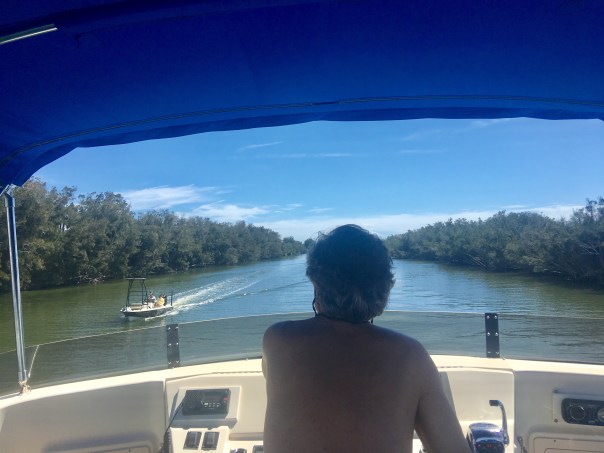
During my husband, Ed, and my recent 156 miles trip up the IRL, aboard ADRIFT, I contacted Duane DeFreese Ph.D., Executive Director for the Indian River Lagoon National Estuary Program. I called Duane because I knew why the southern lagoon looked better but was impressed by how good the water in the central and northern lagoon looked as well. No brown tide. No superbloom.

Since am unfamiliar with the waters north of the Treasure Coast, except by books, I wanted a scientific update. Well, boy, did I get it! See Dr. Duane’s comments below. Also included is the invaluable, recent St John’s Water Management District’s “June 20th Indian River Lagoon Conditions Update.”

For visual input as well, I am inserting some of Ed and my photos, with comments, of our incredible journey along what is still considered to be one of the world’s most biodiverse estuaries. What a treasure! From north to south, we must do all we can to ensure a toxic-free future.

Keep up the fight!

Jacqui

IRL map: Researchgate
Ed and JTL start of the trip on “Adrift.”
Location: Jupiter Island near the Jupiter Inlet, as almost always the water here is like the Bahamas, looking great! Near the border of Martin and Palm Beach Counties.
Near Jupiter Inlet, border of Martin and Palm Beach Counties. Wow!

JTL:

Duane, hi. Hope you are having a great summer. At this time, are there algae blooms reported in the IRL near Melbourne, the N. IRL north of Titusville, or anywhere in the Mosquito Lagoon? Thank you for letting me know. Jacqui TL

Duane DeFreese, Ph.D. Exec. Dir National IRL Estuary Program, http://www.irlcouncil.com

Conditions being reported to me by the local guides are consistent with the report and my own observations. Overall water quality looks pretty good, but small, patchy areas of poor water quality continue. The fishing guides tell me one day it looks great and a day later the same area will have color and turbidity (probably patchy bloom conditions). My personal observation is that we have been lucky so far and the system is vulnerable. I would not be surprised to see blooms intensify as we move deeper into summer and the rainy season. Lagoon water temperatures are also really warm. the SJRWMD Report documents that we have had patchy blooms occurring of multiple species. Two confirmed species of concern are Pseudo-nitzschia, a marine diatom and Pyrodinium bahamensis, a dinoflagellate. The worst water conditions continue to be in Banana River and in Sykes Creek. There are boater reports of patchy poor water quality in some areas of the northern IRL. The third species of significant recent concern has been Brown tide (Aureoumbra lagunendis). It was in almost in continuous bloom for most of last year in the Banana River. Bloom conditions have subsided. Aureoumbra thrives in warm, high salinity environments. It is not known to be toxic. Blooms of pseudo nitzschia, a marine diatom, can produce a neurotoxin called domoic acid. Blooms of Pyrodinium can produce saxitoxin. I expect that we will see patchy and flashy bloom conditions of multiple species throughout the summer. If we get lucky, I hope none of these blooms get intense enough to elevate toxin levels, low DO levels and fish kills. I’m very concerned about the slow recovery of seagrasses, even in areas of good water quality. Feel free to call me anytime.  Have a great 4th July!

Indian River Lagoon Conditions Update June 20

JTL:

Dear Duane, thank you so very much for the super informative reply! I wrote because my husband and I are taking our maiden voyage in a trawler. We have gone from Stuart to Jupiter to Vero to Cocoa, north as far as possible in IRL, past Titusville, and today-through the Haul-over Canal into the Mosquito Lagoon. Not being familiar with these waters, all I have seen visually appears quite good compared to the St Lucie and even parts of the S. IRL. Some varying coloration is apparent, but overall seems good and in the north, many baitfish balls are shimmering under the surface and dolphin families are gorging themselves and teaching their young! We have seen many dolphins everywhere. Throughout Indin River County, Ospreys nesting in channel markers. One after the other!  In the Mosquito Lagoon there were many more wading birds than S IRL. Even saw a few roseate spoonbills. I was not expecting it to be so full of life up here… a nice surprise. Not off the chart healthy, but marine and bird life very visible! I really appreciate the info you sent. I plan to blog on trip once home, so I can quote your knowledge. Happy 4th of July to you as well and I hope to see you soon.


The confluence of the St Lucie River and Indian River Lagoon off S. Sewall’s Point, Bird Island. Near Stuart, Martin County.
Sewall’s Point and Stuart, Martin County.
Beautiful blue water near the Ft Pierce Inlet, St Lucie County. Ft Pierce rocks!
Waters of Vero Beach, Indian River County.
Old map showing the designated area of famous INDIAN RIVER LAGOON CITRUS. Citrus Museum, Vero Beach, FL
1920 Blue Heron Map shows clearly the area of the Everglades, Heritage Center and Citrus Museum, Vero.
Street sign in Vero Beach, as everywhere ALL canals lead to Lagoon! No trash, fertilizer, pesticides, etc!
Sebastian Inlet, Indian River County, brings blue waters to the area. So pretty!
Approaching Cocoa Village, north of Melbourne in Brevard County.
Waters nearing Cocoa Village in Brevard County
Ed and I visited the Kennedy Space Center along the Indian River Lagoon and Banana River. Surrounded by the Merritt Island National Wildlife Refuge. Space & Nature. https://www.fws.gov/refuge/Merritt_Island/visit/plan_your_visit.html Such an inspiration!
3-D movie at Kennedy Space Center really took us to the moon, Mars, and beyond!
The ominous Vehicle Assemble Building, NASA, so large it is visible no matter where one is are along the central and northern IRL. It’s like it is following you!
Eau Gallie, Melbourne. The Eau Gallie River, or Turkey Creek,  is a small version of the St Lucie and also impaired due to runoff from agriculture and development.
Like a sentinel, the Vehicle Assembly Building as seen over the Indian River Lagoon north of Titusville.

Baitfish!

Waters approaching Titusville, Brevard County.
Train track bridge north of Titusville, Brevard County.
Train track bridge north of Titusville, Brevard County. Shortly beyond channel turns right through the Haulover Canal and into the Mosquito Lagoon.

Ed navigates through the Haulover Canal, connecting the northern IRL with the Mosquito Lagoon.
Water in the Haulover Canal was greenish.
Entering the stunningly beautiful, peaceful, undeveloped Mosquito Lagoon. This area is flanked by the Scottsmoor Flatwoods Sanctuary and Canaveral National Seashore. Wildlife abounds.

360 of the unforgettable Mosquito Lagoon:

Flora and fauna along shoreline, Mosquito Lagoon
Anhinga twins, Mosquito Lagoon

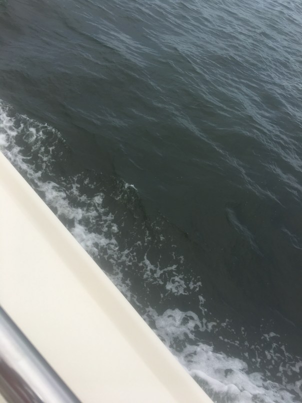
Incredible footage of 4 dolphins in our wake near Ft Pierce welcoming us home!

ADRIFT is a 2007 Mainship 400 trawler, top speed about 8 knots 🙂

“Death in Every Direction,” The State of Florida’s Waters…SLR/IRL

Photo 3-20-16 Facebook SWFL Clean Water Movement- Sarah Joleen / Cocoa Bch
Photo 3-20-16 Facebook, SWFL Clean Water Movement- Sarah Joleen / Cocoa Bch.

North, South, East, West….

You know I have really just about had it. I know you have too.

I am so tired of posting and writing about the sad state of affairs of our state waters. Every direction one turns!

This weekend many photos showed up on Facebook reporting an enormous fish kill in the Central Indian River Lagoon near Melbourne and Cocoa Beach. These photos of hovering and floating fish are very disturbing.

What is even more upsetting is when one considers the state of just about all of Florida’s waters. Is this the same state I grew up in as a child. Really?

To summarize  a few recent, ongoing situations:

CENTRAL INDIAN RIVER LAGOON-experiencing  “brown tide” and fish die off…

NORTHERN LAGOON: 2011-2013 Super Bloom, morality events (both north and central), 60% seagrass die off…

Florida Today: http://www.floridatoday.com/story/news/local/2016/03/18/report-fish-kill-brevard-county/81992006/ or http://www.orlandosentinel.com/news/environment/os-florida-water-catastrophe-statewide-20160304-story.html

–ST LUCIE RIVER/S. INDIAN RIVER LAGOON: repeated discharges from Lake Okeechobee and area canals have destroyed the heath of the river. It was declared “impaired by the state in 2002. State of Emergency due to Lake O called in Feb. 2016).

(Article: TC Palm: http://www.tcpalm.com/news/indian-river-lagoon/health/lake-okeechobee-discharges-to-st-lucie-river-begin-2a945729-88d4-59b9-e053-0100007fc4eb-367103911.html)

—-CALOOSAHATCHEE RIVER  (The western outlet for lake Okeechobee discharges, the river has been straightened, and connected to Lake O. Sometimes suffers from too little fresh water/high salinity. State of Emergency due to Lake O called in Feb. 2016)

Caloosahatchee area photo John Moran 2016.
Caloosahatchee River area, photo John Moran 2016.

(Article: Tampa Bay Times http://www.tampabay.com/news/environment/water/lake-okeechobee-flood-control-creates-environmental-disaster/2270032)

—FLORIDA BAY: over the past few years has lost massive amounts of sea-grasses due to high salinity. When I was just there with my UF NRLI class this year, the bay looked murky. This bay historically received the fresh waters from Lake O.

(Article: Miami Herald http://www.miamiherald.com/news/local/environment/article37583577.html)

—FLORIDA SPRINGS– Some have gone dry and others are lacking sufficient flow due to aquifer withdrawal. Many have experienced algae blooms. Photographer John Moran has documented their decline.

(Site: http://springsforever.org) or (http://springseternalproject.org)

–LAKE OKEECHOBEE–deluged with water from the mostly straightened Kissimmee River and others. It has been dammed and directed to the northern estuaries.

(State BMAP plan to improve: http://www.dep.state.fl.us/water/watersheds/docs/bmap/LakeOkeechobeeBMAP.pdf)

–BISCAYNE BAY has also had seagrass die off and water quality issues/high human impact)

(Article: http://www.sun-sentinel.com/local/broward/fl-noaa-biscayne-bay-20150118-story.html)

Keep documenting. Keep posting. Keep reading. Keep learning…Keep writing your elected officials…

Keep pushing for a better state. A better state of Florida’s waters.

2016 St Lucie River /IRL
2016 St Lucie River/IRL EL/JTL

(Thank you to Ms Bobbi Blodgett for getting me the details on the fish kill photograph.)

Photo 3-20-16 C.IRL fish kill Coco Bch.
Photo 3-20-16 C.IRL fish kill by Saha Joleen, Cocoa Bch.


_________________________________________
3-25-16: I am adding this follow up article on the fish kill by Florida Today. The blog was written on 3-21-16. http://www.floridatoday.com/story/news/local/environment/2016/03/23/what-we-know—-and-dont-know—-fish-kill/82163574/

Giant Mammals 10,000 Years Ago Along the Indian River Lagoon

Ten thousand years ago some of the largest mammals ever known lived right here along the northern central Indian River Lagoon.
Ten thousand years ago some of the largest mammals ever known lived  along the  Indian River Lagoon. (Photo Jacqui Thurlow-Lippisch.)

I am in Melbourne, Florida, serving as a delegate for the Marine Resources Council’s  Action Assembly of the Indian River Lagoon. I got here early and started reading up on this area of the lagoon that is suffering from marine mammal deaths of manatees and dolphins. Brevard County holds 60% of the lagoon and basically just about all of their sea grasses are now dead and though over nitrified water certainly fed the super bloom that killed the sea grasses, scientists feel there is more to the story. But scientists are not allowed to just feel, they have to “prove” so the struggle to explain what happened continues…

The assembly is being held at Florida Tech, which sits close to Crane Creek, a tributary of the IRL. About 10,000 years ago Mammoths lived here and their gigantic skeletons have been excavated. Paleontologist have also found bones of mastodon, horses, camels, the 20 foot tall ground sloth (the largest mammal to ever roam North America) along with tapir, peccary, camel and my favorite, the incredible saber-toothed cat.

image

Image from (http://www.slothsanctuary.com)

Although humans also lived in this area 10,000 years ago, it was not until modern times that Crane Creek was drastically altered. In 1922, after the times of the pioneers, efforts to drain the area under Florida statute 298 were successful and the M-1 canal along with with feeder canals dried the lands of the surrounding area and inland along the St Johns River for agriculture that the real estate ads had promised.

Today the area is highly populated and is the home of a struggling NASA. A six lane highway abuts the once beautiful Indian River Lagoon and concrete is everywhere.

of course, times change, still it is hard to picture Mammoths walking around here! I wonder what this area will look like in another 10,000 years? Maybe something weirder than a 20 foot sloth or humans will walk or climb. Maybe something smarter? I hope.