Tag Archives: waters of the state

Let’s Make History! “No Oil and Gas Drilling in Florida’s Territorial Seas”~ Florida ballot 2018

This past Wednesday, I presented, P91 or “No Oil and Gas Drilling in Florida’s Territorial Seas” to the Declaration of Rights Committee of the Constitution Revision Commission. This was the second and final committee hearing and it passed! My other four environmental proposals were “killed”…

To be clear, as it is confusing, there are coastal territorial seas and there are offshore federal waters. This proposal would protect our territorial seas, our state waters, the waters under our jurisdiction. These waters have been drilled before and, hands down, if the oil and gas industry can, they will influence our state legislature so that they can drill our coastal waters again. There is no doubt about it. Just study history!

We all know, drilling so close to shore, as is done in other coastal southern states, would be visually, environmentally, and economically destructive to Florida’s unique/peninsular marine, real estate, and tourism resouces.

It is written in Article II of our state constitutional that “we shall protect our natural resources and scenic beauty.” P91 belongs in Florida’s Constitution. It would be an enormous statement on behalf of the people of Florida and would have major policy implications on many levels helping to keep all oil drilling away from our state today and in the future.

P91 is now one of 37 proposals of 103 that made it through the CRC committee process.

Today I am publishing the notes from my presentation that should be interesting and informative to readers.

Thank you for following the CRC process and I will keep you appraised of P91 as the CRC process continues and we move towards what gets on the ballot for 2018.

In the end, we must do something for our environment!

Fondly,

Jacqui

P91, presentation Declaration of Rights 1-31-18

Greetings Chair Carlton and Honorable Commissioners; I am Jacqui Thurlow-Lippisch  from the Town of Sewall’s Point in Martin County.

This morning, I am pleased to be presenting P91, also known as, “no oil and gas drilling in Florida’s territorial seas.”

~So you may ask,“ what are Florida’s territorial seas?”

The boundaries of Florida’s territorial seas are based on the foresight of our forefathers who expanded the boundaries of Florida, accepted into Florida’s Constitution in 1868 during the era we rejoined the Union. These boundaries are defined as: three marine leagues, or approximately 9 miles, on to the west coast, in the Gulf of Mexico, and extending as far as the shifting Gulf Stream, or three miles east, which ever is further, into the Atlantic Ocean off Florida’s east coast.

The US Code defines Florida’s territorial seas as three marine leagues on the west cost, and three miles out on the east coast.

Most of us have forgotten our history, but in 1944 Florida sold “everything hugging the shore out to 10.36 miles, from Apalachicola to Naples,” on the Gulf Coast to Arnold Oil Company. These lands consisted of of 3.6 million acres.

After decades of embittered fighting, unsuccessful exploration, and a movement to end the leases, in 1989 the Florida legislature banned oil and gas drilling in Florida’s territorial waters and stopped collecting lease money from the oil company that had the rights to these leases lands.

The battle ensued over time and party lines, but in 2002 Governor Jeb Busch with the help of his brother, the president of the United States, arranged for the oil company to accept 12.5 million state dollars to “abandon all further claims.” This transaction was finalized by 2005 with great fanfare of the public that was ecstatic to have Florida’s beautiful beaches and important natural resources “off the table.”

And yet by 2006 there were rumblings and by 2009, there was even serious talk of a bill on the floor of the Florida Legislature allowing for drilling within five miles of Florida’s west coast. Once again, tremendous pressure to reopen Florida’s territorial seas!

In 2010 the nightmare of the BP Deepwater Horizon really took this possibility off the table for discussion, but we must not be naive, especially in the current climate, this threat to our shores is still there!

Today, you as Commissions  of the Constitution Revision Commission have a chance to make history by voting “yes” on P91 “no oil and gas drilling in Florida’s territorial seas,” giving the possibility for Floridians to put language into our state constitution in 2018 that would protect Florida.

Let’s make history.

1868 map
Florida’s territorial seas
Gulf Stream

Links:

P91 CRC http://flcrc.gov/Proposals/Commissioner/2017/0091

Herald Tribune 2009 http://www.heraldtribune.com/article/20090926/News/605227437

Florida Trend 2009 http://www.floridatrend.com/article/5050/revenue-vs-environment

Earth Justice, David Guest,  2009:https://earthjustice.org/blog/2009-september/oil-drilling-axis-targets-floridas-offshore

Offshore Magazine, Destin Dome: http://www.offshore-mag.com/articles/print/volume-57/issue-3/news/exploration/eastern-us-gulf-of-mexico-destin-dome-may-yet-revive-eastern-gulf-of-mexico.html

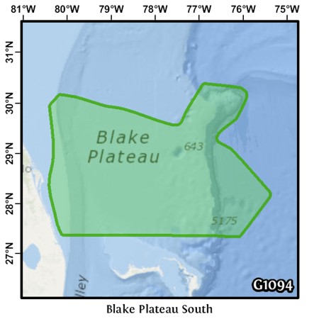
Blake Plateau, Florida’s east coast is under partial currents of the Gulf Stream: http://edcon-prj.com/wp-content/uploads/2014/04/G1094_ocean.jpg

USGS Blake Plateau https://pubs.usgs.gov/pp/0659/report.pdf

CRC Analysis 2 http://flcrc.gov/Proposals/Commissioner/2017/0091/Analyses/2017p0091.pre.dr.PDF

______________________________

The next phase of the CRC is public hearings; there is a hearing in Ft Lauderdale tomorrow. After the public hearings the final proposals will be chosen to go on the 2018 ballot.
http://flcrc.gov/Media/PressReleases/Show/1071

Jacqui Thurlow-Lippisch is a member of the 2018 CRC, all comments are public record:  http://flcrc.gov/Commissioners/Thurlow-Lippisch

Florida Channel’s taping of prevention: Thank you to those who spoke in favor of the proposal. https://thefloridachannel.org/videos/1-31-18-constitution-revision-commission-declaration-rights-committee/

Article 11 Sec. 1 of our constitution defines Florida’s boundaries. Our forefathers had foresight in doing this. Our boundaries are much more extensive than other coastal sates. May we have the same foresight in expanding the boundaries to protect or territorial seas.

“Death in Every Direction,” The State of Florida’s Waters…SLR/IRL

Photo 3-20-16 Facebook SWFL Clean Water Movement- Sarah Joleen / Cocoa Bch
Photo 3-20-16 Facebook, SWFL Clean Water Movement- Sarah Joleen / Cocoa Bch.

North, South, East, West….

You know I have really just about had it. I know you have too.

I am so tired of posting and writing about the sad state of affairs of our state waters. Every direction one turns!

This weekend many photos showed up on Facebook reporting an enormous fish kill in the Central Indian River Lagoon near Melbourne and Cocoa Beach. These photos of hovering and floating fish are very disturbing.

What is even more upsetting is when one considers the state of just about all of Florida’s waters. Is this the same state I grew up in as a child. Really?

To summarize  a few recent, ongoing situations:

CENTRAL INDIAN RIVER LAGOON-experiencing  “brown tide” and fish die off…

NORTHERN LAGOON: 2011-2013 Super Bloom, morality events (both north and central), 60% seagrass die off…

Florida Today: http://www.floridatoday.com/story/news/local/2016/03/18/report-fish-kill-brevard-county/81992006/ or http://www.orlandosentinel.com/news/environment/os-florida-water-catastrophe-statewide-20160304-story.html

–ST LUCIE RIVER/S. INDIAN RIVER LAGOON: repeated discharges from Lake Okeechobee and area canals have destroyed the heath of the river. It was declared “impaired by the state in 2002. State of Emergency due to Lake O called in Feb. 2016).

(Article: TC Palm: http://www.tcpalm.com/news/indian-river-lagoon/health/lake-okeechobee-discharges-to-st-lucie-river-begin-2a945729-88d4-59b9-e053-0100007fc4eb-367103911.html)

—-CALOOSAHATCHEE RIVER  (The western outlet for lake Okeechobee discharges, the river has been straightened, and connected to Lake O. Sometimes suffers from too little fresh water/high salinity. State of Emergency due to Lake O called in Feb. 2016)

Caloosahatchee area photo John Moran 2016.
Caloosahatchee River area, photo John Moran 2016.

(Article: Tampa Bay Times http://www.tampabay.com/news/environment/water/lake-okeechobee-flood-control-creates-environmental-disaster/2270032)

—FLORIDA BAY: over the past few years has lost massive amounts of sea-grasses due to high salinity. When I was just there with my UF NRLI class this year, the bay looked murky. This bay historically received the fresh waters from Lake O.

(Article: Miami Herald http://www.miamiherald.com/news/local/environment/article37583577.html)

—FLORIDA SPRINGS– Some have gone dry and others are lacking sufficient flow due to aquifer withdrawal. Many have experienced algae blooms. Photographer John Moran has documented their decline.

(Site: http://springsforever.org) or (http://springseternalproject.org)

–LAKE OKEECHOBEE–deluged with water from the mostly straightened Kissimmee River and others. It has been dammed and directed to the northern estuaries.

(State BMAP plan to improve: http://www.dep.state.fl.us/water/watersheds/docs/bmap/LakeOkeechobeeBMAP.pdf)

–BISCAYNE BAY has also had seagrass die off and water quality issues/high human impact)

(Article: http://www.sun-sentinel.com/local/broward/fl-noaa-biscayne-bay-20150118-story.html)

Keep documenting. Keep posting. Keep reading. Keep learning…Keep writing your elected officials…

Keep pushing for a better state. A better state of Florida’s waters.

2016 St Lucie River /IRL
2016 St Lucie River/IRL EL/JTL

(Thank you to Ms Bobbi Blodgett for getting me the details on the fish kill photograph.)

Photo 3-20-16 C.IRL fish kill Coco Bch.
Photo 3-20-16 C.IRL fish kill by Saha Joleen, Cocoa Bch.


_________________________________________
3-25-16: I am adding this follow up article on the fish kill by Florida Today. The blog was written on 3-21-16. http://www.floridatoday.com/story/news/local/environment/2016/03/23/what-we-know—-and-dont-know—-fish-kill/82163574/

Trying to Understand “Water Classifications of the State,” SLR/IRL


Sunrise over Florida's "Waters of the State," SLR/IRL region.
Sunrise over Florida’s “Waters of the State,” SLR/IRL region.

The more I learn about water, “the more I learn what I don’t know”…Federal laws….state laws…and local governments living with the “sins of the fathers,” —just trying to keep up…

Because I taught eighth and ninth grade for so many years, it is my training to try to break down complicated information, so that it can be understood on a basic level and shared. Obviously, I am no expert on water law so please chime in!

Today’s lesson? CLASSIFICATION OF FLORIDA SURFACE WATERS

Classifications and designated uses of water by the state of Florida are required by the Clean Water Act of the United States. “The act requires that the surface waters of each state be classified according to “designated uses.” Florida has six classes with associated designated uses, which are arranged in order of degree of protection required.” DEP

From FAQ DEP 2012.
Classification, Waters of the State, FAQ Fl. Dept. of Environmental Protection, 2012.

(http://www.dep.state.fl.us/water/watersheds/assessment/faq.htm)

The classes are:

Class I: Potable Water

Class II Shellfish Propagation or Harvesting

Class III Fish Consumption, Recreation, Propagation and Maintenance of a Health, Well-Balanced, Population of Fish and Wildlife

Class III-Limited the same Class III but “with limited physical/habitat conditions…

Class IV Agriculture Water Supplies

Class V Navigation, Utility and Industrial Use.

I wonder what category the St Lucie River/ Indian River Lagoon falls under? This is not easy to find on-line. Let’s guess….Look at the chart above closely….

What do you think?

My guess would be Class III-Limited, but I don’t know. I could not find it “for sure” on-line.

Looking at the chart and reading the DEP website, it sounds like all waters of the state of Florida are “Class III” regular “unless otherwise specified….”

—–Finding a simple list of class designations for waters of the state is not easy. This download is what I found and it does not make sense.

(https://www.flrules.org/gateway/readFile.asp?sid=0&tid=3294816&type=1&File=62-302.400.doc)

Now to complicate the issue, certain classes of water that are listed as Class III or otherwise can also be listed separately as “Outstanding Waters of the State,” or as “Aquatic Preserves.” How can this be?

—–For instance, the North Fork of the St Lucie River is listed as an “Aquatic Preserve” and “Outstanding Water” of the State. Also the Indian River Lagoon has parts, including parts in St Lucie and Martin Counties, that are also Aquatic Preserves. This doesn’t make sense to me. These bodies of water have been designated as “protected” since the 70s but they are not protected with canals dumping pollution into them. We all see that! 

SFWMD canal and basin map. C-44 canal is the canal most southerly in the image.
SFWMD canal and basin map.C-24 dumps pollution into North Fork of SLR, C-23 dumps into main area of SLR, C-44 dumps into South Fork, and C-25 into IRL near Ft Pierce. The North Fork of the SLR and parts of the IRL are Aquatic Preserves/and or Outstanding Florida Waters…..this makes no sense.
Aquatic Preserves of the IRL as shown in DEP's IRL Management Plan draft June 2014.
Aquatic Preserves of the IRL as shown in DEP’s IRL Management Plan draft June 2014.

Now I am going to share some photos of the Southern Indian River Lagoon, (an Aquatic Preserve), that my husband, Ed, took last Sunday, September 13th. The photos are of the C-25 canal which is dumping into the Indian River Lagoon in Ft Pierce. I don’t know about you, but I don’t think it makes sense to dump pollution into an aquatic preserve, no matter what class the waters are.

To be fair, I must mention that I recently received an email from Mr Glenn Henderson, the senior grants writer for St Lucie County. He noted that a blog reader sent him the shocking photographs of C-25 recently published.  Mr Henderson noted that he and others are working together with the St Lucie Issues Team to get a grant from the state for the San Lucie storm water detention project. The San Lucie is  an old subdivision that has dirt roads, few swales and no structures to hold stormwater — and it’s less than a mile from the IRL. This is one of the many things running into the lagoon.

Thank you Glenn and everyone!  And the state? “Let’s get back to class!”

Algae fills C-25 as this water is dumped into the IRL in Ft Pierce, an aquatic preserve. (Photo Ed Lippisch 9-13-15)
C-25 9-13-15 (EL)
C-25 9-13-15 (EL)
C-25 9-13-15 (EL)
C-25 9-13-15 (EL)
C-25 9-13-15 (EL)
C-25 9-13-15 (EL)

_______________________________________________________

US Clean Water Act:(http://www2.epa.gov/laws-regulations/history-clean-water-act)
Classification of Waters, DEP (http://www.dep.state.fl.us/water/wqssp/classes.htm)(http://www.dep.state.fl.us/water/wqssp/ofw.htm)

Aquatic Preserves: (http://www.dep.state.fl.us/coastal/sites/indianriver/plan.htm)
(http://www.dep.state.fl.us/coastal/programs/aquatic.htm)

North Fork of the St Lucie River Aquatic Preserve Management Plan (http://www.floridadep.org/coastal/sites/northfork/pub/NorthFork_Plan_2009.pdf) (http://www.gpo.gov/fdsys/pkg/CZIC-qh90-75-f6-g57-1984/html/CZIC-qh90-75-f6-g57-1984.htm)

Outstanding Florida Waters: (http://www.dep.state.fl.us/water/wqssp/ofw.htm)

JTL blog “Our Deadly Canals” photos 9/2/15:(http://jacquithurlowlippisch.com/2015/09/04/update-our-deadly-canals-and-the-kiss-of-death-lake-okeechobee-slrirl/)