Tag Archives: FDEP

River Warrior Times 5-16-21

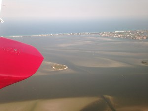
Port Mayaca, Structure S-308 at Lake Okeechobee opens to Canal-44 into St Lucie River. S-308 is open for water supply for agriculture but is not going through S-80 into the St Lucie River/ Indian River Lagoon. Aerial, Ed Lippisch, 5-5-21.

River Warrior Times 5-16-21. This piece is written specially for Lake Okeechobee.

It was my intension to write a summary water piece every two weeks. I last wrote on April 25, 2021.Today, I will try to catch up.

If I had one phrase to describe what has happened since April 25, it would be “high-alert.” Governor DeSantis visited on May 10, giving direction as his executive order 19-12 is the guidepost for the Department of Environmental Protection and the SFWMD.

The blue-green algae bloom at Pahokee Marina, I wrote about last time, was cleaned up through a cooperative of the South Florida Water Management District and the Department of Environmental Protection. This is a first as globs of purple, blue, green, and grey cyanobacteria -blue green algae- sat in marinas and inside canal communities in 2016, and 2018 until they rotted and fell to the bottom. This time, under Governor DeSantis of which DEP and the SFMWD sit organizationally, it was determined (under Section 1 part I of 19-12) to remove the toxic algae via vacuum and chemical treatment, relocating what Palm Beach County could not take safely, far away to District lands away from people and wildlife.

Keith W. Babb, Mayor of Payhokee, attend the May 13 SFWMD Governing Board meeting and was very grateful. You can listen to his comments at 39.00 the beginning of the meeting. Congressman Brian Mast, who led Governor DeSantis’ transition committee, also provided fiery commentary.

Although it is definitely a positive that the toxic algae was removed, we must ask ourselves a question. How are we going to pay for this again, and again, and again? A precedent has been set. Is vacuuming each time sustainable? With Lake Okeechobee in its present condition this is a very relevant question.

As Mark Perry, the Executive Director of Florida Oceanographic has repeatedly stated: “Unless we address the source of the problem in the upper watershed of Lake Okeechobee, we will never reach the 105 metric tons at 40 ppb.” Translated, that means the pollution numbers coming into the lake are high, in some basins over 600 parts per billion phosphorus. You can’t vacuum away as an avalanche of pollution pours in!

The situation is complex. However, the handling of Pahokee Marina is symbolic of a larger problem. I would have liked not only DEP and SFWMD to be in the spotlight at the Pahokee Marina, but also FDASCs the Florida Department of Agriculture and Consumer Services. Why? Because the lake did not get sick overnight, and the history of Lake Okeechobee is an agricultural one. This is reflected in “who” is in charge of water quality.

First, back-pumping fertilized and chemical-leaden water into Lake Okeechobee was common practice and allowed by the by the state. The sugar industry/EAA imparticularly partook of this practice for decades. It almost killed the lake. In the 1970s and 1980s lawsuits forced water that was once back-pumped into Lake Okeechobee to flow south, sparing the lake, but creating a new issue of destroying the Everglades. This in turn spurred other lawsuits so that today Everglades Agriculture Area (EAA) runoff must first be filtered through Storm Water Treatment Areas, south of Lake Okeechobee before it can enter the Everglades Protection Areas or Everglades National Park. Most of this was paid for by taxpayers, just like the clean up at Pahokee Marina.

Lake O, EAA, STAs, and WCAs. (Map SFWMD)

Lake Okeechobee, though in a better position than in 1970 continues to be fed high concentrations of phosphorus and nitrogen mostly from agriculture areas north of Lake Okeechobee. Thus destruction already done from the early years is locked up in sediments,  and the new destruction that continues makes for a hyper-eutropic lake that now blooms every year.

Not a good situation. So how is fixing our waters supposed to work? Who is in charge of water quality?

The Northern Everglades and Estuaries Protection Program (373,4595. Florida Statutes) directs the Florida Department of Environmental Protection, the Florida Department of Agriculture and Consumer Services, and the South Florid aWater Management District to work together to reduce pollutants and achieve water quality standards in the the Lake Okeechobee, St Lucie River, and Caloosahatchee River watershed through Basin Management Action Plans and Total Maximum Daily Loads program (403.067. Florida Statutes.)”

No one agency is in charge of water quality. Like it or not, in Florida, three agencies have this responsibility. As Florida Statue requires, we must all work together to turn Florida’s organizational chart from a line into a triangle. Until FDEP, SFWMD & FACS are truly working together, there will not be improvement to Lake Okeechobee’s water quality and Florida’s tax payers will be on the hook.

THE TRIANGLE!

Organizational chart State of Florida. Note the members of The Triangle (circled) responsible of water quality. The Dept. of Ag is a cabinet position. DEP and SFWMD are lower agencies but fall under the top tier, the governor. The governor is doing a great job but he can not do it alone!

Links to timely information:

JAX ACOE keeps S-80 closed, adjust flows to Caloosahatchee

SFWMD operations statement Ops_Position_Statement_May_11_17_2021

EyeonLakeO website Todd Thurlow

DEP algae bloom dashboard 

FOS SLR water quality report

Orca report on dead manatees in the IRL by county


If “Off With Their Heads” is Not an Option, What is? Documenting the Destructive Discharges 2015, SLR/IRL

Reenactment of canon fire at the Castillo, St Augustine, 2015. (Photo Ed Lippisch)
Flying north at convergence  of SLR/IRL at St Lucie Inlet.  (Photo Jacqui Thurlow-Lippisch, 3-18-15.)
Flying north at convergence of SLR/IRL at St Lucie Inlet. Brown polluted-sediment water of Lake Okeechobee fills the estuary turning a usually blue/green area dark brown. (Photo Jacqui Thurlow-Lippisch, 3-18-15.)
Standing at the St Augustine Bride over the Matnazas River. (Photo Ed Lippisch 2015)
Standing at the St Augustine Bridge over the Matnazas River. (Photo Ed Lippisch 2015)

My photos of dark waters of the St Lucie River/Indian River Lagoon were taken on Wednesday, 3-18-15 as my husband, Ed, flew us to St Augustine for a Thurlow Family trip my mother organized, in “America’s oldest city.”

Seeing the destructive view of the discharges on our way north was not a good visual, but before we’d left St Augustine, I had learned that their river, very much like the Indian River Lagoon, is named “The Matanzas” meaning “River of Slaughter” in memory of Spain’s Don Pedro Menendez ‘ and his men’s decapitation of the shipwrecked colony of French Huguenots  in 1565. During the massacre, the river “ran with blood…” (http://en.wikipedia.org/wiki/Matanzas_River)

Today our river runs with death as well, albeit a different kind…but we do not live in an age where if you are trying to displace someone, or don’t support their belief system, you chop their heads off….So what then can we do other than try to entice our dear government, to purchase land south of Lake Okeechobee to store, clean and convey water south the Everglades?

We can ask them to “document” what is happening….That sounds reasonable.

I have been reading the book: “Conservation in Florida, It’s History and Heros” by Gary L. White. Originally “the Department of Natural Resources,” the precursor to today’s  Department of Environmental Protection, did what it could to protect resources rather just be in charge of permits to destroy such.

I think until the Department of Environmental Protection removes the word “protection” from its name, it still has an obligation to “protect” which also means to “document.”

Seagrasses—fish species—-coral reefs and fish species–oysters—-marine mammals—birds—-aquatic plants——–all that is being lost….

It’s pathetic that the agency is not doing this already. Documenting loss forces state and federal agencies to “do something.” Otherwise, the destruction just continues and everyone “forgets” life was ever there. We owe this to future generations if nothing else.

If you agree, would you please contact the “Department’s” new Secretary, who is a cabinet member of Governor Scott. Please ask him if the agency could document what is happening here is the St Lucie River/Indian River Lagoon or maybe “protect” it in some way since that word it is still in their name….

Jonathan P.  Steverson DEP Secretary: 850-245-2011. Mr Tom Frick is in charge of Environmental Restoration for our part of the state; his number 850-245-7518. (http://www.dep.state.fl.us

You can reference what Florida Oceanographic states on its website: (http://www.floridaocean.org)

In the St Lucie/Indian River Lagoon area, several “protected areas” are now bing impacted, including two “state aquatic preserves:”

“1. The Indian River Lagoon National Estuary,” running from south of Ft Pierce to Jupiter Inlet that is a National Oceanic and Atmospheric Administration (NOAA,) as well as an Environmental Protection Agency, (EPA,) “Essential Fish Habitat for Seagrass.” 2. Another area being impacted by the Lake Okeechobee discharges is the “St Lucie Inlet State Preserve Reefs, and Nearshore Reefs” nominated by NOAA for “National Marine Sanctuary Designation.” 

The SLR/SIRL estuary,coastal-ecosystem and habitat has been documented by Dr Grant Gilmore, formerly of Harbor Branch, and others to be “the most bio diverse estuary in North America with habitat for more than 4,000 species of plants and animals, including 36 endangered and threatened species.”

–Where is the protection for these areas? Where are the agencies that are charged with enforcing these protections? 

2.
2. IRL and SLR converge at Crossroads by St Lucie Inlet then IRL runs north between starting at Sailfish Point and Sewall’s Point. This area has been documented as the most bio diverse marine environment in North America.
3.
3. Sailfish Point
4.
4. Sailfish Flats
5.
5. Sailfish Flats
6. Jensen Beach Bridge


My nieces look over the Matanzas River from the Lighthouse in St (Photo Jenny Flaugh 2015) .
My nieces look over the Matanzas River from the Lighthouse in St Augustine. (Photo Jenny Flaugh 2015) .


Documenting the Destructive Discharges, Speak Out! 3-9-15, SLR/IRL

Confluence of St Lucie River/Indian River Lagoon between Sewall's Point and Sailfish Point, Hutchinson Island, 3-8-15 showing releases from Lake Okeechobee and area canals. (Photo Ed Lippisch)
Confluence of St Lucie River/Indian River Lagoon between Sewall’s Point and Sailfish Point, Hutchinson Island, “The Crossroads,” 3-8-15 showing releases from Lake Okeechobee and area canals. (Photo Ed Lippisch)

Usually, my husband, Ed, does not like it when I ask him to “do things”…like take out the trash or blow leaves off the driveway. But he always likes it if I ask him to go up in the plane. He did so yesterday, and was able to visually document the polluted discharges pouring into our St Lucie River/Indian River Lagoon.

Yes, once again.

The Army Corp of Engineers (ACOE), and the South Florida Water Management District (SFWMD) agreed to have the Army Corp start releases this year on January 16, 2015 at 200 cubic feet per second (cfs) through S-308 into the C-44 canal which is attached to the South Fork of the St Lucie River, and then in turn is connected to the Indian River Lagoon “my town,” Sewall’s Point.

Exhausting isn’t it?

The ACOE is now discharging at a rate of “950 cfs.” This rate goes up and down. It is going up because Lake Okeechobee is not going down…

SLR basins. SFMWD, 2015.
This SFWMD basin map also shows S-308 at Lake O, the C-44 canal, S-80 at St Lucie Locks and Dam, SLR/IRL.

Today I will share Ed’s photos and show how to “see” how much the ACOE is releasing at S-308. (Structure 308) which is located at Port Mayaca, in Indiantown, Martin County.

Ofcouse, there are discharges from area canals C-44, C-23, C-24 and C-25 as well, but today for simplicity’s  sake, I will focus on the lake discharges today, which in my opinion, are the worst of all anyway—because they are not at all “ours.”

So—–

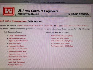
You can search “Jacksonville, ACOE” or just go to this link: (http://w3.saj.usace.army.mil/h2o/reports.htm). You can then very quickly check two things: Lake Okeechobee’s level and how much the ACOE is dumping at S-308 from the lake.

To do so, after accessing the site, go to “Current Lake Okeechobee Water Level” at the top left:  Always one day behind or so, the latest date reported is 3-7-15– Lake O is at 14.71 feet. Then go back to the main page to the last link: “Port Mayaca Lock, S-308 Spillway.” View by date; the last date shows 873 cubic feet per second (cfs)  being discharged. 

Front page of ACOE Lake O website, 2015.
3-9-15 Lake O level   14.71 feet NVGD. (A certain amt of feet above sea level>)
3-9-15 Lake O level 14.71 feet. NVGD.
S-308 report shows 8 cfs on 3-8-15 going into C-44 or SLR.
S-308 report shows 873 cfs on 3-7-15 going into C-44 or SLR.


Here are some more photos Ed took yesterday, 3-8-15, of the SLR/IRL.

East side of Sewall's Point, 3-8-15 showing St Lucie River.  (Ed Lippisch)
West side of Sewall’s Point, 3-8-15 showing St Lucie River. (Ed Lippisch)
West side of SEwall's Point, 3-8-25. (Ed Lippisch)
East side of Sewall’s Point, 3-8-25 showing Indian River Lagoon. (Ed Lippisch)
Southern tip of of Sewall's Point at Crossroads. (3-8-15.) (Ed Lippisch)
Southern tip of of Sewall’s Point showing SLR in foreground and IRL in background. 3-8-15. (Ed Lippisch)
Known as the "Crossroads" this area off of Sewall's Point is the confluence of the SLR/IRL. The St Lucie Inlet is just off of the the tip of S.Hutchinson Island and is known as Sailfish Point. 3-58-15. (Photo Ed Lippisch)
Known as the “Crossroads” this area off of S. Sewall’s Point is the confluence of the SLR/IRL. The St Lucie Inlet is just off of the tip of S.Hutchinson Island and is known as Sailfish Point and is blocked in the far upper right of this photo. 3-8-15. (Photo Ed Lippisch)
Confluence of St Lucie River/Indian River Lagoon between Sewall's Point and Sailfish Point, Hutchinson Island, 3-8-15 showing releases from Lake Okeechobee and area canals. (Photo Ed Lippisch)
St Lucie River/Indian River Lagoon near Sewall’s Point and Sailfish Point, Hutchinson Island. “Crossroads.” (Photo Ed Lippisch)
inlet
SL Inlet in distance, 3-8-15.  (EL)
3-8-15. IRL. (EL)
3-8-15. IRL. East of Sewall’s Point. (EL)

When Ed got home, he said I was lucky I did not go up with him as it was windy which means bumpy…He also said the plume looked different from what we have seen before. It looked “chalky” as is seen in these two photographs below and extended about two miles off shore and further south of the St Lucie Inlet.

I am no scientist, but I would imagine this is silt/suspended solids in the water as everything is “stirred up” from the wind. Suspended solids falling on and smothering our reefs….

Plume off St Lucie Inlet, 3-8-15. (EL)
Plume another view 3-8-15, 3-8-15.
Plume another view 3-8-15. (EL)
Map showing reefs in Marin and Palm Beach counties. The reef in MC is directly impacted by the discharges from Lake O. (map courtesy of state.)


In closing, I must thank my husband for the photos, and I must point something out.

This area around Sewall’s Point and Sailfish Point, this “confluence” of the St Lucie River/Indian River Lagoon, in the not too distant past, has been documented as the most bio-diverse estuary in North America  (Dr. R. Grant Gilmore, senior scientist with Estuarine, Coastal and Ocean Science, Inc., (ECOS)(http://www.floridaoceanscouncil.org/members/bios/gilmore.htm).) 

The map below allows us to see where these precious seagrass beds are/were located. The map above shows where our “protected” near shore reefs are located just outside the St Lucie Inlet where the discharges go out to sea. These reefs are the northern most “tropical reefs” on the east coast of Florida…

SFWMD seagrass map, 2015.

I think it is a truly a sin that the ACOE and SFWMD year after year discharge onto these productive sea grass beds and near shore reef habitats that are the breeding grounds for thousands of fish and sea creatures. Its loss is felt all the way up the food chain, including “us.”

Where is the Department of Environmental Protection? Where is the Florida Wildlife Commission? Where is NOAA?

Not to mention, last year a designation of  “Critical Wildlife Area,” —the first in 20 years for Florida—for 30 plus species of nesting and resting  protected birds, was established on “Bird Island,” located  just 400 feet off south Sewall’s Point….”Now” is right before nesting season’s height. Where will the birds find food when the seagrass beds are covered in silt and the water is so dark they can’t really see? Chances are these releases will continue.

Don’t our state agencies have a duty to protect? Don’t they have a voice or has it been muffled? Not a word? Not a peep. Where is our governor? Isn’t this money? Isn’t the productivity our of waterways linked to our businesses? Our real estate values? Where is our local delegation? Have we all become numb to this destruction? Beaten down and manipulated so long we that have no reaction?

It breaks my heart.

Our state and federal government entities responsible for “protection” especially should hang their heads in shame.

If nothing else “speak out” about how bad it is. Recognize the loss. Address the “constraints,” killing this ecosystem and local economy. Take leadership!

Be true to our heritage. We are the United States of America. Be brave. Speak out!

_________________________________________________

Florida Dept. of Environmental Protection: (http://www.dep.state.fl.us) 

Florida Wildlife Commission: (http://myfwc.com)

NOAA/National Oceanic and Atmospheric Administration: (http://coralreef.noaa.gov)   (http://www.nmfs.noaa.gov/pr/species/mammals/)

Understanding Why Sometimes Some Things Don’t Make Sense, St Lucie River/Indian River Lagoon

Waters in St Lucie River on west side of Sewall's Point, (Photo Ed Lippisch)
Lake O water and some area canal water flowing through SLR after ACOE opened  S-308 on 1-16-15. (Waters in St Lucie River east of Roosevelt Bridge) Photo taken  1-25-15 by  Ed Lippisch)

One thing to remember is that the St Lucie River and many parts of the Indian River Lagoon are “impaired,” as determined by the state of Florida at least by 2002 and 2008:

SLR impairment: (http://www.dep.state.fl.us/southeast/ecosum/ecosums/SLE_Impairment_Narrative_ver_3.7.pdf)

IRL impairment: (http://waterwebprod.dep.state.fl.us/basin411/indianriver/assessment/G5AS-IRL_Low-Res-Merge.pdf)

This basically means any number of things, but mostly, that there is too much “nutrient” (phosphorus and nitrogen) in the water. This comes from many sources and all of the sources should be addressed. These nutrients encourage algae blooms, sometimes toxic,  destroying seagrasses, water clarity, and other “life.”

So no matter how “good” today’s water quality reports may be, or how good the water looks, or whether the Martin County Health Department reports “acceptable” levels of bacteria in the water, the waters of our area are “impaired.” This is especially true, “under the water” where one really can’t see unless you dive in with a mask and flippers.

The state saw this “impairment” status coming for decades due mostly to Florida’s  development boom and the gigantic and historic role of agriculture, but…..

Yes, the key word is “but,” it happened any way…


More recently, on January 16th of 2015, the Army Corp of Engineers (ACOE) started dumping from Lake Okeechobee into the SLR/IRL again. This is early in the year to start dumping and historically this foreshadows a bad summer—-BUT Lake O. was high and the ACOE and South Florida Water Management District (SFWMD) like to have 3 to 4 feet of “freeboard” in the lake so if a hurricane comes in summer and the diked lake fills with  3-4 feet of water, the Herbert Hoover Dike doesn’t break. They don’t like the lake to be over 15.5 feet or so.  It is “best” if the lake is around 12 feet by summer–BUT they will never tell you that——something to do with “water supply…”

Chart  releases 2-15-14 by the SFWMD showing releases from Lake O since January into SLR/IRL.
Chart releases 2-24-14 by the SFWMD showing releases from Lake O since January into SLR/IRL.

The above chart provided by the SFWMD shows all releases since January into the SLR/IRL. Blue is Lake O. The ACOE stopped for one week starting  February 17th so Martin County could complete a bacteria study.

During this time I went up in the plane with my husband; the water looked great in the Crossroads by Sewall’s Point and the St Lucie Inlet as it was an incoming tide and releases had been halted.

One might think: “Oh the water is healthy again!”

Remember, it is not.

SLR/ILR Crossroads 2-22-15. (Photo JTL)
SLR/IRL convergence waters between Sewall's Point and Sailfish Point 2-22-15. (JTL)
SLR/IRL convergence waters between Sewall’s Point and Sailfish Point 2-22-15. (JTL)

Another factor in all of this is—— if you look at the SLR/IRL reports from Florida Oceanographic (http://www.floridaocean.orgover the entire time of the recent releases,  measuring salinity; visibility; and dissolved oxygen, the reports are quite good. And they are good, but this does not remove the “impaired status” of the river. 

I apologize they are out-of-order below, but I could not achieve better with out great time and effort.

You can click on the images to enlarge the reports. These charts basically show a consistent grading of  “B to A”  water quality in the SLR/IRL since January 8, 2015—- other than the South Fork which of course is where the water from Lake Okeechobee is coming into the St Lucie River through C-44!

Anyway, to repeat again, one must remember that at all times and in all places right now no matter how pretty or how good a chart looks,  our St Lucie River and parts of the Indian River are “impaired.”

We must work to improve the status of our rivers by lessening  area freshwater canal runoff; our own “personal pollution” though fertilizer, septic and other stuff we put on our yards and down the sink; from roads/cars–Florida Department of Transportation (FDOT) canals are everywhere and have no “cleaning;”  and most of all, we must work to one day redirect as much water away from Lake Okeechobee as possible.

The purchase of land in the Everglades Agricultural Area south of the lake is about the only place this can be achieved.

It is all so confusing sometimes, BUT one thing is for sure, the more we learn, the more we can help and inspire others to clean up our rivers!


FOS
FOS 1. 1-8-15
2.
2.

photo 1 photo 2 photo 5 photo 3

FOS charts out of order showing water quality.


Dredge/Fill, “Changing History,” Frances Langford’s Outrigger Resort, Indian River Lagoon

Aerial of Francis Langford's Outrigger Resort's marina, ca. 1955. Visible is the dredge and fill it took to accomplish this project. (Photo courtesy of Thurlow archives.)
Aerial of Frances Langford’s Outrigger Resort’s marina, restaurant, and compound, built in Jensen/Sewall’s Point ca. 1955. Visible is the dredge and fill it took to accomplish this project. (Photo courtesy of Thurlow archives.)


"Mt Pisgah," the area contiguous with north Sewall's Point that was her home. (Photo ca. 1950s, courtesy of Thurlow Archives.)  Note cleared lands and orange groves.)
“Mt Pisgah,” the area of Rio, contiguous with north Sewall’s Point, that was Mrs Langford’s home. (Photo ca. 1950s, courtesy of Thurlow Archives.)

At last week’s Everglades Coalition Conference, (http://evergladescoalition.org), one of my favorite quotes was repeated by respected Martin County resident, and nationally renowned environmentalist, Mr Nathaniel Reed:

“Not knowing your history, is like walking into the middle of the movie.”

For us to be effective advocates for the now impaired St Lucie River/Indian River Lagoon, (http://www.dep.state.fl.us/southeast/ecosum/ecosums/SLE_Impairment_Narrative_ver_3.7.pdf), it is important to know our history, especially the history of ourselves.

Prior to the 1970s, the passage of the Clean Water Act, and the national environmental movement, “dredge and fill”was commonplace. Dredge and fill includes the dredging of canals that have created our Atlantic Inter-coastal Waterway; the dreaded Okeechobee Waterway; canals draining South Florida below and around Lake Okeechobee; the Everglades Agricultural Area; as well as  many prominent subdivisions and commercial centers that we relish today.

Postcard photo of Francis Langford's Outrigger Resort ca. 1960s)
Postcard photo of Frances Langford’s Outrigger Resort ca. 1960s)

After people realized the environmental degradation that unfortunately went along with these projects, (some include: turbidity in the water column, destruction of seagrass and wildlife habitat, and sometimes the release of heavy metals and other pollutants harbored in the bottom sands and sediments,) getting permits to “do such” became much harder.

Today the FDEP, Florida Department of Environmental Protection,(http://www.dep.state.fl.us/water/wetlands/erp/dffact.htm), and the EPA, Environmental Protection Agency, together with the Army Corp of Engineers, (http://water.epa.gov/lawsregs/guidance/cwa/dredgdis/primarily oversee such projects; many are not granted or take so long people give up. 

Another aerial of the completed  marina in 1965. (Photo courtesy of Thurlow Archives.)
Another aerial of the completed marina in 1965. (Photo courtesy of Thurlow Archives.) Note healthy looking seagrasses right off shore.

Mrs. Frances Langford  (http://en.m.wikipedia.org/wiki/Frances_Langford), who built the well-known “Outrigger Resort and Marina, “in the 1950s, just north of Sewall’s Point, became an “environmentalist” in her later days, bestowing tremendous monies toward the Florida Oceanographic Society on Hutchinson Island, (http://www.floridaocean.org).

And yes, she gave to just about every charity in town! The point is, she loved helping “create” Florida Oceanographic in her later years, and in the 1940s and 50s people really did not realize the true extent of the destruction their dredge and fill projects were causing to the world that they loved. I believe this even holds true with some of the worst offenders of the agriculture and development industry who have, in essence, destroyed Florida and its waters. 

But times change, and people change. I believe there is a movement of change right now to “send water south” again…to fix our state, and yet to allow businesses that came into being, during earlier times of our history, to survive and adapt.

Frances Langford 1940s. (Public photo.)
Singing to the troops with Bob Hope. "The favorite time of her life..." (Public photo.)
Singing to the troops with Bob Hope. “The favorite time of her life…” (Public photo.)

As I mentioned, to be able to change the St Lucie River/Indian River Lagoon, we first must learn to look around, to be aware, and to be able to recognize the history of our own area as we try to change the bigger state picture as well.

Once you start looking, you will see that “dredge and fill” is all around us.

You may ask yourself:

“How is a huge boat, going through the IRL that on average is three feet deep?”

“How are those boats coming from Ft Meyers across Lake Okeechobee into the St Lucie River/Indian River Lagoon?”

“Am I living on what used to be a spoil island or the edge of a coastal community of fish and birds?”

“Am I living in a former wetland?”

I know, that although I do not live on the river, “I am;” I live in a coastal hammock in Sewall’s Point, a bird sanctuary.

There is no turning back, but we can change how we create a new history in the future.

By knowing history, there is a way to “rebuild”and “reeducate.” Whether it is starting in your yard, or changing state policy…

So look around you. Learn your history, view the “full movie”…And may the great waters of Florida flow again with life, beauty, and all the generosity of the late Frances Langford.

Francis Langford in her later years stands before photos decorating the Francis Langford Outrigger Resort. (Public photo>)
Francis Langford in her later years stands before photos decorating the Francis Langford Outrigger Resort, Rio, Florida. (Public photo.)


Harmful Algal Blooms, (HABs), St Lucie River/Indian River Lagoon

August 24, 2014 photograph of blue-green algae bloom east of S-308, Lake Okeechobee/C-44 Canal area/ (Photo courtesy of Paul Shindel.
August 24, 2014 photograph of blue-green algae bloom east of S-308, Lake Okeechobee/C-44 Canal area. (Photo courtesy of Paul Shindel.

Does the above photo make your stomach turn? What is it?

It is a HAB or Harmful Algae Bloom, taken four days ago, right here in Martin County.

According to the United States Department of Agriculture, “over the past century, alterations of land use and acceleration in the rate of cultural eutrophication have led to widespread increases in harmful algal blooms in Florida, including toxin-producing species.”

First,  what is “eutrophication” and why is it “cultural”?

Eutrophication is is when a body of water becomes enriched in dissolved nutrients (such as synthetic phosphorus and nitrogen from fertilizer) that stimulate the growth of aquatic plant life usually resulting in the depletion of dissolved oxygen and a “bloom.” These algae blooms can be toxic.

“Cultural means “created by humans.”

So what are we doing about this especially since “we” caused it?

In 1997 the Florida Department of Environmental Protection formed a Task Force on Harmful Algae Blooms and in 1999 they produced a scientific document, a White Paper: HARMFUL ALGAE BLOOMS, (http://myfwc.com/media/202228/HAB_whitepaper2006_UPDATE.pdfIt is extensive. 

In my opinion, as usual, our state governors and legislatures did not pay significant attention to these studies, and failed to implement policies that would help overcome this crisis issue. How many of them even read the report?

Case in point, recently, it was the local governments and local residents of the towns, cities and counties along the west and east coasts of Florida who advocated and achieved strong fertilizer ordinances not allowing fertilizer use during the rainy season while the state continues to fight and support less restrictive rules.

According to the Florida Fish and Wildlife website there are four ongoing studies regarding HABs in Florida: (http://myfwc.com/research/redtide/research/scientific-products/)

1. Time-Series Sampling in Pinellas and Manatee Counties) Researchers conduct detailed sampling to better understand when, where and under what conditions harmful algal blooms form.

2. Tampa Bay Monitoring Program Researchers monitor 10 sites in Old Tampa Bay for the presence of, or conditions favorable to, harmful algal blooms.

3. Red Tide Offshore Monitoring Program
Encouraging  people to learn about the program and learn how to become volunteers, collecting water samples around the state to help scientists monitor the Florida red tide.

4. Monitoring Toxic Algae Species and Shellfish in the Indian River Lagoon (2002-present)
Periodic testing of water samples and clams provides an early warning of bloom occurrences and shellfish toxicity and minimizes the risk of human exposure to saxitoxins.

Those are great present HAB programs, so why don’t we hear more about them and why don’t they include Lake Okeechobee, obviously the toxic algae is there as well…

Here at home, when the gates of S-308 open from Lake Okeechobee to the C-44 canal that is connected to the St Lucie River/Indian River Lagoon, the algae in the photo above goes directly into the our river system.

Google Earth image of S-308, structure at Lake Okeechobee that opens to the C-44 canal where above photo was taken. This area always has some spill through the gates. Look at the agriculture right up to the lake...
Google Earth image of S-308, structure at Lake Okeechobee that opens to the C-44 canal where above photo was taken. This area always has some spill through the gates. Note the agriculture lands right up to the C-44 canal…

It is 2014. The state has been studying this problem since 1997. They do not have all the answers but we do know by now that HABs are fed by cultural eutrophication due to clearing of land that can no longer clean water on its way to estuaries, rivers and lakes; building of towns and cities that create concrete and asphalt barriers to water reabsorption;  fertilizer and other runoff;  oil/chemicals from thousands of miles of highway and roads;  septic effluent; canals and redirection of water such as Lake Okeechobee to the St Lucie and Caloosahatchee; agriculture’s heavy destruction of native lands and the fertilizer and chemical runoff associated with their business, unregulated golf courses fertilizer run off and re-use of high nutrient water resources….it’s endless.

It is said that “ignorance is bliss,” well the state of Florida doesn’t have that luxury anymore.

Blue Green Algae is as ancient as the beginnings of our planet...

Blue Green Algae. (Public photo.)

___________________________________

USDA HABs: (http://www.reeis.usda.gov/web/crisprojectpages/0209332-harmful-algal-blooms.html)

FWC HABs: (http://myfwc.com/research/redtide/general/harmful-algal-bloom/)

Fresh Water Pollution, a Destructive Force in the St Lucie River/Indian River Lagoon

Fresh water releases from local canals C-23, C-24 C-44 and polluted fresh water from Lake Okeechobee cover near shore reefs off of Stuart and Jupiter Island, 2013. (Photo Ed Lippisch)
Fresh water releases from basin runoff through local canals C-23, C-24, and C-44 as well as  polluted fresh water from releases from Lake Okeechobee through C-44, cover near shore reefs off of Stuart and Jupiter Island. (Photo MC archives,  2011.)

The concept that fresh water is a “pollutant” is sometimes confusing as we typically associate pollution with heavy metals, nutrients like phosphorus and nitrogen from fertilizer, and muck accumulation, on the bottom of the river, from sediments running off of lands, through canals. Believe it or not, too much fresh water is just as polluting and has dire consequences for the St Lucie River/Indian River Lagoon.

This is historically ironic as well, as when the Ais Indians lived in this area,  the St Lucie River was a large fresh water “stream.” Throughout history, most of the time, the “St Lucie,” was not connected to the ocean. The natural inlet at what was later called “Gilbert’s Bar” by the Spanish was  sometimes open, sometimes not, but never for too long, and the inlet opening was much smaller and shallower than today’s St Lucie Inlet.

Yes, we are going back,  before we go forward, but history is important to know!

The “St Lucie Inlet” was permanently opened by hand using shovels, in 1892, by local pioneers who wanted access to the ocean for trade and communication. They had no idea that by doing this they would create “the most bio-diverse estuary in North America.”

As the salt water came in and mixed with the fresh water of the St Lucie and the “fresher than today’s water” of the Indian River Lagoon, one ecosystem, a freshwater ecosystem was destroyed by the salt, and another was born.

Over time, more fish and critters entered the St Lucie/ Southern Indian River Lagoon than at any other time in known history. The forks of the St Lucie, north and especially north, remained more “fresh” as the salt water usually did not go up that high into those areas. Perfect! Salt and fresh water fishing! It was a unique situation and as mentioned in the day before yesterday’s blog, presidents and other famous people swarmed to the St Lucie for its amazing fishing during this era, and all enjoyed.

Then things changed. In the late 1920s and early 30s, due to flooding  of agricultural lands and bad hurricanes killing people living and working in the southern area surrounding the lake, the Army Corp built the C-44 canal from Lake Okeechobee to the south fork of the St Lucie River.  Then in the 50s and 60s they built canals C-23 and C-24 as part of the Central and South Florida Flood System, another “flood protection project.”  Although all of these drainage programs helped agriculture, especially the sugar industry south of the lake, and citrus, in mostly St Lucie and parts of Okeechobee counties, as well as greedy developers, it did not help the St Lucie River. In fact, these drainage canals have been slowly killing the St Lucie and Indian River Lagoon ever since.

How?

Through many things, but believe it or not, mostly through fresh water.

Once the estuary (St Lucie/IRL) became brackish, a mixture of fresh and salt water, this delicate balance was important to the fish, mammals and others critters that made the river/lagoon their home in this new found paradise.

Briefly, I will summarize some of the killer effects of fresh water on its residents:

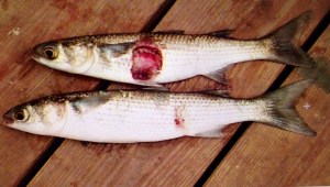
1. Fish: When there is too much fresh water the fish get lesions. This is from a fungus that only can live and operate in a fresh environment. The name of the fungus is Aphanomyces invadans and its spores get into fish skin when temperatures are low and water is fresh causing horrible lesions. More lesions have been reported over time in the St Lucie River that any other site in Florida according to the FDEP report at the end of this blog. The worst outbreak was in 1998 after the ACOE had been releasing fresh water from Lake Okeechobee in the winter months due to heavy rains. Thousands of fisherman were reporting fish with lesions; it is well accepted in the literature of our state agencies that this outbreak was connected to the gigantic releases of fresh water from Lake O.

Striped mullet with lesions. St Lucie River, 1998. (Photo, DEP State of Florida.)

2. Bottle nosed dolphins: Dr Gregory Bossert formerly, of Harbor Branch, has done extensive research into lobo-mycosis, an awful skin disease, in dolphins of the SLR/IRL. The highest number of dolphins with lobo in the entire 156 mile Indian River Lagoon system from Jupiter to New Smyrna Beach, are in the Stuart to Sebastian area. Dr Bossert’s 2009-20014 “Application for a Scientific Research Permit” to NOAA states on page 59:

“Water quality in the central and southern segments of the lagoon, is influenced by infusion of water from flood control drainage canals, e.g., in particular, run-off form agricultural watersheds and fresh water releases from Lake Okeechobee. (Sime, 2005.) Discharges from these sources introduce higher amounts of nutrients, metals, pesticides and suspended solids into the system (Woodward-Clyde, 1994). Analysis of spatial distribution of presumptive cases showed that the highs rates occurred in the IRL  segments 3 and 4 confirming our earlier observations.” (Mazzoil, 2003/Rief, 2006).”

(Sections 3 and 4 are the “south central” and “south” IRL/SLR-from-south of Sebastian Inlet, to Stuart’s St Lucie Inlet. IRL dolphins are “site specific” staying usually in a 30 mile range. The St Lucie River is considered part of the southern IRL.)

S. Indian River Lagoon Dolphin with lobo mycosis. (Photo Dr Gregory Bossert.)

3. Seagrasses: Seagrasses are the basis of health for the entire SRL/IRL. Seagrasses that live in an “estuary” need sunlight and brackish (part salt/part fresh) water to survive. among other problems, the fresh water releases cause turbidity in the water so the grasses can’t get light and they die. Mark Perry of Florida Oceanographic states that during the Lake Okeechobee and canal releases from 2013, that lasted five months, up to 85 percent of the seagrasses died around the St Lucie Inlet. All nursery fishes are affected by this and of course it goes right up the food chain. Manatees, an endangered species, that live exclusively off of seagrasses, are very affected and reduced to eating drift algae that in some cases kills them. Dolphins are swimming around saying: “Where are the fish?!”

Unhealthy looking seagrasses coated in algae as seen 6-14 near Sewall's Point at low tide. (Aerial photo, Jacqui Thurlow-Lippisch)
Unhealthy looking seagrasses coated in algae as seen 6-14 near St Lucie Inlet at low tide. (Aerial photo, Jacqui Thurlow-Lippisch)

4. Near shore reefs: The reef system in our area is the northern most of a tropical reef system that goes all the way south to the Keys. It cannot survive with fresh water dumping sediment on its delicate system and altering the salinity of the St Lucie Inlet. Insaine. These reefs are supposedly “protected.”

Freshwater pollution and near shore reef, St Lucie Inlet. (Photo JTL, 2013)
Freshwater pollution and near shore reef, St Lucie Inlet. (MC archives, 2011.)

I could go on and on, but I will stop here. I’m sure you get the point. Salinity is a delicate and important part of a healthy estuary. Generally short lived fresh water releases during heavy rains by our local canals are bad enough, but long term dumping of Lake Okeechobee releases on top of that, is certain death. It must stop. Send the water south.

_______________________________________________

(NOTE: The links below were removed by the Florida Department  of Environmental Protection in 2016. When I called and asked why, I was told they were archiving…JTL)

FDEP, SLR Impairment/fish lesions: (http://www.dep.state.fl.us/southeast/ecosum/ecosums/SLE_Impairment_Narrative_ver_3.7.pdf )

WETLANDS Volume 25, SFWMD, Estuary in Distress: (SRL/IRL:http://www.evergladesplan.org/pm/recover/recover_docs/cems/cem_st_lucie_irl.pdf)

Citrus Along the Indian River Lagoon, A Killer and a Necessity

Historic postcard, Indian River Citris. (Collection of Sandra Henderson Thurlow)
Historic postcard, Indian River Citris. (Collection of Sandra Henderson Thurlow.)

Thousands of years ago, humankind found a way to avoid the constant nomadic life of following big game, becoming more self sufficient, learning the art of agriculture. Nothing has made our lives better. Unfortunately, after thousands of years of its evolution, nothing has made our lives worse.

Don’t get me wrong, I realize that agriculture an important industry, the second largest after tourism, in the state of Florida. Still, we must look at its issues and try to make things better.

Agriculture is a high intensity land use, using large amounts of pesticides, fertilizers, and fungicides that over time accumulate in the water and the environment. The May 2014 issue of National Geographic states that “farming is the largest endeavor on earth using just under 40 percent of the earth’s surface causing the second largest  impact to the earth, erosion.” 

Much of the land in our area is devoted to agriculture as well, particularly citrus.

The Indian River Lagoon region is famous for its delicious citrus and although the industry is in decline due to canker, it has had huge impacts on the IRL area due to the canal system built to drain the land and water the crops. The muck that has entered the lagoon since the early 1900s is mostly from erosion of canals, due to the runoff from agriculture as they drain their lands that were once swamp or wetlands.

The Indian River Lagoon Region runs from Palm Beach to Volusia Counties, along the 156 miles of the lagoon. (USDA map 2011)
The Indian River Lagoon Region runs from Palm Beach to Volusia Counties, along the 156 miles of the lagoon. (USDA map 2011.)

The USDA documented 89,367 acres of citrus in the Indian River Lagoon region in 2009, declining to 81,673 in 2010. There is a lot of land devoted to citrus, land that has been radically altered from its original state and affects the Indian River Lagoon as there are literally thousands of miles of canals attached and interwoven along these groves. All eventually dump to the river or other water body.

In 1994 the Florida Department of Environmental Protection (FDEP) determined that the north fork of the St Lucie River/Indian River Lagoon, a registered state “Aquatic Preserve,” was contaminated by pesticides that came from the citrus groves in the area of the St Lucie’s headwaters, Ten Mile Creek. (http://www.dep.state.fl.us/southeast/ecosum/ecosums/tenmile_creek.pdf)

In 2002, the Florida Department of Environmental Protection labeled the St Lucie River as “impaired.” Reading through the document there is clear determination of agricultures’ role  in this process, especially with sediment run off, pesticides and heavy metals that have accumulated in the environment. (http://www.dep.state.fl.us/southeast/ecosum/ecosums/SLE_Impairment_Narrative_ver_3.7.pdf)

All postcards of citrus industry in Florida, ca. 1912. (Collection of Sandra Henderson Thurlow.)

IMG_5796 IMG_5797

Reading through the documents it is noted that many of the agricultural areas are quite old, as the post cards I am sharing today from my mother’s  collection are from 1912 and 1914.  According to the FDEP, many of the areas around Ten Mile Creek did not have BMPs, or best management practices in place, as they were  there before such rules were voluntarily implemented in the 1980s and 90s.

I don’t get it. Our environmental agencies have seen the writing on the wall for decades and even with the modern implementations of BMPs, (http://solutionsforyourlife.ufl.edu/hot_topics/agriculture/bmps.htmlwhere farmers try to minimize their impacts on our waterbodies, the rivers, estuaries, and lakes are filling up with excess nitrogen and phosphorus from fertilizer and other pollutants at an alarming rate.

Yes, the FDEP is implementing TMDLs or total  maximum daily loads through the BMAP, or basin management action plan, where municipalities and counties are required to lower their nutrient levels in waterbodies, but these are 15 and 30 year goals, that most certainly will take longer to truly implement. Also agriculture is exempt under the law and Right to Farm Act. They, as mentioned, implement BMPs but it may take fifty or more years to get all farms up to speed, if ever. Do we have that much time?

In the meanwhile, we watch or rivers dying from local runoff from C-23, C-23, and C-44  supporting the citrus and agriculture industries in Martin and St Lucie Counties.  On top of this, during major rain events, Lake Okeechobee, also full of agriculture runoff and high nutrients suspended in muck, from the sometimes back pumping sugar industry south of the lake, pours into the St Lucie River as well, wreaking any work we have done locally to meet local TMDLs.

Would I rather see the citrus lands developed for houses?

No. I rather fix the problems we have. And even though its called “corporate welfare,” I think state, federal, and local governments must help agriculture operate in a way that is not killing the environment. Some of the funds from the state this year that came out of the Senate Hearing on the IRL are doing this and the state really has been helping “forever,” but quietly, under the radar.

It is time to come full out to the public and explain the situation: we must feed ourselves and support our historic industry, but agriculture/citrus is killing our waterways.

In conclusion, of course the industry should make every effort itself to improve the situation, and some are more than others. In any case, we cannot just point fingers at them, we must help them. Perhaps we should bond together and put into law even better, stricter management practices, that will give the children of our state a future, not just eating, but also fishing, swimming and boating in a clean river.

___________________________________________________

IFAS, Update on Best Management Practices, 2014: (http://www.crec.ifas.ufl.edu/extension/trade_journals/2014/2014_January_best_mgt.pd)

USDA and State of Florida Citrus Report 2009: (http://www.nass.usda.gov/Statistics_by_State/Florida/Publications/Citrus/fcs/2009-10/fcs0910.pdf)

The Long Deteriorating “Fishing Ground of Presidents,” St Lucie River/Indian River Lagoon

Harold R Johns, posing with a large tarpon, early 19920s, Stuart, St Lucie River. (Photo from Stuart on the St Lucie by Sandra Henderson Thurlow.)
Harold R. Johns, posing with a large tarpon, early 1920s, Stuart, Florida, St Lucie River. (Photo from Stuart on the St Lucie by Sandra Henderson Thurlow.)

When the pioneers permanently opened the St Lucie Inlet in 1892, it killed the freshwater grasses that filled the waterways creating a brackish estuary that due to the convergence of tropical and temperate zones, and the nearby warmth of the Gulf Stream, became “the most diverse estuary in North America.” (Gilmore)

After a short period of time, sportfishing thrived in the area, and fishing guides called Stuart the “fishing grounds of presidents” as US president, Grover Cleveland, vacationed and fished the area in 1900 and years after.

In spite of long standing issues with the health of the estuary,  as late as the 1970/80s Dr Grant Gilmore of Harbor Branch documented over 800 species of fish living and breeding in the then healthy seagrasses around Sailfish and Sewall’s Point at the convergence of the St Lucie River and Indian River Lagoon. This was a larger variety of species in one place than any other area in United States. (Gilmore)

"Goliath Grouper" called "Jew Fish" at the time, Stuart. ca. 1920s. (Thurlow Collection)

“Goliath Grouper” called “Jew Fish” at the time, Stuart. ca. 1920s. (Thurlow Collection)

Going back to the the 1930s, the 1938 Blue Book, a popular annual fishing publication of the time, lauds fishing throughout the entire Stuart area:

“The City of Stuart located approximately 20 miles south of Fort Pierce is world renowned for its fishing. Located as it is…it offers a variety of fishing similar to Fort Pierce but somewhat more pronounced, particularly with regards to the tarpon, sea trout, snook, channel bass, bluefish, crevasse jack, pompano and ladyfish. It’s fresh water fishing is particularly good far into the back county among the Sloughs with their tributary and drainage canals to Lake Okeechobee and the many drainage canals through this territory. These Sloughs and Canals offer splendid fishing for black bass, as well as for the larger game fish from the salt water, such as  th snook and tarpon, that make their way into Stuart Harbor and on up into the both and south branches of the St Lucie River. –Particularly good fishing for these species can be had at the St Lucie Locks about 12 miles inland south of Stuart…”

All photos from Stuart on the St Lucie, Sportfishing chapter, by Sandra Henderson Thurlow.

IMG_5769 IMG_5767

It is interesting to note that although the Blue Book piece, written in 1938, celebrates Stuart’s fishing, one can find evidence of tension regarding the releases from Lake Okeechobee in the literature of the day as early as 1925.

Fearing the onslaught of development in the booming twenties and the changes brought on by the connection and building of the C-44 canal from Lake Okeechobee to the South Fork of the St Lucie River, beginning in 1923, the South Florida Developer’s, November 10th, 1925 headline reads:

Article 1925, South Florida Developer. (Thurlow collection.)

“Fish Will Leave the River As City Grows, Fisherman Assert, Sewage and Oil Sure Death to a Favored Sport is Verdict.”

The article quotes commercial fishermen who know that  the over abundance of fresh water from Lake Okeechobee will chase away the salt water fish and that the oil on the water from development, perhaps from cars and road runoff,  if excessive, won’t allow the fish to sufficiently breathe.

Fishing guide Phil O’Brian is quoted as saying: “I know the ways of the sea fish. They can’t stand fresh water; and they won’t stand sewer water. We have the fresh water now mixin’ in from Lake Okeechobee and we’ll soon have the sewer water.”

These pioneers are probably rolling over in their graves should they have learned about the story of the St Lucie/Indian River Lagoon most recently.

The St Lucie River was labeled “impaired” by the Florida Department of Environmental Protection in 2002 mostly due to pesticides and heavy metals from agriculture and urban pollution runoff accumulating in the sediment from all area canals, especially C-44 and Lake Okeechobee. In a way, just like the 1920s fisherman foresaw…

The fight against the area canals and Lake Okeechobee continues today, and if by the grace of God we can undo some of the hands of history, the St Lucie and Indian River Lagoon will surely heal herself and we once again could be the ” Fishing Grounds of Presidents…”

…but then we might have to get rid of that green and sprawling golf course at the Floridian.

______________________________________________________

FDEP Impairment St Lucie River: (http://www.dep.state.fl.us/southeast/ecosum/ecosums/SLE_Impairment_Narrative_ver_3.7.pdf) 

The History of the Name “St Lucie River” and Changes to its Watershed along the Indian River Lagoon

The St Lucie River was originally a large fresh water "stream" that ran into the Indian River Lagoon.An inlet was cut in 1892.
The St Lucie River basin/drainage map 2013, SFWMD.

For thousands of years, before the intervention of modern man, the Ais Indians walked the banks of a large fresh water “stream,” that flowed to the Indian River Lagoon. When the Seminoles came years later, they called it Halipatiokee, Alligator Water, as it was fresh and full of gators. The Spaniards came in the 1500s, on and off for centuries. They first called the river, Rio de Santa Cruz, river of the Holy Cross, as the river is cross-like. Later, they re-christened the river Rio De Luz , river of light, for the lighting on the water is heavenly. Eventually, the Spanish called the river, Santa Lucea. The English then taking over, “anglicized” the name Santa Lucea, to what we know today, as “St Lucie,” the church’s saint of the blind, and of “vision.”

1883 Geodetic Survey Indian River Florida, St Lucie River
1883 Geodetic Survey, Indian River Florida, St Lucie River.

Unfortunately, there was not much long-term vision when the watersheds around the St Lucie were altered by modern man. In 1892 area pioneers cut a permanent inlet from the St Lucie River/Indian River Lagoon to the Atlantic Ocean, killing the native fresh water grasses that supported an entire ecosystem. Nonetheless, they created something wonderful, the brackish estuary we all know today.  This area, over the years, before its recent destruction, became one of the most bio diverse estuaries in North America.

That wasn’t enough, the local people and the state, with the help of the federal government’s  Army Corp of Engineers, decided they wanted a connection to Lake Okeechobee for trade, travel, agriculture and the convenience of keeping the big lake of Okeechobee, “low.” So they built the C-44 canal connecting Lake Okeechobee to to the St Lucie “River.” In high water times, the overflow from the lake was directed into the St Lucie River as it is today.  Later, around the late 1950s the people decided they wanted more drained land for orange groves and development in the north, and less flooding, so they got the state and federal government to build the C-23, C-24 canals in Martin and St Lucie counties, draining some areas that had never flown south before. These canals even drained lands out west, in what is now Okeechobee County,  and in the north, known today as the City of Port St Lucie.

Did the people building these canals ever think about the effects on the Saint Lucie River?  This seems doubtful. And so today, we have a river system that takes on much more water than it was ever meant to  receive.

As Ernie Lyons, the former great environmentalist and editor of the Stuart News wrote in the 1960s about the loss of the headwaters of the South Fork of the St Lucie River during his lifetime:

“…The drainers got to work on the marshes. The cypress bordered ponds became white sand in the dry times. A ditch through them gushed silted floods during the heavy rains. The little stream was ruined. It  turned from paradise to paradise lost…”

Not until really the 1970s  did humankind start to reflect and realize that we literally were killling paradise, and we have been trying to revive the spirit of the St Lucie River/Indian River Lagoon ever since.

With out a doubt, the spirit of the saint still lives in the St Lucie River; her ancient story is that she lost her eyes to give the people their own “to see .” When you drive over the bridge and look at her, the beautiful St Lucie, open your eyes and ask her to give us all, “better vision.”

____________________________________________________________

St Lucie River SFWMD: (https://my.sfwmd.gov/portal/page/portal/common/pdf/stlucie.pdf)

Watershed maps/FDEP: (http://www.protectingourwater.org/watersheds/map/)

Story of St Lucy/Lucie: (http://en.wikipedia.org/wiki/Saint_Lucy)