Tag Archives: Lake Okeechobee

Give A Penny or a Thousand, Please Support the Kidz Workbook Event, SRL/IRL

All are invited to attend the River Kidz  Workbook Event Fundraiser
All are invited to attend the River Kidz Workbook II Event Fundraiser

The river is for everyone, especially for kids!

This has been the theme of the River Kidz who since 2011 have been following their self-created mission: “to speak out, get involved and raise awareness because we believe kids should have a voice in the future of our rivers.”

As you may know, River Kidz is a grass-roots group that began with two 5th grade girls in the Town of Sewall’s Point and today includes hundreds of kids who attend local events, follow the Kidz on Facebook, and receive a monthly newsletter through their parent organization, the Rivers Coalition. Groups also sprouted up in St Lucie County and across the state in Lee County. These kids have had a great effect on water quality and St Lucie/Indian River Lagoon issues along our Treasure Coasts and statewide.

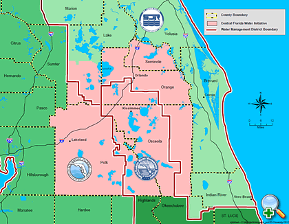
To help educate kids and parents, workbooks came out through a collaboration of adults and Kidz in 2013 focusing on the effects of releases from  C-23, C-24, C-44 and discharges from Lake Okeechobee.

This year, in 2014, the Jensen Beach High School Marine II Honors Class of Mrs Crystal Lucas, reworked the workbook, really entirely redoing it, with more depth of ideas on the canal and Lake Okeechobee problems focusing on the story of Marty the Manatee and his friends and the steady destruction of the rivers over time. New artwork from artist Julia Kelly helps tell the story. The new workbook is more sophisticated and meets Sunshine and Core Standards and most important for the Martine II students, has a mascot to lead the little kids, “Marty the Manatee.” Yes, Marty is based on the student’s  experiences with our local Indian Riverkeeper, Mr Marty Baum!

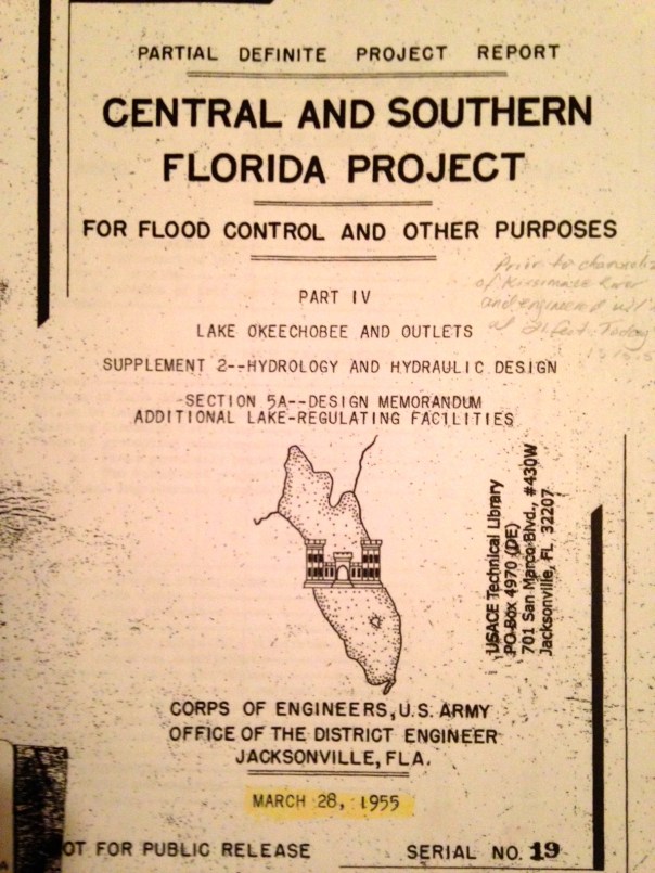
Due to teacher, Mrs Lucas, the Martine II students over a two-year period had exposure to speakers from the Army Corps of Engineers; South Florida Water Management District;  and took field trips to Lake Okeechobee and to the Everglades Coalition meetings among other things. Their depth of study is reflected in the new workbooks. Many of these students will be returning from university for this fundraiser event and to “see” their work published.

The coolest thing of all is that the River Kidz Workbook, Second Edition, is a collaboration of kids teaching kids. The Martin County School District has supported this effort and the plan is to share the workbooks in each second grade classroom in the county. Other workbooks will be shared in other grades and in private and independent schools as well, but second grade is the primary focus.

The final books are not yet printed as the group is raising money. The total costs for around 6000 workbooks is around $10,000 dollars. The books are beautiful full color, around 35 pages, and come with a completion certificate that “makes each kid a River Kid.”

The River Kidz and Adultz overseeing the project are confident they can raise this money as the did for the first workbook. It must be noted that Southeastern Printing of Port Salerno and the Mader family,  have made it possible to print these workbooks at a much lower cost.

We hope that you will attend the November 15th Fundraiser from 4-7PM at Bluewater Editions located at 4665 SE Dixie Highway, Port Salerno, and donate what you can. ALL ARE INVITED!!

We will be joined by artist/photographers Justin Riney, Julia Kelly, and Mike Hoffman.  There will be food and drink, live music, games, artwork for sale, and the River Kidz trademark lemonade stand.

A penny; a dollar; ten; twenty or a thousand…When Marjorie Stoneman Douglas started “Friends of the Everglades” each student gave a quarter and  this is what made the organization work–  EVERYONE WAS PART! This is what we wish to recreate.

So give what you can and come!  Put your money in the  jar by the door! All who donate will be recognized and thanked. Giving something is more important than how much you give.

Fundraising aside, the River Kidz want everyone in the community to be a part of this grassroots effort to save our rivers. I am including some pages of the rough draft so you can see what is “around the corner,” and so you hopefully will be inspired to give.

For me, this project is the “best of the very best” of what will, and already is, creating  a better future for our St Lucie River/Indian River Lagoon. 

Rough Draft of Cover
Page of authors: Mrs Lucas' JBHS Marine Biology students, 2013
Page of authors: Mrs Lucas’ JBHS Marine Biology students, 2013
First page of Chapter 1of 4
Food web
Food web
Sample of questions and artwork
Marty and friends
Marty and friends
What you can do!
“How you Can Help!

____________________________________________

River Kidz is a division of the Rivers Coalition: (http://riverscoalition.org) 

Aerial Tour of October 17th’s Polluted Runoff, C-44, C-23 and C-24 Canals, SLR/IRL

Plume from canal runoff C-44, C-23 and C-24, October 17,2014. (All photos Jacqui Thurlow Lippisch and Ed Lippisch.)
Plume from canal runoff C-44, C-23 and C-24, October 17, 2014. (All photos Jacqui Thurlow-Lippisch and Ed Lippisch.)

Today, I will take you on an air tour, hopefully one of the last of this year’s rainy season. In Florida, rainy season corresponds with hurricane season that lasts June through November. Nonetheless, typically the rains start to wind down towards the end of October.

The Army Corp of Engineers has not released from Lake Okeechobee this year so it has given us an opportunity to see what the runoff  in our area is “in and of itself.” I refuse to use the words “local runoff” because the St Lucie River and Indian River Lagoon’s runoff is over 50%  of what is was before the Water/Flood Control Districts and the ACOE created since the 1920s in order to drain the land for development and mostly agriculture.

It is the runoff of these expanded lands that we are dealing with today, full of sediment, fertilizer, pesticides, herbicides, road pollution, and whatever is on people’s yards.

I think seeing how “bad” our canal runoff is also shows why WE CANNOT ACCEPT WATER FROM LAKE OKEECHOBEE on top of this already bleak situation of our own.

Green is original flood plane and yellow is expanded flood plane. Photo from A "Citizens' Report to Congress" 1995, St Lucie River Initiative.
Green is original flood plain and yellow is expanded flood plain. Photo from A “Citizens’ Report to Congress” 1995, St Lucie River Initiative.

So anyway, enough of my lecture, let’s get started!

Ed in front of Cub Legend
Ed in front of Cub Legend.

The tour starts at Witham Airport in Stuart.

Ruoff from canals and Willoughby Creek
Run off from canals and Willoughby Creek

The first thing one sees once up in the air off of runway 12, is the polluted freshwater pollution/sediment line coming around the tip of Hell’s Gate in the St Lucie River. This water is coming from the South Fork of the St Lucie River where C-44 is located and the North Fork area where C-24 and C-23 are located. This filthy water flows into the St Lucie River proper and then around the tip of Sewall’s Point, into the Indian River Lagoon, out the St Lucie Inlet and then into the open Atlantic Ocean. (See map/chart 3 above for canal locations and expanded watershed runoff.)

Close up
Close up of plume in SLR
Sewall's Point
Sewall’s Point

Continuing on, as one flies over the St Lucie Inlet and along the Atlantic Coast over Jupiter Island one sees the dark water in what is usually a turquoise blue ocean. It must be noted that although this runoff canal-plume is disgusting looking it is nothing close to how dark and sediment filled it was last year when the runoff included releases from Lake Okeechobee.

Beach along Jupiter Island

There was some fun stuff to see also. There were many sharks in the dark waters. Ed and I wondered if they were sneaking  up on the fish in all the cloudy water, there were so many.  We must have seen 20-25 large sharks. We also saw sea turtles and giant rays, and lots of bait fish and sea birds both in and out of the plume area.

Plume from canal runoff C-44, C-23 and C-24, October 17,2014.

As we approached Peck’s Lake, we could see the tip of the plume in the distance like a giant slug. The plume ended about a mile short of Hobe Sound Beach, in Jupiter Island.

Ed and I talked about how one house would have the dark plume waters and another only a few feet away had blue ocean…

Plume up close
Plume up close
Another angle, tip of plume
Long shot with Peck' Lake in background.
Long shot with Peck’s  Lake in background.
Shot of ocean on the trip home
Shot of ocean on the trip home showing edge of plume.

Well that’s the end of the tour. Hopefully you learned something or saw something new. And hopefully it is also the end of the rain for 2014. To learn more about these canals please see links below.

Another year, another rainy season behind us….

As we flew home, I was grateful to live in such a beautiful area and with every flight I become more determined to save it from the dirty waters of our canals and Lake Okeechobee. To destroy such a paradise is wrong.

_____________________________________________

C-44 DEP: (http://www.dep.state.fl.us/southeast/ecosum/ecosums/C-44%20Canal%20.pdf)

C-23 DEP (http://www.dep.state.fl.us/southeast/ecosum/ecosums/c23.pdf)

C-24 DEP (http://www.dep.state.fl.us/southeast/ecosum/ecosums/c24.pdf)


Seeing Results, C-44 Storm Water Treatment Area/Reservoir, St Lucie River, Indian River Lagoon

This aerial shows where the C-44 STA/R. project's intake canal has been built to the right of Indiantown Airport. The immense lands beyond and east of this area will become the STA and Reservoir.
This aerial shows the area of the future almost 10,000 acres that will become the C-44 Storm Water Treatment Area and Reservoir. A landmark of this area is Indiantown Airport, a grass strip located above and north-east of the lake in this photo. So far the C-44 STA/R. project’s four mile intake canal has been built. The immense lands beyond, east, north and west of this area will become the STA and Reservoir.

I spend a good amount of time studying the St Lucie River/Indian River Lagoon; nonetheless,  I am constantly amazed to learn what I don’t know. In a nutshell, the C-44 storm water treatment and reservoir is part of the Indian River Lagoon South Project to clean up the St Lucie River/Indian River Lagoon by storing and cleaning water from our huge C-44 basin.

The project  is part of the Comprehensive Everglades Restoration Plan and even though I have read about it for years, I did not know how or the order of it being built. Today I will share my experience in learning just the beginning.

(http://www.evergladesplan.org/pm/projects/proj_07_irl_south.aspx).

To look back a bit for the history, building the C-44 storm water treatment area and reservoir is combined effort of many years of work of local, state and federal governments and it is one of the most expensive water projects being built in the Florida, with an estimated costs of almost 4 million to complete.  

I wanted to SEE this because it is so hard to understand  it all.

So a few weeks ago my husband Ed, and his friend Shawn and I are flying over this area and I’m saying “where is it? It’s supposed to be here. I want to take some pictures. Hmmm? I don’t see anything…I was expected a big lake like thing off of the C-44 canal or something.”

Ed calmly, says: ” This is it Jacqui. Over the past years the ACOE has been working hard to build this new intake canal. We have seen it for years as we fly over. It must be built first probably; you can see the results.”

So we flew north over the four mile intake canal that finally stopped in a wilderness of agricultural lands.

Intake canal on east, agricultural lands on west.
End of canal.
End of intake canal.

The intake canal was completed in July of 2014 at of cost of 28 million dollars. This is huge accomplishment and this is only the beginning. This is what we can SEE so far.

So what will we SEE in the future?

To get an idea as seen below, the FPL cooling pond off the east coast of Lake Okeechobee is 5,000 acres. The C-44 STA/R. will be almost 10,000 acres. So in the future, when one looks at a Google Maps, there will be another gigantic lake looking thing consisting of the STA (6300 acres) and the reservoir (3, 400 acres) east, north and west of the Indiantown Airport, the red dot below.

Area from Lake O following C-44 canal to St lucie River in Stuart.
Area from Lake O following C-44 canal to St Lucie River in Stuart.
Indiantown Airport
Indiantown Airport along C-44 canal.
Map
Map of C-44 STA/R black. Basin in pink.
Map
Engineering map from ACOE/SFWMD showing where the cells of the C-44 STA/R. will be.

The monies and energy needed to build the C-44 STA and reservoir is and has been tremendous.  In spite of one’s political affiliations or the project itself, we must recognize those who have recently helped ensure the success of the project: the SFWMD, the ACOE, Senator Joe Negron, Governor Scott, Congressman Murphy, the Martin County Commission and the public. I am sure there are many others that I do not know. This gigantic project has taken many years and has been no easy feat. Kudos to the decades of people who have worked to make this first step of the intake canal possible. I recognize your efforts.

Yes it is good to be positive, the C-44 STA and Reservoir is a great start, but it is important to also realize that the resovoir will hold about 50,000 acre feet of water. During some storm seasons we get much more than that just from the C-44 basin alone, and that is NOT counting releases from Lake Okeechobee.

We have a lot more work to do, to get to where we want to be, but finally we are beginning to SEE RESULTS of something getting built to help improve water quality, and that is something more than Martin County has ever seen before in its long fight to save its treasured St Lucie River and Indian River Lagoon.

_____________________________________________


Video C-44 Project (http://www.tmba.tv/broadcastanimation/everglades-restoration/everglades-restoration/)

ACOE 2011: (http://www.sfrestore.org/tf/minutes/2011_meetings/27oct11/IRLS-C44RSTA_TF_27Oct2011.pdf)

SFWMD WRAC 2006 presentation C-44 STA/R. (https://my.sfwmd.gov/portal/page/portal/pg_grp_sfwmd_wrac/portlet_subtab_wrac_archive_reportsdocs/tab772049/wrac_090606_c44_ray.pdf)


How About a Toll Bridge to Raise Money for the Indian River Lagoon?

The Jensen Bridge was completed in 1927. (Photographer unknown, photo courtesy of Bob Washam.)

The idea of a toll bridge over the Indian River Lagoon is not a new one as there were toll bridges in Jensen and Stuart in Martin County’s early days.

Toll Tickets for the Jensen Bridge. Courtesy Bob Washam.
Cover of toll ticket packet for Jensen Bridge. Courtesy Bob Washam.

As my mother says in her Historic Jensen and Eden on Florida’s Indian River book:

“People fishing on both side os the Jensen Bridge made it necessary for automobiles to cross the narrow wooden bridge with extreme  caution.” 

Over time, we have had caution for people, but not for fish.

This morning the Tyler Treadway’s article in the Stuart News states there has been a catfish kill along the Indian River Lagoon Ft Pierce north; it is not yet reported to be in Martin County; in the 1920s no such virus or water quality issues prevailed and fishing was the sport of the day, some of the best in the nation, along the bridges, in the forks, in the St Lucie and Indian River Lagoon, along the clean and sparkling Atlantic Ocean…

Unidentified man with Goliath Grouper caught in area. Photo courtesy of Bob Washam.
Unidentified man with Goliath Grouper caught in Jensen area. Photo courtesy of Bob Washam.

Mrs Thurlow writes in her book:

The Jensen Bridge was instrumental in the development of Jensen with its numerous tourists camps. In the 1930s, the Pitchford, Gideon, and Wade camps sprang up at the western end of the bridge. Other camps, including the massive Ocean Breeze Park, soon followed. The Jensen Bridge was given so much publicity that it became a nationally famous fishing pier.”

"the Jensen Beach Bridge was advertised in the Martin County Chamber of Commerce Fishing Guide, published in 1935. (Courtesy of Robert McClinton Pitchford, Thurlow archives.)
“The Jensen Beach Bridge was advertised in the Martin County Chamber of Commerce Fishing Guide, published in 1935. (Courtesy of Robert McClinton Pitchford, Thurlow archives.)

Today the Indian River Lagoon is still famous for fishing, but also for its seagrass loss and declining fish stock. Yesterday, my father gave me an issue of Florida Sport Fishing, the lead article was entitled “Gator County, Florida ‘s Famed East Coast Lagoon System May No Longer Be the State’s Premier Destination for Giant Trout,” by Jerry McBride.

The beginning of the article reads:

“Two miles of previously lush green vegetation dotted with sandy potholes and carved by narrow channels–once home to monster gator trout–has been reduced to a single acre of sparse seagrass, I fished the entire stretch in less than an hour and paddled home… The estuary’s south end is losing its 80 plus year battle against polluted discharges from Lake Okeechobee, while the rest of the 156 miles long waterways faces an even more insidious adversary—a multi-source nutrient-fueled brown algae scourge that virtually overnight reduced 43,000 acres of rich seagrass habitat to a sandy desert…”

Most of this seagrass loss may have happened north of us, but it is here too. Also, the lagoon is one waterway, whether it is Lake Okeechobee and local canal releases here in Martin County,  or brown tide in the central and north lagoon, we are all affected.

Usually on Friday I try to post something positive and happy.

I have been wanting to share friend Bob Washam’s Jensen Bridge photos,  today was the day.  Nonetheless, I could not ignore the slow and now pronounced losses to our Indian River Lagoon, especially in light of Mr Treaway’s article this morning.

If the tin-can tourist who hardly had a nickel in their packs could be raised from their graves to see what has happened to the Indian River Lagoon,  I am certain they would say:

“You may have more money, but you sure lost a piece of Heaven…and which would you rather have?”

One good thing is that nature is programmed to heal itself, may we have the strength to continue to fight for some semblance of the “good old days,” and should we need to exact a toll on our bridges to start an IRL Fund, I’ll vote “yes.”

___________________________________________________________

Courtesy SCRIPPS NEWSPAPERS/PUBLIC ANNOUNCEMENT

Stuart News announcement 10/10/14:

Catfish die-off hits lagoon
By Tyler Treadway

tyler.treadway@TCPalm.com 772-221-4219

Thousands of dead hardhead catfish are floating in the Indian River Lagoon from Palm Bay to Fort Pierce.

Because only one species is affected and all the dead fish are juveniles mostly from 4 to 12 inches long, a local marine biologist believes the cause is a specific virus rather than poor water quality in the lagoon.

Weve had die-offs like this in the lagoon before, where only sea cats and nothing else was dying,said Grant Gilmore, lead scientist of Estuarine, Coastal and Ocean Science in Vero Beach.

The cause was a viral infection back then, so I would assume its the same this time. Kelly Richmond, a spokeswoman at the Florida Fish and Wildlife Conservation Commission laboratory in St. Petersburg, said the agencys hotline has received 16 reports of dead catfish beginning Monday.

Staffers collected three live catfish and water samples from the lagoon for analysis.

Results should be available early next week, Richmond said, and the agency wont guess at a cause until then.

Paul Fafeita, a Vero Beach fishing guide, said he saw dead catfish Wednesday morning in the lagoon from the Barber Bridge in Vero Beach to the North Causeway bridge at Fort Pierce.

Im talking hundreds, if not thousands of dead fish,Fafeita said.­They werent sporadic, one here and one there. They were steady, up and down the lagoon. Mike Peppe, a Sebastian fishing guide, reported seeing dead catfish Wednesday in the lagoon from Wabasso to the Sebastian Inlet.

They were everywhere,Peppe said.There had to be thousands. Look down and youd see a bunch of white things in the waterthe catsbellies.

History of the River Movement; the Tipping Point, It’s Coming, St Lucie/Indian River Lagoon

St Lucie River Initiative's Report to Congress 1995, and River Dayz '96 Festival. (Courtesy of historian Sandra Henderson Thurlow.)
St Lucie River Initiative’s Report to Congress 1995; River Dayz ’96 Festival booklet; and historic newspaper info in this article courtesy of historian Sandra Henderson Thurlow.

A woman’s right to vote did not come come in a day; stopping the horrors of slavery in the Untied States took a civil war and the life of one of our greatest presidents; most recently, we are seeing a revolution in gay rights.

These movements take time, but eventually, there is tipping point were things begin to change direction. As we know, our river movement has been going for almost 85 years as the first time the Martin County commission asked the ACOE to stop releasing Lake Okeechobee water into the St Lucie River was documented in their minutes of  1930.

1930 request of the MCBOCC for the ACOE to halt releases from Lake O to SLR.

Today I wanted to encourage you not to feel discouraged that the St Lucie Indian River Lagoon movement has been going on so long, but to feel empowered that you are part of something that is big, that takes years, and has a moral element to it just like human rights. This moral element is what in time will force the State of Florida and the United States of America to scrutinize our destructive drainage practices of the past.

As it says in our Declaration of Independence:  When in the Course of human events, it becomes necessary for one people to dissolve the political bands which have connected them with another, and to assume among the powers of the earth, the separate and equal station to which the Laws of Nature and of Nature’s God entitle them, a decent respect to the opinions of mankind requires they should declare the cause which impels them to the separation.

For me, this document gives permission to pull away when necessary. We are and have been pulling away. We envision something better and we are willing to fight for it. Just for the record, some of those before us include:

1. Commercial fishermen in 1925, two years after the canal opened in 1923, in the newspaper of the day, The Florida Developer fought the destructive abundance of fresh water from the lake.

2. A 1931 article from  The Florida Developer’s editorial team notes it was “critical” that the releases from Lake Okeechobee be stopped.

3. 1945 another paper, The Stuart Messenger notes that the river had turned into a “mud soup,” killing fishing; tourism; and real estate.

4. 1958 local citizens filled the Martin County Courthouse to discuss with a delegation of the Flood Control District and the Army Corps of Engineers the possibility of a third outlet from Lake Okeechobee. Although hopes were high, nothing  materialized.

5. Editor, and writer for the Stuart News, Ernest Lyons (1931-1974) wrote many award-winning articles against over canalization in our area of not only C-44 from Lake Okeechobee but also  C-23, C-24 and C-25 further north that drained even more polluted fresh water into the rivers. His newspaper/writing career continued for many years.

6. In the early 1950s the Izzak Walton Group; the Martin County Conservation Committee and the St  Lucie- Indian Rivers Rivers Restoration League all fought for the river even garnering meetings with top government officials. Apparently the ACOE met with locals and a report was done “but nothing ever happened…”

7.  In 1990 Ernest Lyons, who had been prominent in all groups  listed in #6, died:  to fill that void, “Leadership Martin County” in 1992 , with the help of Mr Bud Jordan, Kevin Henderson and Tim Kinane, founded the St Lucie River initiative whose report to Congress is today’s blog photo. Their “River Dayz Festival” on behalf of the river brought hundreds together, they created river materials for elementary, middle and high school students, focused on muck removal and business support.

8. In 1993 the Greater Martin County Board of Realtors joined in its support of the St Lucie River/Indian River Lagoon, sending out a letter stating that the organization had joined the St Lucie River Initiative and encouraged a “call to action to contribute to the organization and to write letters to government officials.”

9. In 1998, after the worst toxic algae bloom and fish kill/fish lesion outbreak ever documented in Martin County during heavy  releases from Lake Okeechobee, the Rivers Coalition came into being unifying businesses and an education program as well as developing the Rivers Coalition Defense Fund set up to sue the Federal Government and others on behalf of the St Lucie River/Indian River Lagoon. Realtor Leon Abood, became the longstanding and outspoken chair.

10. On December 4th, 2010, a Rivers Coalition Lawsuit against the Federal Government was heard in the Court of Federal Claims in Washington DC. According to edited words of Karl Wickstrom, chair of the Defense Fund at that time, U.S. District Judge Lynn Bush wrote in her explanation:

“The St. Lucie River is by all accounts, a national treasure. The longterm environmental consequences of defendant’s,  U.S. Army Corps of Engineers,’ massive discharges into the river are tragic, and the court takes note of plaintiffs’ tireless efforts to reverse that damage.”

The court ruled that a remedy to stop the harmful discharges must come not from the courts but from Congress; she dismissed the case, but it garnered national attention and moved issues of the river forward.

11. In 2011 the River Kidz were born of two 5th grade girls and became a division of the Rivers Coalition. They held two river rallies at the St Lucie Locks and Dam in 2012 during discharges from Lake Okeechobee. Senator Joe Negron, Chairwoman Sarah Heard, and other politicians mingled with parents looking for a way to deal with the discharges. Congressman Patrick Murphy later also supported the Kidz in their efforts. The key: parental involvement and youth.

12. 2009-2011, going public in 2012/13, it was realized a that a super bloom and brown tide algae bloom had killed 60% of the seagrasses in the northern and central IRL. Unusual Mortality Events (UMEs), declared by NOAA, followed for both endangered manatees and the protected bottle nosed dolphins. Hundreds of pelicans also died.  This galvanized the counties of the IRL, southern, central and northern alike.

13. 2013, the ACOE starts releasing from Lake Okeechobee May 8th until October 21st. This time becomes the “Lost Summer,” toxic conditions ensue. Young Evan Millar and Clint Starling and others call for a rally at the locks on Facebook. Over 5000 show up. Beach rally later brings over 2000. Hands Across the Lagoon unifies thousands across the 156 mile lagoon as well.  The STUART NEWS/SCRIPPS NEWSPAPERS starts a river news campaign that has educated thousands and is still going today. St Lucie County as well as Lee County River Kidz is born…

14. 2013 the Sugarland Rally in Clewiston; Senator Negron’s Senate Hearing on the Indian River Lagoon and Lake Okeechobee Basin;  Congressman Murphy invites the state and local officials, the River Warriors, and River Kidz  to to a meeting on the Indian River Lagoon and Lake O.  in Washington DC. …..Commissioner Ed Fielding forms the Indian River lagoon County Collaborative unifying all counties along the lagoon. (Palm Bach quits.)

15. In 2014 the fight has continued. The pressure has not let up. Presently the University of Florida is studying the issue of “sending water south…”

16. 2014,  last week, the South Florida Water Management District and Dept of Environmental Protection and others recommend against Sugar Hill, a proposed development in Hendry County on option lands, most designated for Everglades restoration or trading.

It has been a long journey, but I am confident that the tipping point is coming. We have over drained our lands, we have destroyed our rivers and lakes, we are wasting 1.7 billion gallons of fresh a day to tide knowing we have a growning population coming…

If nothing else, it will be the need for fresh water and the knowledge that wasting it is wrong that will  in the future push the St Lucie/Indian River Lagoon movement tipping over the edge…


Aerial Photos: SugarHill-Sector Lands, Restoration, Indian River Lagoon

A view from Airglades Airport looking southerly. Photo Ed Lippisch, 9-14)
A view from Airglades Airport, the business center of proposed US Sugar’s “SugarHill” development,  looking southerly into a horizon of agricultural lands. (All photo by Ed Lippisch, 9-27-14)

(* I have just realized the photo above is the old Clewiston Airport not Airglades. Here is one of Airglades from http://www.airnav.com/airport/2IS.   JTL 9:30 AM.)

Airglades Airport, photo Wikipedia.
Airglades Airport, photo AirNAv.

The flight last weekend: Stuart to Clewiston…

I could not be a passenger, it was too windy and I knew I would be sick hanging my head over the edge of the Cub. It has happened before.

In the yellow Piper Cub, the fight to Clewiston from the St Lucie River/Indian River Lagoon, in Stuart, is about 45 minutes one way, a long time if the air becomes a rough ocean.

Approaching Clewiston from the east.

So my husband, Ed flew alone and sent me a few photos along the way. He will do anything to get  up in that airplane. For him it is fun even if it is windy.

So let’s take a closer look where Ed flew, to that area we all keep taking about in Hendry County and proposed first by US Sugar Corporation: SugarHill.

As one can see from the map below, Airglades Airport is west of Clewiston close to where Highway 27 shoots north.  The SugarHill sector plan land use change encompasses a tremendous amount of land, 44,000 acres, these  lands are located where the state has an option to buy for Everglades restoration.  If some of those lands get zoned for residential and commercial development it could complicate trying to send water south through trading these lands or using them for restoration in the future. That’s why we want to take a look.

Location of Airglades Airport, Google Maps, 2014.
Sugar Hill proposal, 2014.
A view from Airglades.
A view from Airglades Airport, (same photo as above) shows runway on right, development on left, and miles and miles of surrounding agricultural lands.
Agricultural lands.
Agricultural lands.
Agricultural lands.
Agricultural lands.
Agricultural lands land canal.
More agricultural lands and canal.
Very north west over what was once Lake Hipochee.
Very north-west over what was once Lake Hipochee, headwaters of the Caloosahatechee.
Flying back to Stuart looking back to Clewisotn.
Flying back to Stuart looking back to Clewiston.

So basically the SugarHill sector lands are west of Clewiston, there is an airport, some development and miles and miles of agriculture. What is shall become only time will tell. I hope now that you’ve had a look, it will be easier for you to make a decision to protect these lands for the Everglades, St Lucie River and Indian River Lagoon.

__________________________________

Article 360: (http://www.law360.com/articles/579122/us-sugar-s-plan-could-bog-down-everglades-restoration) 


The Far Reaching Hand of Hamilton Disston/Our Savannas, and the Indian River Lagoon

Aerial photo over the Savannas, a mosaic of color comparable to one of Monet's most beautiful.
Aerial photo over the savannas.(Photo Jacqui Thurlow-Lippisch/Ed Lippisch 2013.)

I learned something recently that surprised me…

Hamilton Disston, the titan-developer and “drainer extraordinaire” who bailed Florida’s “Internal Improvement Fund” out of debt in 1881 owned land right here in St Lucie and Marin Counties. (http://en.wikipedia.org/wiki/Hamilton_Disston)

My first thought upon realizing this, was “what if he’d started draining here? “

Disston instead started along the Kissimmee River and Lake Okeechobee and was the impetus and inspiration for draining south and central Florida which has led to our state’s development but also our environmental destruction.

Disston 4,000,000 acres from the state of Florida in 1881, which included much of the land within the savannas. ( Public map, 1881.)
Disston purchased 4,000,000 acres from the state of Florida in 1881, which included much of the land within the savannas. ( Public map, 1881.)

The above map shows in pink the 4,000,000 acres of land that Hamilton Disston purchased which although hard to see  included much of the land within our savannas.

Plat map of St Lucie Gardens originally part of Disston's lands in the savannas, 1911. (Courtesy of historian Sandra Thurlow)
Plat map of St Lucie Gardens originally part of Disston’s lands in the savannas, 1911. (Courtesy of historian Sandra Thurlow)

Another wild thing I recently realized in relation to Hamilton Disston is that my friend Sam Henderson, of Gulfport, is the mayor of Disston’s first founded city. Gulfport is in Pinellas County near Tampa. Sam is certainly one of the most environmentally oriented mayors in the state; we know one another from our work on the Florida League of Cities’ environmental committee.  (http://en.wikipedia.org/wiki/Gulfport,_Florida)

Mayor Gulfport, Sam henderson and I at a recent Florida League Cities meeting, 2014.
Mayor of Gulfport, Sam Henderson and I at a recent Florida League of Cities meeting, 2014.

So for some reason, before my epiphany last week, I had no idea that Disston’s drainage machine went so far north beyond Tampa, to where Sam lives on the west coast, and so far east, to my home area near the savannas, along the Indian River Lagoon. You’d think I’d know such a thing!

Savanna State Park, Martin and St Lucie Counties. (Photo from their website.)
Savanna State Park, Martin and St Lucie Counties. (Public photo.)
The Savannas today are located  between Jensen Beach Boulevard to Midway Road.
The Savannas today are located  between Jensen Beach Boulevard to Midway Road. (Public map.)

Well my mother Sandra Thurlow did know, and when I ask her about it she told me that in her book  Historic Jensen and Eden on Florida’s Indian River, I could read all about the savannas ecosystem that was once almost 200 miles long and has been reduced to 10 ecologically intact miles between Ft Pierce and Jensen Beach, and how the railway running along its eastern edge ironically protected it.

She also noted that in 1854, a Florida state engineer/geologist proposed cutting a canal from the “Main Savanna” into the St Lucie Sound. This did not happen, but some of the land was developed as St Luice Gardens and development certainly has encroached…

What if they’d drained it all…..

To close, we are fortunate that Hamilton Disston did not start draining around the SLR/IRL and that we have a small remnant of the savannas left. Let’s continue building  friendships with other environmentally water-oriented people our across our state and put the drainage spirit of Hamilton Disston on the shelf where it belongs.

_______________________________

Many thanks to those who worked to create Savannas State Park like former Martin County commissioner Mrs Maggie Hurchalla.

Savannas State Park website: (http://www.floridastateparks.org/savannas/)


Artist Julia Kelly and the Second Edition River Kidz’ Workbooks, St Lucie River/Indian River Lagoon

Artist Julia Kelly's beautiful artwork will be featured in the River Kidz Second Edition Workbook. Her work was also featured in the first edition. (Photo 2014.)
Local artist, Julia Kelly’s vibrant artwork will be featured in the River Kidz second edition workbook. Her work was also featured in the first edition in 2013. (Julia Kelly, Photo, 2014.)

In 2013, the first edition of the River Kidz workbook was produced with help from Mary Anne Conrad, teacher at Jensen Beach Elementary, Nic Mader, River Mom and Dolphin Ecology Project, Julia Kelly, artist, (http://juliakellyart.com), input from the “Kidz,” and me, Jacqui Thurlow-Lippisch.

The workbooks were a great success and shared in many of the Martin and St Lucie County elementary and middle school classrooms.

Cover of River Kidz, "Paradise is Home"  workbook, first edition. Artwork by Julia Kelly, 2013.
Cover of River Kidz, “Paradise is Home” workbook, first edition. Artwork by Julia Kelly, 2013.

(In case you have not seen the first edition,  electronic copies are available  at (http://riverscoalition.org) at the bottom of the page.)

Now, in 2014-2015, a second edition will be released. Exciting! But what’s the difference and why so soon?

Well, long story short, one of the projects that master-teacher Crystal Lucas did with her Jensen Beach High School (JBHS) Marine Biology II Class last year, during the LOST SUMMER, was a “rework” of the first edition workbooks. The idea was to have the older kids teaching the younger kids. A collaborative effort and from their perspective.

River Kidz was started by two fifth grade girls in the Town of Sewall’s Point in 2011, Evie Flaugh and Naia Mader. The power of the movement is that it comes from kids. The overseeing adults of River Kidz wanted to keep that theme going, but to bring it to a new level.

The JBHS students were in a position to do this because with Crystal’s leadership they had had extensive studies of the Everglades, St Lucie River/Indian River Lagoon in reference to discharges from Lake Okeechobee and the local canals, C-23; C-24 and C-25.  This education involved attending the Everglades Coalition Conference, studies with the Everglades Foundation, air boat rides in Lake Okeechobee with legends Nat Reed and Maggie Hurchalla/SFWMD, classroom visits by the Army Corp of Engineers’ Lt. Col. Thomas Greco, Marty Baum, the Indian Riverkeeper and many local and state elected officials including myself.

The students even won first place in the Keep Martin Beautiful Environmental Stewardship Awards  for their work on water issues!

Concerning the rewrite of the workbook’s first edition, the JBHS students decided first and foremost that there needed to be a mascot and a story.  They determined the mascot should be named , “Marty the Manatee,” and yes, this was inspired by none other than Mr Marty Baum! (http://www.indianriverkeeper.org)

So artist Julia Kelly was task to come up with a character and she did, even though she refused to put a mustache on Marty as the students requested because she felt “we needed to be wary of anthropomorphizing the animals.” The steering committee agreed, and Marty was born! 🙂

"Marty the Manatee" by artist Julia Kelly, 2014.
“Marty the Manatee” by artist Julia Kelly, 2014.

Through the JBHS students’ eyes, Marty tells the story of his ancestors’ former home in all its glory with the mythical Pond Apple Swamp at the southern rim of Lake Okeechobee, clean rivers, and a life with animal friends throughout the northern and southern Everglades.  He then goes into today’s struggle with overdevelopment, agriculture, sugar and agribusiness south of the lake, polluted water discharges, redirection of  water into the St Lucie/IRL and Calooshatchee from Lake Okeechobee, and other drainage canals, loss of seagrass, algae blooms and friend “die-offs.”  He gives ideas for a better, cleaner world and a happier future. There is hope! And that hope lies in the River Kidz, the future….

Marty the Manatee with all of his river friends. Julia Kelly, 2014.
Apple Pond Forest.
Apple Pond Forest.

The workbooks will be a beautiful collaboration of student and artistic ideas that are sure to inspire generations to come. The goal is to have a fundraiser-grand-release party in November at Blue Water Editions, a division of Southeastern Printing, the invaluable local company that  will be printing the workbooks.

The workbooks are a collaboration, and River Kidz is a division of the Rivers Coalition. The steering committee consist of Nichole Mader, Crystal Lucas, Valerie Gaynor, Jacqui Thurlow-Lippisch and Blue Water’s Jason Leonard.

Donations are welcome!

Bumperstickers promoting the workbook are available at Blue Water Editions, located at 4665 Se Dixie Highway, Port Salerno. (http://www.bluewatereditions.com)

More information will be forthcoming. But for now, enjoy the artwork and remember ALL KIDZ (and ADULTZ)  are River Kidz!

Our mission is to “speak out, get involved, and raise awareness, because we believe kids should have a voice in the future of our rivers!”

Marty...
Marty eating, swimming and thinking…
Marty the wonderful and friendly manatee!
Marty with friends and family discussing wounds from boat hits, polluted water, and lack of seagrass…teaching the kids how to build a better world for him and the kids through creating a better water environment.


Florida Classics Library, Everglades’ Historical Destruction, St Lucie River/Indian River Lagoon

One of Val Marin's favorite books, "Everglades of Florida," first printed in  1911, and reprinted as "South Florida in Peril," 1988. Florida Classics Library.
One of Val Marin’s favorite books, “Everglades of Florida,” first printed in 1911, and reprinted as “South Florida in Peril,” 1988, by Florida Classics Library.
Florida Classics Library

When I was a kid in the 1970s and 80s, there was a bookstore called VAL’s BOOKS. It was located on East Ocean Boulevard across from the Martin County Courthouse. My parents were very fond of Val and we would often visit, browse, and buy. Visiting the bookstore was an escape from the wonderful but limited world of early Stuart.

Years passed, and the businesses along East Ocean changed, and the beloved owner of Val’s Books, Mr Val Martin, moved his bookstore to Hobe Sound. Today you will see it if you drive south on Dixie Highway from Stuart to Bridge Road. It is located at a fork in the road and is a large, attractive spanish style building. The sign reads FLORIDA CLASSICS LIBRARY.  (http://www.floridaclassicslibrary.com)

This bookstore is the absolute coolest for the “river enthusiast,” River Warrior, the person who appreciates Florida history or just wants a break from the norm.

There are copies of very old maps, old books, out of print books that have been reprinted by Mr Martin, and a great selection of children’s books as well. All have to do with Florida.

1856 War Map of Florida Everglades, Florida Classic Library.

It was at this bookstore that I first found maps and books that would give me great insight and historical reference for the destruction of South Florida and our St Lucie River/Indian River Lagoon. Val has fought for the Indian River Lagoon himself since the early days and you will see his name now and again in a Letter to the Editor. At the bookstore, he is a great “guide.”

The first book he called to my attention was the one in today’s featured photo, A Study in Bureaucratic Self-Deception, South Florida in Peril-How the United States Congress and the State of Florida in cooperation with land speculators turned the River of Grass into a billion dollars sand bar.

It’s cover photos features a poor alligator in the Everglades struggling to find water in a culvert in the same “land” its ancestors thrived.

The book itself is a collection of documented congressional and state meeting minutes/summaries. Reading it is sometimes a collection of  nauseating run on sentences but very educational and mind-blowing.

For instance on page 21, in an excerpt from 1881, entitled: Note 2, Agreement Between *Hamilton Disston and Trustees of the Internal Improvement Fund for the Reclamation of overflowed Lands, the book reads in discussion of Lake Okeechobee, the St Lucie River, and the Caloosahatchee:

Drainage map of Florida 1911. Florida Classics Library.
State/Federal drainage map of Florida 1911. Florida Classics Library.

“…by cuts or canals, including both those already patented as well as those that may hereafter be patented to said State by the United States, the said lands are to be reclaimed and drained and rendered fit for cultivation by permanently lowing and keeping reduced the waters of Lake Okeechobee, and thereby permanently lowering and keeping reduced the high water level of said river, and by thus lowering the waters…it being understood and agreed that the drainage, reduction of lowering of the waters of Lake  Okeechobee may be made by a series of canals or cuts from the waters of said lake to the Caloosahatchee River on the west and by cuts and canals from said lake eastwardly to the waters of the St Lucie or other available point…”

For me, it is hard to believe this conversation took place in 1881!

The book goes on to document the state’s efforts to introduce sugar cultivation into south en Florida around the fertile muck lands of Lake Okeechobee and is a documentary record of “those efforts at both the State and National level to ditch, dike and reclaim the Everglades for agricultural production which ultimately resulted in the legacy of destruction of ecosystems across the south region of Florida and its adjacent seacoast.”

Oh well…

The only way to change history is to know history. A visit to Val Martin’s Florida Classics Library is a great place to start!

__________________________________

The address of Florid Classics Library is: 11300 Se Dixie Hwy, Hobe Sound, FL 33455.  Here is the website from which you can also “browse:”(http://www.floridaclassicslibrary.com)

*Hamilton Disston was the first successful “drainer” of our state, it is widely believed that despite his “success” and great riches, he ended up committing suicide in a bathtub because of the repercussions of the “Financial Panic of 1893;” some reports say it was heart trouble. (http://en.wikipedia.org/wiki/Hamilton_Disston) 

Central Florida Water Initiative, Running Out of Water, What Could This Mean to the SLR/IRL?

The Central Florida Water Initiative is an area of Florida that "does not have enough water." Could they use ours?
The Central Florida Water Initiative is an area of Florida around Orlando that “does not have enough water.” Could they use ours?

We keep hearing: “Water is the new oil.”

This is hard to believe when one lives in Martin County and watches the destruction from too much fresh water into the St Lucie River/Indian River Lagoon from canals C-23, C-24, C-25, C-44 and releases from Lake Okeechobee. According to the Florida Oceanographic Society, 1.7 billion gallons of fresh water per day is sent/wasted to the Atlantic Ocean and Gulf of Mexico through the St Lucie, Caloosahatchee and other South Florida canals.

Well, there is one area of our state, not too far away, that is running out of water. Today, these counties are part of what is called the “Central Florida Water Initiative,” CFWI. They include:  Seminole, Orange, Osceola, Lake, Polk, Brevard and Volusia.

I must divert for a moment because this is really something as this area holds the “headwaters of the Everglades.”

“Shingle Creek,” in Orlando’s Orange County, is generally considered to be the northernmost headwaters of the Everglades’ watershed. This is an area you probably drive right past upon a visit to Disney World. It was named after the cypress trees that were used to make roof shingles in the pioneer era and beyond.

In the 1960s and 70s, after the cypress trees were cut for the shingle industry, Shingle Creek and the other surrounding streams and lakes’ water-levels were “brought down” in order to allow more development.  One of the ways this was achieved was through the Army Corp of Engineers’ canalization of the once long, serpentine, Kissimmee River. Canalization of the Kissimmee not only helped lower the lakes so they could drain, but also created lands along the now straight canal  for ranch and real estate development.

Today, as we know, all that now dirty, unfiltered, water shoots down the Kissimmee into Lake Okeechobee and then is redirected to the St Lucie and Caloosahatchee so the sugar and vegetable farmers south of the lake have “dry feet,” as well… Thankfully, parts of the Kissimmee have been restored and society recognizes the canalization of the Kissimmee River as an environmental disaster. Our disaster.

Nonetheless, there is no way to completely undo what we have done, so now south of Lake Okeechobee and north of Lake Okeechobee often does not have enough water, while the Northern Estuaries sometimes HAVE TOO MUCH.

Where am I going with all this?

So fast forward, it is now 2014, and as I mentioned the “headwaters of the Everglades” and the counties surrounding it are literally “running ” out of water.

This is why the Central Florida Water Initiative, mentioned at the beginning of this write up, was formed.

An excellent article entitled “Central Florida Water Initiative,  “A Regional Response to Avoid a Pending Crisis” written by attorneys  Michael Minton, Laura Minton, and John Wharton, of Dean Mead for the Florida Engineering Society succinctly explains the history, goals, and future for the CFWI. I would like to share some of this article.

The article notes how from 2007-20012, the St Johns, South Florida, and Southwest Florida water management districts undertook an assessment of available groundwater for the seven counties listed at the beginning of this blog, noting insufficient quantities for the area’s projected growth— projected to be 6.6 million by approximately 2050. This would include an addition of  3,000,000  people to the population today.

Thus over time and through much coordination and work the CFWI was born.

After deep explanations, the article explains that the CFWI’s conclusions  and recommendation include the following concepts: water is undervalued; continued use of just groundwater sources would cause unacceptable environmental impacts to the Floridan aquifer; the importance of conservation; the importance of alternative water sources, its expense and the coordinated regional effort that would be required to achieve such for the future.

The CFWI is obviously a complex effort thus I will not attempt to go into too great of detail. If you are interested, you can read more about it here:

(http://cfwiwater.com); (http://floridaswater.com/watersupply/CFWIinitiative.html ); (http://cfwiwater.com/pdfs/CFWI_RWSP_FinalDraft_Vol1.pdf)

What I must mention is that on  the final page of the Dean Mead article something very interesting is stated:

“The Solutions Planning Team’s (STP) report is scheduled to be made public in Fall 2014. Once the findings of the SPT are approved by the Steering Committee, it is anticipated that the findings will be made available to the Central Florida Legislative Delegation. The collection of uniquely talented individuals who have volunteered their time and effort to serve on the committee has yielded many novel and creative concepts. Some of the creative opportunities look beyond the CFWI’s geographic boundaries and contemplate transmission of surface water from regions with excess water supply, to the detriment of their environment, to Central Florida to supplement the existing supply. These creative and innovative options are the type of out of the box thinking that long-term solution Florida’s water strategy and policy will require…”

I wonder and I hope they are talking about “us…”

____________________________

The Article, Central Florida Water Initiative,  A Regional Response to Avoid a Pending Crisis by Dean Mead, was published in the JOURNAL of the Florida Engineering Society, to access this article you must be a member: (http://www.fleng.org/pubs.cfm)


Sugar Hill Sector Plan/Airglades Airport’s Location and How it Affects the Indian River Lagoon

Sugar Hill Sector Plan and Airglades Airport's location in reference to Lake Okeechobee, (Maps, iPhone, 2014.)
Sugar Hill Sector Plan and Airglades Airport’s location in reference to Lake Okeechobee, (Maps, iPhone, 2014.)

Since last week, you may have seen press on “Sugar Hill and Airglades Airport,” a land use change proposal located in Hendry County southwest of Lake Okeechobee. This is a highly controversial, approximately 67 square miles, of present “farmland” that could change to residential, (up to 18,000 homes), and commercial lands, built around an airport that is already in place with the potential to expand.

Just for comparison, the Airglades Airport runway is 5900 feet long while Witham Airport’s in Stuart is 5800 according to my husband Ed. (http://en.wikipedia.org/wiki/Airglades_Airport)

Anyway, this morning I do not have time to debate this issue in detail, but I will say of course that it is a true “game changer.” I wanted to SHOW where these lands are located in reference to lands that are still available for purchase by the state of Florida due to an option you may have heard of as well.

If purchased, these “option” lands would be key in Everglades restoration from Lake Okeechobee to the Everglades and restoring some pathetic remnant of its historic flow.

Presently, the state does not want to buy these lands because politicians claim there is no money to maintain them and if they were bought the lands will just end up “sitting there,” at great expense until a possible time they could be utilized in the future, like 2060.

This argument may sound “reasonable” but in order to save the Everglades and the St Lucie River/Indian River Lagoon, purchasing these lands is critical and should be done “now” because if these lands are not purchased “now,” as the Sugar Hill Sector Plan shows, their land use could be changed  and then the lands will be too expensive for the state to ever purchase. Market value for agricultural lands is less than residential. Sometimes life demands you spend money now to save in the future.

So, just so we know where we are talking about, where are these Sugar Hill and Airglades lands located? See map below.

Airglades Airport and the Sugar Hill Sector plan are located south west of Clewiston by about five miles on the west side of Lake O along Hwy. 27.

They are located on Highway 27 west of Clewiston. Highway 27 runs through the Everglades Agricultural Area south of Lake Okeechobee connecting both coasts. The Airglades Airport and Sugar Hill Sector Proposal are located right before the highway shoots north. See red dots above and below. The 67 square miles of Sugar Hill Proposed Sector lands are “around” the airport. I do not know exactly where, but I would think mostly south.

At closer view, one can see the Airglades Airport  amongst the sugar fields.
At closer view, one can see the Airglades Airport amongst the sugar fields.

Now if we look at a partial map of the option lands we can see that the Airglades Airport and Sugar Hill Sector Proposal are located in lands that were designated for purchase to one day benefit Everglades restoration for posterity. (Dark green is of “most importance” and yellow is of “importance,” both are option lands…)

Map showing option lands close to Clewiston.

Overall EAA option lands:

Option Lands marked for purchase for Everglades restoration under former gov. Charlie Crist. The deal fell apart due to politics and the financial crisis of  2008--a much smaller land purchase ensued.
Option Lands marked for purchase for Everglades restoration under former Gov. Charlie Crist. The deal fell apart due to politics and the financial crisis of 2008–a much smaller land purchase ensued.

OK…so how would this fit into the Plan 6, River of Grass restoration? Please keep in mind Plan 6 and all “plans” are fluid as they have not happened yet…The amount of water we are talking about it almost beyond comprehension and requires great areas of land beyond lines on a sheet of paper. So even though this Plan 6 chart concentrates flow between the Miami and New River Canals the lands west of this area where Sugar Hill would be located are part of the overall restoration plan for this area as we can tell from the option lands maps above.

Plan 6.
Plan 6.
Plan 6, River of Grass.
Plan 6 flow, River of Grass.

In conclusion, and to repeat myself:  all the lands marked as option lands are important for the overall Everglades/Northern Estuaries restoration project. The Sugar Hill Sector Plan, if successful, is setting a precedent for changes in agricultural land use in Florida. There may be no turning back on this at this point as the Scott Administration gutted the Department of Community Affairs  that used to keep such land use changes in check.  As usual the state of Florida has put development  before restoration of natural lands and water’s protection.

When Florida’s future waters are  just one big toxic algae bloom, and people do not want to live here, I wonder if some of our politicians will wish they had voted another way? Oh but they will be dead like me, so I guess it doesn’t matter….

It does matter. It matters almost more than anything in the world. Please make your voice known and let’s leave something to the children of the future other than cookie cutter homes.

_________________________

Tampa Bay Times Article, Sugar Hill: (http://www.tampabay.com/news/environment/us-sugar-plans-development-on-land-florida-wanted-for-everglades/2196332)

Teamwork’s Success, Reporting S-308’s Toxic Algae Bloom to the State and ACOE, St Lucie River/Indian River Lagoon

The collective teamwork of the SLR/IRL River Movement has had a tremendous effect on state agencies such as the ACOE and SFWMD. "KEEP THE GATES CLOSED!" (Photo of  River Warrior and River Kidz mom, Cristina Maldonado, donning her homemade protest shirt at the St Lucie Locks and Dam River Rally. Photo Jacqui Thurlow-Lippisch, 2013.)
The collective teamwork of the SLR/IRL River Movement has had a tremendous effect on state agencies such as the ACOE and SFWMD. “KEEP THE GATES CLOSED!” (Photo of River Warrior and River Kidz mom, Cristina Maldonado, donning her homemade protest shirt at the St Lucie Locks and Dam River Rally. Photo Jacqui Thurlow-Lippisch, 2013.)

Today I want to share what I consider a huge recent success of the River Movement and our ability to network and work together to protect our St Lucie River/Indian River Lagoon.

On August 25th, Jensen Beach activist Jackie Trancynger sent out an email blast featuring a photograph taken by Paul Shidel of an awful looking algae bloom he found while photographing birds at Port Mayaca. Port Mayaca is where structure S-308 is located that allows water from Lake Okeechobee to be released into the C-44 canal to the St Lucie River/Indian River Lagoon.

Here’s the photo. You may recall reading about it in one of my previous blogs or seeing it in an email exchange:

August 24, 2014 photograph of blue-green algae bloom east of S-308, Lake Okeechobee/C-44 Canal area/ (Photo courtesy of Paul Shindel.
August 24, 2014 photograph of blue-green algae bloom east of S-308, Lake Okeechobee/C-44 Canal area/ (Photo courtesy of Paul Shidel.)

So anyway after I saw the photo,  I called Jackie Trancynger and got Paul Shidel’s email in order to verify the location of the bloom-certainly appearing to be toxic algae. Paul not only verified the location but provided a map!

Map of algae bloom's location on east side of S-308, C-44 canal. (Paul Schindel.)
Map of algae bloom’s location on east side of S-308, C-44 canal. (Paul Schidel.)

On Tuesday, August 26, I participated as I have for almost two years now, in the ACOE Periodic Scientists Call in my capacity as an elected official from the Town of Sewall’s Point at the invitation of Ms Deb Drum, who oversees Martin County’s Ecosystem Restoration & Management Division.

During this call I sent Paul’s photo and map to the ACOE stating concern that if S-308 were opened this possibly toxic algae would head straight into our SRL/IRL.

Then an amazing thing happened..

The ACOE ask the Department of Environmental Protection (DEP) to test the algae.

Yesterday, Deb Drum from Martin County reported that the testing came back positive as “Microcystis, a toxic blue-green algae.” The county in turn notified the ACOE that the algae exists in that location to document their concern.  If the ACOE  were to open the locks at S-308, the algae could travel downstream with the water flow into the SLR/IRL. This knowledge could  actually make a difference in a decision of the ACOE to open up those structures. 

Wow. Thank you Paul!

I  have complained before on the ACOE call about  toxic algae being released from Lake Okeechobee as the SLR/IRL does not seem to “go toxic” from its local canals,  but only when Lake Okeechobee’s waters are unleaded to our shores. Toxic algae has been seen in the area between S-308 and S-80 many times but we need to start documenting this. Documentation is a powerful tool in changing the tide of destruction.

So thank you for your teamwork! Together we can help KEEP THEM CLOSED! The “Gates of Hell” that is…

____________________________________________________________________

REPORT:

Subject: Lake Okeechobee, Okeechobee/Glades/Hendry/Palm Beach/Martin Counties: Florida CyanoHAB Tracking Module has received a record update

On August 27, 2014, Florida Department of Environmental Protection’s Southeast District staff sampled an algal bloom found in Lake Okeechobee. A single grab sample was collected of surface scum at the Port Myakka Lock (C-44.) Following are the laboratory results for this sample:

Result:
Class
Toxin potential *
The dominant taxon was:
Microcystis aeruginosa
Class Cyanophyceae
yes

Other taxa present:
Dolichospermum circinale **
Class Cyanophyceae
yes
Pseudanabaena sp.
Class Cyanophyceae
undetermined
Eudorina elegans
Class Chlorophyceae

Pediastrum simplex
Class Chlorophyceae

Glenodinium sp.
Class Dinophyceae

* Information based on literature searches and personal communications; information is continually being updated. “Undetermined” refers to specimens for which the lowest practical level of taxonomic identification is genus and some, but not all, species within that genus have the potential to produce toxins or toxin information not available for the identified species but is available for genus level.

** Dolichospermum circinale (synonym = Anabaena circinalis)


Harmful Algal Blooms, (HABs), St Lucie River/Indian River Lagoon

August 24, 2014 photograph of blue-green algae bloom east of S-308, Lake Okeechobee/C-44 Canal area/ (Photo courtesy of Paul Shindel.
August 24, 2014 photograph of blue-green algae bloom east of S-308, Lake Okeechobee/C-44 Canal area. (Photo courtesy of Paul Shindel.

Does the above photo make your stomach turn? What is it?

It is a HAB or Harmful Algae Bloom, taken four days ago, right here in Martin County.

According to the United States Department of Agriculture, “over the past century, alterations of land use and acceleration in the rate of cultural eutrophication have led to widespread increases in harmful algal blooms in Florida, including toxin-producing species.”

First,  what is “eutrophication” and why is it “cultural”?

Eutrophication is is when a body of water becomes enriched in dissolved nutrients (such as synthetic phosphorus and nitrogen from fertilizer) that stimulate the growth of aquatic plant life usually resulting in the depletion of dissolved oxygen and a “bloom.” These algae blooms can be toxic.

“Cultural means “created by humans.”

So what are we doing about this especially since “we” caused it?

In 1997 the Florida Department of Environmental Protection formed a Task Force on Harmful Algae Blooms and in 1999 they produced a scientific document, a White Paper: HARMFUL ALGAE BLOOMS, (http://myfwc.com/media/202228/HAB_whitepaper2006_UPDATE.pdfIt is extensive. 

In my opinion, as usual, our state governors and legislatures did not pay significant attention to these studies, and failed to implement policies that would help overcome this crisis issue. How many of them even read the report?

Case in point, recently, it was the local governments and local residents of the towns, cities and counties along the west and east coasts of Florida who advocated and achieved strong fertilizer ordinances not allowing fertilizer use during the rainy season while the state continues to fight and support less restrictive rules.

According to the Florida Fish and Wildlife website there are four ongoing studies regarding HABs in Florida: (http://myfwc.com/research/redtide/research/scientific-products/)

1. Time-Series Sampling in Pinellas and Manatee Counties) Researchers conduct detailed sampling to better understand when, where and under what conditions harmful algal blooms form.

2. Tampa Bay Monitoring Program Researchers monitor 10 sites in Old Tampa Bay for the presence of, or conditions favorable to, harmful algal blooms.

3. Red Tide Offshore Monitoring Program
Encouraging  people to learn about the program and learn how to become volunteers, collecting water samples around the state to help scientists monitor the Florida red tide.

4. Monitoring Toxic Algae Species and Shellfish in the Indian River Lagoon (2002-present)
Periodic testing of water samples and clams provides an early warning of bloom occurrences and shellfish toxicity and minimizes the risk of human exposure to saxitoxins.

Those are great present HAB programs, so why don’t we hear more about them and why don’t they include Lake Okeechobee, obviously the toxic algae is there as well…

Here at home, when the gates of S-308 open from Lake Okeechobee to the C-44 canal that is connected to the St Lucie River/Indian River Lagoon, the algae in the photo above goes directly into the our river system.

Google Earth image of S-308, structure at Lake Okeechobee that opens to the C-44 canal where above photo was taken. This area always has some spill through the gates. Look at the agriculture right up to the lake...
Google Earth image of S-308, structure at Lake Okeechobee that opens to the C-44 canal where above photo was taken. This area always has some spill through the gates. Note the agriculture lands right up to the C-44 canal…

It is 2014. The state has been studying this problem since 1997. They do not have all the answers but we do know by now that HABs are fed by cultural eutrophication due to clearing of land that can no longer clean water on its way to estuaries, rivers and lakes; building of towns and cities that create concrete and asphalt barriers to water reabsorption;  fertilizer and other runoff;  oil/chemicals from thousands of miles of highway and roads;  septic effluent; canals and redirection of water such as Lake Okeechobee to the St Lucie and Caloosahatchee; agriculture’s heavy destruction of native lands and the fertilizer and chemical runoff associated with their business, unregulated golf courses fertilizer run off and re-use of high nutrient water resources….it’s endless.

It is said that “ignorance is bliss,” well the state of Florida doesn’t have that luxury anymore.

Blue Green Algae is as ancient as the beginnings of our planet...

Blue Green Algae. (Public photo.)

___________________________________

USDA HABs: (http://www.reeis.usda.gov/web/crisprojectpages/0209332-harmful-algal-blooms.html)

FWC HABs: (http://myfwc.com/research/redtide/general/harmful-algal-bloom/)

Why I am Such a Big Supporter of Senator Joe Negron, Indian River Lagoon

Senator Joe Negron and I after a torrential down-pour at "Hands Across the Lagoon" Sept 28.2013.Sewall's Point. (Photo Dave Thatcher)
Senator Joe Negron and I after a torrential down-pour at “Hands Across the Lagoon” Sept 28, 2013. Sewall’s Point. (Photo Dave Thatcher.)

I am big supporter of Senator Joe Negron. I believe that his intervention has “changed the game” for the Indian River Lagoon and put the St Lucie River/Indian River Lagoon squarely on the map in front of every politician and agency in the state. Now we have a chance to save it.

Yes, there have been champions for the lagoon before, but in my opinion, no one has ever done what Senator Negron has done.

I had been aware of Joe Negron for years but it was not until 2012 that I had any  contact with him and that contact changed my life and improved my efforts for saving the Indian River Lagoon.

For half of 2011 and all of 2012 I was the mayor of the Town of Sewall’s Point and in 2011 the River Kidz had started on their own, authentically, in the Town. Two fifth grade girls, Evie Flagh, (my niece) and Naia Mader, held a lemonade stand in Indianlucie giving their proceeds to “those old gentlemen,” the River’s Coalition, who said they “needed youth in their organization.” Columnist, Eve Samples, had written about this and the children filled the calling. River Kidz ended up becoming a force with hundreds of kids joining and spreading to other counties. They even came up with their own mission statement: “Our mission is to speak out, get involved and raise awareness, because we believe kids should have a voice in the future of our rivers.”

As mayor, I made it my priority to help these kids as I have none of my own and am a former teacher. As a lifetime resident, I knew the dying river was a gigantic issue for the town and this all looked like a “good fit.”

Myself, my sister Jenny Flaugh, and good friend Nic Mader, started advocating along with these kids. Many other parents and children joined.

Senator Negron at the River Kidz' first rally for the river in October 2012. St Lucie locks and Dam. (Photo JTL)
Senator Negron at the River Kidz’ first rally for the river in October 2012. St Lucie locks and Dam. (Photo JTL)

In the late summer of 2012, I thought of who could help the cause of the river and the kidz? Who was in a  position to help. “Joe Negron,” I thought. He is our senator and he is the head of the Appropriations Committee, one of the most powerful positions in the state. I was nervous. I really did not know him. He was friends with my husband’s business partner as they had both gone to the Hope Sound Bible School in their youth.  I had seen him once at a birthday party. I was certain he had no idea who I was.  After much angst, one day I called him. Somehow I got his phone number from my husband Ed I think. I was shaking.

“Hello, Senator Negron. This is Jacqui Thurlow-Lippisch from the Town of Sewall’s Point. I am the mayor. May I speak to you for a minute please?

“Yes,” he replied.”

I was a wreck. Believe it or not, I am not good at “asking.”

“Sir, I am calling for your help. I am calling about the river….and the future…..about the kids….”

By the end of the short conversation, Joe Negron said he had an op-ed idea for awhile…maybe he would send it in to the paper? It had to do with the river. I encouraged him.

“Yes. Yes.” I said, “Please. We need your help. Thank you.”

Within a month or so the op-ed came out: (http://www.tcpalm.com/news/joe-negron-congress-must-strip-army-corps-of-it) The headlines read: Congress Must Strip the Army Corp of Engineers of their Authority of Lake Okeechobee.”

The day I saw the op-ed, I said to myself, “Wow, he did it.”

In spite of one’s opinion on the situation, this article shook the foundations of the status quo. A state senator, chair of the Appropriations Committee, had said something, written something so taboo and it got the state and federal government’s attention and started a scrutinizing dialogue of the management of the lake and the deathly discharges to our estuaries.

Things ramped up. The ACOE starts releasing water from Lake Okeechobee into the St Lucie River/Indian River Lagoon in June of  2012. The River Kidz held a protest at the locks with their friends and parents. Joe Negron along with Martin County commissioner, Sarah Heard attended. It poured rain but they came. The Kidz feel important. The movement’s volume turned up. More kids and parents got involved. The river seemed to always be in the Stuart News.

Skip forward to the “Lost Summer” of 2013. The ACOE began dumping in May due to early rains. The river is a putrid, toxic mess. The kids can’t go in the water. The River Kidz rally at the locks again. Joe Negron attends, again….

And then Joe Negron, Senator Joe Negron,  pulls a rarely used and ultimate political card from his pocket going where he, and we, had never gone before. He organizes the “Senate Select Committee on the Indian River Lagoon and Lake Okeechobee Basin.” It  occurs August 22, 2013 at the Kane Center in Stuart. All eyes of the state are upon us. The media, state and national and local, take over. We are on the map like never before. It is an explosion. Even newspapers in Europe cover the story. (http://www.flsenate.gov/Media/Topics/irllob)

By the end of the following year’s legislative process in 2014, more than 200 million dollars goes towards the Indian River Lagoon and related projects supporting “some more” water going south. Everyone is Tallahassee know about the St Lucie River/Indian River Lagoon and Lake Okeechobee. Not a fix but a start. A large start. Senator Negron has put his neck on the line as he is tapped “to be” Senate President. Some are angered by his complete focus on the IRL. He stands firm.

Between the Select Committee and the threat to cut ties with the Army Corp’s abusive relationship over us, change is in the air.

As an aside, I must admit, I have been criticized by some people, for my blatant  support of Joe Negron. That is OK. I knew that could happen. Politics is emotional. People are allowed to have their opinions and I have mine.

The commercial I did to support  him in this year’s election has been seen across the state. (http://clicks.skem1.com/preview/?c=44003&g=40&p=0794e19e2aa8c747d5d31c46c3822cfa)

At my recent Florida League of Cities meeting in Hollywood, all comments were positive. Elected officials were coming up to me from the panhandle, to Tallahassee, to Miami saying they had seen the commercial or heard of it and were impressed with our campaign for the Indian River Lagoon. “I never knew the estuaries got damaged by Lake Okeechobee…” They said.

Now the University of Florida is charged by the Select Committee with “a technical review of options to move water from Lake Okeechobee to the Everglades…” Will it fix the problem, I doubt it, but it will begin to and have some of the most outstanding minds in our state working on the problem now and in the future. In time,  it could help solve the problem…

In conclusion, I was raised to repay my debts and to Senator Joe Negron I am indebted. And I am honored to be so. I will do everything I can to help him and keep him in office and to encourage him to help the Indian River Lagoon.

Recently,  Eve Samples wrote an article about PACs and monies for Joe Negron’s campaign, which included campaign contribution from US Sugar.  What do I have to say about that?

Politics is a hard and imperfect game and everyone is trying to influence powerful people  however they can. Thankfully, I have a tool more powerful than money. I appeal to “conscience.” And Joe Negron is a man who listens to his. Of that, I am convinced.


DEP’s “2014 Indian River Lagoon System Management Plan” for the Once Outstanding Waters of Our Aquatic Preserves

Cover of NOAA/DEP Indian river Lagoon System Management Plan, 2014.
Cover of NOAA/DEP “Draft”Indian River Lagoon System Management Plan, 2014.

My husband came home from the airport yesterday, I was on the couch in the living room reading.  “Have you had a good afternoon?” He asked.

“Awesome,” I replied. “I have been reading the most wonderful document  that contains all of  the important information about  the entire Indian River Lagoon.” I energetically held up my gigantic copy of the Florida Department of Environmental Protection and NOAA- Indian River Lagoon, Draft Report for 2014.  (http://www.dep.state.fl.us/coastal/sites/indianriver/plan.htm)

Ed smiled and looked at me like he usually looks at me in such instances. “That’s great,” he ironically replied, “government publications are my favorite too, how exciting…”

I am not always enamored with government publications, but I am with this one, especially as it is not finalized yet and the agencies are taking comment from the public.

What I like best about the document is that is deals with the entire lagoon, not just one section, including the lagoon’s  four aquatic preserves: 1. Banana River; 2. Malabar to Vero Beach; 3. Vero Beach to Ft Pierce; and 4. Jensen Beach (really just south of the City of Ft Pierce) to Jupiter Inlet.

Locations of the IRL's four aquatic preserves
Locations of the IRL’s four aquatic preserves

According to the document, “each of the four aquatic preserves comprising the IRL System was classified by the state of Florida as OFWs or “Outstanding Florida Waters, “in 1979 (Rule 62-3-2.700 (9) F.A.C.

I was 15 years old at that time. I remember those waters and how they shaped and enriched my life growing up here in Stuart. To think that these “Outstanding Florida Waters,” are now “impaired” makes me sad and makes me angry.

It has been coming for years, but in 2011 through 2013 the lagoon system really “crashed” with the “super-bloom” and brown tides in the central and northern lagoon, killing more than 60% of the area’s seagrass and leading to two federally designated “Unusual Mortality Events” of the endangered manatee, and the protected bottle nosed dolphin.

And also in 2013 the months long toxic algae outbreak in the southern lagoon… This occurred  due to blue-green “microcysis aeruginoas” algae water released by the ACOE from Lake Okeechobee, into the St Lucie River/IRL system. The SLR/IRL system was already over stressed from discharges coming from local canals C-44; C-23; C-24 and C-25…the lake Okeechobee water was the nail in the coffin so to speak.

I think there is a disconnect here. Aren’t these waters protected?

According to the publication, the mission statement of the Florida Coastal Office/Department of Environmental Protection is the following:

1. protect  and enhance the ecological integrity of the aquatic preserves;

2. restore areas to the natural condition;

3. encourage sustainable use and foster active stewardship by engaging local communities in the protection of aquatic preserves; and

4. improve management effectiveness through a process based on sound science, consistent evaluation, and continual reassessment.

I will refrain from bashing of the Department of Environmental Protection as I do not think our fair state’s leadership over the past hundred and fifty plus years has helped them attain their mission. How do you “direct” an agency to protect something and then simultaneously promote over drainage of natural systems,  channelizing, overdevelopment along the lands of these once “outstanding waters,” and allow water districts to over-grant permits for aquifer withdrawal for more agriculture and development?

Another irony I have to add here is that these once “outstanding waters” are what helped bring  people to our  locations and supported their high real estate values. That is changing as some people are now leaving. Last year, in the Town of Sewall’s Point, although the real estate market  improved overall in the county, our property values only increased 0.13%. As a “desirable” water front community with some of the highest property values in the county, this came as a surprise and is certainly directly linked to the “lost summer” and toxic waters of 2013.

The state of Florida needs to “wake up.” The Town of Sewall’s Point is a microcosm for the rest of the state. So what can we do to help? Speak up! 

Please if you have time and interest, check out Indian River Lagoon System Management Plan, Draft Report 2014 below. Even if you don’t read it all, which is almost impossible, keep it as an electronic resource,  and MAKE A COMMENT to the DEP. Even if it is just one that you appreciate that they are reevaluating their management plan and how much the IRL means to you.

It is only through the continued pressure of a caring public that the Indian River Lagoon will be resurrected and its “living waters” will run through our cities again.

_______________________________________________

*Copy of Draft IRL System Management Plan,DEP/NOAA, 2014, and list of public meetings that can be attended to make public comment on the document. (http://www.dep.state.fl.us/coastal/sites/indianriver/plan.htm)

* The IRL is managed also by the South Florida Water Management District and the St Johns River Water Management District.

The Contributions of “The History Lady,” Sandra Henderson Thurlow, St Lucie River/Indian River Lagoon

Sandra Henderson Thurlow, historian and author has written four books about the pioneer culture along the St Lucie River/IndianRiver Lagoon.(Photo, Tom Thurlow, 2010)
Sandra Henderson Thurlow, historian and author, has written four books about the pioneer culture along the St Lucie River/Indian River Lagoon. (Photo, Tom Thurlow, 2011.)

As the jacket of her Sewall’s Point Book states:

“Sandra Thurlow was a resident of Sewall’s Point for twelve years before she became fascinated by its history. In 1986, the Town of Sewall’s Point commissioners ordered the demolition of  a lovely old home that stood on a bluff overlooking the St Lucie River. Queries revealed that it was once the High Point Rod and Gun Club, a wildness retreat for a coterie of politically powerful Philadelphians. Further research uncovered a wealth of local history that needed to the shared and preserved. ”

As you may already know or have guessed, Sandra is my mother and the house was one the children of Sewall’s Point played in and got into trouble having lots of fun….And yesterday, we as a family honored Sandra’s  75th birthday and today she will be featured in my blog. 🙂

Even though she is my mother, it is my opinion that no one has done more for “Stuart’s” local history and  no one has written more about the pioneer families who made their way along this wilderness, once known as “Santa Lucia” or the “Indian River Region.”

When I came back to visit Sewall’s Point and Stuart after graduating from University of Florida in 1986, I could tell things had really changed at the Thurlow house. My sister Jenny was getting ready to go off to school, I had been gone four years and our bedrooms were being transformed into offices. –Offices  full of shelves and drawers of historic negatives, old maps from my father’s law office, abstracts,  camera equipment, historic photos, taped interviews and the beginnings of what would become personal computers.

“Wow, ” I thought,  “that’s cool, she and dad certainly will not suffer from empty nest syndrome when Todd leaves in another two years….”

As the years went on, she and my father, dove into the history of our area, and the history of our area is the history of the St Lucie River and Indian River Lagoon. A teacher by early profession and native of Gainesville, by 2008, my mother, with the help of my dad, had written and published four books: Sewall’s Point, the History of a Peninsular Community on Florida’s Treasure Coast; Stuart on the St Lucie; Historic Jensen and Eden on Florida’s Indian River; and together with my sister-in-law Deanna, Gilbert’s Bar House of Refuge, Home of History.

Book covers of the local history books written by Sandra Henderson Thurlow.

IMG_7423 IMG_7417

IMG_7429

My mother taught me not to brag. But today I am bragging. It’s time. She has inspired and educated not only me but thousands of people. She has given talks, presented slide shows, worked with students in our local high schools, and has won state awards for her work.

I think she has helped make Martin County one of the “best documented histories” of our state. And through it all, whether she is writing about Captain Richards and his daughter Lucy of Eden struggling to grow pineapples in the sandy soil along the Indian River; or the first pioneers of Stuart trading with the Seminoles and calling their new-found paradise, “Stuart on the St Lucie;” or the early fish houses pouring over in Jensen Beach; or the shark fishermen in Salerno; or the lonely House of Refuge Keepers longing for the site of a ship or boat in river or ocean and who sustained themselves from the great riches of its waters; and even the documentation of the great detriment  that came to this place through the false hope of canals and connection to Lake Okeechobee, she writes about the relationship of people to the land and the relationship of people to the water.  The water is our history and we are the water, as that is why we came to this land….

Thank you mom for all of your work and happy birthday! Stuart is 100,  you are 75 and I, your oldest, am 50. Time is flying, and  the water that defines this place is still defining it as we fight to bring it back to health so that future generations can have some stories and write some books too.

75 birthday SHT
___________________________________
Sandra’s books are available at Stuart Heritage, 161 Flagler Avenue, Stuart, FL 34994 in Downtown Stuart.(http://www.stuartheritagemuseum.com) and through Amazon and Barnes and Nobel.

Martin County, the “Epicenter” of Florida’s Governor Campaign, St Lucie River/Indian River Lagoon

Cover of "Let's Keep Florida Beautiful," The environmental plan, Gov. Rick Scott, 2014.
Cover of “Let’s Keep Florida Beautiful,” the environmental reelection plan for Gov. Rick Scott, 2014. Many Florida springs have stopped flowing and are choked with algae. The SPRINGS ETERNAL PROJECT explains the plight of Florida’s ailing springs:  (http://springseternalproject.org) They, like our SLR/IRL, are dying.

Yesterday, I stumbled out of bed by 5:00 A.M to write my blog and make it to Palm City for the Collaborative Chamber Breakfast starting  at 7:30 A.M. I had to get up as Governor Rick Scott’s kick off campaign tour to publicize his “Let’s Keep Florida Beautiful Plan,” was kicking off,  in of all places, Martin County, Florida. I wanted to hear what he had to say.

Scripps reporter, Isadora Rangel,  implies this morning in our Stuart News that Martin County was chosen as the kick off location because “it is the epicenter of grassroots efforts to clean the estuary.”

Reporter Isadora Rangel interviews Congressman, Patrick Murphy who attended the breakfast.
Reporter Isadora Rangel interviews Democrat, Congressman, Patrick Murphy who attended the breakfast. (Photo JTL)

There were about 200 people at Martin Downs County Club and both Democrats and Republicans and were present. The Lagoon goes beyond political boundaries. But politics abounds…

I greeted everyone from Democrat Maggie Hurchalla, to Republican Senator Joe Negron, and found my seat.  I introduced myself to the people at my table. I looked around the room to see a veritable “who’s who.”

Hmmm? I thought.

In spite of the politics. This is pretty cool. Martin County has been chosen to kick off the governor’s reelection campaign. Why?

Because we are the most vocal little county in the state! Because 5000 people protested last summer at the height  of the SLR/IRL toxic algae outbreak and releases from Lake Okeechobee. Our voices were heard. We practiced our right to assemble under our constitution. We are fighting still as last weekend’s 1500 plus at the Clean Water Rally showed.  We have made a name for ourselves. Some of our politicians helped us, yes. But WE did it. We have called attention the dying St Lucie River/Indian River Lagoon, the canals and Lake Okeechobee and maybe now there will be help.

As I was daydreaming about how great Martin County’s River Movement is, the governor walked to the front of the room and took the microphone.

He was very well dressed and looked more comfortable than usual. He greeted the crowd and then told the story of his life:

Born in Illinois, single mom, did not know his father, step dad, poor, Eagle Scout, Navy, University of Missouri, Law-Southern Methodist, no money, worked since a kid, rose to success, went to church a lot as his mother said he would….no money…family….made money….the importance of jobs…

I sat there thinking that if the governor had a really good P.R. person they would have written a book on the “Eagle Scout” part….and not concentrated so much on the business….

So anyway, his assistants walked around the room and passed out a booklet with a photo of a spring on the front reading “Rick Scott, Let’s Keep Florida Beautiful.”

“Hmmmm? I thought. This is different. A pretty picture of a Florida spring and Rick Scott’s name on it.”

I opened up the booklet and right on the first page it read: DURING MY SECOND TERM I WILL: 1. Ensure that Everglades and Indian River Lagoon Restoration continue to have the vision and funding to provide a restored ecosystem to our children…”

“Remarkable” I thought. After the “Indian River Lagoon” having “no name” in Tallahassee for years, it is now listed in the first sentence of a governor’s reelection booklet. Will it happen? Time will tell. At least we are recognized.

One thing is for sure. Martin County is not just the epicenter for the Indian River Lagoon, it is the epicenter of water change for the whole state. No place has a reputation like we have. The governor choosing Marin County to start his campaign supports this point. Like him or not, that’s cool.

I have included photos I took of the booklet below. Some are blurry but it will give you an idea of what it says.

Politics are as toxic as the waters of the SLR/IRL. And we, little Marin County, have risen to the top of the fermenting algae heap. Be proud and keep fighting for the St Lucie River/Indian River Lagoon! 

Booklet passed out  at yesterday's kick off re-election campaign for Rick Scott.

Booklet passed out at yesterday’s kick off re-election campaign for Rick Scott.

IMG_7334 IMG_7335 IMG_7336 IMG_7337 IMG_7338 IMG_7339 IMG_7340

Martin Memorial Health Systems Joins the River Movement, St Lucie River/Indian River Lagoon


Robert Lord spoke at the rally on behalf of  Martin Memorial Hospital. (Photo Jacqui Thurlow-Lippisch.)
Robert Lord spoke at the rally on behalf of Martin Memorial Health Systems.  (Photo Jacqui Thurlow-Lippisch, 2014.)

Video of Rob Lord speaking from the rally: (https://www.youtube.com/watch?v=ImG8-gAI_9Q&feature=youtu.be)

Yesterday’s August 3rd, “2nd Annual March Against the Lake Okeechobee Discharges,” was remarkable. One year later, after the toxic releases from Lake Okeechobee, and the putrid discharges from our local canals,  the grass-roots momentum has not stopped and is expanding with respectable allies.

Some 1500 people, artists, news agencies, and many politicians (in office or running to be) came with political signs, costumes and with children in tow. They sat in the baking sun and dead air, under one lone oak tree if they could fit,  to listen to almost two hours of “educational speakers” and then to march to the locks. I was inspired.

Most jaw dropping for me, was to see the conservative and well spoken Senior Vice President, Chief Operating Officer and Chief Legal Officer,  Robert Lord, (http://www.martinhealth.org/executives) for Martin Memorial Health Systems, climb the stairs and pledge the institution’s support for our St Lucie River/Indian River Lagoon and publicly note the institution’s concern for the SLR/IRL’s related health issues.

“Wow.” I thought. “Now this is a turning point. They can’t call us tree huggers anymore…”

I did not write down what Mr Lord said, but I stood there at his feet basically and watched him. I have known the family for my whole life. His father was a famous Country Western singer/later developer Bobby Lord, and I went to school with Cabot, Rob’s younger brother. Rob noted that he is “sixth generation,” and that his family grew up in the area, and that he, as a child,  enjoyed our area and these waters. They were wonderful days. He noted his dear family friend Jo Neeson, a river supporter and organizer of the event, and all the fun they had growing up here.  He then said something to this effect:

Robert Lord, MHS, 2014.

I am here today to speak on behalf of Martin Memorial Health Systems. We are concerned…We cannot prove that the many health issues- that have taken place- happened because of contact with river water but we can state that all of these people  had contact with the water during the discharges….we are concerned. We  are concerned for the health of the people and for the St Lucie River/Indian River Lagoon. For Martin Memorial, I am here today to say we support the movement for the river… 

With such support and honest revelation, how can our state and local agencies such as the Army Corp of Engineers, the South Florida Water Management District, the Department of Environmental Protection and the State Department of Health ignore our cries?

They can’t.  The hiding is over. The years of allowing destruction of our most precious resource, water, is done. The “cat is out of the bag,” “Pandora’s box is open.” Let’s keep talking and keep pushing and give our children  a place to fish, swim, boat and see the magic of a dolphin break the waves…

Thank you Martin Memorial Health Systems and the other who will be coming along as well….

Yesterday’s speakers:
– Sierra Club
– Rivers Coalition
– Stonecrab Alliance
– Florida Oceanographic Society
– Indian Riverkeeper
– Maggy Hurchalla
– Fly & Light Tackle Angler
– River Kid
– Treasured Lands Foundation (Land and Legacy, Amendment 1)
– Miccosukees tribe & Love the Everglades Movement
-Jonathan Flick- Pro Surfer
-Brent Mienhold – Pro Surfer
-Jordan Schwartz – Ohana Surf shop owner
– River Kidz
– Save the Manatee
– West Coast Resident
Senior Vice President and Chief Operating Officer of Martin Memorial Hospital Services
-Others

Overcoming Our Differences/Fighting as “One” this Sunday for the St Lucie River/Indian River Lagoon

river rally 2014

Great passions surround issues of the St Lucie River/Indian River Lagoon.

Over the past month, I have have been “corrected,” like a middle school child, not only by some friends  but by institutions, for my outspoken comments for or against certain politicians  or programs affiliated with the Indian River Lagoon. This berating came as a shock to me as I have not “been corrected” since I lived in my parents house and was constantly corrected. I was not good at it then, and I am not good at it now.

When I complained about this recently, my husband Ed just looked at me  and laughed saying, “Get used to it, if you want to be involved in politics!”

“I am working for the river, I replied, not politics.”

Ed looked at me like I was  in outer space and again laughed that infectious laugh of his.”

“Sure Jacqui…”

Of course Ed is right. Water is politics. And politics can be even more toxic than our St Lucie River/Indian River Lagoon.

This Sunday, August 3, at 10 a.m. , at Phipps Park, (St Lucie Locks and Dam), the River Warriors with the second year leadership of Evan Miller and the help of the Rivers Coalition, the Indian River Keeper,  and the Sierra Club, will hold the “March Against the Lake Okeechobee Discharges.”

There will hopefully be hundreds if not thousands of people there. And even though there will be people of many political affiliations, backgrounds, and beliefs,  when the “powers that be” see the group together in one place our differences fade and WE ARE ONE. It is this oneness, this togetherness that has brought us from obscurity to state and national recognition for the problems of Lake Okeechobee, the St Lucie River and Indian River Lagoon in just one short year. 

I have an old chest in my living room that came over to the United States in the 1700s. Its owners were  French Huguenots who were openly persecuted and killed for their religious beliefs.  When I see that chest, I think of its journey across the great ocean and  it reminds me that people came to our county for many reasons, but the protections of “free speech” and “freedom of assembly,” to many may have been most important.

May we exercise our American Freedoms with dignity on Sunday and with the protections of the First Amendment of our United States Constitution:

Congress shall make no law respecting an establishment of religion, or prohibiting the free exercise thereof; or abridging the freedom of speech, or of the press; or the right of the people peaceably to assemble, and to petition the Government for a redress of grievances.”

And please remember, in spite of our differences, or what we believe is the best way to support of our rivers,  we are most powerful when WE ARE ONE, and we can still be ONE with our many differences.
__________________________________
History of the First Amendment:(http://illinoisfirstamendmentcenter.com/history.php)
History of the French Huguenots (http://en.wikipedia.org/wiki/Huguenot)

The History, the Future, of Plan 6 and “Sending Water South,” St Lucie River/Indian River Lagoon


plan 6 prototype
Map for the “Performance Configuration” co-authored in 2009, incorporating Plan 6 ideas for sending more water south.

First thank you to Dr Gary Goforth for providing much of this historical data.(http://garygoforth.net)

There is a lot of controversy surrounding the idea of “sending water south,” mostly because in order to do so privately owned lands would be taken out of sugar productivity. This post is meant to share some of the history of ideas over the years to do so, not debate it.

As we all know, before the lands south of Lake Okeechobee were drained for the budding agriculture industry in the late 1800s onward, when Lake Okeechobee overflowed, ever so gently its waters ran over the southern lip of the lake through a pond apple forest, creating a “river of grass” that became the Everglades.

In the 1920s at the direction of Congress and the State of Florida the Army Corp of Engineers (ACOE) redirected these overflow waters that had functioned as such for thousands of years through canals C-44 to the St Lucie River and C-43 to the Caloosahatchee.

This achieved better flood control for agriculture and development but has caused an environmental disaster for the northern estuaries and for the Everglades.

The environmental destruction and safety issues of the Herbert Hoover Dike were noted early on.  As far as the destruction of a local industry, the fishing industry in the St Lucie River was the poster child.  This and many other reasons caused many people over the years to seeks “improvements,” to the  overall ecological system.

One of the first was the 1955 ACOE Central and Southern Florida Project Part IV. It was a proposal evaluating different options (plans) for “increasing lake outlet capacity.  One component was “Plan 6,” a one mile wide floodway extending from the Herbert Hoover Dike to one mile into Water Conservation Area 3. For this report, Plan 6  was  the recommended improvement.  Dr Gary Goforth notes discharges to the St Lucie would have been lessened about by half,  but “not eliminate lake discharges to the St Lucie River.” In the end, the entire plan was not acted upon as many tax payer paid plans are not…but Plan 6 was not forgotten…

photo 1
Photos taken of 1955 ACOE CSFP Report courtesy of Dr Gary Goforth.
photo 5
Floodway 1955

photo 3 photo 2

Various references to Plan 6 and a floodway.

Dr Goforth also notes a “more robust plan,”a plan co-authored in 2009 by Karl Wickstrum, Paul Gray, Maggy Hurchalla, Tom Van Lent, Mark Oncavgne, Cynthia Interlandi, and Jennifer Nelson. (See first photo in this blog.) This plan is referenced by Mark Perry in his well known “River of Grass” presentation.

Plan 6
Mark Perry’s drawing in his presentation for “River of Grass,”used today, 2014.

photo 1

The Art Marshal Foundation (Art was one of the great conservationist of the early 1960/70s environmental movement and has a wildlife preserve named after him) also notes in their literature that Plan 6 is traceable to the Marshall Plan-1981.

marshall
“Marshall Plan 1981 to Repair the Everglades, Why Plan 6 Will Work.” Marshall Foundation publication 2013, Version 2.2.

Most recently in 2013, the Rivers Coalition published on its website “Plan 6 Flowway, River of Grass, Missing Link.”

photo 2

Rivers Coalition Plan 6, the Missing Link, River of Grass, 2013.
Rivers Coalition Plan 6, the Missing Link, River of Grass, 2013 (http://riverscoalition.org/the-solution/)

You can learn more about this version of the plan by clicking on the above link.

All of these plans, I believe, are one way or another based upon the 1955 ACOE Report. it may not have come to fruition but it certainly provided a lot of inspiration!

Also last year, Senator Joe Negron was able to secure $250,000 for a University of Florida study that should occur in 2014 for “Sending more water south.” Wonder what their plan will recommend?

If history repeats itself, even more Plan 6 versions will be created. In any case, let’s keep pushing for change to save the estuaries and find some way to move more water south. And thank you Army Corp of Engineers for the inspiration…


An Ironic Hope for the Future, Water Farming, St Lucie River/Indian River Lagoon

Caulkins Grove off of Citrus Blvd. is a pilot project of the SFWMD for water farming. (Photo Jacqui Thurlow-Lippisch 7-18-14.)
Caulkins Grove off of Citrus Blvd. in Martin County is a pilot project of the SFWMD for water farming. (Photo Jacqui Thurlow-Lippisch 7-18-14.)

On Friday, July 18th, Dr Gary Goforth (http://garygoforth.net/resume.htm) and I met at Indian River State College just after noon. I jumped in his truck, wearing my dress and heels, and we drove the back roads to find our destination. Our destination was long time Martin grove, Caulkins Citrus, located off Citrus Boulvard, near Indiantown, adjacent to the C-44 canal which of course connects to the St Lucie River/IRL and to Lake Okeechobee.

Kevin Powers, of the South Florida Water Management District governing board, longtime Martin County resident, and family friend, had invited Gary and I to see a pilot project of “water farming.” Water farming is idea that has been in the works for the past few years and is now finding its reality. If it works, thousands of acre feet of polluted water along the C-44 canal, in this case, will not find its way to the St Lucie River/ Indian River Lagoon. Farmers are paid for this service and their lands are not sold to development.

How could this be? Farmers “growing” water?

First we have to go back a bit.

In a Stuart News article dated April of 2013, Doug Bournique, executive vice president of the Indian River Citrus League, is interviewed by reporter Paul Ivice. Ivice writes:

“Diseases, (greening and canker), hurricanes and urban expansion have all cut into Florida’s citrus acreage which is down 38% from 1996…Nowhere in Florida has acreage fallen as sharply as in Martin County. It has less than 15% remaining of the 48,221 acres in production in 1994. The county has suffered the greatest loss for four consecutive years and and been declining sine 1994.”

A diseased citrus tree stands in what was once a thriving orange grove. (Photo JTL)
A diseased citrus tree stands in what was once a thriving orange grove, Caulkins Citrus. (Photo JTL.)

As the citrus industry is dying, so is our economy. While farmers figure out what else they can grown on their land, the idea for some farmers to hold precious fresh, all be it polluted, waters on their lands came into being. This helps the river and it helps the farmers and it helps our local economy. Boyd Gunsalus, among other scientist at the SFWMD, has worked long and hard for the past many years on this concept.

Caulkins Citrus is in a prime location and were one of the farms that competed for a bid to try out the new technology and receive a DEP/SFWMD grant.

An example from Google Maps showing C-44's close proximity to Citrus Blvd. Hwy. 76 is south of canal and Citrus is north.
An example from Google Maps showing C-44’s close proximity to Citrus Blvd. Hwy. 76 is south of canal and Citrus is north.

When Gary and I arrived we were met by Tom Kenny, Kevin Powers, and Ronnie Hataway. After introductions, they explained to us how the “farm”operated, how it was created, their hopes for the future, and gave us a walking and driving tour. It was pretty amazing if not surreal. Egrets and herons perched in the dying orange trees surrounded by water. A deer track was at my feet. Water was everywhere and from what I was told could one day go to the horizon.

Although Gary and I had been somewhat skeptical, we left feeling very hopeful and impressed.

So how did they create it?

Basically the grove is fallow due to poor health, and although the farm is much larger, (thousands of acres) a  berm was constructed around a few hundred acres of the grove for the pilot study. Then water was/is pumped from the C-44 canal into the old grove. The berm holds the water inside.

The water can go as high as four feet but according to Mr Kenny it is percolating so well through the soft sandy soils that basically the pump can stay on all the time. The nitrogen and phosphorus and other pollutants are cleaned and eaten by healthy bacteria as the water filters through the earth.

The pilot’s long term goal is to hold 6600 acre feet of water but things are looking like they will be able to hold more. The water is slowly filtered into the water table replenishing the aquifer about 40 feet below. Caulkins is installing a number of apparatuses that they call “wells” that will read where the water is going and what is happening underground. If things work out, Caulkin’s acreage to hold water will be expanded.

Various photos of the SFWMD pilot water farming project at Caulkins Grove: fallow orange groves surrounded by brim, pumps bringing in water form C-44 canal, sand, deer track.
Various photos of the SFWMD pilot water farming project at Caulkins Grove: fallow orange groves surrounded by berm, pumps bringing in water from C-44 canal right next door,  sandy soil, and deer track.

IMG_6579 IMG_6585 IMG_6588 IMG_6591 IMG_6596 IMG_6599 IMG_6602 IMG_6605 IMG_6608 IMG_6611 IMG_6577 IMG_6589 IMG_6594 IMG_6606 IMG_6575 IMG_6578 IMG_6581 IMG_6587 IMG_6595 IMG_6604

Although this is wonderful, we must note that it would take many water farms to offset the water flowing into the SLR/IRL.

Dr Goforth states in a recent writing: “For the 34 days between June 13 and July 17, approximately 51,000 acre feet of C-44 runoff was sent to the St Lucie River…”

With that in mind, if a water farm similar to Caulkins could hold 10,000 acre feet, we would need five just to hold the water that has come in this summer SO FAR from C-44 basin runoff. Of course in time, 2020 maybe, the C-44 Storm Water Treatment and Reservoir and Storm Water Treatment Area will be one line, and hopefully working, and that is said to hold  about 56,000 acre feet. (http://www.tmba.tv/broadcastanimation/everglades-restoration/everglades-restoration/)

In the end, really though, no one knows how much water can be held until these projects are working. Hopefully all of them, like Caulkins Grove seems to be so far, will exceed expectations. 

As we tied up our tour, shook hands and left the property Mr Hataway said, “I have been telling them for years to keep this fresh water on the land….”

Mr Kenny noted, “The goal is to have less water going into the river and out the inlet…”

It is an ironic twist of fate. We worked for 100 years to drain the lands so we could grow agriculture. Now we are trying to keep the water on the land for the health of the river, because fresh water is extremely valuable, and because the citrus industry needs a new crop. 

Words such as these about “keeping the water on the land,” especially from successful agriculturally minded businessmen, are an inspiration to me, and give hope for a better water future.

_________________________________________________

After the fact, I am including  this 2 page summary provided to me  by the SFWMD when I asked about costs on behalf of blog reader George Gill. Click to enlarge.

photo 1 SFWMD summary WF

__________________________________________________

RELATED LINKS:

DEP/SFWMD Water Farming Grant: (http://www.sfwmd.gov/portal/page/portal/xrepository/sfwmd_repository_pdf/dep_nr_2014_0429_water_farming.pdf)

Citrus Greening UF:(http://okeechobee.ifas.ufl.edu/News%20columns/00%20citrus_greening.htm) 

The Indian River Lagoon,”The Most Significant Bull Shark Nursery on the U.S. Atlantic Coast”

Baby bull shark navigates shallow waters. (Photo public files.)

Having grown up in Martin county water skiing, tubing, swimming, boating and fishing, I was surprised to learn as an adult that the Indian River Lagoon is one of the most important bull shark nurseries along the US Atlantic Coast.

Obviously the young sharks must display a different behavior than some of the older ones we learn about, as bull sharks are listed in the top sharks that attack humans. From what I have read, there have been no reported attacks in the St Lucie/Indian River Lagoon itself.

Personally, I was fascinated with sharks as a kid, (I am from the movie JAWS generation,) and know they play an important role in the food web and in the health of our oceans. I respect them which, yes, holds a certain element of fear. But there is no fear to be had for the many baby and juvenile sharks living in the St Lucie River and Indian River Lagoon.

Netted bull shark juvenile to be studied and returned to the IRL. (Public photos)

In 2011 a study was published by The American Fisheries Society by Tobey Curtis, Douglas Adams, and George Burgess entitled “Seasonal Distribution and Habitat Association of Bull Sharks in the Indian River Lagoon, Florida: A 30 Year Synthesis.” The study covers years 1975-2005. Impressive!

Major points of interest for me were:

1. In the spring, female bull sharks enter the lagoon through inlets, and have live baby sharks in the northern lagoon. The females’ gestation period is around 10-11 months. She does not enter the lagoon until she is ready to have birth and will bear between 1-13 “pups.” She leaves afterwards. The pups are on their own and will eat seagrass critters, rays, fishes, turtles, and even take chunks out of bottle-nosed dolphins.

2. These baby sharks show “site fidelity,” (they stay in certain areas,) but beginning  in October or November they appear to migrate south. Catch and releases of these young sharks have been documented all the way south to the St Lucie River although the majority were found in the area of the Sebastian Inlet.

3. Sharks under three feet represent the “dominant size-class” in the lagoon.

4. “Sharks greater than about 190 centimeters, or just over 6  feet, appear to have reached the size at which they leave the nursery and fully transition to offshore adult habitats.” Yikes! 🙂 Sharks this size are thought to be sexually mature but data is sparse, and some studies note up to 15 years for sexual maturity.  (Some of the largest documented bull sharks in the ocean are 9-11 feet and over 500 pounds and are estimated to live from 20 to 30  years but no one really knows yet.)

5. Bull sharks are tolerant of both salt and fresh water and known to go far up into the rivulets of estuaries.

6. Bull sharks slow growth and reproduction rate means they do not populate easily or rapidly.  Bull sharks, as many sharks, are on the edge of “threatened status,” and should be protected.

7. Because baby bull sharks use inshore and nearshore systems like the SLR/IRL that are “suffering from dramatic anthropogenic alteration and habitat loss, this potentially affects the survival of the species.

8. Bull shark juveniles are frequently observed at heated power plant outfalls, brackish and saltwater creeks, around piers, over seagrass flats, open and muddy bottoms and in dredged channels.

9. The authors note that “although seagrasses in some areas are stable or increasing, seagrasses have declined up to 70% in some areas over a 50 year period. (And this paper was compiled before the crash of 60% seagrasses that occurred from 2011 to 2013 in the northern and central lagoon due to the super and brown tide algae blooms.)

Adult bull shark. (Public photo/Pinecrest.)

10. The bull sharks of the Indian River Lagoon are their own genetic stock, unique from bull sharks of other areas.

The is no reason to be afraid and every reason to be fascinated! If you catch a baby bull shark please release it back into the lagoon. He or she has a long  journey ahead to clean up our oceans and fulfill its destiny as a top predator of the sea. 

Adult bull shark swimming. (Public photo for "wallpaper." )
Adult bull shark swimming. (Public photo for “wallpaper.” )

________________________________________________________________

Seasonal Distribution and Habitat Association of Bull Sharks in the Indian River Lagoon, Florida: A 30 Year Synthesis: (http://research.myfwc.com/engine/download_redirection_process.asp?file=11curtis_2543.pdf&objid=61673&dltype=publication)

If above link will not load try this: (http://www.researchgate.net/publication/233147673_Seasonal_Distribution_and_Habitat_Associations_of_Bull_Sharks_in_the_Indian_River_Lagoon_Florida_A_30-Year_Synthesis)

FWC/Bull Sharks: (http://myfwc.com/research/saltwater/sharks-rays/shark-species/bull/) 


The National Academy’s “Clean Coastal Waters” and the Irony of “More Studies” for the Indian River Lagoon


Toxic Algae bloom washes up  along the shoreline, St Lucie River, Riverside Drive, Stuart, Florida. (Photo Jenny Flaugh, 7-13)
Toxic Algae bloom washes up along the shoreline. St Lucie River, Riverside Drive, Stuart, Florida. (Photo Jenny Flaugh, summer 2013.)

RECENT HEADLINE: “FUNDING FOR  82 Million in NEW RESEARCH/CAUSES/CONTROL OF ALGAE BLOOMS IN US AND IRL– SPONSORED BY U.S. SENATOR BILL NELSON D-FL”

As much as I am thankful for the politicians and policy makers who have recently gotten monies allotted to fight the “toxic algae in Florida’s waterways,” I am slightly miffed. From what I understand, and have learned over the past years,  much of the research to understand these problems has already been accomplished, particularly by the National Research Council.

In 2008, when I was just beginning to really plow in and try to understand why the St Lucie River and Indian River Lagoon issues were happening and basically at the time being ignored publicly and politically, I was recommended to read “Clean Coastal Water, Understanding and Reducing the Effects of Nutrient Pollution,” published by the National Research Council in 2000.

The National Academy of Sciences (NAS) is a non-profit organization in the United States. Members serve pro bono as “advisers to the nation on science, engineering, and medicine”. Election to the National Academy is one of the highest honors in U.S. science. The academy was signed into law under the presidency of Abraham Lincoln in 1863. These public documents are available to all and these agencies give presentations to the US House and Senate and have done such on “algae blooms in coastal waters.”

The National Academy of Sciences is part of the National Academies, which also includes:the National Academy of Engineering (NAE); the Institute of Medicine (IOM); and the National Research Council (NRC).

It is an honor to be a member or to do research for a member and nearly 200 members have won nobel prizes. These scientists and their affilliatoins are the “best of the best.”

Locally, Dr Brian LaPoint working in St Lucie County, helped with the publication. He is from Harbor Branch/FAU. Also  Dr Margaret Leinen, the Executive Director of Harbor Branch at the time, now of Scripps Oceanography in California, was invited to speak before Congress on the subject.

Toxic algae, photo by Mary Radabaugh of St Lucie Marina, July 2013.)
Toxic algae, photo by Mary Radabaugh of St Lucie Marina, summer months of 2013.)

So, in 2000, the National Research Council’s book Clean Coastal Waters, Understanding and Reducing the Effects of Nutrient Pollution, was published and it is very clear in its studies, and recommendations. I will quote from the executive summary:

“What common thread ties together such seemingly diverse coastal problems as red tides, fish kills, some marine mammal deaths,  outbreaks of shellfish poisonings, loss of seagrass habitats, coral reef destruction, and the Gulf of Mexico’s dead zone? Over the past 20 years, scientists, coastal managers, and public decision makers have come to recognize that coastal ecosystems suffer a number of environmental problems that can, at times, be attributed to the introduction of excess nutrients from upstream watersheds…the driving force is the accumulation of nitrogen and phosphorus in fresh water on its way to the sea. For instance, runoff form agricultural land, animal feeding operations, and urban areas, plus discharge from water water treatment plants and atmospheric deposition of compound releases during fossil fuel combustion all add nutrients to fresh water before it reaches the sea.”

On page 34 the writers note:

” Inorganic fertilizer accounts for more than half of the human alteration of the nitrogen  cycle. Approximately half of the inorganic nitrogen fertilizer ever used on the planet has been  used in the last 15 years… The increased use of commercial fertilizer over the last 50 years has contributed to dramatic increases in per acre crop yields. But it has also brought problems, (e.g., adverse changes in soil properties and offsite environmental problems caused by runoff.)

Later in the book nutrient pollution is recognized as an enormous, complex and difficult issue but the NAS’s advice is to implement policies in a coordinated effort, locally, state and nationally to control nutrient pollution at its sources. Guidance for this is provided in chapter 9 “Source Reduction and Control.”

For me as a  Sewall’s Point commissioner, our commission fought and passed a strong  fertilizer ordinance in 2010, and since that time many others have as well along the Indian River Lagoon.  This is just a start and local governments will have to do more in the future.

NAS states nutrient pollution problems come from “agricultural land, animal feeding operations, and urban areas plus discharge from water water treatment plants and atmospheric deposition of compound releases during fossil fuel combustion all add nutrients to fresh water before it reaches the sea.” We along the coast in cities, etc..qualify as the “urban areas.” And locally that is all we have the jurisdiction to control. The rest, particularly  agriculture issues of “best management practices” and more, has to come from the state and federal governments. 

So back to Senator Bill Nelson, who I admire very much, and who grew up in the Melbourne area along the IRL, spearheaded a recent bill by the US Senate that will “fund research into the causes and control of large algae blooms.” This is terrific, but guess what? “We” basically already know the causes.

Let’s get some nerve politicians, and use this money to help and demand those who are not making fast enough efforts to lower their output of nitrogen and phosphorus. Let’s break the wall of not being allowed to implements restrictive laws on the agriculture industry that is protected by the “”right to farm act;” and let’s assist them in the funding they need to make these changes and find other ways to grow crops or different crops to grow…

Lets continue dealing, moving and helping dairies and animal operations close to waterbodies; let’s implement even stricter laws  on water treatment plants like the one along the Banana River in the Coca Beach area, in the northern central lagoon, where all the Unusual Mortality Events (UME) occurred last year of manatee, dolphin, and pelican deaths, and the majority of the 60% seagrass loss in the IRL since 2009 has occurred.

Atmospheric compounds? Perhaps require /inspire higher emission standards for cars in our Treasure Coast and continue the fight for clean air on a National/Global level through are Congressional representatives. Learn to “make money” for people from this problem rather than limiting people.  No easy task…

“Invasion of government,” you may say. “Yes it is.” And I don’t like it either, but at this point in order to to save the SLR/IRL, is their any other way?

If  we need the local data, then lets get it, but I do believe we already know where to start and I do believe we already know what to do.

_________________________________________________________

National Academies Press: (http://nap.edu)

National Academies of Science: (http://en.wikipedia.org/wiki/United_States_National_Academy_of_Sciences)

Sunshine State News: (http://www.sunshinestatenews.com/story/bill-nelson-and-bill-posey-team-pass-bill-fighting-algae-outbreaks) 


C-25 Canal/Taylor Creek Impacts the “Best of the Best” of Our Indian River Lagoon


Aerial photo of C-25 canal carrying what DEP and SFWMD district note as "nutrients and agriculture chemicals to the Indian River Lagoon." (Photo Ed Lippisch, July 10, 2014.)
Aerial photo of C-25 canal depositing what DEP and SFWMD note in their Eco-Summary literature as “nutrients and agriculture chemicals into the Indian River Lagoon.” (Photo Ed Lippisch, July 10, 2014.)

Ed and I returned from California on July 9th and within 24 hours he was up in his plane and took these photos of C-25’s Taylor Creek outlet in Ft Pierce releasing excessive rain water runoff into the Indian River Lagoon. Still recovering from the three hour time difference, I gladly stayed home!

C-25 runoff into IRL. (Photo Ed Lippisch 7-10-14.)

The C-25’s  canal outfall, although not connected to Lake Okeechobee, is one of the most dramatic and heartbreaking sites of our Indian River Lagoon’s destruction as it releases very close to the Ft Pierce Inlet so the difference in the water color is extreme. C-23, C-24, and C-44 releasing into the St Lucie River are probably quite similar, however, because the St Lucie River is dark in color and not close to an inlet to the ocean–the brown on brown water does not give the same effect as C-25’s brown on blue.

C-25 canal in Ft Pierce. (Photo Ed Lippisch 7-10-14.)

During last year’s heavy releases from Lake Okeechobee by the ACOE, my husband Ed and I flew up to Ft Pierce and flew the entire length of the C-25 canal which attaches  to the C-24 canal, which in turn attaches to the C-23 canal. The water can be”made” to go in any direction by the South Florida Water Management District for agriculture purposes or otherwise. So water from C-23 or C-24 could theoretically be moved into C-25 and visa versa.

So anyway, Ed and I were taking a video for Dr Edie Widder of ORCA who is studying the water issues of the area. The ride was so bumpy and windy I became very sick which is not unusual for me in airplanes.

“Ed can you turn around?” I think I am going to puke.” I muffled through the microphone.

“Sorry babe, we’re in for the long haul with this wind; we should just  follow the canal in this direction and ride it out….”

At that point my jacket  in the back storage area flew out of the Cub and I envisioned it going over Ed’s face and us crashing, but it did not, and instead floated to the ground below. I held my stomach wondering what the person or cow who saw the jacket fall to the ground thought, hoping it did not land on someone’s windshield.

That trip, along the C-25, C-24 and C-23 back to Stuart was the worst ride of my life and I got sick many times while looking over mostly acres of orange fields and other agriculture. I saw some cows and then development as we got closer to the coast.  I really just remember that is was acres and acres of land.

In the wind, the trip took over an hour from Ft Pierce, inland, south, and then back to  the east coast of Stuart. The map below shows how the canals are connected and you can see the path we took–like a giant tall open rectangle.

Canal and basin map SLR/IRL. (Public)
Canal and basin map SLR/IRL. (Public.)

There is great literature on the C-25 and from what I have read the state agencies have been aware of the destruction caused by the canal for many years.

The ECO SUMMARY written by the Florida Department of Environmental Protection 1998, unfortunately, mostly still applies today, as the Indian River South Plan, has not come into being yet. The Indian River South Plan is a component of the Central Everglades Restoration Plan or CERP, that was approved by Congress around 2000. This plan would and hopefully will, one day, acquire lands, to hold water so it doesn’t just run untreated into the lagoon.

C-23, C-24 and C-44 are part of this IRL Plan as well, and as we know we have been fortunate this year and in recent past years to have been appropriated partial monies by our US Congress, the state of Florida and Martin County to build the C-44 Storm Water Treatment and Reservoir system–they are building it now.

But back to the C-25 the Eco-Summary. This link  below interestingly states:

“The C-25 Canal was created as past of the Central and Southern Florida Flood Control Project (1950/60s) and discharges into the Indian River Lagoon…The section of the lagoon currently impacted by discharges from C-25 comprises one of  the best remaining segments of the lagoon, namely the area just north of Harbor Branch Oceanographic Institution to the Ft Pierce Inlet…Thus C-25 potentially impacts the best of the best.”

“C-25 delivers a greater volume of water and thus a great net pollutant load that the other major upper east coast drainage canals C-23, C-24, and C-44. ( A surprise to me.) C-25 has been shown to transport pesticides, polyaromatic hydrocarbons, and heavy metals into the estuary as well as offshore…”

DEP: (http://www.dep.state.fl.us/southeast/ecosum/ecosums/c-25.pdf)

As you would expect, the C-25 is an “impaired” water body and was determined as such by the Department of Environmental Protection in 2003. Yet the IRL, from Vero to Ft Pierce Inlet, has been designated by the state as  a protected Aquatic Preserve since 1975.  

Did I just write that?

An impaired canal full of heavy pollutants has been running into an Aquatic Preserve?

 Yes, I just wrote that. This is the truth. 

This to me is even more heartbreaking than the photo. To know  “we” have known the situation since the 1970s really and have not fixed the issue is a crime. We are all guilty as it is we that direct the course of our government.

So please don’t forget:

“The power of the government is derived from the consent of the governed….”Let’s keep pushing our elected officials and be prepared ourselves to do what it takes to fix this mess! 

Thank you for reading my blog and for caring about our rivers.

_________________________________________________________ 

Department of State/Impairment C-25 Canal: (http://www.dep.state.fl.us/southeast/ecosum/ecosums/C-25_Impairment.pdf)

IRL Aquatic Preserve Vero to Ft Pierce: (http://www.liveoakproductiongroup.com/AquaticPreserve/indian_river_south.html) 

Aquatic Preserves DEP (http://www.dep.state.fl.us/coastal/programs/aquatic.htm)

SFWMD: Indian River Lagoon South Project/CERP: (http://www.sfwmd.gov/portal/page/portal/common/pdf/irl_south_042804.pdf)

C-44 Basin Runoff 2014, Another Summer of Dirty Water For Our Indian River Lagoon, Why?

Aerial of the confluence of the SLR/IRL off of Sewall's Point, July 27th, 2014. (Photo courtesy of Scott Kuhns.)
Aerial of the confluence of the SLR/IRL off of Sewall’s Point, June 27th, 2014. (Photo courtesy of Scott Kuhns.)

If there is one thing constant about the St Lucie River/Indian River Lagoon’s problems, it is that they are multi-layered and complex. I believe this is one reason it has been so hard to “fix.” If there were just one problem, it would be easier, but there is not one problem, there are many.

So, today I wanted to focus  on C-44 basin runoff, again, as it has been in the news a lot, especially the two weeks since I was gone as I heard it really rained and we even got our first named hurricane.

The photo above shows the waters just off of the tip of Sewall’s Point on June 27th, 2014. Disgusting.

Basin map Martin/St Lucie SLR.

The basin map above reminds us of the C-44 basin’s location  in southern Martin County. The “basin” is the large area surrounding the C-44 canal in black lines.  As we know, this area is largely agricultural and was expanded over the years to drain more land than nature intended.

Through permits with the South Florida Water Management District the agricultural businesses are allowed to use water from the C-44 canal for irrigation when needed, especially during the “dry” season. The Army Corps of Engineers manages the level of the canal mostly for agricultural use; this is an historic relationship. In spite of “best management practices” much of the water used to irrigate their fields, runs back into the canal, over and over again, filled with fertilizers, pesticides, herbicides, etc…This is the untreated, polluted water that goes straight into our rivers.

As we can see looking at the canal map, over the years, the C-44 basin has become tremendous in size in order to drain land for agriculture and development.  Millions of gallons of water come off these lands when it rains, as has been the case the past couple of weeks.

This recent photo below by local river activist and fishing guide, Michael Conner, shows what the C-44 basin water looks like when it comes out of the S-80 gates at St Lucie Locks and Dam, the same gates that are used when water is released from Lake Okeechobee when the ACOE opens S-308 at the lake. This can be confusing because usually we associate this type of photo with releases from Lake Okeechobee. S-80 can release just C-44 canal water or “just lake water,” or both lake and C-44 water…

S-80 releases water from S-80 into the C-44 canal at St Lucie Locks and Dam, July 2014. (Photo  courtesy of Michael Connor.)
Releases from S-80 from the C-44 canal at St Lucie Locks and Dam, July 2014. (Photo courtesy of Michael Connor.)

So why haven’t we talked  about the C-44 basin until this summer, or seen or very much about it in the newspaper “before?”

Well, it is confusing to the lay person, and I don’t claim to know everything, but I will explain what I can.

Generally, in the past,  the ACOE did not usually release the C-44 into the river during the summer…but this summer they are. Why?

Well according the the “Environmental Impact Statement (EIS) for the 2008 Lake Okeechobee Regulation Schedule (LORS),” the document the ACOE uses to manage Lake Okeechobee:

“All alternatives assume back flow from the St Lucie Canal, C-44, to Lake Okeechobee to be allowed to occur at lake stages of 14.50 ft or 0.25 from the bottom of the the lowest non-baseflow regulatory zone, whichever is lower.”

Basically this means that under most circumstances if the lake is under 14.5 feet,  which it is now, (13.38), the ACOE will “back flow” C-44 canal runoff water into the lake through S-308, rather than sending it east to the SLR/IRL through S-80. This summer the ACOE  has chosen not to do this, so we are getting C-44 basin water released into the SLR/IRL so the water looks gross. In the ACOE’s July 11th, 2014, public periodic scientist call email statement, explaining their choices, it reads:

“The Water Control Plan deliberately allow some flexibility to consider real time and forecasted conditions and decisions made within the guidance provided by the Water Control Plan…for the specific decision not to flow water from the C-44 basin into Lake Okechobee since 12 June 2014, the conditions that we took into consideration were rising lake levels, water supply, remaining duration of the wet season and proximity to the low sub band….the 8 July report from the South Florida Water Management District evaluates the condition of St Lucie Estuary and states “salinity at US1 is within the preferred range for oysters in the mid estuary.”

Photo of  SLR/IRL off Sewall's Point yesterday, 7-15-14. (Thank you Ed Lippisch)
Photo of SLR/IRL off Sewall’s Point yesterday, 7-15-14. (Thank you Ed Lippisch)

Hmmm? Obviously the SFWMD’s salinity report was not that of Mark Perry’s at Florida Oceanographic…Let’s read and take a look.

Mark Perry feels the ACOE should be back flowing the C-44 water into the lake. He says:

“According to the Water Control Plan for the Lake the Corps should be opening S-308 and back flowing this local basin runoff into the lake when the lake is below 14 feet and the C-44 is above 14.5 feet but they have chosen to make steady releases from the C-44 basin through S-80 into the St Lucie at near 1000 cfs since June 14. Not so good outlook for the St Lucie Oysters…”

Please view his chart below that shows what has happened to salinity levels since the C-44 has been flowing into the SLR/IRL. (Mind you C-23, and C-24 are also dumping their basin runoff water, but C-44’s basin area is larger.)

Salinity is going below safe levels for oysters since the C-44 has been opened.
Salinity is going below safe levels for oysters since the C-44 basin at S-80 has been opened.

On the other hand, friend of Mark Perry, Kevin Henderson, long time advocate for the SLR/IRL and founding member of the St Lucie River Initiative, feels the ACOE is perhaps trying a strategy that will help the St Lucie in the “future.” Kevin states:

“I firmly disagree that the Corps should always run C-44 drainage west until the Lake reaches 14.5. That is the pattern that gets us the most continuous lake and C-44  drainage into the fall, and the the patten that kills oysters…It is not basin runoff that kills the estuary, it’s months of continuous discharges at rates that never let salinity recover. This is why I advocate sending C-44 drainage west only when local salinity could recover for a while, then send it east again and do not let Lake O get high enough to wreck us with longer term discharges…”

I think he’s saying, the ACOE, by not consistantly filling the lake up with C-44 basin water during summer, may be avoiding long term runoff into the SRL/ILR in the future come fall…

Hmmm?

Both Mark and Kevin have a point.

My non-scientific perspective?

I think the ACOE was so taken aback by the wrath of the general public last year, the River Warriors, the River Kidz, the River Movement, the Stuart News/media, as well as some politicians, that they will do “almost anything” not to release water from Lake Okeechobee into the St Lucie River/Indian River Lagoon if they don’t have to.

By letting the C-44 basin water go into the river and not the lake, if a hurricane comes, there is just that much more room in the lake to hold the water so they don’t have to dump here and listen to us scream….

_____________________________________


ACOE Jacksonville/Lake O: (http://w3.saj.usace.army.mil/h2o/reports.htm)


“Stuart on the St Lucie,” Real Estate History and the Cluelessness of Developers Regarding the Health of the Indian River Lagoon

St Lucie Estates, On the Beautiful St Lucie River, Stuart Florida, 1926 booklet. (St Lucie Estates, Inc.)
St Lucie Estates, On the Beautiful St Lucie River, Stuart, Florida, 1926 booklet. (St Lucie Estates, Inc.)

In the 1960s, I grew up in St Lucie Estates, Stuart, Florida, the neighborhood just north and south of Kreugar Creek close to the St Lucie River, not too far from Downtown Stuart. Until I was ten, we lived at 109 Edgewood Drive. I loved that little brick house. I had full reign over the neighboring empty lots and could ride my bike on the “black road,” to get to a park, along  the river, next to the Granfield’s house. The kids of the neighborhood often met there, and we pretended the gigantic, falling Australian Pine was a ship and we made it into our fort. We traveled across oceans. We fought pirates. It was a wonderful childhood.

As a kid, I had no idea of the long running issues with the St Lucie River/Indian River Lagoon, the canals, and Lake Okeechobee. I just knew I loved the river. I loved that I could escape there. Even when I was in high school, living in Sewall’s Point, I’d steal away and sit under the bridges and “think” in the privacy of the river’s ancient calm.

Today, at half a century, I am still in love with the river, but I view it in a different light. A light of history and destruction. My heart aches because I really don’t know if it can make it against the odds. Now that I am older, I know its complete destruction has been coming for a long time, kind of like a cancer. I am miffed that since 1923, when the ACOE first connected the C-44 to the South Fork of the St Luice, that locals were not able to stop the “drainage machine,” as Ernie Lyons, previous editor of the Stuart News, called it. I am miffed also that the state and federal agencies would so blatantly kill an ecosystem.

When I look through my mother’s historical data and read the ads for selling land in Stuart in the early 1900s, it is ironic that they all incorporate the St Lucie River into their sell while they were killing her.

“Stuart on the St Lucie, 1907;” “St Luice Estates, On the Beautiful St Lucie River, 1926;” “Stuart, Atlantic Gateway to the Gulf of Mexico, ca. 1926.”

The are all bragging about draining the Everglades; they are bragging about the digging of the Okeechobee Waterway from Stuart to Ft Meyers thorough Lake Okeechobee; they are basing the draw of the Stuart area on its  location/proximity to the St Lucie River/Indian River Lagoon, and yet they seem to have no clue that by supporting the over draining and over dredging of everything, they have created the rivers’ own destruction!

All news adds and photos from Stuart on the St Lucie, by Sandra Henderson Thurlow, 2001)
All news ads and photos from Stuart on the St Lucie, by Sandra Henderson Thurlow, 2001)

IMG_5887 IMG_5882 IMG_5883;IMG_5877 IMG_5884

This is an excerpt from the St Lucie Estates sales booklet:

” St Lucie Estates is situated in one of the most gorgeous spots in Florida—the beautiful St Lucie River County…The St Lucie and the Indian River meet here to form one of the most wonderful bodies of water in the world—one hundred miles of navigable waterway,  edged with luxurious tropical foliage able white sandy beaches…”

“In the introduction to my mother’s book, Stuart on the St Lucie, she writes” Pioneer businessmen of Stuart…realized the St Lucie River was the town’s greatest asset. To foster awareness they of the town’s superior location, they used “Stuart on the St Lucie” in promotional literature, on signs and as newspaper headings. Time has not changed the fact that the St Lucie River is the best thing about Stuart.”

Promotional signs to "Stuart on the St Lucie"  along Dixie Highway from Jacksonville read as shown on list and stated, ca. 1919. (SHT)
Promotional signs to “Stuart on the St Lucie” along Dixie Highway from Jacksonville read as shown on list and stated, ca. 1919. (SHT).

The St Lucie is still the best thing about Stuart, and now we know better. The drainage of lands surrounding the St Lucie/IRL was too extensive. In order to make way for agriculture and real estate development.  The St Lucie River and Indian River Lagoon now take on more than twice what was originally drained into them. 

The excess fresh water and pollutants have all but killed the St Lucie River/Indian River Lagoon. This chart shows the original drainage in green and today’s drainage which has been added to the green area  in yellow. Lake Okeechobee’s  discharges, in pink, are often on top of this. It is too much.

The old adage says “history repeats itself.” Well, here in “Stuart on the St Lucie,” history cannot repeat itself anymore. We must create a new future.

Drainage changes to the SLR.
Drainage changes to the SLR 1900s to today.(Citizen’s Report to Congress, 1995)


Fresh Water Pollution, a Destructive Force in the St Lucie River/Indian River Lagoon

Fresh water releases from local canals C-23, C-24 C-44 and polluted fresh water from Lake Okeechobee cover near shore reefs off of Stuart and Jupiter Island, 2013. (Photo Ed Lippisch)
Fresh water releases from basin runoff through local canals C-23, C-24, and C-44 as well as  polluted fresh water from releases from Lake Okeechobee through C-44, cover near shore reefs off of Stuart and Jupiter Island. (Photo MC archives,  2011.)

The concept that fresh water is a “pollutant” is sometimes confusing as we typically associate pollution with heavy metals, nutrients like phosphorus and nitrogen from fertilizer, and muck accumulation, on the bottom of the river, from sediments running off of lands, through canals. Believe it or not, too much fresh water is just as polluting and has dire consequences for the St Lucie River/Indian River Lagoon.

This is historically ironic as well, as when the Ais Indians lived in this area,  the St Lucie River was a large fresh water “stream.” Throughout history, most of the time, the “St Lucie,” was not connected to the ocean. The natural inlet at what was later called “Gilbert’s Bar” by the Spanish was  sometimes open, sometimes not, but never for too long, and the inlet opening was much smaller and shallower than today’s St Lucie Inlet.

Yes, we are going back,  before we go forward, but history is important to know!

The “St Lucie Inlet” was permanently opened by hand using shovels, in 1892, by local pioneers who wanted access to the ocean for trade and communication. They had no idea that by doing this they would create “the most bio-diverse estuary in North America.”

As the salt water came in and mixed with the fresh water of the St Lucie and the “fresher than today’s water” of the Indian River Lagoon, one ecosystem, a freshwater ecosystem was destroyed by the salt, and another was born.

Over time, more fish and critters entered the St Lucie/ Southern Indian River Lagoon than at any other time in known history. The forks of the St Lucie, north and especially north, remained more “fresh” as the salt water usually did not go up that high into those areas. Perfect! Salt and fresh water fishing! It was a unique situation and as mentioned in the day before yesterday’s blog, presidents and other famous people swarmed to the St Lucie for its amazing fishing during this era, and all enjoyed.

Then things changed. In the late 1920s and early 30s, due to flooding  of agricultural lands and bad hurricanes killing people living and working in the southern area surrounding the lake, the Army Corp built the C-44 canal from Lake Okeechobee to the south fork of the St Lucie River.  Then in the 50s and 60s they built canals C-23 and C-24 as part of the Central and South Florida Flood System, another “flood protection project.”  Although all of these drainage programs helped agriculture, especially the sugar industry south of the lake, and citrus, in mostly St Lucie and parts of Okeechobee counties, as well as greedy developers, it did not help the St Lucie River. In fact, these drainage canals have been slowly killing the St Lucie and Indian River Lagoon ever since.

How?

Through many things, but believe it or not, mostly through fresh water.

Once the estuary (St Lucie/IRL) became brackish, a mixture of fresh and salt water, this delicate balance was important to the fish, mammals and others critters that made the river/lagoon their home in this new found paradise.

Briefly, I will summarize some of the killer effects of fresh water on its residents:

1. Fish: When there is too much fresh water the fish get lesions. This is from a fungus that only can live and operate in a fresh environment. The name of the fungus is Aphanomyces invadans and its spores get into fish skin when temperatures are low and water is fresh causing horrible lesions. More lesions have been reported over time in the St Lucie River that any other site in Florida according to the FDEP report at the end of this blog. The worst outbreak was in 1998 after the ACOE had been releasing fresh water from Lake Okeechobee in the winter months due to heavy rains. Thousands of fisherman were reporting fish with lesions; it is well accepted in the literature of our state agencies that this outbreak was connected to the gigantic releases of fresh water from Lake O.

Striped mullet with lesions. St Lucie River, 1998. (Photo, DEP State of Florida.)

2. Bottle nosed dolphins: Dr Gregory Bossert formerly, of Harbor Branch, has done extensive research into lobo-mycosis, an awful skin disease, in dolphins of the SLR/IRL. The highest number of dolphins with lobo in the entire 156 mile Indian River Lagoon system from Jupiter to New Smyrna Beach, are in the Stuart to Sebastian area. Dr Bossert’s 2009-20014 “Application for a Scientific Research Permit” to NOAA states on page 59:

“Water quality in the central and southern segments of the lagoon, is influenced by infusion of water from flood control drainage canals, e.g., in particular, run-off form agricultural watersheds and fresh water releases from Lake Okeechobee. (Sime, 2005.) Discharges from these sources introduce higher amounts of nutrients, metals, pesticides and suspended solids into the system (Woodward-Clyde, 1994). Analysis of spatial distribution of presumptive cases showed that the highs rates occurred in the IRL  segments 3 and 4 confirming our earlier observations.” (Mazzoil, 2003/Rief, 2006).”

(Sections 3 and 4 are the “south central” and “south” IRL/SLR-from-south of Sebastian Inlet, to Stuart’s St Lucie Inlet. IRL dolphins are “site specific” staying usually in a 30 mile range. The St Lucie River is considered part of the southern IRL.)

S. Indian River Lagoon Dolphin with lobo mycosis. (Photo Dr Gregory Bossert.)

3. Seagrasses: Seagrasses are the basis of health for the entire SRL/IRL. Seagrasses that live in an “estuary” need sunlight and brackish (part salt/part fresh) water to survive. among other problems, the fresh water releases cause turbidity in the water so the grasses can’t get light and they die. Mark Perry of Florida Oceanographic states that during the Lake Okeechobee and canal releases from 2013, that lasted five months, up to 85 percent of the seagrasses died around the St Lucie Inlet. All nursery fishes are affected by this and of course it goes right up the food chain. Manatees, an endangered species, that live exclusively off of seagrasses, are very affected and reduced to eating drift algae that in some cases kills them. Dolphins are swimming around saying: “Where are the fish?!”

Unhealthy looking seagrasses coated in algae as seen 6-14 near Sewall's Point at low tide. (Aerial photo, Jacqui Thurlow-Lippisch)
Unhealthy looking seagrasses coated in algae as seen 6-14 near St Lucie Inlet at low tide. (Aerial photo, Jacqui Thurlow-Lippisch)

4. Near shore reefs: The reef system in our area is the northern most of a tropical reef system that goes all the way south to the Keys. It cannot survive with fresh water dumping sediment on its delicate system and altering the salinity of the St Lucie Inlet. Insaine. These reefs are supposedly “protected.”

Freshwater pollution and near shore reef, St Lucie Inlet. (Photo JTL, 2013)
Freshwater pollution and near shore reef, St Lucie Inlet. (MC archives, 2011.)

I could go on and on, but I will stop here. I’m sure you get the point. Salinity is a delicate and important part of a healthy estuary. Generally short lived fresh water releases during heavy rains by our local canals are bad enough, but long term dumping of Lake Okeechobee releases on top of that, is certain death. It must stop. Send the water south.

_______________________________________________

(NOTE: The links below were removed by the Florida Department  of Environmental Protection in 2016. When I called and asked why, I was told they were archiving…JTL)

FDEP, SLR Impairment/fish lesions: (http://www.dep.state.fl.us/southeast/ecosum/ecosums/SLE_Impairment_Narrative_ver_3.7.pdf )

WETLANDS Volume 25, SFWMD, Estuary in Distress: (SRL/IRL:http://www.evergladesplan.org/pm/recover/recover_docs/cems/cem_st_lucie_irl.pdf)

The Long Deteriorating “Fishing Ground of Presidents,” St Lucie River/Indian River Lagoon

Harold R Johns, posing with a large tarpon, early 19920s, Stuart, St Lucie River. (Photo from Stuart on the St Lucie by Sandra Henderson Thurlow.)
Harold R. Johns, posing with a large tarpon, early 1920s, Stuart, Florida, St Lucie River. (Photo from Stuart on the St Lucie by Sandra Henderson Thurlow.)

When the pioneers permanently opened the St Lucie Inlet in 1892, it killed the freshwater grasses that filled the waterways creating a brackish estuary that due to the convergence of tropical and temperate zones, and the nearby warmth of the Gulf Stream, became “the most diverse estuary in North America.” (Gilmore)

After a short period of time, sportfishing thrived in the area, and fishing guides called Stuart the “fishing grounds of presidents” as US president, Grover Cleveland, vacationed and fished the area in 1900 and years after.

In spite of long standing issues with the health of the estuary,  as late as the 1970/80s Dr Grant Gilmore of Harbor Branch documented over 800 species of fish living and breeding in the then healthy seagrasses around Sailfish and Sewall’s Point at the convergence of the St Lucie River and Indian River Lagoon. This was a larger variety of species in one place than any other area in United States. (Gilmore)

"Goliath Grouper" called "Jew Fish" at the time, Stuart. ca. 1920s. (Thurlow Collection)

“Goliath Grouper” called “Jew Fish” at the time, Stuart. ca. 1920s. (Thurlow Collection)

Going back to the the 1930s, the 1938 Blue Book, a popular annual fishing publication of the time, lauds fishing throughout the entire Stuart area:

“The City of Stuart located approximately 20 miles south of Fort Pierce is world renowned for its fishing. Located as it is…it offers a variety of fishing similar to Fort Pierce but somewhat more pronounced, particularly with regards to the tarpon, sea trout, snook, channel bass, bluefish, crevasse jack, pompano and ladyfish. It’s fresh water fishing is particularly good far into the back county among the Sloughs with their tributary and drainage canals to Lake Okeechobee and the many drainage canals through this territory. These Sloughs and Canals offer splendid fishing for black bass, as well as for the larger game fish from the salt water, such as  th snook and tarpon, that make their way into Stuart Harbor and on up into the both and south branches of the St Lucie River. –Particularly good fishing for these species can be had at the St Lucie Locks about 12 miles inland south of Stuart…”

All photos from Stuart on the St Lucie, Sportfishing chapter, by Sandra Henderson Thurlow.

IMG_5769 IMG_5767

It is interesting to note that although the Blue Book piece, written in 1938, celebrates Stuart’s fishing, one can find evidence of tension regarding the releases from Lake Okeechobee in the literature of the day as early as 1925.

Fearing the onslaught of development in the booming twenties and the changes brought on by the connection and building of the C-44 canal from Lake Okeechobee to the South Fork of the St Lucie River, beginning in 1923, the South Florida Developer’s, November 10th, 1925 headline reads:

Article 1925, South Florida Developer. (Thurlow collection.)

“Fish Will Leave the River As City Grows, Fisherman Assert, Sewage and Oil Sure Death to a Favored Sport is Verdict.”

The article quotes commercial fishermen who know that  the over abundance of fresh water from Lake Okeechobee will chase away the salt water fish and that the oil on the water from development, perhaps from cars and road runoff,  if excessive, won’t allow the fish to sufficiently breathe.

Fishing guide Phil O’Brian is quoted as saying: “I know the ways of the sea fish. They can’t stand fresh water; and they won’t stand sewer water. We have the fresh water now mixin’ in from Lake Okeechobee and we’ll soon have the sewer water.”

These pioneers are probably rolling over in their graves should they have learned about the story of the St Lucie/Indian River Lagoon most recently.

The St Lucie River was labeled “impaired” by the Florida Department of Environmental Protection in 2002 mostly due to pesticides and heavy metals from agriculture and urban pollution runoff accumulating in the sediment from all area canals, especially C-44 and Lake Okeechobee. In a way, just like the 1920s fisherman foresaw…

The fight against the area canals and Lake Okeechobee continues today, and if by the grace of God we can undo some of the hands of history, the St Lucie and Indian River Lagoon will surely heal herself and we once again could be the ” Fishing Grounds of Presidents…”

…but then we might have to get rid of that green and sprawling golf course at the Floridian.

______________________________________________________

FDEP Impairment St Lucie River: (http://www.dep.state.fl.us/southeast/ecosum/ecosums/SLE_Impairment_Narrative_ver_3.7.pdf) 

The Once Legal Capture of Dolphins for Marine Parks From the Indian River Lagoon

Discovery Cove, with "Natasha" 2008.
Discovery Cove, with “Natasha” 2008.

If you have ever visited a marine park in the United States, chances are you have seen a dolphin, or its offspring perform, that once lived in the Indian River Lagoon. A total of 68 dolphins were captured and permanently removed from the lagoon between 1973 and 1988 for captive display at mostly US marine parks.

I myself went to Discovery Cove in 2008 with my husband Ed, and witnessed a freak accident  when Natasha, “our” assigned dolphin, was killed during a stunt when she slammed into another dolphin while preforming back flips in the confined area.  What was to be a wonderful day, turned into a disturbing experience and it caused me to reevaluate and think more deeply about capturing and holding bottle-nosed dolphins and other marine mammals in captivity. In 2008, I had just become a commissioner for the Town of Sewall’s Point and started my journey, some may call it, my obsession,  with the health of the Indian River Lagoon. This horrible experience at Discovery Cove has fed my obsession.

In 2010-11, I served as mayor of Sewall’s Point, and at this time, through my interactions with the Treasure Coast Council of Local Governments, I became a volunteer in the Marine Mammal Department for FAU’s Harbor Branch Oceanographic Institute in Ft Pierce, through the help of Steven McCulloch. I learned a lot during this time, and Steven taught me about the history of dolphins in the IRL because he had lived it.

He explained to me that things started to look better for dolphins in the late 1980s as prior to this time they were being captured for marine parks.

The Marine Mammal Protection Act of 1972 was the beginning of change and awareness for dolphins.

The Marine Mammal Protection Act of 1972 (MMPA) was the first act of the United States Congress to call specifically for an ecosystem approach to natural resource management and conservation. MMPA prohibits the taking of marine mammals, and enacts a moratorium on the import, export, and sale of any marine mammal, along with any marine mammal part or product within the United States. The Act defines “take” as “the act of hunting, killing, capture, and/or harassment of any marine mammal; or, the attempt at such.”

In November 1989, a temporary ban on the practice of removing dolphins by permit from the IRL and other Florida waters was passed federally. The last dolphin to be captured and removed from the Indian River Lagoon was in 1988.

Dolphins of course are mammals and they like humans, have very strong social ties. They live in pods, or groups and display site fidelity. Dolphin calves are raised by a group of females and will stay with the mother and nurse for up to four years. Generally, only males leave the original group and even so these dolphins have lifelong family relationships. These bonds are fierce and serve the animals in their survival.

Steve MuCulloch started and oversaw the Marine Mammal Department at Harbor Branch and is the most incredible person I know in this arena. No longer with the institute he helped build, he was responsible for overseeing the health assessments (HERA) that occurred  in the IRL and has provided tremendous scientific information with the help and permitting of NOAA and  Dr Gregory Bossert.  Steve always showed a passion and attachment to the animals that defied the norm. I was fascinated and ask him to tell me his story.

A sick dolphin is assessed by Dr Gregory Bossert at HBOI. (Photo Brian Cousins)

Eventually, he told me of his history with the dolphins of the IRL and explained that in the early days, he had helped with their capture for marine parks. He told a heart wrenching story of how this changed for him when once on a mission, the take included a calf and the mother swam frantically along side the boat jumping and whistling/speaking with her calf. The calf struggled and clicked and whistled back.

Steven Mcculloch who built the marine mammal department at Harbor Branch. (Photos Brian Cousins, HBOI 2012.)
Steven McCulloch who built the marine mammal department at Harbor Branch. (Photos Brian Cousins, HBOI 2012.)

Steve said a powerful feeling overcame him and he knew this was the last dolphin he would ever help remove from the lagoon; he would now make it his life to keep them safe and the families together.  He yelled out: “The calf is not going to make it! Release!” This was policy if it appeared a dolphin was over stressing, as they are known to die in stressful situations with humans. The others on the boat stood speechless as McCulloch released the fretting, but not “over stressing,” calf back into the water with its mother. McCulloch said the mother happily reunited with her calf and then lifted her head out of the water  looking straight at him as if to say “thank you!” Over time, Steve McCulloch became the charismatic local leader in marine mammal studies, research, fund raising and rehabilitation.

Things do change. Hearts change. Laws are passed for the good of the environment. Perceptions of yesteryear become archaic reminders of how far we as humans have come as a species.

Today, there are new threats due to poor water quality, excessive agricultural and urban runoff, emerging diseases, algae blooms, and an increasing number of boat hits, but at least the dolphins are free.

Life changing, good things have happened for the lagoon in the past and will be happening again. Please remember this and be inspired next time you see our protected friends, the  beautiful Indian River Lagoon bottle nosed dolphins.

______________________________________________________

Bottlenosed Dolphin (Tursiops truncates) IRL Estuarine System Stock,  December 2009, pg. 467 documents # of dolphins documented by the state of Florida removed from the lagoon for marine parks: (http://www.nefsc.noaa.gov/publications/tm/tm219/462_BODO_IRLES.pdf)

FAU/HBOI Marine Mammal Department: (http://www.fau.edu/hboi/marine_mammals/)

NOAA Marine Mammal Act 1972: (http://www.nmfs.noaa.gov/pr/laws/mmpa/)

Orlando Sentinel Article, 1992 IRL Dolphin Alliance: (http://articles.orlandosentinel.com/1992-10-26/news/9210260130_1_dolphins-indian-river-marine-fisheries)

What’s the Difference Between C-44 Basin Runoff and Lake Okeechobee Releases along the St Lucie River/Indian River Lagoon?

The S-80 structure at St Lucie Locks and Dam. C-44 canal in background goes to Lake Okeechobee. (Photo Scott Kuhns, 2013)
The S-80 structure at St Lucie Locks and Dam. C-44 canal in background goes miles to Lake Okeechobee where the S-308 structure is located at the eastern edge of Lake O. (Photo Scott Kuhns, 2013)
Basins whose water runoff flows into the St Lucie River, note C-44 south. (SFWMD, 1999.)
Drainage basins into the St Lucie River, note C-44 south. (SFWMD, 1999.)

The locks are back in the news again. WPTV, “hard working for the river reporter,” Jana Eschbach, broke the story yesterday, that the Army Corp of Engineers did not alert the public that they would be releasing polluted canal, C-44 basin water through the S-80 structure into the St Lucie River. Jana, like most people, feels that the public should be alerted when polluted water will be coming into the estuary in that we swim and fish. She is also concerned the water in the area of Palm City and the Roosevelt Bridge, which has been reported to have high levels of bacteria, will be pushed to the popular Sandbar area.

Video WPTV: (http://www.cbs12.com/news/top-stories/stories/vid_16935.shtml?fb_action_ids=10204339758793609&fb_action_types=og.comments&fb_source=aggregation&fb_aggregation_id=288381481237582)

This can be confusing. Don’t we just care about lake water? Also, if the locks are open, doesn’t that mean the ACOE is releasing Lake Okeechobee water? Not necessarily, and the basin water can be just as damaging to the estuary and the public. So how does releasing basin or lake water work? 

There are two structures along the C-44 canal which runs along the side of Highway 76 from the South Fork of the St Lucie River, to Lake Okeechobee: S-308 at the edge of  Lake Okeechobee, and S-80, 20 miles or so, east, at the St Lucie Locks and Dam.

This ACOE canal and structure map shows S-308 at Lake O. and S-80 20 miles east.
This ACOE canal and structure map shows S-308 at Lake O. and S-80 along the C-44 inland.

S-80 serves duel purposes. First to release water through Lake Okeechobee, but only if S-308, at the lake, is open first, allowing water into the C-44 canal. Then S-80 lets the water pour into the St Lucie River.

Second, S-80 can be opened just to allow water from the C-44  to flow into the St Lucie River, as the C-44 canal is surrounded by a 185 square mile basin, mostly agriculture, that has been directed to flow into the canal when it rains. Agriculture also uses this water in the C-44 canal to water their crops. To make things more confusing, C-44 can “deliver” local basin runoff in both directions: to Lake Okeechobee and to the St Lucie Estuary. The ACOE decides where the water “needs” to go by opening  and closing the structures of S-308 and S-80.

It must be noted that the  water from the C-44 basin is polluted, as is the water from Lake Okeechobee. The Florida Department of Environmental Protection writes: “…the construction of the C-44 canal has had the greatest impact of the St Lucie Estuary–and nearly all of that impact has been bad, FDEP 2001.) The charts below show how much nitrogen and phosphorus come into the river from the C-44 and other basins. C-44 is the highest.  Phosphorus and nitrogen mostly from fertilizer, feed toxic algae blooms in the hot summer months.

Chart shows amounts of nitrogen and phosphorus runoff into the SLR. Note C-44 basin is the highest. (SFWMD, 1995.)
Similar charts shows amounts of nitrogen and phosphorus runoff into the SLR. Note C-44 basin is the highest. (SFWMD, 1995.)

photo 3

Fortunately, there is good news due to the help of our local, state and federal governments. The almost 3 billion dollar “C-44 Storm Water Treatment Area/Reservoir” has received first stage fundings and is under construction in Indiantown. It has been since 2011. This reservoir will hold the release water from the C-44 basin and clean it before it is returned to the St Lucie River. This is a huge positive, although it will not stop the releases from Lake Okeechobee.

An educated public is the best defense against the continued destruction of the St Lucie River/Indian River Lagoon. Thank you for being part of the solution and hopefully, next time, the ACOE opens any structure for any reason, they will alert the public, because here in Martin and St Lucie counties, we want to know!

________________________________________________

Cool video SFWMD C-44 STA/R. (https://www.youtube.com/watch?v=4BsC0BoIPJ4)SFWMD (http://www.hdrinc.com/portfolio/c-44-reservoir-stormwater-treatment-area-project)

FDEP C-44 Canal: (http://www.dep.state.fl.us/southeast/ecosum/ecosums/C-44%20Canal%20.pdf)

The History of the Name “St Lucie River” and Changes to its Watershed along the Indian River Lagoon

The St Lucie River was originally a large fresh water "stream" that ran into the Indian River Lagoon.An inlet was cut in 1892.
The St Lucie River basin/drainage map 2013, SFWMD.

For thousands of years, before the intervention of modern man, the Ais Indians walked the banks of a large fresh water “stream,” that flowed to the Indian River Lagoon. When the Seminoles came years later, they called it Halipatiokee, Alligator Water, as it was fresh and full of gators. The Spaniards came in the 1500s, on and off for centuries. They first called the river, Rio de Santa Cruz, river of the Holy Cross, as the river is cross-like. Later, they re-christened the river Rio De Luz , river of light, for the lighting on the water is heavenly. Eventually, the Spanish called the river, Santa Lucea. The English then taking over, “anglicized” the name Santa Lucea, to what we know today, as “St Lucie,” the church’s saint of the blind, and of “vision.”

1883 Geodetic Survey Indian River Florida, St Lucie River
1883 Geodetic Survey, Indian River Florida, St Lucie River.

Unfortunately, there was not much long-term vision when the watersheds around the St Lucie were altered by modern man. In 1892 area pioneers cut a permanent inlet from the St Lucie River/Indian River Lagoon to the Atlantic Ocean, killing the native fresh water grasses that supported an entire ecosystem. Nonetheless, they created something wonderful, the brackish estuary we all know today.  This area, over the years, before its recent destruction, became one of the most bio diverse estuaries in North America.

That wasn’t enough, the local people and the state, with the help of the federal government’s  Army Corp of Engineers, decided they wanted a connection to Lake Okeechobee for trade, travel, agriculture and the convenience of keeping the big lake of Okeechobee, “low.” So they built the C-44 canal connecting Lake Okeechobee to to the St Lucie “River.” In high water times, the overflow from the lake was directed into the St Lucie River as it is today.  Later, around the late 1950s the people decided they wanted more drained land for orange groves and development in the north, and less flooding, so they got the state and federal government to build the C-23, C-24 canals in Martin and St Lucie counties, draining some areas that had never flown south before. These canals even drained lands out west, in what is now Okeechobee County,  and in the north, known today as the City of Port St Lucie.

Did the people building these canals ever think about the effects on the Saint Lucie River?  This seems doubtful. And so today, we have a river system that takes on much more water than it was ever meant to  receive.

As Ernie Lyons, the former great environmentalist and editor of the Stuart News wrote in the 1960s about the loss of the headwaters of the South Fork of the St Lucie River during his lifetime:

“…The drainers got to work on the marshes. The cypress bordered ponds became white sand in the dry times. A ditch through them gushed silted floods during the heavy rains. The little stream was ruined. It  turned from paradise to paradise lost…”

Not until really the 1970s  did humankind start to reflect and realize that we literally were killling paradise, and we have been trying to revive the spirit of the St Lucie River/Indian River Lagoon ever since.

With out a doubt, the spirit of the saint still lives in the St Lucie River; her ancient story is that she lost her eyes to give the people their own “to see .” When you drive over the bridge and look at her, the beautiful St Lucie, open your eyes and ask her to give us all, “better vision.”

____________________________________________________________

St Lucie River SFWMD: (https://my.sfwmd.gov/portal/page/portal/common/pdf/stlucie.pdf)

Watershed maps/FDEP: (http://www.protectingourwater.org/watersheds/map/)

Story of St Lucy/Lucie: (http://en.wikipedia.org/wiki/Saint_Lucy)

Understanding Appropriations for the IRL & Okeechobee Basin, Fiscal Year 2014-2015

Florida League of Cities, 2014. (Photo FLC/Negron)

Senator Joe Negron, Senate Appropriations Chair, and leader of the “Senate Hearing on the Indian River Lagoon and Lake Okeechobee,” brought home more money for the IRL compared to any other water body in the state: $231,998,021. Our springs comrades  who have been publicly fighting ten years longer than us, brought home 30 million. Tallahassee is wondering who this new kid on the block is, us….

Appropriations chart IRL/L.O. Basin 2014/15. (Senator Negron's  Office)
Appropriations chart IRL/L.O. Basin 2014/15. (Senator Negron’s Office)

Whether you are a fan or not, it must be noted that Senator Negron stuck his neck out, possibly compromising his senate presidency, to get our “name on the map” as far as Tallahassee  goes. Prior to last year, most “good ‘ol boys in Tallahassee would have said, “Indian River Lagoon…Hmmmm? Creature of the Indian Lagoon, ain’t that a movie?”

Nonetheless, I do not pretend to think that these monies alone will cure the lagoon’s ills, as the gorilla in the room has not been addressed “head on and in its entirety:” the releases from Lake Okeechobee through S-308 and S-80. I believe this will come in time if we keep fighting.

In my opinion, the biggest part of change is the first step. With the outrage of the public over the “Lost Summer’s” toxic St Lucie River and Indian River Lagoon, and the support of Senator Negron, one of the few  people in a the legislature with the seniority and status to act somewhat independently of demanding party pressures to conform, we have taken the first step forward to fixing the lagoon. Actually, a leap.

WE MUST CONTINUE, YES! But let’s be happy that we have made public progress on a state level more than ever before, and let’s look at what we received, as we should be aware of the gift of public monies from people all over our great state and be full of gratitude. 

It’s a lot to go over, but it is important, so I will simply go down the list and summarize. Let’s look at the map as well. Please remember the SLR/IRL is part of the greater Everglades system, from the Kissimmee River area in Orlando, south to the Tamiami Trail in Dade, and beyond to Florida Bay.  So anything done to help “the system,” helps us move water south, and with our health as well.

Fascility and Infrastructure Location Map Index, 2014. (Senator Negron's Office)
IRL/L.O. Fascility and Infrastructure Location Map Index, 2014. (Senator Negron’s Office)
Key to star/locations on map.
Key to stars/locations on map.

Here we go!

1. $32,000,000 for Water Quality storage in Storm Water Treatment Area 1 in Palm Beach County. Water storage is key to stop releasing so much into the estuaries.

2. $3,000,000 for Best Management Practices (BMPs) for farmers in the St Lucie, Lake O, and Caloosahatee watersheds. It is difficult to swallow more public money going to help farmers with pollution runoff, but there is no other way to do this. We must continue to help fund them, big or small. This is a historical issue as they have been here since the 1800s in many cases. I look at it like “grandfathering” with an extra requirement, as in real estate. The good news is that as time goes on, agriculture businesses will have higher standards to avoid pollution fertilizer, pesticides and fungicide runoff that is killing our waterbodies. Hopefully we can make changes before the rivers and springs die off completely.

3. $40,000,00  for the C-44 Storm Water Treatment Area/reservoir in Martin County. This will offset local drainage farm and urban runoff along the C-44 canal, not water from Lake Okeechobee. We must clean our local runoff as well as it is responsible for around 50% of the destruction to our estuary and on an everyday basis.

4. $2,000,000 CERP Picayune Strand east of Naples in Collier County. This area is important to the southern glades and needs monitoring and vegetative management for water flow and storage and improvement. Hopefully it will help some panthers too!

5. $5,000,000 C-111 South Dade. This is a crucial water delivery system to allow more water to “go south.” A  must.

6. $5,000,000 Kissimmee River Restoration. The all time worst thing ever done in Florida other than dike Lake O and redirect the water to the estuaries, was to straighten the Kissimmee River. (Hold my tongue!) Restoration of the ox bows must continue. So far the ACOE has restored about 22 miles of the 56 miles of what was once 153 miles of gorgeous serpentine like, vegetative, wildlife filled, cleansing waters.

7. $18,000,000 C-43 STA along Caloosahatchee River. This is the equivalent of C-44 STA/reservoir for the Caloosahatchee.  Only fair. C-43 is a must. They take up to three times the polluted runoff from Lake Okeechobee that we do!

8. $20,000,000 IRL muck removal in northern lagoon. The northern IRL has lost 60% of their seagrasses and has 2 Unexplained Mortality Events including manatee, dolphin, and pelican die offs. Give them what they need! Sediment/muck fills the lagoon over the years from canal runoff covering seagrasses; when stirred up, it releases legacy pollution. GET THE MUCK OUT!

9. $2,075,000 Lake Worth Lagoon. Lake Worth does not get the attention it needs being in development happy Palm Beach County. This area was once full of sea grass and life but not after years of receiving dump water from Lake O, like us, but through a different canal. Local advocate, Lee  Shepard, is a great advocate for this part of the lagoon. Let’s help!

10. $4,000,000 Water Quality research for  Harbor Branch and ORCA. Although it is hard to justify “more tests,” as we can all see the lagoon is dying, these new, scientific studies will help us find sources to our pollution issues that the legislature can’t ignore.  Septic leakage,  especially, is difficult to trace without such systems. LOBOS and Kilroys, please help us!

11. $1,000,000 Oyster recovery programs for St Lucie and Caloosahatchee Rivers. Millions of dollars worth of  oysters, natural and deployed by government programs, died during the fresh water discharges of 2013 and years before. One oyster can filter 50 gallons of water a day. Government in action….

12. $90,000,000 NUMBER ONE NECESSITY  is raising the Tamiami Trail in Dade County so water is not blocked off from going south. They should raise the whole  road as the road built in the 1920s cuts off the flow of water south to the Everglades  for the entire state. (Another environmental nightmare to fix.)

13, $2,7769,585 This money will be used for pump improvements etc to move more water south and cut away vegetation blocking water “going south,” or hold water in the C-43/44 reservoirs that would go into the estuaries.

14. $2,076,728 The Loxahatchee is one of two “Wild & Scenic Rivers” in the state of Florida and home to tremendous amounts of wildlife. Helping with storm water runoff and preservation is key for the health of this important part of the Everglades System.

15. $2,076,718 The St Lucie Rivers Issues Team has a long history of working with local governments for “close to home” projects along the SLR/IRL. Kathy LaMartina at its helm, South Florida Water Management District. Thank you!

Grand total= $231,998,021

I am  grateful to the state legislature, especially Senator Negron, and I must note Governor Scott did not veto one line. But please know everyone, the “fight for right” along the Indian River Lagoon has just begun!


Up Close and Personal with “Clover,” the Newest Baby Dolphin, of the St Lucie River/Indian River Lagoon

Clover the baby dolphin next to mother, Shamrock, May, 2014, Crossroads, SLR/IRL. (Photo Nic Mader, Dolphin Ecology Project.)
Clover- the baby dolphin, next to mother, Shamrock, May, 2014, Crossroads, SLR/IRL. (Photo Nic Mader, Dolphin Ecology Project.)
Nic Mader, taking photos of dorsal fins to identify IRL dolphins. (Photo JTL, 2013.)
Nic Mader, taking photos of dorsal fins to identify SLR/IRL dolphins. (Photo JTL, 2013.)

Nic Mader has one of the coolest jobs in the world, and one of great importance to our St Lucie River/Indian River Lagoon. She volunteers for the Dolphin Ecology Project in conjunction with Harbor Branch’s photo ID program. She photographs the dorsal fins of all dolphins in our area. When one looks closely, each dorsal fin is unique.

S. IRL dolphins fins/names created by Nic Mader 2013.
S. IRL dolphins’ fins/names created by Nic Mader 2013.

Generally speaking,  the IRL bottle-nosed dolphins are “site specific,” they have a “territory.” Even during crisis, like heavy rains causing polluted discharges and toxic algae blooms in our river from our local canals and Lake Okeechobee, the dolphins remain in our area within a range of about thirty miles. Nic photographs these dolphins and knows them by name. Her newest dolphin is a baby named “Clover.” The mother’s name is Shamrock. Baby Clover will stay aside Shamrock and accompanying group females for up to three years.

Clover is the newest documented member of the group/family of dolphins that live in the “southern lagoon,”which includes the southern IRL and St Lucie River. There are are other groups in the central and northern lagoon as well, all the way up to Volusia County. Sometimes these different groups interact but not too often.

Also, very rarely would one go into the Atlantic ocean through an inlet or a larger oceanic dolphin come inside. The dolphins of the SLR/IRL feel protected here. The entire 156 mile lagoon has about 800-1000 dolphins.  Just over a hundred live in the southern area full time.

Even though the lagoon provides protection, there are numerous threats to Clover and her friends and family.

1. Boat hits: More dolphins are struck by boat hits in the southern IRL than any other part of the lagoon and unfortunately Clover’s mother Shamrock is raising the calf in the Crossroads area, the busiest boat traffic area in Martin County. Fishing is good in this area so Clover is being taught to fish, like her pod, in these dangerous waters. (FAU/Harbor Branch Dolphin Health and Boat Hits: (http://www.fau.edu/hboi/marine_mammals/pbbe_lab.php)

Dolphin in IRL whose dorsal fin has been split by boat hit. (Photo Nic Mader, HBOI/DEP.)

2.  Toxicity: Harbor Branch has documented that IRL dolphin have the highest levels of mercury in the southeastern US. As much as 14 times higher than “acceptable” by FDEP. In fact, it is well accepted that the first baby dolphin a mother has often dies as mothers offload acquired toxins into the first baby that are stored in the mother’s fat. Just horrific. (Dolphin and Human Mercury IRL, Schafer, HBOI, (http://www.cehaweb.com/documents/2_000.pdf)

3. Fishing line and hooks: Unfortunatley dolphins are so smart it often gets them in trouble like when they try to steal fish off a fisherman’s hook or curiously tamper with crab traps getting the band stuck over their head and neck.

4. Feeding by humans: One of the worst things that can happen to wild dolphins is for people to feed them, as this behavior teaches them not to feed themselves. (PSA,Don’t Feed Wild Dolphins: (https://www.youtube.com/watch?v=EjHNXbviACk)

5. Lobomycosis: Lobomycosis is a terrible skin disease only know to affect humans and bottle nosed dolphins. Harbor Branch has documented more lobomycosis in the southern IRL (17%) than anywhere in the entire IRL, west Florida,  and SE US. This is linked to polluted fresh water releases.  (Abstract “Lobomycosis,”  Dr Bossert, Harbor Branch: (http://link.springer.com/article/10.1007%2Fs10393-008-0187-8)

Lobomycois in S. IRL dolphins. Photo Dr Gregory Bossert, 2011)

6. Chemicals: Unfortunately, septic tanks do not filter drugs that we all take and these drugs, antibiotics, even caffeine, find their way into our rivers accumulating  in dolphins. Many are immune to antibiotics in the IRL. (Abstract, Anti-biotics IRL Dolphins, Dr Bossert, Harbor Branch: (http://www.ncbi.nlm.nih.gov/pubmed/19415386)

7. Morbillavirus: Morbillavirus is like dolphin measles. Presently there is an UME or “unusual mortality event” along the east coast of the US and thousands of dolphins have died. If there were contact between a sick oceanic dolphin and our IRL dolphins, our IRL dolphins could contract the deadly disease. (Abstract, Morbilliavirus IRL dolphins, Dr. Bossert, Harbor Branch: (http://www.sciencedirect.com/science/article/pii/S0378113509005732)

8. Tumors/Papillomaviruses: About 33% of IRL dolphins have been documented to have tumors linked to papillomaviruses.  (Abstract, Papillomaviruses IRL Dolphins, Dr Bossert, Harbor Branch: (http://www.sciencedirect.com/science/article/pii/S0378113512003574)

Most IRL dolphins have an average life span of 25 years – and a maximum life span of about 50 years. Dolphins living in the ocean have a longer average life span by about 15 years. Seems it would be the opposite as the lagoon is a “safe haven.” (Sea World, (http://www.animalsnetwork.org/wild-world/zoo-research/indian-river-project/dolphin-56.htm)

Clover, like all new life, has a mountain of obstacles to overcome, but making  that even more difficult is that, in today’s world, especially in the St Lucie River/indian River Lagoon, bottle-nosed dolphins’ immune systems are compromised due to poor water quality.

Let’s do what we can to help out. Please slow down if you are in the Crossroads, take the time to look around and see if you can find Clover playing in the waves or learning to hunt.  And most important, let’s not  accept the above list of 1-8 as “status quo;” let’s fight to give Clover a chance for a long and beautiful life along the Indian River Lagoon.

________________________________________________

Dolphin Ecology Project: (http://www.dolphinecology.org/FindOut/index.html) 

FAU/Harbor Branch and “Save Wild Dolphin” license plates: (http://www.fau.edu/hboi/)

EAA/SFWMD, why isn’t more water going south, instead of into the SLR/IRL?

This chart shows how even though more Storm Water Treatment Areas came on line in 2004 and after, actually less water from Lake Okeechobee is "going south." Why? (Chart by engineer Gary Gorforth, formerly of the SFWMD.)
This chart shows that even though more Storm Water Treatment Areas (STAs) came on line (red) in 2004, actually less water is “going south,” (blue). Why? (Chart by engineer, Dr. Gary Gorforth, formerly of the SFWMD, 2014.)

The first time I saw Gary Goforth speak (http://garygoforth.net/services.htm) at Senator Joe Negron’s Senate Hearing on the Indian River Lagoon and Lake Okeechobee in 2013, I was very impressed. He was sitting next to Karl Wickstrom, the founder of Florida Sportsman Magazine, who I sit with on the Rivers Coalition Defense Fund. I knew if Dr Goforth had Karl’s “blessing” he belonged to an elite group of people in the River Movement, as Karl, who I love,  is understandably critical of everyone.

I came to learn that this accomplished and well spoken man, had worked at the South Florida Water Management District (SFWMD) as a Ph.D. engineer, most of his esteemed career and in fact “built” the Storm Water Treatment Areas (STA) in the Everglades Agriculture Area (EAA) as head engineer for the district’s projects in 2004 on onward. Today he runs his own engineering company here in Martin County independent of the district. (See link above.)

Map south of Lake O. showing EAA, STAs, and WCAs. (Map Everglades Foundation, public)
Map south of Lake O. showing EAA, canals, STAs, and Water Conservation Areas, (WCAs.) (Map SFWMD, public.)

An STA is an area that filters water through vegetation taking up nutrients like phosphorus and nitrogen and even pollution before it goes into a water conservation area and then to the Everglades.  It is an area engineered to do what Mother Nature did before we transformed her into farmlands and urban landscapes.

Aerial os STA in EAA surrounded by sugar fields. (Public photo.)
Aerial of STA in EAA surrounded by sugar fields, northern area. (Public photo.)

When the Everglades Forever Act was passed by the Florida legislature in 1994, and after Governor Chiles “laid down his sword,” the SFWMD was required to build more STAs to filter the polluted water running  into the Miccosukee lands and Everglades further south. The Miccosukee had sued the US government and the SFWMD, (a long, famous lawsuit starting in 1988), as specifically the high phosphorus from  fertilizers and pollution from  the EAA’s sugar farms was destroying their reservation’s waters and fauna and therefore all that lived there. The law suit accomplished two major things. It called for 10 parts per billion phosphorus rather than 200 plus so the STAs were built and it called for a certain amount of water to go south to sustain the life of the Everglades.

So in comes the law regarding amounts: In chapter 3773.4592, Florida Statues, “1994 Everglades Forever Act” the SFWMD was directed to send an additional 28 % water to the Everglades, including 250,000 acre feet of Lake Okeechobee water based on base flow statistics from 1979-1988. The Everglades needs water to live.

It is confusing, but although the STAs can send both EAA water and lake water south to the Everglades, the SFWMD gives the EAA water (from the lake, used to water their crops), priority in moving south. Lake water goes south only if the STAs have room….

OK. Here is the kicker.

Although in the recent past, the EAA spent tons of money removing toxic chemicals from the lands they had to give up for STAs and although the tax payers spent billions of dollars building the STAs on those lands for cleaning EAA water and Lake Okeechobee water, Gary Goforth’s charts and engineering show that since 2004, actually less lake water is going south to the Everglades. And most of the water going south is EAA water, very little Lake water comparatively ….Why?

Well, from what I think I understand, even though all this money has been spent in the EAA and tax payers building the STAs, the EAA and SFWMD who work together,  are “scared” to send too much water south  because if they go over the 10 parts per billion phosphorus limit (an annual limit) they could be sued again. Thus they hold the EAA water in the STAs letting it dribble out and therefore there is no room for Lake O’s water most of the time.

Hmmm?

As Dr Goforth points out,  it is the St Lucie River and Caloosahatchee that do not get what was legislated for them: a minimum of 250,000 acre feet of lake water sent south a year.

As  stated in an email to me:

“The 1994 Everglades Forever Act (Florida legislation Ch. 373.4592, F.S.) directed the South Florida Water Management District to send an additional 28 percent water to the Everglades, including 250,000 acre feet of Lake water. The 1979-1988 base period flows to the Everglades included an average of 100,931 acre feet from Lake Okeechobee – resulting in a targeted increase of Lake water to the Everglades of 148 percent.
For the most recent 10-year period (May 2005-April 2014) an average of 71,353 acre feet of Lake water was sent to the Everglades – or an average decrease of 29 percent from the 1979-1988 base period.

So – the target was a 148 percent increase – and the reality was a 29 percent decrease. This was in exchange for a billion dollars of public funding for the STAs. Who holds the State accountable?” Gary Goforth

Another chart showing the same ideas. )Gary Goforth 2014.)
Another chart showing the same ideas.) (Gary Goforth 2014.)

If you are like me, this all may remain confusing, but I think the point is made… I hope so anyway.

“Legally, not enough Lake O water is going south.”

This is a serious situation. Really, only the people can hold the state accountable, but do we really want to sue again? Can this be resolved?

Many say it is impossible to send the water south at 10 ppb. This may be the case. Nonetheless, I say the Miccosukee  Indians finally won something after generations of sadness to their people, after being forced to live on a postage stamp, so as “tough as it sounds,” I believe the EAA, the SFWMD,  and the state of Florida have some more work to do.

_________________________________________________________________

Florida Statutes, Everglades Forever Act, (Ch. 373.4592)(http://archive.flsenate.gov/statutes/index.cfm?App_mode=Display_Statute&URL=0300-0399/0373/Sections/0373.4592.html)

FDEP, Everglades Forever Act: (http://www.floridadep.org/everglades/efa.htm)

(Everglades Restoration:(http://en.wikipedia.org/wiki/Everglades_Forever_Act#Everglades_Forever_Act)

1906-2014, Water Depth Changes in the St Lucie River/Indian River Lagoon

Hand drawn map Sewall's Point water depths created for Hugh de Laussat Willoughby ca. 1914. (Map and history courtesy of Todd Thurlow and Sandra Thurlow.)
Hand drawn map of Sewall’s Point’s water depths created for Hugh de Laussat Willoughby’s proposed New York Yacht Club at the southern tip of Sewall’s Point. Willoughby came to Sewall’s Point in 1906 in hopes of establishing a Southern New York Yacht Club. (Map and history courtesy of  Sandra Thurlow and Todd Thurlow.)

If Hugh Willoughby had not been searching for a southern location for the prestigious New York Yacht Club in 1906, we would not have the remarkable hand drawn map above. The New York Yacht Club’s southern headquarters was never established at the southern tip of Sewall’s Point, but we can see the water depths in the area were substantial, at 20 feet, around the tip of the protected west side of today’s High Point subdivision.

I stumbled upon the information about the New York Yacht Club again, because of trying to track water depths in the St Lucie River/Indian River Lagoon over the past century in my mother’s book, The History of Sewall’s Point.

From my parent’s old timer friends, over the years, I have heard stories about the the water depth and clarity being extensive in many areas of the St Lucie River, from Palm City to Stuart to Sewall’s Point, and how over time the sediment, due to canal run off from C-23, C-24 and C-44, has “filled the bottom of the river” in many areas, even forming “islands” north of the Palm City Bridge. C-44, connected to Lake Okeechobee, was first connected in 1923, and then deepened and widened again in the 1930s, and 50s and “improved since.” C-23 and C-24 were built in the 50s and 60s. Tremendous amounts of sediment and pollution has filled the river over time from these once thought “harmless” canals.

Today this sediment fill is often referred to as “muck.”

Anyway, for a baseline comparison of water depths, I started looking thorough my historian mother’s maps and asking questions to my attorney brother, who is a wiz at any type of map old or new, and although I did not get mapping for all of the the St Lucie River/Indian River Lagoon, I did for my own beloved Sewall’s Point. I imagine it is a microcosm of the rest.

Let’s take a closer look:

IMG_4928

(http://www.charts.noaa.gov/OnLineViewer/11428cgd.shtml)

Hand drawn map Sewall's Point water depths created for Hugh de Laussat Willoughby ca. 1914. (Map and history courtesy of Todd Thurlow and Sandra Thurlow.)

NOAA, 2014 electronic water depth map juxtaposed to hand drawn map of Sewall’s Point ca. 1906.

Comparing the two maps, one can see that the southern tip of Sewall’s Point in the NOAA map is not documented, I imagine because it is too far away from the Okeechobee Waterway. Disappointing. Nonetheless, if one looks at Sewall’s Point’s mid area, across and north of Hell’s Gate (the narrow part of the river) one can see water depth numbers like 19; 15; and 14 feet. Today those numbers on the NOAA chart read 4; 8; and 7.

Looking on the Stuart side, north of Hell’s Gate, the 1906 map reads 10; 8 and 12 feet. The 2014 NOAA map reads 2; 3; and 4 feet. Mind you, the channel has been dredged many times by the Army Corp, and Florida Inland Navigation District since 1906 and this certainly affects depths overall in the river as well. Nonetheless, for me, it is interesting to compare as even the channel depths in this area are no deeper than 11 feet and often more like 8 or 6  feet.

The famous mid 1900s environmentalist editor of the Stuart News, Mr Ernie Lyons, once said “Life too, is a changing river.” I  wonder if he knew how much we were going to fill it in…

___________________________________________________

After I wrote this blog , friend, Kevin Stinnette, sent me the insert for south Sewall’s Point as he has experience as an avid sailer. I am adding for interest although I will not adjust my blog. The same principles hold true. 🙂 Thank you Kevin!

InsertD-Chart 11472b SP


The “River Lady’s Neighborhood” along the the Indian River Lagoon


I taught middle and high school for many years, and I still have numerous friends in the profession. Last week, I received a phone call from teacher, Maureen Breslauer, whose son now attends Bessey Creek Elementary School in Palm City. She asked if I’d like to be filmed by the school’s media specialist, Kelly Middleton, creating  a River Kidz public service announcement, as the school, headed by outstanding, Principal Defenthaler, has been learning about river issues and were having a T-shirt day. I was grateful to Maureen for the opportunity to share the concept of “River Kidz” through the morning news. The product reminded me of who I am “most,” at heart, a teacher, and very funny in that in “a moment,” I became the “River Lady.” We did it in one take! For any you who watched Mr Roger’s Neighborhood growing up, I think you’ll get a kick out of the video.

*River Kidz, a division of the Rivers Coalition: (

Home

) See River Kidz tab.


Not Only Have We Become a Political Force for the Indian River Lagoon; We are in the Driver’s Seat, So Drive!

Gubitorial candidates wrote directly to the residents of the St Lucie River/Indian River Lagoon area on May 8th, 2014.
Gubitorial candidates wrote directly to the residents of the St Lucie River/Indian River Lagoon area on May 8th, 2014 in the Stuart News.

I didn’t pick up Sunday’s Stuart News until Monday, as I had been out of town. Sipping my coffee and holding the old fashioned paper, I love so much, my lips curled in a broad smile. The opinion page juxtaposed articles by two candidates running for Florida governor: Nan Rich and Rick Scott.

These letters were not just broad sweeping letters; they were thoughtful and personal, they mentioned the River Warriors and direct stories of inspiration from local residents. Don’t get me wrong, I know it is an election year, but nonetheless, it is simply amazing. In one year, since the discharges from Lake Okeechobee and our local canals turned our world upside down, and news of such “went viral,” the people have accomplished the most impressive of our forefathers’ American expectations. Expectations that years of  social conformity and  acceptance of over-development and  pollution had overridden. The people of the Indian River Lagoon have stood up to their government.

The rebellion of the southern lagoon corresponded to the northern lagoon’s massive deaths of manatees, dolphins, pelicans and loss of almost 100% of its seagrasses. These die-offs and toxic algae blooms in the north, actually began happening in 2011 but did not come out publicly until the uprising in the southern lagoon blended the two tragedies.

I know for many of my friends the politics of the River Movement is hypocritical, frustrating and painful. I feel the same way. In fact lately I have been a bit depressed over the whole thing. But I am getting out of it. Boy is it a pleasure to see that paper, to be in the drivers seat, to have “them” writing letters, visiting, and actually thinking that there is no longer a “golden ticket” to pollute. I have been in Martin County many years, and on “this level,” “this” has never happened before.

Finally, even Senator Rubio is getting heat in the press; long standing Senator Nelson is happy he’s been around, but also nervous he is part of the lagoon “establishment;” Charlie Crist is taking out his old notes about US Sugar; Senator Negron is promising more for the lagoon in 2015; Congressman Murphy is regrouping and studying the Farm Bill after the ACOE refused CEPP on his watch; and the future speakers of the Florida house and senate are making their cases for the future of “water.”

Many times the lagoon has been defiled by our government, in fact 2013 was not the worst its ever been. But  I am telling you, this time it is different because of “us.”  This time we have exposed them. This time we are asking truly for government to do what it is supposed to: “protect the health; safety and welfare” of its people. This time we are united in a brotherhood and sisterhood of diverse backgrounds and interests. This time we have reached a tipping point, as has the lagoon.

And most important for change, this time, “they” are watching and listening to us.

Please take advantage of this opportunity. Don’t turn your back because the politics are so repulsive to watch. Look to the sky—look to the river ——write a letter or make a call and say : ‘thank you; we are happy you are taking an interest in the lagoon; I will be weighing who to vote for based on who really has the desire, passion and an honest heart.”

These politicians may never be able to reach perfection, their world is pretty insane,  but be grateful they are paying attention, and know you are a force for change in a way never before. Drive your points home!

Charles Pierce’s Account of the Great Rain of 1884, and How it Relates to the Indian River Lagoon

"End of he Rainbow," South Florida. (Photo by John Whiticar, 2013.)
“End of the Rainbow,” South Florida. (Photo by John Whiticar, 2013.)

As we approach hurricane season, we must prepare for rain. Florida is more like Africa than the rest of the county in that there are really only two seasons: dry and rainy. “Officially,” rainy season runs from June 1st to November 30th, and dry season is from December 1st through the end of May.

One of the most interesting accounts I’ve ever read of a “great south Florida rain” was published in 1886 by pioneer  Charles Pierce, member the famous Hannibal Pierce family, to which our illustrious Indian Riverkeeper, Mr Marty Baum belongs. We along the St Lucie/Indian River Lagoon are part of the south Florida great rain system and there are reoccurring themes whether here or farther south, as  l think you’ll see as I share the story.

Charles Pierce is most well known for his book “Pioneer Life in Southeast Florida” written about the years 1870 through 1894, and published by Miami’s University Press in 1970. It is a five star classic. According to a write up on the book, during this era of Florida history  around 724 people were living between Stuart and Miami.

My mother, historian  Sandra Thurlow, shared an excerpt that Charles Pierce wrote for the Broward Legacy in 1886, as he was living and overseeing  the Biscayne House of Refuge at the time.

According to Pierce:

“In October of 1884 occurred the greatest and longest rainfall ever known on the east coast since its  earliest settlement. It poured down for eight days and nights, slacking at times for a few minutes, but never stoping; then came down harder if that were possible. The whole southern part of the state was inundated…

On the eighth day the rain stopped and the next day came in bright and clear, and the sun shone brightly on a rain-soaked Florida…

I was on the east porch looking out to sea…looking up the coast to the northward, I caught the glint of something white about four miles away. At first, I thought it was a sea gull, then it looked like striking fish. I was not certain which it was, so I went for the old long spyglass to get a close up view  of the scintillating white. What the spyglass revealed surprised me. The flickering white I had seen was now clearly shown to be whitecaps or breaking seas at the head of a dark body of water rushing down the coast….a mass of dark water some hundred feet in width rushing along to the south and with breaking seas over running the blue water in front.

It was a strange sight and at first we all wondered where it came from. My father Hannibal solved they mystery when he said, ‘It is fresh water from the New River Inlet.’ Could that be possible? It was fourteen miles away but there was no other solution to the phenomenon.

What a mighty volume of water must be coming out of the inlet and with tremendous velocity enough to overcome the resistance of wind and sea for so many miles. By night of that day the entire ocean in sight of the Station was covered with dark coffee-colored freshwater from the New River. Not a bit of blue water to be seen in any direction. Biscayne Bay was fresh for nearly a month after the week of rain.”

Incredible. So even before humankind diked and channelized the entirety of south Florida, when it  rained heavily, the black wave of fresh water pushed forth through the south eastern inlets to the ocean; it did not just “go south.” We see a similar but not as intense phenomenon today, although drainage has been modified, when a heavy rain gushes through the  St Lucie Inlet, Ft Pierce or Jupiter Inlets.  In any case,  when one hears a story such as Mr Pierce’s it makes one wonder, with all that water,  during a really “great rain” a rain that comes only once in a few hundred years, will our manmade structures hold?

We all know the Army Corp of Engineers, along with support from the South Florida Water Management District, is working diligently to harden the dike around Lake Okeechobee, but it seems that a third outlet, a flow way south, from the lake to the Everglades surely would alleviate some of that natural pressure, the pressure Charlie Pierce describes as  a
“tremendous velocity…”

If he were alive today, I wonder what Mr Charles Pierce would think?

_____________________________________________________________

Lake Worth Pioneer Association, (Charlie Pierce family): (http://www.lwpa.org/pioneer_hannibal_dillingham_pierce.html) 


May 8th, 2013, the Day Things Changed for the St Lucie River/Indian River Lagoon

Army Corp of Engineer Structure S-80 releases water from Lake Okeechobee in the the C-44 Canal that leads to the St Lucie River.
Army Corp of Engineers’ structure S-80 releases water from Lake Okeechobee into the the C-44 Canal that leads to the St Lucie River/S. Indian River Lagoon. (Photo Jacqui Thurlow-Lippisch, 2013.)

Today is what I consider the genesis of the Martin and St Lucie River movement, as last year, on this day, May 8th, 2013, the Army Corp of Engineers opened the gates of S-80 once again, but little did they know, this time things would never be the same….

Before we laud ourselves too much it is important to know our history and its not a fun one to study. Martin County and the C-44 Canal have a long history, in fact the canal, started in 1915 precedes Martin becoming a county which occurred in 1925. The City of Stuart though was incorporated in 1914, and it was their early leaders that supported the the building the C-44 canal.

Ironically most the early settlers wanted it, having no idea of its unintended consequences, and in 1915 even held  a celebration when construction began by featuring the high school band and a gathering at Woodmen Hall in downtown Stuart.

According to historian Sandra Thurlow’s book Stuart on the St Lucie:

“The Stuart Times pleaded for a canal in its early issues in 1913. The Stuart Commercial Club pushed for the canal and clashed with BW Mulford and and other promoters of Salerno who insisted that the best route for the proposed ship and drainage canal from Lake Okeechobee would be one cut into the Manatee Pocket.”

The canal was an economic issue and people wanted jobs and trade brought to the area.

After the Hurricane of 1928 the canal was widened and deepened, and the situation really got worse. “Silt and chemicals entered the St Lucie/Indian River and diminished the once teeming fish population.” Again according to Sandra Thurlow,  “because the the changes were gradual it took a while to notice that the abundance that had nourished the settlers and attracted the sports fishermen no longer existed.”

Hard to believe isn’t it? I have had some people tell me, “It’s better not to bring this up….” I disagree. Times change and values change. Our country is known for overcoming some of the most difficult of institutions such as slavery and women’s rights. Environmentalism is also a social issue. It is based on how one views the world, what is acceptable or not.

Today most Stuart and Martin/StLucie residents agree that it is no longer acceptable to have up to 9000 cubic feet per second  of dirty, tainted Lake Okeechobee water released into our St Lucie River. In 2013 the releases from Lake Okeechobee tipped the scale for toxic algae blooms in the estuary, (FOS, Mark Perry). And it was well known from sampling that the South Florida Water Management District (SFWMD) knew toxic algae was being released into the estuary at S-80.

In the early 1900 and even through the 1970s, not that many many people lived in Martin County. Having grown up here, I can attest to that. But, that is not the case today. Releases that were  simply “accepted” are now “unacceptable.”  Unlike years ago, with today’s high population and health and safety issues that are the responsibility of the state, the releasing of toxic waters from outside our basin is an embarrassment and seems illegal.

1930 was the first year the Martin County Commission asked the ACOE to stop discharging and passionate  people have been demanding such ever since. But at that time, there were not enough people to really have a voice and the general public was not screaming along side its leaders.  Today we are  are all on one page. Local elected officials and the public. And we also have tools that allow us to make our cause a state and national issue.

photo

If history has shown anything at all it is that things do change. I believe we are the generation that is in the right place at the right time to finally cause the turn of history for the St Lucie River/Indian River Lagoon. Happy May 8th, 2014!

________________________________________________

DEP Eco-summary C-44 Canal: (http://www.dep.state.fl.us/southeast/ecosum/ecosums/C-44%20Canal%20.pdf)

Impairment of C-44 Canal, DEP: (http://www.dep.state.fl.us/southeast/ecosum/ecosums/C-44_Impairment.pdf)

Aerial Tour of the Kissimmee River/Inspiration for the Indian River Lagoon

Aerial photo of positron of restored Kissimmee River. Note discolored filled in C-38 canal juxtaposed to winding restored oxbows. (Photo Jacqui Thurlow-Lippisch, 2014).
A portion of the restored Kissimmee River. Note discolored and filled C-38 canal juxtaposed to winding restored, greener oxbows. (Photo Jacqui Thurlow-Lippisch, 2014).

Last week, on a hazy smoked filled afternoon, Ed and I flew over Lake Okeechobee and the once mighty Kissimmee River. There was the normal stress involved with me giving Ed directions and the fun of an adventure. It went something like this:

“Oh there it is, the Kissimmee’s opening to the lake, over there!”

I can’t fly north of “over there,” it’s off limits; it’s a near a bombing range or air force base…” says Ed, shooting me a serious glance.

“What a bombing range-air force base? You’re kidding, close to of some of the state’s richest wildlife habitat? How symbolic…”

Ed rolls his eyes, I can feel it. But he tries harder…

Somehow, Ed talks to Miami Air Traffic Conrol and we get lucky.  It is  a Sunday and we are allowed to fly over at least part of the area I wish to see.

On the way, we fly over the southwest area of the lake’s agricultural lands. The hand of humankind is reflected in organized, perfect sized boxes of agriculture and straight canals.

SW Lake O. Ag

We veer off to the northwestern area of the Lake Okeechobee where earth and water meet; on this side of the lake the hand of the Creator still evident. Little specks of light blend together in a blinding symphony of light.

Fish-eating Creek

We near the area in Okeechobee County where the mouth of the once great Kissimmee meets Lake Okeechobee. The straightened canal looks out of place among the lush greenery and  a small town is evident. There are people here. Flooding is an issue.

mouth

It is great seeing “it all” from above as I have never really been able to figure out on a map where the Kissimmee River restoration is happening. It starts about 20 miles north of the lake.

The Kissimmee river was once 103 miles of wildlife/fish filled meandering oxbows, but it was canalized to a depth of 30 feet as C-38 from 1962-71. This was  part of the Army Corp of Engineers and the Central and South Florida “Flood Control Project” of 1954. The state had asked for help after two back to back hurricanes and wide spread flooding and destruction  in 1945. The state got help but with untended consequences…

The Kissimmee River that once meandered south to Lake Okeechobee as part of a two mile wide flood plane now shot down to the lake with grave environmental effects that included the destruction of the estuaries, St Lucie/Indian River Lagoon and Caloosahatechee.

Since 1994, around 23 miles of the now 56 mile long  canal, C-38,  from Lake Kissimmee to Lake Okeechobee has been/is being backfilled and considered part of “the” most ambitious environmental restoration project in the world.

IMG_3558

Recently, the ACOE and SFWMD  have been in a dispute over the completion of the restoration project.  The project is tremendously expensive requiring federal and state funding which has not come easy since 2008. The two agencies “cost share” in its completion. Word is they are “working things out…”

The long term goal is to continue the restoration of at least 20 miles more of the 56 miles of the canal.

In light of the dying Indian River Lagoon, it is important to see that restoration can be accomplished. Mother Nature is quick to rebound once given the chance.

The Kissimmee’s restoration is critical, as the polluted waters coming from Orlando south carry sediment, and urban and agricultural runoff  into the lake. As we know, when the lake gets too full the water is diverted to the estuaries because the water is not presently allowed to flow south, as the EAA (Everglades Agricultural Area) is located there along with cities of people.

So we here along the St Lucie Indian River Lagoon, are fighting a two front war. One north and the other south of the lake.  We are winning in the north because the ACOE and SFWMD recognized their/our mistakes, and have been working since 1994.  We are also getting closer in the to finding a safe way to “move the water south…” CEPP (Central Everglades Planning Project) is not looking good right now,  but the pressure is on, and even Tallahassee  is saying “move the water south!”

We must have inspiration or we will never complete our goal of saving the estuaries. The  Kissimmee River is a place to look and find hope.

15b869bc8b67d1256346bae6b672f40f

2014 Google Earth map of restored area of Kissimmee River.

___________________________________

LINKS:

SFWMD (http://www.sfwmd.gov/portal/page/portal/xweb%20protecting%20and%20restoring/kissimmee%20river)

Great write up on Kissimmee from  2006 SFWMD: (http://www.sfwmd.gov/portal/page/portal/xrepository/sfwmd_repository_pdf/krr_exec_summary.pdf)

Sun Sentinel photos: (http://www.orlandosentinel.com/news/local/orl-kissimmee-river-photos,0,460375.photogallery?index=orl-kissimmee-river-rend20100103202823)DEP ( http://www.protectingourwater.org/watersheds/map/kissimmee_river/)