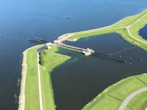
Original locks at Canal Point WPB Canal, JTLWPB Canal built in 1917 at Canal Point, JTL
Survey marker on original lock at Canal Point, WPB Canal. JTLThe beautiful iron and wood work on the original lock at Canal Point’s WPB Canal.IronworkPictured here: The original lock at Canal Point. I think this should be restored as a historic landmark as it was built in 1917 as part of the WBP canal and basically set us on the path we are today and is also a symbol of where we can go. The man on this lock reminded me of the story of the shared swing-bridge at Torry Island that once was part of the Roosevelt Bridge in Stuart. This will be the subject of today’s post.
2016 has been an incredible year, and 2017 will be as well. In 2016, both Lake Okeechobee and the St Lucie River blew up with toxic algae, and #GladesLivesMatter was established as a voice for a way of life that could be lost…
As far as 2017, as I write this post, deals are being cut, and advocates on both sides are working to get legislative support for their positions. But during this season of light, may we also remember our interests, as they hold things we share in common rather than apart: a Healthy Lake Okeechobee and St Lucie River, as well as Local Economic Prosperity for All are certainly goals both the Glades and the Coast desires…right now, in most areas of our combined worlds, this does not exist…
Yesterday, I toured the Glades once again with former Pahokee mayor, J.P. Sasser, someone I don’t always agree with, but definitely get along with. Someone who is teaching me a ton about the Glades, a history linked to my history, the St Lucie River/Indian River Lagoon….
Along the journey, a noteworthy thing happened right of the bat at Canal Point, our first stop. Here, I met an older gentleman fishing along the original locks of the historic West Palm Beach Canal. As I was taking photos, I thought I should introduce myself.
“Hello,” I said, extending my hand.
“Hello.”
“Catching much?” I asked.
“Not today, but usually, yes.”
“Do you live around here?” I inquired.
“No, Tequesta.”
“Wow Tequesta? That’s pretty far away…”
“Not really,” he said. “Maybe thirty minutes. I used to come here with my father in the 1950s.”
“That’s cool.”
“And where are You from?” He inquired.
“Stuart.”
The fishing line bobbed in the water. I saw noticed a dead gar fish float by. The water doesn’t look so good, I thought.
“Have things changed a lot?” I asked.
“Yes they have,” he said, “but not a lot out here at Canal Point. That’s why I come.”
An alligator silently swam the shoreline…
“You know your bridge is here.” the fisherman softly said,” pulling on the line.
“Wow, funny you should know that…my mom…she’s a historian. Torry Island right? They used part of the Roosevelt Bridge in Stuart to build out in here in Belle Glade in 1938. It’s still here today…a swing-bridge….right?”
He looked at me holding his gaze. “Right young lady, the bridge is here….”
J.P. called from the car. The fisherman and I locked eyes.
“The bridge is here.” I repeated.”The bridge is here.”
As we drove away, I wrote something on my notepad: “2017 #GladesCoastMatters … ”
_________________________________________
Torry Island Bridge is located in Belle Glade about a 15 minute drive around Lake O from Canal Point.
“The story of the bridge’s origins flow smoothly from Corbin… The 1928 hurricane that ravaged the Glades set in motion the chain of events that would bring the bridge to Belle Glade. The storm destroyed the original dike that surrounded the lake. To build the replacement dike, the federal government spooned out a canal, separating Torry Island from Belle Glade, and used the dirt for the dike. The new canal, called the Okeechobee Waterway, needed a bridge. In 1938, state contractors built the Point Chosen Bridge, replacing a pontoon bridge with a swing bridge that was built in 1916 and relocated from the St. Lucie River near Stuart. The bridge consisted of the movable portion and wooden trestles on each end.” Associated Press article, 2009.
Merry Christmas and Happy Holidays to all my readers! See you in 2017!
Jacqui
This is the swing bridge that used to be in Stuart on the Roosevelt Bridge but is now part of the Torry Island Bridge in the city limits of Belle Glade.Torry Island, Belle Glade.The swing-bridge looking across the rim canal around Torry Island.The Bridge Between Us…JP and JTL.J.P.’s bumper sticker
My bumper sticker/sHistoric map of the Glades showing cities. Canal Point upper left and Belle Glade further west and south. WPB canal is in Canal Point and the Torry Island Bridge is in Belle Glade.
Flying over the black gold of the EAA. JTLFields in Pahokee, JTL
Road Trip Series.
Since I began my Glades “Road Trip” Series, I have read three books by Lake Okeechobee historian, Laurence E. Will: Okeechobee Hurricane, Swamp to Sugar Bowl, and A Cracker History of Okeechobee.
These books hold amazing stories of the Glades; if Mr. Will hadn’t written, there would be very few first-hand accounts of farming that became a Florida mega-industry just over the first half century of the 1900s. Today, I will transcribe some of his most interesting descriptions of Lake Okeechobee, the magical landscape that was transformed into today’s contoversial Everglades Agricultural Area, for none other than its MUCK.
EAA below Lake Okeechobee. (Public map SFWMD)Photo of pond apples also know to locals as custard apples in Big Cypress- shared on Flicker by photographer Mac Stone, allow us to envision what this incredible forest looked like. 32,000 acres rimming the southern and eastern shore of Lake Okeechobee. The best muck built up over thousands of years under these roots that worked like a seine as the lake overflowed its edge then running south through the sawgrass. The Everglades….
Close up of small pond apple on Torry Island, by Lawrence E Will.
Photo from Swamp to Suagrland, showing pond apple with moon vines around Lake O. (Lawrence E Will)
pond apples
Florida Memory Project, photo by John Kunkel Small 1869-1938.
When I was on my recent tour with former mayor of Pahokee, J.P. Sasser, I learned the nick-name for Pahokee is “The Muck,” named so for the “black gold” soil that accumulated over thousands of years under the roots of a custard apple forest that rimmed the lake. (Kind of like fresh water mangroves today in the Indian River Lagoon.)
When one drives deeper into the Glades, one finds similar nick-names or “muck mottos,” that have to do with the muck. For instance, Belle Glade’s motto is “Her Soil is Her Fortune;” Clewiston’s is “America’s Sweetest Town,” and South Bay’s refers to its highways, “Crossroads of South Florida,” named so for its intersection of two major roads, East-West State Road 80, and North-South, U.S. Highway 27, roads that get one into the muck, or out of it….
Will first experienced the Lake in the early 1900s as a boy when his father was developing Okeelanta, located about four miles below today’s South Bay. Okeelanta, today a mill location for the Fanjul holdings, was located not in an apple custard forest, but rather in the miles of sawgrass lying south. Although the soil here is excellent, it is different, more peaty and not as “mucky.” Thus the most productive lands lie closer to the lake, deep in the MUCK.
Here is a moving account by Will about the land of muck in “Cracker History of Lake Okeechobee:
“Before the dredges crashed through the custard apple woods to start the first canals, the lake most always stayed high and clear, unbroken except for those islands Kreamer, Torry, and Observation. When I first saw the lake it was still wild. Excusing the trifling settlements at Utopia, Ritta, and Tantie, a score of fishing camps, and the openings to four unfinished canals, it’s swampy shores hadn’t changed since Zachary Taylor found the redskins or probably not since DeSoto anchored in Tampa Bay. It sill was just as the good Lord had fashioned it. The lake was lonely Mack, silent and mysterious as well. But I tell you boy, it was beautiful, and sort of inspiring too.”
Will was absolutely pro development, pro farming/agriculture, but he, like most of the old timers, recognized the tremendous awe-inspiring beauty of the place.
Most all the natural beauty the lakeside shoreline in Martin County, where the FPL Power Plant is today, and north to the town of Okeechobee has also been radically altered as well.
FPL solar plant and “cooling pond” in Martin County looking west towards “Barley Barber Swamp.” This area was once a forest of mostly giant cypress trees and others. JTL
Excerpts by Lawrence E. Will:
“Dense forest ringed the lake around. Along its northern half water oak, maple, cypress, potash, rubber and palmetto trees crowded each other on the lakeshore ridge…the south shore and half way up the eastern side was something else… Here were custard apples, a solid belt of tropical trees, blanketed with a moonvine cover, which stood, two miles or more in width, without break or opening, from near Clewiston’s Sand Point, slap around to Port Mayaca. 32,000 acres of custard apple woods there were, the most of these trees, I wouldn’t doubt, on the whole blamed continent of America.”
“…Although the shores were for the most part black muck, low and flat, there were some fine sandy beaches too. Along the east side for eighteen miles lay beautiful East Beach…”
“Now if Zachary Taylor or Hamilton Disston could return to Okeechobee they would find that farmers have exterminated the custard apple woods. Highways, service stations, super markets and housing projects have replaced the cypress, rubber and maple trees along the ridge. A levee occupies the onetime shore and drainage has lowered by half a dozen feet the water’s elevation. Tractors cultivate the former seining grounds, and unless you as old–and no amount, as some of us, your never heard of town of Tantie, Utopia or Ritta. Civilization has re-made the lake and I’d be the last to say it isn’t better so, but the lakeshore’s one time natural beauty is long gone, and man, wasn’t that old lake a fascinating place.”
Well, to the land of Lake Okeechobee! For all she was, and for all she is. It’s enough to make one exclaim:”What The Muck?!!!”
My recent Glades tour with former Pahokee mayor, JP Sasser, lasted seven hours, and one of the most unexpected things I got to see was Storm Water Treatment Area 3-4. I have read about the STAs, flown over the STAs, and have had many discussions with engineer, Dr Gary Goforth, who is an “Architect of the STAs,” but nothing prepared me for what I felt when I unexpectedly saw an STA from the ground, or the other mystery I’d learn about that day.
So just about when my tour of the Glades was over, JP looked at me and ask: “Do you want to see the where the big reservoir was supposed to be?”
“Yes!” I exclaimed.” The reservoir? Hmmm. I’d heard stories of “the reservoir” but I really didn’t get it. Why didn’t it get finished? And what is it today? And then of course river advocates like me are supporting Senate President Joe Negron’s reservoir. What’s the deal with all these reservoirs? So confusing…
JP stopped the car, his blue eyes dancing: “We’ll have to drive south….”
“Please!” I begged, knowing I may never have this opportunity again.
So JP turned the steering wheel 180 degrees in the middle of all the sugar fields and headed south of Belle Glade on Highway #27– driving right along the historic North New River Canal that I did know something about.
We drove, and we drove, and we drove…through sugar field after sugar field. And then, there it was, to my right, what appeared to be blowing reeds surrounded by shallow sparkling waters, silver and white, reflecting clouds in a blue sky. Birds flew by. It was beautiful. Miles long. My eyes welled up, and I thought about how amazing it was to see water in this place…”It’s like…..the Everglades….”
We drove until we got to the SFWMD’s STA 3-4 entrance gate and I asked JP to pull over so I could get a picture. I was unsure…So to JP, a Glades local, this area has to with “the reservoir,” but here we are at an STA? As I was pondering, we drove further into Broward County and JP pointed out many new-looking pump stations to send water south. I couldn’t stop wondering about “the reservoir.”
When I got home I did some research.
I believe, in short, this is the story. Please chime in if you know more.
After lawsuit/s due to long-standing polluted EAA water impacting southern lands, and after “acts of the Legislature,” in the 1990s a “Settlement Agreement,” was obtained. Thus the state of Florida had to construct 32,000 acres of storm water treatment areas (STAs) in the EAA (Everglades Agricultural Area) to clean water leaving the EAA and going into Water Conservation Areas and Everglades National Park.
By 2000 the first of six had been constructed, and by 2004 the first water ran through. Thus the building of the STAs is associated with the law suits. At the same time, Congress was working legislatively on CERP, the Comprehensive Everglades Restoration Plan. It was approved by Congress in 2000. But it was moving too slowly, so in 2006, Florida’s state legislature approved LOER (Lake Okeechobee and Estuary Recovery Plan) and under Jeb Bush chose 8 projects of CERP to “accelerate.”
One of the “Acceler 8” projects was the A-1 Reservoir. This reservoir was to be located basically right above STA 3-4 and it had three water components, one for agricultural use; one for the environment; and one for people.
Well time moves on and we are now post Jeb Bush, and into Charlie Crist’ governorship who in 2008 announced that the SFWMD would be negotiating with United States Sugar Corporation (USSC) to acquire as much as 187,000 acres of their land for Everglades Restoration! Lots of internal fighting. Environmentalist are excited about historic land acquisition, but many others are irritated that Everglades Restoration (CERP/Acceler 8) will be halted in order to purchase lands. Other sugar companies in the EAA are impacted as they share mills with USSC. US Sugar surprised everyone with this announcement. Not very nice! Some people in the ag industry are furious. Politics. Lawsuits. But such an opportunity!!! The Great Recession hits. The A-1 Reservoir and its 3 components are halted in order to possibly purchase the USSC lands.
Even more lawsuits ensue including one from the Miccosukkee who want the reservoir completed as their lands are being depleted. Time is of the Essence.
The recession gets worse…the USSC land deal falls apart. Fewer lands are purchased. In 2010 Tea Party and “Jobs” Governor Rick Scott comes to power and negotiates with the Federal Government over of a law suit that included creating Numeric Nutrient Criteria for Phosphorus coming out of the EAA. “10 parts per billion” becomes the number. Some feel he sold out, others think it’s good.
In any case….the SFWMD now implements what the District had been planning as things were falling apart and money got tight, not a 3 part deep reservoir but rather a shallow Flow Equalization Basin, or FEB, in the A-1 reservoir lands above STA 3-4.
Thus the “Restoration Strategies,” law suit brought to the table by Rick Scott and State Legislature funded the A-1 Reservoir FEB and has more to come. What is important to note is that the A-1 FEB and the STAs were created to clean EAA sugar/agricultural runoff, due to lawsuits, not to hold, clean, and convey overflow Lake Okeechobee water that is destroying the estuaries…This is different.
And that’s why we environmentalist are talking about “a reservoir” today…a reservoir that would help the estuaries…because we don’t have one.
On the way home, JP and I talked.
He is concerned that Negron’s 60,000 land purchase for a deep water reservoir could take so much land out of sugar production that one of the EAA’s four mills would not have enough cane to process, close, and put people out work. Pahokee cannot afford this…
“This stinks,” I thought to myself. “Do we have to choose?” Why can’t people in the Glades and the Environment flourish? Everything is so confusing around here. This too should not be a mystery…
I noticed after writing this post that I did not report uses of reservoirs correctly thus I am adding this slide on 12-16-16, one day later. This slide shows what the reservoir compartments were proposed for in this 2012 SFWMD presentation slide by Matt Morrison. I had included “people/water supply” and this was incorrect. The entire presentation is linked below title EAA Storage Reservoirs, 2012. JTL
Today we continue our road trip in the Glades atop the Herbert Hoover Dike.
In the short video below you can see my Glades tour-guide, former mayor JP Sasser, driving, –in his hometown of which he knows so much about–Pahokee. On the right lies the city, and on the left is Lake Okeechobee. A precarious position indeed!
Pahokee is actually unusual in that this little town is “high-ground.” According to JP, about 13 feet above ground. This is not the case for most of the Glades.
Interestingly, in the video, JP discusses how the Army Corp recently decided where to strengthen the dike in Pahokee, because if they had extended it out 500 feet as was done along the rest of the eastern shore, the town of Pahokee would have been covered up as it is located right beside the dike.
Lake Okeechobee’s dike and its history are fascinating just as is all our area of the Northern Everglades including the St Lucie River/Indian River Lagoon that in 1923 became the primary exit point for waters that could no longer flow south after the Herbert Hoover Dike was built.
According to historian and Gladesman Lawrence E. Will:
“…following the floods of 1923 and 1924 water stood over farm lands nearly the entire winter. To protect the farms, the state of Florida had then constructed an earthen dike along the whole south shore. It was some five to eight feet above ground level but this dike was never intended to withstand a hurricane.”
Regarding the expansion of the dike, as the “Herbert Hoover,”after the horrific hurricanes of 1926, ’28 and again in again in ’49, Mr. Nathaniel Reed notes in his writing “Lake Okeechobee and the Everglades: “The Corps of Engineers studied the average size of Lake Okeechobee and designed a dike around it…”
Now this is where things get very interesting.
“The average size of the lake….” what’s that?
Now if we look at this slide taken from a 2016, presented by Jeff Sumner, who was at the time Office Chief State and Agricultural Policy, SFWMD, it shows the size of the lake pre-development. One can see it was about once about 1000 square miles in size and today it is 750.
The False Edge of Lake Okeechobee, SFWMDThe checkered fields were once lake bottom. L. E. Will, “Okeechobee Hurricane”L.E. Will Swamp to Sugar Bowl. The Glades area, today’s Everglades Agricultural Area has become one of the most productive agricultural areas in the world…
Of course the size expanded and contracted based on rainfall, but one still gets the point…this lower area was nature’s shoreline, a boggy marsh with rivers leading into a sawgrass “river of grass” bordered by a forest of over 30,000 acres of Custard Apple trees that functioned like mangroves extending up to five miles or more south into what is today’s Belle Glade. As Mr Lawrence Will would have said: “Who wudda thought!” (http://museumoftheglades.org)
Pahokee is in upper right. Map Laurence E WillThe lake once went further south here and there following the rivers to Hwy. 80Land ownership todaySen. Joe Negron’s map for land purchase
On May 10th, 2016 there was a knock on my front door. I was expecting somebody. Kait Parker and her team from the Weather Channel had arrived via New York to do a story on the St Lucie River/Indian River Lagoon.
The group was upbeat and friendly. They interviewed Ed and me in our kitchen, and later we took them up in both the Cub and the Baron to shoot footage and to get “the view.” –The aerial view of the discharges from Lake Okeechobee that had started this year on January 29th.
What really struck me about Kait was that although this Texas girl’s beauty, talent, and ambition had moved her beyond the Treasure Coast to Atlanta’s Weather Channel, (Kait had been a well-known and loved meteorologist for three years at WPTV, the West Palm Beach/Treasure Coast NBC affiliate), she had come “home” to see what the heck was going on. She, as so many others, had heard the horrible stories of destruction facing the St Lucie River/Indian River Lagoon.
I commend Kait for coming back to see for herself and for using her fame to share our story with others. This gesture will not be forgotten and “Toxic Lake” is already making waves! Waves of change.
Thank you Kait.
With Kait ParkerGetting camera and barf bag ready just in caseEd explaining something.Smile
Discharges from Lake O through the St Lucie Inlet 5-10-16Plume rounding Jupiter Island through St Lucie Inlet 5-10-16St Luice Inlet 5-10-16Crossroads and SL Inlet 5-10-16
*Thank you Kait Parker,Spenser Wilking,and Andy Bowley.
Over the Thanksgiving holiday, I completed a book entitled “Okeechobee Hurricane,” by Lawrence E. Will. The book contains old photographs and provides eyewitness accounts of the great storms of both 1926 and 1928. As we have leaned somewhere between 1500 and 3000 people were killed in the 1928 storm alone. A majority are buried in a mass grave that created a graveyard here in Martin County, at Port Mayaca. There were many farming families, but most of the dead were black migrant workers who had no warning of the storm. Mr. Will relays the horrific stories of these pioneer farming families surviving from Kreamer Island, Torry Islands, Chosen, Belle Glade, Pahokee, South Bay, Bean City, Sebring Farm, Ritta, and Okeechobee.
Pahokee does not have its own chapter but is included in Lawrence Will’s rebuttal of a Palm Beach Times article entitled “The Lost Settlement of Pelican Bay, “a settlement lying between Pahokee and Belle Glade where it had been reported 400 people “must be dead, and 250 of them are now unreachable…”among other things, Mr Will argues that many floated in from miles away and were not from the ‘Pelican Bay’ sugar company camp…
I have to say, although I learned a ton, I am glad I am finished with the book. It was difficult to read so many stories of death. That no one has made a full length feature film of this surprises me: the breaking of the state dike; 7-11 foot rising waters; people fearfully clinging to rooftops with children in hand in 150 mile an hour winds; falling over and gasping for breath while trees and houses floated by or pushed one under. Hair caught in the gates of the locks…More than once, Will refers to the breaking of the dike causing a “tidal wave” coming all at once and travelling from Chosen outward to Belle Glade, like a tsunami.
On page 35 he writes:
“The levee, extending along the southern and part way up the eastern shores of the lake, had been constructed between 1923 and 1925 and had been rebuilt where damaged in the blow of 1926. The dike was built to prevent farm lands from being flooded by high lake levels, it was never intended as a protection from hurricanes. Had there been no levee to pile up the water, there would have been no loss of life in either the hurricane on 1926 or 1928. On the other hand, without the protection against flooding of crops it is extremely doubtful that the Glades could have attained its high state of productivity.”
Quite a thought….one to ponder that’s for sure.
Belle Glade 1928, archives of Sandra Henderson Thurlow.Belle Glade 1928, archives of Sandra Henderson Thurlow
As you know, we are on a Road Trip. We are driving through not only to learn about the Glades, but also to learn about ourselves. Whether we realize it or not, we are all connected. We are related by history, by the drainage of the Everglades, and by a “better water future” we have no choice but to build together.
This map of the Glades is from the Florida Memory Project. It maps flood damage from two great hurricanes. Notice that the 1926 Hurricane damaged mostly the western part of the lake near Moore Haven, where as the 1928 Hurricane most intensely hit the eastern communities around Belle Glade. The towns/areas of Canal Point, Pahokee, Bacom Point, Belle Glade, South Bay, Lake Harbor, Bare Beach, Clewiston, Moore Haven and Newell all had to rebuild. “Chosen” near Belle Glade was chosen to be lost…
These past hurricanes define the history and the nature of some of the people of the Glades. The ones who “made-it” are survivors beyond anything we can possibly envision.
As Mr Lawrence E. Will an old family, a politician, and a prolific writer from the area wrote in HURRICANE:
“One word describes it. It was Hell. A raging inferno of rolling, swirling waters, of shrieking, demoniac winds, of lashing rain and of darkness, black and absolute. There were no atheists that night on the shores of Okeechobee! Then for the those still living came the second phase of hell; the phase of desolation and despair; of searching in the flooded woods and marshes, in elder clumps and sawgrass for the horrible remains of family and friends and neighbors; of loading them into trucks by unending scores; and finally of burning them in help of dozens when they could no longer be transported. It is hard to know which hell was worse…”
As we know in the 1930s the Herbert Hoover Dike was built to avoid such a disaster from happening again…but there is always the question of whether it will or not. It is dangerous to live on the low side of a dike.
As advocates of the St Luice River/Indian River Lagoon, we must be sensitive when discussing Senate President Joe Negron’s proposal for 60,000 acres to be purchased south of the lake to store, convey and move water south to the Everlgades. One can see how shouts of “Send the Water South” may send some people living south of the lake “over the edge…”
We must always make clear that when discussing Everglades resoration and improved health of the St Lucie River/Indin River Lagoon, safety, and economic prosperty for the Glades communties comes first. We know and respect their past…
Recently, in response to Senate President Joe Negron’s proposal to purchase 60,000 acres of land south of Lake Okeechobee, a movement began called #GladesLivesMatter. This group is concerned for the future of their communities due to the intensifying coastal cry: “Send the water south!”
Tension or misunderstanding between the Glades and the Coastal Communities is not a new theme. As we’ll learn, with creativity and determination it has been overcome before. Maybe we can learn something from the past and try to achieve this too?
In 1917, the year the West Palm Beach Canal was constructed and roads were first available from the coast to the Glades, Palm Beach County Chamber of Commerce president, T.J. Campbell wrote a Post article urging his readers to “take a growing interest in the people who live in rural communities, and make their living from the products of the soil.”
According to Palm Beach County historian James D. Snyder, Campbell’s article was unintentionally patronizing in that, “it chastised the urbanite for too often viewing the ruralists with feelings not unmixed with contempt or at least a certain pride of superiority.”
Sound familiar?
After some ruffled feathers, deliberation, and discussion it was decided that Campbell was making a point and that both sides needed each other, and both sides misunderstood the other.
So with the new transportation routes a motorcade (road trip) was organized to Belle Glade. It was a success and the coastal residents were amazed. To show good will, in the months following, the American Legion of the Glades traveled to the coast and marched in the 1921 Palm Beach County parade. They performed a song-poem as the “Muck Rats” and were the hit of the parade!
I’m from old Lake Okeechobee,
Where they raise gators,
Beans and pertaters,
Catfish and termites and Prohibition haters,
Custard apple, moon vine,
Catfish and moonshine,
All the time!
Even if the main thing in common was that many of the Coastal and Glades residents were “Prohibition haters,” of which we’ll learn about tomorrow, this effort of goodwill bettered relationships. And in the end, both sides made the effort. Why not take a drive? A road trip? You just might be amazed… 🙂
Before we begin today’s lesson, two major changes must be recognized. First after almost a year, the ACOE halted the destructive Lake Okeechobee discharges to the St Lucie River. These releases began January 29th, and lasted through November 4th, 2016.
And on Tuesday, November 8th, Donald Trump won the 2016 presidential election over Hillary Clinton, an election considered the most remarkable and unpredictable in over 100 years…
Now back to our Road Trip series:
Most recently we have traveled to Canal Point, the first town south of the Martin County line on the east side of Lake Okeechobee. This almost forgotten little town has an amazing history, and holds the seeds of today’s expansive Everglades Agriculture Area and of United States Sugar Corporation itself.
The easiest way to take this drive through history is a timeline. So let’s crank up the car and begin!
Connors’ Hwy 1920s Florida Memory
1914-1918 – World War 1. Sugar rationing across the nation.
1917- The West Palm Beach Canal is constructed, intersecting at Canal Point, allowing transportation of goods and internal land development around Lake Okeechobee
1918-After the war, Congress holds hearings about concerns that the county should “never again” get into a position where domestic sugar production is just 1.7 billion. The United States Department of Agriculture opens a sugarcane research central at Canal Point that still operates today-a hundred years later.
Original USDA lab/office, Canal Point (Wiki)2016
1920- The American Legion and Federation of Women’s Clubs mount a national lobbying campaign against the high price of sugar. West Palm Beach chapters lead in support of the effort.
1920- Englishman, F.E. Bryant, already a successful farming business man in Lake Worth, forms the Florida Sugar and Food Products Company working with G.T. Anderson at Canal Point. They buy land and build the first sugar mill by 1921 and encourage expanded sugar farming.
1922-Flooding of some cane fields…they plod on…
1923- 900 acres of sugarcane in Palm Beach County, 800 of it in Canal Point. This is a real success.
1924- Connors’ Highway constructed allowing access in and south of Lake Okeechobee for more sugar farming and development
1924- More flooding of cane fields– a major set back so Bryant merges his faltering company into a “better capitalized” company in Clewiston. The name of this company is Southern Sugar Company.
1926- Hurricane
1926 Florida land booms slows, beginnings of the Great Depression for Florida
1928 Hurricane- an historic Category 4/5 hits Lake O area coming through West Plam Beach. Up to 3000 people die. Many are never found.
Coffins at Canal Point, Florida Memory
1931 Businessman and General Motors executive, Charles Stewart Mott purchases Bryant’s failing Southern Sugar Company renaming it United States Sugar Corporation. This is the hugley successful and profitiable Clewiston “US Sugar Corporation” that we know today. http://www.ussugar.com
When I drove through Canal Point a couple of weeks ago, I had no idea that this little town held so much history. A history that eventually and unintentionally led to the diking of Lake Okeechobee and the destruction of the St Lucie River/Indian River Lagoon.
S-352 at Canal Point/WPB Canal
*Thank you to the book Black Gold and Silver Sands, by James D Synder, and the Palm Beach Historical Society as sources.
Canal Point, the lake town just south of today’s Martin County line, was once an epicenter of life changing activity, a road trip there is no turning back from…
As we learned previously, in 1917, the construction of the West Palm Beach Canal created Canal Point, the town of lumber-man and developer, Mr. Gilbert A Watkins. During this era, planting sugarcane in the rich muck soils surrounding Lake Okeechobee was becoming even more of a rage and the federal and state government helped it take shape.
In 1913, Florida’s Internal Improvement Fund appointed an engineering commission to study the feasibility of draining the Everglades. At this same time, roads were assessed. In 1919 those belonging to Southern Land and Timber Company, Hamilton Disston’s heirs’ lands around Lake Okeechobee–some that became Watkins’—were determined to be “inadequate.” The only east/west road was Jupiter -Indiantown, and that was not enough.
Nationally, it was all the rage to be part of South Florida’s new-found” investment. “Buffalo’s New Yorker, Fingy Connors, was perfect for the job. He’d lost his thumb when he was young, but this didn’t keep him from grasping or getting what he wanted. After a visit to the area celebrating the building of the West Palm Beach Canal, he bought lands in the area of Canal Point and built his road.
Connors’ Highway Toll-Road became an “engineering and development marvel” and all knew it was Fingy’s skill as a big time political boss that got it done. Like the video and biography in this post implies, some saw him as a villain, and others as a hero…
What is for sure, is that although a large section of the road was built from Canal Point north to Okeechobee, it later was extended under the lake and across the state becoming Highway-80, paving the way for the future of the sugar industry and what would evolve into the riches of the Everglades Agricultural Area.
William J. Conners, aka Fingy (1857-1929) was born in the slums of the Old First Ward. Fingy obtained his nick-name because he lost his thumb when he was young. When he was 19, his parents passed and he acquired a small saloon/rooming house on Louisiana St. He then bought a 2nd saloon on Ohio St. With Conners’s flashy, tough personality, he managed to form contracts to supply labor all across the Great Lakes utilizing 1,000s. His men would eat, sleep, drink, and spend their earnings at his saloons. He had sovereignty over the work force for over a decade. Next in life, he became a leading real-estate developer, operated his own paving company and brewing company, poultry farm, and started the early stages of the Courier Express. Conners definitely tested the waters by reducing wages of grain scoopers which caused a strike. This strike caught nation-wide attention, as 8,000,000 bushels of wheat were backed up. After dipping into politics, he came to control 85% of the packaged freight business on the Great Lakes (Great Lakes Transit Corporation). Conners donated a small fortune to Buffalo’s poor. Later in life, Fingy resided in Florida for half of the year. Floridians considered Fingy to be of hero stature.
HISTORIC PHOTOS CIA FLORIDA MEMORY, CONNORS’ HIGHWAY 1920s.
Connors’ Hwy. toll area with non-diked Lake Okeechobee in background ca. 1925. (Florida Memory Project)A car drives along Connors’ Hwy. with Everglades fauna to right. (FMP) Connors’ Hwy and Everglades fauna.
Cistern with Lake O in background.Connors’ Hwy along area of canal or rim canal-here I am uncertain but this photo too is included in the Florida Memory Projects documentation of the Connors’ Hwy.
HISTOROR MARKER TEXT AND PHOTO
*Thank you to my mother for the photos retrieved from Florida Memory and the write up of the historical marker and the video history.
Thank you to John Campbell, Public Affairs Specialist, Army Corp of Engineers, for these numbers comparing “flows” for 2016, 2015, and 2013. I have been using since last week when presenting and wanted to share. Note, there were no flows (discharges from Lake Okeechobee to the St Lucie River) in 2014 and that is why the year is not reported. The Corp has announced their intent to further decrease flows in the coming weeks as they transition to the dry season. Hurricane, or wet season, comes to an end on November 30th.
All numbers are important but a very important # is how much water is going south…
2016 Flows, JAN 1-OCT 23 (Number of inches based on estimate that 1 foot of Lake O water is about 460,000 acre feet)
Inflows/Rain
Direct Rain 1.85 million ac-ft (48 inches)
Other inflows 3.32 million ac-ft (86 inches)
Caloosahatchee
Moore Haven 1.61 million ac-ft (42 inches)
Franklin 2.39 million ac-ft
St. Lucie
Port Mayaca 630,000 ac-ft (19 inches)
St. Lucie 730,000 ac-ft
South 550,000 ac-ft (14 inches)
Evap/seep/other 1.86 million ac-ft (48 inches)
2015 flows, JAN 1-DEC 31
Inflows/Rain
Direct Rain 1.48 million ac-ft (38 inches)
Other inflows 2.45 million ac-ft (63 inches)
Caloosahatchee
Moore Haven 590,000 ac-ft (15 inches)
Franklin 1.21 million ac-ft
St. Lucie
Port Mayaca 120,000 ac-ft (2 inches)
St. Lucie 190,000 ac-ft
South 1.28 million ac-ft (33 inches)
Evap/seep/other 2.14 million ac-ft (55 inches)
2013 Flows, MAY 8-OCT 21 Inflows/Rain-(Not available at time of request) Caloosahatchee
Moore Haven 1.02 million ac-ft (26 inches)
Franklin 2.15 million ac-ft
St. Lucie
Port Mayaca 402,000 ac-ft (10 inches)
St. Lucie 663,000 ac-ft
The chart below provides a good visual of 2016 Lake O releases though the C-44 Canal from S-80 comparing 2016, 2013, and 2015. S-80 discharges include the surrounding man-made basin as well as releases from Lake Okeechobee. This info has been compiled by my brother, Todd Thurlow, http://www.thurlowpa.com/LakeOLiveData/ via SFWMD. (Automatic updates every 7 days.)
Via TT3Via TT3
In order to fix a problem, you have to know what the problem is…..yesterday’s visual makes clear to all the problem. Don’t be mistaken, this problem although overwhelming, can be greatly alleviated –“fixed.”
In March of 2015, the University of Florida published: OPTIONS TO REDUCE HIGH VOLUME FRESHWATER FLOWS TO THE ST LUCIE AND CALOOSAHATCHEE ESTUARIES AND MOVE MORE WATER FROM LAKE OKEECHOBEE TO THE SOUTHERN EVERGLADES. This was an independent technical review by the University of Florida Water Institute.
The 134 document summarizes three things necessary to give relief to the estuaries:
200,000 acre-feet of water storage within the St Lucie River watershed. (*For C-23, C-24, C-25 and C-44 canal alone—not including releases from Lake Okeechobee through C-44 JTL)
400,000 acre-feet of water storage within the Caloosahatchee watershed.
approximately 1,000,000 acres of water storage distributed north and south of Lake Okeechobee.
Senate President Elect Joe Negron’s plan for land purchase in the EAA fulfills part of #3. This reservoir would be “dynamic,” meaning that in simple terms it would hold, clean, and move water south to the Everglades. In other words, it would move multiple acre feet over time.
Our St Lucie River is degrading in ways that may not be reversible. We must work for land purchase south of Lake Okeechobee to begin to alleviate the destruction. —We must not just support, but also help Joe Negron. Get ready for Florida’s legislative session 2017.
I think one of the most difficult parts of the St Lucie River/Indian River Lagoon/Lake Okeechobee problem is to understand how much Lake Okeechobee water we are talking about….
I recently asked Deb Drum of Martin County, Dr Gary Goforth and my technology-wiz brother, Todd, the following question:
“Do you know how many acre feet of water came just from S-308, (Lake Okeechobee), into the St Lucie River/Indian River Lagoon? ”
SFWMD canal and basin map. C-44 canal is the canal most southerly in the image.
I got great information from all. Deb Drum from Martin County summarized most simply:
“From January – October 2016, SLE has received about 630,000 acre feet of water (1 foot of water over 630,000 acres)…”
In an ideal world the St Lucie River would receive NO discharges from Lake Okeechobee as there was no natural connection to the lake or its watershed.
The Treasure Coast Regional Planning Council EAA map I have been using for my series, “Who Owns the Land? Mapping Out Florida’s Water Future,” shows us the 700,000 acres that comprise the Everglades Agricultural Area south of Lake Okeechobee.
Now picture this…
If all the water that was discharged into the St Lucie River/Indian River Lagoon in calendar year 2016 were to have gone instead into the Everglades Agricultural Area, 630,000 acres of its 700,000 acres would be covered in one foot of water….
That’s a lot of water! In fact, almost all of the EAA would be completely covered in water. And this of course is not taking into account the Caloosahatchee that receives about three times as much water.
Gulp.
Red shows approximately 630,000 acre feet of water covering 700,000 of the EAA’s total acreage.
“Who Owns the Land in the EAA? Mapping Out Florida’s Water Future.”
Today I will complete 1-10 listed on the Treasure Coast Regional Planning Council’s map of Everglades Agricultural Area land ownership. As I did not go into the great detail as I did with 1-7 previously, I have included informational links to 8-10.
My husband, Ed, told me my multi-colored map showing land ownership was getting confusing with parts 1-7, so I have tried to simplify and re-color code it below. This hand-made map is by no means perfect and certainly has errors, but gives an idea.
What have we learned in the past seven posts? Well it appears the Fanjul Family owns at least 2, 3, 7, 8 and 9 on the map and U.S. Sugar Corporation owns 1 and 6. #4 is King Ranch; #5 is Wedgworth Farms. They are independent. #10, New Farm Inc., was not listed on Sunbiz, but I did find it listed in law suit regarding contamination of lands from 1985. I will try to learn what is the status of these lands, and if I am missing something.
Below you will find each corporation 1-10 linked to SUNBIZ listing officers and the 1985 law suit of New Farms Inc. As you go through the links you will start to recognize some of the names. Through recognizing the names you will see who owns what and the connections.
Names aside, it is clear that most of the 700,000 acres in the EAA is owned by only a handful of corporations and powerful families…
This entire series was started because of Senate President Elect, Joe Negron’s proposal for land purchase to store, clean and convey waters south the Everglades (the circles on bottom image). This controversial subject will come up during the 2017 legislative session. Land ownership will be important information to have on hand. Purchasing lands in the EAA is not a far-fetched idea. A third outlet south of the lake and moving water south is the only way to truly alleviate the destruction of our St Lucie River/Indian River Lagoon. We must advocate for this goal!
*10/25/16 addition: Thank you to reader Bob Washam who sent me the following link after reading my post whose officers show New Farm Inc to be a Fanjul property as well: (Jacqui here is a possible link to the officers of New Farm, Inc.
The Fanjul Brothers, Plantation Services Land Report 2012
“Who Owns the Land? Mapping Out Florida’s Water Future.”
Stofin Co. Inc. is #7 on the Treasure Coast Regional Planning Council’s (TCRPC) map of land ownership in the Everglades Agricultural Area, (EAA). These lands lie on the eastern side of the EAA and comprise 7,189 acres. Stofin Co. is affiliated with Fanjul Corporation more widely known to river activist as “Florida Crystals.” As we know, Fanjul Corporation is a large sugar and real estate conglomerate with interest in Florida, the Dominican Republic and soon to be in the brothers’ homeland, Cuba, once again. The family is very influential in all politics and donates extensively to both the Democratic and Republican parties.
We can see by doing just a bit of research that some of the same officers of Fanjul Corporation are also listed in Stofin Co. Inc. such as Erik J. Blomqvist and Luis J. Hernandez.
Looking at our TCRPC map I have colored #7 parcels in orange just as #2 Okeelanta Corp. and #3 New Hope Sugar Co. were. As we learned earlier those too are Fanjul Corp. lands. I have just added a purple dot to differentiate. So far all in ORANGE below is Fanjul holdings.
It is interesting to compare the TCRPC map with the historic maps also below and note the “shape” of the original “river of grass” before it was dammed and destroyed by agricultural development in the EAA. Note how the river veered off to the right, or in an eastly direction. Surveyor, Chappy Young’s map shows the westerly development over the years into the “Everglades’ agreeed boarder” from the east. We have swallowed her up in every direction. She needs to be restored. It only makes sense that some of the overflow water from Lake Okeechobee destroying the St Lucie River/Indian River Lagoon is allowed to go south again. Thank you for reading my blog and for caring about the health of the St Lucie River/Indian River Lagoon and the Florida Evergldes.
Historic map from 1948 book “Lake Okeechobee” written in 1948 by Alfred Jackson and Kathryn Hanna as part of the Rivers of America Series.War map of the Everglades created during the Seminole Wars, 1856.West of the red lines shows the edge of what was once the Everglades in South Florida. Development has crept and continues to creep over this edge. (Photo/map courtesy of Chappy Young,/GCY Surveyors, 2014.)Senator Joe Negron’s proposed aquisition map in the EAA, 2016.
Today’s lesson in my series “Who Owns the Land? Mapping Out the Future of Water,” is #6, SBG Farms Incorporated. SBG Farms owns 8,569 acres of land in the EAA according to the TCRPC map.
I couldn’t figure out what SBG Farms stood for, but a couple of my favorite acronyms from acronym finder (http://www.acronymfinder.com/SBG.html) were: “Super Blue Green”and “Saved By Grace.”
Yes that makes sense…to not have Super Blue Green algae in the St Lucie River/Indian River Lagoon we all must be Saved By Grace….
So who is SBG Farms?
I believe SBG Farms is part of U.S. Sugar Corporation because according to Sunbiz, where once goes to look up registered corporations in the state of Florida, two of their officers are the same as for U.S. Sugar Corporation: president Robert H. Buker Jr. and vice president Malcolm S .Wade Jr. Also the registered address is in Clewiston, Florida, the same location as U.S. Sugar Corporation. As we learned with land owner #1, U.S. Sugar Corporation is the “Granddaddy” of the land owners. “They were in the EAA first.” We must respect and work with this… You can read the company’s history and their leadership from their website here: (http://www.ussugar.com/history/)
So above I have colored in the #6 parcels in the same purple crayon as #1 (USSC) and outlined in green marker so there is a visual difference.
Now for those of you who have been around fighting for the St Lucie River/Indian River Lagoon since 2013, don’t get worked up when you see “Bubba” Wade’s photo, remember in the end, we all can be “SBG.” All of us that is, and we need it! For a better Florida water future we must all be “Saved By Grace,” and maybe, just maybe, we already are…
Senate Presidient Joe Negron’s proposed land acquisition map for water storage –2016/2017 legislative session.
“Who Owns the Land in the EAA? Mapping Out Florida’s Water Future.”
Today we learn about King Ranch, #4 on the TCRPC map of land ownership in the Everglades Agricultural Area (EAA).
King Ranch is full of history and mystique and part of Texas’ long US history with Mexico. They are “Americana” even on the road. Perhaps you have gotten behind a truck with their brand symbol? Maybe you own one of those trucks? King Ranch is a huge company and has many different interests.
One of King Ranch’s major interests in Florida is Consolidated Citrus and they have an office in Indiantown in Martin County.
Not everything has been a royal flush for King Ranch. Over the decades the company has had to change out their fields because of the loss of orange groves due to canker and citrus greening. In Martin County alone basically 98% of the groves are fallow. A terrible loss. But to remain King, one must adapt, and they have according to Stuart Magazine “growing sod, corn and sugar, as well as testing out perennial peanuts and organic rice.”
So as the orange groves die, some are replaced with sugarcane.
You may recall articles about Rick Scott and the Florida Legislature a couple of years back going to visit King Ranch in Texas with the support of U.S. Sugar Corporation money? Yes, “these guys are buds.” They do business together and they play chess together. There are kings, queens, knights, rooks, and pawns.
So according to the map, King Ranch owns 19,755 acres in the Everglades Agricultural Area.” I have colored this in dark blue. They may not be the largest land owner, but considering their influence they certainly are King.
Negron’s proposed land mapTCRPC map of land ownership in the EAA 2016
*Mr. Mitch Hutchcraft of King Ranch serves on the South Florida Water Management District. He was appointed by the Governor.
TCRPC EAA map 2016Senator Negron’s possible land acquisition map 2016/17
“Who Owns the Land South of the Lake? Mapping Out Florida’s Water Future.”
Today we discuss #3, New Hope Sugar Corporation. It is difficult to find much information on the company, however, it is part of the Fanjul family’s holdings. It is also the same name, as we learned yesterday, as the Fanjul charity: New Hope Charities whose mission is to help families in the Glades.
Let’s look at the charity again…
Their website reads: “New Hope Charities was incorporated as a 501(3)(c) charity in 1988 offering support to remote, distressed and underserved segments of society. The first program implemented by New Hope distributed food to needy families living in the “Glades” area of western Palm Beach County. Currently, we operate a multi-service center in Pahokee, Florida, the second poorest city in the United States. The Family Center consists of a Day Care Center, a Youth Center, an Education Center, a Health Center, basketball courts, and an open field for soccer, baseball and football.”
Now back to the land…
I have colored in New Hope Sugar Corp. in the same orange highlighter as Okeelanta Corporation, but added a red dot to differentiate. New Hope Charities above mentions Pahokee as the nation’s second poorest town. Pahokee is south of the Martin County Line along the rim of Lake Okeechobee; it is not far away. The point of my blog series is to show landholdings, but I think the “New Hope” theme lends itself to a discussion on something more.
New Hope Sugar Corp orange with red dot, #3. Fanjul holdings.Map south of Lake O, Pahokee is marked
I have been blogging for four years now, it is becoming clear to us all that there is a bridge to be crossed, a hand to be held if we are going to go any further. Since the beginning of our river journey there have been cries from the interior of the state/south of the Lake. Cries of fear that we want to “send the water south” and destroy their cities and livelihoods…Even thought we know this isn’t so, this is understandable— and let there be no mistake about it: #GladesLivesMatter
I think it is time we talk about this openly. We must address the fears and the realities and we must begin to help…because there is so much help we can do for these communities and for a better water future for our state.
What got me thinking on all this was researching New Hope Sugar Corporation, #3 on the TCRPC map. I realized I have never thought that much about these areas south the Lake, except maybe when my father told me some of the best football players come from Pahokee and Belle Glade. I have driven through before and I have flown over. But have I ever walked inside? No I have not. After I finish this “land south of the Lake series” I think it is time to go inside this world and see how we can help.
We have got start a conversation including the Glades communities, a plan to help the poverty in Pahokee and Belle Glade and other Glades communities. We have to talk about Everglades Restoration as a plan for everyone. I am sure the Fanjul’s New Hope Charities with same name as their Sugar Corporation is doing great work, but why couldn’t Everglades restoration offer something more? Because in order to create more than hope, we must move beyond charity…
Excerpt NY Times Article, 2013… In the Glades, the “official” jobless rate has always been a joke because so few people are even on the books. Many of the agricultural jobs disappeared as vegetable production turned into sugar growing, now largely mechanized.
St Lucie Inlet, Ed Lippisch photos 10-9-16Hurricane Matthew a CAT 4 was 42.8 miles from shore, Google Image via Todd ThurlowHurricane Matthew over Florida, Terra MODIS via Todd Thurlow
Martin County was fortunate to “dodge the bullet” of category 4 Hurricane Matthew, but as long as the St Lucie Indian/River Lagoon is attached to Lake Okeechobee via the C-44 canal, the river cannot. She is shot in the chest each time.
These photos taken yesterday morning by my husband, Ed, show the discharges, like blood, gushing out of the St Lucie Inlet. Melodramatic personification? Perhaps, but true.
A press release by the Army Corp of Engineers on October 7th stated:
“Lake Okeechobee continues to rise; today’s stage is 15.93 feet…
The Corps has resumed discharges from Lake Okeechobee after suspending them during the storm. Water managers have removed target flows and will release as much water as practical through Moore Haven Lock (S-77) located on the west side of the lake, and the Port Mayaca Lock (S-308) located on the east side of the lake…
‘We anticipate inflows to the lake will increase as a result of Hurricane Matthew,’ said Col. Kirk. ‘Therefore, we must maximize outflows in order to slow the rise in the lake and be as prepared as possible for additional hurricane season uncertainty…”
“Additional uncertainty?” Not for the river.
As the Corp has been discharging from the lake since January 29th, 2016 and now the gates are wide open to save life and property south of the lake, the St Lucie did not really dodge a bullet at all. She is hemorrhaging once again.
Until Lake Okeechobee is redirected south as God designed, “dodging a bullet” in Martin County remains an illusion.
This email came in via my brother Todd this morning, amazing how similar the paths of the two hurricanes are. I thought I’d share. In any case, to all “be safe.” Jacqui
“Attached is the 1979 Hurricane David Track vs. the Hurricane Matthew track and forecast track.
Today we start learning about land owners inside the Everglades Agricultural Area (EAA) as listed on the above map; some will own land within Joe Negron’s proposed circles for land acquisition, and some will not. In any case, we should know them all.
#1 United States Sugar Corporation, “Old Granddaddy”
When talking about United States Sugar Corporation, (USSC), we must remember that we are talking about “Granddaddy,” the oldest of the sugar producers of the EAA. Granddaddy is listed on the Treasure Coast Regional Planning Council’s map as owning 140,451 acres of EAA land. I have colored the #1s in with a purple crayon to get a better idea of how these lands line up with Joe Negron’s circles. This non-tech approach I’m sure has my brother Todd cringing, but for me, a former 8th grade teacher, it works! Mind you it is just a “guestamation.” 🙂
Perusing the #1s I’ve colored in, we see vast land holdings. USSC has a long history in Florida, rising from the ashes of the failed Southern Sugar Company of Clewiston of the late 1920s to their Godlike political and production influence today. USSC owns some of the “muckiest of the muckland” closest to the lake, as they were there first. They own the most black gold….
General Collection Florida Memory, Clewiston ca.1929.
How did they rise to such power?
It was auto industry legend Charles Stewart Mott’s applied business principles and a twist of fate in the American political climate that lifted USSC to its tremendous status. Let’s review…
Mr Lawrence Will, well-known historian for people like my mother wrote in his 1968 book, “Swamp to Sugar Bowl:”
“…although Southern Sugar Company owned some 100,000 acres of the best land around the lake, under U.S. government regulations, the state of Florida was permitted to produce only nine tenth of the one percent of the nations needs. However, when Fidel Castro took over Cuba the Everglades reaped the benefit. For a short time our government permitted the unrestricted planting of sugar cane. Oh Brother, you should have seen how cow pastures and vegetable fields were plowed up and planted! Now we have 189,500 acres of sugar cane in the Glades.
By the 1980s USSC became a leading sugar producer in the United States as they are today. The key here is the effect on our waterways due to the politics of the Cuban Revolution.
Jumping ahead to 2007/8, an unprecedented opportunity was presented: Granddaddy offered a full buy out. USSC was on the table. Incredible! But not everyone liked then Governor Charlie Christ nor did the legislature appreciate him taking the situation into his “own” hands…nor did all trust US Sugar. The state had been implementing CERP since 2000. Now this giant opportunity was a gift but a wrench as well. Environmentalists were excited but wary. Politicians took sides. Other sugar companies fumed.Tempers flared. Blame. Intrigue. Posturing…Sound familiar?
Anyway, by the time the Great Recession bit down on the nation full force in 2010, a smaller land purchase had been negotiated by the SFWMD, and the drama of Florida politics and sugar was playing out. The land sale was but a shadow of its former self for Everglades Restoration and USSC left an option on the table through 2020 just in case there’s ever money in system again.
Exhausting.
After the SFWMD killed the EAA US Sugar Lands option, where do we go from here? (Map Everglades Foundation, River of Grass 2008.)
So …Granddaddy is still in control. But before we leave him, let’s remember this:
One of the unintended consequences of the proposed 2008 USSC “failure” we forget to talk about (sometimes in the excitement of hoping one day USSC will willing want to see their lands again,) was the halting of “more than a dozen projects already under way in 2008.
…among them (was) a massive reservoir in western Palm Beach County that was seen as a major step toward restoration of the Everglades.” (New York Times.) This reservoir would have alleviated discharges to the estuaries. This would have been a reservoir similar to the one we wish to create now.
Yes, the A-1 Reservoir, as it was known, was hit on two sides: halted for the USSC land purchase, and it also collided with yet another water issue, a law suit with the federal government over water quality standards, RESTORATION STRATEGIES. This one was guided to a close by then new Governor Rick Scott.
Thus the A-1 Reservoir became a shallow rather than a deep water reservoir. She never came into her full glory…
In in any case, the deep water reservoir needs to be back at the top of the list. Maybe if he’s in a good mood this year, Granddaddy can help her out. 🙂 Let’s be sweet and see what happens…becasue nothing will happen with out Granddaddy….
Senate Pres. Elect Joe Negron’s proposal/landownership in EAA, TCRPC 2016
Yesterday we talked about the importance of maps and how they allow us to have a vision for the future. For today’s lesson we are going to visually compare Senator Joe Negron’s land proposal map with a map of land ownership. This ownership map was recently created by the Treasure Coast Regional Planning Council (TCRPC) and I shared these maps with Senator Negron prior to the choice of land ownership possibilities.
Learning about lands south of Lake Okeechobee can be dizzying. The first thing you have to do, not to lose your sense of direction, is to familiarize yourself with the canals. Your landmarks.
From left to right, the largest canals visible running north/south under Lake Okeechobee are the Miami, New River, Hillsborough, and West Palm Beach. You will also notice the Bolles Canal, (L-21), that runs east/west intersecting. When flying over this area with my husband these canals are the only landmarks that guide me in knowing where I am. Otherwise, it is just miles and miles of sugarcane.
Canal map SFWMD
I love the TCRPC map below with the list of land owners in the Everglades Agricultural Area (EAA). It really makes it easy to “see.” Notice the color coded BLUE: Public (the state or federal government); YELLOW: Private Ownership; and RED: Major Private Ownership.
When I asked the council the difference between private ownership and major private ownership, they said bigger corporations quality as “major private ownership.” One can see by all the red that most of the land under Lake Okeechobee is in major private ownership!
In regard to landownership inside the circles, Isadora Rangel of TC Palm stated in her August 10th article as follows:
“Sugar giant Florida Crystals owns 60 percent of each of those two parcels, Negron said. U.S. Sugar Corp. owns 30 percent of one, and sugar grower King Ranch owns 30 percent of the other. The state and others own the rest of the land. A U.S. Sugar spokesman declined to comment on whether the company will sell. Florida Crystals said it was reviewing Negron’s plan, according to media reports. Negron said he’s “optimistic” the companies will sell and said if the state allocates the money, then negotiations will be easier…”
Well, as we learn about this area (so we can speak in an educated manner to those involved who win on November 8th) let’s look at ALL of the owners on the map.
1.United Stats Sugar Corporation
2. Okeelanta Corp.
3. New Hope Sugar Co.
4. King Ranch Inc.
5. Wedgeworth Farms Inc.
6. SBG Sugar Farms
7. Stofan Co. Inc.
8. Closter Farms Inc.
9. Sugar Cane Growers
10. New Farm Inc.
We know something about one or two but what about the rest?
In the coming days, we will learn about history of these land owners and the history of what was once the “river of grass.” It will benefit us to review the story of the this area, because it our story too, the story of the slow demise of the St Lucie River/Indian River Lagoon.
If we are trying to go somewhere; if we are trying to achieve a goal; if we are tying to win a war; maps are critical for success. They give direction. They give confidence. They provide vision…
The map above is the proposed land purchase of Senator Joe Negron, and before we dive into this map we need to consider the map of the Florida Senate, how its representation will change November 8th, and why this is important to us along the St Lucie River/Indian River Lagoon.
Last year the Senate maps were redistricted due to a law suit, but its effect will play even more out “now.”
According to TC Palm reporter, Isabella Rangel, the redistricting resulted in two things:
new boundaries for state Senate districts that required all 40 seats be on the ballot in 2016; and the renumbering of those districts that determined the fate of many senators.
People elected in odd-numbered districts will have a four-year term. Those in even-numbered districts will have a two-year term, followed by a four-year term if they haven’t reached their term limit.
What a shift! Every seat is up for reelection and the districts and timing has changed…And who is going to be keeping hold of the reigns on this wild stallion should he win his district?
President Elect Senator Joe Negron of course…
For us, advocates for the St Lucie River/Indian River Lagoon, we must think beyond ourselves. When maps change, power shifts. We should be watching this statewide election very closely. Look at the maps now and think of who you know in any of the districts ….because it will take more than Joe Negron to win this war. It will take all of us.
Former Senate districts, 2016Portion of new Florida Senate map. Martin County has changed to District 25 rather than 32 and 21.
Click to see recent satellite images of Lake Okeechobee and algae-full images from this summer: http://www.thurlowpa.com/LakeOImagery/ (Compiled by Todd Thurlow)
I am lucky to know a lot of people who are smarter than me. And one of them is my brother. Ever since we were kids Todd read meteorological books or the Guinness Book of World Records. He likes data. Today, over forty years later, he is helping me apply his knowledge of data to the St Luce River/Indian River Lagoon.
If you are a regular blog reader, you know that this past summer Todd helped publicly identify what became a 240 square mile algae bloom in Lake Okeechobee that was being released into the C-44 causing our river to become toxic. Today, I will share his ideas on avoiding the perfect toxic algae storm.
Here is a photo of Todd and I when we were young in the 70s, when the river was in better shape and we were having fun fishing on Ronnie Nelson’s dock on Hutchinson Island.
Here is a photo of Todd and me today. As you can see we have changed a lot and the river has changed too…
After studying these satellite aerials for a while, I can tell that the blooms are definitely related to sunlight and wind..Our scientists friends would sarcastically say, “no kidding?!”
High pressure system -> a lot of sunlight + no wind = bloom. Clouds + wind = less algae.
The fresh water, phosphorus and nitrogen are always in the lake, but not necessarily the river. Luckily, cloudless days are also the perfect time to spot the algae by satellite.
Maybe the ACOE should add to their discharge schedule that they will hold back the releases when it is forecast to be calm and sunny for several days to prevent the risk of and bloom in the estuaries? Then they can pulse the releases again when the clouds and wind pick up and the algae blows away in the lake – kind of like mother nature.
Jacqui: “Always better if we go with Mother Nature so we don’t end up with such ecological disasters…”
Todd: ” I think Gary Goforth, Mark Perry and others would tell us that the disaster timeline sets up like this:
– A low pressure weather system moves into Florida and dumps a bunch of rain, local runoff begins and the lake starts to rise
– They keep S-308 at Mayaca an other lakeside gates closed and open S-80 because the priority is always to transport the “local” runnoff first and not add to flooding problems by sending lake water through the coastal canals
– The local basins start to drain out and a high pressure weather system moves in. It gets sunny, hot, and the wind dies down to zero.
– With a lot of sun and no wind, the lake starts to bloom. With local runoff subsiding, the tides help flush all to local runoff out to sea but not completely.
– Just when conditions in the lake are “the perfect storm”, the estuaries would otherwise be recovering from the local runoff, the lake is in full bloom and rising, S-308 is now opened to drop the lake at the worst time. All the algae that just exploded in the lake is transported down C-44 through S-80 and into to estuaries. Salinity in the estuaries stays low instead of naturally recovering. With the sunny conditions and unnatural discharges, the estuaries explode with algae blooms.
If they would just delay opening S-308 for just a few days, maybe a week, allowing clouds and wind to return, could the perfect storm be avoided?”
T3
You can access more of Todd’s shared data here under FIRM FAVORITES: http://www.thurlowpa.com
__________________________________
Thank you Todd! Hope the ACOE thinks on this. We don’t want to get in the Guinness Book of World Records 2016 for the estuary with the most toxic algae blooms!
JTL vs the Political Machine, A Retrospective, Part #5
When I saw my mother yesterday, she said, “Jacqui, I think you need to stop writing about those PACs…I get it now…” One of my Grassroots Team members implied that I may ruin my reputation for running a clean campaign, and compromise my chances to run again, with all the harsh comments coming in on my recent posts….My husband looked at me wide-eyed over a glass of wine: “I thought you tried to keep your campaign out of the blog…?” Joe Catrambone, CEO of the Stuart Chamber, who I like very much, sent out a group email saying: “Jacqui isn’t accepting defeat very well! Speaks volumes doesn’t it!!!”
For those of you who are uncomfortable, or think I am a sore loser, please don’t fret. Today will be my final day investigating those who spent time and money to affect my loss for Martin County Commission District 1.
I do apologize to the Stuart Chamber as they really don’t belong in the category of reptiles as they chose not to send out a negative post card against me, just for Doug Smith; I was simply trying to make the point that the influence of Tallahassee affects home.
Early on, in my own head, I knew that whether I lost or won, I would be reporting on the outcome dynamics of the campaign in my blog. Writing on this issue is all part of my river journey. I know what I am doing, and it will be shared. These insights in time will help us get closer to saving our dying river…
Mom, “don’t worry,” I will stop taunting the alligators very soon! 🙂 But first we must try to see the truth behind the scenes.
Here we go:
#5
Our last PAC to add to the previous three days of postings: Write in Candidate Chase Lurgio; Martin County Firefighters Union’s “Citizens for Public Safety;” C-Pac; and “Committee to Elect Real Conservatives;” (all ridiculous names) and today’s”Committee to Protect Florida.”
So when we look at the third negative post card that came out against the JTL campaign, we see on the bottom it reads: “Paid electioneering Communication for by Committee to Protect Florida, PO Box 102005 Tallahassee, FL 32302.” It is yet another ad full of lies, but I do appreciate that they used two of my favorite pictures of myself, my younger looking real estate head shot from 2007 and the hysterical “piranha photo” Ed took of me in Peru along the Amazon River.
This PAC’s chairperson is Mr Roger “Rockie” Pennington. Mr Pennington is a very well-known in Tallahassee politics. I first heard about Mr Pennington, when I was told in the last campaign cycle that he ran Doug Smith’s campaigns. At the time I wondered why Doug would use someone from Tallahassee….
Rockie Pennington owns Southern Campaign Resources, and according to his website “has been a fixture in Republican politics for nearly four decades.” You can read more here: http://www.southerncampaigns.com
Let’s look up who contributed to his PAC: ironically the Florida Chamber of Commerce at over $100,000 dollars, Florida Jobs Pac, $50,000. These are the same PACs that gave money to C-PAC and Committee to Elect Real Conservatives from yesterday with sprinkles of the sugar industry.
But what is even weirder is when you look up “Nature Coast Conservatives” that gave the lion’s share of the donations, $100,000s of dollars. This PAC is run by Roger Pennington’s partner in Southern Campaign Resources, Mr Mark Zubaly who is listed along with Rocky Pennington on the bio page of Southern Campaign Resources.
As the bio states “(Mark) is a partner in two Tallahassee-based companies that count at least one-fourth of the Florida Legislature among their clients: Southern Campaign Resources, a political consulting and lobbying firm, and Summit Communications, a media production firm. He also serves as the campaign consultant to a number of Florida’s city, county and judicial elected officials.”
And yes…Mark Zubaly was also Rockie Pennington’s PACs treasurer…
Of course as you dig deeper the money keeps going and going and going….
So The Doug Smith Campaign had its own campaign manager with his own PAC with his own partner funding the PAC from his own PAC that uses many of the same questionable donors that were linked to, C-PAC, and the # 2 post card of Josh Cooper who ran opposition research for the Governor. On top of this there was the Firefighters Union PAC, Citizens for Public Safety, sending out positive post cards for Doug Smith, sending out negative post cards against JTL all the while building signs, placing signs, making negative phone calls against JTL, pulling up opposition JTL signs, and waving….
I’d say we did pretty well considering our opponents! What an alligator pit!
I feel like we’re in a Carl Hiaasen book! We don’t even need to go to Miami!
In conclusion, The Jacqui Thurlow-Lippisch Grassroots Campaign lost to this Political Machine by 2.9% or 677 votes…raised considerably more money and had considerably more diverse support. Supported a clean river and land purchase south of lake…in any case, did not support the status quo…
Wow! What a race!
It was exciting!
And now that we know who we’re in the pit with, maybe next time we’ll get them on their backs and Protect Florida For Real.
Today is part four in a series examining the loss of the “JTL Campaign for Martin County Commissioner,” a campaign that focused on the St Lucie River/Indian River Lagoon. The goal of this series is to learn, understand, and educate the public at large as to the “local” political process.
The past two blogs reviewed the Write in Candidate, Chase Lurgio; the Firefighters Union and their PAC, Citizens for Public Safety, and C-PAC, the PAC for the Stuart Chamber. Today we will look at a Tallahassee based Political Action Committee, (PAC), that calls itself “Committee to Elect Real Conservatives.” This PAC put out a negative ad and a negative video to promote my loss and the win of sixteen year incumbant, Doug Smith.
Why…
#4
Committee to Elect Real Conservatives:
Because it is a Tallahassee registered PAC, we must go to the Florida Department of State, Division of Elections. You may recall we also went here yesterday when following what entities gave money to the Stuart Chamber’s C-PAC. As we learned yesterday after clicking on this link, one goes to COMMITTEES to type in the name to find the wanted: http://dos.elections.myflorida.com/campaign-finance/contributions/
What is bizarre is that when you pull up this PAC its largest contributor at $25,000 on 8/2/16 is FLORIDA JOBS. The same PAC that gave $25,000 to C-PAC. So when one follows the paper trail and looks up Florida Jobs it leads to the same thing as yesterday… Among many, but most recognizable to me, again, Duda and Sons Inc., Florida Crystals, FPL, and United States Sugar Corporation. I must note there are others as you can see yourself, like Pubix Supermarkets and Disney.
The Chairperson is Josh Cooper. So who is he? Well oddly enough the only information I found about Josh Cooper is that he owns a company named Strategic Information Consultants, a of division of Next Generation Strategies. This company is most well-known for doing opposition research for Governor Rick Scott when the governor was first elected.
Wow! How could this be? Why would such high rolling people be interested enough in Martin County to start a PAC just a month before the election and spend thousands of dollars to influence the outcome? Who got them to do it?
So now for the negative ad that arrived on August 10th, less than a month after the PAC filed with the Division of Elections on 7/16/16 and less than a week after Florida Jobs donated $25,000. There is a video too. I laugh every time I see it.
So in closing, here is something to think about…
The only way we will ever have clean water in Florida, and a healthy St Lucie River Indian River Lagoon is when the powers that be stop tying to heard us like sheep with their lies. Even little lambs know that lies are “baaaaaad!” 🙂
Today along the St Lucie River/Indian River Lagoon, I continue my series “JTL vs the Political Machine,” a retrospective for my county commission district 1 campaign loss. I find that hindsight is always 20/20, reviewing everything is helpful, and certainly understanding how things work will make me a better candidate in the future. As a teacher it is an oportunity for me to share the electoral process so others can learn too.
Yesterday we reviewed Write in Candidates, and the Firefighters Union. Today we begin with one of multiple PACs, or Political Action Committees. On the simplest level, a PAC is an organization that raises money privately to influence elections or legislation. PACs must report monies raised to election offices, and the tiers of giving are often multilayered and not easy to trace.
I am going to start with the PAC closest to home, C-PAC. C-PAC is the political action committee for the Stuart Chamber. https://www.stuartmartinchamber.org
I have a lot of acquaintances in the Stuart Chamber, but due to long-standing relationships and other factors the chamber supported my opponent Doug Smith. Thus we study his post card today.
The Stuart Chamber supported Mr Smith by sending out a post card for him. The average political postcard mailing for design, printing, and mailing runs around $15,000, so it is very helpful if a PAC sends out a postcard for you if you are a candidate because then you don’t have to raise the money yourself!
Below is the postcard C-PAC sent out for Doug Smith. Look closely on the back side bottom, it reads: “Paid Electioneering Communication paid for by C-PAC, 1650 S. Kanner, Highway, FL 34994” if Mr. Smith’s campaign had paid for this, it would say that…
For the busy and hardworking public, it is hard to take the time to find out where PACs get their money and thus who is really supporting a candidate so let’s look a bit deeper and see what we find out. It’s fun. Like being a detective!
First of all as C-PACs address is in Martin County, you have to go to the Martin County Supervisor of Election’s website and click on the COMMITTEE INFO, COMMITTEES, C-PAC, and then “Non Election Specific Reporting:”
Once clicking around one can see that in 2015 and 2016, C-PAC accepted PAC money from the following :
I know most of the donors in 2015, but who is Florida Jobs Pac in 2016 who gave $25,000 to C- PAC on 7/14/16? According to the StPetersburgBlog: Florida Jobs PAC is a political arm of the Florida Chamber of Commerce. That makes sense–but let’s look at the donations. As Florida Jobs Pac’s address is Tallahassee we must go to the Florida Division of Election’s website and type in Florida Jobs under “Committees:” http://dos.elections.myflorida.com/campaign-finance/contributions/
This is what comes up. There are many donors but some stand out like Duda and Sons Inc., Florida Crystals, FPL with so many, and United States Sugar Corporation.
Hmmmm?
So although the postcard says C-PAC. There is more to it than that. Good to know! We’ll study some more of the Tallahasse PACs in the coming days. They are very interesting too.
Now that the dust is settling, it is important to study and document the loss dynamics of “Jacqui Thurlow-Lippisch for Martin County Commission District 1.” In retrospect, it was a voice for the river grassroots campaign versus a sophisticated political machine. The narrow loss to 16 year incumbent Doug Smith, by only 677 votes or 2.9% makes the retrospective even more interesting!
As there is such a plethora of material, today we will research only parts #1 and #2: The Write in Candidate (WIC), and the Martin County Firefighters Union. In follow-up posts, we will breakdown the influence and monies of the political action committees and their cohorts better known as PACs.
#1 WRITE IN CANDIDATE (WIC)
One very effective way the political machine affects a race is by putting in a “write in candidate.” Because of a constitutional amendment brought forward by the voters in 1998, Florida is a “universal primary state,” meaning in a primary election that determines the General Election, voters of all parties are allowed to vote. But there is one “opinion” loophole that came later: “if a write in candidate (opposition) enters the race, the race becomes closed.”
Write in candidates could be real candidates who at the last minute decide to run, or they can be fake candidates who are put up by the “powers that be” to close the primary race to one party, or for the “benefit” a certain candidate.
This is what happened in the JTL District 1 race. Chase Lurgio, an 18 year old teenager at Jensen Beach High School, who is certainly a not in a position to be a county commissioner, was put up for the benefit of Mr Smith the last days of June. The race had been going on since September the year before.
Who put up this candidate and was he awarded for service? This we may never know, but as we study the players in the arena we begin to get an idea….
If you are interested, all of Chase Largo’s WIC information can be found on the Martin County Supervisor of Elections’ website; also, one can call and request his qualification papers. There is not much to learn as a write in candidate pays no fee, (“real” county commission candidates are required to pay almost 4,000$ or get 1100 petitions signed to quality); WIC do not have to fundraise, participate in forums, etc.., can be of the same party they close, (as is the case of Chase Lurgio who is a Republican himself like me and Doug Smith); they do not have to put forth a biography…nothing is really required to be a WIC, you just have to be willing to sign up.–they don’t even have to live in the county!
To repeat, the JTL Campaign, a loud independent voice for the health of the St Lucie River, a bipartisan issue with broad appeal to all parties was threatening to the political machine and to Doug Smith. So the race was closed by a WIC, disenfranchising over half the voting population of Martin County (Democrats and Independents.) Considering the will of the people 1998 constitutional amendment made Florida a universal primary state, this does not seem correct.
Numbers of Martin County Registered Voters: |Republican: 55,015 | Democrat: 27,501 | Other: 26,591 | Total: 109,107
People can change parties but this is a lot to ask, and only a very small population even figure out what is going on. Many voters are furious when they get to the polls and names they expected to vote for are not on the ballot.
Mind you, I have no problem with true write in candidates or closed primaries. However the tactics of Florida’s present system are fraudulent and encourage foul play. The only way to change this is to work against the corruption of WIC fraud and in time get the state constitution changed for either straight closed primaries or open primaries.
In conclusion, as time goes on more and more law suits have arisen regarding WIC and in fact there is a case in the Florida Supreme Court Case pending although one was just determined and the opinion on WICs was upheld. It is the people who must overturn this fraudulent part of our system.
SOE MCChase Largo’s Facebook picture has been widely distributed since he signed up to be a WIC
#2 THE MARTIN COUNTY FIREFIGHTERS UNION
Another factor affecting the JTL race was the Martin County Firefighters Union. The MC Firefighters Union has been at an impasse with the Martin County Commission for raises etc… To overcome this situation, they have regrouped and developed a ruthless union that has raised dues to back candidates that promote their interests.
It is kind of “You scratch my back, I’ll scratch your back” approach. As was quite obvious during the race, where I used my grassroots team, Doug Smith used the firefighters. They put his signs together in the union parking lot and waved signs along with their families on the side of the road in sweltering heat.
They also raised extra money with their union dues to send out a negative post card against me and later made direct phone calls to citizens in my hometown of Sewall’s Point stating untruths.
Their Political Action Committee, Citizens for Public Safety, (PAC) sent out the ad below and by clicking on the link one can see they raised over 100,000 dollars in their PAC to run negative ads against candidates. On average it cost about 15,000$ to send out one postcard.
If you go to the link from the Florida Department of State Division of Elections and enter their PAC “Citizens for Public Safety” into COMMITTEES you will see reporting.
The misleading ad they sent out against the JTL Campaign is below. Look closely and you will see “Paid electioneering communication paid for by Citizens for Public Safety”
As I said many times during the course of my campaign, I am forever grateful to the firefighters for saving my life when I broke my neck in 2001, but I find their campaigning for any candidate a total conflict of interest. It will be interesting to see if Mr. Smith supports their raises in the coming budget cycles. I am also surprised the “Republican” candidate would have such a close relationship with unions.
Hindsight is always 20/20. Hope you learned something today. I certainly have! See you for part 3, Stuart Chamber’s C-PAC in the coming days.
Jacqui
FL DOEPostcard sent out by Citizens for Public Safely-MC Firefighters Unionback of card
With Lucifer in the garage, Todd, Jenny, Jacqui and Dad. Stuart, Fl ca. 1972. Photo Sandra Thurlow.
One of my most vivid memories of growing up in Stuart, was befriending Lucifer. Lucifer was a Great Dane that lived in the neighborhood. In the 1970s, many dogs roamed free, some of the time anyway….
Lucifer was an amazing creature and he scared the daylights out of us kids. But we would taunt him too. Sometimes, when there was nothing to do, which was most of the time, we would walk outside when our parents were not looking and call “Lucifer….Lucifer….” and this huge, galloping, horse-like dog, with giant teeth and saliva dripping from his lips, would come running out of the bushes—and what would we do? We would smile and start running ourselves!
We would run, and run, and run with Lucifer at our backs, us shrieking, eyeing one another in anticipation of a fall to the earth. And then, if we were lucky, we’d make it to the jungle gym. And there, we would climb to the highest level and look down on Lucifer, as he barked and jumped and tried to climb the jungle gym himself.
It was great fun for us, but not so much for Lucifer…
Somewhere along this journey in St Lucie Estates, a stone’s throw from the St Lucie River/Indian River Lagoon, I realized I was being mean. That Lucifer had not given himself that name, nor had he asked to look so scary. He was just trying to play. I eventually got down off the jungle gym and befriended him. This took time. He was my height and barked and ran around a lot. He jumped on me and knocked me down. But over time, we trusted each other, and then it became my job to keep him from being tortured by the other kids. I took great pleasure taming this wild creature that we kids had called to kill us….this gave me power in the neighborhood kid hierarchy.
Is there a metaphor here for our river? I don’t know, but I looking through the old family photo album my mother gave me and upon reading the headlines this morning, I felt inclined to share this story today.
May we remember that names are given, and that we are really just grown-up kids, and that the power is in taming Lucifer.
As we know, my brother Todd has been keeping his eye on the Landsat satellite images as they provide tremendous insight into the condition of Lake Okeechobee and potential algae blooms that affect the health, safely and welfare of those living around the St Lucie River/Indian River Lagoon. Todd notes that in studying the Landsat images: “Perhaps the algae grows on Rocky Reef? The area just north of this location is were some of the earlier blooms originated.”
Hmmm? Could the Rocky Reef be an area where the water cannot flow in the lake as easily due to its nature? Could it be possible that nutrient rich back pumped waters from the sugar fields fester in this area feeding a lake wide bloom? Worth a thought as we try to fix our problems…
The toxic algae blooms –people are still talking about them….
You may have noticed recently in various publications and “Letters to the Editor” across the state that some are calmly claiming that “algae blooms have been occurring in Florida since the beginning of time…” This may be true, however, this summer’s 240 square mile algae bloom in Lake Okeechobee that led to the outbreak in the St Lucie River was unprecedented. Comparing the situation to prior algae bloom outbreaks of 2013, 2014, or any other is like comparing a dog to a wolf. The same but very different.
Another interesting thing Todd stumbled upon while researching the “Rocky Reef” located basically above Clewiston was a 1977 joint NASA/SFWMD report on, of all things, using Landsat radiance data to study the turbidity and chlorophyll concentrations in Lake Okeechobee.
Since obviously the South Florida Water Management District has been using the Landsat information since 1977, and Martin County has been paying taxes to the District since around the same time, I think it would have been polite if the District had let us know when Lake Okeechobee’s then poisonous waters were overflowing with algae and headed this way. Don’t you as well?
You can learn about Todd’s discoveries about the Rocky Reef below.
Jacqui
___________________________________
In correspondence to Mark Perry, Todd Thurlow provided the following: (http://www.thurlowpa.com)
I like to believe that I receive messages from Nature. You know, like Florida’s Native Americans did? They paid attention to their natural environment. They were an extension of it. This helped them survive and adapt, giving them an edge when it came to Mother Nature and Humankind’s periodic wrath.
I remember reading a chapter in Patrick Smith’s “A Land Remembered;” it only dawned on the pioneers that a hurricane was coming when they noticed the Indians moving to higher ground.
I feel that this week, I too, was given a sign.
Last week, on August 20th, the first day of “early voting,” I visited my parents at my childhood home in beautiful Sewall’s Point. My mom, being mom, recommended I go outside and lie under her favorite ancient oak tree and just soak in the beauty of it all.
She knew I had been stressed lately running my campaign for the river and for Martin County’s quality of life.
She handed me a banana and I went outside on the deck under our giant oak tree.
—The deck of all the family outings, the deck that used to be a swimming pool before my mother filled it in, the deck of running grandchildren, the deck of Thanksgiving and of Easter. The deck of memories.
It was a gorgeous day so I took some pictures and rested in a reclining chair right under the amazing tree. It’s branches reached the ground enclosing me an a giant embrace. Sunlight danced from leaf to leaf and reflected in the wings of dragonflies. Woodpeckers and squirrels darted from branch to branch tending to their babies. I noticed how the old tree was intertwined with numerous equally old stick-like cabbage palms. I thought about how many had walked under the oak’s branches: the Native People, the Pirates, the Spanish, the Pioneers –different animals–and now me.
How long had it been alive? Maybe 250 years?
Seven days later, I received a text from my sister, Jenny, who lives next door to my parents. “I have some bad news. Mom and Dad’s giant oak tree split in half….everyone is OK, but the back yard is a mess. One side is still standing.”
So the following day I went to look at the damage. It was dramatic but it looked so strong we thought the other half might endure. An arborist said it was possible.
And then, on August 31st, the day after losing the election, its remains came crashing down…
Yesterday, I visited walking around taking pictures.
No one was home. Just me and the tree. The tree I watched grow from my bedroom window and saw reflected in the mirror every time I assessed myself. I was assessing myself now, but there was no reflection.
I moved about with care and disbelief. Finally, not knowing what else to do, I put my hand on the tree’s gigantic fallen limb. No birds chirped. No crickets called. All I could muster to say was “thank you.”
I walked away, saddened and empty.
Then it dawned on me, I’d missed something. A message. I turned around; I looked over the pile of destruction. And then I saw it, green and full of life, the resurrection fern.
I moved against the tree’s wet branches: “Yes, I said….”Through water, we are reborn.”
A. Ruhnke, Stuart Nov. 12, 1956. (Courtesy of Sandra Thurlow)
I started the day looking for a quote of inspiration; this is what I found:
“You can never cross the ocean until you have the courage to lose sight of the shore.”
-Christopher Columbus
There have been some heavy set backs lately, for me and for others. After a year of total dedication and tremendous support, I lost a close race for Martin County commissioner. A race mostly inspired by our river…
Sometimes it may seem that we have fallen overboard and are surrounded by sharks, but we are not. We have just run aground… I believe because of our collective efforts since 2013 there is more wide-scale awareness for the St Lucie River/Indian River Lagoon than in the combined previous 83 years. Progress is being made and will continue. There are always set backs as a goal is being achieved.
Just yesterday, I opened up “Florida Trend Magazine”and right there was the now famous aerial photograph of a beautiful North River Shores peninsula surrounded in fluorescent green algae. The title? Southeast “Bloom Blame, Florida researchers look for links between environmental factors and brain diseases.”
Unbelievable….
As you know, our plight, the plight of the St Lucie River/Indian River Lagoon has become a state issue. A national issue. The sad story of Lake Okeechobee and the St Lucie River is now mainstream, not just for a certain well read group, but for everyone.
Why?
Because we organized, we protested, we taught our youth, we went into schools, we went into churches and synagogues, we spoke at our dinner tables, we created organizations, we exploded on social media, we inspired candidates to run for the river, we inspired incumbents who had not spoken for the river to speak…
We had the courage to lose sight of the shore, this dirty shore that we stand on, and cross the ocean of the unknown. Along this journey, some have been persecuted, others are spreading the word…
This 1956 photo of the City of Stuart nestled in the arms of the St Lucie River was taken eight years before I was born. There were problem with the river then too, but only a few to speak for it, and hardly a way to spread the news…
Such a beautifully composed photograph, isn’t it? With the bridge leading to Stuart and the St Lucie Inlet on the horizon?
Thank you Dr Goforth for allowing me to share this update. Through knowing our subject, we shall prevail! Jacqui
____________________________________
Subject: Updated Lake discharge information, August 23rd, 2016
Updated flows and loads attached.
Since January 1:
· 178 billion gallons of polluted Lake water has been discharged to the St. Lucie estuary, equal to 24% of all Lake discharges. This foul water dumped millions of pounds of pollution into the estuary:
o 247,000 pounds of phosphorus
o 2.4 million pounds of nitrogen
o 47.5 million pounds of sediment
· 372 billion gallons of polluted Lake water has been discharged to the Caloosahatchee estuary, equal to 50% of all Lake discharges. This foul water dumped millions of pounds of pollution into the estuary:
o 325,000 pounds of phosphorus
o 4.7 million pounds of nitrogen
o 19.3 million pounds of sediment
· 21.4 billion gallons of polluted Lake water has been discharged to the Lake Worth Lagoon, equal to 3% of all Lake discharges.
· 45.4 billion gallons of treated Lake water has been discharged to the Everglades, equal to 6% of all Lake discharges, and 60% less than last year at this time.
· 12.6 times more Lake water has been sent to the estuaries than to the Everglades
Despite the high pollution load from the Lake to the St. Lucie estuary in 2016, agricultural runoff has contributed about 70% more phosphorus pollution, and almost as much nitrogen pollution.
Because the Army Corp of Engineers has been discharging into the St Lucie River for the past months and the nightmare of June’s algae situation, my brother has been monitoring satellite images of Lake Okeechobee. Unfortunately, another large bloom has been documented. For awhile the large bloom that reached a size of over 200 square miles seemed to subside and was not not very visible via satellite …
Since August 19th, 2016 a visible bloom is back.
Considering what happened in June and July of this year, we as a community should be prepared for another possible river algae outbreak if this bloom significantly grows or other conditions are right–presently, Todd measured the bloom at just over 40 square miles. (See below)
Many reports and Facebook posts have already surfaced about algae blooms building up again in marinas and along shorelines. Hopefully if there is an outbreak, it won’t be as extreme as earlier this year when the Governor declared a state of emergency.
Thank you Todd for the information and the images.
We will keep reporting.
JTL
———————–
On Aug 20, 2016, at 4:12 PM, Todd Thurlow <todd@thurlowpa.com> wrote:
Jacqui:
I sent this to Mark Perry. They just posted yesterday’s Landsat 8 pass. Algae is clearly visible. The outline around the bloom is 41.4 square miles:
EAA Reservoir in white section-Planning Phase Proposed
Recently, Senator Joe Negron proposed as part of his goal-set as incoming Senate President the purchase of lands in the Everglades Agricultural Area south of Lake Okeechobee. The idea of a reservoir is not a new one, but is certainly an idea whose “time has come.” To have the Present of the Senate supporting this idea is unprecedented!
As we move forward, it is important to know that this concept has been “on the books” since the beginning of Everglades restoration and is doable. We have all been really fighting for land since 2013, but the Comprehensive Everglades Restoration Plan took shape in 2000. Unfortunately is not taking shape very quickly as it is caught in the tar-pits of government and can’t seem to break free.
So now we the state must take leadership.
The chart I want to share with you– in case you are unfamilar —so you can see the “tar-pit”— has a confusing name.
It is called the “Integrated Delivery Schedule” or (IDS).
But what does that mean?
The Army Corp of Engineers “IDS” as seen above, in many colors, is like a goal sheet, but because there are so many moving parts going on simultaneously and they because they are dependent on each other, the chart is multi-dimensional rather than just “one, two, three.” Nonetheless, the projects are “in order”…just think of it as a “list of things to do” from top to bottom…as the money comes in and the ACOE tries to get things done between politicians and stakeholders fighting.
OK to stick on point, I want to call attention to the bottom of the sheet. Third from the bottom in white you will notice a line that reads: “EAA Storage & ASR/Decomp Ph2.”
EAA storage is referring to water storage for Lake Okeechobee in the EAA; ASR is an entire other subject–like deep injection wells in the aquifer to store and retrieve water. Obviously the two concept were seen to work together.
It is all very complicated and I will write more about it in the coming months, but Senator Negron’s proposal has the potential to put the EAA reservoir higher up on the list, save the St Luice River/Indian River Lagoon, promote faster Everglades Restoration and pull us out of the tar-pits.
I for one am very thankful to Senator Negron, and I plan on pulling this Mammoth out by his tusks! 🙂
Jacqui
La Brea Tar Pits,CA
Here are some insightful links on the subject.
1. “Florida Audubon 2016: The Role of the EAA in Everglades Restoration Storing water in the EAA is one of the central components of the Comprehensive Everglades Restoration Plan (CERP). The EAA Reservoir project in CERP sought to hold water from Lake Okeechobee and farm runoff in the wet season and release this water south in the dry season. A er leaving the reservoir, freshwater would move through the network of man-made filter marshes called Stormwater Treatment Areas to remove phosphorus and other nutrients that are harmful to the plants and wildlife before continuing its path through the Central Everglades, Everglades National Park, and Florida Bay. Although an initial plan for the EAA Reservoir project was developed, the project was not constructed. The original location on for the project is now being used for two shallow water storage structures known as Flow Equalization on Basins (FEB). One FEB is part of the Central Everglades Planning Project (CEPP) project while another is part of the State of Florida’s Restora on Strategies plan required to meet water quality standards. These are important projects, but as recognized in the CEPP plan, the EAA Reservoir project is s ll necessary to achieve the goals of restoration on.1 There is an urgent need for state and federal agencies to come together to plan for water storage in the EAA.” (http://fl.audubon.org/sites/g/files/amh666/f/audubon_eaa_reservoir_may2016.pdf)
Recently, at Rivers Coalition Defense Fund meeting, president Kevin Henderson brought along the old River League’s briefcase. It had been stored away for many decades in an aging house in Stuart. In case you have not heard of them, “The River League” worked tirelessly in the 50s and 60s to stop the expanding destruction of our rivers by the Florida Flood Control District (today’s South Florid Water Management District) and the Army Corp of Engineers.
I couldn’t believe the old brief case—a beautiful sight–aged leather, and rusted metal with the sweat of those who carried it unwashed from its handle…
Kevin placed the briefcase on the table and opened it. It had not been opened in almost 50 years! No pun intended, but the sound of the locks “clicked”and suddenly it was open…
I held my breath.
I swore for a second that I saw the spirit of Ernie Lyons come out of the old briefcase like a genie. He had a giant cigar in his mouth and dark rimmed glasses. His hair was greased back and he sat at a floating desk from the old Stuart News…He was leaning back in his chair with his hands behind his head smiling from ear to ear. His teeth were stained with tobacco juice and he looked happy as a clam.
“Ernie here….Ha! Good to see you workin’ so hard! Those bastards are still killing it aren’t they? The river that is! Don’t you for a moment have despair. As you know this war has been going on for a long, long time. All of us, who have passed, are on your side. We are here. All of us who worked so hard to save the paradise of this place. You’ve probably caught on. Good versus evil is not a game. And I got a secret to tell ya. —I know the end—and good wins. Don’t give up! And know we’re here working the magic behind the scenes to help you save the St Lucie/Indian River Lagoon.”
Then he looked away and started furiously typing…the words he was writing could be seen above his head:
Today’s column, 1968
HOW THROATS OF OUR RIVERS WERE CUT BY CANALS
“There was never anything more beautiful than a natural South Florida river, like the North and South Fork of the St Lucie…
A bank of cabbage palms and live oaks draped with Spanish moss and studded with crimson-flowered air-plants and delicate wild orchids– were scenes of tropical wonder, reflected back from the mirror-like onyx surface of the water….”
When I looked up, Ernie was gone and our meeting was in full discussion…
As a reflection from the mirror of the St Lucie’s onyx-like water–I know that Ernie is here…
Ernest Lyons, Editor Stuart News and state and national award-winning conservationist: Florida Press: (http://www.flpress.com/node/63)
Ernest Lyons with Mr Oughertson, (bow tie) Timer Powers (hat) and other dignitaries ca 1960s (Photo Sandra Henderson Thurlow) The bridge between Sewall’s Point and Hutchinson Island is named in honor of Ernie Lyons.
Sandra Henderson Thurlow, photo by Lindsey Potter, 2016.Sewall’s Point Post Office, 1892.
With the help of Ms Kelly Arnold, my mother, historian Sandra Henderson Thurlow, has a web-site! My brother, Todd; my sister, Jenny; my father, Tom; and I –are very happy that people can now contact her directly to purchase or discuss her local history books.
Mom’s web site tells you where you can buy a book locally, or you can even arrange to get one at her Sewall’s Point home–she will sign the inside cover should you wish. Her work is meticulously researched, cited, and contains wonderful photographs and maps that take you back to a time of wild beauty and raw grit.
Undoubtedly because of my mother, Martin County has one of the best documented historys in Florida. All of her books, Sewall’s Point, The History of a Peninsular Community on Florida’s Treasure Coast; Stuart on the St Lucie; Historic Jensen and Eden on Florida’s Indian River; and Gilbert’s Bar House of Refuge, Home of History; are about the pioneer families that came here to live and thrive because of our waters-a precious resource that must be restored.
Visible algae around S-308 at Port Mayaca , August 3 2016.
Algae Flyover…
Included today are aerial images my husband Ed Lippisch took Wednesday, August 3rd and a satellite image for grand overview.
As far as my husband’s photos, the algae is lessened but it there. Look closely. The above image is of S-308 the structure that allows water to enter the C-44 canal, S-80 and then the St Lucie River/Indian River Lagoon. Algae blooms can be identified even from 1000 feet.
The photos included below may be recognizable to many of you showing other views of S-308, S-80, the C-44 canal and the St Lucie River in the area of Palm City. Alage blooms are present.
The Landsat satellite image also from Aug 3rd was shared by my brother Todd Thurlow. As he notes, “it has been cloudy thus viewing is difficult.” Nonetheless, these images are key to knowing what is going on in the lake.
So thank you Ed! Thank you Todd! We will continue to check things ourselves hoping another toxic algae episode is not on the way. Also Thank you to the ACOE/SFWMD for lessening the discharges from Lake Okeechobee to the estuaries since e June 29th. Better but not best. The long term goal? Clean up this water and re-plumb this state.
Rand, McNally, and Co. 1884 (Bloomfields Illustrated Historic Guide) Library of Sandra Henderson Thurlow.
Yesterday, my mother, historian Sandra Henderson Thurlow, came across this map while going through some old things…isn’t it a beauty? Look at the sprawling Everglades! Look at how the St Lucie River was not connected to Lake Okeechobee– at all…Look how at that time the inlet, Gilbert’s Bar, our inlet, was open…naturally.
When my mother came across this image, she wrote my brother and I:
“I know Todd has every map there is but still holding an original is fun and I thought the configuration of Lake Okeechobee was interesting on the 1884 Rand, McNally & Co. map tucked in the back of Bloomfield’s Illustrated Historical Guide. Of course it was too big for me to scan the whole thing. I love it that I know right where I am on this map. I am about on the former Dade/Brevard County line as I type this.” Mom
What is she talking about? Our family home in Indialucie, Sewall’s Point, named so as it is located between the St Lucie River and Indian River Lagoon, sits on the border of what once was Dade and Brevard counties. Since I was a kid there has been a piece of wood nailed to a tree, in my parent’s back yard that reads: “Dade County.”
My, how things change..too bad we didn’t save more our state’s natural water connections. Swamp or no swamp, it must have been beautiful. But I am glad our family home in now in Martin and not Dade County. 🙂
Landsat satellite photo of Lake Okeechobee 7-26-16.
I believe in not being dependent on the federal or state government, but what recently happened along the St Lucie River is ridiculous…
In the months following the June 29th, 2016 “State of Emergency”and toxic algae bloom invasion of the St Lucie River, one thing is clear. Our federal and state governments did not look out for Martin County’s best interests, instead knowlingly discharging toxic algae from the lake into the communities along the St Lucie River— with out so much as “public-peep”— until real tragedy and helath risks had struck. Then suddenly, it was like: “Oh my, where did all this algae come from?”
Well, it happened knowingly because the state and federal government (ACOE/SFWMD/ DEP/ Florida Dept of Health) knew Lake Okeechobee was not “popping” here and there with a few algae blooms as is often the case, but rather was”covered in the stuff.”
By July 2nd commonly distributed government satellite images, like the one above, were showing over 200 square miles of algae bloom that obviously had to grow over time to attain such prominance.
Anyway…the least “they” could have done was to have given the public fair warning to be careful and ready as is standard operating proceedure during a drought when wild-fire conditions are present.
But they did not.
Instead, the Department of Environmental Protection quietly took its tests, reporting to the District and the Army Corp– at their leisure— the few results they attained…They should have warned the county government of more than a bloom here and there. They should have told everyone that a dangerous situation was getting ready to occur. But they did not. Maybe they thought it wouldn’t happen? I doubt it. This is true negligence considering the first duty of government is health, saftey and welfare of the people it levies taxes from…
Thus today, I am sharing a brief exchange between my very technically-savvy brother, attorney, Todd Thurlow, and me, from earlier this week. Todd’s shared images will help us look out for ourselves. Thankfully, the recent Landsat satellite images of Lake Okeechobee, for now, look much clearer of algae than just a few months ago.
The link below the exchange will allow you see the satellite images of the lake over time, dates are also present:
Jacqui: Do the satellite images show any more algae in the lake? J
Todd: I might see some in the southwest quadrant but not definitive. As mentioned before, unfortunately, Landsat 7 has a broken instrument that causes the black lines on the image.


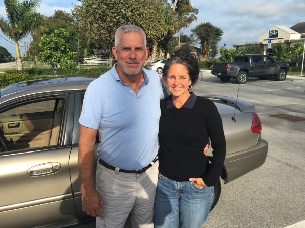
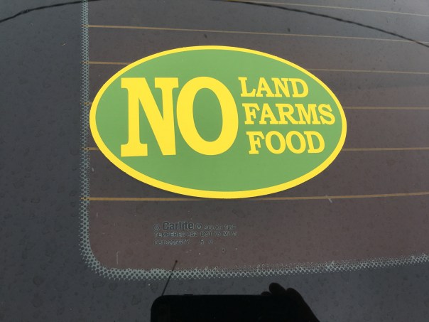


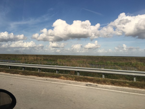


 Today we start learning about land owners inside the Everglades Agricultural Area (EAA) as listed on the above map; some will own land within Joe Negron’s proposed circles for land acquisition, and some will not. In any case, we should know them all.


 Recently, at Rivers Coalition Defense Fund meeting, president Kevin Henderson brought along the old River League’s briefcase. It had been stored away for many decades in an aging house in Stuart. In case you have not heard of them, “The River League” worked tirelessly in the 50s and 60s to stop the expanding destruction of our rivers by the Florida Flood Control District (today’s South Florid Water Management District) and the Army Corp of Engineers.