Tag Archives: USDA

The Seeds of U.S. Sugar’s Success, Canal Point, SLR/IRL

Image 11-10-16 at 7.47 AM.jpg
Sugar ration ad WW1

Before we begin today’s lesson, two major changes must be recognized. First after almost a year, the ACOE halted the destructive Lake Okeechobee discharges to the St Lucie River. These releases began January 29th, and lasted through November 4th, 2016.

And on Tuesday, November 8th, Donald Trump won the 2016 presidential election over Hillary Clinton, an election considered the most remarkable and unpredictable in over 100 years…

Now back to our Road Trip series:

Most recently we have traveled to Canal Point, the first town south of the Martin County line on the east side of Lake Okeechobee. This almost forgotten little town has an amazing history, and holds the seeds of today’s expansive Everglades Agriculture Area and of  United States Sugar Corporation itself.

The easiest way to take this drive through history is a timeline. So let’s crank up the car and begin!

kor0872
Connors’ Hwy 1920s Florida Memory

1914-1918 – World War 1. Sugar rationing across the nation.

1917- The West Palm Beach Canal is constructed, intersecting at Canal Point, allowing transportation of goods and internal land development around Lake Okeechobee

1918-After the war, Congress holds hearings about concerns that the county should “never again” get into a position where domestic sugar production is just 1.7 billion. The United States Department of Agriculture opens a sugarcane research central at Canal Point that still operates today-a hundred years later.

IMG_6675.JPG
Original USDA lab/office, Canal Point (Wiki)
img_6478
2016

1920- The American Legion and Federation of Women’s Clubs mount a national lobbying campaign against the high price of sugar. West Palm Beach chapters lead in support of the effort.

1920- Englishman, F.E. Bryant, already a successful farming business man in Lake Worth, forms the Florida Sugar and Food Products Company working with G.T. Anderson at Canal Point. They buy land and build the first sugar mill by 1921 and encourage expanded sugar farming.

1922-Flooding of some cane fields…they plod on…

1923- 900 acres of sugarcane in Palm Beach County, 800 of it in Canal Point. This is a real success.

1924- Connors’ Highway constructed allowing access in and south of  Lake Okeechobee for more sugar farming and development

1924- More flooding of cane fields– a major set back so Bryant merges his faltering company into a “better capitalized” company in Clewiston. The name of this company is Southern Sugar Company.

1926- Hurricane

1926 Florida land booms slows, beginnings of the Great Depression for Florida

1928 Hurricane- an historic Category 4/5 hits Lake O area coming through West Plam Beach. Up to 3000 people die. Many are never found.

FullSizeRender 2.jpg
Coffins at Canal Point, Florida Memory

1931 Businessman and General Motors executive, Charles Stewart Mott purchases Bryant’s failing Southern Sugar Company renaming it United States Sugar Corporation. This is the hugley successful and profitiable Clewiston “US Sugar Corporation” that we know today. http://www.ussugar.com

When I drove through Canal Point a couple of weeks ago, I had no idea that this little town held so much history. A history that eventually and unintentionally led to the diking of Lake Okeechobee and the destruction of the St Lucie River/Indian River Lagoon.

img_6462
S-352 at Canal Point/WPB Canal

*Thank you to the book Black Gold and Silver Sands, by James D Synder, and the Palm Beach Historical Society as sources.

file-page1-2

Road Trip to the Glades, Canal Point, SLR/IRL

My “Road Trip to the Glades” series is meant to be an experience of exploration. Exploration into a world many of us from the Coast have not seen. It is my hope that through learning about the Glades communities we can forge insights and hopefully friendships that assist us in our journey for a solution to Lake O’s discharges, Senate President Elect Joe Negron’s land purchase proposal for 2017, and a restored Everglades including a healthy St Lucie River/Indian River Lagoon.

At this point, as river advocates, we must make clear that we wish to attain these things, not at the expense of the communities of Lake Okeechobee. The best way to begin this conversation is to educate and visit there ourselves, because yes, #GladesLivesMatter.

We begin first our journey driving west from Stuart on Kanner Highway, named for Judge A.O. Kanner. “A.O.” had an accomplished legal and legislative career, and in 1925 was chosen to move to Martin County by longtime friend and colleague, Governor Martin, to get newly founded Martin County “off to a good start.” A note of interest is that “Abram” and his wife Mary were one of Martin County’s few Jewish families.  At the time,  Jews were not allowed to buy in certain subdivisions. But thankfully Kanner was embraced by the Martin County community, and became one of its most respected citizens. He lived in Stuart until his death in 1967. As a legislator, Kanner fought for roads. State Road 76, was the result of his effort to get good roads to the Glades. It is on his legacy that we will drive forward.

IMG_6439.JPG

FullSizeRender 2.jpgDriving west about twenty miles outside of Stuart, we pass Indiantown. We see train tracks, agricultural fields, and wonderful open natural lands such as DuPuis Wildlife Area. All the while the C-44 canal is to our right. An eagle flies overhead. The blue and white clouded sky seems bigger here.

Just a few miles before reaching the Lake we see the looming Port Mayaca Cemetery. In this cemetery are buried in a mass grave 1600 of the 3000 dead from the horrific 1928 Hurricane. A stark reminder of the past, the power of Mother Nature, and how we live dangerously so in a drained swamp. There are graves of others not associated with the hurricane too. Old families. People whose blood and sweat laid the ground for South Florida’s development.  Many of the family plots go back to the 1800s. IMG_6492.JPGIMG_6496.JPG

Getting back into the car and back on Kanner Highway, we drive past sod farms and sugarcane fields. King Ranch has a sign with their brand atop. After about 10 minutes, slowly and with caution we approach Port Mayaca. It is impossible to see Lake Okeechobee herself as a gigantic berm and structure surround her. We do see the ACOE’s S-308, the structure that allows water to enter the C-44 from Lake Okeechobee that eventually flows and destroys the St Lucie River. Strangely, we notice an “advisory” blue-green algae sign prominently displayed while at least four people are fishing in the canal. IMG_6432.JPGIMG_6437.JPG
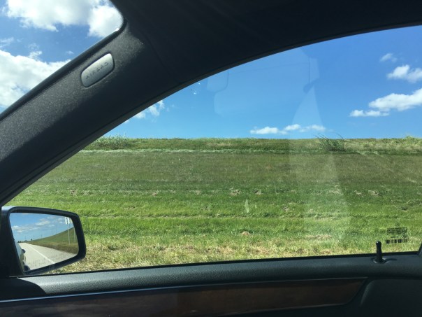
Pulling onto the once famous toll road of Connors Highway and going south, we see the berm of Lake Okeechobee. We leave Martin and enter Palm Beach County. Large trucks fill the road. It is nerve-wracking but exciting. Some beautiful old homes stand amoungst thickets of royal palms and tropical vegetation. Roses and honey are for sale if one has the nerve to pull over. IMG_6440.JPG

After about twelve miles we reach Canal Point. Canal Point is not incorporated, but part of Palm Beach County. At this location is S-352 built in 1917, today’s SFWMD’s structure allowing water into the West Palm Beach Canal, Water Conservation Area 1, as well as being used for irrigation.

We take a sharp turn into the Canal Point Recreation Area praying not to get rear ended. Here we can drive on top of the dike and take a look at Lake Okeechobee and across the street. Fishermen fish near the structure. An alligator waits nearby. It’s nice to see some wildlife.

IMG_6448.JPGIMG_6449.jpg IMG_6462.JPGIMG_6459.JPGIMG_6456.JPGIMG_6450.JPGIMG_6471.jpg

A beautiful Baptist church stands among tidy homes. A U.S.Department of Agriculture Research Service Sugarcane Station also sits along the Connor Highway that hugs the lake not too far from S-352.

IMG_6473.JPGIMG_6475.jpgIMG_6478.JPGIMG_6477.jpg

IMG_6479.JPG
Sugarcane fields
IMG_6481.JPG
Connors Hwy. allowed the Glades to develp
IMG_6486.JPG
Homes with dike in background

IMG_6485.JPGIMG_6484.JPG

Canal Point has about 525 people and the town is very small located between Lake Okeechobee and sugarcane fields.  From what we can see there is also a post office, one elementary school, and a store. Larger, Pahokee is just a few miles away.

This little town has a rich and important history. In the coming days we will learn about Canal Point’s mark on the Northern Everglades of which we are part.

__________________________________________________

Judge A.O. Kanner: http://historicpalmbeach.blog.palmbeachpost.com/1999/12/19/most-respected-judge-of-the-treasure-coast-ao-kanner-nov-2-1893-april-13-1967/

Dupuis Wildlife and Management Area: http://myfwc.com/viewing/recreation/wmas/cooperative/dupuis

Canal Point: http://canalpointfl.com

USDA Sugarcane Field Station Canal Point: https://www.ars.usda.gov/southeast-area/canal-point-fl/sugarcane-field-station/

Citrus Along the Indian River Lagoon, A Killer and a Necessity

Historic postcard, Indian River Citris. (Collection of Sandra Henderson Thurlow)
Historic postcard, Indian River Citris. (Collection of Sandra Henderson Thurlow.)

Thousands of years ago, humankind found a way to avoid the constant nomadic life of following big game, becoming more self sufficient, learning the art of agriculture. Nothing has made our lives better. Unfortunately, after thousands of years of its evolution, nothing has made our lives worse.

Don’t get me wrong, I realize that agriculture an important industry, the second largest after tourism, in the state of Florida. Still, we must look at its issues and try to make things better.

Agriculture is a high intensity land use, using large amounts of pesticides, fertilizers, and fungicides that over time accumulate in the water and the environment. The May 2014 issue of National Geographic states that “farming is the largest endeavor on earth using just under 40 percent of the earth’s surface causing the second largest  impact to the earth, erosion.” 

Much of the land in our area is devoted to agriculture as well, particularly citrus.

The Indian River Lagoon region is famous for its delicious citrus and although the industry is in decline due to canker, it has had huge impacts on the IRL area due to the canal system built to drain the land and water the crops. The muck that has entered the lagoon since the early 1900s is mostly from erosion of canals, due to the runoff from agriculture as they drain their lands that were once swamp or wetlands.

The Indian River Lagoon Region runs from Palm Beach to Volusia Counties, along the 156 miles of the lagoon. (USDA map 2011)
The Indian River Lagoon Region runs from Palm Beach to Volusia Counties, along the 156 miles of the lagoon. (USDA map 2011.)

The USDA documented 89,367 acres of citrus in the Indian River Lagoon region in 2009, declining to 81,673 in 2010. There is a lot of land devoted to citrus, land that has been radically altered from its original state and affects the Indian River Lagoon as there are literally thousands of miles of canals attached and interwoven along these groves. All eventually dump to the river or other water body.

In 1994 the Florida Department of Environmental Protection (FDEP) determined that the north fork of the St Lucie River/Indian River Lagoon, a registered state “Aquatic Preserve,” was contaminated by pesticides that came from the citrus groves in the area of the St Lucie’s headwaters, Ten Mile Creek. (http://www.dep.state.fl.us/southeast/ecosum/ecosums/tenmile_creek.pdf)

In 2002, the Florida Department of Environmental Protection labeled the St Lucie River as “impaired.” Reading through the document there is clear determination of agricultures’ role  in this process, especially with sediment run off, pesticides and heavy metals that have accumulated in the environment. (http://www.dep.state.fl.us/southeast/ecosum/ecosums/SLE_Impairment_Narrative_ver_3.7.pdf)

All postcards of citrus industry in Florida, ca. 1912. (Collection of Sandra Henderson Thurlow.)

IMG_5796 IMG_5797

Reading through the documents it is noted that many of the agricultural areas are quite old, as the post cards I am sharing today from my mother’s  collection are from 1912 and 1914.  According to the FDEP, many of the areas around Ten Mile Creek did not have BMPs, or best management practices in place, as they were  there before such rules were voluntarily implemented in the 1980s and 90s.

I don’t get it. Our environmental agencies have seen the writing on the wall for decades and even with the modern implementations of BMPs, (http://solutionsforyourlife.ufl.edu/hot_topics/agriculture/bmps.htmlwhere farmers try to minimize their impacts on our waterbodies, the rivers, estuaries, and lakes are filling up with excess nitrogen and phosphorus from fertilizer and other pollutants at an alarming rate.

Yes, the FDEP is implementing TMDLs or total  maximum daily loads through the BMAP, or basin management action plan, where municipalities and counties are required to lower their nutrient levels in waterbodies, but these are 15 and 30 year goals, that most certainly will take longer to truly implement. Also agriculture is exempt under the law and Right to Farm Act. They, as mentioned, implement BMPs but it may take fifty or more years to get all farms up to speed, if ever. Do we have that much time?

In the meanwhile, we watch or rivers dying from local runoff from C-23, C-23, and C-44  supporting the citrus and agriculture industries in Martin and St Lucie Counties.  On top of this, during major rain events, Lake Okeechobee, also full of agriculture runoff and high nutrients suspended in muck, from the sometimes back pumping sugar industry south of the lake, pours into the St Lucie River as well, wreaking any work we have done locally to meet local TMDLs.

Would I rather see the citrus lands developed for houses?

No. I rather fix the problems we have. And even though its called “corporate welfare,” I think state, federal, and local governments must help agriculture operate in a way that is not killing the environment. Some of the funds from the state this year that came out of the Senate Hearing on the IRL are doing this and the state really has been helping “forever,” but quietly, under the radar.

It is time to come full out to the public and explain the situation: we must feed ourselves and support our historic industry, but agriculture/citrus is killing our waterways.

In conclusion, of course the industry should make every effort itself to improve the situation, and some are more than others. In any case, we cannot just point fingers at them, we must help them. Perhaps we should bond together and put into law even better, stricter management practices, that will give the children of our state a future, not just eating, but also fishing, swimming and boating in a clean river.

___________________________________________________

IFAS, Update on Best Management Practices, 2014: (http://www.crec.ifas.ufl.edu/extension/trade_journals/2014/2014_January_best_mgt.pd)

USDA and State of Florida Citrus Report 2009: (http://www.nass.usda.gov/Statistics_by_State/Florida/Publications/Citrus/fcs/2009-10/fcs0910.pdf)