Tag Archives: Us Sugar Corporation

The Mystery of the “A-1 Reservoir,” SLR/IRL

IMG_7509.JPG

Road Trip Series:

What is the A-1 Reservoir?

My recent Glades tour with former Pahokee mayor, JP Sasser, lasted seven hours, and one of the most unexpected things I got to see was Storm Water Treatment Area 3-4. I have read about the STAs, flown over the STAs, and have had many discussions with engineer, Dr Gary Goforth, who is an “Architect of the STAs,” but nothing prepared me for what I felt when I unexpectedly saw an STA from the ground, or the other mystery I’d learn about that day.

So just about when my tour of the Glades was over, JP looked at me and ask: “Do you want to see the where the big reservoir was supposed to be?”

“Yes!” I exclaimed.” The reservoir? Hmmm. I’d heard stories of “the reservoir” but I really didn’t get it. Why didn’t it get finished? And what is it today? And then of course river advocates like me are supporting  Senate President Joe Negron’s reservoir. What’s the deal with all these reservoirs? So confusing…

JP stopped the car, his blue eyes dancing: “We’ll have to drive south….”

“Please!” I begged, knowing I may never have this opportunity again.

So JP turned the steering wheel 180 degrees in the middle of all the sugar fields and headed south of Belle Glade on Highway #27– driving right along the historic North New River Canal that I did know something about.

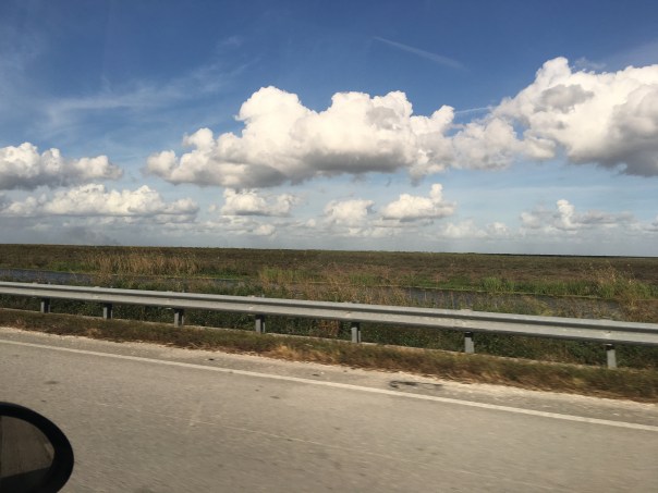
We drove, and we drove, and we drove…through sugar field after sugar field. And then, there it was, to my right, what appeared to be blowing reeds surrounded by shallow sparkling waters, silver and white, reflecting clouds in a blue sky. Birds flew by. It was beautiful. Miles long. My eyes welled up, and I thought about how amazing it was to see water in this place…”It’s like…..the Everglades….”

We drove until we got to the SFWMD’s STA 3-4 entrance gate and I asked JP to pull over so I could get a picture. I was unsure…So to JP, a Glades local, this area has to with “the reservoir,” but here we are at an STA? As I was pondering, we drove further into Broward County and JP pointed out many new-looking pump stations to send water south. I couldn’t stop wondering about “the reservoir.”

When I got home I did some research.

I believe, in short, this is the story. Please chime in if you know more.

After lawsuit/s due to long-standing polluted EAA water impacting southern lands, and after “acts of the Legislature,” in the 1990s a “Settlement Agreement,” was obtained. Thus the state of Florida had to construct 32,000 acres of storm water treatment areas (STAs) in the EAA (Everglades Agricultural Area) to clean water leaving the EAA and going into Water Conservation Areas and Everglades National Park.

By 2000 the first of six had been constructed, and by 2004 the first water ran through. Thus the building of the STAs is associated with the law suits. At the same time, Congress was working legislatively on CERP, the Comprehensive Everglades Restoration Plan. It was approved by Congress in 2000. But it was moving too slowly, so in 2006, Florida’s state legislature approved LOER (Lake Okeechobee and Estuary Recovery Plan) and under Jeb Bush chose 8 projects of CERP to “accelerate.”

One of the “Acceler 8” projects was the A-1 Reservoir. This reservoir was to be located basically right above STA 3-4 and it had three water components, one for agricultural use; one for the environment; and one for people.

Well time moves on and we are now post Jeb Bush, and into Charlie Crist’ governorship who in 2008 announced that the SFWMD would be negotiating with United States Sugar Corporation (USSC) to acquire as much as 187,000 acres of their land for Everglades Restoration! Lots of internal fighting. Environmentalist are excited about historic land acquisition, but many others are irritated that Everglades Restoration (CERP/Acceler 8) will be halted in order to purchase lands. Other sugar companies in the EAA are impacted as they share mills with USSC. US Sugar surprised everyone with this announcement. Not very nice! Some people in the ag industry are furious. Politics. Lawsuits. But such an opportunity!!! The Great Recession hits. The A-1 Reservoir and its 3 components are halted in order to possibly purchase the USSC lands.

Even more lawsuits ensue including one from the  Miccosukkee who want the reservoir completed as their lands are being depleted. Time is of the Essence.

The recession gets worse…the USSC land deal falls apart. Fewer lands are purchased. In 2010 Tea Party and “Jobs” Governor Rick Scott comes to power and negotiates with the Federal Government over of a law suit that included creating Numeric Nutrient Criteria for Phosphorus coming out of the EAA. “10 parts per billion” becomes the number. Some feel he sold out, others think it’s good.

In any case….the SFWMD now implements what the District had been planning as things were falling apart and money got tight, not a 3 part deep reservoir but rather a shallow Flow Equalization Basin, or FEB, in the A-1 reservoir lands above STA 3-4.

Thus the “Restoration Strategies,” law suit brought to the table by Rick Scott and State Legislature funded the A-1 Reservoir FEB and has more to come. What is important to note is that the A-1 FEB and the STAs were created to clean EAA sugar/agricultural runoff, due to lawsuits, not to hold, clean, and convey overflow Lake Okeechobee water that is destroying the estuaries…This is different.

And that’s why we environmentalist are talking about “a reservoir” today…a reservoir that would help the estuaries…because we don’t have one.

On the way home,  JP and I talked.

He is concerned that Negron’s 60,000 land purchase for a deep water reservoir could take so much land out of sugar production that one of the EAA’s four mills would not have enough cane to process, close, and put people out work. Pahokee cannot afford this…

“This stinks,” I thought  to myself. “Do we have to choose?” Why can’t people in the Glades and the Environment flourish? Everything is so confusing around here. This too should not be a mystery…

screenshot 3.jpg
2012 SFWMD presentation slide, Matt Morrison

Video:http://www.youtube.com/watch?v=5QKW91i-yu8

Video:http://www.youtube.com/watch?v=k-mEk_mc2wo

IMG_7510.jpg

IMG_7517.JPGIMG_7515.jpg

IMG_7519.JPGIMG_7513.JPG

file-page1.jpg

FullSizeRender 2.jpg
I noticed after writing this post that I did not report uses of reservoirs correctly thus I am adding this slide on 12-16-16, one day later. This slide shows what the reservoir compartments were proposed for in this 2012 SFWMD presentation slide by Matt Morrison. I had included “people/water supply” and this was incorrect. The entire presentation is linked below title EAA Storage Reservoirs, 2012. JTL

Timeline of Everglades Restoration DEP: http://www.dep.state.fl.us/evergladesforever/about/timeline.htm

EAA Storage Reservoirs SFWMD Matt Morrison 2012: http://evergladesrestoration.gov/content/cepp/meetings/012512/Recap_EAA_Reservoirs.pdf

A1 Reservoir history: https://www.sfwmd.gov/sites/default/files/documents/jtf_a1_feb.pdf

A1:http://xportal.sfwmd.gov/paa_dad/docs/F31147/PL9%20EAA%20A1%20Flow%20Equalization%20and%20Planning%20-%20T%20Morgan.pdf

Acceler8 :http://141.232.10.32/news/news_item_accerer8.aspx

Restoration Strategies:http://www.evergladesfoundation.org/wp-content/uploads/2016/09/Everglades-Water-Quality-Fact-sheet.pdf

CERP:https://www.nps.gov/ever/learn/nature/cerp.htm

SBG Farms/U.S. Sugar Corporation”Saved By Grace?” Mapping Out the Future of Water, SLR/IRL

file-page1-2.jpg

Today’s lesson in my series “Who Owns the Land? Mapping Out the Future of Water,” is #6, SBG Farms Incorporated. SBG Farms owns 8,569 acres of land in the EAA according to the TCRPC map.

I couldn’t figure out what SBG Farms stood for, but a couple of my favorite acronyms from acronym finder (http://www.acronymfinder.com/SBG.html) were: “Super Blue Green”and “Saved By Grace.”

Yes that makes sense…to not have Super Blue Green algae in the St Lucie River/Indian River Lagoon we all must be Saved By Grace….

So who is SBG Farms?

I believe SBG Farms is part of U.S. Sugar Corporation because according to Sunbiz, where once goes to look up registered corporations in the state of Florida, two of their officers are the same as for U.S. Sugar Corporation: president Robert H. Buker Jr. and vice president Malcolm S .Wade Jr. Also the registered address is in Clewiston, Florida, the same location as U.S. Sugar Corporation.  As we learned with land owner #1, U.S. Sugar Corporation is the “Granddaddy” of the land owners. “They were in the EAA first.”  We must respect and work with this… You can read the company’s history and their leadership from their website here: (http://www.ussugar.com/history/)

IMG_6188 2.JPG

(http://search.sunbiz.org/Inquiry/CorporationSearch/GetDocument?aggregateId=domp-683448-93ceb6fc-2d8d-4267-90ca-bfd54e7816bf&transactionId=683448-957ff114-9c63-4005-a54a-546677c0dfd3&formatType=PDF)

IMG_6183.jpg

(http://www.ussugar.com/people/robert-h-buker-jr/)

IMG_6184.jpg

(http://www.ussugar.com/people/malcolm-wade/)
(http://www.ussugar.com/leadership/)

IMG_6187 2.jpg

So above I have colored in the #6 parcels in the same purple crayon as #1 (USSC) and outlined in green marker so there is a visual difference.

Now for those of you who have been around fighting for the St Lucie River/Indian River Lagoon since 2013, don’t get worked up when you see “Bubba” Wade’s photo, remember in the end, we all can be “SBG.” All of us that is,  and we need it! For a better Florida water future we must all be “Saved By Grace,” and maybe, just maybe, we already are…

file-page1.jpg
Senate Presidient  Joe Negron’s proposed land acquisition map for water storage –2016/2017 legislative session.

Okeelanta Corporation, Mapping Out the Future of Water, SLR/IRL

file-page1-2.jpgToday I will continue my series “Who Owns the Land South of Lake Okeechobee? Mapping out the Future of Water.” Hurricane Matthew caused a slight interruption, but now we shall continue. 🙂

Here we go!

Number two on the TCRPC map (above) is Okeelanta Corporation. “Okeelanta is a division of Florida Crystals, the word is a combination of two made into one. “Okee,” coming from “Okeechobee,” and “lanta,” coming from “Atlantic.” Cleverly named for a location between Lake Okeechobee and the Atlantic Ocean. Okeelanta was a historic town founded by writer and politician Laurence E. Will’s father. The town stood about one mile below South Bay. It was destroyed in the 1928 Hurricane: http://www.pbchistoryonline.org/page/okeelanta

I’m not sure if the company Okeelanta is named after the town, but I believe it was bought, and I know it is now owned by the Fanjul family of Cuba who owns Florida Crystals. As many of us know, the Fanjul family came to South Florida because of Fidel Castro’s 1959 Marxist Revolution. The family moved to Florida along with other wealthy, dispossessed families. Here with the support of the US Government the Fanjuls rebuilt their fortune as the US grew to be a leader in the world sugar trade, at the expense of the Florida Everglades.

In regards to the map, it must be noted that compared to US Sugar Corporation, the Fanjul family are relative”newcomers.” This is why their land holdings are further south of Lake Okeechobee. They acquired lands as the industry expanded after 1960.

Sometimes I say “until the Cuban Revolution there were only 100,000 acres of sugar cane in the EAA.” This is probably off, but you get the point. As Laurence E. Will in his historic book noted in a previous post: “After the Cuban Revolution, for a short time our government permitted the unrestricted panting of sugar cane…”

Again I stress that the expansion of these lands by the US Government is what allowed this area to be convered from Everglades to sugar fields, and it is only our state and national governments that can encourage and fairly compensate land owners for lands purchased in the EAA to allow water storage in an area that should never have been 100% developed in the first place. We have to encourage land owners to please be a part of the solution of allowing storage of excess water and helping more clean water move south…

According the TCRPC map Okeelanta owns 86,793 acres of land in the Everglades Agricultural Area, (EAA.) A lot!

I have colored in the #2s  with orange highlighter so you can see these lands more clearly and how the intersect with Senator Joe Negron’s circles for possible proposed land acquisition. Remember that 9 days ago I colored in United States Sugar Corporation’s (USSC) lands in purple crayon. They are #1.

IMG_5991.jpg

So now we can clearly “see” what lands are owned by USSC and by Okeelanta.

“Okeelanta Corporation, a sugarcane company, engages in farming, milling, packaging, and distributing sugar cane. It has a 67,000 acres facility that includes cane fields, a mill, refinery, packaging and distribution center and a power plant. The company was incorporated in 1984 and is based in West Palm Beach, Florida. Okeelanta Corporation operates as a subsidiary of Florida Crystals Corporation.”

As we shall see in future posts, the Fanjul holdings have various names, thus they own more land than noted in the map above. Like them or not, the family is clever just like the name “Okeelanta” and infamous for their political influence. The two most well known brothers are noted for ties to different political parties:  Alfonso Fanjul, Democratic Party while Pepe, contributes to Republican Party. For the record the other brothers names are Alexander and Andres. And they have a sister. Her name is Lillian Banjul Azqueta and she is president and founder of New Hope Charities.

As controversial as the family is, they do a lot of good for the poor Glades communities and they own what we want. We must work together for a better water future for Florida that includes our St Lucie River/Indian River Lagoon.

Vanity Fair article IN THE KINGDOM OF BIG SUGAR: http://www.vanityfair.com/news/2001/02/floridas-fanjuls-200102

New Hope Charities: http://www.newhopecharities.com.

Okeelanta Corp.: http://broward.jobing.com/florida-crystals-okeelanta-corporation

Florida Crystals: https://www.floridacrystals.com

Fanjul Bros. WIKI: https://en.wikipedia.org/wiki/Fanjul_brothers

file-page1.jpg
Senator Negron’s proposed land purchase map 2016/17

“All is Fair in Love and War,” St Lucie River/Indian River Lagoon

Martin County Fair 2016
Since my childhood the Martin County Fair has been one of my favorite times of year. US Sugar was not an advertiser when I was growing up here.
First sign displayed upon entering fairgrounds., 2016.
First sign displayed upon entering fairgrounds., 2016

At the chance of sounding like “a sounding brass, or a clanging cymbal,” I would like to share my experience yesterday at the Martin County Fair.

Mind you, for me, the Martin County Fair is as apple pie as a once clean river. Growing up in Martin County the fair was THE event of the year. We waited all year for it to come to town!

It was the one place our parents would set us “free” to run around and visit our friends, go on the ferris wheel and the Zipper!—-Scrunched together in the gravity of middle school, this was about as much fun as could possibly be attained…..I have wonderful memories of the fair.

Most recently, I have gone to the Fair with my nieces, and last night by myself. My husband, Ed, wanted to piddle around at the airport just across the street….Well, yesterday when I walked through the fair’s gate there was a most prominently posted sign that read:  “U.S. Sugar.”

sign
Sign….

This surprised me. This bothered me.

I knew they were a sponsor for the fair but I was taken aback that this was the first sign one would see upon walking into the fairgrounds  from the entrance gate. Thousands of parents and children saw that sign right before they had a ton of fun…

Hmmmm?

I complained to Ed later. “Jacqui are you really surprised?” he asked….”The fair needs sponsorships. U.S. Sugar is marketing…”

Maybe my eyes are not totally opened, but I do find a U.S.Sugar banner prominently displayed at the Martin County Fair odd and ironic.

I find this ironic as at this very moment the gates of S-80 are at “maximum capacity” forcing the polluted waters of the Lake Okeechobee into the St Lucie River/Indian River Lagoon. The lands of U.S. Sugar are blocking the flow south to the Everglades.

Often I hear that the fault lies north as those waters are coming from the Kissimmee basin not south of the lake. To me that is like stopping in traffic and blaming a car two miles up the road for the traffic jam.

Last year, U.S. Sugar did not support the purchase of option lands that could have eventually alleviated this problem. I don’t think it is morally right for them to advertise at our fair until they take leadership on this issue…but then…

—-“all is fair in love and war.”

And I will speak for love…


The red colored blocks south of Lake O. are the EAA-700,000 acres of sugar lands and vegetables. South of the EAA are the STAs and water conservation areas .(SFWMD map, 2012.)
Thie big picture...the EAA blocks the water from flowing south into the Everglades. EF.
The big picture…the EAA blocks the water from flowing south into the Everglades. EF. The water is directed to the coasts through the St Lucie and Caloosahatchee.
S-80
S-80
1st area to enter upon entering fairgrounds.
1st area to enter upon entering fairgrounds, with US Sugar banner prominently displayed. 2016.

U.S. Sugar Corp:http://www.ussugar.com/#

M.C.Fair:http://www.martincountyfair.com

“They’re Here” U.S. Sugar Corporation in Martin County, SLR/IRL

Clewistons' US Sugar Corporation refinery 2013 (Dr Scott Kuhns)
Clewistons’ US Sugar Corporation refinery with fields surrounding, 2013.  (Aerial, Dr Scott Kuhns)
Sugar production site, public photo
Sugar refinery with cane in foreground, public photo.
Land ownership
Land ownership

U.S. Sugar Corporation…..I always think of them as a giant corporation “south of the lake,” blocking the waters of Lake Okeechobee causing the waters to be redirected to our St Lucie River/Indian River Lagoon…Well “they” are no longer just south of the lake….

“They’re here”———and I am not speaking about cane fields.

"They're here.."
“They’re here.” Poltergeist 1982.

I have been thinking about writing this blog post since October of 2015, but waited. It was in October of 2015, from a very reliable source, that I first  heard that U.S. Sugar Corporation had become a member of the Martin County Economic Council. I was surprised. This is a game changer for Martin County in my opinion. And then I started looking around and realized that they had been here to influence for a while and I just had not noticed…

US Sugar listed on Economic Council Website 2016
US Sugar listed as a trustee member  on the Economic Council of Martin County’s Website’s  2016

For instance a couple of months ago, my husband Ed and I attended an event at the historic Lyric Theater. My husband, Ed, started donating in both our names to his beloved Lyric Theater shortly after our marriage in 2005. About two months ago we attend an event and when we sat down to have our picture taken against the newly designed Directors’ Circle Donor Wall, I notice that our name is right up there “in bronze “with US Sugar Corporation. “This is new,” I thought to myself….”Wow.”

“I didn’t see that last time we were here….Interesting.”

Bronze walled sponsors for the Lyric.
Bronze walled sponsors for the Lyric. Look left third up.
Ed and I have been list on the wall since 2006.
Lyric booklet of Director Circle Donars
Lyric booklet of Director Circle Donors

OK let’s continue ….

So then yesterday, I go to Office Depot to get a special pen, and while I am standing in line a nice lady hands me the brochure for the upcoming Martin County Fair. I have attended the fair since middle school—an iconic event.  I smile, thank her, open the brochure, and  guess who is one of the sponsors?

Yes. US Sugar Corporation.

Martin County Fair brochure 2016

When I really think about it, I guess this is no surprise as US Sugar Corporation has been very visible trying to improve their image locally in the Stuart News after 2013’s “Lost Summer” toxic algae fiasco spending $100,000s of dollars on ads like the one below. I wonder where their influence will show up next?

In any case they are not just south of the lake, “they’re here.” This is becoming more and more obvious. Look around.

— The good thing is we’ll have a chance for conversation a little closer to home…I look forward to it.

Ad in Stuart News 2014/15

MC Economic Council:http://www.mceconomy.org

Lyric Theater: http://www.lyrictheatre.com

MC Fair: http://www.martincountyfair.com

Getting the Numbers Straight With U.S. Sugar, SLR/IRL


This pie chart shows an average of Lake O discharges in acre feet to the estuaries from 1996-2015. (Dr Gary Goforth 2015)

After last Thursday’s WRAC meeting at the South Florida Water Management District, I left somewhat miffed.

(http://www.sfwmd.gov/portal/page/portal/xweb%20about%20us/meetings)

The numbers seemed wrong….

These meetings are difficult to follow, and almost surreal at times.  On Thursday, this was especially true with “paid” protesters yelling outside against the option land purchase, and afterwards the group’s slick sun-glassed/suit-wearing organizer coming inside to pat one of the WRAC members on the back.

I sat there thinking “life really is stranger than fiction,” no wonder south Florida satirist and writer Carl Haaisen says almost all of his material is “simply out of the newspapers…”

Another oddity for me was when Bubba Wade, representing US Sugar Corporation, during WRAC members’ comments referencing “2013,”  in defense of not purchasing the option lands, quoted the acre footage of water to the St Lucie Estuary/IRL as “4.5 million acre feet annually,” —and thus justifying that if the 26,000 acre option lands located south of the lake were purchased, even with that water “exchanged,” it would never be “enough…”

I’m thinking to myself: “445,000—4.5 million…I saw  “that” number in a Palm Beach Post article too, but I swear it said billion and not million acre feet….where are these numbers coming from? Is Bubba using the right numbers? I think they are wrong….Am I wrong?”

After the meeting, I even walked up to Mr Wade, who I have met on many occasions and feel I have a good working relationship with saying: “Bubba, where did you get your numbers?  I am almost sure the St Lucie River, no maybe the estuaries received around 1.5 million acre feet of water in 2013, not 4.5 million acre feet to the SLR. What are the numbers? If we can’t agree on what numbers we are talking about, how we ever agree on anything at all? ”

Bubba was talking out loud trying to figure where he got his numbers, and I was wondering where I got mine as well…in the end we just stared at each other…

When I got home I consulted Dr Gary Goforth. I have interpreted and put into laymen terms what he wrote to me below.

It shows that the numbers change depending on what years one is talking about, and over how long a period of time.

First of all…. : For calendar year 2013, 1.584 million acre feet of Lake water was sent to the estuaries… The St Lucie gets about 20% of that…. But in figuring out “distribution,” one does not just look at one year….Dr Goforth shared again his hand out from last month’s SFWMD Governing Board meeting:

The chart below shows in acre feet, the “distribution of Lake Okeechobee releases from  water years 1996-2015.” “20 years” of reference, gives a more accurate estimate of the long-term average of annual values than a shorter time period. Of course every year annual flows vary. For years 1996-2015 the average number of acre feet to the SLR/IRL  is 270, 224.

This pie chart shows an average of Lake O discharges in acre feet to the estuaries from 1996-2015. (Dr Gary Goforth 2015)
This chart, taken from the ACOE and SFWMD and shown here in a slide presentation by Mark Perry of Florida Oceanographic, shows a 10 year period from 1996-2005.

The above chart is different as it shows a ten-year, not a twenty-year average, 1996-2005). Here the number, 442,000 looks more like  Bubba’s 4.5 million acre feet. (I found this chart in Mark Perry’s presentation on his website at Florida Oceanographic.)This must be the chart Bubba Wade was referring to…?

Which number is better? Which number is correct? That depends what one is trying to prove. Right? 🙂

In any case, when quoting numbers, it is good to know which reference chart one is quoting. One one should also reference which chart one is using….This goes for me as well as for Mr Wade of U.S. Sugar….

Heading of Dr Goforth's chart showing estimated releases from Lake O to SLR from 1931-2013.
Heading of Dr Goforth’s chart showing estimated releases from Lake O to SLR from 1931-2013.
A section of Dr Goforth's chart 1988-2013.
A section of Dr Goforth’s chart 1988-2013. Years 1988-2013 showing acre feet flows from Lake O to SRL.
Lake Okeechobee conversion sheet, Everglades Coalition break out session, 2015.
Lake Okeechobee water/conversion sheet, Everglades Coalition break out session, 2015.

_______________________________

WRAC, SFWMD, (http://www.sfwmd.gov/portal/page/portal/xweb%20about%20us/wrac)

Mr Malcom (Bubba) Wade, US Sugar Corporation, (http://www.ussugar.com/press_room/bios/wade_bio.html)

Dr Gary Goforth: (http://garygoforth.net)

Florida Oceanographic/Mark Perry’s power point presentations: (http://www.floridaocean.org/p/233/advocacy-environment#.VSKHyrrRwl8)

_____________________________________

This photo is to reference a comment on this blog:

Page 16 of Jeff Kivett's System constraints document, SFWMD, 2015 as shown to respond to blog comment. 4-7-15
Page 16 of Jeff Kivett’s System constraints document, SFWMD, 2015 as shown to respond to blog comment. 4-7-15
This is THE photo where the 4.5 million acre feet comes from. Thank you to Christine Stapleton of the Palm Beach Post for sharing when I asked where she got her sources for her article referred to in comments in this blog post.  THE PROBLEM with the slide is that this is referring to ALL WATER into the estuaries: "local runoff" and Lake Okeechobee water. This conversation is not about ALL WATER/"LOCAL" runoff water---it is about Lake Okeechobee and how the ACOE and SFWMD make us take this water that IS NOT  OURS. The 4.5 M number makes it sound like it is not possible to fix lake O. This is untrue. IT is fixable at 1.5 million acre feet or even twice that much. If nothing else the issue could be alleviated.
4-7-15: This is THE source where the 4.5 million acre feet comes from. (Jeff Kivett’s SFWMD constraints doc.) Thank you to Christine Stapleton of the Palm Beach Post for sharing when I asked where she got her sources for her article referred to in comments in this blog post. THE PROBLEM with the slide is that this is referring to ALL WATER into the estuaries: “local runoff” and Lake Okeechobee water. This conversation, this blog post, the land purchase south of the lake,  is not about ALL WATER/”LOCAL” runoff water—it is about Lake Okeechobee water and how the ACOE and SFWMD make us take this water that IS NOT OURS. The 4.5 M number mentioned by Mr Wade or Ms Stapleton makes it sound like it is not possible to “fix” lake O, or to buy enough land that would help the estuaries or hold clean, and convey water,. This is untrue. It is “fixable” at 1.5 million acre feet or even twice that much. If nothing else the issue of lake O being the toxic nail in our estuaries could be half way alleviated.