Original locks at Canal Point WPB Canal, JTLWPB Canal built in 1917 at Canal Point, JTL
Survey marker on original lock at Canal Point, WPB Canal. JTLThe beautiful iron and wood work on the original lock at Canal Point’s WPB Canal.IronworkPictured here: The original lock at Canal Point. I think this should be restored as a historic landmark as it was built in 1917 as part of the WBP canal and basically set us on the path we are today and is also a symbol of where we can go. The man on this lock reminded me of the story of the shared swing-bridge at Torry Island that once was part of the Roosevelt Bridge in Stuart. This will be the subject of today’s post.
2016 has been an incredible year, and 2017 will be as well. In 2016, both Lake Okeechobee and the St Lucie River blew up with toxic algae, and #GladesLivesMatter was established as a voice for a way of life that could be lost…
As far as 2017, as I write this post, deals are being cut, and advocates on both sides are working to get legislative support for their positions. But during this season of light, may we also remember our interests, as they hold things we share in common rather than apart: a Healthy Lake Okeechobee and St Lucie River, as well as Local Economic Prosperity for All are certainly goals both the Glades and the Coast desires…right now, in most areas of our combined worlds, this does not exist…
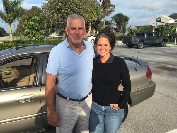
Yesterday, I toured the Glades once again with former Pahokee mayor, J.P. Sasser, someone I don’t always agree with, but definitely get along with. Someone who is teaching me a ton about the Glades, a history linked to my history, the St Lucie River/Indian River Lagoon….
Along the journey, a noteworthy thing happened right of the bat at Canal Point, our first stop. Here, I met an older gentleman fishing along the original locks of the historic West Palm Beach Canal. As I was taking photos, I thought I should introduce myself.
“Hello,” I said, extending my hand.
“Hello.”
“Catching much?” I asked.
“Not today, but usually, yes.”
“Do you live around here?” I inquired.
“No, Tequesta.”
“Wow Tequesta? That’s pretty far away…”
“Not really,” he said. “Maybe thirty minutes. I used to come here with my father in the 1950s.”
“That’s cool.”
“And where are You from?” He inquired.
“Stuart.”
The fishing line bobbed in the water. I saw noticed a dead gar fish float by. The water doesn’t look so good, I thought.
“Have things changed a lot?” I asked.
“Yes they have,” he said, “but not a lot out here at Canal Point. That’s why I come.”
An alligator silently swam the shoreline…
“You know your bridge is here.” the fisherman softly said,” pulling on the line.
“Wow, funny you should know that…my mom…she’s a historian. Torry Island right? They used part of the Roosevelt Bridge in Stuart to build out in here in Belle Glade in 1938. It’s still here today…a swing-bridge….right?”
He looked at me holding his gaze. “Right young lady, the bridge is here….”
J.P. called from the car. The fisherman and I locked eyes.
“The bridge is here.” I repeated.”The bridge is here.”
As we drove away, I wrote something on my notepad: “2017 #GladesCoastMatters … ”
_________________________________________
Torry Island Bridge is located in Belle Glade about a 15 minute drive around Lake O from Canal Point.
“The story of the bridge’s origins flow smoothly from Corbin… The 1928 hurricane that ravaged the Glades set in motion the chain of events that would bring the bridge to Belle Glade. The storm destroyed the original dike that surrounded the lake. To build the replacement dike, the federal government spooned out a canal, separating Torry Island from Belle Glade, and used the dirt for the dike. The new canal, called the Okeechobee Waterway, needed a bridge. In 1938, state contractors built the Point Chosen Bridge, replacing a pontoon bridge with a swing bridge that was built in 1916 and relocated from the St. Lucie River near Stuart. The bridge consisted of the movable portion and wooden trestles on each end.” Associated Press article, 2009.
Merry Christmas and Happy Holidays to all my readers! See you in 2017!
Jacqui
This is the swing bridge that used to be in Stuart on the Roosevelt Bridge but is now part of the Torry Island Bridge in the city limits of Belle Glade.Torry Island, Belle Glade.The swing-bridge looking across the rim canal around Torry Island.The Bridge Between Us…JP and JTL.J.P.’s bumper sticker
My bumper sticker/sHistoric map of the Glades showing cities. Canal Point upper left and Belle Glade further west and south. WPB canal is in Canal Point and the Torry Island Bridge is in Belle Glade.
My recent Glades tour with former Pahokee mayor, JP Sasser, lasted seven hours, and one of the most unexpected things I got to see was Storm Water Treatment Area 3-4. I have read about the STAs, flown over the STAs, and have had many discussions with engineer, Dr Gary Goforth, who is an “Architect of the STAs,” but nothing prepared me for what I felt when I unexpectedly saw an STA from the ground, or the other mystery I’d learn about that day.
So just about when my tour of the Glades was over, JP looked at me and ask: “Do you want to see the where the big reservoir was supposed to be?”
“Yes!” I exclaimed.” The reservoir? Hmmm. I’d heard stories of “the reservoir” but I really didn’t get it. Why didn’t it get finished? And what is it today? And then of course river advocates like me are supporting Senate President Joe Negron’s reservoir. What’s the deal with all these reservoirs? So confusing…
JP stopped the car, his blue eyes dancing: “We’ll have to drive south….”
“Please!” I begged, knowing I may never have this opportunity again.
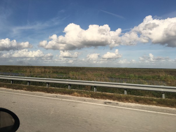
So JP turned the steering wheel 180 degrees in the middle of all the sugar fields and headed south of Belle Glade on Highway #27– driving right along the historic North New River Canal that I did know something about.
We drove, and we drove, and we drove…through sugar field after sugar field. And then, there it was, to my right, what appeared to be blowing reeds surrounded by shallow sparkling waters, silver and white, reflecting clouds in a blue sky. Birds flew by. It was beautiful. Miles long. My eyes welled up, and I thought about how amazing it was to see water in this place…”It’s like…..the Everglades….”
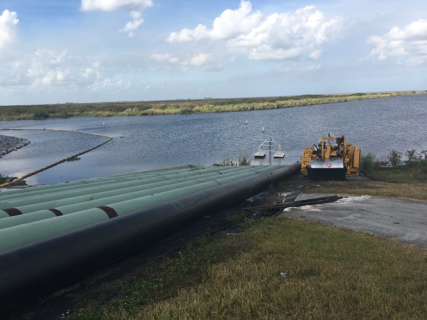
We drove until we got to the SFWMD’s STA 3-4 entrance gate and I asked JP to pull over so I could get a picture. I was unsure…So to JP, a Glades local, this area has to with “the reservoir,” but here we are at an STA? As I was pondering, we drove further into Broward County and JP pointed out many new-looking pump stations to send water south. I couldn’t stop wondering about “the reservoir.”
When I got home I did some research.
I believe, in short, this is the story. Please chime in if you know more.
After lawsuit/s due to long-standing polluted EAA water impacting southern lands, and after “acts of the Legislature,” in the 1990s a “Settlement Agreement,” was obtained. Thus the state of Florida had to construct 32,000 acres of storm water treatment areas (STAs) in the EAA (Everglades Agricultural Area) to clean water leaving the EAA and going into Water Conservation Areas and Everglades National Park.
By 2000 the first of six had been constructed, and by 2004 the first water ran through. Thus the building of the STAs is associated with the law suits. At the same time, Congress was working legislatively on CERP, the Comprehensive Everglades Restoration Plan. It was approved by Congress in 2000. But it was moving too slowly, so in 2006, Florida’s state legislature approved LOER (Lake Okeechobee and Estuary Recovery Plan) and under Jeb Bush chose 8 projects of CERP to “accelerate.”
One of the “Acceler 8” projects was the A-1 Reservoir. This reservoir was to be located basically right above STA 3-4 and it had three water components, one for agricultural use; one for the environment; and one for people.
Well time moves on and we are now post Jeb Bush, and into Charlie Crist’ governorship who in 2008 announced that the SFWMD would be negotiating with United States Sugar Corporation (USSC) to acquire as much as 187,000 acres of their land for Everglades Restoration! Lots of internal fighting. Environmentalist are excited about historic land acquisition, but many others are irritated that Everglades Restoration (CERP/Acceler 8) will be halted in order to purchase lands. Other sugar companies in the EAA are impacted as they share mills with USSC. US Sugar surprised everyone with this announcement. Not very nice! Some people in the ag industry are furious. Politics. Lawsuits. But such an opportunity!!! The Great Recession hits. The A-1 Reservoir and its 3 components are halted in order to possibly purchase the USSC lands.
Even more lawsuits ensue including one from the Miccosukkee who want the reservoir completed as their lands are being depleted. Time is of the Essence.
The recession gets worse…the USSC land deal falls apart. Fewer lands are purchased. In 2010 Tea Party and “Jobs” Governor Rick Scott comes to power and negotiates with the Federal Government over of a law suit that included creating Numeric Nutrient Criteria for Phosphorus coming out of the EAA. “10 parts per billion” becomes the number. Some feel he sold out, others think it’s good.
In any case….the SFWMD now implements what the District had been planning as things were falling apart and money got tight, not a 3 part deep reservoir but rather a shallow Flow Equalization Basin, or FEB, in the A-1 reservoir lands above STA 3-4.
Thus the “Restoration Strategies,” law suit brought to the table by Rick Scott and State Legislature funded the A-1 Reservoir FEB and has more to come. What is important to note is that the A-1 FEB and the STAs were created to clean EAA sugar/agricultural runoff, due to lawsuits, not to hold, clean, and convey overflow Lake Okeechobee water that is destroying the estuaries…This is different.
And that’s why we environmentalist are talking about “a reservoir” today…a reservoir that would help the estuaries…because we don’t have one.
On the way home, JP and I talked.
He is concerned that Negron’s 60,000 land purchase for a deep water reservoir could take so much land out of sugar production that one of the EAA’s four mills would not have enough cane to process, close, and put people out work. Pahokee cannot afford this…
“This stinks,” I thought to myself. “Do we have to choose?” Why can’t people in the Glades and the Environment flourish? Everything is so confusing around here. This too should not be a mystery…
I noticed after writing this post that I did not report uses of reservoirs correctly thus I am adding this slide on 12-16-16, one day later. This slide shows what the reservoir compartments were proposed for in this 2012 SFWMD presentation slide by Matt Morrison. I had included “people/water supply” and this was incorrect. The entire presentation is linked below title EAA Storage Reservoirs, 2012. JTL
Today we continue our road trip in the Glades atop the Herbert Hoover Dike.
In the short video below you can see my Glades tour-guide, former mayor JP Sasser, driving, –in his hometown of which he knows so much about–Pahokee. On the right lies the city, and on the left is Lake Okeechobee. A precarious position indeed!
Pahokee is actually unusual in that this little town is “high-ground.” According to JP, about 13 feet above ground. This is not the case for most of the Glades.
Interestingly, in the video, JP discusses how the Army Corp recently decided where to strengthen the dike in Pahokee, because if they had extended it out 500 feet as was done along the rest of the eastern shore, the town of Pahokee would have been covered up as it is located right beside the dike.
Lake Okeechobee’s dike and its history are fascinating just as is all our area of the Northern Everglades including the St Lucie River/Indian River Lagoon that in 1923 became the primary exit point for waters that could no longer flow south after the Herbert Hoover Dike was built.
According to historian and Gladesman Lawrence E. Will:
“…following the floods of 1923 and 1924 water stood over farm lands nearly the entire winter. To protect the farms, the state of Florida had then constructed an earthen dike along the whole south shore. It was some five to eight feet above ground level but this dike was never intended to withstand a hurricane.”
Regarding the expansion of the dike, as the “Herbert Hoover,”after the horrific hurricanes of 1926, ’28 and again in again in ’49, Mr. Nathaniel Reed notes in his writing “Lake Okeechobee and the Everglades: “The Corps of Engineers studied the average size of Lake Okeechobee and designed a dike around it…”
Now this is where things get very interesting.
“The average size of the lake….” what’s that?
Now if we look at this slide taken from a 2016, presented by Jeff Sumner, who was at the time Office Chief State and Agricultural Policy, SFWMD, it shows the size of the lake pre-development. One can see it was about once about 1000 square miles in size and today it is 750.
The False Edge of Lake Okeechobee, SFWMDThe checkered fields were once lake bottom. L. E. Will, “Okeechobee Hurricane”L.E. Will Swamp to Sugar Bowl. The Glades area, today’s Everglades Agricultural Area has become one of the most productive agricultural areas in the world…
Of course the size expanded and contracted based on rainfall, but one still gets the point…this lower area was nature’s shoreline, a boggy marsh with rivers leading into a sawgrass “river of grass” bordered by a forest of over 30,000 acres of Custard Apple trees that functioned like mangroves extending up to five miles or more south into what is today’s Belle Glade. As Mr Lawrence Will would have said: “Who wudda thought!” (http://museumoftheglades.org)
Pahokee is in upper right. Map Laurence E WillThe lake once went further south here and there following the rivers to Hwy. 80Land ownership todaySen. Joe Negron’s map for land purchase
I would like to thank former mayor of Pahokee, JP Sasser for on November 29th guiding me through a seven hour tour of the Glades! At first you may think JP and I are unlikely “friends.” Actually we have something very much in common in that we have both been mayors of small Florida cities.
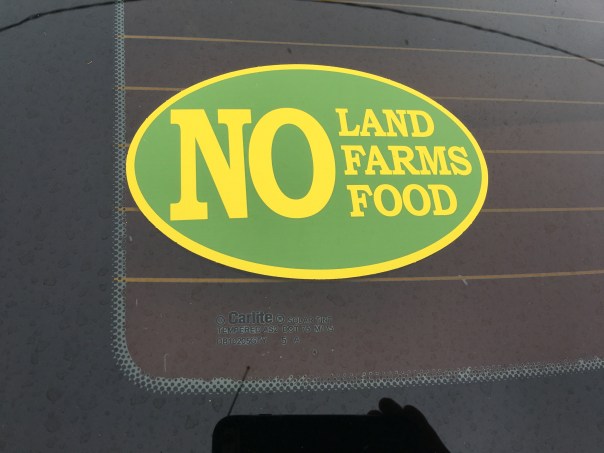
Yes, there are also a few serious things we don’t have in common such as our opinion regarding land purchase in the Everglades Agricultural Area, (EAA), for a reservoir to alleviate the destruction of the St Lucie River. Also, Sasser has written extensively about concerns regarding the direction of the Rivers Coalition. I have been on the Rivers Coalition Defense Fund for six years. Mayor Sasser and I have not always been on the same page. For me this is O.K. JP and I having differences of opinion shouldn’t preclude working together. At this point in my river journey, I am going to do all I can to build relationships. To find common ground. “Common muck” should I say?
Anyway, enough politics. My tour was awesome! For this post, I will just concentrate on Pahokee.
JP and I met at Canal Point, at the USDA Sugarcane Field Station that dates back to 1920 about ten miles south of the Martin County/Palm Beach County line at the WPB Canal.
Pahokee has about 6000 residents. It has beautiful new schools. Many of the lands are owned by family farmers and the Fanjul family. The population is about 80% black and 20% white. Everyone I met was friendly and happy to see me.
Locals fishing at marina
JP asked me where I wanted to go. I asked him to take me to the Pahokee Marina and Tiki Bar that he so famously worked for during his mayorship. This marina is within view of Port Mayaca in Martin County. JP’s dream was that this marina would become the basis for economic development and diversity of Pahokee. The city desires economic development. (http://www.mypalmbeachpost.com/news/business/guy-harveys-resort-chain-eyes-site-in-okeechobee-c/nmwGw/)
I learned that Pahokee unlike much of the Glades is thirteen feet above the lake. It is high ground. The town is just a few miles long and 500 feet wide right along the dike. One sees dike, houses, road and then fields…Thus when the ACOE recently wanted to make improvements and “go out 500 feet out from the dike” they would have basically had to had to knock down the city.
I learned that much of the lands close to the Lake were covered with Apple Custard Trees that had been removed in the early 1900s and thus the lands have excellent deep muck soil that grows not only sugarcane, but sod, corn, vegetables, and supports tree farming. Pahokee is known as “Muck City.”
JP then took me off the beaten track to see his horses and donkeys. So here is something else we have in common. A love of animals!
We drove on…JP showed me the remains of the Pelican River which led to Pelican Bay that I had read about in my book. This was the area where the Palm Beach Times reported over 400 dead after the 1928 Hurricane. I tried not to imagine…
We then drove to Pahokee’s original graveyard that had to be moved along with its resting bodies to Port Mayaca in Martin County after the 1928 Hurricane. There was a plaque that listed those who had been buried there. A sad thought, but here is another way Martin County and the Glades are connected.
We visited the airport. Very nice. Right along the lake. In fact this area was once lake bottom. Bizarre. Hmmm…My husband Ed would like this airport I thought. More possibilities for economic development?
Again back to the dike. It always goes back to the dike…
We checked up on ACOE repairs where they had draped the pipes carrying water to the fields over the dike like spaghetti and then JP took to me to lunch….
Part #2 will be entitled: “The Best Fried Chicken of My Life.” Please see photos below.
JP at Pahokee MarinaDriving on road atop the dike by marinaView from dike looking south. Homes stand right next to the dike.Old Pelican RiverTree Farm looking from dikeJP’s horese and donkeys
Original Pahokee graveyard at base of dike
Old GraveyardPahokee’s nice new roads with lovey houses on right and fields on other side of roadCanal and control structure to fieldsLocation of airport, once lake bottom
JPRepair of dike ACOE with water for irrigation from lake over dike so they can get to culverts