A quaint church before the water tower, Pahokee, “Welcome Home,” JTLNegronBraynon
Senate President Joe Negron’s District 25 includes the Treasure Coast south to Palm Beach County, and inland to the City of Pahokee in the Glades. Pahokee will be hosting President Negron and Senate Democratic leader Oscar Braynon tomorrow, March 17th at 5p.m. to talk about Senate Bill 10, and the future of the area.
This is a good opportunity to meet our neighbors and learn what they, the people, have to say about Senate Bill 10, and what they want for the future of their historic community. I encourage coastal residents to attend.
The people we support; the environmental destruction of our St Lucie River/Indian River Lagoon, we cannot. The waters of the great Lake Okeechobee flowed south for thousands of years before the rich soils it created were discovered, and our environment was put at risk.
Isn’t there a way more water can flow south as God and Nature intended while enhancing the economics and life style for the people of this area? Can’t we let the people speak for themselves?
Let us try.
Thank you.
Jacqui
_____________________________________
Press Release: Glades County Democrat Newspaper
Area residents invited to hear Senator Joe Negron Mar 15th, 2017 · by Special to the Glades County Democrat PAHOKEE — Florida Senate President Senator Joe Negron and Florida Senate Democratic Leader Senator Oscar Braynon will be at the Glades Community Discussion on Friday, March 17, at 5 p.m. to discuss the future of our historic communities.
This discussion is open to all communities of Pahokee, Belle Glade, Clewiston, South Bay, Canal Point, LaBelle, Okeechobee and Moore Haven.
The Glades Community Discussion will take place at the Pahokee High School located at 900 Larrimore Road.
Free locally grown food for Glades residents will be served. There will be chicken dinners, corn boil and corn giveaway for Glades families.
Photos of beautiful, historic, Pahokee
Hanging in the Presidient Negron’s office if this historic photo from Pahokee of the corn harvest.Pahokee is famous for its streets lined with stately royal palms. JTL…Pahokee’s rich muck soils yield tremendous produce.Black gold up closeA home in Pahokee.Homes in the Glades are built on multiple stilts in the mucky soils. Soil subsidence is an issue.The sugar mill nearby-there are concerns about job loss if land in the EAA is purchased for a reservoir. The area already has a high unemployment rate. The question is, is the present situation the situation Glades residents want for their future?Number sticker on a car in the GladesSenate Districts Florida
Sunset over Lake Okeechobee at Canal Point, neighbor to Pahokee, by Todd Thurlow
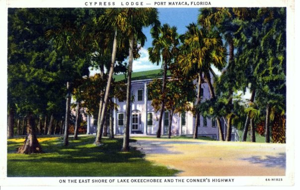
Historic Postcard courtesy of historian Sandra Henderson Thurlow.Back of post card
If one drives to end of Kanner Highway adjacent to the C-44 Canal connecting the St Lucie River to Lake Okeechobee, there is a gem to see. A place that will take you back to an earlier time. The name of this place is the “Cypress Lodge,” in Port Mayaca.
According the “History of Martin County,” this beautiful lodge first opened its doors in 1938 and is *now operated by Mr and Mrs Charles Dorrell functioning as a resting stop for tired motorist crossing the state from north to south, or east to west.”
Page 253 reads: “The lodge, boasting an outstanding cellar, is colonial in design, built originally as a tavern, has been operating ever since. The two-story all cypress building with a large dining room, is staffed mostly by residents of Pahokee, Canal Point, and surrounding towns. It is said more people work in Port Mayaca than live there.”
Just last week I learned that friend, and long time Stuart resident, Elsie Jean Stewart, has deep ties to the property as her parents were married there. She recently shared with me a wonderful family photo of the young couple. Their tremendous smiles in black in white were full of color. What days these must have been…
I recently drove out past the lodge on my way to Belle Glade while daydreaming what the area was like as in the mid-1800s between Seminole Wars. I saw a giant cypress forest full of wildlife and there was no dike around the lake, so from horseback, I could see over the wide expanse of Lake Okeechobee….
Those things are gone and the lodge was built later, but it is still connected. I have been curious to see the structure as I have been missing it on my recent drives to Belle Glade. On my last trip, I figured out that at some point the historic Connors’ Highway had been rerouted so now at the Lake, one must turn north rather than south to see the familiar structure.
When I found the lodge, I took some photos to share. Still beautiful. Still timeless. I believe today it is a private residence. Thankfully it is still here and remains a gem of Martin County’s fascinating history around Lake Okeechobee.
The Cypress Lodge and Port Mayaca are located west near S-308 at Lake Okeechobee. You can see the C-44’s connection from the Lake to the South Fork of the St Lucie River/Indian River Lagoon.
2-18-17: Correction!
Today I figured out, thanks to an article by the Luckhardts, that although not mentioned in the “History of Martin County” on page 252-3 , it was Paul M. Hoenshel of Miami who originally built and operated the lodge. Hoenshel is the grandfather of Elsie Jean Stewart whose “parents were married in the lodge” that I mention…. Jacqui
Original locks at Canal Point WPB Canal, JTLWPB Canal built in 1917 at Canal Point, JTL
Survey marker on original lock at Canal Point, WPB Canal. JTLThe beautiful iron and wood work on the original lock at Canal Point’s WPB Canal.IronworkPictured here: The original lock at Canal Point. I think this should be restored as a historic landmark as it was built in 1917 as part of the WBP canal and basically set us on the path we are today and is also a symbol of where we can go. The man on this lock reminded me of the story of the shared swing-bridge at Torry Island that once was part of the Roosevelt Bridge in Stuart. This will be the subject of today’s post.
2016 has been an incredible year, and 2017 will be as well. In 2016, both Lake Okeechobee and the St Lucie River blew up with toxic algae, and #GladesLivesMatter was established as a voice for a way of life that could be lost…
As far as 2017, as I write this post, deals are being cut, and advocates on both sides are working to get legislative support for their positions. But during this season of light, may we also remember our interests, as they hold things we share in common rather than apart: a Healthy Lake Okeechobee and St Lucie River, as well as Local Economic Prosperity for All are certainly goals both the Glades and the Coast desires…right now, in most areas of our combined worlds, this does not exist…
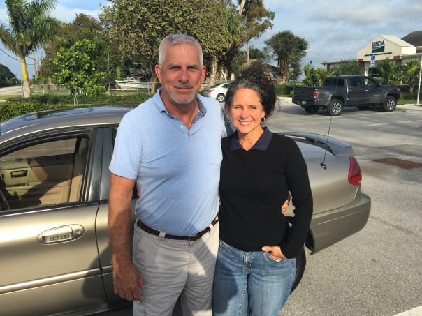
Yesterday, I toured the Glades once again with former Pahokee mayor, J.P. Sasser, someone I don’t always agree with, but definitely get along with. Someone who is teaching me a ton about the Glades, a history linked to my history, the St Lucie River/Indian River Lagoon….
Along the journey, a noteworthy thing happened right of the bat at Canal Point, our first stop. Here, I met an older gentleman fishing along the original locks of the historic West Palm Beach Canal. As I was taking photos, I thought I should introduce myself.
“Hello,” I said, extending my hand.
“Hello.”
“Catching much?” I asked.
“Not today, but usually, yes.”
“Do you live around here?” I inquired.
“No, Tequesta.”
“Wow Tequesta? That’s pretty far away…”
“Not really,” he said. “Maybe thirty minutes. I used to come here with my father in the 1950s.”
“That’s cool.”
“And where are You from?” He inquired.
“Stuart.”
The fishing line bobbed in the water. I saw noticed a dead gar fish float by. The water doesn’t look so good, I thought.
“Have things changed a lot?” I asked.
“Yes they have,” he said, “but not a lot out here at Canal Point. That’s why I come.”
An alligator silently swam the shoreline…
“You know your bridge is here.” the fisherman softly said,” pulling on the line.
“Wow, funny you should know that…my mom…she’s a historian. Torry Island right? They used part of the Roosevelt Bridge in Stuart to build out in here in Belle Glade in 1938. It’s still here today…a swing-bridge….right?”
He looked at me holding his gaze. “Right young lady, the bridge is here….”
J.P. called from the car. The fisherman and I locked eyes.
“The bridge is here.” I repeated.”The bridge is here.”
As we drove away, I wrote something on my notepad: “2017 #GladesCoastMatters … ”
_________________________________________
Torry Island Bridge is located in Belle Glade about a 15 minute drive around Lake O from Canal Point.
“The story of the bridge’s origins flow smoothly from Corbin… The 1928 hurricane that ravaged the Glades set in motion the chain of events that would bring the bridge to Belle Glade. The storm destroyed the original dike that surrounded the lake. To build the replacement dike, the federal government spooned out a canal, separating Torry Island from Belle Glade, and used the dirt for the dike. The new canal, called the Okeechobee Waterway, needed a bridge. In 1938, state contractors built the Point Chosen Bridge, replacing a pontoon bridge with a swing bridge that was built in 1916 and relocated from the St. Lucie River near Stuart. The bridge consisted of the movable portion and wooden trestles on each end.” Associated Press article, 2009.
Merry Christmas and Happy Holidays to all my readers! See you in 2017!
Jacqui
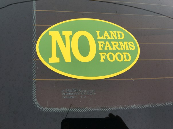
This is the swing bridge that used to be in Stuart on the Roosevelt Bridge but is now part of the Torry Island Bridge in the city limits of Belle Glade.Torry Island, Belle Glade.The swing-bridge looking across the rim canal around Torry Island.The Bridge Between Us…JP and JTL.J.P.’s bumper sticker
My bumper sticker/sHistoric map of the Glades showing cities. Canal Point upper left and Belle Glade further west and south. WPB canal is in Canal Point and the Torry Island Bridge is in Belle Glade.
Flying over the black gold of the EAA. JTLFields in Pahokee, JTL
Road Trip Series.
Since I began my Glades “Road Trip” Series, I have read three books by Lake Okeechobee historian, Laurence E. Will: Okeechobee Hurricane, Swamp to Sugar Bowl, and A Cracker History of Okeechobee.
These books hold amazing stories of the Glades; if Mr. Will hadn’t written, there would be very few first-hand accounts of farming that became a Florida mega-industry just over the first half century of the 1900s. Today, I will transcribe some of his most interesting descriptions of Lake Okeechobee, the magical landscape that was transformed into today’s contoversial Everglades Agricultural Area, for none other than its MUCK.
EAA below Lake Okeechobee. (Public map SFWMD)Photo of pond apples also know to locals as custard apples in Big Cypress- shared on Flicker by photographer Mac Stone, allow us to envision what this incredible forest looked like. 32,000 acres rimming the southern and eastern shore of Lake Okeechobee. The best muck built up over thousands of years under these roots that worked like a seine as the lake overflowed its edge then running south through the sawgrass. The Everglades….
Photo from Swamp to Suagrland, showing pond apple with moon vines around Lake O. (Lawrence E Will)
Close up of small pond apple on Torry Island, by Lawrence E Will.
pond apples
Florida Memory Project, photo by John Kunkel Small 1869-1938.
When I was on my recent tour with former mayor of Pahokee, J.P. Sasser, I learned the nick-name for Pahokee is “The Muck,” named so for the “black gold” soil that accumulated over thousands of years under the roots of a custard apple forest that rimmed the lake. (Kind of like fresh water mangroves today in the Indian River Lagoon.)
When one drives deeper into the Glades, one finds similar nick-names or “muck mottos,” that have to do with the muck. For instance, Belle Glade’s motto is “Her Soil is Her Fortune;” Clewiston’s is “America’s Sweetest Town,” and South Bay’s refers to its highways, “Crossroads of South Florida,” named so for its intersection of two major roads, East-West State Road 80, and North-South, U.S. Highway 27, roads that get one into the muck, or out of it….
Will first experienced the Lake in the early 1900s as a boy when his father was developing Okeelanta, located about four miles below today’s South Bay. Okeelanta, today a mill location for the Fanjul holdings, was located not in an apple custard forest, but rather in the miles of sawgrass lying south. Although the soil here is excellent, it is different, more peaty and not as “mucky.” Thus the most productive lands lie closer to the lake, deep in the MUCK.
Here is a moving account by Will about the land of muck in “Cracker History of Lake Okeechobee:
“Before the dredges crashed through the custard apple woods to start the first canals, the lake most always stayed high and clear, unbroken except for those islands Kreamer, Torry, and Observation. When I first saw the lake it was still wild. Excusing the trifling settlements at Utopia, Ritta, and Tantie, a score of fishing camps, and the openings to four unfinished canals, it’s swampy shores hadn’t changed since Zachary Taylor found the redskins or probably not since DeSoto anchored in Tampa Bay. It sill was just as the good Lord had fashioned it. The lake was lonely Mack, silent and mysterious as well. But I tell you boy, it was beautiful, and sort of inspiring too.”
Will was absolutely pro development, pro farming/agriculture, but he, like most of the old timers, recognized the tremendous awe-inspiring beauty of the place.
Most all the natural beauty the lakeside shoreline in Martin County, where the FPL Power Plant is today, and north to the town of Okeechobee has also been radically altered as well.
FPL solar plant and “cooling pond” in Martin County looking west towards “Barley Barber Swamp.” This area was once a forest of mostly giant cypress trees and others. JTL
Excerpts by Lawrence E. Will:
“Dense forest ringed the lake around. Along its northern half water oak, maple, cypress, potash, rubber and palmetto trees crowded each other on the lakeshore ridge…the south shore and half way up the eastern side was something else… Here were custard apples, a solid belt of tropical trees, blanketed with a moonvine cover, which stood, two miles or more in width, without break or opening, from near Clewiston’s Sand Point, slap around to Port Mayaca. 32,000 acres of custard apple woods there were, the most of these trees, I wouldn’t doubt, on the whole blamed continent of America.”
“…Although the shores were for the most part black muck, low and flat, there were some fine sandy beaches too. Along the east side for eighteen miles lay beautiful East Beach…”
“Now if Zachary Taylor or Hamilton Disston could return to Okeechobee they would find that farmers have exterminated the custard apple woods. Highways, service stations, super markets and housing projects have replaced the cypress, rubber and maple trees along the ridge. A levee occupies the onetime shore and drainage has lowered by half a dozen feet the water’s elevation. Tractors cultivate the former seining grounds, and unless you as old–and no amount, as some of us, your never heard of town of Tantie, Utopia or Ritta. Civilization has re-made the lake and I’d be the last to say it isn’t better so, but the lakeshore’s one time natural beauty is long gone, and man, wasn’t that old lake a fascinating place.”
Well, to the land of Lake Okeechobee! For all she was, and for all she is. It’s enough to make one exclaim:”What The Muck?!!!”
I would like to thank former mayor of Pahokee, JP Sasser for on November 29th guiding me through a seven hour tour of the Glades! At first you may think JP and I are unlikely “friends.” Actually we have something very much in common in that we have both been mayors of small Florida cities.
Yes, there are also a few serious things we don’t have in common such as our opinion regarding land purchase in the Everglades Agricultural Area, (EAA), for a reservoir to alleviate the destruction of the St Lucie River. Also, Sasser has written extensively about concerns regarding the direction of the Rivers Coalition. I have been on the Rivers Coalition Defense Fund for six years. Mayor Sasser and I have not always been on the same page. For me this is O.K. JP and I having differences of opinion shouldn’t preclude working together. At this point in my river journey, I am going to do all I can to build relationships. To find common ground. “Common muck” should I say?
Anyway, enough politics. My tour was awesome! For this post, I will just concentrate on Pahokee.
JP and I met at Canal Point, at the USDA Sugarcane Field Station that dates back to 1920 about ten miles south of the Martin County/Palm Beach County line at the WPB Canal.
Pahokee has about 6000 residents. It has beautiful new schools. Many of the lands are owned by family farmers and the Fanjul family. The population is about 80% black and 20% white. Everyone I met was friendly and happy to see me.
Locals fishing at marina
JP asked me where I wanted to go. I asked him to take me to the Pahokee Marina and Tiki Bar that he so famously worked for during his mayorship. This marina is within view of Port Mayaca in Martin County. JP’s dream was that this marina would become the basis for economic development and diversity of Pahokee. The city desires economic development. (http://www.mypalmbeachpost.com/news/business/guy-harveys-resort-chain-eyes-site-in-okeechobee-c/nmwGw/)
I learned that Pahokee unlike much of the Glades is thirteen feet above the lake. It is high ground. The town is just a few miles long and 500 feet wide right along the dike. One sees dike, houses, road and then fields…Thus when the ACOE recently wanted to make improvements and “go out 500 feet out from the dike” they would have basically had to had to knock down the city.
I learned that much of the lands close to the Lake were covered with Apple Custard Trees that had been removed in the early 1900s and thus the lands have excellent deep muck soil that grows not only sugarcane, but sod, corn, vegetables, and supports tree farming. Pahokee is known as “Muck City.”
JP then took me off the beaten track to see his horses and donkeys. So here is something else we have in common. A love of animals!
We drove on…JP showed me the remains of the Pelican River which led to Pelican Bay that I had read about in my book. This was the area where the Palm Beach Times reported over 400 dead after the 1928 Hurricane. I tried not to imagine…
We then drove to Pahokee’s original graveyard that had to be moved along with its resting bodies to Port Mayaca in Martin County after the 1928 Hurricane. There was a plaque that listed those who had been buried there. A sad thought, but here is another way Martin County and the Glades are connected.
We visited the airport. Very nice. Right along the lake. In fact this area was once lake bottom. Bizarre. Hmmm…My husband Ed would like this airport I thought. More possibilities for economic development?
Again back to the dike. It always goes back to the dike…
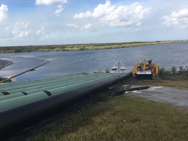
We checked up on ACOE repairs where they had draped the pipes carrying water to the fields over the dike like spaghetti and then JP took to me to lunch….
Part #2 will be entitled: “The Best Fried Chicken of My Life.” Please see photos below.
JP at Pahokee MarinaDriving on road atop the dike by marinaView from dike looking south. Homes stand right next to the dike.Old Pelican RiverTree Farm looking from dikeJP’s horese and donkeys
Original Pahokee graveyard at base of dike
Old GraveyardPahokee’s nice new roads with lovey houses on right and fields on other side of roadCanal and control structure to fieldsLocation of airport, once lake bottom
JPRepair of dike ACOE with water for irrigation from lake over dike so they can get to culverts
As you know, we are on a Road Trip. We are driving through not only to learn about the Glades, but also to learn about ourselves. Whether we realize it or not, we are all connected. We are related by history, by the drainage of the Everglades, and by a “better water future” we have no choice but to build together.
This map of the Glades is from the Florida Memory Project. It maps flood damage from two great hurricanes. Notice that the 1926 Hurricane damaged mostly the western part of the lake near Moore Haven, where as the 1928 Hurricane most intensely hit the eastern communities around Belle Glade. The towns/areas of Canal Point, Pahokee, Bacom Point, Belle Glade, South Bay, Lake Harbor, Bare Beach, Clewiston, Moore Haven and Newell all had to rebuild. “Chosen” near Belle Glade was chosen to be lost…
These past hurricanes define the history and the nature of some of the people of the Glades. The ones who “made-it” are survivors beyond anything we can possibly envision.
As Mr Lawrence E. Will an old family, a politician, and a prolific writer from the area wrote in HURRICANE:
“One word describes it. It was Hell. A raging inferno of rolling, swirling waters, of shrieking, demoniac winds, of lashing rain and of darkness, black and absolute. There were no atheists that night on the shores of Okeechobee! Then for the those still living came the second phase of hell; the phase of desolation and despair; of searching in the flooded woods and marshes, in elder clumps and sawgrass for the horrible remains of family and friends and neighbors; of loading them into trucks by unending scores; and finally of burning them in help of dozens when they could no longer be transported. It is hard to know which hell was worse…”
As we know in the 1930s the Herbert Hoover Dike was built to avoid such a disaster from happening again…but there is always the question of whether it will or not. It is dangerous to live on the low side of a dike.
As advocates of the St Luice River/Indian River Lagoon, we must be sensitive when discussing Senate President Joe Negron’s proposal for 60,000 acres to be purchased south of the lake to store, convey and move water south to the Everlgades. One can see how shouts of “Send the Water South” may send some people living south of the lake “over the edge…”
We must always make clear that when discussing Everglades resoration and improved health of the St Lucie River/Indin River Lagoon, safety, and economic prosperty for the Glades communties comes first. We know and respect their past…