


It was September of 1924, Stuart was still part of Palm Beach County, and few people lived here. It was the “boom era” and residents were excited about building the future. But then it started raining, and raining, and raining…
By Edwin A Menninger, reprinted in the 1950 Anniversary of the Stuart News with my location references.
JUST WHAT WAS STUART LIKE 25 YEARS AGO? THE YEAR STUART ALMOST WASHED AWAY…
…We had just had four days of torrential rain. At one time it rained 36 inches in 36 hours. Stuart was flooded. The railroad tracks washed away at Rio. They washed away also just south of Salerno, and two FEC passenger trains carrying about 500 people were marooned in Stuart till the tracks could be rebuilt. The Vanderbuilts just happened to be on the train!…I published a special FLOOD EXTRA and sold 400 copies…the heavy rains made an enormous lake in th heart of Stuart. (It was before 4th Street (East Ocean) was graded and paved) and a huge lake stretched from the court house to the school.(Today’s Stuart Middle School and Ad. Buildings)
A small ditch to drain off the worst was dug from the lake’s edge (where W.V. King’s house now stands) (Across from Willie Gary’s office on Osceola today) to the St Lucie River; in an hour this became a raging torrent. Water ran so fast it dug a ditch 75 feet wide to the river, undermined houses nearby, threatened extensive damage before Curt Schroeder and his crew got things under control again. The ground was s waterlogged that drainage problems were difficult. Water stood across 4th Street (East Ocean) in deep, big ponds for more than a month in front of where John Demich now lives (today’s 5th and Cortez) and at the tennis court. The old hospital building was surrounded by water for weeks and physicians came and went in boats…
A raging torrent that dug a 75 foot ditch from East Ocean Blvd to the St Lucie River! Doctors going to the hospital in boats? Holy cow. That must have been something. How did they put back the land that washed out? Below I have tried to figure out where that area might have been…
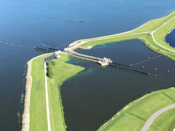
In closing, hope you have enjoyed this week’s pond series. The message remains the same, Lake Okeechobee or a little pond on East Ocean Blvd. “Over drainage has consequences….”
________________________________________________
Notes of location referred to in the 1924 article, by Sandra Thurlow, help to figure out location:

- Mom, where is the King’s house?
The King house was Kay Norris’s parents’ house across from the Pelican Hotel (Willie Gary’s ) The corner of our church property where Mary’s Closet is today used to flood terribly. There was once a rectory there that had to be demolished because it flooded and was ruined. Uncle Dale could tell you all about that. The King house still stands on Osceola I believe. At one time it was Dr. Eckersley’s office.
2. Where was the Dumich house?
Dumich lived on 5th Street about where Cortez intersects it.
3. Mom, remined me about the flooding when I was a kid.
Think of the courthouse. As you probably remember Memorial Park was always flooding. When it was suggested for a site for the library years before, Mary Kanner, (Kanner Highway, Highway 76, is named after her Judge husband) said “I am not going to have the library built in that sometime lake.” The pond that was dug in front of where the Log Cabin was constructed, later became the Middle School Pond. Now, it too, has been made to disappear.

~Edwin A Menninger, The South Florida Developer, 1924
(Menninger purchased the weekly paper, South Florida Developer, in 1923, moving its publication headquarters to Stuart from Canal Point. In 1928 he bought the Stuart Daily News. This excerpt was reprinted in the 1950 Anniversary Edition of the Stuart News.) (This excerpt can also be found on page 453 of a History of Martin County.)

Thank you to my awesome brother Todd Thurlow who created this image after reading today’s blog post. He writes: “Hi Jacqui – If you want to see the 1924 lake, the FEMA flood maps show the low spot pretty well. Check thiis out:” ~Todd


 Recently, at Rivers Coalition Defense Fund meeting, president Kevin Henderson brought along the old River League’s briefcase. It had been stored away for many decades in an aging house in Stuart. In case you have not heard of them, “The River League” worked tirelessly in the 50s and 60s to stop the expanding destruction of our rivers by the Florida Flood Control District (today’s South Florid Water Management District) and the Army Corp of Engineers.


