Florida is like Africa. We have a wet season and a dry season. This dry season has been very wet!
In today’s blog, I will share the most recent update by Dr Gary Goforth sent to Martin County on 3-13-15 entitled: “Summary of Dry Season Flows, November 1, 2015 – February 29, 2016.” Dr Goforth gives a summary and provides wonderful visuals. The “pages” he mentions in his summary for this post have been converted to slides. (Please view slides from left to right.)
Thank you Dr Goforth. (http://garygoforth.net)
Are are an integral part in helping us understand why we must sent the water south…
Engineer, Dr Gary Goforth.SFWMD satellite map, S.Fl. Water Conservation Areas (WCAs) are below the Everglades Ag. Area (EAA) which is just under Lake O.
” All,
Thought you might be interested in this comparison of dry season inflows to, and discharges from, Lake Okeechobee. Inflows to the Lake were 79% higher this dry season (Nov. 1 2015 – February 29, 2016) compared to a year ago, but Lake discharges have only been 1% higher due to the inability to send water south. Hence Lake stages have increased more than a foot above the level it was at this time last year.
The basins with the biggest increases in Lake inflows are those along the north and northwest shores of the Lake – but not the Upper Kissimmee, which exhibited a 50% reduction in flows to the Lake compared to last year.
As we’ve seen, because of the heavy rains south of the Lake and the agencies delay in moving water out of the Water Conservation Areas, WCAs, the estuaries have taken the brunt of Lake releases this year.
The flow estimates on the first 5 pages are in acre feet and in billion gallons on the second 5 pages.
Gary Goforth
Dry Season Summary slides Dr. Gary Goforth 3-15-16.
Thank you to my husband Ed for taking these photos once again of our east coast Indian River Lagoon inlets: Sebastian, Ft Pierce, and St Lucie– in this order. He took them Saturday, 3-12-16, around 4pm.
How to recognize a photo up close if you are not sure? Sebastian is recognized by its bridge over the inlet, Ft Pierce by the discharges exiting C-25 into the IRL at Taylor Creek near the marina, and Stuart’s St Lucie by “ball-like” Sailfish Point and undeveloped Jupiter Island south across the inlet.
Each inlet is unique, but all share that destructive channelized discharge waters running through them to the Atlantic Ocean—carrying sediment covering seagrasses, oysters, and reefs—too much freshwater for healthy fisheries and wildlife….and over nutrification—–
The rare, old-fashioned, 1987 “IRL Joint Reconnaissance Report “map below shows the Indian River Lagoon basin as a whole all the way from Ponce de Leon, in Volusia County to Jupiter Inlet, in Palm Bach County. The image shows the various freshwater discharge points into the Indian River Lagoon “basin.”
Yes, the Florida we know was “built on drainage” of the lands, but if the Florida of tomorrow is going to thrive, this system must be re-plumed/reorganized.
As we are aware, and have been aware, we are slowing killing our treasured ecosystem with these discharge outlets. It is time to rethink the drainage equation. Hopefully, in the future, “the canal map” will not look like this, nor will the aerials. To view series of aerials below, please click image and then direct with arrows.
Source: Indian River Lagoon Joint Reconnaissance Report 1987 as shared by Gary Roderick.
Aerials of Sebastian, Ft Pierce and Stuart’s St Lucie Inlet 3-12-16 Ed Lippisch.
Mr. Robert Crandall, the chief executive of American Airlines from 1985 to 1998 and leading the fight against All Aboard Florida in Martin County.
“I can’t believe you are not marching in the streets with pitchforks; this is going to ruin your county.” Bob Crandall, 2016
There was something about him. Maybe it was the confidence that radiated, or the casual way he put his hands in his pockets while looking people straight in the eye…something about him let you know that you were dealing a legend… the kind of person they don’t make anymore…
On February 24th, I attended the Stuart Chamber’s Government and Transportation Committee’s guest speaker series. On this day it was Robert “Bob” Crandall, former chief executive of American Airlines who lives in Palm City. Mr Crandall and C.A.R.E. are leaders in the fight against All Aboard Florida. (AAF)
Trying to understand All Aboard Florida is difficult. It is multi-layered and after a while its easy to glaze over. Acronyms like FDFC; EIS; ROD and the discussion of extensions and bonds can turn off even the most interested. So today I am just going to share “the simple” and “the why” of Mr Crandall’s presentation and summarize why “we need to grab our pitchforks.” I will end with a true quote form Martin Health System.
AAF is a health and safety issue.
There will be less business, period. Noise and vibration will all facilitate less business in Downtown Stuart, and cause structural harm to its businesses, and historic Lyric Theatre.
Property values will decline.
A train going 55 miles per hour takes one mile to stop. These trains will go faster.
Pedestrians such as in Golden Gate, used to slower trains, will not correctly judge speeds. There will be accidents .
The costs to Martin County is estimated to be $323,000 in 2016; $1,000,000 by 2020; and $3,000,00 by 2040. Taxes WILL be forced up.
The Maritime industry will suffer greatly. Property values for marinas and homes on west side of bridge will decline. Boaters will be frustrated and leave the area.
The Roosevelt Bridge is now closed 3 hours and 30 minutes a day; with AAF it will be closed 9 hours and 30 minutes a day.
The 80-year-old bridge over the St Lucie River WILL get stuck…
Dangerous substances will eventually be coming through. Freight is the long-term goal.
We can’t win politically; we have to win legally.
For me things really set in my mind after Mr Crandall’s talk. During the question answer period the representative from Martin Health System said the following. I kid you not. He said the following: “If All Aboard Florida goes thorough, people will die.” He was speaking of ambulances stuck at tracks. Seconds count if you have a heart attack.
I thought to myself: “This is unbelievable. The most conservative of our community and the number one employer of our community just said ‘people will die.’ And the chamber has not taken a position. Why aren’t we out in the street with pitchforks?”
This morning I went searching for inspiration so I visited the “Florida Memory Project” and typed in Lake Okeechobee. A variety of historical photos came up. So interesting. Old photos of an ancient shoreline rimmed with pond apple, cypress trees, white sandy shorelines and loads of fish. Photos of building the dike and dredging around Lake Okeechobee…even some in another section of the St Lucie River and Indian River Lagoon. And then this aerial from 1968 of a VMCJ-2 squadron EA-6B Prowler photographed over Lake Okeechobee. I was captivated looking at this photo. The early days of color photography …dreamlike…
And the lake is so large– over 35 miles long and 28 miles across –70% its original size–still enormous! You can tell the pilot flying next to this airplane took the photograph. Skill. Teamwork. Belief.
1968— This was a time of great social change and struggle in the United States, but also a time of great determination. Apollo 11 was the first manned mission to land on the Moon, on 20 July 1969, shortly after this photograph was taken. This EA-6B jet is not a space ship, but it too represents the technological capabilities of the United States. Our ability to achieve when we believe.
When this photograph was taken, I was four years old. I remember this time in spirit if not in memory. Nonetheless, it is ingrained in me, as in all Americans, that we can accomplish anything if we put our minds to it. This photo is an image that remind us that we CAN fix water in the state of Florida if we take the wide view and the high view of Lake Okeechobee. And if we believe.
Dr Gary Goforth has been kind enough to update his “Flows South Comparison”report. I posted his previous one just this week on 2-22-16. His most recent comparison is included below in slide format. Please click on the slides to enlarge and view information.
The numbers are staggering.
At this point, more than 171,000 acre feet (55.99 billion gallons) of Lake Okeechobee water (blackwater) has been dumped to the river/estuary during just the first 26 days of the 2016 Lake releases; this is equal to 41% of the entire 2013 releases and 16% of the 1997/98 El Nino event. …
We are in for a very difficult, long year of discharges for our St Lucie River/Indian River Lagoon; and they have more than likely “just begun.” We must remain updated, educated, and vocal —and documenting–take photos share what you see. Last night I was told there are dead fish in the area of Sailfish Marina. If you see such a thing take a photo and post it or send it to me with location etc….(jthurlow@me.com) Also continue contacting our state and federal partners and advocating that land be purchased south of the lake to offset these type of events. We shall and are turning this Titanic.
“Clam Diggers” Gloucester, MA by Emile Gruppe as shared by Gloria Fike from a Christmas card years ago sent by Frances Langford.
Water…and the gifts of life from the water….
Today I am sharing a beautiful work of art that is connected to our St Lucie River/Indian River Lagoon by the late, famous, and long time resident, Frances Langford. She resided most of her life along both rivers’ shores.
Kimberly Falconer is a friend of mine that I grew up with here in Martin County. Kim now lives in Miami as owner of “Ocean Adventures.” After reading my blog post a few weeks back about the famed Gruppe collection of Frances Langford, she wrote:
“—-thought I would share a few images with you. This one is of artist Emile Gruppe’s painting entitled“Clam Diggers Gloucester, MA.” It was reproduced as a Christmas card by Frances. Feel free to use it however you wish. Credit for sharing should go to my mother, Gloria Cabre Fike.” (Kim’s family was great friends with the late Mrs. Langford.)
Today is supposed to bring heavy rains again due to the El Nino conditions. Our St Lucie River/Indian River Lagoon will continue to be destroyed by releases from Lake Okeechobee and the area canals. I though this image might be of interest and inspiration and a break from the aerial photos. Think of it as an early Christmas card from Frances Langford.
I think the image says a lot about the intricate relationship between man and water whether it be in Massachusetts or Florida.
…..Dead pelican floating in discharge water, recent photo from Jupiter Island’s, photo credit: The Guardians.
These aerial photos were taken around 4PM by my husband, Ed Lippisch, this past Sunday, 2-21-16. They show the Lake Okeechobee/area canals’ plume moving south along Jupiter Island over nearshore reefs. There are photos of the exclusive neighborhood, Sailfish Point, at the mouth of the St Lucie Inlet as well.
High levels of Lake Okeechobee and canal discharge water (7000 cfs +/- at S-80) continue to decimate the seagrasses, oysters, fish, and bird life of the St Lucie River/Indian River Lagoon. Our reef communities and property values are also affected.
Unfortunately, even with unprecedented state and federal actions of the South Florida Water Management District and the Army Corp of Engineers to “move water south” from the Water Conservation Areas to Everglades National Park, there is presently no end in sight for the northern estuaries.
There has to be a better way. “Finishing the projects” is not enough….
Over the weekend at my niece Julia’s lacrosse game I ran into a former fellow commissioner, and long time Martin County resident, Dr Paul Schoppe.
“Hey Jacqui,” he said. “I was just thinking about you…”
“Oh really, ” I replied.
“Yes. I was thinking about you when I went down to my dock and saw a dead Snook floating in the foamy dark water….. What are we doing about this river…..?”
Yesterday, I received a call from a Sewall’s Point resident informing me of a phone call he got from a friend in real estate. The friend was photographing the water at his listing on the St Lucie River and forwarding the photos saying: “I hope the buyers don’t cancel when they see the water. They are doing their walk through today.”
At Publix, that evening, I ran into an old-timer of Stuart. He said to me: “Jacqui of course there have been releases from the lake for years…the difference now is that the water is so polluted….”
Today I am sharing in full Dr Gary Goforth’s ( http://garygoforth.net/resume.htm) note and summary of Lake Okeechobee releases for 2016 compared to 2013 and the last big El Nino event (1997-1998) as presented to Martin County. Please click on slides for larger view and thank you Dr Goforth for helping us with the numbers.
….Slide 1
From the desk of Dr Gary Goforth regarding slide presentation:
1. More than 113,000 acre feet (36.9 billion gallons) of Lake water (“blackwater”) has been dumped to the River/Estuary during the first 20 days of the 2016 Lake releases; this is equal to 27% of the entire 147-day 2013 event, and 11% of the 1998 event.
2. The 2016 average daily rate of Lake releases is slightly less than the average 1998 rate, and more than twice the 2013 rate.
3. A distinguishing feature of the 2016 event is exceptionally high rates of C-44 Basin runoff in combination with the high Lake releases.
4. The 2016 average daily C-44 Basin runoff rate is 4 times the runoff rate of 1998, and more than twice the 2013 rate.
5. The 2016 average daily rate of combined flows through S-80 is more than the 1998 rate, and more than twice the 2013 rate.
6. The 2016 maximum daily rate of combined flows through S-80 is less than the 1998 maximum flow, but more than the 2013 maximum flow.
7. The 2016 Lake releases have already contributed more than twice the annual TMDL for phosphorus and nitrogen.
2016 data are preliminary and subject to revision.
I was on the IRL yesterday and travelled from the St. Lucie Inlet to the Ft. Pierce inlet – I saw no pockets of clear water and visibility was only 6 inches – 18 inches. I can’t imagine the sea grasses are getting any sunlight; I certainly didn’t see any sea grasses from the surface.
Gary
SLIDE PRESENTATION:
….Slide 1
Notes: 1. More than 113,000 acre feet (36.9 billion gallons) of Lake water (“blackwater”) has been dumped to the River/Estuary during the first 20 days of the 2016 Lake releases; this is equal to 27% of the entire 2013 releases, and 11% of the 1997-1998 event. 2. The 2016 average daily rate of Lake releases is slightly less than the average 1998 rate, and more than twice the 2013 rate. 3. The 2016 average daily C-44 Basin runoff rate is 4 times the runoff rate of 1998, and more than twice the 2013 rate. 4. The 2016 average daily rate of combined flows through S-80 is more than the 1998 rate, and more than twice the 2013 rate. 5. The 2016 maximum daily rate of combined flows through S-80 is less than the 1998 maximum flow, but more than the 2013 maximum flow. 6. The 2016 Lake releases have contributed more than twice the annual TMDL for phosphorus and nitrogen. 7. 2016 data are preliminary and subject to revision.
Blue line 2013 releases into SLR/IRL, red 2016. It is only February and we are 1/3 there. Discharge amounts are much higher this time. Slide, Todd Thurlow.Cumulative 2-18-16 Slide created by SFWMD data via Todd Thurlow. Click to enlarge.….
“—Here it is graphically vs 2013 – The year of ‘The Lost Summer.’ As you can see, as we approach 75 billion gallons we are already one-third of the way to the amount released in of all of 2013. It took us until July 30, 2013 to accumulate 75 billion gallons of discharges in that year.” —-Todd Thurlow(http://www.thurlowpa.com)
Today I am sharing numbers from my brother, and photos from my husband. Documenting the St Lucie River/Indian River Lagoon is a family effort. I am very fortunate to have such help.
The St Lucie River/Indian River Lagoon is not so fortunate. Right now as you can see from the two slides above, the cumulative discharges into the rivers are already one-third the total amount released by the ACOE/SFWMD into the estuary during 2013’s “Lost Summer.” We are experiencing another complete ecological disaster and rainy season doesn’t even begin until June 1st…
Sometimes I am speechless… Sometimes my eyes swell with tears thinking about all this and the sun hasn’t even risen….but I take a deep breath and know my duty.
We will not give up. We will shine a light on this issue for all the world to see; and for us to change. And we will.
….SLR approaching SL Inlet. (All photos, Ed Lippisch 2-17-16)…Sewall’s Point once surrounded by rich seagrass bed much fish and wildlife. Years of destruction from discharges especially has taken a great toll.….Sailfish Point…..Crossroads–seagrass beds covered in silt and viewed through blackwater.….Jupiter Island….….Plume leaving inlet. This year Ed says it is skinnier going further south than in 2013. It is reported about 2 miles out the inlet on outgoing tides.…..Jupiter Island….Jupiter Narrows, Jupiter Island…Jupiter Island….Jupiter Island beach
Water Conservation Areas as seen below the Everglades Agricultural Area. South Florida is compartmentalized to control water to “protect” farms and people ….this does always work.
We are in rain-year not seen before….
The state is overflowing…..
Our St Lucie River/Indian River Lagoon is again being destroyed by too much fresh, dirty, water….
Why is it so hard to send this water south?
It is “so hard to move water south” because the state of Florida has been compartmentalized to protect the Everglades Agricultural Area south of Lake Okeechobee and to keep-dry much of the lands that we live on. And now our waters are polluted…
Imagine, if you would, what would be going on here in South Florida now if modern man had never “conquered” it….Basically it would be a clean free-flowing marsh all the way from Shingle Creek in Orlando through Lake Okeechobee to the Everglades.
Well that it is no longer the case, is it? Since the 1920s, and more so since the 1940s, these lands have been drained, and diked, and altered, so that humans can grow food, and live here –inadvertently polluting the system. It is an imperfect situation and we must try to understand it, so we can make it better as we all need clean water.
1850s map of FloridaToday’s flow into SLR and Caloosahatchee from Lake Okeechobee used to flow south.
So for the everyday person trying to figure out “what is going on” right now, let’s take a look at “today:”
It has been raining lot. Since the end of January, the St Lucie River/Indian River Lagoon and Caloosahatchee are being destroyed once again as the state of Florida and the U.S. Army Corp of Engineers dump incoming waters out of Lake Okeechobee so that the Everglades Agricultural Area south of the lake and surrounding communities are not flooded. Drainage and property in our area is part of this too.
A rare situation occurred this past week where Florida’s governor, Rick Scott, issued an order to release water south through a canal into the Everglades. He had to confer with the US ACOE to do this. (Due to poor water quality and safety, just “sending water south” is not allowed. But now with so much water, it is an emergency.)
The Water Conservation Areas south of the EAA, —these gigantic areas (see bottom slide) that are considered part of the Everglades and full of wildlife and in some places sacred Native American tree islands, are so full of water that they have to be dumped first. If they are lowered, then more water can enter from the Everglades Agricultural Area and hopefully Lake Okeechobee itself. Then, and only then, would there be less dumping into the St Lucie River/IRL and Caloosahatchee. We have a long way to go and its not even “rainy season.”
I commend all those working hard to alleviate the overflowing system and I encourage investment in working to improve this relic as well as investment in the children who must be part of the goal to re-plumb this system. Dr Gary Goforth shows us how it is working right now as I asked for a simple explanation to share with the River Kidz.
Gary Goforths’ image to explain “water going south.”
“Jacqui—
Due to increased stormwater pumping from the EAA and surrounding areas and direct rainfall, the water levels in the WCAs are too high. Last week the Gov. sent a letter to the Corps requesting authorization to raise water levels in the Tamiami Canal allowing increased flows into the Park through Northeast Shark River Slough. Yesterday the District began making those increased discharges through structure S-333. Whether or not the District will send additional Lake water south is yet to be seen – lowering the stage in the WCAs should help. See the map above. (from page 2 of the attached).”
FOR IMMEDIATE RELEASE
February 11, 2016
CONTACT: GOVERNOR’S PRESS OFFICE
(850) 717-9282
media@eog.myflorida.com
DEP and FWC Issue Orders to Allow Army Corps of Engineers to Ease Effects of Flooding
TALLAHASSEE, Fla. – Today, the Florida Department of Environmental Protection (DEP) and the Florida Fish and Wildlife Conservation Commission (FWC) issued orders that will allow the U.S. Army Corps to move more water south through Shark River Slough to ease the effects of flooding in South Florida. Click HERE (http://www.flgov.com/wp-content/uploads/pdfs/FFWCC.pdf)
to see the orders.
Earlier today, Governor Scott sent a letter to the U.S. Army Corps of Engineers to take immediate action to relieve the flooding of the Everglades Water Conservation Areas and the releases of water from Lake Okeechobee to the Caloosahatchee and St. Lucie Estuaries. To read the letter, click HERE (http://www.flgov.com/wp-content/uploads/2016/02/2.11.161.pdf).
Just last year, Florida Realtors, “The Voice for Real Estate in Florida,” published a final report on the impacts of water quality on Florida’s home values. “March 2015 Final Report.”
The first page of the executive summary states:
“There has long been a belief that there is a connection between home values and the quality and clarity of Florida waterways. The objective of this study was to determine whether that belief is in fact true.
We examined the impact of water quality and clarity on the sale prices of homes in Martin and Lee counties over a four-year period, from 2010-2013. What was clearly found was that the ongoing problem of polluted water in the Caloosahatchee and St Lucie rivers has indeed resulted in a negative impact on home values.
In addition, the study found a significant economic impacts resulting from improved water quality and clarity. Lee County’s aggregate property values increase by an estimated $541 million while Marin County’s aggregate property values increase by an estimated $428 million. These increased property values also provide additional revenue for city and county governments.”
…..
Unfortunately this report, very much like the University of Florida Report, was basically ignored by the South Florida Water Management District and the state legislature when speakers came before them last year using this document and asking for relief.
As we enter yet another long summer of water pollution, may we re-familiarize ourselves with this report; we are going need to reference it again. Even though this is certainly “common sense,” it helps to have the formal report in hand when speaking.
Here is the full document for your reference. Reading through you will see the story of Lake Okeechobee’s worsening polluting discharges and our property values’ decline.
Martin County Fair 2016Since my childhood the Martin County Fair has been one of my favorite times of year. US Sugar was not an advertiser when I was growing up here.First sign displayed upon entering fairgrounds., 2016
At the chance of sounding like “a sounding brass, or a clanging cymbal,” I would like to share my experience yesterday at the Martin County Fair.
Mind you, for me, the Martin County Fair is as apple pie as a once clean river. Growing up in Martin County the fair was THE event of the year. We waited all year for it to come to town!
It was the one place our parents would set us “free” to run around and visit our friends, go on the ferris wheel and the Zipper!—-Scrunched together in the gravity of middle school, this was about as much fun as could possibly be attained…..I have wonderful memories of the fair.
Most recently, I have gone to the Fair with my nieces, and last night by myself. My husband, Ed, wanted to piddle around at the airport just across the street….Well, yesterday when I walked through the fair’s gate there was a most prominently posted sign that read: “U.S. Sugar.”
Sign….
This surprised me. This bothered me.
I knew they were a sponsor for the fair but I was taken aback that this was the first sign one would see upon walking into the fairgrounds from the entrance gate. Thousands of parents and children saw that sign right before they had a ton of fun…
Hmmmm?
I complained to Ed later. “Jacqui are you really surprised?” he asked….”The fair needs sponsorships. U.S. Sugar is marketing…”
Maybe my eyes are not totally opened, but I do find a U.S.Sugar banner prominently displayed at the Martin County Fair odd and ironic.
I find this ironic as at this very moment the gates of S-80 are at “maximum capacity” forcing the polluted waters of the Lake Okeechobee into the St Lucie River/Indian River Lagoon. The lands of U.S. Sugar are blocking the flow south to the Everglades.
Often I hear that the fault lies north as those waters are coming from the Kissimmee basin not south of the lake. To me that is like stopping in traffic and blaming a car two miles up the road for the traffic jam.
Last year, U.S. Sugar did not support the purchase of option lands that could have eventually alleviated this problem. I don’t think it is morally right for them to advertise at our fair until they take leadership on this issue…but then…
—-“all is fair in love and war.”
And I will speak for love…
The red colored blocks south of Lake O. are the EAA-700,000 acres of sugar lands and vegetables. South of the EAA are the STAs and water conservation areas .(SFWMD map, 2012.)The big picture…the EAA blocks the water from flowing south into the Everglades. EF. The water is directed to the coasts through the St Lucie and Caloosahatchee.S-801st area to enter upon entering fairgrounds, with US Sugar banner prominently displayed. 2016.
History, “being changed,” is always uncomfortable….
—-Kudos to Adam Putnam, and —-Kudos to the River Warriors…
This is not an easy video to watch, and I apologize for the foul language, but I do think it is important we document this movement. Yesterday evening Florida’s Commissioner of Agriculture, and more than likely our next Governor, stood in a sea of angry River Warriors at an Economic Council dinner at the Elliott Museum in Martin County, Florida.
The crowd angry over the discharges once again killing the St Lucie River/Indian River Lagoon as well as their way of life and their businesses… –We see here how volatile and political the issue has become.
That Adam Putnam tried very hard to talk to the crowd and remained amongst them for such a length of time is to his credit. It is well-known that in the past politicians have run away. I do believe there is a silver lining here. I do believe this means that someone may have been found who is brave enough and versed enough to tackle this issue beyond “finishing the projects.”
For all involved, this is hard to do, but can be done.
We must find a way to sit at the table together to begin to solve this issue . May this difficult day have been the beginning. —-Hope.
Chart by Dr Gary Goforth accompanying his letter comparing pollutants into SLR/IRL from Lake O and C-44 basin area 1980-2015For many years Dr Gary Goforth led STA projects for the SFWMD. He is now independent.
“Death by the numbers”…
Simply click on the image above to view 1980-2015. Numbers showing Lake Okeechobee and C-44 Basin flow rates and pollutants into the St Lucie River/Indian River Lagoon as presented by Dr Gary Goforth in his letter to Martin County dated February 9th, 2016.
This letter indeed helped the Martin County Commission decide to call a State of Emergency and perhaps Senator Joe Negron shared it with the Governor as well, inspiring the Governors’ call to the Asst. Secretary of the Army Corp of Engineers to “stop the discharges.” Great requests.
It would probably be easier for the ACOE to achieve such with some significant land south of the lake…..
Hmmmmm?
Anyway—-
The state knows it. The federal government knows it. We all know it. The St Lucie River/Indian River Lagoon have been sacrificed —–not for the common good, but for the interests of agriculture and development.
It is “death by the numbers” and it should stop.
Excerpt from Dr Gary Goforth letter to Martin County, 2-9-16.:
1. The intentional destructive Lake releases knowingly cause environmental and economic damage to the region; the State of Florida and US government intentionally cause these by sacrificing our region in order to protect the area south of the Lake, and should therefore, the Lake releases should be considered Emergency Operations. The BOCC should declare a State of Emergency and ask the State/feds to do the same. This may free up funds to help the region’s businesses and residents that will suffer losses as a result of the discharges.
2. In addition to water, the Lake releases carry significant amount of pollution and sediment/muck – the amount of nitrogen from the Lake over the next few months will likely dwarf the amount coming from septic tanks, and greatly exceed the TMDLs for nitrogen and phosphorus.
3. We can’t forget that the River & Estuary also receive local basin runoff in addition to Lake releases, so the Lake releases are destructive above and beyond impacts from local runoff. The “local” watershed is more than twice the natural drainage due to addition of C-23, C-24, C-25 and C-44 Canals.
4. The BOCC should ask the State and Corps to stop the releases immediately. They should ask that inflows to the Lake be reduced, that the Kissimmee Chain of Lakes be operated per their regulation schedules and NOT FOR USFWS purposes, that Holey Land and Rotenberger be used to the maximum safe depth (temporarily exceeding their 0-1 ft operating schedules), that the STAs receive as much Lake water as possible – based on hydraulic not water quality criteria, allow the WCAs to temporarily be operated above the regulation schedules up to maximum safe depths to allow Lake inflows, and that the District temporarily put water on as many public lands (e.g., a portion of DuPuis) as dispersed water management.
Sunrise over the St Lucie River’s Willoughby Creek, by John Whiticar.
Today, I will once again feature the work of local photographer and famous Stuart boat building family member, Mr John Whiticar. I have shared his gorgeous photographs many times, but this time may be the most important.
This morning, as I walked to the mailbox—- in the darkness of Sewall’s Point—-the peninsula lying between the two massacred rivers of St Lucie and Indian, I saw the “rosy-fingered dawn” rising— silhouetted— against arching gumbo limbo and ancient oaks trees.
I thought to myself, “you know, on this day I shall not share more photos of destruction, but rather the recent sunrise photos of Mr Whiticar…..”
In the face of the present destruction, we will find inspiration for our rivers. We must not despair but be the light for a new generation.
St Lucie River, John Whiticar.St Lucie Sunrise, John Whiticar.Mangrove Indian River Sunrise, John Whiticar.
Mr John Whiticar, Feb 4th, 2016.
“The mangrove island is on the Indian River. The sad part is the water was finally starting to clear up only to get trashed again by new releases from the c-44 canal. The last release was bad but this may be the worst ever. Massive back-pumping to save crops from record-setting rain yields higher amounts of sediments and nutrients.
The second panorama was taken…on the St. Lucie… The location is a few blocks north of the (Whiticar) Boat Yard… sunrise was taken at the Boat Yard on Willoughby Creek.”
JW
Thank you to Mr Whiticar for his beautiful and inspirational photographs and for allowing me to share.
View of convergence of SLR/IRL between Sailfish Point and Jupiter Island. Plume from Lake O discharges flowing out into ocean. Photo 2-7-16, Ed LippischCanals in Stuart, C-23, C-24, C-25 built in the 50s and 60s. C-44 connected to Lake Okeechobee constructed in the 1920/expanded in 1940s. The natural basins of the SLR have been tremendously enlarged plus Lake O water. This is killing the SLR/IRL. More water must go south.
It is important to know how to “speak the language” of the ACOE and SFWMD.
The St Lucie River/Indian River Lagoon is once again under siege. The Army Corp of Engineers and the South Florida Water Management District are doing the will of the reigning powers and discharging tremendous amounts of water and pollutants from Lake Okeechobee and altered surrounding lands (basins) into the St Lucie River/Indian River Lagoon.
We must learn how to interpret this destruction and how to use their language of “cubic feet per second,” (cfs), when talking about discharge amounts from Lake Okeechobee and area canals into the SLR/IRL.
I am not good at this interpretation, but someone I know is….
As in most families, each chid in my family was born with different talents. My brother, Todd Thurlow, got all the number and sharp analytical skills that I did not. I am very thankful to him for helping with my St Lucie/Indian River Lagoon educational efforts.
Todd has created a VERY EASY way to convert cubic feet per second (the language of the ACOE/SFWMD discharges) into gallons. All you have to do is click on this link below and put in the numbers. Seriously.
For instance if you click on the link today, it will show that S-80 is last reported to be releasing approximately 6800 (cfs) cubic per second, down from just under 7600. Just enter 6800 in the top box and it will be converted to 1. gallons per second; 2. gallons per day; and 3. “olympic size swimming pools” (in honor of Stuart News reporter Tyler Treadway’s common example for communicating with the public.)
Go to this link now, and try it! You will be amazed at how east this is. To win this war, we must be able to speak “their” language and to understand.
Click on chart below to get started. Save the link to have it handy for this year. It is going to be a difficult one and we are going to need to know what we are talking about in order to negotiate and to communicate.
An “S” structure south of Lake Okeechobee as seen on flight to Clewiston passing Bell Glade. (Photo JTL, pilot Shawn Engebretsen 2014).S-2 Image SFWMD image showing piled up vegetation against structure.SFWMD map. Notice the S-2 structure south of the lake, near Bell Glade. The SFWMD oversees the S-structures south of the lake. The ACOE oversees the structures going into the SLR and Caloosahatchee.Wider view of SFWMD map.S-80 releasing at StLucie Lock and Dam.
After much controversy, today the South Florida Water Management District has halted its recent “backpumping.”
“Backpumping” —kind of an odd word isn’t it? What does it mean? And why in spite of multiple law suits, some changes, appeals, and “back and forths” on what is allowed is it still going on?
Basically, in reference to Lake Okeechobee, backpumping means that water that would normally be flowing south is pumped north—Pumped back into Lake Okeechobee to keep it out of the Everglades Agricultural Area (EAA).(https://nicholas.duke.edu/wetland/eaa.htm)
The satellite/GIS image below gives one an idea. This image is from 2005, also a rainy year. Through this satellite image shared by the Captiva Conservation Organization one can see how the EAA remained dry(er) and yet southern and central parts of the state are wet. This is basically what the EAA is trying to achieve now.
My explanation and example is certainly oversimplified but gives an idea to those who may not quite understand all the controversy surrounding backpumping.
Let’s continue…
Many do know that when Lake Okeechobee is “too high” the ACOE and SFWMD work together to dump the water into the St Lucie River/Indian River Lagoon and the Caloosahatchee estuaries usually with devastating effects. Thus locals are protesting again.
….Satellite/GIS image 2004 /2005. Blue is water.
So why does the ACOE and SFWMD dump?
People, property, and farmlands are south of the lake. In 1926 and 1928 there were horrific hurricanes that killed thousands of people and destroyed property. We live in fear of this happening again, and oh yes, we need those sugar fields dry…don’t we?
So what is the answer for not destroying the estuaries and not flooding Bell Glade and other communities south of Lake Okeechobee?
That is for the experts to work on, and the “we, the people” to encourage….
One thing is for sure, there has to be a better way. We must have vision.
The Belle Glade Everglades experiment station after the hurricane of 1928. Palm Beach Post file photo BELLE GLADE — An undated photo taken in the aftermath of the 1928 hurricane shows the damage done to a cluster of scientific work stations. Thousands drowned on Sept. 16 that year when hurricane-force winds blew a wall of water from Lake Okeechobee through a makeshift dike. The official death toll is 1,836, but historians and hurricane researchers say it’s probably closer to 2,500 or 3,000. Palm Beach Post online.
Please note this correction to this blog post from Mark Perry. My post originally read under the first and second photos: “An “S” structure south of Lake Okeechobee as seen on flight to Clewiston passing Bell Glade. (Photo JTL, pilot Shawn Engebretsen 2014). These structures can pump forward (downhill) into the EAA to water fields or backwards (up hill) into Lake O when there is “too much” water.”–These pumps can work in both directions.”
Mark Perry, Florida Oceanographic, kindly corrected my mistake and I am thankful for the correction. We all learn from each other as we try to understand things. Thank you Mark!
“Hi Jacqui,
Thanks for you post of “Backpumping 101” but I need to offer a correction.
Below your aerial photo of the S2 pump station you stated that “These pumps can work in both directions”. This is incorrect as the S2 and S3 pumps only go in ONE DIRECTION, from the EAA canals INTO the Lake. The gate structures next to the pumps (S-351 & S-354) can flow both ways depending on which side has higher water elevation. (See Attached Photo- Note Blue Arrows for flow). As of yesterday, 1-31-16, the Lake was at 16.16 feet and the canals were at 11.11 feet (at S-354see below) so if the gates were opened, the water would flow from the Lake into the canals that is why they are keeping them closed. You can see the pump flows in cfs for S3 (745) and S2 (856) as of yesterday.
Hope this helps to make it clear. Backpumping in not good for the Lake or eventually the Estuaries where the water will go.
Call me if you want to discuss this.
Thanks for your posts.
Mark
Mark D. Perry
Executive Director
Florida Oceanographic Society
890 NE Ocean Blvd.
Stuart, Florida 34996
772-225-0505 x103
772-486-3858 (Cell)
772-225-4725 (Fax) http://www.FloridaOcean.org
Florida Oceanographic’s mission is to inspire environmental stewardship of Florida’s coastal ecosystems through education and research.
Please consider the environment before printing this e-mail. Reduce, Reuse & Recycle”
S-153 drains this area.S-153 drains into the C-44 canal and then the St Lucie RiverSFWMD canal and basin map. C-44 canal is the canal most southerly in the image. See S-153 northeast of the C-44 “basin” area.
Water, water everywhere….
The ACOE and South Florida Water Management District are scrambling….they will have to start dumping from the lake and the local basin runoff is exceeding targets ….But is all the runoff into the C-44 really from a local basin? No it’s not.
Let’s drill down a bit.
The ACOE’s recent press release reads:
“FOR IMMEDIATE RELEASE
Corps to increase flows from Lake Okeechobee
The U.S. Army Corps of Engineers Jacksonville District intends to release
more water from Lake Okeechobee starting this weekend as it continues to
manage the lake level in the midst of El Nino conditions.
Starting Friday (Jan. 29), the new target flow for the Caloosahatchee
Estuary will average 2,800 cubic feet per second (cfs) over seven days as
measured at W.P. Franklin Lock (S-79) near Fort Myers. The new target flow
for the St. Lucie Estuary is a seven-day average of 1,170 cfs as measured at
St. Lucie Lock (S-80) near Stuart. However, runoff from rain in the Caloosahatchee or the St. Lucie basins could occasionally result in flows
that exceed targets as the water passes through the spillway gates at the
Franklin or St. Lucie structures…”
What we have to remember is that the “basin,” the lands that water runs off of into the St Lucie River has been altered by agriculture and development ….so to call “all the water” going into the St Lucie its own basin water is really misleading and not respectful of history….
Let’s look at S-153 for instance, a spillway that is presently dumping approximately 1.2 billion gallons into the C-44 which then goes into the St Lucie River. If man had not altered this area, much of this water would naturally be flowing back into the lake…so again we really should not refer to it as “basin runoff” that belongs to the St Lucie River. Today large portions of this area are agriculture fields and an FPL energy plant so the run off water of this area has been redirected from the lake to us.
S-308 drain LO; S-153 drain area around FPL plant.
Hmmm?
Let’s reflect for a moment on this information from my brother Todd:
“Jacqui,
According to my C-44 page the gates at the locks are up 2ft and dumping 4451cfs which equals 2.8 billion gallons per day.
Nothing is coming from the lake so they will say that this is all local runoff because S-308 at Port Mayaca is at 0? That S-153 spillway is dumping 1.2 billion into C-44. It seems to pull water west of Indiantown that would have otherwise gone into the lake not to the St. Lucie?
Todd of course is right. And 1.2 billion gallons of extra fertilized, dirty water is worth noting. Don’t you think? The least they could do is filter it!
Todd and I will look into this further with historic maps of the old creek and ridge system prior to development and how the water historically flowed prior to S-153 flows, etc—– but for now, let’s not entirely be sold “up the creek,” by believing the all this water is “local” basin runoff.
Because it’s not. 🙂
Other basin changes are also bringing excess water into the river right now. This map shows general drainage changes to the SLR. Green is the original watershed. Yellow and pink have been added since ca.1920. (St Lucie River Initiative’s Report to Congress 1994.)
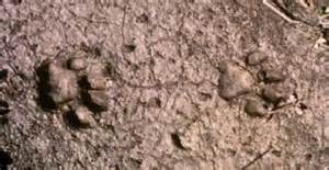
….1744:112215:77F:0000:CAMERA1: Florida Panther walks through Martin County, Florida 11/22/15…1745:112215:77F:0000:CAMERA1:3…..1745:112215:77F:0000:CAMERA1:3Panther tracks
So close to the St Lucie River/Indian River Lagoon… Do you see his tracks?
I have been holding back on writing this blog, but today seems like the “puuurfect” day to write! Trapped inside with all this rain has me daydreaming about Florida adventures.
Did you know that a panther was spotted just ten miles west of Palm City in November of 2015? Just two months ago? Maybe he is there today– hiding in the palmettos– trying to get out of this rain.
I learned about the panther’s visit to Martin County when I attended my University of Florida Natural Resources Leadership Institute in January. I didn’t write about as I was not sure I could share the photos. As I have learned the photo are public, I am now sharing. I learned the following from my source:
The person who shared today’s photos with the Florida Wildlife Commission advised that the photos were taken on a trail camera at Allapattah Flats in Martin County’s Wildlife Management Area on November 22, 2015. He/she advised the camera was in the Wildlife Management Area off of State Road 714, but did not give any more specific location.
Panther biologists confirmed that this is “FP232.” This panther was hit by a car in Ft Meade in Polk County northwest of Lake Okeechobee, in April of 2014. He is a male and was given veterinary care by the University of Florida for his broken leg, and rehabilitated in Yulee until his release in January of 2015. FP232 was released at Kissimmee River Prairie Preserve State Park, and has since roamed all over south central Florida. It was very exciting to learn of his appearance in Martin county.
I think this is so totally cool. Panthers were once common in Martin County, in all Florida, but now as Florida is full of highways, houses, and swimming pools they are very, very rare; I have written about panthers before, but never thought I’d get to share a photo of one right here. Very rarely are they photographed…
May the panther who visited us have the very best of luck! I will take this public opportunity to name him “Martin” as FP232 is not a name fit for such a magnificent creature.
My Frances Langford theme continues. Today I will share some photos of Frances’ St Lucie River estate treasures given to me by blog reader and salvage director, Bobbi Blodgett. Bobbi recently contacted me. Not only did we have a very interesting conversation regarding the recent destruction of the Langford property and the difficulties of getting developers to “reuse and recycle,” but Bobbi also shared some good news about what was “salvaged” from the Langford Estate in 2008 when it was first being “deconstructed,” as part a tax write off for the developers via Habitat For Humanity.
Her email reads:
“Hi Jacqui,
Langford additional pics during 2008 deconstruction project. Frances was very into Polynesian style and the “tapa cloth” pictured, we salvaged also, It was all handmade and imported. It was laid on the bars, walls etc.
The long bar was in the river house. I believe it was purchased by a couple who bought the house she owned on Hutchinson Island, which is awesome.”
ReUse Salvage Inc.
Bobbi Blodgett, Director
“Green & Clean”
De-construction Services
Removal of Products for Reuse http://www.reusesalvage.com/
….
Thank you to Bobbi for allowing me to share so many pictures. It is fun just to look through them. So many memories! Thank you for this historic documentation. May everyone enjoy!
….…….….….….….…..….….….….….….….….…..….…….….………….
….….…..…….….….….Frances Langford 1913-2005….The estate2016 scraped clean for Langford Landing (Photo JTL and EL)
Former Langford Estate, 1-20-16 Photo by Ed Lippisch.
Today I continue documentation of the former Frances Langford Estate, the 53 acres bordering Mount Pisgah and the Town of Sewall’s Point. Mount Pisgah, at 57 feet, is the highest point in the region along the St Lucie River and Indian River Lagoon.
I have written on this topic extensively already. Perhaps, too much. So I’ll keep it short and just say, once again…”There has to be a better way to develop property with such historical significance, and once, such tremendous natural beauty.”
Yes—- this type of development is within the law, but is it within our conscience? What was Martin County and the Commission thinking when they approved this transfer? How can we stop this from happening again? Can we?
Anyway—I did recently visit the site and the “Engineer of Record” assured me the high bluff will not be leveled to allow for more homes as is rumored.
“It is the lot’s majestic view of the water that we want…” he said. Six will face the river. You can see that lots are small compared to Sewall’s Point.
Personally, I think it would have looked even more majestic if some of Mrs Langford’s world-famous tropical vegetation and pond had been left and the lots were not so crammed in.
In conclusion, here are some photos for “the record.”
Thank you to my husband, Ed Lippisch for taking the aerials. All were taken yesterday, January 20th, 2016.
Oh, by the way, when I was leaving I noticed the documents stated that the cleared land had to be “seeded” within 30 days. We’re getting close. The lot was cleared at Christmas. I bet they put in sod. From tropical paradise to sodded conformity. What a loss.
Front of Langford Landing today 1-19-16. (Photo JTL)Langford home stands on barren hill 1-19-16. (Photo JTL)The subdivision Langford Landing. 6 houses will be located on bluff overlooking the St Lucie River. (Documents on site)A 60 boat marina will be put in. The submerged lands went with the property.…..…….….
Frances Langford’s tiki hut on her estate as possibly portrayed by Emile Gruppe. (unsigned)
Sometimes things are a mystery and reveal themselves slowly through many days…such is the story of black and white sketch of “The Hut” you see above.
I first saw the piece in an email dated January 14th, 2016, sent to me by my mother, historian Sandra Thurlow. Her email read: “I came across this in a box of treasures. It was an invitation to a joint birthday party for Talley Crary, Frances Langford Stuart, and Jane Merrell. I guess it was “The, with a capital, Hut.” Mom
Prior to receiving this email I had traveled on a yacht up the St Lucie River with my next door neighbor Mr Rohloff—this was two days after Christmas. This was when Ed and I saw up close the destruction of the former Langford Estate. Cleared to the bone.
Scared clean, Frances Langford estate today. (Photo Jacqui Thurlow-Lippisch)the Tiki Hut and pond, Frances feeding her swans. (Aurthur Ruhnke courtesy o Sandra Thurlow, 1961)….
When the captain of Mr Rohloff’s yacht heard me gasping as I saw Mrs Langford’s wrecked estate he told me he used to live on there, and was married there, and that he actually worked for Mrs Langford for some time. His name is Rick Copeland. Captain Copland continued to talk about Mrs Langford throughout the trip and told stories of what a remarkable person she was.
He told a story that as she was aging she gathered all the painting of Emile Gruppe who she and her husband collected and gave them to the artist’ son. “These were very expensive paintings……” She wanted to make certain they were given to the right place and appreciated….
Now fast forward to last weekend. I attended an Environmental Studies Luncheon and sat next to Matt Kelly, who oversees the real estate for Martin Health Systems and years ago was my swimming coach. He took his phone out showing me the same ‘The Hut” piece going back in an email to the son of Emile Grippe and with my sister who works for MHS.
It’s a small world and the heart of Frances Langford lives on!
By just doing a quick search on the internet I found an article about an art show in 2013 in Naples of these Langford/Evenrude paintings! The Gruppe family is very famous and there were three generations of paintings as you will read.
It would be fun if I could find more of the the paintings to share. Here’s one I found. Mrs Langford called her house along the St Lucie River, the “River House,”—maybe this is hers?
Today we continue looking at parts of a 1974 text entitled: “Environments of South Florida, Present and Past,” by Patrick J. Gleason, lent to me by Dr Gary Goforth.
Today’s map of study was created by Frederick A. Ober.
Fred Ober was a man who once ran a shoe shop, but one day, with a dream in mind, literally “threw off his shoes.” He decided to go on an adventure and make something more exciting of his life. In 1974 he visited and documented our Lake Okeechobee and surrounding Everglades.
Our text ironically, looks at Lake Okeechobee 100 years after his visit–published in 1974.
To look at the map and see such notes as “commencement of cypress belt with sandy shore” along the east side; “custard apples, and marshy lands, —-sand beach on the south side”; and “palmetto ridge and Kissimmee Prairie in the north,” really take one to another world.
—A world that basically does not exist anymore.
We scraped it clean. We rearranged it. We built it out. We drained it. We diked it. We planted seed. We erected houses. Maybe one day the young people will try to put some of it back. It must have been spectacular.
What will it look like in another 100 years? Will today’s Google map below appear as obsolete as Ober’s? What do you think? Is there a way to go back? Envision 2074.
….cover of text, 1974south rimKissimmee River area, northNE area of lakethe lake up closeToday’s Google map, 2016.
This week we will take a look back at Lake Okeechobee, a lake that since 1923–via the C-44 canal, has been connected to the St Lucie River/Indian River Lagoon.
Information for these posts is made possible through a book entitled “Environments of South Florida–Past and Present,” by Patrick J. Gleason. This text was lent to me by Dr Gary Goforth. I will transcribe portions of this rare and amazing text in order for us to contemplate the changes that have occurred and how those who first documented this once remote area experienced our region.
It continues to amaze me—the ability of the early map makers and surveyors who functioned without today’s technology.
For me it is noteworthy to notice how the original map of the lake “veers off to the south-east.” Looking below one can see that today this area is today’s Bell Glade and South Bay. These lands are the richest in “black gold” as they have the accumulation of thousands of years of muck. Now we can see why. Tremendous amounts of sugar and vegetable products are produced in this area. Also, I believe these lands are most valuable because they are less likely to freeze due to their proximity to the lake.
As we can see, although we must take the Captain’s map with a grain of salt–interestingly enough—this area was once the lake…
Today’s Google map, 2016.
Here are the words of Captain Backus for us to ponder as I transcribe:
In 1838 map produced by Captain E. Backus had produced a map of Lake Okeechobee, which for a long time remained buried in the national archives records of the Seminole War. It reveals the knowledge of the lake that time, and his version of the lower Kissimmee River shows graphically how that crooked meandering stream flowed thirty-five miles from Fort Basinger to reach the lake only eighteen miles away– as the crow flies… In a brief statement in the lower left portion of the map, Captain Backus writes: “Many small streams flow into the Okee-cho–bee on the North-East and West side and also on the South- East side, but it is not known that it has any outlet, and probably has none, except at the high water when Grassy Lake (The Everglades) and Okee-cho-bee are united, and probably empties thought some streams into the Atlantic. This is corroborated by the statements of different indians and negroes who profess to have crossed from one side to the other in a canoe at high-water, and to have carried and dragged a canoe many miles over the portage at low tide.”
I wonder how we would have seen the lake had we been there? Would you have crossed it in a canoe? What would you have dreamt it to become?
….The handwritten text….Book information and inside cover.
Frances Langford poses here with her first husband, Jon Hall.
Today I am featuring two more time line videos on Frances Langford’s property created by my brother Todd Thurlow. Through viewing history, we get a better understanding of how we got to where we are today…
Today we look back in history….but you have to look….
These historic photographs are marked “Fairchild Aerial Surveys, Inc.”
According to Mr. John H. Canada, president, Ocean Naval Architects, the year was 1925. You may recognize one of the images as it was used in a former blog post discussing the piled up sand of the C-44 canal. From 1915 to 1925 the government was connecting the canal from Lake Okeechobee to the St Lucie River and Indian River Lagoon. A big mistake!
These photos below were originally sent to my mother, historian, Sandra Thurlow, by Mr John Whiticar. In their discussion, it is noted that one can see farming where Indian River Plantation is today (The Marriott); one cannot see an Intercostal Waterway–no spoil islands off Sewall’s Point; there was no development on Rocky Point; and most interesting for me, looking at the photo this time: today’s Martin County Golf Course, part of yesteryear’s “Sunrise Inn,” sits right there “in the middle of no where” in 1925. Those were the days!
Frances Langford and Ralph Evenrude photographed before their trademark Tiki Hut and pond, Jensen Beach Estate, 1961. (Photo Arthur Ruhnke with permission of historian Sandra Henderson Thurlow)Frances Langford as young movie star. April 4, 1913 – July 11, 2005
“I am sure the new development will be re-landscaped very beautifully, but it is hard to see the once serene property so desecrated.” –Local historian, Sandra Thurlow, 2016
“Frances Langford,” the name is as beautiful as the woman. She is a legend here in Martin County and much of the world. No one has been more generous, loving, and appreciative towards our community. A true philanthropist, her name graces buildings, parks, and centers from the Indian River Lagoon to Indiantown.
As a singer and movie star, she is best known for “entertaining the troops” during World War II aside Bob Hope. Through her family, young Frances was exposed to Jensen Beach, and later, after the war, came back to create her dream: “Frances Langford’s Polynesian Outrigger Resort.” It sat along the beautiful St Lucie River and Indian River Lagoon just north of Sewall’s Point.
Over time, inspired by her travels, Frances and her husbands created a tropical paradise known far and wide. Cottages, a restaurant, a marina, palm trees, rare foliage, freshwater ponds, peacocks, and even swans graced the property. Famous movie stars often visited. She gave Martin County a reputation and she put it on the map. She made Martin County’s Jensen Beach her permanent home.
Frances chose to build her personal residence near Mount Pisgah, the highest point of the peninsula. Lore has it that pirates and Indians once lived here too, standing on the high bluff looking for passing ships in the ocean. The property is steeped in beauty, history, and mystery. Sadly, in the end, the remaining 53 acre parcel was treated like any other piece of real estate.
After a long wait since the 2008 Great Recession, the property is finally being developed ironically as “Langford Landing.” The manner in which this is being done has taken most us by surprise.
Is it really necessary to remove every beloved palm tree, stately strangler fig, and blade of grass? Surely Frances thought some of her legacy might stand. It has not. The majority of the property has been scraped clean for new development. My sister said it best: “Jacqui, from the water, it looks like the property has been Napalmed.”
There has to be—-a better way.
The Tiki Hut, bridge and pond, Frances feeding her swans. Many fundraisers were held here and many movie starts attended “in the day.” (Arthur Ruhnke courtesy o Sandra Thurlow, 1961)Langford Estate 1961. (Arthur Ruhnke/ST)Langford Estate 1961. (Arthur Ruhnke/ST)View of estate from river by kayaker. This photo was sent to me by a Facebook friend.
Tiki hut in ruins 2016. (Rebecca Fatzinger)Around the pond, palm trees lay in a heap. 2015. (Photo by Rebecca Fatzinger)Today in 2015/16 photo of Langford property by (Rebecca Fatzinger)The grounds 2015/16 (Rebecca Fatzinger)Estate sold for development. (Courtesy Todd Thurlow/Google Earth)From the air–history scraped clean, 1-1-16, Frances Langford’s estate after all foliage has been removed. (Photo Jacqui Thurlow-Lippisch and Ed Lippisch )Langford Estate seen from the St Lucie River, 12-3-16. (Photo by Todd Thurlow)Photo of one of Frances Langford’s peacocks on her estate, 1980s. (A gift to me from her housekeeper 2006.)Young Frances. Public photo.Frances in her later years.
Dredge and fill, public photo, 2015.A multi-image of the area in the 1887 NOAA map, the 1925 shot (partially), 1940, a 1958 NOAA map, 1970 and today by Todd Thurlow.
Today’s blog is a full expansion of the 1925 aerial photo I wrote about last Friday.
My brother Todd took this photo creating a time line flight of 1925 and 1940 views of the Sailfish Flats, the Indian and St. Lucie Rivers, and the St. Lucie Canal (C-44).
Todd’s video is a history lesson in “dredge and fill” which was very common throughout all south Florida and the United States until national laws in the 1970s required more scrutiny and often no longer allow such due to heavy impacts and damages on waterways and the natural environment.
Our Martin and St Lucie County canals dug by the ACOE and water management entities C-44, C-23, C-24, C-25 are dredge and fill. Sailfish Point, Sewall’s Point, and Indian River Plantation, just to name a few, have large portions that are dredge and fill. The dike around Lake Okeechobee and the work abound the FPL plant in Indiantown by Barley Barber Swamp are dredge and fill. At the time, it was “how it was done.” People did not foresee the ramifications to the environment or to people living in these areas in the future.
The land was our Play Doh…
1925 aerial by Bob Higgins shared by Sandra H. Thurlow. SLR/IRL
I know you will learn a lot and enjoy watching Todd’s video. The link is above.
—My questions to Todd after I saw the video included:
Jacqui: “So Todd, what are the white lines on the edge of Stuart, Rocky Point etc…more piled white sand? Looks like Jupiter Island was smaller at one point…across from Sailfish…
So how in the world did they dig out the Sailfish Point Marina and what about the straight marina of Sailfish Point that was already there from the days of Mr Rand? Also what about the FPL Pond in Indiantown? Where do you think they put that fill? Holy cow! That’s a lot of fill!
(I have adapted Todd’s words after checking concepts with him so I could present info in a simple manner.)
Todd: “The lines on the edge of Rocky Point were probably a beachy shoreline. With it being more open water at the time and more exposed to the inlet; I’m sure there was more of a beach there. That shoreline matches perfectly the shoreline shown on the early NOAA maps – even before the inlet was there.
With respect to Jupiter Island, you are probably referring to all the spoil that was piled up at the entrance to the Great Pocket – some of that was put there when I was in middle school. The main part of Jupiter Island is more to the east and is now gone – and earlier connected to Hutchinson Island. The old Gilbert’s Bar Inlet was south of that point.
The marina on Sailfish Point was dredge fill. We have some aerials of it in the making. As was the case in areas of Sewall’s Point, the sand dug to build small marinas or subdivisions was piled on the land (Archipelago, Isle Addition) to make the land higher or to create completely new lands.
As far as the giant FPL pond, they probably just dug with a dragline and used the fill to make the dike around the outside of the pond and also to build up the land around FPL.”
Hmmm?
So we live in an environment altered by our forefathers, and now we are experiencing unintended consequences to the health of our St Lucie River/Indian River Lagoon. We must assist the next generation in understanding the past so that we and they can create a better water future. And that we can!
May 1925 aerial for the Sailfish Club by Bob Higgins shared by historian Sandra Henderson Thurlow.
This amazing 1925 aerial photograph of the confluence of the St Lucie River and Indian River Lagoon tells a story….I found this photo looking back through some old emails between me, my mother, and my brother dated 2010. At the time, I did not catch all of the nuances in the photograph….
For instance, look at the beautiful, healthy seagrasses hugging the elbow of the shoreline of Hutchinson Island; what about the dock in the midst of the seagrasses that is no longer there; the gentle, crashing waves over a thriving reef at “Bathtub Beach;” the entire area so pristine with extensive natural vegetation. Look at the wispy sandbars forming in the river… Nearby the St Lucie Inlet had been permanently opened, (1892), but also much “improved,” as 1925 was just before the real estate crash, great depression, and two hurricanes that altered Florida’s history forever.
In 1925, community leaders were actually planning a port, Port Sewall, one to complete with Miami and Jacksonville right in this area! In fact they dug a turning basin for ships just off the southern tip of Sewall’s Point and created Sandsprit Park with the fill. Can you imagine?
Back to the photo…
Notice there were no spoil islands off of Sewall’s Point–no Archipelago or Island Addition…Notice the sparse development of Stuart and the lack of an airport. Notice the basically undeveloped peninsula of Sewall’s Point, Rocky Point, and the even less developed— later named— “Sailfish Point.”….The Manatee Pocket just east of and beyond Sewall’s Point shows some signs of the coming future but not many….Do you see anything else?
For me the most interesting thing of all was caught by my brother Todd’s keen eye.
“What is that huge white stripe on the horizon??” He said. “It’s looks like a giant 20-mile-long spaceship runway. Well, it’s the spoil from the freshly-dug Okeechobee waterway. See it in the attached comparison from Google Earth.”
Looking upward and beyond in the 1925 photograph to the right of the clouds, Todd noticed the piled up sands of the C-44 canal—a long curving snake connecting Lake Okeechobee to the South Fork of the St Lucie River. Can you see them?
Of course we all know that this canal along with others and extensive development, over time, destroyed the healthy seagrasses, great fishing, negatively altering the beautiful paradise of the St Lucie River/Indian River Lagoon..
It’s fun to look back, but its even more fun to think about how we have the ability to improve things in the future.
….Google image 2010 showing C-44 canal to compare to 1925 aerial. (Todd Thurlow)
Sewall’s Point Post Office ca. 1890s. Photo courtesy of Historic Society of Martin County and Sandra Henderson Thurlow.
Certain photographs become imprinted in our minds, affecting us on an emotional level–conjuring up images and memories again and again….
One such photo for me is this late 1800s image of Captain Henry Sewall’s Post Office and home. The picture graces the cover of my mother’s book “Sewall’s Point, A History of a Peninsular Community on Florida’s Treasure Coast.” This photograph was often laid out on our family dining room table and we kids listened to mom tell stories of the house and the people from that era of history.
The first time I ever saw the photo it was like I was walking along the long, crooked dock myself to say “hello” or go pick up the mail. I could imagine a gentle breeze blowing, the sun shining, the birds flying over, the fish jumping, and yes, maybe a mosquito or two….
In my imagination, I also thought about how happy I would be to say “hi” to the Sewalls and to maybe get some mail…My mother in her years of writing the books repeatedly pointed out how “lonely” it was for the pioneers, and that the post office played a social role in the community as well as one of function.
With no roads, the St Lucie River/Indian River Lagoon—were the roads—the only means of transportation to greet a neighbor, get supplies, or pick up the mail. The river brought people tougher, just like it does today.
Yesterday, when I drove to today’s Stuart Post Office from Sewall’s Point to drop off Ed and my Christmas cards, I thought about how much things have changed.
But I have to say, that even though I did not recognize anyone at the post office, the holiday mood and bustle of mail led to many smiles just as it must have in the days of Captain Henry Sewall. The post office, even with all of the world’s changes, still holds the heart of “greetings and hellos,” especially during the holidays.
SEWALL POST OFFICE/HOUSE TIMELINE
1889: Capt. Henry Sewall builds a house on Sewall’s Point
1891: Sewall’s Point post office established in the house
1913: The house is moved by barge to Port Sewall
2006: The house is moved by barge to Indian RiverSide Park with unanimous support from the Martin County Commission and advocacy of historian Sandra Thurlow, Stuart Heritage, the Historical Society of Martin County and others. A large donation is made to support the move by Mr. Fred Ayers.
2012: Restoration of the house is completed/the house is listed as one of 11 properties on the Martin County Local Historic Register of Historic Places.
Merry Christmas and Happy Holidays!
Jacqui
Jacqui Thurlow-Lippisch
Sewall House and Post Office tip of South Sewall’s Point, ca 1890s. HSMC
All of Sandra Thurlow’s books can be purchased at the Stuart Heritage Museum (http://www.stuartheritagemuseum.com) on Flagler Avenue, the Elliott Museum, or ordered on Amazon.
Having trouble thinking of a holiday or Christmas gift? Consider one of my mother’s four books…
1. Stuart on the St Lucie
2. Historic Eden and Jensen on Florida’s Indian River
3. Sewall’s Point, A History of a Peninsular Community on Florida’s Treasure Coast
4. Gilbert’s Bar House of Refuge
All of these books have tremendous historic value with fabulous old stories of pioneer families, photos, maps, surveys, charts and advertisements. As you know, I pull much of what I write about in my blogs from these books.
They can be perused and purchased at Stuart Heritage on Flagler in Downtown Stuart (http://www.stuartheritagemuseum.com) and the Elliott Museum on Hutchinson Island (http://www.elliottmuseum.org) The books run $39.95. You can also order them on-line from Barnes and Noble but Amazon is probably faster.
Thanks Mom! Thanks everyone! Merry Christmas and Happy Historic Holidays!
A photo with Senator Joe Negron at his designation as Senate President made to look “more historic.” 12-2-15. (Photo Ed Lippisch)
On December 2nd, 2015 my husband Ed and I flew to a historic event in Tallahassee, the designation of local politician, Joe Negron, as President of the Florida Senate.
To try to bring understanding and light to Joe’s accomplishment is really not possible for me… His world is one few know, including myself. I have supported Joe Negron all along the way, first working together in 2012 on Lake O issues when I was mayor of Sewall’s Point. Yes, the ACOE was releasing that year too and the River Kidz were protesting at the locks even then…..I believe in Joe. I believe too that that you have to cut people a break who are “in the Lion’s Den.” It is easy to sit outside of the cage and yell “how to tame,” “how to win,” and “how not to get eaten….”
I admire people who try tame lions…..Don’t you? Could you tame them?
Sitting in the balcony during the event, I recorded what I could of Senator Negron’s acceptance speech. He noted four goals: making Florida’s top universities even greater, dealing with the Lake Okeechobee dilemma, not criminalizing adolescence, and embracing the Constitution.
Today I have transcribed the part of Senator Negron’s speech from my iPhone recording. This part is about his goal for Lake Okeechobee. I am thankful “beyond words for these historic words…” “Thank you Joe!” Every one of us who were part of the fight to right the Lost Summer are part of the spirit of this historic speech! We have come a long way since 2013! And get ready for the ride of the future mostly in 2016-2017.
Here we go…
Words of Joe Negron 12-2-15, Florida Senate Chambers:
“Issue number two, let’s solve the Lake Okeechobee dilemma. …In the summer of 2013 there were near historic levels of rainfall in south Florida and Lake Okeechobee rose to the levels where the ACOE made the decision to have massive releases east and west in order to protect the integrity of the dike. And in the community that I represent, 136 billion gallons of water was sent from Lake Okeechobee into the St Lucie River and Indian River Lagoon.
It also had an adverse effect on southwest Florida with water going to the Caloosahatchee to the Ft Meyers area. Our community came together, and this Senate stepped up, and President Gates appointed a “select committee.” We met in Stuart, and I promised people “measurable progress in a reasonable time.” The then speaker of the house, Speaker Weatherford, also came to our community to visit. We had a group called the River Kidz that were young people who came together to support our efforts… there was some excellent reporting by the Stuart News on this issue that led to not only local coverage but also state coverage and national coverage which was very effective at bringing the attention of the state to our issue.
We funded 231 million dollars in projects. These were not studies, they were not groups sitting around talking about what to do. These were tangible things. Thanks to Governor Scott’s support for bridging two and a half miles of the Tamiami Trail so that water can flow south from Everglades National Park into Florida Bay. That’s going to be a step in the right direction. We just broke ground on the C-44 reservoir which will store basin run off and also assist our in not having water go into the lake….
My goal is before I finish my time in the senate and pack up boxes and put them in the Jeep and go back go Stuart—I have a personal goal/mission and that is to work with the agricultural community, to work with Florida’s best scientists, to work with all of us as a legislature who have background and knowledge on this issue and we will permanently protect our estuaries, protect our lagoons, come up with a way to not have these terrible discharges from Lake Okeechobee that destroy our environment. That’s one of my goals….”
Senator Joe Negron
Designee President to the Florida Senate
Joe Negron at River Kidz protests at St Lucie Locks and Dam because of Lake O releases in 2012..2013 Joe Negron at River Kidz protest at Locks.….2015 Senate chambers. Color guard.….2015 Senator Negron in his seat in Senate chambers.….2015, Gov. Scott and others…….2015 Joe Negron makes his acceptance speech for designated Senate President 2017-2018.…..The historic Florida capitol.….Today’s Florida capitol.
Audio file Jacqui Thurlow-Lippisch 12-2-15: (Go to website if not available)
Ed and I at a bus stop for tourists east of Havana.A new bridge at the tourist stop. Wild royal palms were scattered across the hilly horizon. The ocean to the east…
It has been awhile since I have blogged; a lot has happened. I think I’ll start with Cuba.
One of the stories my father relays to me with great relish is his 1954 Stuart High School senior trip to Havana, Cuba. Can you imagine that? A senior trip to Cuba? My dad grew up on Riverside Drive in Stuart, Florida, in the 1950s, on the St Lucie River/Indian River Lagoon.
With a broad smile and sparkling eyes, he tells of magnificent buildings, music, art, restaurants, and night clubs around Port of Havana, and having “lots of fun.” “In fact one of the students had so much fun, he was sent back to Stuart!” My dad laughs out loud, with thoughts of the “good old days.”
My father’s Stuart High School class traveled with chaperones before Fidel Castro’s 1958 rise to power over Batista and later the embargo and tumultuous history that the world has watched unfold for over a half century.
My husband, Ed and I, traveled for a very different reason during a very different time. Two weeks ago we left on a journey with the Episcopal Diocese of South East Florida and we were classified by the government as”pilgrims.”
Stuart High School senior trip 1954. My father, Tom Thurlow, is standing in the back row one from far right.
Our journey was led by Bishop Leo Frade of Miami and his wife.
The trip took about fifty people, including other priests, to Havana, Cardenas, Lemonar, Bolondron, Metanzas and back again to Havana. We visited churches that were rebuilding since the communist government allowed them in the 1990s to once again worship. They have few resources but great spirit.
Group in Old Havana square.….
It was a great education for me. If I had to describe the experience in one sentence I would say: “Government is corrupt, not its people.”
To see the smiles and hear the appreciation of those we met along the way, to think about all they have endured, to realize more than ever before how much I take for granted.
I have visited poor countries before. I lived and taught in Berlin, Germany in 1990 just after the Berlin Wall came down and East Germany was emerging from the brace of communism…I think what was so different for me about Cuba, is that it is so close to home and I know some people who lost everything. Also, the flight took less than an hour. Cuba’s climate is much like Florida; it is geologically considered part of North America.
Although most of the buildings were falling apart, it is a beautiful, beautiful country…So here are some photos. May the next generation of Thurlows see something better, but may the smiles and the warm spirits of the Cuban people stay the same.
With our guide.…Limonar’s church.…..There was no roof.….The priests.…..….….…School kids in uniform. Cuba is highly literate.………Old American cars still running……….….…….……Sugarcane has a long history in Cuba and is very tied to South Florida in the U.S.…….….Havana.…Fixing up old buildings…….
_______________________________________
Last night my Dad and I took out the souvenirs from his 1954 senior trip to Cuba.Photograph my dad saved of the school bus taken from Stuart to Miami in 1954.
Wild turkey sitting under American Flag in Sewall’s Point, 2008. JTL.
Dear Readers:
I wish all of you a very “Happy Thanksgiving!”
There is so much to be thankful for in spite of the difficulties we face with the health of our river, as well as our nation and the world. This week, I will be taking a blog break in order to “take time to be grateful.” Tomorrow is my husband’s birthday and of course Thursday is Thanksgiving, a time to spend with family and friends. Before I break, I thought you might enjoy this photo of a wild turkey that flew over the St Lucie River to rest in Sewall’s Point. She appears to be feeling rather grateful to be taking such a nice rest right under the American flag…See you next week.
Fondly,
Jacqui
Close up of wild turkey under American flag, Sewall’s Point, 2008.
Confluence of St Lucie River/Indian River Lagoon at St Lucie Inlet. This aerial shows mosquito ditches through mangroves and other vegetation on today’s Sailfish Point. Due to state and local protections, the mangroves could not be removed today as they were in Martin County in the late 70s and early 80s. Aerial dated 1952 courtesy of Thurlow Archives.
“A rose is a rose is a rose…”
The “Coral Strand” was a rose; “Seminole Shores” was a rose; “Sailfish Point is a rose…” and whatever Native American name the Indian’s had for this sacred area was also a rose….
In her poem’s famous first line: “a rose is a rose is a rose,” poet Gertrude Stein’s words are often interpreted as meaning “things are what they are”…”using a name of a thing already invokes the imagery and emotions associated with it..”
For me all these names are “a rose” evoking different images and times of Indian River Region history. The Coral Strand being the name given to the land by the McCoy brothers–famous rum runners and wheeler-dealer business men. Seminole Shores the name given by James Rand a wealthy eccentric of our area whose riches founded the Florida Oceanographic Society; and Sailfish Point the name given to the area after its development by Mobil Oil Corporation in the 1980s.
Will there be another name in the future? And if so what will it be? Well–a rose is a rose is a rose, always and forever…..no matter the name.
Picnicking at the Coral Strand 1927, “for sale/lease” sign in the background. Photo courtesy of Stuart the History of Martin County.According to the History of Martin County the Coral Strand was for sale for $25,000 in the 1920s.Wider view showing the SLR/IRL in all its former fishing riches, impacts from regional development agricultural canals, and area development with removal of vegetation have lessened water quality.
El Nino means possible heavy rains for our SLR/IRL region during the coming winter.
I woke up this morning to the percussion of hard, fast rains hitting our tin roof… In my foggy state of slumber, I bumped Ed’s shoulder, “How are you going to take out the dogs?”
Rolling over, I started thinking about what I’d heard on Tuesday’s Army Corp of Engineer Periodic Scientist Call: “…How are we going to prepare if NOAA’s El Nino rain predictions are right? What if there is up to seven feet of water that fills the lake?….”
Seven feet? That would mean releases from Lake Okeechobee this Florida winter.
Remember 2008 and Tropical Storm Fay? For reference, that storm raised Lake Okeechobee by more than three feet in no more than few weeks. The lake fills up six times faster than it can be “drained”….and as we all know, we are the drainage pipe.
It’s an odd thing how the flow of water going south to the Everglades is blocked by the EAA (Everglades Agricultural Area) so now the over-flow is directed to the St Lucie River and Caloosahatchee. But it’s a reality. A reality that one day must be changed.
We must restore the flow of water to the Everglades and halt releases to the SLR/IRL. This requires land purchases and reservoirs.
Remember–too much fresh water, as during releases from Lake Okeechobee, is a pollutant to our St Lucie River/Indian River Lagoon— altering salinity, destroying spawning/fisheries, wiping out seagrasses and food throughout the food chain, lowering property values and the right of residents and their children to have “peaceful enjoyment” of their property…Yes, I can clearly state that toxic algae blooms and fish lesions do not precipitate peace for the Town of Sewall’s Point, nor for Martin and St Lucie Counties.
So how do we prepare? We must educate ourselves ahead of time; we shouldn’t over fertilize; we should get our septic tanks checked; and we should contact our legislators now saying we want to see a plan. We want to know ahead of time what may happen if indeed seven feet of water fills the lake between December and this coming May. How will we adapt to knowns and unknowns? We can’t just wait. Not when it’s this clear…we must be proactive on every level.
Legislative delegation Senate President Negron, Representative Harrell and Magar, what are we doing now to deal with all this water and what are we going to do in the future? The C-44 Reservoir/STA is great but it does not address Lake Okeechobee…. Why are we wasting the valuable water? What about Amendment 1 and the purchase of lands?
Like it or not, “Coyote” is here, and coyote is not going away. He is clever; he is ancient; and he is a master at adapting to his environment, as are we—humans. We have met our match.
Of course because both are “canines,” coyotes can mate with our friends, domesticated dogs. This is documented out west; they are known as “coydogs.” Hmmmmm?
Warner Bros. “Looney Tunes,” “Coyote and Road Runner” was a cartoon my generation grew up with. Unlike in real life, “Coyote” was not always so smart!
Don’t get me wrong… the first time I read that coyotes were “here,” in Marin County…the first time I saw Bud Adams’ picture on the back page of “Indian River Magazine,” the hair went up on the back of my neck. Old wives tales and ancient fears gripping me….
Since that time, I have read a lot and learned more. I am cautious but not afraid. In fact my roommate at this month’s University of Florida Natural Resources Leadership Institute class was a coyote expert for the Florida Wildlife Commission. We stayed up late into the night; she showed me photos of all the things coyotes eat and told me first hand stories of how places like Hernando County, Florida, are dealing with the issue.
I sat in silent awe….
One of the most interesting things she shared was that the population of coyotes goes up the more populated an area is–you would think the opposite. “Coyotes have moved in and adapted so well we sometimes wonder who the suburbs were actually built for, us or them.” Her excellent article is at the end of this post.
Last night at a Sewall’s Point Commission meeting, a resident came forward during public comment to report about the coyotes in her subdivision. Passions flared! The discussion included guns, protected wildlife, unprotected wildlife, trapping, not leaving out cat food, not leaving out cats, as well as not leaving your small dogs or small children outside unattended. In the end, it was decided comprehensive town education was the best approach.
Coyote, public image.
I find my self struggling with the image of coyote. Last night after the meeting, I took a walk and kept waiting for one’s red eyes to shine in the reflection of my iPhone. At every corner I was sure one was standing….They do intimidate me, but I am intrigued with their success. I respect them.
This animal is deeply associated with Native Americans who of course “we” eradicated. Remember the Seminole Wars? The US relocation plans? Not that long ago really. Perhaps this is our karma?
For many Native American tribes the coyote, known as a trickster for his ability to “be everywhere at once,” was the most powerful of creatures. In fact, it was believed that tribal members of tremendous power could “shift” shape into a coyote achieving amazing things….Why the coyote? The reasons are many, but one is because “Coyote,” just as in the Greek story of Prometheus, —-(also a clever trickster)—-brought fire from Heaven to the Earth, betraying the Gods, to help us survive.
Perhaps there is a greater message here? I don’t know…but it has me thinking…One thing is for sure: smart, master-adapter, coyote is here in Sewall’s Point, and throughout Martin County. And he is so smart and adaptable that “he is not going away.”
__________________________________
—Coyotes are now reported in all 67 counties of the state of Florida. They also live throughout much of the nation.
–Due to agriculture/rancher and landowner complaints, California spent 20 million dollars to eradicate coyotes with no success and now ironically the population is perhaps higher than ever.
—Coyotes are omnivorous, like people, eating everything especially insects, pet food, vegetation, road-kill, rodents, and “trash.” Thus they adapt easily.
—-Coyotes have flourished and spread since the human eradication of the larger canine family wolf —in Florida and through out the U.S. When top predators are removed others expand.
—Coyotes hunt in family groups not “packs, or alone; ” They mate for life and their social nature is part of their success.
—Read article below for tips on how to live and/or deal with coyotes.
The house built in the “outback” by Maggy’s mother in the early days of a growing Miami.……..The driveway leading to the house. (JTL)The porch.The grounds has many trees planted by Mrs Reno years ago that are now gigantic.Oolite rock on the grounds.The house only lost one shingle during Hurricane Andrew in 1992. This hangs on the wall as a testament to Mrs Reno and her husband.Cover of book. Mrs Jane Woods Reno.In 1994, when I was a much younger woman, my mother handed me a book entitled: “To Hell With Politics,” a compilation of the writings of Jane Wood Reno.
My mother noted that the author was an incredible woman. She had built her house with her own two hands; was a savant; she had had a career as a reporter for the Miami Herald; she once hiked many miles northward, for days and nights, along the Atlantic’s shoreline meeting, speaking, and writing about the people she met along the way; she had befriended the Miccosukee Indians and they considered her an “Indian Princess;” she raised peacocks on her very large parcel way out west of Downtown Miami; she was a dedicated mother and wife…..she was Martin County Commissioner Maggy Hurchalla’s mother.
To say the least, I found Mrs Reno’s story interesting and never forgot the book. Fast forward twenty years; I was invited to visit the house, and I did.
Driving down on October 24, 2015, I thought it would be a straight shot down the Turnpike from Stuart. But somehow I “took a wrong turn” and ended up in the craziness of Downtown Miami driving in carpool lanes as a single driver, cameras taking my picture, and barriers forcing me to stay in “my lane.” As I pulled off I-95 stressed out and sweating Siri’s voice rung in the tense air. Then I saw it, the mailbox.
Turning right down a long unpaved driveway I exited the bustle, excessive traffic, shopping malls, and crowded housing developments, and went back in time. Driving in I noticed wild coffee plants and gumbo limbo trees just like some areas of our St Lucie River/Indian River Lagoon. “Weird.” I thought. “Is there a creek around here somewhere? I wonder what Kendall looked like before they drained it, filled it, mowed it down, and planted hedges? A pine forest? An oak/palm hammock? Beautiful…”
I parked my car and looked around. Time stood still. A tropical breeze floated through the trees and the sun shined. Birds were chirping. Legend Maggy Hurchalla greeted me and I toured the grounds of her family home. She was there caring for her older sister, former U.S. Attorney General, Janet Reno. It was a day I will always treasure. A day a book I read as a younger woman came to life.
I think the photos will say it all, so I won’t write much more.
The house is an island. It is a symbol of what was, and what has become. Thank you to Maggy Hurchalla who helped keep what happened around her childhood home from happening in Martin County.
You can see the Reno parcel unchanged amoung the rampant development of Miami Dade. Google maps 2015Up close.Chickee built by Maggy’s brother. (Photo JTL)Maggy gives me a tour of the grounds.Mrs Hurchalla having a park named after her in Martin County 2013 for her work as a commissioner from 1974-1994. (MC Flicker photos.)Plaque in Maggy’s park, Photo Sandra Thurlow 2015.Sally Schwarz’ article about park in MC: (http://opinionzone.blog.palmbeachpost.com/2013/12/07/martin-county-names-park-after-maggy-hurchalla/)
Photos of controlled burns at “wildland urban interfaces,” Duval County. Photo courtesy of NRLI 2015.
It is hard to believe that I am already half way through my University of Florida, Natural Resources Leadership Institute (NRLI) fellowship for 2015/2016.
This week I will be taking a blog-break to prepare for this week’s NRLI course in Jacksonville, “Wildland Urban Interface.” This subject deals with the challenges, dangers, and importance of prescribed burns and how they become more complicated as Florida’s growing population is allowed to develop further into once undeveloped/natural areas of our state.
Fire, of course, is a huge issue here in Martin County in the St Lucie River/Indian River Lagoon Region as well. Fire is a natural part of the Florida ecosystem and necessary for the health of the lands, its wildlife, and the protection of people. “Not burning,” is not an option, as excess fuel– due to vegetation build up, causes fires to burn even hotter and is extremely dangerous!
As many may remember, in June of 2014, a controlled burn in Savannas State Park, in Jensen, quickly got out of control during high winds. This was a scary and nerve-wracking situation for the fire fighters and for the public, especially those who live across the street on Jensen Beach Boulevard in Pine Crest Lakes subdivision.
Fire, like water, is a part of the greater whole of our ecosystem…something we must understand.
I will return to blogging later next week. Thank you for reading my blog; see you soon.
Jacqui
Fire June 2014 Savannas State Park, Jensen Beach Boulvard. Martin County Scheriff Twitter shared photos.
Bobcat, Sewall’s Point, 2008. Photo courtesy of Jackie Pearson.
I have had many phones since 2008. I have dropped them, lost them, and forgotten them…Throughout all of my phones, only one image has graced its screen: the “Bobcat of Sewall’s Point,” by Jackie Pearson.
In this photo, the bobcat, in all its athletic beauty, looks up, as if recognizing a greater power…
In the hectic bustle of my days, I often look to this image as a reminder of what’s important to me.
Today I will share a few other bobcat images I have compiled over the years. If you are lucky enough to see one of these secretive and shy survivors that has adapted to our human world of the St Lucie River/Indian River Lagoon, don’t be afraid, be amazed!
Sewall’s Point bobcat 2008, Jackie Pearson.Bobcat up in oak tree, Sewall’s Point, 2010, Beverly Beavis Jones.Domestic cat juxtaposed to wild bob cat–drinking from my mother’s bird bath, Sewall’s Point. Sandy Thurlow, 2012.