This week we will take a look back at Lake Okeechobee, a lake that since 1923–via the C-44 canal, has been connected to the St Lucie River/Indian River Lagoon.
Information for these posts is made possible through a book entitled “Environments of South Florida–Past and Present,” by Patrick J. Gleason. This text was lent to me by Dr Gary Goforth. I will transcribe portions of this rare and amazing text in order for us to contemplate the changes that have occurred and how those who first documented this once remote area experienced our region.
It continues to amaze me—the ability of the early map makers and surveyors who functioned without today’s technology.
For me it is noteworthy to notice how the original map of the lake “veers off to the south-east.” Looking below one can see that today this area is today’s Bell Glade and South Bay. These lands are the richest in “black gold” as they have the accumulation of thousands of years of muck. Now we can see why. Tremendous amounts of sugar and vegetable products are produced in this area. Also, I believe these lands are most valuable because they are less likely to freeze due to their proximity to the lake.
As we can see, although we must take the Captain’s map with a grain of salt–interestingly enough—this area was once the lake…
Today’s Google map, 2016.
Here are the words of Captain Backus for us to ponder as I transcribe:
In 1838 map produced by Captain E. Backus had produced a map of Lake Okeechobee, which for a long time remained buried in the national archives records of the Seminole War. It reveals the knowledge of the lake that time, and his version of the lower Kissimmee River shows graphically how that crooked meandering stream flowed thirty-five miles from Fort Basinger to reach the lake only eighteen miles away– as the crow flies… In a brief statement in the lower left portion of the map, Captain Backus writes: “Many small streams flow into the Okee-cho–bee on the North-East and West side and also on the South- East side, but it is not known that it has any outlet, and probably has none, except at the high water when Grassy Lake (The Everglades) and Okee-cho-bee are united, and probably empties thought some streams into the Atlantic. This is corroborated by the statements of different indians and negroes who profess to have crossed from one side to the other in a canoe at high-water, and to have carried and dragged a canoe many miles over the portage at low tide.”
I wonder how we would have seen the lake had we been there? Would you have crossed it in a canoe? What would you have dreamt it to become?
….The handwritten text….Book information and inside cover.
Today we look back in history….but you have to look….
These historic photographs are marked “Fairchild Aerial Surveys, Inc.”
According to Mr. John H. Canada, president, Ocean Naval Architects, the year was 1925. You may recognize one of the images as it was used in a former blog post discussing the piled up sand of the C-44 canal. From 1915 to 1925 the government was connecting the canal from Lake Okeechobee to the St Lucie River and Indian River Lagoon. A big mistake!
These photos below were originally sent to my mother, historian, Sandra Thurlow, by Mr John Whiticar. In their discussion, it is noted that one can see farming where Indian River Plantation is today (The Marriott); one cannot see an Intercostal Waterway–no spoil islands off Sewall’s Point; there was no development on Rocky Point; and most interesting for me, looking at the photo this time: today’s Martin County Golf Course, part of yesteryear’s “Sunrise Inn,” sits right there “in the middle of no where” in 1925. Those were the days!
There are only a handful of people who are qualified to help us navigate the turbulent and murky waters of Lake Okeechobee and its effects on our beloved St Lucie River/Indian River Lagoon….
One of these rare individuals is Dr Gary Goforth. “Gary” has more than 30 years of experience in water resources engineering, encompassing strategic planning, design, permitting, construction, operation and program management.
For the last 25 years, his focus has been on large-scale environmental restoration programs in the Kissimmee-Okeechobee-Everglades ecosystem. He was the Chief Consulting Engineer during the design, construction and operation of the $700 million Everglades Construction Project, containing over 41,000 acres of constructed wetlands.
With all this experience Gary spends a tremendous amount of time at River Coalition and SFWMD meetings, and with every day people, advocating to local, state, and national officials telling the story in a manner that the average person can understand but with the power and expertise of a scientist.
Dr Goforth teaches us that we CAN HOLD THE ACOE, AND ESPECIALLY THE SOUTH FLORIDA WATER MANAGEMENT DISTRICT ACCOUNTABLE.
We can ask such questions as “are you sending the maximum practicable amount of water south?” “Is it 28% more than in 1994 as required by the Everglades Forever Act?” ” Is an average per year of 250,000 acre feet going south from the lake to the Everglades as required by the Everglades Forever Act?” “Are the Storm Water Treatment Areas being used to full capacity?” “Is the truth of the destruction of the estuaries being reported?” “Should 2008 LORS, Lake Okeechobee Regulation Schedule, been revised?” “Should the Everglades Settlement’s Q-Bell (limit of Phosphorus) be reviewed-is it realistic?” “Is a large reservoir being created in the Everglades Agricultural Area as is called for in the Central Everglades Restoration Plan?” “Who are the Lake and the STAs really serving?”
In order to hold the agencies accountable we must be educated! We must ask questions. We must look at the figures for water flowing south of the lake every year and compare.
Dr Goforth provides regular public updates on these issues, directly and indirectly holding the fire to the agencies. Today I am publishing in full his DRAFT–WET SEASON 2015 LAKE DISCHARGE report.
Please read it, study it, familiarize yourself with it. Dr Goforth has a website if you have any questions. Thank you Dr Goforth for the gift of shared knowledge. It is the greatest gift of all.
Draft – Wet Season 2015 Lake Discharges by Dr Gary Goforth:
Goforth – December 18, 2015
Flows into and out of Lake Okeechobee were examined for the period May 1, 2015 – October 31, 2015, corresponding to the first half of the annual water year (May 2015 to April 2016), and roughly corresponding to the south Florida wet season. The flows and associated Lake water levels were compared to same period from last year. In light of the influence of the current strong El Nino, Lake water levels were compared to the levels that occurred during May- November 1997 which preceded over 1 million acre feet (347 billion gallons) of destructive Lake releases to the St. Lucie Estuary between December 1997 and May 1998.
Flows into Lake Okeechobee – excluding rainfall. For the period May 1 to October 31, 2015, surface inflows to Lake Okeechobee amounted to 1.43 million acre feet (466 billion gallons) (Table 1). This is 20 percent less than for the same period in 2014 (Table 2 and Figure 1).
Flows out of Lake Okeechobee – excluding evapotranspiration. For the period May 1 to October 31, 2015, surface outflows from Lake Okeechobee amounted to 780,000 acre feet (254 billion gallons) (Table 3). This is 37 percent more than for the same period in 2014 (Table 4 and Figure 2). Approximately 30 percent more Lake water was sent to the EAA and L-8 Canals during 2015 than 2014, likely in response to higher water supply demands (due to lower rainfall than in 2014).
Lake Okeechobee water levels. The level of Lake Okeechobee varied from 13.81 ft on May 1 to 14.55 ft on October 31, 2015, reaching a low level of 11.96 ft on July 16 (Figure 3). For 2014, the level of Lake Okeechobee varied from 13.07 ft on May 1 to 15.85 ft on October 31, reaching a low level of 12.32 ft on June 11. Lake water levels rose only 0.74 feet during the 2015 wet season compared with a rise of 2.78 ft during the same period in 2014. The Lake level on October 31, 2015 was approximately 1.3 ft lower than it was a year earlier, and approximately 0.5 ft lower than October 31, 1997 (Figure 4). In addition, the Lake level on November 30, 2015 was approximately 1 ft lower than it was on November 30, 1997, which preceded over 1 million acre feet (347 billion gallons) of destructive Lake releases to the St. Lucie Estuary between December 1997 and May 1998. Two important differences between 1997 and today that could influence Lake discharges to the estuary include rainfall over the Lake Okeechobee watershed and the regulation schedules governing Lake operations. According to the South Florida Water Management District (District), November 2015 was the wettest November since 1998, indicating inflows to the Lake over the next month may be substantially larger than average. Additionally, the Lake is currently operated under the LORS2008 schedule which was anticipated to result in increased frequency and magnitude of Lake releases to the estuaries compared to the regulation schedule in place during 1997-1998.
Lake flows to the STAs. Beginning in August 2015, the District began operating the EAA A-1 Flow Equalization Basin (FEB), which is approximately 15,000 acres in size and can store water up to 4 feet deep. The FEB can receive Lake releases and EAA runoff, and distribute flows either to STA-2, STA-3/4 or to the EAA for irrigation. At this time incomplete flow records are available to the public through the District’s DBHYDRO database to fully account for the various flow paths, and until additional data are available, the estimates of Lake releases and runoff to STA-2 and STA-3/4 will be subject to revision. Using these preliminary estimates, approximately 13 percent less Lake water has been sent to the STAs in 2015 compared with 2014 (Figures 5 and 6 and Table 5). During the same period, approximately 32 percent less basin runoff was sent to the STAs, reflecting less wet season rainfall in 2015.
Flows to the estuaries. Lower rainfall in 2015 resulted in less basin runoff to the estuaries for the period May to October than occurred in 2014 (Table 6). However, due to the Lake releases that occurred during January through May 2015, Lake discharges to the estuaries in 2015 far exceeded Lake releases during 2014.
SUMMARY. Lower rainfall during the May to October 2015 period resulted in about 20 percent less inflows to Lake Okeechobee than in 2014. However, outflows from the Lake increased compared to 2014, likely in response to higher water supply demands (due to lower rainfall than in 2014). Lake water levels rose only 0.74 feet during the 2015 wet season compared with a rise of 2.78 ft during the same period in 2014. The Lake level at the end of October 2015 was about 1.3 ft lower than in 2014. In addition, the Lake level on November 30, 2015 was approximately 1 ft lower than it was on the same date on November 30, 1997, which preceded over 1 million acre feet (347 billion gallons) of destructive Lake releases to the St. Lucie Estuary between December 1997 and May 1998. However, differences in rainfall and Lake regulation schedules prevent a forecast of potential 2016 Lake discharges compared to the 1997-1998 discharges to the estuaries based on Lake levels at the end of November.
Sofia slide on fish lesions in SLR 1999.Slide from Dr Gary Goforth’s December 2015 update on SLR/IRL Lake Okeechobee.
Today I would like to briefly remember 1997 and 1998 and recall why this year is so important to our St Lucie River/Indian River Lagoon history. I would also like to note for some who may not know why these years are being brought back into the ACOE/SFWMD discussion this year.
Today’s slide is complements of a recent document shared by our friend, Dr Gary Goforth. (http://garygoforth.net) “Draft – Wet Season 2015 Lake Discharges – December 9, 2015.” This slide shows that Lake Okeechobee today is lower than it was in 1997.
Why is Dr Goforth comparing 1997? He is comparing 1997 because in 1997-98 there was a strong El Nino (rainy winter), just as we are experiencing right now in 2015/2016.
Certainly we have all noticed how much it is raining this winter so far!
The difference as far a Lake O management in 1997-98 was that there was no”LORS” schedule then….The 2008 LORS or “Lake Okeechobee Release Schedule” did not go into place until 2008 so prior to that year the lake was allowed to be over a foot higher. Since 2008, the lake is required to be lower because of work and safety issues on the Herbert Hoover Dike.
It is important that as we move forward to also look back. We must remember what happened in 1997-98, a similar El Nino to what is happening right now…. 1997-98 were not good years for the river…So much water was released into the St Lucie River/Indian River Lagoon in 1997-1998 that there were more reported fish lessons than ever before– due to too much and too long of exposure to fresh water. This is also why, in 1998,the Rivers Coalition was born. (http://riverscoalition.org)
Section of Dr Goforth’s report on Lake O levels December 9, 2015.
A photo with Senator Joe Negron at his designation as Senate President made to look “more historic.” 12-2-15. (Photo Ed Lippisch)
On December 2nd, 2015 my husband Ed and I flew to a historic event in Tallahassee, the designation of local politician, Joe Negron, as President of the Florida Senate.
To try to bring understanding and light to Joe’s accomplishment is really not possible for me… His world is one few know, including myself. I have supported Joe Negron all along the way, first working together in 2012 on Lake O issues when I was mayor of Sewall’s Point. Yes, the ACOE was releasing that year too and the River Kidz were protesting at the locks even then…..I believe in Joe. I believe too that that you have to cut people a break who are “in the Lion’s Den.” It is easy to sit outside of the cage and yell “how to tame,” “how to win,” and “how not to get eaten….”
I admire people who try tame lions…..Don’t you? Could you tame them?
Sitting in the balcony during the event, I recorded what I could of Senator Negron’s acceptance speech. He noted four goals: making Florida’s top universities even greater, dealing with the Lake Okeechobee dilemma, not criminalizing adolescence, and embracing the Constitution.
Today I have transcribed the part of Senator Negron’s speech from my iPhone recording. This part is about his goal for Lake Okeechobee. I am thankful “beyond words for these historic words…” “Thank you Joe!” Every one of us who were part of the fight to right the Lost Summer are part of the spirit of this historic speech! We have come a long way since 2013! And get ready for the ride of the future mostly in 2016-2017.
Here we go…
Words of Joe Negron 12-2-15, Florida Senate Chambers:
“Issue number two, let’s solve the Lake Okeechobee dilemma. …In the summer of 2013 there were near historic levels of rainfall in south Florida and Lake Okeechobee rose to the levels where the ACOE made the decision to have massive releases east and west in order to protect the integrity of the dike. And in the community that I represent, 136 billion gallons of water was sent from Lake Okeechobee into the St Lucie River and Indian River Lagoon.
It also had an adverse effect on southwest Florida with water going to the Caloosahatchee to the Ft Meyers area. Our community came together, and this Senate stepped up, and President Gates appointed a “select committee.” We met in Stuart, and I promised people “measurable progress in a reasonable time.” The then speaker of the house, Speaker Weatherford, also came to our community to visit. We had a group called the River Kidz that were young people who came together to support our efforts… there was some excellent reporting by the Stuart News on this issue that led to not only local coverage but also state coverage and national coverage which was very effective at bringing the attention of the state to our issue.
We funded 231 million dollars in projects. These were not studies, they were not groups sitting around talking about what to do. These were tangible things. Thanks to Governor Scott’s support for bridging two and a half miles of the Tamiami Trail so that water can flow south from Everglades National Park into Florida Bay. That’s going to be a step in the right direction. We just broke ground on the C-44 reservoir which will store basin run off and also assist our in not having water go into the lake….
My goal is before I finish my time in the senate and pack up boxes and put them in the Jeep and go back go Stuart—I have a personal goal/mission and that is to work with the agricultural community, to work with Florida’s best scientists, to work with all of us as a legislature who have background and knowledge on this issue and we will permanently protect our estuaries, protect our lagoons, come up with a way to not have these terrible discharges from Lake Okeechobee that destroy our environment. That’s one of my goals….”
Senator Joe Negron
Designee President to the Florida Senate
Joe Negron at River Kidz protests at St Lucie Locks and Dam because of Lake O releases in 2012..2013 Joe Negron at River Kidz protest at Locks.….2015 Senate chambers. Color guard.….2015 Senator Negron in his seat in Senate chambers.….2015, Gov. Scott and others…….2015 Joe Negron makes his acceptance speech for designated Senate President 2017-2018.…..The historic Florida capitol.….Today’s Florida capitol.
Audio file Jacqui Thurlow-Lippisch 12-2-15: (Go to website if not available)
El Nino means possible heavy rains for our SLR/IRL region during the coming winter.
I woke up this morning to the percussion of hard, fast rains hitting our tin roof… In my foggy state of slumber, I bumped Ed’s shoulder, “How are you going to take out the dogs?”
Rolling over, I started thinking about what I’d heard on Tuesday’s Army Corp of Engineer Periodic Scientist Call: “…How are we going to prepare if NOAA’s El Nino rain predictions are right? What if there is up to seven feet of water that fills the lake?….”
Seven feet? That would mean releases from Lake Okeechobee this Florida winter.
Remember 2008 and Tropical Storm Fay? For reference, that storm raised Lake Okeechobee by more than three feet in no more than few weeks. The lake fills up six times faster than it can be “drained”….and as we all know, we are the drainage pipe.
It’s an odd thing how the flow of water going south to the Everglades is blocked by the EAA (Everglades Agricultural Area) so now the over-flow is directed to the St Lucie River and Caloosahatchee. But it’s a reality. A reality that one day must be changed.
We must restore the flow of water to the Everglades and halt releases to the SLR/IRL. This requires land purchases and reservoirs.
Remember–too much fresh water, as during releases from Lake Okeechobee, is a pollutant to our St Lucie River/Indian River Lagoon— altering salinity, destroying spawning/fisheries, wiping out seagrasses and food throughout the food chain, lowering property values and the right of residents and their children to have “peaceful enjoyment” of their property…Yes, I can clearly state that toxic algae blooms and fish lesions do not precipitate peace for the Town of Sewall’s Point, nor for Martin and St Lucie Counties.
So how do we prepare? We must educate ourselves ahead of time; we shouldn’t over fertilize; we should get our septic tanks checked; and we should contact our legislators now saying we want to see a plan. We want to know ahead of time what may happen if indeed seven feet of water fills the lake between December and this coming May. How will we adapt to knowns and unknowns? We can’t just wait. Not when it’s this clear…we must be proactive on every level.
Legislative delegation Senate President Negron, Representative Harrell and Magar, what are we doing now to deal with all this water and what are we going to do in the future? The C-44 Reservoir/STA is great but it does not address Lake Okeechobee…. Why are we wasting the valuable water? What about Amendment 1 and the purchase of lands?
C-44 canal with Coca Cola’s Minute Maid Orange Groves, 1964. Photo Arthur Ruhnke courtesy of historian Sandra Henderson Thurlow.SFWMD including C-44 R/STA in blue, 2014. This area was once Minute Maid’s orange groves.
The C-44 Reservoir and Storm Water Treatment Area has been in the news over the past few years. Once completed by the SFWMD and ACOE with help funds raised locally, it will clean water from the tremendous and polluting C-44 basin. It is one component of the Indian River Lagoon South Project that is part of the Central Everglades Restoration Plan. But what was all that land used for in the past? That land was orange groves. Thousands and thousands of acres of orange groves! As far as the eye could see….
Today even with the area’s transformation to STA/Reservoir, “Coca Cola” and “Minute Maid” roads remain as reminders of an all too distant past…when oranges were healthy and the St Lucie River/Indian River Lagoon was not impaired.
Today I will share eleven incredible 1964 aerial Ruhnke aerials my mother stumbled upon while creating a presentation for the Martin County Property Appraiser’s office. Arthur Ruhnke photographs are so important to our understanding of our history and I thank my mother for sharing these treasures. Art was a well-known photographer in his day and my parents acquired many of his photos.
The following is an exchange with my mother, Sandy, and long time family friend Jack Norris, who was an executive for Minute Maid. In the exchange, they “talk”about these photographs. Their interplay tells the story best, so I have gotten permission to share.
—-Jack, Tonight Fred asked me if I had any images to illustrate the his Citrus Program. These are from a packet of 10 Ruhnke negatives marked Minute Maid Groves, Indiantown, 1964. Surely the canal shown isn’t C-44? Are those workers’ houses? Sandy
—- Sandy”Hi Sandy – The barn, equipment storage & office are located in the NW corner of the intersection, the buildings in the SW and NE are workers houses, and the buildings in the SE corner are supervisors houses. The canal running N&S was the main source of irrigation, originating at the St. Lucie at the site of the rodeo bowl. It is now substantially enlarged by the SFWMD to carry water to the new reservoir. The NS canal and l the main drainage canal was owned and operated by the Troup – Indiantown Drainage District.” Jack
So then my mother sends this email to me:
—-Jacqui, I am working on my program for the Property Appraisers and thought I needed to say something about western Martin County. I thought I might show the old Minute Maid Grove and say it is now a reservoir. I couldn’t find my aerials. I have finally found them and thought I would share them with you. Understanding them would be an education. Jack Norris was in charge of planting all of those millions of citrus trees.
So I today I am sharing the photos and started researching Minute Maid and the land purchase for the C-44 STA/R; this is what I found: According to a 2011 Stuart News article bout C-44 R/STA by Jim Mayfield:
“The project site, 12,000 acres of former citrus land, was purchased in 2007 for $168 million, $27 million of which came from Martin County taxpayers through the one-cent sales tax for conservation lands, South Florida Water Management officials said. The property is south of the Allapattah Flats Wildlife Management Area near Indiantown. Over the last year, the water management district has spent roughly $5 million to remove trees and rid the topsoil of copper deposits, officials said.” Jim Mayfield
I hope you enjoy these historic photos today. I find these aerials amazing! It is my hope that one day even more of this agricultural land will be converted to hold water as Nature intended. The C-44 STA/Reservoir is a great start.
Orange Groves and C-44 canal. All photographs below taken in 1964 by Arthur Ruhnke and shared by historian Sandra Henderson Thurlow.…..….…….….….………
“Here is one of your pictures – here and now”
(Cool video with historic maps and Google Earth fly over by my brother Todd Thurlow: (https://youtu.be/i9h1d1pzfww)
___________________________________________________
This ACOE sponsored video gives an artists rendition of what the C-44 R/STA will achieve for water polluted by agricultural runoff once complete:video: (https://www.youtube.com/watch?v=4BsC0BoIPJ4)
From bottom to top: Atlantic Ocean, Hutchinson Island, Indian River Lagoon, Sewall’s Point, St Lucie River, Stuart…1947. One notes here Hutchinson Island– so thin… (Fairchild aerial survey ca. 1940s-photo courtesy of Sandra H. Thurlow)Look closely–My mother’s business card shows an historic map of the mid 1800s with an Inlet across from Sewall’s Point at today’s A1A and SP Road. This area is not an inlet today as it was in the 1800s. (Sandra H. Thurlow)
Inlets, the shifting sands of time on our barrier islands. Fascinating, and a reminder of the power of Nature and the limited control of human endeavors….
Recently I looked closely at my mother’s business card and asked “Why is the St Lucie Inlet so far north?” Looking closely one can see it once was located midway across from South Sewall’s Point. “It looks like it was there, because at that time, it was,” she replied.
Such is the matter-a-factness of coastal change…
Today, I am going to feature one of my brother Todd’s amazing flight videos incorporating historic maps and today’s Google images to show the changing sands of time, our barrier islands, in a way you may never have seen before. Todd has a talent for this rare communication format and he will be teaching us more before the end of the year!
This is his write up”
This video is a time capsule review of the inlet of Hutchinson island that appeared on maps between 1515 and 1900. It is a rough draft of a larger project that I wasn’t going to post yet. I planned to drop the music and break it down into 5 shorter videos which were kind of the chapters of the long one: 1. 1515 to 1871 Freducci, Jeffreys and Romans 2. St. Lucie Sound 1763 to 1834 – 5 maps 3. Gilbert’s Bar 1850 to 1861 – 4 survey maps 4. Hurricanes and The Gap 1871 to 1882 – hurricane tracks and 2 maps 5. Digging the St. Lucie Inlet 1887 to 1900 – 2 maps I believe there was an inlet, referred to on the old maps as “The Gap”, that reappeared in the mid 1800s. It was in the general area of today’s Florida Oceanographic Society and probably opened and closed many times like the other inlets. Coincidentally the area was struck by back-to-back Cat 2 and Cat 3 hurricanes around that time (sound familiar?). “The Gap” will be the topic of another project the I would like to post some day on Jonathan Dickinson because I believe that it could be described in his journal. I will update this summary later… Todd Thurlow
Official seals are as ancient as Mesopotamia. Whether ancient or modern, seals symbolize what is important to us and how we see ourselves. Throughout history, seals are often recreated to represent new perceptions and values. All seals, of every era, hold great historic importance. Let’s take a look at the seals of Martin County, Florida, and its surrounding municipalities.
Recently my mother, historian Sandra Henderson Thurlow, gave a presentation at Indian River State College. I was intrigued by the early seal of Stuart and its changes throughout the years.
I was also struck that the St Lucie River, the original reason people moved to our area, was removed in favor of the sailfish and ocean sometime in the 1970s or 80s. I was also struck that the Railroad was so prominent, and today we are fighting it. —-Today the prominent symbol is a sailfish. A sailfish is certainly a wonderful and attractive symbol, however, it seems repetitive in that both Martin County and the City of Stuart use the sailfish. View both seals below.
Martin County sailfish.City of Stuart sailfish.
Let’ s reflect. Stuart became the sailfish capital of the world in the 1930s and 40s, very cool, but Stuart was originally named “Stuart on the St Lucie ” for the river….Stuart became a city if 1914; Martin became a county in 1925.
In any case, how much do we promote sports fishing since it is the symbol of both the city and the county? The sports fishing industry a huge money-maker and is directly related to the health of the St Lucie River/Indian River Lagoon. If the river is sick, and the polluted canal plume waters from C-23, C-24, C-25, C-44 and Lake Okeechobee are belching off our inlet, it is more difficult for the sailfish to have a successful spawning season.
Why isn’t the river at all represented anymore?
It’s all tied together— the river and the inlet ocean area…partially due to the degradation of our waterways we are really no longer truly the “Sailfish Capital of the World.” How can we become the sailfish capital of the world again?
How can we honor our sailfish history and have an eye for a better water future? Is it time for updated seals? Should Stuart and Marin County both be sailfish? What do you think? I suppose the most important questions are: “What is most important to us today, and what do we really stand for?”
Stuart City seal 1914 with East Coast Railroad Bridge over the St Lucie River and docks. No auto bridge. Image shared by Sandra Henderson Thurlow.City of Stuart seal showed the railroad and an auto bridge over the St Lucie River in 1978. Seal taken from city stationary. Courtesy of Sandra Henderson Thurlow.City of Stuart seal changed to sailfish sometime after 1978. (Sandra Henderson Thurlow)
Here are some other seals of Martin County’s incorporated cities and towns:
Town of Jupiter Island, palm tree and wavy waters, 2015.Town of Sewall’s Point seal brown pelican and satin leaf plant unique to its hammock, 2015.The Town of Ocean Breeze does not appear to have an official seal that I could find, but this image is displayed often, 2015.
Bridges across the St Lucie River, ca. 1920. The swing span (metal span) of the auto bridge was moved to Torry Island, Lake Okeechobee in 1938. (Photo archives Sandra Henderson Thurlow)Location of Torry Island, Belle Glade, Lake Okeechobee where the St Lucie Bridge was moved to in 1938..
Few people realize that a little piece of Stuart history sits on Torry Island near the City of Belle Glade. Belle Glade of course sits south the man-made southern shore of Lake Okeechobee….I didn’t know about the bridge connection either, until I visited my mother last week.
When I got to her house, she handed me what appeared to be a gold leaf yearbook, but when I looked closer it read: “Florida Trails to Turnpikes 1914-1964, Florida State Road Department.” Page 216 was marked:
“The old original bridge across the St Lucie River had been built by E.P. Maule in 1917 with a twelve-foot-wide roadway swing span across the navigation channel. We moved that swing span of barges down the St Lucie Canal and down Lake Okeechobee to Torry Island. Should you cross from the mainland over the canal onto Torry Island today, you would cross on the old swing span of th abridge that originally went across the St Lucie River.”
“Wow that’s cool mom. Like you always say, we’re all connected.”
“Your father and I visited not too long ago. The Corbin family has been manning the bridge for generations. It’s a fascinating story that you should know about.”
A short history is explained here:
“The story of the bridge’s origins flow smoothly from Corbin… The 1928 hurricane that ravaged the Glades set in motion the chain of events that would bring the bridge to Belle Glade. The storm destroyed the original dike that surrounded the lake. To build the replacement dike, the federal government spooned out a canal, separating Torry Island from Belle Glade, and used the dirt for the dike. The new canal, called the Okeechobee Waterway, needed a bridge. In 1938, state contractors built the Point Chosen Bridge, replacing a pontoon bridge with a swing bridge that was built in 1916 and relocated from the St. Lucie River near Stuart. The bridge consisted of the movable portion and wooden trestles on each end.” Associated Press article, 2009.
The Corbin family has manned the swing span for many generations. Photo of a photo shared by Sandra Henderson Thurlow.
“Very interesting. Do you have any pictures of your and dad’s field trip ?”
My mother disappeared and was back within minutes:
….Torry Island, Belle Glade, Lake Okeechobee.…..the bridge at Torry Island…plaque….Bridge at Torry Island with swing spanI took this of your dad with Lake Okeechobee behind him but it was not taken at Torry Island. The Lake just blended with the sky.” Sandra Thurlow
“Thanks mom”…..as I read more about it, I learned that the bridge’s name, “Point Chosen Bridge,” was chosen because there used to be town named “Chosen” located there. Chosen was one of the original towns along the shores of Lake Okeechobee. It was destroyed in the 1928 hurricane. So the bridge swing span from Stuart was chosen to rest at Chosen. Wow. An intertwined history indeed….
Florida Trails to Turnpikes, 1964.Transcription via Sandra Thurlow from Florida Trails and Turnpikes 1964 about the St Lucie swing span being moved to Torry Island.Article, undated via Sandra Thurlow.
Photo from “Flight to Everglades City,” (Photo Jenny Flaugh (2007)My niece Evie with her mom, my little sister, Jenny Flaugh. “Flight to Everglades” with my husband Ed, 2007)…..Robert Fennema’s presentation slide , GEER 2008 about water going south to the Everglades…SFWMD map showing STAs and WCAs. Storm Water Treatment Areas’s (STA) vegetation etc. clean the water of excess phosphorus and nitrogen coming from agriculture and development. Then the flows into the Water Conservation Areas (WCA)/Everglades hopefully meeting standards.……
GOAL: Sending water to the Everglades!
The South Florida Water Management District did a great job “sending water south,” from May-September last year, so how are they doing so far this year comparatively? Recently I asked Dr Gary Goforth (http://garygoforth.net) if I could share his calculations:
Jacqui, As you know, my mantra has been to send the Lake water south – slowly but steadily – throughout the year.
This was echoed by Robert Fennema describing historical flows from the Lake to the Everglades in the same 2008 Greater Everglades Ecosystem Restoration (GEER) workshop as the Chris McVoy piece you referenced recently: “Persistent outflow along the southern shore provided the head to maintain constant flow through the Everglades.”
All the best, Gary
Here are Dr Gary Goforth’s numbers:
2 years ago May-Sept: 32,032 acre feet to STAs Last year May-Sept: 187,125 acre feet to STAs This year May – Sept.: 95,600 acre feet to STA/FEB
He adds: “Jeff Kivett stated there was 60% probability of above average rainfall during the upcoming dry season and now is the time to keep the Lake low by sending it to the Everglades.”
Thank you Dr Goforth.
I have noticed, at recent meetings, speakers and scientists for the SFWMD note that rainfall and other issues have a lot to do with how much water they can send south. It would be wonderful if someone from the District could explain this in simple terms for the public and noting the goal for this year. Please feel free to participate in this blog.
As we all know, sending water south and working on more ways to achieve such is imperative for restoring the Everglades and for saving the St Lucie River Indian River Lagoon. This power point presentation by Robert Femema (http://conference.ifas.ufl.edu/geer2008/Presentation_PDFs/Wednesday/Royal%20Palm%20VI/1200%20R%20Fennema.pdf) was given in 2008 at the GEER conference and is another great resource for those of us learning as much as we can about creating a better water future for ourselves, our children, and grandchildren.
South Bay is approximately 5.8 miles from open water, it was once “in” water. Lake O has been drained and altered for agriculture over the past 100 years with most drainage occurring after the 1926 and 1928 hurricanes. (Slide from Todd Thurlow’s presentation)The red line shows where a former canal was located and filled in. The square is Section 2, Township 44, Row 36E, once custard apples and a “dead river” part of the lake, now sugar fileds. (Todd Thurlow.)
Published on Oct 16, 2015
This overlay flight shows the following maps:
– 1907 Official Map of the Everglades Patent 137 conveyed to Florida on January 2, 1905
– Map of the Everglades Patent 137 re-recorded in Plat Books of Broward County, originally recorded in Plat Book B, Page 131, Dade County Florida
– 1924-1925 USCGS Maps of the Airplane Survey of Lake Okeechobee
After taking a counterclockwise lap around the shoreline of Lake Okeechobee while viewing the 1925 surveys, we return to South Bay.
Section 2 of Township 44 South, Range 36 East, north of the town of South Bay, was originally under the waters of South Bay. On 12/31/1888 that section was conveyed by TIFF to the Pensacola and Atlantic Railroad Company. The area of the Lake is now sugarcane farms.
Lake Okeechobee used to be a much larger lake. It crested at about 21 feet to fall over an undefined edge of sawgrass and in some areas a pond apple forest.
Since the late 1800s the lake has slowly had its undefined edge pushed back and dammed. The lake perhaps holds about 30% less water than it originally could. Those overflow waters today are plumed to drain into the St Lucie River/Indian River Lagoon and the Caloosahatchee so that the Everglades Agricultural Area (EAA) can exist. Watch this amazing historic map/Google Earth video created by my brother Todd Thurlow and see for yourself!
South Bay, for instance…Todd explains: “You can see on Google Earth where the canals and levees follow the old shoreline of South Bay, now 5.8 miles from open water, but 2 miles from the rim canal. That Section 2, which was under the bay, was conveyed to the Pensacola and Atlantic Railroad Company by TIIF deed on 12/31/1888. It looks like there is a little town there called South Bay…”
Winning art by 10-year-old Aiden Serafica, “Save the River” toilet seat in acrylics, Visionary School of the Arts, 2015.
Art has always been political. It is by nature. It makes us think. It makes us feel—whether we want to or not. Our reaction to art is ancient and deeply programmed into our innermost being….
Today, I say “Kudos!” to 10-year-old Aiden Serafica, a student at Lynn Barletta’s “Visionary School of the Arts,” in Stuart. As you probably know, the school is doing a wide range of amazing things with area youth. (http://www.visionaryschoolof-arts.org)
So this past Sunday, I was at Carson’s Tavern having dinner with my husband, Ed, and friends Anne and Peter Schmidt, when an adorable ten-year old boy walks up to me and says: “My grandmother told me I should show you this…”—he was smiling from ear to ear! He reaches out and shows me a phone, and this is what I saw:
…..……
“Aiden Serafica age 10 is in Miss Robyn’s Thursday class. Aiden was commissioned to paint a toilet seat in a “SAVE OUR RIVER” theme by local business owner Susan of Palm City Farms. Aiden received $100.00 for his beautiful rendition in acrylics. In addition this piece won first place in a contest at Martin County Fairgrounds as part of the best booth of the fairgrounds! Congratulations to Aiden on acompletely unique and daring project of creativity. Art is indeed everywhere!”
I was so excited by what I saw and read, and that this young man, Aiden, would share this with me.
“This is wonderful Aiden! Congratulations! Very powerful! So proud of your artwork and expression. Thank you for speaking out on behalf of our St Lucie River/Indian River Lagoon! ” Aiden and I shook hands. He was beaming; he even winked…
I think the Army Corp, the South Florida Water Management District, the state legislature and the Governor’s office are going to have to have a lot of pressure from future generations to “get the water right….” —-perhaps they too, if they see Aiden’s toilet art, will come up with some daring and creative ways to speed up fixing our rivers.
A mullet jumps in the St Lucie River off North River Shores. (Photo Todd Thurlow, 10-10-15.)
Mullet are famous for being excellent jumpers. In fact, Florida Fish and Wildlife states “it’s often easy to identify their locations by simply watching for jumping fish.” Me? When I see a mullet jump, I have a tendency to personify thinking, “now there’s a happy fish!”
This beautiful jumping mullet-sunset photo was taken by my brother, Todd Thurlow, this past Saturday evening, October 10th, 2015 just off of North River Shores.
Former Stuart News editor and river advocate Ernest Lyons wrote about mullet jumping in his essay ” Never a River Like the St Lucie Back Then.”
There was never a river to compare to Florida’s St Lucie I when I was young….the river fed us. You could get all the big fat mullet you wanted with a castnet or a spear. If you were real lazy, you could leave a lantern burning in a tethered rowboat overnight and a half-dozen mullet would jump in, ready to be picked off the boat bottom next morning….at the headwaters of the south fork of the St Lucie….the waters were clear as crystal… (Ernest Lyons 1915-1990)
Today, the water of St Lucie River/Indian River Lagoon are anything but clear, but “hail to the mullet that are still jumping!”
Sunset over the St Lucie, Todd Thurlow, 10-10-15.……….
Aerial photo of plume from C-44; C-23, C-24, Tidal Basin, and 10 Mile Creek, along Jupiter Island south of St Lucie Inlet. Photo taken at 1000-1500 feet on 10-10-15 through a green glass canopy. Jupiter Narrows, part of the Indian River Lagoon, is visible west of Atlantic Ocean. Photo Cam Collins/Pilot Ed Lippisch.
Today I will be sharing aerial photos of the recent plume along Jupiter Island south of the St Lucie Inlet, taken this past Saturday, October 10th at 9:34 am. These photos are courtesy of friend Mr. Cam Collins. My husband, Ed, took Cam up in an acrobatic plane, the Extra 300, a plane I have not flown in yet. Doing “Half-Cubans” and “Loops” over the Atlantic Ocean is not my favorite way to see the St Lucie River/Indian River Lagoon….
Typically I am sharing photographs taken in the Legend Cub, an open aircraft; most photos are taken at around 500 feet. Cam’s photos are taken at about 1000-1500 feet, thus there is a much broader perspective. The effect is powerful.
I was surprised to see the giant plume considering the major rain event from tropical activity occurred on September 17th, 2015, over three weeks ago. Out of curiosity, I went back and looked at the ACOE Periodic Scientists Call information to review what the release numbers from C-44, C-23, C-24, the Tidal Basin, and Ten Mile Creek have been. No Lake Okeechobee so far. This is what I found:
8-25-15/8-31-15 was reported at 1985 cfs (cubic feet per second)
9-8-15/ to 9-14-15 was reported at 2108 cfs
9-15-15/9-21-15 was reported at 5877 cfs (rain event)
9-22-15/9-28-15 was reported at 2311 cfs
9-29-15/10-5-15 was reported at 1418 cfs.
Cubic feet per second is very hard to understand. For reference, I can share that at the height of releases from Lake O during 2013, the cfs were between 5000 and 7000 cfs at S-80. (http://www.midtel.net/~dccinc/sample_graph.html)
SFWMD discharge chart via ACOE 10-6-15.
So I wonder how long it takes the discharge water to travel through the St Lucie River/Southern Indian River Lagoon and out of the St Lucie Inlet? September 17th’s rain event was three weeks ago? It seems that water would have passed through by now…..what water is the water in Cam’s photographs? Is October’s plume September’s water? If you have an idea, please write in.
——In any case, thank you Cam and thank you Ed. We will continue to document the discharges, Lake O or otherwise, that are killing our St Lucie River and Indian River Lagoon.
SFWMD canal and basin map. These canals have expanded the basin of the SLR/IRL 5 times or more its natural water flow. (Florida Oceanographic Society)Cam Collins, 10-10-15.2.3.4.5.6.
To get involved, advocate, and learn about St Lucie River/Indian River Lagoon issues please attend a Rivers Coalition meeting: (http://riverscoalition.org)
St Lucie Inlet, plume exiting SLR at Crossroads of SLR/IRL. 10-3-15. Photo Dr Scott Kuhns.
I am supposed to be on a blog break, but I did not want to miss the chance for Dr Scott Kuhns’ photos to be documented. Dr Kuhns has a much better camera than Ed or myself who use our iPhones. These photos were taken on Saturday, October 3, around 11:00am, 2015, with a Nikon D750.
So far this year, the St Lucie River/Indian River Lagoon has avoided the releases from Lake Okeechobee, and we were fortune that Hurricane Joaquin did not hit Florida which certainly would have filled up that lake. Nevertheless, we have been getting the discharges from regional canals C-23, C-24, C-44 and C-25 up in Ft Pierce.
While this fresh water is running off Martin, St Lucie, Okeechobee, and Indian River County, and being dumped to tide through our ailing rivers, Lake Okeechobee is filling up from the Kissimmee and other tributaries.
10-3-15 plume rounds Jupiter Island south of St Lucie Inlet, Hutchinson Island over near shore reefs. Sailfish Point on right. (Kuhns)10-3-15 —-(Kuhns)10-3-15 over Sailfish Point. (Kuhns)SFWMD discharge chart from ACOE Per. Scientist Call 10-29-15SFWMD basin/canal map, 10-29-15.SFWMD salinity chart SLR Roosevelt Bridge.10-29-15.Thie big picture… image courtesy of the EF.
Lake Okeechobee’s level today is at 14.77 NGVD. (http://w3.saj.usace.army.mil/h2o/currentLL.shtml) Hurricane Season officially ends November 30th….When the lake gets over approximately 15.5 feet there is a high chance its waters will be directed through C-44’s S-308 and S-80 to the St Lucie River/IRL by the SFWMD and the ACOE.
Presently according to NOAA, there is an El Nino (complicated, but basically a wet “winter” predicted/fewer hurricanes in summer) so this 2016 winter and Florida-spring, during what is normally the “dry season,” it may be rainy.
We must keep an eye on Lake O’s level every day, all year-long. I would still like to get a bank in Stuart to sponsor a “Lake O. Level Screen,” next to the temperatures….like they do in Clewiston. Like Clewiston, the lake affects our lives and livelihoods along the St Lucie River/Indian River Lagoon on an everyday level—– whether we can “see” it or not.
Thank you Dr Scott Kuhns for the quality aerial photographs! Let’s keep documenting, learning, advocating, and affecting change.
Muck from the SLR/IRL region. Muck holds pesticides and other chemical residue. Public photo.
When I got up this morning, I saw a Facebook post by Delta Gamma sorority sister, Katie Schwader. Katie, who runs a page entitled “Love Your Neighbor,” had posted: “As September wraps up, I encourage all to join the Support Peyton McCaughey Facebook page. ” (https://www.facebook.com/PeytonRecovery?fref=ts)
According to TC Palm reporter Paul Ivice: “...the three-bedroom house was fumigated for termites by Terminix in August 2014, but the termites returned. “Under the direction of Terminix, the home was re-tented and fumigated” on Aug. 14 by Sunland…Zythor was used..Sunland didn’t use the proper dosage…and “didn’t properly ventilate what was pumped into the home to kill the termites…”
Now this 10 year old child is “not able to walk, or even lift his own head,” according to Ed Gribben Jr., the brother of mother and Martin County Hight School assistant principal, Lori Ann McCaughey.
Is there any greater nightmare than this? I cannot imagine…We all must support this family.
Family photo of Peyton Mc Caughey as shared on the Facebook page for his families’ fundraiser.
Chemicals and pesticides are very dangerous. And many of them are lurking in our river…
Image from USGA DEP report SLR pesticide contamination, 2003.Cover of USGS/DEP Report, 2003.
High levels of pesticides also exist in areas of our St Lucie River/Indian River Lagoon, and many of us are not even aware of this. Most of the chemicals end up in the sediment or “muck” at the bottom of the river, so even if issues of contamination are addressed, the river bottom remains poisonous.
The following is an excerpt from a the “Water Resources Investigations Report Occurrence and Distribution of Pesticides in the St Lucie River Watershed” prepared by A.C. Lietz, of the US Geological Survey, in cooperation with the Florida Department of Environmental Protection, in 2003. I wonder how much has changed in just over ten years? I could not find a follow-up report.
An excerpt reads:
“The St. Lucie River watershed is a valuable estuarine eco- system and resource in south- central Florida. The watershed has undergone extensive changes over the last century because of anthropogenic activities. These activities have resulted in a complex urban and agricultural drainage network that facilitates the transport of contaminants, including pesticides, to the primary canals and then to the estuary. Historical data indicate that aquatic life criteria for selected pesticides have been exceeded. To address this concern, a reconnaissance was conducted to assess the occurrence and distribution of selected pesticides within the St. Lucie River watershed.” –A.C. Lietz, USGA, 2003
If you take a look at this write-up, you will see the pesticide contamination and locations listed, and the “BMPs,” Best Management Practices, recommended to correct the situation. These pesticides have killed and distorted many fish and other species that used to live at the bottom of this area of the river. As the river bottom remains full of chemicals and grasses can’t grow, many animals and fish never came back. Some that remain have been reported sick and malformed.
The second publication we should all be familiar with is the 1995 DEP report “Pesticide Contamination in 10 Mile Creek” by Gregory A. Graves and Douglas G. Stone. This report is about the agricultural contamination of Ten Mile Creek, the headwaters of the north fork of the St Lucie River, in St Lucie County—- this creek runs south into Martin County. Believe it or not, the North Fork of the St Lucie River is a state designated “aquatic preserve.”
An aquatic preserve! Sometimes things just don’t make sense, do they?
Conclusion from report:
” Fourteen separate pesticides were detected in the water and sediment of Ten Mile Creek, several at concentrations exceeding applicable water quality standards. Some of these concentrations appear to be the highest found anywhere in Florida surface waters (Storet). ….The true scope of the adverse impact upon the resident biota may be underestimated due to unobserved events. Ten Mile Creek is classified by the State of Florida as Class III waters. As such, these waters are presumed suitable for “recreation, propagation. (FAC 62-302.530). The contamination and resultant biological impairment documented constitutes a loss of Class III function for Ten Mile Creek waters.”
(This link below was removed by the Florida Dept of Environmental Protection in 2016. When I asked why they said they were archiving. At least I saved a quote. This info should always be made available to the public JTL)
How was the situation resolved? The report states:
“Several State of Florida biological and chemical water quality standards were violated. Recommendations include application of best management practices (BMP), review of pesticide use within the basin, regional water management and expanded study of the implications of pesticides entering the North Fork St .Lucie River OFW. (Outstanding Florida Waters). A cooperative panel including local agricultural concerns is recommended to resolve this situation with minimal conflict.”
That’s nice they resolved this terrible situation with “minimal conflict,”but I do hope the situation has been resolved; I would like to get my hands on a follow-up report that is easy to access on-line…
Miami-Dade sewage treatment report, photo 2014.Sign in Polk County, public photo.
Years ago when I started trying to learn about the issues facing the St Lucie River/Indian River Lagoon, Gary Roderick, who worked for Martin County, started educating me. One of the first things he shared was the term “biosolids,” or “residuals,” which I learned were other words for “treated sewage leftovers….” or as the state used to call it: “domestic wastewater residuals.”
The state of Florida actually changed the name it used with the public beginning in 2010. Why? Probably because the state would prefer the public doesn’t wish to engage in a conversation about “how it is being fertilized,” and how its waters are being poisoned by the public’s own “poop.”
Perhaps I am exaggerating, but it is worth thinking about….talk about “one big circle!”
To make a long story short, prior to the 1970s, in many cities and counties, sewage went directly into the water–rivers, lakes, and the ocean. In some places this still occurs….However, in the 1970s the federal government passed laws requiring this practice to halt, and states had to change their ways. This is good. But the outcome of this, many years of biosolids’ land application, may have reached a saturation point we can no longer tolerate—- as our waters receive too much nitrogen, phosphorus, and other pollutants as it is.
The other question to seriously consider is: “Does the pressure to get rid of human waste, and any money being made in transportation and application, incentivize the process or skew the law?
Yes, we know the Florida Department of Environmental Protection “checks” this and laws are slowly getting tougher, but does the Dept of Agriculture and DEP really have the good of our state waters at heart or are they more motivated by business?
Internet photo, public. Sewage treatment plant.Public photo biosolids’ land application.
To repeat myself, in case your jaw has dropped, after the EPA’s 1970s requirement, state water treatment plants started beginning the expensive process of adapting their plants, refining the sewage, and creating “fertilizer.” This comes in different forms like AA, and A, and B but that is too confusing to go into right now.
What is important, is that this refined sludge was/is produced, and “cleaned,” (although many metals and prescription drug residuals cannot be removed) and then shipped in trucks to various counties throughout Florida. Sometimes we buy biosolids from other states—then these biosolids, almost 100,000 dry tons a year, are spread on the land to “enrich the soil.”
In fact from what I’m told sometimes land owners are paid to put it on their land. Hmmmm?
I guess we have to get rid of it. This is true. And it is a problem. So much and growning! But where does it go after it is spread on the land? During rain events, it flows right back into our waterways. From Orlando to Lake Okeechobee to us…Kind of a disgusting thought, isn’t it?
Thankfully, since 2013 there is a special protection zone for the watersheds of the St Lucie River/IRL and Lake Okeechobee, but from what I have read, the practice of applying “biosolids” or refined human waste sludge, has not stopped completely. Our waterways are still impacted from upstream by this practice.
So when I really ponder all of this on a personal level, it means I worked tremendously hard with the commission in the Town of Sewall’s Point to pass a fertilizer ordinance in 2010 to protect our rivers, and all the while, the (blank) is just flowing right back in…..
2009 map, the last year made available. Where Class AA biosolids are distributed and manufactured. Key below.(via Gary Roderick, source Biosolids in Fl 2009, DEP 2010.)Key to above.DEP chart breakdown 2014.Public photo of sewage treatment for biosolids.
(7) For application sites located in geographic areas that have been identified by statute or rule of the Department as being subject to restrictions on phosphorus loadings (such as the Everglades Protection Area as set forth in Section 373.4592, F.S., the Lake Okeechobee watershed as set forth in Section 373.4595, F.S., Lake Apopka as set forth in Section 373.461, F.S., and the Green Swamp Area as set forth in Section 380.0551, F.S.), the NMP shall:
(a) Base application rates on the phosphorus needs of the crop; and
(b) Address measures that will be used to minimize or prevent water quality impacts that could result from biosolids application areas to surface waters.
The NMP for a proposed site located within the Lake Okeechobee, St. Lucie River, or Caloosahatchee River watersheds, shall also include the demonstration required by subsections 62-640.400(11) and (12), F.A.C., as applicable. Any permit issued based on such a demonstration shall require monitoring and record keeping to ensure that the demonstration continues to be valid for the duration of the permit. Documentation of compliance with the demonstration shall be submitted as part of the site annual summary submitted under paragraph 62-640.650(5)(d), F.A.C.
Summary of Biosolids Use and Disposal
In 2013, approximately 178,511 dry tons of Class AA biosolids products were distributed and marketed in Florida, approximately 97,880 dry tons of Class B biosolids were land applied to sites in Florida, and an estimated 111,923 dry tons of biosolids were disposed of in landfills. Compared to 2012, this represents a 16 percent decrease in Class AA biosolids products distributed and marketed, a 10 percent decrease in land application, and no change in the quantity of biosolids sent to landfills. Although it would appear there was a decrease in biosolids generated in Florida in 2013, these estimated quantities of biosolids and biosolids products used or disposed by Florida and out-of-state facilities differ from the estimated quantities of raw biosolids generated by Florida facilities. Charts are provided in this report to illustrate these differences. There is no indication the quantity of raw biosolids generated by Florida facilities decreased in 2013.
EPA http://water.epa.gov/polwaste/wastewater/treatment/biosolids/genqa.cfm
3) Why do we have biosolids?
We have biosolids as a result of the wastewater treatment process. Water treatment technology has made our water safer for recreation and seafood harvesting. Thirty years ago, thousands of American cities dumped their raw sewage directly into the nation’s rivers, lakes, and bays. Through regulation of this dumping, local governments now required to treat wastewater and to make the decision whether to recycle biosolids as fertilizer, incinerate it, or bury it in a landfill.
This image shows St Lucie Farms separated from the entire land purchase of Disston to Reed. IRL east and PSL west.(Overlay created by Todd Thurlow)
Lands purchased by Sir Edward J. Reed from Hamilton Disston, as platted in the late 1880s/early 1900s. This land includes areas of Martin and St Lucie Counties…overlay on Google map by Todd Thurlow.
It all started with a recent comment by Bob Ulevich, at a Treasure Coast Regional Planning Council meeting. In the course of his presentation and questioning on the history of the water management districts, Bob noted that the EAA, the Everglades Agricultural Area, was not historically “just located” where it is today, south of Lake Okeechobee, but basically included all of Disston’s lands. Are you kidding me? “Gulp”….
The red colored blocks south of Lake O. are the EAA-700,000 acres of sugar lands and vegetables. South of the EAA are the STAs and water conservation areas .(SFWMD map, 2012.)
Hamilton Disston. Remember him? The “savior,” “the drainer” of our state—-who basically bought the entire state from a bankrupt entity, the Internal Improvement Fund? (https://en.wikipedia.org/wiki/Hamilton_Disston)
The more I read and think about it, I think what Bob meant was that almost of all the swamp lands sold to Disston and then others were marketed for people to purchase and farm….basically creating a giant Everglades agricultural area…but it wasn’t always so easy….
Orginal Everglades document of the state of Florida. (Downloaded by TT)Ddisston’s AGCCOL Co. (TT)
When I was trying to figure all this out, I went back to a map I had seen before, reread a chapter in my mother’s Jensen and Eden book, and contacted my brother, Todd, to help me answer a question.
Map of Disston’s lands.
“Todd, why isn’t St Lucie Gardens in pink on the Disston map? …And wasn’t this area supposed to be farmland?”
St Lucie Gardens was a huge subdivision in the region of the St Lucie River/Indian River Lagoon including the savannas filed in 1911 by the Franklin Land Company of Jacksonville. According to my mother’s book, “the land was advertised as far away a Kansas and a few families bought land and tried to make a living farming. However land that had been pine flat woods continued to have cycles of flooding a drought and was impossible to farm profitably. The families that came to farm in St Lucie Gardens either gave up or turned to other ways to make a living.”
St Lucie Gardens…overlay by Todd Thurlow.St Lucie Gardens plat map 1910. MC Property appraiser, via Todd Thurlow.The Waters family promoting St Lucie Gardens 1910. (Photo Reginald Waters Rice) from Jensen and Eden by Sandra Henderson Thurlow.Draining the savannas around St Lucie Gardens, 1911. Franklin Land Co. (Reginald Waters Rice) Jensen and Eden, Sandra Henderson Thurlow.Page listing lands of Disston, mind you county boarders were different at this time. Martin was Brevard. (TT)
Todd and I never found our why those lands of the St Lucie River/Indian River Lagoon were not included on the 1881 Disston lands map, and the people who created it are not around to ask, but Todd did create the awesome visuals at the beginning of this post and he did find the deed of the purchase of the lands in our region. To have this document is an incredible part of our history.
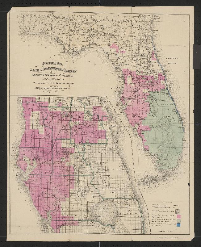
Deed of Disston lands sold to Reed, 1881, page 1. (TT)Page 2. (TT)Disston bought 4,000,000 acres from the state of Florida then sold half to Reed. Some of those lands included land in the SLR/IRL region. These lands are not shown on this map. ( Public map, 1881.)
And the EAA? With all the water problems we have today, I am glad it does not include everything in pink and green on the map and that something remains of our Savannas along the Indian River Lagoon.
____________________________________
An interesting email from Todd; Thank you Todd for all the research!
Jacqui,
It was fun to go through some of the stuff on my computer tonight. I just downloaded this publication “Disston Lands of Florida”, published 1885. I attached the intro page.
Disston had the pick of ALL the public lands owned by the state. It took three years to make the selection. Perhaps the pink area had been picked as of the date of the map and St. Lucie Gardens had not yet been picked?
Or maybe the St. Lucie Gardens land is not shown in pink on the map because Disston directed that the St. Lucie Gardens property be deeded directly from TIIF to Sir Edward James Reed. The Florida Land and Improvement Company never took title.
The TIIF deed that we pulled up for Sir Edward James Reed (attached) is dated 6/1/1881. In includes a little more land (21,577 Acres) than ended up in St. Lucie Gardens (e.g. Section 1, of T36S R40E is not part of St. Lucie Gardens but is included in the deed.)
Early rendition of a portion of the “Everglades” (Painting in my parents home, Tom and Sandra Thurlow.)Cover of book, 1910 by Walter Waldin.…..…..…….
This past Friday, I attended a Treasure Coast Regional Planning Council meeting and was treated to a wonderful presentation entitled: “A Brief History of Florida Water Management 1800-2000 Ponce to CERP.” The talk was given by Mr Bob Ulevich, president of Polymath Consulting Services, L.L.C. ” (http://polymathconsultingservices.com). Bob” is a beloved man who has a long history himself as senior water resources project manager for the South Florida Water Management District. Bob is considered the “father of water farming.”
His presentation left me speechless, once again being reminded of the history of agriculture in the state of Florida and its deep intertwinement with the state’s government and politicians….basically they are one in the same. This is how it is….St Lucie River/Indian River Lagoon and every inch of the rest of the state. “We” may not like this, but we must accept this…
With rumor that Adam Putnam, the Commissioner of Agriculture, could be our next governor, it is critical to refresh our memory on this historic relationship. Today I will share a book a from my historian mother’s shelf and also post the raw iPhone footage of Bob speaking before the council. It is my belief that we have got to learn to understand this historic relationship along with the power agriculture yields and “work with it,” in our quest for better water quality. They too are “naturalist” at heart….they are. Some of them in our South Floirda region have just “morphed,” and need some help getting back to their roots. 🙂 They hold the key to Florida’s water future.
The first page of the booklet talks about “getting back to nature” as farming is deeply intertwined with nature. Unfortunately today many of the intense practices of farming destroy nature and our water resources.
…
This is an another excerpt from the book:
….the independent countryman’s life must appeal, for he is a free man, master of himself, is conversant with nature in its many moods, enjoys the first fruits of the earth with the gleam still on them, and all its first impulses and pleasures….”
…..
“No wonder, then, the cry of today is, “Back to the back and nature.” And back we must and will go, for this threatening catastrophe is too appalling to be passed by unchallenged.”
The catastrophe Mr Waldin is speaking of is that so many people were leaving America’s lands to go to the cities, that the “vitality of our nation was being drained proportionately…” Mr Waldin feared the lands would be empty and all would move to the cities…..It basically has happened, hasn’t it!
Below are the links to Mr Ulevich’s presentation, his presentation does not encompass the little book. I added that. Bob speaks on “A Brief History of Water Management 1800-2000 and although my “Jacqui home videos” are poor quality, you can hear the message. I had to break the videos up into 15 minutes sections as my You Tube account is not set to post anything over 15 minutes…Bob’s presentation is excellent. For those of you who have time to listen, you will enjoy it very much and learn a ton! Bob will finish his presentation next month covering approximately from 1910 to today.——– And that’s where we get to hear “the rest of the story….” 🙂
Sunrise over Florida’s “Waters of the State,” SLR/IRL region.
The more I learn about water, “the more I learn what I don’t know”…Federal laws….state laws…and local governments living with the “sins of the fathers,” —just trying to keep up…
Because I taught eighth and ninth grade for so many years, it is my training to try to break down complicated information, so that it can be understood on a basic level and shared. Obviously, I am no expert on water law so please chime in!
Today’s lesson? CLASSIFICATION OF FLORIDA SURFACE WATERS
Classifications and designated uses of water by the state of Florida are required by the Clean Water Act of the United States. “The act requires that the surface waters of each state be classified according to “designated uses.” Florida has six classes with associated designated uses, which are arranged in order of degree of protection required.” DEP
Classification, Waters of the State, FAQ Fl. Dept. of Environmental Protection, 2012.
Class III Fish Consumption, Recreation, Propagation and Maintenance of a Health, Well-Balanced, Population of Fish and Wildlife
Class III-Limited the same Class III but “with limited physical/habitat conditions…
Class IV Agriculture Water Supplies
Class V Navigation, Utility and Industrial Use.
I wonder what category the St Lucie River/ Indian River Lagoon falls under? This is not easy to find on-line. Let’s guess….Look at the chart above closely….
What do you think?
My guess would be Class III-Limited, but I don’t know. I could not find it “for sure” on-line.
Looking at the chart and reading the DEP website, it sounds like all waters of the state of Florida are “Class III” regular “unless otherwise specified….”
—–Finding a simple list of class designations for waters of the state is not easy. This download is what I found and it does not make sense.
Now to complicate the issue, certain classes of water that are listed as Class III or otherwise can also be listed separately as “Outstanding Waters of the State,” or as “Aquatic Preserves.” How can this be?
—–For instance, the North Fork of the St Lucie River is listed as an “Aquatic Preserve” and “Outstanding Water” of the State. Also the Indian River Lagoon has parts, including parts in St Lucie and Martin Counties, that are also Aquatic Preserves. This doesn’t make sense to me. These bodies of water have been designated as “protected” since the 70s but they are not protected with canals dumping pollution into them. We all see that!
SFWMD canal and basin map.C-24 dumps pollution into North Fork of SLR, C-23 dumps into main area of SLR, C-44 dumps into South Fork, and C-25 into IRL near Ft Pierce. The North Fork of the SLR and parts of the IRL are Aquatic Preserves/and or Outstanding Florida Waters…..this makes no sense.Aquatic Preserves of the IRL as shown in DEP’s IRL Management Plan draft June 2014.
Now I am going to share some photos of the Southern Indian River Lagoon, (an Aquatic Preserve), that my husband, Ed, took last Sunday, September 13th. The photos are of the C-25 canal which is dumping into the Indian River Lagoon in Ft Pierce. I don’t know about you, but I don’t think it makes sense to dump pollution into an aquatic preserve, no matter what class the waters are.
To be fair, I must mention that I recently received an email from Mr Glenn Henderson, the senior grants writer for St Lucie County. He noted that a blog reader sent him the shocking photographs of C-25 recently published. Mr Henderson noted that he and others are working together with the St Lucie Issues Team to get a grant from the state for the San Lucie storm water detention project. The San Lucie is an old subdivision that has dirt roads, few swales and no structures to hold stormwater — and it’s less than a mile from the IRL. This is one of the many things running into the lagoon.
Thank you Glenn and everyone! And the state? “Let’s get back to class!”
Algae fills C-25 as this water is dumped into the IRL in Ft Pierce, an aquatic preserve. (Photo Ed Lippisch 9-13-15)C-25 9-13-15 (EL)C-25 9-13-15 (EL)C-25 9-13-15 (EL)
View of new intake canal far right and lands to be used for C-44 STA/Reservoir. C-44 canal in foreground. Near Indiantown.(Photo 2014, JTL)Intake canal for C-44 STA/R.(JTL)
Today’s blog is a review of something we have been talking about for a long time now. Something that is in the news once again. The C-44 Storm Water Treatment Area and Reservoir, a component of the Indian River Lagoon South, CERP project.
Today we will break down this project into chucks so we can understand what is happening, and what has already happened, and clarify some terminology.
The term “C-44” can be confusing as C-44 is a canal but is applied to others things and used as a “nickname” for an entire, multi-layered project. First, the C-44 is a canal that was built from 1915 to 1923 by the flood control district of the era and later by the Army Corp of Engineers. This canal has dual purposes. It allows water from the C-44 basin to run into and be released into the North Fork of the St Lucie River, and it allows overflow water from Lake Okeechobee to be released into the North Fork of the St Lucie River. “All this water” plasters the bottom of the estuary with silt and pollution from surrounding lands, in this case mostly from agricultural runoff.
There are two structures along the C-44 canal that release the water: structure 308 (S-308) at Lake Okeechobee, “Port Mayaca,” and S-80 at St Lucie Locks and Dam in Tropical Farms.
Believe it or not, the canal can “run in both directions, dumping water to the lake or to the St Lucie. The ACOE is in charge and works together with the South Florida Water Management District to manage this canal that is part of Florida’s history for “water supply” of agriculture and “flood control” for agricultural lands that later became populated by people other than just farmers…..
SFWMD canal and basin map. C-44 canal is the canal most southerly in the image.
So the “C-44 STA/R.,” as I will call it, has been in the works conceptually since the Comprehensive Everglades Restoration Plan or CERP that was agreed on by stakeholders in 2000. There are/were 68 project components of CERP, none are 100% complete. C-44 STA/R is part of “Indian River Lagoon South” a part of CERP that got a jump-start in 2007 and moved up on the list of 68.
Why haven’t all these projects been approved and funded? In the insane and fickle world of federal and state politics there is never a guarantee. So the ACOE and SFWMD live in a state of flux as do we, the public. This is why we must fight so hard, elect the right legislators, and “never give up.”
An overview of C-44 STA/R can be read about here:(http://www.martin.fl.us/web_docs/eng/web/EcoSystem_Restoration_and_Management/Water_Quality/Indian_River_Lagoon_South_Fact_Sheet.pdf)
Martin County and the public have done a great job supporting the SFWMD and advocating for the C-44 STA/R. As reporter, Tyler Treadway, stated in his recent Stuart News, article: “The C-44 project began in 2007 when the South Florida Water Management District spent $173 million and Martin County kicked in $27 million through a special 1-cent sales tax to buy and clear 12,000 acres for the facility.”
In 2011, after a couple of false starts the ACOE held a groundbreaking for the C-44 STA/R project. This was a happy day. I was mayor of the Town of Sewall’s Point at the time and participated in the groundbreaking event. This was Contract 1 and there are many components to this contract, but the most visible one is the building of the INTAKE CANAL from C-44 canal into the interior of the lands where the STA and Reservoir are to be built.
As you can see from this breakdown the project below, C-44 STA/R has multiple “contracts.” This is why we keep hearing about it “again and again.” The chart below is very helpful in understanding a timeline of the contracts. Each is funded separately. For fun, I have also included some pictures of the 2011 groundbreaking event. You can see how many people involved are not “here” anymore….
Breakdown of Contracts, C-44 STA/R.Sign for groundbreaking, 2011.Conceptual rendering 2011 event.Unidentified gentleman, Lt Col. Kinard, and Col Pantano. 2011. (Photo JTL)Agency leadership, groundbreaking 2011.Martin County Commissioners, 2011.Agency, regional leadership, and local leadership pose for the camera, groundbreaking, 2011.
OK so now fast forward to 2013. A year that rings like torture for those of us who lived here in Martin and St Lucie Counties during that time. It was the “Lost Summer” when the waters of Lake Okeechobee and C-44, C-23, C-24, and C-25 just about killed us and did kill our economy and the St Lucie River Southern Indian River Lagoon. It was during this time that Governor Rick Scott and the state legislature put 40 million towards “the C-44” to speed up construction of the STAs. This was wonderful cooperation between state and federal agencies. Entities that sometimes are at odds. This cooperation shined light on the agreed importance of improving water quality in the St Lucie River/Indian River Lagoon system, a yes…it WAS an election year! 🙂
Sewall’s Point confluence of SLR/IRL 2013. (JTL)Toxic algae SLR, photo Mary Ratabaugh 2013.Plume along Jupiter Island, Lost Summer 2013. (JTL)The people rally for the river, Stuart Beach. Over 2000 people docuemtned. (Sevin Bullwinkle, 2013.)
There were also other local politicians that were very vocal and helpful during this 2013 time. Florida Senator Joe Negron; Congressional Representative Patrick Murphy, there were others too like Senator Bill Nelson; Senator Marco Rubio even visited- and others….the public though was what really shined as they rallied and advocated on behalf of the river.
Now we are hearing about C-44 STA/R in the news AGAIN. So what are they talking about now? They are talking about the next part of the “contract sequence,” or phase…this time to build the reservoir as seen in light blue below. This is where the water will be held before going to he STA to be cleaned before again being released into the canal and then the river….
The reservoir is in light blue on left. The canal and storm water treatment area is in blue. The water is pulled out of the C-44 canal as seen in bottom of image.(ACOE)Palmar on far bottom right is part of the water quality component of the C-44 STA/R as seen on north side of C-44 canal.(ACOE)….
So as you can see, the building and funding of the C-44 STA/Reservoir is not an event but rather a story. “Reaching the finish line” includes many chapters….Considering so many other Everglades Restoration projects are not even close to getting this kind of attention and funding is something we must appreciate and be proud and thankful for.
What we must also understand is this is just the beginning and will not alone fix our water problems. In a bad year maybe 1.5 to 2 million acre feet— (one foot of water on one acre of land) ——-of water goes into Lake Okeechobee from the Kissimmee River alone. This amount of water is basically unfathomable. Picture all the water that used to be on the lands of central Florida each wet season before we drained them and straightened the Kissimmee River….not to mention “Disney”….
And since the Everglades Agricultural Area (EAA) south of Lake Okeechobee blocks the flow of water south to the Everglades this water is redirected to the St Lucie River/IRL and to the Calooshahatchee. The C-44 STA/R is meant to clean water from the C-44 basin alone. A reservoir of 50,600 acre feet will help the C-44 basin problems but not the releases from Lake Okeechobee. Only an outlet south of the lake, and a tremendous amount of storage can do that. —-So in essence, our race has just begun…
This satellite photo shows water on lands in 2005. One can see the lands in the EAA are devoid of water. This water has been pumped off the lands into the Water Conservation Areas, sometimes back pumped into the lake, and also stored in other canals. (Captiva Conservation 2005.)
Fresh water plume flowing past Sailfish Point at St Lucie Inlet 9-3-15. (Ed Lippisch)
Fresh water plumes flowing out of estuaries into the ocean are, of course, noted all over the world. There are even accounts from early Florida pioneers in the 1800s documenting such phenomenon. The difference with the “freshwater plumes” in our area of the St Lucie River/Indian River Lagoon, is that the watershed has been radically altered over time to take on more than its fair share of water and the plumes are not just sediment and organic material but often toxic.
As we are aware, canals C-44, C-23, C-24, and C-25 expanded the watershed of the SLR/IRL by more than five times its God-given capacity, plus in the case of C-44 the overflow waters of Lake Okeechobee. Yes we live in a “swamp.” But our South Florida swamp has been over-drained.
Drainage changes to the SLR. Green is the original watershed. Yellow and pink have been added since ca.1920. (St Lucie River Initiative’s Report to Congress 1994.)
Today I will share photos my husband Ed Lippisch took on September 3rd, and September 7th, 2015, and then contrast then with a few taken in September of 2013 during the “Lost Summer.” My point being, even our rain plumes, like “now,” are not natural to our watershed as the watershed has been expanded so much. Add Lake Okeechobee to it, and a really bad summer like 2013, and the plumes are visibly “different.”
Of course lighting and timing have a lot to do with a photograph.
A photograph is an image in time; it is not necessary “scientific,” but no one can say, a picture doesn’t “speak a thousand words.”
9-3-15 SL Inlet.9-3-15. SL Inlet.9-3-15 Close up freshwater plume exiting SL Inlet.
_______________________________________________
9-7-15 By Over Stuart Harbor looking north towards the North Fork. Plume seeming to be coming from South Fork, C-44. (bottom brown) (Ed Lippisch)Over Rocky Point looking to Sewall’s Point, 9-7-15.SL Inlet near Jupiter Narrow’s opening 9-7-15.Sailfish Flats between Sewall’s Point and Sailfish Point 9-7-15.Sailfish Flats…9-7-15.Sewall’s Point storm approaching, 9-17-15.SLR near Willoughby Creek a polluting outfall into river, water from Airport and surrounding area….This is just on the west side of South Sewall’s Point, 9-7-15.
_______________________________________
Map. Sewall’s Point is the peninsula. Inlet is to east. (Google maps) 2013.Plume in 2013, during the LOST SUMMER along Jupiter Island coming form SLI.C-23, C-24 , C-44 and mostly Lake O.9-13 St Lucie Inlet with plume exiting…JTL C-23, C-23, C-244 and mostly Lake O.Plume in 9-13 coming form C-23, C-24, C-44 and mostly Lake O. (JTL)
Photo from central IRL near Cape Canaveral, Sandra and Tom Thurlow, 1994.
Today’s blog was inspired by a question on Facebook by beloved Stuart News reporter, Mr Ed Killer.
Yesterday in my blog post, I wrote that I would be going to Apalachicola this week with the UF Natural Resources Leadership Institute. “Ed” commented and this is what he said:
“Tcpalm Ekiller: I want you to think of something while in Apalachicola Jacqui Thurlow-Lippisch : That industry is about a $2 mill /yr industry statewide, with most of that impact in that area. While it stinks for the oyster men that lack of water is a problem, we haven’t been allowed to eat an oyster from our estuary since the 1970s because the DEP downgraded the health of our water to class D. We have (FOS & a few other groups) have added more than $2 million in oyster shell projects to the St. Lucie River to help clean our water knowing we can never harvest the oysters.” Ed Killer
This got me thinking, and I thought, “Yeah, what really did happen to our St Lucie River/Indian River Lagoon oysters and what is their history? In fact, if I think about it, we are surrounded by mounds of ancient oysters, “Indian mounds” that attest to how plentiful they used to be…
Did you know?
Mt Elizabeth, better known today as “Tuckahoe,” at Indian Riverside Park, is said to stands around 40 feet tall. It is a shell mound built up over thousands of years. It consists of oyster shells and some clam shells that come from the Indian River Lagoon region. You can still see the ancient oysters in the dirt under the modern landscaping today.
Tuckahoe 2010. You can see the oysters shells in the soil. (JTL )A view of the IRL from 60 feet at Tuckahoe an ancient Native American shell midden of mostly oyster shells. Shell can be seen i the soil. (JTL, 2010)Ancient oyster shells can still be found at Tuckahoe itself and along the shoreline as seen here. (2015)
The native people of our area did not have to hunt game full-time or at all as they had all they needed from the riches of the estuary. In those days the natural inlets opened and closed on their own as they broke through “Hutchinson Island.” Oysters would have been more plentiful when the inlets broke through as they live in brackish waters.
*Note that the first 1882 chart describes Mt. Elizabeth (Tuckahoe) as located at what is now the top of Skyline Drive (Mt Washington) at the location of Jensen Beach Community Church. The 1883 (lettered 1888) map locates Mt. Elizabeth at what is now Indian Riverside Park at the Tuckahoe Mansion. This can be confusing.
Front page of Todd’s video showing a historic view of seeing Mt Elizabeth from the Shoal off shore in the ocean. Some early sailors mixed up Mt Elizabeth (Tuckahoe with Mt Washington (Sky Line Drive).
So what about after the Native Americans? I remember my mother telling me stories of pioneer accounts, after the St Lucie Inlet was opened permanently in 1892, of people eating oysters “as big as a man’s hand.” One a meal in itself!
Obviously the oysters would grow most plentiful by the inlets, like near Sewall’s Point and today’s Hutchinson Island.
So yesterday I wrote my historian mother, “Mom, do you have any information on oysters in IRL?
And she sent a fabulous historic survey, an old post card from Sewall’s Point, and account from the House of Refuge. Basically at that time too, a lot depended upon the inlets. I am including a lot of information, and more than likely “just a read for the history hardcore,” but you’ll get the idea.
But then the decline….
Historic photo. Florid Memory project. C-44.Historic photo St Lucie Locks and Dam, Stuart Heritage.
—it began in the 1920s with C-44 and the connection to Lake Okeechobee and then was exacerbated by C-23, C-24 and C-25. “Canals of Death…”We over drained the land, we built houses and scraped the wetlands for agriculture fields….we threw poison and fertilizer on the lands so things would grow and pests would go away…slowly, ever so slowly it drained back into the rivers….For a time, we “flourished,” but it has caught up to us, and our rivers are dying, as Ed Killer said in we’ve been “downgraded to a Class D.” Oysters can’t live in that…
May we bind together and turn things around because no one is going to do it but us. Nature, just like people can heal. We just have to give her a chance.
Oysters in the IRL by Cape Canaveral. “Oyster bars were everywhere.” (Photo Sandy and Tom Thurlow, 1994) Look how clear the water was.Post card to Sandra Thurlow, 1987, from Glee Wright about the plentiful oysters growing on the mangroves around 1957 at the Kiplinger Property in Sewall’s Point. (Courtesy of Sandra H. Thurlow)
I. An 1898 excerpt from a magazine of the day about oyster stew made right at the house of Refuge...shared by Sandra Thurlow.
The Caribou
by John Danforth
Excerpted from “Florida Sport” an article in Shooting and Fishing
December 15, 1898
I have decided on one which happened in 1898 in Dade County, Florida. My wife and myself, in company with Ben Crafts, were living on board a twenty-five foot cabin sloop, which had all the conveniences of a shore camp. We cruised on the Indian River, but most of the time we spent on the St. Lucie River and its tributaries.
Our sloop was built by the Bessey brothers especially for cruising the in Florida waters. The Bessey brothers are educated gentlemen, who have modeled and built nearly all the sailing craft owned by the Gilbert’s Bar Yacht Club, and in our sloop they seemed to get as near perfection as one could ask. We had plenty of room for cooking, eating, sleeping and to carry fresh water, provisions, and tackle of all kinds. We had an outfit, so we could leave the sloop anchored, with the cabin locked, and go for a cruise in the woods for days. My object in securing such a boat was not for catching and killing all we could find, but to better support myself and family by becoming a guide for gentlemen who visit Florida for sport.
At the time of which I write the Caribou (our sloop) lay at anchor about a half mile off the mouth of Hup-pee creek in the full moon of June. I had planned to be on the ocean beach at night to welcome the big turtles which come there to deposit their eggs in the sand where they hatch. When their work is done they disappear and are not seen again until the next year at about the same time. From where we lay at anchor to the U. S. Government house of refuge was eight miles across the Indian River. At the house of refuge it was only a stone’s throw from the Indian River to the Atlantic Ocean. The wide sand beach extended north and south as far as the eye could reach was a good place for turtles to come.
We hoisted the mainsail, then the anchor, and as the Caribou moved out Ben set the jib. With the stiff breeze that was blowing we were soon bowling along at lively speed, and it was only a short time when I called Ben to let go the jib. We hove to just off the house of refuge, took in the mainsail, let go the anchor, and soon had things snug for the night. Ben shelled oysters, my wife lighted the gasoline stove, and in a short time we had an oyster stew that was what Ben called “real filling.”
II. 1883 Historic survey as shared by Sandra Thurlow, compliments of surveyor Chappy Young.
S. Coast and Geodetic Survey
E. Hilgard, Superintendent
State: Florida
Descriptive Report
Topographical Sheet No. 1652
Locality: South End of Indian River
1883 Chief of Party:
A. Colonna
S. Coast and Geodetic Survey Office
Washington, Feb. 7th, 1883
Plane Table Sheet No. 1652 Scale 1/20,000
East Coast of Florida Indian River
From Eden Post Office or Richards Southward to Pecks Lake, and including St. Lucie River
Surveyed by E. L. Taney Aid USC&GS in 1882-83, B. A. Colonna Asst. C&GS. Chief of Party
S. Coast and Geodetic Survey
E. Hilgard, Superintendent
State: Florida
On the west Shore of Indian River the ground rises eighty feet above the level of the ordinary height of water in Indian River the higher ridges give quite a pretty land fall when seen four or five miles off shore quite overtopping the land and forest between Indian River and the ocean. On the east shore of Indian River and between it and the ocean the mangrove swamp is about on a level with the water in the River at ordinary stages and near the beach is from 3 to 15 feet above ocean high tide. I had a signal scaffold 45 feet high on top of a hill 82 feet high on the West Side of Indian River (Blue Hill?) from this scaffold I had a fine view of the county to the westward which consisted of numerous parallel ridge of sand with intervening saw-grass ponds the major axis of all of which extended in a northerly & southerly direction. Cattle-men that I met at the St. Lucie P. O. informed me that it was a succession of these ridges back to Okeechobee and that the old government wagon road which ran north and south and was back about 4 to 12 miles from the river was still passable and ran for the most of the distance along such ridges. Nearly all of this country rest on a foundation of marine conglomerate called Cochina [coquina] which is at various depths but occasionally crops out rising from 3 to 5 feet above mean ocean tides. This cochina differs very much in structure from that of Beaufort N. C. and other places north of here, large shells are seldom found in it and some of it presents the appearance of course white or yellow sand stone. When burned it makes a fairly good shell lime and when wet can be readily cut into building blocks with an axe. The sand of which the soil is almost exclusively formed is white or yellowish, it underlies all of the streams, saw-grass ponds, mangrove swamps & two or three feet generally bringings (?) the white sand even in mangrove and other swamps. It is impracticable to dike any of the low grounds because the water on a rise would come in from the bottom. — Whenever pine is indicated there will be found a growth of underbrush of various kinds and ranging in height from 1 to 10 feet. The pine timber itself is of little or no value being of stunted growth and the underbrush is scrub oak, whorttlebun (?), low saw-palmetto etc. etc. Where hard wood is depicted, except the mangrove swamps, the land is always best for cultivation, such hard wood land is called “Hammock-land by the natives and seems to owe its fertility to the fact that cochina lies near the surface and like an impermeable clay holds those chemicals that are gathered from the decaying vegetation, among the trees growing in these hammocks are those locally known as Palmettos, Mastics, Rubber trees, Live Oaks, Iron wood trees, the Crabwood trees and a great variety of others. There are various course grasses growing along the Ocean shore, and several varieties of running cactus, prickly pear in se and mixed in every when, a decided feature on the level sand wastes and elsewhere along the ocean side and occasionally west of the Indian River is the Scrub palmetto, a species of palm that although it has a trunk from 4 to 8 inches in diameter and from 3 to 20 feet in length runs along the ground like a vine and among them progress is very difficult for their trunks cross each other in mast confusion and their leaves are just about 5 feet high and have sharp edges. On the west side of the river among the pines and in the lands along the edges of the saw grass ponds there was nice tender grasses on which deer feed, and I never ate more delicious venison than here. The Indians of whom there are 3 or 400 back in the Glades, remnants of the Seminoles, always burn off the underbrush as much as they can about January or February. The saw grass ponds to which I have alluded are of fresh water generally very shallow and cut up by narrow sloughs or streams, these streams are seldom over 4 feet deep and have hard sandy bottoms on which various water grasses grow. The sawgrass itself has generally in the dry season only 3 or 4 inches of water about its roots but in the wet season the water rises 2 or three feet, the blades of this grass are from 3 to 10 feet long, about an inch wide and their edges are serrated, touch and very sharp. They rapidly cut out the clothing. If there is any hotter place than one of these saw grass ponds when the sun shines down and the myriads of mosquitoes swarm in our face stinging by tens and twenties, I hope it is not on top of the earth. Wherever these saw grass ponds run parallel to the River and within a mile or so of it excellent water can be had had by setting a flour barrel at the river side along the foot of the bluff. But on the east side of Indian River and between it and the Ocean good water is unknown for when fresh it is so strongly impregnated with lime that it is far from wholesome. —The mangroves grow to a greater height here than elsewhere within my experience. The natives divide it into two varieties, the Black and the red. I had the black mangrove cut down from one of the lines of sight that measured 85 feet from roots to top. When season[ed] the mangrove wood looks much like mahogany and is very hard, it takes a high polish. When burned the ashes are very strong in potash, a fact that may prove of value some of these days because the trees are so assessable. The old Gilbert’s Bar entrance, now closed, is shown on this sheet. Whenever the salt and fresh waters meet the mangrove flourishes and such has been the case at Gilbert’s Bar. Once fine oysters grew there and all kinds of fish belonging in these waters were abundant but since the inlet closed the oysters have died and the fish are gone except a few bass and catfish. Just outside however and along the old Gilbert’s Bar (Cochina Reef) there are lots of them Barracuda, Pompano, Bluefish, Cavallies, Green Turtle, Mullet, Sea Bass and a beautiful fish much resembling our Spanish mackerel but having more beautiful colors and very game. Trolling them I have seen them take the hook and bound 5 to 10 feet clear of the water. I had thought the blue-fish game and the taking of it fine sport but one of these beauties far exceeds any thing I ever saw for punk rapidity of motion and beauty of form and color. From October to April the climate is delightful and Indian River is the boatman’s paradise, from May to Sept. the heat although seldom above 85˚ and the mosquitoes and other insets are very troublesome. In all of the waters represented on this sheet eelgrass grows luxuriantly and it is the favorite food and principal feeding ground of the manatee. I have seen a heard of ten feeding in the St. Lucie at one time, they go to bottom, eat, rise, blow the water in a spray from their nostrils and in a few seconds they sink again. Like other grazing animals they feed early in the morning and late after-noon principally. They are very careful of their young and I never saw one turn to flee until the calf was well started. There are a great number of Coots in these waters in the fall & winter and a few ducks. In the woods there are quail, or partridge, and wild turkeys. Very many small birds of various colors migrate from these shores to the Bahama Ids., every winter returning about the first of May. The country in 1880 had but one settlement, it now has several and the tide of immigration seems to be setting towards it. Settlers have located up the St. Lucie near the forks and they are prospecting in every direction. The influences of ocean tides are not felt within the limits of this sheet in the Indian River. During rainy season the water rises one or two feet higher than in the dry season and at all times the prevailing wind exercises great influence— A Northern making high water, a South Easter or S. Wester— making low water. The mean rise and fall of the ocean tide is about 1.8 foot and the prevailing current along the coast is to the Southward. The edge of the Gulf Stream is only 2 or 3 miles off shore and an easterly wind throws it much nearer in-shore the prevailing Southerly current is supposed to be the eddy from the Gulf Stream. The limit of this sheet marks what is probably the northern limit of the successful growth of the Cooco Nut Palm, Oranges, Pineapple, Bananas and sugar cane flourish. The tomato and other vegetables ripen in April, Sweet Potatoes grow the year round and I have eaten from one which I was informed was of two years growth. There was not a horse, an ox, a mule within the limits of this sheet, broken to harness in 1882-3.
House of Refuge No. 2 was the best dwelling within the limits of the sheet and Doctor Baker; was the only place that look[ed] like a home. The Rattle Snake and the largest I have ever seen being from 6 to 7 feet long but they are not very numerous, Alligators are no longer numerous and they have learned to be very shy. Raccoons and opossums are so thick that it is difficult to raise domestic fowls. The wild cats from about 4 ft. 6 ins. from tip to tip when extended, Black Bears come to the beach every year from about the 1st of June and comb it for turtle eggs. When they arrive they are nice and fat and are very good eating but after running (?) up and down the beach so much they get very thin. We were told that a bear could be seen almost any night and once we went over and got one but the mosquitoes were so bad that we did not try it again.
The prettiest land on this sheet is the peninsula laying between the St. Lucie River and the Indian River from Mt. Pleasant South to the point. It is high hammock land, with coquina, foundation and covered by a heavy growth of hard wood and underbrush with now and then a pine. This country had quite a population in it once, just before the Seminole outbreak, and for a time after it, the settlers had oranges, lemons and limes, some of the old trees are still to be found in the vicinity of Eden P. O. and the limes are very fine but the oranges are bitter and the lemons not bearing.
A. Colonna
Asst. U. S. G & C. S.
Chief of Party
_______________________________________________
Other Readings:
Thank you to Mark Perry and Florida Oceanographic who work tirelessly to restore oyster habit in the IRL today:(http://www.floridaocean.org) They often have deployments should you wish to volunteer!
Eagle Scout Project of Riley Carlson with River Kidz at FOS, 2013.
C-25 at Taylor Creek, exits into the IRL near Ft Pierce Inlet. (Photo Ed Lippisch 9-2-15)
On Wednesday, my husband Ed and I sat down for dinner. “Did you see my photos of the river? He asked.
“No, I’m sorry, I haven’t looked at them yet…”
“They are pretty dramatic,” he replied, taking a swig of his Lagunitas.
I didn’t think much more about it, but later that evening, when I reviewed his shots, I understood.
Today I will share Ed’s recent photos of the Indian River Lagoon and St Lucie River that he took on Wednesday, September 2nd between 11:30AM-1PM. The first set of photos are from the Ft Pierce area around Taylor Creek where canal C-25 dumps into the IRL near Ft Pierce Inlet. C-25’s discharge can also be from C-24 or C-23 as they are all connected and can be manipulated to flow in different ways by the South Florida Water Management District. C-25, C-24 and C-23 ARE NOT connected to Lake Okeechobee. These photos are just showing rain runoff and all that is carried along with it and brought in by rising ground waters.
Canal and basin map SLR/IRL. (Public, SFWMD)Drainage changes to the SLR. Green is the original watershed. Yellow and pink have been added since ca.1920. The watershed has been unnaturlaly expanded to include up to 5 times the amount of water in the natural watershed.LO is the final blow when it comes. (St Lucie River Initiative’s Report to Congress 1994.)SFWMD chart showing flow into C-25 over past days.
I believe there have been recent improvements made at Taylor Creek (C-25), but perhaps there should be more as the outflow still looks like an oil spill. A cocktail of agriculture, development, residential, and road runoff….a “river of death…”
Once a reader wrote me saying,” Jacqui I like your blog but when it rains anywhere in the world there are these freshwater plumes….you are being misleading….”
I nicely replied. “I agree there are freshwater plumes all over the world, but I have to say, ours in the SLR/IRL region are beyond freshwater-soil plumes…they are deadly, full of heavy pollution. You can read it on agency web sites if you look hard enough…It is unnatural…and it is killing the St Lucie River/Indian River Lagoon.”
C-25 Canal in Ft Pierce. 9-2-15. (EL)C-25 discharging into Taylor Creek and the Marina, IRL Ft Pierce. 9-2-15. (EL)9-2-15 EL9-2-15 EL9-2-15. EL
_____________________________________
This second set of photos is from the same day, but further south along the Indian River Lagoon where it meets the St Lucie River at Sewall’s Point. Here you will see a plume at Hell’s Gate, not so dramatic as the C-25 plume, but a definite plume nonetheless.
The ACOE did recently dump BASIN runoff from around the C-44 canal (see map above) in preparation for ERIKA, but they DID NOT dump from Lake Okeechobee. In fact the canal is higher than the lake. I think this blog makes clear we have enough problems even with out releases from Lake Okeechobee.
Well, hope you learned something. Have a good Labor Day weekend as we honor the American Labor Movement and the contributions laborers have made to the strength, prosperity, and well-being of our country. —Sounds like just who we need to rework our canals….
ACOE/SFWMD slide showing breakdown of runoff into SLR. (9-1-15)ACOE website shows no releases from S-308 or Lake O.
ACOE website does show releases from S-80. In this case this is from the C-44 basin only. The basin is huge and mostly agricultural. See above chart.Plume at Hell’s Gate St Lucie River, west side of Sewall’s Point. This water is from rain runoff probably from C-44, C-24, and C-23 unless the SFWMD is dumping C-23 and C-24 through C-25 in Ft Pierce. (Photo EL 9-2-15)9-2-15 EL Another angle of Hell’s Gate and SP, SLR9-12-15 ELIncoming tide still clear around southern tip of Sewall’s Point. 9-2-15 EL –Hell’s Gate jutting forward far left.Confluence of SLR/IRL between Sailfish Point and Sewall’s Point. St Lucie Inlet in full view. (Photo EL 9-12-15)EL 9-2-15. Another view. Sailfish Point, SLR/IRL This areas seagrasses have still not recovered from 2013 even though water is blue in this photo.Sailfish Flats in distance SLR/IRL EL 9-2-15.
Leon Abood served as the chair of the Rivers Coalition for 17 years. (1998-2015)
Today and will share some history, and today I will honor Mr Leon Abood, who has led the Rivers Coalition of Martin County for the past seventeen years…
In 1998 a terrible thing was happening. An uncanny number of fish in the St Lucie River had lesions, and for the very first time, numerous algae blooms were being reported the river. The ACOE and SFWMD had been releasing fresh water from Lake Okeechobee into the estuary for a longer period of time than “typical” due to high rains and high water levels in Lake Okeechobee; this had occurred before, but this time something was different. Really different.
“Fish with lesions? Disgusting. And those poor fish! What’s going on?”
RC handout 2005.
Fishermen were confused and furious; the public was just learning the extent of the problems in their beloved St Lucie River; and real estate agents were desperate because they could not sell houses. All were watching the economic vitality of Martin County and its essential natural system (that brought residents here in the first place) collapse.
The standing motto of the day became: ENOUGH IS ENOUGH!
Agencies as usual declared uncertainty of why the fish were so sickly, everyone looking at everyone else…In time, very quietly, studies did verify that high levels of fresh water in brackish systems allow a bacteria to grow that promotes lesions, as a fish’s delicate slime coat is compromised….It was Lake Okeechobee exacerbated by the other canals….
This is taken into account today before decisions are made…When possible, “pulse releases” became more common rather than giant long-lasting slugs of water into the system….
As far as “the river,” other groups had been fighting for the St Lucie River/Southern Indian River Lagoon since the 1950s, but now it was time for “business!”
In a fit of fury and desperation, the Realtor Association, on May 12th, 1998, formed the “Rivers Coalition.” The group was built from the earlier formed El Nino Task Force and focused on group rather than individual membership.
Founding members in 1998 included the St Lucie River Initiative, the Realtor Association of Martin County; Stuart/Martin Chamber of Commerce; Treasure Coast Builders Association; Martin County Conservation alliance; Economic Council; Florida Oceanographic Society; Marine Industries Association; Audubon of Florida; Audubon of Florida; and the Martin County Farm Bureau.
Leisoned fish St Lucie River, 1998, From FWC, RC files.Photograph of fish from SLR 1998, DEP C-44. See link above to read about this.
Leon has led the coalition through the horrors of fish lesions, toxic algae blooms, releases from Lake Okeechobee and area canals, along with Mr Karl Wickstrom–a law-suit against the federal government, and has been the face and front man of the river for a confused and desperate public. His calm and authoritative demeanor gives people confidence. He is a true leader, calm when surrounded by controversy and sharks at every turn.
Leon’s goal has always been that all stakeholders are to take part: business, environmental, and residential…. and to bring information forward for the public so they can make “logical and intelligent decisions about what is going on.” He has helped achieve this important goal. —And without information and discussion there is no change…
Quote
Since 1998, the Rivers Coalition has grown and evolved but always remained a consistent “voice for the river.” Without the voice the Rivers Coalition, our river situation would not have the statewide recognition and there would not be the pressure on government to fix the problems.
We all know, it is a problem of monumental proportion, TO MOVE WATER SOUTH and not through our estuary, that will take generations. Knowing this, Leon Abood gave the first “go ahead” to support the River Kidz in 2011 so they could one day “take the baton.”
River Kidz listen to Mr Abood at St Lucie Locks and Dam protest of Lake O. 2014.(Photo Darrell Brand)Leon Abood holds map of South Florida. Rally/protest St Lucie Locks and Dam 2103. (Photo Darrell Brand)
Please read more about Leon Abood and the accomplishments of the Rivers Coalition below on Rivers Coalition link.
Leadership for the future will be made soon. Leon will not walk-away until he has given his blessing and guided new leadership. After 17 years of investing heart and soul it’s not as easy as “passing the baton,” and the River Kidz are just a tad too young. We are going to need some leaders just a bit older….:) He has a few in mind…
Why is he leaving?
After 17 years, he is tired. And Leon simply wishes to spend more time with his wife Georgia, a well-known artist; they love to travel to Europe specifically Paris and Italy. What do they say in real estate? In life too, “Time is of the Essence….”
Thank you Leon, you will never be replaced, and you will always be remembered!
Know the Rivers Coalition will have a rebirth with you always at its side.
Gulfstream Goodwill industries, Inc. Stuart, Fl. The group has been studying the river for months and now advocates for its goodwill. Group photo with guest speaker JTL, photo, Irene Laverty 9-1-15.)
GULFSTREAM GOODWILLS’ MISSION STATEMENT: “Gulfstream Goodwill Industries, Inc., assists people with disabilities and other barriers to employment to become self-sufficient, working members of our community.” (http://www.gulfstreamgoodwill.com)
I am certain the St Lucie/Indian River Lagoon has a new group of outspoken advocates. And let me tell you, they know their river stuff!
Yesterday, I spoke before sixty Martin and St Lucie County residents with disabilities at Gulfstream Goodwill Industries, in Stuart. The coordinator of “Adult Day Training Services” is Mr Tony Polito; he was fantastic with me and with his group. My visit was a remarkable experience, one I shall always cherish. —-The river brings all people, yes, all people together for a common good.
Before I got there, I was nervous. I taught eighth and ninth grade for many years, but never had more than thirty in a classroom and knew I’d be speaking an hour and a half. I never taught students with disabilities. I wondered if they would like me… If they would pay attention…
I awkwardly entered through the back, schlepping in my giant basket full of all my workbooks, maps, markers, pens, paper, giant photographs, and River Kidz FDOT signs. Many came to help me. The group all sat perfectly ready for me. All eyes were upon me….some were in wheel chairs, some had assistants, one lady was blind, others has nerve issues. There were young and old. They were smiling and happy to see me. I waved and introduced myself, and then it the magic began.
I lectured for a few minutes and then we discussed what they had been learning the past month studying the River Kidz/Rivers Coalition workbooks. I talked. They talked. They told stories about the river and animal life. They raised their hands. They were the patient. They were opinionated. They were excited to share. We spoke of the impacts to seagrasses and the river due to population, pollution, fertilizer, storm-water runoff, trash, oil from cars, as well as the long-term impacts of canals C-23, C-24,C-25, C-44 and the awful discharges from Lake Okeechobee. We spoke about what we can do to help.
Recycled FDOT stop sign. STOP pollution of the River! Created by Ms. Walker’s art class of River Kidz at the Pine School, 2012.
A young man by the name of D.J. told me the group has been directly affected by the poor state of the St Lucie River in that Tony, their coordinator, can no longer take the group fishing at the Roosevelt Bridge. They had done this for years. This had been one of their favorite activities. We decided to write Senator Joe Negron letters, and we did. He will receive all sixty in the next few days.
Many told me they had actually waved signs for the river on the Roosevelt Bridge! They were brought before the group and applauded!
Of course, the daycare group at Goodwill Industries are voters, but now they are also advocates.
Together we all memorized the River Kidz mission statement changing one word to fit them: OUR MISSION IS TO SPEAK OUT, GET INVOLVED, AND RAISE AWARENESS, BECAUSE WE BELIEVE ADULTZ SHOULD HAVE A VOICE IN THE FUTURE OF OUR RIVERS!
And they my friends, —they will! 🙂
Fishing poles sitting on the wall, no longer used due the to condition of the fish of the SLR/IRL. (Photo, Goodwill Industries, 2015.)Receiving River Kidz certificate.2.3.4.5.6.7.8.Coordinator, Tony Polito; helper Ann Marie; JTL.Letter to Senator Negron.Letter to Senator Negron.
Aerial of SLR/IRL. Confluence of St Lucie River/Indian River Lagoon near St Lucie Inlet with low tide exposed sea grasses looking bleak. (Photo Ed Lippisch; plane piloted by Scott Kuhns 8-20-15.)Most recent chart showing discharges into the SLR from area canals C-23, C-24, C-44 Ten Mile Creek, and “Tidal Basin” –from rainfall. No Lake O. (From ACOE Periodic Scientist Call 8-18-15. Image courtesy of the SFWMD.)Basin chart, SFWMD.
As we all know, until last week, it has been raining a lot! Almost daily it seems the grey clouds gather and beat their chests threateningly; most often making good on their promise. This past week was the first time in a long time, my husband, Ed, could get up in the Cub and photograph the river. I will share these photos today.
Following are two sets of photos; the first Ed took on Thursday, August 20, 2015, and the second set were taken by Ed and friend Scott Kuhns, Sunday, August 23, 2015.
The point of the blog is to share the photos, and celebrate our 2015 “clearer waters” near the Indian River Lagoon’s southern inlets, but also to feature the weaker-looking “rain-event, fresh-water plumes.” You may recall the wretched, horrific looking plumes of the Lost Summer of 2013 during the discharges from Lake Okeechobee and area canals? Here is a photo to remind you taken in September 2013:
St Lucie Inlet September 2013 looking towards Sailfish Point.(JTL)
2015’s summer rain induced plumes do not include Lake Okeechobee releases, or the other conditions of 2013; this summer’s plumes are not as severe looking as 2013’s as you will see. Thus we have “clear water,” even when there is a lot of rain.
Last, I ask you to note the photos of the seagrasses around the Sailfish Flats area between Sewall’s Point and Sailfish Point. I am no scientist, but I think they look awful. Recently, I was told having some algae on the seagrasses is good in that when they are exposed during low tide they are protected from the burning sun. That is nice to know. Nevertheless, they look weird. Like there is too much algae; they do not look healthy. They appear grey and sickly. It is obvious they are not recovered yet from 2013 and before.
Seagrass beds of the St Lucie River/Indian River Lagoon near St Lucie Inlet 8-20-15.
I do not have a “before aerial.” but this photo from the St Johns River Water Management District show up close what healthy seagrasses look like and I do not think ours look anything like this right now.
Photo by Lauren Hall, SJRWMD, “up close” showing what healthy seagrasses should look like in the IRL. (From Save the Manatee Website)
So here are the photos, enjoy the clearer water thus far this summer, and please stay on the Water Districts and politicians noting that clear water doesn’t mean healthy seagrasses. We have a long way to go!
Sailfish Flats outskirts off Sewall’s Point near St Lucie Inlet. Beautiful blue waters but odd-looking sea grass beds. 8-20-15. (Ed Lippisch)St Lucie Inlet with weak plume exiting northerly through jetty with most going south. 8-20-15. (Ed Lippisch)Sewall’s Point, 8-23-15. (Ed Lippisch)Sailfish Flat between Sailfish Point and Sewall’s Point. Here aside Hutchison Island looking southwest. 8-23-15. (Ed Lippisch)St Lucie Inlet 8-20-15. (Ed Lippisch)Weak rain plume exiting SL Inlet with near shore reefs in clear view through clear ocean water. 8-24-15. (Ed Lippisch)View of rain plume hugging shoreline as it leaves St Lucie Inlet along Jupiter Island. 8-24-15. (Ed Lippisch)
THESE LAST PHOTOS ARE OF FT PIERCE INLET. FT PIERCE INLET GETS WATER FROM C-25 WHICH DOES NOT DISCHARGE INTO THE ST LUCIE BUT DIRECTLY INTO THE IRL JUST OUTSIDE OF THE FT PIERCE INLET AT TAYLOR CREEK. C-25 IS NOT SHOWN ON THE CHART AT THE BEGINNING OF THIS POST FOR THE ST LUCIE RIVER. C-25 CAN ALSO RELEASE WATER FROM THE C-23 AND C-24 CANALS IF THE SFWMD DIRECTS SUCH. SEE CANAL MAP BELOW.
Canal and basin map SLR/IRL. (SFWMD)Ft Pierce Inlet takes water from C-25. This water exits directly into the IRL at Taylor Creek and Marina. 8-23-15. (Ed Lippisch)Ft Pierce Inlet 8-23-15. (EL)Ft Pierce Inlet. 8-23-15. (EL)
Thank you to my husband Ed Lippisch, friend Scott Kuhns for these photos. Also thank you the ACOE and SFWMD for sharing their chart information.
The other day at a Martin County Commission meeting, I felt like a parent beaming with pride. I had been there about four hours when my mother popped into the meeting, then my sister, and then Evie, Jenny’s daughter who is now 15. This is the only child that I literally saw born into the world…
Following Evie were many of her team mates, young men and women. So cute! And to see them sitting there in the commission chambers, what a sight! When public comment came around my niece, Evie, confidently walked to the podium and ask the commissioners to support full funding of a dock at Leighton Park that would allow the youth and others not to have to walk on the river bottom to launch their skiffs. This area of the St Lucie River is has the highest bacteria levels and is ground zero for the polluted discharges from C-44 and Lake Okeechobee. Cutting feet on dead oysters is not a good idea and even with shoes is dangerous. As we know open wounds in filthy water can have devastating consequences.
I watched in awe.
Tears swelled up in my eyes seeing Evie unafraid to “go before the commission.” As a commissioner for the Town of Sewall’s Point myself and as someone who has spoken before commissions prior to my commissionership, I know the tortured feeling of inadequacy that can often come upon one in such a situation. The commissioners up high on the dais, peering down on you, like you are a mere peasant. It is very intimidating even for the most educated and confident.
Because Evie is a River Kid whose mission is to “speak up, get involved, and raise awareness,” she has been speaking before commissions, politicians, and high level agency leaders since she was 10 years old! Going before the Martin County Commission was “old hat” for her. “What a gift,” I thought. The gift of learning public speaking and being at ease with it….a skill that can be applied to all aspects of life.
Evie Flaugh, speaks on behalf of her team, before the commission. 8-18-15. (JTL)Evie’s notes she wrote herself to speak before the commission. (2015)“The team sitting in the commission chambers.” (JTL)Parental support staff, and coast Stefani Faulkner far right. (JTL)
Coach Stefani Faulkner, spokesperson Dr Eric Pheiffer, and parents accompanied these kids. Take a minute see the good work they are doing! They are winning state competitions. And the river, in spite of its challenges, is helping make winners of them all!
“The Treasure Coast Rowing Club (TCRC) was established to stimulate and foster interest in the sport of rowing among amateurs. We promote this interest through education and competitions using every reasonable endeavor for the advancement and up-building of amateur rowing in accordance with the best traditions of sportsmanship. Our goal is to have a safe and fun environment where both adults and youth rowers can enjoy the sport of rowing. We aim to teach the joys of rowing to anyone willing to learn and wanting to get behind an ore, or on the water. We welcome all athletes regardless of their ability or experience. If you are willing to show up and work hard, there is a place for you in our boats”. (TCRC website)
I grew up in Martin County in the 60s and 70s. Nature and “healthier” rivers were abundant and a part of everyday life. We did not comprehend that the rivers were already dying; we did know of a people whose culture had suffered greatly because our white ancestors had “pushed their way in.” In spite of this terrible history, I was raised to know of the Native People who had lived along our waters’ shores and to respect their ways. We learned of the tribes that had lived here and others throughout our entire country. The Ais, the Seminole, the Miccosukee, the Lakota…
Map Native Tribes of North America-public.
One of the most profound memories of my youth is local artist, James Hutchinson and his wife, Joan, who lived with the Seminole Indians at Brighton Reservation for six years, located on the north rim of Lake Okeechobee. I will share part of their story today.
To set the tone, I would like to begin with a reading from Black Elk, a Lakota, from out west:
“I am blind and do not see things of this world; but when the light comes from Above; it enlightens my heart and I can see, for the eye of my heart sees everything. The heart is a sanctuary at the center of which there is a little space, wherein the Great Spirit dwells and this is the eye. This the eye of the Great Spirit by which He sees all things and through which we see Him. If the heart is not pure, the Great Spirit cannot be seen, if you should die in this ignorance your soul cannot return immediately to the Great Spirit but it must be purified by wandering about in the world. In order to know the center heart where the Great Spirit dwells you must be pure and good, and live in the manner that the Great Spirit has taught us. The man who is thus pure contains the Universe in the pocket of his heart.”
It is our hearts that will bring back the river of grass….”Kahayatle”… “Love’s power” is transformative and changes broken people, and broken waters…
So to continue, artist, James Hutchinson, was long time friends of my parents; in 1962 he and his wife Joan received an Arthur Vining Davis Foundation grant, and moved to the Brighton Reservation to paint portraits of the Seminole elders. Many years later, Mr Hutchinson wrote me in a personal letter in 2009 after my husband commissioned him to paint “Lena Tiger”—the figure chosen by Hutchinson when I asked for a woman to go with my warrior prints.
Lena Tiger, by James Hutchinson.Halpatter, “Alligator.” James Hutchinson.Holata Micco “Billy Bowlegs II.” James Hutchinson.Osceola, “Powell.” James Hutchinson.Coacoochee, “Wildcat.” James Hutchinson.
The letter reads:
“When Joan and I moved to the Seminole Indian Reservation at Brighton, we found ourselves at a loss as to begin our work…there were many weeks where we were isolated from the tribe and we thought we had failed. Lena Tiger was wife of the last true medicine man, Waha-Tiger. She saw how lost we were and came to our rescue, taking us around to meet several families’ campsites scattered around the reservation. Our travels with her gave us a sense of place…Lena introduced us to Billie Bowlegs III who became our close friend and taught us a few words of Muscogee as well as stalking.
She was an endless source of Indian etiquette which was essential to outsiders like us….Lena was a person of the of the highest character, one who witnessed great change and challenges to her people and one who offered the welcomed hand of friendship.”
Without this “friendship, this “love,” Hutchinson would never have been able to document the Seminoles of that era and learn of their historical brothers and sisters first hand. The work that Hutchinson did at Brighton defined his career and helped others appreciate a culture their ancestors had destroyed. Healing begins…
The moral of the story?
We too must offer the hand of “friendship” to our “enemies.” This does not mean that we do not stand up for what we believe in, but it does mean that we open our hearts to those who “cannot see.” It is through being open that the power of the Great Spirit will bring back life, and light, to the Florida Everglades, Lake Okeechobee, and to the St Lucie River/Indian River Lagoon.
_______________________________________________
*In their own Miccosukee language, the Tribe uses the word “Ka/ha/ya/tle” to refer to the shimmering waters…the Everglades.
1909 map of South Florida from the State of Florida report: “Report on the Drainage of the Everglades of Florida, By J. O. Wright, Supervising Drainage Engineer.” (Courtesy of Dr Gary Goforth.)
Just say “No!” To wasteful canals that is….
There are over 2000 miles of canals draining precious fresh water off South Florida; it’s a good idea to know the main ones. I started thinking about this after going through some old files and finding this awesome 1909 Map Dr Gary Goforth shared with me showing a plan in 1909 to drain the Everglades and Lake Okeechobee WITHOUT killing the St Lucie River/Indian River Lagoon.
1909 map of South Florida from the 1909 State of Florida report on the Drainage of the Everglades of Florida, By J. O. Wright. (Goforth)
Well as they say: “The rest is history….” As we know, the C-44, or St Lucie Canal, was later built.
So when I was looking on-line for a good map to show the canals of South Florida today to compare to Gary’s canal map of 1909, believe it or not, I could not find one! One that was well labeled anyway. So I made my own.
It’s pretty “home-school” but its readable. From left to right, below, you will see canals Caloosahatchee, (C-43); Miami, (L-23); New River, (L-18); Hillsboro, (L-15); West Palm Beach, (L-12); L-8 that never got a name as far as I am aware; and St Lucie, (C-44.) I do not know why some are labeled “C” and others are “L,” but you can follow them to see where they dump.
I believe the first two built were the Miami and the New River— by 1911, as I often see those two on historic maps prior to 1920. Today our state canal plumbing system is outdated and wasteful sending on average over 1.7 billion gallons of fresh water to tide (to the ocean) every day. (Mark Perry, Florida Oceanographic.)
Even though I grew up in Stuart, I was never really taught about the canals. As a young adult and even older, I drove around for years not knowing about these canals and others like C-23, C-24, and C-25. If I “saw” them, I did not “recognize” them. I knew the land had been “drained” but really had no conception of what that meant or the extent thereof…
I remember my mom used to say if we were driving around in Ft Pierce in the 80s, “And to think there used to be inches of water covering all this land at certain times of the year….” I just stared at her but didn’t really “get it.” The pine trees flashed by and it seemed “impossible” what she was saying…
In any case, the young people today should be learning in detail about these canals so they can be “updated,” “refreshed,” “reworked,” and “replugged.” Say “no” to old-fashioned canals, and “hello” to a new and better South Florida!
South Florida major canals: L to R. Caloosahatchee, Miami, New River, Hillsboro, West Palm Beach, L-8, and St Lucie. (SFWMD canal map 2013)
Below is a history of the South Florida canals as written in an email to me by Dr Gary Goforth. It is very enlightening. Thanks Gary!
Hi Jacqui
As you know, plans to manage the level of Lake Okeechobee (by discharging to tide) in order to develop and protect the agricultural lands south of the lake were developed before 1850 and evolved through the mid-1950s.
1. Buckingham Smith, Esq. in 1848 proposed connecting the Lake with the Loxahatchee River and/or the San Lucia (report to the Sec. of the US Treasury; copy available).
2. In 1905, Gov. Broward rejected a proposal to lower the Lake with a new canal connecting to the St. Lucie River.
3. Attached is a 1909 map of South Florida from the 1909 State of Florida report “Report on the Drainage of the Everglades of Florida, By J. O. Wright, Supervising Drainage Engineer”. The importance of this map and report is the recommendation to manage the water level in Lake Okeechobee via drainage into multiple canals from the Lake to the Atlantic Ocean – but NOT the St. Lucie Canal. The primary canal for moving Lake water to the Atlantic was to be the Hillsboro Canal which would connect the Lake to the Hillsboro River in present day Deerfield Beach / Boca Raton. Note the recommendation is to construct what is now called the “West Palm Beach Canal” and route Lake water into the Loxahatchee River and then out to the ocean via the Jupiter Inlet – this is actually being accomplished as part of CERP and the Loxahatchee River restoration program.
4. In 1913, the State accepted the recommendation of an NY engineer (Isham Randolph) to construct a canal connecting the Lake to the St. Lucie River (report available). The Everglades Drainage District was formed the same year, and was responsible for the construction of the canal and associated locks/water control gates. (historical construction photos available). Construction lasted from May 1915 through 1924, and the first Lake discharges to the St. Lucie occurred June 15, 1923 (ref: Nat Osborn Master’s thesis 2012, copy available)
5. After the 1928 hurricane, the State asked for and received federal assistance. The canal was enlarged by 1938; new St. Lucie Locks was rebuilt in 1941; the new spillway was constructed in 1944. —Dr Gary Goforth (http://garygoforth.net)
Today I will try to provide some insights for every day people trying to figure out what a basin management action plan is, why we have one, and how we are doing so far….
Before we begin, we must first note that in 2002 the state of Florida declared the St Lucie River “impaired.” Impaired as in “its health”— with too much nitrogen and phosphorus and other pollutants from fertilizer and other sources that run off agricultural and developed lands…If you want, you can read the 2002 report below.
Today we hear more about BMAPs (Basin Management Action Plans) and TMDLS (Total Maximum Daily Loads) than the original impairment report, but we must be aware that the only reason we have a BMAP is because the river is “impaired.” A BMAP is put in place by the state to “fix” impaired water bodies.
Our Martin County/St Lucie St Lucie River (SLR) impairment is compounded by the fact that the watershed has been heavily altered over the past 100 years. The Everglades Agricultural Area (EAA) south of Lake Okeechobee blocks the natural flow of Lake O. water going south to the Everglades; therefore the “overflow” waters of Lake Okeechobee are released into the St Lucie.
On top of that are canals C-23, C-24, C-25 that go way out west expanding the St Lucie River’s basin, draining parts of Okeechobee and St Lucie counties and even waters of the St John’s River that used to go north once located near Vero! Road runoff, marinas, agriculture, our yards, tributaries, non-functioning septic tanks, and other things all add up to create a pollution cocktail encouraging toxic algae blooms that kill seagrasses and wildlife and lower our property values for the entire area.
According to the St Lucie River Initiative our canals expanded the “flow” into the St Lucie River by as much as five times what Nature intended. See map below. The BMAP doesn’t really deal with this problem; it does not try to reroute these canals, it rather tries to “better the situation” we are in now as far as water inputs.
Drainage changes to the SLR. Green is the original watershed. Yellow and pink have been added since ca.1920. (St Lucie River Initiative’s Report to Congress 1994.)
So with that in mind, let’s get back to the state of Florida’s created Basin Management Action Plans implementing “total maximum daily loads” (TMDLs) for nitrogen and phosphorus. “Everyone” is part of lowering their loads to the river through building projects that help lower loads and implementing Best Management Practices for fertilizer etc…. Everyone in the basin that is. (Not Lake O- They have their own plan). Not everyone is an equal polluter but everyone tries to lower their load.
The stakeholders agreeing to do projects and implement Best Management Practices to lower their inputs are:
Agriculture
City of Fort Pierce
City of Port St. Lucie
City of Stuart
FDOT District
Hobe St. Lucie Conservancy District
Martin County
North St. Lucie River Water Control District (NSLRWCD) 10
Pal Mar WCD
St. Lucie County
Town of Sewall’s Point
Troup-Indiantown WCD
These stakeholders work together with the help of DEP, the Department of Environmental Protection, and others to lower their measured inputs of Nitrogen and Phosphorus into the river over a period of fifteen years, in five-year increments beginning in 2013. The draft report now is just reviewing the first two years of the first five years. We have a long way to go….
This slide of the summary report provides some overall insights. You can see the load originally compared to now and how far they have to go together to achieve the first increment.
DEP chart for SLR BMAP. (Draft 2015)
1.1 Summary of Accomplishments
Table 3 summarizes the projects completed during the second annual BMAP reporting period. These resulted in an estimated reduction of 118,163.3 lbs/yr of TN and 26,998.8 lbs/yr of TP. The reductions are in addition to those projects given credit before BMAP adoption. Therefore, the total reductions to date are 595,952.0 lbs/yr of TN and 157,540.8 lbs/yr of TP, which are greater than the required reductions in the first BMAP iteration of 316,024.2 lbs/yr of TN and 121,250 lbs/yr of TP. These reductions, in addition to those shown as completed in the BMAP, are 56.6% of the required TN reductions and 39.0% of the required TP reductions of the Phase I BMAP.
The progress towards the TMDL TN and TP load reductions in the St. Lucie River and Estuary Basin are shown in Figure 2 and Figure 3, respectively. The first bar in these figures shows the baseline load for stormwater runoff. The second bar shows the current estimated loading with the implementation of projects. The third bar shows the total allocation for stormwater runoff to meet the TMDLs. The line shows the target for the first BMAP iteration. (DRAFT REPORT)
____________________________________
So the St Lucie River BMAP is making “pretty good” progress according to the report. I imagine there is still a lot to improve. It is a process. We are learning….
These programs are definitely a major “participatory decision-making process” to be commended. I cannot imagine what it takes to coordinate this effort! It would be a nightmare actually. I rather just reroute the canals!
In closing we must note the Indian River Lagoon of which the St Lucie River is a tributary, has a BMAP, but it is for the central and northern lagoon not the southern lagoon where we are in Martin County. I don’t quite understand this. The river does not seem healthy in this area either.
Maybe one day soon the southern IRL will soon have its own BMAP too? A very complex process for two very sick rivers…A process we should all try to understand and help with too.(DEP BMAPS http://www.dep.state.fl.us/Water/watersheds/bmap.htm)
Florida BMAPs DEP.Close upList of Florida’s impaired water bodies and BMAPS.
*According to the Department of Environmental Protection: a BMAP is a “blueprint” for restoring impaired waters by reducing pollutant loadings to meet the allowable loadings established in a Total Maximum Daily Load (TMDL). It represents a comprehensive set of strategies–permit limits on wastewater facilities, urban and agricultural best management practices, conservation programs, financial assistance and revenue generating activities, etc.–designed to implement the pollutant reductions established by the TMDL. These broad-based plans are developed with local stakeholders–they rely on local input and local commitment–and they are adopted by Secretarial Order to be enforceable.
*Also for the first five years of the fifteen years the BMAP will take place, the stakeholders are getting extra credit because their SLR BMAP” credit includes storm water management strategies and projects that have been put in place since 2000 or will be implemented during the first five years of implementation June 2013-June 2018).”
I am adding a comment from Dr Gary Goforth to this blog post at 1:00 PM 8-13-15. I think his professional insights are helpful even to the lay person; he did attend the BMAP meeting yesterday; and he is a regular contributor to my blog. Thank you Gary. (http://garygoforth.net)
3-18-15 at 7:17 AM Gary Goforth commented on 2015 Annual Update, St Lucie River and Estuary Basin Management Action Plan, SLR/IRL
Inside cover of the Draft 2015 SLR BMAP Report. I …
Hi Jacqui
I am very familiar with the TMDLs and BMAP for the St. Lucie River Basin. I attended the BMAP progress meeting yesterday along with Mark Perry and others. There were nice updates by Diane Hughes and her counterpart in St Lucie County on construction and operation of what should be good, effective projects for reducing nutrient loads to the St. Lucie River and Estuary. It is clear that local communities and others are working hard to reduce nutrient loading.
However that’s where the good news ended.
While the progress report leads the public to believe that great strides have been made by landowners in cleaning up their stormwater pollution, unfortunately the BMAP process and progress reporting is seriously flawed and present an overly optimistic assessment of the region’s water quality, and the progress made towards achieving the desired endpoint. I expressed this opinion to FDEP, FDACS and SFWMD staff at the meeting yesterday, with the following support:
1. The nutrient loading data in the progress report are not real (measured data), rather they are a combination of potential load reduction estimates superimposed on simulated data. No where in the progress report will you find the observed amount of nitrogen or phosphorus that actually entered the St. Lucie River and Estuary during 2015. As was discussed at the meeting, FDEP does not plan to bring real data into the progress reports until 2017.
a. The real data show a very different story, for example, phosphorus loading from the C-44 Basin (excluding Lake releases) has increased more than 50% from the 1996-2005 Base Period.
b. Until real data are shown, there can be no assessment of how well the BMAP program is working, and no mid-stream corrections will be made.
c. The majority of load reductions are attributed to agricultural land uses as a result of BMPs. However, FDACS and FDEP staff acknowledged that they have not yet documented the actual effectiveness of any ag BMP in the region – they repeatedly stated they were short on staff.
2. The progress report (and the BMAP) ignores the nutrient and sediment load from Lake Okeechobee discharges. In the 2015 reporting period, the assessment ignores over 400,000 pounds of nitrogen and 47,000 pounds of phosphorus that entered the River and Estuary from the Lake. And don’t expect future reports to reflect this loading – the BMAP process will continue to ignore loading from Lake Okeechobee, assuming instead that the Lake will achieve its own TMDL (another sad subject altogether).
3. The nutrient loads for the BMAP base period are not the actual loads that occurred in each of the basins – instead it is a simulated load that differs up to 25 percent from the observed load. Without an accurate base period load, true progress cannot be assessed.
I could go on for a while; I made many more suggestions how to improve the process and will follow up with written comments to the FDEP.
Florida Natural Resource Leadership Institute. (Header from web site: http://nrli.ifas.ufl.edu)NRLI list of fellows Class XV
Something very exciting is going to start happening for me this week.
I am beginning a new journey as a “fellow” of University of Florida’s IFAS Natural Resources Leadership Institute, or NRLI (http://nrli.ifas.ufl.edu). Our first of seven “field trips and study sessions” over the next year begins this Thursday right here along the Indian River Lagoon at NASA where our state’s developing space program is eyeing lands in the National Wildlife Refuge for new runways.
NRLI teaches “leadership skills” in dealing with such explosive environmental natural resource issues…it tries to teach you to build a “cohort” to get things done.
NRLI schedule for class XV
I will be participating as an elected official from the Town of Sewall’s Point. Elected officials in the program are rare and when they invited me to apply last year, I said: “Are you sure? I don’t see many “politicians or bloggers ” on your list of graduates and my town is really small….?” I was assured there had been elected officials before, and if I wanted to apply, I was encouraged to do so….
So I did…
I first came into contact with NRLI, when I was invited to be a speaker. In 2014, a year after the “Lost Summer,” and the St Lucie River/Indian River Lagoon’s toxic mess caused by releases from Lake Okeechobee and area canals. Area canals mind you that have been expanded to dump agriculture and development water into the river’s basin at five times beyond what Nature envisioned. So NRLI “Class 14,” was studying the “Indian River Lagoon, —-an Estuary in Decline.” Pretty bleak title isn’t it?
Along with their directors, the fellows met at a room at the Marriott on Hutchinson Island just over bridge from Sewall’s Point. There were about twenty “fellows” from varied backgrounds such as the ACOE, Water Districts, Florida Fish and Wildlife; the Nature Conservancy, the Miccosukee Tribe; the Department of Agriculture; South Florida County governments; etc…some younger, some older, all different…
It was cool.
I sat on a the panel with Jim Brother, a recreational fisherman; Leroy Creswell, University of Florida IFAS Extension Sea Grant Program; Scott Deal, CEO and President Maverick Boat Company; and George Jones, Indian River Keeper. I spoke about how the releases impacted Sewall’s Point’s peninsular real estate and wildlife as well as the grassroots formation of River Kidz and local advocacy. We the “panel people” sipped our bottled water and answered questions. We listened to ourselves talk and wondered how what we were saying could be happening…loss of seagrasses and oysters, dying and sick wildlife, loss of real estate values, loss of boat sales, kids can’t go in the water….
The fellows were attentive, inquisitive, and ask great questions. They were from all over the state so many were not familiar with the IRL. I always wondered what the fellows said behind closed doors after the session? “Man that’s one big mess! Didn’t they see it coming? Those kids are going to have to save that river!” or maybe not, maybe they had great ideas of how to really start moving in the right direction. Maybe they are doing that now behind the scenes as NRLI graduates? Maybe this is how we change the world?
NRLI states their purpose as the following:
We are all dependent on Florida’s natural resources. Decisions about natural resources involve complex sets of issues and stakeholders. Expensive and time-consuming disputes often emerge over issues such as endangered species, land use, coastal and marine resources, and water quality and quantity. Effective leadership in managing such issues requires a specialized set of skills, tools, and strategies to build trust and promote collaboration among competing interests. In recognition of this, the Florida Natural Resources Leadership Institute (NRLI) was founded in 1998 to bring together professionals in sectors that impact or are impacted by natural resource issues to develop the skills required to work towards collaborative solutions.
When I got accepted, I immediately emailed my Uncle Russell, now retired in Gainesville. My mother’s brother, an Annapolis graduate who served in Vietnam and lived under the ice in the North Pole finding spy submarines or something top secret…..He is my favorite uncle…. My Grandfather Henderson, his father, worked for UF and IFAS so I wanted to share that I would be part of that legacy although it would be in a different capacity different from the “rape and pillage goals” of the 1930s and 40s. IFAS is remaking itself…
He congratulated me and then said: “You know Jacqui, they are probably trying to take the fire out of you…you know….calm you down….make everybody get along….but congratulations! Grandaddy would be proud…”
I laughed and said something like, “you know what Uncle Russ, you are probably right but I’m pretty good at capturing from the inside and keeping my head.”
He laughed…. we laughed….Dead Silence….
All I know right now, is that when I see my name on the list, I am honored, excited, and hoping to be a part of a better natural resources future for Florida and the Indian River Lagoon.
______________
UF IFAS means: University of Florida’s Institute of Food and Agricultural Sciences. IFAS has extension offices in almost all Florida counties. My Grandfather worked for IFAS for many years in the 1930s and 40. He taught Soil Sciences at University of Florida and surveyed the Florida Everglades.
This slide was to sent to me from Jeff Kivett of the SFWMD. It shows Regional Flows “south,” for Water Year 2014-2015 or May 2014 thorough April 2015.Map south of Lake O. showing EAA, STAs, and WCAs. Everglades is south as is Florida Bay. (Map public.)
I was a teacher for many years. I taught 8th, 9th, and 11th grade English and German. Throughout my career, whether the students were 13 or 17 years old, there was nothing better for them than “getting an A.”
I don’t think in my ten-year career, I ever gave an A plus.
Until now that is…. 🙂
The South Florida Water Management District deserves an A plus for their creative, determined, and difficult work “sending water south” in a politically explosive environment. —-Probably the worst mine fields in the state…
For “WATER YEAR REGIONAL FLOWS May 2014, through April 2015” at least 585,000 acre feet of water was sent south to the Storm Water treatment Areas and into the Water Conservation Areas. This translated into 565,000 acre feet of water to starved Everglades National Park.
To appreciate this achievement one must compare:
This chart from Dr Gary Goforth shows water flow comparisons for water years 1995-2015. (Courtesy Dr Gary Goforth who worked for the SFWMD and was key in designing the STAs. 7-22-15.)
The chart above, courtesy of Dr Gary Goforth, shows acre feet of water going to STAs from 1995-2015. The highest number ever. The colors show the different STAs the water went through.
Sometimes when studying “sending water south” it gets VERY confusing as more water was sent south in 1995, but this water was sent when there were very few STAs and so Florida Bay got pounded with nitrogen and phosphorus laden Lake Okeechobee, and I would think some water from the Everglades Agricultural Area….
The Storm Water Treatment Areas clean the water…
It must be noted that some grading the system may think differently as South Florida certian water users and agriculture have been afraid we were, or are almost going into a drought or that the STA were overused. Some may say the ACOE and SFWMD district “should not have sent so much water south, but rather stored it in the lake…” Maybe they are right. Today I will not judge, but reward.
So anyway, “to repeat myself IRL students,” 🙂 THIS YEAR THE SOUTH FLORIDA WATER MANAGEMENT DISTRICT HAS SENT MORE WATER SOUTH TO THE STAs THAN EVER BEFORE.
You may recall that the Army Corp of Engineers opened the gates to the St Lucie River on January 16th 2015 and this did not stop until late May. This water charted going south this year helped alleviate our destruction. It could have been worse… If they weren’t sending it south, it may have gone to “us.”
My hope is that water management becomes the top-cool thing to do for future generations, and that many River Kidz and even more young people from all over the world and our nation, come to our state to work, learn and study water management. It is a politically explosive and difficult work environment, but nothing is more important for the people and the for wildlife of our state.
I admit that I am part of that politically explosive environment..but my heart really is with the living creatures of the Earth and its waters. May we overcome our genetically wired warlike behavior, send the water south, and save the St Lucie River/Indian River Lagoon….
Thank you South Florida Water Management District for your outstanding work! Yes there are great difficulties, but for a better water future, we are counting on you!
The next generation! (Public photo of a shore bird baby in the Everglades.)
A pipe into the Indian River Lagoon from a cottage along the Indian River Drive goes directly into the river disposing of sewage. In our Treasure Coast’s regions’ early days there were no laws prohibiting this. Photo archives of historian Sandra Thurlow. ca late 1950/60s.
It’s been a tough week for river lovers.
It was reported by the Stuart News and others that a gentleman died suddenly after being “stuck by a fish.” He had put in his line in the Indian River Lagoon, near Harbor Branch, in St Lucie County. Just a few days later, the headlines noted the experience of Mr Bruce Osborn whose “knee and leg turned black, swelled up, and became hot to the touch after he dove into the confluence of the St Lucie River/Indian River Lagoon. Mr Osborn was boating near the Sandbar which is located within sight of the St Lucie Inlet…
Mr Osborn had an open sore….he recovered with prompt, emergency-room, antibiotic-treatment and a good wife.
Today in Stuart New’s “Letters to the Editor” a retired New York sheriff is of the opinion that the news of the fisherman had been “sensationalized” noting that “no autopsy had been performed on the man– who died…..”
Who is right? Who is wrong? Or does “truth” lie somewhere in between?
Who knows…But it is all certainly worth thinking about.
Interestingly enough, in this river or near-ocean story, the culprit would not be a shark or anything scary like that, but rather a microscopic bacteria or virus that cannot even be seen….
Bacteria is everywhere. In soil and in water. On our skin and in our bodies. For humans there is “good” and “bad” bacteria.
How do we know where there “bad” bacteria is in the river?
Canal and basin map SLR/IRL. (Public) The basin has been expanded at least 5x its natural size since 1920.
I don’t know, but I do know numbers of bacteria everywhere in water communities are highest in the sediment. Sediment is the sand, clay and other soil types that build up on the bottom of the river in the St Lucie River/Indian River Lagoon and all estuaries of the world.
Muck from the bottom of the Indian River Lagoon. (Public photo)
In our area, the most recent hundred years of sediment, this “muck,” has been heavily affected by human alteration of the environment, especially by drainage canals, like C-44, the drainage of Lake Okeechobee, C-23, C-24, and C-25, as well as shoreline development’s tear down of native vegetation along the shoreline. (That can no longer filter runoff.)
Giant, mile-long canals drain mostly agricultural lands from out west. Many if not most of these lands never even drained into the St Lucie River/Indian River Lagoon in the first place. Not by God. Not by Nature. Just by “us” since around 1920.
So now literally thousands of pounds of fertilizers, pesticides, herbicides, metals, oils from cars and roads, septic effluent…..the list goes on and on….so these pollutants run into our waterways building up in the sediments of the river, —-to be re-suspended with every storm, with every boat that races by……as the sediment builds and flocculates, bacteria grows–especially if it is warm..many fish live on the bottom of the river….
Estuary depiction public photo.
On the positive side, as far as water, many things have changed for the better since my childhood.
During my lifetime, in the early 60s, sewage was directly dumped into the St Lucie River/Indian River Lagoon from homes and boats….I swam and skied in this water every weekend….Not many people lived here. As kids, we did not know or notice although we used to make jokes about “logs passing by…”
🙂
And yes, since the 1960s and 70s tremendous improvements in sewage treatment plants, packaging plants, septic systems, “Best Management Practices” for Agriculture to lower runoff, etc…have been made. This is fantastic.
Ag runoff DEP photo.
But we can never catch up….We are always chasing our tail….Because we keep putting more pollution into the system than we can clean up. Like putting too many fish in a fish tank, and not cleaning your gravel often enough…our relatively closed lagoon system has met its limit…
The chart below just goes to the year 2000. Florida is now the third most populated state in the nation with over 19 million people. 19 million people’s’ waste….19 million people’s yards, and not just small time farmers anymore, but agribusiness– hundred of thousands of acres of fields and chemicals….a huge portion seeping into our water. Best Management Practices. That’s just not enough…Oh. Let’s not forget what runs down from Orlando….
What’s the truth? The truth is there are too many fish in our fish tank. And we whether we know the cause or not, until we stop draining so much of our personal and agricultural waste into our waterways, we will continue to “drown in our own filth.”
Mouth of a pacu fish with very human like teeth. Yikes! 🙂 These fish are reported to be in Lake O. Public photo.
Just the other day, one of my readers sent me a funny but educational video on Lake Okeechobee and the continued sightings of Pacu fish. Pacu Fish are related to Piranhas and both fish live in the Amazon River of South America. Both have TEETH.
Since my husband pulls out wisdom teeth and replaces teeth with implants, teeth are often a topic of discussion for us, even at the dinner table….when we first met, he told me my teeth were great, except my “lateral incisors were too prominent…..:) —-the vampire teeth! 🙂 I was not happy…:)
Me holding up a fried piranha Ed and I caught recently on a trip to Peru. (Photo Ed Lippisch 2015.)
Anyway. Today’s blog post is meant to be fun but serious.
Invasive species are forever changing South Florida. Between pythons in the Everglades, Lion Fish in the St Lucie River/Indian River Lagoon, Cuban Tree Frogs as well as Bufo Frogs in Sewall’s Point, and Pacu Fish with their “human like teeth” in the Lake Okeechobee—that of course is periodically dumped into our rivers—our world is changing. Native species are being replaced and overwhelmed.
In their 5th Biennial Review of Progress in the Everglades or lack thereof, the National Reasearch Council noted Invasive Species as a top concern for Everglades Restoration.
I read about all this and get upset at the invasive species problem…then it dawns on me that some may say “we, modern man, in South Florida, are an invasive species too.”
Food for thought anyway….
Thank you to Ricardo Zambrano and Kelly Gestring of the Florida Wildlife Commission for replying to my question about PACU and Lake Okeechobee as seen below:
Pacu fish in an aquarium. Related to a piranha that looks somewhat similar but has sharp teeth. People have released them into Lake O. Public photo.
Dear Commissioner Thurlow-Lippish,
To the best of my knowledge, this report of a singleton pacu being caught by a commercial fisherman in Lake Okeechobee is true. The reporter contacted several FWC people and I was asked to confirm the identity of the fish.
We receive numerous reports every year of singleton pacu being caught (primarily in HOA ponds) every year from locations around the state. However, there is no indication that pacu are reproducing in any of our waterbodies. This strongly suggests that the illegal releases of pacu are by owners who no longer want their pet.
Pacu are primarily herbivores and pose little threat to native species. Anglers should be careful removing the hook as pacu’s have very strong jaws and their molar-shaped teeth could inflict a lot of damage to a finger.
We encourage anglers that catch a pacu to remove them to reduce any potential impacts they may have on the environment.
Thank you for your concern and if you have additional questions, don’t hesitate to contact me.
Kelly Gestring
Non-Native Fish and Wildlife Program Florida Fish and Wildlife Conservation Commission 10216 Lee Road Boynton Beach, FL 33473 (561) 292-6007 office (561) 234-9925 cell kelly.gestring@myfwc.com
Everglades Snail Kite, Audubon web site. Photo by R. J. Wiley.
To me there are few birds as striking as the Everglades snail kite, especially the hooked-beaked, wicked-talloned, dark/red-orange colored male. They are raptors in the family of eagles, hawks and vultures. Skilled beyond belief they have specialized their hunting ritual to include one thing, the apple snail. They fly with what is described as the slow, head-down, gargoyle-like flight of a blue heron, but eyes lowered with radar vision positioned to see and seize their tiny prey. Beautiful, remarkable, a machine of God’s creation and nature’s adaptation. An inspiration to all.
You may have heard that recently at the South Florida Water Management District the Snail Kite was discussed in light of pumping water from Lake Okeechobee. I do not know all the details of the meeting, but I would imagine it had something to do with the Endangered Species Act, the birds are endangered, and that the snail kite’s habitat. Their habit is around Lake Okeechobee, so if too much water were pumped out of the lake, more than likely their habitat and health would be affected. They are protected by federal law.
Another species also affected by the level of Lake Okeechobee is humans. We are not endangered. Homo Sapiens flourish in Florida. Especially those who are farming south of the Lake in the Everglades Agricultural Area, (EAA), 700,000 acres of sugar cane, vegetables, and citrus that is also reliant on the waters of the lake (to water their crops free of charge….) This area totally blocks the once free-flowing waters of Lake Okeechobee. Those waters were diverted to the estuaries such as the St Lucie River/Indian River Lagoon and Caloosahatchee.
Do I sound like I have a chip on my shoulder? I do.
Also— I believe the aquifers under and surrounding the Water Conservation Areas south/outside of the EAA are connected to the people of Miami-Dade and their water supply.
This is huge….
Presently it is not raining that much and the lake is close to being near “water shortage,” for the Homo Sapiens as defined by the SFWMD.
I feel for everyone “hemmed in by this situation,” I really do but I also feel for the birds, for the lake, and for all of us who endure the wrath of a system that is totally altered and totally out of balance. A system we have created and can work harder to improve.
Perhaps situations like these will push us to develop more water storage south, north, and around the lake? To buy more land? To support Amendment 1? To exercise the option…or something like it?
Because we all know, with out the needed water levels, we too, like the snail kite are “dead.”
The 2015 ACOE Jacksonville District leaders. (L to R top down) Lt. Col. Jennifer A. Renyolds; Col. Jason A. Kirk; Lt. Col. Mark R. Himes. (ACOE website)
This past Thursday, at 5:30 PM in Jacksonville, Florida, was the farewell celebration for Col. Alan Dodd who has served the ACOE Jacksonville District the past three years. During his tenure he faced almost immediately the “Lost Sumer” of 2013. Something very positive that was born of that disaster was that communication between the South Florida Water Management District and the Army Corp of Engineers improved. This is a tremendous achievement. As all War College graduates know, you cannot win a war with out good communication.
Col Dodd and Lt Col Greco are now retired I believe. Or determining their futures. Thank you. The Jacksonville office of the US ACOE will now be led by Col. Jason A. Kirk along with two Lt. Cols. Mark R. Himes, and Jennifer A. Renyolds. Lt Col Renyolds will be our main point of contact as she will oversee South Florida and be stationed here in West Palm Beach. Many have already met her. She is very popular.
I wish I had been at the celebration. I wish I had been a fly on the wall. Over a couple of beers, I wonder what the conversations were like:
Army War College….Engineering….Bosnia….Kosovo….Iraq….Afghanistan….Fort Hood…West Point…West Palm Beach….Jacksonville…St Lucie River/Indian River Lagoon…Calooshahatchee…Everglades Restoration…Lake O…Agriculture…the EAA…U.S. Sugar…the Florida Legislature…
That says it all doesn’t it?
I encourage everyone to reach out and introduce yourself to this new leadership team. Yes, there is a conundrum in that now these leaders are in charge of “opening the gates” to allow the polluted waters of Lake Okeechobee to ravage our St Lucie River/Indian River Lagoon. They have a job to do. To listen to Congress and the Dept of the Interior. Safety. Flood Control. More recently, the Environment. A job whose history, responsibility, and direction predates us. As is so often the case in this life, they are charged with managing and undoing what was done by our forefathers in an era where “man over nature” reigned supreme.
Can the same agency that historically destroyed our waterways through the building of drainage canals help to undo this mess? I think so. The Kissimmee River restoration is a testament to that.
This does not come easily or quickly but it can come. And through our passion we can win the hearts of these modern-day warriors, a step at a time…a year at a time. A disaster at a time.
Yes they have outstanding resumes and wide experiences but in the end, they are human like everybody else. I am certain they want a better future for their children. This is the key.
Their mission is stated as follows:
Jacksonville District provides quality planning, engineering, construction and operations products and services to meet the needs of the Armed Forces and the nation.
Our missions include five broad areas:
• Water resources
• Environment
• Infrastructure
• Homeland security
• Warfighting
Within these mission areas, our programs and projects:
• Ensure navigable harbors and channels
• Provide flood damage reduction
• Restore ecosystems
• Protect wetlands
• Stabilize shorelines
• Provide recreational opportunities
• Respond to natural disasters and in emergency situations
• Provide technical services to other local, state, federal and international agencies on a reimbursable basis
Welcome ACOE Warriors! Yes, the River Warriors and the River Movement of Martin and St Lucie Counties truly welcome you! We are relying on you to protect us and our river the best you can.
River Kidz founders Evie Flaugh and Naia Mader, 2011.River Kidz 2015.(Photo Nic Mader.)
“Time flies”… “Time waits for no one”… “Time is of the essence”….
There are hundreds of sayings about time, and none of them can truly encompass its passage and what it feels like to know it is slipping away….
Having no children of my own, I am dependent on the children of others to really see time “fly.” As time seems to fly fastest when it comes to children turning into adults–right before our eyes, while we of course feel “exactly the same…”
I deeply believe that all kids are River Kidz!
The two closest to me are my niece Evie Flaugh, and Naia Mader, two Town of Sewall’s Point girls that founded River Kidz in 2011 when I was mayor. Sometimes they come and visit me. These are some of my favorite days. When they visit, I am struck by how they are changing. They are growing up. They are becoming women.
“10ish” years old when their endeavor started, I think they are now both “15.” Three months apart. Evie is a bit older but they are in different grades. I can’t keep up actually. But I do know they were both once well below my shoulder and they now stand almost a full foot taller than me. I noticed recently, when I sat on the bench with them for a picture, that my feet hardly reached the ground. Their knees were bent…
I look at them in awe.
“Was I that young once?
I was, and boy did want to be older…. This I remember.
Things are going to start changing even more quickly.
They will be driving soon….Gulp….
And where have “we” all driven the river since 2011? The St Lucie River/Indian River Lagoon is in really in the about same predicament it was in 2011. In some areas worse. A lot has happened, and good has been achieved, however, the biggest killer, discharges from canals C-23, C-24, C-25, C-44 and Lake Okeechobee will continue to slowly kill the river with no end in sight, because our state in is denial of the depth and timing of our pollution and water crisis. They think we have 30 years…Oh let’s make that 50 years….no 100….
However awareness is high. As Amendment 1 and our local River Movement has shown, the public is pushing for change; and not giving up. WE ARE MAKING PROGRESS even though it seems sometimes it may take forever, or that we will return to our maker not having achieved the goal.
I am certain that one day there will be substantive positive change for the Indian River and all of Florida’s precious waters. There must be in order for the state to survive. To feed this change and the human will for survival which requires clean water, we must continue to put “gas in the car,” or better yet, use solar energy—- we have to keep making “River Kidz out of kids.” We have to keep driving.
One day soon, these kids will take the wheel of life. I am confident they will drive with more care than previous generations did; they will do all they can to navigate the crash we will be leaving them.
The River Kidz, Naia and Evie, they inspire me. But my heart aches for them. For them we must work harder to change the tide of legislative and agency complacency. We must make more people realize that we do not have 30 years. We have now.
Sometimes you just need to take a break! I will be “blog-breaking” to spend time with my husband; I will return 7-15-15.
In review, before I stop blogging, thus far 2015 has not been a particularly rewarding year for river advocates— mostly because of the state legislature’s tumultuous session, their interpretation of Amendment 1, and their refusal to consider the purchase of the US Sugar’s option lands in the Everglades Agricultural Area.
To top it off, the ACOE began releasing from Lake Okeechobee into the St Lucie River very early this year, starting January 16th and continuing until just recently–the end of May. There may be more coming this rainy season….
The ACOE and the SFWMD decided to “dump” because the lake was “too high” to be safe for the Herbert Hoover’s Dike and its surrounding farms and communities. This is “understandable,” but at great expense to our SLR/IRL economy and ecosystem.
Ironically, ample water supply is now a concern for “users,” such as agriculture, with Lake Okeechobee down to 12.20 feet and rapidly evaporating….((http://w3.saj.usace.army.mil/h2o/currentLL.shtml))You may have heard that Miami is already in a drought…on top of this, the Caloosahatchee needs some lake water right now to keep its salinities from going too high but they are not getting it…
It always seems more likely that South Florida will have a hurricane, and that Lake O could fill up quickly with 3-4 feet in one week, too much to dump fast, so the agencies prefer the lake lower during summer’s rainy season… There is that chance though—that it won’t rain, and dry conditions will parch our state as occurred in 2006/2007.
Wouldn’t that be something? After all that water being released? South Florida going into a drought? The farm fields dying? The ecosystem and its animals in danger? And people not having enough water?
It may seem an odd thought, but it is one that is not the “stuff of science fiction”— that one day, in the future, after an extended drought or a climatic shift, people could be fighting over the billions of gallons of fresh water that is wasted to the Atlantic Ocean through the C-44 basin, the St Lucie River, and Caloosahatchee during storm events…
We need to prepare for this. We must not give up our advocacy. We must keep more of this precious water on the land and going south for the Everglades.
On a positive-personal note regarding the year thus far….
You may have noticed—-
I am enjoying collaborating with my family. To have my mother’s history and most recently my brother’s “flying time capsule maps” to share is very rewarding. I have linked some of Todd time capsule flights below. They have been very popular!
My brother Todd and I on Ronnie Nelson’s dock, Martin County, FL, IRL, ca 1974. (Thurlow Family Album)
Todd is six years younger than me as you can see from the photo above. My sister, Jenny, is four years younger. Growing up, Todd and Jenny were more together, and I was kind of “old.” I was out of Martin County High School where as they attended during the same time. Now, the years seems fewer in between…. 🙂
In closing, thank you very much for reading my blog; I wish you a good couple of weeks enjoying the Indian River Region, and I’ll see you soon!
Above: Google Earth/Historic Maps Overlay Flights shared on my blog, created by my brother Todd Thurlow, (http://thurlowpa.com) These flights using Topo and other historic maps combined with today’s Google Earth images flashing between “yesterday and today” give tremendous insight into the water and land changes due to drainage for agriculture and development that have occurred in our region. JTL