Tag Archives: Calusa Indians

In Search of the Calusa 3

About Randell Research Center, Pine Island, Lee County, FL -an extension of the University of Florida, both Ed and my alma-mater.

This post will be my final post in a series entitled “In search of the Calusa.” Today is number 3. You may have already read 1 & 2.

In Search of the Calusa 1

In Search of the Calusa 2

Pine Island’s Randell Reaserch Center was the perfect place to end Ed and my west coast Calusa journey in May of 2022. It made a huge impression. A big shout out to my Uncle Russell who brought the center to our attention.

The research center and heritage trail is located on the northwest side of Pine Island, an island that is seventeen miles long making it the largest on the Gulf Coast of Florida. Although Ed and I were traveling via our trawler, Adrift, we rented a car and drove about forty-nine miles from Captiva Island to the center.

The Randell Reasearch Center consists of fifty-three acres and is the heart of a huge shell mound of more than a hundred acres. At the center, one can interact with a volunteer expert, walk the Calusa Trail, and then look through artifacts and literature in the museum.

-Adrift docked in Sanibel/Captiva. Its draft precluded a boat outing to Pine Island.What made this experience different than Ft Meyers (1) or Marco Island (2) is that the Calusa village on Pine Island is basically intact. Thus it was here that Ed and I felt we finally met soul of the Calusa. The walking trail is about a mile long and a series of artistic and informational signs tell the story of the Calusa and the lands they inhabited. I have taken pictures of some of the signs. If you wish to read, click on the image and it will be enlarged.

The Calusa were a fascinating and impressive people. Standing tall, long-haired, painted  and beautiful, they skillfully constructed towns, built relationships with distant tribes, engineered extensive hand-dug canals, partook in canal-connected “aquaculture” holding-ponds to feed their people, experienced a deep spiritual life, and respectfully buried their dead. This society created complex and self-sufficient living with influence as far away as Cape Canaveral.

It was interesting to me to learn that the Pine Island site was originally named “Tampa.” Apparently, only Big Mound Key near Charlotte Harbor and Mound Key in Estero Bay are comparable in sophistication. All of these communities lived from the overflowing bounty of their estuaries and with shells, fish, and animal bones built what became multi-generational mounds rising from the landscape. These were the great cities of their time and perfectly located for life. The Spanish documented 60 smaller Calusa towns by 1612.

As one walks through the varied landscape, the tallest mound provides an observation platform. These sacred places are where for at least 1500 years these amazing people worshiped, loved, lived  and politicized, until unfortunately decimated by European Contact.

Ed and I were so honored to experience their home. Thank you to those who preserved rather than developed these lands. May the spirit of the Calusa Warrior be with us as we fight today to bring our estuaries back to full life.

-The Caloosahatchee River pours out into Pine Island Sound, beyond,  and into the Gulf of Mexico.-Ed with volunteer at welcome center and library.-A portion of the Calusa Trail.-Remains of a Calusa shell mound.-Another mound, the shape clear to see.-Walking on along the mile long trail, Ed spots an osprey chick!-Ed reads one of the many interpretive signs along the Calusa Trail.-The site is on the Nation Register of Historic Places. -A marsh rabbit says hello!-DAILY LIFE-BROWNS MOUND COMPLEX-Atop the highest mounds is a boardwalk.-It was hot! Bring your mosquito spray! -CALUSA SOCIETY-ON TOP OF THE WORLD -A nice place to sit and ponder the ways of the Calusa.THE PINELAND CANAL-Remnants of the two and a half mile, six foot deep canal, dug by hand using “buckets”! This canal cut ten miles off a journey to Matlacha Pass. The Calusa constructed many canals across the marshy landscape of South Florida and these canals were part of why they had such wide reaching influence. -Photos of the canal and bridge today… -A sign in three sections: EARLY & MIDDLE PINELAND -
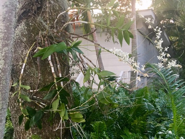
A view along the trail.-SPIRITUAL LIFE -PRESERVING THE PAST -SACRED PRECINCTS-PINELAND SINCE THE CALUSA -A walk through time…-Library information and artifacts -The Calusa made weights of shells for their fishing nets. -Quahog clams are often a part of the great mounds. You may see these clams around today.-An impressive people; we remember them with honor…

In Search of the Calusa 2

-Ed, Estero Bay, Lee County, FLIn Search of the Calusa 2-Mound Key to Marco Island, May 8-13, 2022.

In Calusa 1, Ed, Mindi, and I learned about villages of the Calusa that once existed right in downtown, Ft Meyers. Soon after, we visited an even more remarkable remnant, the Mound House seven miles away on Ft Meyers Beach.

Continuing our journey, we headed south along Estero Bay, an aquatic preserve connected to the Caloosahatchee River.  As Adrift’s draft was too deep, we viewed Calusa site #3, Mound Key Archeological State Park, from a distance. Archeologists have determined that “Mound Key” was the capital so to speak, the ceremonial center, of a sprawling Calusa Kingdom that influenced much of South Florida. Over centuries, high shell mounds and a grand canal were built on Mound Key by Calusa hands as explained in Trail of Florida’s Indian Heritage. Seeing the famous key from a distance was quite remarkable and really and gave me a reference point for the Calusa people and their travels throughout the remainder of the trip.

III. Mound Key

-Image Florida Museum

-Mindi and Ed lead Adrift through to Estero Bay

-Ft Meyers Beach and Estero Bay to Mound Key, Google Maps.

-Wider view: Ft Meyers to Marco Island, Google Maps.

IV. Marco Island

-Rounding into Marco Island, Gulf of MexicoThe boat trip to beautiful Marco Island, Calusa site #4, cradled in the Gulf of Mexico, was rough, but once we got there about six hours later, it was calm and beautiful. I knew -here as well- we could not experience Calusa culture first hand as its most famous archeological site is now developed and covered over  by the Olde Marco Inn. This photo below is close to this area.

Key Marco as documented in the Pepper -Hearst Expedition of 1886

The Key Marco/Marco Island’s story is fascinating. Around 1895, landowner, W. D. Captain Bill Collier, no relation to the famous Collier family, was living-subsiding-on Key Marco of today’s Marco Island. While digging on his property, he noticed artifacts. Serious artifacts. Shortly thereafter, anthropologist, Frank H. Cushing, sponsored by the Smithsonian, University of Pennsylvania, and William and Phoebe Hearst was called to excavate. The “Key Marco” location became one of the most famous North American archeological sites of all time as Cushing basically “unearthed remains of an entire Calusa village.”

-The Calusa used many beautiful and once abundant shells for various aspects of their amazing culture  -All photos are replicas of Cushing’s finds, Randell Research Center, JTL Most famous among the 1896 finds is the hard-wood, in tact, gorgeous “Key Marco Cat,” and many ceremonial masks that were painted by Wells M. Sawyer before they disintegrated or fell apart. Eventually, the artifacts, photos, watercolors, and drawings were split-up among well known institutions after Cushing’s death only four years later in 1900. Thus it is difficult to view them all in one place.

Thankfully, the most famous, the “Key Marco Cat” or “Panther Man God” is on loan from the Smithsonian to the Marco Island Historical Museum until 2026. You can learn more about the iconic Florida artifact by watching this video by Pat Rutledge, Executive Director of the Marco Island Historical Society with her guest, Curator of Collections, Austin Bell.

Unfortunately, Ed and I did not get to see the Marco Cat as I left Marco Island to attended a South Florida Water Management District governing board meeting in Key Largo. But Ed and I are planning a trip back to Marco Island to see the famous feline! This is a must! Our in Search of the Calusa tour is ending up being one of our all time favorite trips! So much to learn about our Florida!

Screen shot of slide via above link to video, Austin Bell.

-Not a replica. Image of Key Marco Cat or Panther Man God, Smithsonian Museum Florida Museum of Natural History reconstruction of  ancient Calusa chief/dolphin images-Ed meets a modern street dolphin while walking Marco Island -As you can see from this photo, Marco Island is built up today as is most of South Florida…-Advertisement for the Marco Cat at the Marco Island Historical Museum!-Goodbye Marco Island! Next stop Pine Island north of the Caloosahatchee River. Ed and I look forward to taking  you there for our final Calusa visit!

In Search of the Calusa, 1

-Museum exhibit, Mound House, photo Ed LippischOn May 2nd of 2022, Ed and I began one of my favorite adventures. We went in search of the Calusa, one of Florida’s most famous native tribes. It was in spirit that we found them and they, indeed, were everywhere…The trawler left Stuart going through Lake Okeechobee to Ft Meyers. Lightening and thunder exploded with great force over the Caloosahatchee as Adrift slowly approached Legacy Harbour Marina. As first mate, I refused to walk to the bow to dock the boat for fear I would be struck. “Don’t you realize Florida has more lightning strikes than any other state?” I called through the wind and rain. Ed gave me the evil-eye until I did my job, and the storm was lessening. I stepped out into the elements, crossed myself, pulled up the hood of my rain jacket, and grabbed the lines.

My prayers must have worked as almost immediately the sky began to clear.  After, cleaning up, Ed and I got off the boat, now in good spirits, and walked towards downtown where right away there were signs of former Calusa villages…The following day, my UF friend, Mindi Morrall, met us and we began the second part of the trip to the Mound House, this time by car, located about seven miles away on Ft Meyers Beach. We quickly realized that the Uber driver was from out of state and was not aware that any “Calusa Indians” had ever lived in Florida at all.

The Mound House is considered the “Crown Jewel” of Fort Myers Beach. In April of 2019, it was added to the National Register of Historic Places. It was selected for its historic and its archeological value. The Calusa built the shell mound underlying the mound house over many centuries. A timeline marks their presence in the region from 500 B.C. through the 1700s.

The Calusa lived from the riches of the estuary environment eating tremendous amounts of mollusk and fish, piling remains into very tall mounds -some taller than thirty feet- over centuries. In the 1500s the Calusa were the dominant people in what today we call “South Florida.” The word “Calusa” is thought to mean “fierce people.” They were not farmers, but fisher-hunter gatherers, and as their name states, fiercely independent. The Spanish explorer, Ponce de Leon, was attacked and fatally wounded by this tribe upon his return to La Florida, the conquistador’s first visit being in 1513.

I have always felt it is the spirit of the Calusa Warrior that helped bring a turning point to the estuaries of the St Lucie River and Caloosahatchee. Today, I will briefly share this experience as an introduction.

This image by the Florida Museum of Natural History shows the “radiation” of the Calusa.

Photos of our meeting the Calusa:

-Entrance to the Mound House, Lee County, FL-Mindi was taller than most Calusas and I was just about the height of the Spanish!-Road to the Mound House built in 1906 atop the thousand/s year old Calusa shell mound-Ed and Mindi wait for the tour to begin. Estero Bay in the distance. -Presentation by Mound House Preservation specialist. Welch & conch were used for many different tools and other utensils. The Calusa are famous for their masks and art.-Location of Mound House and other sites of the Caloosahatchee

-An Atala butterfly on a Strangler Fig tree, the sap of tree used by the Calusa to make paint. -Examples of Calusa replica artifacts -many are some of the most famous in the world. -Looking into floor of  the Mound House built in early 1900s. Shells! -Of great interest was where a display in the ground where a swimming pool had been excavated and shell layers of the mound beneath the house could be closely viewed “over time,” layer by layer.-Necklace of the four corners

Escalante Fontaneda’s Memoir 1575

The Mound House was a great introduction to the Calusa. But there is much, much more! Ed and I will take you there next: Marco Island & Pine Island…


Useppa ~Very Different Waters Indeed

I was still stewing over thinking that Charlotte Harbor was the Gulf of Mexico when the trawler docked at Useppa.

The sunlight reflected off impressive white structures lining the island. An American flag flew prominently atop what Captain Glenn said was once a Calusa Indian midden ~the tribe whose arrow maimed, later killing, Ponce de Leon.

There was certainly an air about the place, that for eternity, it had been a center of power and influence.

As I walked with Captain Glen and Ed beyond the docks, the front office gave hints to the days of Baron Colliers’ famed Izaak Walton Club, clearing, dredging, filling and building, to make available Florida’s most famous of Tarpon filled waters.

ca. 1906 https://www.useppa.com/legacy/izaak-walton/, courtesy  web site, Useppa

Looking around, I saw messages and awards written on Tarpon scales, enshrined in glass casings of an era long gone by. It made my heart ache for a time of healthier Florida waters, times when nutrient pollution, toxic-algae, and over-drainage were not killing our state. I decided be thankful for this looking-glass of history and enjoy a walk.

The island remained absolutely beautiful…and such strange and wonderful treasures! As we walked up the mound, I gasped at the wonder all around me.

I saw night-blooming cactus vines like hundreds of green ropes covering the huge ancient oaks trees; Spanish-moss swaying in a light breeze: an empty beach catching the colors of coming sunset; orchids and bromeliads blooming everywhere high and low; a gigantic banyan tree, a gift from Thomas Edison, standing like an aging hurricane-weathered sentinel – old limbs broken and reformed, arching over houses and sidewalks alike!

There were animals too. We met a friendly, stowaway orange cat that had arrived on a supply vessel and now was the mayor of the town. And also an old gopher turtle happily clipping grass with an awesome multi-entrance and exit gopher tunnel.

At the end of the sidewalk tour, the famed Collier Inn stood atop the ancient Indian mound looking out over the waters. It was beautiful yes, but I knew, in spite of the awe around me, with no tarpon jumping, those were very different waters, indeed.


Links:

Useppa resident speaks up: https://www.news-press.com/story/news/2018/08/22/toxic-algae-florida-scientists-question-health-departments-stand/973593002/

Calusa Indians, Fl: http://www.pbchistoryonline.org/middle-school-lessons/001-Calusa/001-Calusa1.htm

Historic Society, Useppa: http://www.useppahs.org/pages/useppa_history.html

Izaak Walton Club, Collier: https://www.useppa.com/legacy/izaak-walton/

Note Useppa Award from Captains For Clean Waters: https://captainsforcleanwater.org

West Florida Sailing and Cruising School: http://www.flsailandcruiseschool.com

https://captainsforcleanwater.org

Ghosts of Lake Okeechobee’s Sugarcane Fields, St Lucie River/Indian River Lagoon

Calusa Indian mask image, public domain. Many wooden masks were found particularly at the Marco Island in far west Florida. They were and sketched  before they disintegrated once removed from the muck.
Calusa Indian mask image, public domain. Many wooden masks were found particularly at Marco Island in west Florida. They were and sketched before they disintegrated once removed from the muck.
Tribes and locations of Florida's natives peoples around 1500.
Tribes and locations of Florida’s natives peoples around 1500. (Online source)
Swamp to Sugar Bowl, Lawrence E Wil, 1996.
Swamp to Sugar Bowl, Lawrence E Wil, 1968.

Today, I continue my series based on the 1968 book “Swamp to Sugar Bowl,” by Lawrence E. Will.

To understand the St Lucie River/Indian River Lagoon region and its water issues, it is imperative we study not only our own area, but also the waters and the history that  is connected to Lake Okeechobee. As you know, the area south of Lake Okeechobee is inexorably connected to our region, as the reason the waters of Lake Okeechobee do not flow south, and are directed through the northern estuaries is due to the agricultural development south of the lake.

The area south of the lake includes various “townships,” but today we will focus on Belle Glade, in Palm Beach County very close to Martin County. Today, Belle Glade is the home of the Sugar Cane Growers Cooperative, (http://www.scgc.org)

In ancient times, it was the home of the warrior tribes known as the Calusa Indians. According “Swamp to Sugar Bowl,” somewhere between 1000 and 1700 A.D. , the Calusas lived along the shores of Lake Okeechobee. A Paleo-Indian culture preceded them thousands of years earlier. The Calusa were “mound builders” using the shellfish they gathered and consumed to create mounds sometimes over 70 feet in height and over 100 feet long. They were a fishing society, living off the rich resources of the waterways. Agriculture was not necessary for their survival. (Ironic considering today!)  In the Belle Glade area, the Calusa lived between the forks of a river that of course has been channelized, known by white settlers as “the Democrat.”

Location of indian mounds just south of Lake Okeechobee in today's Belle Glade community.  (Map Swamp to Sugar Bowl. 1968.)
Location of Indian mounds are  just south of Lake Okeechobee in today’s Belle Glade near historic “Chosen,” on mainland’s north shore side of Canal Street at the Torry Island Bride. (Map Swamp to Sugar Bowl, 1968.)

It is sadly ironic to me that we live on the burial grounds of Indians that lived so in tune with nature, and we manage to so completely destroy it. That goes for areas of Martin County as well. Much of Hutchinson Island and other locations across the state were bulging with shell middens, sometimes sacred graveyards,  that later were used to pave roads. “Bad karma,” I’d say.

Guess what is left of this once magnificent  Indian Mound in Belle Glade today? Not a thing. It is a sugar field in a “ghost town” known as “Chosen!” (http://www.ghosttowns.com/states/fl/chosen.html)

Map of Indian Mound area today, Google Maps, 2015.

The small community of “Chosen” (http://www.pbchistoryonline.org/page/chosen) preceded, “Belle Glade,” and was destroyed in the horrific Hurricane of 1928 that drowned somewhere between 2000 and 3000 people: (According to Mr Lawrence it was 3/4 black farm workers and 1/4 white pioneers.) These bodies were piled up and burned or buried in mass graves. 

Indian Mound of Chosen being excavated by the Smithsonian and University of Florida in the 1930s. (Palm Beach Historical Society.)
Remains of the Indian Mound at Chosen being excavated by the Smithsonian and University of Florida in the 1930s. (Palm Beach Historical Society.)

The whole story is quite disturbing really. Don’t you agree? My family recently went to St Augustine and the kids got me thinking about ghosts. Lake Okeechobee and the St Lucie River/Indian River Lagoon soils must be full of them. I bet they are watching how we handle this next part of of our water history.

Welcome to Belle Glade Where Her Soil is Her Fortune.
Welcome to Belle Glade where “Her Soil is Her Fortune.”

_______________________

Belle Glade: (http://www.bellegladegov.com/index.php?option=com_content&view=article&id=63:about-us&Itemid=53)

Burial Mounds of the Calusas: (http://teachingflorida.org/activity/ceremonial-and-burial-mounds)


Sugarland Road Trip to the Caloosahatchee, Celebrating 50 Years of Friendship along the St Lucie/Indian River Lagoon

Martin County High School Class of 82 friends celebrated their 50th birthday on the Caloosahatchee, the sister river to the St Lucie.
Girlfriends from the Martin County High School Class of 1982 celebrating our 50th birthdays in Sanibel/Captiva, the area of the Caloosahatchee River, Lee County, Florida.

This past weekend, my girlfriends from high school decided to travel across the state to celebrate our 50th birthdays!

photo

It was a great time. We stayed in the area of the Caloosahatchee River which is the sister river the the St Lucie River. Both rivers have been plumbed to take overflow waters from Lake Okeechobee that Nature meant to flow south to the Everglades. The Caloosahatchee, in fact, is the “bigger sister,” in that when the rains come, she takes three to four times as much polluted, fresh water as we do—she is longer and larger than ourself. Ironically now, year long,  the river needs constant small releases of fresh water from the lake as she becomes too saline. The system is suffering as is the St Lucie.

Caloosahatchee River was the first estuary to be channelized and connected to Lake Okeechobee in the late 1800s by Hamilton Disston.
Caloosahatchee River was the first estuary to be channelized and connected to Lake Okeechobee in the late 1800s by Hamilton Disston. (Photo, CRCA)

“Caloosahtchee” means “river of the Calusa,” after the native peoples who lived and thrived there thousands of years ago.

So how does the Calooshatchee compare to the St Lucie? Well, according to the Caloosahatchee River Citizens Association, (CRCA), as sea levels receded after the last ice age, a series of lakes connected by wet prairies fed a tiny lake in the center of a valley feeding a “tortuously” long, crooked river that flowed slowly west to the Gulf of Mexico. So the Calooshatchee like the St Lucie drained to the sea but was never “connected” to Lake Okechobee. 

But then entered “modern man.”

In 1881, investor and business man, Hamilton Disston, bought four million acres of Florida lands for development and agriculture getting the state out of debt.  His first project was to drain the land around lake Okeechobee.

He dynamited the water fall between Lake Flirt and the Caloosahatchee and connected an old Indian passage from the Caloosahtchee to the lake. With that and the dredging and channeling of the mouth of the Kissimmee, the lake dropped tremendously, and although Disston committed suicide in a bathtub after the Panic of 1893, he inspired those following him to continue the drainage machine that has formed the Florida  we know today.

After the floods and hurricanes of 1926 and 1928  the Caloosahatchee was straightened, deepened, and widened, draining surrounding agricultural lands and controlling flood waters.  The “improvements” continued again in the the 1950s as more people moved into the area.

The story of the Calooshatchee is very similar to the St Lucie.

On another note, one of the most interesting parts of getting to the Caloosahatchee with my friends was driving “under” Lake Okeechobee taking Highways 441, to 80, to 27 and passing through the sugar towns of Belle Glade, South Bay, Clewiston and La Belle. It was a  three and a half hour drive from Stuart to Captiva and most of the drive was through the Everglades Agricultural Area.

The Everglades Agricultural Area is 700,000 acres south of Lake Okeechobee.
The Everglades Agricultural Area (EAA) is 700,000 acres south of Lake Okeechobee. To drive through them one drives just south of the lake.

As we were driving through we were amazed to think that historically the waters of Lake Okeechobee went south,  as today, south of the lake,  it is sugar fields for as far as the eye can see! And for many, many miles you are driving right next to the dike.

“This is kind of weird…”

Mile upon mile of sugar fields is the view while  traveling south of the lake.
Mile upon mile of sugar fields is the view while traveling south of the lake.
Southern dike around Lake Okeechobee looks more like a hill of grass.

I reminded my friends of the hurricane of 1928 and the thousands of migrant workers that were killed with no alert of the coming doom. The small dike around the southern lake certainly did not look like it would hold if another monster storm came. We talked about how clueless we were as kids to the environmental effects of agriculture on our St Lucie River/Indian River Lagoon compared to what the children are learning today.

Of course we need agriculture but to have 700,000 acres completely cut off water flow south of the lake is an accident waiting to happen and a death sentence for our St Lucie Indian River Lagoon and for the Caloosahatchee.

As I talked about a possible third outlet to the lake, I told my friend Jill not to speed because if we were stopped, and I was in the car, we would all certainly go to jail!They laughed knowing I am an advocate for the St Lucie/Indian River Lagoon an often contentious issue when it comes to sugar farming.

Once in Captiva, we had a great time, paddle boarding, riding bicycles, swimming, and going out in Sanibel/Captiva Island.

Such a wonderful time would not have been possible had the Army Corp and South Florida Water Management District been releasing masses of polluted, fresh water from Lake Okeechobee. United  we are on both sides of the state, that there has to be another option for Lake Okeechobee’s water coming through our estuaries–we are sisters!

A beautiful sunset over the convergence of Pine Island Sound and the Caloosahatchee.
A beautiful sunset over the convergence of Pine Island Sound and the Caloosahatchee , our sister river.