Secretary Hershel Vinyard, of the DEP, fields questions from river activist Benjamin D’Avano about a toxic SLR/IRL, “TMDL Celebration” Downtown Stuart, 2013.
Right before Thanksgiving, I heard the news, “Secretary Hershel Vinyard announced he is retiring from the Department of Environmental Protection….”
Even though there were many times over the past few years, that I felt like the DEP was not doing its job, and that the Scott administration had “demoralized” the agency, I felt saddened to hear this news….
Why? Because Hershel Vinyard was someone who went out of his way to build relationships in Martin County. Who will I call now? Clifford Wilson, the 35-year-old interim Secretary for the DEP? Don’t think he’d recognize my name and maybe not even be that familiar with the problems facing the St Lucie River/Indian River Lagoon…
Clifford Wilson, interim Secretary for the DEP.
After thinking for a while, an image came to mind of the first time I saw Secretary Vinyard deal with an angry public. He did a good job and from that moment on I liked him.
I have to say that Secretary Vinyard did a good job handling an angry crowd and over time I came to know him and appreciated that he took the time to visit Stuart on many occasions and learn the history and polluted plight of the St Lucie River and Indian River Lagoon. He would listen. He helped bring Governor Scott here to see the river. He saw how much we cared and responded even though he could not single-handedly fix the situation. Martin County is not known for getting much attention–I am appreciative that it was given…you can’t start changing things until those in power know who you are.
Group shot, Town of Sewall’s Point Commissioner, Jacqui Thurlow-Lippisch; Stuart Former mayor and Commissioner, Jeff Krauskoph; SFWMD Board Member, Kevin Powers, DEP Secretary Hershel Vinyard; SLC Commissioner, Chris Dzadovsky ; Martin County Commissioner, Ed Fielding; River Kidz member, Mary Thurlow, 2013.Speakers talk about the clean up of the SLR, 2013.Mary, Secretary Vinyard and me, 2013.
One time, when I emailed the Secretary about the SLR/IRL, I made the mistake of writing “Secretary Walker…” as in “Hershel Walker,” a very famous Georgia football player from my era who tortured the Florida Gators. As always, Mr Vinyard was a gentlemen and did not make me feel like an idiot.
In spite of people or parties we “like or dislike,” we must remember that it is relationships that will help heal the St Lucie River/Indian River Lagoon, and these must be built with whomever is in office. And although it may have been political, Secretary Vinyard was on the Army Corp of Engineer Calls at the end of this summer asking the agencies NOT TO RELEASE LAKE OKEECHOBEE WATER THROUGH S-308 into the St Lucie River/Indian River Lagoon. I will never forget these words….this is progress.
Yes, I am thankful for the times Secretary Vinyard took an interest in Martin County and since he resigned Thanksgiving week, I want to mention this. I hope that the next person who takes the position of Secretary of the DEP comes to know the St Lucie River/Indian River Lagoon too. We are entering a critical time with the possibilities of land acquisition in the Everglades Agricultural Area though Amendment 1; it’s a lot easier to work this with people we know or knew…
Wild turkey, taking a rest, Sewall’s Point, 2008. (Photo Jacqui Thurlow-Lippisch.)
HAPPY THANKSGIVING!
Taking a break under the American flag. (Photo Jacqui Thurlow-Lippisch, 2008, High Point, Sewall’s Point.)
In 2008 there was a flock of about seven wild turkeys that would fly over from Hell’s Gate across the St Lucie River and visit my street, Riverview, as well as others right here in Sewall’s Point.
The first time I saw them, I thought they were peacocks as there were peacocks here at the time, before the mail man ran over the male and the rest got eaten by bobcats.
At closer look, the tailless peacocks or very brown peahens were skinny, nervous, running wild turkeys! Ed had seen them too, very early in the morning on the way to work, and sent me a photo from his phone. We really enjoyed seeing them!
Over about the course of a year, I really came to like them, and began to feel bad about eating their fat, farmed cousins for Thanksgiving…Since about 2011 they have not visited. I wish them, wherever they may be, as well as you, and your family, a very Happy Thanksgiving this week. In spite of life’s difficulties, there is so much to be thankful for…
On a river note, we have the attention of of government for the Indian River Lagoon, and things may get better, if we keep pushing and calling attention to the river’s plight and how important it is in our lives.
Wild turkey, Sewall’s Point, 2008. (Photo JTL, 2008.)
For the Thanksgiving week, I will be taking a “blog break” to spend time with my local family, visiting relatives, and celebrate Ed’s birthday; he turns 58 today! 🙂
See you next week! And if you see a wild turkey, wish it a Happy Thanksgiving and tell it we’d love to have it and its family back in Sewall’s Point!
Benjamin Franklin preferred the wild turkey as our national bird, as he felt the bald eagle, that sometimes steals food from other birds of prey, had “bad moral character…” Even so, one has to wonder if the United States of America would have ever reached its “greatness” if our national bird had been a turkey.
A beautiful but not quite as stately, wild turkey displays its fanned tail. (Public photo)
Just recently during the Stuart Air Show, my brother Todd, sent me some photos he took of an eagle soaring over the St Lucie River in North River Shores. About three weeks ago, I was pulling into Cedar Point Plaza in Stuart, I looked up and saw the unmistakable white “bald” head, large body enormous wing span of a bald eagle. Incredible! Inspirational! It made my day!
Bale Eagle flying over North River Shores. (Photo by Todd Thurlow, 11-14.)
Today, in our Indian River Lagoon Region, birds of prey are by far more prevalent than when I was a kid growing up in Stuart in the 1970s and 80s. Even if the Indian River Lagoon system was healthier then, than it is now, in the 70s and 80s, rarely did one see the great eagle soaring or the abundant ospreys one sees today.
The reason? Of course DDT, (dichlorodiphenyltrichhloroethane), a powerful chemical used to control mosquitoes and as an agricultural insecticide. Once it became widely known that DDT was a threat to both bird and human health, primarily due to the publication of Silent Spring by Rachel Carson, in 1962, DDT’s use was eventually outlawed in the United States.
So in spite of the St Lucie River and Indian River Lagoon’s extensive decline, there are more eagles about today than before. In Florida, after being designated as “endangered” since 1972, in 1995 the bald eagle was reclassified as “threatened.” The birds and their habitat remain protected.
Eagles mate for life and a pair has been reported in the area of Sewall’s Point for about four years. The photo below was taken by Greg Braun and shows one of the eagles sitting on a rock by Bird Island. Apparently, the pairs may leave each other for many months when traveling great distances, and then return to their nesting sites. There are accounts of their “mating sky dance” where the eagles lock talons hundreds of feet up in the air and then tumble, almost hitting the earth, only to release and regain their flight at the last-minute!
Eagle sitting near Bird Island just off of the Town of Sewall’s Point. (Photo by Greg Braun, 2012.)
An eagle can stand three feet in height, and its wing span can be up to 8 feet! Their eyes are just larger than human eyes and of course, their eye sight is superior, approximately 3 and 1/2 times better than a human with 20/20 vision. For instance, they are able to see another eagle flying 50 miles away and a rabbit moving over the ground a mile away. They love fish and are outstanding hunters. Females are larger than males and dominate the nest, often killing the smaller male sibling. Nature does not sugar coat the eagle’s drive to dominate and survive, especially the females….
Another strong instinct is “pruning” which chicks mimic even before they have feathers by accessing an oil gland at the base of the torso using their curved beak to pretend they are coating each feather. Baby eagles must grow for about five or six years to be sexually mature and attain their white head feathers. Parents take care of the young for many months even though the young start flapping their wings around 8 weeks and are encouraged to take flight. I was lucky to experience this wonder, when a few years ago, Dr Dale Hipson, a friend of the family, took me to his camouflaged hide out in the Corbett Wildlife Management Area to watch eagle parents dutifully feeding and teaching their young. It was an experience I will never forget.
Dr Hipson taught me that the word “bald” is an archaic word for “white” and this is how eagles got their name. Juvenile eagles are brown in color and often mistaken as ospreys or hawks.
Reading about eagles, it is hard to understand their migration patterns and perhaps scientists do not really know as they can’t fly with them, but it seems some eagles in Florida migrate thousands of miles to Alaska (Snow birds!) and some are “resident” eagles remaining here. Florida is the second most eagle-populated state in the nation other than Alaska.
Eagle nests are the largest nests known. (Photo Harbor Ridge reporting/video taping of nesting site, 2011.)Eagle in area of Rio, as taken last week by wildlife photographer and Facebook friend, Rebecca Fatzinger, 11-14.)
In closing, I am happy that some birds are doing well in spite of the poor health of the Indian River Lagoon. And I have to say that with no disrespect to the turkey, I am glad the eagle is our national bird!
Benjamin Franklin preferred the wild turkey to the bald eagle as our national bird as he felt the eagle was of “bad moral character…”
This chart shows “the inherent variability in annual flows to the SLR/IRL.” (Dr Gary Goforth, 2014.)
One of the positive things that has come out of the negativity of the St Lucie River/Indian River Lagoon situation, is building relationships with incredible people who care about our rivers. One of these people is Dr Gary Goforth.
Dr Gary Goforth, 2014. (Photo Jacqui Thurlow-Lippisch)
I first met Dr Goforth last August when he spoke before the “Senate Hearing on the Indian River Lagoon and Lake Okeechobee Basin,” at the Kane Center in Stuart, organized by Senator Joe Negron. Dr Goforth was sitting next to Karl Wickstrom, founder of Florida Sportsman Magazine and outspoken member of the Rivers Coalition.
Listening to Dr. Goforth plead his case, I said: ” Wow, who is this guy?”
He spoke for the St Lucie River/Indian River Lagoon as a scientist showing the SFWMD and ACOE could move more water south, and he knew as he very much helped design the system! I came to learn that he in fact is the “father of the STAs (Storm Water Treatment Areas) in the Everglades Protection Areas and worked for the South Florida Water Management District for I believe almost 20 years. Now he is independent and has his own company. (http://garygoforth.net)
Having access to Dr Goforth is like having access to a “water issues computer” and I am continually blown away by his breadth of knowledge and that he is openly willing to share.
Sometimes our conversations go like this:
“Dr Goforth, I am looking at your chart, and my husband tells me never to speak in public when it comes to numbers…..but what does this mean……?”
He never makes me feel stupid, has the patience of a saint, and goes over the material until I get a hang of it.
The chart at the beginning of this blog entry is an example of complexities made simple through Dr Goforth. The chart, through color coding, shows “the inherent variability in flows” to the St Lucie River through C-23; C-24; Ten Mile Creek; C-44 Basin; Other Tributaries (a huge area around all the developed area of the river); and Lake Okeechobee Discharges. This is shown in AF (acre feet), or an acre of land with a foot of water on it.
Map of St Lucie Basin. Over the years, this basin has been expanded to take in water over 50% of its original footprint. (SFWMD/ACOE map 2014.)
Referring to the chart is enlightening and disturbing to note that for instance in 2005, almost 2,500,000 acre feet of water came into the St Lucie River/Indian River Lagoon; and in 2013, our “Lost Summer” about 1,250,000 acre feet came in. Other years shown on the chart between 1995 and 2013 with “worse” years than 2013 are 1998; 2003; and 2004. To somewhat put this in perspective, the huge EAA, or Everglades Agricultural Area, south and around the Lake Okeechobee is 700,000 acres. So for 2,500,000 acre feet of water, where would we ever find 2,500,000 flat acres of land to put this water on? We would not, and this is why “they” have to deal with volume and deeper storage areas. Mind blowing? YES!
The red colored blocks south of Lake O. are the EAA-700,000 acres of sugar lands and vegetables. South of the EAA are the STAs and water conservation areas .(SFWMD map, 2012.)
So getting back to home, why did we finally “freak out” and go over the edge in 2013, when the flows have been “worse” before? Well, I personally think social media is a big part of this, as well as the aerial photos that “showed” people” the true repugnance of the big picture; and like someone in an abusive relationship, after years and years, we’d finally HAD ENOUGH!
C-44, C-23 and C-24 basin runoff discolor the waters of the SLR/IRL while exiting the St Lucie Inlet over near shore reefs, 7-19-14. (Aerial photo, Ed Lippisch.)
Dr Goforth’s chart also shows that the annual flow to the SLR is 999,468 acre feet; and the average annual flow of Lake Okeechobee water to the SLR is 291,899 acre feet or 29% of the flow. I’ll round that up to 30% and say, “Yes, we here in Martin and St Lucie County have terrible issues with our own local runoff of C-23; C-24; Ten Mile Creek; C-44 Basin; and Other Tributaries; yes, in fact we are almost killing ourselves, SO ACOE and SFWMD PLEASE DON’T TOTALLY KILL US BY RELEASING POLLUTED WATER FROM LAKE OKEECHOBEE ON TOP OF OUR ALREADY HORRIBLE SITUATION!
With that said, I hope you learned something today and if you have time, take a closer look at the chart, it’s really educational; also, if you ever see Dr Goforth around town, go up to him and thank him and shake his hand. He is one of the most outstanding “River Warriors” of all!
The forgotten boulder under the Ernest Lyons Bridge… (All photos by Jacqui Thurlow-Lippisch, 11-16-14.)
Just a few days ago, while walking and trying to “get back into shape,” I saw the giant granite boulder, like Stonehenge, with the sun setting behind it, and the full beauty of the river’s reflection bursting forth.
Immediately, I experienced a kind of flashback. It was 1979; it was raining. I was fifteen years old; I was awkward; and the most important thing in the world to me was my friends who I was hanging out with that day, and experiencing freedom away from my parents, who were just down the causeway.
And then, something I’d never seen happened. A governor was before me. Yes, Governor Bob Graham came out and started speaking, next to this giant rock. Everyone was quiet, even we girls stopped fooling around. The governor was wearing a suit, had presence, and when he started talking his slow cadence and confidence was rather mesmerizing ….He was talking about the St Lucie Inlet and the future of Martin County…
The lone boulder sits unmarked….Alone, unmarked….history is forgotten.
This experience, may in fact, have been the first time I realized a politician could have an effect on people…My mind’s eye still holds the image of seeing the governor, like a photograph.
I am fortunate to have information detectives in my family so after my flashback experience, when I got home, I immediately contacted my mother and brother and asked about the lone boulder that I recognized that was sitting all alone. “What’s its story…?”
I knew that before the “new” Ernest Lyons Bridge, the boulder stood close to the “old” Ernest Lyons Bridge along the Stuart Causeway. One would always see it on the way to the beach, sitting right there, very visible, along A1A. Today it is tucked away under the tall bridge between Sewall’s Point and Hutchinson Island, without so much as a plaque to note its symbolic significance.
Within a short time, my brother, Todd, found a Palm Beach Post Article from 1979 entitled A FESTIVAL FOR ALL—EVEN IN THE RAIN by Jim Reeder. The article tells the story of the thousands of people who showed up to see the dedication of the boulder and Governor Graham at the “St Lucie Inlet Festival.” “This festival was in celebration of the extensive improvements to the inlet miraculously approved by Congress, requiring blasting and dredging that amazingly was “supported overwhelmingly by all the groups that are normally at odds, such as developers and conservationists.”
How quickly things are forgotten….
The lone boulder watches the sun set over the Indian River Lagoon and peek through the Ernest Lyons Bridge. (Photo by Jacqui Thurlow-Lippisch, 11-16-14.)
It is my hope the lone boulder gets a plaque. According to my historian mother, it was one of the gigantic granite rocks to be used to improve the new St Lucie Inlet jetty, set aside for the event to memorialize that special day. This jetty is still out there taking the waves, and is still part of an inlet that has problems, but represents one of the few times, Martin County contingencies “got along.” This is worth recognizing….
The Florida League of Cities advocates the Florida legislature on behalf of over 400 Florida municipalities.
Today I would like to share good news from the Florida League of Cities of which I have been an active member, as an elected official of the Town of Sewall’s Point, since 2009. I was also fortunate to be chosen to chair the league’s environmental committee last year in 2013 and in 2013 the SLR/IRL became a part of the leagues legislative priorities. Today I am happy to share continued support by the FLC regarding the plight of the St Lucie River/Indian River Lagoon and Caloosahatchee River due to excess polluted discharges from Lake Okeechobee.
Only a few years ago, the league had never heard of the St Lucie River/Indian River Lagoon, and thanks to last year’s public outcry and the leadership of Senator Joe Negron, and others, today we are part of their greater lobbying effort!
To give some background, the Florida League of Cities is the “united voice” for Florida’s municipal governments and was first started in 1922. Its goals are to serve the needs of Florida’s cities and to promote local self-government and Home Rule. The league was founded with the idea that local self-government is the keystone of American Democracy. Today there are over 400 municipal members, (towns, cities, villages) represented by the league. (http://www.floridaleagueofcities.com)
Florida League of Cities Legislative Committee, 2014. (Photo Jacqui Thurlow-Lippisch)
Regionally, the Town of Sewall’s Point, City of Stuart, Town of Ocean Breeze, Town of Jupiter Island, St Lucie Village, City of Port St Lucie, Ft Pierce, Fellsmere, Sebastian, Vero Beach and Okeechobee are active members of the league.
There are five legislative committees of the league and ten priorities come out of each legislative session based on the work of the legislative committees that comprise members from all over the state with as many as 50 members sitting on a committee. This year’s Legislative Committee for the FLC occurred November 12-14 in Orlando.
The committees are as follows: Energy, Environmental and Natural Resources; Finance and Taxation; Growth Management and Economic Affairs; Transportation and Intergovernmental Relations; and Urban Administration.
Sam Henderson 2014 Chair for the EENR Committee, presenting with FLC’s Ryan Matthews.
As I mentioned, I chaired the Energy and Environmental and Natural Resources Legislative Committee last year, but this year did not, and I was wondering if estuaries of the SLR/IRL and Caloosahatchee would take a back seat as there is fierce competition and many water problems throughout the state. I was delighted to see that the committee continued its commitment to calling attention on a statewide level to the water problems of our region.
The POLICY STATEMENT for Water Quality and Quantity 2014 reads:
The Florida League of Cities supports legislation that provides recurring allocations of financial resources for local government programs and projects resulting in the protection of water resources, the improvement of water quality and quantity, and the expanded use of alternative sources of water.
The background immediately following this priority is even more specific stating:
Florida is currently dealing with multiple water challenges. South Florida faces water quality problems in the form of massive water releases of nutrient enriched waters. Those releases, which are controlled by the Army Corp of Engineers–a federal agency, pollute the estuaries and water systems that flow to the St Lucie on the east and the Caloosahatchee on the west. North Florida faces an impending disaster in its oyster industry due to increased water usage by neighboring states Alabama and Georgia. Meanwhile all of Florida is struggling with how to efficiently conserve water and avoid devastation to the Florian Aquifer….
I am thankful to the league and to the many elected officials from all parts of our state who supported this legislative policy statement for 2014. This statement will go before the state legislature as the league lobbys and works for policies of the league.
We must be mindful of all of our water issues, from spring degradation, dying lakes and rivers, aquifer depletion, as well as the St Lucie/Indian River/Caloosahatchee/Lake Okeechobee issues we deal with at here home.
Understanding all of our water issues together is necessary, as we are all connected.
Together as cities fighting for what we love, our cities, we can overcome the common apathy of our state legislature and the destruction that has been brought upon our state by overdevelopment and lack of appreciation of our natural systems and the role they play in strong economies and quality of life.
With cities addressing Florida’s water problems together, we just might turn the tide….
Only a thin ribbon of land separates the Atlantic Ocean from the Indian River Lagoon…. (Photo Jacqui Thurlow-Lippisch and Ed Lippisch, 2014.)
As we all know, estuaries are the nurseries of our oceans. Sometimes we think of rivers and oceans as separate, but they are connected and the destruction brought upon one affects the other.
Looking above at this photograph of Hutchinson Island near the House of Refuge one can see how close the Indian River Lagoon estuary and the Atlantic Ocean really are. Not only that, when polluted water flows out of the St Lucie Inlet from the St Lucie River estuary, it covers and negatively affects our “protected” near shore reefs and the tremendous variety of life there.
A photo from Martin County shows polluted runoff flowing over nearshore reefs along Jupiter island south of Hutchinson Island and the St Lucie Inlet, 2011.
According to the Consortium for Ocean Leadership (http://oceanleadership.org) of which locally FAU/Harbor Branch is a member:
“Ocean ecosystems have been subjected to decades of intense fishing, urban and agricultural runoff, and the loss and degradation of estuaries and wetlands. Furthermore, changes in ocean temperatures, salinity, currents and acidity are having significant impacts on marine living resources. The incidence of hypoxia, as in the Gulf of Mexico (http://www.ncddc.noaa.gov/hypoxia/) (dead zones) has increased almost 30 fold in the United States since 1960 with more than 300 systems recently experiencing hypoxia.”
As we all know, the entire St Lucie/Indian River Lagoon is often a “dead zone,” due to toxic algae blooms caused by too much polluted fresh water runoff from canals carrying nitrogen, phosphorus and other pollutants from agricultural canals along the lagoon, and Lake Okeechobee .
The recommendation of the Consortium is as follows:
“…support conservation programs and services to reduce runoff of nitrogen and phosphorus, and sediment from agricultural activities which is causing harmful algae blooms and dead zones.”
Think about this for a minute.
The four agricultural canals we have here in Martin and St Lucie Counties: C-44, C-23, C-24, and C-25 have no filtering system. When it rains, the water falling on thousands and thousands of acres of agricultural as well as urban lands picks up fertilizer, pesticides, herbicides, oil, cow, horse, and pet waste, leaky septic tank effluent, and what ever else is out there; this water then runs into the canals that in turn are released directly into our waterways. When Lake Okeechobee is dumped it too has no filtering process, so not only do we get our pollution but we get “Orlando’s” as well as the Everglades Agricultural Area south of Lake O. forces the lake water to flow east and west rather than south as nature intended…. Is it any wonder why we are a toxic mess?
Canal and basin map SLR/IRL. (Public)
It must be noted that Martin County, the state, and federal government for years have been working on the IRL South Project that is part of CERP. (http://www.evergladesplan.org/pm/projects/proj_07_irl_south.aspx) This project would help hold, filter, and clean polluted water for canals C-23, C-24, and C-25 before it enters the St Lucie River/Indian River Lagoon. These projects are so expensive and political they are a “slow moving slug,”but they are moving.
Clean water does not come easy. The public must push and push. There is fierce competition.
Yes, we the public must learn more about these projects and how to help get these projects funded, along with our fight for a flow way south of Lake Okeechobee.
The government will only move forward with these projects if they know the public is expecting it and helping with it. With Amendment 1’s passage the possibility is even more of a reality, but it is no guarantee. We must advocate.
The line between the estuary and the oceans is very thin, as is the line between the people and their government. Get involved! The river and the ocean both need you!
Blue Heron silhouetted against sunrise, St Lucie River/Indian River Lagoon. (Photo by John Whiticar, 2012.)
Yesterday morning at sunrise, I drove north along Indian River Drive to Harbor Branch Oceanographic Institute in Ft. Pierce. This drive, in the early hours of morning, is the most inspirational of times…
The lone herons and egrets are many, some in groups, but most alone, standing still, and stately, and eternal, waiting for a fish. Waiting for that perfect light “to see…”
Later in the day, I looked up the definition of the word “inspire” as we talked about what this meant and how to achieve such at the board meeting for the foundation. There were various definitions, but a few captured what I felt driving along Indian River Drive in the morning’s early light…
May we all be inspired by the beauty around us, the gift of the river…
inspire, verb:
1. to influence, move, or guide by divine or supernatural inspiration
2. to give someone the enthusiasm to do or create something
3. a divine influence directly and immediately exerted upon the mind or soul
Painting on the fence at TERRA FERMATA in Stuart. (Photo Sandra Thurlow, 2014.)
Today I wanted to find a way to share the above photo that reads: BE NICE TO YOUR MOTHER…..”Mother Earth” that is….Ironically, the photo was taken by none other than my mother, Sandra Thurlow.
The painting is located at Terra Fermata on 6th Street, behind my father and brother’s law office, in expanding Downtown Stuart. The Rivers Coalition has held various fundraisers at Terra Fermata for the St Lucie River/Indian River Lagoon. Ron Hart, the owner, is one of Stuart’s business super-stars, a big supporter of the river, and makes Stuart a much cooler, hipper, younger place. (http://www.terrafermata.com)
The concept of “Mother Earth” is an ancient one and is connected to many cultures. The famous words of Chief Seattle, (http://www.historylink.org/index.cfm?DisplayPage=output.cfm&file_id=5071) a great Native American leader of the west, describe the concept about as well as possible. Apparently these words were written in response to the US Government when the chief was informed the US wanted “buy” their lands….
I think if Chief Seattle were here today, he would be proud of our fight for the Indian River Lagoon, for our Mother….
“The President in Washington sends word that he wishes to buy our land. But how can you buy or sell the sky? The land? The idea is strange to us. If we do not own the freshness of the air and the sparkle of the water, how can you buy them?
“Every part of this earth is sacred to my people. Every shining pine needle, every sandy shore, every mist in the dark woods, every meadow, every humming insect. All are holy in the memory and experience of my people.
“We know the sap which courses through the trees as we know the blood that courses through our veins. We are a part of the earth and it is a part of us. The perfumed flowers are our sisters. The bear, the deer, the great eagle, these are our brothers. The rocky creast, the juices in the meadows, the body heat of the pony, and man, all belong to the same family.
“The shining waters that moves in the streams and rivers is not just water, but the blood of our ancestors. If we sell our land, you must remember that it is sacred. Each ghostly reflection in the clear waters of the lakes tells of events and memories in the life of my people. The water’s murmur is the voice of my father’s father.
“The rivers are our brothers. They quinch our thirst. They carry our canoes and feed our children. So you must give to the rivers the kindness you would give any brother.
“If we sell our land, remember the air is precious to us, that the air shares its spirit with all life it supports. The wind that gave our grandfather his first breath also receives his last sight. The wind also gives our children the spirit of life. So if we sell you our land, you must keep it apart and sacred, as a place where man can go to taste the wind that is sweetened by the meadow flowers.
“Will you teach your children what we have taught our children? That the earth is our mother? What befalls the earth befalls all the sons of the earth.
“This we know: the earth does not belong to man, man belongs to the earth. All things are connected like the blood that unites us all. Man did not weave the web of life, he is merely a strand in it. Whatever he does to the web, he does to himself.
“One thing we know: our god is also your god. The earth is precious to him and to harm the earth is to heap comtempt on its creator.
“Your destiny is a mystery to us. What will happen when the buffalo are all slaughtered? The wild horses tamed? What will happen when the secret corners of the forest are heavy with the scent of many men and the view of the ripe hills is blotted by talking wires? Where will the thicket be? Gone! Where will the eagle be? Gone! And what is it to say goodbye to the swift pony and the hunt? The end of living and the beginning of survival.
“When the last Red Man has vanished with his wilderness and his memory is only a shadow of a cloud moving across the prairie, will these shores and forests still be here? Will there be any of the spirit of my people left?
“We love this earth as a newborn loves its mother’s heartbeat. So, if we sell you our land, love it as we have loved it. Care for it as we have cared for it. Hold in your mind the memory of the land as it is when you received it. Preserve the land for all children and love it, as God loves us all.
“As we are a part of the land, you too are part of the land. This earth is precious to us. It is also precious to you. One thing we know: there is only one God. No man, be he Red Man or White Man, can be apart. We are brothers after all.”
The Central Indian River Lagoon. (Photo by Jacqui Thurlow-Lippisch and Ed Lippisch, 2013.)
Although the Martin County Health Department reports that Vibrio vulnificus, a bacteria found in the waters of the Indian River Lagoon, is not truly a “flesh-eating bacteria,” in rare circumstances it can cause horrific blisters, limb amputations, and even death.
The naturally occurring bacteria is not well understood, but a study published in The Journal of Applied and Environmental Microbiology in 2004 regarding a study in Barnegat Bay, New Jersey states:
“V. vulnificus population dynamics are strongly correlated to water temperature and although the general trend is for V. vulnificus abundance to be inversely correlated with salinity, this relationship depends on salinity levels. Irrespective of temperature, high abundances of V. vulnificus are observed at 5 to 10 ppt, which thus appears to be the optimal salinity regime for their survival…”
This “ideal salinity level” is particularly noteworthy as during the rainy summer months salinities in the Indian River Lagoon lessen, due to polluted freshwater run-off and canal discharges. This situation is exacerbated in the southern lagoon if there are releases from Lake Okeechobee, as there were during the “Lost Summer” of 2013.
People are exposed to the bacteria through an open wound or through ingesting raw seafood, especially infected oysters. Cases occur though out the US, but according to the Center for Disease Control, Florida, Texas, and Maryland report the highest number of cases annually.
Contracting an infection from “vibrio” is extremely rare, and in fact, most people exposed to the bacteria may show no signs of infection at all. Others might experience mild effects such as diarrhea, vomiting, and stomach pain. However, for those who have weak immune systems, chronic liver disease, or other serious health problems, the vibrio can strike very quickly and be fatal.
In 2013, Florida Today reported that Florida averages 50 cases, 45 hospitalizations and 16 deaths annually, most from the Gulf Coast region, according to the Florida Department of Health. They also report that Brevard County, along the IRL, where Melbourne is located, has had 32 cases of Vibrio vulnificus infections since 1993.
Within the past year, two very serious, but non-fatal cases were reported in Melbourne, in Brevard County; and one fatal incident was reported in Ormand Beach, Volusia County, along the Halifax River, which is connected to the northern Indian River Lagoon, north of Ponce Inlet. Ironically, these central and northern IRL areas are the same locations where there have been high dolphin and manatee mortalities as expressed in NOAA’s 2013 “Unusual Mortality Events,” (UME).
As far as the southern lagoon, it was recently reported in Scripps Newspapers that two FAU/Harbor Branch scientists had found Vibrio vulnificus here as well.
This is unsettling, but to be expected, as this bacteria was probably here when I was 5 years old growing up in Stuart, every summer, full of scrapes and cuts swimming around in the warm waters of the lagoon. We must keep our perspective. Thousands of people have contact with Florida’s waters and the Indian River Lagoon and yet few become sick.
Martin County Health Department Director, Klaretta Peck, stated in a press release to Martin County elected officials this year:”
“I am writing today to share some information with you regarding Vibrio vulnificus. As you may have heard, some news media outlets have taken a sensationalistic approach to this issue, going as far as reporting unconfirmed cases, which can cause unnecessary alarm to the public. There are no recent cases of Vibrio Vulnificus in Martin County and though vibrio can cause blisters and lesions, is it not a “flesh eating bacteria” and should not be referred to as such.”
This is reassuring, nonetheless, at the height of summer, a Sewall’s Point mother called me, as I am a town commissioner. She was worried by what she had read in the papers and asked me if I thought it was alright to take her three-year old twins swimming at the Sandbar.
American Society for Microbiology: AEM Journal: “Effects of Temperature and Salinity on Vibrio vulnificus Population Dynamics as Assessed by Quantitative PCR”
Mark A. Randa, Martin F. Polz, and Eelin Limhttp://www.ncbi.nlm.nih.gov/pmc/articles/PMC520858/#!po=85.4167)
Looking at the clouds over the St Lucie River, Roosevelt Bridge, Stuart, Florida. (Photo Jacqui Thurlow-Lipppisch 11-14)
“Darkness cannot drive out darkness; only light can do that…” Martin Luther King, Jr.
The situation for the St Lucie River/Indian River Lagoon remains a bleak one, but I am telling you, “I can see the light!”
At last week’s Water Resource Advisory Commission, (WRAC), of the South Florida Water Management District, (SFWMD), Dr Gary Goforth, (http://garygoforth.net) the great scientist watchdog of the District and former employee who designed and “built” the Storm Water Treatment Areas, (STAs) for the SFWMD, stood before the commission and gave thanks to the District and to the Army Corps of Engineers for “sending more water south” through the STAs to the Everglades in 2014, than since 1995.
273,188 acre feet in fact!
Although 273,188 acre feet of Lake Okeechobee water will not save the St Lucie, sending this much water south is an incredible move on the part of the SFWMD and the ACOE. Of course there is more work to do and the situation wouldn’t be as rosy if we had had as much rain fall as in the “Lost and Toxic Summer of 2013.” Nonetheless, those who worked hard for this must be given credit.
Doing so meant taking risks of breaking the WQBEL, or how much phosphorus can enter the Everglades Protection Area. Over a certain amount is a breach of federal law. Sending so much water south also meant irritating some powerful stakeholders, like the EAA and Homestead sugar and vegetable farmers who need dry feet to grow their crops and stored water to insure they can grow them…..
Dr Goforth’s chart showing amount of Lake O. water sent south to the STAs from 1995-2014.
The situation is difficult, really the”razors edge” as the “water going south” does not just include the waters of Lake Okeechobee but also the waters of the EAA that have precedence.
So….
This year was markedly different. Why?
Because of the pressure put on the ACOE, SFWMD, the Governor, DEP and others by the SLR/IRL and Caloosahatchee River Movements, the public, Scripps Newspapers, Martin County, St Lucie, and Indian River Commissioners, the IRL 5 County Coalition, and powerful “linked-in” politicians, like Senator Joe Negron and Congressman Patrick Murphy who are watching, and forcing the agencies to follow the requirements of state and federal policy to send water south even though it is a very slippery slope.
The clouds and sun are always moving….
Change happens slowly; it requires altering the culture and habits of institutions and society. Looking at what happened this year, is proof that this indeed is occurring.
I am a no “Pollyanna;” I know that what has to happen to save the St Lucie and Indian River Lagoon is tremendous, almost beyond comprehension, but in order to overcome darkness one must begin by recognizing the light…
Moon over the “St Lucie River Bend,” by Highwayman, Livingston Roberts, categorized in 1975.
Last night, you may have seen it? The Indian River Lagoon region became a Highwayman painting…
In early evening, the full moon rose like a wise old sentinel, slowly, beautifully, magically bathing our world in a light belonging only to dreams and to fairy tales…
Moon through the giant oak tree at my parent’s house, Sewall’s Point, 11-6-14. (Photo Jacqui Thurlow-Lippisch.)
In my younger years, my Grandfather Henderson gave me a Highwayman painting by Livingston Roberts. It is a moonscape and when the moon is not out, I look to it for the same inspiration as I felt last night. It is the painting at the top of this blog post.
As shared on the Highwaymen website, Livingston Roberts, the painter of my piece, belonged to the Highwaymen group, an association of young African-American artists that functioned in 1950s and beyond in Ft Pierce, Florida. The Highwaymen artists specialized in painting Florida landscapes in a recognizable and flamboyant style.
Because they were black, it was not possible for them to sell their paintings in art galleries and shows, so they were selling them right from the backs of their cars and trucks. That is how they gained their name – “Highwaymen.”
If you have not discovered the Highwaymen, please visit the Bean Backus Museum in Ft Pierce.
Mr Backus taught Alfred Hair, the group’s founding painter and businessman. Artist, Mr Bean Backus, the father of impressionist natural-landscapes of our region and world renowned, welcomed the young black artists into his studio during a time of great prejudice. This kindness opened a whole new world for the young artists and a new light shone on Ft Pierce….
Like the moon, the story of the Highwaymen is one of a great inspiration.
My niece Evie “holding the moon…” (Photo by Jenny Flaugh, 2012.)
The two painting below were shared by Ann Benedetti. The first is by Highwaymen artist Harold Newton and the second is by Highwaymen founder, Alfred Hair. Thanks for sharing these gorgeous paintings Ann!
Executive Director, Mark Perry, Florida Oceanographic; Dr. Tabitha Cale, Florida Audubon ; Executive Director, Eric Eichenberg, Everglades Foundation; Comr. Sewall’s Point, Jacqui Thurlow-Lippisch; and Dr Paul Grey, Florida Audubon, stand before the St Lucie River, Downtown Stuart, October, 2014.
Last week, at a Rivers Coalition meeting, Eric Eichenberg of the Everglades Foundation and Dr Tabitha Cale of Audubon, gave an impassioned speech in support of Amendment 1. Such calls to action inspired Florida state voters to approve the constitutional amendment yesterday by almost 75%.
It was interesting to me that I did not know of one member of the state legislature who openly lauded support of Amendment 1, Florida’s Water and Land Conservation Initiative, for 2014.
Why not? Because it designates monies. Those in power like to have freedom with the state’s monies, rather than having them marked in stone…
Oh well….
When I first saw the furor and motivation of those working for the amendment, it was almost poignant.
The intense drive was markedly different. It was something that only manifest itself through those who have lost something; of those who have had something they cherish taken away, something they love….
Florida, our paradise, our estuaries, our springs, our rivers, our lakes, our remaining wetlands, our upland forests, our fisheries, our wildlife, our Everglades, our “Fountain of Youth” are all slowly dying. All of us who love it see this clearly, and in an organized backlash to take back what is most dear decided to do anything to save Florida from complete and total destruction, as the state is quickly becoming, some say it already is, the third most populated state in the nation.
Many have tried, but our government has not protected Florida well enough and thus we, the people, have taken this responsibility into our own hands, we have peacefully risen up, to protect Florida through the power and structure of a state constitutional amendment.
Awesome.
Will it work? Only time will tell. As we all know, money often brings out the worst in people, even those with the very best intentions.
Personally, for me there was no other choice. The state has not done its job and we were/are headed for disaster unless something changes. There can be business and paradise, but with out paradise there will be no business…
Our water and most precious land resources, what brought us all to this state in the first place, needs something more.
How the amendment reads is powerful. When you have time, take a look and read the link as well. Please keep your eye on this and the fight over the money as it is truly Florida’s last and final chance. It will only work, and the St Lucie/Indian River Lagoon will only benefit if you stay involved.
SECTION 28. Land Acquisition Trust Fund. —
a) Effective on July 1 of the year following passage of this amendment by the voters, and for a period of 20 years after that effective date, the Land Acquisition Trust Fund shall receive no less than 33 percent of net revenues derived from the existing excise tax on documents, as defined in the statutes in effect on January 1, 2012, as amended from time to time, or any successor or replacement tax, after the Department of Revenue first deducts a service charge to pay the costs of the collection and enforcement of the excise tax on documents. b) Funds in the Land Acquisition Trust Fund shall be expended only for the following purposes: 1) As provided by law, to finance or refinance: the acquisition and improvement of land, water areas, and related property interests, including conservation easements, and resources for conservation lands including wetlands, forests, and fish and wildlife habitat; wildlife management areas; lands that protect water resources and drinking water sources, including lands protecting the water quality and quantity of rivers, lakes, streams, springsheds, and lands providing recharge for groundwater and aquifer systems; lands in the Everglades Agricultural Area and the Everglades Protection Area, as defined in Article II, Section 7(b); beaches and shores; outdoor recreation lands, including recreational trails, parks, and urban open space; rural landscapes; working farms and ranches; historic or geologic sites; together with management, restoration of natural systems, and the enhancement of public access or recreational enjoyment of conservation lands. 2) To pay the debt service on bonds issued pursuant to Article VII, Section 11(e). c) The moneys deposited into the Land Acquisition Trust Fund, as defined by the statutes in effect on January 1, 2012, shall not be or become commingled with the General Revenue Fund of the state.[4]
Juvenile hawk, North River Shores, 11-1-14. “Birds of Prey” have excellent vision. (Photo Todd Thurlow.)
The 2014 mid-term election is now over, but our job is just starting.
We must watch the governor; we must watch his administration and agencies; we must watch our town, city, county, state, and congressional candidates. We are tired yes, but we must not take our eyes off them, not for a second.
Whether you voted for them or not, “winning the election” means that these candidates are working for you. But if you do not communicate with them, or watch what they are doing, don’t be surprised if they wander from their promises and goals. It is only through the pressure and support of the people that the representative process works.
The stately hawk in the photo above was taken by my brother Todd Thurlow, (http://thurlowpa.com) at his North River Shores home this past weekend during the Stuart Air-Show. I think the hawk is symbolic for what we must do and how we must conduct ourselves. The hawk was not afraid of my brother or the loud and larger airplanes in the sky. It just kept watching……
As far as identifying the hawk, I cannot tell if it is a red-shouldered, red-tailed or another type as the bird’s markings have not yet matured, and I am no expert of the avian species. If you know, please share!
What I do know though, is that this bird’s eyesight, particularly because it is a “bird of prey,” is one of the very best in the animal kingdom.
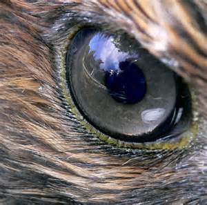
Close up of hawk eye. Public photo.
“The visual ability of birds of prey is legendary, and the keenness of their eyesight is due to a variety of factors: eyes size to body mass; eyes shape and make up– with more receptors, foveae, rods and cones giving the bird spectacular long distance vision, seeing more than 6-8 times better than humans.”
Let this young hawk inspire us. Let’s not take our eyes off our elected officials!
Help me watch them; help me push them; help me encourage them to fight the next four years for sending more water south from Lake Okeechobee, and over all water quality for our area canals, St Lucie River and Indian River Lagoon.
Hawk with airplanes from air-show in distance. (Photo Todd Thurlow.)
Congratulations especially to winners Senator Joe Negron; Congressman Patrick Murphy and Martin County Commissioner, Ed Fielding whom I supported and promoted in this election. I will be watching! 🙂
Vicki Davis, Supervisor of Elections, Martin County, FL (2013)
The whirlwind of the elections is fully upon us, and today is the “big day…”
There will be winners and there will be losers, but one thing we can count on in our country, county, and state, is that there will be a “peaceful transfer of power.” This is no guarantee in many places around the world. We are fortunate…
My family has been in what would become the “United States” since the mid 1700s on my mother’s side, and since the late 1800s on my father’s side; but, my husband, Ed, was born in Buenos Aries, and his family emigrated from Argentina to the United States in 1960, when Ed was four years old.
When Ed’s father, “Papi,” was still alive, I used to spend hours speaking to him about the political and economic situation that led to him and Mrs Lippisch bringing Ed and Ed’s sister, Lupi, to the United States. No easy feat….
Over many cups of coffee, Papi told me about the dictatorships and the frightening economic up and downs and military coups under the Perons and others during that part of Argentina’s history……(http://en.wikipedia.org/wiki/Juan_Perón)
Sadly, Papi is gone, but his spirit lives as I remember his stories well and they have made me more appreciative my own country in spite of its faults and imperfections….
Today, I wish to thank Mrs Vicki Davis, our Supervisor of Elections for Martin County for all of her hard work and for helping ensure that peaceful transfer of power. She is lovely and hard-working and she is local, having graduated from Martin County High School.
Every time I see her, she thanks me for my work for the St Lucie River and Indian River Lagoon. And every time I see her she introduces me to another “young person” working in her office. Her outreach program is phenomenal. Recently, this summer, in 2014, Vicki attended the River Warriors’ “River Rally” at Phipps’ Park and registered voters in the 100 degree heat and sweltering humidity.
She loves the rivers and she loves her country; and she is a true professional. If you see her today, please say: “thank you.” And whether you are happy with the outcome of today’s election or not, please continue to do all you can to support the St Lucie River/Indian River Lagoon and the peaceful transfer of power in the United States of America.
Because I was born in 1964, I am a child of the 1960s and 70s.
The first time I saw this VOTE sign above it struck a deep chord as I remembered having had the LOVE blocks based on Robert Indianan’s giant art piece on my desk a young person. There is a connection I thought…
LOVE by Robert Indiana
You may not approve of all who win or lose tomorrow. But be a part of the process: CARE, VOTE, LOVE, for the St Lucie River/Indian River Lagoon and for the future.
Railroad Bridge, Stuart Florida. (Photo Jacqui Thurlow-Lippisch, 2014.)Classic photo of original wooden trestle bridge over the St Lucie River and train, 1894. (Courtesy of the Historical Society of MC and Sandra H. Thurlow.)Train going over new steel railroad bridge in 1905. (Archives of Historical Society of MC and Sandra Henderson Thurlow, “Stuart on the St Lucie.”)The present railroad movable part, “wide enough to accommodate a double track” was built/added in 1925. (“Stuart on the St Lucie,” Sandra Henderson Thurlow.)
Did you know that Henry Flagler’s Florida East Coast Railway was originally named “Jacksonville, St Augustine and Indian River Railway? ” I didn’t until I re-read The Railroad chapter my mother’s book “Stuart on the St Lucie.” The name was changed on September 9, 1895 to the infamous and famous “Florida East Coast Railway.” The train did and does, massively affect our Indian River Lagoon Region.
Yesterday, All Aboard Florida had a poster presentation at the Kane Center where the public was allowed to view and then put hand written comments in boxes. The Stuart News said 800 people showed up. When I was there, the tension was thick between the public and the paid, mostly young, working “presenters” in the room. These presenters looked exhausted. As usual business and outside politicians don’t know what they are in for when they come to Martin County. Like a mother bear protecting her cub, we fight for the beauty, tranquility and “quality of life” of our area. AAF met NOT All Aboard Florida. It was a train wreck…
I personally, am not against train travel at all, in fact I am for it, but I am against All Aboard Florida as there are no benefits, only unfunded mandated costs to the Treasure Coast area to maintain equipment and tracks and to alter the pleasant areas of downtown crossings that fill our counties.
Also it is so obvious that this is really about freight of course: the widening of the Panama Canal, the expansion of the Port of Miami, about feeding “all those people in Orlando” as it is encouraged to grow, consume, and excrete pollution that will drain down the Kissimmee then into Lake Okeechobee and be released into our rivers. It’s about Airglades Airport that really is not about the Sugarhill development “proper” as much as the already “approved” Airglades Airport Inland Port in Hendry County that will scare away every panther that has quietly walked that remote part of Florida over hundreds of years and yes affect Everglades restoration.
South Florida is headed to become a shipping center.
I recommend we lie down on the tracks. Honestly. I don’t want AAF’s freight corridor or fake passenger through trains. Not here.
Since a picture speaks a thousand words, I will stop “talking”and let you take a look at what we are, and you can image what we will become, how our real estate and marine industry will change, and what these new shipping tracks and trains will look like—unless of course, we rise up and change the course of history…never doubt that that can be achieved.
Google Earth view of Old and New Roosevelt Bridges today 2014.Train going over SLR railroad track 2014Close upThe railroad bridge up, built in 1925 and now expected to allow 32 more trains plus freight to drive over it.Close up view of the past to become the future.
Sunrise, photo by John Whiticar, St Lucie River, 2014.
Today I thought I’d share a transcribed old Stuart News Column, by award-winning river activist and newspaper man, Ernest Lyons, for whom the bridge between Sewall’s Point and Hutchinson Island is named. It was given to me by my mother. The year of the piece’s writing is unknown but Lyons lived in Stuart since 1915 and was the paper’s editor for 44 years. He wrote prolifically about the changes and his love of the St Lucie River and Indian river Lagoon. I would imagine this piece was written around the 1950s. It is a time capsule and gives perspective on today. Enjoy.
By Ernie Lyons: Retiree’s New Money Crop at River of Light
“One of the earliest names of the St Lucie River was “Rio de Luz,” or “River of Light.” The imaginative Spaniard who gave it that name must have seen the dawn come sweeping in the inlet on a green flood tide, bringing light to the broad estuaries upstream.
Light from the distant sun outlined the rude thatched hut of the Jeagas, the primitive Indians that lived on Hutchinson Island. Those Indians disappeared around 1670 and there were no white settlements until the Armed Occupation Act of 1840.
The white settlers fled fearing Indian attack, and the first serious settlement began in 1875 when Captain Thomas Richards introduced pineapples to the Indian River at Eden just north of Jensen Beach. Pineapples meant money.
No matter how beautiful a river may be, it takes money to provide the fuel for a civilization on its banks. With the coming of the railroad and the building of ice plants, the settlers began harvesting the incredible crops of fish in the Indian and St Lucie Rivers and adjacent ocean.
Some planted small orange groves of hit and run patches of truck crops out in the back country. Drainage was so poor that regular year round farms were impossible. Meat was secured by rounding up a few bony wild cattle or wild hogs. Regular ranging was discouraged by the fact that all of country was open range with no fences.
The flow of money often scant, determined the prosperity of the St Lucie River country. After the pineapples and fish came tourist willing to pay a fee to rent a place for the winter of even to hire a hunting or fishing guide.
Summers were long, hot and plagued by hordes of salt marsh mosquitoes that flew over from the mangrove swamps along the ocean to torment the few brave souls that managed to stick it out.
Money, is still the driving force for the area, although now it is from people. The retirees are now the basis our economy.
Some of them sold their homes or other properties for fancy prices up north and reinvested in the area. They opened savings accounts and bought certificates of deposit in our banks and savings and loans, fueling the building boom.
We are getting the benefits of a new sort of American, where folks older than 65 receive Social Security checks, often pension checks and, if they have invested wisely , dividend checks.
Sure we have thousands of citrus and productive farms lands, as well as fisheries but the real money that makes the St Lucie River region hum with prosperity comes from people.
And most of it comes from outside of our area. It is in the form of government checks, pension checks, saving interest and dividend checks.
Next time you see a retiree salute him of her and say you’re glad they chose this part of Florida. They are our biggest industry, an industry without a smokestack, the industry that keeps our food stores and shopping centers going, the industry that keeps our many services going.
Retirees are the reason for our modern hospital and the host of specialized medical services the town now has.
The old River of Light has seen some amazing changes but none so remarkable as the constant flow of new money from outside brought by the retirees….”
All are invited to attend the River Kidz Workbook II Event Fundraiser
The river is for everyone, especially for kids!
This has been the theme of the River Kidz who since 2011 have been following their self-created mission: “to speak out, get involved and raise awareness because we believe kids should have a voice in the future of our rivers.”
As you may know, River Kidz is a grass-roots group that began with two 5th grade girls in the Town of Sewall’s Point and today includes hundreds of kids who attend local events, follow the Kidz on Facebook, and receive a monthly newsletter through their parent organization, the Rivers Coalition. Groups also sprouted up in St Lucie County and across the state in Lee County. These kids have had a great effect on water quality and St Lucie/Indian River Lagoon issues along our Treasure Coasts and statewide.
To help educate kids and parents, workbooks came out through a collaboration of adults and Kidz in 2013 focusing on the effects of releases from C-23, C-24, C-44 and discharges from Lake Okeechobee.
This year, in 2014, the Jensen Beach High School Marine II Honors Class of Mrs Crystal Lucas, reworked the workbook, really entirely redoing it, with more depth of ideas on the canal and Lake Okeechobee problems focusing on the story of Marty the Manatee and his friends and the steady destruction of the rivers over time. New artwork from artist Julia Kelly helps tell the story. The new workbook is more sophisticated and meets Sunshine and Core Standards and most important for the Martine II students, has a mascot to lead the little kids, “Marty the Manatee.” Yes, Marty is based on the student’s experiences with our local Indian Riverkeeper, Mr Marty Baum!
Due to teacher, Mrs Lucas, the Martine II students over a two-year period had exposure to speakers from the Army Corps of Engineers; South Florida Water Management District; and took field trips to Lake Okeechobee and to the Everglades Coalition meetings among other things. Their depth of study is reflected in the new workbooks. Many of these students will be returning from university for this fundraiser event and to “see” their work published.
The coolest thing of all is that the River Kidz Workbook, Second Edition, is a collaboration of kids teaching kids. The Martin County School District has supported this effort and the plan is to share the workbooks in each second grade classroom in the county. Other workbooks will be shared in other grades and in private and independent schools as well, but second grade is the primary focus.
The final books are not yet printed as the group is raising money. The total costs for around 6000 workbooks is around $10,000 dollars. The books are beautiful full color, around 35 pages, and come with a completion certificate that “makes each kid a River Kid.”
The River Kidz and Adultz overseeing the project are confident they can raise this money as the did for the first workbook. It must be noted that Southeastern Printing of Port Salerno and the Mader family, have made it possible to print these workbooks at a much lower cost.
We hope that you will attend the November 15th Fundraiser from 4-7PM at Bluewater Editions located at 4665 SE Dixie Highway, Port Salerno, and donate what you can. ALL ARE INVITED!!
We will be joined by artist/photographers Justin Riney, Julia Kelly, and Mike Hoffman. There will be food and drink, live music, games, artwork for sale, and the River Kidz trademark lemonade stand.
A penny; a dollar; ten; twenty or a thousand…When Marjorie Stoneman Douglas started “Friends of the Everglades” each student gave a quarter and this is what made the organization work– EVERYONE WAS PART! This is what we wish to recreate.
So give what you can and come! Put your money in the jar by the door! All who donate will be recognized and thanked. Giving something is more important than how much you give.
Fundraising aside, the River Kidz want everyone in the community to be a part of this grassroots effort to save our rivers. I am including some pages of the rough draft so you can see what is “around the corner,” and so you hopefully will be inspired to give.
For me, this project is the “best of the very best” of what will, and already is, creating a better future for our St Lucie River/Indian River Lagoon.
Rough Draft of CoverPage of authors: Mrs Lucas’ JBHS Marine Biology students, 2013First page of Chapter 1of 4Food webSample of questions and artworkMarty and friends“How you Can Help!
THIS ARTICLE WAS WRITTEN FOR MR LARRY ROBINSON AND HIS “CUB CLUB” THAT WILL BE FLYING INTO HISTORIC BUCKINGHAM FIELD AIRPORT CLOSE TO THE CALOOSAHATCHEE RIVER IN LEE COUNTY; I THOUGHT THIS MIGHT BE OF INTERESTS TO ALL.
Cub Club of Florida
When flying into Buckingham Airport near Ft Meyers, one will surely get a view of the beautiful Caloosahatchee River that runs from Lake Okeechobee to the Gulf of Mexico.
The river, named after the warlike Calusa Indians, has a great history and is unfortunately under great pressure due to man-made changes in its surrounding hydrology. The original lands of the watershed allowed for the waters of the Kissimmee Valley, near Orlando, to move south through the then winding Kissimmee River, into Lake Okeechobee, and then slowly make their way to the Florida Everglades.
Historic flow of Lake Okeechobee. (Map courtesy of Everglades Foundation.)
Before the late 1880s, the Caloosahatchee was not truly connected to Lake Okeechobee; its headwaters started at Lake Hicpochee, west of today’s Clewiston. Marshlands filled from Lake Hicpochee to Lake Okeechobee in times of heavy rain “connecting” the waterway but this was not lasting.
In the late 1800s investor and land owner, Hamilton Disston, following an old Calusa Indian canal, connected the river permanently to Lake Okeechobee by digging a wide canal. This was done in order to drop the level of the lake and drain the surrounding lands for agricultural development.
Disston was not completely successful but he did inspire others to complete his work in the early 1920s.
Redirection of the waters of Lake Okeechobee through the Caloosahatchee and St Lucie Estuaries. (Map courtesy of Everglades Foundation.)
People had been farming in Florida south of the Lake Okeechobee since the late 1800s as the muck was very rich and produced wonderful crops. But flooding was a constant issue.
After the horrific hurricanes of 1926 and 1928 that completely flooded the area south of the lake and took thousands of lives, the state of Florida begged the federal government for flooding assistance which resulted in the Cross State Canal being built from Ft Meyers to Stuart and the building of the Herbert Hoover Dike around southern Lake Okeechobee.
The canal allowed not only for east west navigation across the state, but also redirected the waters of Lake Okeechobee that traditionally flowed south to be sent east and west through nearby estuaries: the Caloosahatchee on the west and the St Lucie River/Southern Indian River Lagoon on the east.
After another great storm and flood in 1948, and repeated outcry of the state and public, the Army Corps of Engineers “improved the system” through the Central and South Florida Project by widening and deepening already constructed canals and by building many more.
By the 1960 the Everglades Agricultural Area (EAA), south of the lake, became the number one sugar and vegetable producer of the state and one of the top in the nation; fortunes were made in the post-wartime era.
Simultaneous to the success of the EAA, development exploded along the two estuaries, the Caloosahatchee, and St Lucie/Southern Indian River Lagoon. Both of these areas depended heavily on fishing, tourism, and real estate values for their economies so when Lake Okeechobee would overflow and billions of gallons of fresh water would pour into the estuaries disturbing the brackish balance, killing seagrasses, destroying fishing stock and wildlife, of course these cities along the coasts complained.
Over time, even more people have moved the Caloosahatchee and St Lucie areas, and the massive population of Orlando has complicated the situation as “Orlando’s” polluted water full of nitrogen and phosphorus from fertilized lawns and farmlands travels south filling Lake Okeechobee. Since the water cannot go south, it is redirected to the estuaries. As a result, the Caloosahatchee and St Lucie estuaries experience toxic algae blooms during heavy destructive discharges.
This “health and safety” situation came to a head recently during the summer of 2013 when the Army Corps released from Lake Okeechobee for five months straight: May 8th- October 21st. This time became known as the “Lost Sumer” as health departments warned citizens and pets to stay out of the water for months on end.
Due to public outcry, Florida Senator Joe Negron, chair of the Appropriations Committee, organized a “Senate Hearing on the Indian River Lagoon and Lake Okeechobee Basin” that included studies of both estuaries. Congressman Patrick Murphy invited citizens to Washington DC.
The east and west coasts and many politicians unified during this time, thousands rallied, and news of the toxic waters was told by local, state, national and global media.
The Florida governor, state legislature, US Congress, along with “water managers,” Army Corp of Engineers and the South Florida Water Management District, felt tremendous pressure to find alternative ways to store water and clean water north of the lake and to “send more water south.”
Under the 2013/14 state legislative sessions the state legislature and federal government designated monies for both estuaries to help abate these issues. Part of the Tamiami Trail was even “opened” to allow more water to flow south and plans are being made to lift and open more areas in the future. University of Florida water experts are studying the issue.
Unfortunately, in spite of what can be done, this is just the tip of the iceberg as the amount of water that needs to be redirected away from the estuaries is enormous, truly beyond comprehension. This is why many believe Everglades restoration plans are taking entirely too long and that we must find a way to fully restore the Kissimmee River and create a third outlet south of the lake.
In my readings, I come across quite a few interesting old maps.
The one above, is most unusual because it is labeled “Jensen” rather than “Stuart” as to where the canal draining Lake Okeechobee was to go in the early 1900s.
When reading such work form the late 1800s and early 1900s, it mind-boggling to think of how our perceptions have changed and how we as a society are constantly dealing with the decisions of our ancestors, who helped get us here, albeit today, possibly considered “politically incorrect.”
Take for instance the Swamp Land Act of 1885.
Let’s read about its encyclopedic history:
“The Swamp Land Act of 1850 was US federal law and essentially provided a mechanism for transferring title to federally owned swampland to private parties agreeing to drain the land and turn it to productive, presumably agricultural, use. This gave broke states like Florida an opportunity to make money and for people to buy very cheap land and make it “productive…”
This law was primarily aimed at the development of Florida’s Everglades, and transferring some 20 million acres (31,000 sq mi) of land in the Everglades to the State of Florida for this purpose.
The law also had application outside Florida, and spurred drainage and development in many areas of the United States, including areas around Indiana’s Kankakee River, Michigan’s Lake St. Clair’s shores, and elsewhere, and encouraged settlement by immigrants arriving in the United States.
Much later the law was considered to have been ecologically problematic. Many of its provisions were in time reversed by the wetland protection acts in 1972 and later legislation, but its historical effects on U.S. development and settlement patterns remain.”
I was born in 1964, so wet land protection is ingrained in me. Nonetheless my great grandparents were taught to think of wetlands or swamps as useless….
When reading through the piece by A.B Clark, he lists the counties as Lee, Desoto, Dade and St Lucie as the primary ones to be drained. One must note of course that the county lines were different then. For instance my parents live in Indialucie in Sewall’s Point and my mother created a sign and nailed it to a cabbage palm. The sign reads: “Brevard-Dade”
“St. Lucie-Palm Beach.” The sign represents the county line between the counties. St. Lucie was created in 1905 and Palm Beach in 1909.
We have gotten quite a kick out showing guests this sign over the years!
Old stuff is cool.
Here are some old public Florida county line maps. They are fascinating to look at too. The lines have gone back and forth and changed over the years.
Wonder what they will read in the future with rising seas, higher populations, and wetlands now known for their importance to water supply and water quality?
Florida marked as 1883Florida marked as 1850
They say “the only constant is change.” How true this is….
Humankind has not woven the web of life. We are but one thread within it. Whatever we do to the web, we do to ourselves. All things are bound together. All things connect. —Chief Seattle, Duwanish Tribe, Washington
Spiny-backed orbweaver spider. (Public photo)
As I have mentioned before, living close the St Lucie River and Indian River Lagoon, I look to nature for inspiration and this year inspiration has surrounded my house in the form of tiny spiny-backed orbweaver spiders. My husband and I have seen these very small spiders, half the size of a dime, throw a connecting web to their interior design at least twenty feet if not more. It is absolutely remarkable, seemingly impossible, that these little creatures can do this.
Although you can’t see it, the spiny-backed orb weaver spider has a web across the trees in the front of our house. From one side to another between the trees is at least 15 feet. (Photo JTL)
Their beautiful webs blow in the wind reflecting sunshine like baskets catching insects. From what I have read, it is the female that makes the web and though I have never seen one, the smaller male is somewhere hanging on a single thread beside her.
Web in our yard…(Photo JTL)Inner web up close… (Public photo)
I learn a lot watching these little spider. First of all, that “you can do something seemly impossible”–it’s in you—. Second, I often see their webs which must have taken hours to weave get destroyed by birds, rain, wind or even me accidentally running into them–they just “quickly crawl back up and start right over again”…This is a good life lesson.
I have also learned that butterflies must be able to see spider webs as I have watched the many in my yard purposefully navigate away from them. Pretty cool.
In fact, I think that after the many months of the spiny-backed orbweaver spiders living in Ed’s and my yard, (much more so since we took out the grass and stopped using fertilizer and sprayed pesticides) they are learning to adapt to where we walk. I swear they now build their webs right in front of our walkways and doors but leave a large open space for us to walk though!
Its colors are red, black and white. (Public photo)
They do not bite and are they not aggressive…..like all of God’s creatures, they are my friends, and I learn from them.
…My mother used to sometimes say: “The webs we weave……”
Seeing the little hard-working spiders each day makes me mindful that, yes, we are all connected, and that I choose where and how to build my web.
Port Sewall development map, 1911. (Courtesy of Sandra Henderson Thurlow.)
I have wanted to share this Port Sewall land development map for a while as it is so interesting to observe.
Port Sewall, established in 1911, was one of our area’s first “planned developments.” It consisted of lands from the Hanson Grant that Captain Henry Sewall acquired through his family line. The infamous Hugh Willoughby later joined him and they formed the Sewall’s Point Land Company, which according to Sandra Henderson Thurlow’s book The History of Sewall’s Point: ” built the Sunrise Inn, dredged for a yacht turning basin, and planned to develop a deepwater port.”
Due to the Great Depression of the 1920s theses dreams evaporated but left this map that became the basis for part of South Sewall’s Point, Stuart, St Lucie and Old St Lucie Boulevard, Port Sewall, and Golden Gate.
The body of water in the Port Sewall map is today’s Willoughby Creek. The original name Oyster Creek, was changed. This is fitting as today when I look over the edge of the little bridge on Indian Street, I do not see many oysters, only manatees swimming around in dirty looking water.
Today, I pose what may be an odd question but it is one I think about in light of my Florida League of Cities meetings and friends that force me to think about climate change and where things are going in the future of South Florida.
This is not “bad,” it is just change. Just 12,000 years ago there were mammoths, mastodons, saber toothed cats, 17 foot tall sloths and broad horned bison walking around looking for watering holes and hoping not to get “bow and arrowed” by a paleo-Indian. Things change. Times change. Slowly. We must adapt.
As a side note, a few years ago my husband Ed and I visited his birth city of Buenos Aries, Argentina. We noticed, just like Ed’s father told us, Argentina’s development was further back from the river. Most of the lands along the water bodies were left for “everyone” along with wildlife and to promote the area’s fishing. This was prompted by periodic flooding and storms. Just like we have here….
“We,” on the other hand, have completely built out to the edge of the water, right up in fact or over every little creek and rivulet.
It may be a rhetorical question, but if we had it so do all over again, how would we develop our lands to ensure the integrity of the surrounding waters, giant hammocks, upland forests, forks, creeks, wetlands, and shorelines?
As a Sewall’s Point commissioner of seven years, one the “craziest” things I have ever heard was that FEMA would help our town buy out some of the shoreline houses that have experienced repetitive flood losses. Hmmmmm….But we would lose the tax base I thought…..but then if the water is coming up, and the storms seem to be getting stronger, and it is my responsibility to plan for the future of the town….is this really such a crazy thought?
Ft Lauderdale is doing this…..Miami is doing this…..
Most certainly many elements have added to the degradation of the St Lucie River and Indian River Lagoon. Intense coastal development is right up there.
As we move forward in light of climate change, there may be opportunities to offset that destruction. These changes are not something anyone is ready for or wanting to discuss.
Nonetheless, Mother Nature just may force the conversation. We should start thinking now, what exactly we are going to say to her, because she is coming…
Florida sailfish ad, ca. 1960s. (Florida Memory Project.)
I vividly remember my father going fishing for sailfish with his buddies in the 1960s and 70s; my brother has taught his three girls to “reel them in…”
Me? I have never caught a sailfish; I am not a hunter either. Nonetheless, I recognize that fishermen and women, and hunters are some of the strongest conservationist in the United States and around the world. People protect what they love…
I started thinking about sailfish recently because Jamie Burns asked me if I would be a “judge” for a boat theme contest taking place October 24-25 for the “Salt Water Sisters” Lady Angler Tournament.
I was honored to be included and started reading about the organization which is an arm of the famous “Stuart Sailfish Club” that formed in Martin County informally in the 1930s, and later formally in 1941. This organization set the bar on conservation in our area.
According to my mother, Sandra Thurlow’s book, Stuart on the St Lucie:
“Immediately after the club’s incorporation, Ernie Lyons announced the next immediate goal was the creation of a release button to be given to individuals who consistently released their sailfish….in 1941 records show that a record, over 5000 sailfish, were caught in a 90 day period, January through March 1941. Many sportsmen let their sailfish go but thousands were slaughtered only to be dumped into the river, carted off by garbage collectors, or used for shark bait.
Because of the efforts of the Stuart Sailfish Club, anglers soon began to compete for Curt Whiticar’s beautifully designed release button in preference to all the rest.”
Stuart Sailfish Club release button, designed by Curt Whiticar, 1941. It reads “Stuart Sailfish Club, Released.” (Photo courtesy of Thurlow archives.)
I think this is an amazing and inspirational story!
As a St Lucie River/Indian River Lagoon side note, I hear a lot of things about the Indian River Lagoon and someone once told me the sailfish spawn right off the St Lucie Inlet. In our area the fish can spawn a good portion of the year but mostly in the warmer summer months, therefore, polluted releases from our canals and Lake Okeechobee have an effect on the sailfish population in our area. Just one more reason to stop them!
Ernest Hemingway was an avid sailfish fisherman and popularized the sport. (Photo Florida Memory Project.)Drew family of Jacksonville in Stuart ca. 1920 fishing for sailfish. (Photo Thurlow archives.)Stuart Sailfish ClubSaltwater Sisters
In closing, I would like to wish all of the participants of the Salt Water Sisters Lady Angler Tournament “good luck” this weekend. Wear your “catch and release” button with pride in the memory of those who came before us and had the foresight to protect the beautiful creatures of the ocean and our way of life.
Plume from canal runoff C-44, C-23 and C-24, October 17, 2014. (All photos Jacqui Thurlow-Lippisch and Ed Lippisch.)
Today, I will take you on an air tour, hopefully one of the last of this year’s rainy season. In Florida, rainy season corresponds with hurricane season that lasts June through November. Nonetheless, typically the rains start to wind down towards the end of October.
The Army Corp of Engineers has not released from Lake Okeechobee this year so it has given us an opportunity to see what the runoff in our area is “in and of itself.” I refuse to use the words “local runoff” because the St Lucie River and Indian River Lagoon’s runoff is over 50% of what is was before the Water/Flood Control Districts and the ACOE created since the 1920s in order to drain the land for development and mostly agriculture.
It is the runoff of these expanded lands that we are dealing with today, full of sediment, fertilizer, pesticides, herbicides, road pollution, and whatever is on people’s yards.
I think seeing how “bad” our canal runoff is also shows why WE CANNOT ACCEPT WATER FROM LAKE OKEECHOBEE on top of this already bleak situation of our own.
Green is original flood plain and yellow is expanded flood plain. Photo from A “Citizens’ Report to Congress” 1995, St Lucie River Initiative.
So anyway, enough of my lecture, let’s get started!
Ed in front of Cub Legend.
The tour starts at Witham Airport in Stuart.
Run off from canals and Willoughby Creek
The first thing one sees once up in the air off of runway 12, is the polluted freshwater pollution/sediment line coming around the tip of Hell’s Gate in the St Lucie River. This water is coming from the South Fork of the St Lucie River where C-44 is located and the North Fork area where C-24 and C-23 are located. This filthy water flows into the St Lucie River proper and then around the tip of Sewall’s Point, into the Indian River Lagoon, out the St Lucie Inlet and then into the open Atlantic Ocean. (See map/chart 3 above for canal locations and expanded watershed runoff.)
Close up of plume in SLRSewall’s Point
Continuing on, as one flies over the St Lucie Inlet and along the Atlantic Coast over Jupiter Island one sees the dark water in what is usually a turquoise blue ocean. It must be noted that although this runoff canal-plume is disgusting looking it is nothing close to how dark and sediment filled it was last year when the runoff included releases from Lake Okeechobee.
Beach along Jupiter Island
There was some fun stuff to see also. There were many sharks in the dark waters. Ed and I wondered if they were sneaking up on the fish in all the cloudy water, there were so many. We must have seen 20-25 large sharks. We also saw sea turtles and giant rays, and lots of bait fish and sea birds both in and out of the plume area.
Plume from canal runoff C-44, C-23 and C-24, October 17,2014.
As we approached Peck’s Lake, we could see the tip of the plume in the distance like a giant slug. The plume ended about a mile short of Hobe Sound Beach, in Jupiter Island.
Ed and I talked about how one house would have the dark plume waters and another only a few feet away had blue ocean…
Plume up closeAnother angle, tip of plumeLong shot with Peck’s Lake in background.Shot of ocean on the trip home showing edge of plume.
Well that’s the end of the tour. Hopefully you learned something or saw something new. And hopefully it is also the end of the rain for 2014. To learn more about these canals please see links below.
Another year, another rainy season behind us….
As we flew home, I was grateful to live in such a beautiful area and with every flight I become more determined to save it from the dirty waters of our canals and Lake Okeechobee. To destroy such a paradise is wrong.
Area along Indian River Lagoon in Jensen 1945 where Ocean Breeze Park is today. Note extensive seagrass beads. (Historic aerial courtesy of Sandra Henderson Thurlow.)
Seagrass, the basis of life for the Indian River Lagoon… how much was there in the past and how does it compare with today?
This is not always an easy question to answer. I have asked the South Florida Water Management District for their records and basically their records show seagrass was declining in the 1970s and then there was more than ever in the 1990s, and then there was the crash in the northern and central lagoon in 2009-2013, but here in Martin County? They say the seagrass comes and goes based on how heavy the releases from Lake Okeechobee and canals C-23, C-24 and C-25.
Mark Perry of Florida Oceanographic stated last year in 2013 that about 80% of the seagrass was lost in key areas. The SFWMD seems to always report it is coming back and improving but this is difficult for me to always believe because when Ed and I fly over it, it looks so disgusting if it is low tide and you can see it, full of algae and blackish in color.
Seagrass off Sewall’s Point, June 2014, photo JTL.
Anyway, today I thought I would share two of my mother’s historic photos for reference.
First, I must state that according to Jensen and Eden on Florida’s Indian River, by Sandra Thurlow, there were freshwater grasses in the lagoon even into the early 1900s. Her archives include an old ad from 1914 that reads: RIVER GRASS WILL NOT DISCOLOR THIS PAINT. Apparently before the St Lucie Inlet was opened by hand in 1892, the river was mostly fresh as at that time the natural inlet had closed. Over the centuries it opened and closed depending on the moods of Mother Nature.
When it was closed for any length of time, fresh water grasses filled the river; apparently there was a lot of iodine in the grass so if it were exposed in the hot summer months it would turn a “white house black.”
Old add to overcome freshwater seagrass staining. ( Thurlow archives.)
Bizarre.
Well over the years this fresh water grass died off and was replaced with brackish marine grasses that formed a home for many fish and much wildlife, the IRL became “the most bio diverse estuary in North America.” Today with all the sea grass loss and pollution it is not holding onto that honor.
This UF link has a lot of great information of seagrasses in our area (http://edis.ifas.ufl.edu/in189) and it is important to know because if we have healthy seagrasses we will have a healthy river.
If there is one thing that government likes best, it’s an uneducated public. It is so-o-o-o much easier for the government to “do its job,” if no one knows what’s going on…
The best tool to fight being taken advantage of as a citizen, is to educate yourself. I have watched this at work over the past three years with the Indian River Lagoon. Through social media, the Stuart News, and other sources the public has become VERY educated on St Lucie/Indian River Lagoon issues and thus our Florida state legislators and even the governor could no longer ignore us. We even educated our children thorough the River Kidz…..
An educated public is a very threatening thing to the status quo….
My friend Scott Dudley at the Florida League of Cities said it best:
“The power of the government is derived from the consent of the governed. Consent can be granted through apathy or approval…”
I invite everyone, of all cities and counties, to continue their education tomorrow in my hometown of Sewall’s Point.
Tomorrow we will fight apathy and share opinions in a public forum. Please join us tomorrow, October 16th, from 6:30-8:30 PM at the Sewall’s Point Town Hall, located at 1 South Sewall’s Point Road. Richard Geisinger will present along with others on behalf of the Martin County Taxpayers Association. Richard is a Sewall’s Point resident of many years, whose family goes back to our early days. He is an amazingly dedicated servant for the public and truly cares.
Topics covered will be:
1. The Water and Land Legacy Amendment, known as: Amendment 1.
2. The Proposed 1 Cent Sales Tax Referendum for Martin County and local municipalities.
3. The Children’s Services Council Reauthorization that is on the ballot this year, its first in many.
4. An All-Aboard Florida update.
Even if you already “know” how you are going to vote on these issues, please attend.
In historical times the Town Hall gathering was a time when the people would come together and discuss TOGETHER proposed ideas and laws that would affect their town. We rarely have this kind of discussion any more and that is a great loss. In spite of technology the best way to communicate is “face to face,” “person to person.” Communication experts explain that 85 percent of communication is non-verbal. The important nonverbal element is often missed today as we often do not communicate face to face…
Town Hall gatherings are also fun. They make you feel American! Involved! Educated! Non Apathetic!
Please come out and learn. Come out and share. See what others are thinking and tell others what you are thinking yourself.
We don’t always have to agree but should all fight apathy and work hard at being informed because then we are less likely for our government to run us over with a train…
McCarty Ranch is/was located in St Lucie County and will be the future water supply for the City of Port St Lucie.
The first time I heard about McCarty Ranch was from, at the time, City Manager Greg Orvac. It was 2012 and he invited me up to Port St Lucie to see all the wonderful work they were doing building areas to clean water run off and to learn about how the city was planning for its future water supply.
I was told that the idea of McCarty Ranch was that the city would build a water treatment plant to withdrawal the polluted agriculture tainted water in the C-23 canal before it gets to the river, hold it, treat it, and use it.
“Wow,” I thought. “This is wild, I have heard of things like this in other areas of the state, but right here at home?”
This is great news about cleaning the filthy C-23 canal water that is one of many canals along with Lake Okeechobee releases killing our St Lucie River/Indian River Lagoon, (http://www.dep.state.fl.us/southeast/ecosum/ecosums/c23.pdf) but there is also a tang of future “water wars” in this scenario as cities jostle for securing their future water supply.
Port St Lucie recently has become the 9th largest city in the state of Florida and has approximately 250,000 residents. By 2060 or so, they expect 400,000 or more. Three years before I was born, in 1961, a handful of residents petitioned the legislature for the fish camp area to become a city…
By looking at the Google map above, one can see that McCarty Ranch is located just above the C-23 canal east of Gatlin Boulevard. The C-23 canal is the “county line” between Martin and St Lucie Counties. I do not really know the details, and I think the city and county are still arguing over details in spite of a front page article in Scripps Newspapers today, but one would think the city will either have to also annex some of the lands below the McCarty piece or just have giant pipes connecting it to the C-23 through a small connected parcel. Either way, I am sure over time it will occur. They will build what they need to remove by South Florida Water Management District, (SFWMD), permit, water from the C-23 canal and use it for their citizens.
You may be thinking, the McCarty name rings a bell because you know or because I recently wrote a blog about Dan McCarty awhile back. The blog was about how I stumbled upon a grave in Palms Cemetery along Indian River Drive that read: “Governor Daniel McCarty.”
Yes, the ranch belonged to this prominent St Lucie County, former 1800s pineapple, then ranch and citrus family.
If you have the time to listen to the first video link below, there is a fascinating video interview with Mrs Peggy McCarty Monahan, the granddaughter of Charles Tobin McCarty, talking about her father, the brother of Dan, the governor, saying to her when she was a young girl: “Water is gong to be an issue, water is going to be the most important thing…”
Through these words he was telling her that one day the ranch’s proximity to the City of Port St Lucie would make it ideal for water storage and supply. Many of these old time ranchers preached this theme to their children knowing we had worked so hard to get the water off the land and one day we would be trying to put it back on…
Apparently there are lakes and mined areas on the property for water storage; I am unsure if the original McCarty idea included drawing water from C-23 canal; it very well could be, as C-23 was built in the 50s and 60s and waste tremendous amounts of water to tide in order to drain the surrounding lands for agriculture and development.
C-23 is one of the dirtiest canals dumping into the St Lucie River; it will be good to remove some of the water before it gets to the river but will there ever be a day when it takes too much or Martin County wants that water too?
Sounds far-fetched for sure, but all I know is that stranger things have happened along the St Lucie River/Indian River Lagoon. Who would have though Port St Lucie would one day be projected to have over 400,000 people?
Aerial of what was to become the City of Port St Lucie, 1957. (Photo Ruhnke/Thurlow collection, courtesy of Sandra Henderson Thurlow.)
This aerial shows the area of the future almost 10,000 acres that will become the C-44 Storm Water Treatment Area and Reservoir. A landmark of this area is Indiantown Airport, a grass strip located above and north-east of the lake in this photo. So far the C-44 STA/R. project’s four mile intake canal has been built. The immense lands beyond, east, north and west of this area will become the STA and Reservoir.
I spend a good amount of time studying the St Lucie River/Indian River Lagoon; nonetheless, I am constantly amazed to learn what I don’t know. In a nutshell, the C-44 storm water treatment and reservoir is part of the Indian River Lagoon South Project to clean up the St Lucie River/Indian River Lagoon by storing and cleaning water from our huge C-44 basin.
The project is part of the Comprehensive Everglades Restoration Plan and even though I have read about it for years, I did not know how or the order of it being built. Today I will share my experience in learning just the beginning.
To look back a bit for the history, building the C-44 storm water treatment area and reservoir is combined effort of many years of work of local, state and federal governments and it is one of the most expensive water projects being built in the Florida, with an estimated costs of almost 4 million to complete.
I wanted to SEE this because it is so hard to understand it all.
So a few weeks ago my husband Ed, and his friend Shawn and I are flying over this area and I’m saying “where is it? It’s supposed to be here. I want to take some pictures. Hmmm? I don’t see anything…I was expected a big lake like thing off of the C-44 canal or something.”
Ed calmly, says: ” This is it Jacqui. Over the past years the ACOE has been working hard to build this new intake canal. We have seen it for years as we fly over. It must be built first probably; you can see the results.”
So we flew north over the four mile intake canal that finally stopped in a wilderness of agricultural lands.
Intake canal on east, agricultural lands on west.End of intake canal.
The intake canal was completed in July of 2014 at of cost of 28 million dollars. This is huge accomplishment and this is only the beginning. This is what we can SEE so far.
So what will we SEE in the future?
To get an idea as seen below, the FPL cooling pond off the east coast of Lake Okeechobee is 5,000 acres. The C-44 STA/R. will be almost 10,000 acres. So in the future, when one looks at a Google Maps, there will be another gigantic lake looking thing consisting of the STA (6300 acres) and the reservoir (3, 400 acres) east, north and west of the Indiantown Airport, the red dot below.
Area from Lake O following C-44 canal to St Lucie River in Stuart.Indiantown Airport along C-44 canal.Map of C-44 STA/R black. Basin in pink.Engineering map from ACOE/SFWMD showing where the cells of the C-44 STA/R. will be.
The monies and energy needed to build the C-44 STA and reservoir is and has been tremendous. In spite of one’s political affiliations or the project itself, we must recognize those who have recently helped ensure the success of the project: the SFWMD, the ACOE, Senator Joe Negron, Governor Scott, Congressman Murphy, the Martin County Commission and the public. I am sure there are many others that I do not know. This gigantic project has taken many years and has been no easy feat. Kudos to the decades of people who have worked to make this first step of the intake canal possible. I recognize your efforts.
Yes it is good to be positive, the C-44 STA and Reservoir is a great start, but it is important to also realize that the resovoir will hold about 50,000 acre feet of water. During some storm seasons we get much more than that just from the C-44 basin alone, and that is NOT counting releases from Lake Okeechobee.
We have a lot more work to do, to get to where we want to be, but finally we are beginning to SEE RESULTS of something getting built to help improve water quality, and that is something more than Martin County has ever seen before in its long fight to save its treasured St Lucie River and Indian River Lagoon.
The Jensen Bridge was completed in 1927. (Photographer unknown, photo courtesy of Bob Washam.)
The idea of a toll bridge over the Indian River Lagoon is not a new one as there were toll bridges in Jensen and Stuart in Martin County’s early days.
Toll Tickets for the Jensen Bridge. Courtesy Bob Washam.Cover of toll ticket packet for Jensen Bridge. Courtesy Bob Washam.
As my mother says in her Historic Jensen and Eden on Florida’s Indian River book:
“People fishing on both side os the Jensen Bridge made it necessary for automobiles to cross the narrow wooden bridge with extreme caution.”
Over time, we have had caution for people, but not for fish.
This morning the Tyler Treadway’s article in the Stuart News states there has been a catfish kill along the Indian River Lagoon Ft Pierce north; it is not yet reported to be in Martin County; in the 1920s no such virus or water quality issues prevailed and fishing was the sport of the day, some of the best in the nation, along the bridges, in the forks, in the St Lucie and Indian River Lagoon, along the clean and sparkling Atlantic Ocean…
Unidentified man with Goliath Grouper caught in Jensen area. Photo courtesy of Bob Washam.
Mrs Thurlow writes in her book:
The Jensen Bridge was instrumental in the development of Jensen with its numerous tourists camps. In the 1930s, the Pitchford, Gideon, and Wade camps sprang up at the western end of the bridge. Other camps, including the massive Ocean Breeze Park, soon followed. The Jensen Bridge was given so much publicity that it became a nationally famous fishing pier.”
“The Jensen Beach Bridge was advertised in the Martin County Chamber of Commerce Fishing Guide, published in 1935. (Courtesy of Robert McClinton Pitchford, Thurlow archives.)
Today the Indian River Lagoon is still famous for fishing, but also for its seagrass loss and declining fish stock. Yesterday, my father gave me an issue of Florida Sport Fishing, the lead article was entitled “Gator County, Florida ‘s Famed East Coast Lagoon System May No Longer Be the State’s Premier Destination for Giant Trout,” by Jerry McBride.
The beginning of the article reads:
“Two miles of previously lush green vegetation dotted with sandy potholes and carved by narrow channels–once home to monster gator trout–has been reduced to a single acre of sparse seagrass, I fished the entire stretch in less than an hour and paddled home… The estuary’s south end is losing its 80 plus year battle against polluted discharges from Lake Okeechobee, while the rest of the 156 miles long waterways faces an even more insidious adversary—a multi-source nutrient-fueled brown algae scourge that virtually overnight reduced 43,000 acres of rich seagrass habitat to a sandy desert…”
Most of this seagrass loss may have happened north of us, but it is here too. Also, the lagoon is one waterway, whether it is Lake Okeechobee and local canal releases here in Martin County, or brown tide in the central and north lagoon, we are all affected.
Usually on Friday I try to post something positive and happy.
I have been wanting to share friend Bob Washam’s Jensen Bridge photos, today was the day. Nonetheless, I could not ignore the slow and now pronounced losses to our Indian River Lagoon, especially in light of Mr Treaway’s article this morning.
If the tin-can tourist who hardly had a nickel in their packs could be raised from their graves to see what has happened to the Indian River Lagoon, I am certain they would say:
“You may have more money, but you sure lost a piece of Heaven…and which would you rather have?”
One good thing is that nature is programmed to heal itself, may we have the strength to continue to fight for some semblance of the “good old days,” and should we need to exact a toll on our bridges to start an IRL Fund, I’ll vote “yes.”
Thousands of dead hardhead catfish are floating in the Indian River Lagoon from Palm Bay to Fort Pierce.
Because only one species is affected and all the dead fish are juveniles mostly from 4 to 12 inches long, a local marine biologist believes the cause is a specific virus rather than poor water quality in the lagoon.
Weve had die-offs like this in the lagoon before, where only sea cats and nothing else was dying,said Grant Gilmore, lead scientist of Estuarine, Coastal and Ocean Science in Vero Beach.
The cause was a viral infection back then, so I would assume its the same this time. Kelly Richmond, a spokeswoman at the Florida Fish and Wildlife Conservation Commission laboratory in St. Petersburg, said the agencys hotline has received 16 reports of dead catfish beginning Monday.
Staffers collected three live catfish and water samples from the lagoon for analysis.
Results should be available early next week, Richmond said, and the agency wont guess at a cause until then.
Paul Fafeita, a Vero Beach fishing guide, said he saw dead catfish Wednesday morning in the lagoon from the Barber Bridge in Vero Beach to the North Causeway bridge at Fort Pierce.
Im talking hundreds, if not thousands of dead fish,Fafeita said.They werent sporadic, one here and one there. They were steady, up and down the lagoon. Mike Peppe, a Sebastian fishing guide, reported seeing dead catfish Wednesday in the lagoon from Wabasso to the Sebastian Inlet.
They were everywhere,Peppe said.There had to be thousands. Look down and youd see a bunch of white things in the waterthe catsbellies.
The area of Ed and my back yard where grass has slowly been removed, planting areas enlarged, and mulched with leaves.
In 2010 the Town of Sewall’s Point passed a strong fertilizer ordinance, the first on Florida’s east coast. It was during this time, that I became “anti-turf grass.” Today when I look at a “beautiful” sprawling yard of green grass, all I see is fertilizer, pesticide, herbicide, and heavy water needs that are contrary to a healthy St Lucie River/Indian River Lagoon and a successful Florida future.
Native coontie.
In order to put my “money where my mouth is,” in 2010, I informed my husband that I was going to start removing the grass from our yard and mulching with leaves from our oaks, strangler figs, and other trees. As usual, he looked at me like I was slightly crazy, but as usual, he agreed.
This decision was made easier in that around this same time our well was starting to go dry and I had gotten estimates in from $5000 to $8000 to replace it. Not to mention the well guys said if they did drill, as it is well-known wells are going dry in this high hammock area of Sewall’s Point, and they were unsuccessful, Ed and I would still have to pay half.
“Not my kind of odds.” I thought, especially knowing water issues regarding wells, and salt water intrusion are only going to increase. Last week, in 2014, I changed the house over to “city water” as our well has finally died. I am very glad that over the past few years I have de-grassed the yard for the most part, a heavy water user, and filled it with Florida Friendly (http://www.floridayards.org) plants that do not require much watering. I am hoping to irrigate only once a week, or never, and just water by hand.
City water is expensive! The South Florida Water Management District states that “up to 60% of a south Florida homes’ water use can go to irrigation. That’s insane and a huge waste of water and money.
I have read that Florida produces 25% of the WORLD’S turf grass.(http://floridaturf.com/about/) Considering that, I’d say the state has an interest in keeping us “in grass.” This is a problem…a conflict of interest. I wish they were investing in inventing an attractive low-water/low-or no fertilizer, ground cover other than floratam type grasses; they would make billions, and help save the state’s precious spring, lake, and estuary waters rather than encouraging us to destroy them. The sod and fertilizer industries are multi-billion dollar industries that want to keep us “addicted.”
Well, I have broken free. 🙂
Back to my family, I have to say, also, that my brother-in-law, landscape architect Mike Flaugh (http://mikeflaughla.com) and my mother, always ahead of her time, also inspired me on this issues. As they too have de-grassed their yards years ago and their yards still look beautiful. Mike has “natively” and “Florida Friendly” landscaped some of the newest and finest homes in the area with no or little grass and these homes are examples of the “new yard,” “the conscious yard,” “the yard of the future.”
Today, I’d like to share some photos of my de-grassed yard in hopes of inspiring you, should you wish to be inspired, and hopefully are already! 🙂
Font of house is now ferns and other plantings.Creeping jasmine vine has replaced grass in the front yard. Loves shade or partial sun, but not full sun.Back yard where grass was removed and replaced with stepping stones and Florida Friendly plants.Front yard with stepping-stones and edged with ferns and plantings.Leaves from the trees in the yard are used as mulch, as they break down they enrich the soil.One area of the house in the front was left with grass for our dogs to run, and play, and…Bird houses for wildlife; wildlife increases dramatically once grass and chemicals are removed. The birds eat bugs.More native plants like this satin leaf started to germinate and grow once the grass was gone. I am letting more natives grow-letting the yard “be itself.”Native Beautyberry provides food for wildlife and color.Wild coffee grew like crazy in our area once the grass was out. It has colorful berries for wildlife and a shiny green leaf.Native firebush attracts butterflies.Golden dew drop with its pretty purple flowers is a butterfly magnet.Lantan, another butterfly and low water plant.Purple porter, yet another butterfly and low water native.Once grass was gone, this Mexican star, or something like that, started to come up all over the yard; it has a pretty yellow morning flower and is native.this century plant needs little water and has an interesting shape; native beach sunflower vine in rear.Crotants are not native but use little water and add color.Side yard…no more grass, with lots of blue flowering plumbago, also a low water, butterfly attracting, Florida Friendly plant.
St Lucie River Initiative’s Report to Congress 1995; River Dayz ’96 Festival booklet; and historic newspaper info in this article courtesy of historian Sandra Henderson Thurlow.
A woman’s right to vote did not come come in a day; stopping the horrors of slavery in the Untied States took a civil war and the life of one of our greatest presidents; most recently, we are seeing a revolution in gay rights.
These movements take time, but eventually, there is tipping point were things begin to change direction. As we know, our river movement has been going for almost 85 years as the first time the Martin County commission asked the ACOE to stop releasing Lake Okeechobee water into the St Lucie River was documented in their minutes of 1930.
1930 request of the MCBOCC for the ACOE to halt releases from Lake O to SLR.
Today I wanted to encourage you not to feel discouraged that the St Lucie Indian River Lagoon movement has been going on so long, but to feel empowered that you are part of something that is big, that takes years, and has a moral element to it just like human rights. This moral element is what in time will force the State of Florida and the United States of America to scrutinize our destructive drainage practices of the past.
As it says in our Declaration of Independence: When in the Course of human events, it becomes necessary for one people to dissolve the political bands which have connected them with another, and to assume among the powers of the earth, the separate and equal station to which the Laws of Nature and of Nature’s God entitle them, a decent respect to the opinions of mankind requires they should declare the cause which impels them to the separation.
For me, this document gives permission to pull away when necessary. We are and have been pulling away. We envision something better and we are willing to fight for it. Just for the record, some of those before us include:
1. Commercial fishermen in 1925, two years after the canal opened in 1923, in the newspaper of the day, The Florida Developer fought the destructive abundance of fresh water from the lake.
2. A 1931 article from The Florida Developer’s editorial team notes it was “critical” that the releases from Lake Okeechobee be stopped.
3. 1945 another paper, The Stuart Messenger notes that the river had turned into a “mud soup,” killing fishing; tourism; and real estate.
4. 1958 local citizens filled the Martin County Courthouse to discuss with a delegation of the Flood Control District and the Army Corps of Engineers the possibility of a third outlet from Lake Okeechobee. Although hopes were high, nothing materialized.
5. Editor, and writer for the Stuart News, Ernest Lyons (1931-1974) wrote many award-winning articles against over canalization in our area of not only C-44 from Lake Okeechobee but also C-23, C-24 and C-25 further north that drained even more polluted fresh water into the rivers. His newspaper/writing career continued for many years.
6. In the early 1950s the Izzak Walton Group; the Martin County Conservation Committee and the St Lucie- Indian Rivers Rivers Restoration League all fought for the river even garnering meetings with top government officials. Apparently the ACOE met with locals and a report was done “but nothing ever happened…”
7. In 1990 Ernest Lyons, who had been prominent in all groups listed in #6, died: to fill that void, “Leadership Martin County” in 1992 , with the help of Mr Bud Jordan, Kevin Henderson and Tim Kinane, founded the St Lucie River initiative whose report to Congress is today’s blog photo. Their “River Dayz Festival” on behalf of the river brought hundreds together, they created river materials for elementary, middle and high school students, focused on muck removal and business support.
8. In 1993 the Greater Martin County Board of Realtors joined in its support of the St Lucie River/Indian River Lagoon, sending out a letter stating that the organization had joined the St Lucie River Initiative and encouraged a “call to action to contribute to the organization and to write letters to government officials.”
9. In 1998, after the worst toxic algae bloom and fish kill/fish lesion outbreak ever documented in Martin County during heavy releases from Lake Okeechobee, the Rivers Coalition came into being unifying businesses and an education program as well as developing the Rivers Coalition Defense Fund set up to sue the Federal Government and others on behalf of the St Lucie River/Indian River Lagoon. Realtor Leon Abood, became the longstanding and outspoken chair.
10. On December 4th, 2010, a Rivers Coalition Lawsuit against the Federal Government was heard in the Court of Federal Claims in Washington DC. According to edited words of Karl Wickstrom, chair of the Defense Fund at that time, U.S. District Judge Lynn Bush wrote in her explanation:
“The St. Lucie River is by all accounts, a national treasure.The longterm environmental consequences of defendant’s, U.S. Army Corps of Engineers,’ massive discharges into the river are tragic, and the court takes note of plaintiffs’ tireless efforts to reverse that damage.”
The court ruled that a remedy to stop the harmful discharges must come not from the courts but from Congress; she dismissed the case, but it garnered national attention and moved issues of the river forward.
11. In 2011 the River Kidz were born of two 5th grade girls and became a division of the Rivers Coalition. They held two river rallies at the St Lucie Locks and Dam in 2012 during discharges from Lake Okeechobee. Senator Joe Negron, Chairwoman Sarah Heard, and other politicians mingled with parents looking for a way to deal with the discharges. Congressman Patrick Murphy later also supported the Kidz in their efforts. The key: parental involvement and youth.
12. 2009-2011, going public in 2012/13, it was realized a that a super bloom and brown tide algae bloom had killed 60% of the seagrasses in the northern and central IRL. Unusual Mortality Events (UMEs), declared by NOAA, followed for both endangered manatees and the protected bottle nosed dolphins. Hundreds of pelicans also died. This galvanized the counties of the IRL, southern, central and northern alike.
13. 2013, the ACOE starts releasing from Lake Okeechobee May 8th until October 21st. This time becomes the “Lost Summer,” toxic conditions ensue. Young Evan Millar and Clint Starling and others call for a rally at the locks on Facebook. Over 5000 show up. Beach rally later brings over 2000. Hands Across the Lagoon unifies thousands across the 156 mile lagoon as well. The STUART NEWS/SCRIPPS NEWSPAPERS starts a river news campaign that has educated thousands and is still going today. St Lucie County as well as Lee County River Kidz is born…
14. 2013 the Sugarland Rally in Clewiston; Senator Negron’s Senate Hearing on the Indian River Lagoon and Lake Okeechobee Basin; Congressman Murphy invites the state and local officials, the River Warriors, and River Kidz to to a meeting on the Indian River Lagoon and Lake O. in Washington DC. …..Commissioner Ed Fielding forms the Indian River lagoon County Collaborative unifying all counties along the lagoon. (Palm Bach quits.)
15. In 2014 the fight has continued. The pressure has not let up. Presently the University of Florida is studying the issue of “sending water south…”
16. 2014, last week, the South Florida Water Management District and Dept of Environmental Protection and others recommend against Sugar Hill, a proposed development in Hendry County on option lands, most designated for Everglades restoration or trading.
It has been a long journey, but I am confident that the tipping point is coming. We have over drained our lands, we have destroyed our rivers and lakes, we are wasting 1.7 billion gallons of fresh a day to tide knowing we have a growning population coming…
If nothing else, it will be the need for fresh water and the knowledge that wasting it is wrong that will in the future push the St Lucie/Indian River Lagoon movement tipping over the edge…
Charlie Crist visits the St Lucie River/Indian River Lagoon October 3, 2014. (Photo by Jacqui Thurlow-Lippisch.)
As you probably saw in the paper, Charlie Crist, Democratic gubernatorial candidate for Florida, visited Stuart on Wednesday, October 3, 2014. Very exciting! I have been waiting for the governor’s race to crank up and for the St Lucie River/Indian River Lagoon to be in the spotlight as it should be.
In my dream of dreams Governor Scott and Charlie Crist would come to Stuart debate. For now, I will be satisfied that this year both have visited and spoken and are aware of health issues facing the St Lucie River/Indian River Lagoon.
I had seen Charlie Crist speak before at the Florida League of Cites, in Hollywood, but it was fun to see “the man, the myth,” our former governor, up close, face to face, along with his beautiful wife Carol.
I shall tell you of my short experience…
As I did not learn of the visit until the day before, I already had commitments and thus was one hour and a half late to Mr Crist’s planned arrival to tour the lagoon at the invitation of Marty Baum, Indian Riverkeeper.
This was inconsequential as the Crist team was late itself, so when I arrived at Sandsprit Park, Mr Crist and his team had just gone out in the boat with Marty Baum, Mark Perry of Florida Oceanographic, and others.
Coming in off the boat.Marty Baum and friends.
As Mr Crist came off the boat I moved to greet him and grabbed his hand to help him onto the dock. I thanked him for his visit. His wife, Carol was at his side holding a sign that read, A FAIR CHANCE FOR FLORIDA. I knew that the couple had married in 2008 and that she was a very successful business woman who ran the family business, Franco American Novelty Co . and was most well-known for inventing the slogan: “Where Fashion Meets Halloween,” and creating sexy Halloween costumes that were big sellers. She is a talented marketer.
I wondered what she thought so far of Stuart. She smiled, stepping off the boat in high heels.
Charlie Christ’s wife, Carol, was at his side on the boat ride. (Public photo)
Once off the boat they got their sea legs as apparently a big wave had hit…the small crowd loved him and gathered around.
Mr Crist composed himself, a calm and confident speaker. This was obviously a man used to being in the public eye.
The questions from the reporters about the lagoon were many, and Mr Crist did a good job answering. Nonetheless there was an awkward moment that must be noted.
Tyler Treadway from the Stuart News asked Mr Crist about how he would stop the discharges from Lake Okeechobee and Mr Crist answered that “he would put the right people on the South Florida Water Management Board and the discharges would stop; like they did before, when he was governor…”
There was silence. Tyler’s lips quivered; he said something like …”Sir I don’t know how you can say that? …That you stopped the discharges….”
Charlie Crist repeated again that he had.
I watched this crowd who adored and appreciated Mr Crist but they were too educated and too far into this not to know that stopping the discharges is a lot more complicated that that….and that they have NEVER stopped for long.
The was the pregnant pause….Silence….Tyler looked at his writing pad….the crowd stared into space.
As usual I could not stop myself and I finally blurted out: “Temporarily…..”
Charlie Crist looked straight at me; I respectfully held my gaze, head slightly down.
We all looked at each other….and stared. It was time to go.
We all thanked him. It was a great visit.
I believe Mr Crist’s intentions are good, I just don’t think, he like all politicians, is used to speaking to such an educated public.
We know the truth, we need a third outlet from the lake and other water holding areas, there are no saviors, no boards that will fix our terrible St Lucie River/Indian River Lagoon/Lake Okeechobee problem.
“Why didn’t he speak about his US Sugar buyout plan from 2008?” Said someone as we were all walking away?
“He didn’t know who he was taking to,” I answered. “The most educated public in the state. Politicians are not used to that…”
We waved goodbye. And Charlie flashed us that winning smile. We hope he’ll come again.
Pam Joy hold a sign SAVE OUR RIVER.SAVE USSt Lucie River Kidz were there to meet Charlie Crist. Their mission is to speak out, get involved and raise awareness….
ca. 1944 post card advertising Ocean Breeze Camp. (Photo, Sandra Henderson Thurlow’s book, Historic Jensen and Eden on Florida’s Indian River.)
I love driving north along Indian River Drive towards Jensen Beach from the Town of Sewall’s Point. The palm trees, the river, the old brightly painted houses, and the Town of Ocean Breeze. Since childhood, “Ocean Breeze Park,” has been an icon for retired people growing old and having a great time. A little crowded in there for my taste, but still, what a cool place!
According to Sandra Henderson Thurlow’s book, Historic Jensen and Eden on Florida’s Indian River, “In the 1930s, Harry and Queena Hoke along with their two teenage sons, came to Martin County in a red trailer that was their home.”
According to the family: “The trailer was so small you had to go outside to change your mind.”
After visiting Pitchford’s trailer camp further north, the family eventually purchased 23 acres of the former C.F. Wolf pineapple plantation. The formation of the town is an American dream story. After success as a park, they eventually incorporated in 1960 increasing their coffers and their land holdings by buying adjoining properties.
With a great advertising campaign and true caring for the lives and fun of their residents the park-city became a true home.
Early advertising for Ocean Breeze Park.(Courtesy of Sandra Henderson Thurlow.)Original site of Ocean Breeze Park, 1948. (Courtesy of Sandra Henderson Thurlow.)
According to the town’s Wikipedia article: “at the time of its incorporation, in 1960, the 65-acre park was said to be the largest privately owned trailer park in the United States.”
One of the great town stories is Mrs Geeben.
Mrs Dorothy Geeben, embodied the spirit of Ocean Breeze. She was mayor from 2001 to 2010. When she was re-elected in 2004 at age 96, the national media dubbed her “the nation’s oldest living mayor. She passed on January 11, 2010 at the age of 101 just short of her 102nd birthday.
The Ocean Breeze Park Clubhouse, social center for parties, dances, meetings and performances. (Thurlow collection.)Ocean Breeze Park, 1965.Recent aerial photo. (Internet)Photo 9-27-14 by Jacqui Thurlow-Lippisch and Ed Lippisch.Town of Ocean Breeze’s town limits.
Today new things are on the horizon for the Town of Ocean Breeze. Yes, it is run down, but it is improving. Flying over or driving through one can see that many trailers have been removed and western lands belonging to the town are being cleared for residential apartments. The town owns a tremendous amount of land as well as land in the Indian River Lagoon. (see chart above.) The Town of Ocean Breeze is a sovereign. They regulate themselves.
Hmmmm? What will the future bring?
Recently, there was a rumor going around that the town could ignore the county’s four-story height limit within its boarders and build condominiums to “see the sea.” I think that is doubtful, but stranger things have happened in Martin County and if Ocean Breeze is to evolve into the future it will certainly have to change.
According to Scripps Newspapers, after great financial difficulty the town was bought in 2013 by Carefree RV Resorts for Arizona for 16.5 million. The company owns 60 communities nation wide.
Although I know I’ve got many more good and productive years, I find myself thinking about where Ed and I might eventually downsize. I want a great location, a place where I can see the Indian River, somewhere within walking distance to town, and a community where I can have fun and grow old. Ocean Breeze just might be the ticket!
Newly elected Congressman Partick Murphy holding recycled FDOT signs painted by the River Kidz. The flag sign was taken to Washington DC and displayed in the front office, 2012.
I support politicians that work in the interests of the St Lucie River/Indian River Lagoon. The river doesn’t belong to a political party; it belongs to all of us.
To me, people are more important than their political affiliations.
From the beginning Patrick Murphy displayed that he wanted to work with everyone. After winning Florida US House District 18, he came to Martin County and met with leaders of all municipalities and the county, together. He introduced himself and ask us what issues were most important to us. The health of the St Lucie River/Indian River Lagoon was the top agreed choice and Patrick got to work.
Looking back, little things say a lot.
I recall I was impressed that he wasn’t afraid to get his “hands dirty.” He immediately participated in an oyster restoration event in Ft Pierce with St Lucie County Commissioner, Chris Dzadovsky. Dzadovsky ended up suffering from a skin infection due to an oyster cut during the oyster deployment….Congressman Murphy quickly caught on to the seriousness and the extent of the Martin, St Lucie river problem and how much the river’s improvement meant to the local people.
Another plus for me was that he quickly befriended the River Kidz and took their call for “getting involved, speaking out, and raising awareness”seriously. Some members even went to Washington DC to participate in his IRL meeting with congressional leaders. Now that’s a first!
Patrick’s list of accomplishments is broad including pushing hard for monies for the C-44 Storm Water Treatment and Reservoir for C-44 basin runoff; and CEPP, the Central Everglades Planning Project that if ever approved will divert about 12% of Lake Okeechobee’s water south, and monies for the National Estuary Program’s revamping. The list goes on, please see image below.
Flyer of Murphy’s IRL “Action and Advocacy.”(Click to enlarge.)Side two of flyer.Congressman Murphy in Washington DC with River Warriors, River Kidz and commissioners, and others, for session on IRL. In spite of a government shutdown, many congressional leaders met with the group. (Photo Nicole Mader, 2013.)
I know over time there is a lot more to do. But the young congressman is off to a great start and most important, we have developed a relationship with him. We must keep this relationships going. For in the end, no political party will save the river; it is only people and their relationships that can do that.
Patrick at fundraiser held in the Town of Sewall’s Point by Karen Cahan. Sewall’s Point is known as a “republican enclave,” 2013.Speaking on behalf of Congressman Murphy at his campaign headquarter in Stuart, 2014.
_______________________________________
Campaign commercials I have done in support of Congressman Patrick Murphy, Democrat and Senator Joe Negron, Republican, 2014.
Sunrise Roosevelt Bridge draw bridge, photo by John Whiticar, 2014.
All Aboard Florida and NOT All Aboard Florida have Henry Flagler’s East Coast Railway on the front page of every paper along Florida’s Treasure Coast.
History and urban legend have some railroad stories of their own I’d like to share….
According to the book, The History of Martin County, Henry Flagler wanted to extend his railway through Sewall’s Point between the St Lucie River and Indian River Lagoon, but instead had to take a sharp easterly turn near Rio in order to cross the shortest point of lands along the St Lucie River, near today’s Downtown Stuart.
Looking at an aerial one can see that the Florida East Coast Railway swings east before reaching Sewall’s Point -see middle “line.”Railroad takes a sharp easterly turn over St Lucie River at today’s Downtown Stuart.
Quoting from The History of Martin County:
By February of 1894, Henry Flagler’s East Coast Railway was as far south as Fort Pierce, and he planned to extend it along the Indian River Lagoon through Jensen Beach on through Sewall’s Point, and then to build a bridge across the St Lucie, to what is now Port Salerno, and so on to Palm Beach where he had already built a luxury hotel. Running into opposition from pineapple growers who did not want railroad tracks through their plantations, and refused to sell him the right of ways he needed, Flagler faced a serious problem. Far sighted Walter Kitching with an eye to commercial improvement of his own property, was only too happy to solve the problem.
Owning property on the St Lucie including at the area where the railway bridge now crosses the St Lucie River along side the present Roosevelt Bridge , Kitching offered Flagler the right of way he needed provided the railroad went through his property: “I offered the railroad $200 in cash and all the land they required if they would give us a railroad dock and a depot on this side. They accepted the land and built the dock.” Downtown Stuart was born.
Aerial of new Roosevelt Bridge, original draw-bridge for train, and the old Roosevelt Bridge. (Photo Jacqui Thurlow-Lippisch 2013.)
History is sometimes hard to really know as it “becomes” what is written. However, one thing is certain, for now, the sun always rises and the sun always sets, and a bridge is a symbol of the people and the times along the St Lucie River/Indian River Lagoon.
Sunrise over the fishing pier at the Roosevelt Bridge. Photo by John Whiticar, 2014.
_____________________________________________
Thank you to photographer of Whiticar Boat family fame, John Whiticar, for allowing me to share his beautiful photos. His words: “Going across the old Roosevelt Bridge in Stuart Florida this morning facing the new Roosevelt and old Railway bridges; Second photo is the fishing pier under the bridge.” September 22, 2014.
The nuns of Mount Elizabeth, St Joseph’s College, 1964. (Photo Aurthur Ruhnke, Thurlow photo archives.)
In the 1960s and 70s, when I was a kid sitting in my parents’ car, watching the world go by, I often saw a sight along Indian River Drive that even today, I can clearly bring into my mind’s eye: the nuns of the Indian River Lagoon.
It was a striking image for a child. The nuns in their black veils in the 90 degrees weather walking in unison under the royal palms, the sparkling river in the background…
St Joseph’s College was founded in 1890 and the branch that was located at today’s Indian Riverside Park, along the Indian River, opened in 1966.
The story of how the nuns got there is a rather ironic one, and today I will share this story.
First let’s set the stage…
The lands where the nuns lived was originally an ancient Indian burial mound, and in 1855 was included in the 100 acres of land purchased by wealthy gentleman, Henry William Racey whose son Charles Henry Racey eventually built a beautiful home atop the 4000 year old Indian mound; the site became known as “Mount Elizabeth,” shown below.
The Racey home on Mount Elizabeth, ca. 1892. (Photo courtesy of Thurlow photo archives.)
Later, the property was purchased by Judge Edward Swann, and next in 1936, by Coca-Cola heiress Anne Bates Leach and her husband Willaford. Their home was named “Tuckahoe,” or “welcome” in the ancient tongue of the once proud and strong native peoples. The estate was spectacular, as seen below.
During the 1940s, the Martin County Commission had “allowed” Francis Langford and her husband to dredge a marina and construct tourist cottages on their property immediately south of the Leach estate and “tourist camps” had sprung up along the Indian River shoreline from Jensen Beach to the northern boundary of Tuckahoe.
According to Sandra Henderson Thurlow’s book “Sewall’s Point, A History of a Peninsular Community on Florida’s Treasure Coast,”
“The Leaches felt that the value of their property was greatly diminished and they were infuriated when the county refused to lower their taxes. To “get even” they vowed to sell their property to an organization with a tax-exempt status…”
which they did….
The property was sold to the Catholic Church for $75,000 and in 1950 the estate became a novitiate for the Sisters of St Joseph. 🙂
Nuns in front of the former Leach mansion, now with dormitories, Tuckahoe. (Photo Aurthur Ruhnke, Thurlow photo archives.)
As we know, the campus of St Joseph eventually became the Florida Institute of Technology, a school that has created many of our local ecologically minded business leaders. After hard financial times the institute closed in 1986, and sat deserted for many years.
Then, through the very hard of work of a “redeemed Martin County Commission,” the land blossomed into “Indian Riverside Park,” a gem of our Treasure Coast.
When one looks at the history of the property, it is hard not feel like somehow, we’ve been blessed.
Tuckahoe today is a popular site for weddings and meetings. (All photo by Jacqui Thurlow-Lippisch, 2014.)Oyster and clam shells thousands of years old form the mound, the “mount” of Tuckahoe.View along the boardwalk of Tuckahoe.Historic marker for Mount Elizabeth, telling the story of the Ais Indians, Riverside Park.
“Palms Cemetery” lies along the beautiful Indian River Lagoon at 7201 South Indian River Drive, Ankona. (All photos by Jacqui Thurlow-Lippisch 2014.)Entrance to Palms Cemetery, Indian River Drive.
I had driven by a thousand times, but recently, for some reason, I decided to park and go inside …the graveyard along Indian River Lagoon.
This was not too unusual for me, as my mother, historian Sandra Thurlow, taught me that graveyards are “windows to history.”
“Palms Cemetery” dates back to the early Indian River 1800s pioneers, as originally the river was the only mode of transportation and all things happened along its shores: birth; work; life; love; struggle; achievement and death.
Walking through the well maintained graveyard, there were lovely flowers and trees.
Huge, old red hibiscus bush in the cemetery.
Walking through, I felt a sense of timelessness; the landscape still held the original beauty of the area. Respectfully, I had opened and carefully closed the gate and made my way back to higher ground. Surrounded by 250-year-old cabbage palms, I read each name and wondered who these people were, and what their lives were like along the river.
A few of the names I recognized, many I did not.
And then, about half way back, I saw it. The governor’s grave.
Daniel Thomas McCarty II, Governor of Florida, 1912-1953.
“Wow,” I thought, “A Florida governor is buried right here? Who was he, and why don’t I know about him?”
Well obviously, I didn’t put two and two together at Martin County High School when we played “Dan McCarty High” in football. Obviously, I wasn’t listening when my historian mother told me the story of the “governor from Ft Pierce.” Obviously, even the greatest among us eventually fade into the background but our deeds do carry on..
Daniel McCarty, 31st governor of the state of Florida. 19112-1953.
Later that day when I got home, I read about Governor McCarty and this is what I learned:
*”Dan McCarty was born in Fort Pierce on January 18, 1912. A citrus grower and cattleman in Fort Pierce, he served in the Florida House of Representatives from 1937 until 1941 and was the speaker of the 1941 House. McCarty distinguished himself in World War II and returned as a colonel with the Legion of Merit, Bronze Star, Purple Heart, and the French Croix de Guerre.
McCarty was runner-up for the Democratic nomination for governor in 1948 and was elected governor in 1952. He suffered a disabling heart attack on February 25, 1953, and died on September 28 in Tallahassee.
During his short-term of office, McCarty began major construction projects in the state, reformed purchasing and hiring practices, boosted teachers’ salaries and created scholarships for teacher training, opposed oil exploration in the Everglades, and instituted aid programs for the disabled.”
Governor Dan McCarty was only 41 when he died…
I appreciate all he is noted for, especially that he is recognized for his “opposition to oil exploration in the Everglades.” Upon reading more about that I saw that our present administration and many others support it…
The beat goes on.
…What a beautiful resting place for the governor.
Thank you sir, for your service and your work and may your spirit help protect the Indian River Lagoon.
View looking towards the Indian River Lagoon.The walkway through the cemetery.Family plot McCarty.View of cemetery.Gravestone.Gravestone.Gravestone.Gravestone.Gravestone.Gravestone.Grave made of coral shell.Going home along Indian River Drive…
My “first fish,” a puffer, Indian River Lagoon. (Family album, 1968.)
Some things never change, like the wonder of a kid catching his or her “first fish.”
I still remember mine. A puffer fish! It was 1968, and my parents took me fishing along the Indian River Lagoon…
Fishing is a powerful experience for a young person. There is no better way to teach youth how to appreciate and protect the St Lucie/Indian River Lagoon than by “taking a kid fishing.” It is well documented that hunters and fishermen/women are some of our county’s most outspoken and powerful conservationists.
In keeping with this Treasure Coast fishing legacy, on October 18th, 2014, something really remarkable is happening. Kids in our area have organized a fishing tournament for kids! The event is called “Lines in the Lagoon.” (http://www.linesinthelagoon.com/#!about/mainPage)
This fishing tournament is meant to turn kids on to fishing; raise awareness regarding the pollution problems of the Indian River Lagoon; and raise money for two great organization that help the river: ORCA (http://www.teamorca.org/cfiles/home.cfm) and the Everglades Foundation, (http://www.evergladesfoundation.org).
Vero Beach freshman high school student, Quinn Hiaasen and his friends organized the event. Quinn is obviously on his way to “stardom” himself, but it must be mentioned that his father is none other than satirist and writer Carl Hiassen, (http://www.carlhiaasen.com/bio.shtml), a well-known proponent of our rivers and Everglades. Quinn’s mother, Fenia, has also been working for the event and assisting her son for months– “spreading the word” and communicating with River Kidz momz here in Martin and St Lucie Counties. Martin, St Lucie, and Indian River counties are one, as the lagoon knows no county lines or political districts; it is a Tri-county tournament.
Early on, Mrs Hiaasen let us know that pre-fishing/fishing tournament events included:
September 6th: LAGOON CLEAN UP DAY
October 27th: INDIAN RIVER SCIENCE FAIR DAY
October 1st: CHIPOTLE IN STORE PROMOTIONS 3-7pm 50% DONATION TO ORCA AND EVERGLADES FOUNDATION
October 18th: FISHING TOURNAMENT AND AWARDS BANQUET AT THE BACKUS MUSEUM IN FT PIERCE
From what I am told by River Kidz mom, Nicole Mader, the group is also working on displaying a “responsible fishing tent” to teach children care with fishing line and hooks, as careless discarding of such is a serious threat to wildlife and of course the tournament is primarily “catch and release.”
“Lines in the Lagoon” fishing tournament, information, Oct 18, 2014.
Isn’t this a great thing?
So sign up…
Support the kids; support conservation; and support the Hiaasen family!
And remember, by taking a kid fishing, you are creating future advocates for our Indian River Lagoon.
“River of Grass” US Sugar Land Acquisition map. US Sugar website 2014.
Do you remember the historic Everglades restoration plan entitled the “Reviving the River of Grass?” In all honesty, “I do, but I don’t,” as I was just jumping into the boiling pot of small town politics at this time having run for my Sewall’s Point commission seat in 2008.
From what I recall, this was an amazing time, in that it appeared possible for the state of Florida to purchase lands south and around Lake Okeechobee so that overflow waters could flow south of the lake and thus not cause such incredible destruction to the St Lucie/Indian River Lagoon and Caloosahatcee estuaries.
The short version of this deal and how it changed is as follows:
2008: included 180,000 acres for 1.34 billion; 2009: included 73,000 acres for 536 million with option for remainder; 2010: 26,800 acres was bought for 194 million in cash, with option/s to purchase remaining 153,200 acres.
The clock is still ticking on these option lands and although it is not on the state’s agenda to buy these lands at this time, the recent sector lands’ land use change/s proposal has brought the US Sugar Lands Option and Everglades Restoration back into the limelight.
Even though our governor and state legislature would consider it a headache, now would be a good time for the people to push for the purchase of these lands.
Let’s learn about them and let’s begin by reviewing the history according to the deal’s biggest player, US Sugar Corporation:
“2008 through 2010 was a bittersweet time for U.S. Sugar – a company that has been farming in the Lake Okeechobee region for more than four generations. It was during this time period when the Company agreed to sell a considerable amount of its sugar cane and citrus acreage to the South Florida Water Management District for the “River of Grass” restoration project. U.S. Sugar is firm in its belief that the sale was for a good cause and is proud to be part of this historic opportunity to make extraordinary progress in Everglades restoration and restore much of the natural footprint of South Florida.”
History of the Agreement
2008 In June of 2008, an announcement was made that the South Florida Water Management District would purchase 187,000 acres of U.S. Sugar’s land (292 square miles or three times the size of the city of Orlando) located in environmentally strategic areas that would help restoration efforts for Lake Okeechobee, the Caloosahatchee and St. Lucie estuaries and the Everglades. Under the terms of the original agreement, sufficient land would also be available for critical water storage and treatment as well as for allowing sustainable farming in the Everglades Agricultural Area and the Everglades to be sustainable.
Over the course of the next two years, modifications were made to the agreement. In May 2009, an amended agreement provided for the initial purchase of close to 73,000 acres for $536 million, with options to purchase the remaining 107,000 acres during the next ten years when economic and financial conditions improve.
2009 In 2009, a proposal for a scaled down acquisition was made due to the global economic crisis. Under the new contract, U.S. Sugar agreed to sell 72,500 acres of the Company’s land for approximately $530 million to the SFWMD. While the SFWMD finalized plans for the land, the Company would continue to farm the 72,500 acres through a 7-year lease that may be extended under certain circumstances. The agreement also provided the SFWMD with an option to acquire the Company’s remaining 107,500 acres for up to ten years.
2010 On August 12, 2010, a second amended agreement was reached for the South Florida Water Management District to buy 26,800 acres of land for $197 million along with the option to acquire 153,200 acres in the future.
In October 2010, the agreement for 26,800 acres was finalized and the following month the Florida Supreme Court struck down a challenge to the land acquisition stating that the purchase of U.S. Sugar lands fulfills a valid and extremely important public purpose in providing land for water storage and treatment to benefit the Everglades ecosystem and the coastal estuaries.
Arrows point to lands with a 2 year non-exclusive option of purchase 46,000 acres by October 12, 2015.
The next part gets confusing, and I don’t think I understand it all, but I will try to share what I think I know. This is the part about the Sugar Hill Sector Plan controversy and how it relates to the US Sugar Option and Everglades restoration.
First: So in 2010 the state purchased two huge pieces of land. This purchase, totaling 26,000 acres, is shown in black in the map above. I believe they are the piece in the upper right east corner and the piece below the lake all the way at the very bottom left.
Second: There was a 10 year option negotiated between US Sugar and the State of Florida to buy the remaining 153,000 acres. This is still out there.
Third: Another element of this option mentioned above is a “2 year non-exclusive option” to buy 46,000 acres by October 12, 2015. This requires the purchase of 46,000 acres of land and it is shown in the map above; the four arrows point to these lands. One of these arrows is pointing to the lands that are the proposed Sugar Hill Sector Plan Lands in Hendry County; it is the second arrow from the left.
Confused yet? Don’t feel bad, I always am!
Sector Plan lands, 44,000 acres, located in US Sugar option lands required to by bought by 2015 if purchased for Everglades restoration.
So it is these sector lands that the second arrow on the left side points to that are the proposed Sugar Hill development in Hendry County. These are the lands causing much controversy because they are located inside “option lands.”
Hendry County wants their land use changed for future economic development; for that I cannot blame them, this is the job of every commission. Nonetheless, the issue for the state and for those of us inundated with toxic waters from Lake Okeechobee every few years is that these lands were set aside for the “River of Grass Restoration Project.”
If the land use is changed from agricultural to residential/commercial its price will be much higher and realistically never purchased by the state of Florida for Everglades restoration.
Overlap lands between option lands and Sugar Hill.
To keep going with this, the map above shows that the possible US Sugar land purchase option lands and the Sector Plan lands of Sugar Hill. You can see in the black lined areas that there is an overlap by approximately 13,250 acres. These are the acres that are requesting land use change that are located within the option lands. So if it is only part of the lands, why the problem?
According to Mr Mark Perry of Florida Oceanographic who provided the maps for this blog entry, ”
The issue here is that the subsequent 2-year, non-exclusive option —46,000 acres (by October 12, 2015) must be bought in total and with changing “land use” on part of the lands, it may pose a problem for the State purchase.”
At this time many conservation groups led by the *Everglades Foundation have sent letters to Governor Scott stating stating:
“We are concerned the proposed land purchase can be jeopardized by a recent 43,000 development plan (The Sugar Hills Sector Plan…) We encourage your administration to revue the impact this Sector Plan may have on the ability of the state to move forward with the land purchase with special attention given to the fiscal impact a land use change could have on the market value of the option lands…”
Only time shall tell if development interests or Everglades restoration wins out. One way to help is to write Governor Scott at the website below. Thank you trying to learn all this and for continuing to fight for the St Lucie River/Indian River Lagoon.
*It was pointed out to me that it was the Sierra Club, not the Everglades Foundation that sent a letter inclusive of many environmentalist groups. The Everglades Foundation did send a letter but just from their board. Thank you Chris Maroney.