Category Archives: aerial photos

Wrapping up 2022-St Lucie River Update

Tomorrow will be December 31, 2022. Today I share the most recent aerial photographs of the St Lucie River/Indian River Lagoon and even one around Lake Okeechobee.

It was a very cold Christmas season. According to the Stuart News, Stuart logged in at 39 degrees on Christmas Day! The cold system hovered for a few days causing intermittent rain and cloud coverage. These photos taken a few days later after it warmed up -on an incoming tide- reveal that since our last photo session, it appears the river is clearing up thankfully with no discharges from Lake Okeechobee in 2022.

AERIALS

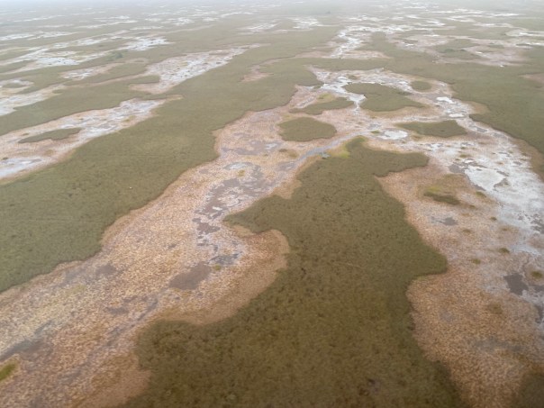
-December 28, 2022 at 8:45am, west of Stuart, east side of Lake Okeechobee, near Barley Barber Swamp and FPL cooling reservoir, -sugarcane burning or a controlled burn??? Photographs taken by Scott Kuhns from SuperCub.

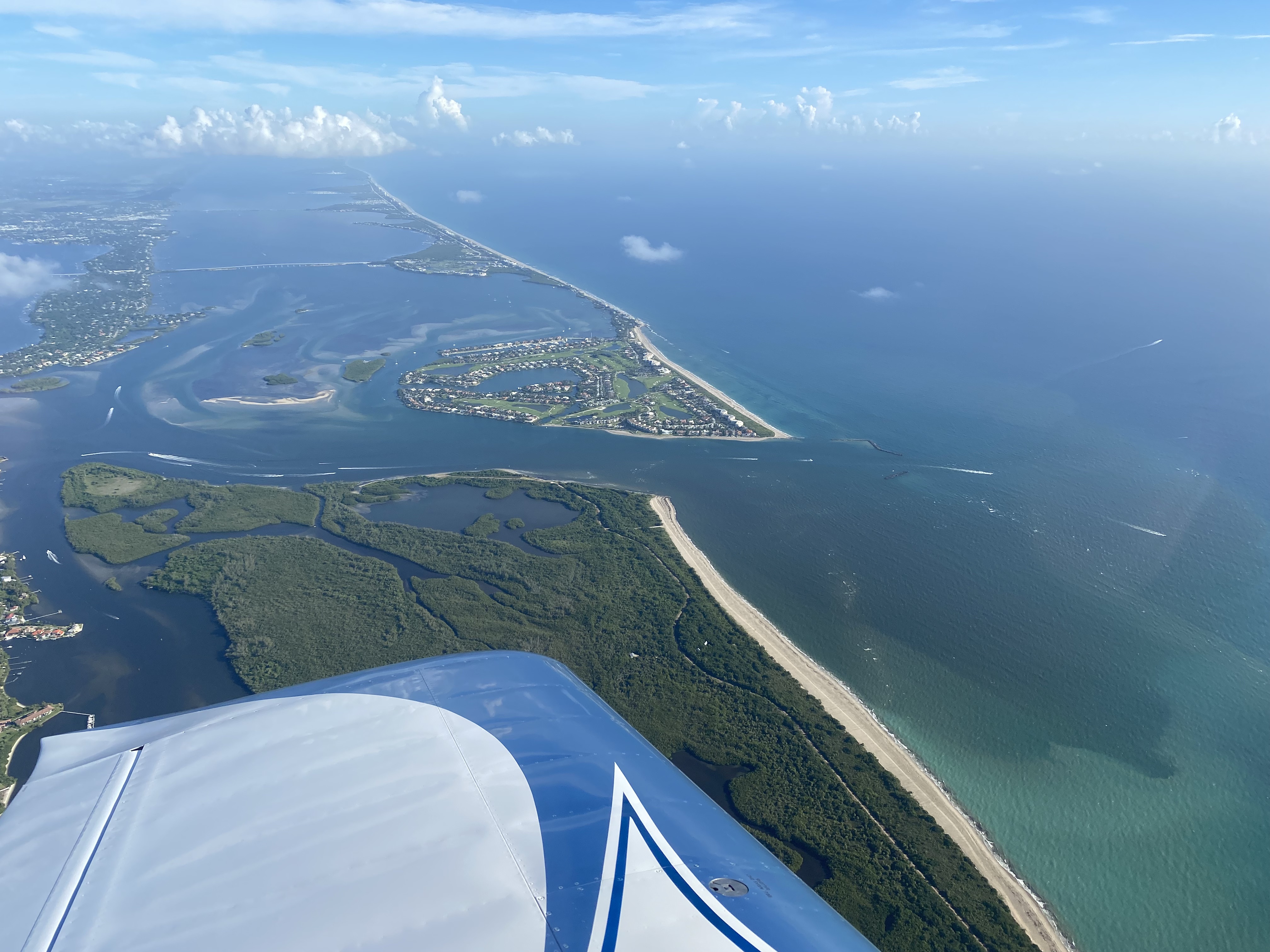
-December 29, 2022 around 2:30 pm, St Lucie River/Indian River Lagoon around St Lucie Inlet, Sewall’s Point, Sailfish Flats, wide view taken over Palm City. Aerials by Ed Lippisch from Vans RV. I am including all photos although some are very similar as each one shows something a little different. Remember you can click on photo to enlarge 🙂

Wishing everyone a very happy and safe New YearEve and let’s continue to work together for a great 2023 for the St Lucie River! 

Visual Update St Lucie River 12-20-22

I wanted to provide a visual update of the St Lucie River/Indian River Lagoon. Even though the river looks dark and silty, as 2022 comes to a close, we remain fortunate that there have been no major discharges from Lake Okeechobee to the St Lucie River since 2018 and no discharges to the St Lucie this year even though Lake Okeechobee got very high -maxing out at 16.51 feet.

Recently, there has been quite a bit of rain in Martin County. This follows the rains of Hurricane Ian and Hurricane Nicole. Thus the river looks dark and silty from weeks of runoff. The runoff now is coming from surrounding lands as well as C-23, C-24 and C-25 out in the IRL at Ft Pierce. There are also hundreds of old ditches that dump into the St Lucie River running though creeks such as Dansforth, Willoughby, Warner and others.

Thankfully the Indian River Lagoon South project is underway by the ACOE and local sponsor SFWMD to offset the destruction of the major canals of the Central and Southern Florida Plan. If things go well and the economy and political will remain in place, the remainder of these projects should be complete in ten or fifteen years. The C-44 Reservoir and STA in Indiantown, Martin County is complete.  Ten to fifteen years sounds like a long time, however, these  are gigantic, expensive  projects working to undo gigantic problems as our population skyrockets.

In the meanwhile we should be working on going septic to sewer where necessary and improving our yards by using little grass, fertilizer, or pesticides;  planting more native and Florida Friendly plants; using less water, picking up dog waste; and realizing everything we put on our laws or fertilize -crops and/or yard plants- ends up in the water ways! We have to be part of the solution. Don’t expect the government to do it all.

AERIAL PHOTOS ST LUCE RIVER UPDATE

Ed Lippisch, my husband, and Scott Kuhns, our dear friend, took the aerials  I am sharing today. The river does not look great due to so much rain. Thank goodness there are no Lake O discharges on top of this “local runoff.” Of which it really is not! This runoff has been mainlined here through canals of the Central and Southern Florida Plan.

SFWMD canal and basin map.

Next year they both Ed and Scott will have been River Warriors for ten years documenting the St Lucie! As eyes in the sky they provide a wider view and inspire a wider net of recovery for these waters. My brother, Todd’s web site eyeonlakeo allows for full time satellite and data updates.

SCOTT KUHNS, SUPER CUB, December 16, 2022 around 9:40 am. St Lucie Inlet (Hutchinson Island) plume about 12 miles south past Peck’s Lake, (Hobe Sound).

ED LIPPISCH, VAN’S RV December 18, 2022 around 12:15 pm. Plume at St Lucie Inlet, and dark runoff waters discoloring the entire estuary even close to the inlet around Sewall’s Point and Sailfish Point, Hutchinson Island.

Most recent rain as shown in my rain gauge. Just under 4 inches around December 14.

12-21-22 Added Presentation from ACOE Periodic Scientist Call: Periodic_Scientists_Call_2022-12-20

Draining Palm City

My recent blog post featuring my brother Todd’s time capsule flight of Palm City 1966 Then & Now received great interest. So today I am going to take the subject a bit further in our study of area canals that drain wetlands into the St Lucie River.

If you have never seen the 1940s Aerial Photos UF Collection, you must! These historic aerials were taken when the United States had new-spy plane technology. They are our earliest comprehensive, aerial wetland accounts of Martin County, St Lucie County, and all of central and southern Florida. (All the dark in the photos is little ponds and sloughs!)

Just recently, through the help of archivists at the South Florida Water Management District, I was able to verify important historic information regarding canals C-23, C-24 and C-25. Again, these canals were constructed as part of the Central and Southern Florida Plan after the great flood of 1947. What is most interesting is that these canals were dug atop already existing local drainage ditches…

According to the SFWMD:C-23: “Acquisition began in April 1951 and concluded in 1961. There was an existing creek and ditch known locally as the Bessey Creek Canal. The Corp’s As Built Survey is dated November 18, 1964.

*I would think this local ditch had been dug by the Palm City Drainage District.

C-24: Acquisition began in August 1958 and concluded in October 1962. There was a existing canal know as the Diversion Canal, which was under the jurisdiction of the North St Lucie River Drainage District and they converted their interest in the canal to the SFWMD in August 1958. The Corps’ As Built Survey dates June 22, 1962.

NO PHOTO for C-25. (1940 aerials do not contain the Belcher Canal as the plane did not fly that far north. There are later aerials of the Belcher Canals after 1940, but I am sticking with 1940 today! the Belcher Canal, now C-25 is starts in Ft Pierce at Taylor Creek dumping into IRL.)

C-25: Acquisition began in October 1949 and concluded in September 1962. There was an existing canal known as the Belcher Canal, which was under the jurisdiction of Fort Pierce Farms Drainage District and they converted their interest in the canal to the SFWMD in January 1961. The Corp’s As Built Survey is dated July, 8 1964.”

Full view 1940’s Aerials  1 & 2

For me,  it is important to know the history of these canals. The C-44 south, and connected to Lake Okeechobee is our greatest water quality nightmare, however C-23, C-24, and C-25 are also extremely destructive. Yes, they allowed great growth of agriculture and development,  but they, as all the canals of the Central and Southern Florida Plan continue to killing our environment and the wildlife that once flew, roamed, ran, hopped, and dug freely, not to mention water quality issues.

The ACOE and the SFWMD are in the process of Northern Everglades restoration through the Indian River Lagoon South component of CERP.  This is wonderful news! We must be mindful of this before we continue to allow more growth and development and more drainage within these lands.

Indian River Lagoon South an overview

C-23/25 Recevoir & STA under construction


SFWMD basin map for SLR showing C-canals draining lands into the SLR.

Palm City, FL 1966 Then and Now w/ Todd Thurlow

Today’s blog post is about western Martin County Florida’s Palm City. This post includes  my mother’s inspiration, my brother Todd’s  time capsule flight video, and my writing.

Palm City was once narrow strips of pine flatlands interspersed with hammocks, ponds, wide prairies, sloughs, sawgrass and cypress trees. Today it is a bustling part of Martin County due to the drainage of the C-23 canal on the north, and the C-44 canal on the south. When one attempts to unravel the long history of drainage of Palm City, it is helpful to think in three connected but separate levels: local, state, and federal. 

In 1919  the Palm City Drainage District was created. It was established for a local level as a special drainage district by the Florida Legislature with a lifetime of fifty years. It was primarily created to drain newly established Palm City Farms. Miles of canals and ditches were dug to drain into Bessey Creek, Dansforth Creek, and the South Fork of the St Lucie River. Some of these canals and ditches still exist today or have been incorporated into larger canals.

Palm City Drainage District Docs. 1919

Digging of the St Lucie Canal in the south began around 1915  lasting into 1926. It was dug by the Everglades Drainage District, State of Florida, from the South Fork of the St Lucie River to Lake Okeechobee. After the deathly hurricane of 1928, the federal government authorized widening and deepening the St Lucie Canal to create the Okeechobee Waterway also known as the Cross State Canal from Stuart, across Lake Okeechobee, to Ft Meyers. Doing so allowed the St Lucie Canal to conveniently function as the main outlet for Lake Okeechobee’s flood waters. Later, after the great flood of 1947, the canal became part of the Central and Southern Florida Plan and renamed C-44 becoming part of the giant Central and Southern Florida Flood Control System of the Army Corp of Engineers.

The great flood of 1947 called not just for the widening and depending of the St Lucie Canal and enlargement of its structures, but the federal Flood Control Act of 1948 authorized more canals, levees, and structures  to be built by the Army Corps of Engineers throughout southern and central Florida. Among the new canals were the C-23, the C-24 and C-25 canals of Martin and St Lucie counties -all discharging into the North Fork of the St Lucie River. The state asked for and supported this. The C-23 is the border between Martin and St Lucie Counties. Of course there were major unintended consequences that added to the discharges of the St Lucie Canal and the original Palm City Drainage District. This plethora of fresh, dirty water has all but killed the St Lucie River. Improving the health of the St Lucie is the goal of local, state, and federal restoration efforts today.

The video below created by my brother Todd begins in 1966 after all the aforementioned canals were constructed. It is easiest to see in a large format. You can either click on the YouTube image below or use this link to watch this remarkable Palm City time Capsule Flight!

*Click on link to watch video by Todd Thurlow

-Below: the federal government’s (ACOE) Central and Southern Florida Flood Control Project authorized by Congress in 1948 included C-23 on the border of Martin and St Lucie Counties, C-24, and C-25,- and enlarging the flood control structure along the St Lucie Canal. Once this system was built out it was turned over the state of Florida’s Central and Southern Flood Control District; however, the ACOE kept the St Lucie Canal now named C-44, for federal flood control. The Central and Southern Flood Control District, a Florida state agency that followed the Everglades Drainage District in 1949, became the South Florida Water Management District in 1977. -Below: A 1973 C&SFP update map, Army Corp of Engineers. Green never built thank God!

More Rain, but #NoLakeO, SLR/IRL

Thanksgiving was a whirlwind and a lot of fun as Ed’s family including niece and nephew visited. The two days before their arrival on November 22, 2022 was quite rainy -a light, humid, constant rain. After the “rain event” my rain gauge read just under 6 inches! Here along the coast in Sewall’s Point the old saying remains: “when it rains, it pours.”

Today, I am sharing my husband Ed’s aerials of the St Lucie River/Indian River Lagoon. They were taken area above Sewall’s Point, the St Luice Inlet, and a few of the Roosevelt Bridge in Stuart -on November 26, 2022 around noon on an incoming tide. Like my previous post , after Hurricane Nicole, the contrast of milky, stirred up ocean water and the dark, fresh, polluted, runoff from area canals and surrounding lands and neighborhoods is extreme.

In my opinion, to witness such events without the discharges from Lake Okeechobee is educational, it makes clear how important not fertilizing and using chemicals on our yards is, and thankfully the tides flush the mouth of the river out over time. When the ACOE starts Lake O discharges, this can go on and on – for months and in worst case scenarios -for years. The river cannot clean out. There have been no major, longstanding discharges from Lake Okeechobee since 2018 and the Sailfish Flats’ seagrass community has been slowly recovering.

Today the lake stands at 16.50 feet. There is a periodic scientists call today of the ACOE when input will be taken regarding lake discharges and other water issues.

Thus Ed and I present these photographs for the record.

-My rain gauge after the rains a few days prior to Thanksgiving on November 24, 2020. almost 6 inches.

-SFWMD Lake O update

-Canal map

SFWMD basin map showing canals that lead to the SLR. The C-44 can dump water in the C-44 basin or water from Lake O or both.

11-29-22 6:17pm slide from ACOE PSC at 2pm


Hurricane Nicole’s Ugly Effect – St. Lucie River/Indian River Lagoon

As shared in my recent blog post, Hurricane Nicole brought a significant storm surge to the St Lucie River and Indian River Lagoon region. Many residents experienced flooding and property damage, especially of docks and seawalls.

Today, 11-16-22, my husband, Ed, went up in the RV plane and took pictures to compare to others we took prior to Hurricane Nicole.

It has been quite a time. Nicole hit Florida on November 10, 2022 and Hurricane Ian on September 28, 2022. The river has taken two recent hits.

When Ed got home and I asked him how the river looked, there was a pause and he replied, “just like old times…” meaning “not good.”

Ed’s photos were taking during a rising tide around 1:15 November, 16, 2022. You will see that there is the flushing/cleaning of incoming ocean water from the St. Lucie Inlet. If the estuary is left alone, in time, a few weeks, it will significantly clear up. If the ACOE discharges from Lake Okeechobee, (the Lake is at 16.22 feet) it will not clear. Tomorrow’s (11-17-22) Rivers Coalition meeting at 11am at the City of Stuart Chamber, 121 SW Flagler Avenue, Stuart, Fl 34994, will address this issue, also the issue of “sending water south.” The guest speaker will be LTC Todd Polk. I encourage all to attend.

The goal? To allow the St Lucie River to return to her true beauty and that can only happen when we stop the discharges, all of them.

2-11-15 ACOE Periodic Scientist Call information: Periodic_Scientists_Call_2022-11-15

-Sewall’s Point between the SLR/IRL -click on to enlarge. -Ernie Lyons bridge from Sewall’s Point to Hutchinson Island- IRL–Jupiter Narrows far left, SLR-Plume in Atlantic Ocean coming out of St Lucie Inlet


Then and Now Images and Movies – Hurricane Ian

Screenshot of slide-bar image: “Then and Now Images and Movies:” “Matlacha After Hurricane Ian,” eyeonlakeo.com, Todd Thurlow.

Having grown up in Florida, my brother Todd and I both developed a reverence for the natural world. Hurricane Ian made landfall in Southwest Florida on September 28, 2022. Today, I share Todd’s latest eyeonlakeo.com creation featuring jaw-dropping “then and now images and movies” of Hurricane Ian’s swollen effects on the Kissimmee, Peace, Lake Harney and St John’s rivers; the Gulf of Mexico; the intense destruction in Charlotte County’s Gulf Cove; Lee County’s once fishing village of Matlacha; and Sanibel Causeway; as well as NOAA NGS emergency response imagery. This is documentation is almost as powerful as the storm itself and the comparison images can be viewed by clicking on the illustration and then using the simple blue dot slide-bar to go back and forth. Respectfully, Todd and I submit this documentation with continued prayers for those whose lives are forever changed.

Please click link below:

THEN & NOW HURRICANE IAN 

Different Views~St Lucie River Region

These aerials were taken by my husband, Ed Lippisch, between September 16 and September 23, 2022. I had asked him to get some photographs other than our normally featured Sailfish Flats area between Sewall’s Point and Hutchinson Island.

I chose a few of my favorites for a series entitled “A Different View.” This past weekend, I started closely reviewing all of Ed’s photos and decided to share more. Ed captured from Stuart, to Hobe Sound, to Palm City and Port St Lucie. I think what is most clear is how close we are to the river and thus how it is clearly our responsibility to protect her. Thank you Ed for being our eye in the sky and for giving us these different views.

-Roosevelt Bridge, FEC Railroad, and US1 crossing St Lucie River, Stuart. Palm City west. -Roosevelt Bridge, St Lucie River Stuart looking east over Witham Field and Sewall’s Point to Atlantic Ocean.-Shoreline of North River Shores, just north of Roosevelt Bridge, Stuart, FL.-Closeup Roosevelt Bridge, Florida East Coast Railway, and US1. St Lucie River, Stuart.-Indian River Lagoon and Savannas Preserve State Park, Jensen/Rio and north St Lucie Co. -North Fork of St Lucie River, Port St Lucie, looking east to Indian River Lagoon and Atlantic Ocean. -Savannas Preserve State Park looking west to Savannah Club Golf Course, St Lucie Co. (I think) -Savannas Preserve State Park looking south to St Lucie River, note Sewall’s Point & St Lucie Inlet. Very old- Indian River Drive and the Florida East Coast Railroad are clearly seen along the ridge of the Indian River Lagoon. -Nettles Island in the Indian River Lagoon,  St Lucie County, Hutchinson Island. -Jensen Beach Bridge at Hutchison Island where large section of mangroves died due to drowning and poor planning. It appears some are coming back to life.-North Sewall’s Point looking from over the IRL to forks/and the St Lucie River. Line of C-23 can be seen in distance. -Evans Crary Sr. & Ernie Lyons bridges from Stuart to Sewall’s Point leading to Hutchinson Island, St Luice River/Indian River Lagoon. Rio/Jensen north, and City of Stuart sprawling north and south. -Bird Island, a Critical Wildlife Area, off South Sewall’s Point, note seagrass/macroalge beds.-Ernie Lyon’s Bridge ending at Hutchinson Island at Indian River Plantation, Marriott, right. Elliott Museum and Florida Oceanographic on left. Indian River Lagoon and Atlantic Ocean in view.-C-23 Canal, the county line between Martin and St Lucie counties. Note the difference in development patterns. “Newfield” will be constructed around Citrus Blvd. the wavy white line in the now green area of Martin County it’s pattern will not resemble PSL. -Next two photos: Another view of C-23 Canal and surrounding area near North Fork and former arm of the St Lucie River. -Next five photos: Winding North Fork of St Lucie River surrounded by development of Port St Lucie under puffy clouds. -Hobe Sound area near Bridge Road looking southwest. This is where the controversial development of Atlantic Fields was just approved by the Martin County Commission. The Polo Club where it will be built  is located close to the oval shape (maybe a horse track) seen in the green field. Atlantic Ridge State Park and Loxa-Lucie are also in this region of Martin County. The Town of Jupiter Island is along the Indian River Lagoon and the Atlantic Ocean at the east end of Bridge Road. There are many other developers eyeing this area or Martin County.  -Next three photos: Same area of Hobe Sound -note Indian River Lagoon and Atlantic Ocean east and right, and St Lucie River ahead. The South Fork of the St Lucie was once easy to see in this area. Since drainage of South Florida it is almost unrecognizable, but it is here. -Florida Turnpike and I95 near Bridge Road, Hobe Sound, FL. -Natural Lands near Atlantic Ridge State Park and Seabranch Preserve State Park looking east towards Jupiter Narrows, Indian River Lagoon, and Atlantic Ocean. Thank you to those who worked to save some of these lands around the St Lucie River/Indian River Lagoon. We must conserve even more!

Thank you Ed, for giving us “a different view.”

A Different View~Western Port St Lucie

-September 21, 2022 at 10:48 am, SW Gray Fox Lane, at Heron Preserve, Port St Lucie, FL, aerial photo by Ed Lippisch. 

A Different View~Western Port St Lucie

I once read that as a city grows, road names reflect a time long past. This is certainly the case here in western Port St Lucie. The name the road below is “SW Gray Fox Lane,” but there are no longer gray foxes running here. And the development? Ironically, “Heron Preserve.”  Don’t think so. Just scraped and squared wetlands that once cleansed water running south. Our river cries for days long past.

A Different View~North Fork St Lucie River

-North Fork of St Lucie River surrounded by by development, Port St Lucie, Florida. Distinctive oxbows lie south of Prima Vista Blvd. Aerial photo by Ed Lippisch September 16, 12.15pm.

The above aerial of the North Fork of the St Lucie River is the second in my recent series entitled: “A Different View,” as Ed and I feature areas of the St Lucie River/Indian River Lagoon other than the Sailfish Flats and Sandbar between Sewall’s Point and Hutchinson Island.

For me, today’s is a powerful visual. Though it shows the remaining serpentine beauty of the North Fork of the St Lucie River one can easily see how the river, remaining natural lands, seagrasses, and fish and wildlife -close by and downstream-  are impacted by human activity from the surrounding houses, roads, bridges, and highways.

Just think of all the people living in this sea of development surrounding the winding waterway. Imagine if the people were thoughtlessly putting fertilizer and pesticides onto their lawns -that runoff in turn draining into the river- or perhaps their home located right inside the river’s watershed has an old, leaking, septic tank. Envision all the oily/dirty runoff from the surrounding roads and highways flowing down into the waters after a hard, long rain like we’ve had this week.

An image such as this makes it intensely clear and can be applied anywhere as a learning tool in the St Lucie River region: It is ridiculous not to change and modernize our ways if we truly desire the health and recovery of our waterways. All of us!


A Different View, St Lucie River~Indian River Lagoon

-Indian River Lagoon & St Luice River meet to flow into the Atlantic Ocean as seen over the savannas. Nettles Island , a landmark, juts into the IRL (upper left.) Note peninsula of Sewall’s Point and St Lucie Inlet. Aerial photograph by Ed Lippisch, 9/11/22, 6:15pm.Recently, I have been asking Ed to get a “different view” while flying-something other than the location between Sewall’s Point and Hutchinson Island near the St Lucie Inlet. That area is the heart of the matter when documenting seagrass recovery or destructive discharges from Lake Okeechobee. However, the St Lucie River/Indian River Lagoon includes much more than that. The undeveloped savannas region seen above is quite striking.

Here Ed looks south over the savannas, now Savannas Preserve State Park, an area west of the railroad tracks stretching ten miles between Jensen Beach and Fort Pierce.

As my mother, author Sandra Thurlow writes  in her book, Historic Jensen and Eden on Florida’s Indian River, …”ours is not a savanna at all. A true savanna is grassland with scattered, small drought resistant trees. Many eons ago the Jensen Savannas was a lagoon like the Indian River. Now the ancient lagoon is a region of lakes, marsh and pine flatwoods. When polar icecaps formed, bringing Florida out of the sea, tides and winds shaped a primary dune along the east coast of the peninsula. The shallow waters in the wetlands behind the dune were brackish. The ocean levels continued to drop and sand bars just off the coast were exposed, forming Hutchinson Island. What had been the primary dune became the Atlantic Coastal Ridge.” 

She goes on to explain that prior to modern times the savannas’ ecosystem was almost 200 miles long, but due to development along the Indian River Lagoon the region has been reduced to just ten ecologically intact miles.

Areas such as these “savannas” are critical to the health of the St Lucie River/Indian River Lagoon and an inspiration for more comprehensive protection in the future.

Hope you enjoyed today’s different view.


True Beauty, SLR/IRL

-L to R: The peninsula of Sewall’s Point lies between the SLR/IRL. The Sailfish Flats and Sandbar seagrass meadows lie between Sewall’s Point and Hutchinson Island. Witham Field, Stuart, can be seen west. The Atlantic Ocean is east. St Lucie Inlet State Park is located south on Jupiter Island. The St Lucie Inlet is cut between Hutchinson and Jupiter Islands. Today’s photos highlight the area’s returning seagrass meadows after their disappearance primarily because of years of damaging cyanobacteria laden Lake Okeechobee discharges, especially in 2013, 2016, & 2018. Photo Ed Lippisch, 8/26/22.When Ed came home from flying the RV on Friday, August 26, 2022, he said, “I think the aerials look good, you can really see the seagrasses.” I looked at him kind of funny. He never says anything like that. Looking on my phone, I could tell the photos were revealing, but it wasn’t until I viewed them full screen on my computer that I saw their true beauty. Ed’s photos reveal clear water, clear air, defined nearshore reefs, and lush seagrass/micro-algae meadows.

It is exciting to see and am I so glad Ed captured it! In the coming days and weeks tropical weather may be pushing our way. “Thank you Ed, for capturing the river before the height of hurricane season, before possibly more rains and more runoff.”

These just might be the most beautiful recent photos ever taken of the St Lucie River/Indian River Lagoon. Over the past couple of years, we’ve had some good ones of blue water alone, but blue waters cradling seagrass beds, the life of the sea itself, this is “true beauty.”

These improvements have only been possible due to recent  ACOE policy decisions – no major Lake O discharges for over three and one half years, and Mother Nature, who so far, has not brought any of her discontent our way.

At this time, it is in order to thank former City of Stuart Mayor, Merritt Matheson, who went to great lengths over the past four years to hold accountable and build relationships with the Army Corps of Engineers. Mayor Matheson led numerous boat tours and meetings inviting, colonels, commanders, and staff. His St Lucie River tours led by an elected,  passionate, educated, local helped the ACOE understand the fragility of our region and the intense ecological and health impacts caused by discharges from Lake Okeechobee. Mayor Matheson your efforts made a tremendous difference for the health of the St Lucie River. Thank you.

Canal system SLR/IRL, SFWMD


Awash

This post is for aerial documentation. With recent needed rains this past week in the St Lucie Region, the St Lucie River is “awash” from area canals and “local” runoff. But #NoLake O!

Remember: Don’t fertilize through rainy season-June 1-Nov. 30-and let’s all be aware that everything we or our four legged friends put on our lawns ends up in the river. Seagrasses are recovering let’s help not hurt.

Ed Lippisch & Scott Kuhns, August 19, 2:18pm, RV, Lake Okeechobee (no visible algae) to St Lucie River 

-Island in Lake O south of Buckhead Ridge also visible is Kissimmee River, now C-38  -St Lucie River at St Lucie Inlet 

Ed Lippisch, August 21, 8:45am Lake Okeechobee to St Lucie River, RV -Visible plume 

Canal systems dumping fresh water into SLR, SFWMD.

8-14-22 (South Sewall’s Point)

8-17-22

Aerial Update St Lucie River/IRL-end July

My “River Warrior” team and I continue to document the health of the St Lucie River/Indian River Lagoon. Thank you to pilots Scott Kuhns, and my husband, Ed Lippisch. Also my brother, Todd Thurlow, for his eyeonlakeo website updates and Florida Oceanographic for their weekly water quality report. As the summer temperature heats up, the water is not as clear as earlier this year, however, Saharan dust is keeping the rain and hurricanes away, seagrass is rebounding, and there have been no major discharges from Lake Okeechobee in over three years. Thank you to everyone and every agency fighting and advocating for clean water!

Florida Oceanographic Water Quality Report shows a C+ for the overall St Lucie Estuary with high scores near the inlet but lower scores in the main river and forks. See above link.

The seven photos below were taken by Scott Kuhns from his SuperCub on Saturday, July 30, 2022 around 11:30am.

1.

-St Lucie Inlet area and confluence of SLR/IRL -Sailfish Flats with seagrass recovery but lots of attached micro algae

2.

The ten photos below were taken by Ed Lippisch from the Vans RV-also on Saturday, July 30th, at approximately 2pm. No visible algae was seen visually at S-308, Port Mayaca or S-80 in the C-44 Canal although Lake Okeechobee was recently reported by FDEP to be around “50% algae coverage.” View here on my brother’s website  EYEONLAKEO under HAB-IMAGES.

-Port Mayaca’s S-308 at Lake Okeechobee -S-80 at St Lucie Locks and Dam, C-44 Canal

SFWMD canal and basin map. C-44 canal is the canal most southerly in the image and the only canal that connects to Lake Okeechobee.


Turquoise Today

Today’s post is a visual water update. My husband, Ed, flew over the confluence of the St Lucie River/Indian River Lagoon on July 6, 2022. As you can see, it looks beautiful. Our waters near the inlet are turquoise today. The water is not this color throughout the estuary, only in the area where the inlet regularly flushes in and out.

May Mother Nature hold off her heavy storms and rains this summer; may the state and federal agencies recharge themselves to do all possible to be laser-focused on sending  water south.

As the heat increases, the annual algae bloom in Lake Okeechobee is expanding. Keep track on my brother Todd’s site, EYEONLAKEO.

#NOLAKEO

Aerials, July 6, 2022

-St Lucie Inlet’s nearshore reefs -St Luice Inlet: confluence of SLR/IRL -Sailfish Flats with budding seagrass and macro algae visible -Sailfish Point, Hutchinson Island, Sewall’s Point, Stuart. Look at the color of the ocean! Ed gets into the Van RV pre-flight,  a plane I have not flown in yet. 🙂 Thank you Ed! Our “Eye in the Sky since 2013.”KNOW THE ENEMY: Canals of the Central and South Florida Plan. Only C-44 is attached to Lake O and can have long term human-made discharges. All canals negatively affect the St Lucie Estuary.

SFWMD canal and basin map. C-44 canal is the canal most southerly in the image.


Visual Update SLR/IRL June 23, 2022

I am very fortunate to have a team of people, “River Warriors” who help me document from sky to water the St Lucie River/Indian River Lagoon. Today, I share photos taken by friend  Mary Radabaugh who overnighted in the area over Father’s Day weekend, June 18-19, 2022. She took amazing photos of nature: live sand dollars, growing seagrasses, wading birds, manatees, and sea turtles. Life is returning to the area.

Next, Dr Scott Kuhns shares five aerials he took the same weekend, on June 18,  around 11:30am. These photographs reveal clear waters with rain runoff plume over St Lucie Inlet and nearshore reefs. There is also a photo of the C-44 Reservoir filled to just over ten feet. This reservoir sits on the C-44 Canal and was just completed this past year as the first major CERP project. It is scheduled to be operational by 2023, although the ACOE is trying for earlier.

My husband, Dr Ed Lippisch, took his plane up yesterday. He shares four photos from June 22, 2022 around 12:30 pm that encompass the estuary from a higher altitude. The darker rain runoff is more visible. The estuary still looks good in the region near the St Lucie Inlet. Higher up the north and south forks the water is darker. There have not been major discharges from Lake Okeechobee in over three years. This is a very good thing and we must continue to make this our goal.

Thank you for all who fight for a clean and healthy St Lucie River!Periodic_Scientists_Call_2022-06-21

ST LUCIE RIVER/INDIAN RIVER LAGOON

I.-Mary Radabaugh, living sand dollar and more life, Sandbar near St Lucie Inlet between Sewall’s Point & Hutchinson Island, 6-18/19-22


I am adding two more wildlife videos 4:35pm, 6-23-22

A. Spotted Eagle Rays at the Sandbar, June 19, 2022,  by my sister Jenny and her husband Mike Flaugh.

B. Trigger Fish, Powers family dock, S. Sewall’s Point, IRL side June 23, 2022.


II.-Scott Kuhns, SuperCub, June 18, 2022 near St Lucie Inlet and C-44 Reservoir, 6-18-22.


III.-Ed Lippisch, Van RV, St Lucie Inlet SLR/IRL  June 22, 2022. 6-22-22.

SFWMD canal and basin map.


Not too Bad…

I visited my mother yesterday and we talked about the tremendous recent rains. We sat inside to chat because the mosquitoes were so bad outside.

This is about how our conversation went:

Jacqui: “I just took a picture of another seven inches in my rain gauge.”

Sandy: “Yes, I have dumped out over fifteen inches of rain in mine since that tropical disturbance…”  (6-3-22)

In spite of all this rain, the St Lucie River/Indian River Lagoon doesn’t look too bad. Here are aerials taken by my husband, Ed Lippisch, and friend, Scott Kuhns, on June 11, 2022 to show what the area looks like. The St Lucie itself does look dark brown and there is a plume from runoff, but overall it is “not too bad…”

We will continue to be your eye in the sky documenting the St Lucie River/Indian River Lagoon.

#NOLAKEO

-Ed Lippisch, RV, June 11, 2022 10:30am. St Lucie Inlet. -Roosevelt Bridge, St Lucie River 

-Scott Kuhns, SuperCub. June 11, 11:30 am. St Lucie Inlet. -Shawn Engebretsen flies his T-6 on the edge of the Atlantic Ocean & IRL 

The St Lucie River Central & South Florida Project Canal System SFWMD-June 11, 2022 South Sewall’s Point, JTL. My mom lives in North Sewall’s Point. 

Post Tropical Disturbance Rains – A look at the St Lucie & Loxahatchee

-St Lucie Inlet plume, June 5, 2020, aerial Scott KuhnsThis year’s hurricane Season was off to a quick start with a rare Tropical Disturbance that originated as Hurricane Agatha in the Pacific. Most of the rainfall occurred at Stuart, Florida on June 3rd and 4th, 2022.

-Image from “SFWMD Weather” a great resourceTCPalm reported significant rainfall along the Treasure Coast. My rain gauge in south Sewall’s Point read over 7 inches.And as the system pulled out over the Atlantic Ocean, Sunday, June 5, 2022, the day after the rains passed, it was beautiful! Both my husband, Ed Lippisch, and friend, Scott Kuhns, took flight. I will share their aerials today. We can use these photos as a baseline as more water makes it way to the St Lucie.

The ACOE opened one gate of S-80 to the C-44 canal for about one day, certainly C-23 and C-24 and C-25 overflowed, and then there is the surrounding runoff. Luckily no discharges came in from Lake Okeechobee, today reported at 12.75 feet. 

So what did the St Lucie River look like one day after such rains? Here you go!

SCOTT KUHNS

~Scott Kuhns’ aerials, Sailfish Flats/confluence of the St Lucie River & Indian River Lagoon, near St Lucie Inlet. One can see the runoff plume.-Hutchinson Island in distance-Plume coming out of St Lucie Inlet -Sewall’s Point and Hell’s Gate SLR -St Lucie Inlet  -Area between Sewall’s and Sailfish Point, IRL -Sailfish Flats -Below: approaching Witham Airport plane is over Sewall’s Point going to Stuart 

ED LIPPISCH

Ed’s photos below are from Lake Okeechobee to the Loxahatchee River to the St Luice Inlet area. Ed said the canal water of the C-44 looked like expresso but no visible algae from the airplane.

-S-308 at Port Mayaca, Lake Okeechobee -Development along C-44 Canal near intake canal of C-44 Reservoir-S-80 at St Lucie Locks and Dam along C-44 Canal was closed after being open for about a day -Loxahatchee River in Jupiter also with runoff -St Lucie River/Indian River Lagoon, Sailfish Flats, Hutchinson Island 

So let’s keep our fingers crossed for no storms the remainder of hurricane season!

The Old Stiller Bros. Fish House, Dad, and Mariner Cay

-My dad’s photo -bus for Stuart High School, Senior Trip to Havana, Cuba, 1954Why the “Stiller”name rings a such a loud bell for me is because my late, dear, father, Tom Thurlow Jr.  always loved to tell the story about his 1954 Stuart High School Senior Trip to Havana, Cuba. As you can see above, the bus was all written up in shoe polish!

I remember saying to my dad, “I get “Stuart Tigers” and “Havana or Bust”, but why does it say FISH FOR SALE, STILLER BROS. FISH HOUSE?” Dad would begin chuckling  and reply: “That was my classmate Freddy Stiller…” 

-Indian River State College President, Dr. Timothy Moore, JTL, Sandra Thurlow, Vice Chair District Board of Trustees IRSC, Tony George, May 24, 2022. Receiving a “Resolution of Appreciation” for my late father, Thomas H. Thurlow Jr. for his many years of service to the institution. -Mom holds dad’s Resolution of Appreciation. Thank you IRSC!Recently, after receiving a a beautiful plaque from Indian River State College in honor of my father for his service to the institution, my mother, historian Sandra Thurlow, and I visited  Mariner Cay where my dad’s friends Freddy Stiller’s family once fished.

During our visit, my mother pointed out that commercial fishing operations flourished along the St Lucie River/Indian River Lagoon after the opening of the St Lucie Inlet in 1892. In the 1940s, the fishing was still wonderful. It was this year that Hubert Stiller, Freddy’s forefather, purchased 75 acres of land from the Jacksonville Partnership Corporation -for the principal sum of $11500.

In 1963, the Stillers sold the family property, except for three lots to Whiticar, Garlington and Dragseth who later also sold the property. This land, platted in 1973, other than the three lots, became Mariner Cay off of St Lucie Boulvard near San Sprit Park.

-Mariner Cay Marina in 2022

When my mom got home she sent me some historic aerials that I will share today. It is fascinating to see what the land once looked like at a time when men could pull thousands  of fish from our waters.

PHOTOS & HISTORIC AERIALS LAND ONCE OWNER BY THE STILLERS-TODAY’S MARINER CAY ON ST LUCIE BOULEVARD, STUART, FL

-Early photo of a Stiller Fish House ca. 1945, courtesy Thurlow Archives.-Thurlow Archives/all aerials marked 1964 of the Stiller lands that in 1964 sold to Whiticar, Garlington, and Dragseth. The St Lucie Inlet and Seminole Shores, (today’s Sailfish Point) can be seen in the distance over an undeveloped Rocky Point. -Mouth of Manatee Pocket also 1964, Stuart, FL

-My mother took this photo below of a remaining Stiller structure still located on one of “the three lots” not sold by the family in 1963. It remained/s separate. My friend and realtor, Julia Sansavere who lives in Mariner Cay informed me these “Stiller” properties have just sold. Nonetheless, they will remain a piece of history of my dad’s friend Freddy Stiller who once wrote on the Senior Trip bus to Havana in 1954: “Fish For Sale, Stiller Bros. Fish House…” 

-A remaining Stiller structure, on the once Stiller lands, within Mariner Cay, May 24, 2022, photo Sandra Thurlow.-Today’s Mariner Cay red balloon, Google Earth, 2022.


Clear Waters From Ground to Above

As I mentioned in my previous post, “Ed is on a roll…”

Yesterday, 5-24-22 around 11:30 am, my husband took the Maverick to the Sailfish Flats area and the sandbar that forms at low tide off of Sailfish Point. Next, at 2:30pm he took a ride in the RV to view from above. Beautiful.

Rainy season usually officially begins on June 1st. So if you can enjoy the clear waters near the St Lucie Inlet before the rains…

I wanted to share these photos so we can compare.

~On the ground

-Seagrass with Gracilaria, a common macro-algae in the Lagoon according to Mark Perry

~In the air

-RV: Sailfish Flats and Sailfish Point, Hutchinson Island, near St Lucie Inlet on March 24, 2022, around 2:30pm. The exposed sand in these aerials is the sandbar Ed walked on and took photos of above.

Thank you Ed, for being my eye in the sky.

Aerials Sailfish Flats- St Lucie River/Indian River Lagoon May 2022

Ed is on a roll!

Yesterday, 5-23-22, at around 3:30pm, these aerials were taken of the Sailfish Flats, the confluence of the St Lucie River/Indian River Lagoon between Sewall’s Point and Hutchinson Island.

The water looks great and I have had reports of seagrass-although sparse-growing in some parts of this region. KEEP THE LOCKS CLOSED and thank you Ed for documenting the St Lucie!

Mind you, the entire river is not this color. The water gets more tannin and darker as you approach the locks and upper reaches of the forks. These were once fresh and clear. In a hundred years, things have drastically changed…

As you can see, the proximity to the St Lucie Inlet allows for flushing/cleaning of this area. Since repeated blue-green algae laden discharges starting in 2013, and then again in 2016 and 2018, the grasses have become sparse mostly due to poor light penetration. The inlet cannot flush when high discharges from Lake Okeechobee and area canals are pouring through for long periods of time.

Some of the shading you see is macro-algae not seagrasses. It takes years for seagrass to recover. With three good recent years they seem to be recovering. Things are looking up so long as Mother Nature and politics don’t get in way. Please continue to advocate for our waters!

I am including all photos- although similar- so you may compare and get the feeling of

~Flight~

1977 aerial below by Chris Perry for historic comparison.

Aerial of seagrasses in 1977 in and around Sailfish and Sewall’s Point.


Lake O’s Edge to Pal Mar/St Lucie Inlet

Greetings. Ed and I have just returned from three weeks of touring Florida’s west coast in our trawler, Adrift. It was awesome!  I am nowhere close to being back in gear (I am recovering one could say) but my husband Ed is…

Yesterday, 5-22-22, around 1pm, Ed took the RV for a spin and got some great aerials. I wanted to make sure to share. I will be writing more soon. Hope all my readers are doing well and enjoying the water!

~Flight~

-C-44 Canal at S-80, St Lucie Locks and Dam. No algae at S-80 but we did see some bubbling up in our wake in Lake O.

-Sugarcane burning near Lake Okeechobee…

Pal Mar’s lands  are under siege as you may have read about

-Light plume from rains, St Lucie Inlet at Hutchinson Island, Sailfish Point. Water is looking great after three years of no major discharges from Lake Okeechobee.-Sailfish Flats as viewed over Hutchinson Island. Pretty with seagrass “budding back.” Let’s keep those discharges at bay so it can grow, grow, grow!


St Lucie River/Indian River Lagoon Aerials 4-24-22

Today I share recent photos of the St Lucie River/Indian River Lagoon taken by my husband, Ed, yesterday, April 24, at 2:30pm. The water remains a lovey shade of turquoise blue but there is a visible plume exiting south of the St Lucie Inlet. As there has been no documented discharges from C-23, C-24, C-44, or Lake Okeechobee of late, this must be the effect of recent rains and local runoff.

I am also sharing the SFWMD’s weather site; it is full of information, including scientific predictions. You can access through this link here or type in “SFWMD weather” as a search. As June approaches it is very important for us to keep our eye on rains and weather systems that will affect the St Lucie River/Indian River Lagoon and Lake Okeechobee’s level. 

As we know the St Lucie was once just a small river running in to the longer Indian River Lagoon, but the today she is connected to canals and Lake Okeechobee and it is killing her. The state and federal government are well funded and continue working  to improve the situation every day. We too can help: Don’t fertilize! Plant your yard with native and Florida Friendly plants. Conserve water! It’s simple, like they said in the old days,“give a hoot, don’t pollute!”


-Peck’s Lake of Jupiter Narrows and Atlantic Ocean -visible plume but water still pretty. Happy sailing!  -Below:  St Lucie Inlet -one can see small plume from local runoff. The water near the St Lucie Inlet and offshore still looks good. There have been no major discharges in three years. Nonetheless seagrass is not lush and there is a UME for manatees in the IRL. We all must work for better water quality.

SFWMD canal and basin map. C-44 canal, attached to Lake Okeechobee,  is the canal “most southerly” in the image.

Pre-Easter Flight SLR-LO

Ed took a pre-Easter flight in his new RV plane on April, 16, 2022 at 10am. He flew from Witham Field in Stuart west to Lake Okeechobee, back over parts of the C-44 Canal, and then over the St Lucie Inlet.

We are at the hight of the dry season. Once the wet season begins in the next couple of months, conditions will drastically change. We can use these photos as an “end of dry season base line.”

The St Lucie River/Indian River Lagoon looks very good as we have had little rain and no major Lake O discharges in three years. See page 14 below of “SFWMD Environmental Report,” – meeting date 4-14-22.As far as Lake O, although on April 8, 2022, the Martin County Health Department issued a cyanobacteria (blue-green algae) warning for area near Port Mayaca and  Lake Okeechobee, blue-green algae was not visible from the sky.  Please read press release.

We must stay vigilant.

I.

-Lake Okeechobee at S-308, Port Mayaca

II.

-C44 Reservoir/STA at Indiantown-at 10 feet being filled and check for safety by ACOE

-C44 STA and intake canal from C-44 canal

-More of Reservoir and STA -Caulkins Water Farm next to C-44 R/STA

III.

-C-44’s S-80, St Lucie Lock and Dam

IV.

-St Lucie Inlet with nearshore reefs visible, Atlantic Ocean  -Smile Ed!!!!!

Hello New Friend, a view from Ed’s RV

On January 12, 2022, Ed sold the Baron and I entitled my post “Last Flight Old Friend.” Today I am hoping to make a new friend with Ed’s RV. To begin this friendship, on April 3, 2022, I sent Ed up to take photographs in RV flight.

His aerials came out well; I wanted to share them today. They provide a striking look at some of the beautiful and changing areas of Martin County.

-Ed and his new RV

I.

-C-44 Reservoir located in Indiantown & being filled up by the ACOE.

II.

Halpatiokee Regional Park 

III.

-I am not sure what development this is being created, however, one can see the St Lucie Inlet and Jupiter Narrows  as a reference. If anyone knows, please share. It looks to me to be located around Hobe Sound.

IV. April 3, 2022, 11:30am

-The St Lucie River/Indian River Lagoon looks good. There have been no major discharges from Lake Okeechobee since 2018. Mind you, April is the near end of the dry season. The wet season begins around June 1. According to NOAA, the 2022 storm names are: Alex, Bonnie, Colin, Danielle, Earl, Fiona, Gaston, Hermine, Ian, Julia, Karl, Lisa, Martin, Nicole, Owen, Paula, Richard, Shary, Tobias, Virginie and Walter. I hope it is not foreshadowing that of of them is named “Martin.”

Ed’s aerials below show the effects of discharge on the St Lucie River/Indian River Lagoon near the St Lucie Inlet not from C-44 or Lake O, but from Canals C-23 , C-24 and local runoff. Seagrasses, or lack thereof, is a concern. Please see link for recent Army Corp updates:  ACOE Periodic_Scientists_Call_Power Point 2022-03-29 2

Slide Periodic Scientist Call ACOE 3-29-22

Thank  you Ed for taking photos! Maybe next time, if I get my nerve up, I’ll be up there with you! I have to say, my favorite plane so far was not the Baron, but the original “River Warrior”, the Cub. 🙂 No matter what you’re flying we will continue to document the St Lucie fighting for her health! 

Helicopter Ride Over the Caloosahatchee’s C-43 Reservoir

The recent Governing Board meeting  of the South Florida Water Management District was held on March 10, 2022, on beautiful Sanibel Island, in Lee County. Prior to the meeting, the board was given a tour of the C-43 Reservoir located in LaBelle, in Hendry County, which is on the way and where the giant reservoir is being constructed.

The C-43 Reservoir is also known as the “Caloosahatchee Reservoir,” as it will help manage water from the river’s basin and from Lake Okeechobee. The reservoir’s construction began in 2015; it will be over twice as large as the recently completed St Lucie Reservoir, or C-44 Reservoir, in Martin County. The Caloosahatchee is a much larger system!

For fun, let’s compare….

~The C-44 Reservoir covers 3000 acres; the C-43 Reservoir covers 10,500 acres

~The C-44 Reservoir stores 50,600 acre-feet of water; the C-43 Reservoir will hold 170,000 acre-feet of water

~The C-44 Reservoir is about 15 feet deep; the C-43’s depth will range from 15 to 25 feet

~Looking across the C-44 Reservoir is about three miles; the C-43 is is approximately six miles!

These reservoirs, along with the EAA Reservoir, once complete, will give greater flexibility to the Everglade’s system in many capacities and help offset damaging discharges and algae blooms from Lake Okeechobee.

Enough talk. Let’s go!

-Jared Ross of welcomes us-On the ground, we get a safety lesson and review a diagram of the project-Pre-helicopter driving tour, with John, SFWMD, our guide  

-Atop the dam-Workers at a giant culvert I had seen the C-43 before, at its major groundbreaking in 2019. It was exciting to see it almost three years later and note the progress that has been accomplished thus far. Today, I will share my photos and videos so you too can see. It is hard to grasp it all as it is so sprawling, but from the air you will get a good idea.

-With Jennifer Reynolds, Ecosystem Restoration SFMWD, and Jennifer Smith, Chief of Staff, SFWMD. My helicopter mates!-Time to fly-Following diagram below, going around the reservoir counter-clockwise, starting middle bottom above my thumb-Townsend Canal allows water to be delivered from Calosahatee to reservoir. Water supply to surrounding agricultural fields will be also met. 


-Perimeter Canal, further away and closer up -James our pilot-Back on the ground, a follow up. Wow, impressive! Let’s get it done! I will write more about the C-43 in the future, but today I just wanted you to have an opportunity to see it by air!

C-44 Reservoir Being Filled with Lake O Water

C-44 Reservoir, Martin County, FL, 1-19-22, aerial by Ed Lippisch. (Plane: Piper Lance belonging to Dr. Shaun Engebretsen.)Last Wednesday, on January 19, 2022, I received a text from my husband, Ed. The text was brief: “C-44 with water.”

I looked at the message and the photographs and being swamped with reading, I ignored both.

On Saturday, January 22, my brother, Todd,  texted me: “They have been bringing lake water into the C-44 basin most of the week via S-308 at Port Mayaca. Now it’s closed and S-80 is open at 811 cfs? This is called “local basin runoff,” to the St Lucie, hopefully just a little blip.” This time, I put down my reading. I called my contacts at the SFWMD and the ACOE to find out what was going on. The ACOE was filling up the C-44 Reservoir via a “high”Lake Okeechobee through S-308 and the C-44 Canal.  After a few days, a rainstorm hit, so the ACOE opened the S-80 gates at St Lucie Locks and Dam to get the C-44 Canal level down. Hmmm?

The photos taken from the Piper Lance show the C-44 Reservoir as it was filled on January 19th, 2022. It must be much higher now, six days later.

The filling -for the first time- of the C-44 Reservoir is historic. The C-44 Reservoir is the first major CERP project that was completed by the ACOE and their partners – right here in Martin County.

Part of Indian River Lagoon South, this massive project, and in the future, the EAA Reservoir, give real hope for a better water future: more water flowing south to the Everglades and fewer damaging discharges from Lake Okeechobee to the St Lucie River/Indian River Lagoon.

Check out these photographs!

~FULL, 1-19-22.

Below, I have included three photos from November 26, 2021 that Ed took when he still had the Beechcraft Baron. These photos were taken when the C-44 Reservoir was just a” little bit full” in November after the ACOE’s Ribbon Cutting Ceremony on November 19, 2021.

~NOT SO FULL, 11-26-21.

THE PHOTOS BELOW ARE SHARED TO COMPARE THE “FULLER” PHOTOS ABOVE FROM JANUARY 19, 2022,  TO THE “NOT SO FULL” PHOTOS OF NOVEMBER 26, 2021. Ed Lippisch.

SFWMD canal map, Martin & St Lucie Counties.


Last Flight Old Friend

The Beechcraft Baron – whose distinctive wing tip has marked thousands of aerial photos since the infamous algae bloom year of 2016 – is flying to further skies. I thank this airplane for documenting the important issues of our St Lucie River/Indian River Lagoon, Lake Okeechobee, and Florida Everglades. Ed and I never gave him a name, other than “the Baron.” I insisted that Ed take some farewell photos before he is handed off to a new owner.  I share those photographs today.

~Last Flight Old Friend, I will miss you.  

 -Early morning sunlight and rain combine in a beautiful farewell to an extraordinary place, St Lucie Inlet, St Lucie River/Indian River Lagoon, Stuart, Florida 8:00am, 1-12-22. Ed Lippisch

  -Ed with Baron 6-19-2016

-Ed with Baron 10-30-21.

-Me kissing Baron goodbye…

Beautiful Christmas Season Above the St Lucie

-Ed in his favorite Bullsugar shirt and FOS Chair, Mr Bob Mathias smile for a selfie pre-flightWell the weather has been fabulous! Ed and I wish everyone a very Merry Christmas and Happy Holidays!

To document the end of the 2021, Ed and the Chair of Florida Oceanographic Society’s Board of Directors, Mr Bob Mathias, flew over the region on December 23 at 2:00 pm with Ed giving his best history lesson of the Central and South Florida Project that so negatively affects the health of our St Lucie River/Indian River Lagoon.

Most recently, since 2019, there have been some, but no major discharges from Lake Okeechobee as in 2013, 2016 and 2018. However, intermitent heavy rains have overwhelmed the estuary through C-23, C-24, C-44 and area stormwater runoff. We must remember that originally, prior to drainage the St Lucie received filtered water and less than half the amount being dumped into it today.

Above: drainage changes to the SLR. Green is the original watershed. Yellow and pink have been added since ca.1920. (St Lucie River Initiative’s Report to Congress 1994.)

As you know, because of recent record state and federal funding and Governor DeSantis, massive efforts are finally underway by the ACOE and SFMWD to improve the situation for the entire Everglades region, and the C-44 Reservoir came on-line in Martin County as the first major completed CERP Project  this year. More good news is that the C-23, C-24 Reservoirs are in design by the ACOE, and the C-25 land purchase became complete by the South Florida Water Management District just two weeks ago!

With lots of work to do, we are heading in the right direction and must continue to do more, more, more to get water quality right and seagrass lushly growing again for Florida’s iconic manatees that are not having a happy holiday season.

Good new year’s resolutions we can achieve right in our own backyards to help are to give up fertilizer and plant native and Florida Friendly, and to keep pushing politicians on all levels to “work for water.”

The recent “Riverlution,” 2013, due to the LOST SUMMER,  started  right here in Matin County and it has spread to the entire state! WE MUST KEEP THE WAVE GOING!

~Merry Christmas and Happy Holidays as we all continue to work for clean waters!

~Jacqui & Ed

St Lucie Inlet: St Lucie Inlet State Park, Sailfish Point, Hutchinson Island, Sewall’s Point, Stuart, Rio, Jensen and Port St Lucie in the distance. This area is the St Lucie/Indian River Lagoon confluence. The inlet was dug by pioneers in 1892.

SFWMD basin map for SLR showing S-308 and S-80 along with other structures.

-Various views -Stuart and Rocky Point looking towards St Lucie Inlet and Atlantic Ocean  -Looking up the Indian River Lagoon that is 156 miles long -the St Lucie is east of the peninsula of Sewall’s Point.

-Lake Okeechobee’s Port Mayaca S-308 and C-44 Canal 

An After Thanksgiving Flight

-C-44 Reservoir filling up…Greetings. These aerials were taken November 26, 2021, the day after Thanksgiving, by my husband, Ed Lippisch, and his niece Darci. They took an after Thanksgiving flight and I made sure they took some pictures. It was a glorious Florida day!

Today, I am sharing Ed and Darci’s flight photos of the following:

-S-308 at Lake Okeechobee and Port Mayaca

-The C-44 Canal

-The ACOE’s recently completed  C-44 Reservoir, part of the Comprehensive Everglades Restoration Plan’s INDIAN RIVER LAGOON SOUTH projectbeing filled with C-44 Canal water- in Indiantown. 

-The South Florida Water Management District’s C-44 Reservoir Storm Water Treatment Area-receiving the water from the reservoir and cleaning it before it is returned to the canal and thus the St Lucie River

-Wonderfully performing Caulkins Water Farm

-S-80 at St Luice Locks and Dam (gate open for C-44 basin runoff)

-And finally,  the skinny, but very visible plume exiting at the confluence of the St Lucie River/Indian River Lagoon exiting the St Luice Inlet. 

The water quality grade from Florida Oceanographic Society ending November 24th was a “B.” This is good news, however, seagrasses remain sparse and manatees are migrating due to colder weather, hungry, and deaths are way above average due to loss of seagrass throughout the Indian River Lagoon and other parts of the state.

The C-44 Reservoir will very much help improve water quality from the C-44 canal into the St Lucie River/Indian River Lagoon. This is a huge step and will be be majorly complemented by the EAA, and C-23/24 Reservoirs in the future. The C-44 Reservoir is being filled incrementally, checking for the structure’s  integrity, and is expected to be in full service by the end of next year. Improved water quality is the only way to heal our waters and we need the EAA Reservoir to send the water south!

-Lake Okeechobee appears algae free. Looking east over Structure 308 and the C-44 Canal. FPL Cooling Pond left surrounded by agriculture, mining, and DuPuis Management Area.

-C-44 Reservoir is two and one half miles wide, and two miles long. Note pump station in left foreground. It is being filled slowly by the Army Corp of Engineers. The STA is in closest foreground. -Another angle -Back to pump station view

-C-44 Storm Water Treatment Area’s 6 cells cleansing and treating C-44 water were built by the SFWMD. Reservoir is visible far upper left. Note speck of pump station in the distance.

-Caulkin’s Water Farm is remarkably successful. It cleanses and stores water and was once a citrus grove. Such projects are funded by the Florida Legislature and managed by the SFWMD.

-Various angels of the C-44’s Structure 80, or “The Seven Gates of Hell” that allow both C-44 basin water and Lake Okeechobee water to disrupt salinity and pollute the St Luice River. The gate open in this photo is for C-44 basin water only. Many call this “local basin runoff,” but it is not. In 1916 C-44 busted through the natural ridge that historically separated the St Lucie from Lake Okeechobee.

-St Lucie Inlet looking north towards Sailfish Point. The runoff is from Canals C-44, C23, C-24 and runoff from all our our homes and streets, etc. Pick up dog waste! Don’t fertilize! Go to native and Florida Friendly plants; get on sewer if on septic; demand Agriculture follow Best Management Practices and prove accountability. SAVE OUR RIVERS! -St Lucie River at Witham Field. See you next flight!

The St Lucie River was originally a large fresh water “stream” that ran into the Indian River Lagoon. An inlet was cut in 1892.


Sometimes flying makes me nervous, but always worth it

Ed and I went up in the Baron recently on October 30th, 2021 and it was a little bumpy. Although I have flown hundreds of times with Ed since the “Lost Summer” of 2013, when I decided I needed to overcome my fear of flying in small planes, sometimes this feeling, again, gets the best of me.

There may be a little turbulence or a vulture goes wizzing by the windshield and I think to myself: “This is it. This is the day. “

No matter how turbulent it gets, Ed always appears unaffected. He trusts the plane, the engineering, the physics of flight. Me? As much of a wonderful miracle as flying in a small plane can be, it always seems a bit, what shall I say, “unnatural.” Every time we land I cross myself thankful for one more flight. Ed always laughs.

What makes me go up again and again? Because every time we go up, it reinforces how much there is to fight for, what a beautiful place we live in along the St Lucie River/Indian River Lagoon. From the ground it is beautiful, from the air it’s something hard to describe. Some call this a relative of the overview effect.

I thought I’d share these St Lucie Inlet photos because they are impressive in their own right and also to compare them to what I posted yesterday on a flight from 10-27-21. As you can see light is everything. Appearances shift. On 10-30-21, around 11:00am it was overcast grey/green/blue over St Lucie Inlet Preserve State Park. It is also interesting to note the erosion on the south side of the St Lucie Inlet which was dug by hand as a permanent inlet in 1892 and created the St Lucie Estuary.

You’ll see that our German Shepard, Luna, was nothing but smiles! She reminds us we have so much to smile for!

-Ed’s selfie

-Luna is a very good flyer and never doubts the plane or pilot

-The air is great but there’s no place like home, Terra Firma! 

Beautiful but…seagrass is the life

These pictures were taken by my husband, Ed Lippisch, on 10-27-21. It was such a busy few days, that I really did not get to look at them until now. The first thing that struck me was the beauty and the interesting geometric shapes. We certainly live in a gorgeous place. This year the river has suffered from tremendous run-off from the C-23, C-24 and C-44 canals  as well as stormwater runoff from all of our yards, driveways, and streets. Fortunately, we did not have major, long lasting, discharges from Lake Okeechobee. Fortunately, we were not struck by a hurricane!

-10-14-21 SFWMD Ecological Update, Laurence Glen

I wanted to share this entire series of aerials as I think they complete a picture and give one the feeling of flight. The St Lucie Sailfish Flats look beautiful but please keep in mind that although you will see some dark areas on the sandbars that look like recovering seagrass, reports from Indian Riverkeeper, Mike Connor, and others, report various clinging algae more than lush seagrass beds. My brother, Todd Thurlow, has been reporting on the  phenomenon of seagrass loss at recent Rivers Coalition meetings by comparing Google Earth images. You can go to his website eyeonlakeo.com to view in detail.

The St Lucie/Southern IRL has not had a “major event” since 2018 and worse, 2016, when the entire rive became a toxic soup due primarily to the discharges from Lake Okeechobee over an already impaired system. The ACOE and SFWMD continue to move forward on exciting projects that will help improve the river’s woes. The first of these to come on line will be the C-44 Reservoir in Indiantown. This ribbon-cutting will happen this month. I will be reporting on it and other components of CERP’s Indian River Lagoon South that are in motion. With Indian River Lagoon South and the EAA Reservoir there is hope. Actually there is more than hope. Our river one day, shall recover. Please do your part to refrain from fertilizers, and if you have one, keep a clean septic tank until you can go to sewer. Agriculture, too, must do its part, as we continue our journey to build a healthy water future.

SFWMD canal and basin map


Aerial Update St Luice, Jupiter, Lake O-August 20-21, 2021

VISUAL UPDATE-AERIALS ST LUCIE, JUPITER, LAKE O pilots Ed Lippisch and Scott Kuhns

FOR FULL EVERGLADES’ SYSTEM ECOLOGICAL CONDITIONS REPORT SFWMD 8-18-21

SuperCub, Scott Kuhns, August 20, 2021, 9am

-St Lucie Inlet to Atlantic looking beautiful at this time day. Note nearshore reefs.

-Crossroads’ confluence of St Lucie River and Indian River Lagoon, S. Sewall’s Point – note lack of lush seagrass meadows

Jupiter Inlet and Loxahatchee River– heavy rains causing discoloration 

Beechcraft Baron, Ed Lippisch, August 21, 2021, 3:30pm

-Looking towards Stuart over Sewall’s Point, SLR/IRL. Sailfish Point Marina left  corner.-Sailfish Flats- note shades of seagrasses but no lush meadows-brown coloration -Over Atlantic-Indian River Lagoon lies east of Sewall’s Point, St Lucie River lies west -Various views

-One can see river’s proximity to Witham Field in Stuart. These photos show darkness of St Lucie due to stormwater runoff off lands and canals C-23. C-24, and C-44. No Lake O discharges.

-St Lucie Inlet 

-Stuart Sandbar with many boaters. Water is dark with stormwater and canal runoff but remains to recreational standards.

-West now over S-308, Port Mayaca, Lake O – no visible algae from altitude of 1500 feet. Satellite images do show algae on west and middle of lake. SEE my brother Todd’s website  EYEONELAKEO for all info. -Although water looks good at St Luice Inlet at an incoming tide, the estuary is suffering from too much input. Read Florida Oceanographic’s update for details.

Today, August 22, 2021 Lake Okeechobee is at 14.39 feet. This recent TCPalm article by Ed Killer gives insights based on a recent media conference with Col. Kelly of the ACOE.

Canal and basin map SLR/IRL. (Public)

And the Rains Come Down; St Luice with No #LakeO

Ed, Scott, and I, part of your River Warrior team since 2013, continue to visually document the St Lucie River/Indian River Lagoon by air.  Although due to algae at the gates of Port Mayaca the ACOE’s lake schedule has not  subjected the St Lucie River to Lake Okeechobee discharges since April 10, 2021, the rains and stormwater runoff from surrounding lands and canals C-23, C-24 are flowing. I know I am not an official keeper of rain, however, the rain gauge in my garden has displayed significant rain over Sewall’s Point in the past weeks. See ACOE & SFWMD recent official documents below.

ACOEPeriodic_Scientists_Call_2021-08-03

SFWMDOps_Position_Statement_Jul_27_Aug_2_2021

July 30, 2021

August 4, 2021

Today I will share aerials from Dr Scott Kuhns. A view from the Super-Cub. These aerials reflect a visual change in the water color due to the rain. The water is darker and contains sediment, and all other that runs off roads and lawns, and agriculture fields out west. Sometimes over a million acre-feet of discharge a years can come from C-23 and C-24 alone! We do not need any Lake O discharges on top of this. C-44 runoff (see canal map at end of this blog post)  is probably on the way as when the canal level is lower than the lake it is usually made to flow in our direction. Right now the lake is at 13.87 feet. Two tropical systems are being watched. Hopefully, we will not have a hurricane! The river over all has been looking great! Seagrasses slowly returning. Better fishing reports.

It is important we stay on top of things. Continue to advocate! Learn all you need to know about #LakeO on my brother Todd’s website eyeonlakeo.

Ok, here are Scotts photos. Compare the difference to July 28, 2021.

~Super-Cub

Dr Scott Kuhns, SLR/IRL July 30, 2021at 8:30am.

Dr Scott Kuhns, SLR/IRL, yesterday, August 5, 2021 at 10:00 am. Note Atlantic remains blue in color and St Lucie Inlet as well but there is a plume.  The estuary and Crossroads of the St Lucie River/Indian River Lagoon-they are more impacted. The final photo of St Lucie Locks and Dam’s S-80 structure is inland and thank goodness remains closed!  Thank you Dr Scott Kunhs for being our eye in the sky and longtime River Warrior documenter!

We’ll see you next week, weather allowing. JTL

SFWMD-Canal system C&SFP


Green’s My Favorite Color, but I Love When it’s Blue

Documenting the St Lucie River/Indian River Lagoon, 2021

Super-Cub

Dr Scott Kuhns sent me aerials he took from the St Lucie Inlet this morning, July 28, 2021, at 10am from 2500 feet. Although due to rain there is local basin runoff and C-23/24 dumping into the St Lucie River, there is not Lake Okeechobee discharge mostly due to the presence of algae. So we have been fortunate and our waters have been looking great. So blue!  Beechcraft Baron

The second batch of photos I already shared on Facebook. My husband Ed took these photos Saturday, July 24, 2021, from about 1500 feet. Seagrass is budding back! One sees the darker colored runoff water inside the St Lucie River/Indian River Lagoon, but again, there is no Lake Okeechobee water thus still blue out over the nearshore reefs and closer to the St Lucie Inlet/Atlantic Ocean. Last, I will share Ed’s aerials inland of Lake Okeechobee taken on July 24, 2021 as well. The lake aerials show algae along the shoreline, but not so much further out. We must heal all our waters including this lake!

Hopefully there will not be a hurricane this season, and the waters of the St Lucie can continue to recover from previous long-lasting Lake Okeechobee discharges. In any case, Scott, Ed, and I will continue to document.

Thank you pilots!

In closing, I must admit that for my whole life, my favorite color has been green, but I love when it’s blue!

SFWMD canal and basin map

Learn all you need to know on my brother Todd’s  website eyeonlakeo Click on image to see Lake O and C-44 discharges so far in 2021. 

Keeping Alive the Power of the Public Voice #2

I’ve had so many calls and reactions to my recent post “Keeping Alive the Power of the Public Voice,” that I’m going to keep sharing my photo archives of the “Riverlution.” Yes, today’s modern Florida water advocacy all started here in Martin County.

This next set of archived photos is dated August 10, 2013, Lost Summer (only seven days after the Rally at the Locks,) and labeled “Beach Rally for the River.” Photos reveal a large crowd at Stuart Beach and aerials of a black coffee/green algae St Lucie River/Indian River Lagoon. Terrible!

For me, one of the all time most inspirational photos is in this collection. I am displaying it as the first one. It shows a  little boy raising his arms in glee towards the sky as Ed’s original River Warrior -the yellow Cub- plane passes overhead and the flag flies! Save Our River! We are working not just for ourselves but for the future. Please keep the power of the public voice alive for all our Everglades’ rivers during the optimization of LOSOM. The voice of the people must direct policy and we must continue to lead the way!

(Email to comment: LakeOComments@usace.army.mil)

Beach Rally for the River, August 10, 2013, Stuart, Florida (Thurlow archives)

Things Have Changed, but Things are the Same…

The Fourth of July 2021 was fun!

Ed’s family came to visit. I was thankful the water was in good enough shape that Ed and I could take everyone out to enjoy the St Lucie River/Indian River Lagoon. The highlight for me was after a boat ride to Peck’s Lake, building a sandcastle with Capri (7) and Cole (5) at St Luice Inlet State Park.

With my hands in the earth at the side of the sea in a place of my childhood, it was as if nothing had changed. Except building the castle out of re-nourished beach sand maybe. But Capri and Cole did not notice.

Ours became a wonderful sandcastle, and together we cheered “We will not retreat” and kept building and adapting as the ocean moved ever-forward. I did not say a word, but thought perhaps I was preparing them for sea-level-rise. In the end, Cole took a shell to the wall and informed Capri and me that a “dinosaur had arrived to destroy the castle!” Capri was not happy; but I assured that it was “OK” as the nesting sea turtles preferred flat sand and would appreciate the tear down.

-Capri (7) Aunt Jacqui (57) and Cole (5)The next day, Ed took the family up for a flight.

It was Capri’s first time and although I was nervous due to temperature and turbulence, she was brave and her parents supportive. All was wonderful, but it did feel a little weird saying: “Capri, don’t be surprised when the giant Lake Okeechobee is bright green.” At seven years old, she gave me the largest of smiles and I smiled back. Then I turned to Ed saying “Babe, you may needed to talk about cyanobacteria (blue-green algae) when up in the plane.”

Ed nodded concentrating on the flight.

Never in a million years would I think to myself that this would be the conversation. In any case, Ben and Capri had a great flight! Kelli and Cole stayed behind with me.

-Ed’s relatives. The Linder family: L to R. Ben, (nephew); Capri; Ed; Cole, & Kelli)-Ben, Capri, and Ed up in the airHere are some aerials of their flight, 7-2-21, 12: 57 pm:

-St Lucie River/Indian River Lagoon at Sewall’s Point, heavy local rain runoff, but no Lake Okeechobee releases.-S-80 St Lucie Locks and Dam, closed.-S-308 at Port Mayaca, Lake Okeechobee open for agriculture water supply but not going through S-80 to St Lucie River.-S-308, note algae inside structure leading to C-44 Canal.-Ed over Lake Okeechobee note age streaks and location of GPS near Clewiston. -Over western and central area of Lake Okeechobee -note GPS. Once we got home, there was no slowing down. Somehow the kids found Ed’s telescope up in the loft. Laughing, but embarrassed, Ed and I realized we had not taken it out in seventeen years!

We were able to look at a nearby oak tree, but not at the stars when they came out at night. The telescope had seen better days.

Even though we didn’t see the stars,  it was adorable watching Ed with his niece and nephew. And I though to myself, “things have changed, but things really are the same and we must show the way to the next generation.”

-Ed works the telescope with Cole (5) and Capri (7) after the kids  discovered it. -Capri looks towards the future…


Aerials 6-27-21 -St Lucie to Lake O

Yesterday, Sunday, 6-27-21 -at 2:15 pm, my husband, Ed, took a flight over the St Lucie River/Indian River Lagoon. In spite of significant local basin runoff, due to local rains, the river looked good.

Flying west -Lake Okeechobee at Port Mayaca showed no visible signs of algae from 1000 feet, however also on 6-27-21, Mike Connor, Indian RiverKeeper reported cyanobacteria within and around Port Mayaca’s S-308 gate; and on June 24, 2021, the Martin County Hearth Dept issued a BLUE-GREEN ALGAE BLOOM ALERT FOR THE WATERS NEAR PORT MAYACA. As expected,  The Department of Environmental Protection reports Algae in Lake Okeechobee at this time.

Florida Oceanographic gave a “B” for water quality in the St Lucie River for June 17-23.

Check out the SFWMD Ops_Position_Statement_Jun_22_28_2021

The ACOE reports the lake is at 12.66 feet 6-28-21 and there have been no Lake O discharges since April 10, 2021. Thank God! We continue to advocate for the health of the St Lucie and its residents. #NoLakeO

Enjoy the Flight! Enjoy the Water in the SLR/IRL! Ed and I visited Boy Scout Island on Saturday and the water was beautiful. The way Martin County is supposed to be! 

~Thank you Ed for being our Eye in the Sky since 2013~

-Sandbar St Lucie River/Indian River Lagoon-Sailfish Point, Sailfish Flats and Sandbar. Seagrasses are few, but there. Hopefully they will grow back if there are no Lake O discharges this year. Photo below is from Boy Scout Iland boat trip very near the Sandbar on 6-26-21.-Another view-Area between Sewall’s and Sailfish Points-Sewall’s Point visible on left-St Lucie Inlet at Sailfish Point- various photos -Great shot of St Lucie Inlet State Park, Jupiter Island looking north to Sailfish Point, Hutchinson Island. Here opens St Lucie Inlet from confluence of St Lucie River and Indian River Lagoon.-Ed taking a rare selfie! I think his first. “Thanks Ed!” 🙂-Lake Okeechobee at Port Mayaca, raining near Pahokee and south rim of lake. No visible algae but hard to see in this light. In any case, S-308 the gates at Port Mayaca are open only for water supply to agriculture and S-80 at St Lucie Locks and Dam remains closed thanks to the ACOE. Thus no Lake O water to the St Lucie. Hopefully they will remain closed for all 2021 and beyond!

My brother Todd Thurlow’s website EYEONLAKEO will keep you in the know!

Everglades 2021-Second largest nesting event since pre-drainage period in the 1940s

Words of Dr Mark Cook, Wildlife Ecologist | Restoration Scientist | Wildlife & Scientific Photographer | Public Speaker | Science Communicator/SFWMD

“As the rainy season finally kicks in after a late start, and the wading bird nesting now draws to a close, it’s time to reflect on a very successful nesting season. Final nest numbers and fledging rates are yet to be calculated but in general we can say this was the second largest nesting event (over 80k nests!) since the pre-drainage period in the 1940s, and very likely the most successful year in terms of the number of young birds produced! The photo here shows just one of the large flocks of young wood storks (note the yellow beaks not the black beaks of the adults) that recently fledged and are now recruited into the population. The late start of the wet season was certainly helpful because it allowed the vast majority of late hatching birds to fledge before the rains started and lost their food supply. It also extended the period of excellent foraging habitat which increases the probability of survival for these young, naive birds. It’s likely that all wading bird species nesting in the Everglades experienced a significant boost to their populations this year.” –Dr Mark Cook, 6-24-21, Facebook

Today I share photos of a helicopter tour taken June 18, 2021 under the direction of South Water Management Districts‘ Dr Mark Cook. Twenty-seven year veteran, JK Wells served as pilot, and Mr Sean Scully, Bureau Chief, Applied Science -Kissimmee River was a guest -just like me.

JK flew us “everywhere. This post will focus on Water Conservation Areas 1, 2, and 3. (WCA) and Everglades National Park. This flight was taken so that Dr Cook could document one of his final bird counts for the year. Most juvenile birds had fledged their nests. This is fantastic news. So we did not see the “super colonies,” some with up to thirty thousand birds, that were present just a few weeks ago -but we did see fledgling birds and parents and the Everglades landscape itself.  Spectacular!  I want to share these photos today.

~And kudos to the birds of 2021! So happy you had a great year! Thank you Dr Cook for letting me tag along!

-Pilot JK Wells, Mr Sean Sculley, JTL, and Dr Mark CookAt 7:00 am the machine rose like a dragonfly and West Palm Beach came into view. Within a short time we were over Water Conservation Area 1, also known as “Aurthur R. Marshall Loxahatchee National Wildlife Refuge.” This area is famous for its tree islands. -West Palm Beach below1. Water Conservation Area 1

-Tree island with remaining wading bird colony-Amazing tree islands in WCA1. “Tree islands are important centers of biodiversity in the Florida Everglades; they have two to three times the plant and animal diversity of the surrounding wetlands. This high diversity is due primarily to their higher elevation relative to the adjacent wetlands. In the natural Everglades system, water levels fluctuated seasonally with rainfall, and tree islands were the only sites that escaped flooding during the wet season. These seasonally dry sites provided refugia and nesting sites for animals and allowed tree and shrub communities to flourish.“USGS -Another view of this remarkable habitat! -Large tree island amongst smaller ones. The difference has to do with soil type and topography. Aren’t they spectacular? Biodiversity reigns here. -Note dead Lygodium or Old World Climbing Fern below that has been treated, now dead hanging in tree islands.Below: “Loxahatchee Impoundment Landscape Assessment,” LILA, -“human-made tree islands.” This research will eventually help recreate the many areas that have lost their tree islands. 2. Water Conservation Area 2

WCA 2 has experienced high phosphors and nitrogen levels going back to the 1960s. We could see the impaired landscape as we entered WCA2. The vegetation really started to change. The tree islands were no longer visible as the nutrient pollution has altered the flora and fauna. This is what happens when loads of phosphorus and nitrogen from agriculture and developed areas flows through pristine areas. They are lost, but there is hope…

-Leaving Water Conservation Area 1, going over the Hillsboro Canal into Water Conservation Area 2. Note vegetation changes compared to WCA1. -Hillsboro Canal-Note lack of tree islands. The vegetation has gotten so thick and tight Mark Cook says even an alligator cannot push though. There are many plants but mostly cattail, sawgrass, and willow. Dr Cook explained a program entitled “Cattail Habitat Improvement Project” or CHIP.

He showed us -large rectangles-cut into the thick vegetation. This was done a an experiment and is showing to be quite successful. Mark said just a few weeks prior, the birds were “going crazy” feeding here. These cuts-outs become “pools of life!” You can see them below.

-Thick vegetation WCA2 -CHIP- the wildlife and birds do return to these areas were vegetation has been cut out and improved. This gives hope for the future of WCA 2. 3. Water Conservation Area 3

Next we crossed the North New River Canal entering gigantic Water Conservation Area 3.

Here the lands are also impaired due to pollution but not as much as Water Conservation Area 2. One can still view here the Ridge and Slough that made up just about all south of the sawgrass prairie that today is the Everglades Agricultural Area.

-Note the small white specks – birds on giant tree island-A side view-Further west in WCA 3 – very clear Ridge and Slough pattern -Further Southwest above the Tamiami Trail – cypress domes and cypress forest. So pretty! -Juvenile birds feeding away from their nests

4. Everglades National Park – below the Tamaimi Trail. Dr Cook said the green in the water is water lettuce.

-This handout from earlier in the year shows the areas of the greatest bird nesting (red ovals and stars). Look at the numbers!

Final words of Dr Mark Cook

“This morning I completed my last survey of the breeding season and I’m excited to report that pretty much every nest in the Everglades (all 80k of them) has now fledged. Despite the start of the rains and the increased water levels there are still thousands of foraging birds in the freshwater marshes and along the coast meaning that the Everglades is still affording the young birds plenty of foraging opportunities which is critical at this early stage of life. The photo is part of a large flock of ibis in the western marl prairies of #evergladesnationalpark -“

-Dr Mark Cook, Facebook, 6-25-21

Thank you for JK for a very smooth flight!

Videos

  1. WCA 1-tree islands
  2. WCA 2-impaired Everglades
  3. Super colony in WCA3
  4. Cypress domes southwest WCA 3 in slow motion

At Our Front Door

My husband Ed took up the Baron today. His aerials are a potent reminder that even though the water has been looking “great” near the Sandbar in the St Lucie River/IndianRiver Lagoon, there is algae literally at “our front door.”

-Structure 308 at Port Mayaca, Lake Okeechobee 6-15-21, 1:18 pm -all photos Ed Lippisch-Just west of S-308 at Port Mayaca, Lake Okeechobee-North of S-308 at Port Mayaca, Lake Okeechobee along Rim Canal-Lake Okeechobee north of Port MayacaSt Luice River/Indian River Lagoon residents have been fortunate that the ACOE, due to the presence of algae, made decisions this 2021 not to discharge as much to the St Lucie. This began on April 19, 2021 when the ACOE S-308 “Sediment Study” was postponed due to high levels of cyanobacteria in the toxic blue-green algae at the S-308 gate. The HAB DEVIATION the ACOE had put in place made this possible.

Looking broadly, my brother Todd’s website EyeOnLakeO shows that although cloudiness has made satellite images difficult, the majority of the algae in Lake Okeechobee is presently on the west side, and the Caloosahatchee, unlike the St Lucie, has to take water to to maintain salinity levels. Thus they have algae in their river system right now.

As I sit here, rain is pouring down. We know dry season is over and rainy season has begun. What is critical is that the ACOE does not open S-308 and S-80 this year as our seagrass beds are just starting to recover after years of Lake O discharges. S-80 is the gatekeeper for the St Lucie River/Indian River Lagoon. For now, S-80 is closed. In order to keep it closed for 2021 please write the ACOE at: PublicMail.CESAJ-CC@usace.army.mil

SFWMD canal and basin map. C-44 canal is the canal most southerly in the image, note S-308 and S-80.

-S-80, St Lucie Locks and Dam now closedI am very pleased that Lake Okeechobee’s level is down to 12.50 feet; however, we know that could change quickly due to hurricane season. We must remain vigilant.

In closing, I want to share one cool thing that happened during Ed’s flight the thad nothing to do with algae. He saw the Goodyear Blimp!

Thank you Ed for continuing to be our “eye in the sky” since 2013! To view the SFWMD’s most recent comprehensive Ecological Report click here. There is a lot more to the system than us! 🙂

-Ed and Jacqui walking the bridge over the St Lucie River/Indian River Lagoon, 2021. Working for the betterment of the SLR/IRL ’til the end of time!