-C-44 Reservoir filling up… Greetings. These aerials were taken November 26, 2021, the day after Thanksgiving, by my husband, Ed Lippisch, and his niece Darci. They took an after Thanksgiving flight and I made sure they took some pictures. It was a glorious Florida day!
Today, I am sharing Ed and Darci’s flight photos of the following:
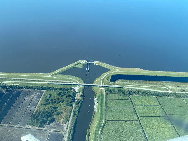
-S-308 at Lake Okeechobee and Port Mayaca
-The C-44 Canal
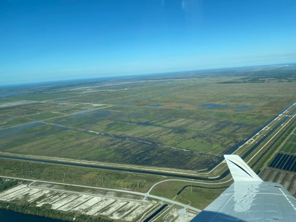
-The ACOE’s recently completed C-44 Reservoir, part of the Comprehensive Everglades Restoration Plan’s INDIAN RIVER LAGOON SOUTH project, being filled with C-44 Canal water- in Indiantown.
-The South Florida Water Management District’s C-44 Reservoir Storm Water Treatment Area-receiving the water from the reservoir and cleaning it before it is returned to the canal and thus the St Lucie River
-Wonderfully performing Caulkins Water Farm
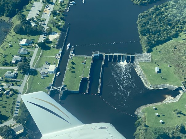
-S-80 at St Luice Locks and Dam (gate open for C-44 basin runoff)
-And finally, the skinny, but very visible plume exiting at the confluence of the St Lucie River/Indian River Lagoon exiting the St Luice Inlet.
The water quality grade from Florida Oceanographic Society ending November 24th was a “B.” This is good news, however, seagrasses remain sparse and manatees are migrating due to colder weather, hungry, and deaths are way above average due to loss of seagrass throughout the Indian River Lagoon and other parts of the state.
The C-44 Reservoir will very much help improve water quality from the C-44 canal into the St Lucie River/Indian River Lagoon. This is a huge step and will be be majorly complemented by the EAA, and C-23/24 Reservoirs in the future. The C-44 Reservoir is being filled incrementally, checking for the structure’s integrity, and is expected to be in full service by the end of next year. Improved water quality is the only way to heal our waters and we need the EAA Reservoir to send the water south!
-Lake Okeechobee appears algae free. Looking east over Structure 308 and the C-44 Canal. FPL Cooling Pond left surrounded by agriculture, mining, and DuPuis Management Area. 


-C-44 Reservoir is two and one half miles wide, and two miles long. Note pump station in left foreground. It is being filled slowly by the Army Corp of Engineers. The STA is in closest foreground.

 -Another angle
 -Back to pump station view
-C-44 Storm Water Treatment Area’s 6 cells cleansing and treating C-44 water were built by the SFWMD. Reservoir is visible far upper left. Note speck of pump station in the distance. 


-Caulkin’s Water Farm is remarkably successful. It cleanses and stores water and was once a citrus grove. Such projects are funded by the Florida Legislature and managed by the SFWMD.
-Various angels of the C-44’s Structure 80, or “The Seven Gates of Hell” that allow both C-44 basin water and Lake Okeechobee water to disrupt salinity and pollute the St Luice River. The gate open in this photo is for C-44 basin water only. Many call this “local basin runoff,” but it is not. In 1916 C-44 busted through the natural ridge that historically separated the St Lucie from Lake Okeechobee.


-St Lucie Inlet looking north towards Sailfish Point. The runoff is from Canals C-44, C23, C-24 and runoff from all our our homes and streets, etc. Pick up dog waste! Don’t fertilize! Go to native and Florida Friendly plants; get on sewer if on septic; demand Agriculture follow Best Management Practices and prove accountability. SAVE OUR RIVERS!

 -St Lucie River at Witham Field. See you next flight!
 The St Lucie River was originally a large fresh water “stream” that ran into the Indian River Lagoon. An inlet was cut in 1892.