Tag Archives: agriculture

Understanding Appropriations for the IRL & Okeechobee Basin, Fiscal Year 2014-2015

Florida League of Cities, 2014. (Photo FLC/Negron)

Senator Joe Negron, Senate Appropriations Chair, and leader of the “Senate Hearing on the Indian River Lagoon and Lake Okeechobee,” brought home more money for the IRL compared to any other water body in the state: $231,998,021. Our springs comrades  who have been publicly fighting ten years longer than us, brought home 30 million. Tallahassee is wondering who this new kid on the block is, us….

Appropriations chart IRL/L.O. Basin 2014/15. (Senator Negron's  Office)
Appropriations chart IRL/L.O. Basin 2014/15. (Senator Negron’s Office)

Whether you are a fan or not, it must be noted that Senator Negron stuck his neck out, possibly compromising his senate presidency, to get our “name on the map” as far as Tallahassee  goes. Prior to last year, most “good ‘ol boys in Tallahassee would have said, “Indian River Lagoon…Hmmmm? Creature of the Indian Lagoon, ain’t that a movie?”

Nonetheless, I do not pretend to think that these monies alone will cure the lagoon’s ills, as the gorilla in the room has not been addressed “head on and in its entirety:” the releases from Lake Okeechobee through S-308 and S-80. I believe this will come in time if we keep fighting.

In my opinion, the biggest part of change is the first step. With the outrage of the public over the “Lost Summer’s” toxic St Lucie River and Indian River Lagoon, and the support of Senator Negron, one of the few  people in a the legislature with the seniority and status to act somewhat independently of demanding party pressures to conform, we have taken the first step forward to fixing the lagoon. Actually, a leap.

WE MUST CONTINUE, YES! But let’s be happy that we have made public progress on a state level more than ever before, and let’s look at what we received, as we should be aware of the gift of public monies from people all over our great state and be full of gratitude. 

It’s a lot to go over, but it is important, so I will simply go down the list and summarize. Let’s look at the map as well. Please remember the SLR/IRL is part of the greater Everglades system, from the Kissimmee River area in Orlando, south to the Tamiami Trail in Dade, and beyond to Florida Bay.  So anything done to help “the system,” helps us move water south, and with our health as well.

Fascility and Infrastructure Location Map Index, 2014. (Senator Negron's Office)
IRL/L.O. Fascility and Infrastructure Location Map Index, 2014. (Senator Negron’s Office)
Key to star/locations on map.
Key to stars/locations on map.

Here we go!

1. $32,000,000 for Water Quality storage in Storm Water Treatment Area 1 in Palm Beach County. Water storage is key to stop releasing so much into the estuaries.

2. $3,000,000 for Best Management Practices (BMPs) for farmers in the St Lucie, Lake O, and Caloosahatee watersheds. It is difficult to swallow more public money going to help farmers with pollution runoff, but there is no other way to do this. We must continue to help fund them, big or small. This is a historical issue as they have been here since the 1800s in many cases. I look at it like “grandfathering” with an extra requirement, as in real estate. The good news is that as time goes on, agriculture businesses will have higher standards to avoid pollution fertilizer, pesticides and fungicide runoff that is killing our waterbodies. Hopefully we can make changes before the rivers and springs die off completely.

3. $40,000,00  for the C-44 Storm Water Treatment Area/reservoir in Martin County. This will offset local drainage farm and urban runoff along the C-44 canal, not water from Lake Okeechobee. We must clean our local runoff as well as it is responsible for around 50% of the destruction to our estuary and on an everyday basis.

4. $2,000,000 CERP Picayune Strand east of Naples in Collier County. This area is important to the southern glades and needs monitoring and vegetative management for water flow and storage and improvement. Hopefully it will help some panthers too!

5. $5,000,000 C-111 South Dade. This is a crucial water delivery system to allow more water to “go south.” A  must.

6. $5,000,000 Kissimmee River Restoration. The all time worst thing ever done in Florida other than dike Lake O and redirect the water to the estuaries, was to straighten the Kissimmee River. (Hold my tongue!) Restoration of the ox bows must continue. So far the ACOE has restored about 22 miles of the 56 miles of what was once 153 miles of gorgeous serpentine like, vegetative, wildlife filled, cleansing waters.

7. $18,000,000 C-43 STA along Caloosahatchee River. This is the equivalent of C-44 STA/reservoir for the Caloosahatchee.  Only fair. C-43 is a must. They take up to three times the polluted runoff from Lake Okeechobee that we do!

8. $20,000,000 IRL muck removal in northern lagoon. The northern IRL has lost 60% of their seagrasses and has 2 Unexplained Mortality Events including manatee, dolphin, and pelican die offs. Give them what they need! Sediment/muck fills the lagoon over the years from canal runoff covering seagrasses; when stirred up, it releases legacy pollution. GET THE MUCK OUT!

9. $2,075,000 Lake Worth Lagoon. Lake Worth does not get the attention it needs being in development happy Palm Beach County. This area was once full of sea grass and life but not after years of receiving dump water from Lake O, like us, but through a different canal. Local advocate, Lee  Shepard, is a great advocate for this part of the lagoon. Let’s help!

10. $4,000,000 Water Quality research for  Harbor Branch and ORCA. Although it is hard to justify “more tests,” as we can all see the lagoon is dying, these new, scientific studies will help us find sources to our pollution issues that the legislature can’t ignore.  Septic leakage,  especially, is difficult to trace without such systems. LOBOS and Kilroys, please help us!

11. $1,000,000 Oyster recovery programs for St Lucie and Caloosahatchee Rivers. Millions of dollars worth of  oysters, natural and deployed by government programs, died during the fresh water discharges of 2013 and years before. One oyster can filter 50 gallons of water a day. Government in action….

12. $90,000,000 NUMBER ONE NECESSITY  is raising the Tamiami Trail in Dade County so water is not blocked off from going south. They should raise the whole  road as the road built in the 1920s cuts off the flow of water south to the Everglades  for the entire state. (Another environmental nightmare to fix.)

13, $2,7769,585 This money will be used for pump improvements etc to move more water south and cut away vegetation blocking water “going south,” or hold water in the C-43/44 reservoirs that would go into the estuaries.

14. $2,076,728 The Loxahatchee is one of two “Wild & Scenic Rivers” in the state of Florida and home to tremendous amounts of wildlife. Helping with storm water runoff and preservation is key for the health of this important part of the Everglades System.

15. $2,076,718 The St Lucie Rivers Issues Team has a long history of working with local governments for “close to home” projects along the SLR/IRL. Kathy LaMartina at its helm, South Florida Water Management District. Thank you!

Grand total= $231,998,021

I am  grateful to the state legislature, especially Senator Negron, and I must note Governor Scott did not veto one line. But please know everyone, the “fight for right” along the Indian River Lagoon has just begun!


Florida Inland Navigation District, F.I.N.D., Maintaining the Okeechobee/Atlantic Waterways of the St Lucie River/Indian River Lagoon

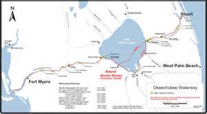
The Okeechobee Waterway or Cross State Canal is managed through a partnership of  F.I.N.D.and the US government.
Parts of the Okeechobee Waterway or Cross State Canal, (partially C-44), is managed through a partnership of F.I.N.D.and the U.S. government, ACOE. (Photo Jacqui Thurlow-Lippisch, 2009.)

The Intracoastal and Okeechobee Waterways are important navigation channels and part of our country’s heritage.

Atlantic Intercoastal Waterway from Maine to South Floida. (Map, public.)
Atlantic Intracoastal Waterway from Maine to South Floida. (Map, public.)


Okeechobee Waterway from Atlantic to Gulf of Mexico. (Map, public)

The history of navigation in the United States is a long one that is difficult to put into perspective within the context of today’s modern world. Military, commercial and communication centers were imperative goals to the newly established United States and remain so today, but these things are now taken for granted and have also inadvertently caused massive environmental destruction.

The Atlantic Intracoastal Waterway is a 3000 mile inland waterway along the east coast of the US from Maine to Florida. The Okeechobee Waterway is a few hundred miles across the state, from Stuart to Ft Meyers, linking the Atlantic to the Gulf of Mexico through canals and Lake Okeechobee.

These canals are directly supported by the public though a tax.  If you look at your tax bill you will notice you are charged a .3045 mill to maintain the Florida Atlantic and Okeechobee Intracoastal Waterways. After a long evolution, today, the state’s Florida Inland Navigational District or FIND is the entity that acts in cooperation with the US Government, Army Corp of Engineers,  to oversee these tax funds in order to maintain these important canals that serve many purposes.  Some we don’t like…

One of the purposes of the Okeechobee Canal, built in the late 1920s and “improved” many times since, by being deepened and widened,  is to release water from Lake Okeechobee into the St Lucie River/Indian River Lagoon when Lake Okeechobee gets too full, as the lake  has been diked for the safety of agricultural lands and urban communities living around and south of the lake.

The mission of FIND is very broad actually; if we look at the mission statement of FIND it reads:

“The Florida Inland Navigation District has two primary missions: (1) to perform the functions of the “local sponsor” of the Atlantic Intracoastal Waterway project and a portion of the Okeechobee Waterway project in Florida, both of which are State/Federal navigation projects, and (2) provide assistance to other governments to develop waterway access and improvement projects. As the local sponsor of the Waterway, the District provides all lands required for the navigation project including rights of way and lands for the management of dredged materials removed from the waterway channel during dredging activities.”(http://aicw.org/index.jsp)

FIND is overseen by commissioners from the twelve counties along Florida’s east coast. Commissioners are appointed by the Governor and approved by the Senate. Our local commissioner is friendly and well known,  Mr Don Cuozzo.

Don Cuozzo
Don Cuozzo

FIND also serves other purposes very close to the people and local communities that I do care about, such as providing grant funding for local waterways improvements, and maintaining the important manatee signage and protection zones. We all know this iconic and endanger species, a gentle, distant relative of the elephant, is often stuck by speeding boaters.

Award winning photo seen in National Geographic story on south Florida waters.
Award winning photo seen in National Geographic story on south Florida waters, 2012.) (Photo by Paul Niklin, friend of Nichole Mader.)

Thank you to FIND, but it sure would be nice if we could FIND another way to for the lake’s water to go than through the St Lucie/Indian River Lagoon.

For 2013, Ed and I paid $13.31 to FIND. Although I would prefer not to support the Okeechobee Waterway atrocity, I do like manatees, boating, and the Town of Sewall’s Point has benefited from FIND grant programs as well.  So, I guess, for now, Ed and I  will pay the tax; but one day, I have the feeling, I might just rebel!

_______________________________________________________

Atlantic Intercoastal Waterway (http://en.wikipedia.org/wiki/Atlantic_Intracoastal_Waterway) 

Okeechobee Waterway, ACOE: (http://www.saj.usace.army.mil/Missions/CivilWorks/LakeOkeechobee/OkeechobeeWaterway(OWW).aspx )

EAA/SFWMD, why isn’t more water going south, instead of into the SLR/IRL?

This chart shows how even though more Storm Water Treatment Areas came on line in 2004 and after, actually less water from Lake Okeechobee is "going south." Why? (Chart by engineer Gary Gorforth, formerly of the SFWMD.)
This chart shows that even though more Storm Water Treatment Areas (STAs) came on line (red) in 2004, actually less water is “going south,” (blue). Why? (Chart by engineer, Dr. Gary Gorforth, formerly of the SFWMD, 2014.)

The first time I saw Gary Goforth speak (http://garygoforth.net/services.htm) at Senator Joe Negron’s Senate Hearing on the Indian River Lagoon and Lake Okeechobee in 2013, I was very impressed. He was sitting next to Karl Wickstrom, the founder of Florida Sportsman Magazine, who I sit with on the Rivers Coalition Defense Fund. I knew if Dr Goforth had Karl’s “blessing” he belonged to an elite group of people in the River Movement, as Karl, who I love,  is understandably critical of everyone.

I came to learn that this accomplished and well spoken man, had worked at the South Florida Water Management District (SFWMD) as a Ph.D. engineer, most of his esteemed career and in fact “built” the Storm Water Treatment Areas (STA) in the Everglades Agriculture Area (EAA) as head engineer for the district’s projects in 2004 on onward. Today he runs his own engineering company here in Martin County independent of the district. (See link above.)

Map south of Lake O. showing EAA, STAs, and WCAs. (Map Everglades Foundation, public)
Map south of Lake O. showing EAA, canals, STAs, and Water Conservation Areas, (WCAs.) (Map SFWMD, public.)

An STA is an area that filters water through vegetation taking up nutrients like phosphorus and nitrogen and even pollution before it goes into a water conservation area and then to the Everglades.  It is an area engineered to do what Mother Nature did before we transformed her into farmlands and urban landscapes.

Aerial os STA in EAA surrounded by sugar fields. (Public photo.)
Aerial of STA in EAA surrounded by sugar fields, northern area. (Public photo.)

When the Everglades Forever Act was passed by the Florida legislature in 1994, and after Governor Chiles “laid down his sword,” the SFWMD was required to build more STAs to filter the polluted water running  into the Miccosukee lands and Everglades further south. The Miccosukee had sued the US government and the SFWMD, (a long, famous lawsuit starting in 1988), as specifically the high phosphorus from  fertilizers and pollution from  the EAA’s sugar farms was destroying their reservation’s waters and fauna and therefore all that lived there. The law suit accomplished two major things. It called for 10 parts per billion phosphorus rather than 200 plus so the STAs were built and it called for a certain amount of water to go south to sustain the life of the Everglades.

So in comes the law regarding amounts: In chapter 3773.4592, Florida Statues, “1994 Everglades Forever Act” the SFWMD was directed to send an additional 28 % water to the Everglades, including 250,000 acre feet of Lake Okeechobee water based on base flow statistics from 1979-1988. The Everglades needs water to live.

It is confusing, but although the STAs can send both EAA water and lake water south to the Everglades, the SFWMD gives the EAA water (from the lake, used to water their crops), priority in moving south. Lake water goes south only if the STAs have room….

OK. Here is the kicker.

Although in the recent past, the EAA spent tons of money removing toxic chemicals from the lands they had to give up for STAs and although the tax payers spent billions of dollars building the STAs on those lands for cleaning EAA water and Lake Okeechobee water, Gary Goforth’s charts and engineering show that since 2004, actually less lake water is going south to the Everglades. And most of the water going south is EAA water, very little Lake water comparatively ….Why?

Well, from what I think I understand, even though all this money has been spent in the EAA and tax payers building the STAs, the EAA and SFWMD who work together,  are “scared” to send too much water south  because if they go over the 10 parts per billion phosphorus limit (an annual limit) they could be sued again. Thus they hold the EAA water in the STAs letting it dribble out and therefore there is no room for Lake O’s water most of the time.

Hmmm?

As Dr Goforth points out,  it is the St Lucie River and Caloosahatchee that do not get what was legislated for them: a minimum of 250,000 acre feet of lake water sent south a year.

As  stated in an email to me:

“The 1994 Everglades Forever Act (Florida legislation Ch. 373.4592, F.S.) directed the South Florida Water Management District to send an additional 28 percent water to the Everglades, including 250,000 acre feet of Lake water. The 1979-1988 base period flows to the Everglades included an average of 100,931 acre feet from Lake Okeechobee – resulting in a targeted increase of Lake water to the Everglades of 148 percent.
For the most recent 10-year period (May 2005-April 2014) an average of 71,353 acre feet of Lake water was sent to the Everglades – or an average decrease of 29 percent from the 1979-1988 base period.

So – the target was a 148 percent increase – and the reality was a 29 percent decrease. This was in exchange for a billion dollars of public funding for the STAs. Who holds the State accountable?” Gary Goforth

Another chart showing the same ideas. )Gary Goforth 2014.)
Another chart showing the same ideas.) (Gary Goforth 2014.)

If you are like me, this all may remain confusing, but I think the point is made… I hope so anyway.

“Legally, not enough Lake O water is going south.”

This is a serious situation. Really, only the people can hold the state accountable, but do we really want to sue again? Can this be resolved?

Many say it is impossible to send the water south at 10 ppb. This may be the case. Nonetheless, I say the Miccosukee  Indians finally won something after generations of sadness to their people, after being forced to live on a postage stamp, so as “tough as it sounds,” I believe the EAA, the SFWMD,  and the state of Florida have some more work to do.

_________________________________________________________________

Florida Statutes, Everglades Forever Act, (Ch. 373.4592)(http://archive.flsenate.gov/statutes/index.cfm?App_mode=Display_Statute&URL=0300-0399/0373/Sections/0373.4592.html)

FDEP, Everglades Forever Act: (http://www.floridadep.org/everglades/efa.htm)

(Everglades Restoration:(http://en.wikipedia.org/wiki/Everglades_Forever_Act#Everglades_Forever_Act)

The City of Port St Lucie, a city along a dying “Aquatic Preserve” of the St Lucie River/Indian River Lagoon

Aerial of what was to become the City of Port St Lucie, 1957. (Photo Ruhnke/Thurlow collection, courtesy of Sandra Henderson Thurlow.)
Aerial of what was to become the City of Port St Lucie along the North Fork of the St Lucie River, 1957. (Photo Ruhnke/Thurlow collection, courtesy of Sandra Henderson Thurlow.)

Wow, look at this!  A 1957 aerial photograph of the beautiful North Fork of the St Lucie River and its surrounding virgin lands that would incorporate as the City of Port St Lucie in 1961.

This Aia Indian and Seminole wilderness became spotted with many ranch lands but there was foresight for “protections” for some areas as it was beloved by hunters and fisherman and “just people” that wanted to protect its resources. It was full of wildlife on land and in its waters, which had been considered the best mostly “fresh water” fishing in the area for decades.

Preserve sign in the the area of Pruitt's Fish Camp, near today's Club Med.
Preserve sign in the the area of Pruitt’s Fish Camp, near today’s Club Med, ca. 1960s. (Photos courtesy of  Sandra Henderson Thurlow.)

In 1972 local, federal and state agencies led by the Florida Department of Natural Resources cooperated to declare the North Fork of the St Lucie River an “Aquatic Preserve.” And in 1984 the Department of Natural Resource, which merged into today’s Department of Environmental Protection, created a management plan for the area. The plan states:

“The preserve is one of the last remaining freshwater/estuarine wilderness areas in this region of Florida. The major objectives of the aquatic preserve management program are to manage the preserve to ensure maintenance of essentially natural conditions, and to restore and enhance those conditions which are not in a natural condition. Management will also be directed to ensure public recreational opportunities while assuring the continued propagation of fish and wildlife.” (

http://www.gpo.gov/fdsys/pkg/CZIC-qh90-75-f6-g57-1984/html/CZIC-qh90-75-f6-g57-1984.htm

)

(NOTE: The Florida Department of Environmental Protection removed these links from public view in 2016. When I called they said the links were being archived. JTL)

I don’t know why really, but this plan was not implemented and unfortunately the area of the North Fork’s headwater’s at Five and Ten Mile Creek were contaminated by agricultural pesticides in 1995 in a formal document by the Florida Department of Environmental Protection. (

Click to access tenmile_creek.pdf

) In 2002 the St Lucie River including parts and beyond the “aquatic preserve” was designated an “impaired water body” by the same agency  in 2002. (

Click to access SLE_Impairment_Narrative_ver_3.7.pdf

)

All the while the city of Port St Lucie grew and grew…

Growth of City of City along Port St Lucie
Growth of PSL along North Fork of  St Lucie River, 1969 to 2000, from the book, Port St Lucie at 50, A City for all People, by Nina Baranski. photo

According to the US census there were 330 residents in 1970 and 88,769 in 2000. In 2012 there were over 250,000 residents. 

Over the years, the city and agencies did not pay attention to  how developers and people developed their homes along the river, and many were developed go right up the the shoreline of the Aquatic Preserve as this photo by the FDEP shows. This is how fertilizers and pesticieds run right into the water. Not smart.  (

http://www.dep.state.fl.us/coastal/sites/northfork/description/surroundings.htm

)

NF_grass1


The State of Florida projects that the City of Port St Lucie is to have have 400,000 residents by 2025. Presently with over 250,000 residents, they are the state of Florida’s ninth largest city.

As odd as it sounds, this population may be a key to turning things around for the St Lucie River/Indian River Lagoon. Our Treasure Coast area never had enough votes to get much attention until recently and some of the St Lucie city and county commissioners are some of the most vocal in the the Save the Indian River Lagoon movement.

Why the state and federal and local agencies allowed the degradation of lands they spent an enormous amount of time protecting is pathetic. As usual there is only one hope for change, the people pushing government to save what’s left and find ways to let the estuary recover, may be the only answer to saving the St Lucie River/Indian River Lagoon.


Sugarland Road Trip to the Caloosahatchee, Celebrating 50 Years of Friendship along the St Lucie/Indian River Lagoon

Martin County High School Class of 82 friends celebrated their 50th birthday on the Caloosahatchee, the sister river to the St Lucie.
Girlfriends from the Martin County High School Class of 1982 celebrating our 50th birthdays in Sanibel/Captiva, the area of the Caloosahatchee River, Lee County, Florida.

This past weekend, my girlfriends from high school decided to travel across the state to celebrate our 50th birthdays!

photo

It was a great time. We stayed in the area of the Caloosahatchee River which is the sister river the the St Lucie River. Both rivers have been plumbed to take overflow waters from Lake Okeechobee that Nature meant to flow south to the Everglades. The Caloosahatchee, in fact, is the “bigger sister,” in that when the rains come, she takes three to four times as much polluted, fresh water as we do—she is longer and larger than ourself. Ironically now, year long,  the river needs constant small releases of fresh water from the lake as she becomes too saline. The system is suffering as is the St Lucie.

Caloosahatchee River was the first estuary to be channelized and connected to Lake Okeechobee in the late 1800s by Hamilton Disston.
Caloosahatchee River was the first estuary to be channelized and connected to Lake Okeechobee in the late 1800s by Hamilton Disston. (Photo, CRCA)

“Caloosahtchee” means “river of the Calusa,” after the native peoples who lived and thrived there thousands of years ago.

So how does the Calooshatchee compare to the St Lucie? Well, according to the Caloosahatchee River Citizens Association, (CRCA), as sea levels receded after the last ice age, a series of lakes connected by wet prairies fed a tiny lake in the center of a valley feeding a “tortuously” long, crooked river that flowed slowly west to the Gulf of Mexico. So the Calooshatchee like the St Lucie drained to the sea but was never “connected” to Lake Okechobee. 

But then entered “modern man.”

In 1881, investor and business man, Hamilton Disston, bought four million acres of Florida lands for development and agriculture getting the state out of debt.  His first project was to drain the land around lake Okeechobee.

He dynamited the water fall between Lake Flirt and the Caloosahatchee and connected an old Indian passage from the Caloosahtchee to the lake. With that and the dredging and channeling of the mouth of the Kissimmee, the lake dropped tremendously, and although Disston committed suicide in a bathtub after the Panic of 1893, he inspired those following him to continue the drainage machine that has formed the Florida  we know today.

After the floods and hurricanes of 1926 and 1928  the Caloosahatchee was straightened, deepened, and widened, draining surrounding agricultural lands and controlling flood waters.  The “improvements” continued again in the the 1950s as more people moved into the area.

The story of the Calooshatchee is very similar to the St Lucie.

On another note, one of the most interesting parts of getting to the Caloosahatchee with my friends was driving “under” Lake Okeechobee taking Highways 441, to 80, to 27 and passing through the sugar towns of Belle Glade, South Bay, Clewiston and La Belle. It was a  three and a half hour drive from Stuart to Captiva and most of the drive was through the Everglades Agricultural Area.

The Everglades Agricultural Area is 700,000 acres south of Lake Okeechobee.
The Everglades Agricultural Area (EAA) is 700,000 acres south of Lake Okeechobee. To drive through them one drives just south of the lake.

As we were driving through we were amazed to think that historically the waters of Lake Okeechobee went south,  as today, south of the lake,  it is sugar fields for as far as the eye can see! And for many, many miles you are driving right next to the dike.

“This is kind of weird…”

Mile upon mile of sugar fields is the view while  traveling south of the lake.
Mile upon mile of sugar fields is the view while traveling south of the lake.
Southern dike around Lake Okeechobee looks more like a hill of grass.

I reminded my friends of the hurricane of 1928 and the thousands of migrant workers that were killed with no alert of the coming doom. The small dike around the southern lake certainly did not look like it would hold if another monster storm came. We talked about how clueless we were as kids to the environmental effects of agriculture on our St Lucie River/Indian River Lagoon compared to what the children are learning today.

Of course we need agriculture but to have 700,000 acres completely cut off water flow south of the lake is an accident waiting to happen and a death sentence for our St Lucie Indian River Lagoon and for the Caloosahatchee.

As I talked about a possible third outlet to the lake, I told my friend Jill not to speed because if we were stopped, and I was in the car, we would all certainly go to jail!They laughed knowing I am an advocate for the St Lucie/Indian River Lagoon an often contentious issue when it comes to sugar farming.

Once in Captiva, we had a great time, paddle boarding, riding bicycles, swimming, and going out in Sanibel/Captiva Island.

Such a wonderful time would not have been possible had the Army Corp and South Florida Water Management District been releasing masses of polluted, fresh water from Lake Okeechobee. United  we are on both sides of the state, that there has to be another option for Lake Okeechobee’s water coming through our estuaries–we are sisters!

A beautiful sunset over the convergence of Pine Island Sound and the Caloosahatchee.
A beautiful sunset over the convergence of Pine Island Sound and the Caloosahatchee , our sister river.


Giant Mammals 10,000 Years Ago Along the Indian River Lagoon

Ten thousand years ago some of the largest mammals ever known lived right here along the northern central Indian River Lagoon.
Ten thousand years ago some of the largest mammals ever known lived  along the  Indian River Lagoon. (Photo Jacqui Thurlow-Lippisch.)

I am in Melbourne, Florida, serving as a delegate for the Marine Resources Council’s  Action Assembly of the Indian River Lagoon. I got here early and started reading up on this area of the lagoon that is suffering from marine mammal deaths of manatees and dolphins. Brevard County holds 60% of the lagoon and basically just about all of their sea grasses are now dead and though over nitrified water certainly fed the super bloom that killed the sea grasses, scientists feel there is more to the story. But scientists are not allowed to just feel, they have to “prove” so the struggle to explain what happened continues…

The assembly is being held at Florida Tech, which sits close to Crane Creek, a tributary of the IRL. About 10,000 years ago Mammoths lived here and their gigantic skeletons have been excavated. Paleontologist have also found bones of mastodon, horses, camels, the 20 foot tall ground sloth (the largest mammal to ever roam North America) along with tapir, peccary, camel and my favorite, the incredible saber-toothed cat.

image

Image from (http://www.slothsanctuary.com)

Although humans also lived in this area 10,000 years ago, it was not until modern times that Crane Creek was drastically altered. In 1922, after the times of the pioneers, efforts to drain the area under Florida statute 298 were successful and the M-1 canal along with with feeder canals dried the lands of the surrounding area and inland along the St Johns River for agriculture that the real estate ads had promised.

Today the area is highly populated and is the home of a struggling NASA. A six lane highway abuts the once beautiful Indian River Lagoon and concrete is everywhere.

of course, times change, still it is hard to picture Mammoths walking around here! I wonder what this area will look like in another 10,000 years? Maybe something weirder than a 20 foot sloth or humans will walk or climb. Maybe something smarter? I hope.

Aerial Tour of the Kissimmee River/Inspiration for the Indian River Lagoon

Aerial photo of positron of restored Kissimmee River. Note discolored filled in C-38 canal juxtaposed to winding restored oxbows. (Photo Jacqui Thurlow-Lippisch, 2014).
A portion of the restored Kissimmee River. Note discolored and filled C-38 canal juxtaposed to winding restored, greener oxbows. (Photo Jacqui Thurlow-Lippisch, 2014).

Last week, on a hazy smoked filled afternoon, Ed and I flew over Lake Okeechobee and the once mighty Kissimmee River. There was the normal stress involved with me giving Ed directions and the fun of an adventure. It went something like this:

“Oh there it is, the Kissimmee’s opening to the lake, over there!”

I can’t fly north of “over there,” it’s off limits; it’s a near a bombing range or air force base…” says Ed, shooting me a serious glance.

“What a bombing range-air force base? You’re kidding, close to of some of the state’s richest wildlife habitat? How symbolic…”

Ed rolls his eyes, I can feel it. But he tries harder…

Somehow, Ed talks to Miami Air Traffic Conrol and we get lucky.  It is  a Sunday and we are allowed to fly over at least part of the area I wish to see.

On the way, we fly over the southwest area of the lake’s agricultural lands. The hand of humankind is reflected in organized, perfect sized boxes of agriculture and straight canals.

SW Lake O. Ag

We veer off to the northwestern area of the Lake Okeechobee where earth and water meet; on this side of the lake the hand of the Creator still evident. Little specks of light blend together in a blinding symphony of light.

Fish-eating Creek

We near the area in Okeechobee County where the mouth of the once great Kissimmee meets Lake Okeechobee. The straightened canal looks out of place among the lush greenery and  a small town is evident. There are people here. Flooding is an issue.

mouth

It is great seeing “it all” from above as I have never really been able to figure out on a map where the Kissimmee River restoration is happening. It starts about 20 miles north of the lake.

The Kissimmee river was once 103 miles of wildlife/fish filled meandering oxbows, but it was canalized to a depth of 30 feet as C-38 from 1962-71. This was  part of the Army Corp of Engineers and the Central and South Florida “Flood Control Project” of 1954. The state had asked for help after two back to back hurricanes and wide spread flooding and destruction  in 1945. The state got help but with untended consequences…

The Kissimmee River that once meandered south to Lake Okeechobee as part of a two mile wide flood plane now shot down to the lake with grave environmental effects that included the destruction of the estuaries, St Lucie/Indian River Lagoon and Caloosahatechee.

Since 1994, around 23 miles of the now 56 mile long  canal, C-38,  from Lake Kissimmee to Lake Okeechobee has been/is being backfilled and considered part of “the” most ambitious environmental restoration project in the world.

IMG_3558

Recently, the ACOE and SFWMD  have been in a dispute over the completion of the restoration project.  The project is tremendously expensive requiring federal and state funding which has not come easy since 2008. The two agencies “cost share” in its completion. Word is they are “working things out…”

The long term goal is to continue the restoration of at least 20 miles more of the 56 miles of the canal.

In light of the dying Indian River Lagoon, it is important to see that restoration can be accomplished. Mother Nature is quick to rebound once given the chance.

The Kissimmee’s restoration is critical, as the polluted waters coming from Orlando south carry sediment, and urban and agricultural runoff  into the lake. As we know, when the lake gets too full the water is diverted to the estuaries because the water is not presently allowed to flow south, as the EAA (Everglades Agricultural Area) is located there along with cities of people.

So we here along the St Lucie Indian River Lagoon, are fighting a two front war. One north and the other south of the lake.  We are winning in the north because the ACOE and SFWMD recognized their/our mistakes, and have been working since 1994.  We are also getting closer in the to finding a safe way to “move the water south…” CEPP (Central Everglades Planning Project) is not looking good right now,  but the pressure is on, and even Tallahassee  is saying “move the water south!”

We must have inspiration or we will never complete our goal of saving the estuaries. The  Kissimmee River is a place to look and find hope.

15b869bc8b67d1256346bae6b672f40f

2014 Google Earth map of restored area of Kissimmee River.

___________________________________

LINKS:

SFWMD (http://www.sfwmd.gov/portal/page/portal/xweb%20protecting%20and%20restoring/kissimmee%20river)

Great write up on Kissimmee from  2006 SFWMD: (http://www.sfwmd.gov/portal/page/portal/xrepository/sfwmd_repository_pdf/krr_exec_summary.pdf)

Sun Sentinel photos: (http://www.orlandosentinel.com/news/local/orl-kissimmee-river-photos,0,460375.photogallery?index=orl-kissimmee-river-rend20100103202823)DEP ( http://www.protectingourwater.org/watersheds/map/kissimmee_river/)

Understanding South Florida’s Canal Systems, Storing/Sending More Water South to Save the Indian River Lagoon

Understanding sending water south requires understanding  the canal structures north and south of Lake Okeechobee and how they can be altered. ACOE map, April 18th, 2014.
Understanding sending water south and storing north requires familiarity with the canal structures and pump systems  north and south of Lake Okeechobee. ACOE, April 18th, 2014.

I have been getting a lot of calls asking me to explain how South Florida’s canal systems work; how more water will be stored north of Lake Okeechobee and more sent south to the Everglades in light of everything that is recently in the newspapers.  So in this short space, I will attempt to give just an overview of South Florida’s canal and drainage system. Mind you, you may come up with some of your own ideas to add to what is already being proposed…

As an aside, I must note that the main way the “powers that be” keep the public from changing “things” is that they don’t talk a lot about “how things work.” So it is our job to be proactive and figure this our by ourselves. There are many resources at our disposal should we seek, and if we help each other interpret the data.

EVERGLADES RESTORATION: (http://www.evergladesplan.org/about/landing_about.aspx)

SFWMD:(http://www.sfwmd.gov/portal/page/portal/sfwmdmain/home%20page)

ACOE J-V: (http://www.saj.usace.army.mil)

First of all, the natural water system of Florida has been completely altered since the early 1900s and even more so since World War II.  Look below at the pink line surrounding the lake; this is the approximate boundary of the original greater everglades drainage basin. Look at all of the houses built inside the pink line from Palm Beach County south. Next, look at the yellow line inside of the pink line, on the right side; this is the East Coast Protective Levee, a giant concrete permeable slab along with pumps, that keeps the natural ground water from “seeping permanently” into the area built inside the drainage basin. 

photo

Now we will look north of Lake Okeechobee to see the Kissimmee River, that has was channelized, or made straight,  in the 60s and 70s that dumps tons of water into Lake Okeechobee, that in turn is diverted to our estuaries. The great river once had a wide, winding, drainage basin that held water, but it was straightened so now it all pours quickly into the lake full of agricultural and urban filth. An approximate 20 mile long section is  now slowly being restored as best possible, in light of ranching and regaining right of ways. We must encourage them to restore it all in time.

photo 4

Now let’s take a good look south of the lake. One can see that the entire area is now the EAA, or Everglades Agricultural Area. This area has very productive land, as it, like the Nile River in Egypt, naturally floods and overflow its banks, enriching the surrounding areas with layers of rich soil. But rather than just grow crops when the river receded, we diked the lake permanently and now grow crops year-round south of the lake, not allowing the waters to flow south if the lake starts to overflow.

Agriculture is the monetary and cultural heritage of Florida but it is interesting to note that today agriculture is the second biggest industry in Florida after tourism. With the estuaries areas growing population, today, there is substantial tourism money connected to the estuaries; there was not in the 1900 through the 1970s. But the canal system is still set up for the agriculture industry to thrive as it has since about World War II and we do need  agriculture. Here in lies the tension.

Also, of course,  the water being diverted into the estuaries protects people south of the lake inside that pink area from being flooded as well. So figuring “this one”out is very tricky business. Nonetheless, we must create a flow way south as hopefully CEPP will start to do.

CEPP Central Everglades Planning Project: (http://www.evergladesplan.org/pm/projects/proj_51_cepp.aspx)

photo 1

What a change to Mother Nature. Is this now a permanent system or could it be altered to accommodate changes in values and concerns for today? Like all things, in order to survive, it must adapt.

So slowly a flow way south of the lake must be the goal; the Kissimmee River must be fully restored so its flood plain can hold and filter more water; the St Lucie River and Caloosahatchee Rivers must be restored.

I think we have all noticed that, the River Movement is finally catching traction, and we must  not let up. We are excited for our seeming progress but remember, “smoke and mirrors” will appear. But this is no magic trick to be amazed by, this is real.

We are making progress. Let’s keep educating ourselves, and continue fighting and inspiring our government and our children to keep working to store more water through the restoration of the Kissimmee and send more water south. Let’s learn about South Florida’s canal and drainage system and think of ways to adapt it for a better future.

photo 5

*Most of these maps can be purchased through the South Florida Water Management District or at Val Martin’s bookstore in Hobe Sound, Florida Classics Library: (http://www.floridaclassicslibrary.com)

Understanding the Water Resources Development Act, (WRDA), and the Indian River Lagoon

Congressman Patrick Murphy speaking, Kiwanis luncheon, 4/15/14, 2014.
Congressman Patrick Murphy speaking, Kiwanis luncheon, 4/15/14, 2014. (Photo by Jacqui Thurlow-Lippsich)

One of the nicest things lately is spending time with my father. He is a long time member of Kiwanis and has invited me to be a guest three times this year. Yesterday, he invited me because Congressman Murphy was speaking, and my dad  knows I like politics, especially “river politics,” of which Congressman Murphy has been very supportive.

In the relatively small group I had the opportunity to ask a direct question. One thing I am very aware of is that even though I study this water “stuff” all the time, I literally understand the only “tip of the iceberg.” This is confusing and I know if I don’t know, there  are plenty of others who don’t know either.

So today, I am going to try to explain what I think I know, and what Congressman Murphy explained yesterday about the Water Resources Development Act (WRDA) that we keep hearing so much about.

First of all, the federal government is a black hole and just because they vote on something does not insure it will happen. As in “authorizing”–or agreeing to spend money on projects. Let’s keep this in the back of our minds….

So WRDA is a bill that is only passed ever so often, in which Congress “authorizes” (kind of promises to give money, over time) to the Army Corp of Engineers, so the Army Corp can do their work. So far, there have been a number WRDA acts since 1974-2007, but none lately. (http://en.wikipedia.org/wiki/Water_Resources_Development_Act)

The proposed WRDA bill that is being worked on right now, for 2014, (it was  2013), “promotes critical investment in the nations water infrastructure:”,  (http://www.epw.senate.gov/public/index.cfm?FuseAction=Files.View&FileStore_id=1db8714f-ac01-4253-8c9f-367d09d6f573). The projects referred to in this bill are mostly structural and not environmental, as in improving ports and the moving agricultural product. Nonetheless, we can benefit from this bill.

From what I understand CEPP, or the Central Everglades Planning Project, that the South Florida Water Management District just voted 5-0 last week to “recommend,” (a big deal), can now go to the Army Corp of Engineers to be included the Corps “final report,”  to hopefully be included in WRDA 2014. CEPP is the first part of “moving more water south” from Lake Okeechobee to the Everglades and is critical to the beginning betterment of the St Lucie River and Indian River Lagoon.

(http://www.evergladesplan.org/pm/projects/proj_51_cepp.aspx)

So this was my question to Congressman Murphy yesterday: ” You just now said WRDA passed, but whenever I hear the ACOE talking about it, it sounds like they are still waiting  for it and hoping to “tag on,” as it is possible to still “get in…?”

Congressman Murphy explained that WRDA passed the US HOUSE with flying colors, (he serves in the House), and then later passed the US Senate, but that the language although similar was not the same, so the bills, together, had to go “to committee” and are still being hashed out–blending House and Senate language and goals for a final bill.

So WRDA  2014 is not yet passed or final…

OK….that makes sense but what is confusing to the public and to me is when they say “it passed.” I guess this is not too much different than in municipal government when an ordinance “passes first reading,” but it still has to go through “second reading” to  “really” pass….

It’s  all very confusing, but WRDA is one of our greatest tools to fix the lagoon, so don’t give up. Keep pushing for WRDA and CEPP’s inclusion, and if you really want to help, write Congressman Murphy to thank him for WRDA passing just the House.  Then egg  him on for Easter and Passover to keep pushing for WRDA, and our river, in ways bigger than he already has.  (FLMurphyPatrick@mail.house.gov)

Developing a Habit of Checking Lake Okeechobee’s Level in Light of the Indian River Lagoon

My niece Evie stands at the manicured edge of the east side of Lake Okeechobee at Port Mayaca. (Photo Jacqui Thurlow-Lippisch 2013)
My niece, Evie, stands at the manicured, “parking lotted” edge of the east side of Lake Okeechobee, Port Mayaca. (Photo Jacqui Thurlow-Lippisch 2013)

Last year, when I was in Clewiston, I thought it was really amazing how everyone, and I mean just about everyone, was aware of the level of Lake Okeechobee. In fact, the local bank on the main drive through town had the lake level flashing on its information screen the way we in Stuart might see temperature. “LAKE OKEECHOBEE 14 FEET” FLASH, FLASH, FLASH…

Of course Clewiston is located at the southern edge of the lake, so for them it is critical to know the lake level as  they are more at risk of flooding and mayhem the higher the lake gets. In fact, according to a Palm Beach Post article last year by Christine Stapelton: “At  15.51 feet, the Corps considers the probability of a breach at about 3 percent; probability rises increasingly faster with each inch. At 16.9 feet it climbs to 10 percent. At 18 feet, to 45 percent. At 21 feet, the dike would fail, causing widespread flooding.”

We here in Stuart, are also affected by the level of lake as when it gets over 15.5 feet the Army Corp’s LORS Lake Okeechobee Regulation Schedule is getting close or telling them to  “dump” to the estuaries. So if one is watching the “writing is on the wall.” There is no need to be surprised when news comes of the dumping if we’re paying attention….

In a perfect world, residents of Martin County would check and know the level of Lake Okeechobee. Last year I asked my husband if he would consider putting a flashing sign of the lake level on his office building on East Ocean. He smirked, laughed out loud but didn’t say “no,” so I am still waiting.

In the meantime, the easier way to check Lake Okeechobee’s level, to see if it is nearing “dump level”, is to go to the Army Corp of Engineers’ Lake Okeechobee web site: (http://w3.saj.usace.army.mil/h2o/currentLL.shtml)

Today the lake is at 13.3, below 15.5. Although this level seems “good” for  Martin County, it is actually only  a few tenths away from where it was last year at this time. If a huge tropical storm or rain event came it could easily increase the level of the lake  by three to four feet. This has happened many times.

So why isn’t the lake lower? Why don’t “they” let it drain to the Everglades now? Well obviously there are other interests than just “ours.” Agriculture in the EAA likes to insure that there is enough water in the lake, because they know that  just as quickly as a  storm could fill the lake, drought could ensure, and not only would the agriculture community be lacking needed water for crops but some of the utilities on the southeast coast may go short on drinking water.  For the wildlife agencies, they are cognizant of  the need of water, but not too much, for wildlife to survive, especially birds and fish.

It is a delicate balance that really Mother Nature and God should be working out but since the mid 1900s “we” have really completely taken over, or so we think…

So let’s be aware of the “bigger picture” and know how we fit into that picture, and in the meanwhile, get into the habit of regularly checking the lake level. Also take time to write your legislators and insist that more water flow south and be stored, and that Kissimmee River be fully restored to hold more water in its flood plain. If they say, “there’s no place to store or clean the water, and there’s no money,” tell them nicely to “figure it out…”and remind them of the great things this county has done in its past.

And last, if you see my husband around town, would you please ask him if he is ever going to put up the electronic sign outside at his office? I’d appreciate it!

Restoration of the Kissimmee & Indian River Lagoon

ACOE Lt. Col. Greco explains restoration of the Kissimmee River
ACOE Lt. Col. Greco explains restoration of the Kissimmee River at a River Coalition meeting in Stuart, 3-26-14. (Photo JTL)

At the request of the Florida and US government, the Army Corps of Engineers channelized the Kissimmee River between 1962 and 1970 to improve flooding that had specifically occurred in 1947. Almost immediately this channelization was recognized as problematic to Lake Okeechobee and the estuaries. In 1997 Congess approved efforts to restore parts of the Kissimmee to its natural design.

With ranch, agricultural and other land purchases that were made in the former flood plains, restoration is/was complex and difficult. Nonetheless the ACOE has completed an approximate twenty mile restoration. This is one of the few great accomplishments made so far to improve the misjudgments of the Central and South Florida Flood Project of 1948.(http://www.evergladesplan.org/about/restudy_csf_devel.aspx)

The problem with the Kissimmee was that it was straightened, let’s try to simplify what has led to the destruction/problems of the Indian River Lagoon by listing what has led to its poor health:

too much shoreline development, building the C-44 canal from Lake Okeechobee to the St Lucie a River, diking Lake Okeechobee, channelizing the creeks that are now the C-23 and C-24 canals, the channelizing of the Kissimmee River, dredging a channel in the lagoon and St Lucie River, runoff from agriculture and urban development that runs into the lagoon, automobiles and the thousands of Department of Transportation canals that also lead to lagoon, causeways that block the flow of water in the lagoon, marinas and boat traffic, fishing line and trash left to harm wildlife, rains that may carry mercury and other pollutants from thousands of miles away, inlets that have been dug and made permanent or at least not allowing the ocean to break through when and where it desired as it did for tens of thousands of years, the invention of synthetic fertilizer and septic tanks, suburbia, herbicides and pesticides and even laundry detergent, drugs and antibiotics that many of us take that seep into the waters of the lagoons causing disfunction to animal life like antibiotic resistant dolphins, (http://www.cehaweb.com/documents/2_000.pdf) the list goes on…

Fixing the Indian a River Lagoon is actually more historic and multilayered than fixing the Kissimmee River. Thankfully we know we have the will to make our government and to make ourselves fix it.

The ACOE’s “Periodic Scientists Call” and the Indian River Lagoon

S-80, Connecting Lake Okeechobee to the St Lucie Canal or C-44
S-80  connecting Lake Okeechobee to the St Lucie Canal or C-44 controlled by the ACOE. (Photo JTL)

“Who controls the past controls the future. Who controls the present controls the past.” George Orwell 

I used to think it was the Colonel of the Army Corp of Engineers who single handedly had control to open the gates at S-80 and S-308 to allow the waters  of Lake Okeechobee to flow into the St Lucie River, Indian River Lagoon. (http://www.saj.usace.army.mil/Missions/CivilWorks/LakeOkeechobee.aspx)

But since February of last year,  I have gotten more insight.

As an elected official, I am allowed to sit in on the Army Corp of Engineers “Periodic Scientists Call” that occurs about once every two weeks.  Last year I was invited to sit in with Martin County and I have attend ever since.

No experience has helped me understand the south Florida water process as much as  consistently sitting in on these calls.

The call is a meeting of the scientific stakeholders to give their input to the ACOE before the Corp makes  its “guidance” for Lake Okeechobee, and usually the following Thursday, after, meeting with the SFWMD,  a “recommendation.”

As you can imagine,  the call is run by the US Army, so it  is very systematic and the language is filled with acronyms and science jargon. For the first six months, I was basically a silent  idiot listening to a foreign language. But slowly I have been catching on.

Thankfully some things are totally predicable. For instance, every call the first thing that is accomplished after reading the rules of the call, is that  the roll call is taken. I like to listen to who is there: ACOE? Florida Fish and Wildlife Commission? City of Sanibel? Ft Meyers? Martin County? St Lucie County? NOAA? Florida Dept. of Environmental Protection?  Florida Department of Agriculture and Consumer Services? SFWMD? Broward County? Highlands County? Osceola County? Tribal Nations? Lee County? Ding Darling? Congressmen and other elected representatives? Members of the public? Other?

Then a leader from the ACOE  gives a short power point presentation that reviews rainfall; precipitation outlooks by the SFWMD and NOAA; Lake Okeechobee inflows and outflows;  operational band standing; SFWMD position analysis; Lake Okeechobee Regulation Schedule (LORS); and then finally a “guidance” for a “decision.”(http://www.saj.usace.army.mil/Media/NewsReleases/tabid/6071/Tag/2128/lake-okeechobee-regulation-schedule.aspx)

Next, each stakeholder, one at a time, gives an update on their specialty and makes their case for their interest. Public members are then allowed to speak and and the again the ACOE leader goes through everyone one more time to see if if anyone has  new comments based on the other just shared.

The calls are scientific and unemotional. However, there times of tension and difficulty like last year when the ACOE began releasing to the St Lucie River, Indian River Lagoon and Caloosahatchee on May 8th and continued steadily, then intensely, through September 21, 2013. This tension may start up again soon, as the lake is higher than they wish for this time of year and it has been a wet winter. The “decision” should become public today.

I have to say that after sitting in on all these calls, the Army Corp often holds back when the LORS chart, and maybe even the SFWMD, says to “release.” But in the end, the inevitable occurs.

Although I appreciative of the hard working men and women who run the ACOE, I do think the overall system fails to take into account the long term survival needs of the natural system which includes “us,” and favors the security of resources of the sugar industry and agriculture south of the lake.  It is easy to fall back on  “flood control” each time the lake rises, and dump east and west, but the system is more far reaching and has greater demands than just that. The water they are dumping, 1.7 billion gallons on average a day, is simply wasted due to an outdated system. (FOS, Mark Perry)

On a deeper level, the intertwined culture of the SFWMD, the ACOE and agriculture, especially the sugar industry, is one going back over 100  years. Their connection runs deep and is a cultural one, one that has allowed them to control water and politics for their own interests in South  Florida, past and present.

But times change and world views evolve. Personally, I am pushing for a future  a little less Orwellian, and a little more respectful, of our natural resources and Mother Nature.

Sugar, the Indian River Lagoon, and the Changing Hurricane Winds of 1928

Historical marker of mass burial site, 1928 hurricane, Indiantown, near Port Mayaca. (Photo by Evie Flaugh)

Historical marker of mass burial site for  Florida’s 1928 hurricane, near Port Mayaca, Indiantown. (Photo by Evie Flaugh)

If you drive west from Stuart, on Highway 76  towards Port Mayaca,  you’ll eventually see a large graveyard on the left hand side of the road. It is well kept and reminiscent of an old Florida, a Florida of pioneers, the Klu Klux Clan, and the Indian Wars. Large oak trees line the property and the unusually massive grave stones stand like sentinels to a time long past.

At the entrance is a memorial sign dedicated to the approximately 3000 people who were killed in the Florida hurricane of 1928. An earthen dike, barely holding back the waters that had naturally flowed south for thousands of years, breeched, killing mostly black agricultural migrant workers, while flooding sugar, vegetable farms, and personal property built in the  path of the natural flow way south of the lake. Thousands of bodies were  laboriously  buried in mass graves, one in Martin and another in Palm Beach County. (http://www.srh.noaa.gov/mfl/okeechobee)

African American, Etonville writer, Zora Neale Hurston, http://en.wikipedia.org/wiki/Zora_Neale_Hurston) writes in her classic novel, Their Eyes were Watching God, about migrant workers “looking back” as they were running to escape the furry of the 1928 hurricane. 

“Above all the drive of the wind and the water…and the lake. Under its multiplied roar could be heard the almighty sound of grinding rock and timber and a wail….people trying to run in raging waters and screaming…The monstropolous beast had left his bed. The two hundred miles an hour winds has looses his chains. The sea was walking the earth, with a heavy heel.”

All work for blacks during the late 1920s was difficult and filled with the prejudice and hardship of the Jim Crow Laws. In the sugar industry  there were complaints of “controlling” black harvest labor, aided by law enforcement, debt peonage, forced labor and even killings.

Today when people speak about the hurricane of 1928, the death of the workers south of the lake is credited as the source for pushing for “flood protection.”  This is not full disclosure. 

The truth of the matter is that the storm was also an opportunity for the struggling sugar industry, south of Lake  Okeechobee, not only to “protect” their poorly treated laborers, but to rally local, state and national government officials to support legislation to “invest” in  the area against future flooding for the benefit of their fields, and the future riches of the industry.  (Source Raining Cain in the Glades, Hollister, http://www.press.uchicago.edu/ucp/books/book/chicago/R/bo5704198.html)

This was no easy feat and insanely expensive in a time around the U.S. Great Depression. Politicians and businessmen were creative and put emphasis the  Okeechobee Waterway for “navigation, “rather than focusing solely on “flood protection.” At the time, navigation funds were much easier to get from the federal government than funds for “drainage” or flood control of the newly created Okeechobee Flood District.

These funds came to fruition in the construction of the  “Cross State Canal,” also known as  the “Okeechobee Waterway, “which links the Caloosahatchee River to Lake Okeechobee,  to the St Lucie River and Indian River Lagoon and conveniently doubles as a giant drainage canal for the sugar industry, diverting as much a 92% of the flow of water south of Lake Okeechobee.  

You may have seen an arch in Rio that says “Gateway to the Atlantic.” That arch was built in celebration of he Cross State Canal…

Local people at the time had no of idea the greater repercussions of such to their greatest local resource, the St Lucie River, Indian River Lagoon. We still sit open mouthed today when S-308 at Port Mayaca is opened by the Army Corp of Engineers, and our area’s river resources are destroyed. Certainly we have our own local canal and runoff problems, but Lake Okeechobee’s tremendous waters, all the way from Orlando, are most destructive. 

It’s exhausting. The Cross State Canal was completed  in 1937, and we in Martin County have been fighting ever since, the changing winds of Florida’s hurricane of 1928. 


“Golden Handcuffs, our Federal/State Partnership”

C-44 STA Groundbreaking 2011, a Federal/State partnership
C-44 STA Groundbreaking 2011, a CERP project

In 2000, after many years of compromise and work, the stakeholders of WRAC, or the Water Resource Advisory Committee, of the SFWMD, “agreed” on a monumental Everglades restoration project called CERP, or the Central Everglades Restoration Project. This accomplishment, and that it was, was approved and celebrated through the WRDA bill signed by our federal government, with the State of Florida, giddy, cheering on.  Unfortunately, only one of the 60 projects of CERP, Spreader Canal 111, has been completed in fourteen years. Moving forward with projects is  torturously slow. Time goes on, people, positions, the economy, and politicians change; and we forget…http://www.evergladesplan.org/about/rest_plan_pt_01.aspx

To overcome this molasses like state/federal partnership, in 2011, the SFWMD and the ACOE came up with CEPP, fast tracking of some of the components of CERP, “to move more water south…” The goal was to complete the study and recommend to Congress in 18 months. http://www.evergladesplan.org/docs/fs_cepp_jan_2013.pdf  This goal was accomplished but another Federal WRDA bill and a final OK, presently “await.”

Absolutely,  Florida’s government has its problems, but in essence, the fast tracking stopped as soon as CEPP got to the Federal Government causing the  people of Florida to wonder what is happening and continue fighting at home.  Recently, our state government complained that “the feds” have not come forward with their promised share, and “being credited” it is an issue.  Also, you hear about “cost sharing,” a complicated arrangement where the  state cannot outspend the feds or visa versa. So if the feds don’t move forward after the state has spent money, the State has to just wait, and wait,  and wait…

On its most basic level, the state and federal arrangement is a relationship of sorts. CERP/WRDA is a contract, kind of like a marriage or business document.  In the end, if both parties don’t  contribute, things go sour. The biggest  problem for us in this relationship is that we are so dependent on the Federal Government and their money, ironically, just like the Sugar Farmers are dependent for their price limits through the US Farm Bill. And just like the Farm Bill, WRDA  is so intertwined other other things/dependencies  that have nothing to do with the original contract, that we can’t pull away, we can’t let go. We are handcuffed waiting for the money…

So the years go by, and a child grows up and votes and serves our county and has children before another Everglades CERP project is built.  I say our best chance of throwing off the golden handcuffs and  saving the Everglades and our dying estuary, the St Lucie River, Indian River Lagoon, is truly educating our youth on the faults and dreams of our system. They certainly can come up with something better.

The Only Constant is Change…

Map of Seat of War, 1839, East of Lake Okeechobee
Change on the Map “Seat of War, 1839,” East of Lake Okeechobee

I use my mother a lot when I speak about myself because  she has had such a profound impact on me. She and my father taught me to like maps, to like history, to like the stories of the people of today and of those that were pioneers, in our once great wilderness. And my mother, unlike me, is much more accepting of our area’s change. “It’s history,” she says….

I look at this 1839 map excerpt,  I see so many changes,  and I wonder  if the history we are creating  is going awry. This 1839 map was a war map because we were at war with the Seminoles pushing them further into the interior of the Everglades. They never surrendered….but we took most of the lands they lived on and changed them.

In 1892 we dug, by hand, the St Lucie Inlet, once Gilbert’s Bar,  that had closed up since this map was drawn, creating the most bio diverse estuary in North America, as salt water and fresh water of the ocean, and St Lucie River/ Indian River Lagoon, mixed; in 1923 we dug the C-44 canal from  Lake Okeechobee to the St Lucie River as an outlet for a “diked” lake that had been created for agriculture south of the lake, the first and “most important” industry in our state; in the 1930s and 40s we built C-23 and C-24 to drain the “useless”  Alpatiokee  Swamp meandering through “Martin and St Lucie Counties,” once known as “Mosquito County;”  we “moved” the Indian River Inlet,  creating the Ft Pierce Inlet; we built bridges, houses, roads, schools, churches and other places of worship, and finally we built shopping malls. We fought wars, had children, we had grandchildren, farmed, started businesses, went through desegregation and women’s rights. And along the way we loved and cherished what we had created, although it was hard: “a human paradise,” a veritable Garden of Eden.

And what do we have today? For me, it is still paradise, with a couple of  caveats, a dying river, children who can’t swim or catch fish with out the possibility of a tumor or lesion, a lot of people on the road….  Can we  turn back? Or is this change going to be constant? I think even my mother would say: “the river’s history, is a history to  change.”

Ft Pierce Does Get Canal Releases at Taylor Creek

Black water is released into the ILR near Ft Pierce Inlet

Along the Treasure Coast it seems “everyone” always thinks Ft Piece does not get any releases. It does. C-25 is one of three that lie in the northern Martin/St Lucie region that drain rain water and runoff from agricultural and some residential lands. This area is part of the IRL Project for CERP that was appropriated in 2007. At this point lands have been purchased for C-23 and C-24 but otherwise it s the same old  _______ running right into our beloved estuary. Disgusting.