~Cayo Costa in Photographs

I have had such a reaction to my blog post on Cayo Costa that I have decided to share more of my photos. Ed and my recent visit along this very special place will never be forgotten. A place I did not even know about, until I went;  I still am having trouble with its tongue- twister name! Thank you to those who helped protect this barrier island from development. It is a tremendous gift today, and for future generations. Enjoy.

https://www.floridastateparks.org/parks-and-trails/cayo-costa-state-park

Thankfully, it was not.


Screenshot of location iPhone

Links:

Audubon: https://www.audubon.org/important-bird-areas/cayo-costa-pine-island

Historic Cemetery: https://www.findagrave.com/cemetery/2277307/cayo-costa-pioneer-cemetery

General Info, Wiki: https://en.wikipedia.org/wiki/Cayo_Costa_State_Park

Useppa ~Very Different Waters Indeed

I was still stewing over thinking that Charlotte Harbor was the Gulf of Mexico when the trawler docked at Useppa.

The sunlight reflected off impressive white structures lining the island. An American flag flew prominently atop what Captain Glenn said was once a Calusa Indian midden ~the tribe whose arrow maimed, later killing, Ponce de Leon.

There was certainly an air about the place, that for eternity, it had been a center of power and influence.

As I walked with Captain Glen and Ed beyond the docks, the front office gave hints to the days of Baron Colliers’ famed Izaak Walton Club, clearing, dredging, filling and building, to make available Florida’s most famous of Tarpon filled waters.

ca. 1906 https://www.useppa.com/legacy/izaak-walton/, courtesy  web site, Useppa

Looking around, I saw messages and awards written on Tarpon scales, enshrined in glass casings of an era long gone by. It made my heart ache for a time of healthier Florida waters, times when nutrient pollution, toxic-algae, and over-drainage were not killing our state. I decided be thankful for this looking-glass of history and enjoy a walk.

The island remained absolutely beautiful…and such strange and wonderful treasures! As we walked up the mound, I gasped at the wonder all around me.

I saw night-blooming cactus vines like hundreds of green ropes covering the huge ancient oaks trees; Spanish-moss swaying in a light breeze: an empty beach catching the colors of coming sunset; orchids and bromeliads blooming everywhere high and low; a gigantic banyan tree, a gift from Thomas Edison, standing like an aging hurricane-weathered sentinel – old limbs broken and reformed, arching over houses and sidewalks alike!

There were animals too. We met a friendly, stowaway orange cat that had arrived on a supply vessel and now was the mayor of the town. And also an old gopher turtle happily clipping grass with an awesome multi-entrance and exit gopher tunnel.

At the end of the sidewalk tour, the famed Collier Inn stood atop the ancient Indian mound looking out over the waters. It was beautiful yes, but I knew, in spite of the awe around me, with no tarpon jumping, those were very different waters, indeed.


Links:

Useppa resident speaks up: https://www.news-press.com/story/news/2018/08/22/toxic-algae-florida-scientists-question-health-departments-stand/973593002/

Calusa Indians, Fl: http://www.pbchistoryonline.org/middle-school-lessons/001-Calusa/001-Calusa1.htm

Historic Society, Useppa: http://www.useppahs.org/pages/useppa_history.html

Izaak Walton Club, Collier: https://www.useppa.com/legacy/izaak-walton/

Note Useppa Award from Captains For Clean Waters: https://captainsforcleanwater.org

West Florida Sailing and Cruising School: http://www.flsailandcruiseschool.com

https://captainsforcleanwater.org

Getting to Know the Very Big Caloosahatchee and Beyond, SLR/IRL

Cape Coral along the Caloosahatchee River across river from Ft Meyers, Lee County, FL JTL

Recently, Ed and I took a trawler ride along the Caloosahatchee River and beyond with Captain Glenn. I learned so much, and got to see up close the condition of their waters.

The first thing that hit me was just the sheer size. The St Lucie River/Southern Indian River Lagoon, in comparison, seemed like the tip of a pen.

Flying in, one sees sprawling Cape Coral, once scrub and swamp, now carved with canals and spotted with endless houses. Like Port St Lucie on steroids. On the ground, four lane highways run through neighborhoods walled with strip malls. But old Florida houses are here and there, and one can tell this place was once a quaint hometown tropical paradise.

Remnants of Old Florida remain, a double-headed cabbage palm greeted us along Silver King Boulevard and the adventure began: P102, Inland Powerboat Cruising at the Florida Sailing and Cruising School.

As the old Grand Banks rounded the ben, the conversation went to Punta Rassa. It took me awhile to remember the areas historic importance in Florida and Cuban trade as the destination of the Florida cattle drive, as prominently featured in Patrick Smith’s famous novel,  A Land Remembered. 


Screenshot location from my phone


So a trawler goes slow, and the dolphins liked playing in the wake of our bow. I was happy to see them after reading about the many killed due to red-tide and blue-green algae outbreaks this past summer. There were dolphins everywhere! Calves and mothers too.

When we finally turned north into Pine Island Sound, again, the scale of the waterways and surrounding lands was amazing. I cannot imagine what a fishing haven this place was in its day! There could not be a more perfect combination of rivers, sounds, bays, and barrier islands.

Eventually, we made it north beyond Useppa, the once fishing camp of famed Florida developer Barron Collier, and up to Cayo Costa, a seven mile long state park. We anchored in Pelican Bay and then Ed and I made to the park’s dock. Looking down into shallow salty waters I saw what Captain Glenn said was turtle grass, along with drift algae. There were minnows and a few bigger fish. A good sign, but not particularly healthy looking.

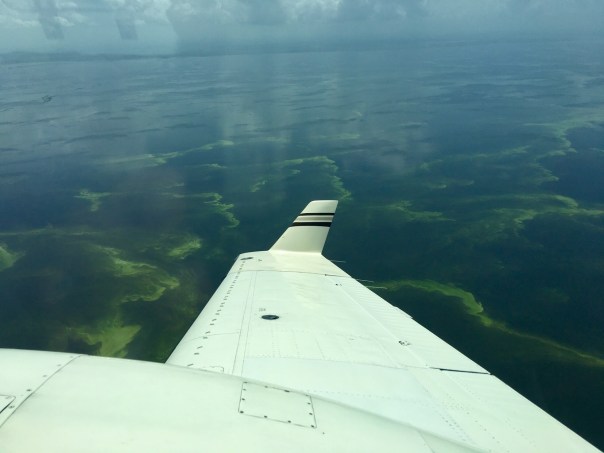
Ironically, our pilot friend, Dave Stone, had sent us an aerial of Cayo Costa showing visible red-tide a couple of days before, so I was curious what Ed and I would see on the Gulf of Mexico side of the island. Thankfully, it was beautiful. I collected shells, admired the bird life, saw a manatee, and got lost in the simple beauty of the place praising those who must have worked miracles to keep it from turning into condominiums and green lawns belching nutrient pollution into the waters.

11-8-18 8000 feet off Captiva and Cayo Costa. Pilot Dave Stone.


As much fun as that day was, I was getting sick at the beginning of the trip and now I was coughing out of control. I went to bed early and when I awoke the boat was moving; the sound of the engines humming along.

I peaked my head out seeing a huge expanse of water thinking we were going through the pass between Cayo Costa and Boca Grande.

“Is that the Gulf of Mexico?” I yelled from the cabin excitedly.

“No, it’s Charlotte Harbor,” Ed yelled back. “We’re turning around to visit Useppa.”

The wind blew and the sun shone…

“God, I’m an idiot,” I thought to myself. I just thought Charlotte Harbor was the Gulf of Mexico.”

Things are bigger on the west coast and there’s a lot to learn around here!


Links:

Altering the Caloosahatchee: http://nsgl.gso.uri.edu/flsgp/flsgpm02003/flsgpm02003_part4.pdf

Lee County Watersheds: http://www.leegov.com/naturalresources/WaterQuality/watersheds/caloosahatchee

Building New Bridges, Remembering the Old: 1934, “Franklin D. Roosevelt Highway Bridge,” SLR/IRL

I continue to share my mother’s historic documents for those who love and appreciate history. Today’s original 1934 Stuart Daily News publication is very impressive, oversized, with aerial photographs and pride-filled words lauding the City of Stuart, and her  Roosevelt Bridge as part of  the new “Gateway to the Gulf of Mexico.”

This gateway, of course, was the Cross State Canal that was federally funded through “navigation” with the dual use to discharge Lake Okeechobee water, that Nature would have flowed south to Florida Bay, into the northern estuaries enhancing “Fishing, Hunting, and Sports on the Beautiful St Lucie….Lake Okeechobee, and Caloosahtchee River….”

In 1934, an era of Man Over Nature, both men and women did not know their determination to control the environment  and its waters would, eventually, kill almost everything they loved.

And here we are today…

But as my hero Ernie Lyons, editor environmentalist of a later newspaper, the Stuart News said: “What men do they can undo.”

I believe this.

New bridges must be built. Not just of concrete but of the heart.

Bridges between people and politics. Bridges between corporations and children. Bridges between agriculture giants and fish. Bridges between developers and a new way to live. Why? Because like it or not, we are a Florida Water Family. All connected. All bridged together by depending on this place.

#FLWaterFamily

I will end with words from my mother, historian, Sandra Henderson Thurlow:

“Jacqui, This is a very large book that was published to celebrate the dedication of the original Roosevelt Bridge on January 8, 1934.  The pages are supposed to face each other so “Stuart–‘Atlantic Gateway to the Gulf of Mexico'” run together. The sentence at the bottom should be “The City of Stuart Invites You to Winter on the Beautiful St. Lucie River.” A gentleman who lives in Rio, Richard Lewis Miller,  shared the original in honor of his father, Alvin Richard Miller 1906-1976.” Mom (http://www.sandrathurlow.com)

Links:

Sandra Henderson Thurlow, website:http://www.sandrathurlow.com

Joe Crankshaw, Transformation of Stuart, TCPalm, http://archive.tcpalm.com/news/in-10-year-span-roosevelt-bridge-transformed-sleepy-little-stuart-ep-405274002-349339071.html/

Former Blog post on subject, JTL: https://jacquithurlowlippisch.com/2018/04/12/city-of-stuart-atlantic-gateway-to-the-gulf-of-mexico-1937-staurt-daily-news/

Silver Manatees Inspire, SLR/IRL

Silver Springs, photo Dr Robert Knight

With the mid-term election behind us, it’s time to get to work, and along the Indian River Lagoon and St Lucie River that means it’s time to get reconnected to Nature during the cool season before the Algae Monster arrives again.

Last week, as the keynote speaker for the Florida Springs Restoration Summit in Ocala, I had an amazing back to nature experience.  On a Silver River Guided Paddle Adventure with Dr Robert  Knight leading the way, five manatees swam underneath my kayak!

Five manatees!

They looked so beautiful, so graceful, so confident, and so powerful!

I could see them perfectly through the clear water of Silver Springs. During the summit, I learned that only recently the spring’s water magnitude had increased to historic levels ~after aquifer recharge of a very rainy 2017, thanks to Hurricane Irma.

Florida springs suffer from lack of water because the Water Management Districts, at the direction of their leaders, over-permit water extraction for more agriculture and development. Also, nutrient pollution haunts the spring-shed due to nitrate leaching of old septic tanks. When flow is low and nitrate high, benthic algae grows on the once white sand bottom of the springs. Almost all Florida springs deal with this issue.

Manatees, Silver River, Dr Robert Knight

But on this recent day, the day of my tour,  Silver Springs was glistening, and its bottom bursting with eel grass. The manatees munched at their leisure, mothers and calves reflecting a bluish hue underneath the clear, streaming water.

As the manatees swam under my little boat, I felt a joy unknown since childhood. “An ancient herd of elephants just swam under my kayak!” I thought, laughing out loud.

And in this moment of pure inspiration, I recalled an image from home of a starving manatee struggling to eat weeds and grasses along the Intercostal. Of course after years of harsh discharges from Lake Okeechobee and area canals, the sea grass forests are dead.

Beyond heartbreaking…

I brought my mind back to this present gift before me. And told the Silver manatees I would  return home inspired to fight for all, and that were were indeed, one Florida water family.

Image pulled off my iPhone, #Toxic18 site 10-28-18, Rita Hendricks Salazar


Links:

Silver Springs: http://www.silversprings.com

Springs Institute:https://floridaspringsinstitute.org

2018 Springs Restoration Summit:
https://www.springsrestorationsummit.org

Dr Knight Bio: https://floridaspringsinstitute.org/our-team/

Silver Springs Study Delayed, Gainesville Sun, Dr Robert Knight,:https://www.gainesville.com/opinion/20180118/robert-knight-silver-springs-study-delayed-restorative-action

The Fisherman, by Ernest Lyons ~SLR/IRL

1953 Stuart Fishing Guide, courtesy of Sandra Henderson Thurlow, Thurlow Archives.

I think for this Friday’s blog post, I will keep it short as the words of the late Ernest Lyons resonate for themselves, especially for those of us who knew our waters in better days.  This poetic piece fills one with inspiration to see healthy waters once again, but reminds us, that in spite of all our troubles, the force of beauty remains.

In her email to me ~sharing this piece, my mother simply wrote:

“This was in a 1953 Fishing Guide. The man in the photo is Capt. Francis A. Adams. Ernie surely could write. He never went to church but….” Mom

Enjoy.

The Fisherman, by Ernest Lyons

His is a measure of the peace that comes to the man of wide waters and in quiet places. Clouds, sea, and rain, the wind and sun accept him into their company.

He sees the creatures that the Lord hath wrought in the deeps…the sawfish with its armored flail, the remora with sucking cups atop its head to fasten onto shark or ray, the mullet always fleeing. He feels the presence of creation’s magic close at hand.

He knows the beauty of the morning and bright fullness of the day upon the sea and rivers. He sees the swift and dreadful, the timid, and the fierce. And within him there is wonder that such miracles should be.   

Biography, Ernest Lyons: http://www.flpress.com/node/63

Sandra Henderson Thurlow, local historian: http://www.sandrathurlow.com

In Michael’s Wake, by John Moran

I am honored to present…
In Michael’s Wake, by guest writer, John Moran, October 2018
Florida friends, 
Scientists have been telling us for many years that in the Age of the Anthropocene, our global carbon addiction will fuel a new breed of superstorms. 
Perhaps the hurricanes of the past 14 month—Harvey, Irma, Maria, Florence and now Michael—are telling us that we are fundamentally altering the climate. 
It appears a new normal may be upon us. If so, we Floridians could be in for a rough ride. 
A week after Michael made landfall, I went to the panhandle to see for myself. 
The devastation is, in a word, astonishing. 
Time now to step aside, and let the pictures do the talking…
John Moran
Gainesville 
————
I begin with a beauty shot from my aerial photo flight with pilot Tom Hutchings.
Seen from high above, it’s easy to think of Florida as…resilient. 
Hard to imagine a Cat 4.9 hurricane blasted through here just a week before. But let’s look more closely…


St. Joseph Peninsula, just offshore from Mexico Beach
Transformed landscape, Mexico Beach.
Mexico Beach
Mexico Beach
Mexico Beach
Mexico Beach
Mexico Beach
Mexico Beach
Mexico Beach
Mexico Beach
Unforgettable Coast
Mexico Beach
Mexico Beach
Mexico Beach
Mexico Beach
Lost cotton harvest, Calhoun County
October snow, Calhoun County
Marianna
Confederate Memorial, Courthouse Square, Marianna
Jackson County
Roadside sign, near Wewahitchka, Calhoun County

History Helps Us “See,” Septic to Sewer Conversion, SLR/IRL

Aerial of Lighthouse Point Feb. 8, 1965, Ruhnke Collection, Thurlow Archives.

At my request, my mother has been sharing historic real estate photos. Regarding today’s aerials, it seems the perfect time to broach the controversial subject of “septic to sewer.”

When I first saw the photographs of Lighthouse Point, I said “What is that?” I thought the land had been created by fill, but then realized it was natural lands filled and dredged. This practice was very common before the 1970s and happened at various locations throughout Martin County, but was more prevalent in destinations like Ft Lauderdale and Cape Coral. Wherever this land use was completed, early photographs allow us to see how strange, how vulnerable,  how naked, the land looks. And we can see its connection, like a sponge, over the surrounding waters…

Let’s take a closer peek at this 1965 photo of Lighthouse Point in the St Lucie River. In 1965, developers had no concerns about nutrient pollution, and every property of course had its own septic tank.

Lighthouse Point/Seagate Harbor 1968, Ruhnke Collection, Thurlow Archives

Fortunately, in the 2000s, Martin County did help residents of Lighthouse Point and neighboring Seagate Harbor, convert from septic to sewer, along with other “hot-spot” communities, as documented in this outstanding presentation by former Martin County Ecosystems Manager, Deborah Drum.

Click to access DDRUM-Rivers-Coalition-June-2017.pdf

Red ballon shows Lighthouse Point/Seagate Harbor neighborhoods in Palm City
See yellow dots, slide from Deb Drum’s presentation of completed projects.

But there is more work to do.

As we know, Septic to Sewer is one of those subjects people passionately fight over as we try to understand why our waterways have become so impaired. This was the case in my own hometown of Sewall’s Point.

Famous for the first strong fertilizer ordinance on Florida’s east coast in 2010, a year of my mayorhood, The Commission flipped this environmental streak, and last year, when I was off the commission, following much back and forth and very poor communication, ~in spite of heroic efforts, but a totally exhausted, confused and furious public, decided not to work with Martin County for a partial sewer conversion. The backlash to this is far-reaching.

I agree that most of Sewall’s Point is not dredge and fill, but some is, and with out a doubt, old septic tanks in flood zones along the Indian River Lagoon are not a good idea.

In Sewall’s Point, and all Martin County residential areas we can “feel better about ourselves” as we know that  Agriculture is the primary nitrogen and phosphorus polluter into our waterways, (and they need to get to work!) by about 88% according to Dr Gary Goforth. (https://jacquithurlowlippisch.com/tag/phosphorus-loading-by-land-use-what-fdep-isnt-telling-us-gary-goforth/) Nonetheless, this does not mean we should act too self-righteous to change out ourselves.

As we all begrudgingly work to lessen nutrient pollution (nitrogen and phosphorus) into our waterways, it is helpful to look backwards as we plan for the future. Thanks mom for sharing your photos; history helps us “see.”

Links:

What is nutrient pollution? EPA https://www.epa.gov/nutrientpollution

Martin County Sewer Conversion: https://www.martin.fl.us/SeptictoSewer

City of Stuart Sewer Conversion: http://cityofstuart.us/index.php/en/sewer-expansion/sewer-expansion-maps

Scientific paper: Earth Sci 2017 estimation of nitrogen load from septic systems
to surface water bodies in St. Lucie River and Estuary Basin, Florida, Ming Ye1 • Huaiwei Sun2,1 • Katie Hallas3: http://people.sc.fsu.edu/~mye/pdf/paper62.pdf

Sandra Henderson Thurlow, local historian: http://www.sandrathurlow.com

Come Together Florida for Clean Air and Clean Water! VOTE #YesOn9!

Nothing has given me as much insight into the political process as serving on the 2017-2018 Constitution Revision Commission (http://flcrc.gov/index.html) When appointed by Florida’s President of the Senate, Joe Negron, my response was:” Are you kidding me? I don’t think I’m qualified for that.” He chuckled, and said in his confident, matter of fact way: “Jacqui, you’ll be fine.”

Although I did not have the experience of the other well-known lawyers and politicians, I was more versed in environmental issues, and made that my goal. After painstaking work, four of my citizen sponsored environmental proposals were rejected, (https://jacquithurlowlippisch.com/tag/environmental-proposals-for-crc/) but one made it to the finish line with close to a unanimous vote. This proposal was submitted by the Florida Wildlife Federation, and was a former Citizen’s Initiative ripe for rebirth: #91, Prohibiting Oil and Gas Drilling in Florida’s State Waters. In the end, the Style and Drafting Committee bundled #91 with #65: prohibiting vaping in public workspaces. I thought it was a perfect fit compared to be being bundled with any of the others; and the proposal would be bundled, I knew that.

Our theme was “clean air and clean water.”

As you may know, the amendment hasn’t been without controversy, and was taken with the rest of the bundled amendments all the way to Florida’s Supreme Court. Finally, they ruled on October 17, 2018, that the commission acted within its rules: “Unlike proposed amendments that originate through initiative petitions, amendments proposed by the CRC are not bound by the single-subject rule limiting amendments to one subject,” the ruling states.

Amendment-9-Ruling

Supreme Court: http://www.floridasupremecourt.org/decisions/opinions.shtml

To say I was relieved, is an understatement!

What a legacy for the state of Florida this could be! And November 6th, Election Day, is right around the corner.

Many times over the past year, during the stress of it all, I have visited the beach myself. Every single time I go, I am filled with inspiration. Walking along the shoreline watching young people, old people, people of every race, nationality, and socioeconomic  background;  studying seagulls fly, and pelicans dive with a skill beyond our human form; seeing silver schools of bait fish shining in the sunlight as the waves swell and dissipate;  watching smiling children bury each other in the sand, collect shells, and laugh as they run on little legs. Joyful!

The true happiness here belongs to all Floridians!

Do not let oil drilling ever take this away. This place, of all places, is where we can come together and appreciate God’s gifts of clean water and clean air. And when we have to pick up and go home, and Monday, be back at work, clean air should be guaranteed in our workplaces as well. We must protect what is sacred to us.

Come together Florida.

Vote yes on 9!

Amendment 9 provides voters with two-fold opportunity | Guest column by CRC Commissioners Jacqui Thurlow-Lippisch and Lisa Carlton: https://www.tcpalm.com/story/opinion/contributors/2018/10/17/amendment-9-gives-voters-two-fold-opportunity-guest-column/1646155002/

Yes on 9 Florida: http://yeson9florida.org

Breathe Clean Florida:http://breathecleanfl.org

CRC Commissioners: http://flcrc.gov/Commissioners.html

Note that Amendment 9 is a grassroots amendment with not major funding as others below. Learn more about all Florida ballot amendments on Ballotpedia:

Ballotpedia: Florida Constitutional Amendments: http://ballotpedia.org/Florida_2018_ballot_measures

The Maps We Follow, SLR/IRL

1910 Standard Guide map of Florida, courtesy historian Sandra Henderson Thurlow

Maps. They get us where we’re going, and they reference were we’ve been.

This 1910 Florida Standard Guide map, shared from my mother’s archives, is a black and white goldmine for comparison to our “maps” today.

If you are from my neck of the woods, you may notice that there is no Martin County just sprawling Palm Beach County. Across the state, we see a monstrous Lee County. Collier and Hendry counties were created out of Lee County in 1923. As far as roads, one may notice there is no Tamiami Trail. In 1915 construction began on this famous highway that has blocked remaining water flowing south from Lake Okeechobee to the Everglades ever since. And what about Alligator Alley constructed around 1968?

What do you see? What dont’ you see? What’s different from today? I think it is interesting to wonder how South Florida would function today if we didn’t work so hard to fill in the southern part of the map.

Mother Nature just may take it back anyway. Check out this sea level rise map: https://freegeographytools.com/2007/sea-level-rise-google-mapplet

Yes, today we use Google Maps, or GPS instruction from our smart phones to figure out where we’re going and what develops.

Where these electronic maps are taking us is only for the future to know. Hopefully our choices, and the maps we follow are more helpful to the environment and to wildlife too! Florida Wildlife Corridor explore maps: http://floridawildlifecorridor.org

Sandra Henderson Thurlow, local historian,  website: http://www.sandrathurlow.com

Google Maps, Florida: https://www.google.com/maps/d/u/0/embed?mid=18J9_j-2FuhO9ABdZDdDg1MKDeQk&msa=0&ie=UTF8&t=h&vpsrc=6&ll=28.750319037763777%2C-83.85705481014259&spn=5.403019%2C10.810547&z=8&output=embed

Tamiami Trail: https://en.wikipedia.org/wiki/Tamiami_Trail

Interstate 75/Alligator Alley: https://en.wikipedia.org/wiki/Interstate_75_in_Florida
Alligator Alley: https://protectnepa.org/alligator-alley-75-extension-everglades-parkway/

Backroads Travel, vintage Florid maps: https://www.florida-backroads-travel.com/florida-vintage-road-maps.html

Blog on Florida Counties’ Evolution: 1884 Rand, McNally & Co. Map, the Everglades and Lake Okeechobee,”My How Things Change…”SLR/IRL: https://jacquithurlowlippisch.com/tag/counties-florida/

Stuart, Florida: From Izaak Walton to River Warriors, SLR/IRL

By Ernest Lyons, 1957 Stuart Chamber of Commerce Fishing Guide, courtesy of historian Sandra Henderson Thurlow

I continue to share now historic advertisements of Florida. Today’s is from my hometown of Stuart, Florida. My mother, historian Sandra Henderson Thurlow, has a trove of these things, and they are interesting to view ~thinking about how much our area has changed.

This 1957 Chamber of Commerce Fishing Guide advertisement, written by Ernest Lyons is entitled: “In the Tradition of Isaac Walton.” So let’s start there: Who was Isaak Walton? !

I had to refresh my memory as well, so don’t feel bad if you did not remember. He is famous for writing  the Complete Angler in 1653,  a book “celebrating the joys of fishing” that inspired thousands of sportsmen, and remains a classic for both men and women today.

Mr Lyons, who was the editor of the Stuart News and an award-winning environmentalist of his era, begins his composition:

“Stuart, Florida means sports fishing in the tradition of Izaak Walton,” and then proceeds to talk about good living, home building, and retirement in a community where the “best things in life are free.”

Fun for me to see, in the collage below, my Aunt Mary Thurlow Hudson is photographed far right playing tennis, and my father, her brother, Tom Thurlow Jr., #7, is shown making a basket for Stuart High School baseball team. Awesome! Those were the days!

My Aunt Mary Thurlow Hudson is photographed far right playing tennis and my father Tom Thurlow making a basket for Stuart High. “Those were the days!’

But we know that nothing is really for free. Stuart, and Florida at large have paid a price for moving so many people here since 1957, and trying to “feed the world” from our rich agriculture fields.

Sixty-one years have passed since 1957. I am now over three times the age of my father and my Aunt Mary pictured here…

Our youth can still golf, play tennis, ride a stallion at a rodeo, play baseball, and football, but water-skiing and fishing? Maybe not.

Before recreating, we must first ask :”Is there cyanobacteria in the water?”

Or God forbid, before going to the beach:  “Is there red-tide?”

The local Chambers of Commerce have not written a fishing guide for years. But if they did the topic sentence would not be, Stuart, Florida means sport fishing in the tradition of Izaak Walton, but rather:

“Stuart,  Florida means fighting for your waters in the tradition of a River Warrior…”

My do things change.

https://en.wikipedia.org/wiki/Izaak_Walton

https://www.audible.com/pd/The-Compleat-Angler-Audiobook/B0038CCZ2I?source_code=GO1GB907OSH060513&gclid=CjwKCAjw3qDeBRBkEiwAsqeO7iOWzzDQ17u9sRDjb0rNzBSnaeeNAjgIBDEZPHBwe95rMgpxxoivfBoCQE8QAvD_BwE&gclsrc=aw.ds

Martin County Chamber of Commerce 2018:https://www.stuartmartinchamber.org

The Scenic Route of Florida? Gone to Hell in a Handbasket! SLR/IRL

Isn’t this old ad from the early 1920s great? Thanks to my mother, local historian Sandra Henderson Thurlow, I have some old real estate ads to share from our region of the state. It makes me think…

The ad reads:

Oscar Hand Pullman Bus Line Connecting with Everglades Boat Line

“Scenic Route of Florida” Daily (Except Sunday)

Through the Everglades, Canals, Across Lake Okeechobee and Along the Famous Muck Soil, the Richest in the World.

Down the Famous Caloosahatchee Vally Route, Abounding with Tropical Scenery, To Fort Myers, the Prettiest Town on the West Coast.

Just $14.04

Today? We could offer a Toxic Algae Tour from Coast to Coast, couldn’t we?

Our ad could read:

A boat ride from the red tide waters of the Atlantic through a polluted St Lucie River

to an airplane or satellite view of an algae filled Lake Okeechobee

then a boat ride to the ailing Calooshahtchee with both red and green tides too!

$1140.04

Historic Scenic Route of Florida?

It went to Hell in a Handbasket! 

Come See! 

Toxic algae under the Evans Crary Bridge, St Lucie River, JTL
Lake O 239 square foot algae bloom, NASA satellite image
Jamie Burns, St Lucie River full of algae bloom from Palm City to Sewall’s Point.
Caloosahatchee algae bloom, photo courtesy Dave Stone.
Caloosahatchee region, photo John Moran

Links:

Local Historian Sandra Henderson Thurlow, Martin County, FL: http://www.sandrathurlow.com

Stuart History Stuart Chamber: https://www.stuartmartinchamber.org/tourism/history

Florida Landboom: http://floridahistory.org/landboom.htm

Florida Land Boom Florida History: https://www.floridamemory.com/blog/tag/florida-land-boom/

History of Development, Fort Meyers, FL: https://fortmyers.org/live-in-fort-myers/history-of-fort-myers/

Miami Herald,
What’s an algae bloom and how did it wind up sliming Florida’s biggest lake?
BY JENNY STALETOVICH, https://www.miamiherald.com/news/local/environment/article214620390.html

Phy.Org: What’s Causing the Algae Crisis? https://phys.org/news/2018-08-florida-algae-crisis.html

Red Tide, FWC east and west coasts of Florida: http://myfwc.com/redtidestatus

Buy it Like a Real Man! Florida Real Estate That Is… SLR/IRL

Historic real estate advertisement, ca. 1919 Pinecrest, FL, Museum of the Glades, https://www.museumoftheglades.org

I have been looking though my collection of maps and other Florida things, and I came across this remarkable real estate ad by W. J. Willingham. I would think it is from the early part of the 1900s when Barron Collier and James Jaudon, “Father of the Tamiami Trail,”  were developing South Florida. Apparently, Jaudon sold the land that became Pinecrest to Willingham.

What is of most interest to me is the tone of the ad, and how different is it compared to how we sell real estate today.  For instance, the first section reads: “Hesitation:” On the plains of Hesitation bleach the bones of countless millions; some men are just plain quitters, but the most pitiable sight in the whole world of failures, is the man who will not start. Opportunity will knock at your door this week and give you a chance to start. You can deny yourself one or two simple luxuries, drop a useless habit or two, and the start is made. You can own a Pinecrest lot. You can be a true-born American and take a shot at it and if you lose, you can take your loss like a real man. On the other hand, if Pinecrest makes a wonderful town, you can enjoy the pleasures invariably comes when a man uses his head and wins. My friend, it is up to you. Will you hesitate? Or will you start?  W.J. WILLINGHAM

Holy cow. This must have been the way one sold land in the Everglades in the old days, before political correctness, equal rights, and other things. Interesting to ponder, don’t you think? Maybe that’s why they mowed everything down.

Looking at the rest, Mr Willingham’s rant continues:

Here’s another duzzie: “Nerve.” That word nerve spells success. I was looking through some of old papers the other day and I ran across and old advertisement I put in a Florida newspaper a few years ago. At the at time I tried my level best to persuade someone to buy a certain property for $11,000. No one seemed to have the nerve. Finally I persuaded my brother to go in with me and buy it. All that was required a small  cash payment and just a little nerve. Now to make a long story short, we recently sold a part of that property for $137,000 and we have some o the property left. In a few short years you will wonder why you did not accumulate just a little nerve when Pinecrest was just starting. Pincerest has a mighty bright future. I am going to give you an opportunity to pick up a few Pinecrest lots at auction. W.J. WILLINGHAM

This is a good one, today we would write “Do you know of anything that has destroyed America’s Everglades more than Tamiami Trail?

W.J. Willlingham’s final words are a harsh motivator as well: “J.J. Hill Said:” James J. Hill, one of the greatest builders this county has produced, designated thrift as the one qualification without which no man could succeed. He said: If you want to know whether you are destined to be a success or a failure in life, you can easily find out. The test is simple, and infallible. Are you able to save money? In not drop out. You will lose. You may think not. But you will lose as sure as you live. The seed of success not in you.” W.J. WILLINGHAM

The seed of success not in you? Hmmmm. I agree with being thrifty, but how the “seeds of success change.” To be successful, the new developers of South Florida will have to adapt to our new world of rising seas, stronger storms, climate change, and the subtleties of selling to modern society. This could be a challenge; we may have to get some advice from the gators who have around a long, long time.

Alligator, public photo.

Links:

Pinecrest went on to be a very successful community. I wonder what the ads in the future will look like as it goes underwater…

Pinecrest: https://en.wikipedia.org/wiki/Pinecrest,_Florida

Pinecrest History: https://www.pinecrest-fl.gov/our-village/history

Pinecrest website: https://www.pinecrest-fl.gov/our-village

James Jaudon, Father of the Tamiami Trail: http://everglades.fiu.edu/reclaim/bios/jaudon.htm

Roads in the Everglades, Collier, Jaudon, Willlingham: https://books.google.com/books?id=oOvcDAAAQBAJ&pg=PA147&lpg=PA147&dq=wj+willingham+fl+pinecrest&source=bl&ots=TzcvzlZ04_&sig=1uugd2-UG8ag8B1QEy0IyD6oYzM&hl=en&sa=X&ved=2ahUKEwitwbfgwIjeAhWqTd8KHXnuCVcQ6AEwA3oECAcQAQ#v=onepage&q=wj%20willingham%20fl%20pinecrest&f=false

What if the EAA had Become “The Promised Land, “Okeechobee Fruit Lands Company… SLR/IRL

“Eager salesman from the Florida Fruit Lands Company crossed the country, promoting the Everglades as a “Garden of Eden”, a “Tropical Paradise,” “The Promised Land”. These “swamp boomers” enticed potential buyers with sales literature quoting government officials who extolled the possibilities of the Everglades…” 

Okeechobee Fruit Lands Co., early 1900’s map, ~Museum of the Glades.

For years, Ed and I have flown over the Bolles Canal, just south of Lake Okeechobee in the Everglades Agricultural Area, and for years, I wondered who the east/west canal in the EAA was named for…

Just goes to show, even if you become famous, or even “infamous,” over time, chances are, even people who should know your name may not have a clue…

Like Hamilton Disston, Richard “Dicky” J. Bolles was a millionaire of the late 1800s and early 1900s set up to help Florida get out of debt and grow an empire out of this “swamp.”

We get the picture here:

“Bolles founded the first of his Florida enterprises, the Florida Fruit Lands Company, to dispose of 180,000 acres in Dade and Palm Beach Counties. The company divided the lands into 12,000 farms of varying size and designated a townsite, ‘Progreso’, with plans for streets, factories, schools, churches, and public buildings. For the price of $240, a buyer could purchase a contract from Florida Fruit Lands Company, entitling them to bid on a farm and town lot through a scheduled auction. This same scheme was employed by other sales ventures pitching swamp land in Florida, including Okeechobee Fruit Lands Company, which dealt in Bolles’ remaining 428,000 acres around the shores of Lake Okeechobee….

Eventually, Federal prosecutors initiated a case against Bolles and his cohorts, producing a 122-page indictment and more than 100 witnesses from across the country. Bolles was arrested on December 18, 1913 and tried the following March — he was found to be “an honest man”… ~Library of Congress, http://everglades.fiu.edu/reclaim/bios/bolles.htm

Florida Fruit Lands Co. Map ca. 1907, Museum of the Glades.


Okeechobee Fruit Lands plat map once again.

It’s fascinating to look at the Okeechobee Fruit lands map and imagine what would have happened, what could have happened, if Dicky J. Bolles had been successful in his underwater private swampland “scheme.” Look at his plan for this multicolored plat map!

Instead over time, the Great Depression set in, and the Federal Government, ACOE, came in just over a couple of decades later to help save us from Mother Nature and from ourselves, creating unified protections of the EAA under the 1848 Central and Southern Florida Plan, House Document 643.

And we all know the rest of the story…

What coulda, woulda, been?

HOUSE DOCUMENT 643 – 80TH CONGRESS (00570762xBA9D6)

Image up close, Museum of the Glades~although I see no date was obviously created prior to the 1914-1923, the dates of the  first digging of the St Lucie Canal which has been worst part of  the  St Lucie’s River’s complete and total destruction. This canal has been deepened and widened many times, reinforced by the CSFP of 1948. Interesting to note penciled in blue line to Jupiter, perhaps this was a possible canal never built.

Links to story of Richard “Dicky” J. Bolles, Reclaiming the Everglades, 1884-1934, U.S. Library of Congress: http://everglades.fiu.edu/reclaim/bios/bolles.htm

Special Edition Everglades Presentation by Fritz David 2004:

Click to access 04-11-everglades.pdf

ACOE Central and Southern Florida Project:http://www.saj.usace.army.mil/CFS-CSFC/

Hamilton Disston, UF:http://www.uflib.ufl.edu/spec/ingraham/expedition/DisstonDrainage.htm

An Owl In My Kitchen, SLR/IRL

A rather remarkable thing happened. There was an owl in my kitchen. Yes, an owl, a real owl.

I woke up, went outside to get the newspaper, and then I fed my fish. When I looked from the dining room into the kitchen, I saw the silhouette of a little owl patiently seated on the back of a chair in our sunroom open to the kitchen. Of course, I did a double-take! And then I thought to myself: “Is it that owl? Is Ed playing a trick on me….?”

Why a trick?

Just a few days ago, I had bought a fake, feathered owl at the Lamp Shop. I attached it to a fake palm tree in my sunroom. You know, the kind of thing with wire for feet, so you can twist it around the branches?

So, in the darkness of early morning, I wondered if Ed had put that thing on the back of the chair just to freak me out.

He had not. I looked again and again, and for certain, a living screech-owl was sitting in my sunroom, in my kitchen. Unbelievable!

I quietly snuck over and closed the surrounding pocket doors to that area. And then quickly went to find my husband, Ed.

From afar, I whispered sounding panicked: “Eddie! Eddie!”

Ed got up out of his chair, leaving the computer with the dogs gleefully trailing behind him.

“Put the dogs in the crates, now!” I said.

Ed looked at me,  confused.

“In their crates! ” Again, I stated.

“O.K. he said.” Looking bewildered.

“Turning around, Ed took Luna, an 80 pound, black, German Shepard, and Bo, an old and now crippled Corgi, to the other side of the house…

Ed returned.

“What’s up with you?” He inquired, irritated. Not even a  “good morning” ?”

“Ed, there’s an owl in our kitchen.”

“What?” He inquired.

“An owl!”

“Do you mean that owl you bought at the store?” Ed snickered.

“No.  A real owl. I think it was attracted to the other owl.”

“What are you talking about?….” He said…

I slowly slid open one of the pocket doors. Sure enough, the beautiful little owl sat there with its head turned towards the fake owl.

Ed let out an explicative and shut the door.

“The owl must have seen the other owl from outside.” I whispered.

” How did it get in?” Ed quietly asked.

“I don’t know, from you? When you let the dogs out? I don’t know, but we have an owl in our kitchen!”

Ed and I looked incredulously at one another, then smiled.

Gently opening the door, we slowly snuck over, as quiet as could be. Ed started removing the screen from behind the joulosy windows. The owl lifted off the chair and flew about the kitchen landing by the fake owl, but the plastic branch sunk under its weight so it flew off and around the kitchen in high circles without a whisper. Ed and I were transfixed, fascinated. When it landed, we took pictures.

Ed  finally got the screen off and cranked the window. It popped open, braking the silence of the morning. Wind blew inside the room.

The owl looked back to its friend, and then, without a sound, flew through the window, and was gone.

same owl with ears up and lit up when it landed a top the refrigerator arrangement

Death by Fertilizer, SLR/IRL

Definition of fertilizer: one that fertilizes specifically, a substance (such as manure or a chemical mixture) used to make soil more fertile so things grow. Usually containing phosphorus and nitrogen.

..

SFWMD 2005

“Death by Fertilizer” or “Our Sick Friends” was originally a booklet created by the River Kidz in 2012 to bring awareness to the ailing health of the bottlenose dolphins in the Indian River Lagoon; I think the message remains a relevant teaching tool today.

Why?

South Florida’s water issues~

~The Lake Okeechobee Watershed: 88% agricultural in nature running into a now sick, eutrophic, algae-ridden, Cyanobacteria filled Lake;  a 700,000 acre Everglades Agricultural Area south of the Lake allowed to back bump when flooding occurs; all this water, in turn, discharged into the ailing St Lucie River and the Caloosahatchee Estuary by the ACOE while the SFWMD and FDEP, and their bosses, the  Executive and Legislative branches of government look on. This putrid, polluted water runs out into the ocean. We think that’s the end of the water destruction, but it’s not, as red tide and seaweed are fertilized, growing into monsters we have never seen before.

Phosphorus Loading by Land Use, Gary Goforth: https://jacquithurlowlippisch.com/tag/phosphorus-loading-by-land-use-what-fdep-isnt-telling-us-gary-goforth/

Septic and sewer pollution is a type of fertilizer too. Some people around the world fertilize their crops with their own human waste; dog poop is also a “fertilizer,” and all this fertilizer leeches or runs off into our estuaries and ends up blending with the polluted Lake O water coming down the pike to the ocean. Every rain event runs right down the storm drains of our neighborhoods and shopping malls with all the “crap” it carries. We designed it that way, years ago, and have not changed this model. The fertilizer put put on our lawns, of course, runs off too.

Yes, it is death by fertilizer that we are experiencing this 2018. Eutrophication, Blooms of algae and cyanobacteria; red tide; too much seaweed suffocating the little sea turtles when they try to come up for air…

The fancy, confusing words of “nutrient pollution” must be replaced with “fertilizer,” something we can all understand. From the time we are children, we learn that “nutrients” are good, they make us strong. Fertilizer can be good, but we instinctively know it can also burn. We know not to eat it; it is not nutritious.  Nutrient Pollution is an oxymoron created by industries and government so we have a hard time understanding what is going on.

In conclusion, fertilizer (phosphorus and nitrogen) from corporate agriculture; poop from animals and people, (mostly nitrogen) and it is feeding, “fertilizing” Lake Okeechobee’s cyanobacteria blue-green blooms that in turn are poured into the St Lucie and Calooshatchee, which in turn this year are feeding, “fertilizing,” tremendous sargassum seaweed blooms, and red tide in the Gulf of Mexico and now in the Atlantic. These blooms are giant multi-celled intelligent, organisms, kind of like a bee-hive. They are hungry and determined and we are feeding them.  It is  a vicious cycle that only we can stop by forcing our government to take charge and coordinate municipal, state and federal programs of education and coordinated implementation. We know what to do.

Developing an effective strategy for reducing the impacts of nutrients, easier understood as “fertilizer over enrichment,” requires all of us to change how we live and the powerful agriculture industry to lead.

Otherwise, it is, and will remain, death by fertilizer.

National Research Council’s book, written in 2000, Understanding and Reducing the Effects of Nutrient Pollution is a step by step guide to this problem: https://www.nap.edu/catalog/9812/clean-coastal-waters-understanding-and-reducing-the-effects-of-nutrient

.

SFWMD 2005

Links:

EPA, Nutrient Pollution: https://www.epa.gov/nutrientpollution/problem

2018 Palm Beach Post, Red Tide:

“Red tide was reported on the east coast in 2007 when it spread to the Treasure Coast south from Jacksonville where LaPointe said discharge from the St. John’s River may have aided its growth. LaPointe said this summer’s plethora of sargassum on southeast Florida beaches could feed red tide with a boost of nutrients leeching into the ocean when the seaweed dies.
Red tide is different from the freshwater blue-green algae, or cyanobacteria, that has spread in Lake Okeechobee, the St. Lucie Estuary and the Caloosahatchee River this summer. But red tide and the cyanobacteria both thrive in nutrient-heavy conditions.
“You have discharges coming out the Jupiter Inlet,” LaPointe said. “Red tide likes the kind of slightly reduced salinity in areas where there’s a river plume.”
https://www.palmbeachpost.com/news/crime–law/new-stretch-beach-jupiter-closed-police-after-odor-sickens-beachgoers/cVD3CBHqrYDrLCFFDV4T7L/

2018 Sun Sentinel, Lake O toxic algae blooms:

“Lake O and Estuaries’ Blooms: Not that this comes as much of a surprise. (Though state leaders feign shock with each new algae outbreak, as if they’ve just discovered gambling in Casablanca.) Environmental scientists have been warning Florida that the watershed lake was an environmental catastrophe since 1969.” Fred Grimm, reporting.
http://www.sun-sentinel.com/opinion/fl-op-column-fred-grimm-lake-okeechobee-algae-returns-20180705-story.html

Close up toxic algae, JTL

2018 Palm Beach Post, Overabundance of Seaweed:

“Palm Beach Post:LaPointe is in the second year of a three-year NASA grant to study how nutrients are changing in the sargassum. What he’s found so far is nitrogen levels have increased, likely from heavy doses of fertilizer and sewage runoff.
“We have altered the nitrogen cycle on our planet and it started with the invention of fertilizer,” LaPointe said. “We think this is what is behind the increased abundance of sargassum.” https://www.mypalmbeachpost.com/weather/why-ugly-thick-brownish-seaweed-cursing-south-florida-beaches/yILMtAMMlxxOXqqYz5H1ZO/

Red tide 2018 #toxic18 site
Plethora of sargassum weed or seaweed at Jensen Beach, 2018 photo Ed Lippisch

Phosphorus Loading by Land Use, What FDEP is not Telling Us, 2018, Gary Goforth: https://jacquithurlowlippisch.com/tag/phosphorus-loading-by-land-use-what-fdep-isnt-telling-us-gary-goforth/

The Late, Great, Johnny and Mariana Jones; Learning From Their Legacy, SLR/IRL

I first met Michelle Jones Connor during 2013’s “Lost Summer,” the year coffee colored, sediment-filled water flowed through the gates of the Army Corp of Engineers for most the year, from Lake Okeechobee into our St Lucie River/Indian River Lagoon. At that time, with energy surging as thousands of peoples’ anger ramped-up the River Movement, at a rally Michelle told me about her environmental-legend grandfather and grandmother, Johnny and Mariana Jones.

Ironically, not too long after this, my mother and father discovered the above plaque while on a field trip to the Hungryland, an area also named after the couple.

Who were these incredible people?

The Florida Wildlife Commission’s dedication to Hungryland explains:

“The Hungryland Wildlife Environmental Area honors the conservation legacy of Johnny and Marianna Jones, passionate advocates for the protection of fish and wildlife resources throughout Florida. During their 61-year marriage, the couple lobbied for environmental issues, were leaders of the Florida Wildlife Federation and were instrumental in the establishment of over 3 million acres of public lands, including the John C. and Mariana Jones/Hungryland Wildlife Environmental Area.”

The list of their achievements is incredible! Almost impossible. Could we ever do something like that today? Of course we could; we just have to learn the tricks of the trade before they are forgotten.

Michelle’s grandparents have recently passed as have so many other of the “greats.” We must fill their shoes. We have no choice but to do so. And learning from the past can be a great help along our journey.

Thankfully, Michelle has given us some of the treasures of her late grandparents.

Today I share with you, with the permission of Michelle, three things from the Joneses and their library. First, a fascinating and insightful 2001 University of Florida interview where Mr Jones answers the question: “What are the two or three most important contributing factors that have led to the present problems in the Everglades?”; Second, “The Marshall Plan, Repairing the Florida Everglades;” and third Johnny Jones’  “The Rain Machine,” my favorite, about how human greed, development, and canalization, and drainage  of Lake Okeechobee and surrounding areas altered Florida’s water cycle ~and thus Florida’s weather itself ~by removing so much water from the land.

Upon reading, you will notice names, such as Marjorie Stoneman Douglas, Arthur R. Marshall, and Nathaniel Reed ~just to name a few. In spite of the difficulties, pressures,  and of course the hottest potato, politics, it was relationships and perseverance  that allowed the Joneses to achieve so much. We must do the same.

Thank you  Michelle  for sharing these rare and valuable documents. We shall honor the legacy of your grandparents and be inspired..

UF/Interview of Johnny Jones by Brian Gridley, 2001:

Click to access EVG_009_Johnny_Jones_5-23-2001Final.pdf

Marshall Plan PDF

The Rain Machine PDF

Michelle Jones Connor 2013, Lost Summer, Michelle is the granddaughter of the late, great Johnny and Mariana Jones.

Link to the Facebook Page Michelle’s Aunt Linda created, shared by Michelle: https://www.facebook.com/FloridaConservation/

Why the name “Hungryland:”…in the mid-1800s, Seminoles seeking to escape the U.S. Army hid out in these wetlands. The Army destroyed and cut off their food supplies, leading local ranchers to refer to the region as “Hungryland.” The slough that still runs through the area was called the Hungryland Slough and was primarily used for grazing cattle.”
FWC: http://myfwc.com/viewing/recreation/wmas/lead/jones-hungryland/history/

Hungryland Slough Guide, FWC: http://discover.pbcgov.org/erm/Publications/HungrylandSloughTrailGuide.pdf

Sofia Memorials, and photo of Johnny Jones above: https://sofia.usgs.gov/memorials/Johnny-Mariana-Jones/

Obituary Johnny Jones: https://www.palmbeachpost.com/news/johnny-jones-remembered-stubborn-advocate-for-the-environment/8va3cqDSp3waubFTm3vBCJ/

Obituary Mariana Jones: https://www.dignitymemorial.com/obituaries/lake-worth-fl/mariana-jones-6456420

UF Interview Johnny Jones/Smather’s Library format: http://ufdc.ufl.edu/UF00005378/00001/1j

Hungryland Field Trip, Sandy and Tom Thurlow, 2014.

“Phosphorus Loading by Land Use – What FDEP Isn’t Telling Us!” Gary Goforth, PhD.

I am once again honored to share Dr. Goforth’s work:

Excerpt from: A Brief Discussion of Lake Okeechobee Pollution G. Goforth, PhD.  9/18/2018:

“For calendar year 2017, the phosphorus loading to the Lake Okeechobee approached 2.3 million pounds, the highest level ever recorded, and the 5-yr average phosphorus loading to the lake was more than 5 times the pollution allocation established for the watershed. This pollution target is called the “Total Maximum Daily Load” or “TMDL.” The result: an algae bloom covered 90 percent of the lake this summer (NOAA 2018).

In addition, the state’s annual “progress report” on efforts to reduce pollution of the lake underestimates the actual loading to the lake. For the last two years the FDEP has published reports indicating phosphorus loading to the lake has decreased – yet these claims conflict with the measured loads to the lake, e.g., the average load measured in 2017 was 60% higher than reported by FDEP…”

Gary Goforth PhD, http://garygoforth.net/, has more than 30 years of experience in water resources engineering, encompassing strategic planning, design, permitting, construction, operation and program management and is an outspoken advocate for the St Luice River/Indian River Lagoon.

Former Florida Supreme Court Justices Against the Environment, Why?

It has been quite an education to serve on Florida’s Constitution Revision Commission.

If you follow my blog, you might recall that during the 2017/18 Commission, I sponsored five public-submitted proposals, all environmental in nature: A Right to a Clean and Healthful Environment; the Department of Environmental Protection as a cabinet position;  Clarifying the Water and Land Legacy; Florida Wildlife Commission/Wildlife Corridors; and No Oil and Gas Drilling in Florida’s Territorial Seas.

Early on in my journey,  with an outcry of controversy from the Associated Industries of Florida, the Florida Chamber, and the Florida Agriculture Coalition, I fought. It was a scathing experience,  I will never forget.

With regard to A Right for a Clean Environment, former Chief Justice of the Florida Supreme Court, Kenneth Bell, was hired along with lawyers from U.S. Sugar Gunster Law Firm to destroy my proposal, which they did.

In the end, only one of my proposals made it to the ballot, supported by all by but one CRC vote that day. That proposal, now an amendment, is “No Oil and Gas Drilling in Florida’s Territorial Seas,” our state waters, ten miles off our west coast and three miles off the east. These waters belong to the people of Florida, not to the federal government.

And now Amendment 9 is under attack from yet another former Supreme Court Justice, Harry Lee Anstead! For me, it is of no consequence that my proposal is bundled with another environmental  proposal.

I think it is repulsive that these men of influence, who raised their hand to represent fairly all the people of Florida now are spending their “golden years” off the bench getting paid by Big Corporate Interests to partake in the carnage of Florida’s environment. Former power and influence should not be allowed to seduce the court.

Shame on you former Supreme Court judges, for getting paid by Big Business, Big Petroleum, Big Tobacco, and Big Gambling  to try to influence the Florida Supreme Court to deny taxpayers of Florida the quiet enjoyment of their properties and the waters we all treasure.

More than  likely we shall know by September 24 if the Florida Supreme Court decides to place CRC Constitutional Revision 9 on the 2018 ballot or not.  In the meanwhile, hang  in there and please keep fighting for Florida’s precious environment.

Gunster, Kenneth Bell: https://gunster.com/staff/attorneys/kenneth-b-bell/

Former Judges: Harry Lee Anstead: https://www.4dca.org/Judges/Former-Judges/Former-Justice-Harry-Lee-Anstead

Links to CRC Lawsuits, Florida Court System

2-15-18 Former Florida Supreme Court Justice Kenneth Bell, and other giants of business fight against A Right to a Clean Environment:http://floridapolitics.com/archives/250218-aif-fight-proposed-constitution-amendment-environmental-protection

8-21-18: Ex Lieutenant Governors and Lawmakers Fight Ballot Proposals http://sunshinestatenews.com/story/ex-lieutenant-governors-and-lawmakers-fight-ballot-proposals

9-14-18 Former Florida Supreme Court Justice Harry Lee Anstead fights against Amd. 9 Prohibiting Offshore Oil and Gas Drilling; Prohibiting Vaping in Indoor Work Places and other constitutional amendments: http:// http://www.tampabay.com/florida-politics/buzz/2018/08/14/heres-another-legal-challenge-for-floridas-constitutional-amendments/

9-5-18 As there have been multiple cases to watch in the court system this article helps to explain: https://www.google.com/amp/s/www.tampabay.com/blogs/gradebook/2018/09/05/whats-at-stake-in-todays-florida-court-hearings-over-amendment-8/%3ftemplate=amp

9-12-18 Good News, Amd. 9 and others going to Supreme Court
http://www.mysuncoast.com/news/three-more-proposed-amendments-going-before-florida-supreme-court/article_54689732-b692-11e8-934b-ff33231f5cb8.html?utm_medium=social&utm_source=email&utm_campaign=user-share

Historic Photos of Mosquito Control Along the Indian River Lagoon

Mosquito Ditch Digging, c.1920

The photograph above is one of those rare images that tells you everything even without a caption. This photo, shared by my mother, historian, Sandra Henderson Thurlow, (http://www.sandrathurlow.com) was given to her by Mrs. Elizabeth Early, a pioneer of Stuart, “Stuart on the St Lucie.” The photo is entitled “Mosquito Ditch Digging,” and the subjects are unidentified. My mother believes the photo was taken in our region around 1920.

Mosquito truck, Florida Memory.

Mosquitos…such an integral part of Florida ~as is our war against them. Some have even gone as far to call the mosquito our “state bird.” As a kid, growing up in Sewall’s Point, in the 1970s, I remember having to run in place at the bus stop so as not to be attacked. Forever it seemed, I had white scars covering my tan scrawny legs. Another classic mosquito tale is gleefully riding my bike, along with my friends, behind the fog of the mosquito trucks. When we heard the trucks coming  we ran from our houses, meeting in the street, quickly negotiating who got to be first behind the blower.

In any case, the mosquito ditches, the mosquito control districts, and the small green and white metal markers along Indian River Drive reading “MC” for Mosquito Control are not something we think too much about anymore, but for the old timers, mosquitos, and our war against  them, and thus against Nature, defines this place.

My mother’s photos from her “Mosquito Control” file tell part of our local Martin County tale below. The lands are almost unrecognizable. In 1948 when the “Bridges to the Sea” were constructed over the Indian River Lagoon onto Hutchinson Island’s beaches – everything changed. The wetlands, the scrublands, and the old bean farms from early pioneers were ditched and diked, laced through and through like a pearl necklace. The government and owners organized with the goal to control those pesky mosquitos so the land would be fit for fill and for sale.

Over time, the mosquitoes lessened, and more and more people came to replace them.

According to my mother,  some of the very early mosquito control worked by allowing fish  into ditches to eat the larva; this not-so-intense mode was later replaced by other more stringent methods, including chemical means using DDT. As so often is the case in Florida, we are “successful,” successful at the expense of the environment.

Today we drive over the the Indian River Lagoon and forget the wars we’ve waged to live here, and instead, we wage a war to put our environment back into place.

Like little pearls, dragline scoops of white sand are deposited along the sides of freshly dug mosquito ditches, the idea being for the fish to come in from the lagoon and eat the mosquito larva. In this photo the Stuart Causeway is being constructed form Sewall’s Point to Hutchinson Island. This area is where the Marriott’s Indian River Plantation and Marina are located today. (Thurlow collection, photo by Arthur Ruhnke, Ca 1948.)
10-16-57 photo Aurthur Ruhnke, Thurlow Collection.  Athough one cannot see the piles of sand as well, they are there. This broad aerial shows all what is today’s Marriott, Indian River PlantationMarriott along Ocean Boulevard, Stuart Beach, The Elliott Museum, Florida Oceanographic and Publix.
Mosquito ditches Hutchinson Island, 1952, (Thurlow Collection, Aurthur Ruhnke) In the 1980s this area was developed by Mobile Corporation as Sailfish Point. Note natural ponds. After the mosquito ditches dug were, over the years, red mangroves already growing along the shoreline would move into the interior of the land via the dug canals. Note visible lush seagrass beds inside of Indian River Lagoon, this area was the epicenter of our SLR/IRL being the most diverse estuary in North America. This information is rooted in a conversation my mother had with, Grant Gilmore, an expert in area fisheries and in the IRL itself.
Mangroves -1956, Hutchinson Island, Thurlow Collection, Aurthur Ruhnke. Note straight lined mosquito ditches. Today this area is in Jensen Beach just north of Jensen Beach Blvd., were a large swath of mangroves has died that inspired my mother to share these photos today.

Links:

“Large Swath of Dead Mangroves, but Why?” Blog that inspired toda’s post: https://jacquithurlowlippisch.com/2018/09/11/large-swath-of-dead-mangroves-but-why-slr-irl/

“Human Eradication of Mosquitoes, San Francisco, and the Destruction of the Indian River Lagoon: ” https://jacquithurlowlippisch.com/tag/mosquito-stuart-history/

UF/IFAS: http://mosquito.ifas.ufl.edu/Florida_Mosquito_Control.htm

Smithsonian: http://www.sms.si.edu/IRLSpec/Impoundments.htm

Martin County: Mosquito Conrol:https://www.martin.fl.us/MosquitoControl

Dept of Ag. & Consumer Services: https://www.freshfromflorida.com/Consumer-Resources/Health-and-Safety/Mosquito-Control-Directory

Large Swath of Dead Mangroves, but Why? SLR/IRL

Google Earth image showing dead mangroves, 9-11-18

Recently a gigantic swath of dead mangroves, east of the Indian River Lagoon on Hutchinson Island in Jensen Beach was brought to my attention. About a year ago, I had noticed the dead forest of trees; however, with my full attention on toxic-algae, water-quality, or lack thereof, I had put this graveyard of walking trees out of my mind. Until I got a phone call a couple of days ago…

My contact, as many others, proposes fundamental changes, such as culverts or another small inlet between the barrier island and the IRL to allow more flushing and increase salinity, pointed out that the primary reason the mangrove forest died, post Hurricane Irma, was too much fresh water. He also noted that the toxic-algae, as bad as it is, is not the worst killer for our St Lucie River. The worst killer is an old enemy: too much fresh water from Lake Okeechobee and area canals. The fluorescent toxic algae has just “put a face” on the carrier, the real enemy, too much fresh water.

The St Lucie is an estuary (https://oceanservice.noaa.gov/facts/estuary.html) and needs salt water to exist, also the microcystin toxin cannot survive in a brackish system. The constant discharges,  from Lake Okeechobee especially,  continually push fresh water through a once brackish system, poisoning it, and toxic algae is along for the ride…

I found this message a powerful tool in visualizing what has happened to our St Lucie River. The dead mangroves are indeed a metaphor for the entire St Lucie River/Indian River Lagoon system: our lush seagrass beds have died and the water quality is terrible, leaving little or no wildlife.

We must remember, below our waters, too much fresh water has caused a dead forest too.

#Stop the Discharges

Algae and Cyanobacteria in Fresh Water, World Health Organization: http://www.who.int/water_sanitation_health/bathing/srwe1-chap8.pdf

9-11-18 El/JTL

Photos taken on a sunny day, 9-15-18 JTL/EL

______________________________________________________

Below, I am including Martin County’s response to my inquiry about the dead mangrove forest as a matter of public interest and education.

Jacqui,

This loss of mangroves at the JBI site prompted a serious investigation by the Mosquito Control and Environmental Resources Divisions. Given the large-scale mortality event, testing was conducted to rule out site contamination. Water quality testing was also conducted to determine dissolved oxygen, pH, salinity, and hydrogen sulfide levels. The Florida Department of Environmental Protection, St. Johns Water Management District, Smithsonian, a local mangrove arborist and Ecological Associates Inc. were all consulted regarding concerns over the mangroves. The majority opinion was that heavy late season rain and high water levels were the primary cause of the mangrove mortality with hurricane stress and suspended solids associated with storm surge as secondary causes. Additionally, lack of species and age structure diversity contributed to the loss, more diverse communities are associated with greater resiliency. Areas in close proximity to the JBI show evidence of mortality caused by ‘ponding’ in which high freshwater levels result in the loss of vegetation.

Recommendations going forward are to improve hydrological connectivity through the installation of additional culverts, clear out channel sedimentation, and install spillways. These actions will improve water quality by allowing for more exchange with the IRL and also increase the discharge capacity of the south cell to prevent high water levels associated with heavy rain and storm surge. In order to accomplish these actions, a capital improvement plan for the site was tentatively approved by the board on April 10th, 2018. Additional funding opportunities will be sought for site improvements and the board granted permission on July 24th, 2018 for staff to pursue State Wildlife Grant funding from the Florida Fish and Wildlife Commission.

While funding opportunities are being sought, in-house activities have been pursued. Specifically, staff gauges have been installed to monitor natural tide conditions to allow for careful water level monitoring. The Project Engineer from Field Operations has put together a conceptual plan. A failed culvert is in the process of being replaced. Blockages along the perimeter have been identified and several have been cleared. Transects are being put in for vegetative monitoring. New growth can be seen within the JBI site, however, this is primarily restricted to the areas in closest proximity to the IRL. Culverts are currently opened to allow for natural recruitment and mosquito control is being accomplished through alternative means to allow the area to reseed.

Let me know if you would like to meet to discuss this.

Terry B. Rauth, P.E., Public Works Director, Martin County Board of County Commissioners

The dead mangrove forest can even be seen from Google Earth just east and north of JB Bridge where map reads Jensen Beach Park, note brown area.
Canal systems dumping fresh water into SLR, C-44 from LO is most constant over long period of time, when Lake O is high, SFWMD
Comment from my mother w/historic photo” “My goodness. I am glad the county is correcting the problem that seems to me, to be that there was no longer tidal action in the mosquito ditches. When I interviewed pioneers like the Pitchfords, who I believe once owned this land, they said originally there were no mangroves. The government dug mosquito ditches connected to the lagoon by culverts causing the mangroves to flourish. Then laws protecting mangroves, made it impossible to develop the property. I guess there were ways to get around this because Sailfish Point and Indian River Plantation were criss-crossed with mosquito ditches and covered with mangroves. I have many photographs I would like to share but I do not know how to add them to this.” Sandy Thurlow (photo Aurthur Ruhnke 1956, Thurlow Collection)

Our Algae Crisis Through the Lens of Master Photographer, Mac Stone

St Lucie Lock & Dam, S-80 where water from sick Lake Okeechobee is sent into the St Lucie River

It really says something about the state of Florida waters, when our most renowned Nature photographers visit to photograph the decline of what was once most beautiful. They cannot lie. To only photograph what is beautiful, is not to tell the story of what is happening to Florida’s waters.

On August 19, my husband Ed and I had the pleasure of taking award-winning Florida conservation photographer,  Mac Stone, https://www.macstonephoto.com for a flight over the St Lucie River, Lake Okeechobee, and afterwards, for a Sunday toxic drive.

Today, I share Mac’s photos, a testament to the terrible we must change…

To be around Mac himself was very uplifting. His message, I offer below. Please visit his Facebook page to view how Mac presented his St Lucie algae experience and to see his other work that is entirely inspirational.

Thank you Mac for sharing. Thank you Mac for caring! It meant so much to have you visit the dear St Lucie and your story reaches the world.

https://www.facebook.com/MacStonePhotography/

“Cities and estuaries, homeowners and businesses, beach goers and anglers, dems and repubs, people and wildlife, we are all affected by polluted water, no matter where you live. It’s heartbreaking to see my beloved coasts and wetlands like this and to hear the desperation in residents’ voices as algae-laden water courses through the arteries of their backyards. Let’s make sure this doesn’t happen again. Elections are coming up and no matter how you lean, please vote for water.” ~Mac Stone

#noworneverglades #florida #algae #everglades @ Martin County, Florida

Algae stream from Lake Okeechobee under the Veterans’ Bridge, Palm City
Cyanobacteria, also known as blue-green algae takes shape in C-44
A boat, no people, a dock, an eerie St Lucie River
The point is no longer the place to be
Cyanobacteria on the west side of Lake Okeechobee, littoral zone, and clouds
Driven by wind, what is toxic, proves beautiful in some odd way
Western Lake Okeechobee with toxic algae blowing into shoreline marsh
A striking image, giant fingers of cyanobacteria and a small boat, Lake Okeechobee
Empty Tiki Bar- Palm City is not, now so fun
Palm City, blue-green algae, properly called cyanobacteria- between red mangroves
Lightning strikes, an ancient form in modern times -cyanobacteria along the St Lucie
Gar fish, St Lucie Estuary, #toxic18
An outdated water model. St Lucie Locks and Dam. Florida must change from water management to water enhancement

_________________________________________________________

What is Deep Well Injection? What are Estuary Protection Wells? SLR/IRL

Image courtesy of FDEP – Locations, Deep Injection Wells, South Florida 2018

“Deep Well Injection” is a term uncommon at most dinner tables. However, it is becoming more so because the South Florida Water Management District has interest in creating deep well injection “Estuary Protection Wells” around Lake Okeechobee. These wells would “lessen discharges from Lake Okeechobee to the St Lucie and Caloosahatchee Estuaries,” hence the name. Of course there is a spin factor here as Estuary Protection Wells sounds better than Deep Well Injection that has a negative connotation, in spite of its popularity in the state of Florida.

So what is deep well injection?

In the 1930s the petroleum industry pioneered the technology, injection of liquids (produced brine from their processing) into underground formations. Over time, this procedure was adapted to many other forms of waste byproduct. According to the U.S. Environmental  Protection Agency’s website, as the popularity of injection wells expanded,  the Federal Government set protections. In 1974, Congress passed the Safe Drinking Water Act,  requiring the U.S. Environmental Protection Agency to develop regulatory requirements to control underground injection. These regulations are called underground injection control rules (UIC)  and continue to regulate safety of drinking water throughout the United States today. (EPA: https://pubs.usgs.gov/of/1988/0477/report.pdf)

EPA website Class I DWI

For the Environmental Protection Agency deep injection wells fall into six categories:

Class I industrial and municipal waste disposal wells 
Class II oil and gas related injection wells
Class III solution mining wells
Class IV shallow hazardous and radioactive waste injection wells
Class V wells that inject non-hazardous fluids into or above underground sources of drinking water
Class VI geologic sequestration wells
(https://www.epa.gov/uic/class-i-industrial-and-municipal-waste-disposal-wells)

Interestingly enough, again, according to EPA’s website “approximately 30 percent of Class I wells in the U.S. are municipal waste disposal wells and these wells are located exclusively in Florida. It must have something to do with Florida’s geology, or the laziness of our state to want to clean up the water. (Sorry, I could not resist.)

You can see from the 2013 map below exactly where these wells are located; a number of them are located in Martin and St Lucie Counties. Partially treated grey-water or waste water is sent thousands of feet below the Earth’s surface into a “boulder zone” where there is space to hold it and it is “separated” by geological barriers from aquifers and surface waters.  Generally it is believed this boulder zone is connected or has an outfall many miles out in the ocean and would leak ever so slowly, if it did at all, and  in a time frame so slow it would be incomprehensible to humans…. Hmmm? (https://wasteadvantagemag.com/wastewater-deep-injection-wells-for-wastewater-disposal-industries-tap-a-unique-resource/)

So if the SFWMD is able to implement Deep Well Injection, it would not be unknown technology, it would be nothing new, nothing Florida isn’t already doing ~taking the easy way out…not cleaning the water on land…

Is it laziness, just more of the same, or something to consider as the Comprehensive Everglades Restoration Plan (CERP) is painstakingly implemented as mentioned in the **UF Water Institute Report of 2015?

Doing the right thing is not easy, however, in the meanwhile the estuaries could totally die. Purchasing the land, insuring funding from Congress every two years, dealing with stakeholders, enduring the slow-pace of the Army Corp of Engineer’s approval process, designing Storm Water Treatment areas that don’t make anybody mad, planting the new vegetation to clean the polluted water running from industrial farms and fewer municipalities into Lake Okeechobee without wrecking the environment for another animal like a poor gopher turtle, takes a lot more time and effort…

In fact, it might be decades before things are in place…

And this is why the South Florida Water Management is considering the wells. I will not say that I agree, but as I sit here surrounded by a dead, toxic-algae filled St Lucie Estuary, I  will admit, I empathize.


Source of 2013 map: http://www.gwpc.org/sites/default/files/event-sessions/Haberfeld_Joe.pdf

LINKS:

*Thank you to Robert Verrastro, Lead Hydrogeologist SFWMD for meeting with me: 2017 Concept for Deep Well Injection in the Northern Everglades, SFWMD,  Verrastro & Neidrauer: https://apps.sfwmd.gov/webapps/publicMeetings/viewFile/10856

NPS/CERP: https://www.nps.gov/ever/learn/nature/cerp.htm

FDEP: https://floridadep.gov/water/aquifer-protection/content/uic-wells-classification

2018 SFWMD Estuary Protection Wells: https://www.sfwmd.gov/news/nr_2018_0824_managing_high_water

2007 SFWMD: https://www.sfwmd.gov/sites/default/files/documents/Deep%20Well%20Injection%20Feasibility%202007%20Final%20Report_0.pdf

Celeste De Palma, Director of Everglades Policy at Audubon Florida, DWI is Not an a Remedy for Water Management: https://www.news-press.com/story/opinion/contributors/2018/07/07/deep-injection-wells-not-remedy-water-management/763586002/

Diverted Water From Lake O, Killing the Northern Estuaries, Florida Oceanographic: https://www.floridaocean.org/blog/index/pid/263/id/23/title/stop-killing-the-estuaries-and-everglades#.W4_XWC2ZOi4

TCPalm Gil Smart: What the Push with DWI? https://www.tcpalm.com/story/opinion/columnists/gil-smart/2017/06/13/gil-smart-whats-behind-push-deep-injection-wells-near-lake-o/389838001/

Brandon Tucker, SFWMD,Op Ed: http://sunshinestatenews.com/story/if-were-serious-about-clean-estuaries-we-should-be-looking-emergency-protection-wells

Sierra Club: Don’t let Governor Scott’s South Florida Water Managers throw away water needed for drinking, Everglades Restoration and agriculture! http://www.sierraclubfloridanews.org/2017/08/dont-let-governor-scotts-south-florida.html

**Pg. 107: 2015 UF Water Institute Study: https://waterinstitute.ufl.edu/research/downloads/contract95139/UF%20Water%20Institute%20Final%20Report%20March%202015.pdf

SFWMD Public Meeting Info: https://apps.sfwmd.gov/webapps/publicMeetings/viewFile/10856

Mark Generales, News Press, Corps Wrong not to Support: Op Ed: https://www.news-press.com/story/opinion/contributors/2017/06/13/army-corps-wrong-not-support-deep-injection-wells/391913001/

Sun Sentinel, Deep injection wells would waste water and money | Opinion: http://www.sun-sentinel.com/opinion/fl-op-injection-wells-20170630-story.html

TC Palm: State upset over deep well injection rejection:
http://www.tcpalm.com/story/news/local/indian-river-lagoon/health/2017/06/09/state-upset-over-deep-well-injection-rejection/384264001/

Everglades Trust and SFWMD DWI and communication:

Click to access Everglades_Trust_Feb%20_16_2017_email%20.pdf

Martin County. DWI and waste water: https://www.martin.fl.us/sites/default/files/meta_page_files/cares_2018_usd.pdf.

EPA explanation of Deep Well injection with visual thousands of feet underground in boulder zone: https://www.epa.gov/uic/class-i-industrial-and-municipal-waste-disposal-wells

EPA categorized: https://www.epa.gov/uic/general-information-about-injection-wells#categorized

1989 Report, History of DWI/UIC: https://pubs.usgs.gov/of/1988/0477/report.pdf

Haberfield Doc with map of DWI in Fl 2013:

Click to access Haberfeld_Joe.pdf

AN OVERVIEW OF INJECTION WELL HISTORY IN THE UNITED STATES OF AMERICA
VanVoorhees: https://www.env.nm.gov/wqcc/Matters/14-15R/Item32/007B_RobertFVanVoorhees-OverviewPublication06-15-15.pdf

Waste Water Advantage Magazine: https://wasteadvantagemag.com/wastewater-deep-injection-wells-for-wastewater-disposal-industries-tap-a-unique-resource/

EPA Class 1 Wells: https://www.epa.gov/uic/class-i-industrial-and-municipal-waste-disposal-wells#non_haz

Janicki Omni-Processor hope for a cleaner future of waste and water: https://www.janickibioenergy.com/janicki-omni-processor/how-it-works/

Florida Water, A Thing of the Past? SLR/IRL

My mother gave me a late birthday present: antique post cards and a bottle once filled with “Florida Water,” a popular tonic sold for health and beauty around the world. Believe it or not, “Florida Water” is still selling across the globe, and has been since 1808 ~for 210 years!

It was poignant to receive such a rare and special gift from my mother because if Murray & Landman began marketing Florida water today, the product would not be so romantic; in fact, the branding  would more look like war.

“Florida Water,” a thing of the past?

Not if we fight to win.

TCPalm reporter Tyler Treadway holds a container of Florida Water in July 2018, Photo by John Moran
Posted on #toxic18, Florida’s new image

LINKS:

Florida Water Cures: http://www.nydailynews.com/making-splash-old-fashioned-florida-water-cures-ails-ya-smells-good-article-1.828293

Florida Water, History WIKI: https://en.wikipedia.org/wiki/Florida_Water

Florida is Losing it’s Brand:

Graham Brink, Business Columnist: Toxic algae blooms from Lake Okeechobee are a stain on Florida, Tampa Bay Times: https://www.tampabay.com/news/business/tourism/Brink-Toxic-algae-blooms-from-Lake-Okeechobee-are-a-stain-on-Florida-_169667590

Julie Dermansky, Fueled by Pollution and Unsound Policies, Toxic Algae Overtakes Florida Beaches and Waterways,https://www.desmogblog.com/2018/08/02/pollution-policies-toxic-algae-red-tide-cyanobacteria-florida-lake-okeechobee

To Close the Beach, or Not to Close the Beach, This is not the Question, SLR/IRL

“Yes. No. No. Yes. Oh wait, sure OK…Sorry, No!”

Such has been the direction from Martin County Government of whether the public is allowed to swim at area beaches.

Let’s review recent days….

8-21-18: Bathtub Beach reported as closed

8-24-18 Bathtub Beach reported as not closed

8-25-18 Bathtub Beach, Stuart Beach, and Jensen Beach reported as closed

These changes are very difficult to keep up with!

Although the 2018 pulse release schedule from the ACOE is certainly a good thing, and a positive effort, one has to wonder if that is part of the reason for the recent back and forth scenario reporting. In 2016 with no pulse releases the algae was everywhere and plastered the beaches with no breaks.

screenshot 2.png

In any case, it has been crazy around here, and unfortunately, the only safe way to deal with things, is to take the “may” out of the permanent signs and not to swim in the water anywhere.

When I visited lifeguards at Bathtub Beach on August 24, the word was if one got on a surfboard and paddled out 50 yards, cyanobacteria was floating in clumps in the sea water watered down by fresh water discharges from Lake Okeechobee since June 1st.

~On and off that is…

To try to get a handle on things, Ed and I took up the SuperCub for the first time on Saturday,  the day all beaches were closed, and boy was that a good thing they were closed because blue-green algae was flowing down the St Lucie River in long arched lines. Right in the middle of the river!  And this was a day the ACOE had stopped discharging from the Lake…As Ed and I were flying around up there in heavy winds,  I was trying to figure out the timing of the algae’s 35 or so mile journey from Lake O and how the pulse releases would affect it.

When Ed and I photographed, the algae was just west of the beautiful peninsula of Sewall’s Point and out in the main St Lucie River.

God what have we done?  My home town?

To close the beach or not to close the beach, that is not the question. The question is how did the state of Florida let the most bio-diverse estuary in North America go straight to hell.

The wild thing about flying in the SuperCub is that I can communicate via text and Facebook. As Ed and I were taking photos from the sky of what was heading to Martin County beaches, reports were coming in of the algae blowing up from the ground from my friend Mary Radabaugh at Central Marine, located in the same area Ed and I were flying. Go to Toxic#18 Facebook for more reports.

Martin County Beach Hotline:http://martin.floridahealth.gov/programs-and-services/environmental-health/beach-and-river-sampling/results/index.html

Water Quality Assessment of the St. Lucie River Watershed – Water Year 2018 – DRAFT, Gary Goforth PhD

Gary Goforth: http://garygoforth.net

Gary Goforth, P.E., Ph.D.

Dr. Gary Goforth has more than 30 years of experience in water resources engineering, encompassing strategic planning, design, permitting, construction, operation and program management. For the last 25 years, his focus has been on large-scale environmental restoration programs in the Kissimmee-Okeechobee-Everglades ecosystem. He was the Chief Consulting Engineer during the design, construction and operation of the $700 million Everglades Construction Project, containing over 41,000 acres of constructed wetlands.  He is experienced in public education, water quality treatment design and evaluation, engineering design and peer review, systems ecology, statistical hydrology, hydrologic modeling, hydrodynamic modeling, water quality modeling, environmental permit acquisition and administration, hydrologic and water quality performance analyses.

Once again, I am honored to share the work our favorite local advocate scientist, Gary Goforth. His news about our St Lucie River is not always pleasing, but it is so helpful to have his insights on important issues. Being educated is our best defense. Please see Gary’s note below  with links to his most recent updates.

8-24-18

Hi Jacqui – attached is the Executive Summary of the paper in jpeg format – easier to share!

The full report is available on my website:

Click to access DRAFT%20-%20Water%20Quality%20Assessment%20of%20the%20SLRW%20-%20Water%20Year%202018.pdf

Also available on my website is:

Brief Discussion of Lake Okeechobee Pollution (http://www.garygoforth.net/Lake%20Okeechobee%20Pollution%20Summary%20-%20Draft%208%2021%202018.pdf)

My guest column in yesterday’s Stuart News: Strengthening Environmental Policies in Tallahassee Required to Resolve Algae Crisis (http://www.garygoforth.net/Strengthening%20Environmental%20Policies%20in%20Tallahassee%20Required%20to%20Solve%20Algae%20Crisis.pdf)

Summary Lake Inflows and discharges to estuaries and areas to the south through July 2018 (http://www.garygoforth.net/2018%20Partial%20Summary%20-%20through%207%2031%202018%20-%20revised.pdf)

Hope these are helpful!

Gary

Change of Command Ceremony ACOE ~Our River of Interests, SLR/IRL

Col. Andrew Kelly, incoming commander ACOE Jacksonville District, 2018. (ACOE)

Early in my studies of the impairment of the St Lucie River, I came across a book entitled: RIVER OF INTERESTS with its introduction by Jacksonville ACOE Col. Alfred A. Pantano Jr. In 2011, the book had just been republished, the work of Godfrey and Catton Historians. “River of Interests: Water Management in South Florida and the Everglades, 1948-2010,” is a history of the construction of the Central & South Florida Project and its unintended negative impacts on the environment, and the evolution of the Comprehensive Everglades Restoration Plan (CERP). (http://141.232.10.32/docs/river_interest/031512_river_interest_2012_complete.pdf)

This incredibly well written, non-biased book became the basis of my river journey, a journey I am still on. The irony that the best book I ever read on the destruction of the St Lucie River and Everglades was  commissioned by the ACOE is a metaphor for all of us. Through our connection to our past, we have all destroyed our environment, and together we must craft its rebirth.

Over the years I have collected signatures in my River of Interests book. Signatures of many I’ve met along the way, kind of like a yearbook from middle school but one that’s carried over time. When I was invited to the Change of Command for 2018, I decided to add retiring Col.Kirk’s signature to my book and welcome the newest colonel, Andrew Kelly.

In my opinion, this ever three years “changing of the guard” is a double-edged sword. I was told years ago that this keeps fresh eyes on problems. Hmmmm? I begged to differ, noting the constant change makes it difficult to develop relationships and the advocacy community if forever catching new colonels up to speed. In any case, this is the way it works so I decided to go.

After Ed dropped me off in Jacksonville, I got up early and was concerned that somehow I had gotten the time wrong, so I called the ACOE number on the invitation to verify. When I asked if the event stared at 10:30 am or pm since the invitation did not specify, the woman on the phone laughed.” Yes mam, it is 10:30 am; we would not be meeting at 10:30 at night!”

I too laughed, and replied: “Just checking.” I was obviously nervous.

Once I got to the performing arts center there was a flood of people even though I was thirty minutes early.  I made it through security and into the dark, cool theatre. I pushed my way to the front rows asking a distinguished older gentleman if  the seat next to him was free. ” You will have to ask him,”  he calmly replied, pointing to my right.  I cleared my throat, really hoping for this seat so I did not come all this was to sit in the back. “Hello, is this seat free please?”

“Jacqui?”

“Yes.” I replied, very surprised this person  knew my name.

“It’s Andrew Geller, from the Army Corp Periodic Scientist Calls.”

“Andrew” I shouted, “it’s awesome to meet you face to face after seven years!”

So fate would have it, that I met by chance those who are very familiar with our St Lucie River, Lake Okeechobee problems,  the leaders, old and new, from the bi-weekly ACOE periodic scientists call! This in itself made the entire trip worth it.

Pictured: Kandida Bronson, Lan Do, Johnathan Jenkins, Allie Silvestri, and Andrew Geller.

The lights dimmed and the Change of Command began. As the band played, the national anthem was sung, and the colors were exchanged from Col. Kirk to Col Kelly. I realized I was taking part in something very old and symbolic and found myself getting choked up.  I thought about all those who have served our country in places like Afghanistan where Col. Kelly is coming from. Everglades restoration is a different kind war, but a war indeed. Welcome Colonel Kelly to our next chapter of River of Interests. May it be one of environmental honor.

About the Periodic Scientist Call, JTL:https://jacquithurlowlippisch.com/2014/03/06/the-acoes-periodic-scientists-call-and-the-indian-river-lagoon/

We are very fortunate that Brigadier General Diana M. Holland has asked LTC Jennifer Reynolds to stay on one more year. Otherwise she would be leaving at this time as well. This will very much assist with Col. Kelly’s transition. http://www.saj.usace.army.mil/About/Leadership/Bio-Article-View/Article/600382/lieutenant-colonel-jennifer-a-reynolds/

The “Michigan J. Frog” Blue-Green Algae of the IRL

Harborage Marina here and below, an area the algae is “always present” looks clear on 8-19-18. JTL

When I was I kid, I loved to watch Looney Tunes. For some reason, my favorite cartoon was the story of “Michigan J. Frog,” the singing frog that would stop singing when its “owner” would take it out of the box to perform.

Although our St Lucie cyanobacteria issues are no performing frog, and are anything but funny, sometimes I do feel like I am in Looney Tunes. And most certainly, the singing frog analogy stands.

Recently, when some big-names came to visit our area to “see” the algae, I must admit, when it wasn’t, I wanted it to be there. This happened with famed conservation photographer Max Stone, and the next day with gubernatorial candidate Ron DeSantis’ ToxicTour with Congressman Brian Mast.

In both cases, just a day apart, we would be staring at an area famous for caked, stinking algae, photographed thousands of times, and the area would look “clean,” completely devoid of the thick green-blue mats. In a desperate attempt for credibility, I’d be showing Max Stone or Congressman DeSantis pictures on my phone displaying how the algae looked “just last week”….”just yesterday!” “See those grey lines on the seawall, they were blue!”

They believed me of course, they’d seen the national news, but it would have been so much more convincing if I had been able to show them the fierce algae face to face! AGGG!

But that’s not my decision. The algae comes and goes. And most important, thick or thin, it is always there. The particulate algae is just as bad as the mats, just not as emotionally charged.

And of course, the moment these big names left, just the next day in fact, the algae started coming back ~like these photos shared this morning by Mary Radabaugh from famed Central Marine in Rio.

Maddening! Isn’t it?

8-23-18 Mary Radabaugh shares photos here and below of cyanobacteria blue green algae” back in Marina. It was not visible like this when I visited just days before.

I guess the lesson is, and what we must know, and be able to explain, is that the algae, like the character Michigan J. Frog, during times when Lake Okeechobee is being discharged, the algae whether performing or not, is always there in the box/in the river.  Only the cyanobacteria/blue green algae will decide if and when it will sing…

Not so visible particulate cyanobacteria (blue-green algae) in the SLR, August 2018. JTL

And it probably won’t when you want it to, and it probably will when you wish it would not…it is a living creature with a mind of its own in tune with temperature and nutrients (food) not thinking of people at all.

In closing, take Bathtub Beach yesterday for a final example, now closed due to cyanobacteria. The same thing! I went to visit after hearing the beach had been closed, but by the time I got there the tide and winds had pushed most of the cyanobacteria out to sea. But it was still there, just quiet. Looking closely, the particulate clumps were gathered at the shoreline waiting to perform. Be certain, the frog, one day, of its own accord, will sing.

MichiganJ.  Frog: https://www.youtube.com/watch?v=Bh376GzsSKI

The River of No Return, Idaho

Boundary Creek, Middle Fork/Salmon River, Idaho. Photo courtesy of Jeanne Gasiorek.

I am back from the “River of No Return,” and before I return to writing about the toxic algae crisis, I’d like to share my experience…

Camping? Are you kidding me?! I had not been camping since my parents took the family to Boy Scout Island to see the full moon over the Indian River Lagoon ca. 1978. Five nights, six days camping and rafting in Idaho with friends, the Wigleys, was great fun, but I am certainly aware that I am in no condition to survive in the wilderness!

Let’s remind ourselves – Where’s Idaho? Far out west, just east of Washington and Oregon, and just west of Montana and Colorado. Although a different world, dealing with fires not hurricanes, we do have a connection. We both have federally protected scenic rivers.

The Middle Fork of the Salmon River, A.K.A. the “River of No Return,” was one of the first eight rivers to be protected under the federal Wild & Scenic Rivers Act in 1968: (https://rivers.gov). In Florida, we have two designated Scenic Rivers: Indian River Lagoon neighbor, the Loxahatchee River,  and the north central Florida’s Wekiva River: (https://www.rivers.gov/florida.php). Only a handful of U.S. rivers hold this special, protected status.

The Middle Fork of the Salmon with clean, clear water, challenging rapids, and spectacular mountain and desert scenery flows free for 104 miles. Nonetheless, due to dams along the connected Snake River, the salmon, for which the river is named, are far and few between compared to the pre-gold rush times when the native Shoshone “Sheepeater” people could “walk across” this river of salmon.

There is much talk in Idaho about removing dams, and of course a huge conflict with stakeholder farming entities. Sound familiar? Whether is the Florida Everglades’ River of Grass diversion to the St Lucie and Caloosahatchee Rivers, or Hells Canyon Dam in Idaho, people are looking for ways to undo some of what has been done to kill the rivers of the United States. Water is meant to flow, and when it does not, eventually sickness sets in, not only for wildlife and fauna, but for people too. It was Stuart’s famed environmentalist and Stuart News editor, Ernie Lyons, who said it best: “What people do, they can undo…” and this I believe is our journey, everywhere.

Since pictures speak louder than words, I will stop here, and say that even though the river was beautiful, and I was super excited to sees two bears, mountain sheep, eagles, and a plethora of other awesome animals – the most memorable experience I have no photo of, ~just a memory~ of endless stars in a black velvet sky with the Milky Way so thick and bright I felt like I could touch it, that I was it…

Remembering that we all are but a flicker in the grand scale of time, and most certainly, part of something much greater than ourselves.

Mexican night. Thank you to the Wigley family for inviting us on this trip!

Links:

USDA, Salmon River – Middle Fork, IDAHO: https://www.fs.usda.gov/detail/scnf/recreation/wateractivities/?cid=stelprdb5302105

The Middle Fork of the Salmon River is not dammed ~running free, but connected to the Snake River that is: Dammed Rivers of the US: https://en.wikipedia.org/wiki/List_of_dams_and_reservoirs_in_United_States

John Moran’s “Florida’s Summer of Slime: Stuart and Lake Okeechobee”

It’s an honor to present:

“Florida’s Summer of Slime: Stuart and Lake Okeechobee,” photo essay by John Moran, August 2018

I reported last month on the plight of the Caloosahatchee River and its befouled waters flowing from Lake Okeechobee; delivering slime to waterfront neighborhoods in Fort Myers and Cape Coral along the way to the Gulf Islands of Southwest Florida.

Next up on our Summer of Slime photo tour is a visit to Stuart and Lake O…Stuart and environs is a glistening jewel born of water. It may well top the list of Florida cities in shoreline per capita. There’s simply water everywhere. Two forks of the St. Lucie River, the Indian River Lagoon, canals and peninsulas and islands, and the Atlantic Ocean beyond. Stuart is pictured above; below is neighboring Hutchinson Island.

But it wasn’t Stuart’s reputation for abundant clean water that drew me south from Gainesville with my cameras. In effect, I’ve become a traveling crime scene photographer—and slime is the crime. A devastating outbreak of toxic algae has once again hit the St. Lucie River and the Treasure Coast, fueled by the polluted waters of Lake Okeechobee and the Kissimmee River basin to the north. Damaging headlines trumpet the story to the nation and the world and Governor Scott has declared a state of emergency. It’s déjà vu all over again.

My hosts in Stuart were water blogger Jacqui Thurlow-Lippisch and her husband, Ed Lippisch.

Ed took me up for a photo flight in his Piper Cub so I could get the big picture.

Seen from a small plane at 500 feet, Florida is a beautiful place.

Here’s Lake Okeechobee and the western terminus of the St. Lucie C-44 Canal. Administered by the U.S. Army Corps of Engineers, the Port Mayaca Lock and Dam has the capacity to discharge 14,800 cubic feet of water per second downstream to Stuart and the St. Lucie River Estuary, 26 miles away.

Sugar industry representatives say the water coming out of Lake Okeechobee is not the problem and that the algae outbreak in Stuart is primarily caused by Stuart’s own septic tanks and urban stormwater. This claim is contradicted by the extensive algae mats seen along the C-44 Canal between the Port Mayaca and St. Lucie Locks, well upstream from Stuart.

Lake Okeechobee historically drained south to Florida Bay, not east and west to the Atlantic and Gulf. The C-44 canal was built in 1916 to divert floodwaters to the coast.

A view of the St. Lucie Lock and Dam, several miles southwest of Stuart. On the day of my photo flight in late July, the dam gates were closed, visibly holding back algae from flowing downstream. Look closely and you can see what some people call The Seven Gates of Hell.

The St. Lucie Lock and Dam are an integral part of South Florida’s complex web of water management structures, born of an age when the Everglades was reviled as a watery wasteland and America was driven to drain it.

Below the St. Lucie Lock and Dam, in Palm City and Stuart, you can still find waterfront homes untouched by the algae bloom. But that’s no consolation for the thousands of Martin County residents whose lives are in upheaval once again this summer. The familiar pattern of algae outbreaks is fueled by fertilizer, manure and urban sources of nutrient pollution, including septic tanks.

All of this is compounded by denial and neglect by elected officials and agencies to whom we entrust the important work of environmental protection and public health.

Jacqui Thurlow-Lippisch took me on a driving tour of the C-44 Canal from Stuart to enormous Lake O, which is more like a stormwater treatment pond than a biologically healthy lake. “There are toxic algae blooms across the globe, but only one place where the government dumps it on you: Florida,” she says.

It’s not just the algae from Lake Okeechobee causing headaches along Florida’s east coast; the sheer volume of freshwater discharges is an environmental pollutant that overwhelms the estuary.

The Lake O gunk visible in the satellite view, above, is shown in the detail photo below.

Fishermen are still drawn to Port Mayaca. On the day we visited, I counted nine.

Dinner in hand (speckled perch), Felix Gui, Jr. has been fishing Lake O for 30 years. “The algae doesn’t affect the fish,” he says. “They eat the same, algae or no algae, and I haven’t gotten sick.” Experts have warned against eating fish exposed to the algae.

A Martin County Health Department sign at Port Mayaca warns against contact with the water but I saw no messaging about whether fish caught in these waters is safe to eat.

Enroute home to Stuart, Jacqui and I stopped at deserted Timer Powers Park on the St. Lucie Canal in Indiantown.

At the St. Lucie Lock, a surreal scene of impaired water, above, and a vortex of slime, below, waiting to be flushed downstream.

A pair of jet-skiers signaled for the lock to be opened, and another pulse of algae-laden water is released towards Stuart and the coast.

Wouldn’t want to anyway, thanks.

Further downstream, the algae spreads…

Nearing the coast, Rio Nature Park and the neighboring Central Marine in Stuart are slimed again. This was the epicenter of the infamous Treasure Coast algae outbreak of 2016.

Reporter Tyler Treadway of TCPalm gathered a sample of the polluted water from a canal behind the offices of Florida Sportsman magazine in Stuart.

Staff complaints of headaches, nausea and dizziness prompted Florida Sportsman publisher Blair Wickstrom to temporarily close the office in late July. “It smells like death,” he said.

The Shepard Park boat ramp parking lot in Stuart was nearly empty on the day we visited.

A man on a mission, Mike Knepper, above and below, posts videos on his Youtube channel documenting the degradation of natural Florida.

“It’s totally unacceptable to me what we’re doing to this planet because we’re very rapidly destroying it,” Knepper says. “My children and grandchildren will be paying the price for all the bad decisions we’re making today. I want to be able to look them in the face and say, ‘I tried to make a difference.’”

Dead-end canals along the St. Lucie River with their limited water exchange have been hardest hit by the toxic blue-green algae, which scientists refer to as cyanobacteria.

A growing body of medical research links exposure to cyanobacteria with neurodegenerative diseases including Parkinson’s, ALS and Alzheimer’s. Google it.

Meanwhile, we’re getting conflicting messages from officialdom. Martin County has erected signs warning against contact with the water but the Florida Dept. of Health website, under the heading How to Keep Your Family Safe While Enjoying Florida’s Water Ways, has this to say: “Cyanobacteria/ blue-green algae…are naturally occurring in Florida’s environment and are also found all over the world. They are part of a healthy ecosystem and help support a wide variety of aquatic life.” (http://www.floridahealth.gov/environmental-health/aquatic-toxins/cyanobacteria.html) In other words, Lighten up, Florida. This is just nature being natural.

An open question remains: What will become of the value of the Florida brand when the world fully sees what we have done to our waters?

Even in disaster, strange beauty emerges.

Greg Fedele has lived in his water-front home since 1991. He grieves for his loss. “I have three kids who can’t enjoy the waterways of Martin County like I did growing up.”

The sign at Ocean Blue Yacht Sales in Stuart echoes a wide swath of community sentiment. Asked to describe in a word how the algae outbreak has impacted his business, president Bryan Boyd replied, “Horrible. The last three years, our bay boat sales have been a third of what they used to be.”

A roadside sign seen in Stuart in late July. If you’re wondering what you can do about the ongoing crisis of Florida waters, we are called to consider our own water footprint, learn about the issues and get involved. And never forget that elections have consequences. Vote for Clean Water. (https://www.bullsugar.org/#)

What we have here in Florida is not just a crisis of water, we have a crisis of democracy and civic engagement.

From the beleaguered springs of North Florida to the sickened rivers and coasts of South Florida, we must understand that no savior is waiting on the horizon who will fix this thing for us.

It took a group effort to create this mess and we need all hands on deck if are to reclaim our waters. Florida needs environmental patriots willing to face down politicians funded by wealthy interests who think nothing of sacrificing our public waters on the altar of their private profits.

We don’t have the luxury of time to get this right. We are losing our waters now. This is our moment. It’s time to set aside our differences and focus on what is at stake, for this is nothing less than a battle for the soul of Florida.

The pictures don’t lie. We the people of Florida bear witness today to nothing less than a crime against nature, and a crime against the children who shall inherit our natural legacy.

A long time ago, Florida political leaders—Republicans and Democrats in common cause—understood there can be no healthy economy without a healthy environment. They wisely enacted laws and regulatory safeguards accordingly.

But that was then and this is now. It’s time to end the popular fiction in Florida that we can plunder and pollute our way to prosperity.

Gov. Reubin Askew said it best when he declared in 1971, “Ecological destruction is nothing less than economic suicide.”

In this, our Summer of Slime, can I get an amen?

by John Moran
August 2018

web: http://johnmoranphoto.com
email: JohnMoranPhoto@gmail.com
cell: 352.514.7670

Feel free to forward or post this photo essay as you wish; attribution is appreciated. Please share this with elected officials and ask them: what’s their plan to clean up our waters?

Breaking Through Water and Sky, Believe

If you feel anything like me, you’re not just tired, but sick of heart from looking at dead animals. The atrocities of our estuaries this year, especially for the Caloosahatchee, are Armageddon like in nature.

It is natural to be saddened, but we must stay strong and find inspiration. When we look around, even on the bloody environmental battlefield, it is there.

Today, I share the beautiful photos of local St Lucie River photographer Stephen Duffy, his Anhinga series shows this symbolic bird in all its glory. These special, yet common birds have no oil on their feathers, so they can both swim underwater and fly above the Earth. Thus the Native People held them sacred.  ~The bird that can fly and swim. The bird that can do “anything.” The bird that breaks the wall of water and sky.

When you see the anhinga remember: fly, swim, break through walls, and most important, believe.

Links:

https://www.nps.gov/ever/learn/nature/anhinga.htm

https://childrenofthesunnativeculture.com/cosnc/?q=node/187

#ToddThurlow #CIcyanoTrueColor; Lake O Tool-Kit

We all know, knowledge is power.

My brother, Todd, has programmed a way to present a running comparative of satellite imagery in an easy way for all to understand. These images are a revolutionary tool for the St Lucie River movement and for the state of Florida. They help us to understand, and put us in a better position to ask for change as we are up to date and we know how things work.  And although experimental, the concept is on track. Make this link a permanent part of your Lake Okeechobee tool kit. Read here:

http://www.thurlowpa.com/LakeOImagery/NCCOS%20HAB%20Images/index.html

My brother Todd and I in 2016.

#ToddThurlow #CIcyanoTrue Color #ThurlowClcyanoTrueColor

“Farewell Dear Friend,” River Warrior Plane, SLR/IRL

I’m the kind of person who gets attached. I’m loyal to people and things that are good to me. One of those is the Legend Cub, the little yellow airplane that started flying in Stuart in 2013.

As she began to fly over the St Lucie River/Indian River Lagoon helping spot destruction from Lake Okeechobee discharges, she came to be known by those who saw her from the ground as the “River Warrior.” Over time, she became known far and wide to pilots, guests, reporters, home-owners, boaters, beach-goers, and children. She flew over multiple river rallies tipping wings side-to-side “waving” inspiring thousands of people.

She inspired me too.

When I was too afraid to get up in the air with my husband, it was she who gave me wings. I trusted her to help me tell our River Story and she did. She discovered algae water pouring through S-80 and the gigantic algae blooms documented in Lake Okeechobee…

Looking back on the thousands of photos Ed and I took from her open cockpit, these photos starting with the Treasure Coast Council of Local Governments, were shared and published~during that changing “Lost Summer,” of 2013, and then 2016, and now, 2018.

The River Warrior’s distinctive yellow strutted aerials have been instrumental in gaining statewide and national attention of the government sponsored destruction of our St Lucie River. The little plane gave us our first look from above and she woke us to action, yes, she did.

~Never a stutter and always with a singing engine she flew…

Since 2013, there have been more “Lost Summers,” now complete with disappeared seagrasses, and toxic blue-green algae to boot. She has seen it all. And today, there are now a total of five Cubs in Martin and Lee Counties. Indeed, being so cute and reliable, she stared a trend.

Nonetheless, next week, she is being sold and replaced with a “better” model. For me, there is no better model. She has changed the game; she gave me confidence to fly when I had none; she shall be missed and remembered forever. So if you see her this final week please wave “goodbye” and wish her well.

Farewell and thank you River Warrior plane. May your next adventure be as touching to those around you, as you have been to me. You are, and alway will be, the soul and heart of our river movement legend.

Love,

Jacqui

Photos from 2013

One of many algae blooms on Lake O:

July 18, 2017
May 30, 2016

One of many river rallies:

NCCOS/NOAA Satellite Imagery, Making the Connection, Todd Thurlow

http://www.thurlowpa.com/LakeOImagery/NCCOS%20HAB%20Images/index.html

If you’re like me, you might wonder about the various satellite images in the news and on social media showing the cyanobacteria, also known as blue-green algae, in Lake Okeechobee. What’s the connection between the colorized and the not? How do the scientists determine the colorized image? Where do they come from?

In this post, I share a link to my brother, Todd Thurlow’s latest creation, “NCCOS HAB Images.” This exciting site juxtaposes an experimental product of the National Centers for Coastal Science, NCCOS, being used to track Harmful Algae Blooms, HABs, in Lake Okeechobee, to NOAA True Color, or enhanced traditional satellite images.
The NCCOS images are referenced by The South Florida Water Management District, however, experimental. Experimental or not they are cool, tell us a lot, and they are interesting!

Before relying on a CICyano (Chlorophyll Cyanobacteria Index) image, scientists must first look at the “true color” version to determine if clouds or sunlight reflections have corrupted the data. Todd has made it easy for us to compare the NCCOS “Chlorophyll Cyanobacteria Index” pictures to the corresponding “True Color” picture. He processed hundreds of images, putting them side by side. Generally, if there are clouds on the right image, then the left image may not be so reliable. But if there are no clouds on the right, then the left image is a good indicator of algae.

This site is an awesome visual tool we can now reference as we continue to learn about HABs in Lake Okeechobee. Technology is a powerful path for connecting to a “better water future.”

SEE LINK BELOW FOR SITE: http://www.thurlowpa.com/LakeOImagery/NCCOS%20HAB%20Images/index.html


http://www.thurlowpa.com/LakeOImagery/NCCOS%20HAB%20Images/index.html

LINKS:

National Centers for Coastal Science: http://coastalscience.noaa.gov

NOAA, Harmful Algae Blooms: https://oceanservice.noaa.gov/hazards/hab/

Blue-Green Algae Present, Lake O Bloom Subsiding, SLR/IRL


Documenting the discharges, is critical whether by air, on the ground, or from outer space.

The two videos above were taken by me over S-308 at Port Mayaca,  the opening from  Lake Okeechobee to the St Lucie River, and over S-80 at St Lucie Locks and Dam on Friday, July 20th, 2018. The satellite images below, my brother Todd Thurlow provided, were taken the same day.

It is clear that the blue-green algae/cyanobacteria, covering, at its height, 90% of Lake Okeechobee, has run its course and bloomed. Now, as the “flower falls,” we see what’s  left.

As seen in the aerials, and what the satellite images cannot portray, is that the algae is still there just lessened. Flying out over the lake a light green algae film remains over the water, a pastel shadow of its once flourescent self.

7-20-18, light colored algae, Lake O off eastern shoreline, JTL

The seven aerials at the end of this blog post were taken by my husband, Ed,  this afternoon, July 22, 2018 around 4pm. The tremendous green shock is gone, but squiggly lines of nutrient bubbles remain, and blue-green algae visibly lines the eastern shoreline to be sucked into the gates…

Will another gigantic bloom arise? Another flower to replace the dropped blooms of yesterday? Only time shall tell…

One thing is certain. Nutrient pollution (Phosphorus and Nitrogen) is destroying Florida’s waters, and unless non-point pollution, especially fertilizer runoff from the agriculture community, is addressed, faster than Florida’s Basin Management Action Plan requires- pushed out 30  or more years, we are will be living with reoccurring blooms indefinitely.

A great book on this subject is Clean Coastal Waters, Understanding and Reducing the Effects of Nutrient Pollution, National Reaseach Council 2000, https://www.nap.edu/catalog/9812/clean-coastal-waters-understanding-and-reducing-the-effects-of-nutrient

Read below how Florida is trying to fix its impaired waters; nice try but no urgency. As we all know, there is no time to wait.

Florida Dept. of Environmental Protections Basin Management Action Plan: https://floridadep.gov/dear/water-quality-restoration/content/basin-management-action-plans-bmaps


Sentinel-2 L1C, SWIR on 2018-07-20.jpg 1,638×1,637 pixels, courtesy of Todd Thurlow. Visit his site here: http://www.thurlowpa.com/LakeOImagery/%5B/

Sentinel-2 L1C, True color on 2018-07-20.jpg 1,668×1,668 pixels, courtesy of Todd Thurlow. Visit Todd’s site here: http://www.thurlowpa.com/LakeOImagery/
Ed Lippisch S-308 at Port Mayaca, the opening form Lake O to C-44 Canal and SLR, 7-22-18
Ed Lippisch 7-22-18
Ed Lippisch 7-22-18
Ed Lippisch 7-22-18
Ed Lippisch 7-22-18
Ed Lippisch 7-22-18
Ed Lippisch 7-22-18

Timely quote for thought by the late Mr Nathaniel Reed 1933-2018

“…The fact that the Department of Environmental Protection and the Everglades Foundation have at last identified every polluter in the vast Okeechobee headwaters is an astonishing feat. The sheer number of polluters is mind-boggling.

The failure to enforce the possibly unenforceable standard (best management practices) shines through the research as testament to the carelessness of our state governmental agencies about enforcing strict water quality standards within the watershed.

There is not a lake, river nor estuary in Florida that is not adversely impacted by agricultural pollution.

As one of the authors of the 1973 Clean Water Act, I attempted late in the process to include agricultural pollution in the bill, but the major congressional supporters of the pending bill felt that by adding controls on agricultural pollution the bill would fail.

Now, 54 years later, fertilizer and dairy wastes are the main contributors to the pollution of the waters of our nation. Algal blooms are all too common even on the Great Lakes.”

Excerpt, Letter to the Editor, Stuart News, 2017

Lake Okeechobee Satellite Images 1982-2018, Todd Thurlow, SLR/IRL


In my last post, I shared my brother Todd Thurlow’s “Lake Okeechobee Satellite Images 1972-2013.” Today, I am sharing his Lake Okeechobee Satellite Images 1982-2018.

Hmmm?

In 1972, I was 8 years old…

In 1982, I was 18 years old…

A lot changes in ten years, and an extra-lot changes in the 100 years we have not taken good care of our state’s largest lake; this is now affecting millions of people and the remaining wildlife we have left.

Todd told me he did not “create by hand,” as I alluded to in my last post, but rather he used a USGS website tool to do it, and then converted, and loaded to YouTube, embed, etc.

In the last video the emphasis was on an a visible algae bloom in 1979, in this “video” the dates of algae blooms are not marked, but you can see clearly blooms towards the end as we reach 2018.

Unless something drastic occurs structurally, socially, and politically, I am sorry to say that we are doomed to have more and more algae blooms in the future.

#VoteWater #MakeAllPoliticiansTalkWaterAlltheTime

SEE LINK BELOW FOR VIDEO:

http://www.thurlowpa.com/LakeOImagery/Landsat4-8_1982-2018.html

Sentinel-2 L1C, True color on 2018-07-15.jpg 1,673×1,674 pixels, http://www.thurlowpa.com/LakeOImagery/

Also see Todd website for updated satellite images he makes easy to access for all to see:

http://www.thurlowpa.com/LakeOImagery/

Previous blog 1972-2013: https://jacquithurlowlippisch.com/2018/07/17/lake-okeechobee-satellite-images-1971-2013-todd-thurlow-slr-irl/

~“The consequences of ignoring ecological planning and environmental protection could be economically devastating in a way not commonly foreseen.” Environments of South Florida Present and Past, by Patrick J. Gleason 1974.

Lake Okeechobee Satellite Images 1972-2013, Todd Thurlow, SLR/IRL

My brother Todd looked through near 1000 historic satellite images to create this video of Lake Okeechobee images from 1972-2013. Wait until 2014-2018 are added! That will say a lot. But wait, it’s interesting to note, that in this video, one can see a substantial algae bloom in Lake Okeechobee in 1979.

The state of Florida has known for decades how passive “environmental protection” would add-up, that Lake O is eutrophic, and sick. The lake was made to over-flow and we contain it. We should know, you can’t contain an “ocean…”

It’s time #Florida.

WATCH VIDEO, LINK BELOW:

http://www.thurlowpa.com/LakeOImagery/Landsat1-4_1972-2013.html

Todd Thurlow:http://www.thurlowpa.com

~“The consequences of ignoring ecological planning and environmental protection could be economically devastating in a way not commonly foreseen.” Environments of South Florida Present and Past, by Patrick J. Gleason 1974.

The Champion Fallen Oak, Nathaniel Pryor Reed, SLR/IRL

Champion oak tree in Angel Oak Park, on Johns Island, South Carolina, National Registry of Champion Oaks page, 2015, https://www.americanforests.org/explore-forests/americas-biggest-trees/champion-trees-national-register/ (Image: B.B. Easton)
Christine Stapleton, Palm Beach Post 2014 https://www.mypalmbeachpost.com/news/state–regional-govt–politics/tales-nature-and-power-award-enough-for-legendary-enviro-nat-reed/IGeJCG9mimBDuetearCDvN/
My parent’s fallen oak tree, 2016.

Nathaniel Pryor Reed 1933-2018

Obituary, Washington Post: https://www.washingtonpost.com/local/obituaries/nathaniel-reed-leader-in-efforts-to-protect-endangered-wildlife-and-wetlands-dies-at-84/2018/07/13/ae25a46a-86a7-11e8-8f6c-46cb43e3f306_story.html?utm_term=.f87d9c61166c

Moon through the giant oak tree at my parents house, 11-6-14. (Photo Jacqui Thurlow-Lippisch)

The death of elderly Mr Nathaniel Reed, was not completely unexpected. He was like an ancient champion oak, old and beautifully weathered. But the news of his death was shocking, bringing  tears and heartbreak to the many touched by his long branches, and the seeds he spread along the way.

I can never “not remember” Mr Reed. He was always, since my earliest childhood, a figment of my greater imagination and consciousness, an example of what it meant to have a meaningful life and purpose,  to walk and make change in the tainted world of politics, to choose the greater-good over greed, to inspire.

During my Sewall’s Point mayorship in 2011,  I first became active in the environmental community for which Martin County is known. Mr Reed planted the seeds, writing me a note here and there, on his quality stationary; in 2016, he gave the maximum amount to my campaign when I ran for county commissioner, District 1, and in his final years, Mr Reed wrote a Letter to the Editor of the Stuart News of which he sent me a copy.

At that time my student proposed Constitution Revision Commission proposal “A Right to a Clean Environment” was getting clobbered by Affiliated Industries, the Florida Chamber, The Florida Agriculture Coalition, and other powers who had assembled a legal team, including a former Florida Chief Justice to squash this threatening idea.

I was so worn down, and had been working so hard. Mr Reed’s letter and support reinvigorated me and the students. And although the proposal did not make the vote, it made smarter people than me on the CRC and throughout the state think, about how our paradise of Florida has become so polluted, and what we can do for change.

Let’s once again read Mr Reed’s words, at the trunk of the fallen champion oak remembering that we are his acorns, or even his resurrection fern…

Thank you Mr Reed. I am forever grateful. We will work towards your legacy.

Letter: Proposed amendment a brave effort to ensure a clean environment

Dec. 8, 2017

Thank you for the Dec. 1 editorial supporting the right to a clean environment!

The “usual suspects” are opposing the constitutional amendment proposed by Jacqui Thurlow-Lippisch, which would receive strong support from the vast majority of Florida voters, just as they quietly opposed Amendment 1.

The fact that the Department of Environmental Protection and the Everglades Foundation have at last identified every polluter in the vast Okeechobee headwaters is an astonishing feat. The sheer number of polluters is mind-boggling.

The failure to enforce the possibly unenforceable standard (best management practices) shines through the research as testament to the carelessness of our state governmental agencies about enforcing strict water quality standards within the watershed.

There is not a lake, river nor estuary in Florida that is not adversely impacted by agricultural pollution.

As one of the authors of the 1973 Clean Water Act, I attempted late in the process to include agricultural pollution in the bill, but the major congressional supporters of the pending bill felt that by adding controls on agricultural pollution the bill would fail.

Now, 54 years later, fertilizer and dairy wastes are the main contributors to the pollution of the waters of our nation. Algal blooms are all too common even on the Great Lakes.

The “usual suspects” may defeat Thurlow-Lippisch’s brave effort, but you are right: The issues won’t go away!

Lefty Durando’s column clearly states the issues involved in the decades-long struggle to protect the Arctic National Wild Life Refuge. Having been there several times as assistant secretary, I have joined a group of well-known environmentalists, Republicans and Democrats urging defeat of the proposal to open the critical habitat of the coast zone to exploratory drilling. I suspect it is a lost cause, but one worth the fight to preserve the “Serengeti of the North”!

Nathaniel Reed, Hobe Sound

Links:

The Right to a Clean Environment Should Be Written Into Florida’s Constitution, JTL, Stuart News: https://www.tcpalm.com/story/opinion/contributors/2017/10/26/right-clean-environment-should-written-into-florida-constitution-guest-column/802410001/

News, Bruce Ritchie, Politico: Affiliated Industries Prepares to Fight a Right to a Clean Environment: https://www.politico.com/states/florida/story/2017/11/22/industry-to-fight-proposed-constitutional-amendment-for-clean-healthful-environment-122148

Resurrection fern

Is it Time to Address South Florida’s Greatest Taboo? “Shared Adversity,” SLR/IRL

LAKE OKEECHOBEE REGULATION SCHEDULE (LORS) http://www.saj.usace.army.mil/Portals/44/docs/h2omgmt/LORSdocs/2008_LORS_WCP_mar2008.pdf

The second she said it, I was at full attention. This past Tuesday, Sanibel-Captiva Conservation Foundation Director, Ms. Rae Ann Wessel, spoke on the Army Corps of Engineers Periodic Scientists Call. In seven years of listening, in seven years of agency and public comment, I had never heard, seriously, and scientifically, someone address South Florida’s greatest taboo.

Ms Wessel said something like this:

Part of the LORS (Lake Okeechobee Release Schedule 2008)  addresses “shared adversity.” Lake Okeechobee is approximately 470,000 acres. Would it be possible to put the water the Corps plans  to release from the lake over approximately 484,000 acres of  crop lands just south of the lake, rather than into estuaries? The Caloosahatchee algae situation is already at its absolute worst…

You could hear a pin drop…

Wessel was recommending options to the Army Corps and stakeholders regarding the ACOE restarting discharges to the estuaries. Since the previous week’s call, due to NOAA images showing 90% of the lake covered in cyanobacteria blooms, and crisis of algae in both estuaries, the Governor and other powerful politicians asked the federal agency to temporarily stop discharges considering all options before discharging, once again.

Just the previous day, before Wessel’s comment, after viewing the putrid algal mess in the Caloosahatchee, Gov. Rick Scott called for a State of Emergency encompassing seven counties.

Some history, earlier this year, the Caloosahatchee was almost begging the South Florida Water Management District and ACOE for water, but was denied. Now the Caloosahatchee is receiving so much water, with algae to boot, that they are experiencing a toxic summer similar to what the St Lucie experienced in 2016. The Caloosahatchee has had it especially tough this year.

The elephant in the room, or perhaps better described as the Tyrannosaurus rex in the room, is that with Lake Okeechobee over 14 feet, and the fact that we are now approaching the most turbulent part of hurricane season, the ACOE “has to start releasing again,” like now! And everybody knows this.

Therefore, Rae Ann was looking for options, for sharing adversity, and this was fair as the Calloosahatchee has bore most of the adversity this year. She wasn’t talking about flooding the cities in the EAA, she was inquiring about flooding the fields, by less than a foot of water that would evaporate quickly at that extension and depth, maybe stressing but not killing the crops. Sugarcane in particular, is a hardy and durable crop for intermittent periods of water.

Shared adversity… Certainly, the estuaries have have their “fair” share…

So why does the ACOEhave to dump to the estuaries? Why is it taboo to talk about flooding the fields? Because although the 2008 LORS talks about shared adversity the EAA is federally protected by an older and more important document. 

The ACOE in not a teacher picking favorites, they are the military taking orders from Congress.

The federal “law,” connected to the Central and South Florida Project (http://141.232.10.32/about/restudy_csf_devel.aspx) is complex, but perhaps best explained by sharing an excerpt from the book, River of Interests, by the Army Corp of Engineers. Page 35, discusses the 1948 Central and South Florida Project, what it did, and requires of the ACOE.(http://sccf.org/downloadable-files/5b465bf85f38152b048d1cce.pdf)

First, the Corps would build a levee from northwest Palm Beach County to the south of Dade County along the east coast, thereby preventing flooding from the Everglades to the coastal communities. Second, the Corps would modify control facilities and levees around Lake Okeechobee in order to create more water storage, and it would increase the discharge capacity from the lake in order to prevent flooding. Third, the Corps would create three water conservation areas in Palm Beach, Broward and Dade counties for water storage. Fourth, the Corps would construct canals, levees, and pumping stations to protect 700,000 acres of agriculture south of Lake Okeechobee in Palm Beach, Hendry, and Glades counties, known as the Everglades Agricultural Area (EAA). Fifth, the Corps would build canals and water control structures to handle drainage in Dade, Broward, Palm Beach, Martin, and St. Lucie counties.

This bolded section is the key, this is why Rae Ann Wessel’s question rung so loudly in the silence of the ACOE call. For the ACOE, it is “understood,” that no matter the case, even with LORS, and in spite of “shared adversity,” that 700,000 acres of agriculture fields, south of Lake Okeechobee is to be protected from flooding destruction.

But as we all know, nothing lasts forever.

Just like other laws of our great county, some do, indeed over time, become outdated for the times. Things change. Among other issues, in 1950, when the Central and South Flood Project law was structured and voted upon to protect the crops in the EAA as part of flood control  2.81 million people lived in Florida. Today, 20 million people reside here. In the old days, the discharges did not have the impact as they do today, the rivers were healthier, and the Lake, it wasn’t so polluted. But now, seventy years later, water quality, pollution, and human health issues have risen to a point of question. “In emergency situations”, is discharging cyanobacteria water from Lake Okeechobee into the now heavily populated areas along the estuaries to prevent flooding of the Everglades Agricultural Area in the state’s best interest, or is it archaic, like the T-Rex in the room?

It might be time to re-evaluate South Florida’s greatest taboo.

-Above aerials: Caloosahatchee algae bloom 7-6-18, photo courtesy pilot Dave Stone.

What is the Everglades Agricultural Area: https://en.wikipedia.org/wiki/Everglades_Agricultural_Area

Gov.Rick Scott State of Emergency proclamation: https://www.flgov.com/2018/07/09/gov-scott-issues-emergency-order-to-combat-algal-blooms-in-south-florida/

SCCF: (https://fortmyersbeach.news/rae-anne-wessel-of-sanibel-captiva-conservation-foundation/)

What are the ACOE Periodic Scientists Calls? Former blog post 2014: https://jacquithurlowlippisch.com/2014/03/06/the-acoes-periodic-scientists-call-and-the-indian-river-lagoon/

A Tear for Lake Okeechobee, SLR/IRL

Ed and I have just returned from vacation. Ironically leaving June 28th, the day the ACOE announced a nine-day reprieve due to algae in Lake Okeechobee; and returning July 8, the day before the ACOE may open S-308 into the St Lucie River once again.

It was a great trip and the weather was excellent.

Ed was our pilot, and we flew with stops from Stuart to Michigan. It was remarkable to sit in the airplane and see the land below me ~ever changing from swampland, to farmland, to cites, to forest, to mountains, to rivers, and peppered with hundreds of lakes….

When we finally approached the Great Lakes Region, I was looking for the algae I had read so much about, and yes, there were some lakes turned green. But not in the vast northern waters of Lake Michigan, or Lake Huron, these lakes were deep mirrors of blue.

“The water here looks like the Bahamas,” Ed noted. We both looked in wonder at their hue.

Sometimes, I awoke at night, thinking of home. Thinking about how there is nothing like it, in spite of the many wonders of our great county. In spite of the beautiful, blue, icy waters of Lake Michigan.

On the way home to Stuart, I asked Ed if we could fly inland over Lake Okeechobee just to see.  It was midday and the clouds had popped up and I knew we’d have to do my least favorite thing, fly though them. As the turbulence engulfed the airplane, I closed my eyes and prayed. And then finally, as always, we were through.

The lake opened up before us like an ocean.

I could clearly see the algae at about three thousand feet. It was visible roughly a mile off the lake’s east coast out into the lake for as far as the eye could see. Ed flew west and then circled around. The green masses of algae had been pushed into geometric designs by the wind, and they were everywhere. We flew for miles over the middle of the lake and beyond. To my surprise, the repetitive, endless, formations of cyanobacteria caused something unexpected to happen. Rather than my usual disgust, or anger for the destruction of the St Lucie, I felt myself begin to tear-up. “This poor lake,”  I thought to myself. “I know you were once so beautiful even mythical;  what have we done to you?

Just unbelievable…”

I wiped the tear from my eye, so sad for what is happening to the waters of my beloved Florida. Ed turned the plane, and we headed home…

S-308 algae was visible about a mile off the east coast of the lake and on and off, sometimes heavy, inside of the S-308 structure and in the C-44 canal to S-80 at St Lucie Locks and Dam.

S-80 was open and algae could be seen going through the gates  from the C-44 canal

Home at last. Sewall’s Point Park River Kidz FDOT recycled sign art

All photos take on July 7, 2018, 3pm. JTL/EL