Baron and Bo wish you and your family a Merry Christmas, Happy Holidays, and a Happy New Year! (Photo by Cathy Baker, 2014.)
Thank you for reading my blog “Indian River Lagoon,” this past 2014.
I will be taking a holiday blog break, and will return January 5th of 2015. My husband, Ed, my dogs, Bo and Baron, and I, wish you a very happy holiday season! Hopefully we can all get outside and enjoy our St Lucie River and Indian River Lagoon.
Bo and Baron also enjoy the water, especially when it’s not too hot to play in a full fur coat!
Bo and Baron enjoying a boat ride along the IRL.Bo and Baron’s favorite spoil-island in the IRL.Baron and Bo at the St Lucie Inlet fetching sticks and playing in the surf.
Indian Riverkeeper, Marty Baum, and River Warrior, Robin Pittman, were wed December 20th, 2014, at Jensen Beach Christian Church, in Jensen, along the Indian River Lagoon. (Photo by Keri West, Keri West Studios, 2014)The Congregational Union Church’s lands were a gift of the Tilton family; the church was built in 1912. (Photo courtesy of historian Sandra Henderson Thurlow’s book , “Jensen and Eden on Florida’s Indian River.”)
Recently, the 1912 Jensen Congregational Union Church was the fabulous setting for a very special day. –A day of marriage, for Indian Riverkeeper, Marty Baum, and his beautiful bride, River Warrior, Robin Pittman.
The quaint, lagoon, pioneer-church, that saw so much happiness this day, has known many names, and many faces throughout its many years: 1912, Congregation Union Church; 1933, Jensen Community Church; and 1969, Jensen Beach Christian Church.
It has been a sanctuary along the Indian River Lagoon for 102 years…
“Love is Spoken Here” hangs above the door of the historic church. The bell is rung to announce the marriage! (Photo Keri West.)
The 2014 ceremony was a real “tear jerker.” The entire River Warrior community came together to make this union happen for Marty and Robin. –The perfect sanctuary; bright, beautiful flowers; fashionable hair styling; sumptuous food; decorations; a classic wedding dress; river invitations; bubbles to blow; a guest book; a river cake; and at the end of the day, pink rose petals on the bed of a romantic river cottage….
Photographer, Keri West and videographer, Kenny Hinkle Jr. documented the entire event; eloquent organizer, and preacher for the occasion, Jo Neeson, led the ceremony with many, many others giving their support.
At one point, the Reverend Guy Calvert looked upon the congregation stating:
“The church welcomes the River Warriors to this house…”
I sat between my parents and my husband, fighting back every tear. Thankfully, Gayle Ryan had knowingly handed me a Kleenex on the way inside.
I sat there thinking about my own marriage, and about how at the end of our life journey, love is really all we have to take with us.
“To find love along the Indian River Lagoon, I thought….this is wonderful…”
At the pulpit with Rev.Guy Calvert. (Photo courtesy of Rebecca Fatzinger.)
As Marty and Robin said their vows, I felt a deep sense of history, and how the Indian River has always brought people together, in fact for hundreds of years.
—The river is in us; it is us, and we are her…
It was a beautiful ceremony and I am thankful to have been there. Through the love of Marty and Robin, may the “living waters” of the Indian River Lagoon flow, renewed, once again for all of us….
The pews of the church were given by Henry Flagler.Congregation welcomes Mr and Mrs Marry Baum!Wedding Song, by Peter, Paul and Mary and sung by the congregation.Historic organ, also from Mr Henry Flagler.A happy day!
Comparison of 1947 USGS map/and Google Earth aerial 2014–Shows natural inlet break 1.1 miles south of St Lucie Inlet in 1947 and how much Jupiter Island has migrated towards the coast since then.
“The only thing that is constant is change…” Heraclitus
In a world that is constantly in flux, it is natural to try to make things permanent. Nonetheless, this is to no avail. Nowhere is this as strikingly apparent as our barrier islands off the U.S. Atlantic coastline, right here at home, along our beautiful Indian River Lagoon.
As you know, over thousands of years, storms, winds and tides, along with other forces, have caused the openings of natural inlets along the Indian River Lagoon. Since the late 1800s, humankind, with the help of the Army Corp of Engineers, has “determined” where “permanent” inlets should be located, and filled in those otherwise forming…
My brother, Todd Thurlow, (http://thurlowpa.com) has finalized his Time Capsule Flight video of “The Inlets of Peck’s Lake and the Jupiter Narrows,” that I first shared with you in “trial version” last week. His result is even more remarkable.
Through the overlay of Google Earth, historic aerial photographs, NOAA, and USGS maps, his work provides a look back in history to see that our coastline south of today’s St Lucie Inlet has broken through at least four times to form four natural inlets since 1947.
They are: 1947 (1.1 mile south); 1952 (0.5 miles south); 1958 (1.1 south again or another in close proximity; and 1962 at Peck’s Lake during the famous Ash Wed storm.
At one point, I tried to pin Todd down about the number of barrier island breakthroughs. This was his reply:
“Jacqui – at least four breaks sounds right, but I am sure there have been an infinite number of breaks over the centuries – Joes point, Herman Bay, the Cove at IRP, Big and Little Mud creeks… “
I also tried to get an answer out of him that I have been wondering about for years: “How much shoreline along Jupiter Island near Peck’s Lake has “disappeared?” Todd was quick to say that it is “not that easy” and that this area has probably been coming and going for a long, long time…
Nonetheless, it is cool to think about. Here is his map. According to Todd, the red polygon in the attached image measures 445 Acres – approximately the amount of land that disappeared between Peck’s Lake and the Inlet since the 1887 NOAA chart. The yellow line measures 1770 feet – a third of a mile.
Yikes! 🙂
Shoreline loss close to Peck’s Lake since 1887 map.
I am excited that Todd is sharing his “evolved” Thurlow map talents, and I am looking forward to a 2015 where he is a regular guest on my blog, taking us all to a high and fluid perspective where we can see change along the St Lucie River/Indian River Lagoon in a way never before.
Home Page for new SFWMD website “Moving Water South,” 2014.
In case you have not seen it, managers at the South Florida Water Management District have created a wonderful new website entitled “Moving Water South.”
This website shows the incredible “work-around” the District performs to send water through the Everglades Agricultural Area, (EAA), to get water to flow south. The EAA, of course, is one of the nation’s richest agricultural areas and completely blocks the flow of water from Lake Okeechobee to the Everglades. Since the 1920s, the EAA has been the primary reason for the Army Corp of Engineers building canals C-43 and C-44 for the “overflow” waters of Lake Okeechobee. These excess waters are then dumped into our precious estuaries of the St Lucie River/Indian River Lagoon and Caloosahatchee. This destroys them.
If you go to the link above and view the website you will see a combination of ten different structures, (S); stormwater treatment areas, (STA); and water conservation areas (WC) that either basically send, clean, or hold water in its journey south.
They are as follows: Lake Okeechobee; S-354; S-351; S-352; C10A; WC1; WC2; WC3; STA3/4; and STA 2.
I really think this is a great site and as a former 8th and 9th grade teacher, I appreciate that it is something that can be visually shared with young people so that they can easily understand why our estuaries are periodically destroyed; the value, but difficulty of the EAA’s location; and why our Everglades are being starved of the amount of water they originally received.
My greatest hope with tools like this is that future generations will be able to figure out a way for us all “to have our cake and eat it too–” allowing enough water to go south so as not to destroy our estuaries, and allow the state’s long time best friend, historic “Ag” to do what it does, make money and feed people….
I definitiely commend the SFWMD for the transparency of the web-site; let’s take a look at what they are reporting today.
From Nov. 1, 2013, through Oct. 31, 2014, South Florida Water Management District operations moved approximately 339 billion gallons of water from Lake Okeechobee – that’s the same as 782,367 football fields filled with 1 foot of water or about 2.2 feet of water depth of Lake Okeechobee.
Holy Toledo! 339 billion gallons of water. Hmmm? How much is that?
After the 2013 Lost Summer and looking at the ACOE’s website for so long, I understand acre feet better….so how do we convert gallons to acre feet? (An acre foot is one foot of water standing on one acre of land…)
Thankfully, I have friends who can help me answer this question.
My friend, Dr Goforth, (garygoforth.net), a former long time employee of the SFWMD and designer of the Storm Water Treatment Areas told me:
“To convert from gallons to acre feet, divide by 325,872.”
All joking aside, thank you SFWMD for the website. By the way, it is important to recognize that the ACOE and SFWMD have “moved more water south” in 2014 than at least since 1995. Bravo!
In conclusion, in conferring with Dr Goforth, he thought it was a great site too, but mentioned it would be nice if the site explained how much water “made it to Everglades,” as this is a tremendous part of the overall goal.
Below is Dr Goforth’s chart showing water to Everglades among other complicated transactions. Like I said, thank God there are people who can read this stuff and do the numbers; all I really know is that sometimes there is an ocean of water coming into our estuaries and it needs to go somewhere else!
Dr Gary Goforth’s chart for moving water south to the Everglades, May-Oct. 2014.
*Thank you to Ted Guy for calling the Move Water South site to my attention!
12-20-14: After completing the above post, I am adding the chart below of Dr Goforth’s showing how much water by year comparatively moved south into the STAs from 1995 to 2014. I think it is a helpful visual and now I can reference this photo in Comments of this blog post.
Dr Goforth’s chart showing amount of Lake O. water sent south to the STAs from 1995-2014.
I am also adding this Option Lands Map as it too is referred to in the comments on this blog post as a way to send even more water south and create a type of flow way in the future….
Bessey Creek (winding left into today’s Palm City) along exiting point for C-23 into the St Lucie River. The canal was built between 1959 and 1961. Bessey Creek used to be a flowing, clean beautiful creek–today it is polluted.(Photo Thurlow Archive, 1965)
Press Release for “Hybrid Wetland Technology Treatment Project Groundbreaking:”
Because of my Sewall’s Point commission position, I received an invitation to attend yesterday’s groundbreaking of Martin County’s “Bessey Creek Hybrid Wetland Treatment Technology Project” ceremony located about 2.1 miles north of SW Citrus Boulevard in Palm City. I was honored that they invited me, so I decided to go. I have read about the project for a couple of years now, but of course I am no expert on chemical cleaning of filthy storm water running into our waterways.
On the way there, I was thinking:
“Does Bessey Creek really start all the way out here?”
I always think of the mouth of Bessey Creek, which intersects with the notorious C-23 Canal as the border of Martin and St Lucie Counties, when I think of Bessey Creek.
Driving so far away from the coast, memories came back to me of Martin County High School in the 1980s, and the great parties off of Boat Ramp Road! (I’ll stop there…. 🙂
Years ago, before the draining and canal building of the 1920s and after, these Palm City area lands were mostly “wetlands” but now they are “dry.” When I was young, it was mostly cows “out here,” but now it is thousands of people and agricultue.
Bessey Creek area by groundbreaking off Citrus Blvd. (northern part of photo Google map photo)This photo is more south-easterly showing where Bessey Creek exits into SLR. (Google Earth) Today’s version of 1965 photo at beginning of this blog post.
The groundbreaking was very well done and elegant Vice-Chair of the Martin County commission, Ann Scott, led the ceremony. Commissioner, John Haddox, was there as well. Deb Drum’s team, from the county’s Ecosystem Restoration and Management Division of the Martin County Engineering Department is the lead organizer for the project itself. One of the many things they are working on!
The Florida Legislature, especially Senator Joe Negron, and the Florida Department of Agriculture also very much helped with this 3 million dollar “turn dirt” project. According to Mr Budell from the Department of Agriculture, the Bessey Creek project is one of about 10 in the state and mid-sized in comparison.
Deb Drum, MC (Photo JTL)Senator Joe Negron, Rich Budell, FDACS and MC Administrator, Taryn Kryzda. (Photo JTL)Part of area to be constructed. (Photo JTL)Artist drawing of project to come. (Photo JTL)
I am happy to see the Agriculture Department’s involvement as “Ag.” plays a huge role in the problem in the first place and without them, as powerful as they are, like it or not, we will never get anywhere…
After the ceremony, Tom Debusk from the company “Watershed Technologies” (http://www.watershedtechnologiesllc.com/technology/) gave a presentation explaining how the system operated. The link above is an excellent resource and also has previous articles from TC PALM.
As usual, during the presentation, I had to ask a lot of questions to understand, and Mr Debusk was very patient with me, but basically the remaining pathetic “headwaters” of Bessey Creek start somewhere between Boat Ramp Road and Citrus Blvd, close to where we were all standing. The county is leasing (for almost nothing) this land from the state. It will be up and running in one year.
How does it work?
Well, simply put, a pond like treatment area will be built and take diverted waters from Bessey Creek and treat them with a combination of aluminum sulfate (basically a salt that is non poisonous and has natural properties to clean water (http://en.wikipedia.org/wiki/Aluminium_sulfate,) and aquatic plants that will “uptake” mostly phosphorus, but also some nitrogen, and other pollutants from the water. So pollutants will be “separated” or “taken in”….leaving the water clean as it meanders to the St Lucie River/Indian River Lagoon.
We must keep in mind of course, that phosphorus and nitrogen come from the surrounding lands: equestrian community; decorative plant farms; ranch homes; (fertilizer and animal waste….etc…)
Tom Debusk of Watershed Technologies explains the project. (Photo JTL)Glass files showing how aluminum sulfate separates the P and N and other pollutants causing them to fall to the bottom and form a clay like substance that can be removed and recycled (as a type of fertilizer) or just put in the land fill. (Photo JTL)Concentrated removal of pollutants from water, now as hard as a rock.
I was happy to learn that the chemical aluminum sulfate won’t hurt wildlife (or people), but I did wonder about dealing with “source pollution” so we are not just paying to clean water that surrounding landowners are continually making dirty….I was assured that surrounding areas are being educated not to shovel horse poop along the creek and Best Management Practices are continually being refined. (http://solutionsforyourlife.ufl.edu/hot_topics/agriculture/bmps.html)
I drove off thinking feeling good and thinking about how “water/the river” is seeing her day in the sun. I also drove off hoping that with all of our various efforts we can clean up a river whose surrounding wetlands and highlands we have turned into a “drained ant-pile of people.”
….Kudos to Marin County and the State for their efforts!
Stuart News article dated March 12, 1962 about the Ash Wednesday Storm and the breakthrough inlet at Peck’s Lake along the IRL.
In case you have been reading my blog the past week or so, you may have noticed that the date/s of Peck Lake’s Inlet breakthrough/s, into the Indian River Lagoon, along Jupiter Island, have been in question.
I originally wrote in my blog dated 12/12/14, “1948 and 1960” as the dates of the Peck’s Lake breakthroughs, based on my mother’s book Sewall’s Point, A History of a Peninsular Community of Florida’s Treasure Coast.
After I wrote, my mother contacted me saying that she had learned throughout the years that the date of 1948 and 1960 may be incorrect as she had taken the 1948/1960 dates off the back of historic photos from “The Ruhnke Collection” in her and my father’s history photo archives. Also there was the fact, that some old timers had said that date/s seemed a bit “off…” and that the 1940’s break may have been somewhere else…
Nonetheless, no one remembered the right dates. Time and tides fade all good memories, even at Stuart Heritage! (http://www.stuartheritagemuseum.com)
I am proud to say, due to some “history detective work” on the part of my mother, who yesterday actually went to the Blake Library and looked through the old papers on the microfilm machine, and a lead from a group email of friend, and attorney, Ted Guy, the exact and correct date of the 1960s break has been revealed!
The exact date that Peck’s Lake Inlet broke through in the 1960s was Thursday, March 12, 1962 during the famous “ASH WEDNESDAY STORM of 1962….” (Still working on 1940s date.)
Being raised Episcopalian, when I heard this clue, I had to ask my mother….”Mom, when is Ash Wednesday? ”
She looked at me and immediately spurted out : “Maybe 40 days before Easter….”
“The Ash Wednesday Storm of 1962 occurred on March 6–8, 1962 along the mid-Atlantic coast of the United States. Also known as the Great March Storm of 1962, it was considered by the U.S. Geological Survey to be one of the most destructive storms ever to affect the mid-Atlantic states. One of the ten worst storms in the United States in the 20th century, it lingered through five high tides over a three-day period, killing 40 people, injuring over 1,000, and causing hundreds of millions in property damage in six states.” (http://en.wikipedia.org/wiki/Ash_Wednesday_Storm_of_1962)
Close up of date on newspaper
This was my mother’s final message:
“Jacqui, because of your interest, we have finally pinned down the date of the article that had the wrong year on it. Your dad found a piece by the county on hurricane damage and it said Peck’s Lake washed through in 1965 as well…”
MYSTERY SOLVED, AND YET ANOTHER DATE REVEALED!
Thank you to all those who helped uncover this “mystery.” It is important to know as surely Peck’s Lake and other areas of Hutchinson Island and Jupiter Island, our ever changing barrier islands, will break through again.
Here are the photos of the Peck’s Lake 1962 breakthrough originally displayed , in case you did not see them the first time:
Peck’s Lake breakthrough 1962 (Photo Ruhnke Collection)Another angle, Peck’s Lake Inlet 1962 (Ruhnke Collection)Peck’s Lake Inlet open to IRL, ca. 1962Another Peck’s Lake photo after ACOE filled in, (Photo Ruhnke from Thurlow Archives.)Filled in after breakthrough….
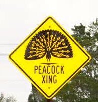
Peacock sits in Francis Langford’s Royal Poinciana Tree, Rio. Photo, gift to Jacqui Thurlow-Lippisch from worker on Mrs Langford’s Estate, 2005.
My father’s parents, Tom and Jane Thurlow, moved to the warm breezes of Stuart, Florida, along the St Lucie River/Indian River Lagoon in 1952. They were coming from the cold winds and snow of Syracuse, New York. My grandfather was no “spring chicken;” he was 46 years old.
My grandparents have passed now, but I remember multiple conversations with them when in my youth when they would take me to “Francis Langford’s Polynesian Outrigger Resort,” today’s Dolphin Bar, on the north edge of Sewall’s Point in Jensen. During these special outings I would always ask the same question:
How was it that you moved to Stuart?
My grandparents racing their beloved sailboat. (Family photos, 1950s, Thurlow.)
My grandparents would look at each other and smile, and then my grandfather would talk about how he refused to shovel anymore show, and how one day after great thought, he put aside his law practice, hooked the “Lightning” sail boat to the back of the station wagon; put my grandmother and the two young kids in the car…Oh yes, along with the dog, “Tanya,” a great dane; a mother cat with two kittens in box; and “Mary B,” my great grandmother, and drove down to Stuart, an area they had raced sailboats before….their beloved hobby.
About this time my grandmother would chime in that once while in Jensen, they went to “Francis Langford’s Outrigger Resort,” which reminded them of where they had been married, Bermuda, and John Hall, who played “Tarzan,” and Francis Langford, who had sung to the troops in World War II, and was a famous movie star of their era, owned the restaurant back then….. My aging, beautiful, grandmother, with a smile on her face, then told the story of Francis Langford and John Hall’s pink Cadillac, and how one night after a few cocktails, the couple drove them around the few roads of Jensen and Stuart in the 1950s. What fun! According to my grandmother, after the “ride” in the pink Cadillac, they “were hooked,” and moved to Stuart soon after in 1952.
Francis Langford and husband John Hall, who played the role of Tarzan. (Public AP photo.)
After my grandparents passed away, the legend of Francis Langford and the remnants of her Polynesian Outrigger Resort, took on an even greater romanticism in my mind. For me, the essence of this era and my grandparents were symbolized in the Francis Langford’s remaining peacocks I would often see prancing around Jensen—- all of which are descendents of a pair which she brought to Jensen in the 1940s.
You may remember, that in 2001, some people in Rio/Jensen complained about her 100 or so peacocks that roamed freely on her 60 acres and often jumped, flew or walked to neighboring Sewall’s Point. Often, 707 would be backed up as drivers stopped to allow the menagerie to slowly pass…
Peacock dispalying his feathers. Public photo.An afternoon visitor, 2008, Sewall’s Point. (Photo JTL)Peacock in Sewall’s Point at my house on Ed’s car, 2008. Photo JTL.Young peachick. Photo JTL 2008.
The famous actress and philanthropist is quoted as saying in a 2001 Stuart News article:
“You just can’t keep them caged up. They are all around and I love them. They are part of my family….”
I used to see the peacocks all the time, but rarely today. In fact, I used to see them right in here in Sewall’s Point, for years, until the US mailman accidentally ran over the male in the Archipelago and the remaining females and chicks were eaten by bobcats. The peahens even laid eggs in my yard one year.
I wish they would come back….even though they are an invasive bird, they hold a special meaning for me.
Peahen eggs in Sewall’s Point, 2008.Peachicks very much resemble baby chickens…(Photo JTL 2008)
So if you would, if you are passing along 707 in Rio and see the striking indigo blue of some local peafowl or some trailing yellow chicks, please stop, and let them cross the road. And when you have to wait, think about a bygone era of the Indian River Lagoon that included pink Cadillacs, Francis Langford, peacocks, and “Tarzan” as your chauffeur.
Spoil island history, MC, FL (A time-capsule “flight” by Todd Thurlow.)
For today’s post, I am partnering up with my younger brother, attorney, Todd Thurlow. Todd, as all members of my family, is intrigued by history and maps. As he is a technology buff as well, he has learned to use Google Earth Pro (in this case a trial version) to superimpose old maps over today’s Google Earth aerials. The effect is amazing in that one can literally “see” the changes over time in land, shoreline, and in today’s case, IRL spoil islands. The islands that one sees in the IRL are not natural, they are dredge fill from the creation of a channel with its government beginnings in 1881. This includes some islands that are now exclusive neighborhoods, such as Island Edition and Archipelago, in Sewall’s Point. Fortunately, the birds got one too–“Bird Island” now a Critical Wildlife Area, (CWA) or MC2. MC2 is located just north, off the Archipelago.
Today our channels are managed by FIND, the Florida Inland Navigation District.
I will provide a summary TIME LINE of Todd’s notes below; nonetheless, be sure to watch the video in the link below, so you can “see!” It is amazing: you will feel like you are taking a time-capsule flight right over our beautiful and ever-changing Indian River Lagoon:
Question: “When Did Spoil Islands “appear” in the Martin County Area of the Indian River Lagoon?”
TIME LINE
1881: Florida Coastline Canal and Transportation Company was formed
1887: Aerial shows no spoil islands in IRL
1890: Dredging complete from Haulover Cut in Merritt Island to Jupiter
1892: Locals dig St Lucie Inlet by hand
1920: No spoil islands east of Sewall’s Point. US ACOE recommends dredging 8 feet deep and 75 foot wide from Jacksonville to Miami
1930: ACOE increases recommended width to 100 feet from 75
1935: Work complete-8 feet deep and 100 feet wide channel
1940: USDA map aerial shows spoil islands deposits on east side of Sewall’s Point (these became Island Edition and the Archipelago developments among other things…)
1945: Congress authorizes ACOE to dredge 12 foot deep 125 foot wide channel
1952: USDA map showing spoil islands DIRECTLY EAST of Sewall’s Point
1958: USDA aerial still shows no spoil islands on EAST SIDE of channel near Sewall’s Point (these are new islands, not the ones already deposited off of the near east side of SP)
1960: Due to ACOE determination, IRL portion between Ft Pierce to Miami is dredged to 10 feet rather than the 12 feet wanted in 1945
1963: NOAA chart shows new channel but no new islands still on the EAST SIDE of the channel off of Sewall’s Point
1965: ACOE work complete– based on 1945 and 1960 determinations
1970: Aerial finally does show spoil islands on EAST SIDE of channel off of Sewall’s Point from dredging/channel projects
1970: Aerial reveals, if one looks closely, that the smallest of the spoil islands to the EAST of the channel off of Sewall’s Point has since disappeared….
Todd Thurlow has given presentations at Stuart Heritage and Florida Oceanographic (http://thurlowpa.com) Call him if your club would like a presentation. Todd and I will be doing more work together in the future!
*I must also credit my dear river activist friend, Ezra Appel, who recently got me interested in spoil islands all over again. Ezra got involved two years ago with the Indian River Lagoon Aquatic Preserves (IRLAP), when his company adopted a spoil island in Vero Beach. Now he is involved with a newly formed group “Friends of the Spoil Islands, Inc, ” a 501 (c) non-profit, Community Service Organization working in partnership with the DEP and IRLAP. Ezra sits on the board as the Treasurer. They have a Facebook page: (https://www.facebook.com/spoilislands) Check it out! Ezra also shares with me aerial photos from INDIAN RIVER BY AIR; they have some great shots of the spoil islands in their neck of the woods: (http://www.indianriverbyair.com/tagged/spoil%20island)
(ca.1971) Local Stuart kids swimming on Jupiter Island beaches, near Peck’s Lake. Pictured: (Jenny Thurlow, Mark Postsdam, Lynda Nelson, Jacqui Thurlow, Eric Potsdam, and Chris Williams. (Thurlow Family album)
My post yesterday about erosion at Bathtub Beach brought a lot of discussion and questions about when the inlet at Peck’s Lake broke through to the Indian River Lagoon as well as beach erosion in general.
Later in the day, my mother sent me some old Whiticar family photos of the Aurthur Ruhnke family. Her friend, John Whiticar, had shared these photos awhile back. I had seen them before as well, and in light of the erosion situation, I thought I would share them today. I often share the gorgeous IRL photography of Mr John Whiticar of the famous Whiticar Boatworks family (http://whiticar.com). John’s photos of the Ruhnke family’s photographs are outstanding and quite beautiful, especially in the black and white of the 1960s.
So whether looking at my own family photo on the beach in 1971 above, or the Whiticar/Ruhnke photos of the same era, one thing is for sure: the shorelines and tree lines may change, and the shifting tides of time may change as well; but one thing is constant: people, especially kids, love the beaches and shorelines of our Atlantic Ocean and St Lucie River/Indian River Lagoon area….Enjoy!
Peck’s Lake breakthrough inlet at Jupiter Island, early 1960s. (Photo Whiticar/Ruhnke.)Wash through, Peck’s Lake, Jupiter Island, ca. early 1960s. (Whiticar/Ruhnke)Another angle of Peck’s Lake inlet at Jupiter Island, ca. early 1960s. (Whiticar/Ruhnke.)News clip regarding Peck’s Lake Inlet contract date to be closed, “June 6th,” with no year. (Whiticar, ca. early 1960s)Aerial of Peck’s Lake area with new inlet. (Whiticar/Ruhnke, ca. 1960s)Driftwood, old trees, and “forest” of perhaps Australian Pines/erosion in the area of Peck’s Lake’s beaches, Jupiter Island. (Whiticar/Ruhnke, ca 1960s)Boaters, Peck’s Lake area…. (Whiticar/Ruhnke ca. 1960s)Huge old tree..perhaps a black mangrove/erosion. (Whiticar/Ruhnke ca. 1960s)Ancient looking tree and beautiful lady… (Whiticar/Ruhnke ca. 1960s)Shoreline…(Whiticar/Ruhnke ca. 1960s)Old trees…(Whiticar/Ruhnke ca. 1960)Old tree….(Whiticar/Ruhnke ca. 1960s)Thank you to John Whiticar for allowing me to use his family’s Art . Ruhnke photos. The Ruhnke’s had a photo shop in Stuart’s early days.
Looking out to the Atlantic Ocean through and ancient black mangrove that was exposed by erosion off of Bathtub Beach.. (Photo 2009, JTL)
There have been many times over thousands of years that the ocean has broken through Hutchinson Island and flowed into the Indian River Lagoon off of Sewall’s Point. Most recently, in 2004, after hurricanes Jeanne and Francis. Also in the early 1960s, at Peck’s Lake*, on Jupiter Island. But of course we “repair” the areas and “put them back”…for a little while anyway….
Peck’s Lake breakthrough ca. 1960, Jupiter Island. (Ruhnke Collection, Thurlow Archives, from the book “Sewall’s Point,” by Sandra Henderson Thurlow.)
I have been fortunate the past few years in my river photography to see the island by air in my husband’s airplane; it never ceases to amaze me that Hutchinson Island, as all barrier islands, is really just a ribbon of sand….
So, of course Mother Nature comes through….
Sand piled hight at Bathtub Beach. (Photo 12-10-14, JTL)
Bathtub Beach is an area that Nature seems determined to reclaim soon. Yesterday, as many, I drove to see the “State of Emergency” claimed by Martin County at Bathtub Beach.
Looking to the ocean….(Photo 12-10-14, JTL)
There was a young couple that had scaled the piled protective sand and I struck up a conversation with them.
“Hi, I’m Jacqui. This is amazing isn’t it?”
The young man replied: “Yeah we came yesterday, and the waves were 10 to 12 feet!” The water was all the way up to this fake dune. Look, you can see the sand is still wet.”
Former Wentworth house, Bathtub Beach. (Photo 12-10-14, JTL)
“Wow,” I exclaimed. “Yes, I have seen this before. It’s incredible. You just have to wonder if one day the ocean will come through so hard she takes it all. This would be terrible for the people who live here…”
The response from the young man?
“Well, at least the river will be cleaner….”
I was amazed to see how far the river culture has expanded, and perhaps the values of a younger generation…
Rather than get into a political conversation with a nice young couple just here to explore, I said how nice it was to meet them, and ran down the sand pile in my high heels to get to my car before I got a ticket.
Wormrock at Bathtub Beach (Photo 2009, JTL)
At 50 years now, I have known our beaches since I was a kid walking around on the worm reef catching fish with a homemade net, before we knew that was “bad” for it. During my youth, the older generation began to really build on Hutchinson Island, which was not such a good idea either….The same goes for the low areas of the Town of Sewall’s Point, across the Indian River, where I live and sit on the town commission. These areas are very vulnerable. It’s a problem.
So how do we deal with this “realization,” that we have built on Mother Natures’ front line? Do we retreat, as in war, knowing we will never win, or do we harden our areas reinforcing the shoreline and our homes as long as we can? Do we spend millions of dollars putting concrete seawalls and dredged sand on our shorelines that will surely eventually wash away and each time, not to mention it covers and destroys our “protected” off shore reefs and sea grasses?
These are the difficult questions, and if we follow the model of South Florida that has been dealing with these issues of sea level rise, and just the “normality” of living on a shifting sandbar that God wants to roll over on itself like a conveyor belt, every few hundred to a thousand years, we have some big problems ahead of us. We can reinforce our shorelines and raise our houses, but in the end, Nature will win. In our short lifetimes, we may not see the “grand change,” but our children and grandchildren will.
For instance, the photo at the beginning of this blog is an ancient black mangrove with a hole in it looking towards the ocean. These mangroves are exposed during high erosion because Hutchinson Island is rolling over on itself. This is called “transgression.”
To repeat, much of the construction on barrier islands happened before people fully understood that these places are particularly volatile.  The clues have been accumulating for decades: beachfronts are thinning, storms regularly swallow dunes and send sand flowing to the far side of the island… Slowly, geologists and government entities have realized that the very nature of barrier islands truly is to “roll over,” typically toward the mainland, as waves and weather erode one side and build up the other. Barrier island ecology is not fully understood; there are many theories. It is complex, but some things we understand now…
Thus when the erosion is greatest, the remnants of an ancient mangrove swamp on the ocean side of the island can be seen….Kind of bizarre isn’t it?
What do they say? “The only constant is change.”
Yes, times are changing, the climate and the oceans are warming; no matter the reason, this has happened before. Our job, as it always has been, is to adapt. But in the world of money, real estate, and ad-valorum tax values to governments—along the Indian River Lagoon, this may never occur, until the ocean is truly upon us…
Ancient swamp on ocean side…..(Photo 2009, JTL)Northerly view of Bathtub Beach and exposed ancient mangrove swamp….(Photo 2009, JTL)Today even with high erosion the ancient mangrove swamp is under the sand. You can see one sticking up…(Photo 12-10-14, JTL)This photo that I found on water/river activist Nyla Pipes’ Facebook page. The view of ocean action along the Atlantic Coast is very telling….
*Originally, I wrote” 1948: as well as “1960” in this blog post as the years that Peck’s Lake opened. Due to communication with my mother, historian, Sandra H. Thurlow, I have changed my blog to say only “1960s.” She believes there was an error in a photograph used in her book, “Sewall’s Point,” in that the photo she used in her book said 1948 but she now, after seeing old shared photos from John Whiticar, thinks this date is incorrect. Please read below:
Peck’s Lake Inlet
The photograph of a wash over at Peck’s Lake in Sewall Point on page 19 is identified as “1948” because it an 8 x 10 print in the Ruhnke/Conant Collection we purchase had that date written on the back.
Year later I began to suspect this was in error.
The clincher was a group of photos that John Whiticar came across that were obviously from Ruhnke which included the washout I had labeled 1948 with others that were obviously from the 1960s because of a flower farm in the background. There were also photos of the drowned trees and Ruhnke family photos of a visit to Peck’s Lake.
A Nov. 11. 1963 article in the Stuart News about Inlet worked said, “Also in April of this year the Martin County Commission passed a resolution asking the Corps of Engineers to take action to insure the boating public would always have as safe an inlet from the ocean as was available at that time through the storm-opened Peck’s Lake Inlet, closed by the Corps this past summer.
12-30-14 I received the numbers on costs from Martin County for beach re-nourishment over the years; I am adding the list here as a photo so I can share it with comments on this blog:
Beach Renourishment Numbers from Martin County 2014.
“If a tree falls in a forest and no one is around to hear it, does it make a sound?” Quote attributed to Anglo-Irish philosopher, George Berkley 1685-1753.
The “Quisenberry House” located at 54 S. Sewall’s Point Road, built in late 1800s.Large waterfront lot facing the Indian River Lagoon.View along South Sewall’s Point Road.
To play off the famous quote by philosopher George Berkley: “If a house falls in a neighborhood and no one notices it, did it exist?”
Today, I am writing about the demolition of the “Quisenberry House,” in Sewall’s Point, along the Indian River Lagoon. The demolition of the house is quietly taking place. The house is over 125 years old, and certainly has a story to tell of its long existence…
Of course, the only reason I know really anything at all about the house is because of my mother, historian Sandra Henderson Thurlow. She has told me about the house since it was a bus stop for the kids going to Jensen Beach Elementary in the 1970s. Every day, sitting on the bus on the way to Highpoint, I would see that old-looking house, and every day, my imagination was set ablaze by its sight…
Mr and Mrs Harmer, 1907. (Photo, Agnes T. Parlin, courtesy of Thurlow Archives.)
“Who lived there?”
“What did they do back then?”
“Why do people say gangsters lived there?”
According to Sandra’s book, Sewall’s Point, The History of a Peninsular Community on Florida’s Treasure Coast, the house was built by Edgar and Katherine Harmer around the late 1800s. Mr Harmer died in a car accident at the Crossroads on Indian River Drive in 1920. His wife’s sister married Mr Jensen, (of today’s Jensen Beach), so the two families were very interconnected and helped with attracting other pioneer families to the remote Indian River area. The Harmers were prominent citizens of their day.
Later, in the 1920s the house was stuccoed, and became the home of Frank Quisenberry , a Detroit banker who worked for the well-known Knowles family for whom Knowles subdivision in north Sewall’s Point is named.
Mr Roger Quisenberry, who now own the home, tells stories of the house being used by Al Capone during prohibition. These stories have circulated for years, and when I was a kid in middle school, along that same bus route, I used to picture dark-suited gangsters in that house, laughing, smoking cigars, and counting their riches, with a giant bottle of rum or moonshine, and some shot glasses, sitting along a hard wooden table….
“It certainly seems like more fun than we are having today,” I thought, dressed in my cheerleading uniform, books in my lap, on the way to school…
Who really knows the truth, but certainly there is truth, that if the walls of that house could talk, there would have been stories to tell of a beautiful, fish and wildlife filled river, of gentle breezes and harsh storms, and of dreams broken and built, along the Indian River Lagoon….
The wrecking ball takes the old house down…12-7-14. (Photo JTL.)
Due to a code enforcement infraction and law suit dating back almost a decade, the entire duration of my “commissionship” in Sewall’s Point, after much money spent, and lots of lawyers racking in the dough, the conflict has finally been resolved, and the house is being demolished. Built in the late 1800s, it is certainly one of Sewall’s Point’s and Martin County’s oldest homes. One of the few historic homes saved, the Captain Sewall’s Home/Post Office that used to sit at the tip of south Sewall’s Point was built in 1889; the House of Refuge was built in 1876; the Stuart Feed Store was built in 1901.
Primarily due to the stucco over the frame, the old wood house held moisture and had become extremely deteriorated. No one has lived in the home for many years. Any salvageable pieces of wood will be collected; and concrete, steel and other valuable materials will be salvaged.
Good bye to the old house upon the Indian River, and to the stories, known and unknown, that you held…
1905, House can be seen in background as Mr Harmer and northern guests stand along a cold and windy Indian River Lagoon. (Photo, Agnes T. Parlin, courtesy of Thurlow Archives.)
Cowboys at work at the Adams Ranch, St Lucie County, FL. Photo courtesy of Adams Family and “Port St Lucie at 50, a City for All People,”by Nina Baranski for the Historical Society of St Lucie County.
Yesterday, I received a copy of the FLORIDA RANCHES 2015 Calendar, 10th Anniversary. I have been lucky enough to have received this calendar for many years from various friends and business associates, and this year it was from, Stacy Ranieri, president of the Firefly Group, a public relations agency.
Stacy states: ” While most calendars focus on being visually appealing, ours also strives to educate the public about the importance of Florida’s ranch lands–and the finite and treasured water that flows through them…”
Hmm…water? I thought.
I casually perused the calendar and one quote I keep thinking about since, is one by Mr Bud Adams, who I consider a local hero. My family has lauded him all my entire life; I saw him speak and receive the “Lifetime Achievement Award” from Harbor Branch’s “Love Your Lagoon,” two years ago; and I was in a commercial this year with Mr Adams for Congressman Patrick Murphy’s reelection.
In the write-up, Carlton Ward, who is the photographer for the calendar, and another amazing person from a local ranch family who focuses also on promoting the Florida Wildlife Corridor, perhaps the coolest thing going right now in the state of Florida…(http://floridawildlifecorridor.org) tells a story.
Carlton Ward is talking to Bud Adams, of course many years his senior, and he ask the well-known ranching environmentalist icon: “Mr Adams, would you consider yourself an environmentalist?”
And Mr Bud Adams with a quiet smile replies,” Well son, We’re careful about that word around theses parts. You see, to us, an environmentalist is a Yankee just out of college who comes out here in their air-conditioned car from their air conditioned office and tells us what to do with our land…”
Of course the Adam’s Ranch in known far and wide as being perhaps the most environmentally sensitive ranch in Florida and, as Mr Adams explains in the calendar:
“Most of the water that falls on Adams Ranch does not reach coastal estuaries. All of the water storage and distribution is privately done by Adams Ranch. These waterways never go dry and support fish that control the mosquito larvae. This eliminates the need for mass pesticides and allows for a healthy bee and insect population. …our heat tolerant cattle do not stand in the water and their waste replenishes soil organic matter…” (http://www.adamsranch.com)
Wildlife, from the smallest bunny, to predators at the top of the food chain, like bobcats and some coyotes, are allowed on Adams Ranch. Water is held on the land and the animals are attracted to this water. The water nourishes the land, the cows, and wildlife…with out running off onto dirty roads or carrying what is on the land into the St Lucie River/Indian River Lagoon.
It is an amazing place, and I have visited with my family many times for tours. Mr Adams is a wildlife photographer himself, like Carlton Ward; His photos are often featured on the last page of Indian River Magazine.
So back to his comment I have been thinking so much about. “We’re careful about that word around theses parts…”
It made me think. My mother is a 5th generation Floridan and my Father is a Yankee… 🙂
Hmmm? What am I?
In any case, the message is that if we environmentalist want to be liked, we must be careful with how we approach those who have been on the land for hundreds of years. This includes ranchers, and yes, farmers too….
No too long ago, ranches used to fill St Lucie County. Even when I was a kid growing up in Martin County in the 1960s and 70s… Indiantown and Palm City also had many ranches.
So many are gone…and now filled with houses. We environmentalists must recognize that development is the greatest threat to our rivers. We should do all we can to keep these working ranches “working” in Florida for the sake of the St Lucie River/Indian River Lagoon.
Early ranches in St Lucie County, courtesy Adams Family and SLHS.
Greg Oravec, Port St Lucie’s new mayor, is a friend to the Indian River Lagoon. Although many of us know him already, as he is the former city manager of PSL, we need to get to know him even better. We need to make him a close ally. He has qualities and desires to help us improve the health of the SLR/ IRL and to work together between Martin, St Lucie and Indian River counties, as well as between the state and federal government.
Mayor Oravec graduated magna cum laude from University of Miami’s honors program in “Marine Environmental Systems.” According to Greg’s bio, as a kid he “grew up fishing and building forts.” Greg loves and appreciates our “good nature….” Today, Greg and his wife are raising three children and want their children to have access to clean water and an healthy outdoor environment too.
Mayor Oravec
So how can Mayor Oravec help us?
Well, in terms of Martin and St Lucie counties, we don’t always think about it, but a tremendous portion of the runoff into the St Lucie River/Indian River Lagoon is from St Lucie County. Thank God they are on sewer and not septic for all but 22,000 of their residential properties… This runoff is primarily because of canals C-23 and C-24. These two canals were built as part of the Central and South Florida Project in the 50s and 60s to drain the lands mostly of St Lucie County for agriculture (citrus) and for development. These two canals release untreated agricultural and urban runoff into the north fork and central area of the St Lucie River. In case you don’t know, C-23 is the dividing line between St Lucie and Martin counties, but of course the river knows no boundaries….
Basin and canal map SLR
For us today, it is important to note that St Lucie County with 250,000 residents is now the 9th largest city in Florida! And it is only going to get bigger with a projected 450,000 plus people by 2050. This is a negative but also a positive, in that St Lucie County and especially the City of Port St Lucie now have significant political power due to this population growth. They are a giant part of the key to getting what we want: more water moving south; no releases from Lake Okeechobee; and the clean up and water storage of excess polluted runoff of canals C-23, C-24 and C-25 into the SLR/IRL.
In fact, the first time I was ever invited to Port St Lucie County to learn about all the city had been doing over the past few years to improve water quality was when I was mayor of Sewall’s Point in 2012 and Greg invited me up to PSL as their city manager. He showed me maps of McCarthy Ranch and the C-23 canal that were part of planning for the city’s water supply, growth, and to clean the polluted water of C-23, along with other impressive local projects.
I have to say, honestly, Greg is one of the most polite yet determined people I have ever met. A true gentleman and a driven man of service. I ask everyone to welcome him and to make him a friend. Email him and congratulate him! Go out of your way to get to know him. Invite him to a Rivers Coalition or River Warrior meeting. Attend a PSL city commission meeting and “speak up!”
It is a rare day, to have such a person as Greg holding the reigns of Port St Lucie.
If you check out his website you will see that he dedicated an entire page to the Indian River Lagoon, stating as part of his goals: “to preserve our natural areas, especially the Indian River Lagoon.”
You can email Mayor Greg Oravec at his new official email : mayor@cityofpsl.com
Believe me, we need him more than ever; there is lots of work to do in PSL, but we sure do look forward working together on regional, state and federal issues to help save our shared resource, quality of life, and economy builder, the St Lucie River/Indian River Lagoon!
Mayor Oravec and Comr. JTL at the TCCLG meeting. We were trying to get the IRL in the background, but there was too much light!
“Give me liberty to know, to utter and to argue freely according to my conscience, above all other liberties.” Milton
This coming Monday, December 8th, 2014, at the City of Stuart commission chamber, located at 121 SW Flagler Avenue, from 9-12, it is our turn to speak up to our Legislative Delegation about the importance of the St Lucie River\Indian River Lagoon.
This is our designated time before the state legislative session formally begins to call attention to our legislators the importance of the SLR/IRL to our local economy and quality of life in Martin County. It is our time to tell them we appreciate what was done last year but we want more. We want to purchase lands in the EAA, Everglades Agricultural Area through the help of Amendment 1 in order for more water to flow south and to restore what we can of the northern and southern Everglades…we also want to complete the Indian River Lagoon South purchases and projects that are part of a greater plan. But before we speak…
What is our “legislative delegation” anyway?
Our legislative delegation is the group of state elected officials from our area. In fact, sometimes I have not been familiar with some of those who are part of the delegation, but I always know for sure that Senator Joe Negron, and representatives Galye Harrell and Mary Lynn Magar will be there, as they are our present Martin County representatives.
Comments were to have been made formally through the offices of the elected officials, but I would imagine if you show up and ask to share a short comment they would allow it; or hand them a written note at the beginning or end of the session.
The whole thing can be rather intimidating, but don’t be afraid, speak up! They are your elected officials and it is their job to listen to you.
The first time I ever went before them, I spoke on not allowing the state to preempt the Town of Sewall’s Points strong fertilizer ordinance. It was uncomfortable for me; I was nervous. Sometimes I felt like some of the delegates were not listening to me or taking me seriously. But I put a smile on my face and I spoke.
I felt better for doing so, and for being a part of the American democratic process, as messed up as it sometimes is…
If you can, go speak up for St Lucie River/ Indian River Lagoon on Monday. It’s easier sometimes not to speak, but how will we change our world if we don’t? 🙂
River Warrior Solidarity Fish T-Shirts in many colors for the holidays!
The River Warriors recently contacted me to tell me that they now have an office, and that I was invited to make Solidarity Fish T-shirts for those walking tomorrow in the Stuart Christmas Parade beside the River Warrior Float. They also invited me to sit on this float along with other River Warrior Ancients. 🙂
I was honored and intrigued….an office? So, yesterday evening, I drove to 745 NW Federal Highway, right over the north side of the Roosevelt Bridge, very close to the St Lucie River.
What I saw almost brought tears to my eyes! A true River Warrior office with energetic elf like River Warriors working away!
River Warrior office.With Gayle Ryan who greeted me at the door…
There were kids and adults and music and all sorts of river and political posters on the walls…busy River Warriors applying acrylic paint to brightly colored T-shirts, and others blowing the paint creations dry with blow dryers, and then neatly folding the shirts on a long straight table…
When the River Elves saw me, they joyously exclaimed, “It’s Jacqui!” Let’s make her a red, white and blue fish!”
I stood there in amazement. “This is so awesome…am I dreaming?”
There was Gayle Ryan at the door, the power-house behind getting the space…Julie Williams who was instrumental in the storefront donation…Marty Baum, the Indian Riverkeeper, and his girl friend Robin and their friends and a huge Santa Clause sitting in the corner. There were children cutting out manatees, dolphins, and sea turtle shapes…
The fluorescent lights juxtaposed to the darkness outside made everything seem brighter…I read every poster on the wall as a flood of memories came back to me….
“So, in 2013 we had the toxic “Lost Summer;” the people had an uprising, and now they, “we,” have an office? Holy Cow!”
With my head spinning, I took great pleasure in seeing a huge flag that read DON’T GIVE UP THE SHIP!
DON’T GIVE UP THE SHIP!
Artist Janeen Mason’s art also covered the walls; she is the originator of the Solidarity Fish that the River Warriors use as their symbol. (http://www.solidarityarts.com) These fish will tonight be part of Christmas tree lighting in Washington DC! Janeen is a marketing genius.
River Warrior ladies busy creating shirtsCreating the solidarity fish…River Kidz!Janeen Mason’s art at entrance of office.
It’s official. Solidarity for the St Lucie River/Indian River Lagoon is here to stay along the Treasure Coast, hopefully in Washington DC, and in our local government offices too! A couple of days ago, I received this holiday card from the “Martin County Ecosystem Restoration and Management Division.” They made their own solidarity fish T-Shirts. Go Deb Drum and Team!
Martin County Ecosystem Division 2014 holiday card with solidarity fish.Me with my solidarity fish/River Warrior T-Shirt.
After a short time, when my shirt was ready, I put it on right over my dress: I was so exited! I am so thrilled to see so much passion for the river one year after the releases by the ACOE and SFWMD from Lake Okeechobee and C-23, C-24, C-25 and C-44 that killed our river.
Well no one will stop us now….we will in time bring our river back.
Happy Holidays, Merry Christmas, and a yet another Solidarity New Year for our St Lucie River/Indian River Lagoon!
Stop Taking…Save Our RiverUpside down solidarity fishsolidarity fishPatriotic solidarity fish!Rock the Boat!Bright paints.Discharge Kills!March to the Locks.With Riverkeeper Marty Baum and Santa.SAVE OUR RIVER in lights above the office door.
Jacqui Thurlow-Lippisch, and Nancy Higgs (former Brevard county commissioner) during a tour to Harbor Branch’s “sponge storage area for cancer research.” Nancy named the area, containing over 3500 specimens, “Spongeville.” Both women serve on the HBOIF board. (Photo by Dr Sheri Pomponi, 11-13-14.)
After a recent tour at FAU’s Harbor Branch Oceanographic Institute, along the Indian River Lagoon, in Ft Pierce, I will never look at my kitchen sponge the same again…..
Sponges in my kitchen….
It has been a great pleasure to serve on the FAU, Harbor Branch Oceanographic Foundation Board for just over a year, and at a recent meeting we were able to tour the famous “sponge storage vaults for cancer reasearch” deep within the inner chambers of the university. I had heard about these sponges for decades but had never seen the 3500 specimens that are shared with visiting scientists from all over the world, “face to face.” World scientists visit HBOI because the collection is unique in the world.
Today, I ‘d like to share just a little about what I saw and learned.
From areas as remote as 3000 feet deep in our world oceans come these specimens! And some may just may hold the cure for certain cancers, malaria, tuberculosis neurodegenerative disease, bone density improvement, and inflammation….
One of Harbor Branch’s famous submersibles now on display.
Walking through the many rooms/cooled vaults of the collection was mind-boggling; our guide was Dr Sheri Pomponi who had collected many of the specimens herself. (http://www.fau.edu/hboi/mbbr/).
Other scientists who assisted us on our tour were Dr Amy Wright, Dr. Peter McCarthy, and Dr Esther Guzmán. The entire presentation was way over my head, but basically I learned that sponges and other deep-sea life do not have such easy lives and participate in a type “chemical warfare” down there vying for survival in a very tough environment.
For instance, a sponge or sea fan like creature may produce chemicals that remarkably allow them to adhere to hard corals, “like bone.” Many can also produce other chemicals, for instance to “taste bad” to predators so they are not eaten…. Amazingly, the chemicals these marine creatures produce to survive can be applied to human survival.
Dr Sheri Pomponi collected many of the specimens across our world’s oceans for HBOI.HBOI collection bottles.HBOI collection all labeled by date, contents and location.
According to Harbor Branch:
“Natural products are inherently bioactive, and most researchers feel that the structures have evolved over time to provide exquisite biological activities. Humans and organisms such as sponges, soft corals and bacteria share similar biochemistry and compounds that might have one use in sponges might have totally different use in humans. Researchers at Harbor Branch can take advantage of the similarity in biochemistry to develop medicines useful in the treatment of human diseases.”
While at the tour, Dr Guzman was actually showing through computer technology how certain chemical compounds from sponges were killing (attacking) cancer cells. “Of course the key is not killing too many other “good” cells at the same time,” she said.
This was like an “Ah-Ha” moment for me. “So some sponge cells kill other cells…even human cells? Like trying to adhere to the coral? Hmmm? The applications? Similar biochemistry? A process better than chemotherapy?” I wondered. Fascinating.
Anyway, the whole thing, taking place right here along the Indian River Lagoon, was incredible and actually a lot of fun because my friend Nancy Higgs who sits on the board with me kept joking over and over again:
“Jacqui, It’s Spongeville! You can write a blog! Spongeville! She and I laughed as we walked deep into the vault, but then suddenly we were very quiet. ”
Wow, maybe the cure for cancer is right in here….” we looked at each other in amazement.
Like I said, I will never be able to look at my kitchen sponge the same again…
Just recently, my husband Ed and I had the hardwood floors of our 1977 home redone. During this time, we literally “moved out” into one room of the house for almost four weeks. As much as this turned my world upside-down, it forced me to go through all of the “stuff” I have acquired over the past ten years in my St Lucie River/Indian River Lagoon files. I found some cool things I had forgotten about.
The folder I am sharing today is entitled OLD INLET PHOTOS. It includes aerial photos of the Jupiter, Stuart (St Lucie), Ft Pierce, and Sebastian inlets. I borrowed the photos from my mother, historian Sandra Henderson Thurlow, years ago. My photos are copies of the originals. I believe she and my father acquired the photos through Aurthur Ruhnke’s Photography Shop that once was located in Downtown, Stuart.
Written on the back of all photos except the Sebastian Inlet, was the year “1936.” The photographer was R.B. Holt. The Sebastian Inlet however, has “1962” written on the back of the photo along with “Sterling Hawk’s name,” a different photographer.
I love old stuff like this; I hope you do too.
Enjoy and dream of a time long ago…the fishing must have been great, and look how undeveloped the surrounding lands were! The inlets helped promote the development of the Treasure Coast Region.
Of course before man created the inlets permanently along the Indian River Lagoon, Mother Nature’s winds and tides would decide if an inlet was open or closed to the sea. Over thousands of years, inlets opened and closed all along the Indian River Lagoon making the naturally fresh waters brackish for a time and allowing wildlife to flourish in these areas.
Man was attracted to these natural inlets as well. I was just reading last night about how the inlet at Jupiter closed in the 1860s when the US government was building the Jupiter Lighthouse. Nature’s closing of the inlet was a “great inconvenience.” Today we would also consider it a great inconvenience to have any of our inlets closed.
The problem is that they are not meant to be permanently open and erosion problems occur over time. As most things in life, there is a positive and a negative; the tricky part is figuring our just where to draw the line in the sand…
Jupiter Inlet, 1936. (All aerials from the Rhunke Collection, R.B. Holt is believed to be the photographer for all but Sebastian Inlet photo, Thurlow archives.)Jupiter Inlet, March 18, 1936.Stuart (St Lucie) Inlet, 1936.Ft Pierce Inlet, 1936.Ft Pierce Inlet, 1936.Ft Pierce Inlet, 1936.Sebastian Inlet, 1962. Photo by Sterling Hawk.
_____________________________________________
All photos courtesy of Sandra Henderson Thurlow, historian. Her books on Sewall’ Point, Stuart, Jensen and the House of Refuge can be purchased at both the Stuart Heritage Museum, (http://www.stuartheritagemuseum.com) and at the Elliott Museum, (http://www.elliottmuseumfl.org).
Secretary Hershel Vinyard, of the DEP, fields questions from river activist Benjamin D’Avano about a toxic SLR/IRL, “TMDL Celebration” Downtown Stuart, 2013.
Right before Thanksgiving, I heard the news, “Secretary Hershel Vinyard announced he is retiring from the Department of Environmental Protection….”
Even though there were many times over the past few years, that I felt like the DEP was not doing its job, and that the Scott administration had “demoralized” the agency, I felt saddened to hear this news….
Why? Because Hershel Vinyard was someone who went out of his way to build relationships in Martin County. Who will I call now? Clifford Wilson, the 35-year-old interim Secretary for the DEP? Don’t think he’d recognize my name and maybe not even be that familiar with the problems facing the St Lucie River/Indian River Lagoon…
Clifford Wilson, interim Secretary for the DEP.
After thinking for a while, an image came to mind of the first time I saw Secretary Vinyard deal with an angry public. He did a good job and from that moment on I liked him.
I have to say that Secretary Vinyard did a good job handling an angry crowd and over time I came to know him and appreciated that he took the time to visit Stuart on many occasions and learn the history and polluted plight of the St Lucie River and Indian River Lagoon. He would listen. He helped bring Governor Scott here to see the river. He saw how much we cared and responded even though he could not single-handedly fix the situation. Martin County is not known for getting much attention–I am appreciative that it was given…you can’t start changing things until those in power know who you are.
Group shot, Town of Sewall’s Point Commissioner, Jacqui Thurlow-Lippisch; Stuart Former mayor and Commissioner, Jeff Krauskoph; SFWMD Board Member, Kevin Powers, DEP Secretary Hershel Vinyard; SLC Commissioner, Chris Dzadovsky ; Martin County Commissioner, Ed Fielding; River Kidz member, Mary Thurlow, 2013.Speakers talk about the clean up of the SLR, 2013.Mary, Secretary Vinyard and me, 2013.
One time, when I emailed the Secretary about the SLR/IRL, I made the mistake of writing “Secretary Walker…” as in “Hershel Walker,” a very famous Georgia football player from my era who tortured the Florida Gators. As always, Mr Vinyard was a gentlemen and did not make me feel like an idiot.
In spite of people or parties we “like or dislike,” we must remember that it is relationships that will help heal the St Lucie River/Indian River Lagoon, and these must be built with whomever is in office. And although it may have been political, Secretary Vinyard was on the Army Corp of Engineer Calls at the end of this summer asking the agencies NOT TO RELEASE LAKE OKEECHOBEE WATER THROUGH S-308 into the St Lucie River/Indian River Lagoon. I will never forget these words….this is progress.
Yes, I am thankful for the times Secretary Vinyard took an interest in Martin County and since he resigned Thanksgiving week, I want to mention this. I hope that the next person who takes the position of Secretary of the DEP comes to know the St Lucie River/Indian River Lagoon too. We are entering a critical time with the possibilities of land acquisition in the Everglades Agricultural Area though Amendment 1; it’s a lot easier to work this with people we know or knew…