What a beautiful word: “Anastasia.” A quick search tells me it comes from the Greek meaning “the resurrection.” This is appropriate in that it is almost a religious experience walking along the beach amongst these ancient rocks. Last Saturday, May 9, 2020, the tide was so low that I could walk between them and the sea looking head on into their strange and beautiful formations. The voice of wind, waves, and time lives here.
I share my photos of this special Martin County moonscape in a place we call home whose waters and reefs also are affected by water quality issues. I began my walk at Santa Lucea Beach moving south past the historic House of Refuge to Bathtub Beach where I saw more eye catching fire coral than people. But those people I did see, made me smile. Watching the faces of children collecting shells and playing in the waves, lifting my gaze to see the talented brown pelicans flying, and sea birds diving.
Bathtub Beach has become a preoccupation this week, and its story “teaches us.” I asked my historian mother if she had any historic photos. Of course, she did, along with insights of this special place in Martin County.
The first thing she said was, “I have been fascinated with the giant black mangroves that used to appear when the Bathtub’s sands eroded. I have a bunch of these photos…”
In my childhood days, this sometimes appearing ancient forest was a conundrum, then a lesson, that things are ever-changing, and barrier islands really are moving. “How could there have been a forest there?” I’d ask my mother, “It’s in the sea?”
This part of Hutchinson Island was developed early on as “Seminole Shores” and there is one photo below that clearly shows the water washing out over the road way back then in the 50s (sepia colored aerial.) Interesting.
From the aerials, one can see how developer, James Rand added the marina we know today as part of Sailfish Point. This type of construction was later outlawed in the 70s due to its serious environmental ramifications. Many of our older area marinas were built this way.
Some may remember famous “Rand’s Pier” that withstood the ocean’s occasional violence for many years. It was still there in the photos towards the end of this blog post that I took in 2007. It has since washed away…
The circular, unusual, worm-reef, giving Bathtub Beach its name, is most beautiful. Although people are not supposed to walk on it, they do; and today’s constant/desperate re-nourishment sands washing back into the ocean must certainly have a negative effect.
As a kid I swam over the reef at high tide catching tropical fish with a net my mother made by hand. Once a moray eel put its face on my mask and I learned not to put my hand in a hole!
Look at photos closely and you will notice many details.
In the first photo, you will see there is no Wentworth house falling into the ocean, and then it appears; the ancient forest foreshadowing its fate.
The final aerial is recently dated and from a tourist website, shared by my life-time friend Amy Galante. This photo packages Bathtub Beach as we all envision it. Airbrushed. Restored. Never changing. And “perfect.”
Fortunately, or unfortunately, perfection takes constant change.
November 22, 1992, before the Wentworth house was built. Erosion reveals ancient black mangrove forest. Photo, Sandra Thurlow.
December 6. 2003, after the Wentworth house was built, also showing ancient black mangrove forest. Photo, Sandra Thurlow.
“This one is good because it shows the reef.” Photo, 1994, Sandra Thurlow.
“The date of the Seminole Shores photo that shows the pool, etc. was, July 6, 1959. They started dredging the marina in October 1957. The washout below would have been a little before then when they were improving the road to Seminole Shores.” Photo, archives of Sandra Thurlow.
“This photo shows the position of pier in Seminole Shores and a close up of added marina in IRL ca. 1950s. Today’s Bathtub Beach is just north of the pier.” Photo archives of Sandra Thurlow.
“As mentioned, the washout would have occurred when they were improving the road to Seminole Shores. (Look to southern portion of scraped and treeless area for washout over road.) Although this photo is the most detailed I have of the area, unfortunately there is not an exact date on this Ruhnke aerial. It is before they began to develop Seminole Shores. Perhaps that log looking thing in the water is the first part of the dredge?” Photo, archives of Sandra Thurlow
1957, construction of Rand’s Pier. Again, Bathtub Beach is just north of this area. Photo, archives of Sandra Thurlow.
Dated, 6-26-49, this Ruhnke aerial reveals much from an earlier era: the St Lucie Inlet, the shoreline of south Hutchinson Island, the Clive House built behind the dune and Anastasia Rock formation, road cut through heavy vegetation, and reflecting coquina sands. Drowned trees in the distance are visible in the crescent of the shoreline showing the remains of the black mangroves. Notice the dark peat underneath them along the shoreline. At low tide the worm rock reef is revealed creating what came to be know as Bathtub Beach. Photo, Ruhnke Collection, Thurlow archives.
The photos below were taken by me in 2007.
Bathtub Beach 2007, JTL Remains of black mangroves in ocean looking towards worm reef is revealed by Mother Nature once again…
Bathtub Beach 2007, JTL
Bathtub Beach 2007, with tree trunks. JTL
Bathtub Beach 2007, JTL
Bathtub Beach’s famous worm reef, 2007, JTL
Bathtub Beach, worm reef growing on ancient black mangrove trunk. This area fills with sand and then naturally erodes based on tides and storms. 2007, JTL
Bathtub Beach 2007, remains of Rand’s Pier. JTL
Beach re-nourishment, Bathtub Beach 2007, JTL
Erosion, roots hold in sand. Bathtub Beach 2007, JTL
Bathtub Beach 2007. Structures and walkways have been replaced many times due to erosion over the years. JTL
Worm reef grows on ancient black mangrove trees. Bathtub Beach 2007, JTL
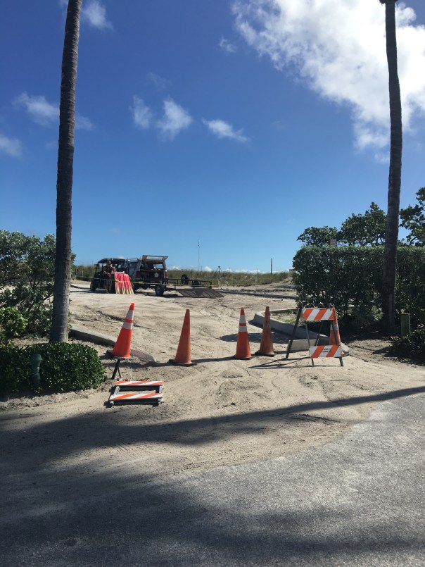
Martin County is furiously fighting erosion at Bathtub Beach. Friend, Amy Galante, sent me a web-cam photo today revealing that ocean water appears to have earlier *breached the remaining man-made dune. When I stopped the by the beach, about an hour ago, at lunchtime, workers assured me no water had entered the parking lot and insisted the area was closed and that I needed to leave immediately. When I got out of my car on the side of the road, it certainly looked as though Mother Nature had left her footprint, but what do I know, I’ve only been visiting Bathtub Beach since I was an infant…
11-15-17: *The County has contacted me asked if I am going to “correct” my post. “The breach you are referring to may be the hole cut in the dune to give equipment access to the beach.” —-I do apologize if my word choice was incorrect. I continue to feel this area of Martin County is one of concern.
Chart 2004-2014. Much re -nourishment has been done since this time. Source: Martin County Government.
Looking out to the Atlantic Ocean through and ancient black mangrove that was exposed by erosion off of Bathtub Beach.. (Photo 2009, JTL)
There have been many times over thousands of years that the ocean has broken through Hutchinson Island and flowed into the Indian River Lagoon off of Sewall’s Point. Most recently, in 2004, after hurricanes Jeanne and Francis. Also in the early 1960s, at Peck’s Lake*, on Jupiter Island. But of course we “repair” the areas and “put them back”…for a little while anyway….
Peck’s Lake breakthrough ca. 1960, Jupiter Island. (Ruhnke Collection, Thurlow Archives, from the book “Sewall’s Point,” by Sandra Henderson Thurlow.)
I have been fortunate the past few years in my river photography to see the island by air in my husband’s airplane; it never ceases to amaze me that Hutchinson Island, as all barrier islands, is really just a ribbon of sand….
So, of course Mother Nature comes through….
Sand piled hight at Bathtub Beach. (Photo 12-10-14, JTL)
Bathtub Beach is an area that Nature seems determined to reclaim soon. Yesterday, as many, I drove to see the “State of Emergency” claimed by Martin County at Bathtub Beach.
Looking to the ocean….(Photo 12-10-14, JTL)
There was a young couple that had scaled the piled protective sand and I struck up a conversation with them.
“Hi, I’m Jacqui. This is amazing isn’t it?”
The young man replied: “Yeah we came yesterday, and the waves were 10 to 12 feet!” The water was all the way up to this fake dune. Look, you can see the sand is still wet.”
Former Wentworth house, Bathtub Beach. (Photo 12-10-14, JTL)
“Wow,” I exclaimed. “Yes, I have seen this before. It’s incredible. You just have to wonder if one day the ocean will come through so hard she takes it all. This would be terrible for the people who live here…”
The response from the young man?
“Well, at least the river will be cleaner….”
I was amazed to see how far the river culture has expanded, and perhaps the values of a younger generation…
Rather than get into a political conversation with a nice young couple just here to explore, I said how nice it was to meet them, and ran down the sand pile in my high heels to get to my car before I got a ticket.
Wormrock at Bathtub Beach (Photo 2009, JTL)
At 50 years now, I have known our beaches since I was a kid walking around on the worm reef catching fish with a homemade net, before we knew that was “bad” for it. During my youth, the older generation began to really build on Hutchinson Island, which was not such a good idea either….The same goes for the low areas of the Town of Sewall’s Point, across the Indian River, where I live and sit on the town commission. These areas are very vulnerable. It’s a problem.
So how do we deal with this “realization,” that we have built on Mother Natures’ front line? Do we retreat, as in war, knowing we will never win, or do we harden our areas reinforcing the shoreline and our homes as long as we can? Do we spend millions of dollars putting concrete seawalls and dredged sand on our shorelines that will surely eventually wash away and each time, not to mention it covers and destroys our “protected” off shore reefs and sea grasses?
These are the difficult questions, and if we follow the model of South Florida that has been dealing with these issues of sea level rise, and just the “normality” of living on a shifting sandbar that God wants to roll over on itself like a conveyor belt, every few hundred to a thousand years, we have some big problems ahead of us. We can reinforce our shorelines and raise our houses, but in the end, Nature will win. In our short lifetimes, we may not see the “grand change,” but our children and grandchildren will.
For instance, the photo at the beginning of this blog is an ancient black mangrove with a hole in it looking towards the ocean. These mangroves are exposed during high erosion because Hutchinson Island is rolling over on itself. This is called “transgression.”
To repeat, much of the construction on barrier islands happened before people fully understood that these places are particularly volatile.  The clues have been accumulating for decades: beachfronts are thinning, storms regularly swallow dunes and send sand flowing to the far side of the island… Slowly, geologists and government entities have realized that the very nature of barrier islands truly is to “roll over,” typically toward the mainland, as waves and weather erode one side and build up the other. Barrier island ecology is not fully understood; there are many theories. It is complex, but some things we understand now…
Thus when the erosion is greatest, the remnants of an ancient mangrove swamp on the ocean side of the island can be seen….Kind of bizarre isn’t it?
What do they say? “The only constant is change.”
Yes, times are changing, the climate and the oceans are warming; no matter the reason, this has happened before. Our job, as it always has been, is to adapt. But in the world of money, real estate, and ad-valorum tax values to governments—along the Indian River Lagoon, this may never occur, until the ocean is truly upon us…
Ancient swamp on ocean side…..(Photo 2009, JTL)
Northerly view of Bathtub Beach and exposed ancient mangrove swamp….(Photo 2009, JTL)
Today even with high erosion the ancient mangrove swamp is under the sand. You can see one sticking up…(Photo 12-10-14, JTL)
This photo that I found on water/river activist Nyla Pipes’ Facebook page. The view of ocean action along the Atlantic Coast is very telling….
*Originally, I wrote” 1948: as well as “1960” in this blog post as the years that Peck’s Lake opened. Due to communication with my mother, historian, Sandra H. Thurlow, I have changed my blog to say only “1960s.” She believes there was an error in a photograph used in her book, “Sewall’s Point,” in that the photo she used in her book said 1948 but she now, after seeing old shared photos from John Whiticar, thinks this date is incorrect. Please read below:
Peck’s Lake Inlet
The photograph of a wash over at Peck’s Lake in Sewall Point on page 19 is identified as “1948” because it an 8 x 10 print in the Ruhnke/Conant Collection we purchase had that date written on the back.
Year later I began to suspect this was in error.
The clincher was a group of photos that John Whiticar came across that were obviously from Ruhnke which included the washout I had labeled 1948 with others that were obviously from the 1960s because of a flower farm in the background. There were also photos of the drowned trees and Ruhnke family photos of a visit to Peck’s Lake.
A Nov. 11. 1963 article in the Stuart News about Inlet worked said, “Also in April of this year the Martin County Commission passed a resolution asking the Corps of Engineers to take action to insure the boating public would always have as safe an inlet from the ocean as was available at that time through the storm-opened Peck’s Lake Inlet, closed by the Corps this past summer.
12-30-14 I received the numbers on costs from Martin County for beach re-nourishment over the years; I am adding the list here as a photo so I can share it with comments on this blog:
Beach Renourishment Numbers from Martin County 2014.


