Monthly Archives: July 2017

Signs of a Toxic Algae Bloom at Central Marine? SLR/IRL

2017/2016

“Here is the basin right now. It may not be the blue-green algae but I am willing to bet it has some of the same properties that created the algae bloom.” —Mary Radabaugh, Central Marine

Central Marine…the epicenter for the St Lucie River’s “Algae Crisis of 2016.” More photographed than a movie star, the marina became home-base for reporters, politicians, as well as state and federal agencies.  All witnessed something beyond human imagination. It is something we will never forget…

Mary and Dutch Radabaugh, who manage Central Marine, bravely and eloquently handled the situation, and kept working….

Mary became the spokesperson for Martin County on local, state, national, and international media. Her confident and calm southern manner gave stability when it was difficult to breathe.

Mary Radabaugh

This year, in 2017, Mary has remained low-key. Although the ACOE is not discharging Lake Okeechobee waters in to the St Lucie River, the marina definitely has been showing signs of a possible coming bloom…

The “circus” too fresh in Mary’s memory, she has not spoken, until now.

The photos below are Mary’s; they are dated. As one can see, although there is no blue-green algae visible, there are the signs. The signs we learned to recognize in 2016. The bubbles, the foam, the nutrient swirls of seeming organization…

So, with no dumping where are the nutrient bubbles coming from? These nutrients (phosphorus and nitrogen)  are known side effects from years of careless agriculture and development—- that feed the “algae…”

Is it there from last year, or before? Is is rising from the putrid muck of the river where the blooms sunk and died only to rise again?

Most important. Is it now endemic to the system? Will it affect our health?

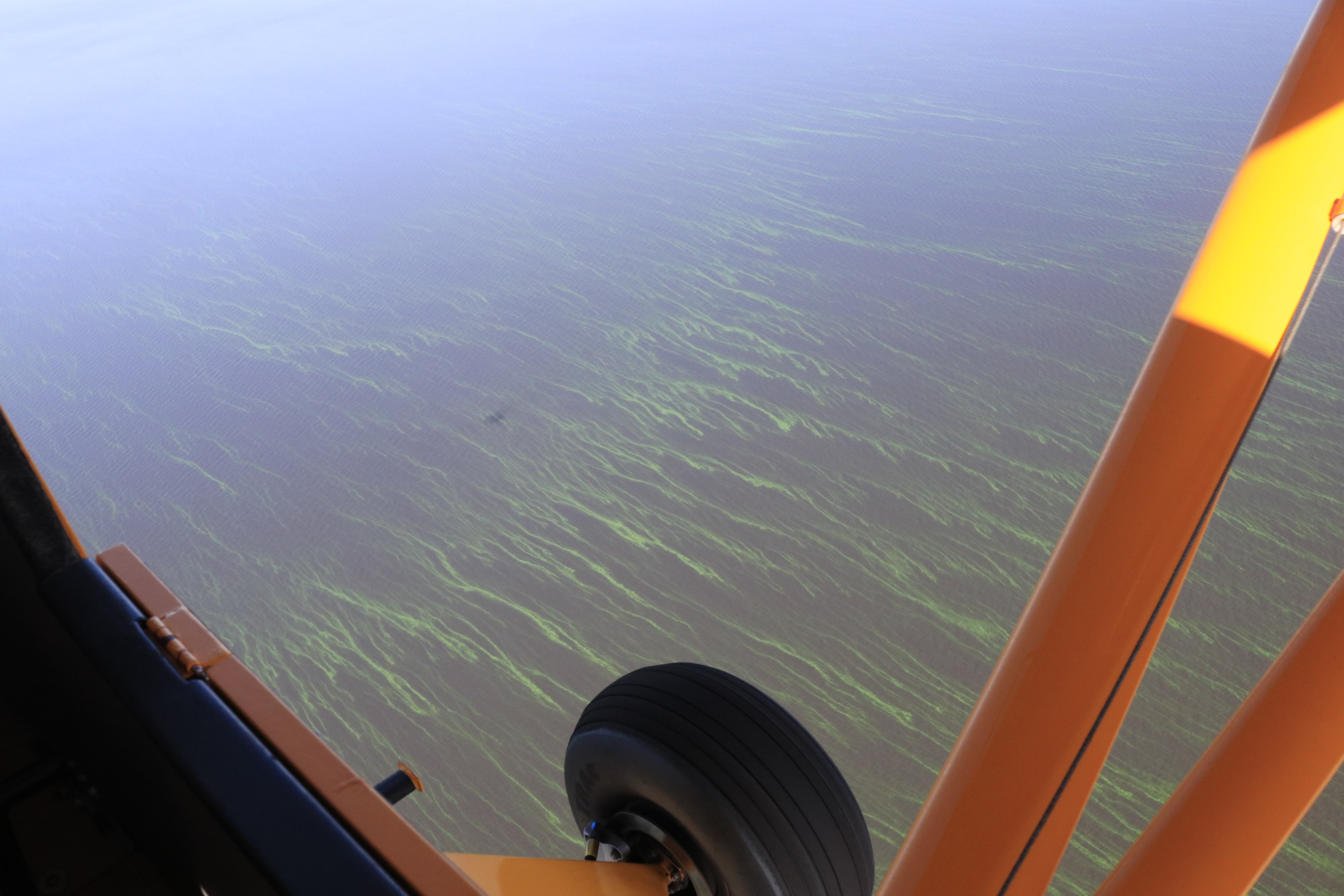
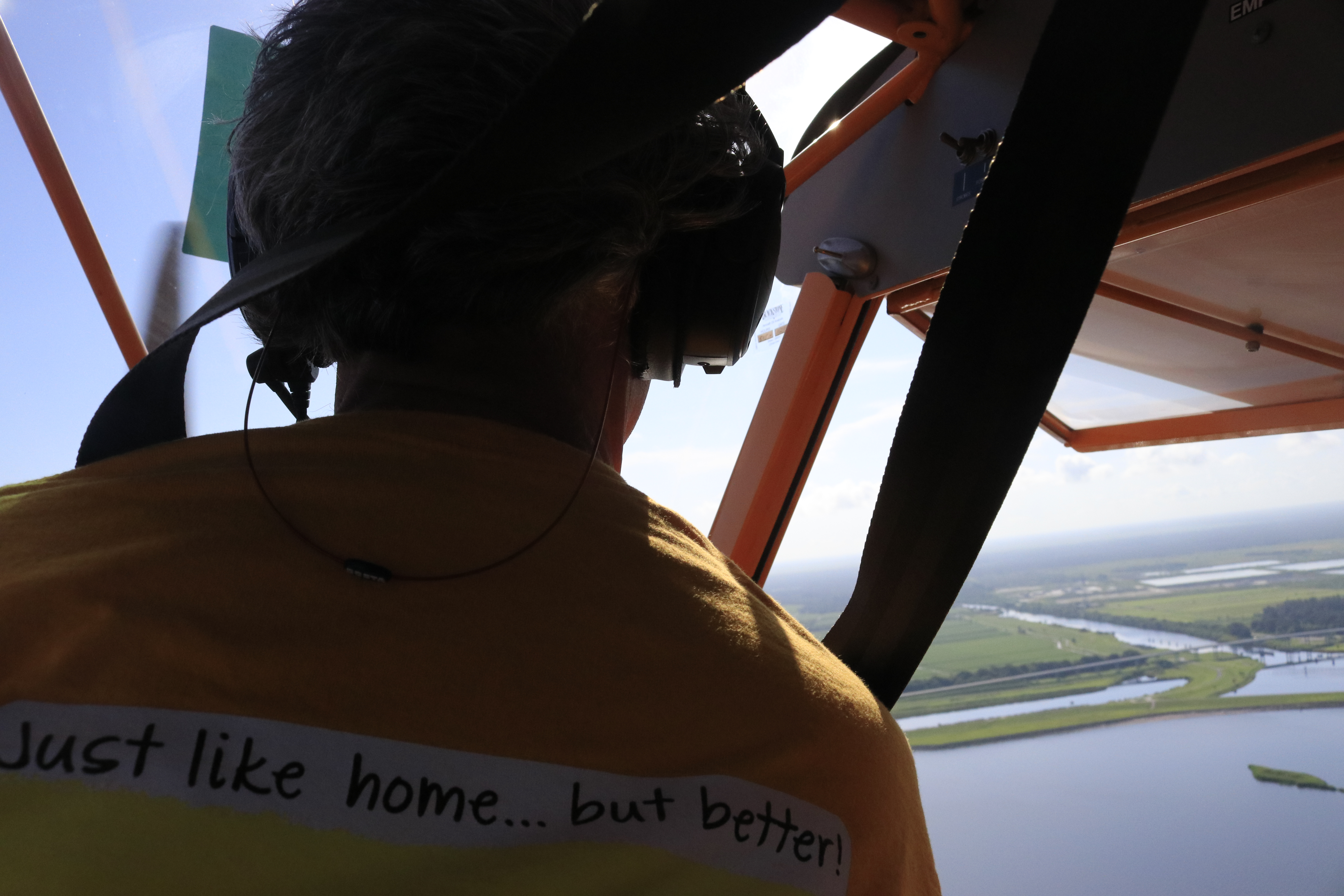
~Just to look and see if we could follow the bubble/foam for Mary, Ed and I flew on Sunday, July 30th, from the St Lucie Locks to the St Lucie Inlet. It was early morning, and the light was not great, but one could see the intermittent bubble swirls like a gigantic serpent to the Inlet. In the video they are most visible rounding the peninsula of Sewall’s Point.

Sewall’s Point is the peninsula and Sailfish Point is the ball like formation at the south end of Hutchinson Island (R) Atlantic on far R. (Google Maps 2013, another Lake O discharge year…)

Mary just happened to be at the Sandbar and St Lucie Inlet on Sunday, just off Sewall’s Point. She texted a photo and wrote:

“I really have a hard time watching people swim in the water when it is that gross brown color. I truly believe if they were dumping the lake right now we would be way worse than last year. This that we are seeing I believe is remnants of algae settled in our river bottom being churned up in combination with natural runoffs. Keep up the documentation so when they do decide they need to open them we can show it will be a catastrophe to human health.”

Mary’s photos of dark river water flowing out towards the St Lucie Inlet, July 30th, 2017:

Mary’s photos since June 19th of the water changes at Central Marina, St Lucie River, Rio, Fl http://www.centralmarinestuart.com

June 19, Central Marine, Mary Radabaugh–list signs of water changes
Central Marine, June 19, 2017, Mary Radabaugh
Central Marine, June 29, 2017, Mary Radabaugh
Central Marine, June 30, 2017, Mary Radabaugh
Central Marine, July 10, 2017, Mary Radabaugh
Central Marine, July 17, 2017, Mary Radabaugh
Central Marine, July 25, 2017, Mary Radabaugh
Central Marine, July 27, 2017, Mary Radabaugh
Central Marine, July 10, 2017, Mary Radabaugh
Central Marine, July 28, 2017, Mary Radabaugh


Central Marine, JTL

Ed & Jacqui’s Flight from the St Lucie Locks and Dam to the St Lucie Inlet, July 30, 2017. “Chasing nutrient bubble/foam swirls….precursors to blooms?”

Video 1 https://youtu.be/2BpN5U_3XNM
(https://youtu.be/2BpN5U_3XNM)

Video 2 https://youtu.be/4uwAZvZpT6c
(https://youtu.be/4uwAZvZpT6c)


Photos from 2016, Central Marine Algae Crisis


2016 Central Marine

The Line Between Past and Present: Corbett Wildlife Area, SLR/IRL

Ed looks outside the plane: a  “line” divides agricultural fields and the wetlands of J.W. Corbett Wildlife Area. 7-8-17.

An overview…
Sometimes it seems there is not a piece of land that doesn’t have the mark of modern-humans on it…but then, we have been leaving our mark for thousands, and thousands of years…

On a recent trip with renowned South Florida photographer Edward Carr, my husband Ed and I flew over the contiguous Dupuis and J.W. Corbett Wildlife Areas ~ “bordering” Martin and Palm Beach counties.

It was quite a view, and I felt embarrassed that I did not know more about these wonderful remaining lands located so close to home. So interesting to see them in a more natural state. The circles of trees, dome-like, standing in shallow water. Shades of green, brown, and blue changing and reflecting with every turn. An animal running into the bush. What was it?! A deer? A panther?

I have to admit, chasing toxic algae sometimes overtake me!.. I must remind myself  “to stop and smell the pond apples!”

Pond apple blossom. Photo by Lisa Jefferson. There was a 32,000 acre pond apple forest on the Southern rim of Lake O prior to development.
Mr Carr was photographing for a documentary on “Big Mound City” the most remarkable of places our human ancestors called home. These native people of Lake Okeechobee’s Belle Glade Culture, built mounds to get above the swamp rather than trying to drain it….as sea level rises, we many have to consider this once again just like the FEMA project in Sewall’s Point!

I find this entirely fascinating…history repeating itself…

I tried to get Ed later in that week to go with me into Corbett for a hike and to explore, but he said it’s too hot right now, he rather fly. It would be “torture in there.” Well, when the weather cools down, I am taking him. What a wonderful piece of natural history to have right in your own back yard.

LINKS:

FWC JW CORBETT: http://myfwc.com/viewing/recreation/wmas/lead/jw-corbett

BIG MOUND CITY: http://myfwc.com/viewing/recreation/wmas/lead/jw-corbett/history/

DUPUIS, SFWMD: https://www.sfwmd.gov/recreation-site/dupuis-management-area

The L-8 Canal runs through Corbett: http://www.dep.state.fl.us/southeast/ecosum/ecosums/l-8.pdf

L-8 & C-51 Reservoir etc: http://my.sfwmd.gov/webapps/publicMeetings/viewFile/8656

Interestingly, Sirkorsky is located in J.W. Corbett: http://lockheedmartin.com/us/what-we-do/aerospace-defense/sikorsky.html

Flight path

Google Earth Dupuis and JW Corbett just east of Lake O and south of FPL reservoir

A view from above

Agriculture fields meet JW Corbett

Edward Carr

Our Common Enemy, Toxic Algae, SLR/IRL

Rocks and algae, Lake O 7-26-17

Definition: caught between a rock and a hard place

“to be in a very difficult situation and to have to make a hard decision”

“State Says Blue-Green Algae in Lake Okeechobee is Not Toxic,”
WPTV, link 7-26-17: http://www.wptv.com/news/region-okeechobee-county/state-says-blue-green-algae-in-lake-okeechobee-is-not-toxic

The fact that Lake Okeechobee, the St Lucie River, and other water bodies of our state are in such poor condition puts the state of Florida “between a rock and a hard place.” After all, for centuries just saying the word “Florida” conjured up visions paradise…
Early rendition of the Everglades area including the rivers of the SLR/IRL. (Thurlow Collection.)
Cyanobacteria, that often becomes “toxic algae,” is bad for business. In fact, perhaps nothing is worse for business. It is also bad for people’s health. Hmm? How does the state report toxic algae and fulfill their responsibility for safety without scaring people away? And without hurting business?

The answer is of course that “you really can’t…” But you can be honest and take leadership. You can turn a bad situation into a good one, because after all, a very powerful force of human nature is a common enemy.

Cyanobacteria, toxic algae, is our common enemy.  For ALL of us.

The state has known that Lake Okeechobee has been eutrophic (prone to algae blooms) since at least the 1960s–the time of my birth. Early documentation from the state Geological Societies and Water Management Districts clearly documented the over nutrification of the lake, due to agriculture and development’s run-off exacerbated by channelization of rivers, lakes, the draining of lands, later the spreading of bio-solids (treated human waste) on fields, and a population explosion.

It is time to start diligently approaching the reporting of algae blooms and tracking their sources. There is a lot of area to cover; we can’t just test from the side of the road. Algae is living and changing and morphing every second. It is worth the investment to monitor it for what it is, an enemy.  24 hours a day…

Area of Lake O algae bloom, 7-21-17.

Dept. of Environmental Protection, algae sites reported and tested: http://www.arcgis.com/home/webmap/viewer.html?webmap=60d6ebf175f44ac1b7e51c00185883b4&extent=-88.8794,23.6596,-75.3882,32.9764

DEP’s warning to the public regarding algae blooms in water bodies: http://www.floridahealth.gov/newsroom/2017/07/072117-dep-and-doh-algal-blooms.html

Visit Florida’s words on algae blooms, toxic algae and cyanobacteria: http://www.visitflorida.org/resources/crisis-preparation/blue-green-algae-information/


Lake O shoreline, 7-26-17
VIDEO:

The Everglades’ Boundary of 1910, and Today’s Toxic Lake Okeechobee, SLR/IRL

Historic map, Palm Beach Farms Company Lands ca. 1910 showing “edge of Everglades.”  Archives, Lawrence E. Will Museum of the Glades, Belle Glade, Fl.

Looking back gives us perspective when looking forward.

This old map showing the Palm Beach Farms Company Lands is interesting as is shows where people saw the “edge of the Everglades” when they were first developing around 1910.

Today it is hard to judge where we are and what “was” the Everglades…Some of us are literally “in it.”

Looking back, it is easy to see how  after over 100 years the waters of Lake Okeechobee are becoming more and more “toxic.” Kind of like a fish tank that can never be cleaned out….

One has wonder if the developers of the Everglades ever considered what would happen to the lake by building and developing farm lands right in the way of the natural flow, and then really blocking it by eventually putting a dike around the lake? In this map, the push was to develop lands further west beyond the eastern ridge…Think all all the development today out west beyond the ridge and into the historic Everglades!

Perhaps in their wildest dreams the early developers  would have never envisioned how many people live in south Florida today. Maybe they didn’t care. In any case, today we all here in South Florida are connected somehow to Lake Okeechobee, Florida’s  “liquid heart,” for drinking water, recharge, recreation, property values, and our health.

Over our history the human spirit has overcome greater threats than toxic algae; I am confident we will once again.

SFWMD satellite map South Florida. Red lines denote historic Everglades.
SFWMD
Lake O eastern shoreline, Port Mayaca, 7-21-17, JTL
Lake O, 7-21-17


LINKS:

Lawrence E Will Museum of the Glades: https://www.museumoftheglades.org

https://www.facebook.com/lawrenceewillmuseum/

Lake O acres today?/451,000: http://www.lakelubbers.com/lake-okeechobee-107/

Township and Range? the squares: http://www.jsu.edu/dept/geography/mhill/phygeogone/trprac.html

Palm Beach Farms Company Lands-History (-bottom of blog by Ginger Peterson, Boyton Historical Society: http://www.jsu.edu/dept/geography/mhill/phygeogone/trprac.html

Two Planes; One Algae Bloom? SLR/IRL

Ed, my husband, and Todd my brother, algae hunters! The Cub.
The Baron, Todd and Ed. All of Todd’s photos are linked at the bottom of this post.

On Saturday, my husband, Ed, took my brother, Todd, up in both the Cub and the Baron to look for a the large algae bloom Ed and I had seen last Wednesday in Lake Okeechobee. I went along for the Baron ride, but the Cub only holds two.

Maybe you, like me, after listening to the news the past few days, realized there were other blooms reported, even a “small one” in Pahokee on May 20th by famed biologist Barry Rosen, of USGA. I wondered if Todd and Ed would see more blooms, other blooms…

Saturday, July 22, 2017, was much more overcast than the previous Wednesday, so the lake photos Todd took are not as bright in color, but the “southwest of Port Mayaca” bloom is definitely still there. Todd did not report any others during the trip and the GPS track shows that he and Ed went quite far north and west. (Channel 12 reported on two blooms on Lake O’s western shore…)

Before the flight, Todd also shared the most recent Landsat 8 satellite image that shows where the large “southwest of Port Mayaca” bloom is located although here too, there are a lot of clouds blocking the image…

Approaching Lake O with widespread cloud cover.

After Wednesday’ s post, many were asking me  if there were visible blooms in the St Lucie River or C-44 Canal.

The answer: “No.” From 1000 feet up, there are none visible. But there are the “bubble like nutrient swirls” that seem to proceed the blooms in some areas.  (You’ll notice these in Todd’s photos and all 350+ photos are linked at end of post.)

I did notice that on Facebook a small bloom was reported at Rivers’ Landing in Palm City, and another one on rocks in the North Fork. The Caloosahatchee has indeed reported a pretty significant bloom…blooms are in the estuaries but the motherload is Lake O.

Have you seen any blooms? If so, here is the link to report algae blooms to the Department of Environmental Protection, “DEP.”

It is important to report what you see!

http://www.dep.state.fl.us/central/Home/Watershed/ReportProblem.htm

I happened to notice when I visited the DEP website that DEP states:  “Blooms are naturally occurring.”

…Yes this is true; so is cancer.

However, nutrient pollution that feeds these algae blooms and is killing our estuaries, and possibly us, is entirely man-made. We know what causes it.

We must be more diligent and creative in stopping the nutrient run of from agriculture and development. “Taking measures”as noted in the DEP quote as the game plan just isn’t enough. After all, this is a war to save our Florida.

Florida’s five water managements districts map DEP.

__________________________________________________________

QUOTE on DEP web page regarding algae blooms: http://www.dep.state.fl.us/water/bgalgae/

“There are no short term solutions to rectifying the situation; this is a naturally occurring phenomenon that the State monitors closely. However, the state is taking measures that in the long-term will reduce nutrient loading and improve water quality.” DEP, 2017 website
 

LINKS:

Weather Channel story with photo of small bloom found in Lake O at Pahokee and reported on May 20, 2017 by USGA biologist, Barry Rosen: https://weather.com/science/environment/news/florida-algae-bloom-lake-okeechobee

USGA: Tracking the Bad Guys 2017: https://www.usgs.gov/center-news/tracking-bad-guys-toxic-algal-blooms

A great book on the subject of nutrient pollution: Clean Coastal Waters, Understanding and Reducing the Effects of Nutrient Pollution: https://www.nap.edu/catalog/9812/clean-coastal-waters-understanding-and-reducing-the-effects-of-nutrient

LANDSAT 8

Landsat 8 satellite image, 7-21-17

Photos by Todd Thurlow SLR, C-44, Lake O

GPS of trip. 1. Blue Cub. 2. Red Baron.
South Fork that connects to C-44 and then Lake O  at Port Mayaca,  near Palm City; following photos just going west towards Lake Okeechobee. Notice the bubble trails.
Rowers near Palm City
American Yachts and 195 overpass is near where C-44 connects to South Fork of St Lucie River
S-80 where area basin water is allowed into South Fork of St Lucie as well as water from Lake O if S-308 is open at Port Mayaca
Part of C-44 Reservoir project, the biggest in the state, to hold area basin water, clean and return to C-44.
Water and sediment leaving ag canals entering C-44 canal
Indiantown area and  C-44.
FPL cooling pond. This area was once a cypress tree forest
Port Mayaca’s S-308 at Lake Okeechobee
C-44 is “running backwards” into Lake O right now, dark color is visible
Algae is present south west of Port Mayaca but not as bright on this cloudy day…
S-308
Lake O southwest of Port Mayaca
S-308 looking east from LakeO
the northwestern shoreline
S-308 with C-44 area basin waters going into lake. Usually these waters flow into C-44 and the SLR
Northwestern shoreline
Water in northwest


Photo in 2nd plane, the Baron. I went along for this one as you can get a more overall view…
Again algae present in Lake O southwest waters but not as intense as seen in blog photos I published four days prior as this day was cloudy and there was little sunlight.
My brother noted the algae around the Okeechobee Waterway canal cut into the lake. Interesting!
The water flowing backwards from C-44 area basin is certainly one of the things fouling Lake Okeechobee.
2. This 1995-2005 map shows phosphorus loads to lake and SRL for that time. (SFWMD)

See all of Todd’s photos here: http://www.thethurlows.com/LakeO_07-22-2017/

“Algae Hunters” Track Significant Bloom Living in the Middle of Lake Okeechobee, SLR/IRL

My husband and I have decided we are algae hunters…

Hello Readers. Hope you are having a good summer!

Even though I am supposed to be on a “blogcation,” my husband, Ed, and I decided to fly over Lake Okeechobee this morning as yesterday Dr Susan Gray of the South Florida Water Management District reported on the Army Corp of Engineer Periodic Scientist Call that recent Landsat Satellite images had revealed significant algae in the middle of the lake- – – an area known as “LZ40.”

Sure enough, once Ed  and I got up in the air, just a few miles west of Port Mayaca, the strings of bright green algae were visible from about 1000 feet —-looking down— up to as far as eye could see…

Very strange to be surrounded by water and bright-colored lines of algae; it resembled  miles of suspended fluorescent paint. I have heard the scientists talking about how the algae comes up in the morning for sunlight and then goes back down into the water column later in the day. It is  intelligent, like an animal, and knows how to hide. You have to track it….

The living bloom was quite extensive, going on for many miles. My photos do not do the color or amount justice, but do document. This is important.

Thank God the ACOE is not dumping into the St Lucie River/Indian River Lagoon this summer. Poor lake O, on the other hand, has been getting “backwards flowing” C-44 water and back-pumped water from the EAA, STAs, and WCAs. No wonder its a mess!

Thank you to the SFWMD for the heads up! We do appreciate your work. We have inherited and created “quite an animal.”

See everyone soon.

Jacqui

*STA is storm water treatment areas

* WCA is water conservation areas

South Florida

SFWMD website:  (https://www.sfwmd.gov)

NOTE OF INTEREST:

*Reader, Professor Geoff Norris recommends we ask NOAA to create a bulletin for Lake O like this one here for Lake Erie since basically we are “in the same boat:” I think this is a great idea. I will have to contact NOAA.

(https://nccospublicstor.blob.core.windows.net/hab-data/bulletins/lake-erie/2017/projection_2017-05.pdf?utm_medium=email&utm_source=GovDelivery)

Tracking of journey upon return from Ed’s watch 7-19-17 around 9am
Center area of Lake O LZ40 is where SFWMD reported 7-18-17 that algae was showing on Landsat satellite images


Ed approaching Lake Okeechobee
FPL pond, Herbert Hoover Dike, and Lake O
S-308 and dike
Algae starts to appear just a few miles out
Algae get thicker and brighter as we continue flying west

_____________________________________________________________________________

​​

“Tis The Star Spangeld Banner, Oh Long May It Wave…” Blog Break, SLR/IRL

Dear Readers,

I do hope you had a wonderful Fourth of July. For a few weeks, I will be taking a blog break. Ed and I wish you all the best along the Indian River Lagoon and across our great country. I do hope you will continue to search my blog site by topic on its home page. There are hundreds of post that “let freedom ring!”

Fondly,

Jacqui

SEARCH 630 blog posts written between 2013-2017: https://jacquithurlowlippisch.com