Monthly Archives: January 2019

Lock No. 1 North New River Canal, Yesterday and Today

~Lock No. 1 is located at 6521 FL 84, Davie, FL 33317, was used until 1912, placed on the National Register of Historic Places in 1978. It is  also known as the Sewell Lock (architect) and the Broward Memorial Lock (https://dos.myflorida.com/florida-facts/florida-history/florida-governors/napoleon-bonaparte-broward/)

Historic Lock No. 1 New River Canal, with “new structure” in background, photo by Ed Lippisch

Driving into the heart of Ft Lauderdale, one is enveloped in traffic while passing through a preserved pond apple slough. Incredible! Just recently, Ed and I visited Lock No. 1 North New River Canal enjoying its art-deco architecture and pondering this “highway” of early Florida. Lock No. 1 was the first of the South Florida canal system playing a major role in the Everglades’ drainage dream of Napoleon Broward.

Canals built south of Lake Okeechobee were not just for drainage and agricultural development,  but also for transportation to achieve these things.  In early times, boats were the car or the horse…

Please read from Broward History below:

One of the canals, the North New River Canal, was, in the early years, a major transportation artery between Fort Lauderdale and Lake Okeechobee. In order to make the canal useful for transportation, locks had to be constructed. Lock No. 1 at the south end of the canal was the first to be built in South Florida.

…The opening of the lock led to an increased agricultural exploitation of the newly drained land along the New River Canal. Produce grown in this area and around Lake Okeechobee was brought down the canal through the locks to the railroad in Fort Lauderdale. An even more important cargo was Okeechobee catfish. New River was lined with fish houses, overhanging the river. Boats traversed the distance between the lake and Fort Lauderdale in groups. This made the trip go faster since more than one boat could get into the hand-operated lock at a time making it more efficient.

The locks also made it possible for small steamboats to operate on a regular basis between Fort Lauderdale, the lake and Fort Myers via the Caloosahachee River. Regularly scheduled steamers included the Suwannee, Lily and Passing Thru. These boats carried passengers, cargo and tourists up and down the river. By 1926 the canals had shoaled to the point that boat traffic was no longer practical and the waterway was replaced by a railroad and highways as the primary transportation method to and from the lake…”

~Excerpt from Broward.org (http://www.broward.org/History/NationalRegister/Pages/LockNo1NorthNewRiverCanal.aspx)


One could say that Lock No. 1 helped lead to the success of the Everglades Agricultural Area (https://pubs.usgs.gov/circ/circ1182/pdf/12Everglades.pdf) as well as the development of Broward County that continues today right into what was once the Everglades (https://www.sun-sentinel.com/opinion/fl-op-buzz-mega-mall-everglades-20180511-story.html)

Florida Memory https://www.floridamemory.com/items/show/105656
1924 Florida Archies
Topographical map of EAA showing elevations.
West of the red lines shows the edge of what was once the Everglades in South Florida. Development has crept and continues to creep over this edge. (Photo/map courtesy of Chappy Young,/GCY Surveyors


For Ed and I the visit was a great experience. And I was happy knowing I could tell my mother we visited something on the National Register of Historic Places! The Iguana’s liked the historic lock too. They were everywhere!
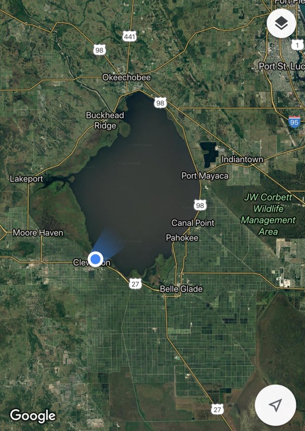
Look closely and you will see many iguanas! I saw at least fifty running around. Big, small, jumping into the water from the lock and dam, sunning themselves. Very cute, although an invasive issue for the area eating everything…

Right before one turns in!
One passes through a cool Pond Apple Slough a remnant this area once being the Everglades.

Pond Apples also known as Custard Apples at the lock. Prior to agricultural development there was a 32,000 acre pond apple forest at the southern edge of the Everglades. It was ripped out to access the valuable “black gold” soil below.
Ed and I in front of the new structure built to replace Lock No 1. along the New River Canal that goes north to Lake Okeechobee. The New River in its natural form has been severely compromised by agriculture and development; however, million dollar homes sit along its altered shores today. The state of Florida must work for both water quality, and our economy as now they are actually one in the same. Lock No. 1 even has its own Facebook page, you can join here:  https://www.facebook.com/pages/Sewell-Lock/568281143229622

Maps:

Links:

Structures of theSFWMD: http://w3.saj.usace.army.mil/h2o/lib/graphics/projmaps/infra.pdf

Nettles Island, a Star of the Show, “Indian River Lagoon”

Nettles Island, westerly view JTL/EL

Over the years, 2013-2019, flying over the St Lucie River and Indian River Lagoon, my husband Ed and I have taken thousands of photographs. Near the border of Martin and St Lucie counties, Nettles Island, a village, jutting out into the river, like a movie star, is “impossible not to recognize.” Today it is a popular place to live and well-known for its strong sense of community. Nonetheless, looking at the crowded island from the air, concerned about today’s environmental standards, one has to wonder about its history as it would be almost impossible to create such today.

So how did it arrive?

My mother, historian Sandra Henderson Thurlow, (http://www.sandrathurlow.com),  provided me with notes about the island, from an interview she held with beloved Stuart resident of country-music fame, Bobby Lord, ~whose sons, Rob Lord, and Cabot Lord, continue their father’s legacy ~especially for our St Lucie River. I have left my mother’s notes in their raw form as I find them most interesting.  Please read below.

Sandra Henderson Thurlow’s Notes From an Interview with  Bobby Lord, February 24, 2002 

334-8562

Outdoor Resorts of America

Out of Nashville

E. Randall Henderson, an attorney was president

They developed a R. V. Campground in Gatlinburg, TN

They developed Holiday Resorts adjacent to Nettles Island.

Nettles was owned by Sir Dennis Losen, a former Lord Mayor of London

Losen had already acquired dredge and fill permits for Nettles Island.

Nettles Island had been owned by Gene Dyer who offered to sell it to Bill Pitchford for $1500. Bill declined because he did not want to pay taxes on it. Bill did want to grow beans on the island and offered to sharecrop with Dyer. Gene Dyer’s share of the bean crop was $1500 so he said Bill Pitchford could have Nettles Island. He still declined because he did not want to be responsible for the taxes. 

Outdoor Resorts purchased Nettles Island in 1969. They began excavating the 80 upland or Hutchinson Island acres and hired Norfolk Dredging to pump 1,850,000 cubic yards of fill from the bottom of the Indian River. The dredge sank on the south side of the island during a violent storm. It was underwater for several weeks and environmentalists were screaming. Finally divers raised the dredge using inflatable tubes. Then the dredging operation continued. 

The resort includes 100 acres on Nettles Island and 80 acres on Hutchinson Island. The land where Shuckers is was sold off. The resort owns cabanas and a clubhouse and swimming pool on the ocean.

The permit for dredging was from the Internal Improvement Fund. When Bobby Lord went to Tallahassee in 1971 and asked what they would be told if they asked for a permit to fill Nettles Island they were told they would be laughed out of the office.

Outdoor Resorts built four miles of seawall and five miles of roads. Misner Marine of St. Petersburg built the seawalls, and Dickerson, Inc. of Stuart built the roads.

Lot sales began in 1971. There are 1585 lots on Nettles Island. Original prices were $5,000 for inside lots and $14,000 for waterfront lots. There are tennis courts, a miniature golf course, a swimming pool and a clubhouse. 

Historic photo Nettles Island ca. 1920, courtesy Debra Duvall

When I first ask my mother about the island, I inquired if it was a spoil island created by the dredging  of the Intracostal Waterway like so many of the islands in the Indian River Lagoon. “No,” was her quick answer and to prove such she provided me with the wonderful photograph shared by Water Point Realty Group broker, Debra Duvall. I love this photo, seen above,  as it doesn’t just show the little island that became “Nettles Island,” but the stunning, rolling, dune coastline of Hutchinson Island prior to development.

Just after Nettles Island was developed, the Clean Water Act’s 404-Regulations, made it much more difficult to “dredge and fill.” This occurred in 1972, under President Nixon. His environmental advisor? None other than Martin County’s Nathaniel Reed! (http://nathanielpreed.blogspot.com)

One of my favorite sayings of the late Mr Reed was this: “If you don’t know your history, you’re walking into the middle of a movie.” Well, hopefully this short piece reveals some of the plot without giving away the entire story and happy ending of our Indian River Lagoon.


Nettles Island postcard, ca. 1970s, courtesy Sandra H. Thurlow
Nettles Island, looking east to Atlantic Ocean, photo JTL/EL
During discharges water quite brown having been pushed north in the IRL 2013, JTL/EL
Nettles Island with setting sun, JTL/EL
Historic photo in book written by real estate agent Dr Blaine Ellingson, photo Lucille Rights
Book on history of and modern era of Nettles Island written in 2004 by Dr Blaine Ellingson

Links:

Florida’s DEP: https://floridadep.gov/water/submerged-lands-environmental-resources-coordination/content/erp-dredging-and-filling

JTL former post on subject: https://jacquithurlowlippisch.com/tag/history-of-dredge-and-fill/

Federal Gov’t EPA: https://www.epa.gov/cwa-404/section-404-permit-program

EPA: https://www.epa.gov/cwa-404/clean-water-laws-regulations-executive-orders

Intracoastal Waterway: https://www.britannica.com/topic/Intracoastal-Waterway

Nettles Island info and more history: Gabe Sanders: https://www.gabesanders.com/neighborhood/nettles-island

Nettles Island’s web-site: https://www.nettlesislandcondo.com

*If you are wondering, I was told by the real estate office the island is on sewer! 


RealEstate Office Nettles Island:http://www.nettlesislandrental.com

Florida, a Lake Filled Sponge!

Major Causes of Pollution: Agriculture and Bio-Solids; Sewage Treatment Plants; Septic Tanks; Urban Suburban Fertilizers; Storm Water

Google Earth image of Florida north of Lake Okeechobee reveals thousands of Lakes, not all visible, 2019


From the air, one really notices that Florida is like a lake filled sponge! This past weekend, Ed and I flew to Gainesville in Alachua County, and then to Titusville, in Brevard County. This time, I was looking at lakes more than rivers. From the air, Florida is a patchwork of ponds and lakes reflecting like mirrors in the sun, a strange and beautiful landscape, or shall I say “waterscape?”

During the flight, I started thinking that if water bodies could talk, it would be the lakes that would have the strongest lobby. According to a 2006 article by Sherry Boas of the Sun Sentinel, the state of Florida has over 30,000 lakes! Many like Lake Apopka, in Orange County, historically, were altered because shoreline wetlands supported successful agricultural endeavors, kind of a smaller version of Lake Okeechobee; and again, just like Lake Okeechobee, although a great industry arose, this led to the demise of the lake. But like the Indian River Lagoon, and Caloosahatchee, people rose up to “Save Lake Apopka” and continue to work on this today: Orlando Sentinel Article 2018, shared by Janet Alford: (https://www.clickorlando.com/water/how-lake-apopka-went-from-floridas-most-polluted-lake-to-the-promising)

(https://friendsoflakeapopka.wildapricot.org/timeline)
Yes indeed, Florida appears to float like a sponge in a sea of water. How we could think that our agriculture fertilizers and human sewage issues would not catch up with us on a broader level was naive. Excessive nutrients coming from humans on land are polluting waterbodies throughout the state which in turn also drain to pollute more waterbodies.  Whether it be ponds, lakes, estuaries, or the Everglades, we must wipe up our mess, clean out our sponge!

In 2018, almost pristine, Blue Cypress Lake in Indian River County was compromised ~becoming full of very toxic #cyanobacteria #BlueGreenAlgae due to application of #biosolids (human sludge from sewage treatment plants “treated” and then spread on ground of fertilizer. Biosolid application that has been supported by our state government and the Dept of Agriculture is finally coming to light as a tremendous problem. DR Edie Wider of ORCA has been instrumental in bringing to light this issue: (https://www.teamorca.org) (Orlando Sentinel, Blue Cypress Lake: https://www.orlandosentinel.com/news/os-blue-cypress-sewage-pollution-20180405-story.html)
Lake Apopka in Orange & Lake Counties is the poster-child for death and destruction and the beginnings of rebirth #Florida #LoveFloridaLakes Save Lake Apopka!
Beautiful Lake Lochloosa in Alachua County very close to better known Lake Newnan, and Orange Lake. (http://www.jimporter.org/lakes/twinlakes/)

In wet times, Paynes Prairie in Alachua County becomes a lake and can be seen from many miles away ~a totally unique ecosystem, many animals even horses and buffaloes! https://www.floridastateparks.org/parks-and-trails/paynes-prairie-preserve-state-park


Approaching Titusville, I saw a phosphate mine and many, many lakes!
The many ponds and wetlands seemed to run into Lake Oclawaha that has a history with the controversial Rodman Reservoir and Cross State Barge Canal (https://en.wikipedia.org/wiki/Ocklawaha_River)
Lake George in Volusia and Putnam Counties is now the second largest lake in #Florida (Apopka was largest before shoreline used for Ag.) and #brackish ~Explorer, John Bartram gave the lake its name in honor of King George lll in 1765. “Welaka” was previous name from the Timucua Indians (https://myfwc.com/recreation/cooperative/lake-george/)

Historic Photos from Florida Memory:

General Collection Florida Memory, Lake Apopka, ca. 1910
General Collection Florida Memory, Juniper Creek at Lake George, 1888
General Collection Florida Memory, Carraway Fish Camp, Lake Lochloosa ca. 1969

Links:

Department of Environmental Protection, Lakes: https://floridadep.gov/search/site/Lakes

Water Atlas Program for Florida Lakes: http://www.wateratlas.usf.edu/atlasoflakes/florida/

Florida Lake Society: http://flms.net/index.php?option=com_content&view=article&id=8&Itemid=119

JTL blog “wetlands/ponds:” https://jacquithurlowlippisch.com/tag/wetlands/


A Closer Look at DeSantis’ Executive Order 19-12: “Achieving More Now For Florida’s Environment”

On January 10th, Florida’s Office of the Governor, under very newly elected Ron DeSantis, issued Executive Order 19-12. The title of this order is “Achieving More Now For Florida’s Environment.” It is a remarkable and voluminous piece.

Today, I am going to share it in full as you may have only heard about parts of it in the newspaper.

*For entire Executive Order 19-12 link here; you may wish to print out for your files: https://www.flgov.com/wp-content/uploads/2019/01/EO-19-12-.pdf

Here we go–

First, note the “Whereases…” giving background and laying foundation for the order.

Whereas, water and natural resources are the foundation of Florida’s communities, economy and way of life; and

Whereas, protection of water resources is one of the most critical issues facing our state and requires immediate action; and

Whereas, recent algae blooms have resulted in an increasing threat to our environment and fragile ecosystems, including our rivers, beaches, and wildlife, as well as causing the issuance of health advisories, closures of recreational areas and economy losses in adjacent communities; and

Whereas, as the Governor of the State of Florida, a primary mission of my tenure is to follow in words of President Theodore Roosevelt by having Florida treat its “natural resources as assets which it must turn over to the next generation increased, and not impaired, in value”;

Now, Therefore, I Ron DeSantis, as Governor of Florida, by virtue of the authority vested in me by Article IV, Section (1) (a) of the Florida Constitution, and all other applicable laws, do hereby issue the following Executive Order, to take immediate effect:

The order is five pages long, with three sections:

Section 1: Focus on Rapid Improvement of Water Quality, Quality, and Supply (A-O) 15 parts directed to the Department of Environmental Protection (DEP); the Department of Health; Visit Florida; and the Department of  Economic  Opportunity.

Section 2: Restructuring, to Focus on Accountability, Transparently, and Science  to Achieve More Now for Florida’s Environment (A-C) 3 parts directed only to the Department of Environmental Protection (DEP)

Section 3: Ensure Florida’s Valuable and Vulnerable Coastlines and Natural Resources are Protected (A-B) 2 parts, again,  directed only to the Department of Environmental Protection (DEP)

There are a total of 20 parts to the executive order. Note state’s organizational chart: DEP’s place is as an executive agency under the governor, Executive Branch. Water Management Districts are under the governor but fall in the “local government” section as the Water Management Districts have the power to levy taxes within their districts,  but are appointed by the Governor.

Please peruse entire executive order below. Read at least first line or underlined and know that it is not one, but all of these “declarations within the declaration” that will empower government structure, if steered by true captains, to abate water woes for all Springs, Estuaries, Rivers, Lakes, and the Everglades of Florida. Thank you Governor DeSantis for this map!

Governor’s website: https://www.flgov.com/2019/01/10/icymi-governor-ron-desantis-discusses-major-water-policy-reforms-in-sarasota/

Watching the Lunar Eclipse’s ~Super Blood Wolf Moon~ From Our Pale Blue Dot

Today I am sharing photos of the super blood wolf moon taken last night by my bother, Todd Thurlow. Hopefully, you had a chance to see it too. Ed and I sat in fascination, with binoculars, feeling as if we could pluck this “red marble” from the clear night sky. Included after Todd’s photos is a video, “Our Pale Blue Dot,”  by Carl Sagan, from 1979. Experiences like last evening, help remind us how magical, beautiful, and fragile life on Earth is and that of course, we must cherish and protect it…

This link below is from Carl Sagan’s 1994 book “Pale Blue Dot” and was inspired by an image taken, at Sagan’s suggestion,
by Voyager 1 on 14 February 1990 from a distance of about 6 billion kilometers.

Please see link for PALE BLUE DOT video:


Space.Com: https://www.space.com/43071-super-blood-wolf-moon-2019-weather-forecast.html

Preliminary Summary of 2018 Lake and Estuary Flow and Pollution Loads ~Gary Goforth, P.E. PhD.

Gary Goforth, P.E., PhD. Everglades Coalition 2019, Duck Key. All photos JTL

~Knowledge is power! The power to change our water-world!

Goforth, P.E., Ph.D.

It is an honor to once again to share the work of Dr Gary Goforth.

Dr Goforth recently presented on a number of panels at the Everglades Coalition (https://www.evergladescoalition.org) in Duck Key, January 10-12;  you can access all of his remarkable presentations here: (http://www.garygoforth.net/Other%20projects.htm).

On January 4, 2019, Dr Goforth released his“Preliminary Summary of 2018 Lake and Estuary Flow and Pollution Loads.”

It is linked below for purposes of documentation.  So many of my readers have written in appreciation of these reference documents in the past. I remain forever grateful for Dr Goforth’s lifetime of dedication to the St Lucie River/Indian River Lagoon, the waters of Florida, and for allowing me to share his work. I am including  short biography below.

Dr. Gary Goforth has more than 30 years of experience in water resources engineering, encompassing strategic planning, design, permitting, construction, operation and program management. For the last 25 years, his focus has been on large-scale environmental restoration programs in the Kissimmee-Okeechobee-Everglades ecosystem. He was the Chief Consulting Engineer during the design, construction and operation of the $700 million Everglades Construction Project, containing over 41,000 acres of constructed wetlands. He is experienced in public education, water quality treatment design and evaluation, engineering design and peer review, systems ecology, statistical hydrology, hydrologic modeling, hydrodynamic modeling, water quality modeling, environmental permit acquisition and administration, hydrologic and water quality performance analyses. http://garygoforth.net/index.htm

“Preliminary Summary of 2018 Lake and Estuary Flow and Pollution Loads” ~Gary Goforth, PhD.

SUMMARY

  • The phosphorus pollution entering Lake Okeechobee reached historically high levels during calendar year 2017, with an estimated 88 percent from agricultural land uses.
  • Heavy rains from during May 2018 raised the water level of Lake Okeechobee to such an extent that the US Corps of Engineers began making regulatory discharges to the coastal estuaries beginning in June 2018.  Approximately 331 billion gallons of polluted Lake water was discharged to the estuaries, including the Lake Worth Lagoon. A State of Emergency was declared for both coasts.

o   On July 2, a massive bloom of toxic blue-green algae was reported to cover up to 90% of the open water of the Lake, yet discharges continued for several months afterward.

o   Approximately 87 billion gallons of polluted Lake water were discharged to the St. Lucie River and Estuary.

  • The Lake discharges to the St. Lucie River and Estuary contained more than 145,000 pounds of phosphorus, 1.3 million pounds of nitrogen, and more than 30 millionpounds of suspended sediment.
  • Massive algae blooms from Lake Okeechobee were present in the St. Lucie River and Estuary, and along the ocean beaches, necessitating multiple beach closures.  In addition, a red tide was present that adversely affected public health.

o   Approximately 234 billion gallons of polluted Lake water were discharged to the Caloosahatchee Estuary.

  • The Lake discharges to the Caloosahatchee Estuary contained more than 303,000 pounds of phosphorus, almost 2.4 million pounds of nitrogen, and more than 20 million pounds of suspended sediment.
  • Massive algae blooms from Lake Okeechobee were present in the Caloosahatchee River and Estuary.  In addition, extensive red tide devastated wildlife and adversely affected public health.

o   Approximately 11 billion gallons of polluted Lake water was discharged to the Lake Worth Lagoon.

  • Overall, the St. Lucie River and Estuary received more than 467,000 pounds of phosphorus, more than 2.5 million pounds of nitrogen, and more than 35 million pounds of suspended sediment from the Lake and local watersheds, which are predominately agricultural.

o   The water quality of Lake discharges to the St. Lucie Estuary is particularly polluted: in addition to toxic algae, the phosphorus concentrations have averaged 200 parts per billion – 5 times the target for the Lake.

o   Nitrogen loading from septic tanks is estimated at approximately 231,000 pounds, or about 9 percent of the total nitrogen loading to the St. Lucie River and Estuary.

o   Despite the destructive magnitude of Lake discharges, stormwater runoff from agricultural lands in the St. Lucie watershed contributed almost twice the phosphorus loads to the estuary as did Lake discharges.

  • Lake discharges to the STAs during the year leading up to the 2018 discharges to the estuaries were the lowest in the last 6 years. However, Lake discharges to the STAs during 2018 were the highest in history, at almost 500,000 acre feet (163 billion gallons).

READ FULL REPORT HERE: Goforth draft – 2018 summary 1 4 2019


The Pin That Changed the World ~for Sailfish! SLR,IRL

Vintage Catch and Release pin designed by the late Curt Whiticar, a gift of Jay Potsdam. Photo Sandra Thurlow.  

The foresight to protect what we love, what we value. This is a power we all hold as citizens of Stuart, Florida, in Martin County; yesterday, and today.

This January 10, beloved Treasure Coast’s Newspaper reporter, Ed Killer, composed this headline: Grandslam Shatters Sailfish Record With 38 in a Single Day

“What a wild, wet and woolly week for the fleet fishing the Pelican Yacht Club Invitational Billfish Tournament.

First, the fleet of 30 fishing teams crushed all the records for the 39th annual tournament, and for the 65-year history of sailfish tournaments fished in Treasure Coast waters.

The final tally was 969 sailfish caught and released.” Ed Killer

Full story: https://www.tcpalm.com/story/sports/2019/01/12/no-one-expected-see-kind-sailfishing-they-enjoyed-wednesday-and-thursday/2558889002/

Incredible?  Yes, it is. And what is even more incredible is that decades ago this 2019 bonanza day of sailfishing was put into action by the Stuart Sailfish Club of the 1930s.

Let’s read some history:

“Immediately after the clubs incorporation, Ernie Lyons announced the next immediate goal was the creation of a release button to be given to individuals who consistently release their sailfish”. (Sandra Thurlow, Stuart on the St Lucie)

This was indeed done but not before a carnage ensued motivating  the club even more so.

“Ironically right at the heels of the Sailfish Club’s official charter to promote conservation, the largest sailfish run in Florid’s history occurred off the St Lucie Inlet at Stuart. Records show that more than 5000 sailfish were caught in the 90 day period. January through March 1941. Many sportsman let their sailfish go free but thousand were slaughtered only to be dumped into the river, carted off by garbage collectors, or used for shark bait. Stuart’s reputation as the Sailfish Capital of the World was affirmed, but so was the need for conservation of the species if its fame was to endure. Because of the efforts of the Stuart Sailfish Club, anglers soon began to compete for Curt Whiticar’s beautifully designed release button in preference to all the rest.” 

Vintage Catch and Release pin designed by the late Curt Whiticar, a gift of Jay Potsdam.

Kudos to  those before us, who held the line giving the successes we have today!

Stuart on the St Lucie, Sandra Henderson Thurlow

Former blog, when Stuart was the Tarpon Capitol of the World, they never got a pin.
https://jacquithurlowlippisch.com/tag/sailfish-run-of-1941/

Ed Killer: https://www.tcpalm.com/staff/10052886/ed-killer/

Sandra Henderson Thurlow: http://www.sandrathurlow.com

Florida Red Tides (Dinoflagellates) and Blue-Green Algal Blooms (Cyanobacteria): Questions and Answers for the Treasure Coast By Geoffrey Norris

Greetings! My long-term readers may recall Dr. Geoffrey Norris whose shared 2017 writings on agriculture and glyphosate usage were extremely popular. Well, Dr Norris has returned from freezing cold Canada to tropical Hutchinson Island and has another work to share. He has written on a question many ask :”Red vs. Green Algae: What’s an Easy Way to Understand the Difference?” Please link below for yet another outstanding piece written for the everyday person, by our dear Canadian friend,  Dr Geoffrey Norris.

florida red tides and blue green v.4 draft algal blooms q&a

Dear Jacqui

Happy New Year!

I am enclosing a discussion piece I have just completed entitled:

Florida Red Tides (Dinoflagellates) and Blue-Green Algal Blooms (Cyanobacteria): Questions and Answers for the Treasure Coast

It is attached as a pdf.  It is quite long, and I have included an Executive Summary for those who might need it.  It is abundantly illustrated, including a couple of aerial shots by you and Ed. 

If you would be willing to include it in your website/blog I would be really happy.  There is so much confusion about red tides and blooms, and hopefully this clarifies things a little.

All the best

Geoff Norris

IMG_1003 geoff norris
Geoffrey Norris, PhD: “In the 1960s, I lived and worked as a petroleum exploration geologist in Tulsa, Oklahoma. Subsequently, I spent almost 40 years at the University of Toronto in teaching and research in geology. A geologist by training, I have a specialized knowledge of fossil algae, their ecology, morphology, and distribution. I have published hundreds of scientific papers on fossil algae and related topics.”

Florida Red Tides (Dinoflagellates) and Blue-Green Algal Blooms (Cyanobacteria): Questions and Answers for the Treasure Coast

By Geoffrey Norris, PhD. Hutchinson Island, Martin County, Florida; 2019

Contact Dr Norris at: rosalex@interlog.com

introduction, EXECUTIVE SUMMARY

This discussion centers on the issues of water quality in Florida’s lakes, waterways and coastal waters, as related to algal and bacterial blooms. It is written in plain language, in question and answer format, using as few technical terms as possible to help explain and clarify the various factors involved that lead to colored waters and toxic outbreaks in Florida’s lakes, estuaries and coastal waters.

Link here for PDF file full executive summaryflorida red tides and blue green v.4 draft algal blooms q&a


An Inauguration Speech for Florida’s Waters, Environment, and Future ~DeSantis

~Thank you Governor Ron DeSantis for including water and the environment in your inauguration speech, not once, but multiple times, and for making a clean environment a goal for your administration and for our children’s future. JTL

Below is excerpt; full speech below.

…”Our economic potential will be jeopardized if we do not solve the problems afflicting our environment and water resources.

People want to come to Florida because of its natural beauty. Tourism is not only a pillar of our state’s economy, it helps spread the tax burden to non-Floridians, limiting taxes on our citizens. But this could be in jeopardy if we do not solve our pressing environmental problems. As the great philosopher Yogi Berra remarked: if people don’t want to come nobody is going to stop them.

For Florida, the quality of our water and environmental surroundings are foundational to our prosperity as a state – it doesn’t just drive tourism; it affects property values, anchors many local economies and is central to our quality of life. The water is part and parcel of Florida’s DNA. Protecting it is the smart thing to do; it’s also the right thing to do.

I will lead the efforts to save our waterways. We will fight toxic blue-green algae, we will fight discharges from Lake Okeechobee, we will fight red tide, we will fight for our fishermen, we will fight for our beaches, we will fight to restore our Everglades and we will never ever quit, we won’t be cowed and we won’t let the foot draggers stand in our way.

We resolve to leave Florida to God better than we found it…

Full text and video DeSantis’ inauguration speech: https://www.abcactionnews.com/news/state/ron-desantis-inaugural-speech-read-the-full-transcript

DeSantis’ Words Make History for the River and the Kidz, SLR/IRL

On Tuesday, I will raise my right hand on the steps of Florida’s Historic Capitol to take the oath of office in much the same tradition that 45 governors have before me. With my wife, Casey, and our two young children, Madison and Mason, watching, it will be a pointed reminder that to whom much is given, much is required. ~Governor-Elect, Ron DeSantis

Casey and Ron DeSantis. He holds a River Kidz workbook. River Kidz LJ Leighton (pink shorts), Keile Mader also holding book. Carley Collins, Jack Maldonado Benson, Carter Streiber and Congressman Brian Mast, St Lucie River Tour

Tomorrow at 11:00 am, Ron DeSantis will be sworn in on the Capitol steps as the 46th Governor of the State of Florida. I met him once. The date was August 20, 2018 and he and his wife Casey, had come to Stuart to see the toxic-algae water problems for themselves. A boat tour had been arranged by Congressman Brian Mast’s office. The water was a disgrace, all explained why….

Ron and Casey DeSantis were attentive listeners, and took seriously the plight of the St Lucie River. They have young children of their own. Just a few days ago, DeSantis, wrote an op-ed referring  to his experiences along the rivers of St Lucie and Calooshahatchee. I  believe the tour and the words of the River Kidz had an effect, read below, and I know the kids too will be watching not just DeSantis but what all of us do…

“I will fulfill promises from the campaign trail. That means prioritizing environmental issues, like water quality and cleaning the environmental mess that has resulted in toxic blue-green algae and exacerbated red tide around the state. We will put Everglades restoration into high gear and make it the reality that Floridians have been promised for three decades.”  Ron DeSantis, Governor Elect  ~Full text, Tallahassee Democrat: https://www.tallahassee.com/story/opinion/2019/01/04/im-committed-pursuing-bold-agenda-florida-ron-desantis/2481606002/)

“Happy your’e here; not happy about the algae!” the River Kidz arrive to meet the DeSantises with River Mom, Cristina Maldonado, River Granny JTL, and Congressman Brian Mast.

Meeting the kidz 
Joe Negron and Stephen Leighton show Governor-elect DeSantis and Congressman Mast Brain Mast blue green algae in Shepherd Park

Algae floating in the SLR

Ron DeSantis, positions: https://en.wikipedia.org/wiki/Ron_DeSantis

Stuart to Chokoloskee; EAA Reservoir Between…


Pin is location east of EAA Reservoir area; Stuart is blue dot, and Chokoloskee is next to Everglades City on lower west coast.

The day began with smoke, smoke off the sugarcane fields.

Yesterday, Ed and I took a flight from Stuart to Everglades City, passing Chokoloskee and photographing the EAA Reservoir lands along the way. It is huge out there in the “Everglades,” seemingly endless. The easiest way to get one’s bearings is to look for the Miami and New River Canals that run south of Lake Okeechobee. Highway 27 parallels the New River Canal; where the red balloon is located above is the area east of where the EAA Reservoir will be constructed. For more specifics see link (https://jacquithurlowlippisch.com/tag/a-1-aerial/)

For Ed and I the flight, although hazy, was an opportunity to learn to recognize from the air Water Conservation Area 3, just south of the EAA Reservoir Area. The water conservation area lands are not located in Everglades National Park, but water quality is protected.

“To me these are the Everglades,” Ed said looking down.

“They are but they aren’t,” I replied. “They are part of the Central and South Florida Project, they are not natural; they are controlled. When they are too full from EAA water, the water from Lake O is not allowed to go south. If too full, from rain, or otherwise the animals can drown. Trapped on the tree islands raccoon, and deer, and panther together. Terrible.”

“Why can’t the water just flow south,” Ed asked.

“Lot of reasons, people like to say it’s because of an endangered bird, but its bigger than that, mostly because we have chosen to make it that way, and powerful entities keep our legislature from changing it in spite of what the voters say.” (SFWMD Constraints: https://apps.sfwmd.gov/SystemConstraintsDataApp/)

Ed did not reply.

We looked forward to what appeared to be little hills. The cypress domes of Big Cypress National Park reflected in the sunlight, and I could see “end of the earth” Chockoloskee right next to Everglades City in the distance. Pretty…

I can understand why people like to live down there so far away from everything. But they too can not escape our problems ~not with water.

WCAs: https://archive.usgs.gov/archive/sites/sofia.usgs.gov/virtual_tour/controlling/wca.html

Water Conservation Area 3: https://en.wikipedia.org/wiki/Water_Conservation_Area_3

Big Cypress National Preserve: https://www.nps.gov/bicy/index.htm

Chockoloskee: https://www.florida-everglades.com/chokol/home.htm

Cape Seaside Sparrow:
http://www.wlrn.org/post/controversial-bird-should-everglades-restoration-hinge-single-species

https://sofia.usgs.gov/projects/atlss/sparrows/ibsemabgeer00.html#fig1

https://www.audubon.org/field-guide/bird/seaside-sparrow

Water Conservation Areas
IMG_5873.jpg
Smoke rises over sugarcane fields southwest of Martin County near the Palm Beach Canal
img_5876
Smoke, canals, sugarcane fields


IMG_5880.jpg
Belle Glade, FL south of Lake Okeechobee
img_5882
Ed asked what this is. Not sure flooded fields, mining?
IMG_5886.jpg
Flowing Highway 27, the A1 on west side begins to show. Now a Flow Equalization Basin this land was once the Tailman Sugar Mill and is located on the east side of where the EAA reservoir is to be constructed.
IMG_5888.jpg
Looking west of A1 towards A2 where EAA Reservoir is to be built
IMG_5889.jpg
A1 from another position
img_5906
The North New River Canal to Ft Lauderdale now follows Highway 27. It once was in isolation as people used the canal to get to and from Lake O from the mouth of the New River
img_5897
Water Conservation Area 3 (WCA3) lies under A1 and A2 area; although not part of Everglades National Park, it’s water quality is protected:

Continue reading Stuart to Chokoloskee; EAA Reservoir Between…