
Although I first took this photo on January 21, 2021 to document the layer of smoke hovering at the horizon due to the burning sugarcane fields, I later noticed the clear aerial composition of the Green Ridge. Thus I share today…
Looking even briefly at the photograph, you will notice that this ridge is scraped flat by agriculture fields and 1-95 swinging over it – to take advantage of the high 30-35 foot topography.
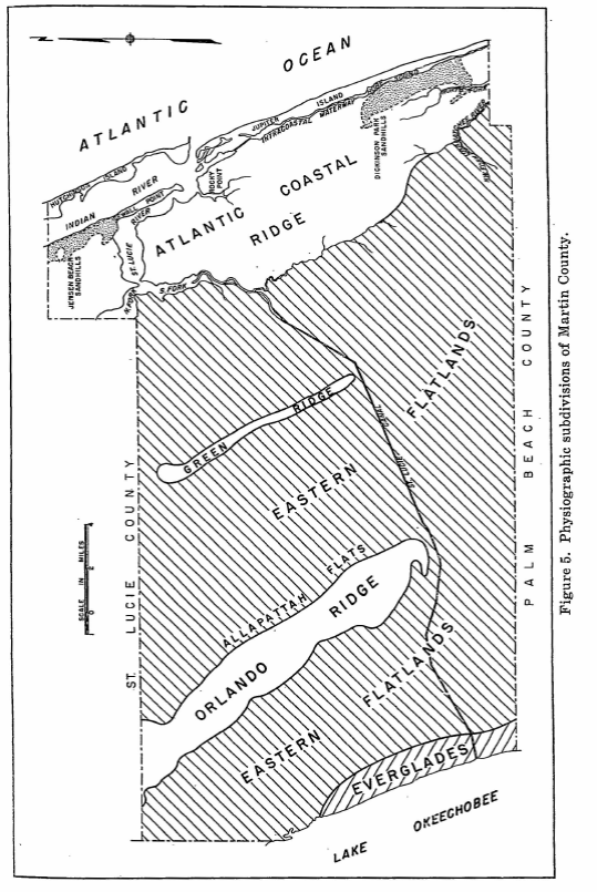
So what is the Green Ridge and why is it important to the St Lucie River?
You may have recently read my post on Allapattah Flats where my brother utilized the map below from a 1960’s U.S.Geological Survey, “Martin County” report, on water resources prepared by William F. Lichtler? This report gives an excellent breakdown on pages 7-11; but even if you don’t read it, you can see it!
The Green Ridge guided waters south as they traveled slowly through the marshy Eastern Flatlands being deepest closest to the Orlando Ridge, Allapattah Flats. (For reference, today Indiantown lies in the southern portion of the Orlando Ridge.)
When the St Lucie Canal, (C-44) was cut ca. 1914-1923 and then deepened, widened, and “improved” many times since, it caused the waters moving southeast to shoot down into the St Lucie. Today, due to agriculture and development, these water are polluted and basically unfiltered and have been allowed to be so for many, many years.
And when Lake Okeechobee is opened into the St Lucie Canal…we all know what happens then. Complete destruction from a water source, Lake Okeechobee, that also was never connected to the St Lucie!
For years I tried to understand the Green Ridge, and it’s importance, now I think I do. In restoring our waters it is helpful to be able to envision how Nature functioned before humans altered the landscape to the point that she is almost unrecognizable.
-Red baloon designates the Green Ridge