The initial goal of my South Florida Water Management District (SFWMD) field trip was to tour Storm Water Treatment Area (STA) 3/4 and the A1 Flow Equalization Basin (FEB). When I saw the location, I asked if it would be possible to also see the A-2 lands to the west that will become the EAA Reservoir.
Later on, I realized that although the future site of the EAA Reservoir “wasn’t that far away,” it certainly wasn’t easy to get to!
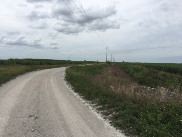
After a long and bumpy truck ride atop levees and back roads we arrived. I was led by two talented South Florida Water Management staff: Ms. Jennifer Leeds, Interim Division Director of Ecosystem Restoration, and Mr. LeRoy Rodgers, Lead Invasive Species Biologist both respected experts in their fields.
After leaving SFWMD Headquarters in West Palm Beach, our first stop was STA 3/4. Tracey Piccone, Chief Consulting Engineer of Water Quality, and Nathan Ralph, STA 3/4 Site Coordinator provided an airboat tour through open areas that were once cattails. Since 2007, the cattails in the northern part of the STA are slowly dying off. This is of great concern to Tracy and Nathan as the cattails are what clean the nutrient rich water leaving the Everglades Agricultural Area. Under certain circumstances, water from Lake Okeechobee is also sent through this STA as well. Strict laws 1994 Everglades Forever Act laws require the exiting water to meet water quality standards before being sent south to Everglades National Park. The scientists spoke to me about resting, replanting, and diversifying the vegetation. I asked how we can send more water south…
It’s complicated. STAs are living systems, not machines. In fact, this 16,300 acres in western Palm Beach County is the largest constructed wetland in the world!

STA 3/4: https://www.sfwmd.gov/our-work/wq-stas
A1 FEB: https://www.sfwmd.gov/recreation-site/a1-flow-equalization-basin
Rotenberger and Hoely Land Wildlife Management Areas/Invasive Species: https://bugwoodcloud.org/mura/ECISMA/assets/File/summit10/7A-SFWMD_FWC.pdf
EAA Reservoir: https://www.sfwmd.gov/our-work/cerp-project-planning/eaa-reservoir


Airboat video:


Video Mr Rodgers speaks on STA vegetation:


After the tour of STA 3/4, we focused north and I could see the glistening 15,000 acres of plants and shallow waters known as the A1 FEB, a “giant triangle” always easy to locate on a map. Once the Tailsman Sugar Company, this land now functions as a Flow Equalization Basin stabilizing the waters coming in from the Everglades Agricultural Area before they go through STA 3/4.
As we drove, I tried to note the markings of multiple bird species. I was so happy to see birdlife in spite of how drastically humankind has altered this once pristine landscape. It is said that today’s wading bird population is down 90% from the days this wetland was an unobstructed “River of Grass.” As we approached, birds flew off in every direction and I thought about Marjorie Stoneman Douglas and others who forged this restoration path.


After the STA 3/4 and A1 FEB tour, we drove north. Sprawling Holey Land Wildlife Management Area was on our left and the A1 FEB on our right. I asked why it was so flat and treeless. “Over the years the tree islands have washed away and been damaged,” was the reply.
We drove in silence.
Size here is Grand Canyon like and it was difficult for me to judge where we were. Suddenly, we took a sharp left. Jennifer Leeds smiled saying: “We’re here…” I climbed out of the truck.
Standing on a levee looking over both fallow and producing sugarcane fields, I stared out to the horizon. I felt my eyes tear over as it hit me that this was the land. The land that one day soon will become the EAA Reservoir.
“This was Senate President Joe Negron’s fight, this is our fight…” I thought to myself. Getting to the EAA Reservoir…
Though my husband Ed has flown me over the A2 lands multiple times, seeing them from the ground was much more convincing. If I’d had a River Warrior Flag I would have staked it in the ground. Instead, I smiled and took a picture. 🙂


Video – A2 lands growing sugarcane that are to become the EAA Reservoir