

The initial goal of my South Florida Water Management District (SFWMD) field trip was to tour Storm Water Treatment Area (STA) 3/4 and the A1 Flow Equalization Basin (FEB). When I saw the location, I asked if it would be possible to also see the A-2 lands to the west that will become the EAA Reservoir.
Later on, I realized that although the future site of the EAA Reservoir “wasn’t that far away,” it certainly wasn’t easy to get to!
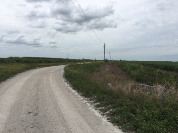
After a long and bumpy truck ride atop levees and back roads we arrived. I was led by two talented South Florida Water Management staff: Ms. Jennifer Leeds, Interim Division Director of Ecosystem Restoration, and Mr. LeRoy Rodgers, Lead Invasive Species Biologist both respected experts in their fields.
After leaving SFWMD Headquarters in West Palm Beach, our first stop was STA 3/4. Tracey Piccone, Chief Consulting Engineer of Water Quality, and Nathan Ralph, STA 3/4 Site Coordinator provided an airboat tour through open areas that were once cattails. Since 2007, the cattails in the northern part of the STA are slowly dying off. This is of great concern to Tracy and Nathan as the cattails are what clean the nutrient rich water leaving the Everglades Agricultural Area. Under certain circumstances, water from Lake Okeechobee is also sent through this STA as well. Strict laws 1994 Everglades Forever Act laws require the exiting water to meet water quality standards before being sent south to Everglades National Park. The scientists spoke to me about resting, replanting, and diversifying the vegetation. I asked how we can send more water south…
It’s complicated. STAs are living systems, not machines. In fact, this 16,300 acres in western Palm Beach County is the largest constructed wetland in the world!

STA 3/4: https://www.sfwmd.gov/our-work/wq-stas
A1 FEB: https://www.sfwmd.gov/recreation-site/a1-flow-equalization-basin
Rotenberger and Hoely Land Wildlife Management Areas/Invasive Species: https://bugwoodcloud.org/mura/ECISMA/assets/File/summit10/7A-SFWMD_FWC.pdf
EAA Reservoir: https://www.sfwmd.gov/our-work/cerp-project-planning/eaa-reservoir


Airboat video:


Video Mr Rodgers speaks on STA vegetation:


After the tour of STA 3/4, we focused north and I could see the glistening 15,000 acres of plants and shallow waters known as the A1 FEB, a “giant triangle” always easy to locate on a map. Once the Tailsman Sugar Company, this land now functions as a Flow Equalization Basin stabilizing the waters coming in from the Everglades Agricultural Area before they go through STA 3/4.
As we drove, I tried to note the markings of multiple bird species. I was so happy to see birdlife in spite of how drastically humankind has altered this once pristine landscape. It is said that today’s wading bird population is down 90% from the days this wetland was an unobstructed “River of Grass.” As we approached, birds flew off in every direction and I thought about Marjorie Stoneman Douglas and others who forged this restoration path.


After the STA 3/4 and A1 FEB tour, we drove north. Sprawling Holey Land Wildlife Management Area was on our left and the A1 FEB on our right. I asked why it was so flat and treeless. “Over the years the tree islands have washed away and been damaged,” was the reply.
We drove in silence.
Size here is Grand Canyon like and it was difficult for me to judge where we were. Suddenly, we took a sharp left. Jennifer Leeds smiled saying: “We’re here…” I climbed out of the truck.
Standing on a levee looking over both fallow and producing sugarcane fields, I stared out to the horizon. I felt my eyes tear over as it hit me that this was the land. The land that one day soon will become the EAA Reservoir.
“This was Senate President Joe Negron’s fight, this is our fight…” I thought to myself. Getting to the EAA Reservoir…
Though my husband Ed has flown me over the A2 lands multiple times, seeing them from the ground was much more convincing. If I’d had a River Warrior Flag I would have staked it in the ground. Instead, I smiled and took a picture. 🙂


Video – A2 lands growing sugarcane that are to become the EAA Reservoir


All so hopeful! One day you can go back and put that flag in the ground when things are flowing.
Nothing is easy to get to in South Florida that is outside the urban development.
You are fortunate to have the “large picture” from extensively flying over South Florida.
You are also realizing how SFWMD staff time and effort goes into providing field tours.
It has been my hope for decades that SFWMD would do mini documentaries (30-40 minutes) to show what you were shown in eight hours, most of which, was travel time.
SFWMD has done great documentaries on the Kissimmee, Lake Okeechobee and other places, however, those were done by under prior administration so those are no longer used.
Very promising, thanks for sharing. We need to be persistent…
I wish you had not been appointed to a position of power—-it is one thing to be a romantic historian dreamin of how things used to be—its another to force your will on millions of people who are liveing like rats stacked on top of each other.
Everthing is good here. Unlike there we have miles and miles of menhadden minnows which feed miles and miles of fish , birds and people. All of them located near where I have put sand. All you are going to do is create a mosquito infested swamp full of pythons. You get a strong wind or tropical storm it will blow billions of mosquitos into Miami or Tampa and be one more desaster our criminal state gov. has created.
I hope the STA is large enough and effective to clean the the nutrient laden water so that it can go South…
All the organic material will be preserved in acid and when acidic water hits Florida bays calcium sand it will make calcium cloride salt. Newspapers are sure enough going to need billions$$$ of bribe money to make it sound like govener did somethig great.
Dear Jacqui,This is wonderful visual documentation of the EAA . Your aerial photos with Ed are always appreciated, and this ground view provides an equally informative perspective. Thank you for all your hard work!Warm regards,Louise KowitchBonita Springs
Thank you so much for writing Louise!
Hi Jacqui, Does your organization have any historic Maps from the early 20s or 30s ?
City of Belle Glade told me most of their historic Maps or damaged from flooding in 2005. I could not find detailed maps from that era at the state archives .
I am happy to purchase Maps if your organization has any copies. Thank you for your environmental work!! I really appreciate it and I enjoy your posts & pics!!
Thank you, Robin Vause
On Mon, Oct 21, 2019, 4:08 PM Jacqui Thurlow-Lippisch wrote:
> Jacqui Thurlow-Lippisch posted: ” The initial goal of my South Florida > Water Management District (SFWMD) field trip was to tour Storm Water > Treatment Area (STA) 3/4 and the A1 Flow Equalization Basin (FEB). When I > saw the location, I asked if it would be possible to also see the A” >
Hi Robyn, I myself do not have historic maps. I know for sure that the Lawrence E Will Museum of the Glades does. They may have closed and are part of the Palm Beach County Historic Society. Certainly you could call both and ask to see the collection. It is public. They must share. Good luck and let me know how it goes.
Front page of brevard county paper shows slimy green mess Someone has finally put calcium sand in our Lake Washington here in Brevard county. Desolved oxygen has activated a half century of toxic chemicals that has been lying dormant in zero oxygen muck. It had to happen soon or later—-you cant go on killing people forever. Now people can see what they are really drinking.
Many of the employees ( or former employees ) of SFWMD know exactly how hard it is to get to the different locations. And how dangerous it can be.You did it in the daytime but many have to make the trips out to the pump stations at night when the weather turns bad. Now imagine how long it would take EMTs to get to those locations at night.
I cannot imagine. I appreciate this comment.