Yesterday, due to presidential Temporary Flight Restrictions, Ed and I decided to fly to the interior of the state and photograph the Kissimmee River. It was a beautiful day, but very bumpy up there.
Looking down at take off, the St Lucie River/Indian River Lagoon appeared dark-colored as the ACOE has been discharging to the river through C-44 from Lake Okeechobee since February 24, 2019 in an attempt to get the lake lower for hurricane season. It has also rained recently so there is canal (C-23; C-24 & C-25) and other runoff mixed in with the Lake O water. As we know, the “throat of our river was cut by these canals…” (https://www.saj.usace.army.mil/Media/News-Releases/Article/1791397/corps-adjusts-lake-o-releases-to-caloosahatchee-over-next-two-weeks/)
Within minutes, Ed and I had passed the Savannas, City of Port St Lucie, and were flying over sprawling agricultural lands, and then the northern diked region of Lake Okeechobee ~where the Kissimmee River meets the lake.
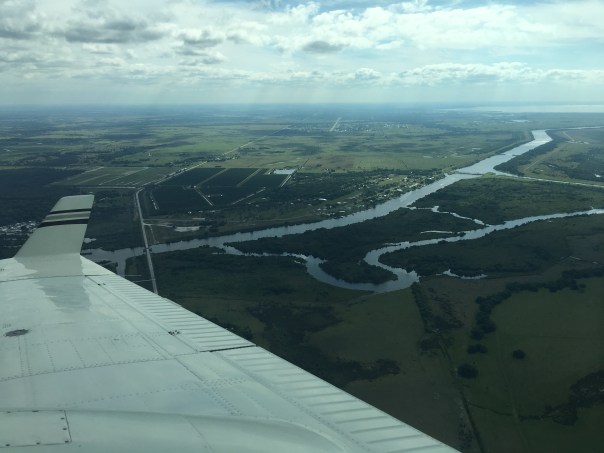
Today we will share photos of the approximate twenty-two miles of the Kissimmee River floodplain, once channelized, that is now being restored by the ACOE and SFWMD.
The map image below shows in detail the different parts of the floodplain-river, and its “de-construction.” For me, the Kissimmee is a the greatest example of Stuart News’ editor Ernie Lyons’ famous words: “What men do, they can undo,” as channelization in the late 1960s, was immediately recognized as an ecological disaster and people began lobbying Congress for change. Sometimes, I guess, we learn the hard way…but at least we learned. Thank you to all those who have been part of this restoration!
http://www.ces.fau.edu/riverwoods/kissimmee.php
Click to access ML14328A488.pdf
https://www.sfwmd.gov/our-work/kissimmee-river

PART1
These five photos below show take-off from Witham Field in Stuart over Sewall’s Point, the St Lucie River and Indian River Lagoon. The last two photos are the North Fork of the SLR and Port St Lucie.


PART 2
The next six photos are the northern part of Lake Okeechobee. There is a lot of vegetation in this area that is sometimes submerged. These areas are important for bird life.


PART 3
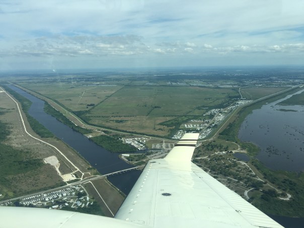
Below we start at the still channelized mouth of the Kissimmee River entering Lake Okeechobee. As we approached the restored area, birds were flying down below, white against green, having returned to their historic nesting grounds: https://www.sfwmd.gov/news/nr_2018_0329_2017_sfwbr


Thank you both for your consistent efforts.
Great visuals. Thanks for your efforts to document from the air. A great way to teach. I love Mr. Lyon’s hope for good change. Thank you. Thank you. Solidarity ya’ll.
Keep up your good work Jacquie, maybe JUST maybe “they” are starting to listen..
🙂
God bless you for getting in the air observing the water/land. I know it’s not the first time you have done so!
We are SO FORTUNATE to have you on the SFWMD Board and I am personally cheering you on!
Blessings!!!!
Most impressive!
Blessings!!!!